3 minute read
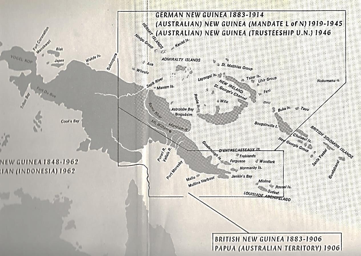
MIGRATION BETWEEN QUEENSLAND AND PNG


Migration is defined as the movement from one part of something to another. The five stages of migration include retire, replace, rehost, rearchitect and retain. There are four types of migration. Internal migration: moving within a state, country, or continent. External migration: moving to a different state, country, or continent. Emigration: leaving one country to move to another. Immigration: moving to a new country.
The most obvious form of migration is human migration. This is the physical movement by humans from one region to another. The main reasons for human migration include eeconomic, demographic, political and social.
Advertisement
The next form of migration is biological migration (ecological). This is the large-scale movement of species from one environment to another. This can be animal migration, bird migration, plant migration (e.g., seed dispersal), gene migration (related to processes of evolution and population genetics), cell migration (e.g., marine life), physical and chemistry migration, information technology.
Causes for Human Migration between Queensland and PNG Lust for Gold
In 1525, Spaniard Antonio Pigafetta6 described New Guinea as a land of gold. In the following centuries the Dutch, French and English chartered the coastlines but made no efforts to explore the interior.
In 1852, Naturalist John MacGillivray on Capt. Owen Stanley’s HMS Rattlesnake noticed traces of gold in native pottery at Redscar Bay. In 1873, Capt. Moresby of HMS Basilisk began prospecting by locating gold traces near Fairfax Harbour. After this, small miners prospected along the eastern coast and offshore islands.
Following the discovery of gold in the Louisiade Archipelago (includes Misima Island) in 1888, within twelve months, there were some 700 miners on the goldfields. In 1895, gold was discovered on Woodlark Island. Many miners came from the Palmer goldfields in North Queensland by fortnightly steamer. In 1896–97, there were 400 white miners and 1,600 Papuan labourers on Woodlark Island. In the period 1888-1898 gold was 54% of the total value of exports from British New Guinea (now Papua).
Louisiade Archipelago
(includes Misima Island)7 .
Source Google Maps.
By the closing years of the 19th Century most exploration efforts had moved to the mainland. In 1897, gold was found on the Gira and Yodda rivers8 followed by finds on the Waria River. The northern side of the Waria watershed fed the Watut Bulolo River systems. A few men penetrated this area before World War1 and reported gold indications but did not live to explore further. After the war, the area came under Australian control and prospecting increased.
The first significant finds on the Watut were made by Shark eye Pearce in 1922, after which many prospectors poured in overland from Salamaua by foot despite the difficulties of crossing steep ranges via the Franscisco River and rough Black Cat Track and Gap and obtaining supplies by porter.
In 1926 Royal and Glasson had a rich strike on Edie Creek near Wau. C J Levin floated Guinea Gold Lt which in 1928 sold its options to Placer Development Limited. This was the start of Bulolo Gold Dredging Ltd (BDG) in 1930. Between World War 1 and World War 2 Salamaua isthmus and airstrip was a thriving township and port before Lae came into being.
It is interesting to note that Eminent TPNG Forester1 Gary Archer’s father was a miner at the gold mine on Misima Island. Gary in 1947, was taken by his mother Wilhelmina ("Mina") Archer to join his father Robert ("Bob") Archer at Bwagaoia on Misima Island (200 km east of the PNG mainland). In 1948 the family moved to Bulolo where his father worked as a sawyer at the Golden Pines sawmill, just outside Bulolo
From 1949 Gary attended primary school at Bulolo and later at Wau, where his father worked for New Guinea Goldfields (NGG) as a gold miner and later as foreman at their Golden Pines sawmill. One of Gary’s schoolmates was Marybeth Owers, the daughter of NGG surveyor Noel ("Jerry") Owers, who located the road to the Kokoda Trail during the Second World War and after whom Owers' Corner is named (Aust. War Memorial, 2003).
While working as a Technical Assistant I saved up the pennies to put myself through the B.Sc. (Forestry) degree in Canberra. I did the first year at my own expense and was then awarded a PNG cadetship from the beginning of second year. This reduced my bond period from the usual five years down to four. - Gary Archer July 2021.

Salamaua in the 1920’s

Source Mitchell library.
The hut in the foreground was occupied by “Shark-eye” Park when he visited Salamaua between long periods in the interior prospecting for gold. Errol Flynn was in Salamaua where he spent time in the local calaboose (jail). He had no money, and even then, known as a serious spiv, con man and womaniser.

The business centre Salamaua 1934 showing Hotel Salamaua and Guinea Airways.

Source Commonwealth Records CRS A24.
Salamaua airstrip 1935 - taken from inside W. R. Carpenters Airline hangar.
Source Derick Crisp PNGAA.
The airfield was used from the late 20s, through the 30s and was captured by the Japanese March 1942. Heavily bombed by the USAAF and RAAF and attacked by infantry, the original town was obliterated. G. Syphers landed on the reopened airstrip.