Portfolio
GIS | Urban Design | Urban Planning | Market Research
Satria Ramadhan MSc in Urban Planning - Columbia University
Satria Ramadhan MSc in Urban Planning - Columbia University
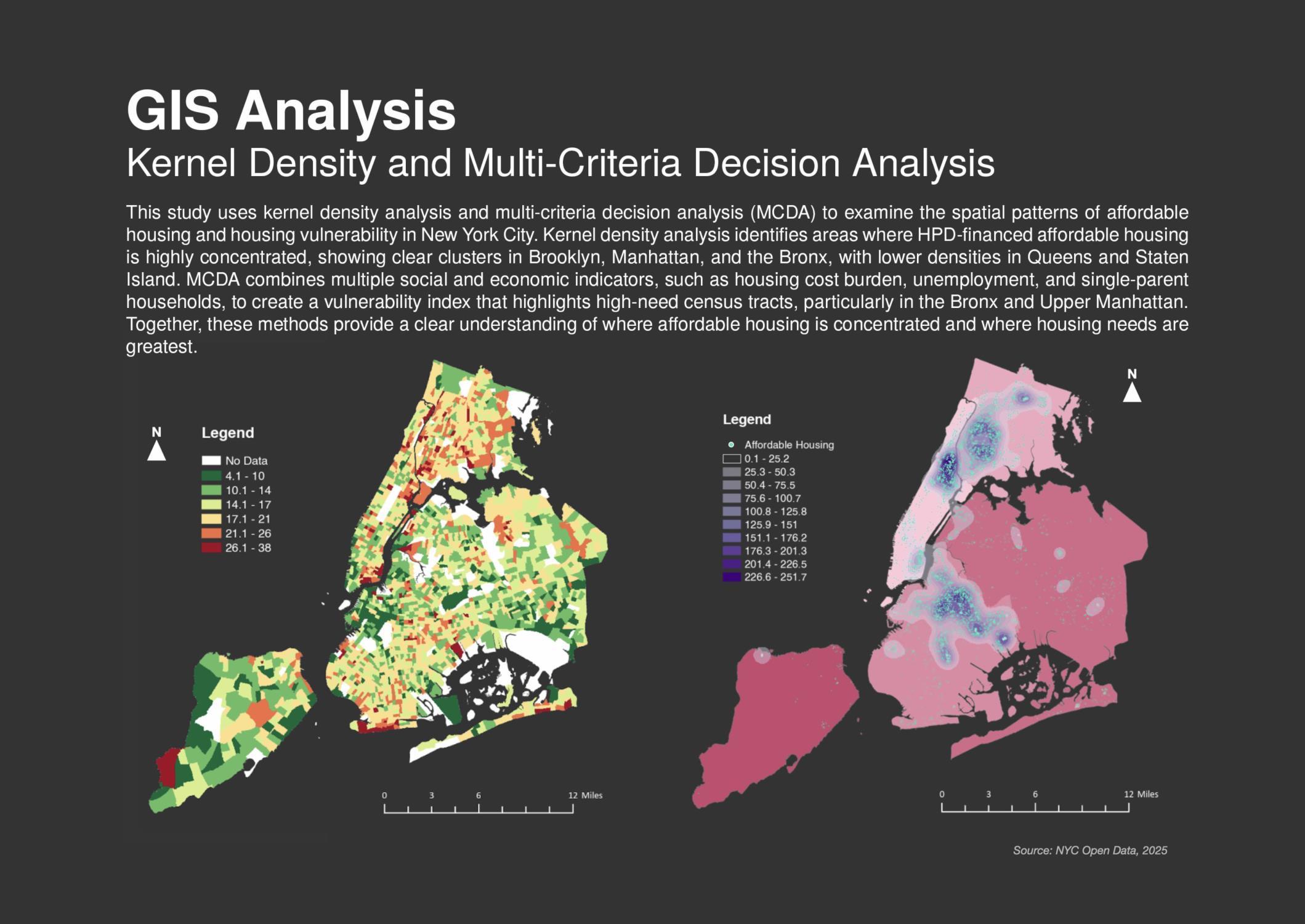
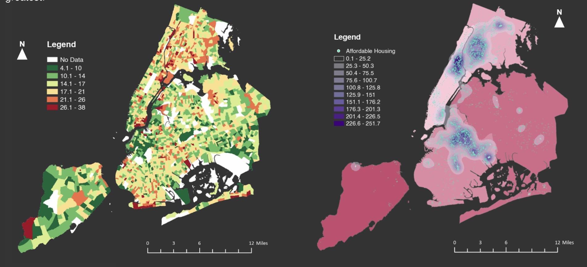
This study uses kernel density analysis and multi -criteria decision analysis (MCDA) to examine the spatial patterns of affordabl e housing and housing vulnerability in New York City. Kernel density analysis identifies areas where HPD -financed affordable housing is highly concentrated, showing clear clusters in Brooklyn, Manhattan, and the Bronx, with lower densities in Queens and Staten Island. MCDA combines multiple social and economic indicators, such as housing cost burden, unemployment, and single -parent households, to create a vulnerability index that highlights high -need census tracts, particularly in the Bronx and Upper Manhattan. Together, these methods provide a clear understanding of where affordable housing is concentrated and where housing needs are greatest.
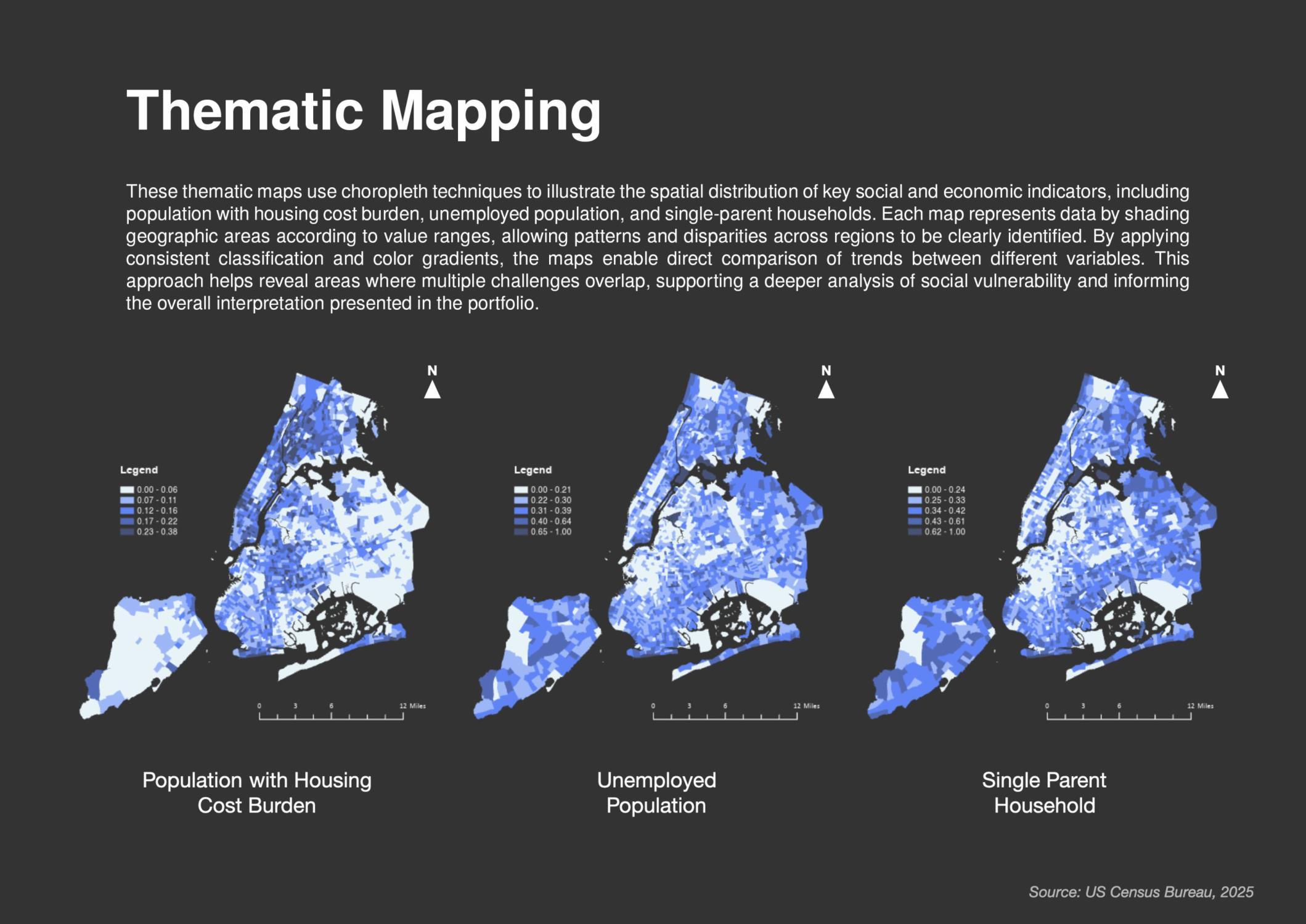
These thematic maps use choropleth techniques to illustrate the spatial distribution of key social and economic indicators, including population with housing cost burden, unemployed population, and single -parent households. Each map represents data by shading geographic areas according to value ranges, allowing patterns and disparities across regions to be clearly identified. By applying consistent classification and color gradients, the maps enable direct comparison of trends between different variables. This approach helps reveal areas where multiple challenges overlap, supporting a deeper analysis of soci al vulnerability and informing the overall interpretation presented in the portfolio.
This study examines the coastal area of Jakarta, Indonesia, with a focus on addressing underutilized land along the waterfront. The study started with a site analysis to understand the physical condition, environment, and surrounding activities. A SWOT analysis was also carried out to identify the strengths, weaknesses, opportunities, and threats of the area. Based on these findings, design responses were developed with a focus on coastal development, including better accessibility, improved infrastructure, and environmental considerations. The final result is a proposal that transforms unused coastal land into a more functional and valuable area, supporting local activities and improving the overall quality of the coastal environment. The project received positive feedback, with the overall concept and design approach being highly appreciated.
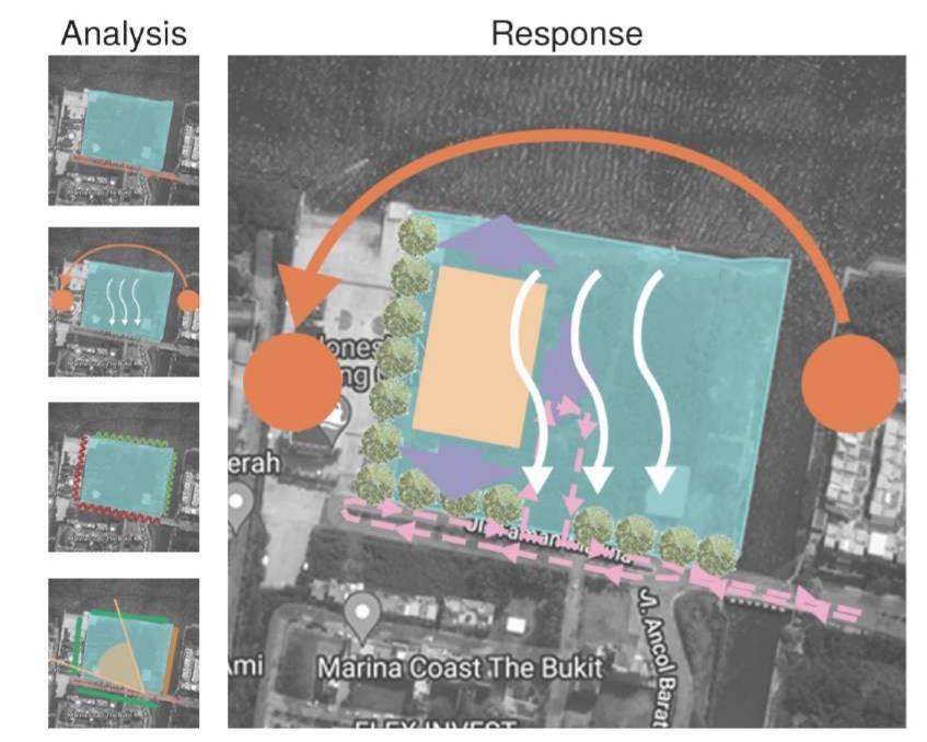

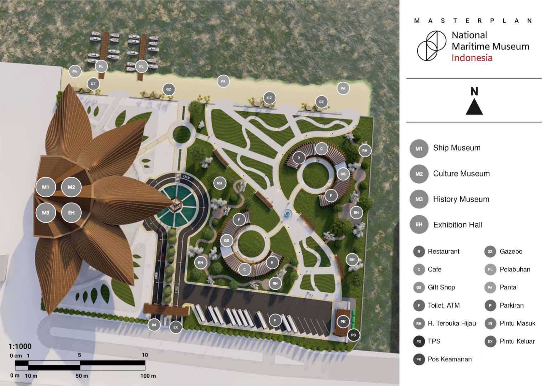
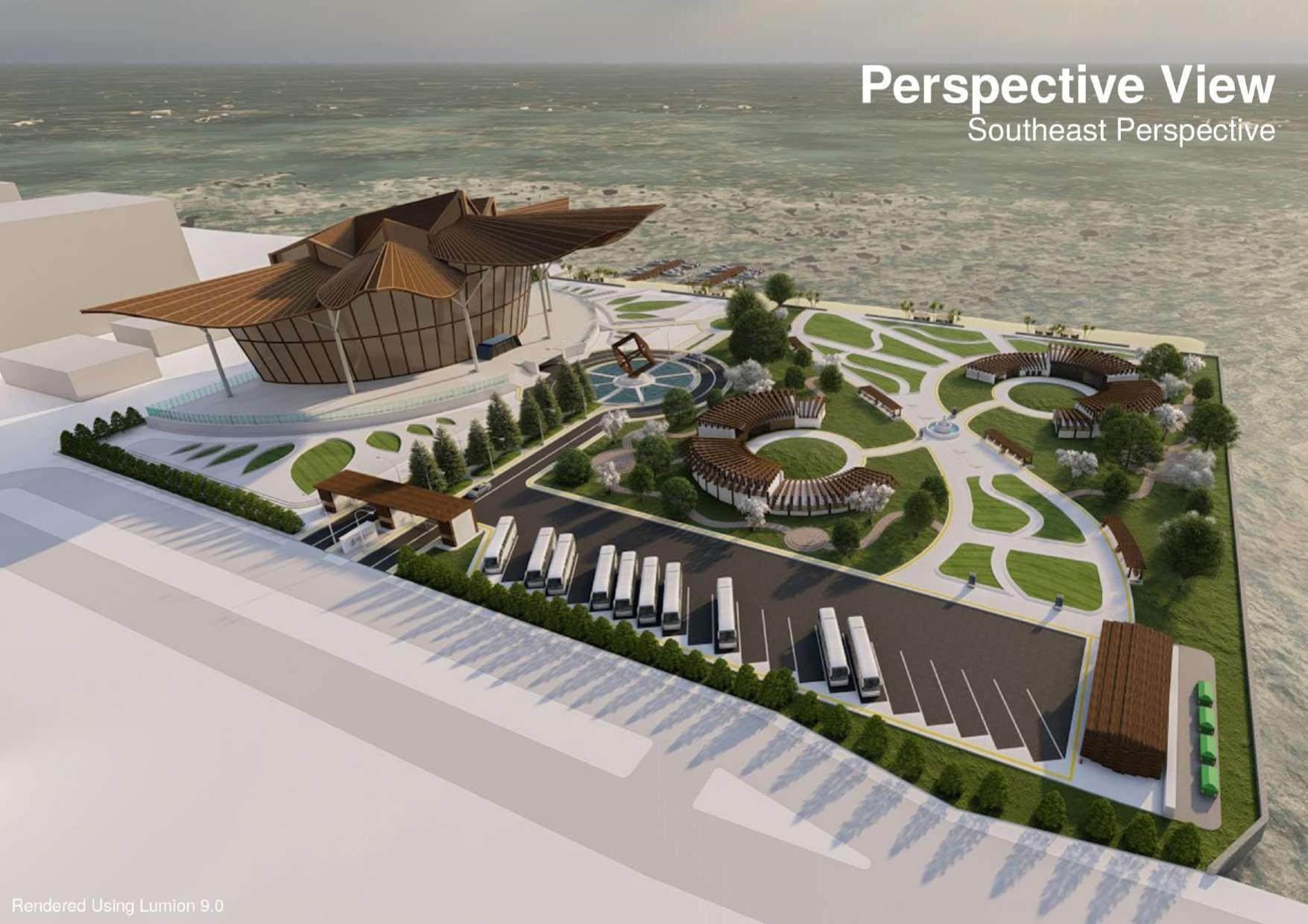
This project focuses on the development of reclaimed land for an industrial area. The client aimed to transform the site into a functional and well-organized industrial zone. In response, I developed urban design guidelines to guide the planning and future development of the reclaimed land. The guidelines addressed land use, circulation, infrastructure, and overall spatial organization to support industrial activities. The final outcome provides a clear and practical framework for development, and the client was satisfied with the result.
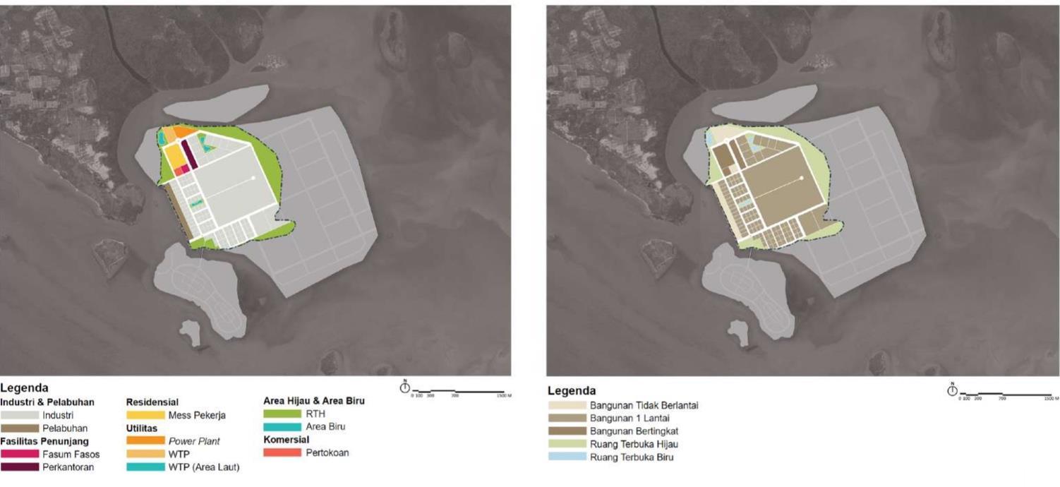
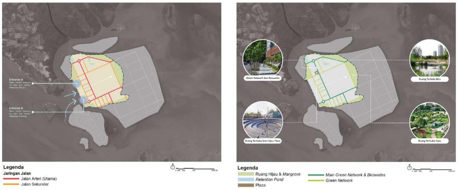
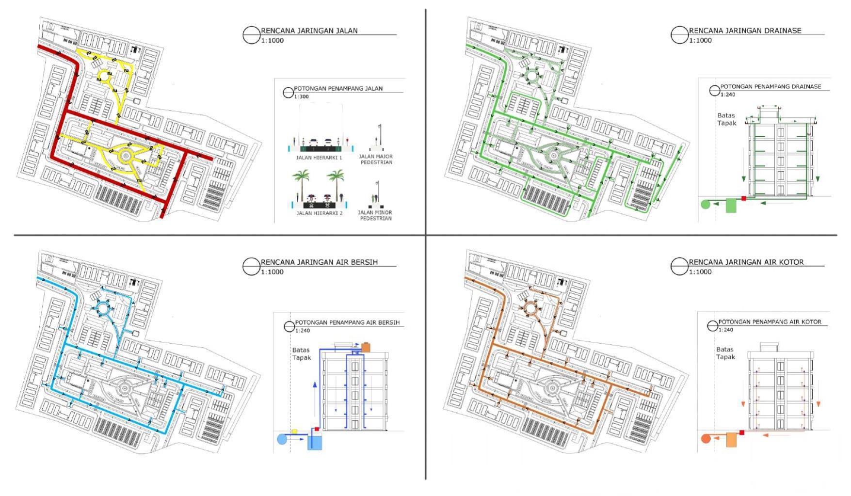
Accessibility, Drainage, and Water & Wastewater Systems
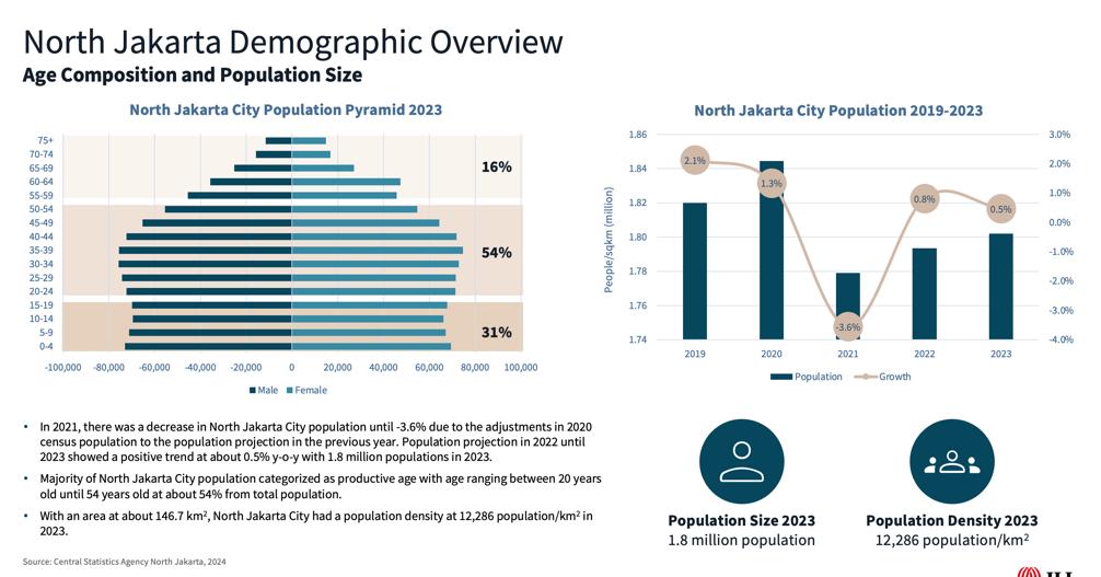
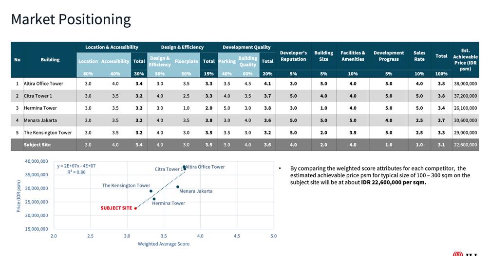
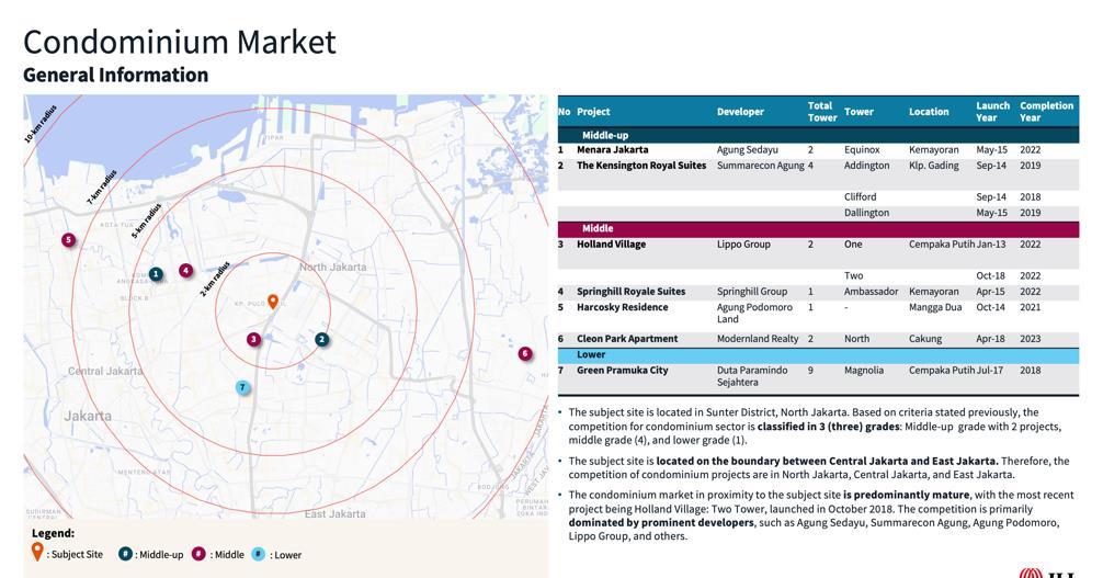
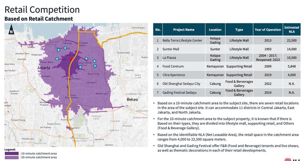
Selected report samples from work at JLL, focusing on market feasibility and highest and best use studies. The work includes socio -economic and demographic analysis, market catchment and positioning, as well as competitor analysis to assess the performance of surrounding real estate properties. These analyses support clear and data -driven development recommendations.