04 Flow in the Loop
Release Ecological Regeneration Ability
Useless Loop, Australia
Area: 700ha
Group Work, Partner: Qinni Ge Studio Work
Instructor: Xi Li(lixi@sicau.edu.cn)
Date:2020.5-6
Individual Contribution:Design 100%, Drawing 50%, Model 60%
Useless loop is an area on the west side of Australia bordering the Indian Ocean. Although it is close to the shark bay nature reserve, the site faces severe ecological problems. Due to the development of the salt mine in the salt field, the untreated saltwater is directly discharged into the sea. After being affected by ocean currents, the high salinity seawater severely destroys the seagrass beds that grow in the surrounding seas.
Our project uses the terrain to construct four strategies to deal with saltwater pollution to restore the seagrass ecosystem. They use rising and falling tides to mix saltwater with seawater, using subsurface flow wetlands to filter saltwater. The seabed terrain promotes the settlement of seagrass and slows down the mixing speed. After multi-treatments, the destroyed seagrass ecosystem will gradually recover in the next 20 years.
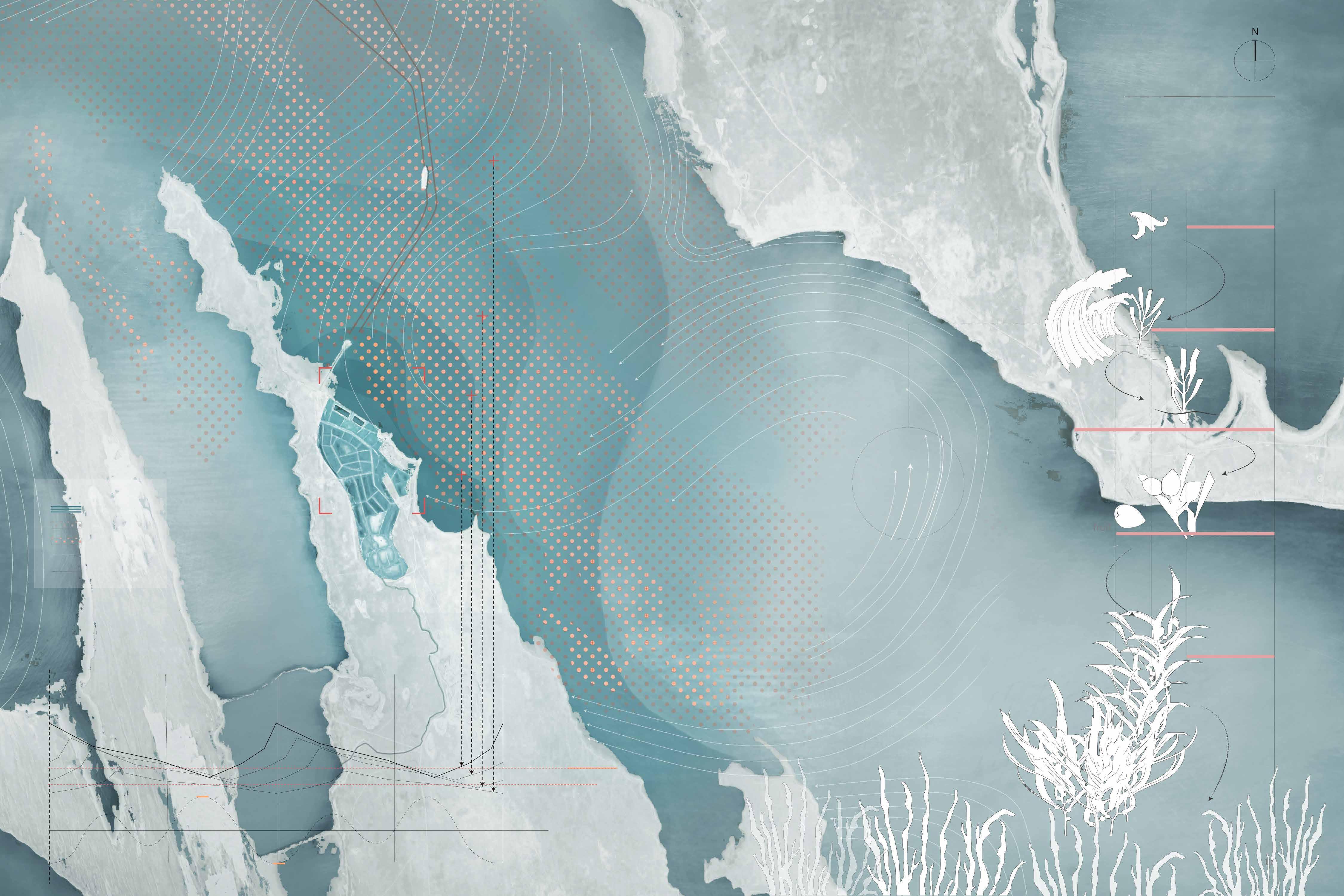
SEAGRASS POLLUTED BY SALINE DISCHARGE
The useless loop area in Australia used to be an excellent seagrass habitat. However, due to the salt mines, the saline that was discharged to the sea without treatment caused the salinity of the surrounding sea to rise sharply and spread outward with ocean currents, causing severe damage to the seagrass that originally inhabited here.
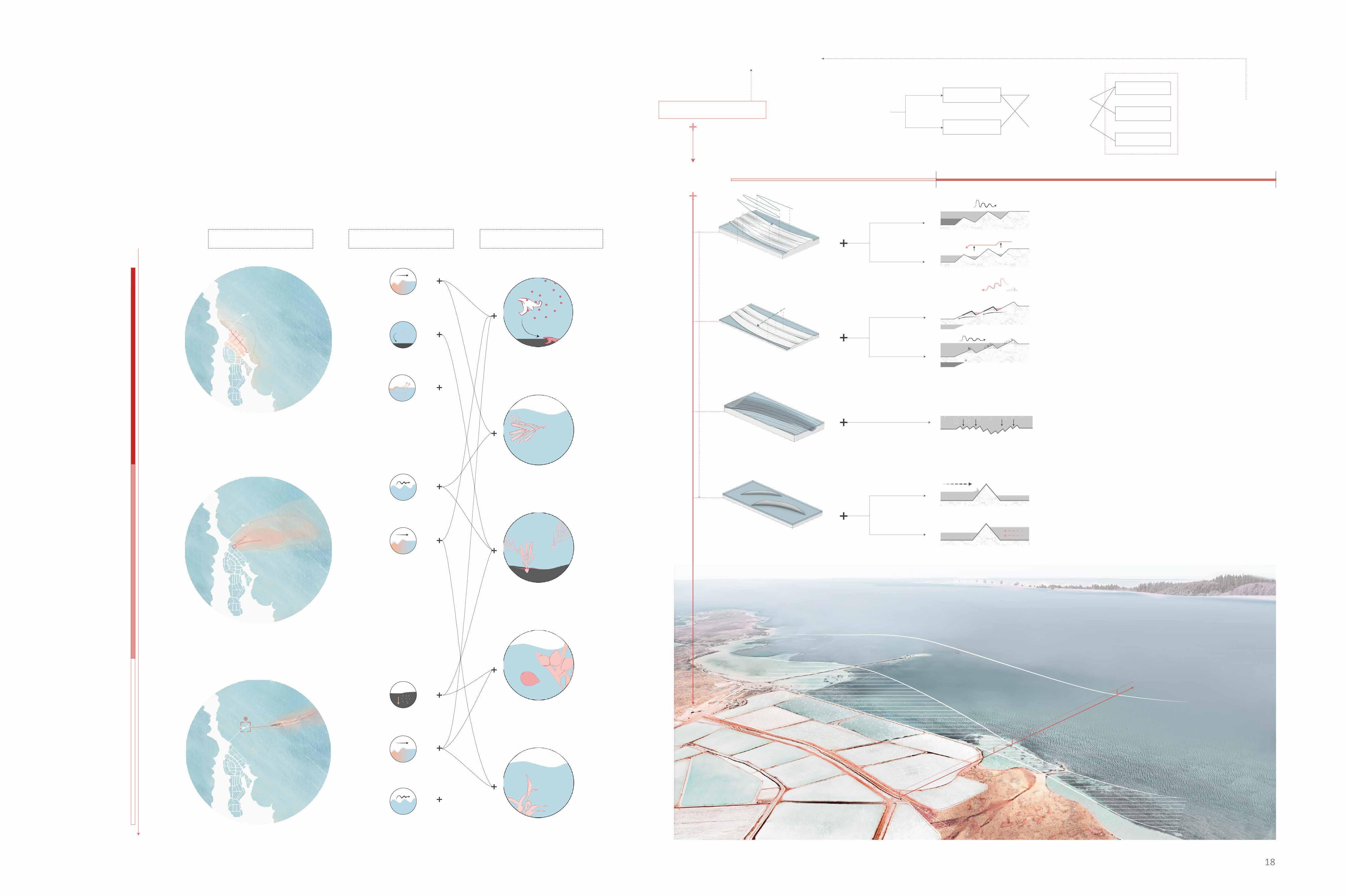
MULTI-TREATMENTS TOWARDS HIGH SALINITY BITTERN
The saltwater pollution in this sea area started from the leakage of saltwater in the salt mine, and the ocean currents passing the passage of salt cargo ships caused it to spread to the outside.
To alleviate salt water pollution, different terrains are used to treat saltwater. The saltwater will be mixed with seawater, penetrate through the wetland, slow down, and finally get seawater suitable for seaweed growth.
PURIFICATION TERRAIN GENERATION
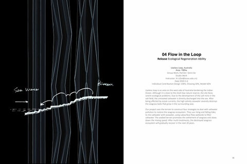
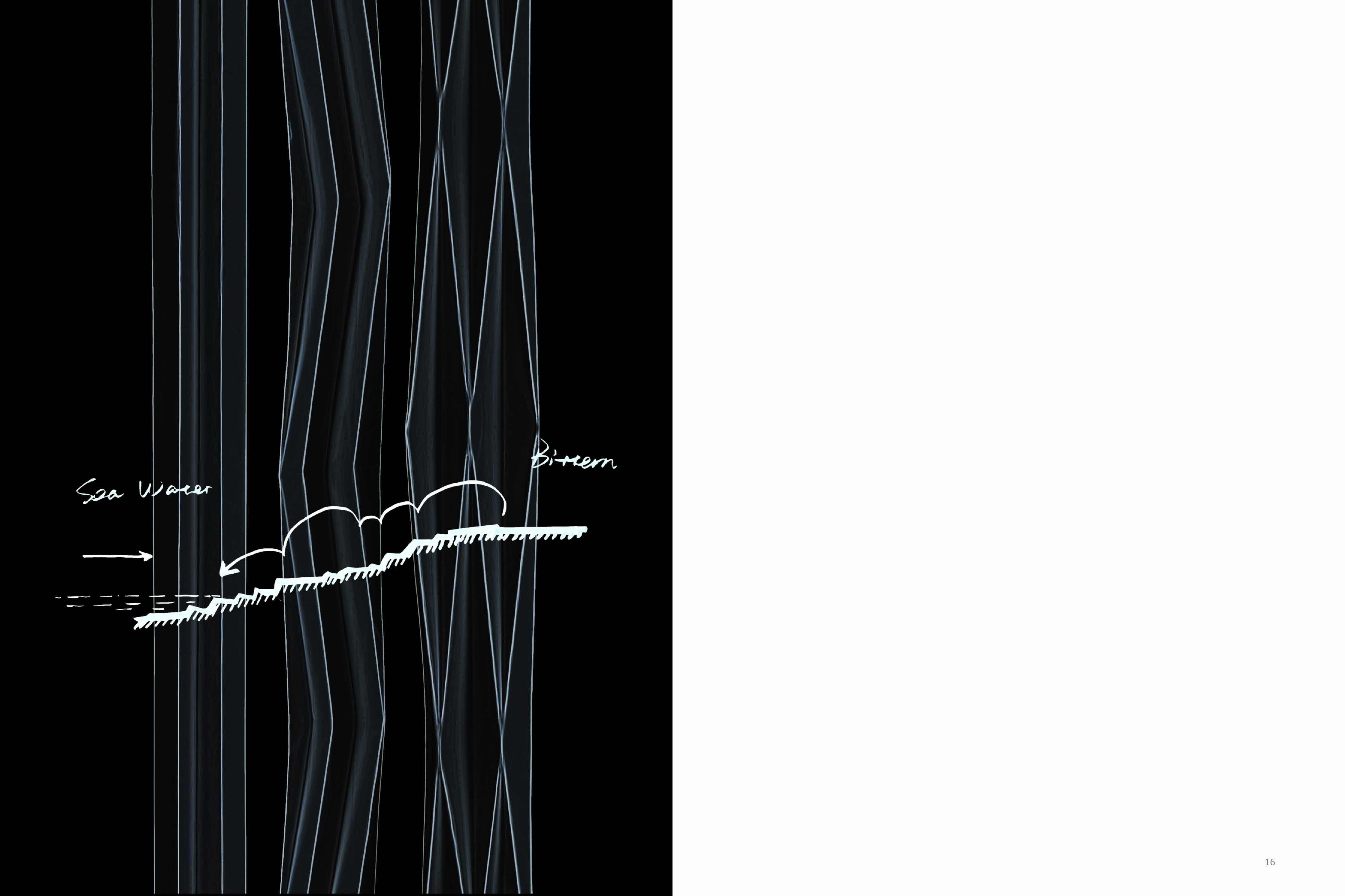
There are four ways to purify the brine discharged from the salt field: the mixture terrain, the underflow wetland, the underwater terrain, and the slow down leeve. The landscape is based on the deformation of the grid and the reconstruction of the structure line generation.
Grid system of terrain Prototype design
step1: contour
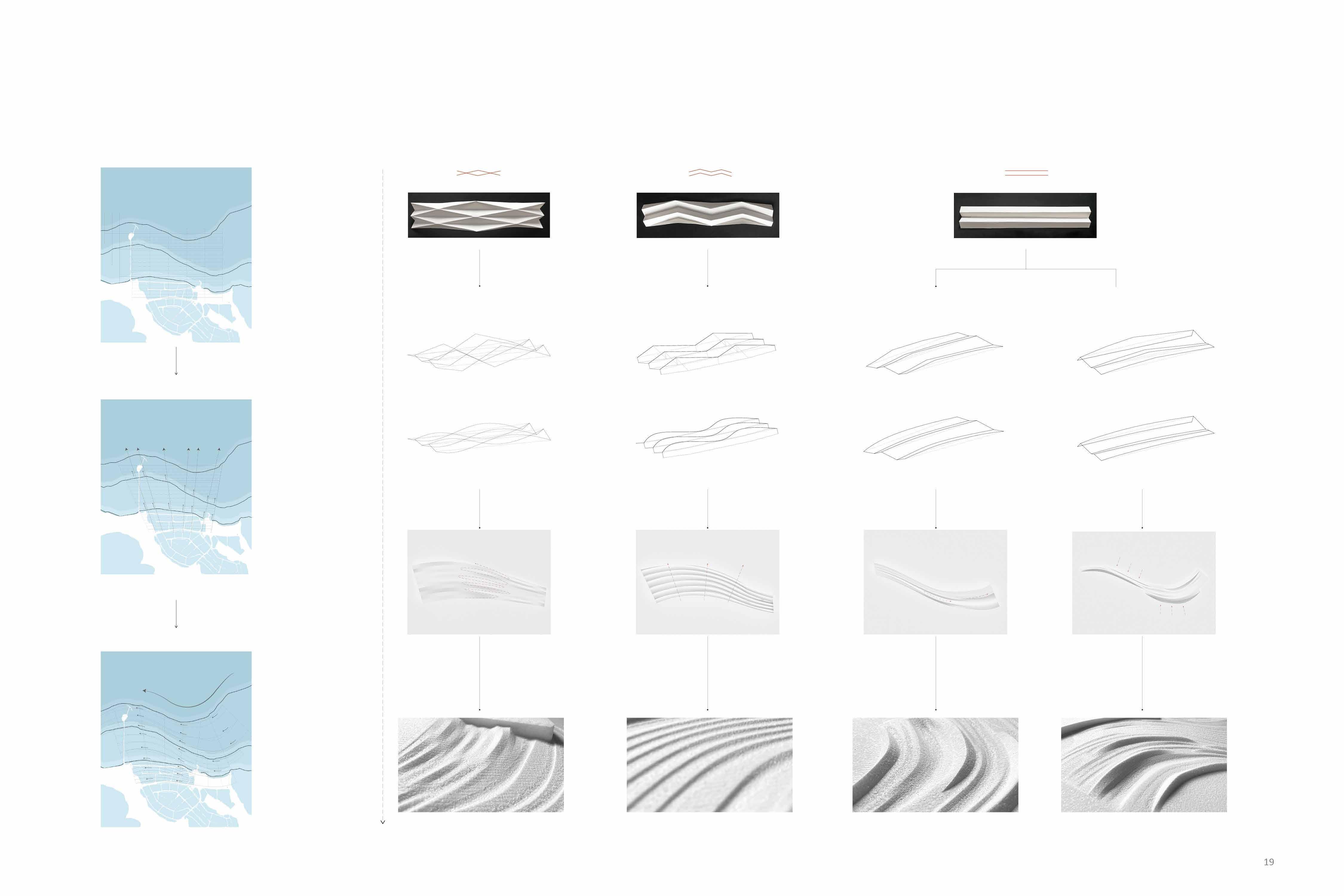
step2: grid of salt field
step3: direction of current
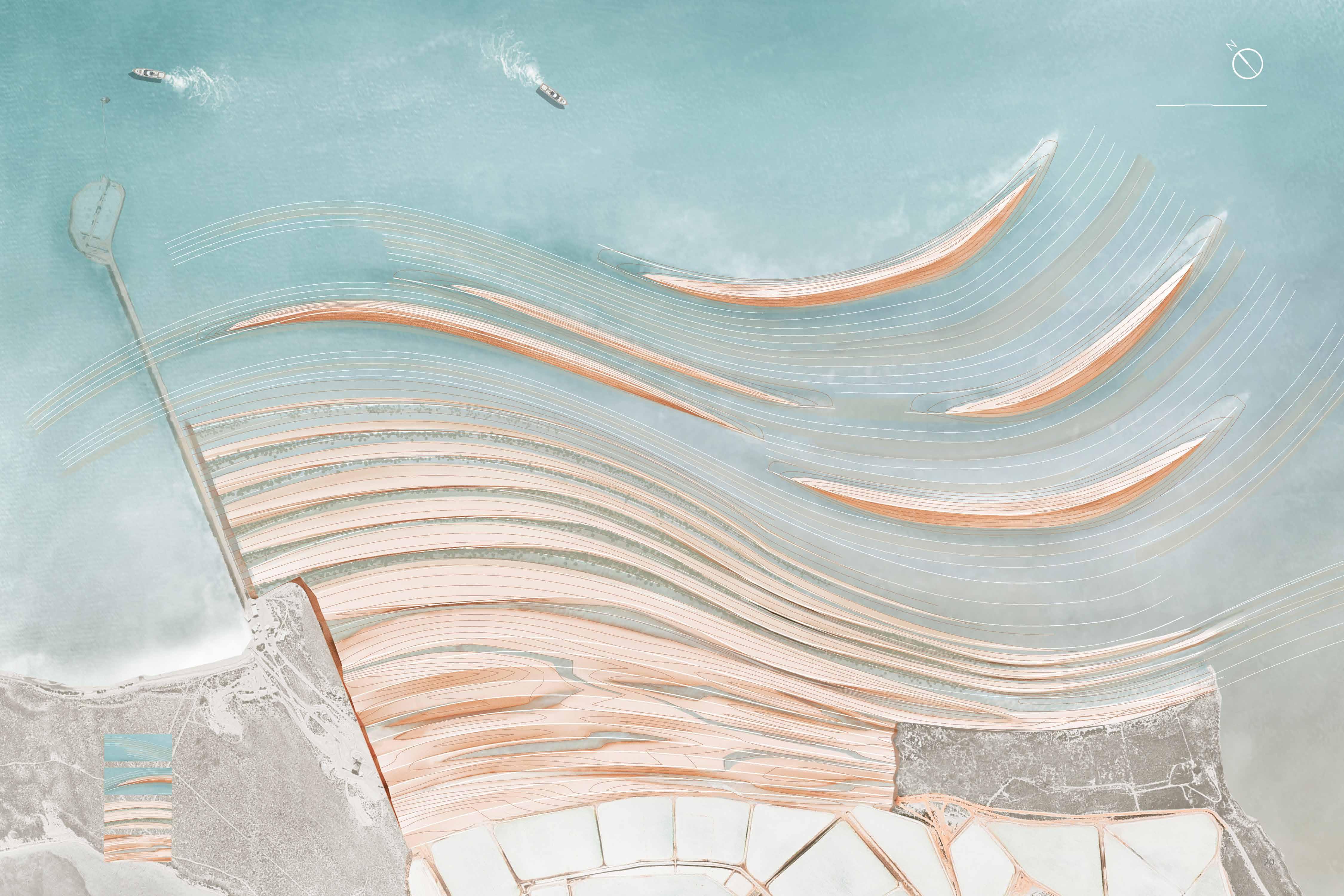
THREE PHASES OF DESALINATION PROCESS
Tidal water level experiment
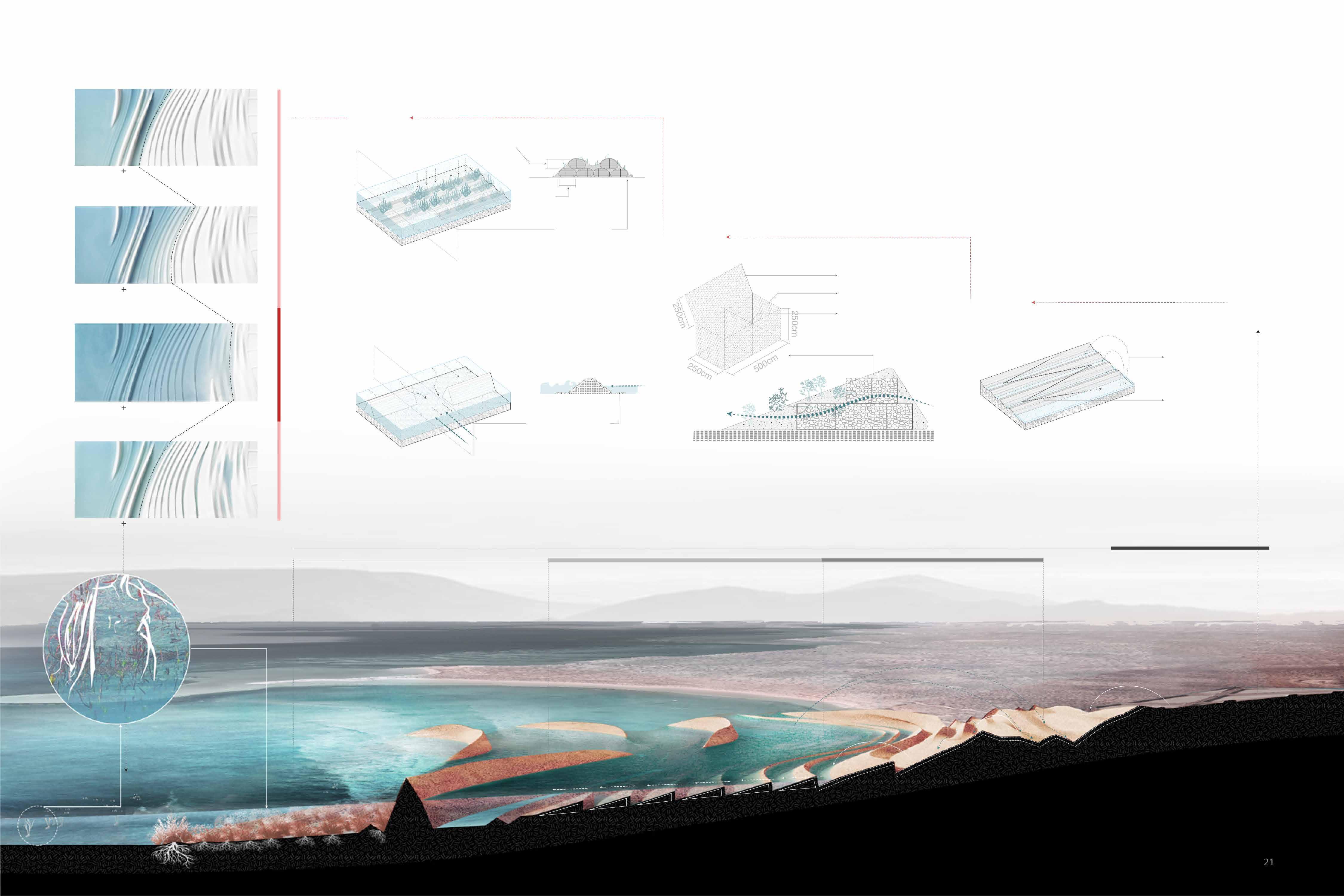
The micro-topography of the seabed formed by sandbags as a base captures the seagrass seedlings brought by the tide and helps them grow firmly.
The saltwater pollution in this sea area started from the leakage of saltwater in the salt mine, and the ocean currents passing the passage of salt cargo ships caused it to spread to the outside.
To alleviate salt water pollution, different terrains are used to treat saltwater. The saltwater will be mixed with seawater, penetrate through the wetland, slow down, and finally get seawater suitable for seaweed growth.
The tidal pass of the concrete foundation slows the impact of ocean currents on the coast, reduces the scouring effect on the seagrass bed, and accelerates the seawater to take away the bittern in the other direction.
The cone-shaped terrain based on the gabion forms a structure for the secondary filtration of the brine, and the preliminarily desalinated brine penetrates the gabion to form an undercurrent wetland.
Sea water brought by the
Brine that flows slowly downwards in Z-shape
The salt brine that flows slowly downward in the Z-shape is mixed with the seawater brought by the tide, and the salt concentration is gradually reduced.
RESTORE THE SEAGRASS ECOSYSTEM
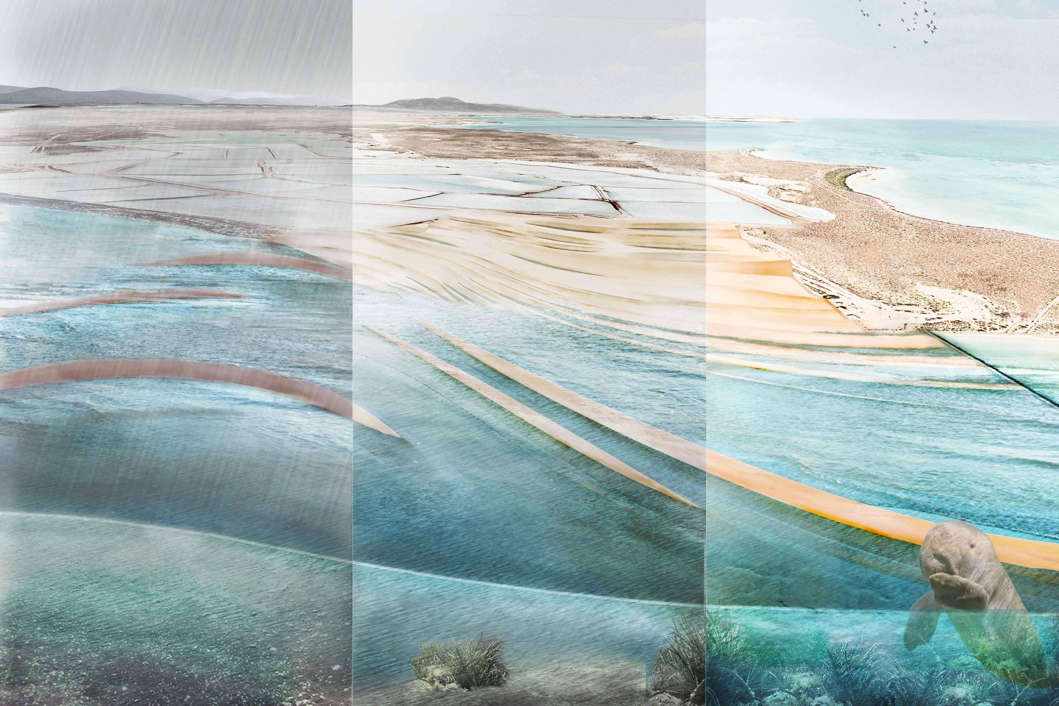
It takes a specific time for the ecological reconstruction of seagrass on the terrain where the saltwater is discharged. At present, it can provide seagrass habitat and slowly promote its settlement. It will restore the seagrass ecosystem in 20 years.
PHYSICAL MODEL
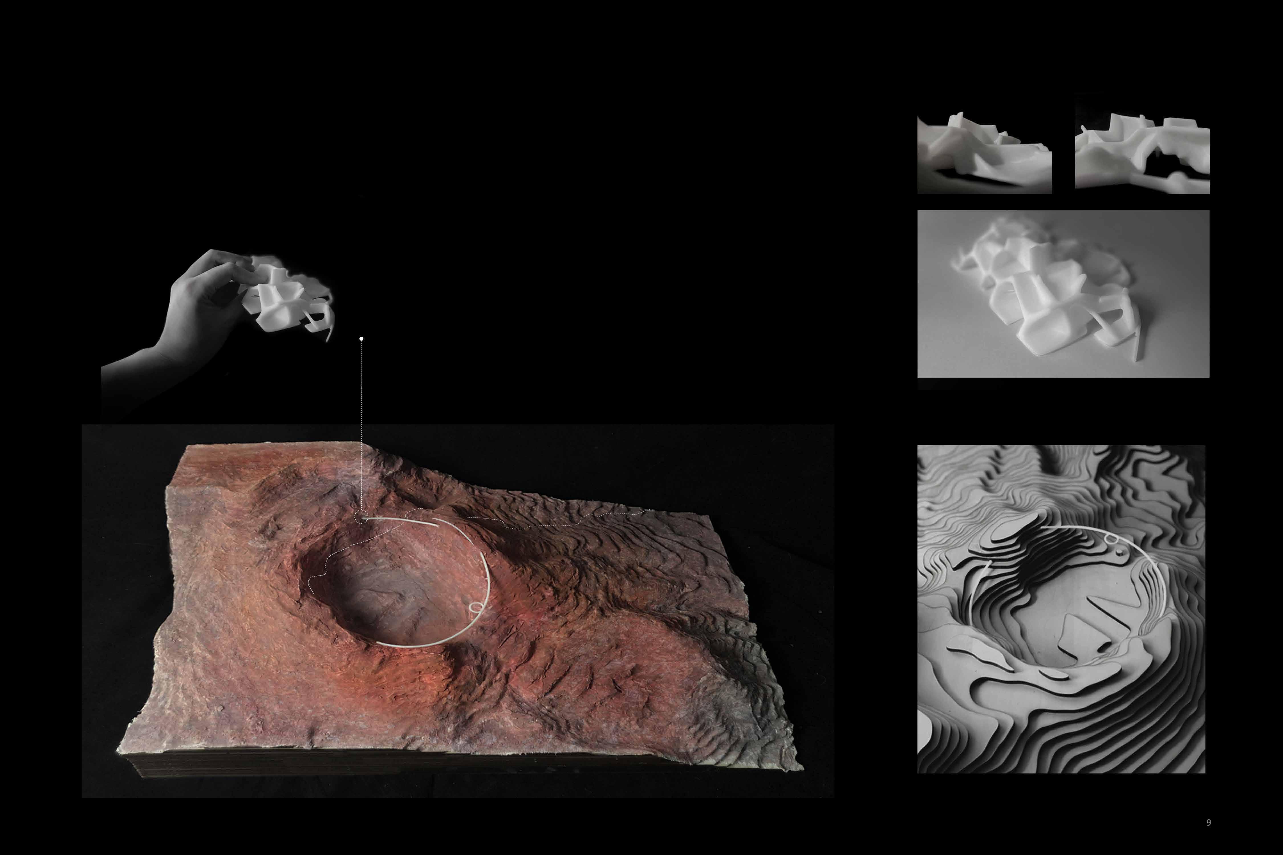
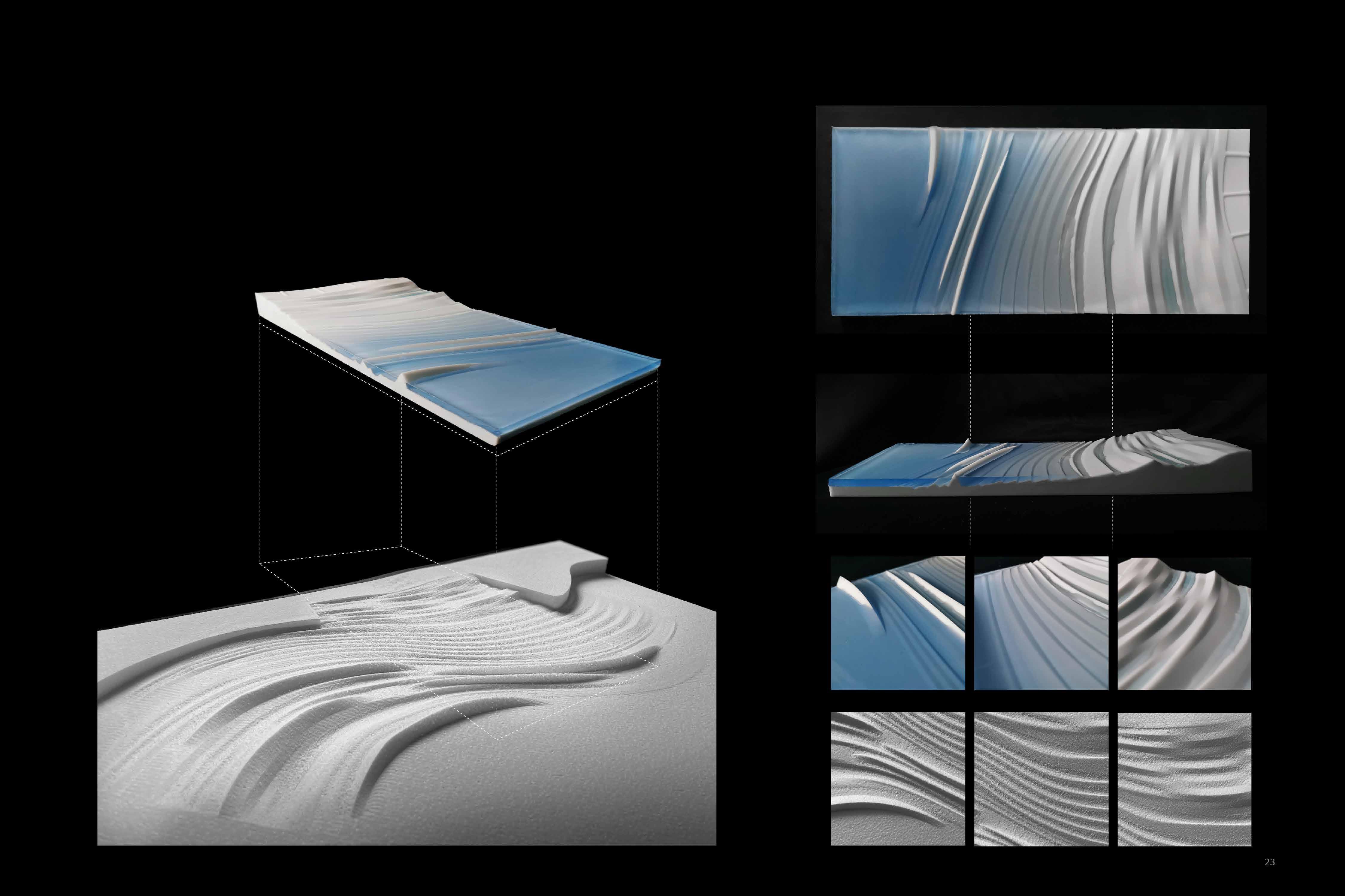
I used the CNC cut model to print out the overall terrain and used the epoxy and 3D printing model to simulate the flow effect of seawater on the terrain. The three-stage landscape and the epoxy formed obvious difficulties between each other.
01 From Risk to Productivity
Release Production Efficiency with Heat Exchange Nodes
Ijen Volcano, Indonesia
Area:230ha
Group Work, Partner: Guanli Feng, Linge Li Studio Work
Instructor: Jie Zhu(525998280@qq.com)
Date:2020.10-11
Individual Contribution: Design 60%, Drawing 60%, Model 40%
East Java Province in Indonesia is famous for its numerous volcanoes in the world. The scenery here is beautiful, but the industrial development is lagging behind.
Local miners reached the Ijen crater by climbing a four-hour mountain road every night. With almost no protective measures, the sulfur formed by the solidification of the sulphur vapor from the crater was collected manually with hands. This dangerous job has seriously affected the health of the villagers.
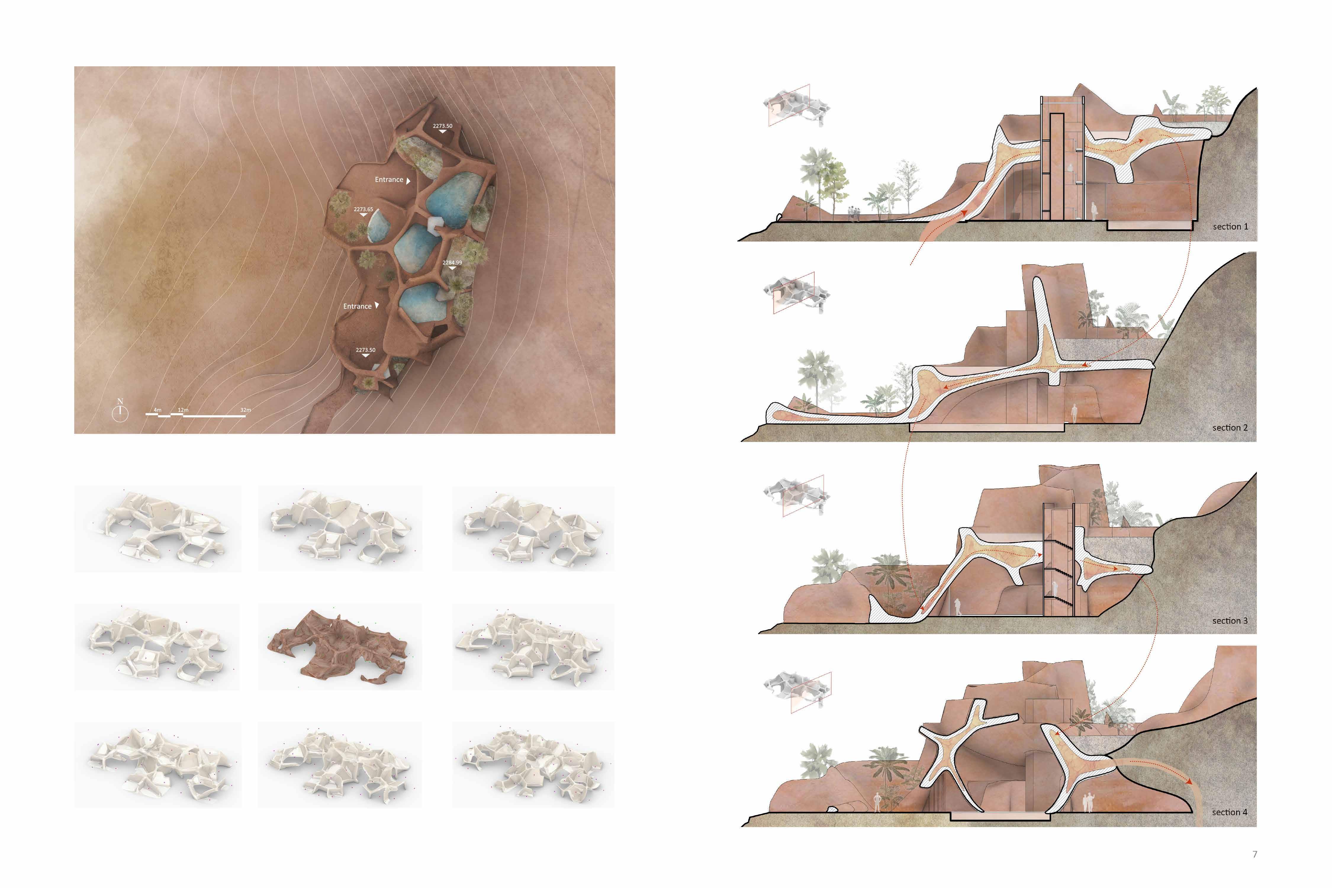
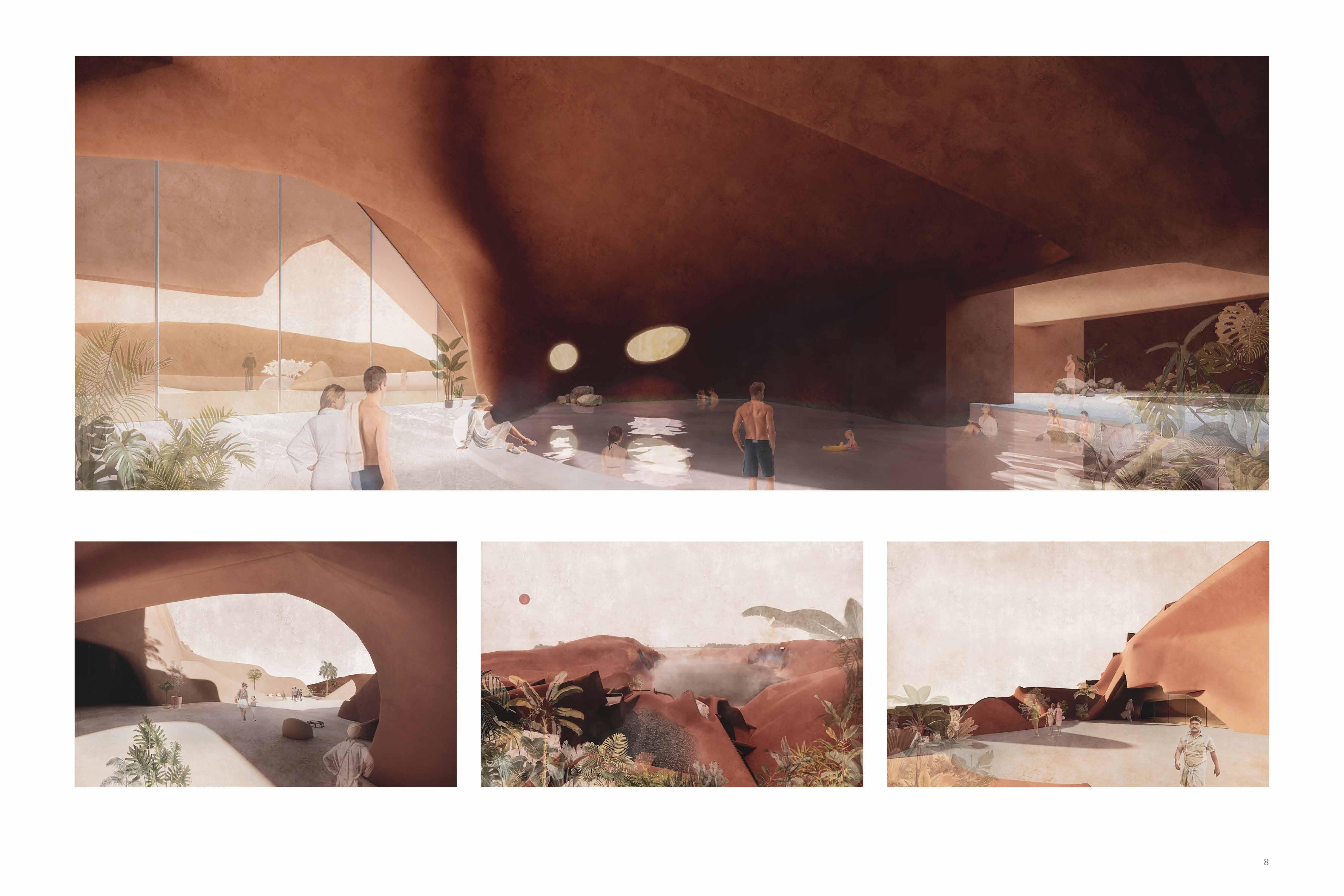
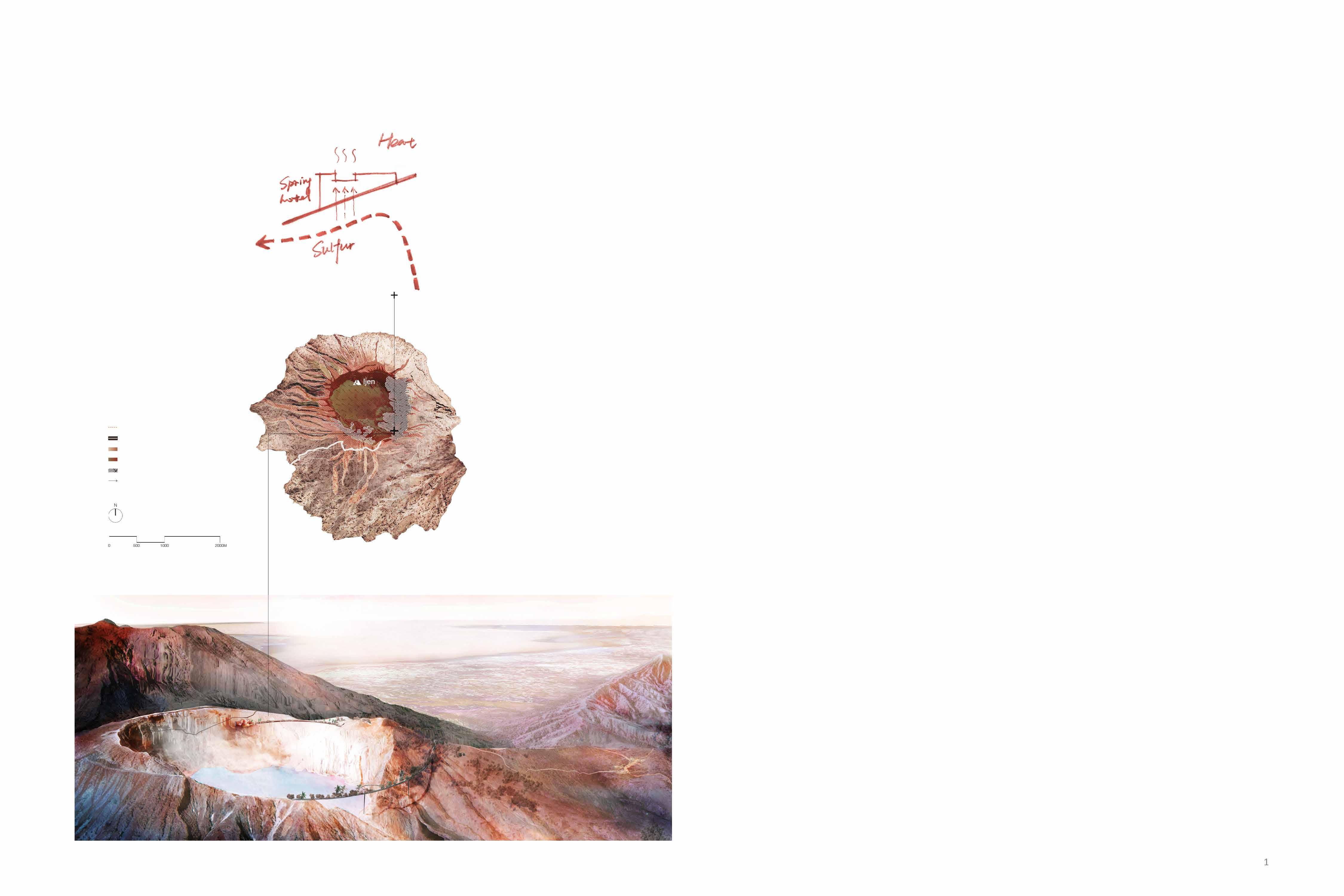
hope to reduce the direct contact between miners and sulfur by designing a series of tourist nodes with body-wrapped functions and using heat exchange to reduce the direct connection between miners and sulfur and increase local tourism income.
The beautiful scenery of Ijen volcano attracts tourists worldwide and is the number one tourist attraction in Indonesia.
However, the road to visit the mountain is rugged and long. Tourists need to crawl for up to hours at night to reach the volcanic crater. This process is very cold and will give people a bad travel experience.
On the other hand, the high temperature acid gas generated during the sulfur mining process brings the miners the risk of scalding and longterm physical damage.
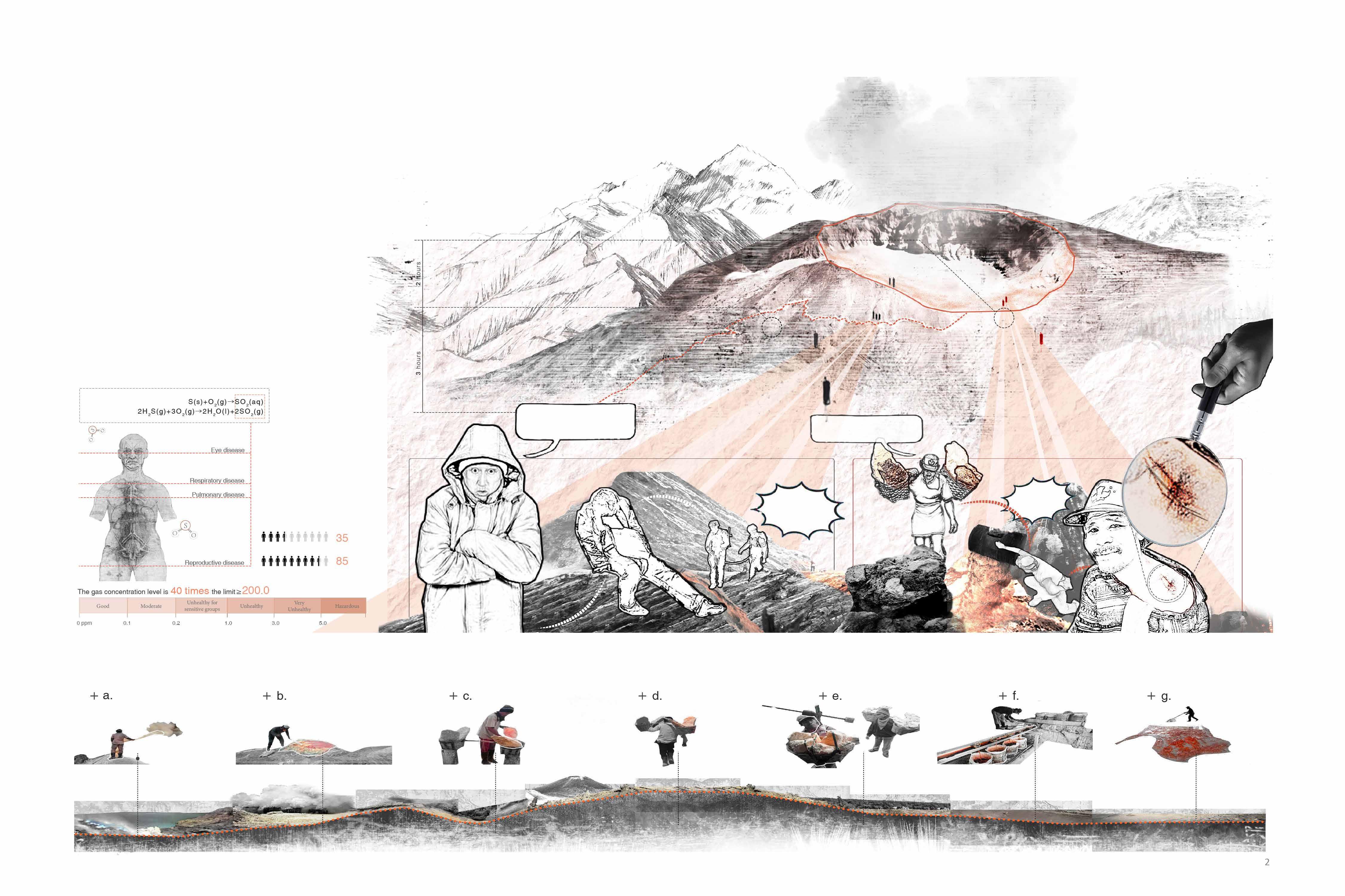
INEFFICIENT AND DANGEROUS
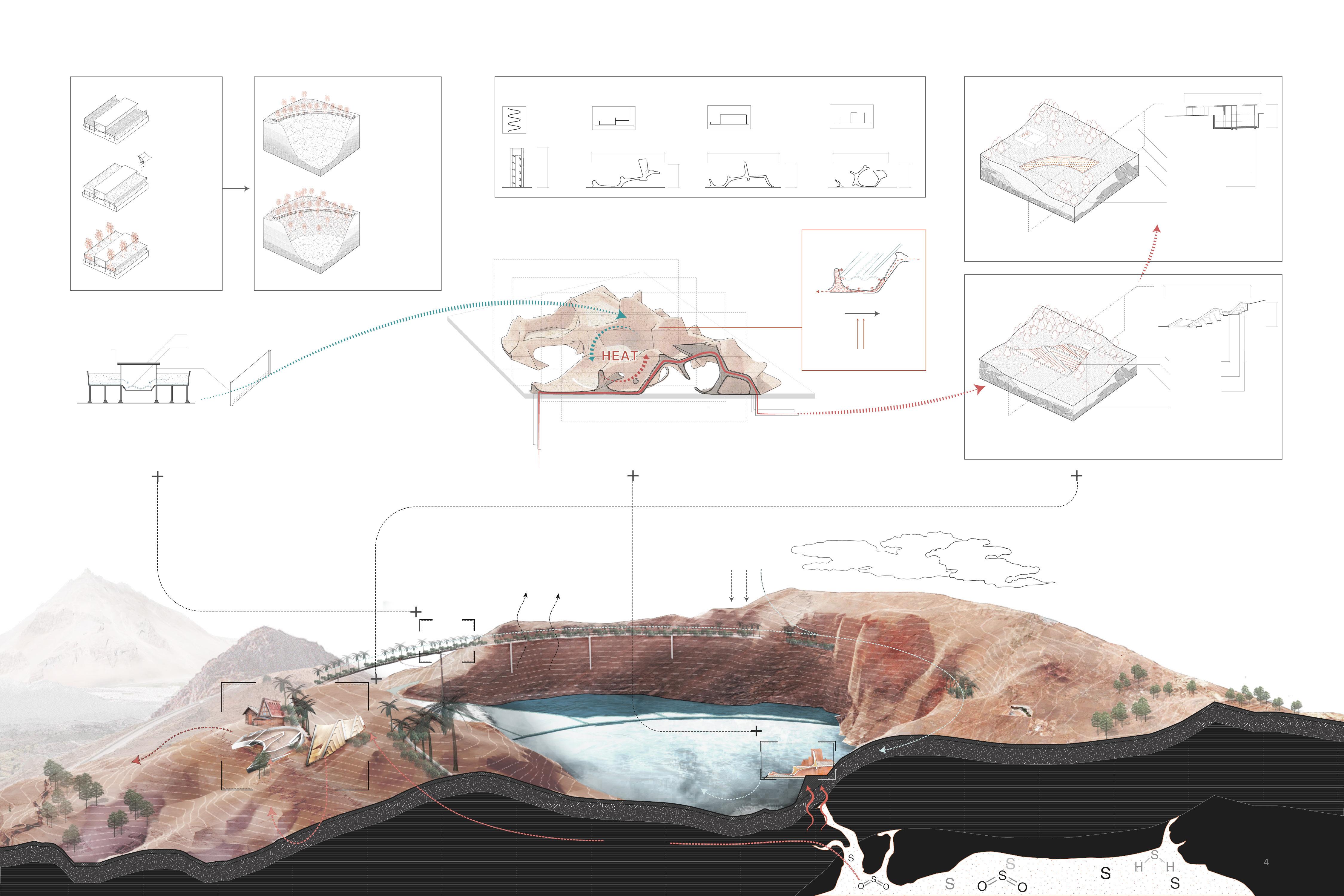
SULFUR INDUSTRIAL PROCESS
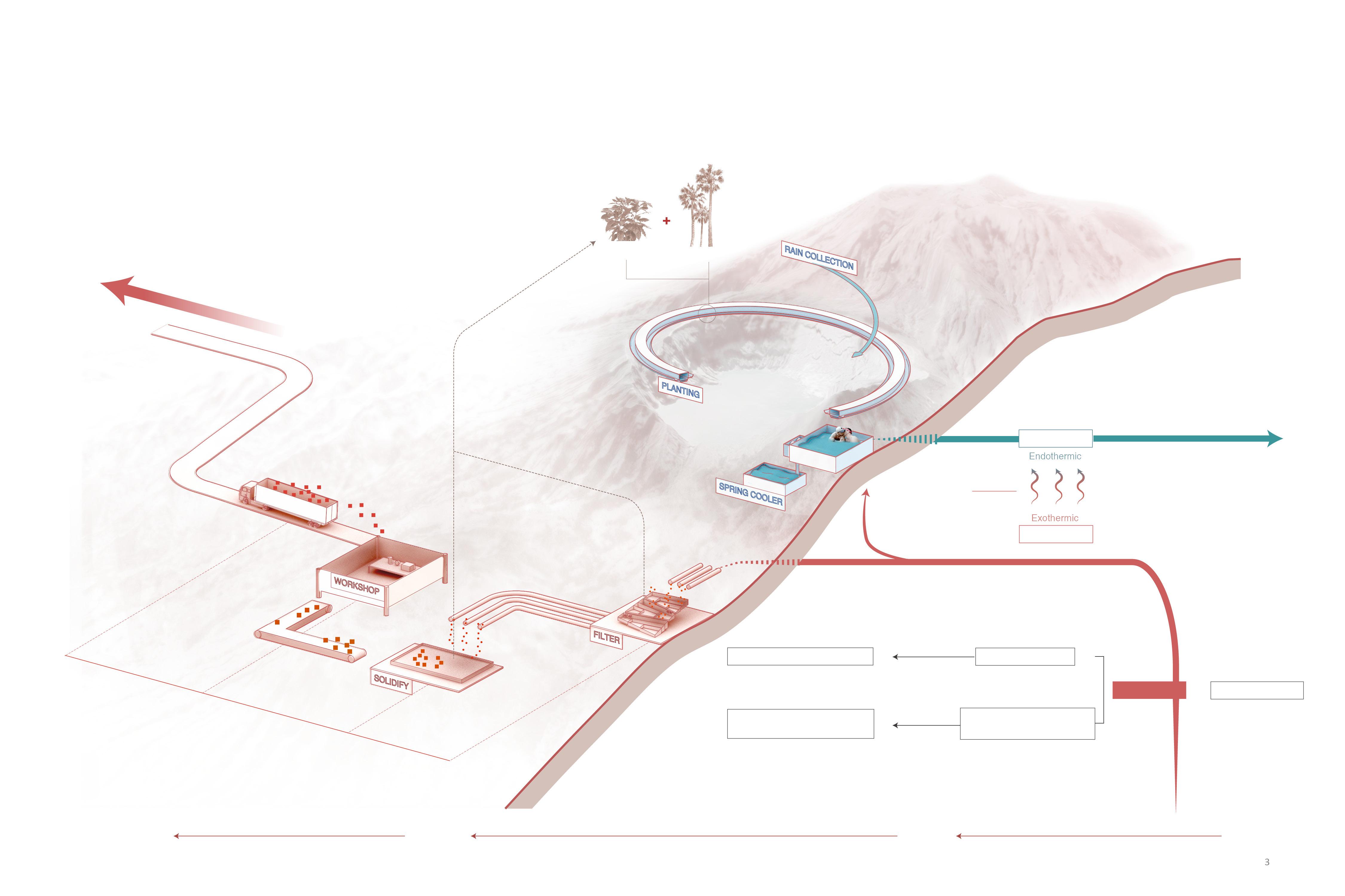
COMBINE PRODUCTION WITH TOURISM
The beautiful scenery at Ijen Crater attracts many tourists, but the long journey is freezing. For the local villagers who depend on mining sulfur mines for their livelihoods, this primitive and backward production method has brought great danger to their lives.At the same time, the toxic gas produced by the reaction of sulfur vapor with air has become the primary source of environmental pollution in this area.
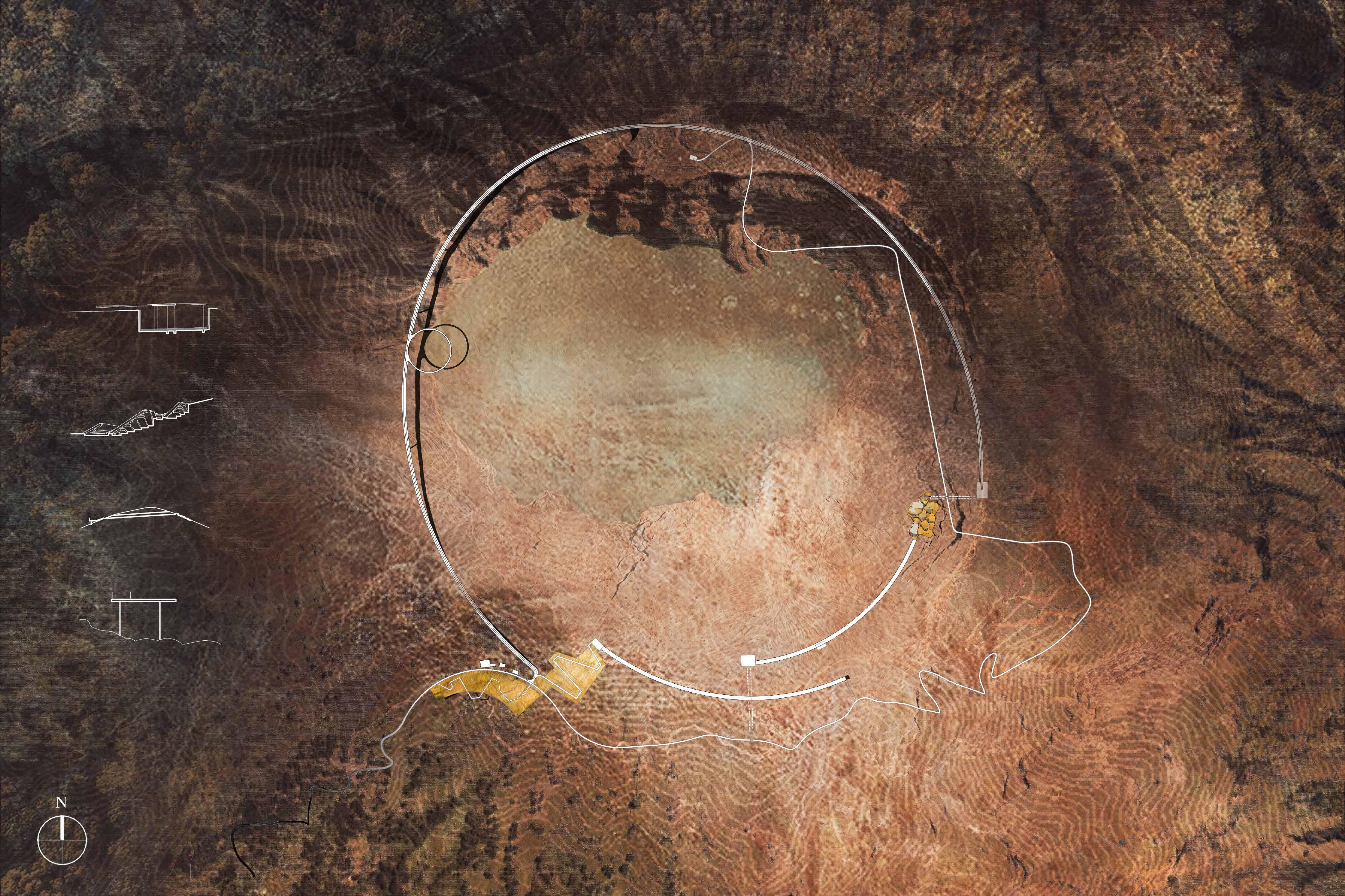
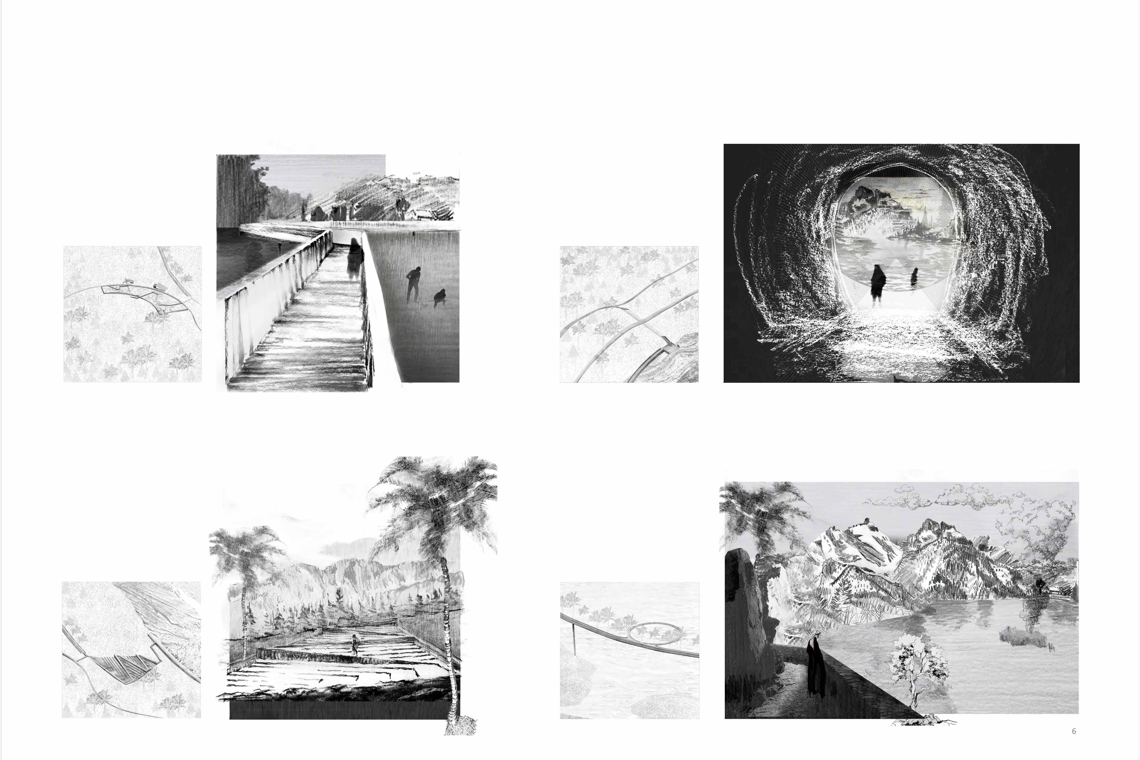
By burying sulfur channels in the mountains to export sulfur vapors to the crater, and designing a spring hotel near the pipelines to exchange heat between sulfur and water, obtaining low-hazard liquid sulfur and hot spring attractions, and designing annular plant buffers around the crater. Absorb harmful gases and collect rainwater filtered by plant roots to provide hot spring water to form a material energy cycle.