Pennsylvania Society of Land Surveyors’ Newsletter
The
Winter 2021
Pennsylvania
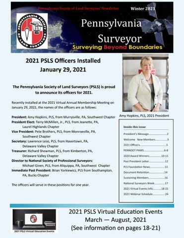
Surveyor 2021 PSLS Officers Installed January 29, 2021 The Pennsylvania Society of Land Surveyors (PSLS) is proud to announce its officers for 2021. Recently installed at the 2021 Virtual Annual Membership Meeting on January 29, 2021, the names of the officers are as follows: President: Amy Hopkins, PLS, from Murrysville, PA, Southwest Chapter President Elect: Terry McMillen, Jr., PLS, from Jeanette, PA, Laurel Highlands Chapter Vice President: Pete Brothers, PLS, from Monroeville, PA, Southwest Chapter Secretary: Lawrence Leso, PLS, from Havertown, PA, Delaware Valley Chapter Treasurer: Richard Shewman, PLS, from Kimberton, PA, Delaware Valley Chapter Director to National Society of Professional Surveyors: Michael Given, PLS, from Aliquippa, PA, Southwest Chapter Immediate Past President: Brian Yorkiewicz, PLS from Southampton, PA, Bucks Chapter The officers will serve in these positions for one year.
Amy Hopkins, PLS, 2021 President Inside this issue President’s Message………………….....2 Welcome New Members……………..3 2021 Officers………………..………….…..5 PENNDOT PAMS……...…..……………6-8 2020 Award Winners………...…..10-11 Past President Letter…………………..12 PLS Foundation News………...…..….13 Document Retention………………….14 Sustaining Members…………………..16 National Surveyors Week…………...17 2021 Virtual Events Info……..….18-21 2021 Webinar Schedule……………...24
2021 PSLS Virtual Education Events March — August, 2021 (See information on pages 18-21)
Message from the President: Why we do it I’ve tried many times over the years to explain to people why I’m so passionate about the profession of Land Surveying. I’m sure the answer is a bit different for all of us. I’ve had a very diverse surveying career and have met so many surveyors over the years. But if I had to pick just one aspect of surveying that I love the most, I’d have to say it’s the history of the land itself.
I was hired to survey and subdivide 78 acres in a rural county surrounded mostly by state game lands. But one of the lands adjoining was my mother’s old family homestead. The property had been out of her family for decades. As I was pulling deeds in the chain of title I got back to the old handwritten deeds and started recognizing names. My grandfather, great grandfather and great uncles. The house in which my mother and two of her siblings were born stood through the trees. It was built in the late 1800’s. A family is living in it and its been well maintained over the years. As I tapped a survey cap with my name and license number on top of the 5/8” rebar I’d just set, I realized that years from now, another surveyor is going to find the monument I just set. They’ll pull the recorded plan from the courthouse that I sealed. They’ll research the same deeds, though the names won’t mean anything to them. As Surveyors, we not only research the history of the land, but we’ll forever be a part of it. Whether you’re a rural boundary surveyor, construction, highway, pipeline, mining, urban, city, geodetic, hydrographic, field, office and drafters, we’re all leaving our mark on history. It takes all of us sharing our expertise, experience, and love of surveying to keep Land Surveying the honorable and respected profession it has always been.
I’d love to hear about your defining moment, that moment when you realized “this is why I love surveying”. If you’d like to share, please send your short story to us at psls@psls.org or me, personally, at PSLSpres@psls.org, with the subject line “Why I do it”.
2
to our New Members! Matthew Boone Allegheny Heartlands Chapter
Lucas Cole PCT Student Chapter
Dean Kostenbauder Bucks County Chapter
Evan Dangle PCT Student Chapter
Lisa D’Andrea Delaware Valley Chapter
Evan Darroch PCT Student Chapter
Charles Dobson Delaware Valley Chapter
Matthew Pondel PCT Student Chapter
Justin Grantz Delaware Valley Chapter
Brynn Schaffer Reading Chapter
Matthew Fisher Harrisburg Chapter
John Gaudlip South Central Chapter
Charles Tabb Harrisburg Chapter
David Kalina Southwest Chapter
Michael Stone Harrisburg, Northeast Chapters
Zoran Milojkovic Southwest Chapter
Dennis Rosatti Laurel Highlands Chapter
Christopher Albee Southwest Chapter
David Laferriere Lehigh Valley Chapter
Mark Reidenbach Southwest Chapter
Robert Hoppes Lehigh Valley Chapter
Brian Sokol Southwest Chapter
Dimitrios Bolkas Northeast Chapter REMINDER! Renew your membership before losing benefits on April 1. Renew now at www.psls.org.
3
Pennsylvania Society of Land Surveyors
PSLS Mission
Officers: Amy Hopkins, PLS, President Terry, McMillen, Jr., PLS, President-Elect Pete Brothers, PLS, Vice President Lawrence Leso, PLS, Secretary Richard Shewman, PLS, Treasurer Brian Yorkiewicz, PLS, Immed. Past President Michael Given, PLS, NSPS Director State Directors:
Allegheny Heartlands Chapter Joseph Hood, PLS & James Mostoller, PLS
The Pennsylvania Society of Land Surveyors, a statewide professional organization, exists for the purpose of supporting, improving and enhancing the profession, its members, and the practice of land surveying. To these ends, the critical work of the Society focuses on providing education, legislative involvement, enhancing the public awareness, and the promulgation of the ethics of the profession.
Bucks Chapter Robert Snyder, PLS & David Spellman Delaware Valley Chapter Jason Bertzos, PLS & Karl Kriegh, PLS Harrisburg Chapter John Clark III , PLS & James Hartman, PLS
2021 Board Meeting Dates Virtual—GoToMeeting 10:00 a.m.
Laurel Highlands Chapter Randall Myers, PLS & Troy Leighty, PLS Lehigh Valley Chapter Stephen Ombalski, PLS & Arthur Swallow, PLS Mid-State Chapter David Archibald, PLS & Gregory Shufran, PLS North Central Chapter K Robert Cunningham, PLS Northeast Chapter
March 19 May 21 July 23 September 10 November 19
Glenn Johnson, PLS & Vincent Stranch, PLS Northwest Chapter Ryan Courtney, PLS Pocono Chapter
Gregg Davis, PLS & William Senapedis, PLS Reading Chapter John Fuehrer, PLS & John Huck, PLS South Central Chapter Eric Gladhill, PLS & Timothy Rojahn, PLS Southwest Chapter Donald Groesser, PLS & Vincent Paparella, PLS Susquehanna Chapter Timothy Wentz, PLS & Robert Weaver, PLS
4
The Pennsylvania Surveyor is published by the Pennsylvania Society of Land Surveyors (PSLS). Articles or opinions expressed in this publication do not necessarily reflect the viewpoints of PSLS, but are published as a service to its members, the general public, and for the betterment of the surveying profession. Articles may be reprinted with due credit given. We welcome submissions via e-mail in MS Word format. Please forward to psls@psls.org or call 717.441.6057.
Contact PSLS Phone: 717.441.6057 PSLS Office--Lori Elliott — PSLS@psls.org Amy Hopkins—PSLSPres@psls.org Terry McMillen, Jr. —PresidentElect@psls.org Pete Brothers—VicePresident@psls.org Lawrence Leso—PSLSSec@psls.org Richard Shewman—Treasurer@psls.org Michael Given—NSPSDir@psls.org Brian Yorkiewicz—PastPresident@psls.org Shaheed Smith—Foundation@psls.org
PSLS Staff Lori Elliott, Executive Director Marcy Robey, Financial Coordinator Margaret Murphy, Conference Coordinator Tiffany Carpenter, Registrations Coordinator Jason Tobias , Membership and Technology Coordinator Kathy Clough,
2021 Officers
Amy Hopkins, President
Lawrence Leso, Secretary
Receptionist
Terry McMillen, Jr., President-Elect
Richard Shewman, Treasurer
Michael Given, NSPS Director
Pete Brothers, Vice President
Brian Yorkiewicz, Immed. Past President 5
PennDOT PAMS: Repository for Historical Monuments and Research Tool for Surveyors by Stephen M. Moore, PLS, Harrisburg Chapter PennDOT has maintained the Photogrammetry Asset Management System for nearly 20 years. This system is a repository for PennDOT flown Aerial Photography coverage and Survey Control Monuments across the state of Pennsylvania. PAMS was established for the Photogrammetry and Survey Section at PennDOT to track job progress and completion, have easy access to past project details, and maintain an up-todate catalogue of survey monuments statewide. PennDOT PAMS can be found at www.penndotpams.org and is accessible to anyone. The original development effort was carried out by geographIT, a Division of EAB Engineering Inc. under the direction of PennDOT’s Photogrammetry and Surveys Section. PennDOT PAMS Desktop home page
As published in the article of The Pennsylvania Surveyor Summer 2020, “Educating the Public on the Importance of Monuments – Warren, PA” by Joseph McGraw, PLS, Northwest Chapter, survey monuments are extremely important to protecting the property of the citizens of the commonwealth. There indeed needs to be more education for government officials, construction contractors, and the general public on this topic. Surveyors know first-hand of this importance and the tragedy of losing these historically significant marks due to negligence or ignorance. In response to this on-going issue, PennDOT has expanded the use of its tools to surveyors across the state. In the past, PennDOT PAMS has been used solely by geodetic surveyors of the Photogrammetry and Surveys Section in PennDOT to record high-order survey monuments and update their positions and condition over time. Having recognized the need to expand the use, there have been modernized releases and enhancements to the website to make this repository available to others. PennDOT’s Photogrammetry and Surveys section has currently entrusted geographIT with converting the site from an internal planning and tracking tool into a robust crowd sourcing system. Plans for this expansion were presented by the PAMS team at the 2019 PSLS Surveyor’s Conference at a seminar titled “PennDOT PAMS: Survey Control Database”. Over the past two years, these plans and ideas have developed into a functional reality. When accessing PennDOT PAMS, any user can access survey monuments across the state from the Map View screen. Here users can utilize the search features, Identify or Circle Query, to select survey monuments from the Map View. A results grid will populate, users can view information about the mark, view datasheets, and now provide updates directly to PAMS Administrators for review. A guest user can use the button, Provide
6
Continued on page 7
Update, on a survey monument to provide additional recovery information, monument condition, and upload a photograph of the mark. A registered user will have full access to the database, in which they can provide positional information, datum updates, arrays of photos, descriptions and more. Registered user feedback will be reviewed by PAMS Administrators prior to acceptance into the database and final datasheet creation. New users can request a registered user login by emailing surveycontrol@pa.gov. With the assigned login, registered users can not only report information on existing marks, but they can also request that marks be added to the database to expand the quality data within the site.
Roadway Mileage stone properly preserved in Lancaster County, East Hempfield Township, Amos Herr Park.
Take the survey monuments from the Warren, PA article referenced above. A registered user; Surveyor, Government Official, Contractor, Geocacher, could request the existing Warren County survey monuments be added into the PennDOT PAMS database. The user could provide feedback on those marks and add photos. Once populated in the in the database, the monuments would be there for anyone to search and review. The information provided does not necessarily have to be survey grade. If a county were able to provide GIS quality locations to get the marks published, the datasheets will clearly reflect the survey monument’s quality and accuracies. The key is to upload these marks into a single repository available to all. Contractors could be made aware of this site at kick-off meetings or provided as part of construction contracts.
Community awareness campaigns could alert the public to the existence of these Survey Marks and their importance. The PAMS database is generally populated with high-order survey control established by National Geodetic Survey (NGS), PennDOT Survey Districts, PA Turnpike, county GIS monuments. The need to include other historically significant survey monuments has been made clear and that could be achieved with the assistance of private sector surveyors and the interested general public. Some examples of historically significant monuments currently in the database are Mason-Dixon Monuments (see “CROWNSTONE 75 RESET- GAUSS” record of control datasheet), Roadway Mileage Stones (see photos), and county line monuments. As Surveyors explore the usefulness of PAMS and its potential, they will also see tools to support the modernization of the Roadway Mileage stone showing 6 miles to LanNational Spatial Reference System (NSRS). PAMS has NGS Coorcaster and 19 miles to Mount Joy. dinate Conversion and Transformation Tool (NCAT) functions
Continued on page 8
7
embedded into the results bar. This PAMS tool currently will take any mark in the database and transform its coordinates to the latest published horizontal and vertical datum using the official NGS parameters in NCAT. As NGS rolls out NATRF2022 and NAPGD2022 (new horizontal and vertical datums) and the proposed Pennsylvania State Plane Coordinate Zones change drastically from the existing PA North and PA South zones, the tool will project the coordinates to the new PA Single Statewide Zone and the new “Sub-zone” associated with the position of the survey monument. As surveyors plan future surveys, they can utilize PAMS to research existing monuments, review the newly transformed positions, and prepare properly for surveying into the future. PennDOT PAMS is a multifunctional website that provides desktop and mobile access to a wealth of survey information. Users have access to many search and filter options to refine the criteria and achieve optimal search results. Modern up -to-date datasheets provide essential information regarding the position, description, and metadata for survey monuments. These sheets are linked to two NGS databases, the OPUS Shared Solutions and the IDB (Integrated Database, which is what generates NGS Datasheets), when available, to maintain the connection to the source of the data. Users are encouraged to utilize both PAMS Provide Update and NGS Survey Mark Recovery tools to ensure data is correct and current across both agencies. PAMS is a tool that ties the historic heritage of survey monuments to the present time usage of high-quality data to the future planning of surveys across the commonwealth and is available to all. Link to PennDOT PAMS page: www.penndotpams.org Link to NCAT page: https:// Pennsylvania Record of Survey Control Datasheet. geodesy.noaa.gov/NCAT/ Link to NGS Survey Mark Recovery page: https://geodesy.noaa.gov/surveys/mark-recovery/index.shtml
8
9
2020 Awards Presented at January 29th Virtual Membership Meeting
10
11
Words of Appreciation, Wisdom, and Encouragement from PSLS Past President
Thank you, President Amy Hopkins, PLS, for honoring me with the President's Award at the Annual Membership Meeting of PSLS last month. The Society faced some extreme challenges due to the pandemic last year. We met those challenges and are better as a result. We pivoted from our traditional conference to a series of virtual educational seminars. We accomplished some legislative goals, are on the verge of finalizing an update to the PSLS Standards of Practice and our membership numbers are improving. None of this happened without the support and dedication of our Executive Committee, Board of Directors, Committee chairs, volunteers, members, and, of course, our friends at Wanner Associates. I am constantly impressed by our leaders, group dynamic and commitment from everyone involved. I had to resign as President when I became a member of the PA Registration Board for Engineers, Land Surveyors and Geologists last September. I want you to know that I continue to vigorously support the Land Surveying profession in my new role, as much or more than I have over the past 35 years as a member of PSLS. In addition to the activities of reviewing and approving budgets, making decisions about examinations and professional development, and reviewing applications for licensure, Board members also respond to complaints and take enforcement action when necessary. I find that fellow Board Members are wellinformed about the differences and commonalities of the three professions and are willing to act when a licensed professional oversteps their boundaries (pun intended). In addition to our monthly webinars, PSLS still has several, day-long virtual education events on the schedule. Make sure you register for these events. I am sure you will see the value, not just in terms of the cost, but also for your own personal professional improvement and advancement. Your Pennsylvania license renews in September. I believe the largest number of enforcement actions by the Registration Board are taken against professionals who forget to renew their license while continuing to practice their profession! Please consider donating to the PSLS PAC to support legislative initiatives for Pennsylvania Land Surveyors. Download the donation form at https://www.psls.org/PAC It's a great time to be a Land Surveyor!! I wish you good health and continued prosperity in the year ahead.
Jonathan J. Tabas, PE, PLS Board Member, PA Registration Board for Engineers, Land Surveyors and Geologists
12
PLS Foundation Gun Raffle Winners Thank you for your support to all who purchased raffle tickets! First Place—Henry Golden Boy .45 Long Colt Jim Thorp Second Place—.22 Long Rifle John Seamans Third Place—Axis 6.5 Creed Rob Barth Fourth Place—12 Guage CZ Drake Shotgun Luke Schragen Fifth Place—50 Cal. Flintlock Rifle Cindy Skoriak
2020-2021 Scholarship Recipients Charles & Mary Ghilani Scholarship awards: Brian Springer Claudia Leu PLS Foundation College Scholarships: Mathew Bogue Gregory Ellsworth Jacob Williams Ayden Yoder
13
DOCUMENT RETENTION: Keep or Toss? In the event of a claim, what will you need, what will you not need, and what will you wish you didn’t have? Many of our clients are tempted to “clean house” every now and again, and this is a good practice. However, there are both legal and business considerations around record retention. Here we break the question of how long to retain project records into six parts. Documents to Retain for the Lifespan of the Project: There are some documents that are helpful to keep for the entire life of a completed project. These include: Requests for Proposals (RFPs) and responses Professional service agreements, with amendments Construction Documents and Record Drawings Certificates of Substantial Completion Records of final payment Documents to Retain for your Defense: Most states have statutes of limitation and repose. These are the periods of time during which a party may make a claim against you. In Pennsylvania, the statute of response for a land surveyor is 12 years; and the statute of limitations is 4 years. You should keep project records long enough to help defend you in the event of a claim. Your attorney can help you with guidance on this. Documents to Retain for Contractual Compliance: Some contracts require you to maintain documents for a specific period of time. Read your contract and follow those requirements. Litigation Holds: If you are sued, your attorney will give you some guidance about document retention. Follow that advice closely, since spoliation of evidence is a punishable crime in many states. Other Business Records: Employment, tax, licensing, and similar records come with their own set of rules. Check with your accountants and attorneys for guidance. Key Takeaway: Your team of advisors should cooperate in providing you with guidance. Some records—like internal notes—may be better to purge! An insurance broker who understands your business is a key part of your advisory team. When you’re a land surveyor, KLEIN is that broker. Mark Amirault, Klein Agency, LLC 14
Employment Opportunity PA PLS with experience in Boundary & Subdivision Plans. Contact Carl Bert cbert@carlbertassociates.com
15
SUSTAINING FIRM MEMBERS Thank you for your support! Civil Training, LLC Attn: John Cooke 5300 Wellington Branch Drive, Suite 100 Gainesville, VA 20155 P: 732-859-8353 F: 732-377-5454 john.cooke@civiltraining.com www.civiltraining.com
Cooper Aerial Surveys Attn: Pete Priestner 412 East Street Rd. Trevose, PA 19053 P: 800-229-2279 pete@cooperaerial.com www.cooperaerial.com Keystone Precision Solutions Attn: George Allport, Jr. 1670 East Race Street Allentown, PA 18109 P: 610-266-2699 georgejr@keypre.com www.keypre.com Klein Agency, LLC Attn: Mark Amirault PO Box 219 Timonium, MD 21094 P: 410-832-7600 F: 410-832-1849 mamirault@eakagency.com www.kleinagencyllc.com Precision Laser & Instrument, Inc. Attn: Robert J. Barth 85 11th Street Ambridge, PA 15003 P: 724-266-1600 F: 724-266-8161 rjb@laserinst.com www.laserinst.com
16
Rodriguez Consulting LLC Attn: David Spellman 1301 N. 2nd St. Philadelphia, PA 19122 P: 215-839-8087 dspellman@rodriguezconsulting.biz Steckbeck Engineering & Surveying, Inc. Attn: Jason E. Chernich, PLS 279 N. Zinns Mill Road Lebanon, PA 17042 P: 717-272-7110 jchernich@steckbeck.net Szalankiewicz Engineering Attn: James Szalankiewicz Box 206 Elderton, PA 15736 P: 724-354-4852 sellc@windstream.net Wetland Studies & Solutions, Inc. Attn: Eric Calladine 5300 Wellington Branch Dr., Suite 100 Gainesville, VA 20155 P: 703-679-5600 F: 703-697-5601 ecalladine@wetlandstusies.com www.wetlandstudies.com
National Surveyors Week March 21-27, 2021 PA Society Celebrates Each year in March, the Pennsylvania Society of Land Surveyors and the National Society of Professional Surveyors (NSPS), its members, and the respective professional surveyor organizations across the United States celebrate both the heritage and the contributions to society of one of the world’s oldest professions. From the “rope stretchers” of ancient Egypt to current day users of GPS and Drones, Surveyors have been at the forefront of the latest in technology to gather, analyze, and interpret data about land. During the week of March 21-27, 2021, Professional Surveyors are encouraged to make a special effort to share their story with their fellow citizens. Professional Surveyors are the only professionals who are involved in every land-related activity, from boundary line issues to providing precise and accurate guidance for the construction of “everything”. They are the only professionals who are licensed by the respective states with the charge of certifying as to the correct location of land boundaries. PSLS encourages everyone to take time to get to know the Professional Surveyors in their community. Finding them is likely to be as simple as typing “professional surveyors in Pennsylvania”, looking in the phone book or visiting us at https://www.psls.org/ consumers. To learn more about surveying and Professional Surveyors, contact PSLS, or the National Society of Professional Surveyors at http://www.nsps.us.com/. The Pennsylvania Society of Land Surveyors is a statewide professional organization that supports the practice of land surveying. The society focuses on providing education, encouraging legislative involvement, enhancing public awareness, and promulgating ethics of the profession. www.psls.org
17
PSLS Education Opportunities Register soon!
March 1 Event Sponsor Upcoming Virtual Education Events Two Tracks of Sessions Each Day Up to 6 PDH per Event Up to 30 Total PDH
18
Save the Dates March1 May 3 July 12 August 2 9:00 am to 3:30 p.m.
PSLS Member— Single Day: $210 Other Prof. Assn. Members— Single Day: $210 (contact PSLS for registration code)
Go to the PSLS website And click on the desired event(s) to register.
Non-Member-Single Day: $275 Half day Member: $175 Half day Non-member: $225 (May be subject to change.)
March 1, 2021
July 12, 2021
301-GIS for Survyors Jeffrey Horneman (3PDH)
701– Railroad Right-of-Ways-Part 1 Gary Kent (3PDH)
302-High Intensity Soil Mapping for Land Development Mapping Laurel Mueller (3PDH)
702-Railroad Right-of-Ways—Part 2 Gary Kent (3PDH)
401-FEMA Elevation Certificates and Zone A BFE Determinations—Part 1 Tom Smith (3PDH) 402-FEMA Computations to establish Base Flood Elevation (BFE) for a Zone A System Part 2 Tom Smith (3PDH)
May 3, 2021 501-Surveying in Forensics and Public Safety Ryan Rezzelle (3PDH) 502-Ethics & Professionalism Don Housley (3PDH) 601-PA Act 82, the Uniform Condominium Act Jonathan Tabas (3PDH) 602-Standards of Practice Donald Groesser and Don Housley (3 PDH)
801-Taking You “From the Field to the Finish Line” with Carlson Software Michael Hyman (3PDH) 802- Sewage System Topics: Planning Modules, Apatial Requirements, Alternate Systems Laurel Mueller (3PDH)
August 2, 2021 901-Clean and Green Subdivision Rob Davidson (3PDH) 902 The New 2021 ALTA/NSPS Land Title Survey Standards Gary Kent (3PDH) 1001-Trimble Business Center Part 1 Ken Fronheiser (3PDH) 1002-Remote Sensing Processing (Individual-Cloud-Based) Matthew Bainbridge, Rob Sinclair (3PDH)
19
View Conference Matrix
View session descriptions
View the speaker bios
View course credits.
20
Be a Sponsor for PSLS' 2021 Virtual Education Events There are many opportunities available to you and your firm for our five virtual, two-track “Webinar Events”.
Overall Event Sponsorship - $1,500 (limit one sponsor per event)
SPONSORSHIPS AVAILABLE: May, July March 1st Sponsor
August 2nd Sponsor
Name and logo on second welcome slide for designated Virtual Event. Half page ad in next issue of Pennsylvania Surveyor. Recognition as Overall Event Sponsor. Sponsor registration due 30 calendar days before event.
Session Sponsorship - $500 Recognition as Session Sponsor with your company's name & logo at the beginning of the virtual session and recognition on website and newsletter. Sponsor registration due 30 calendar days before event. In addition to the benefits listed for each sponsorship level, sponsors will receive recognition as follows: • •
Recognition in the next issue of The Pennsylvania Surveyor newsletter Logo and company link posted on PSLS website before/during/post event. (Preferred logo file types are eps, jpg, or png and should be at least 300 dpi) For More Information: PSLS Office | 908 N. 2nd St | Harrisburg, PA 171102 Phone: (717) 441.6057 Fax: (717) 236-2046 | E-mail: psls@psls.org
21
22
Contact PSLS office for PSLS Member Discount Code
23
PSLS 2021 WEBINAR SCHEDULE
24
MONTH
TOPIC
PRESENTER
January 13, 2021
A look at the Modernized NSRS in PA: Will you have published control in your area?
Jeff Jalbrzikowski
February 17, 2021
Measuring Your Risk: Surveyor Contracts
Mark Amirault
March 24, 2021
New ALTA Standards (2-hour webinar)
Gary Kent
April 21, 2021
Geophysics Subsurface Location & Limitations
Kate McGinley
May 19, 2021
Pipeline Surveys: Unique Demands Create a Dangerous Skills Gap
Aaron Grau
June 23, 2021
Comparison of Survey Methods on a Mine Site (confirm title)
Brian Naberezny, Dimitrios Bolkas
July 21, 2021
Pennsylvania Boundary Commissions and Case Reviews
Michael Brinkash, Sr.
August 18, 2021
ALTA Titles
Erin Fagnili
September 15, 2021
Getting Kids into Surveying
Elly Ball, “Get Kids into Survey” in UK
October 20, 2021
Roadway Safety
Douglas Allwein
November 17, 2021
To be Announced
December 15, 2021
Locating Land Boundaries on Paper
Amy Hopkins
Remember the “PSLS Kids’ Page” on www.psls.org. A new page of our coloring book is posted each week. Coloring books are also available through our online store.
25
Not yet a PSLS Member? JOIN NOW And receive these benefits
NSPS Membership Along with these benefits, PSLS members can also take advantage of these NSPS benefits. Using the NSPS PerksCard, members can get discount son everything from local merchants to Insurance. NSPS also has its own insurance program just for surveyors. Check them out at http://www.nsps.us.com/?page=Benefits
26
27
Advertise on our website or in the Pennsylvania Surveyor *******************************************************************************************************
Wish to advertise with PSLS? Register, pay, and submit your ad through the links below. Questions? Email psls@psls.org or call717.441.6057
Website Advertising: Sign up Here Type
Size in pixels
Duration of Time
Price
Leaderboard (top of page)
728x90
3 months
$300
Leaderboard (top of page) Square (sidebar)
728x90 250x250
6 months 3 months
$500 $150
Square (sidebar)
250x250
6 months
$250
Pennsylvania Surveyor Newsletter: Sign up Here