

Satakunta Green Transition Industrial Areas 2025
Development of Municipal Capabilities for Green Transition Investments Project
Regional Innovations and Experiments Funding

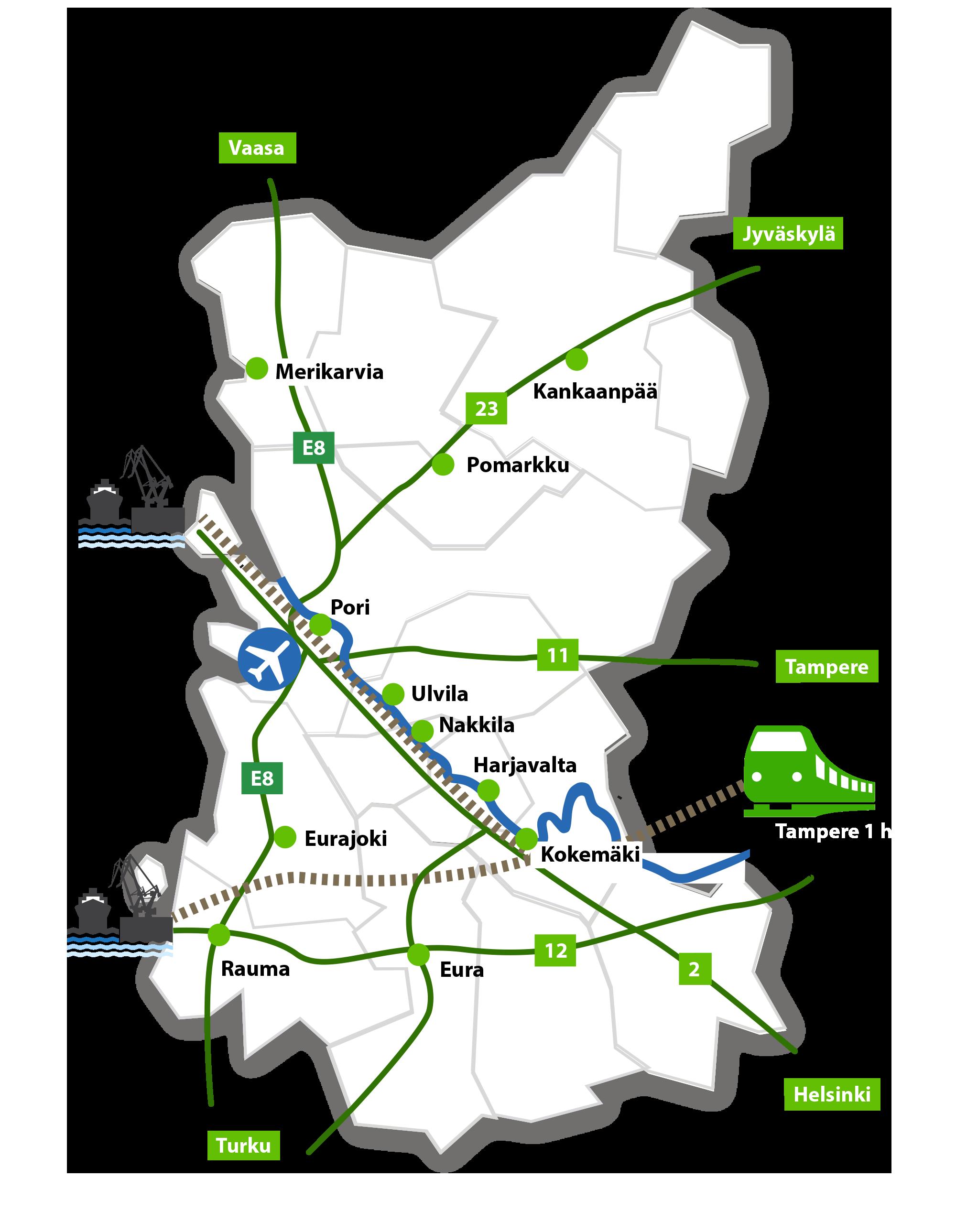
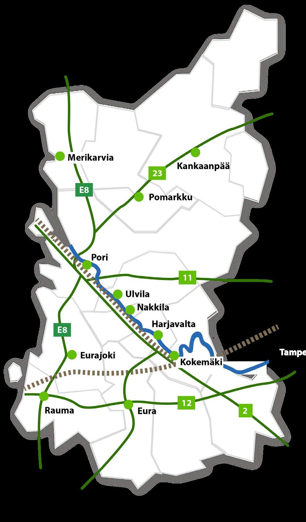
Satakunta region in Finland
• Satakunta is a coastal region in western Finland with a strong industrial background and an export-oriented economy.
• The region has a population of approximately 215,000 and a land area of about 8,200 km², offering space for large-scale industrial and energy investments.
• The largest cities in the region are Pori and Rauma, both featuring ports, industrial zones, and established business ecosystems.
• Satakunta offers excellent logistics, including seaports, rail connections, highways, and access to the Baltic Sea markets.
• The region is a forerunner in the green transition, with active investments in renewable energy, hydrogen, the circular economy, and low-carbon industry.
Satakunta
FINLAND
Content and Objectives
To present areas in Satakunta suitable for green transition industrial and energy projects
To identify key strengths and growth opportunities for each area
To provide an overall picture of the opportunities offered by the green transition industrial areas in Satakunta.
Industrial Areas
Pori:
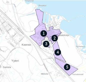
• 1 Kirrinsanta
• 2 Tahkoluoto
• 3 Peittoo
• 4 Kaanaankorpi
Rauma:
• 5 Lakari
• 6 Järviluoto
Harjavalta:
• 7 Sievari
Kokemäki:
• 8 VT2 Business Park
Ulvila:
• 9 Pirunkynsi
Eura:
• 10 Fankkee 2
Eurajoki: • 11 Green Industry Park • 12 Technology Park
Kankaanpää:
13 Kirkkokallio
ELECTRICITY GRID
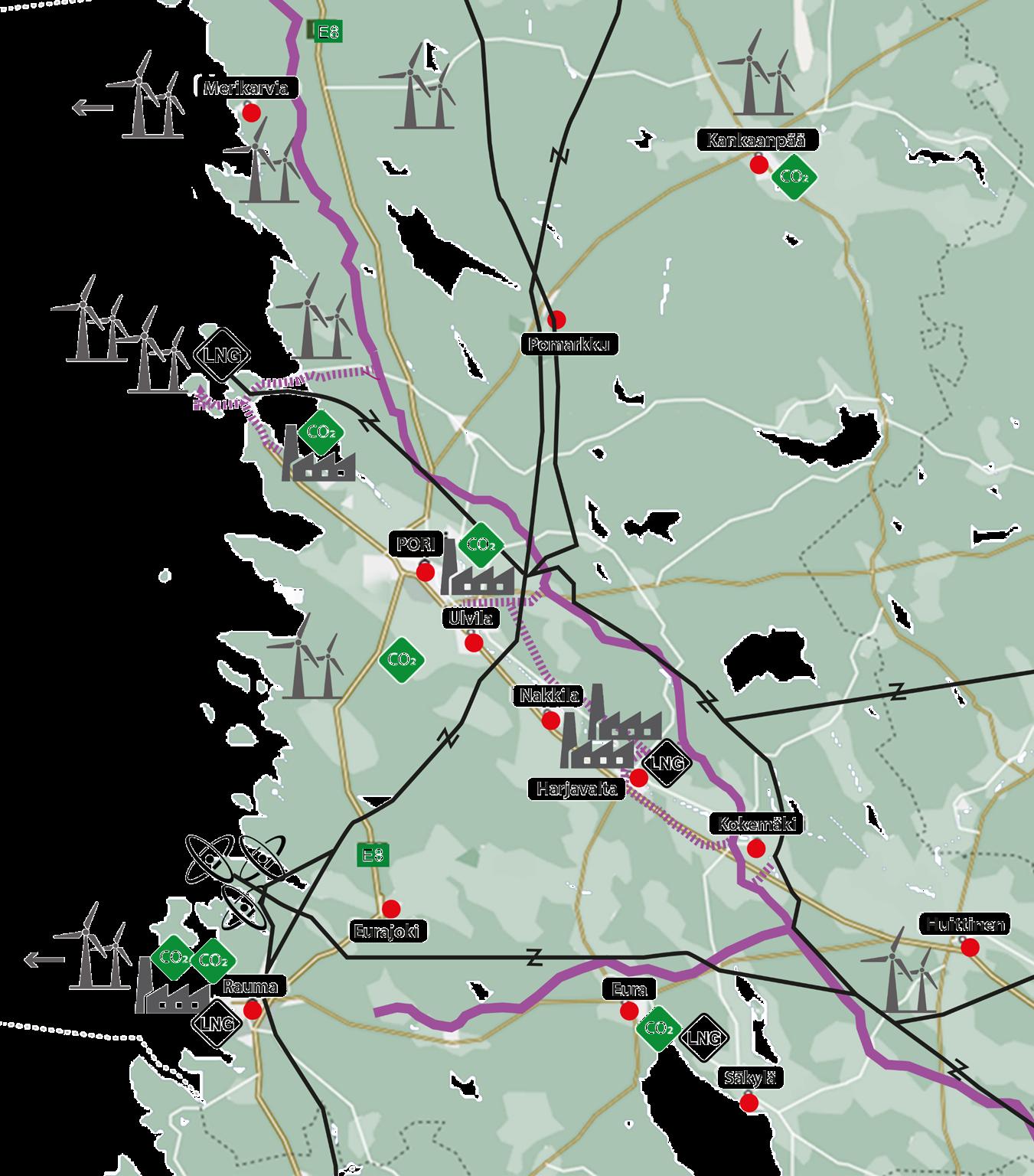
Satakunta produces approximately 40% of Finland’s electricity, most of which is emission-free.
• Three nuclear power plants operate in Eurajoki.
• Satakunta is a forerunner in renewable energy, including onshore and offshore wind power and solar power.
• A strong 400 kV transmission grid ensures secure electricity transmission.
• Fingrid substations in the region provide over 2,000 MW of available consumption capacity.
GAS NETWORK
• Satakunta hosts Finland´s first LNG terminal and a green hydrogen production plant.
• The region has strong industrial synergies for e-fuel production.
• Industrial processes generate approximately 2,500,000 tonnes/year of biogenic CO₂.
• Planned renewable energy production by 2035 is approximately 8 TWh/year, providing significant potential for the green hydrogen production.
Kirrinsanta, Pori
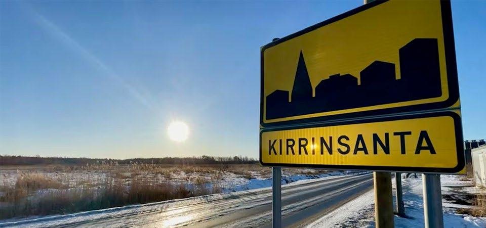

Detailed zoning covers 31.7 ha
Industrial and storage area for chemical plants (T/kem) and solar power plants (T/aur)

110 kV electricity connection available


Municipal water and sewer system; industrial and wastewater treatment plant nearby in Kaanaankorpi
Proximity to port and railway
KIRRINSANTA
INDUSTRIAL AREA
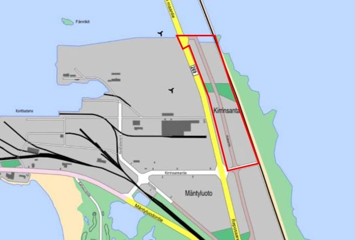
The Kirrinsanta industrial area offers zoned sites suitable for large-scale industrial handling or storage of hazardous chemicals (T/kem) and for solar power production (T/solar). The area is located next to the Mäntyluoto port, close to main roads, and has a railway connection. A spur-track reservation is included in the zoning plan.
Current operators
• 300 MW synthetic methane production plant (planning stage)
• Circular-economy-based battery chemicals production plant More information
Economic Development and Growth, The City of Pori
Jouko Hautamäki
jouko.hautamaki@pori.fi
The City of Pori
Area
• Detailed zoning 31,7 ha (T/aur)
Building rights
• 158 500 m2
Location
• Address: Kirrintie 1, 28100 Pori
• Coordinates: 61.597444, 21.524136
• Distance to downtown Pori 21 km
• Distance to ports Mäntyluoto 1,5 km and Tahkoluoto 10 km
Land ownership
• City of Pori
Strengths
• 110 kV power grid adjacent to the area, with a nearby electrical substation
• LNG terminal and methane gas pipeline nearby
• Municipal water and sewer system
• Next to Reposaarentie road and electrified railway
Readiness and development schedule
The objective of the zoning amendment is to enable the restructuring of the industrial area (scheduled for completion in Q1/2026). Several studies of the area and its natural environment have been conducted as part of the zoning process.
In the draft of the zoning plan, the area is designated mainly as a solar energy production zone, where solar panels and collectors and an electrical substation (EN-1) may be located.
A natural gas pipeline and a power line run through the area. It also contains a potentially contaminated site (a former landfill) and a wind turbine. The natural gas pipeline runs through the site, and a power line runs alongside it, parallel to Reposaarentie road.
Tahkoluoto, Pori
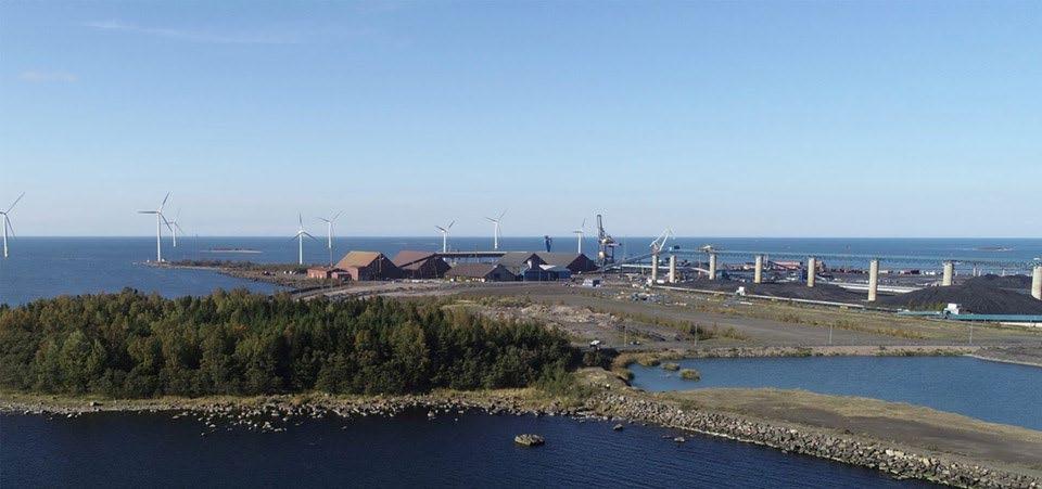
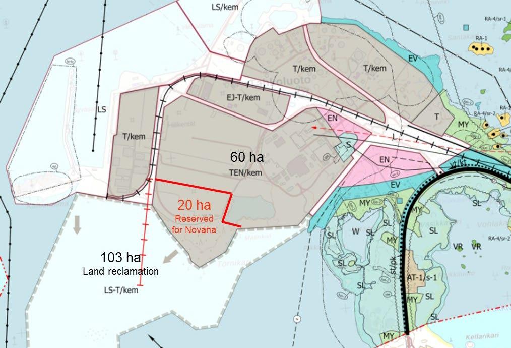
163 ha for industrial use (planning stage)
Industrial zone for chemical plants (T/kem)
110 kV electricity, 400 kV power line, gas pipeline
Municipal water and sewer system; cooling water
Proximity to port, highway, and railway
TAHKOLUOTO
INDUSTRIAL AREA
Tahkoluoto is an industrial area that hosts port, oil and chemical terminal. Tahkoluoto is home to Finland’s first LNG terminal for the import of liquefied natural gas. An offshore wind farm is located close to Tahkoluoto, with an expansion currently being planned.
Current operators
The landowners of the area signed a development agreement in April 2024 with the aim of improving the usability of the Tahkoluoto industrial area for green transition investments.
More information
Economic Development and Growth, The City of Pori Lauri Kilkku lauri.kilkku@pori.fi
The City of Pori
Area
• 60 ha of available area plus 103 ha of filled land (planning stage)
Building Rights
• TBD Location
• Address: Tahkoluoto
• Coordinates: 61.635905, 21.404889
• Distance to downtown Pori 30 km
Land Ownership
• Porin Satama Oy, Fortum Oyj and Suisto Kiinteistöt Oy
Strengths
• Deep-water channel (15.3 m), chemical terminal and LNG terminal
• 400 kV power line to Ulvila substation
• 110 kV power grid, district heating, water and sewer system, cooling water
• Electrified railway and highway access
Readiness and development schedule
In the regional plan, Tahkoluoto is designated as a port and energy production area.
In the new Tahkoluoto–Paakareet zoning plan the renewal of the Tahkoluoto industrial area into a green transition hub for the chemical industry and circular economy is being prepared.
The valve station for the hydrogen pipeline is planned to be located in Tahkoluoto.
Peittoo Circular Economy Park, Pori
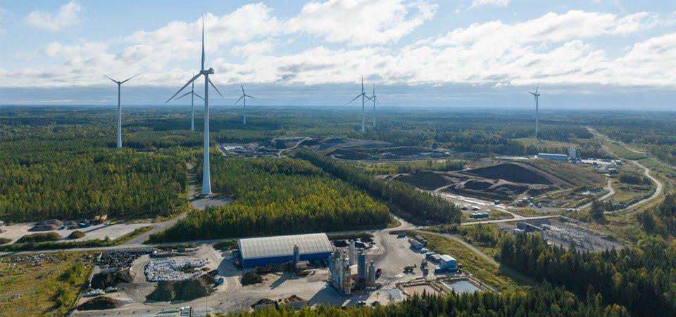
760 ha for circular economy businesses and energy production
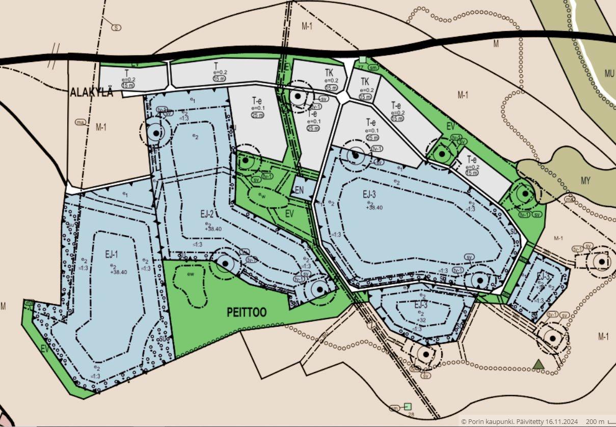
Zoned area: 90 ha for industrial sites
110 kV electrical substation
Municipal water and sewer system
Proximity to port and main roads
PEITTOO CIRCULAR
ECONOMY PARK
The Peittoo circular economy park offers zoned sites for the processing, storage and final disposal of industrial, construction and energy production side streams, as well as for energy production and conversion. The proximity to the port and the extensive size of the area make Peittoo an attractive location for new and expanding businesses.
Current operators
The area is home to several circular economy companies that process side streams and landfill materials. In addition, there is renewable energy production in the area. More information
Economic Development and Growth, The City of Pori
Jouko Hautamäki
jouko.hautamaki@pori.fi
The City of Pori
Area
• 760 ha, with detailed zoning 138 ha
Building Rights
• 159 994 m2
Location
• Address: Ekokorventie 38, 28100 Pori
• Coordinates: 61.642791, 21.663101
• Distance to downtown Pori 20 km
• Distance to Mäntyluoto and Tahkoluoto ports 15 km
Land ownership
• City of Pori and companies operating in the area
Strengths
• Zoned area for circular economy businesses and energy production
• 110 kV power grid and electrical substation
• Municipal water and sewer system
• Proximity to hydrogen pipeline backbone (planning stage)
Readiness and development schedule
In the zoning plan, the area is designated for industrial, warehouse, and commercial buildings, as well as special functions serving the circular economy.
The zoning plan enables the planning and implementation of streets and municipal infrastructure in the area, as well as the allocation of commercial plots. The planned hydrogen pipeline route runs north of the Peittoo wind farm and the zoned Peittoo recycling park.
Kaanaankorpi, Pori
28.4 ha of vacant zoned land
Industrial area for chemical plants (T/kem)
110 kV electricity connection, electrical substation, and gas pipeline
Municipal water and sewer system; industrial water treatment plants
Proximity to port, highway, and railway
KAANAANKORPI
INDUSTRIAL AREA
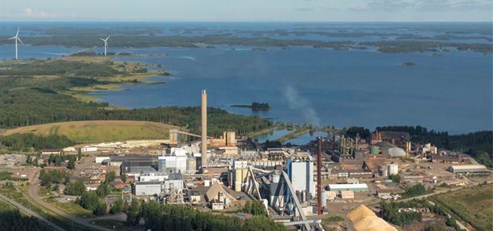
A TiO₂ plant operated in Kaanaankorpi until 2017. After a fire in the area the space became available for new industrial activities. The area’s infrastructure supports a wide range of industries.
Current operators
The area includes Pori Prosessivoima’s CHP plant and the industrial water treatment plants of Suomen Teollisuuden Energiapalvelut – STEP Oy. The area also hosts Eurofins Expert Services Oy, which provides laboratory services, and Kemira Oyj, which manufactures water treatment chemicals. More information
Project Manager
Marjut Vähänen
marjut.s.vahanen@pori.fi
The City of Pori
Area
• 28.4 ha consisting of several sites
Building Rights
• 164 000 m2
Location
• Address: Titaanitie 1, 28840 Pori
• Coordinates: 61.577487, 21.551812
• Distance to downtown Pori 18,5 km
Land Ownership
• Bankruptcy estate of Venator
Strengths
• 110 kV power grid and electrical substation, district heating, steam, water and sewer system, cooling water, wastewater treatment
• Electrified railway and highway access
• LNG pipeline connection to Tahkoluoto LNG terminal
Readiness and development schedule
There are still buildings on the site that have not been demolished (factory buildings, warehouses, workshops, office spaces, and a cafeteria) after the fire in the area. Future operator may utilize these. The bankruptcy estate is currently preparing a plan for the potential demolition of the factory buildings.
Lakari, Rauma
Versatile zoning
Interchange on highway 8
Fingrid substation and 400 kV grid nearby
Municipal infrastructure
Proximity to port and railway
Kuva: Rauman kaupunki
LAKARI AREA
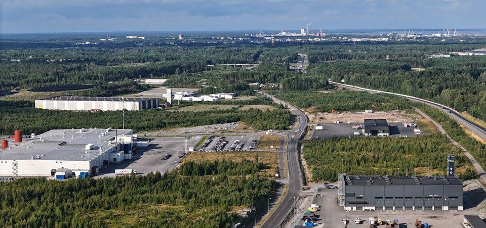
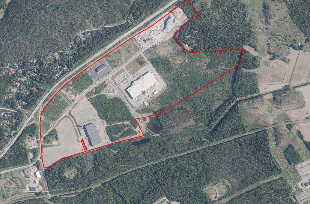
The Lakari area in Rauma has a zoning plan and expansion is underway. Current operators
Several companies in the food and logistics sectors operate in the area. More information
Head of Land Use
Ari-Pekka Asikainen ari-pekka.asikainen@rauma.fi
Business Development Specialist
Mirja Kotiranta mirja.kotiranta@rauma.fi
The City of Rauma
Area
• Approximately 25 ha
• Lakari data center area: 300 ha and over 1 million floor-m²
• Lakari eastern expansion area: 150 ha (zoning begins in 2026)
Location
• Rauma, along highway 8
• Coordinates: 61.148684, 21.573725
• Distance to Rauma port approx. 7 km.
Land Ownership
• City of Rauma
• Some private landowners in the eastern expansion area
Strengths
• Transport connections: highways 8 and 12, short distance to port and railway
• Possibility to connect to 400 kV grid (consumption capacity available 1500 MWe)
• Proximity to hydrogen pipeline backbone (planning stage)
Readiness and development schedule
The Lakari area is located at the junction of highways 8 and 12, where grade-separated interchanges ensure smooth connections to the road network. The detailed zoning plan does not define strict site or block divisions; instead, building sites are flexibly adaptable to different needs. The plan allows the construction of industrial, warehouse, and logistics buildings, as well as office premises.
The detailed zoning plan for the Lakari data center will be completed in 2026. It includes a planning reservation for Fortum. Zoning of the eastern expansion area of Lakari will begin in 2026.
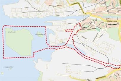
Järviluoto, Rauma
84 ha (approx. 110 ha total across the Järviluoto islands)
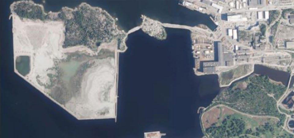
Located on Iso-Järviluoto Island
110 kV power line; 400 kV power line in planning stage
Cooling water from sea
Port of Rauma infrastructure
Kuva: Rauman kaupunki
INDUSTRIAL AREA
The area’s zoning plan is valid.
Current operators
There are no companies operating in the Järviluoto area yet. The companies of the Port of Rauma and the Seaside Industry Park Rauma maritime cluster are located nearby. Norsk e-Fuel is planning an e-aviation fuel production plant in the Rauma main port area.
More information
Managing Director
Janne Virta
janne.virta@portofrauma.com
The Port of Rauma
Area
• 84 ha (approx. 110 ha Järviluoto islets included)
• Available sites approx. 40 ha
Location
• Address: Hakunintie 19, Rauma
• Coordinates: 61.120016, 21.436387
• Port of Rauma
Land Ownership
• Port of Rauma Strengths
• Zoning plan for chemical industry operations and storage of liquefied natural gas (LNG)
• Strong electricity grid
• Central location in the Port of Rauma with excellent infrastructure
• Proximity to hydrogen pipeline backbone (planning stage)
Readiness and development schedule
Zoning (T/kem) is valid; earthworks scheduled for 2027–2028.
Approximately 20 hectares are reserved for a green transition production plant for hydrogen and e-methane with an electric capacity of approximately 500 MW.
A 400 kV transmission line from Lakari to Järviluoto is being planned.
The proximity of forest industry operators enables CO₂ capture and utilization.
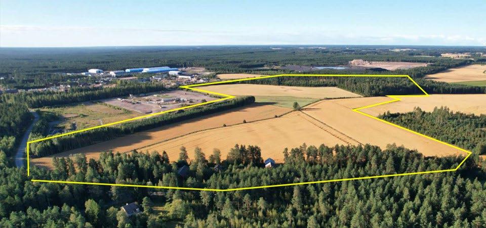
Sievari, Harjavalta
40 ha
Master plan for industrial area
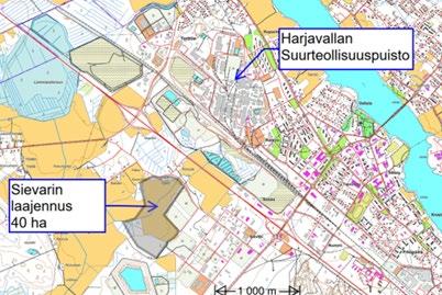
Expansion of Sievari industrial area
110 kV electricity
Municipal water and sewer system. Biomethane pipeline in 2027
Close to Harjavalta Industrial Park
Kuva: Harjavallan kaupunki
SIEVARI
INSDUSTRIAL AREA
Description
The Sievari area offers 40 hectares of industrial land. It is located near the Harjavalta Industrial Park.
Current operators
The Harjavalta Industrial Park hosts companies in metal refining and chemical industry, and the Sievari area is home to dozens of small enterprises.
More information
City Surveyor
Jari Prehti
jari.prehti@harjavalta.fi
The City of Harjavalta
Area
• 40 ha Building Rights
• 240 000 m2
Location
• Address: Metsäkulmantie, Harjavalta
• Coordinates: 61.120016, 21.436387
• Close to Harjavalta Industrial Park
Land Ownership
• City of Harjavalta
Strengths
• Proximity to heavy industry and waste heat sources
• Railway and highway accessibility
• Proximity to hydrogen pipeline backbone (planning stage)
Readiness and development schedule
The area is located near the Harjavalta Industrial Park, south of the road 2 and west of the road 43 with connections directly to the site. A railway connection runs close to it.
The area has a legally valid master plan (T). The zoning plan will be completed in spring 2026.
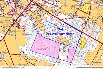
VT2 Business Park, Kokemäki
47 ha of planned industrial sites
Close to Kokemäki town centre, highway 2, and railway
Modern energy infrastructure (planning stage)
Kokemäki River nearby
Proximity to hydrogen pipeline backbone (planning stage)
VT2 BUSINESS PARK
INDUSTRIAL AREA
The zoning process for the area is underway, and industrial plots in accordance with the Tzoning plan are being planned.
Current operators
The area is located in the immediate vicinity of the planned expansion of the data center to be built in the Kirkkokallio area.
More information
City Manager
Teemu Nieminen
teemu.nieminen@kokemaki.fi
040 488 6100
The City of Kokemäki
Area
• 47 ha
Building Rights
• No zoning plan yet
Location
• Address: Linjatie, Kokemäki
• Coordinates: 61.235435, 22.329029
• Distance to downtown Kokemäki 3,5 km
Land Ownership
• City of Kokemäki
Strengths
• Close to planned expansion of data center in Kirkkokallio area
• Proximity to highway 2 and railway
• Good connections to ports and airports
• Proximity to hydrogen pipeline backbone (planning stage)
Readiness and development schedule
The zoning is underway, and industrial plots in accordance with the T-zoning plan are being planned.
Modern municipal infrastructure and energy infrastructure will be built in the area to support demanding industrial use. The area is located next to the planned expansion of a data center to be established in Kokemäki’s Kirkkokallio area, which may offer potential synergies. The area is also located near the planned national hydrogen pipeline backbone.
Pirunkynsi, Ulvila
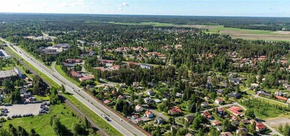
395 ha
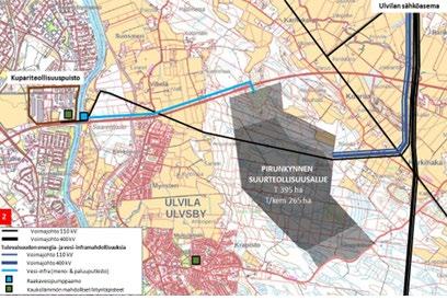
Located east of Ulvila town center along highway 11
Close to 400 kV and 110 kV grid infrastructure
Close to Kokemäenjoki River
Zoning close to completion (T/kem)
Kuva: Ulvilan kaupunki
PIRUNKYNSI
INDUSTRIAL AREA
There is no valid zoning yet. There are no restrictive reservations or designations in the regional land-use plan. Pirunkynsi is part of the municipal master plan 2045 project, which started in 2022. Current operators
There are no industrial operators in the area.
More information
City Manager
Mikko Löfbacka mikko.lofbacka@ulvila.fi
The City of Ulvila
Area
• 395 ha
Building Rights
• No zoning plan yet Location
• Address: along highway 11
• Tampereentie 205, 28450 Ulvila
• Coordinates: 61.459021, 21.909530
• Distance to downtown Ulvila 5km
Land Ownership
• Several private land owners
Strengths
• Extensive zoned industrial areas (T/kem) near national grid substation
• Close to river Kokemäenjoki - access to process and cooling water
• Good accessibility by road, also from ports of Pori and Rauma
Readiness development schedule
The Pirunkynsi area is largely in a natural state. Land acquisition and completion of the zoning process are the next steps in the development process. The new zoning plan covers the Ulvila town centre and its nearby urban areas, as well as the surrounding agricultural and forestry areas, including Pirunkynsi. The City of Ulvila aims to develop the Pirunkynsi area suitable for green-transition industries. The zoning designations will be T, T-1 and T/kem-1. As part of the zoning process, studies related to water and safety have already been carried out. The area is located close to the planned hydrogen pipeline backbone.
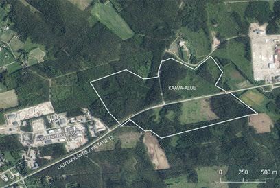
Fankkee 2, Eura
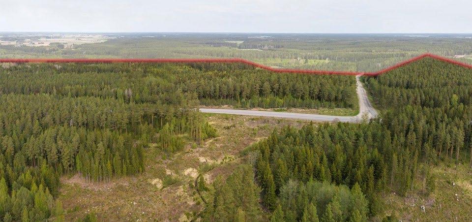
90 ha, zoning (T/kem) under preparation
Location on both sides of highway 12, Eura town centre in 4 km
Connection possibility to 110 kV grid at Kauttua substation (3 km) Municipal infrastructure readiness
Close to hydrogen backbone pipeline and biogas pipeline (planning stage)
FANKKEE 2
INDUSTRIAL AREA
The Fankkee 2 area forms a natural extension to the Fankkee industrial and warehousing area.
Current Operators
On the Fankkee industrial area located to the west, there are companies in the metal industry, maintenance and repair services, and the logistics sector. There are no companies operating in the Fankkee 2 area yet.
More information
Municipal Manager
Kari Kankaanranta
044 422 4020
kari.kankaanranta@eura.fi
The Municipality of Eura
Area
• 90 ha
Building Rights
• Gross floor area 324 000 m² (FAR 0,4) Location
• Approximately 4 km from Eura town centre, on both north and south sides of highway 12
Land Ownership
• Mainly owned by Municipality of Eura
Strengths
• Well suited for industrial operations involving large-scale handling of chemicals
• Close to the biogas distribution network (planning stage)
• Proximity to hydrogen pipeline backbone (planning stage)
Readiness and development schedule
Fankkee 2 is included in the Eura town centre zoning plan (2016), where it is mainly designated as an industrial and storage area (T). The Fankkee zoning plan 2 and its amendment (T/kem) are targeted to be completed by the end of 2026.
Green industry Park, Eurajoki
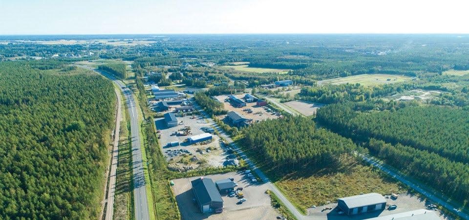
Zoned area 120 ha
Near Eurajoki town centre and highway 8
110 kV and 400 kV national grid substations in 10 km
Municipal infrastructure readiness
Ports: Eurajoki (20 km), Rauma (20 km) and Pori (50 km)
Kuva: Eurajoen kunta
GREEN INDUSTRY
PARK
Current operators
There are no operators yet. Next to the area, there are recycling operators for metals and other materials.
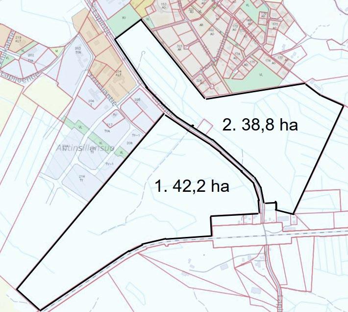
Area
• 120 ha
• 1. 42,2 ha (422 000 m²)
• 2. 38,8 ha (388 000 m²)
Building Rights
• FAR 0,7
Location
• Address: Lapintie 120, Eurajoki
More information Municipal Manager Vesa Lakaniemi vesa.lakaniemi@eurajoki.fi
The Municipality of Eurajoki
• Coordinates: 61.189474, 21.733292
• Close to highway 8
Land Ownership
• Municipality of Eurajoki
Strengths
• Railway connection
• 400 kV and 110 kV grid connection available at the transmission grid substation (Rauma Lakari)
• Proximity to hydrogen pipeline backbone (planning stage)
Readiness and development timeline
The extension of the zoning plan is underway, covering the Green Industry Park and Technology Park areas. Zoning is also in progress.
The Municipality of Eurajoki has a development plan for the area, aiming to establish a large industrial park west of the new alignment of highway 8. The area is suitable for green transition industries and can be expanded if necessary.
Technology Park, Eurajoki
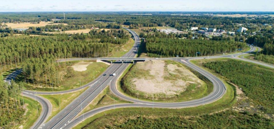
100 ha
110 kV and 400 kV national grid substations in 10 km
Municipal infrastructure available
Ports: Eurajoki (20 km), Rauma (20 km), and Pori (50 km)
Kuva: Eurajoen kunta
TECHNOLOGY PARK
INDUSTRIAL AREA
Current operators
The area is suitable for various types of industrial and storage operations as well as commercial and industrial buildings. There are no operatiors yet.
More information
Municipal Manager
Vesa Lakaniemi vesa.lakaniemi@eurajoki.fi
The Municipality of Eurajoki
• 100 ha Building Rights
• FAR 0,7
Location
• Address: VT8 eteläinen liittymä, Eurajoki
• Coordinates: 61.195738, 21.709718
• Close to highway 8
Land Ownership
• Mainly by municipality of Eurajoki
Strengths
The area can be expanded if needed.
• Connection to nearby 400 kV transmission line is possible
• Railway connection
• Close to hydrogen pipeline backbone (planning stage)
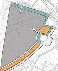
The municipality of Eurajoki has a development plan for the area, aiming to develop it into a technology park for green transition industries Area
Readiness and development schedule
The extension of the zoning is underway. Zoning is also in progress. The detailed plan will define the traffic areas of highway 8 and street areas needed for internal traffic within the plan.
Kirkkokallion Eco-Industrial Park, Kankaanpää
150 ha
Approx. 25 km north of Kankaanpää town centre
Connection possibility to nearby 110 kV power line
Municipal infrastructure, potential for utilising waste heat
Circular-economy cluster
Kuva: Kankaanpään kaupunki
KIRKKOKALLIO ECOINDUSTRIAL PARK
Current operators
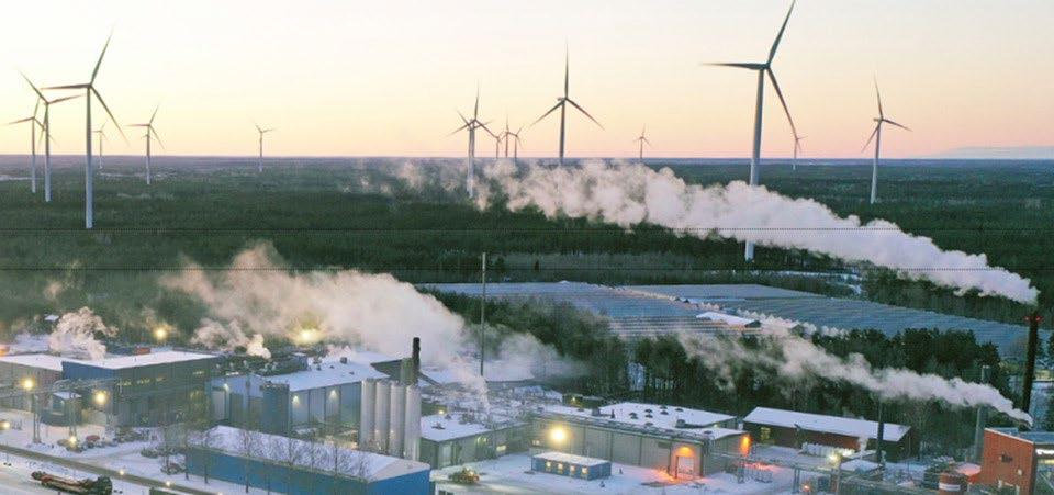
The Kirkkokallio Eco-Industrial Park in Kankaanpää is a circulareconomy business cluster for food industry production, innovation and competence. It applies the principles of circular economy, sustainable development and environmentally friendly operations. Six companies operate in the area. More information Director of Economic Development.
Marko Rajamäki marko.rajamaki@kankaanpaa.fi
The City of Kankaanpää
• 150 ha
Building Rights
• FAR 0,4 Location
• Address: Santastentie 175, Kankaanpää
• Coordinates: 61.982129, 22.281625
• Located 22 km from Kankaanpää town centre and 75 km from Pori
Land Ownership
• City of Kankaanpää and companies operating in the area
Strengths
• Circular-economy cluster
• Connection possibility to 110 kV power line near Honkajoki urban area
• Biogas plant and engine power plant that produce electricity, steam, and heat energy from biogas
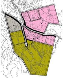
There is 37,146 MWh of unused waste-heat potential. A 1,500 m³ thermal storage unit for waste-heat recovery and distribution is planned for 2026, and a new electrical substation is scheduled for 2027. Area
Readiness and development schedule
Kirkkokallio Eco-Industrial Park is a business cluster formed by circular economy companies, where one company’s side streams and waste are utilized in another company’s production. Companies in the area engage in the processing and refining of animal by-products, the production of renewable energy (including bio- and natural gas), and the food production. The area has an existing zoning plan that enables the construction of new industrial buildings.
Karttakuva