agencies and logistics companies which are carrying out relief efforts in difficult – and dangerous – circumstances.
“So transportation challenges are distinct from those in the US and Europe,” Yamamoto says. “However, there are certain aspects which are common across regions, so each region can learn from the experience of others. The ITS World Congress plays an important role in the global direction of ITS on crosscutting issues such as the environment, sustainability and equity, so we can look in the same direction.”
How easy is it to carry over the learnings from one ITS World Congress to another? Inevitably, does it sometimes feel like we are ‘starting again’ each year?
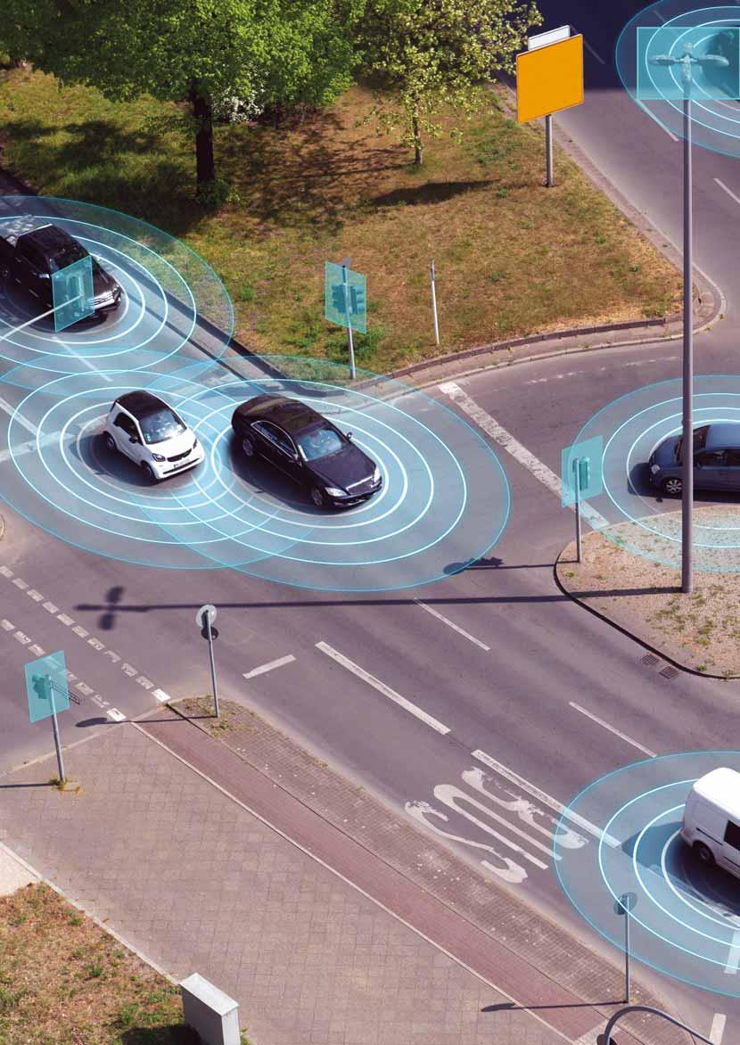
“There is more and more convergence in terms of realities in the world – it used to be telematics and cars and roads; today, it’s about clouds, V2X, traffic signals and many more things,” suggests Joost Vantomme, CEO of Ertico.
There are also new topics to take on board: “The marriage with the telecommunications sector is one; the other marriage will be the energy sector, for charging and Vehicle to Grid; and drones is another one.”
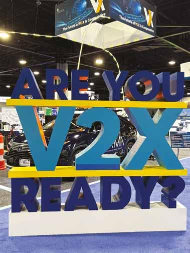
The beauty of having three regional Congresses, he adds, is that an international programme committee can engage in predictive analysis, detecting new trends from round the world. He laughs: “Rome was not built in one day, and this Congress wasn’t either! So we identify – with Laura, Ace and each other’s ecosystems – the newer topics. For example, this year, it was traffic management linked to connectivity: so the V2X deployment you see [in Atlanta] as one of the first ones in the US is very worthwhile to see and to take lessons from.”
Barriers
The structure of the Congresses means each region – the Americas; Europe, Middle East and Africa; and Asia-Pacificorganises and hosts the event every three years. So even though the Congress itself is annual, “we each have two years to think about next steps”, Vantomme smiles. “It’s working well, it’s quite unique, and we should keep that process.”
‘Deployment’ was the theme of 2025 – but is it sometimes the case that the ITS industry is happy to talk about deploying, but less inclined to actually do it?
“I would say the industry is very interested and willing to deploy, but there are certain barriers and challenges that exist which we all have to work around,” insists Laura Chace, president and CEO of ITS America. “Some of these are unique to the US but actually I think they’re more common than not.”
The first one will certainly be familiar to ITS practitioners all over the world: funding.
“We’ve all talked about this,” Chace continues. “ITS systems are digital systems. And in the transportation space, a lot of times funding is reserved for the physical infrastructure. As Joost said, as it becomes more cloud-based - using AI, using data - that means we have to change our mindset to: what are we actually funding? What are we paying for, to help deploy these systems? A second challenge is our workforce. When we’re talking about needing data scientists, cybersecurity experts, people who understand machine learning and AI – the traditional traffic engineer is not educated in those disciplines. So we really need our curriculums in this field to catch up so that our workforce is ready for the future.”
ITS World Congress: ‘Unique platform to share solutions to current and future challenges in transportation and mobility’
Another potential barrier doesn’t really involve the ITS industry at all. “The third challenge is that, inherently, you are deploying systems that the public has to use – so there is a public acceptance and public education piece to this,” Chace explains. “The technologies are very advanced - it’s not really a technology problem: at the end of the day, for many of these solutions to be used at scale, consumers – who don’t understand them – need to accept and adopt them.”
Chace remains optimistic. “So those are some of the challenges we see towards scaling deployment, but I think our community is very gung-ho and ready to deploy!” she laughs. “We just have to open those doors and break down those barriers!”
Do the three CEOs have a sense that legislators and policymakers increasingly understand the benefit of ITS? How do their three organisations help in this?
get into that niche? What do we do with Mobility as a Service – or mobility on demand in the US - where we have multimodal apps: how do they survive and how do they get the right data from the public and private side?”
Yet while there are challenges, there are also significant areas of overlap, Vantomme insists: “We are seeing a lot of convergence there, which is good in terms of harmonisation and synchronisation. Our businesses, our companies, invest worldwide and not necessarily in one country or one region.”
Take the risk – and if you can’t take the risk, find a partner who can, so we can continue to move forward
“ “
“In terms of budget priorities we need to scale up on the digital component – it’s as important as the physical,” says Vantomme. “Maybe the physical sells more easily from a political perspective. But when I see what we can do with data for road safety, for example, the data exchange we do for asset management, the predictive analysis we can do, the information to the driver through digital means - there is so much value.”
Sustainability, climate change and air quality in relation to urban mobility are all hot-button topics on the policy agenda in Europe. “That is somewhere ITS can be an enabler,” insists Vantomme.
Data is another huge, and growing, issue for the intelligent transportation sector.
“We all face the same challenges: do we need to standardise these things? Do we need to regulate – but not stifle innovation?” he asks. “What do we do with the bigger players that have the market power, and the smaller ones that want to
Looking ahead to Gangneung
The ceremonial passing of the ITS ‘globe’ to the AsiaPacific region in preparation for 2026’s Congress in Gangneung, South Korea, marked the end of ITS World Congress 2025 in Atlanta. At the closing ceremony, ITS America president & CEO Laura Chace urged delegates to get on and deploy potentially life-saving technology. “Let’s jump in and be bold on innovation,” she said. “As our host from Georgia DoT, Russell McMurry, said this week, when it comes to safety and improving our transportation system and quality of life, ‘let’s be accused of trying’. We can only achieve a smart, safe and connected transportation system by making the choice to invest and prioritise innovative
And finally, what was the one big takeaway for the CEOs from their time at ITS World Congress 2025? “Data sharing,” says Yamamoto.
“AI and deep learning rely heavily on a large volume of high-quality data to support future ITS services. We need to create sustainable and common data-sharing processes. What do we need to look at? What do we need to tackle?”
Chace’s takeaway is that “innovation is inherently about risk”. Public agencies need to re-assess how they manage risk: “Because there is actually risk in not acting, and in not innovating. And I don’t always know that that is taken into consideration. As someone from the Opening Ceremony said: ‘Take the risk – and if you can’t take the risk, find a partner who can, so we can continue to move forward’.”
Vantomme was leaving Atlanta with the resolution that international cooperation on a much larger scale is needed in ITS. “We discussed this with USDoT and some others: it’s so important,” he concludes. “You have the same issues like automated and autonomous driving, you have the same streets [in the US] and in Europe – it’s asphalt, tarmac, lane markings, traffic signs. Let’s have more international cooperation – we all plead for that: let’s put the policymakers together and then I think we’ll go to real deployment worldwide.”
It is a suitably positive note on which to end: see you all in Gangneung next year. ITS
technology solutions that can be game-changing for our communities. Move with urgency and purpose.”
Ramin Massoumi, chair of ITS World Congress 2025, added: “I urge each of you to carry forward the spirit of collaboration and innovation that has flourished
here - the insights shared and relationships forged during this Congress must not remain confined to the walls of this Congress centre. Whether you are a policymaker, a technologist, an urban planner or an academic, it is through collective effort that we will
overcome the challenges ahead. Let us sustain this moment, continue the dialogue and ensure that our transportation systems become safer and more efficient for all.”
Next year’s Congress will be held in Gangneung, a mid-size city of around 200,000 residents on the east coast of South Korea. The city’s deputy mayor, Kim Sang-young, pledged: “We are fully committed to host a successful Congress in 2026 and it’s our hope that you will visit Gangneung to witness the vision for smart transportation.”
• ITS World Congress 2026 will run from 19-23 October 2026 in Gangneung under the theme ‘Beyond Mobility, Connected World’
(Intelligent Transport Society of Korea) is Korea’s national hub for smart transportation, connecting government, industry, academia, and research since 1999. With companies, it drives mobility innovation.
Designated as the national organization by (Ministry of Land, Infrastructure and Transport), ITS Korea leads (Notice No. 2013-852), (Notice No. 2010-405), and (Notice No. 2015-540).
October 19-23, 2026
Gangneung Olympic Park, Gangneung City, Gangwon State, Republic of Korea
Ministerial Round Table, Plenary / Special Interest Sessions, International / Regional Forum, Technical / Scientific Papers, Exhibition, Demonstration / Tech Tour, Cultural Events and more
When you definitely, not maybe, want to see Oasis…
Be here now
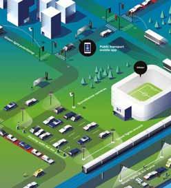
From Oasis to the Olympics, and from Wimbledon to Ohio, getting people to and from major events is a major headache. Beate Kubitz reports on how data is helping authorities to make sense of it all
The star of the Paris Olympic Games in summer last year was generally agreed to be the city of Paris itself. The organisers managed to site venues in the heart of the ancient French capital – reusing existing historic buildings, bringing events onto the streets and plazas framed by iconic landmarks and refusing to build out-of-town stadia that would sit unused after the world’s sports people and their vast audiences disappeared. This glorious spectacle was underpinned by a triumph of transport behaviour ‘engineering’.
Cars were banned from clogging the streets and the flow of the 11 million or so spectators through the city’s streets and metro system was orchestrated by the police and Île-de-France Mobilités (IdFM).
Opening and closing metro stations – and updating journey-planning information – was used as a tool to route people to venues and balance the flows of people across the network. Whilst IdFM provided its own app, even third-party online
journey planners like Citymapper had to participate – using IdFM’s data and algorithm to keep up with the complex routing patterns that ensured security and crowd control.
Wisdom of crowds?
Paris 2024 was an example of how events present their own problems that cannot be solved by the ‘wisdom of crowds’. Organisers need to avoid too many people arriving at the same place at the same time because it creates congestion that can tip into a dangerous crush – whilst also ensuring everyone gets to see the show.
The movement of the vast crowds that converge on events – and then diverge after them - is orchestrated by careful planning to predict and manage journeys, plus data collection and analysis feeding into communication strategies to shape behaviours.
These days, with online booking, event organisers have tools to understand who their audiences are. Options can
be shaped and information presented appropriately.
For Paris 2024, for example, anyone booking a ticket with wheelchair access requirements was immediately given the opportunity to book their journey to and from the venue on a fleet of on-demand accessible minibuses powered by a demand-responsive transport software (Padam Mobility). Whilst improving access for disabled visitors, this initiative also meant the authorities could be stricter about closing streets to other vehicles.
Oasis: what's the story?
Data-based, travel-demand management is increasingly useful for city authorities and event managers. One firm providing it is You.Smart.Thing, which combines a ‘demand analysis dashboard’ for venues and event organisers with a ‘travel assistant’ for attendees.
Online booking also means venues have more information about where attendees come from – analysing this and distributing trips (via the assistant) can be used to
smooth and distribute the flows of people on the day.
Heaton Park in north Manchester was essentially a ‘pop-up venue’ for a series of huge Oasis reunion concerts in the UK this summer. Working with the event organiser and Transport for Greater Manchester (TfGM), You.Smart.Thing provided travel plans for attendees when they booked their tickets. This started the process of managing the journeys people make to the event at the planning stage, explains Chris Thomson, CEO of You.Smart.Thing: “Essentially, TfGM will say to the event organiser, 'we need you to plug this platform into your website to send travel plans to the audience’".
The ‘travel assistant’ is essentially a journey-planning engine – but one which works with event-specific data and journey plans. Before it goes live, the team models the best flow of people around the venue at a very granular level including the entry and exit points, plus routes people will take within the venue.
From that, they create curated routes for each ticket-holding group for the very last part of their journey as they approach the venue so that they enter by the desired gate – keeping the area around the stadium, or wherever, as uncluttered as possible. These bespoke route plans are based on ticket type, best entrance and route through the venue and may include shuttles, walking routes or step-free access so that people’s very specific needs (or indeed event package ‘experience’) can be catered to.
Bespoke journey planning
“Obviously working with the local authority [TfGM] to design the visitor experience will support the licensing process," Thomson adds.
An astroturf platform shows public transport users the way
“ Our clients don't want another app “
In this case You.Smart.Thing also provides the multimodal journey planner that underpins the Bee Network (as Manchester’s public transport service is branded) website and app. These local transport options for Greater Manchester are integrated with the event area routes.
A bespoke journey-planning engine for the UK is the final part of the data jigsaw. These are combined in the travel plans produced to get people from their homes to the venue.
For the Oasis concert the public transport planner is augmented with information from Big Green Coach (the official travel
partner), Uber and various combinations of public transport with other modes – including a shuttle from central Manchester, Uber or driving your own car. If people search on driving the whole journey they are warned about road closures and lack of parking.
“We are working to deliver the next generation of travel-planning technology," insists Thomson.
Smoothing traffic flows by helping people to take different routes (rather than all converging on the same spot in cars causing congestion and gridlock) has significant benefits for local economies, too, thinks Thomson: "Rather than simply looking for the shortest path, You.Smart.Thing’s 'eco-algorithm' is designed to load-balance transport networks against socio-economic objectives that catalyse economic regeneration."
Oh no, not another app
Event travel is different from the normal peak and off-peak flows – but because there are known constraints on the journey – people are all arriving at (more or less) the same place during a pretty specific time window - the journey-planning options can really be tailored to balance the load across the area.
“Day-to-day rules are turned on their head in the context of events," points out Thomson. More complex hybrid routes can be suggested than are (currently) possible or available in generic journey planners. For instance, an event organiser trying to reduce cars arriving at the venue will work with You. Smart.Thing. to find suitable parking with capacity during the event (which is usually out of peak hours) some distance from the venue. The team can then design bespoke combinations where people drive, park up and take onward public transport built into the journey-planner engine. This further reduces pressure on the roads around the venues.
Jenoptik provides innovative and sustainable smart mobility technology and services.
As an end-to-end solution provider, we support our customers with the provision of roadside equipment and software, including integration and installation through to full-service operation. Our strong global presence and installation base is supported by a reliable partner network.
With innovation as our driving force, Jenoptik is a world-leading enabler for smart mobility, making roads, journeys and communities safer around the globe.
Follow us! jenoptik.com/markets/public-safety
“Our clients don’t want another app,” Thomson insists. Therefore, instead of adding complexity, journey planners are seamlessly embedded within the event communications, website, social media or in the event app. People using the travel planner are encouraged to sign up for travel updates by text and email. This means that they can be encouraged to choose a better plan if things change. For instance, as park-and-ride car parks fill up, they can be ‘turned off’ in the platform and a push notification sent to event visitors so they can drive towards a car park with space.
Changing behaviour
In the UK, the summer's annual tennis championship at Wimbledon lasts for two weeks and runs across weekdays and weekends with four types of ticketholders. For this event, the team puts together a set of weekday routes and a set of weekend routes to account for different traffic pressures in the area, and very detailed plans for each group of ticketholders to get to their correct gate.
They take account of ticket type and needs (like step-free access). With development underway at Wimbledon, the number of parking spaces available has reduced. This means that the organisers need to understand people’s intentions and match them to the capacity available.
There are early indications of travel mode intentions when people open their booking email and click on the journey planner. The platform can analyse expected travel plans through these queries and - with several levels of qualification built in - if journeyplanner usage indicates that too many people are intending to drive straight to the venue, action can be taken to change behaviours. The All-England Lawn Tennis Association has engaged in email campaigns in the runup to the event, targeting people who have booked but appear to be intending to drive. This way, it is possible to let them know where and when capacity is tight and help them choose journeys that will not mean circling an overflowing car park for hours.
Gamifying people’s choices is also an option. Ultra-trail marathon organiser UTMB is trying to reduce its event’s carbon footprint. Entries to the races are oversubscribed so that runners have to enter a draw for competition places. The race organisers reward those people who make more sustainable mobility choices using the travel planner designed for the race by boosting their entry chances in the draw to actually start. The journey planner is complemented by a travel document verification system.
No ticket?
Obviously, not everything people go to is ticketed – for the UK's Bradford City of Culture events, 80% of attendees will be ‘turn up and go’. While there is less opportunity to
contact people in advance, it’s still essential to manage the crowds of people attending to ensure they get where they need to go – and reduce disruption for everyone else. The outdoor media campaign advertising events throughout Bradford incorporates QR codes which call up a journey-planning site that serves routes from the person’s location to the advertised event. This is coupled with traffic management screens and a bespoke journey planner embedded in the event website.
Even very localised traffic management can be built in – for instance the rolling roadblocks which protect the safety of London Marathon participants can be built into the journey planner. In this case, the information is not just for participants but also is provided in event communications to help local residents navigate this enormous sporting extravaganza on their doorsteps.
Helping to manage demand is one thing; but other tools are available to measure people’s movements and their impacts.
Street life, Big Data
StreetLight Data, part of the Jacobs group, uses Big Data to give local authorities an accurate picture of traffic and people’s movements around events (and in other scenarios). The team creates models for movements by ingesting data from a variety of sources (including sensors and cell phones) to give a historical benchmark. After processing and analysing this, they can check expectations for the event models against actual usage. Whilst there are many potental applications (for instance, analysing traffic patterns to inform infrastructure investment) this approach can contribute to the management of streets around large venues. By comparing historic data with
With online booking, event organisers have tools to understand who their audiences are “
current observations and previous events, the models can suggest real-time adjustments to the levers of traffic management with better accuracy and more predictable consequences.
Coordinating with traffic management systems means StreetLight can propose street closures, create one-way flows or change digital signage and temporary speed limits. The data can also be used as the basis for communications – for instance, to encourage drivers to reroute or to use ‘car pool’ points where people can meet up, share cars and drive in car-pool lanes.
In addition, StreetLight's analysis of movements in connection with venues has led to better understanding of visitor travel origins and the traffic flows associated with them. Besides informing real-time communication, this also improves longer-term planning to reduce the impact of venues.
One example is the Pro Football Hall of Fame in the US city of Canton, Ohio, which wanted to increase visitor numbers. Streetlight worked with the regional planning commission to look at visitor flows, traffic and available parking. It was able to show that leveraging the existing supply of parking in downtown Canton - and providing shuttles and transportation options - would provide enough parking so the site did not need to build additional car parks.
Data tools are essential to managing the huge flows of people around events – from understanding their movements to shaping their choices. Those that reduce traffic and parking requirements improve the visitor experience while reducing the land requirements, costs and the carbon-emissions profile of the event. They are the unsung heroes that sit beneath some of the greatest shows on earth. ITS
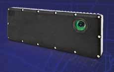
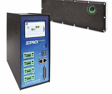
Econolite’s EPIQ RADAR™ revolutionizes intersections with unmatched detection accuracy, reliability, and fullsensor, EPIQ RADAR boosts safety and reduces congestion for all road users.
Backed by a lightning-fast quad-core Intel i7 Hub, seamless controller integration, and blazing Ethernet reaching 1,000 feet, EPIQ RADAR delivers data you can ® insights, and reporting. future-forward solution.
When roads are built for speed instead of safety - especially in areas frequented by children - the consequences can be tragic
The Vision Zero principle – that no road deaths should be tolerated – is a powerful one. But with 40,000 fatalities per year, ITS International asks, could it take root in the US? Wes Guckert suggests a change of perspective is urgently required if that’s to happen…
1. Vision Zero requires bold commitment from cities and road authorities: is this easier to say than to do? Why? What’s stopping it?
Yes, Vision Zero is much easier to pledge than it is to implement. One of the biggest obstacles is institutional inertia. Many DoTs and municipalities still operate under a “mobility-first” mindset, prioritising vehicle throughput over safety. This culture is reinforced by outdated engineering standards that emphasise wide lanes and high-speed design—both of which contradict Vision Zero principles. Political sensitivity and public resistance also play a role. Lowering speed limits or reducing lane widths can be perceived as government overreach or as threats to traffic flow, even when data proves otherwise. Additionally, many agencies still rely on the outdated ‘85th percentile’ rule to set speed limits, undermining safety in areas dense with pedestrians. Finally, funding priorities often favour highway expansions over safety retrofits, while siloed operations across planning, engineering, and enforcement make the coordinated effort Vision Zero demands especially difficult to achieve.
2. You’ve talked before about the rise in traffic deaths among vulnerable road users, including in school zones – why is this happening?
Several factors are contributing to the alarming rise in deaths among vulnerable road users. The return to pre-pandemic traffic volumes without corresponding safety upgrades has worsened risks for pedestrians and cyclists. School zones, in particular, suffer from inconsistent enforcement of speed limits, poor crossing infrastructure, and vehicle-centric designs that fail to prioritise children’s safety. Additionally, higher vehicle speeds dramatically increase fatality risks. A pedestrian hit at 40 mph has an 80% chance of dying, compared to just 10% at 20 mph. When roads are built for speed instead of safety—especially in areas frequented by children—the consequences can be tragic.
3. What are cities doing to address this? Is it about education, road design, legislation – all of these?
Cities that are serious about Vision Zero are taking a multi-pronged approach that includes all of the above:
• Education: Public campaigns and schoolbased programmes raise awareness about safe behaviour and shared responsibility.
• Engineering: Complete Streets designs—like protected bike lanes, raised crosswalks, and daylighted intersections—physically create safer environments for all users.
• Enforcement and legislation: Automated speed enforcement and revised speed-limit laws help ensure compliance without overburdening law enforcement.
• Equity-based investment: Cities like New York and Portland are using data to direct safety upgrades in historically underserved communities.
Success lies in integrating these strategies—not treating them as standalone fixes.
4. Vision Zero is an admirable goal – is it achievable in the US? Surely we’d just settle for a reduction in the 40,000 annual death toll – so why isn’t even this being done?
Vision Zero is achievable, but only if we move beyond the status quo. Many US cities have proven that significant reductions are possible when systemic changes are made— like lowering speed limits, rethinking street design, and investing in safer infrastructure. However, too often, efforts plateau because of political compromise, resistance from within transportation agencies, or lack of sustained funding. Settling for a modest reduction isn’t a failure of ideas—it’s a failure of will. When other nations like Norway can approach zero deaths, it reveals that the barrier in the US is not feasibility, but commitment.
5. Have cities stepped back from Vision Zero? Have they given up, in other words?
Some cities have lost momentum, especially when early results didn’t meet ambitious expectations. But many have doubled down, refining their strategies and expanding public engagement. For example, Montgomery County, MD and Boston, MA have updated roadway designs to better align with Vision Zero principles. The pandemic, budget constraints, and political turnover
have led some jurisdictions to deprioritise Vision Zero, but giving up is not universal. In fact, there's a growing realisation that the problem isn't the goal, it's the inconsistency of the approach.
6. Lessons from countries such as Norway suggest improvements can be made – but is the US just too different for it to work?
The US is different in terms of scale, car dependency, and governance but that doesn't make Vision Zero unworkable. The success in countries like Norway stems from prioritising safety in all aspects of transportation planning, not accepting traffic deaths as inevitable. What the US needs is a shift in values. We must be willing
Kinetic® Mobility
to prioritise human life over speed and convenience. If we adopt safety-focused design standards, fund projects accordingly, and engage communities transparently, there’s no reason we can’t replicate the success seen in other countries. ITS
ABOUT THE AUTHOR: Wes Guckert is chairman & CEO of The Traffic Group
Success in Norway stems from not accepting traffic deaths as inevitable
Rise of the transformers
Autonomous
vehicles are set to have a transformative impact on urban mobility:
but there is a lot to think about when imagining a driverless future, explain Vanessa Miller
and Mark Aiello of law firm Foley & Ladner
As urban environments grapple with persistent challenges like congestion, pollution, and limited accessibility, autonomous vehicles (AVs) present a tantalising promise of transformation. No longer confined to the realms of science fiction, AVs are advancing rapidly, with unsupervised models threatening to fundamentally reshape daily life, urban mobility, and city design. But the path to this future is fraught with complexity— presenting both profound opportunities and significant challenges.
The end of traditional driving AVs promise an eventual end to traditional driving, where individuals navigate roads themselves. With Level 5 autonomy on the horizon, albeit with an uncertain timeline, cities are bracing for a future where machines take over the wheel entirely. This transition is not just about handing over driving duties, but is poised to revolutionize the very way we conceive of roads and personal mobility.
• Daily life: AVs can free up time for individuals, converting commute periods and routine travel into opportunities for relaxation or productivity.
• Mobility: Beyond convenience, AVs offer improved accessibility, particularly benefiting those unable to drive, such as the elderly or impaired.
• City design: The urban landscape will need to adapt, potentially evolving towards more pedestrian-friendly environments and improved land use with fewer parking lots and more green spaces.
What city authorities must consider City planners face a number of considerations as they prepare for AV integration. The technology promises streamlined traffic flows and reduced congestion, yet it also presents new challenges, such as ensuring safety and managing increased traffic from empty vehicles waiting for passengers.
• Safety concerns: While AVs can reduce collisions caused by human
error, which is the leading cause of vehicular incidents, they introduce technological risks. Cities must develop frameworks for consistent safety standards and rapid responses to AV-related incidents.
• Congestion issues: The rise of AVs should ideally reduce traffic jams, but paradoxically, vehicles with lower occupancy or those in transit to pick up passengers could complicate traffic patterns.
• Insurance and liability: The legal landscape will need to evolve, addressing distinctive liability concerns and including insurance and vehicle regulation. In the absence of a human driver, who is held accountable in accidents—the manufacturer, the software developer, or the owner?
The impact on car sharing
While the individual car owner’s excitement over AVs garners attention, the shared mobility sector stands to see more immediate transformations.
AUTONOMOUS VEHICLES
AVs could redefine car-sharing services, optimising route efficiency, reducing operational costs, and providing environmental benefits.
• Increased accessibility: AVs can expand the reach of shared services, serving areas previously underserved by public transport.
• Economic shifts: The shared mobility market may experience growth, propelled by reduced transportation costs and enhanced service provision.
Next generation of urban mobility Robo-taxis, autonomous vehicles specifically designed for ride-hailing services, are poised to spearhead the next generation of urban mobility. By offering flexible, on-demand transportation options, robo-taxis have the potential to revolutionise how we navigate cities, addressing several pressing concerns in urban transport.
• Increasing accessibility: Robo-taxis promise enhanced mobility for demographics traditionally underserved by public transportation, including individuals with disabilities and those living in areas challenged with accessibility. Their availability can bridge gaps in public transit systems, offering reliable alternatives.
• Environmental benefits: Transitioning to a fleet of electric robo-taxis can significantly reduce emissions and urban pollution, contributing to cleaner city environments. With optimised ride-sharing models, these autonomous vehicles can efficiently transport multiple passengers while minimising carbon footprints.
• Reducing urban congestion: By deploying sophisticated AI to manage traffic flow and dynamically adjust routes based on real-time data, robo-taxis can mitigate city congestion, leading to faster travel times and improved commuter experiences.
• Job market impacts: The advent of robo-taxis may disrupt traditional taxi and public transportation sectors, eliciting concerns regarding employment and industry sustainability. However, these shifts also offer opportunities for new job creation in areas like AV maintenance and fleet operation.
Current reality and future outlook
While full Level 4 and 5 autonomy dazzle with their potential, Levels 2 and 3 automation are where true, near-term change can be expected. Gradual expansion of these technologies promises interim benefits, such as driver assistance and partial automation.
• Mainstream integration: With these technologies, assisted driving becomes more widespread, introducing automated benefits such as increased safety without full relinquishment of driver control.
• Perception challenge: Encouraging public understanding that lower levels of automation are indeed steps toward the eventual future of fully-autonomous vehicles.
What's stalling fully self-driving cars?
Expectations for fully-autonomous vehicles have been sky-high, yet the road to Level 4 autonomy is strewn with hurdles. Understanding these impediments is crucial for both stakeholders and the public as we navigate the evolving landscape of autonomous vehicles.
• Technological challenges: Although AV technology has advanced rapidly, achieving reliable and safe Level 4 autonomy demands overcoming intricate technical hurdles. These include perfecting sensor accuracy and landscape mapping, ensuring robust AI decision-making, and creating systems that seamlessly handle unpredictable road scenarios in diverse and dynamic environments.
• Regulatory constraints: The absence of uniform regulatory standards for AV operations and insurance across different regions contributes to stagnation. Governments are tasked with drafting comprehensive legislation that balances innovation with safety and accountability, a process often slowed by varying local policies and public apprehension.
• Safety and ethics: Safety remains the paramount concern, with the need to guarantee AVs outperform human drivers in preventing accidents. Simultaneously, ethical considerations, such as programming AVs to make critical decisions during unavoidable incidents, complicate the development process.
• Infrastructure development: AVs require sophisticated infrastructure to function optimally, including technologies like smart traffic signals and detailed road and landscape mapping. The widespread implementation of such infrastructure is both resource-intensive and time-consuming, necessitating significant public and private investment.
Expectations for fullyautonomous vehicles have been sky-high, yet the road to Level 4 autonomy is strewn with hurdles
“ “
NorthAmerica
• Public perception: Gaining public trust in fully-autonomous vehicles presents yet another hurdle. Highlighted incidents involving AVs can deter public acceptance, emphasising the need for comprehensive education and transparent communication regarding AV benefits and safety.
• Liability and insurance: Determining liability in incidents involving AVs is one of the most pressing issues. When accidents occur, traditional concepts of driver fault are insufficient. Manufacturers, software developers, and fleet operators may all be implicated. Crafting new insurance models and legislative measures to delineate responsibility is crucial for mitigating risks and ensuring victim compensation.
• Data privacy and security: AVs rely on vast amounts of data for operation, including location tracking, passenger information, and sensor data. Ensuring robust privacy protection and cybersecurity measures is critical to prevent data breaches and misuse. Legal frameworks need to establish clear guidelines for data collection, storage, ownership, use and sharing, balancing innovation with individual rights.
• Intellectual property: As technological innovation drives AV development,
VEHICLES
intellectual property rights become increasingly important. Companies must navigate patent laws and proprietary technology protections to maintain competitive advantages without stifling industry collaboration and progress.
Economic and cultural ripple effects
AVs are rapidly improving, promising farreaching impacts beyond transportation. They hold potential to influence sectors like real estate and retail and to introduce profound cultural shifts.
• Economic opportunities: New industries may flourish around AV technology, including fleet operation, maintenance services and data analysis.
• Cultural implications: As AVs redefine personal freedom, societal norms surrounding travel and urban interaction could evolve dramatically.
Conclusion: A call to embrace the future
As we stand on the cusp of an autonomous era, transitioning smoothly to Level 4 and ultimately Level 5 autonomy involves bold and collaborative efforts among technology developers, government bodies, and urban planners.
These stakeholders must work cohesively to resolve existing challenges, ensure the safe integration of AVs, and prepare the infrastructure necessary to support widespread deployment.
By addressing these hurdles collectively, the vision of fully self-driving cars inching closer to reality can become a tangible goal—one that promises to reshape transportation and redefine urban landscapes for the better. Embracing this transformation requires both forwardthinking policy and public openness to the changes ahead.
Ultimately, the success of AVs hinges not just on technological breakthroughs, but on constructing a legal foundation that promotes their use and acceptance. Through thoughtful policy-making and legal construct, we can embrace the promises of AVs while mitigating the risks associated with this technological revolution. ITS
Smarter Cities Start Here
Helping agencies simplify complex traffic challenges through open, scalable solutions.
■ MyCity enables system-wide visibility and control while integrating with existing infrastructure.
■ ATC FLeX® and Omni eX® support true interoperability, giving agencies the flexibility to choose the best tools for their network.
■ Changeable Message Signs are built for clarity and reliability keeping roads safe and costs low.
mccain.swarco.com
ABOUT THE AUTHORS: Vanessa Miller and Mark Aiello are partners at Foley & Ladner
Intelligent Video is the Worlds new OS.
The Camera is the New Sensor
Free POC try Nx Go out risk free.
Easy
Unlock the future of transportation management with Nx Go, leveraging the powerful infrastructure of Network Optix. Experience unprecedented visibility, efficiency, and safety through unified camera intelligence and real-time analytics.
Unified Sensor Intelligence: Transform standard traffic cameras into intelligent sensors delivering structured, GIS data.
Real-Time Insight: Harness live, spatially-aware data integrated seamlessly with GIS and city-scale traffic management systems.
Security: SOC2 compliant and extremely secure.
Driving lesson
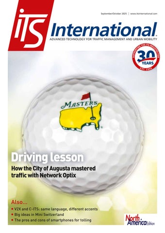
People all over the world –millions of whom have never visited it – know the US city of Augusta. This corner of Richmond County, Georgia, is renowned for holding one of the most recognisable sports events on the calendar. Since the 1930s, the Augusta National Golf Club has hosted the annual Masters Tournament – more commonly known as the US Masters, or simply The Masters.
One of the sport’s four major tournaments, it is a golf event that’s supremely watchable whether you like golf or not. The greens are so green, the water so blue and the bunker sand so white that, when you throw in some azaleas in full bloom, the game can happily take a back seat for the casual TV viewer.
It’s a four-day spectacle, and the fact that the sun almost always seems to be shining in Georgia in early April each year doesn’t hurt either. ‘Iconic’ doesn’t really cover it: you don’t need to know your bogey from your albatross to just get lost in the whole thing.
Quite apart from the millions watching on TV, of course, tens of thousands flock to the course to soak up four days of being up close and personal with the sport’s biggest names. With great popularity comes great crowds.
The annual Masters golf tournament doesn’t only produce stumbling blocks for the players. Adam Hill talks to Marc Faubert of Network Optix and John Ussery of Augusta’s Traffic Engineering division about managing the annual influx of sports fans and their cars
And with great crowds come a lot of cars. Forget trying to chip onto the green out of the sand, or working out which way a putt down a fiendish slope is going to break - it’s traffic management which provides the real logistical challenge here.
Spike in traffic
Managing the spike in the volume of vehicle movements during the Masters falls to the Traffic Engineering division of the Augusta Engineering Department. Covering around 275 signalised intersections, it uses Network Optix’s Nx Go, a scalable, cloud-accessible visual infrastructure solution, for the purpose. The operation was updated to the NxGo platform in 2024.
Speaking to ITS International earlier this year, John Ussery, assistant director, traffic engineering at Augusta, explains the scale
Everybody wants to get in a car, drive here and park: those are some of the challenges wehave
John Ussery
Augusta Engineering Department
of the influx of traffic which routinely happens during the Masters. Most of the roads around Augusta National are state routes: “We conservatively estimate that they may see an increase of maybe 50% above what we would normally see,” Ussery says. “So, for example, Washington Road is how a lot of people get from Interstate 20 to the parking area. On a normal day, it's 55,000 vehicles per day - and on a Masters’ day, we probably see 50% more than that, so 75,000.”
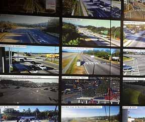
During the Masters, traffic patterns change rapidly, which means that to manage them it’s necessary to reconfigure views or prioritise camera feeds in real time.
that: all the camera and all the video comes to our traffic centre, and the Nx platform is what we use to bring it up on the wall, monitor things and adjust it. It comes in super-handy.”
Nx Go rests on its own server, Ussery says. “Nx really helps us manage all that and arrange it in such a way that it's most helpful for us.”
Network Optix sets great store by the ease of use of the product, and Marc Faubert, the company’s director of mobility platform business development, highlights that City of Augusta staff can have remote access via Nx Cloud to the camera feeds on a mobile device, so don’t have to be in the traffic control centre to see what the cameras are seeing.
these cameras have been offline, maybe from a storm surge or something, so they know where to send the technicians without wasting time.”
Flexibility and visibility
When a traffic signal goes offline, nearby camera feeds provide immediate awareness, with technicians able to remotely evaluate the issue and respond to reduce downtime and disruption for the travelling public.
Ussery and the Traffic Engineering division team need flexibility as well as visibility. Augusta isn’t built on a grid system, and the area has its share of winding roads based on old trails, for example. The area around Augusta National was not set up for significant road traffic.
Cloud-based accessibility means users can manage the system via smartphones, tablets, and laptops whether they’re in the office or in the field.
“Within the platform, we added 3D mapping,” he says. “Now they can see the whole county, and we position icons at a particular intersection - traffic controller, camera 1, camera 2, camera 3, camera 4so now they're looking at the map, and just click on it: here's the video, here's the traffic controller.”
This instant visibility helps decision-making, he says. “They log into the controller and they're able to flush the system out on their phones or iPads. So they can be out in the field, because maybe a camera is down, and they pull up the iPad or phone, log into their account. If traffic is backed up, they log into the traffic controller, turn it green and flush the system out - flushing traffic out is the name of the game.”
They also get timely notification of any faults, Faubert adds. “The way Nx Go was set up is anything that goes offline, they get an alert automatically via email or text…
In fact, if you look at a map, the south side of the course is residential neighbourhoods. During the Masters, that presents a challenge. “We do detour about half the parking lot that way,” Ussery continues. “So there's definitely a huge influx of traffic down there. And they're all two-lane roads so that's one of the reasons why we make some of them one-way in the afternoon, specifically from, like, 4pm to about 7pm or 8pm, depending on the day.”
Faubert says the beauty of Nx Go is that it gives engineers access to everything in one place: “They can actually look at the traffic controller and all the different technology that they have - all on that one piece of glass.”
This ability to monitor across roadways gives the team the ability to swiftly assess congestion, detect incidents and adjust signal operations.
Ussery is inclined to agree with Network Optix’s pledge that Nx Go is a user-friendly interface. “You just drag and drop. It's definitely the easiest one, the most intuitive one I've used,” he confirms. “We've managed
Having oversight of a number of live video streams is crucial: slow responses to incidents or bottlenecks can be frustrating for commuters – and, more importantly, can create road safety issues. Nx Go enables real-time monitoring, rapid response and customisable layouts across devices, all within a single system.
“We use Network Optix for managing all of our video streams,” he continues.
Real-time priority
The team can see dozens of streams simultaneously - north, south, east, west, off the highways - with half a dozen operators managing and maintaining traffic flow from a centralised system.
“So in Richmond County, we have 275 signalised intersections, and about 130 of them are connected to our fibre network, and all of those have PTZ [pan-tilt-zoom] cameras. So Nx Go helps us manage all of
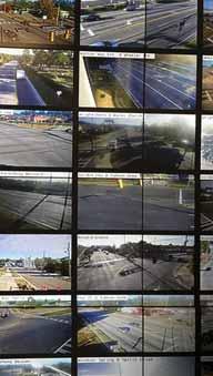
Nx Go video wall
to create custom windows and save the layouts. In the morning, I'm looking at different intersections than I am in the afternoon, I’m looking at different routes. We have the ability to put the most commonly-needed ones on the big video wall. And then at each individual workstation I have other cameras set up that I need to monitor, to be able to react.”
This ability to quickly switch between layouts and prioritise views enables staff to respond proactively as conditions change throughout the event.
No park-and-ride
While the Masters itself lasts four days, there are about 10 days of annual disruption around the golf, with public tickets available to several days of practice for the international pros, plus a couple of other
There is no park-and-ride arrangement for visitors to Augusta National, although there is a ride-share lot for Uber, Lyft and drop-offs. There are relatively few hotels nearby – “this isn’t Las Vegas,” Ussery smiles - so house rental in the surrounding areas is profitable for residents. But it means that people are not able to walk to the venue in great numbers, for example. Arriving in a private vehicle is the main game in town.
“Everybody wants to get in a car, drive here and park,” Ussery smiles. “Those are some of the challenges we have.”
They can look at the traffic controller and all the different technology they have - all on that one piece of glass
For the traffic engineers, preparations for the Masters begin a couple of months ahead of time, and from two weeks beforehand “we pretty much all work full-time on it”, he explains. “All the signs, the additional parking signs and guide signs go in; we're adjusting signal timings; we're checking everything to make sure it's working. You know, all of those things we got to do to direct traffic where it needs to go.”
2018, an $8 million project. There is a second phase to come, Ussery says. “We have a traffic centre with the ATMS, and put in 10-12 miles of fibre to start linking everything together. We can instantly look and communicate with any traffic signal that's on our network.” More fibre will be added in phase two of the project.
Network Optix says the implementation of Nx Go has created significant improvements – not least in terms of scaling up as the city’s traffic-monitoring systems grows: the camera network has grown from a few dozen to over 130, with another 100 or so units expected to come online.
The firm also points to real-time monitoring and customisable workflows empowering technicians to make quicker, more informed adjustments across those 275 traffic signals, leading to smoother daily traffic operations.
Bobby Jones Expressway
Immediate sight of problems on the road means they can be diagnosed and resolved more quickly, the company adds.
And so back to the golf – which is never far away in Augusta. The city’s bypass loop, Interstate 520, is (inevitably) known as the Bobby Jones Expressway after the extraordinary amateur golfer of the 1920s who was also co-founder of the Masters. “Everything, pretty much inside that loop, has been connected with the fibre network,” Ussery says.
He clearly has fond memories of his decade or so in the job. Asked if he is a golf fan, he laughs: “I wasn't till I moved here. I knew what the Masters was, but I had never watched it. So it actually has opened up quite a whole world I didn't even know existed, because I always thought golf was something you watched, you know, when there was nothing else on.”
The City of Augusta had an advanced traffic management system installed in
Now he has been going to the Masters for the past 10 years – something he’s aware that many fans would envy. “Don’t get me wrong,” he concludes. “It doesn't escape me how lucky I am to have gone.” ITS
When you spend enough time in the Vehicle to Everything (V2X) world, you realise something fascinating: everyone is talking about the same thing, but they’re not always speaking the same “language”.
And sometimes they think they’re speaking about the same thing, but actually their perspectives are quite different. I was first reminded of this in January this year when my calendar threw me straight from CES 2025 in Las Vegas into a 10-day road trip across the US via Salt Lake City and Washington, DC.
Later, at August’s ITS World Congress in Atlanta, those impressions deepened. The conversations were inspiring, thoughtprovoking, and sometimes slightly déjà vu. Because here’s the thing: in many ways, the US today feels like Europe did about 10–15 years ago. Only with more pickup trucks, fewer regulations, and perhaps a bit more pragmatism - or dare I say optimism?
So let’s dive into how the V2X conversation differs on either side of the Atlantic — where Europe and the US overlap, where they diverge, and what they could learn from each other.
A tale of two timelines
In Europe, the V2X story has been unfolding for well over two decades already - of which I only participated actively for the last 10
Whether you call it V2X or C-ITS, the idea is the same. Kathrin Hagemann looks at the differences between Europe and the US – and on how their approaches could fit together
years. Larger pilots started as early as the mid-2000s, often under projects – funded by the European Union - where multiple countries worked together to test crossborder interoperability.
Out of those pilots came the specifications, profiles, and standards over the years that today underpin the European approach to cooperative ITS (C-ITS).
And now? Europe has moved well past the pilot phase. We’re talking about real deployments at scale:
• Around two million Volkswagen vehicles are already equipped with V2X capability.
• Roadside units (RSUs) have been deployed across motorways by road operators like Asfinag in Austria or Autobahn in Germany.
• Hundreds of intersections in cities like Hamburg (Germany), Graz, Vienna (both Austria), and Brno (Czech Republic) and more are equipped to prioritise buses or trams.
The use cases that dominate Europe today reflect this maturity. Since the announcement of the analogue shut-down for public transport prioritisation in some parts of Europe, this use case is a major driver for C-ITS.
Cities need a solution for this to make public transport more attractive, traffic
more efficient and to reduce the amount of individual motorised vehicles in cities. So why not use C-ITS, with the option to build upon this one solution with other use cases in the future? Safety use cases are also being integrated into fleets and infrastructure. In other words, the system is moving from “what could work?” to “how do we make it work every day?”
“ The US is like the enthusiastic teenager testing cool new gadgets. Europe is the slightly stricter parent who insists on house rules and helping with dinner “
In the US, the conversation feels different. States like Utah and Georgia are beginning to talk about and run “corridor projects,” where they test interoperable use cases across neighbouring states. For now, the use case most often talked about – at least in the conversations I witnessed - is emergency vehicle preemption, giving ambulances and fire trucks a safer, faster passage through intersections.
The parallels with Europe’s early days are striking. Back then, Europe also ran corridor pilots to test how messages generated in one country would be understood in another - like the ITS Corridor with the Benelux countries (Belgium, Netherlands, Luxembourg) and
Germany. For the US, this is a vital step — because in a country with 50 states, each with its own department of transportation, harmonisation is a monumental task. So while Europe is grappling with series deployment, the US is still working out how to get everyone on the same page.
The technology debate
Technology is, of course, a hot topic on both continents — but in very different ways.
In the US, the story has had strong ups and downs. For years, billions were invested in DSRC (dedicated short-range communications), the Wi-Fi–based cousin of Europe’s ITS-G5. But in 2020, the Federal Communications Commission (FCC) announced the reallocation of most of the spectrum, leaving only 30 MHz for ITS — now designated for C-V2X. The problem? 30 MHz is hardly enough to support the full suite of safety-critical use cases. And the DSRC equipment already deployed? Essentially stranded assets.
So US stakeholders faced the tricky combination of little spectrum and the need to shift technologies midstream.
On the plus side, US Department of Transportation has published an ambitious V2X roadmap to 2030 - Saving Lives with Connectivity: A Plan to Accelerate V2X Deployment - and in 2024 awarded funds of about $60 million for connected infrastructure deployment.
In Europe, the technical foundation has been somewhat clearer - though highly debated. ITS-G5 is the prevalent technology, with large deployments already in place. C-V2X (the cellular variant) hasn’t taken off here, partly due to regulatory hurdles and partly due to technical challenges, or both. One challenge, for example, is protecting digital tolling (CEN DSRC), which operates in a neighbouring frequency band. European rules (EN 302 571 v2.1.1) require C-ITS stations to reduce transmission power near
tolling sites to avoid interference. Wi-Fi–based ITS-G5 can detect tolling signals and adjust automatically — C-V2X cannot as easily.
Further details get quite technical but in short, ITS-G5 is the feasible choice for now. For those who are actively deploying, the consensus is: ITS-G5 works, so let’s deploy it.
But Europe and the US share a second, equally lively debate: direct communication versus cloud-based solutions. On the one hand, direct communication (V2X messages broadcast over the air) enables ultra-lowlatency safety applications. On the other hand, cloud platforms offer richer data, more scalability, and commercial opportunities.
In Europe, initiatives like Euro NCAP’s connected car roadmap and the DFRS (Digital Framework for Road Safety) are pushing for structured, harmonised cloudbased services alongside direct V2X. In the US, private companies are providing proprietary platforms that integrate traffic data, vehicle fleets and third-party apps.
Think of it as VHS vs. Betamax all over again — except this time the outcome affects the safety of millions of road users, not just your Friday night movie plans. (This example is one I’m often being told about in reference to the current situation - though I didn’t actually experience it myself, it almost starts feeling like I did.)
Different words, different worlds
Another fascinating difference lies in the terminology. In the US, people overwhelmingly talk about “V2X”. It’s about the individual communications: Vehicle to Vehicle, Vehicle to Infrastructure, Vehicle to Everything. The focus is on the first use cases, on what connectivity can do today. In Europe, the dominant term is “C-ITS”. It’s a system perspective: how all traffic participants — cars, buses, bikes, pedestrians, infrastructure — cooperate to make the entire network safer and more efficient.
Being active mostly in European C-ITS myself, I favour this term. It doesn’t focus on the single question of communications, but encompasses the entire cooperative system. This is intriguing and challenging to build. Same family, different personalities. The US is like the enthusiastic teenager testing cool new gadgets. Europe is the slightly stricter parent who insists on house rules and helping with dinner. Both are right in their own way.
Regulation and harmonisation
This brings us to one of the most important dividing lines: regulation. Europe thrives on it. The EU ITS Directive and Delegated Acts provide a structured framework for how member states must deploy C-ITS. Specifications are harmonised across borders, meaning a vehicle from Germany should be able to “talk” to roadside units in Austria, France or Spain without confusion.
But Europe also faces regulatory headaches. The sector keeps asking for clarity on three big issues:
1. Trust – How do we ensure messages are secure, authenticated, and not misused?
2. Liability – Who’s responsible if a V2X message goes wrong?
3. Financing – Who pays for deployment and maintenance of roadside units?
These issues are deeply interconnected and far from trivial. The EU has established the C-ITS Security Credential Management System (EU CCMS) to provide trust between C-ITS participants. But as we often say: “Signed garbage is still garbage.”
Trust in the system isn’t only about cryptographic signatures — it’s about ensuring the content itself is accurate, reliable, and backed by clear liability. This is where compliance assessment comes in. Groups like DFRS and the Car2Car Consortium are working on corresponding guidelines.
Financing remains the most debated: should safety be a business case, or is saving lives reason enough for public investment? In practice, the EU supports much of the deployment.
In short: liability, financing, and trust remain key challenges. From my point of view, Europe has the right frameworks and organisation in place to address them. So Europe is working on further guidelines and formal frameworks, to ensure trust and reliability.
The US, meanwhile, is more pragmatic — sometimes refreshingly so. Deployments often happen without waiting for national mandates. States lead the way, companies experiment, and disruption is welcomed. But as deployments scale up, American stakeholders are realising that some level of harmonisation and regulation is unavoidable.
In fact, during my road trip this year
and at ITS World Congress, many DoT representatives acknowledged exactly this: to make V2X work across the country, they’ll need guidelines, common specifications, and maybe even a national framework.
So the US is beginning a journey Europe already started years ago — but with the chance to leapfrog by learning from Europe’s mistakes.
What each side can learn
The beauty of looking at the US and Europe side by side is that both have something to teach the other:
• Europe could use a bit more American pragmatism. Sometimes, the drive for harmonisation leads to paralysis by regulation. Moving faster, testing more boldly, and tolerating disruption could help. In moderation (after all, I’m also European).
• The US could benefit from Europe’s hard-won experience in harmonisation.
The corridor pilots in Utah and Georgia are a great start, but without common specifications, nationwide interoperability will remain out of reach. Using European harmonised profiles and adapting them could save some time.
Both, however, face the same underlying challenge: how to balance innovation with interoperability. How to encourage creative solutions while still ensuring that all vehicles and infrastructure can speak the same language. How to balance regulation and harmonisation with free-market competition and openness for disruptive ideas.
The road ahead
So what does the future hold? In Europe, C-ITS will keep expanding into more cities and fleets, with use cases like public transport prioritisation becoming standard. Regulation will continue to push harmonisation, and cloud-based services will complement direct communication. Possibly with a new Delegated Regulation, possibly with more clear specifications from organisations like Euro NCAP, possibly through the market reaching a tipping point in the number of units deployed or in the number of companies committed to a certain solution, where then everyone else follows - or has to follow. Hopefully, it will be a meaningful and complementary mixture of all of the above.
In the US, I expect more pilots to grow into corridors, more states to align their efforts, and — eventually — a stronger federal role in setting the rules. Emergency vehicle preemption will likely be joined by new safety and efficiency use cases. Global OEMs will
also play a major role in aligning approaches. After all, they don’t want to build completely different systems for Europe and the US. Market forces will drive convergence.
The question will be how the different technologies will play together in the two regions – cloud-based, long-range communication and direct, short-range. From my perspective, a hybrid approach bringing the strengths of the two together, having them complement each other for the different use cases, would be most beneficial for the overall system. But: think of VHS and Betamax.
In five to 10 years, I expect deployments in both regions to look more alike than different. The accents will remain, but the language will be understood everywhere.
Conclusion: cooperation beats competition
Whether you call it C-ITS or V2X, whether you’re in Europe or the US, the principle remains the same: mobility only works if we work together. Europe brings experience, regulation and harmonisation. The US brings pragmatism, state-level innovation and a willingness to disrupt. Both approaches have strengths, both have weaknesses — and both will ultimately converge.
The core for all of this is cooperation. Between cars and infrastructure, between organisations and areas - and also between continents. This might sound naive and idealistic - but why not strive for this? And for me, personally, this is what makes C-ITS so exciting: it’s not just about technology, it’s about building a common language for mobility — across industries, across borders, and across oceans. I truly love bringing these different worlds together, understanding all sides and bridging the gaps. ITS
ABOUT THE AUTHOR:
Kathrin Hagemann is a European C-ITS expert dedicated to making connected mobility interoperable through cooperation
There may need to be an intermediary step before the widespread introduction of Vehicle to Everything technology: Robert Karr, CEO of Star Systems International, explains…
As the global transportation industry sets its sights on a fully-connected vehicle ecosystem, the promise of Vehicle to Everything (V2X) connectivity continues to inspire innovation and investment. In this vision of the future, vehicles seamlessly communicate with each other, roadside infrastructure, mobile devices, and more to deliver enhanced safety, operational efficiency and sustainability.
Despite the momentum behind V2X, the road to its widespread deployment remains complex. Technical challenges like interoperability, evolving communication standards, and stringent cybersecurity protocols are only part of the equation.
Perhaps the most significant barriers are the readiness of both physical and digital infrastructure, as well as the financial and logistical burden that comes with large-scale upgrades.
Tolling agencies, in particular, are also concerned with potential service disruptions and performance during deployment, as consistent operations are critical to their functionality and revenue. In this context, transitional approaches offer a necessary framework for gradual adaptation and integration, ensuring stability and continuity throughout the transformation process. Instead of an abrupt leap from today’s systems to a fully-realised V2X future, there is an opportunity to build a strategic bridge –one that leverages the infrastructure already in place while enabling gradual, forwardcompatible enhancements.
This bridge is what Star Systems International calls T2X: Transponder to Everything. T2X is not a competing vision to V2X; it is a complementary and scalable
framework that allows tolling agencies to extend the value of existing infrastructure and toll systems. At its core, T2X uses widely deployed RFID-based toll transponders as the communication backbone to connect vehicles not only with tolling readers but with a range of digital systems on the roadway.
Unlike conventional V2X approaches that rely on dedicated on-board units (OBUs) and roadside units (RSUs), T2X operates with minimal infrastructure upgrades.
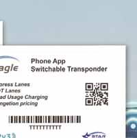
Transponders become the central device, reducing the need for costly new equipment. For example, dual-frequency transponders such as the Falcon and Eagle from Star Systems combine UHF for tolling with NFC (HF) capabilities to interact with mobile devices and other smart infrastructure elements. This hybrid model opens the door to applications in HOT/express lanes, parking management, congestion pricing, and even multimodal transit integration.
T2X is vehicle-agnostic
More importantly, T2X is vehicle-agnostic; it does not require direct integration with vehicle manufacturers, making it deployable across all vehicle types. This significantly lowers adoption barriers and simplifies implementation across mixed fleets and the variety of vehicles on the road today.
T2X enables agencies to take meaningful steps toward connected mobility without waiting for full market readiness. It also provides a cost-effective way to modernise services in places where retrofitting or overhauling roadside infrastructure is financially impractical.
As the industry continues to pursue comprehensive V2X systems, integrating T2X offers a strategic path forward. T2X
and V2X are not mutually exclusive; they complement one another, enabling a balanced and incremental evolution across the transportation landscape. The T2X approach recognises that RFID transceivers, which are currently deployed across the globe, can serve as transitional touchpoints for future connectivity.
T2X-enabled transponders can coexist with emerging V2X devices, working alongside OBUs and RSUs when needed, or independently when resources are constrained.
As newer standards such as SAE J3217 gain traction, Star Systems aims to drive innovation in supporting current tolling standards as well as evolving communication protocols, maintaining long-term compatibility. This flexibility allows agencies to scale intelligently, bridging current capabilities with future projects.
Faced with global urbanisation, rising congestion, and the mounting pressure to modernise infrastructure, agencies must find flexible solutions that bridge today’s reality with tomorrow’s vision. T2X makes this possible as an interim strategy that connects current systems with future technologies.
As the ITS sector evolves, adopting a hybrid approach that integrates legacy systems, transitional technologies, and next-generation platforms may prove to be the most sustainable route. For the tolling industry, progress does not have to mean starting from scratch. With T2X, it is possible to move confidently toward a connected future on a stable foundation that is already in place. ITS
Content produced in association with Star Systems International
Carol Schweiger, Dónal Hodgins and Dr Johanna Tzanidaki consider the role that managing traffic plays within the wider mobility ecosystem – and explore how cooperation between all mobility service providers is required to make journeys work effectively
Over 20 years ago, the US Federal Highway Administration (FHWA) published a report entitled Traffic Congestion and Reliability: Linking Solutions to Problems 1
In the “Toolbox for Congestion Relief,” multiple strategies - including the use of public transport, active travel modes, micromobility and other shared mobility modes - were identified as being effective in addressing congestion. These were in addition to then-traditional techniques such as adding capacity to roads and transit and operational improvements (e.g. incident management and creating or improving transportation management centres).
This indicated a move away from the traditional “predict and provide” approach to land use planning and traffic management towards a vision-led “manage/decide and provide” focus on managing demand.
Integrated management
Shortly after this report was released, the Integrated Corridor Management (ICM) initiative began in the US to “to develop
and demonstrate innovative multimodal and multi-jurisdictional strategies, using intelligent transportation systems, to better manage traffic congestion and more effectively move people and goods through metropolitan corridors.”
Simply put, ICM is the integrated management of freeway, transit, arterial, and parking systems within a corridor using ITS technologies and innovative practices. It is the management of a corridor as a system rather than the management of the individual transportation networks (e.g., rail lines, bus routes, arterials, freeways) within a corridor, which is the current practice in the US.”2
This holistic approach is echoed in Europe and elsewhere with an emphasis, especially in urban areas, on the movement of people and goods in a sustainable manner - rather than the throughput of vehicles.
More recently, ICM was absorbed into transportation systems management and operations (TSMO), a strategy that optimises the performance of existing transportation infrastructure through operational improvements and ITS solutions. It aims to enhance the safety, reliability and efficiency of the
transportation network without adding new physical capacity, thereby seeking to avoid “induced demand”.
Mobility network management
Fast-forward to the 2014 ITS European Congress in Helsinki, where the European Traffic Management 2.0 (TM2.0) approach was launched.
“TM2.0 is an Ertico Innovation Platform that brings together public and private stakeholders to advance interactive traffic management. By fostering collaboration and trust, TM2.0 facilitates the seamless exchange of data between vehicles and traffic management systems to improve mobility services.”3
TM2.0 has developed the broader concept of mobility network management (MNM), extending the principles of collaboration and trust to encompass the entire mobility network, including various mobility services beyond private trips in cars.
This is consistent with the 2023 ITS Directive4 and its predecessor of 2010. While TSMO and MNM have different architectures, they are used to achieve the
USER EXPERIENCE
same results – multimodal approaches to reducing congestion and improving “mobility flow”.
Both of these approaches to traffic management, when applied to the bigger mobility ecosystem, have a focus on prioritising the movement of people rather than the movement of vehicles.
A typical urban mobility ecosystem includes mobility services beyond private cars, such as public transport (including fixed-route and demand-response services), micromobility, active travel (walking and cycling), taxis, transportation network companies (TNCs), carsharing, car/vanpooling, goods delivery vehicles, and private or public automated vehicles.
Successful cooperation
The role of traffic management within this ecosystem requires successful cooperation between all mobility service providers and must consider the availability and use of these types of mobility services.
The vision of this role has evolved from ‘car on the road’ to ‘mobility mode on the transportation network’ in the past five years. MNM has become an integral part of TM2.0 as shown in the MNM concept depicted in Figure 1.
By treating the transport ecosystem as a whole, MNM aligns with the ambitious policies contained in the European Green Deal5 and the resultant initiatives included in the European Commission Sustainable and Smart Mobility Strategy6
The MNM concept is based on the fact that if left unmanaged, congestion in one mobility mode will certainly have a cascading effect on the other modes of transportation
- resulting in a negative user experience and on a dysfunctional transportation network. For example, car traffic congestion on an arterial road will impact the bus network and/or the train/tram network serving the area.
Further, as shown in Figure 1, MNM establishes that there are connections among traffic-related and other mobility service entities.
The TM2.0 community is working on defining whether MNM should be managed by a centralised or a federated platform that would act as the central point for the travel and traffic information service providers
and the public requesting the best possible mobility options to make their trips.
The MNM vision of TM2.0 is bringing the traffic management and Mobility as a Service (MaaS) concepts closer together and has an additional target: the balance of the transportation network, where the individual needs and preferences in travelling and commuting respect the necessity to keep all transportation modes flowing.
In Figure 2, the concept of MNM is explained better: the more the mobility actors cooperate and exchange data and information, the more the transportation system is able to reach its optimum (Level 4).
FIGURE 1. Mobility Network Management Incorporating all Mobility Services7
FIGURE 2. TM2.0 Levels of Cooperation Between Public and Private Stakeholders7
USER EXPERIENCE
Starting with the mere exchange of information between public authorities (PAs) and service providers (Level 0), the MNM aspires to build trust among the mobility actors and have them “coopete” - that is, cooperate for the common good (as this is defined by PAs) and continue to compete in terms of customer service and business profit, based on the quality of their information.
The MNM concept is strongly promoted by the public and private members of the TM2.0 Platform and is currently being piloted via a number of European Union–funded projects.
The concept was a strong theme during the 4th International Symposium on Freeway and Tollway Operations (ISFO) that took place in Vienna in June 2023 and continued to guide the programme of the International Symposium on Navigating the Future of Traffic Management that took place at the end of June and beginning of July 2025 in Athens, Greece8. During the Athens Symposium, both practitioners’ and researchers’ contributions acknowledged and addressed the role and interaction of other mobility services in reducing congestion and improving traffic management.
User-centric solutions
For example, in a session entitled “User Needs - Traffic Management and the Customer Journey”, seven experts explored innovative approaches to sustainable mobility and traffic management, focusing on user-centric solutions to address key urban challenges.
Experts discussed multimodal strategies for improving air quality, promoting modal shifts, enhancing road safety and advancing decarbonisation.
Critical elements in these strategies included gender-inclusive mobility innovations, the role of information channels in shaping sustainable travel behaviour, insights from robotaxi operations, accessibility in vehicle design, and the socioeconomic factors influencing e-scooter ridership.
The insights from this session highlight the importance and need for traffic management to incorporate mobility solutions beyond private automobiles and freight vehicles that consider diverse user needs for a more inclusive and sustainable future.
Car traffic congestion on an arterial road will impact the bus network and/or the train/tram network serving the area
Other sessions at this Symposium covered the role of other mobility services in traffic management, including:
• Transitioning between human and autonomous driving - remote operation of buses and trucks on freeways, motorways and tollways
• International advancements in multimodal traffic management
• Integrated mobility management – a series of use-case presentations and discussions
• Understanding co-creation of fused data
• Turning mobility data into value
• Can we all get along – data-sharing eco-systems?
Data sharing is a key component in ensuring cooperation among traffic management, mobility services and traveller platform entities.
The European Commission initiative for a European Mobility Data Space (EMDS) will facilitate the level of data sharing that will be necessary to reach the vision of MNM.
“The EMDS will not be a single database of all EU mobility and transport data,” it says. “It will instead offer a framework for interlinking and federating many different transportdata ecosystems that are heterogeneous and often difficult to discover or access, while also proposing recommendations for further harmonisation and interoperability. The EMDS framework will have technical (e.g. infrastructure elements) and governance dimensions (e.g. a set of rules, procedures, roles and responsibilities).”9
A typical urban mobility ecosystem includes mobility services beyond private cars
EU mobility data domains and initiatives (e.g. DTLF, ITS NAPs)
Public & private mobility data ecosystems and initiatives
(e.g. German MDS, Eona-X)
Sectoral data spaces
(e.g. Green Deal, energy and tourism)
USER EXPERIENCE
Figure 3 shows the EMDS framework. The success of this framework is contingent on several factors, including data quality and data value.
Figure 4 depicts the ultimate value of integrating traffic and other mobility service data. This was covered in the Athens Symposium as well as identifying the dimensions of data quality: correctness, completeness, timeliness and domain/mobility service-specific dimensions (e.g. accuracy).
Conclusions
In conclusion, traffic management must operate within the broader mobility ecosystem, prioritising the movement of people over vehicles. This includes integrating all mobility services such as public transport, micromobility, walking, taxis, carsharing and automated vehicles with traffic management. For this integration to be effective, there must be several supporting activities/systems, as follows:
EMDS Participants (e.g. data providers, data users, marketplaces and service providers
• Collaboration and data sharing: Effective traffic management requires open communication and cooperation between public and private stakeholders, supported by data-sharing frameworks like the European Mobility Data Space (EMDS). This collaboration fosters trust and enables the seamless exchange of data to improve all mobility services.
• Multimodal approaches: Strategies like transportation systems management and operations (TSMO) and mobility network management (MNM) emphasise multimodal approaches to reduce congestion and improve mobility flow. These approaches focus on optimising existing infrastructure rather than expanding physical road capacity.
• User-centric solutions: Traffic management should address diverse user needs, including gender-inclusive mobility, accessibility and socioeconomic factors. Further, the vision for traffic management includes platforms that help the end user determine the best mobility options, fostering a more inclusive, seamless and efficient mobility experience and ensuring a sustainable transport future for all users.
If left unmanaged, congestion in one mobility mode will certainly have a cascading effect on the other modes of transportation - resulting in a negative user experience
FIGURE 3. EMDS Framework Concept9
• Role of data quality: The success of integrating traffic and mobility services data depends on data-quality dimensions such as correctness, completeness, timeliness, and domain-specific accuracy. High-quality data enables better decisionmaking and improved mobility services.
• Sustainability and innovation: Traffic management must incorporate innovative and sustainable solutions, such as promoting modal shift, improving air quality, enhancing road safety, and advancing decarbonisation.
The outcome of the Symposium in Athens, along with current efforts to integrate information from other mobility services, highlights the need for a continued holistic, collaborative, and data-driven approach to traffic management in the future within the ever-evolving global mobility ecosystem. ITS
ABOUT THE AUTHORS:
Carol Schweiger is president of Schweiger Consulting; Dónal Hodgins is chair of the Network of National ITS Associations (ITS Nationals); and Dr Johanna Tzanidaki is chief innovation officer, Aya Consulting
1 Cambridge Systematics, Inc. with Texas Transportation Institute, Traffic Congestion and Reliability: Linking Solutions to Problems, prepared for Federal Highway Administration, Final Report , July 19, 2004, https://ops.fhwa. dot.gov/congestion_report_04/index.htm#toc
4 The 2023 ITS Directive – description at: https:// eur-lex.europa.eu/legal-content/EN/TXT/ PDF/?uri=OJ:L_202302661
5 The European Green Deal - description at: https://commission.europa.eu/ strategy-and-policy/priorities-2019-2024/ european-green-deal_en
6 The Sustainable and Smart Mobility Strategy - description at: https://eur-lex. europa.eu/legal-content/EN/TXT/ HTML/?uri=CELEX:52020DC0789
7 Created by Dr. Johanna Tzanidaki and used in presentations at 2023 ITS European Congress, 22-24 May in Lisbon, Portugal and 2024 ITS World Congress, 16- 20 September in Dubai, United Arab Emirates
10 Chrysostomos Mylonas and Maria Stavara, Research Associates, Centre for Research & Technology Hellas (CERTH – HIT), “Workshop #4: Turning mobility data into value: Traffic data quality in the context of value creation,” presentation delivered at the 2025 Navigating the Future of Traffic Management: International Symposium, Athens, Greece, 30 June 2025.
FIGURE 4. From Data to Services to Benefits10
For whom the phone tolls
The evolution of satellite tolling continues with smartphones showing their potential: Norbert Schindler of GNSS Consulting considers some of the pros and cons of mobiles…
More than 22 years ago, I left the telecommunications industry to join a team in Vienna that was building what was to become the largest new multi-lane free-flow (MLFF) tolling system in the world.
Austria launched its nationwide truck tolling system (LKW Maut) in 2004, exactly one year before its favourite rival, Germany. Back then, there was a fierce debate about the microwave-based versus satellite-based approach to determining distance-based fees. Now, in 2025, 10 nationwide truck tolling systems are based on satellite technology1 while Austria and Slovenia still operate systems based on dedicated short-range communications (DSRC).
France and the Netherlands are currently rolling out satellite-based systems, while Lithuania and Romania are procuring truck tolling systems based on global navigation satellite system (GNSS).
Satellite solutions come out ahead
There is now a clear preference for using GNSS for nationwide tolling, since this technology has proven to be highly costeffective and extremely flexible.
With satellite positioning, there is no need to build gantries on each individual toll section of the tolled road network as required by a “tag and beacon” system that needs DSRC or RFID readers at each tolling point. In fact, when the Czech Republic replaced its DSRC tolling technology with GNSS in 2019, it removed more than 100 gantries equipped with costly microwave equipment, cutting operational expenses in half while doubling the tolled road network – and thus increasing the overall toll revenue.
“ It is probably just a matter of time before geo-positioning becomes the basis for measuring road usage and financing road infrastructure “
catch potential violators by surprise. MLFF systems using DSRC technology also use mobile enforcement to catch vehicles that are not equipped with active tolling tags.
Impact of European Electronic Toll Service
We have come a long way since Germany started tolling trucks for using the famous Autobahn network of 12,000 km – which has now been expanded to the entire national road network of 52,000 km and generates about €12 billion ($15 billion) in toll revenues per year.
Thanks to the introduction of the European Electronic Toll Service (EETS) in Belgium in 2006, there are now 14 countries that accept an EETS on-board unit (OBU) from one of many toll service providers (TSPs) offering the service.
they travel in, and managing all those different invoices. The European toll domains still provide a service – typically from a national service provider – that allows trucks to use the tolled road network without a service fee. Now that EETS interoperability is well established, fewer windscreens of European trucks are cluttered with the multiple OBUs that were required for each individual country.
Smartphones have entered the scene
With a GNSS-based approach, gantries are built on approximately 10% of the total tolled road sections – for enforcement purposes. The rest of the tolled road network is monitored by mobile enforcement vehicles that move around the tolled road network to
Truck-forwarding countries can register with a single provider to travel with one OBU in many (if not all) of these countries2. Of course, that service comes at a cost, which a growing number of trucking companies are ready to pay for – rather than having to register their vehicles in each country that
When Poland replaced its microwave-based tolling system with GNSS in 2021, it boldly introduced the use of a smartphone app as a free alternative to using a paid service from one of many TSPs that provide an OBU or a tracking device for making toll declarations while using the tolled road network. The Polish agency responsible for the operation of the e-Toll system, the Department of Road Toll Collection at the Ministry of Finance, has published statistics about the use of different options for toll declarations.
As illustrated in Figure 1, in the first half of 2025, only 6% of all the trucks (and buses) processed toll transactions using the
free smartphone app while driving on tolled roads. Since trucking companies have a fleet of vehicles, and a staff of drivers for those vehicles, it is clearly more convenient to have a dedicated device installed in each - rather than every truck driver installing an app and declaring their smartphone is associated with the specific vehicle that they are currently using. There is also a risk that a truck driver may forget to activate or deactivate the smartphone app when starting or ending a
trip. Not having an active OBU or correctlyregistered app while using the tolled road network can result in high penalties that would quickly exceed the cost of having a dedicated tolling OBU.
If we look at the statistics for a specific segment of vehicles, the case for using the smartphone app is much more convincing. During the first half of 2025, among 74,600 smaller commercial trucks in Poland (between 3.5t and 12t) the smartphone app was clearly the most popular choice - as illustrated in Figure 2. Even though this is a relatively small sector of the total amount of 1.6 million registered
vehicles, it demonstrates the potential of the smartphone – in this case, for small local businesses making deliveries within the country.
This year, Denmark became the second country to introduce a smartphone app for a nationwide truck tolling system. The “KmToll” (in Danish: Vejafgifter) covers about 10,900 km of Danish state and municipal roads, and applies to trucks above 12t. The system is the first in Europe that does not have a national “main service provider” but relies on the use of EETS OBUs, with a smartphone app and a simple ticketing system as alternatives.
Fortunately, the state-owned toll operator Sund & Bælt did not need to rely on private EETS providers supplying enough OBUs to meet the demand in Denmark since one of the EETS providers, Brobizz, is also 100% state-owned. The take-up of EETS OBUs was actually higher than originally anticipated.
In the overall statistics in Denmark (Figure 3), the smartphone app has not made much of an impact so far.
Within the first months of operation, only 1% of the total distance driven by all vehicles was declared with the app offered by Brobizz. From January to the end of July, only 12.2 million transactions were made with the app – compared to 1.7 billion with an EETS OBU (93%), and 70.4 million with tickets (6%) booked for each individual trip.
Of the three current EETS providers, only Brobizz offers the smartphone app – which has been taken up by just 10% of users. This percentage will increase as the app – currently just on the iOS platform for iPhones – becomes available on android devices as well. In other words, there is much potential for smartphone apps being used in Denmark.
FIGURE 1. Percentage of toll transactions in Poland by different type of devices in 2025
FIGURE 2. Smartphone app is popular for small Polish trucks making local deliveries
FIGURE 3. Percentage of distance driven by toll declaration type
Will smartphones eventually replace tolling OBUs?
Since virtually all road users in Europe - and elsewhere in the world - own a smartphone, each with a built-in GNSS receiver, it seems logical to use the geo-positioning of smartphones rather than having to manufacture, distribute and install dedicated GNSS devices.
In recent years, GNSS-based tolling OBUs in Europe have had a price tag of about €100 ($115) for road authorities and EETS providers. The use of smartphones did little to reduce the number of OBUs needed, with just 76,000 registered smartphone users in Poland and 8,000 in Denmark in mid-2025. If a new tolling system required millions of dedicated OBUs, on the other hand, the cost could be quite substantial.
In Indonesia, a new GNSS-based solution was developed to replace the existing toll plazas on the national highway network, requiring about 50 million (!) users to be equipped with a GNSS device.
In 2021, the Indonesian government awarded a contract to a Hungarian consortium to build a satellite-based solution on the entire tolled motorway network of 2,578 km. This groundbreaking project would replace all toll plazas with a new MLFF system based on GNSS.
Since this project has faced delays, we don’t know yet how operating such a novel tolling system would look in practice. A new system, in which tens of millions of drivers would use a smartphone app to automatically recognise the distance travelled on toll roads, would surely face many challenges.
In contrast, the cost of supplying 50 million users with OBUs would be huge: even if the price of a GNSS OBU would be just $50, the total cost would reach $2.5 billion.
‘No
free lunch’ principle
In the era of toll service providers, road operators may not need to bear the cost of dedicated OBUs, since TSPs would cover that investment. For a monthly subscription fee, TSPs provide road users with a tolling OBU for automatic electronic toll declarations. This works well for trucks using EETS in Europe, but users can still choose between a free national service and a paid service.
“ There is a risk that a truck driver may forget to activate or deactivate the smartphone app when starting or ending a trip “
Road authorities in Europe need to invest in a national service provider while at the same time paying a commission to the EETS providers for their services of calculating and collecting the distance-based fees using accredited OBUs. It remains to be seen how readily passenger car owners will subscribe to such a service, compared to using a smartphone app for free. The bigger question is what the main cost driver would be for road authorities: investing in dedicated toll OBUs (either directly or through a provider), or allowing the road users to download an app and pay for higher operation costs.
With a smartphone app, both the vehicle owners and the road authorities take on considerable risks. The road user takes complete responsibility for properly installing and using the app on their smartphones, and carelessness will inevitably result in having to pay penalties for toll evasions –whether intentional or not. Road authorities, on the other hand, need to invest more in enforcing the correct use of smartphones. The moment that toll declarations are not automatically made with tolling OBUs, but rely on any type of smartphone that isliterally - in the hands of regular car drivers, the potential for inaccurate trip declarations will increase dramatically. Imagine the level of customer service needed to deal with all the queries from confused and frustrated smartphone users - and all the excuses why the app or the phone wasn’t working. In other words, there is no free lunch. We have yet to see how the cost of operating a large customer service organisation – with a very busy call centre – would compare to the cost of manufacturing and distributing special-purpose OBUs that take care of all toll declarations automatically.
Plug and play
As the statistics from Poland and Denmark have shown, truck-forwarding companies clearly prefer using a tolling OBU, especially when a single service provider can take care of all registration and payment issues in multiple European countries. Smartphone apps, on the other hand, only work for a specific toll domain - as is the case with Poland and Denmark, with Lithuania most
Trucks have been subject to tolls in Germany for years
> Non-intrusive system including high positioning tolerance
> Decoy function to strengthen the deterrent and educational effect on users
> Stationary solution for enforcement of multiple road traffic offences
> Smart traffic enforcement through 3D-LiDAR technology
likely to follow. Since EETS providers need to have the hardware and software of their OBU solutions thoroughly tested in each country, they typically apply for the accreditation of a single OBU configuration. With a smartphone, there is not a specific hardware, since any available smartphone can be used. Whereas GNSS OBUs are designed and manufactured with the requirements of the toll domains in mind, smartphone manufacturers are focused on the consumer market - and not on the specific needs of tolling systems.
A key advantage of dedicated GNSS OBUs is the “plug and play” approach, with the simple installation and handling of a windshield-mounted device. The more automated the entire process is, the smoother tolling operations will be. Once the OBU is installed, there is virtually no need for any user intervention. In the case of an OBU hardware or software failure, the driver can be notified by an alarm and a red warning light on the OBU.
Tolling OBUs also meet strict automotive requirements, such as high levels of vibration and the ability to withstand very high, and very low, temperatures.
Travel data is securely stored and sent in data packages of the needed trip information to a tolling back office, and are usually tamper-proof. Road users cannot simply turn off an OBU or open the casing to remove the OBU’s SIM card or the back-up battery to prevent trip data from being submitted to the tolling back office, where the distancebased fees are calculated and invoiced.
Potential downside of smartphone apps
Smartphone apps face significant challenges when used for distance-based tolling. Road users are required to download the app, correctly register their vehicle, and activate the app before driving on a toll road.
Whenever the road user drives a different vehicle, they need to register that change in their app. They must also ensure that their
smartphones have enough power for the entire duration of the trip, and that enough memory is available on the device to store the travel data when there is no cell coverage or poor data connectivity along the travelled route.
Smartphone users also need to make sure that their telecom service has a sufficient data package for all the travel data to be properly transferred to the toll system. Users must also secure their phones against malicious malware attacks and be wary of fraudulent apps that pretend to be the actual tolling app, with toll charges going to an illegal entity until the fraud is eventually identified.
The way ahead
The position accuracy of a smartphone is particularly vital to the correct calculation of distance-based fees. The quality of geo-positioning provided by different phone models can vary significantly. Even with the best smartphones on the market, accuracy can suffer greatly if the smartphone is not placed near the front windshield. When a smartphone is tucked away in a driver’s pocket, bag, or somewhere in the back seat, position accuracy will not be very reliable.
Although smartphone apps are a viable option for automated toll declaration in a large tolling scheme, their acceptance has been limited so far. From the perspective of a road authority, the chances of something going wrong with the collection of correct and accurate trip data is so much greater with a smartphone, compared to a plug-andplay device.
The evolution of multi-lane free fl tolling over the past 20 years has been substantial. Within the next 20 years, electronic tolling will likely change more rapidly. We can already imagine using multiple sources of geo-positioning in the vehicle for the purpose of road pricing.
Virtually all new cars are equipped with GNSS receivers that could provide a secure and accurate source of travel data to determine the distance travelled on a tolled road – or on any type of road. With the rise of electric vehicles in the market, it seems inevitable that distance-based charging of vehicles will become essential as fuel tax revenues steadily decline.
It is probably just a matter of time before geo-positioning becomes the basis for measuring road usage and financing road infrastructure, and the transmission of travel data from all vehicles on public roads becomes commonplace.
Smartphone apps may find a suitable place in the mix of tolling hardware in the years to come, but at this early stage it is difficult to predict the role of smartphones in distance-based road pricing.
Only time will tell whether the smartphone alternative to tolling OBUs can result in significant savings or ease of use in the
Norbert Schindler is founder of GNSS Consulting. www.gnss-consulting.com
• Over 50 articles, research reports, papers and books
• Academic journals, trade press & professional industry publications
International offices and clients
• Working for 13 of the top-20 global infrastructure investors
• Pension funds, private equity, alternative asset managers & SWFs
Big ideas in Mini Switzerland
Can you take the ‘Mini Holland’ concept of active travel and make it work for integrated mobility in the UK? Thomas Ableman ponders some Swiss public transport lessons
What would it take to grow the public transport sector in Britain by 50%? The answer may lie where we least often look: in the thousands of towns and villages with barely a bus, let alone a train. To understand why, we need to visit the country with the most comprehensive, best-used public transport sector in Europe: Switzerland.
In 2023, the average Swiss resident took 68 trips per year by train, up from 61 preCovid. The average Brit took 24, down from 28 pre-Covid. Across all transport modes, the typical Swiss travels by public transport more than 200 times every year.
The Swiss experience
Switzerland’s rail network is twice as dense as the UK’s: about 133 km of track per 1,000 km² of territory in Switzerland, compared to 67 km per 1,000 km² in the UK. What
makes it possible to sustain so much railway in a rural country? The fact that the Swiss public transport network is a miracle of useability and integration.
To explain, let me tell you about my holiday earlier this year. I stayed in the tiny village of Paspels in the canton of Graubünden, the largest and most remote canton in Switzerland. The population density of Graubünden is 29 people per km; less than half that of Scotland and just 20% of the population density of Wales. Most of its residents live in villages.
Paspels has a population of just 475 people. In the UK, that would be a public transport desert. And yet Paspels is served by an hourly bus to the nearest towns of Thusis and Rhäzüns.
Now, that’s good: an hourly bus to the nearest towns is excellent. But it’s what happens when those buses get to the towns that is so special.
Both arrive at a bus station immediately adjacent to the railway station. As the bus from Paspels arrives into Thusis at 59 minutes past every hour, on the adjacent platform the Regional Express train to the city of Chur also arrives. Three minutes after the people from Paspels alight from their bus, at 02 minutes past the hour, the train departs. The same thing happens at Rhäzüns.
End-to-end journeys
As a result, the end-to-end journey from Paspels to the capital of Graubünden can be done in less than an hour, every thirty minutes. From a village of 475 people.
That’s not all: because the Regional Express is timed to arrive into Chur seven minutes before the Intercity train to Zurich departs, Paspels is connected to Switzerland’s financial capital on the other side of Switzerland in two hours, every hour.
Either we can accept a cycle of decline, or we can do something to show what an alternative future can be
This is typical of how almost every village in Switzerland is connected: an hourly bus that meets a regional train that meets an Intercity train. Switzerland is like a giant animal breathing in and out on an hourly cycle of breaths. On each outbreath, buses arrive in every village in every valley across the country. On the inbreath, those buses connect to rural stations which connect to regional stations which connect to the cities.
It is this hyper-connectivity that is the key to the Swiss public transport miracle.
This miracle is what drives Switzerland’s high level of public transport usage and it’s what makes it possible for the network to sustain itself. Look back at those stats earlier: Switzerland has twice as much railway, with twice as much usage. The reason why rural lines work there but not in the UK is that they’re fed constantly by the local networks of buses. The reasons why the buses work in Switzerland but not in the UK is that they take people to the station. This system is symbiotic. But can we replicate that here in the UK?
Lessons from Mini Holland
From where we’re starting, it just feels an impossible task. Nothing about the way buses and trains work in the UK is designed to the Swiss model. Should we give up?
Well, possibly, but look at active travel. Someone looking at the UK 10 years ago would have said the same about cycling. Nothing about our streetscapes was suitable
for cycling. Too hard, let’s give up.
The solution emerged from former UK prime minister Boris Johnson, of all people, when he was Mayor of London.
Let’s take a handful of relatively small places, he thought, and replicate entirely the cycling infrastructure of a Dutch city. That will prove it can be done, and become a template for others to follow. He called it Mini Holland.
I know how well this worked because I live in one of the Mini Holland locations.
Do a Google Image search for the words
“Mini Holland” and you will see endless photographs of the same street in Walthamstow, east London. The street is Orford Road and, as you can see, it has been analysed and re-analysed by blogs, papers, journals and academics for the last decade.
Orford Road is three minutes’ walk from my house. From 2016, my local area was transformed into a replica Dutch city. All the main roads now have cycle lanes, all the side roads have modal filters and, most photogenically, Orford Road was pedestrianised.
“ The reasons why the buses work in Switzerland but not in the UK is that they take people to the station: this system is symbiotic “
Orford Road: probably in an academic journal near you
Even small villages in Switzerland tend not to be transport deserts
It proved that these interventions are possible, and that they cause local businesses to thrive. It proved that they encourage cycling to go up and traffic to go down.
So what about Mini Switzerland? When the pandemic happened and other towns and cities wanted to introduce what had, by then, been christened Low Traffic Neighbourhoods, there was both a playbook and an evidence bank from Mini Holland.
So, in that context, let me introduce Mini Switzerland. In the Hope Valley, a charming slice of rural England towards the north of the Peak District, we’re taking exactly the same approach.
The Hope Valley already has one of the most important constituent features of the Swiss transport model: an hourly clockface rail service.
Let us imagine we live in Bradwell, a village in the Hope Valley located just three miles from a railway station with a population three times the size of Paspels. Today, if we wished to go to Manchester, we would almost certainly drive: despite the fact that the journey of 30 miles typically takes around 90 minutes due to the condition of the local roads.
Why would we not go by public transport? It’s not like there isn’t any. There’s a bus from, for example, Bradwell roughly eight times a day. But it’s hard to remember when: the times are 08.42, 11.12, 13.36, 16.12 (etc). If this were Switzerland, they’d be at the same minutes past the hour every day, seven days per week: lodged in everyone’s minds.
The bus goes to Bamford station, from which there’s an hourly train to Manchester. And the good news is that the bus arrives just 11 minutes before the train departs. Well, if you’re getting the 11.12 that is. But the 08.42 and the 13.36 miss it by miles. And,
anyway, 11 minutes is quite a long wait. In Switzerland, it would be a maximum of five minutes.
The tickets are priced separately and there’s no way of buying them together. Indeed it’s impossible to even get an online quote for the entire cost of the whole journey and very hard to do an online journey plan for both.
A place called Hope
Do you get the point I’m making? The British state (both trains and buses in the Hope Valley are heavily subsidised) is spending
Holland did for active travel in Walthamstow: by making a single, one-off intervention in one place, we can prove what good looks like.
This is not – yet – a Government initiative: it’s a ground-up project. In fact, it started out as a LinkedIn post. I posted the idea for Mini Switzerland, and did a call-out for a local community that was ambitious enough to try it.
Hope Valley Climate Action got in touch to say they’d been having similar thoughts. Working together, we won a grant from the Foundation for Integrated Transport, and are using this to create a delivery plan.
We’re speaking to local stakeholders including the local authorities, regional authorities and operators. The great news is that there’s a real groundswell of support for Mini Switzerland: we’ve been inundated with offers of voluntary support from consultants, public transport professionals and others with expertise, all coming together to help make this a reality.
We’ve tapped into a recognition that our transport system spends too much delivering too little. Either we can accept a cycle of decline, or we can do something to show what an alternative future can be. Where better to demonstrate that alternative future than a valley named Hope? ITS
THE AUTHOR:
Thomas Ableman is former director of strategy and innovation at Transport for London and founder of Freewheeling www.freewheeling.info
ABOUT
The Swiss public transport network is a 'miracle of useability and integration'
Stbernardstudio
Dreamstime.com
Buses connect easily to train services
www.dynamic-maps.co.jp www.ptvgroup.com
TLEX Interchange now on Microsoft Azure Marketplace
Monotch has made its data exchange engine TLEX Interchange available on the Microsoft Azure Marketplace. With this launch, the Dutch company says public authorities, integrators and infrastructure owners worldwide can quickly spin up a fullymanaged, C-ITS-compliant data exchange engine and begin real-time data sharing layer that connects road infrastructure, road users, applications, AI models and data exchange networks. It allows connected mobility and digital infrastructure, enabling interoperability and real-time collaboration across the mobility on AMQP and aligned with international standards such as C-Roads. It is designed to enable public authorities, integrators without the need to build their own systems. Already used in programmes such as Mobilidata in Belgium and NordicWay, TLEX Interchange has become a foundation for smart city deployments, Interchange directly into their own Azure environment, integrate instantly with ready-made connectors and scale using Azure’s pilots and trials to custom deployments and scaling down again. www.monotch.com
SENSYS LAUNCHES AI AND WIRELESS TRAFFIC DETECTION PLATFORM
video AI and wireless sensor technologies into a single system. The manufacturer says MultiSens Intersection combines deep-learning video analytics at the intersection with wireless in-road sensors for choosing between technologies that each do one thing well," said Brian Fuller, president at Sensys Networks. "Video AI excels at scene analysis at the intersection but struggles with advance detection. Wireless sensors provide reliable advance detection but don't provide the visual element. MultiSens Intersection eliminates this compromise vehicles and vulnerable road users such as motorcycles, bicycles, scooters, and pedestrians across all approach lanes simultaneously. power, communications, or direct line-of-sight – with no trenching while wireless sensors are immune to rain, snow, fog, and glare. A single software platform eliminates the complexity of managing separate vendor systems, simplifying set-up, diagnostics, and ongoing management. The system can be deployed with core detection and expanded over time to include advanced analytics, automatic incident detection, and adaptive signal control.
www.sensysnetworks.com
EPIQ EFFORT FROM ECONOLITE
Econolite, part of Umovity, has introduced the Epiq Radar movement detection. A key feature is a built-in 1080p camera (30 FPS) with low-light sensitivity for visual validation. Epiq brings in FMCW (frequencymodulated continuous wave) radar technology with a 110° (275m) of detection, explained
Sunny Chakravarty, Econolite’s vice president, engineering. This means that only two sensors are needed to fully cover all approaches at most intersections. “It’s ideally suited to address diverse intersection geometries with reliable detection, supporting a
and emerging smart mobility programmes,” said Chakravarty. This helps reduce travel times
increasing safety for all roadway users. Epiq Radar is capable of tracking and classifying 128 objects generated from 512 unique detections. It provides
vehicle counts and travel ETA data, supporting the detection needs for stop bar, advance, departure, bicycles and pedestrians. This enables safety-critical applications like mitigation of dilemma-zone and red-light running. The solution consists of two key components, the Epiq Radar Sensor with built-in HD camera for visual validation and the Epiq Radar Hub. The solution integrates with Centracs +Detect for advanced and automated cloud-based data reporting, analytics and monitoring capabilities. www.econolite.com
VITRONIC: SMART ENFORCEMENT FOR SAFER ROADS
When drivers use a phone, their full attention is diverted, which is extremely dangerous, even for a few seconds, in a moving vehicle. According to the German Road Safety Council, a driver who reads or types a message for just two seconds will travel up to 28m without looking at the road at 50 km/h and up to 55m at 100 km/h. The UK’s Royal Society for the Prevention of Accidents (RoSPA) also states that drivers using a phone are four times more likely to be involved in a crash. In today's digital world, staying connected has become second nature, particularly through smartphones. Addressing this serious distraction requires overcoming two main challenges. Firstly, the social acceptance of mobile phone use behind the wheel remains widespread. Recent statistics show that one in four drivers admits to making or taking calls while driving; among young
deterrent effect,” explains Till Neumann from Vitronic. Effective enforcement is key to reducing distraction caused by mobile phones. So why hasn’t this been achieved yet? The answer is that traditional
49%. Secondly, the public often sees this behaviour as merely inappropriate rather than dangerous and illegal. “Because phone bans are rarely enforced, many people don’t follow them. This creates a wrong public perception and removes any
demanding and costly. It requires enormous labour and resources. What approach that works independently
workload. The solution to this modern issue lies in machine vision technology. “With high-performance cameras that record tiny details even at high speeds,
combined with AI software trained to spot phones in drivers’ hands, we enable effective automated enforcement,” says Neumann. “The system can also check seatbelt use, which further increases safety and compliance.” While these advanced systems may sound futuristic, they are already ready for use and can be seamlessly integrated into existing transport infrastructure or deployed as mobile solutions.
www.vitronic.com
Content produced in association with Vitronic
Advertisers INDEX
AGD p29 www.age-systems.com
Cross Zlin p35 www.invipo.com
CSRB p43 www.csrbgroup.com
Daktronics p29 www.daktronics.com/tmc
Intercomp p23 www.intercompcompany.com
Intertraffic p30 www.intertraffic.com
Iteris p23 www.iteris.com
ITS European Congress p24 http://2026.itseuropeancongress.com
ITS World Congress p14 https://2026itsworldcongress.org
Jenoptik p17 www.jenoptik.com
Network Optix p19 www.networkoptix.com
Parifex p41 www.parifex.com
PTV (Umovity) IFC www.umovity.com
Qualcomm p27 www.qualcomm.com
Quarterhill
p9 www.quarterhill.com
Smart City (Tomorrow Mobility) p47 www.tomorrowmobility.com
Stalker Radar p35 www.streetdynamics.com
Tagmaster p13 www.sensysnetworks.com
Taplane OBC http://edgepulse.cloud
Tattile p4 www.tattile.com
NorthAmerica Edition
Cubic
Econolite
NA7 www.cubic.com
NA1 www.econolite.com
ITS America NA4 www.itsamericaevents.com
Q-Free NA3 www.q-free.com
Swarco McCain NA8 http://mccain.swarco.com
One platform. Any vendor. Total control.
Smarter, Safer Device Management for your ITS Network
Agencies struggle to manage their increasingly complex ITS infrastructure. Refresh collaboration with your IT department and deploy EdgePulse — the cutting-edge alternative to old / retrofitted network management software.
A bold new approach to managing RSUs and ITS assets
All-in-one platform with centralized monitoring and control
Health monitoring
SCMS integration
Vendor neutral by design
Affordable
AI-driven insights
Firmware management
Robust security
Supports the latest NTCIP standards, including NTCIP 1218 for RSU management.