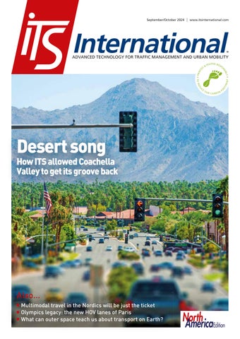
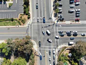
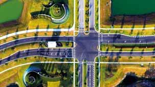
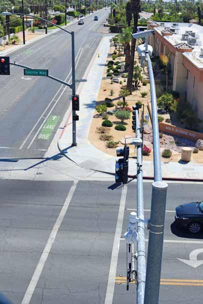
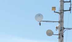
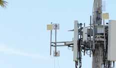
ITS allowed Coachella Valley to get its groove back
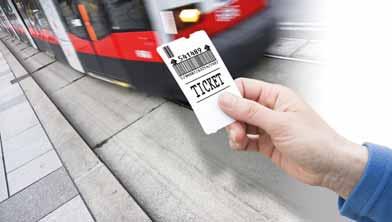
Multimodal travel in the Nordics will be just the ticket Olympics legacy: the new HOV lanes of Paris What can outer space teach us about transport on Earth?
Driving Road Safety and Security
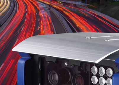
Jenoptik provides innovative and sustainable smart mobility technology and services.
As an end-to-end solution provider, we support our customers with the provision of roadside equipment and software, including integration and installation through to full-service operation. Our strong global presence and installation base is supported by a reliable partner network.
With innovation as our driving force, Jenoptik is a world-leading enabler for smart mobility, making roads, journeys and communities safer around the globe.
Follow us! jenoptik.com/markets/public-safety
COMMENT
NEWS DIGEST
CONTRACTS & DEALS
SUSTAINABLE TRAFFIC & TRAVEL MANAGEMENT
Why is making a multimodal travel plan between Nordic nations so difficult? No wonder planes and cars are so popular, says Søren Sørensen – but a new project means things may be about to change
SECURITY
As the ITS world becomes ever more connected, cybersecurity risks are increasing. Cisco experts Pete Kavanagh and Angela Murphy explain how to overcome key challenges
COACHELLA VALLEY
c management initiative aims to cut travel times and reduce emissions in one of California’s busiest regions: we talk to the engineers involved in the massive CV Sync
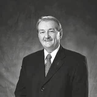
For two decades, Pat Jones has been executive director and CEO of IBTTA. As he approaches retirement at the end of this year, he looks back on a career spent ‘stretching and growing’
38
TRANSPORT PLANNING
What will transport systems look like in space settlements? And what can that tell us about transport now on Earth? Dimitris Milakis looks for answers in the stars
43
ENFORCEMENT
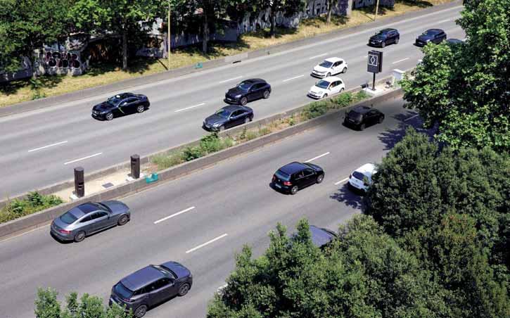
Olympics legacy: François Leblanc explains how Fareco won the race to put a new high-occupancy vehicle lane on the Paris Périphérique
46
AI IN TRANSPORTATION
Navigating the future of mobility means approaching AI as a powerful tool that, when wielded responsibly, can help us build transportation systems that truly serve people, says Alex Nesic
50
PRODUCTS & INNOVATIONS
Road users’ acceptance of advances in technology means the environment for a new electronic toll collection architecture is evolving. But
California’s beautiful Coachella Valley attracts visitors to myriad events, including the world famous music festival, which boasts headliners such as Lana del Rey, Doja Cat and Blur. Attended by a quarter of a million people over two weekends in April each year, it is an event which naturally strains surrounding road infrastructure. Many thousands more come to the region for sports tournaments such as the Indian Wells BNP Paribas Open, often called the ‘fifth Grand Slam’ of the tennis calendar, and golf’s Desert Classic.
This influx is part of the reason behind a highly-ambitious regional transportation infrastructure and technology project, called CV Sync. It aims to develop Coachella Valley as one of the largest smart regions in the US to improve transportation efficiency, cut traffic jams, boost road safety, enhance emergency preparedness and elevate environmental sustainability. In this issue, we talk to the traffic engineers involved in this massive undertaking. CV Sync is unusual not just
Editor
Adam Hill
Email: ahill@ropl.com
Tel: +44 1322 612062
Editorial Director
Geoff Hadwick
Email: ghadwick@ropl.com
Tel: +44 1322 612013
Sales Director
Dan Emmerson
Email: demmerson@ropl.com
Tel: +44 1322 612068
Sales Team
Graeme McQueen
Email: gmcqueen@ropl.com
Tel: +44 1322 612069
Production Manager
Nick Bond
Email: nbond@ropl.com
Tel: +44 1322 612066
Design Team
Simon Ward, Andy Taylder
Office Manager
Kelly Thompson
Email: kthompson@ropl.com
IT & Data Services
Director
James Howard
Email: jhoward@ropl.com
Tel: +44 1322 612070
Data & Marketing
Manager
Alan Cansick
Email: acansick@ropl.com
Tel: +44 1322 612061
“
We never tire of saying that ITS has to be about outcomes
for the technology it uses, but for the collaboration it demonstrates, because information and expertise has had to be shared between cities and companies in order to create multi-jurisdictional smart intersections, smart corridors and a robust broadband communication network across the region. That work is ongoing.
Our 10-page ITS Project Analysis: Coachella Valley starts on p20. And we will have more such analyses from around the world in future issues: there are so many deployments of intelligent transportation technology going on at the moment, and we want to make sure they get the attention they deserve. If there’s a project you think we should be highlighting, message me directly.
We never tire of saying that ITS has to be about outcomes. True, ITS technology is, in and of itself, a thing of wonder – but
it needs to serve a purpose. Thanks to the work of the traffic engineers and the companies behind CV Sync, the revellers and the festival goers may find their route smooth and their way surprisingly clear to the Empire Polo Club in Indio, next April. Not that they’ll know why. But we’ll know who Coachella’s real headliner is. ITS
Web Manager
Sarah Biswell
Email: sbiswell@ropl.com
Tel: +44 1322 612078
Publisher/
Managing Director
Andrew Barriball
Email: abarriball@ropl.com
Tel: +44 1322 612057
CEO
Roger Adshead
Email: radshead@ropl.com
Printed by Warners (Midlands) PLC
ITS International, USPS 13324, is published 6 times a year (January/February, March/April, May/June, July/August, September/October and November/December) by Route One Publishing Ltd, Second Floor, West Hill House, West Hill, Dartford, Kent, DA1 2EU, UK.
Airfreight and mailing in the USA by agent named World Container Inc., c/o BBT 150- 15, 183rd St, Jamaica, NY 11413, USA. Periodicals postage paid at Brooklyn, NY 11256.
POSTMASTER: Send address changes to ITS International, World Container Inc., c/o BBT 150-15, 183rd St, Jamaica, NY 11413, USA.
Air Business Ltd is acting as our mailing agent.
Subscription records are maintained at Route One Publishing Ltd, Second Floor, West Hill House, West Hill, Dartford, Kent, DA1 2EU, UK.
All editorial, advertising or circulation enquiries to:
ITS International, Second Floor, West Hill House, West Hill, Dartford, Kent, DA1 2EU, UK.
No part of the publication may be reproduced in any form whatsoever without the express permission of the publishers. Views expressed in this journal do not necessarily reflect the opinion of the Editor or Route One Publishing Ltd.
Reader Enquiry Service: data@ropl.com
Tel: +44 1322 612061
Subscription Enquiries: subs@ropl.com
Global: Print ISSN 1463-6344
Kistler goes big on WiM in smallest US state
Kistler is to install what it says is the largest digital Weigh In Motion site in the world, with 40 Lineas digital quartz company is working for Rhode Island Department of Transportation to protect the structural health of Washington Bridge in the city of Providence. Rhode Island is the smallest state by area in the US. Currently, the north span of the Washington Bridge is being removed and a new span is planned. To keep
were added to the south span.
ITS sector 'working hard to reduce disadvantage'
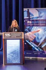
ITS technology has the power to improve inclusivity, says ITS Australia president Silje Troseth. Speaking about the ITS Australia Summit in Sydney, she said several presentations demonstrated
Summit also emphasised the importance of the next generation of transportation professionals, with the hosting of the inaugural Careers Expo: students from three leading NSW universities— University of Sydney, UTS, and UNSW
Sydney—joined delegates on the
May Mobility brings AV to Peachtree Corners
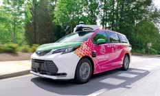
On-demand ride-share specialist May Mobility has deployed an autonomous vehicle in the US state of Georgia for
Drone pics are 'golden nugget' for
capital of Mongolia, to develop and implement a road-crash data-management system. The World Health Organisation says the country's mortality
is 12 per 100,000 inhabitantsmore than twice the European
100,000. WHO says road crashes represent one of the main causes of death in Mongolia, especially among young men. In Ulaanbaatar, home to 1.6 million people, TRL will work with the
establish an integrated roadcrash data-management system.
3rd Asecap Sustainability Forum looks to green future in Dublin
with Curiosity Lab at Peachtree Corners and 5G provider T-Mobile, the AV specialist will operate - with a safety attendant - an autonomous Toyota Sienna Autono-MaaS to demonstrate the technology to visitors at Curiosity Lab. The service, which takes four passengers at a time, will open to the general public after 7 October, with eight stops along Technology Parkway, running Monday to Friday from 8am-4pm.
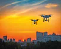
Coventry City Council in the UK is working with consultancy Vesos, drone operator Skyfarer and Haas Alert to see how
response to an automated eCall from a vehicle involved in an incident. Once an eCall alert
the location and transmits live pictures to emergency services and the local transport control centre. Responders can then decide what resources to deploy based on what they see, as well as the data from the vehicle.
TRL wins crash data management deal
TRL has won a two-year contract with the Governor’s
The future of sustainable transport is not just a goal - it's a necessity, says European tolling organisation Asecap, ahead of its 3rd Sustainability Forum, to be held in Dublin on 26 November 2024. All aspects of ‘going green’ will be discussed in the Irish capital: how to encourage the development
of new mobility options; how to attract private investors and stakeholders; policy and vision to promote new mobility solutions; use of motorways to sustain mass public transport such as bus rapid transit, carpooling and car sharing; as well as access to alternative fuels.
mobility platform to communities in the US Midwest, including installations in the states of Wisconsin, Illinois and Indiana. through the cloud and supports data-driven planning decisions with the goal of optimised mobility. By using a combination of networks to change the signal lights in real time based on
Datik buy is real-time move for Optibus
Public transit scheduling specialist Optibus has bought Datik, a transport tech company based in San Sebastian, Spain. Datik will collaborate with Optibus’ R&D and product teams on the development and launch of B2B and B2G SaaS products in passenger information, control and monitoring, safety and operations. Datik's predictive, real-time technology is designed to prevent vehicle collisions, enhance service frequency and on-time performance, reducing passenger wait times and service disruptions. By integrating Datik’s data sets into Optibus’ software platform, Optibus says the capability of its AI to predict operational and service outcomes will be enhanced.
Mercedes goes with Haas Alert's Safety Cloud
Haas Alert's Safety Cloud solution is now part of MercedesBenz's Emergency Vehicle Alert Beta testing initiative. The car maker’s US-based technology 'Car-to-X' programme is exploring how to improve a driver’s ability to react to emergency services vehicles. Vehicle to Everything (V2X) safety expert Haas Alert’s Safety Cloud platform provides warnings to drivers: as soon as participating emergency vehicles activate their warning lights, a signal is received by the Mercedes Carto-X cloud platform. Depending on the number of incidents nearby, the system monitors an area around the vehicle between 3km and 9km.
SSI helps 'digital transformation' of Dominican Republic tolling
Star Systems International (SSI) is cooperating with local partners in the upgrade of tolling systems in the Dominican Republic. RD Vial, which manages the toll system in the Caribbean country, recently announced it was implementing a digital transformation of its operation, replacing outdated equipment with new readers and transponders/ tags from SSI. “Using the Paso Rápido transponder and on major highways is greatly enhanced," says Keither de la Cruz, technology advisor and innovation project manager at RD Vial. "This reduces travel time and improves traveller experience across the Dominican Republic.”
AV software specialist Oxa acquires StreetDrone
Self-driving vehicle software provider Oxa has bought develops and deploys autonomous technology for the movement of goods in ports and logistics hubs. Oxa says StreetDrone's "expertise in industrial logistics, and proven drive-by-wire, vehicle integration and teleoperation technologies” complement Oxa's self-driving software platform. “StreetDrone joining Oxa marks another leap forward for us as we continue to build the world’s most comprehensive self-driving software platform," said Gavin Jackson, CEO of Oxa. “StreetDrone's technology and capabilities will accelerate our and repeatable self-driving solutions across a wide range of industries.”
Emovis Qualify, with VíasChile, which manages 412km of roads across four concessions in the Metropolitan and Valparaíso regions of Chile, South America. The OBO is designed to improve the productivity of electronic transaction processing and the quality of data obtained in toll gantries. It will be used on Autopista Central, the urban highway crossing capital Santiago through two high-speed express lanes. “Our OBO is designed with a high degree of automation to manage very high volumes of data,” says Christian Barrientos, CEO of Abertis Mobility Services.
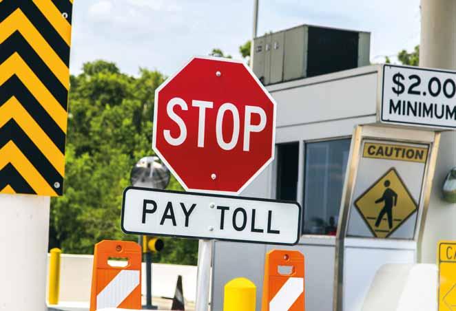
Ticket to ride
Why is making a multimodal travel plan between Nordic nations so difficult? No wonder planes and cars are so popular, says Søren Sørensen – but a new project means things may be about to change
The Nemu (Nordic Ecosystem Mobility Unlimited) project consortium has received funding from Nordic Innovation to further seamless, integrated and people-centric mobility in the Nordic countries. The three-year project will use open mobility data to allow planning, booking, payment and navigation of multimodal journeys across regional and national borders – with key partners Entur (Norway), Matkahuolto (Finland), SFMCON (Denmark) and Nordic+ (a collaboration between Nordic ITS organisations). Nemu will be the first major user of open mobility data sourced through multiple national access points (NAPs). The ambition is to showcase how Nordic mobility companies and other public and private stakeholders can share data to optimise operations and support a more climate-efficient and profitable mobility sector in the Nordics and beyond.
The Nemu project
Today, we can navigate the world by air travel using one travel agency app including booking, ticketing and payment in the currency we prefer. We can also navigate from anywhere to anywhere, even across borders using the built-in GPS in a car or on an app. But if we want to use more sustainable and shared mobility on land or sea, there aren’t any easy, end-to-end, digital planning, purchase and navigation services available that can compete with the borderless navigation
using the car’s GPS. We must rely on our own skills and abilities - and plenty of timeto figure out how to get a ticket, book a ride or - even more difficult - make and navigate a multimodal travel plan. No wonder that the use of the car and air travel is increasingly popular.
The European Union is addressing the lack of Europe-wide multimodal planning and navigation through the Multimodal Travel Information Services (MMTIS) regulation which calls for access to open mobility data from all modalities through NAPs. Shortly, the booking and payment of mobility services through Mobility as a Service (MaaS) agents will be governed by the EU regulation known as Multimodal Digital Mobility Services (MDMS). The NAPs are beginning to get populated with open mobility data, but the true value of the MMTIS and MDMS regulation will first be recognised when MaaS providers actually use the data. While regional and national MaaS implementations may be facilitated both by public and private actors, it is unclear how cross-border MaaS schemes will evolve. The Nemu project is poised to address the challenges for more sustainable, shared, seamless, borderless mobility in the
Nordics through a Living Lab with real travellers.
Open trip planner
The open trip planner for the Nordics is designed to find optimal multimodal travel plans – even across borders – in a single travel planner service. Travel plan suggestions include pricing between any two addresses in the Nordics. It consolidates NeTEx and Siri open mobility data from NAPs in Norway, Sweden, Denmark and Finland. It will be an open service for MaaS providers.
Seamless mobility across borders in the Nordics and beyond is an important part of the EU single market both for commuting and for business travel and leisure/tourism. While it is easy to use a private car or air travel to cross borders in the Nordic region, the use of digital planning and navigation of other land or sea-based mobility modes is very fragmented and within national borders. The Nemu project will focus on how to seamlessly bridge national borders through a single digital service using shared and more
sustainable mobility choices. The project is, by nature, transnational. It aims at validating the use of open mobility data from several NAPs in the Nordic countries to deliver multimodal, multinational travel information services of real value to citizens in the region. To support cross-border multimodal travel planning, a travel planning service supporting the whole Nordics will be made available to the project by Entur. The Nordic travel planner can be used to plan multimodal trips between any addresses in the Nordics including pricing using NeTEx data from NAPs. The project shall formulate a strategy for how to facilitate third-party booking, seat reservations, payment, ticketing and validation of multimodal trips from one MaaS agent in one go. The strategy shall look towards the preparatory work for the MDMS regulation for how to standardise third-party booking, validation and payment of multimodal, cross-border travel plans.
The strategies formulated will allow crossborder multimodal discovery, planning, booking, payment and navigation in one go for:
1.The Oslo-Gothenburg, Malmö, Copenhagen corridor (train & bus as minimum)
2.The Helsinki – Stockholm – Oslo corridor (train, bus & ferry)
The benefits for long-distance travellers are that it will be easier to discover and plan multimodal cross-border journeys. And a single commuter ticket for multimodal travel will make cross-border commutes seamless. It is the ambition for the project that the established MaaS services will expand into viable commercial operation and create first benchmarks on how open mobility data can be used to make use of sustainable multimodal travel - accessible to all - without prior knowledge of regional (or other countries’) public transport systems and ticketing methods.
During the project, travel patterns in the two cross-border corridors will be analysed before and during the intervention. The programme is navigating unchartered territory and is likely to find problem areas which will need further exploration and innovation. Nordic+ open mobility rig will closely monitor progress on the project and prepare further proposals to fulfil the ambitions of enabling use of sustainable ground and sea mobility options between any two addresses throughout all Nordic countries.
While the Nordics are the home of good rail and road infrastructure and a wide variety of shared mobility options, there are no digital services that will support travel planning across national borders in the Nordics. The Nemu project will be pioneering the value of use and combination of
open mobility data through NAPs to make it possible to roam around in the whole Nordic region just as easily as we are used to doing in our home regions.
How will this create something unique?
The Nemu project will create the first fullyfledged multimodal, cross-border mobility service in the Nordics – and Europe. The service will use open mobility data distributed through the National Access Points from several Nordic countries and follows up on the emerging EU mobility directives. The most significant innovation is the ability to plan, book and pay for mobility in and between Nordic countries in a single service using native languages, paid in one go in the home country’s currency. In fact, planning of cross-border multimodal journeys will go from hours of hard labour to a few minutes of easy planning - and fully compete with the booking of air travel or using a car and GPS navigation. ITS
ABOUT THE AUTHOR:
Smart mobility consultant Søren Sørensen is part of the Nordic+ team representing ITSDanmark - where he is chairman of the board – and he is Nemu project manager
Background to the Nemu project
The Nemu project was initiated by Nordic+ as a follow-up action after the Nomad project. (Nordic+ was established during the lifespan of Nomad and constitutes the same stakeholders: all the ITS associations in the Nordics including Estonia). The Nemu project uses the findings and results of Nomad
- listed as a minimum number of criteria that need to be in place to make crossborder multimodal MaaS and roaming work – as a platform:
• A shared understanding of the MaaS concept and societal goals (including the joint Nordic Vision 2030)
• Sharing of data in a free, standardised and unbiased way
• Clearing-house functions for both private and public transport providers
• Fair models for cost and revenue sharing for all transport providers
ity operations (including the Odin project’s work on NAP and mobility operations)
• Adoption of local currencies and language
• Borders, concession areas and other boundaries should not limit transport operations
• A responsible unit/authority for crossborder and cross-boundary mobility in the Nordics
- this might include the sharing of public subsidies with private transport providers
• Standards for the exchange of data, organisational aspects, and mobil-
Nemu: who's who?
The first six bullet points will be addressed directly in Nemu and will certainly help solve the last two. In addition to the Nomad results and findings, Nordic+ will serve as a network with access to a community of mobility entities and experts – and with the capacity to run projects, demonstration and pilots. Nordic+ is a purpose-driven innovation ecosystem, also known as a rig. The Nemu project is seen as the first step as part of a larger picture/evolution towards seamless sustainable multimodal mobility throughout the Nordics - also known as MaaS roaming.
Nordic+ is a network of Nordic and Baltic ITS associations which share a vision of connected and sustainable mobility, reachable for all user groups across regions from cities to rural areas. The network contains more than 300 companies, startups, authorities, academia and research organisations throughout the region. They have a track record of stimulating innovation, advancing connected and sustainable mobility in the Nordics – as evidenced in the Nomad project. Nordic+ is the project owner for the Nemu project.
Entur is owned by the Norwegian Ministry of Transport and is intended to offer basic public transport services within travel planning and ticketing on competition-neutral terms. Entur is leading the use of open-source data to provide easy access to information about multimodal travel options, including purchase of combined tickets in Norway. In the Nemu project, Entur is the main driver for adherence to standards and pioneering how to facilitate sales of cross-border multimodal journeys in one go.
Matkahuolto is a private Finnish public transport service provider, focusing on sustainable mobility services, tickets and timetables. Matkahuolto acts as a MaaS agent selling own- and third-party mobility services in Finland – where the MaaS market is open by law. Through the Nemu project, Matkahuolto will use the same approach as Entur as far as possible to demonstrate the value of using the same standards and open-source components to deliver good services to end users.
SFMCON is a Danish company which helps mobility scheme stakeholders create integrated and smart MaaS solutions, allowing seamless journeys from A to B, combining use of both public- and private-operated shared vehicles. SFMCON delivers the technical lead role of the Nemu project.
Data is crucial for multimodal travel
• Network with industry leaders, policymakers, and innovators from across the Americas.
• Discover the latest technologies and strategies to address pressing urban mobility challenges.
• Learn how cities have successfully implemented sustainable transportation systems.
• Participate in discussions to influence future transportation policies and regulations.
• Position your organization as a leader in sustainable transportation and urban development.
As the ITS world becomes ever more connected, cybersecurity risks are increasing. Cisco experts Pete Kavanagh and Angela Murphy explain how to overcome key challenges
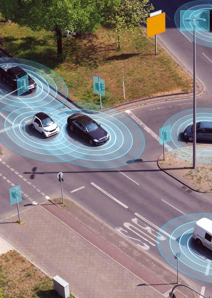
With the value of highway and street construction in the US expected to grow to $175 billion in 2028, and a draft US Department of Transportation Vehicle to Everything (V2X) deployment plan being deployed in 40% of the nation’s intersections by 2029, developing a strong foundation for digitisation of roadways infrastructure is a more urgent priority than ever. With increased digitisation, reducing cyber risks is essential, as recently highlighted by the World Economic Forum.
Ensuring the cybersecurity of ITS equipment is crucial, as cyber-attacks can have widespread consequences, affecting public
USDoT wants V2X to be deployed in 40% of US intersections by 2029
safety and economic stability. This is a major concern for departments of transportation (DoTs), cities, and roadway operators as they plan digitisation programmes to enhance safety, improve traffic flow, and address sustainability and climate change goals.
Cybersecurity encompasses many aspects, from the physical security of the roadside cabinet and the equipment inside, right through to the security of applications such as those controlling the phases of a traffic signal to prioritise emergency vehicles, for example. However, there are many challenges faced by operators as they tackle issues such as:
• Challenges in connecting large numbers of roadside systems across wide geographic areas, compounded by a shortage of skilled labour.
• The lack of a detailed and up-to-date inventory of connected systems.
• Challenges in managing and enforcing unified security policies across all sites.
• Limited physical space in cabinets and at the roadside to deploy additional hardware appliances to deliver cybersecurity capabilities.
Cisco works with roadways operators around the globe, many of whom have shared experiences concerning cyber incidents that have already happened. However, many of them have been aware of ongoing exposure of the network that supports their ITS systems, primarily due to bad practices and non-optimal network designs.
In our conversations with DoTs and roadways operators, five clear steps have emerged to reduce cyber risks for connected ITS equipment and address challenges that they face.
Step 1: Secure, reliable and resilient connectivity is a must
Connecting numerous ITS systems across both urban and rural areas requires enterprise-grade performance, security and industrial-strength reliability. Highperformance ruggedised switches, cellular routers, and wireless access points are essential to meet the connectivity needs of large, diverse geographic areas.
Because there is a need to support various types of cellular connectivity across the network, it is important to be able to change WAN interfaces on routers without changing entire devices. This ensures that the routers can easily adapt to changes in available connectivity, and as they provide access to the network, they also need to be firewalls to protect critical roadside equipment.
Key capabilities include:
• Next-generation firewall (NGFW) with application awareness to filter traffic in real time and identify and control applications.
• Intrusion detection and prevention (IDS/ IPS) to identify and block known threats and malicious activities.
• Advanced malware protection to iden tify and block both known and unknown threats from malicious files.
• URL filtering to block or allow users to access URLs based on allowed or block lists, reputation or web categories.
• DNS security to prevent infected assets from contacting malicious servers.
• Centralised management to unify security policies and simplify securing ITS equipment at roadsides and intersections at scale.
Step 2: Understand what ITS equip ment is connected
Securing roadways infrastructure begins with having a detailed understanding of what is connected to the network, developing an inventory, and making sure that inventory is continually updated: detailed information, including specifics such as device types, vendor details, serial numbers, software versions and more. Clearly, maintaining this information manually would be prohibitively labour-intensive and error-prone, and so this
step needs to be automated. The inventory provides the necessary information to build effective security policies into IT security tools, and drive compliance with security regulations.
Step 3: Take a zero-trust approach
Zero-trust is a crucial security principle in enterprise IT and extends to the world of connected ITS equipment. Essentially, zero-trust security ensures that no device is trusted to connect to a network by default, either from inside or outside an organisation. Verification is required for any device connecting to the network. Only specific devices should be granted access to the ITS network, and all other devices denied access by default. This approach blocks unauthorised access and must be built into networking equipment to protect infrastructure. But it doesn’t stop there. Additionally, zero-trust principles continuously monitor communications to verify trust and isolate compromised equipment.
Step 4: Enforce trust through network segmentation
Once a device has been granted access, roadways operators need to ensure that it communicates only with the resources it needs to in order to do its job, to reduce the risk if a system is compromised. Segmentation of the network controls how traffic flows between different parts. For example, network segmentation can separate surveillance cameras from traffic signal controllers. It can also prevent systems installed at intersection X communicating with those installed at intersection Y. This stops malicious traffic from moving between systems and helps to curb the impact of a breach.
Step 5: Enable easy-to-use secure remote access
ITS equipment is distributed across every city, region and country. Enabling remote access for troubleshooting and upgrades is key to reducing operational costs and the knock-on effects of outages on congestion and road user safety. Whether traffic operations teams need to grant access to third parties or make it simple for their own technicians to manage connected equipment, they need a remote-access solution that’s easy to implement and highly secure.
Roadways operators are starting to deploy Zero Trust Network Access (ZTNA) solutions to simplify the remote-access workflow. To simplify processes, remote users should be able to log into a single portal where access policies are defined and enforced for the entire infrastructure, making it easy to control access and define credentials to address emergency situations. The portal should then communicate with routers and switches in the infrastructure to ensure that remote users are only granted access to selected equipment which they need to configure, not to the entire network.
Fitting everything into the roadside cabinet
In roadside cabinets, there is often little space to install equipment. This means that network devices need to be small enough to fit into limited space and easy to install at every location. The security capabilities outlined in steps 1-5 should be built into the network devices themselves, as there is limited space for hardware within the cabinets, and maintenance costs need to be minimised.
ITS connectivity is ramping up to address emerging use cases like vulnerable road user safety
> Non-intrusive system including high positioning tolerance
> Decoy function to strengthen the deterrent and educational effect on users
> Stationary solution for enforcement of multiple road traffic offences
> Smart traffic enforcement through 3D-LiDAR technology
Reaching our destination
Even though most in the industry recognise that physical security for ITS systems is limited and creates risk, connecting ITS devices directly to the public internet is the primary cause of exposure when it comes to cybersecurity. Earlier solutions consisted of data networks with limited or no segmentation, often directly exposed to the public internet and with little or no consideration for cybersecurity.
As density of ITS connectivity ramps up to address emerging use cases like connected and autonomous vehicles and vulnerable road user safety, the risk also increases almost exponentially, unless modern data networking and security best practices are adopted.
Achieving the goals of digital innovation in connected roadways and intersections requires a strong technical foundation. As we have illustrated, connecting roadside equipment needs a solution that combines strong advanced cybersecurity capabilities with small form factor networking devices that can fit into a roadside cabinet and withstand the extreme environmental conditions at roadsides and intersections. To deliver the scale necessary to support huge numbers of intersections and systems, centralised management is key to simplify network
deployment and unify security policies across the ITS infrastructure, so that there is no gap in defence.
Tried and tested, validated solutions for connected roadways and intersections are available today. Designed around small form factor ruggedised routers and switches with built-in cybersecurity capabilities, these reference architectures are optimised to enhance ITS cyber-resilience.
Modern solutions reduce cyber risks and provide a scalable foundation to pave the way for new innovations like C/AVs, enhancing safety, improving traffic flow and delivering a more sustainable future.
Start your journey to secure ITS
As we have explored in this article, key steps to achieving successful outcomes come down to adhering to a core set of key principles:
• Securely connect your ITS equipment using high-performance, resilient connectivity which includes firewall protection.
• Understand what is connected to the network with a detailed inventory and ensure that it is continually updated.
• Enforce zero-trust so that no unverified device can gain access to your network.
• Provide secure remote access to ensure that only trusted individuals can access equipment for troubleshooting and upgrades.
• Network devices, which include the above security capabilities need to be ruggedised to withstand the environmental conditions at the roadside and intersection and must be able to fit into constrained spaces.
• Centralised management capabilities are required to provide control of security policies at scale across the network.
A Cisco webinar on 23 October 2024, called Shielding the Future: Defending ITS and Roadways from Cyber Threats, further explores these themes. ITS
Content produced in association with Cisco
• Segment your network to control which systems can communicate with each other.
Cybersecurity includes security of applications such as those controlling the phases of a traffic signal
ABOUT THE AUTHOR: Pete Kavanagh is principal architect, roadways solutions, and Angela Murphy is senior global product marketing manager for Cisco Industrial IoT
mccain.swarco.com Discover SWARCO McCain’s legacy of innovative Intelligent Transportation Solutions, including Traffic Management Software, ATC Controllers, Dynamic Message Signs, and our versatile and dependable ATC Cabinets.
SWARCO McCain
Change is in the air
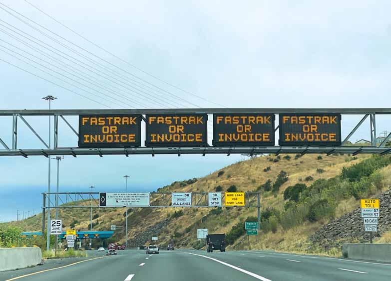
Trends in technology plus users’ comfort in adopting new advances indicate that the environment for a new electronic toll collection architecture is evolving. Hal Worrall considers what this might look like
The electronic toll collection (ETC) development in the 1990s resulted from the necessity to collect revenue more quickly and more closely balance roadway capacity with toll collection capacity. It also increased usage and revenue as customers no longer had to stop to pay a toll. For some agencies, it was a mission-critical event. Traffic flow that was inhibited by manual toll collection could process 400-500 vehicles per hour while open lanes could move traffic at 1,800-2,000 vehicles per hour. Traffic backlogs in peak hours were common. Though the technology risk was considerable, ETC was a task of necessity.
The first ETC developers in the US were mostly large defence contractors attempting to apply their superior technical skills to domestic projects since defence spending was reducing. They joined with small regional companies who possessed considerable knowledge of the toll collection process and in some cases the two joined to create corporations that would come to be known as ‘toll integrators’.
The development of ETC was, of necessity, based on the technology
The current ETC infrastructure will not - and should not - be expected to change without a plan for transition “ “
available at the time. From 1990 to today, computer clock speeds, data transmission capacities and storage capacity have altered radically. The first Intel P5 Pentium CPUs were introduced in 1993 with 60 MHz speed; today’s desktops are commonly 2.5-3.5 Ghz. Internet access in the early 1990s occurred over telephone lines and in 1993 the fastest available modem was capable of transferring data at 14.4 kilobits per second (Kbps). Not until 1998 did 56 Kbps capabilities arrive. Today’s telephonic speeds are capable of 5 Gbps and fibre optics at 100 Gbps. Storage capacities were another limitation in ETC design. In 1990, a ‘normal’ hard drive held 40 megabytes and by the mid-1990s, the typical hard disk drive for a PC had a capacity of 500 megabytes to 1 gigabyte. Today, cloud storage offers unlimited capacity. Defining an ETC architecture in today’s technological environment will result in a very different design.
Today we think of ETC as predominantly all-electronic toll collection (AETC) but in the 1990s the introduction of ETC had to be transitioned from automatic coin machines (ACM) and manual lanes (ML). In some cases, lanes were capable of accepting ACM/ETC and ML/ETCand all requiring gate arms to ensure toll operators suffered no loss of revenue. Gates were not removed until toll operators were convinced through testing that automatic licence plate readers (ALPR) and optical character recognition (OCR) could meet prescribed performance standards.
Over the following three-plus decades of ETC, systems have been continually improved with new cameras, new software, faster lane servers, much greater transmission bandwidth, cloud computing, and now artificial intelligence (AI). ETC systems have been incrementally and significantly improved but not until recently has a re-envisioning of ETC system architecture begun. Instead of starting with the traditional system architecture, a new concept of ETC is being developed based on today’s advanced technological tools.
A new architecture
Today’s ETC architecture can be defined by starting with the goals of an ETC system rather than accepting the historical methods, hardware, software
and procedures that evolved incrementally. Rather than accepting the existing definition of what composes an ETC system, today’s ETC system designs can incorporate technological tools that have never been used, or existing tools that have advanced so significantly that they can be applied in new ways.
For example, radio frequency identification (RFID) technology came to ETC from the use of transponders to track livestock. One of the early companies in the US ETC space was Amtech, an acronym for Animal Management Technology - a spinoff from Los Alamos National Laboratory. RFID became an accepted method for identifying a vehicle. As toll integrators developed RFID technology standards suitable for their unique ETC solutions, toll operators were faced with the challenge of interoperability. The issue gained enough significance that the US Congress began to push legislatively for a resolution.
Imagine an ETC system with the capability to collect video and static image data, beyond licence plates, to identify vehicles based on unique vehicle characteristics. Much like facial images are relied upon today to clear customs when travelling internationally, vehicle identification can be performed reliably. Once a vehicle is identified the first time, it will be recognised on subsequent occasions even if the licence plate is obstructed. Such a process significantly reduces image review costs.
Advanced ETC systems track vehicles
Many current toll customers are satisfied with the use of transponders for processing toll payment and will likely continue to do so for some time to come “ “
through tolling points and between tolling points making them particularly useful for road user charging proposals such as interstate tolling. Additionally, and perhaps most importantly, all video and static data is processed in the lane instantly by hardware graphic processors and the data is combined into one transaction data set. Rather than transmitting voluminous graphic data, the lane transmission is a consolidated dataset, stored in a cloud system that can be accessed from a broad range of perspectives. Lane data becomes available in real time rather than days or weeks later. The development of today’s ETC is focused on data collection, data processing and information access, rather than starting with existing application architecture.
Procurement of ETC
Today’s procurement process is designed to support an application approach. Today’s requests for proposals (RFP) contain detailed system requirements that assume accepted system architecture.
They presume RFID, licence plate cameras, axle count mechanisms and lane controllers, etc. All of these devices are given required performance standards and an overall system set of performance standards are defined. It is up to the integrator to select hardware and software components in order to meet the system requirements.
Architecture-specific RFPs are prepared by staff and consultants with knowledge of system components, software and procedures used in a traditional architecture. The process restricts the potential to consider alternative approaches, and results in voluminous responses - all of which must be evaluated and scored for selection. It is a complex, meticulous process of procurement that leads to a lengthy development with multiple unit and system tests. Conflicts between vendors - and between vendors and agencies - sometimes lead to less than satisfactory results.
Rather than beginning with the requirements of a project that assume the current architecture of an ETC system, an RFP could start with the goals of the project. Integrators, who feel they can meet the goals of an RFP, should be given the opportunity to demonstrate their performance through rigorous performance testing before finalising a request for proposal. Consultants could develop the performance-test process and administer it. Once major components of the system have been tested and test results shared, RFPs could be constructed that specified the best technologies to be used.
RFPs also typically contain experience requirements that limit the introduction of new technology. Years of experience in developing traditional ETC systems has become the standard for RFP preparation. Of course, agencies must be assured that revenue will be accurately collected and proposers should have the ability to bond performance. Bonding can, however, be a limiting factor to innovation.
The future of ETC
Future roadside ETC systems are starting to become available and are being installed on a pilot-testing basis. These systems do not require RFID, inductance loops or expensive gantries and offer much lower levels of maintenance to meet performance standards for accurately collecting toll revenue. Instead of years to install, these new technology systems can be installed in much shorter time frames. The core technology is static and dynamic visual data stored in easily accessible and scalable cloud storage.
A fully-functioning ETC system will also communicate with the road user and offer a quick and easy method of registering and providing payment information. The smartphone has become a major payment method for many types of financial transactions and offers multiple methods of immediate communication and record keeping. Smartphones have
Traffic flow was inhibited by manual toll collection
been used in various applications for ETC payment but are interfaced to traditional ETC systems and processes rather than integrated in the design.
If the primary interaction with the customer becomes the responsibility of a service firm, toll operators may become
concerned with how customers might be served. Because toll operators are vigilant about customer service, regulation of service-firm payment processes and communications will be essential.
Rather than communications based on paper and voice, the capabilities of
the smartphone offer an opportunity to quickly and easily register and pay tolls. Smartphone payment is becoming not only common but preferred by many consumers. Currently, there are 310 million smartphone users in the US, a 96% market penetration. Rarely is a smartphone offered for purchase
Intersection-level performance insights without connectivity
The new set of probe data-based performance metrics within ClearGuide® helps agencies reduce congestion by monitoring traffic signal performance and identifying deterioration at the intersection, without reliance on infrastructure.
without a pre-installed payment application. Further, approximately 115 million (or 43%) of US smartphone owners used proximity mobile payments in 2023 - up 24.4% from 2020. This technology is ripe for processing toll payments and texting could conveniently communicate payment information to customers, even on a real-time basis.
ETC technology development and implementation
New technology
New approaches to ETC are beginning to become available. The Central Florida Expressway has installed a roadside system developed by TollScopic that will collect all of the data necessary to implement ETC. The solution is interfaced with RFID technology to support system transition and serves as an audit function for RFID. The system has been tested on a five-lane roadway in South Florida with daily traffic of 150,000 vehicles per day and has been shown to be extremely accurate. The system has many of the features mentioned before, including vehicle-recognition technology and real-time, in-lane processing on an Nvidia processor. ALPR technology is enhanced with AI capabilities and transaction data is transmitted and available in near-real time. It is a powerful tool, making it possible to identify vehicles by make, model and speed
and identifies licence plates by state as well as providing a video feed of lane activity. System scalability is not limited and can be easily interfaced with many system platforms.
For new Greenfield toll initiatives, such systems will be able to support large-scale tolling initiatives such as road user charging or Interstate tolling for significantly less cost in installation and operation and installed more quickly.
Implementation and transitioning ETC has been installed on nearly all toll roads in the US. The investment in equipment and software is huge and - as reported by US Department of Transportation - over 86 million electronic transponders have been distributed, as of March 2021. The number is likely close to 100 million today. Large expenditures have occurred for developing back-office systems to process payments and manage collection processes, and thousands of customer service representatives answer calls, send out invoices and manage ETC accounts. The current ETC infrastructure will not - and should not - be expected to change without a plan for transition.
Many current toll customers are satisfied with the use of transponders for processing toll payment and will likely continue to do so for some time to come.
A trend has, however, begun to develop in which customers prefer the use of licence plate reads if the toll payment amount is not significantly more than using a transponder. A review of toll operator annual reports reflects this trend.
Summary
Trends in technology and user comfort in adopting the technologies indicate an environment for a new ETC architecture is evolving. Toll equipment/software innovators are quickly developing solutions that allow for significantly less initial and ongoing operating cost of ETC. Similarly, toll operators are considering other technologies to reduce costs and improve customer service. The technologies are available and the acceptance of tolling as a funding mechanism for transportation infrastructure development will be affected by the development of these new ETC systems. ITS
ABOUT THE AUTHOR:
Hal Worrall is founder of Transportation Innovations, and is a former president of IBTTA and former chair of ITS America
Spoke, through VRU2X™ has expanded the use of C-V2X so that VRUs are seen by cars, and VRUs see the vehicles around them.
C-V2X enables Experience a demo video www.spokesafety.com
Extreme measures
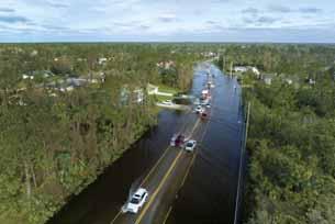
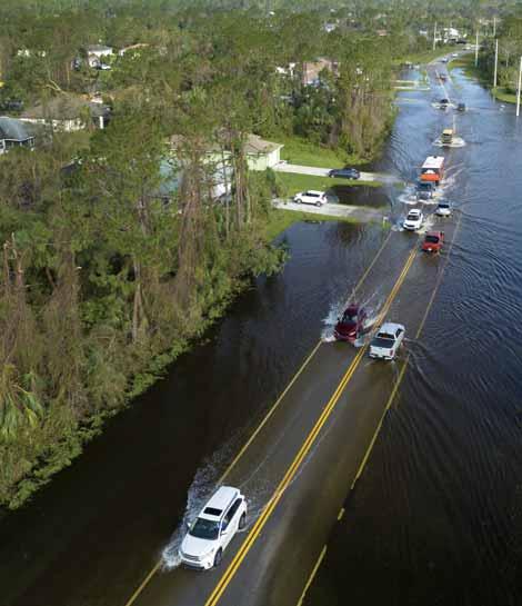
As hurricanes and floods in parts of the US wreak havoc, USDoT is re-emphasising the importance of sustainability and resilience in infrastructure and operations
September’s storms left a trail of destruction across half a dozen US states, with hundreds of people dead.
It comes after a series of extreme weather events – primarily involving heat, fires and flooding – which have bedevilled North America in recent years.
These incidents – with often dreadful consequences for life and property – are a stark reminder of why the US Department of Transportation (USDoT) is increasingly emphasising the importance of resilient, sustainable and accessible transportation systems in its work.
The organisation says it has been “working to integrate consideration of climate resilience and risk across transportation decision-making and to ensure that transportation investments incorporate evidence-based climate resilience measures or features”. It is already sponsoring the Center for Emissions Reduction, Resiliency and Climate Equity in Transportation,
announced earlier this year, which will be led by Rutgers University Center for Advanced Infrastructure and Transportation.
The Bipartisan Infrastructure Law has certainly allowed more money to be funnelled into projects which aim to mitigate the effects of climate change on
US infrastructure.
In April this year, USDoT awarded nearly $830m in grants through the Promoting Resilient Operations for Transformative, Efficient and Cost-saving Transportation (Protect) discretionary grant programme to state and local governments, Tribal Nations, and US territories. These were additional to the $7.3 billion in formula funding that goes directly to states to support transportation-system resilience to climate impacts, including flooding, sea-level rise, wildfires and extreme heat.
And USDoT’s Climate Adaptation Plan 2024-27, released in June, points out that USDoT’s interest in this is not new: the department’s Center for Climate Change and Environmental Forecasting (DoT Climate Change Center) was established in 1999, and the Federal Highways Administration started to issue reports on the potential impacts of climate change on transportation as early as 2002.
“More frequent and severe weather events year-round have lasting impacts on critical supply chains and Americans’ ability to safely travel,” USDoT says in a statement.
In the same breath, it highlights that the transportation sector is “responsible for more carbon pollution than any other sector of the US economy”.
This is quite a circle that needs squaring. Investment in ‘clean transit’ is one of the categories which come under the BidenHarris administration’s Justice40 initiative. For the first time in US history, Justice40 makes it a goal that 40% of the “overall benefits of certain Federal climate, clean energy, affordable and sustainable housing, and other investments flow to disadvantaged communities that are marginalised by underinvestment and overburdened by pollution”.
Building and expanding transportation systems “that reduce greenhouse gas emissions, are resilient to the impacts of climate change, and advance climate and environmental justice priorities” is one stated goal of the government. But to say the problem is complex would be a vast understatement. ITS
Climate and transportation
In summer, USDoT hosted a Climate and Transportation Symposium, bringing together climate champions from cities, states, and communities across the country to showcase climate solutions. It highlighted how USDoT
and stakeholders are implementing the US National Blueprint for Transportation Decarbonization, including creating more accessible and affordable mobility options. USDoT is also implementing the new $6.4 billion Carbon
Reduction Formula Program, established by the Bipartisan Infrastructure Law. Funding goes to projects which aim to reduce carbon emissions, including complete streets programmes, public transportation, and traffic management.
California’s Coachella Valley attracts visitors to myriad music and sports events. But now an ambitious traffic management initiative aims to cut travel times and reduce emissions. Adam Hill talks to the engineers involved in the massive CV Sync project
Coachella Valley in California is home to beautiful desert scenery, is the location of one of the world’s best-known music festivals – and is also the nexus of some very busy roads.
But the latter part is changing, thanks to the introduction of a highly-ambitious regional transportation infrastructure and technology project. CV Sync, led by the Coachella Valley Association of Governments (CVAG), aims to develop Coachella Valley as one of the largest smart regions in the country to improve transportation efficiency, cut traffic jams, boost road safety, enhance emergency preparedness and elevate environmental sustainability. Quite a task, in other words.
Phase I of the mammoth project commenced in April 2021 - spanning three major regional roadways: Highway 111, Ramon Road and Washington Street - and was completed in June 2023. Phase II began in February 2023 and will conclude around November 2025. Phase III is currently under design.
Coordination and collaboration are at the heart of CV Sync. “The effort extends beyond the traditional Smart City concept, focusing on the developing multi-jurisdictional smart intersections, smart corridors, and a robust broadband communication network across the region,” explains Carlos A. Ortiz, Advantec Consulting Engineers CEO and consultant programme manager. “The primary goal of the project is to enhance the quality of life for residents and visitors by reducing congestion and minimising the adverse impacts of traffic throughout the Coachella Valley.”
‘Smart region’ focus
With its focus on creating a smart region equipped to integrate current and emerging multimodal transportation systems - as well as new technologies and smart mobility solutions - there is a huge number of moving parts at play: CV Sync requires the integration of hundreds of key transport elements, with transportation engineers and construction teams leveraging advanced ITS technology to drive development and implementation.
“This project upgrades legacy traffic signal controllers, traffic management systems and communication networks to enable interagency traffic signal synchronisation across the region,” says Ortiz.
Advantec was chosen by CVAG in August 2015 to provide planning, design, construction support, and development of signal timing and synchronisation plans for the project. The company developed the Regionwide ITS/Smart Region Master Plan, a tool that helps prepare CVAG and local agencies for emerging transportation technologies.
The company has designed a regionwide digital infrastructure, preparing final bid
documents for Phases I and II that included 24 major corridors, over 420 signalised intersections, more than 12,000 ITS elements and 21 software with cybersecurity and cloud services. ITS elements consist of open architecture and state-of-the-art 2070 and Nema ATC units with application programming interface, openly sharing management information bases at no cost to CVAG. There are also smart CCTV systems with analytics, cellular Vehicle to Everything (C-V2X) roadside units (RSUs), arterial performance measurement systems, changeable message signs (CMS), video/radar detection systems, weather sensors and secured ethernet fibre optic communications.
Phase III includes three corridors and 27 signalised intersections, and connectivity to Tribal Nations facilities, and to Acrisure Arena, the multi-purpose indoor venue in Palm Desert. Advantec is also supporting CVAG on its implementation of broadband communications in the Coachella Valley.
“CV Sync is a prime example of applying innovative concepts
to address transportation challenges,” says Ortiz. “The project features advanced technologies such as connected and automated vehicles, Big Data analytics, integrated corridor management, and Smart Cities initiatives. The implementation includes a complex network of nine traffic operation centres (TOCs) and one regional traffic management centre (RTMC), equipped with CCTV systems, Bluetooth/WiFi arterial management systems and enhanced detection systems for vehicles, pedestrians and cyclists. This innovative approach minimises the need for extensive roadway construction, focusing instead on leveraging technology to improve traffic flow and safety.”
Key players CVAG and Advantec formed a Transportation Systems Management and Operations (TSM&O) working group formed of CVAG staff, and county and cities employees, to provide education materials, facilitate project delivery, approval of regionwide technology standards, and development of the cooperative agreement.
CT West and Q-Free are two more key players in CV Sync. During the head-to-head technology assessment pilot project with other manufacturers, they were chosen as the sole provider of the STMP, R-ATMS, L-ATMS, ATC traffic controllers and Maxtime ic local controller software. CT West’s technical support team provided the timing conversions and on-site support for the ATC controllers. Currently, there are 372 signalised intersections deployed, or scheduled to be deployed, with the Q-Free ATC 2070LX or XN controllers during Phase I and Phase II.
“Q-Free has been a key technology partner and traffic software provider of choice on the project since the pilot in 2019,” says Whitney Nottage, senior EVP of operations, traffic management COO, Q-Free America. “Each of the nine participating agencies in the ‘smart region’ use our traffic signal controllers (2070LX, XN-1, and XN-2 controllers) and intersection control software (Maxtime ic)
Connecting this many agencies in a region has never been attempted and we're excited to have a major role in something that could set a standard for years to come
Whitney Nottage, Q-Free “
at the edge. In addition, each agency has the signal module of our Kinetic Mobility ATMS platform, Kinetic Signals, for the remote monitoring, control, and management of their traffic signal network.”
CVAG can connect to each agency’s Kinetic Signals system using centre-to-centre (C2C) communications enabled by their own deployment of Kinetic Mobility. CVAG has acquired several additional Kinetic Mobility modules in addition to signal management to allow for robust coordination of the region’s traffic network.
These additional modules and functions include:
• Events – detect, manage and respond to incidents or planned events
• Signs – centralise sign control management and messaging
• Video – end-to-end video management for improved situational awareness
• Travel time – view historical and real-time traffic data for journey times
• Counts – vehicle counts and classifications
• Corridors – automate corridor management and unify corridorwide device control
“ “
The field crews are completing their craft work in a high-quality manner; some days they experience temperatures up to 115 degrees F
Joseph P. Meidl Crosstown
Q-Free has supplied over 150 traffic signal controllers with another 350 more to be deployed over the next year, and 700 anticipated overall. The system aims to incorporate 132 signs, nearly 300 count stations, 12 weather stations, over 650 cameras, more than 350 travel-time end points and 275 RSUs.
“Connecting this many agencies in a region has never been attempted and we're excited to have a major role in something that could set a standard for years to come,” enthuses Nottage. “The unique architecture includes a hub-and-spoke C2C connection to the eight local agency systems to pull both local and regional assets into the regional TMC, providing the local agencies control over their signals for day-to-day operations while supplying the regional TMC with a comprehensive roadway ATMS across all
arterials and freeways for roadway operations during regionally significant events.”
Open standards and interoperability
Q-Free has worked with the various vendors across the region to integrate all the devices and systems into the Kinetic Mobility platform. “This includes various sign, camera, travel time, signal vendors and more,” Nottage says. “The project is a true testament to the power of collaboration, open standards and interoperability within our industry.”
There are yet more links in the CV Sync chain, explains Bill Brown, executive vice president of CT Group. “As the supplier of the STMP, R-ATMS, L-ATMS, and ATC controllers, CT West has worked closely with Crosstown Electrical & Data [prime contractor] and system integrator IndustrialEnet [iEnet] as well as all suppliers of ITS elements on the project. CT West is in the unique position of coordinating the implementation of the Q-Free Kinetic Mobility package with the other suppliers to make sure that project goals are met.”
Joseph P. Meidl, senior project manager with Crosstown, prime contractor of CV Sync, points out that the project covers major roadway corridors in an area of 675 square miles (1,728km). In addition to managing its own crews over that distance,
CV Sync covers major roadway corridors in an area of 675 square miles
Crosstown manages eight subcontractors and integrators – as well as iEnet and CT West, these are: MSL Electric, Ferreira Construction, Western Systems, Irvine Global Consulting, Iteris, Ontrack Scheduling and Maneri Traffic Control.
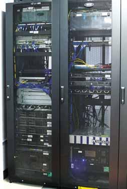
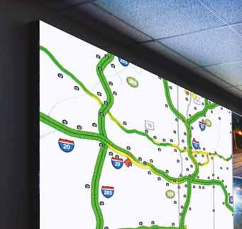
Crosstown manages, coordinates, and performs infrastructure construction (conduit, pull boxes), roadway and sidewalk restoration, installation of fibre optic and data cables, plus installation of Ethernet switches, traffic signal controllers, edge devices (such as CCTV cameras, C-V2X RSUs and changeable message signage). TMC and TOC construction and integration consists of Ethernet network hardware and software, such as Ethernet switches, servers, communication conversion devices, workstations and video walls.
Seamless connections
“The C-V2X connected vehicle system introduces smart road technology for the future,” says Meidl. “The installed RSUs seamlessly
What the CV Sync project involves
CV Sync includes nine traffic operation centres, one regional traffic management centre, connected and automated vehicles, Big Data, integrated corridor management, Mobility as a Service, Mobility on Demand and Smart City initiatives. Advantec’s work consisted of 35 major tasks including the development of the priority corridors evaluation, system engineering management plan, concept of operations and strategic deployment plan, system requirements, environmental, preliminary engineering, technology assessment and evaluation (including ITS, C/AV, and Smart Cities), systems integrator procurement and design, system implementation, traffic signal synchronisation, operations and maintenance. Improvements include:
connect vehicles to the infrastructure, playing a role in alleviating traffic congestion.”
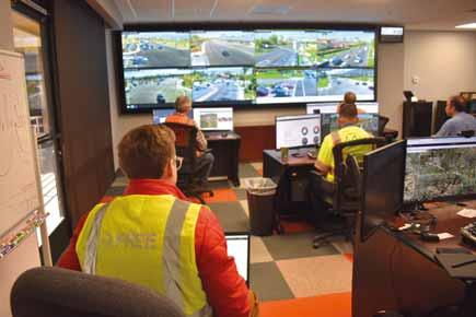
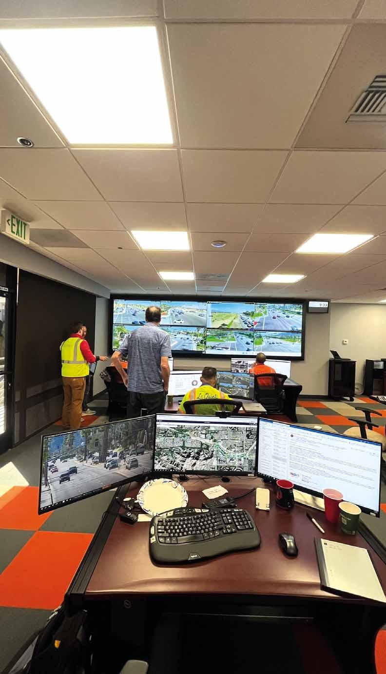
The fibre optic cable and radio backbone interconnects eight cities: Palm Springs, Cathedral City, Palm Desert, Indian Wells, La Quinta, Indio, Coachella and Desert Hot Springs. Two agencies are remotely connected (Caltrans and the County of Riverside). At each of the TOC facilities, operators or traffic signal technicians have the ability to monitor the entire Coachella Valley and perform traffic signal changes in their respective jurisdiction.
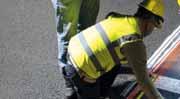
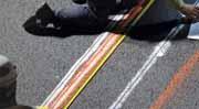
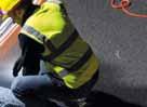
To put all this in place can be hot work. “The field crews are completing their craft work in a high-quality manner,” Meidl says with pride. “Some days they experience temperatures up to 115 degrees F.”
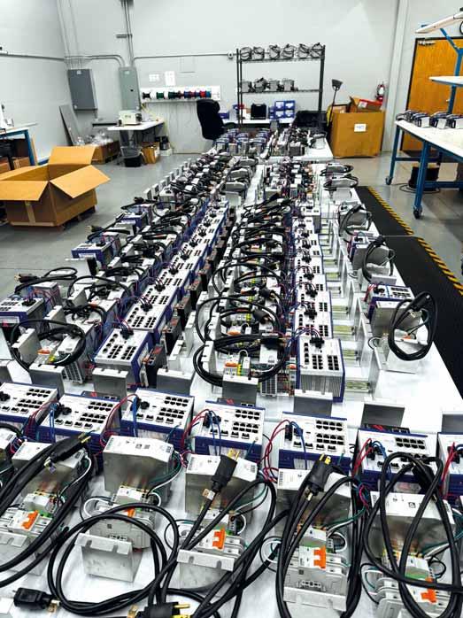
Bryan Vinson, director of operations at iEnet, takes up the story: “We have worked with the designer and stakeholders to develop a scope and comprehensive technology commissioning, integration and testing plan for critical technologies along the corridor.” The company has also held the role of technology integration management for the entire CV Sync project, Vinson adds (see box The technology of CV Sync).
What does CV Sync mean for road users?
The Coachella Valley is a vibrant location that hosts numerous large-scale events, such as the Ironman Triathlon, BNP Paribas Open (tennis), Coachella Music and Arts Festival, Coachella Stagecoach Country Music Festival and Desert Classic Golf Tournaments - thus attracting hundreds of thousands of visitors. The CV Sync project is a multi-faceted initiative that combines various innovative concepts, including the installation of a secure communication network, CCTV cameras, variable message signs, advanced traffic signal controllers, C-V2X RSUs, and video detection systems. Yet while the technology described so far is very interesting, ITS is focused on outcomes - so how will all this hard work by various companies and agencies help the road users of CVAG’s Smart Traffic Region?
wrong-way driver alerts, red-light runner alerts and so much more.”
“The benefits to end users on the road from a project like CV Sync will include greatly improved travel efficiency and safety through enhanced signal timing, video analytics, connected vehicle applications, and coordinated centralised control for events such as Coachella Music Festival,” says iEnet’s Vinson. “In short, the local residents as well as the abundant visitors will be able to travel throughout the Coachella Valley as quickly and safely as possible.”
Now that the technology is deployed, the options are endless, says Mindy Gillespie, head of communications – North America at Yunex Traffic: “Of course there will be accurate travel time, but the project can also deploy pedestrian safety applications,
For Carlos A. Ortiz of Advantec, CV Sync has already had a profound impact on transportation in the Coachella Valley. “By synchronising signals across interconnected roadway networks spanning multiple jurisdictions, the project has reduced traffic congestion, travel delays and greenhouse gas emissions,” he begins. “Real-time communication between traffic signals, connected vehicles and TMCs allows for more efficient traffic flow management, particularly during regional events and emergencies. Additionally, the project has enhanced goods movement and improved the overall quality of life for residents and visitors.”
One of the largest project challenges has been the many jurisdictional boundaries and differing systems within this large, multi-jurisdictional area. To resolve this and better work with all agencies involved, CVAG and participating stakeholders developed and approved a participating agreement to develop valley-wide ITS technology standards, synchronise major corridors, and procure, install, manage, operate and maintain the ITS infrastructure.
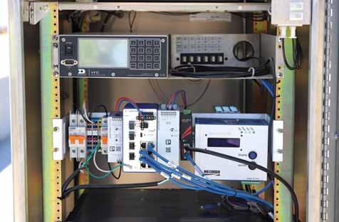
ABOVE: Hirschmann switches being commissioned in the iEnet lab BELOW: One of Crosstown's cabinets
Everyone has the same goal in mind and, as a result, working together is more productive and less stressful
Bill Brown CT West “
Jurisdictional boundaries
the system’s regional approach is crucial for managing the massive influx of visitors during major events, significantly reducing congestion and travel times while improving overall safety. As the system is fully utilised, further benefits will include transit signal priority to enhance public transportation, emergency vehicle pre-emption to cut response times, and automated event management to streamline operations during significant events.”
“The project has redefined current engineering thinking by using technology to solve traffic challenges rather than more lanes, and other on-the-ground solutions,” Ortiz says. “The Phase I Project has brought the Coachella Valley to the 21st century using ITS, smart transportation technologies, and innovative solutions to improve mobility, travel times, safety, and reduce greenhouse gases in the valley. The project improvements will support agencies to manage recurrence and non-recurrence events in real time for the betterment of our communities.”
Prior to CV Sync, road users often faced
inconsistent travel conditions as they moved through different jurisdictions managed by various infrastructure owners and operators, points out Whitney Nottage of Q-Free. “This lack of coordination could lead to unpredictable traffic patterns, congestion and longer travel times,” she says. “Our work on the CV Sync project introduces a centralised system, Kinetic Mobility, that fosters regional collaboration, allowing for seamless traffic management across the entire Coachella Valley. This means that drivers can now enjoy consistent roadway operations, resulting in smoother travel and enhanced safety throughout their journey. Additionally,
Changes to traffic timing during high-profile events can be made from CVAG’s TMC in Palm Desert, where staff actively monitor and modify the entire Valley’s intersections on the system, optimising vehicle flow. “The system also allows for adapting to seasonal traffic changes,” says Joseph P. Meidl from Crosstown. “From October to March the valley’s population increases considerably due to the exceptional weather and activities available. The temporary residents, known as ‘Snowbirds’, recognise and appreciate the ease in commuting.”
Facilitating a shorter travel time from point A to point B also has environmental benefits, not least in cutting emissions. “The Coachella Valley is a dry desert area where emissions tend to stay suspended in the air,” says CT Group’s Bill Brown. “Reducing emissions will help improve air quality for the citizens and visitors of the region. One of the other advantages the road users will benefit from, but not necessarily notice, is the cross-jurisdictional cooperation of the participating agencies, which allows traffic flow to be coordinated across city lines. The ability of each agency to have access to the valley’s traffic flow data is essential to the success of this project.”
A ‘transformational’ project
It is precisely this level of cooperation which leads CV Sync to be often described as a “transformational” project. For Iouri Nemirovski, US field device product manager at Yunex Traffic, it “is transformational in the sense that it breaches a gap …by meeting today’s needs and providing a long-term future-proof solution”.
The sheer number of local authorities and agencies involved is another reason. “The project is unique in the sense that it incorporates numerous technologies, which when combined create the ideal technically ‘driven’ corridor,” says Meidl. “The number of intersections integrated and synchronised makes it special – eight cities under control.”
It is truly “one-of-a-kind in the ITS world”, thinks Bryan Vinson at iEnet – and CV Sync’s legacy may be considerable: “[It] is proving to be transformative in the way it has been successful at a deployment level but has also begun to influence similar ‘CV Sync-like’ projects in scale, budget and technology design and aspirations.”
is essentially the foundation for future synchronisation projects that employ agencyto-agency, agency-to-region and C-V2X elements, both nationally and globally, believes Brown. “Without cross-jurisdictional cooperation, the connected and autonomous vehicle (C/AV) technologies cannot become reality,” he says. “The infrastructure needs to be seamless for the road user. This project demonstrates that seamlessness and is, therefore, being viewed across North America as a benchmark for future RTSSPs [regional traffic signal synchronisation programmes]. CV Sync proves that the future can become a reality.”
Advantec’s Ortiz adds: “These technologies provide real-time traffic surveillance, data collection and system performance monitoring, enabling agencies to manage traffic effectively and improve mobility along major corridors. CV Sync is using the application of innovative engineering technology to meet the challenges of traffic congestion, safety and sustainability.”
‘Future-proofing’
The investment in ITS technology also has a ‘future-proofing’ element to it too, Ortiz continues, “to prepare the region for integration of current and upcoming multimodal transportation technologies, and smart mobility programmes”.
The project’s solutions have improved traffic flows, emergency response and largescale event management, all while reducing congestion and environmental impact, he adds. And the new, secured fibre optic network will also support future public-private broadband communications, extending benefits to low-income communities and tribal lands.
“These innovations enhance safety, security and quality of life while improving transportation for a diverse range of users. By utilising advanced technology rather than disruptive pavement construction, CV Sync has achieved significant cost savings and responsible use of public funds,” Ortiz concludes.
“The CV Sync project is groundbreaking because it brings together 10 different infrastructure owners and operators (IOOs) –nine participating agencies plus Caltrans – to collaborate on a unified transportation solution, a feat rarely achieved in the industry,” says Q-Free’s Nottage. “The fact that these agencies not only agreed to work together but also implemented a cohesive system that benefits the entire travelling public is truly transformational. What sets this project apart even further is its implementation: no other system in the country offers C2C operations across eight agencies within a single region, integrating both arterial and freeway management into one advanced ATMS platform. This level of regional collaboration and technical integration is unparalleled, making
The technology of CV Sync
There are a plethora of critical technologies in the CV Sync corridor, explains Bryan Vinson, director of operations at iEnet. These include Bosch IP cameras, Genetec Video Management System (VMS), Belden Hirschmann Layer 2 Network Switches and Layer 3 Hub Switches, Cisco Layer 3 Core Switches and VPN Firewall Appliances, Belden Hirschmann Network Management System (NMS), Dell System workstations and laptops, cybersecurity, Genetec Physical Access Control (hub cabinet smart locks) and Belden Network Access Control (NAC). The list is com-
prehensive: iEnet has commissioned and deployed 270 IP Cameras with ITS analytics, 440 Layer 2 Edge Switches, 55 Layer 3 Hub Switches, 20 Layer 3 Core Switches, 10 VPN Firewalls, 35 workstations and 22 ruggedised laptops, 35 Hub Cabinet Smart Locks and 30 Servers running VMS, NMS, and NAC software throughout the cities of Desert Hot Springs, Palm Springs, Cathedral City, Palm Desert, Indian Wells, La Quinta, Indio, Coachella, County of Riverside and Caltrans District 8 at traffic signal cabinets, local TOCs and the RTMC at CV Sync HQ in Palm Desert.
CV Sync a model for future smart traffic systems nationwide.”
Importance of collaboration
With 17 agencies and entities, including local governments, Tribal Nations, and federal and state transportation authorities, involved, collaboration has also been a key feature of CV Sync. “Absolutely,” Nottage continues. “Q-Free’s Kinetic Mobility platform was specifically designed to facilitate collaboration. We’ve observed a significant industry shift from traditionally separate freeway and signal operations to a more integrated, collaborative approach. Anticipating this change, we began developing Kinetic Mobility four years ago to support and drive this evolution. By consolidating freeway and signal operations into a single application and enabling robust C2C architecture, Kinetic Mobility empowers operational divisions and agencies to work together more effectively in managing transportation systems.”
Mindy Gillespie, Yunex head of
communications – North America, says: “It is often not easy to bring together multiple agencies, and vendors into one project. Without collaboration the project would not be nearly as impactful. It also shows how interoperability can play a key role, not just in the technology but with all the stakeholders as well.”
“We have most definitely seen collaboration between the agencies, suppliers, and consultants,” confirms Brown. “As the main system on-site commissioner, we have worked with all the participating agencies and suppliers. Everyone has the same goal in mind and, as a result, working together is more productive and less stressful.” Prime contractor Crosstown Electrical & Data “has done a fantastic job of keeping every element of the project moving forward, ensuring success”.
Crosstown’s Joseph P. Meidl says: “Collaboration begins with the entire project having been organised by CVAG bringing each city to the programme, securing
Bosch IP camera
www.ct-west.com
CT West is honored and proud to be the supplier of the Q-Free Mobility Software package and the ATC Controllers to the Prime Contractor Crosstown Electrical & Data, Inc. on the CV Sync Project for both Phase 1 & Phase 2. We are engaged in this project on a daily basis and the main contact for the CVAG Staff on the software operation.
This project is a milestone project for CT West and has allows us to showcase our partner Q-Free products and our capabilities as the Industry moves into the next stage of cross jurisdictional cooperation of signalized operation to better serve the citizens of their communities and save emissions as we work toward a cleaner environment.
www.cv-sync.com
numerous funding sources and in cooperation with the state and federal governments. From concept to design to deployment, this project required and received a commitment from all involved.”
A project the size and scale of CV Sync, with dozens of technologies and thousands of field elements deployed in public roadways across 12 cities and municipalities, is a challenge on multiple levels. “One of the fundamental challenges is delivering all equipment, software and related services at scale in a manner that is cohesive and aligned with contract expectations across multiple technology vendors,” says Bryan Vinson of iEnet. The company’s technology integration management role for the CV Sync project gives it responsibilities for leading weekly integration meetings, peer vendor collaboration and reviews and overall technology integration management to ensure project submittals, design documentation, schedules, RFIs, engineering requests, project changes, commissioning and testing procedures are coordinated, reviewed and approved as a team.
“[We need to] avoid and manage disparate vendor procedures and practices to ensure full system interoperability to avoid project delays and keep the project on time and on target,” Vinson notes.
Looking to the future
For Advantec’s Carlos A. Ortiz, the project has been a significant milestone.
Bryan Vinson iEnet “ “
Success on a project like this is not static but ongoing as we conquer each new technology hurdle and continue to add resources
The consensus of opinion among the engineers involved in CV Sync is that similar projects will definitely be seen across the US in the coming years.
“CV Sync has disrupted our transportation industry by championing open-architecture applications and shifting focus from investing in R&D for regional-specific needs,” he suggests. “I hope that agencies move away from legacy and proprietary technologies. We need to engage technology partners (e.g. Q-Free, Bosch and others) to align with each agency’s smart region vision and provide support not only during deployment but also throughout the programmes’ operations, management and maintenance.”
In the Coachella Valley network, technology has been applied to improve safety, security, quality of life and overall transportation for a diversity of users.
Ortiz highlights again the innovative use of engineering technology, including that complex network of nine TOCs, one regional TMC, C-V2X tech, Big Data, smart
intersections and corridors, cybersecurity and Smart Cities initiatives. “This project is one of the largest smart region projects in the US and is being used as an example all over the world due to its social impact of reduced congestion, reduced travel time, improved air quality, managed emergencies, managed events, increased quality of life in the regions, targeted and better, controlled management to transportation engineering, while also implementing sustainable practices in transportation,” he adds. “A key to success in this or similar deployments, is developing a partnering agreement between participating agencies to allocate funding for planning, design, construction, operations, management and maintenance.”
“The demand is clear,” says Nottage. “Throughout 2023 and 2024, we've seen several requests for systems that integrate signal and freeway operations and support the kind of C2C architectures demonstrated by the CV Sync project. We’re actively engaging with both current and potential customers to showcase the success of CV Sync, helping them shift mindsets, foster collaboration, and unite willing partners in the shared mission of improving mobility for all roadway users. Success with CV Sync will be measured by the increased efficiency, safety and seamless travel experiences for the public, setting a benchmark for future projects.”
Bryan Vinson of iEnet is certain that more CV Sync-type projects will be seen “both throughout California as well as across the US in the very near future”. He adds: “As CV Sync continues deployment of technologies in Phase II and prepares for the next phase soon, these current systems are up and operational with nothing but improvements and enhanced operability on the horizon. Success on a project like this is not static but ongoing as we conquer each
Coachella 2025: see you and perhaps Billie Eilish there
new technology hurdle and continue to add resources and improve user experience and overall project value.”
These types of projects are most certainly going to continue to be designed and deployed in the future, agrees Bill Brown at CT Group: “I am aware of a few RTSSPs in the early stages of development and assessment of the technologies currently available,” he says. “As this project progresses, other municipal planning organisations are keeping a close eye on this project and are reaching out to the CVAG staff for information and lessons learned so that, as they develop their Smart Signal Regional Plan, they are using real-life, usable data.”
As far as quantifying the success of CV Sync, he says that during the last round of major events in the region – such as Stagecoach, Coachella and Ironman - the communication with road users via DMS signs, as well as the implementation of special event timing, helped make the ingress and egress of traffic much smoother than ever before. “This alone demonstrates great project success,” Brown points out. “Additionally, as more ITS elements are deployed, the system will continue to see more and more success.”
So who’s up for Coachella 2025? We’ve left the biggest, most important question until last: Lana del Ray and Doja Cat were among the headliners at Coachella 2024 - so are the engineers planning to let their hair down and strut their stuff at Coachella 2025 with Billie Eilish, SZA, or whoever else is currently predicted to perform?
“Team Yunex Traffic wouldn’t miss it!” says Gillespie. At Crosstown Electrical & Data, Meidl is not so sure: “Probably not (again). We talk about it every year, but never
How CV Sync has already been working
CV Sync’s technologies and tools have already been implemented at major events in the Coachella Valley, explains Carlos A. Ortiz of Advantec… City of La Quinta 2022 and 2023 Ironman Triathlon: City staff, County of Riverside Sherriff, and Advantec staff used the Phase I ITS technologies to manage the event in real time via the
city’s remodelled TOC. Using installed CCTV cameras and advanced signal controllers meant City staff could close travel lanes and roadway segments and re-open these facilities in real time while communicating with field staff and officers.
City of Indian Wells 2023 and 2024 BNP Paribas Open: During this tennis tournament, often dubbed the ‘fifth Grand Slam’, CVAG and city staff, with support from Advantec, managed inbound and outbound traffic in real time using CCTV cameras, video detection systems and advanced traffic controllers from the RTMC. It allowed staff to be able to change signal timing to minimise delays and impacts as vehicles and buses were entering the Indian Wells Tennis Garden - and allowed staff to do the same to flush out traffic at the end of the last evening tennis match.
get around to making it happen. Maybe I’ll drive by!”
Currently, Advantec is designing a TOC for Goldenvoice, the promoter responsible for events such as the Coachella Music & Arts Festivals and Stagecoach, to support management of special events at the Empire Polo Fields, so Ortiz says he is hoping to be there.
The last word goes to Whitney Nottage at Q-Free, who demonstrates her commitment to both music and her work. “I anticipate being in the CVAG region for Coachella in 2025,” she predicts. “Though I might be there more in a work capacity
- helping CVAG manage the intricate event planning and traffic operations that ensure everyone gets to the festival safely and efficiently. If I’m lucky, I might catch a concert or two, but honestly, as a ‘traffic enginerd’, being in the ‘war room’ orchestrating the flow of thousands of people will be the real headliner for me.”
Thanks to the work of these traffic engineers and their enterprising companies, revellers and festival goers may find their route smooth and their way surprisingly clear to the Empire Polo Club in Indio, next April. Not that they’ll know why. But we’ll know. ITS
For two decades, Pat Jones, has been executive director and CEO of IBTTA. As he approaches retirement at the end of this year, he talks to Adam Hill about a career spent ‘stretching and growing’ – and helping others to do the same
Industry legend Pat Jones is retiring: after two decades as executive director and CEO of IBTTA, he steps down on 31 December. What will he be thinking on his final day in post? “I think it will be a mix of feelings, of melancholy and gratitude,” he admits. “I’ll certainly be thinking about the people I've grown close to over the years. I never could have imaginedwhen I started this job in January 2002 - that I would have had as many interesting experiences, and had the opportunity to stretch and grow - and help other people, perhaps, to stretch and grow. So, yes, a great feeling of gratitude.”
It has been a long road: Jones had roles in transportation before IBTTA, working for American Trucking Associations and the American Public Transportation Association, but can trace his interest in tolling back further than that. His father was a civil engineer and worked on the New Jersey Turnpike; as a child, Jones remembers family drives from Connecticut to Southern New Jersey, taking the Garden State Parkway.
“We’d stop periodically on the way. I don't know how frequently - every 10 or every 20 miles - and my dad would toss the coin into the basket, and we were on our way. So from an infant, I have been
a passenger in cars that have been on toll roads.”
Jones took over from Neil Schuster, who was IBTTA’s much-loved boss from 1985 to 2001. “I knew that the staff had a strong attachment to him,” Jones recalls. “And anytime you have a change in leadership, people feel uncomfortable. So I opened [my first] staff meeting by saying: ‘Look, I know you've got some thoughts and feelings and reflections about Neil, and I'd like to hear them’. So they did, and I thought that was a good beginning; and based on that foundation, we could begin to look to the future and chart a course and a vision ourselves.”
Guiding
principle
That idea of inclusion has typified Jones’ approach to the role ever since. For example, in his opening address at IBTTA meetings he makes a point of welcoming first-time attendees. “I guess ‘hospitality’ would be the word that sticks with me about what I bring to IBTTA,” he continues. “And I think it's all about trying to create an environment in which good things can happen. So I guess my spirit of hospitality, of welcoming the first-time attendees, is a way to get at that.”
Members can also see that getting involved and making a difference in areas that interest them is encouraged – and this
If people feel included and have a sense of belonging, then good things can happen
Pat Jones’ father worked on the New Jersey Turnpike as a civil engineer
has led to a growth in the number of committees under the IBTTA umbrella. No-one can be coerced into setting one up; instead, Jones sees his role as “continuing to invite people to do things”.
He dates the change to around 2019, when a group of IBTTA young professionals gave a talk to the board of directors in which they said they wanted to be on the programme at IBTTA events: “We need to mix things up.”
“So at any rate, people started coming out of the meetings and saying: ‘Alright, let's do this Young Professionals thing’; and then, Women in Tolling: ‘We've got a voice, let's get together here’. We've been doing the Leadership Academy since 2008 and [people said] ‘let's actually get some of the alumni together and have some activities’.”
Committees, councils and task forces on Sustainability and Resilience, Road Usage Charging, Toll Revenue Assurance and Diversity, Equity & Inclusion followed,
“People started finding challenges and opportunities that they wanted to focus on –and we got a lot more participation,” Jones says. “What I've attempted to do is create an environment in which people can be successful, in which people can experiment, and innovate, and learn, and try new things.”
Comfort zone
This spirit of inclusivity stretches into other areas. “It’s about expanding people's comfort zone and mine as well,” he continues. “I am intensely curious about a lot of things, and I've learned a lot about many different things since being at IBTTA. And one of the things that I've been awoken to is the whole diversity, equity and inclusion topic, which
we started as an association with vigour in 2020 after George Floyd was murdered. And it's really opened my mind a lot to people who are disregarded in society, people who are marginalised, people of colour, the poor, the economically disadvantaged, the physically challenged - and we've got a lot of work to do. So if I can challenge people and challenge myself about those kinds of things, I think it's important to do.”
Like Frank Sinatra, in the famous song, if Jones has had regrets in his time at IBTTA, they’re too few to mention. “I'm very pleased that, before I left IBTTA, we introduced the Open Space concept at our meetings,” he says. These are free-flowing sessions where the participants create and manage the agenda themselves around a central theme – something that can seem daunting but which can also unleash creativity. The worst that can happen is that people just leave without saying anything. “I thought about it for years,” Jones goes on. “How do I bring this to IBTTA? And, you know, I would discuss it with other staff, and they sort of looked at me like I had lobsters coming out of my head. And then last year, I finally decided, let's for God's sake try this thing.” He eventually took the plunge “with perhaps the toughest audience of all - the CEO roundtable”.
It was nerve-wracking. “I consulted a lot of people who are experts in Open Space, and I read a lot about it, and got a lot of advice,” he says. “And I decided, look, this is going to be a success no matter what happens. I mean, if it's a catastrophic failure, I will be able to say, at least we tried this thing, right? So I made up all my flip charts and my pictures of butterflies and bumblebees and all
this kind of stuff, and posted it in the room, hours before the event happened, and I just sat there and I thought: it's either gonna work or it's not gonna work. It's out of my hands now - but we are going forward, you know, pedal to the middle. And by golly, they loved it. They absolutely loved it. And then I knew, all right, we can do this with a much bigger audience.”
‘Good things can happen’
This bigger audience was 150 sceptical people at the next meeting who, Jones assumed, were thinking: “Man, this thing is going to fall flat on its face.” He did the introduction, and for a while, nothing happened. “People are supposed to start getting up and writing things, and there was a long pause, you know, there was a long silence…and then people started getting up, you know, and it worked. So that's probably one of the proudest things I've done, and I would have regretted if we had not tried that,” he says. Jones’ wife Mia recently sent him a picture of a poster from the second-grade school classroom where she works. “It’s a set of affirmations that's posted in the classroom, and it's four aspirations. It says: ‘I am unique, I am kind, I always try my best, and I am loved’. And the class, as a unit, reads those affirmations first thing in the morning every time they're in the class. And I thought, imagine what the world would be like if all of us read those affirmations first thing every day? Right?”
He smiles: “If people feel comfortable, if people feel welcome, if they feel loved, if they feel respected, if they feel included and have a sense of belonging, then good things can happen.” ITS
Where it all started: childhood journeys on the Garden State Parkway
Access. Security. Automated. Master your vehicle flow
Whether you’re managing parking, barriers, gates, ports, terminals, or industrial sites, TagMaster’s Long Range RFID Readers ensure secure and seamless vehicle access.
Our RFID readers are simple to install and compatible with all major access control systems —no converters required. With reading distances of up to 14 meters (46 feet), they guarantee smooth access and optimized traffic flow.
Our commitment to unmatched security and quality means you’ll benefit from a reliable and cost-effective access solution that streamlines your operations for years to come.
In short, we deliver the world’s best long range RFID readers
Space transport systems: a new frontier
What would transport systems look like in space settlements? And what can that tell us about transport now on Earth? Dimitris Milakis, of the Institute of Transport Research, looks for answers in the stars
1.
The motivation I am a generalising-specialist in the field of transport innovations and society. I develop theory and conceptualise complex system interactions and then empirically explore them using a variety of methods. In other words, I like to connect the dots. My aim is to develop new perspectives in transport planning that help the scientific, professional, and policy communities address key societal challenges globally, such as sustainability, liveability and societal well-being. Space transport is one of the fields that has recently attracted my attention, motivated by the “unknown ‘unknown’” factors, the systemic nature of the problem, and the potential significant benefits for Earth's transport systems within a climate-crisis context.
(1997) and the International Space Station (1998) captured my interest during my childhood and teenage years. Fast-forward 20 years, after conducting research in urban and transport planning with a focus on transport innovations in several countries around the world, I was pleased to read about the renewed plans of the international space exploration community to expand human presence from low Earth orbit (LEO) to the Moon, Mars and beyond - for curiosity, science, resource, economic, and environmental reasons. But what is the plan for space exploration?
Space discovery developments have always intrigued me, although I was not born during the Apollo Programme (1968-1972). However, key space missions like the Challenger (1986), the launch of the Hubble Space Telescope (1990), the Mars Pathfinder
2. The global space exploration roadmap
The International Space Exploration Coordination Group (27 space agencies) has recently published the fourth edition of the shared roadmap for expanding humanity’s presence in the solar system (ISECG, 2024).
The space exploration roadmap describes a stepwise vision for robotic-first and humanlater space exploration through 2050, starting with LEO (e.g. space stations, space
telescopes, satellites), the Moon (sustained lunar presence), Mars (the horizon target for searching for evidence of life, exploring Mars’ surface, interior and atmosphere and gradually establishing human presence in orbit and on the surface) and other solar destinations (robotic missions from Mercury up to the Kuiper Belt) (Figure 1).
At the moment, the focus is on opening the second doorway of the space frontier after LEO: the Moon. Three exploration phases have been outlined (ISECG, 2022). First, sending humans and robotic exploration missions to the Moon to prepare subsequent phases (Phase 1: Boots to the Moon); second, further exploring the lunar surface and selecting optimal sites for extended habitation and resource utilisation (Phase 2: Lunar exploration - expanding and building); and third, establishing a sustained, active presence on the Moon over the coming decades and expanding exploration efforts with missions to Mars (Phase 3: Sustained lunar opportunities). Phase 1 is in progress with lunar missions like Chang'E (CNSA, China) and Artemis (Nasa, US), while Phase
Lessons from space transport systems designed to operate under extreme environmental conditions could help plan for more resilient transport infrastructure in harsh or changing climate conditions on Earth
“
2 will follow with the landing of humans and rovers on the Moon before the development of fixed surface habitats in Phase 3 at the end of this decade. Technology development to complete these missions is ongoing. But does it suffice for long-term human space presence?
3. Technology readiness: is it enough for long-term human space presence?
brakes, powertrain, path planning, autonomous decision-making and obstacle avoidance, teleoperation).
modes and transport infrastructures for both passenger and freight transport, the transport operations under severe contextual restrictions, and the implications for safety, the environment, health, wellbeing and social equity of space settlement inhabitants. But how can we start planning for transport in space settlements?
4. A conceptual approach of a transport system for permanent space settlements
The space exploration roadmap focuses on key existing technologies, as well as critical gaps in technological areas that need to be addressed to realise Moon and Mars missions (i.e. propulsion, landing, and return; autonomous systems; life support and habitability; crew health and performance; communications, positioning, navigation and timing; power; transversal technologies; extravehicular activity [EVA], mobility, and robotics). Scientific research has naturally focused on addressing those technological gaps, with space mobility centring on the development of rover concepts, designs and technologies (e.g. wheels, suspensions,
Several countries have developed or are developing such Moon, Mars and asteroid rovers, including Canada (Lunar rover for the Artemis programme), China (Yutu), Europe (Rosalind Franklin rover), Germany (Mascot: Mobile asteroid surface scout), India (Pragyan), Japan (Lunar cruiser), the UAE (Rashid rover), and the US (e.g. Curiosity, Perseverance). However, the organisation and operation of extra-terrestrial settlements, including transport systems, on the Moon and Mars remains an open, though fundamental, question. This question refers to the post-Phase 3 period of the lunar exploration (beyond the 2030s) and is the focus of my recent editorial in Transport Reviews (Milakis, 2024) and my ongoing research. Transport planning in permanent space settlements would be a fundamental dimension of post-Phase 3 space exploration, involving key questions about the travel needs and preferences of people and companies in extra-terrestrial space settlements, the travel
The key difference for an extra-terrestrial transport system is the context within which it is developed. In space, transport systems face extreme contextual differences compared to Earth, including exposure to cosmic radiation, reduced gravity, lack of atmosphere, extreme temperature fluctuations, abrasive dust and soil, and unpredictable environmental factors - all of which require careful planning to ensure safety, efficiency and resilience. In my thought experiment, I brought together the key elements of Earth's transport system and the extreme space context to provide insights into transport planning in permanent space settlements. I developed a conceptual model for transport systems in space settlements consisting of three main elements: core, travel and impact (Milakis, 2024). The core element addresses the needs and preferences
influence the development and operation of transport systems in space.
The core element (i.e. needs, infrastructure, location activities, transport resistance) would be heavily influenced by the unique environmental challenges of space. Transport
storage solutions. Space settlements may also be vertically structured to minimise radiation exposure, with transport systems like elevators or vertical railways being developed to support travel within such compact spaces. Travel cost will likely account for not
Structure
Unknown
Safety
Environment
Health and wellbeing
Social equity
health-related benefits. Travel within compact settlements will be short, but for longer distances to remote areas, fast tube-based collective transport would be needed to reduce radiation exposure. Transport systems would likely be modular and adaptable, with
features like regenerative braking and energysharing networks enhancing efficiency. Rigorous coordination of demand, capacity and scheduling would be critical to ensure energy-efficient and safe traffic flow in both horizontal and vertical directions, especially when freight and passenger transport share the same infrastructure.
For the impact element (i.e. safety, environment, health, wellbeing, social equity), strict safety standards would be critical due to human vulnerability in extra-terrestrial environments. Transport systems would need to minimise resource consumption by designing long-lasting, modular and recyclable vehicles that are easy to maintain. Health and wellbeing would be key aspects, addressing psychological challenges with welldesigned interiors and solutions like artificial gravity stations to prevent physiological health problems. Ensuring accessibility and social equity is also important to prevent social isolation in space settlements. Thus, transport systems would need to offer equal and enhanced access for all space residents.
The governance of the transport systems would be an important factor in space settlements. Efficient resource management and sharing, especially for energy and infrastructure, would be critical. Therefore, policies would likely favour energy-efficient
collective transport and compact, vertical and horizontal development. Ensuring wellbeing, social equity and equal access to all sectors of the settlement would also be important, due to the harsh space conditions and resource constraints. Given the unpredictability of space environments, governance would need to be flexible and adaptive. But how could research on space transport systems benefit life on Earth?
5. Could space transport planning research help improve transport systems on Earth?
Earth-related benefits from space exploration typically stem from leveraging space technologies for everyday life. Examples range from GPS and navigation to artificial limbs and common infrared thermometers. Transport planning for space settlements could offer a whole new category of knowledge and applications exchange between Earth and extra-terrestrial environments regarding passenger and freight transport systems. The extreme contextual factors in space and the necessary adaptation of transport systems could improve both passenger and freight transport on Earth in terms of vehicle design, resource efficiency and sustainability, resilience, travel experience, traffic control multimodal integration, and transport governance.
The operation of extra-terrestrial settlements, including transport systems, on the Moon and Mars remains an open, though fundamental, question
“ “
Space-designed lightweight, durable materials - along with modular vehicle design for easy maintenance and upgrades - could improve fuel efficiency, reduce emissions and increase vehicle durability if applied to
vehicles on Earth. At the same time, more human-centred in-vehicle designs on Earth could be inspired by space transport systems that will carefully account for physiological and psychological wellbeing in confined environments. Moreover, lessons from space transport systems designed to operate under extreme environmental conditions (e.g. temperature fluctuations, dust, reduced gravity) could help plan for more resilient transport infrastructure in harsh or changing climate conditions on Earth. Advanced coordination of multiple transport modes within compact (horizontal and vertical), resource-constrained space environments (e.g. complex multimodal hubs, shared infrastructure, real-time data coordination) could help design seamless, multimodal transport networks on Earth. Also, the predictive algorithms and automated systems of rigorous dynamic traffic management in space could further optimise traffic flow, reduce congestion and improve service reliability for both urban and freight systems. Indeed, freight transport in space will likely need to share infrastructure with passenger transport in highly-controlled environments, requiring careful coordination to avoid conflicts. This shared-use model can stimulate more efficient integration of urban logistics and passenger transport on Earth. Finally, governance models developed for efficient resource-sharing and equitable transport access in space, where a shared effort for survival is necessary, could inform more effective policies for inclusive mobility on Earth. ITS
ABOUT THE AUTHOR:
Dr. -Ing. Dimitris Milakis is senior researcher, European Research Coordinator, Institute of Transport Research, German Aerospace Center (DLR)
References
ISECG (2022). The global exploration roadmap. Lunar surface exploration scenario update. International Space Exploration Coordination Group https://www.nasa.gov/ wp-content/uploads/2018/01/ger-supplement-update-2022-final-10-6-22_tagged.pdf?emrc=710655
ISECG (2024). Global Exploration Roadmap. International Space Exploration Coordination Group https://www.globalspaceexploration.org/wp-content/isecg/GER2024.pdf Milakis, D. (2024). Beyond rockets: transport planning for permanent space settlements. Transport Reviews, 44(1), 1-7 https://doi.org/10.1080/01441647.2023.2264097
Experience innovative technologies!
Arti cial intelligence, embedded vision and the tight interlocking of machine vision and automation create new possibilities – for the smart factory of tomorrow and for the steadily expanding non-industrial applications.
08 – 10 October 2024
Messe Stuttgart, Germany
www.vision-fair.de
Olympics legacy
There’s a new high-occupancy vehicle lane on the Paris Périphérique: François Leblanc of Fareco tells Adam Hill about winning the race to put this technology in place
Whenever a global city hosts the Olympic and Paralympic Games, there’s inevitably a lot of talk about ‘legacy’.
Usually, this refers to the long-term use of stadia built specially for the event – but in the case of Paris, the location for the games from July to September this year, things are slightly different: a new type of traffic management will be one of the key takeaways from this summer of sport.
During the games, the left lane on the Périphérique - the famous 35km-long, dual-carriageway ring road which circles the French capital – was dedicated to certain vehicles (a requirement of the International
Olympic Committee) to enable them to get around the city more easily.
Usually these lanes revert to normal use once the Olympics cavalcade has rolled through and residents are moving on to their day-to-day lives, out of the global spotlight once more. But in Paris it has now been turned into a high-occupancy vehicle (HOV) lane - for a total cost to city authorities of more than €18 million - which will run permanently in a bid to nudge Parisians away from their single-occupancy vehicle habit and onto carpooling.
inside the City of Light itself; so it makes sense, now, to turn a similar spotlight on the Périphérique.
Accuracy is crucial
Paris, under Mayor Anne Hidalgo, has made extraordinary strides towards reducing air pollution and easing traffic congestion
White diamond signs alert drivers to the HOV lane
However, to make HOV lanes work, accuracy is crucial. Patented ‘Hovy’ technology – an AI-based high-occupancy vehicle counting system - from French company Fareco will enforce the lane for the city of Paris, explains François Leblanc, the firm’s president, director general. “We have a Lidar trigger system to detect the vehicles in a very accurate and reliable way,” he tells ITS International. “And then the system itself has two cameras on two separate masts. We take pictures with a three-quarter angle front camera; and then, simultaneously, we take pictures from the side camera. Thanks to this layout, we can have binocular vision, which means we can have a 3D vision that allows us to count the number of passengers and locate the passengers in the car.”
Fareco says Hovy accurately counts the number of people inside vehicles and reads the licence plate. Its AI has been trained by the company’s data scientists on millions of
images of HOV applications, including in challenging conditions such as stop-and-go congested traffic or with vehicles travelling at very high speeds, and in all weathers.
There are 10 installations on the Périphérique, five on each side, in each direction. There are three cameras per installation, with two cameras for passenger counting and another one for automatic number plate recognition. There is no facial recognition on Fareco’s system: faces are blurred to conform with GDPR regulations.
Variable messaging signs and white diamonds alert drivers to the HOV lane, where travel is restricted to single-occupancy vehicles at certain times of the day.
The company’s involvement in this new operation does not stop at the roadside. “We are involved in the back office as well,” Leblanc explains. Fareco has developed a centralised solution that allows the collection of pictures of potential malefactors. “The city officer can use our system in order to then validate the infringement.”
Rigorous procedure
Fareco says it has worked with the Institut d'Optique Graduate School, a world leader in optics and photonics based at ParisSaclay University, to obtain the best optical performance between the camera and infrared illuminators, which are designed to provide better visibility within the vehicles themselves.
In a rigorous tender procedure, Leblanc thinks Fareco’s technology gave the
company the edge. “It was a long selection process,” he says, “with a first public tender where two companies were selected initially, and then after a year-and-a-half or so, the city issued a second public tender - open not only to the pre-selected companies, but to all companies.”
For Fareco, Paris is an excellent shop window to make the Hovy solution visible to a wider audience – in North America, for instance, as well as the rest of Europe. “We
hope to deploy the technology, not only in France, but also abroad, because there are many countries where HOV lanes are already in operation,” says Leblanc. “So our ultimate goal is to export the system where there would be needs for passenger counting in general, meaning HOV lanes, or also for parking applications, where people would need to know how many people are travelling in the car.”
The Hovy system is installed in a number of locations in France today, wherever the counting of passengers is required. These include two projects on the country’s A1 motorway: a pilot deployment for Groupe Sanef; and what Fareco calls an ‘educational application’ with variable message signage for Direction Interdépartementale des Routes Nord. This is to inform drivers whether their vehicle is authorised to use the carpool lane depending on the number of occupants –rather than being used as a direct automated enforcement solution. Hovy is also being used to provide an access control and quota management service for Quillebeuf's ferry in Normandy, as well as deployments at park and ride sites and company premises.
“Our goal is to become a strong reference in passenger counting, especially for HOV or parking applications,” says Leblanc. “We plan to deploy our systems abroad, definitely.” And has there been interest from other countries since Paris? “It's picking up,” he smiles. The City of Paris may not be the only one to get a legacy from these Olympics. ITS
The French capital’s Périphérique ring-road runs for 35km
François Leblanc Fareco
A revolution in transportation
Navigating the future of mobility means approaching AI as a powerful tool that, when wielded responsibly, can help us build transportation systems that truly serve people, says Alex Nesic
The transportation sector is undergoing a profound transformation, driven by the rapid advance of artificial intelligence (AI). As we drive towards an increasingly interconnected and data-driven future, AI is emerging as a gamechanging force in how we move people and goods across the globe. From bustling city centres to remote rural highways, AI is reshaping our mobility systems, promising unprecedented levels of efficiency, safety and sustainability.
Yet AI remains an enigmatic concept, often shrouded in a mix of excitement and
apprehension. While sexy tools like Chat GPT and Midjourney dominate the broader AI conversation, there are myriad more mundane yet powerful applications of AI in transportation. As we venture down this path, it's crucial to demystify AI, understand its real-world applications, and critically examine both its immense potential and the challenges it presents.
What AI currently is and isn’t capable of
At its core, artificial intelligence refers to computer systems capable of performing tasks that typically require human
intelligence. These include visual perception, speech recognition, decision-making, and language translation. However, it's important to dispel some common misconceptions:
- AI is not a magic pill that can instantly solve all problems. It's a tool that requires careful implementation and human oversight.
- Current AI systems are "narrow" AI, designed for specific tasks. We're still far from "general" AI that can match human-level intelligence across all domains.
- AI doesn't (yet) "think" like humans. It uses complex algorithms and vast amounts of data to recognise patterns and make predictions.
use real-time data from sensors, cameras and connected vehicles to dynamically adjust traffic signals, reducing congestion and improving traffic flow. AI algorithms can predict traffic patterns, allowing city planners to proactively manage transportation networks and respond to changing conditions.
For example, some cities are implementing AI-powered traffic management systems or using AI-enabled crowdsourced dashcam video feeds that can optimise routes and reduce average travel times by up to 25% and cut emissions by adapting to real-time traffic conditions. These systems can also prioritise public transit and emergency vehicles, further enhancing urban mobility.
Public transit optimisation
In transportation, AI manifests in various forms, from machine learning algorithms that optimise traffic flow to computer vision systems that govern micromobility fleets or enhance vehicle safety. By understanding these fundamental concepts, we can better appreciate AI's role in shaping the future of mobility.
Key applications of AI in transportation
Traffic management and urban mobility
AI is revolutionising how cities manage traffic and urban mobility. Intelligent traffic systems
AI is making public transportation more efficient, reliable, and user-friendly. Machine learning algorithms can analyse historical and real-time data to optimise bus and train schedules, predict maintenance needs, and improve route planning. AI-powered chatbots and mobile apps are enhancing the passenger experience by providing personalised trip planning and real-time updates.
In some cities, AI systems are being used to dynamically adjust bus routes based on demand, reducing wait times and improving service in underserved areas. Computer vision systems are also put to use on buses to detect and enforce vehicular violations of dedicated bus lanes which helps ensure timely bus services. This not only increases ridership but also contributes to more equitable and accessible public transportation.
Autonomous vehicles and micromobility
Perhaps the most visible application of AI in transportation is in the development of autonomous vehicles (AVs). Self-driving cars, trucks, and buses use a combination of sensors, cameras and AI algorithms to navigate roads safely. While fully-autonomous
vehicles are still in development, AI is already enhancing vehicle safety through advanced driver-assistance systems (ADAS).
In the micromobility sector, AI is optimising the deployment and management of shared bikes, scooters, and other small vehicles. AI algorithms can predict demand patterns, ensuring vehicles are available where and when they're needed most.
Computer vision technology is being used to enhance safety, for example, by detecting when riders are not wearing helmets or detecting what type of infrastructure (sidewalk, bike lane or street) is being used and sharing that data with urban planners.
Tolling and congestion charging
AI is streamlining tolling and congestion charging systems, making them more efficient and fair. Machine learning algorithms can analyse traffic patterns to implement dynamic pricing, encouraging off-peak travel and reducing congestion. AI-powered image recognition systems can accurately identify vehicles and process payments without the need for physical toll booths, reducing traffic bottlenecks. Similarly, some of the most hotly-contested real estate in cities is the kerb; AI-powered computer vision systems are being deployed to proactively manage and enforce proper use of it by various stakeholders depending on the time of day or week. Beyond that, these systems can be integrated with broader urban mobility strategies, using AI to optimise pricing and incentives to achieve specific policy goals, such as reducing emissions or promoting public transit use.
Logistics and supply chain
In the world of freight and logistics, AI is driving significant improvements in efficiency and sustainability. AI-powered route-optimisation algorithms can reduce fuel consumption and delivery times. Predictive maintenance systems use machine learning to anticipate
ABOVE: The AI-driven transportation revolution needs to serve all of humanity
equipment failures, reducing downtime and extending the lifespan of vehicles.
AI is also enhancing warehouse operations through automated inventory management and robotic picking systems. In ports and intermodal facilities, AI is being used to optimise container stacking and vessel loading, significantly reducing turnaround times.
Benefits
and opportunities
Increased efficiency and productivity
AI's ability to process vast amounts of data and make rapid decisions is driving unprecedented efficiency gains across the transportation sector. From optimizing traffic flow to streamlining logistics operations, AI is helping to reduce delays, cut costs and improve resource utilisation. For instance, AI-powered predictive maintenance can reduce vehicle downtime by up to 20%, while route-optimisation algorithms can cut fuel consumption by 15% or more.
Enhanced safety
Safety is critical in transportation, and AI is emerging as a powerful tool in reducing accidents and saving lives. Advanced driverassistance systems (ADAS) and autonomous vehicle technologies use AI to detect and respond to potential hazards faster than human drivers. In public transit and freight
AI algorithms can predict traffic patterns, allowing city planners to proactively manage transportation networks and respond to changing conditions “ “
operations, AI can monitor driver behaviour and alertness, preventing accidents caused by fatigue or distraction. The potential impact is significant – some estimates suggest that widespread adoption of AI-driven safety technologies could reduce traffic fatalities by up to 90% in the long term.
Environmental
sustainability
As the world grapples with the urgent need to address climate change, AI offers promising solutions for reducing the environmental impact of transportation. By optimising routes, reducing congestion and improving vehicle efficiency, AI can significantly cut fuel consumption and emissions. In public transit, AI-driven systems can encourage ridership by improving service reliability and convenience, potentially reducing private car usage. Moreover, AI is playing a crucial role in the integration of electric vehicles and renewable energy systems, helping to balance grid loads and maximise the use of clean energy in transportation.
Improved user experience
AI is transforming the way people interact with transportation systems, making journeys more personalised, convenient, and enjoyable. From AI-powered trip-planning apps that provide real-time, multimodal journey options to chatbots that offer instant customer support, the technology is putting users at the centre of the mobility ecosystem. In the future, AI could enable even more seamless and intuitive transportation experiences, such as autonomous vehicles that adapt to individual preferences or smart cities that anticipate and meet citizens' mobility needs proactively.
Challenges and considerations
Data privacy and security
The effectiveness of AI in transportation relies heavily on data, raising important questions about privacy and security. As vehicles and infrastructure become more connected, they also become potential targets for cyberattacks. Ensuring the security of AI systems and protecting user data will be crucial in maintaining public trust and preventing potentially catastrophic breaches.
Ethical concerns
The implementation of AI in transportation raises complex ethical questions. For instance, how should autonomous vehicles be
programmed to make split-second decisions in potential accident scenarios? How do we ensure that AI-driven systems don't perpetuate or exacerbate existing social inequalities in access to transportation? Addressing these ethical concerns will require ongoing dialogue between technologists, policymakers and the public.
Workforce impacts
While AI promises significant productivity gains, it also has the potential to disrupt traditional jobs in the transportation sector. From truck drivers to traffic controllers, many roles may be transformed or eliminated by AI technologies. Managing this transition and ensuring that workers are prepared for the jobs of the future will be a critical challenge for the industry and society as a whole.
Infrastructure requirements
Realising the full potential of AI in transportation will require significant investments in infrastructure. This includes not only physical infrastructure like sensors and communication networks but also digital infrastructure for data storage and processing. For many cities and regions, the cost and complexity of these upgrades may be a significant barrier to adoption.
Prioritising people in the AI transportation revolution
As we look to what’s in the stars for the future, the potential applications of AI in transportation seem boundless. We may see the emergence of fully autonomous transportation networks, where self-driving vehicles seamlessly interact with smart infrastructure to optimise urban mobility. AI could enable new modes of transportation,
AI is streamlining tolling and congestion charging systems, making them more efficient and fair “ “
from autonomous flying taxis to hyperloop systems, reshaping our concepts of distance and urban planning.
Having said that, we must remember that technology should serve people, not the other way around. The potential benefits of AI in terms of efficiency, safety, sustainability and user experience are indeed enormous. However, these advancements must be guided by a singular focus: creating more livable cities and transportation systems that prioritise human needs and well-being.
The future of mobility is not about optimising for machines or pursuing efficiency for its own sake. Instead, it's about leveraging AI to create transportation ecosystems that enhance quality of life, foster community connections and respect the diverse needs of all city dwellers. This means designing AI systems that prioritise pedestrians and cyclists, enhance public spaces, reduce noise and air pollution and make our streets more vibrant and inclusive.
As we navigate this transformation, it's crucial to approach AI not as an end in itself, but as a powerful tool that, when wielded responsibly, can help us build transportation systems that truly serve people. This requires ongoing dialogue between technologists, urban planners, policymakers, and - most importantly - the communities that will be affected by these changes.
The AI revolution in transportation is just beginning, and its ultimate shape will be determined not by what is technologically possible, but by what is socially desirable. As we embark on this journey, let us embrace the possibilities of AI while steadfastly ensuring that our cities remain human-centric. Our goal should be clear: to create a future of mobility that doesn't just move people efficiently, but one that contributes to happier, healthier and more connected communities.
In the end, the true measure of success for AI in transportation will not be the sophistication of our algorithms or the efficiency of our systems. It will be the smiles on the faces of children playing safely in their neighbourhoods, the ease with which elderly residents can access vital services and the vibrancy of our public spaces.
By keeping these human outcomes at the forefront, we can ensure that the AI-driven transportation revolution truly serves all of humanity, creating cities that are not just smart, but also deeply livable and lovable. ITS
To download the AI in Transportation supplement, go to www.itsinternational. com/archive
ABOUT THE AUTHOR: Alex Nesic is a serial tech entrepreneur who has worked at the intersection of AI and urban mobility, most recently as a co-founder of Drover AI
LG’S V2X SOLUTION GETS CERTIFICATION
Q-FREE RELEASES INTRADA OPERATIONAL BACK OFFICE
Q-Free has released a new software tolling solution, Intrada the mobility solutions provider’s Intrada suite of solutions. The tools and plug-and-play modules new system is also interoperable with third-party technologies and fully scalable, making it tolling operators across the products are project-based and built from scratch for off-the-shelf tolling software solution is remotely updatable and installed quickly and easily on any project. Much like its
cousin, Q-Free’s Kinetic Mobility
was developed to be modular and vendor-agnostic. This allows network operators to integrate into their system seamlessly, including Q-Free’s own roadside systems. The new platform uses engine that is currently handling millions of toll transactions
Q-Free’s automatic licence plate recognition solution, ensuring precise toll collection and minimising revenue leakage. Personal data is carefully protected with automated retention, deletion and anonymisation policies.
Ouster’s Blue City passes Nema TS2 certification
and walk signs. The standard is designed to ensure high network
platform provides monitoring and visualisation in real time, that many cities around the world are evaluating and installing its
to improve safety in tunnels and on bridges. Flir, part of Teledyne Technologies, noted that it is in tunnels and on bridges where drivers are most at risk for hitting unseen objects or detection performance. Flir says that it has imaging resolution or data loss due to bandwidth
to Nashville DoT and the city of Chattanooga to make streets intersections.
TRAFIBOT DUAL AI CAMERA HAS TUNNEL VISION
Flir proprietary AI models simultaneously, developed and trained from millions of Flircaptured images collected across the world. One
while the other two classify vehicles on thermal and on the visual stream, including unusual objects such as e-scooters and vulnerable road users like pedestrians and bicyclists. Combined
AI features a greater capacity to detect incidents view, the camera anticipates vehicle speed and trajectory, even if tracked objects become occluded or obscured by other vehicles, objects or road infrastructure.