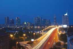
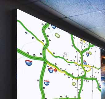
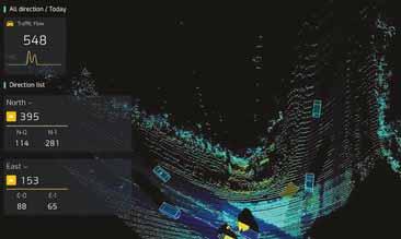
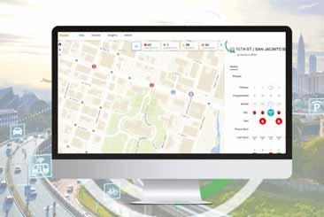
Multimodel macro and microscopic modeling, simulation, and visualization software. Modeling and Planning
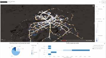
Data and AI-driven monitoring, prediction, decision-support, and Prediction and Management
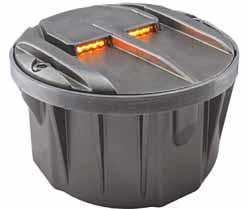
Cutting-edge cabinets, controllers, sensors, and professional services. On-site Traffic Infrastructure
Contents
Carol Schweiger on ITS: “We don’t always have the right people at the table when we’re designing systems and deploying them”
ABU DHABI MOBILITY
The emirate’s Integrated Transport Centre has big plans - and knows choices in the mobility ecosystem are crucial when it comes to economic development
ENFORCEMENT
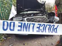
Despite the proven risks for road safety, too many drivers are still needlessly distracting themselves while in charge of their vehicle – and here’s the shocking proof
MERGERS & ACQUISITIONS
US-based ITS sector veteran Iteris has been bought for $335m by Italian digital specialist Almaviva. But who exactly is the new owner and what does
VISION TECHNOLOGY
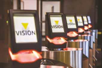
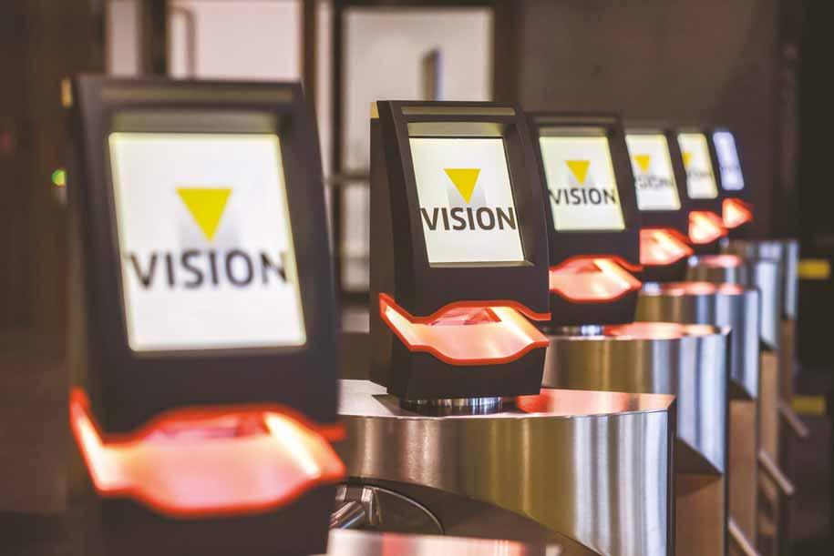
At the Vision 2024 show in Stuttgart, a wide variety of traffic-related solutions was on display..
28 INTERSECTION SAFETY
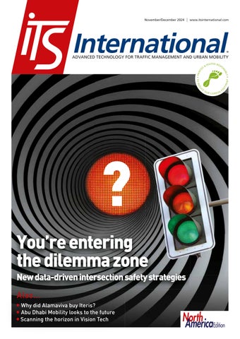
Indecision on the road can kill. Econolite presents new data-driven dilemma zone and intersection safety strategies for a Vision Zero future
35 C/AVS
Nervous about taking a trip in a driverless car? South Korean scientists might be able to help with that
36 WEIGH IN MOTION
WiM’s ability to collect more accurate data is creating increasing value for money
42 SMART CITIES
The vehicles of the future are coming, and so are the cities of the future - if they’re prepared to make the investment...
44 BIG DATA
How do you protect personal privacy while still allowing data to be of use in intelligent transportation? Inrix offers some thoughts
47 PRODUCTS & INNOVATIONS
NorthAmerica Edition
North America area only
NA 01 Hundreds of projects to reconnect US communities separated by roadways will launch in 2025
NA 04 AI & equity: five key takeaways from the 7th International TRB Women and Gender in Transportation conference
NA 07 It’s finally here: the FCC has cleared the way to mass deployment of C-V2X in a bid to reduce road fatalities
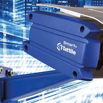
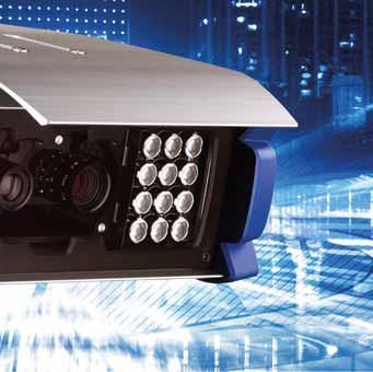
Smart+
THE MOST POWERFUL AI SMART CAMERA
Smart+ camera leverages the advanced capabilities of Stark’s platform, providing a groundbreaking performance for automatic number plate recognition.
“PREVENTING
DDISTRACTED DRIVING? TECHNOLOGY IS ONLY PART OF THE SOLUTION”
o you use your hand-held phone when driving? Just to check a vital WhatsApp? Make a very important call? (A quick call, obviously, you’re not reckless, but it really needs to be made). If so, you’re not alone.
A five-week trial by Acusensus and Aecom in the UK found 812 incidents of drivers being distracted by their mobile device: images show drivers holding cellphones in front of their face and to their ear while behind the wheel, sometimes with passengers – including children – next to them. 812! In five weeks! Oh, there were also 2,393 incidents of people either not wearing a seat belt in a way that would prevent injury, or not wearing one at all. A large number of us clearly think being in a car carries the same risk as sitting on a sofa.
The interior of a two-tonne automobile - with its in-car entertainment, noise reduction, cruise control and general air of temperature-controlled comfort – can be a bubble, seemingly removed from the actual world, an extension of your home
Editor Adam Hill
Email: ahill@ropl.com
Tel: +44 1322 612062
Editorial Director
Geoff Hadwick
Email: ghadwick@ropl.com
Tel: +44 1322 612013
Sales Director
Dan Emmerson
Email: demmerson@ropl.com
Tel: +44 1322 612068
Production Manager
Nick Bond
Email: nbond@ropl.com
Tel: +44 1322 612066
Design Team
Simon Ward, Andy Taylder
Office Manager
Kelly Thompson
Email: kthompson@ropl.com
Data & Marketing Manager
Alan Cansick
Email: acansick@ropl.com
Tel: +44 1322 612061
Web Manager
Sarah Biswell
Email: sbiswell@ropl.com
Tel: +44 1322 612078
“ “ The interior of a two-tonne automobile can be a bubble, seemingly removed from the actual world
living room. Much of the car industry’s advertising emphasises this: it is a smooth ride, this is your personal space, freedom awaits. There is not enough focus on the fact that you are in sole charge of a two-tonne (minimum) killing machine. One can see why. It’s a sobering message. But a necessary one, surely?
ITS technology is very good at detecting dangerous behaviour on the road. Thus it is also a useful tool in preventing it, by aiding the legal process of fines and prosecutions, and by informing future education campaigns for drivers. But much more is needed: what makes drivers – what makes us – behave this way in the first place? Lack of care? Desire for convenience? Ignorance? ‘It couldn’t happen to me?’
No-one likes to be lectured about their behaviour, and hectoring rarely produces
Publisher/
Managing Director
Andrew Barriball
Email: abarriball@ropl.com
Tel: +44 1322 612057
CEO
Roger Adshead
Email: radshead@ropl.com
the desired effect. Yet despite the proven risks for road safety, too many drivers are still needlessly distracting themselves while in charge of their vehicle. ITS is part of the solution. But surely there is a less technological aspect to this too. Understanding the risks of distraction – and taking them seriously – is at the root of the issue. ITS
@itseditoradam.bsky.social
@adamhillwriter
@itseditor_adamhill
Printed by Warners (Midlands) PLC
ITS International (PE 13324) is published 6 times a year with combined issues in January/February, March/April, May/June, July/August, September/October and November/December by Route One Publishing Ltd, Second Floor, West Hill House, West Hill, Dartford, Kent, DA1 2EU, UK.
Airfreight and mailing in the USA by agent named World Container Inc., c/o BBT 150-15, 183rd St, Jamaica, NY 11413, USA. Periodicals postage paid at Brooklyn, NY 11256.
POSTMASTER: Send address changes to ITS International, World Container Inc., c/o BBT 150-15, 183rd St, Jamaica, NY 11413, USA.
Air Business Ltd is acting as our mailing agent.
Subscription records are maintained at Route One Publishing Ltd, Second Floor, West Hill House, West Hill, Dartford, Kent, DA1 2EU, UK.
All editorial, advertising or circulation enquiries to:
ITS International, Second Floor, West Hill House, West Hill, Dartford, Kent, DA1 2EU, UK. No part of the publication may be reproduced in any form whatsoever without the express permission of the publishers. Views expressed in this journal do not necessarily reflect the opinion of the Editor or Route One Publishing Ltd.
Reader Enquiry Service: data@ropl.com
Tel: +44 1322 612061
Subscription Enquiries: subs@ropl.com
Global: Print ISSN 1463-6344
Digital ISSN 2057-3421
NA: Print ISSN 2632-4458
Digital ISSN 2632-5950
FCC adopts C-V2X spectrum rules
The US Federal Communications
rules - its second report and order - for cellular Vehicle to Everything (C-V2X) technology. It means that,
units can operate C-V2X technology in the 5.9 GHz spectrum band. US transportation agencies and private sector companies can move beyond temporary waivers to fully deploy C-V2X devices. “We applaud the FCC for their work towards the completion of this rulemaking," says ITS America president & CEO Laura Chace. "We stand ready to work with our partners to make the promise of V2X a reality.”
Australian Capital Territory does it MyWay+
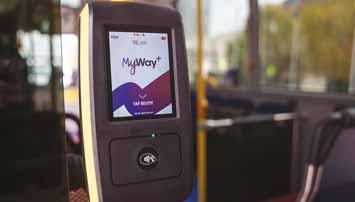
A new public transport ticketing system has gone live in the Australian Capital Territory (ACT), replacing the old MyWay system. MyWay+ will allow people to plan and pay for multimodal journeys in ACT, which includes Australia's capital city, Canberra. It follows several months of system and user testing; new equipment has been installed on buses and at bus and light-rail platforms and interchanges. Passengers don't need to have an account: they can also use a credit card, debit card, Apple or Google Pay on their mobile phone to tap on and off.
Kapsch backs ITS to be part of EU taxonomy
the European Union to fully integrate road tolling and
EU Taxonomy for Sustainable Investment. The company has produced a white paperIntelligent Transport Systems in the EU Taxonomy Regulation - which suggests this is necessary to achieve the Net Zero decarbonisation target in the European Green Deal. EU taxonomy provides companies, investors and policymakers
which economic activities can be considered environmentally that EU Taxonomy "lacks management".
Opsys deploys Altos Lidar at Curiosity Lab
The City of Peachtree Corners in Georgia, US, is deploying Opsys' Altos Gen 2 Lidar at its Curiosity Lab. The 5G-enabled intelligent mobility and smart city living laboratory is a proving ground for IoT, mobility and smart city emerging technologies. The centrepiece is a threemile-long (5km) autonomous vehicle lane that uses cellular Vehicle to Everything (C-V2X) technologies. Opsys' Lidar units are deployed at the intersection of State Route 141 and Town Center Boulevard, where they will provide precise, real-time data on movements, offering management.
Slovenia truck tolls now interoperable with Toll4Europe
Slovenia toll operator Dars now allows for truck and freight interoperability with Toll4Europe solutions across Europe. Q-Free and Telekom Slovenije upgraded system to integrate charging and payments, allowing a single onboard unit to pay tolls seamlessly across borders. It means truck companies and drivers can travel through Germany, Poland, Austria and several other European countries using a single toll transponder. In 2016, Q-Free and Telekom Slovenije were awarded a 10-year contract by Dars to develop a multi-lane, system for Slovenia's motorway network.
management system for Oklahoma DoT
Transport data analysis specialist MS2 has been chosen by Oklahoma Department of Transportation in the US to help update its systems. ODoT has selected MS2's cloud-based
monitoring process. Hosted on Amazon Web Services, it will enable ODoT "to perform and effectively to meet state and federal mandates, as well as align with the state’s Transportation Modernization Initiative to shape the future of transportation in Oklahoma", MS2 says.
New York to start congestion charging 'from January 2025'
New York City's congestion charging scheme - put on hold earlier this year by state governor Kathy Hochul - is now back on the agenda. From 5 January 2025, the proposed daily charge will be $9 to enter the congestion charge zone which covers parts of Manhattan - down from the $15 originally proposed. Its purpose is to reduce congestion, improve air quality and provide funds for public transportation. Transportation and Infrastructure Committee chairman Sam Graves says: “President-elect Trump has made it clear that he does not support this congestion pricing scheme.”
road network and will help road designers understand what changes need to be made to reduce the risk of collisions.
Blyncsy produces US interstate highway asset map
IntelliRoad gets Florida wrong-way approval
IntelliRoad's wrong-way detection system has been added to the Florida Department of Transportation’s Approved Products List. The system is designed to help prevent catastrophic collisions by detecting vehicles travelling on roads in the wrong direction. Using Lidar technology and AI-driven analytics, the system provides real-time alerts to
Derq attracts investment from two VCs
AI safety research money for Systra
Systra has received a € 52,000
intelligence application for classifying the physical environment where road collisions occur. The money, from the UK’s Transport Research and Innovation Grant programme, will help Systra investigate how it can use data from OS MasterMap,
drawings to classify the physical environment. The solution
of where risks of serious and fatal collisions exist on the
Blyncsy has mapped all US interstate highways showing assets such as guardrails, speed limit signs and workzones to support safety and maintenance work. The Bentley Systems company has made the data available to all US state departments of transportation. The map is created using crowd-sourced dash camera imagery from more than one million vehicles. When coupled with Blyncsy’s AI image-analysis toolset, it detects 40 different road conditions and asset inventory issues in near-real time. Clients include Hawaii DoT, North Central Texas Council of Governments and the Port Authority of New York and New Jersey.
message signs, connected vehicles and navigation providers. IntelliRoad, part of Kyra Solutions, achieved FDoT
Application and Tracking History (Path) programme. The approval process involved comprehensive product testing under various environmental conditions at
Research Lab.
- part of global technology
- have invested undisclosed sums into Derq. The MIT spinoff says the new investment will be used to expand its activities in the US and Middle Kuwait, Oman, Qatar, Saudi based solution fuses data sensors and runs real-time edge analytics to enable infrastructure perception and V2X/5G applications as well as insights.
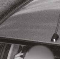
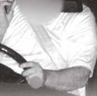
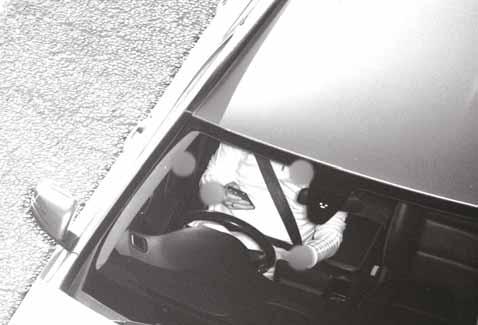
Thousands of people were using their phone behind the wheel, or not wearing seat belts, in a
Aecom and Acusensus in the UK.
On behalf of Safer Roads Greater Manchester, the Heads Up camera system developed by Acusensus recorded 812 drivers distracted by using mobile phones behind the wheel, and 2,393 incidents of seat belt non-compliance. The images show drivers holding mobile phones in front of their face, to their ear while behind the wheel, sometimes with passengers –including children – next to them.
Jenoptik automated speed enforcement deal in Ontario
Jenoptik will deploy 185 automated speed enforcement cameras by the end of summer 2025 in the city of Brampton,
has partnered with the Canadian municipality to enforce speed delivery, installation, operation and maintenance: 100 of the Vector SR cameras will be installed by the end of 2024, with the rest to follow next year. Jenoptik has been providing red-light enforcement programmes in Ontario for a decade - but it is its
CMAC Group and Taxi.EU join forces
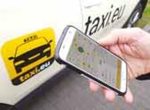
Ground transportation management company CMAC has partnered with Taxi.EU, Europe's largest taxi network and part of FMS/Austrosoft Group, a dispatch
provider. An API integration between CMAC Group’s booking platform and FMS/Austrosoft’s
allow CMAC Group to leverage a network of 165 transport providers and 65,000 vehicles.
its offering in nine European countries, including Germany, Austria, Switzerland and Belgium, according to CMAC. Customers including travel management companies will
transport options across key
Microsoft and TNO ink digital twins agreement
Microsoft has signed a memorandum of understanding with digital twin platform Urban Strategy. Aimed at smart cities and regions, the full service is offered in the Microsoft Azure cloud. It allows various scenarios to be explored live in 3D "where currently solutions will take days for a single scenario".
The result of this is "better, faster, data-driven decisions
public means spent in city infrastructure, and engagement with stakeholders, from city management to residents". Applications for the technology range from smart mobility and air quality to liveability and infrastructure resilience.
Cubic launches Umo platform in Bloomington
Cubic Transportation Systems has launched the Umo Mobility Platform in the US city of Bloomington, Indiana. Cubic said that the joint effort with Tag Canada Fareboxes and Bloomington Transit means
paying fares through mobile app, reloadable smart card, paper token and cash. Transit riders will also have access to powerful account-management features inside the Umo Mobility App and on the new Umo Passenger Portal to help them get where they need to go using the service, fare and payment option that best suits their needs.
Almaviva completes $335m acquisition of Iteris
Almaviva has completed the management company Iteris. The Italian digital specialist is keen to expand its footprint in the US. Iteris has a turnover of around $180 million. It was founded in 1969 in California and is headquartered in Austin, Texas. CEO Joe Bergera insists: "While our ownership has changed, our dedication to supporting our customers and industry partners—and the way we work alongside them— remains unwavering." Iteris will remain a separate legal entity and will retain its brand as part of Almaviva’s portfolio.
Bolt signs e-hailing deal with Dubai Taxi Company
countries, has entered UAE. As well as ride-hail, it offers scooter and e-bike rental, and short-term car rental. Bolt has a footprint in the region, launching in Saudi Arabia in 2017 and in Egypt earlier this year.
Dubai Taxi Company and shared mobility provider Bolt are aiming to create the largest e-hailing platform in the United Arab Emirates, thus reducing reliance on private cars, they say.
Jenoptik provides innovative and sustainable smart mobility technology and services.
As an end-to-end solution provider, we support our customers with the provision of roadside equipment and software, including integration and installation through to full-service operation. Our strong global presence and installation base is supported by a reliable partner network.
With innovation as our driving force, Jenoptik is a world-leading enabler for smart mobility, making roads, journeys and communities safer around the globe.
Follow us! jenoptik.com/markets/public-safety
“THAT WAS THE BEGINNING AND IT WAS AN END: I NEVER LOOKED BACK”
Carol Schweiger is a legend of the ITS industry. She talks to Adam Hill about her career, real train sets, equity, AI, quantum computing – and the difficulty of behaviour change
ome people just seem steeped in transport.
Carol Schweiger is one of those: she’s had nearly five decades’ experience consulting in ITS and advanced public transportation systems and is a regular speaker at the industry’s international conferences and congresses. Her interest runs very deep: you assume she must have had a train set when she was six, or something. “So you already know the story!” she laughs. It wasn’t a train set – it was the real thing. “When I was a little girl, my grandparents on my mother’s side lived in New York City,” she recalls. “I grew up in the suburbs of Boston so we would go to visit my grandparents. I was totally enamoured with public transport, and near where my grandparents lived there was a pedestrian bridge that went over a set of subway tracks. On a clear day, you could see into the next station down the line. And strangely enough, on a really clear day, you could actually see
As I got my voice a little bit more, they recognised that I had something to say, whether they agreed with it or not “ “
the Empire State Building. But I started to think to myself: how did they run these subways? And I was probably seven or eight, and I think my parents thought: ‘oh boy, something’s wrong here’.”
Schweiger wrote letters to New York City Transit Authority, asking things like: why do some trains stop everywhere and why are some just express services? The authority answered. “I think I wrote three letters to them,” she laughs. “They had a public relations department, and I was just so excited when I would get a letter [back].”
Majoring in math
The seed of the interest in transportation was sown, and Schweiger decided she wanted to be a transport planner as a career. However, there were no undergraduate transport courses at the time, so she became a mathematics major to get
Empire State of mind
the background for graduate school work in transport. “In my first job, I wasn’t really a planner,” she says. “I did a little more on the data analysis side, but I worked in a company that had government contracts with the US Department of Transportation, and specifically the Federal Transit Administration [FTA].”
There were also projects with local public transport authorities. “That whole side - of an agency operating what we now call mobility services - intrigued me,” she recalls. The company would give technical assistance to the FTA in a variety of areas. “So my boss at the time said: ‘We just received a task order about helping this agency in Oregon with scheduling software. Carol, you go to Oregon and go help them.’”
This was not what she was expecting. “So after I closed my mouth and got up from the floor, I thought: ‘How am I going to do this? I don’t really know very much about scheduling software’. That was the beginning and it was an end. It was the beginning of my career in ITS: I never looked back.”
She began to build her career on providing technical assistance, mostly to public transport agencies that were interested in technology. “I would help them write specifications, help them through the procurement process, help them oversee the implementation. And then I also did - and still do - some research for both our federal government and for the US Transportation Research Board.”
Schweiger developed a number of training courses. “I did training for a long time in public transport technology, because it’s very hard for people that work in those authorities to really plan or strategise for technology, because they are doing minute-to-minute operations: ‘This bus just broke down - I need to get another bus there - I need to get that bus back to the shop - I need to make sure people are transferred properly and everything goes smoothly.’ That’s what they deal with, which is a very reactive environment. When you’re planning for technology, it’s longer term, more strategic. You’ve got to really think about it over a certain period of time.”
The ITS moniker
WhileSchweiger’s name is synonymous with ITS, there was no ‘ITS’ when she started. “At the beginning, it had no moniker,” she says. “There was no name for it. They really didn’t have an umbrella term until several years after I was into it: then they called it ‘intelligent vehicle highway systems’ - something that I never really appreciated, being a public transport person. It was because the primary amount of funding for technology was on the highway side, so it had more of a highway connotation. And we’d always say: ‘Yeah, but public transport uses roads and highways, they should be included’. And then eventually they got
rid of the ‘vehicle highway systems’ and just called it ‘intelligent transport systems’.”
When Schweiger began life in the industry, it looked very different in other ways, too. “I was one of the only women in the room when I started. I actually worked with a wonderful fellow, and on my first couple of business trips the client thought that I was his daughter. But as I got my voice a little bit more, they recognised that I had something to say, whether they agreed with it or not. But it pretty much has been male-dominated up to the last couple of years. We’re all trying to promote women when they’re very, very young, to start thinking about careers that they probably wouldn’t have.”
Her way in, of course, was those early visits to her grandparents, and riding the New York subway. “My brother and I would play a game. We memorised the Manhattan subway map, and we would quiz each other - and we were pretty good at it, actually.”
People’s mobility
She has seen positive improvements since then. “I think the first one is focusing on people’s mobility - not the vehicle’s mobility. That’s probably the biggest change I’ve seen. We still need to do more work. And I would say some smaller, very positive things are recognising that individuals make travel choices [and] decisions totally differently. So I might make a different decision about taking a trip than you would - maybe a different mode - and you need to be able to explain in very simple terms to people what is available so that they can make the choice that works best for them.”
Positive though this is, it is difficult to cater from a policy perspective to the sheer variety of behaviours that individuals exhibit. “If you’re in a government role, what are the policies that could support the majority of those people?” she asks. “It’s very hard for government to tie those things together. It seems like it’s starting to come together, but it’s just taking time.”
Schweiger is a great advocate of Mobility as a Service but notes wryly that the term is heard less these days. “MaaS went along with the hype curve from the very beginning,” she smiles. Perhaps now there’s a different emphasis: “It’s just basically ensuring that everyone has access to whatever information is available about mobility services, [and] they can make their own choice. Going back to the government side of it, they can work with the public to develop the policies that support mobility and potentially support getting some people out of
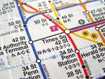
Manhattan subway map: for Schweiger, a lifelong fascination with public transportation began
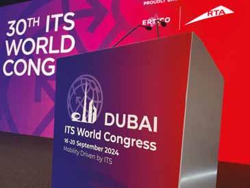
ITS World Congress in Dubai: lots of AI talk
their single-occupancy vehicles. But it’s very difficult to change behaviour.”
It would help if those who develop the mobility ecosystem always had users – whoever they may be - in mind at all times.
“There are a lot of different definitions of equity,” Schweiger says. “But I think in the technology world that we live in - in ITS and maybe transport in general - we don’t always have the right people at the table when we’re designing systems and deploying them.”
Transportation’s underserved communities are often left out because there is a lack of understanding of how their lives work and how they access information. “You know, if it’s someone who works a third shift and there’s a public meeting about developing some great technology infrastructure - they’re at work, or they cannot get to a meeting,” she says. “We need to really make a concerted effort as part of ITS design and development to make sure that we have all the groups at the table, so that we understand what they need and that we understand their values. We have for so many years, in ITS, left out cultural things. We don’t often think about that.”
Little patience
She has little patience with those whose sole argument is that all mobility problems will be solved if only the private car would just disappear. “We can’t always talk about simply getting someone out of their single-occupant vehicle,” she insists. “For a lot of people, that’s their mindset: ‘We can’t do anything else - get rid of the car!’ But we can’t get rid of the car. People live in rural areas where they have no access to any other form of mobility. They have to get to a doctor’s appointment, or they have to go to work very far away from where they live.”
Schweiger strikes you as an optimistic person. “I’m very encouraged by the number of dialogues now in the [ITS] world congresses, and some of the other congresses, about equity,” she says. “I’m really encouraged that we’re even having these discussions. We started them around the Singapore World Congress [in 2019], and we’ve continued that. I’m also encouraged by a lot of the younger people coming into the profession - and maybe they weren’t the traditional transport engineers or planners, they might be in a different discipline. We need people outside of ourselves to look in and say: ‘Why didn’t you think about that?’ And I’m very encouraged by that, because I’m hearing more people that don’t have the traditional planning
We need to really make a concerted effort as part of ITS design and development to make sure that we have all the groups at the table “ “
or engineering background coming in and being able to spotlight something that we probably would never have seen ourselves. A lot of us talk about innovation, but I don’t know that we understand what we mean by that, because innovation has a lot of meanings. There has to be something behind it. To me, again, on the optimistic side, it is because you want to make something better.”
Uses of AI
Artificial intelligence is a good case in point. At the ITS World Congress 2024 in Dubai, Schweiger was a rapporteur – part of a team appointed to report on the Congress itself – with a focus on AI. “Artificial intelligence, artificial intelligence, artificial intelligence - it was everywhere!” she says. “But if you actually read some of the papers, they throw the words ‘artificial intelligence’ into it – whereas it’s really like video analytics, which have been around for a couple of years.”
AI can make video analytics smarter, she acknowledges. But just saying everything is ‘AI’ as though that’s an end in itself doesn’t really advance the debate – and advancing the debate is something that Schweiger sees as vital. “We need to think about how best can we use something that’s so powerful,” she insists.
She recalls a session at a previous ITS European Congress on quantum computing. “A couple of people that I know said: ‘What is this doing here? Are you kidding me? Why were you talking about this?’ We’re talking about it because it’s a very powerful tool. And if you were creating new ways of doing things, you may be putting an undue burden on the computing resources that you have today - so wouldn’t it be great if you could apply quantum computing, which could do the analysis for you in a reasonable time frame? So I saw the purpose of that - maybe not this minute - but it already had some pretty reasonable arguments for being applied in ITS.”
The nascent conversations in ITS about quantum computing may be similar to the ones which were going on about artificial intelligence 10 or 15 years ago.
“There’s always going to be some pushback,” says Schweiger. “You know: ‘We’ve finally gotten good at video analytics - why don’t we just leave it alone?’ But there’s always ways to do things better. You can’t teach someone to be imaginative, to think about what the next innovation is, so that’s why we need these discussions. When people say: ‘Why are we talking about this?’ Well, you’ve got to think a little bit further ahead.” ITS
Automatic Wrong-Way Detection
Finally, a reliable lifeline for wrong-way driving.
Every second counts when a vehicle goes the wrong way. Citilog’s wrong-way detection system, powered by deep learning, provides accurate instant alerts for swift action.
Together, let’s make every journey safer with a solution that is:
•Precise, minimizing false alarms by a factor of 10 compared to other AI systems - letting you focus on real danger
•Proactive, preventing accidents before they happen with deterrence through warning systems
•Pre-trained and compatible with existing camera systems
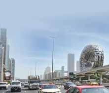
The Integrated Transport Centre in Abu Dhabi has big plans. Adam Hill hears why choices in the mobility ecosystem are crucial when it comes to economic development
million, out of 3.8 million people in the emirate as a whole – an increase of 80% over the last decade and a half.
Moving so many people to and from work, leisure and education is crucial to keep the engines of commerce going, and the emirate sees transportation as a key driver for economic development. “The new mobility ecosystem in any city can play a major role in the growth and development of that city and to meet [citizens’] aspirations,” says a spokesperson from the Integrated Transport Centre (ITC).
The ITC - which also has the brand identity of Abu Dhabi Mobility - is under the umbrella of the Department of
Municipalities and Transportation, responsible for both urban development and transportation. The two go hand in hand.
New focus for mobility
The ITC explains: “We need to ensure that we have the right urban plan that can complement the right mobility ecosystem. We came with a new focus for mobility to ensure that, at the end of the day, mobility needs to be ensuring quality of life: we are talking about reducing congestion, providing public transport, ensuring walking options.”
In the ITC’s plan, quality of life is the first of four pillars on which transport in Abu Dhabi is based. Walking, biking and scooting are being encouraged; people need to feel that the system is supporting and meeting their expectations and lifestyle. They need to be able to take part in active travel – the
safe to send their children to school by public school buses, rather than taking them in private cars.
Transport also needs to be sustainable, with an emphasis on electrification and alternative fuels such as hydrogen. “We need to ensure that public transport is green,” ITC insists. “We have a responsibility here in UAE to ensure that sustainability is clear in our mobility. And when we talk about sustainability, we are not just talking about electrifying a fleet. It's a wider understanding, about ensuring a diversity of choice for the people.” So owning a car is fine – but infrastructure needs to exist in order to make car choices more sustainable, for example through having sufficient electric vehicle charging points available.
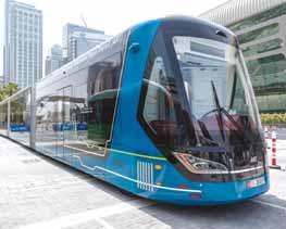
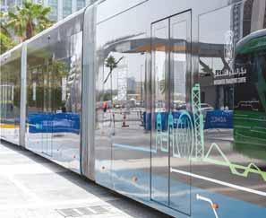
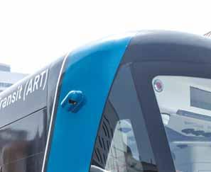
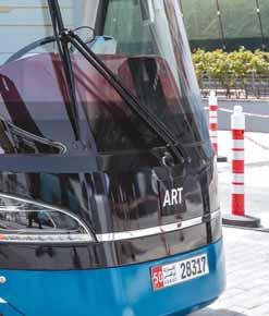
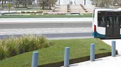
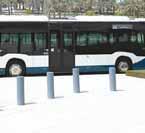
ART - automated rapid transit – operates on a 27km route from Al Reem Mall to Marina Mall
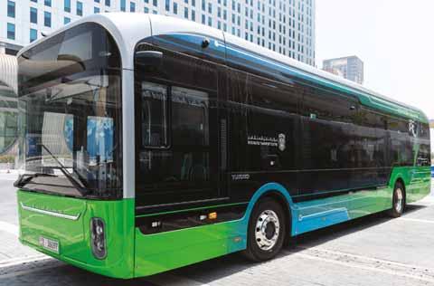
Monthly passes mean bus travel costs less than $1 per day, ITC says
AI technology
“The third pillar for the new ecosystem of mobility we have is to ensure we are smart,” the spokesperson continues. “How we designed the city 10 years ago is different than we design it today - and for sure, will be different than what we design [in 10 years’ time]. But we believe in Abu Dhabi that, if we know that AI technology is the real backbone for the future of mobility, we need to capitalise on this option today.”
Therefore the emirate is investing heavily in ITS systems and in smart parking and mass transit: “We are updating our ticketing system; we need to ensure people have their choice of payment. They need even to benefit from their usage of public and shared mobility. We are introducing Mobility as a Service now in the city. So managing
parking, toll gates, inspection, traffic management - we are planning a multiple programme to upgrade our operation.”
In other words, mobility must support all these economic sectors and meet their requirements. This is the focus of Abu Dhabi Mobility’s efforts: “A city without an economy, with no jobs, people will leave. Nobody will visit. So we need to ensure that when they want to visit Abu Dhabi, they have a choice.”
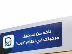
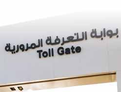
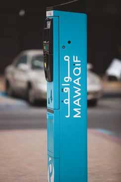
However, the emirate’s authorities are also realistic: many citizens require private transport: “You can't just get people out of their cars - they need them.” But equally, you can’t just drive where you want – at least not without paying. The Darb toll gate system aims to reduce traffic congestion and promote the use of public transport. Vehicle drivers are charged 4 AED ($1) to go through the gates, morning and evening. And if you drive cars, you need somewhere to put them when you get to your destination: MawaQiF, the parking sector of the ITC, has developed a parking management programme that aims to ensure a more accessible and less congested city, supporting Plan Abu Dhabi 2030.
After quality of life, sustainability and smart mobility, there is a fourth and final pillar to Abu Dhabi’s transportation ecosystem: the economy. This factor is always present, embedded in ITC’s thinking: “But now we bring the focus - we need to ensure that whatever mobility ecosystem we bring, it supports economic development. If the tourism sector does not feel that the mobility system supports their tourism plan, we have an issue.” The same goes for sectors from education to logistics and aviation; they must all feel supported by Abu Dhabi Mobility’s plans, use of technology and regulation if the move to shift people to different modes is to be a success.
Changing behaviour
For ITC, behaviour change is the key. “If somebody has, for example, 10 trips every day, and we can ensure that he moves four of them to an alternative from his car - by walking and public transport – that’s an achievement,” the spokesperson says. “So this is the way of changing the behaviour of people.”
We will still be a city that has a lot of cars: we are investing heavily now to ensure that we have the right operational platform “ “
Abu Dhabi Mobility is also keen to learn from other places round the world: “A lot of cities have a good way of thinking. Always, you will have something they can improve, and we need to continue to improve ourselves.”
ITC has noted, for example, plans to make London’s famous shopping road, Oxford Street, pedestrian-only, and has observed that UK politicians are supporting the idea of a major space to walk and enjoy –without motor vehicles.
It goes back to the idea of choices. “We are not trying to banish the car owner,” the ITC spokesperson insists again. “We believe that the new model is ensuring diversity of choice. For example, if you want to use your car, use your car.” Abu Dhabi Mobility would prefer that drivers change from internal combustion engine models to electric – but for that to happen: “We need to ensure that there is infrastructure for you. We need to ensure there's parking for you. We need to ensure the registration for you is there so we support you.”
Meanwhile, public transport needs to be affordable, comfortable and reliable, with a schedule that actually suits users’ needs. The question ‘Can I depend on this bus service?’ is of vital importance to riders: “Because in the end of the day, nobody is going out of his home just to use transportation - it's to reach for a need. So we need to ensure the distance between where you are and to meet your need is served by different choices: car is there, cycling is there.”
As in the rest of the world, people in Abu Dhabi are moving away from the idea of paying for assets they don’t really have to own. When it comes to mobility, they don’t necessarily want to make a
capital investment to ensure their mode of transport – they just need to ensure that they have access for whatever they need. Hence there is an emphasis on shared cars and taxis now too; in addition, WeRide robotaxis are already operating in Abu Dhabi and Uber plans to add them to its app in the emirate.
Weather is a factor in people’s transportation choices. Temperatures of 40 degrees C (104 degrees F) are common in Abu Dhabi’s summer months, so attracting people to public transport, such as buses, requires riders to be looked after while they’re waiting. Standing in the sun for long periods is not an option.
ITC is particularly proud that it has a significant number of bus shelters which are already air conditioned. There are currently around 450 in Abu Dhabi, with plans to add another 300. “Public transport is not about your seat within the bus. It's about the moment that you leave your home until you reach [your destination],” the spokesperson says.
Navigating Abu Dhabi
To make travel planning easier, all schedules are available on an app and on Google Maps, and monthly passes mean bus travel costs less than $1 per day. All of these elements will add up to make Abu Dhabi easier to navigate for work and leisure – and to ensure the emirate’s economic growth and competitiveness.
We need to ensure that whatever mobility ecosystem we bring, it supports economic development “ “
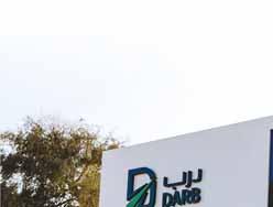
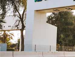
The Darb toll gate system aims to reduce traffic congestion and promote the use of public transport
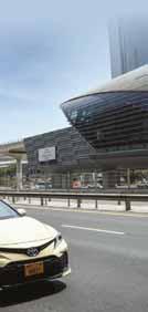
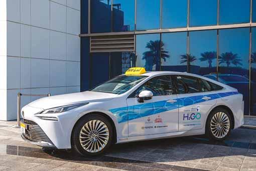
Taxis are a key part of the emirate’s mobility mix
But ITC does not expect any of these initiatives to eradicate the problems of congestion, decarbonisation and accessibility overnight: “There is not one pillar that will solve all the issues. It’s about all the small things you need to bring it together to ensure that there is a solution that meets your expectations. So we are working on that; we are working hard on that issue.”
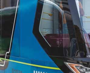
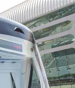
While there are no immediate plans in Abu Dhabi to build a metro like UAE neighbour Dubai, it does have a bus rapid transit (BRT) system as a key element of its public transportation solution, along with ART - automated rapid transit – which has the appearance of a long tram on wheels. This operates on a 27km route, running from Al Reem Mall to Marina Mall, passing along Zayed the First Street and Corniche Street on Abu Dhabi island.
And metro and light rail will come, ITC suggests, “at the right time, with the growth of usage and urban development of Abu Dhabi”. One area which is getting attention right now is signalised intersections to improve road safety. More than 500 signalised junctions in Abu Dhabi have priority for emergency and first responder vehicles, ITC says, while a mobile traffic management centre is on hand to manage major events: “It is clear that ITS will play a major role in traffic management.” The spokesperson points to Abu Dhabi’s upgrade to a new traffic management platform and its traffic modelling and simulation work. “A city is about the behaviour of the people within the city. Dubai is different, Amsterdam is different - it's about the choice and behaviour of the people.” Harnessing Big Data to analyse and forecast what’s coming is crucial.
Nothing stands still
“We will still be a city that has a lot of cars,” Abu Dhabi Mobility acknowledges. “We are investing heavily now to ensure that we have the right operational platform we need.”
Nothing stands still: the emirate is growing, with future plans for a new high-density area outside the island of Abu Dhabi: “The urban plan is coming, and also mobility is coming. Because in any city, it's about the economy, urban distribution, and how to connect this by a solid mobility system. So we are going in this cycle.”
To return to one of Abi Dhabi Mobility’s major themes: “We are not trying to manage the car owner. We don't want to shift everyone to use cycles or everyone to use cars or everyone to use whatever. We are trying to ensure that the new ecosystem gives diversity of choice.” ITS
Abu Dhabi’s urban population is around 2.5 million
Reconnecting communities
Hundreds of projects to reconnect US communities separated by roadways will launch in 2025. Mary Scott Nabers takes a look at a few of them and outlines what’s involved
The 4.2 million miles of roads and highways in the US are critical components of the country’s economic vitality. The transportation infrastructure allows Americans to commute, connect and transport goods efficiently. Yet, many of the older roadways limit access between communities, negatively impacting citizens and businesses. Congress has appropriated an abundance of funding to remedy these situations by supporting projects that reconnect communities with various types of new access options.
The impact has been profound, and many city officials are focused on removing physical and social barriers created by past highway construction. Most projects provide access extensions for pedestrians and cyclists, and often there are project components that include the addition of green spaces, paths and trails that beautify and connect communities.
The projects described below seek to align infrastructure investments with a commitment to social equity, environmental justice and inclusivity.
Multimodal modernisation
A large multimodal project with a projected cost of $1.3 billion will be launched in Massachusetts. It is currently in the environmental-permitting process, but this large effort will require many types of collaborative engagements between public- and private-sector partners. The I-90 Allston Multimodal Project will be led by the Massachusetts Department of Transportation and the City of Boston. When completed, it will deliver a reconstructed section of roadway that has been a physical and social barrier in Boston’s Allston neighbourhood for many years. The project will be designed to reconnect neighbourhoods previously separated by the interstate and reconfigure the interchange and railyard areas with modernisation standards outlined in Complete Streets programming. The existing I-90 interchange
no longer meets current interstate highway design standards, so the project will include removing 2,900 feet of elevated highway, constructing a multimodal transit station and adding walking and biking infrastructure. It will also include adding more than 10 miles of new sidewalks and bike trails and reclaiming over 40 acres of land for parks, open spaces and community developments. No timelines have been announced regarding contracting solicitations.
Pedestrian enhancements
A project in Denver, Colorado, will enhance a roadway and reconnect the Globeville and Elyria-Swansea neighbourhoods, which are some of the Mile High City’s most underserved communities. The neighbourhoods are located on the east and west banks of the South Platte River and are split by Interstates 25 and 70 as well as multiple railroad lines. This $68 million effort will call for the elimination of natural and man-made barriers by adding bike and pedestrian access. It will also include remediating a large, previously unusable brownfield site
Many older roadways limit access between communities, negatively impacting citizens and businesses “ “
so that it can be used for greenspace. Some aspects of the project are already under construction, including rehabilitation of the Franklin Street Bridge and the construction of a greenway corridor along the river. Other project components, however, are still being designed. Plans call for adding a 10-foot multi-use path and buffered bicycle lanes on the north and south sides of the road, plus a sidewalk on the south side. Another aspect of the overall initiative will provide pedestrian enhancements on Lincoln Street under Interstate 70 including lighting upgrades, sidewalk/pedestrian kerb ramp improvements, installation of bulb-outs (concrete curb extensions) and green infrastructure enhancements.
Bus rapid transit
A $61.5m connecting communities project will provide safe access for pedestrians and cyclists to cross Interstate 10 in New Orleans. A feasibility study found that 6% of the city’s fatal crashes involving pedestrians occurred on the I-10 service roads in New Orleans East. Collectively, the improvements will introduce a network of connectivity for walking, bicycling and transit that will remedy a major mobility gap. A key feature of the project is a 10-foot shared-use trail that will run along the north and south service roads for the length of the corridor. The design includes ADA-compliant ramps, crosswalks at intersections and the addition of pedestrian signals. Enhanced lighting, trees and landscaping along the trail are also included in the project. To overcome the divide created by I-10, the project will call for three bridges for non-motorised vehicles as well as shared-use trails. Construction is slated for 2025.
The Central Ohio Transit Authority is developing a bus rapid transit system that will connect downtown Columbus with the Prairie Township neighbourhood. This connection will also provide access to West Broad Street, a corridor that connects
various neighbourhoods, hospitals, schools, shopping centres, theatres and museums. The 9.3-mile project carries an estimated cost of $339m. It will incorporate rapid bus lanes with dedicated centre and kerbside lanes, along with construction of 17 new stations. Planned features include near-level boarding at stations, complete streets improvements and enhanced station amenities designed to improve safety and accessibility. It will also include a new park-and-ride facility and on-route vehicle charging at the western terminus. The purchase of 10 zero-emission or electric vehicles will be required, and work is slated to begin in 2025.
Reconnecting Knoxville is an infrastructure initiative designed to restore access between economic and cultural areas in the city that were separated by urban renewal projects, including the construction of James White Parkway. A project with a cost estimation of $85.6m will connect East Knoxville, Morningside Park, downtown Knoxville and South Knoxville via enhanced transportation pathways and new urban greenspaces. Currently, the James White Parkway and South Knoxville bridge over the Tennessee River both lack sidewalks and bike lanes. The plan will call for construction of access points for pedestrian and bicycle paths designed
to reconnect East and South Knoxville with downtown, local jobs and community resources. Plans also call for a greenway that will begin at the Old City and end at the Knoxville Botanical Garden and Arboretum. The project includes a Cultural Corridor – a multimodal pathway that features markers, maps and digital resources highlighting the African American history that once thrived alongside or near the corridor. The project is currently in the final design phase, and work is expected to begin in 2025
Officials in Milwaukee are planning to revitalise a 2.6-mile stretch of Sixth Street to provide community access to several historically marginalised neighbourhoods. Originally separated by the construction of Interstate 94/I-43 in the 1960s, several communities have experienced extensive disruption and isolation. This $36.5m project will be designed to create a unified, accessible route through these diverse areas. The transformed street will feature dedicated lanes for walking, biking and public transit, emphasising safer, multimodal access across the corridor. Plans include new public transit lanes with enhanced stations where feasible, fully separate bicycle lanes and a narrower roadway to reduce vehicular travel lanes. Trees and green space will be incorporated along the route to enhance the urban landscape and relieve the burden on Milwaukee’s combined sewer system. Design for the project will begin in 2025, but construction may be delayed until 2029. These upcoming projects will provide various types of contracting opportunities and the work, when completed, will revitalise the economy of numerous regions. ITS
ABOUT THE AUTHOR: Mary Scott Nabers is president and CEO of Strategic Partnerships
Knoxville, Tennessee has plans for enhanced transportation pathways and new urban greenspaces
Several projects involve improving – or creating – space for active travel
Generation Advanced Transportation Controllers (ATCs) Econolite’s Cobalt® controllers, powered by EOS, our premier controller software, and AI applications.
Asking good questions
At the 7th International TRB Women and Gender in Transportation conference, Mehri Mohebbi led the Gender Equity and AI in Transportation workshop. Here are some of her key takeaways from the session – and from the wider conference…
The 7th International TRB Women and Gender in Transportation Conference in Irvine, CA, provided a dynamic environment for practitioners and educators to discuss the vital intersection of gender equity, workforce development, and new technologies. It was a lively forum for talking about the crucial nexus between AI in transportation and gender equity.
The Gender Equity and AI in Transportation workshop gave me an
invaluable opportunity of participating in a thoughtful conversation with an outstanding panel of professionals from industry, non-profit, and government. Here are some key takeaways:
1. Workforce education is critical There is an urgent need for workforce education around AI. As AI technologies become more integrated into transportation systems, it’s essential that professionals— especially those in operational and decisionmaking roles—understand how these
systems work. Equipping the workforce with the necessary knowledge will ensure that AI is implemented thoughtfully and effectively, with a human-centric approach.
2. Inclusivity in workforce development is essential
For AI to truly serve everyone, inclusivity must be woven into the fabric of workforce
SWARCO McCain
Discover SWARCO McCain’s legacy of innovative Intelligent Transportation Solutions, including Traffic Management Software, ATC Controllers, Dynamic Message Signs, and our versatile and dependable ATC Cabinets.
mccain.swarco.com
Driven by Innovation and Global Expertise
“ “ Without embedding fairness and inclusivity into AI, we risk widening existing mobility gaps
development efforts. During the discussion, we emphasised that women, people of colour, and historically overburdened groups need to be not only included but to be in power to shape the future of AI-driven transportation. Having a diverse range of voices, particularly at decision-making levels, will ensure that the benefits of AI are distributed equitably across all communities.
3. The need for proactive collaboration
While large-scale regulations often take time, smaller actions at the sector level can create meaningful change. Our conversation highlighted the need for proactive collaboration between public, private and non-profit sectors. Non-profits, in particular, have demonstrated their ability to move the needle, and investing in these partnerships will be critical for fostering equitable innovation in transportation. We can learn from other industries - such as healthcare - on how non-profits leading movements for the betterment of existing systems has been.
4. Government presence is key to transformation
It was encouraging to see such a strong government presence during the event. Public-sector involvement is essential for driving transformation and ensuring AI is implemented in ways that prioritise equity. The collaboration between governments, private companies and non-profits will be vital in shaping policies that make AI-driven transportation solutions accessible to all, particularly underserved communities.
5. Equity is not just beneficial—it’s essential for the future of transportation
One of the most compelling takeaways from the workshop was that equitable approaches to transportation are not just beneficial—they’re necessary for the future. Without embedding fairness and inclusivity into AI, we risk widening existing mobility gaps and leaving vulnerable communities further behind. The collective energy in the room reflected a shared belief that innovation and equity must go hand-in-hand for a sustainable and inclusive transportation future.
Harnessing AI
As Dr. Patricia Hu, director at the Bureau of Transportation Statistics, Research and Innovative Technology Administration, said: “We are here to ask questions.” Good questions can lead to new research and collaborative efforts, ultimately resulting in AI systems that are inclusive, transparent, and adaptable. We need to harness AI not just for efficiency, but for justice and inclusivity. Collaboration across sectors will be essential as we push for a transportation landscape that is innovative and humane. I’m excited for what’s to come and motivated to continue these conversations with fellow thought leaders in the field. Together, we will keep pushing the boundaries of what’s possible in building a forward-thinking transportation future. ITS
Kinetic® Mobility
Mehri Mohebbi
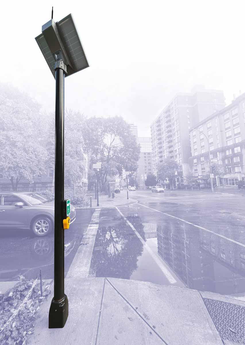
“With the Wireless Ped System, transportation departments can now deliver critical accessibility improvements that align with federal guidelines, in a fraction of the time and cost, enabling safer streets for all.”
— Ryan Macias, Vice-president, Applications Engineering at Polara.
Visit polara.com/WPS to learn more.
It’s finally here: the Federal Communications Commission has cleared the way to mass deployment of C-V2X in a bid to put a much-needed brake on the US’s road crash stats
The US Federal Communications Commission (FCC) has adopted final rules - its second report and order - for cellular Vehicle to Everything (C-V2X) technology. It means that, officially, in-vehicle and roadside units will be permitted to operate C-V2X technology in the 5.9 GHz spectrum band dedicated to ITS.
US transportation agencies and private sector companies can move beyond temporary waivers to fully deploy C-V2X devices.
“The FCC’s efforts to evolve the 5.9 GHz band are a win-win," says FCC chairwoman Jessica Rosenworcel. "It drives innovation in our wireless and transportation economies and can help keep us safe on our roadways when we walk, ride and drive."
The industry reaction has, unsurprisingly, been overwhelmingly positive.
Brian Cronin, director of the Intelligent Transportation Systems Joint Program Office (ITS JPO), says: “The US Department of Transportation applauds the FCC’s decision and doubles down on its commitment to support the deployment of these technologies.”
USDoT released a V2X roadmap in August to help solve what it calls "the crisis of roadway deaths": around 40,000 people a year die on US roads. “This is a core part of our Vision Zero goal to eliminate road fatalities,” Cronin confirms.
In a statement, USDoT said: “FCC’s ruling both provides the certainty needed for industry to bring these life-saving technologies to market, and encourages public agencies to invest. FCC’s leadership in
issuing the final rules for C-V2X technology accelerates deployment for public agencies and automotive manufacturers.”
ITS America also gave its backing to the FCC’s work towards the completion of this rulemaking. "We stand ready to work with our partners to make the promise of V2X a reality; leveraging transportation connectivity to significantly improve safety outcomes for our communities,” says ITS America president & CEO Laura Chace.
With this, C-V2X deployers have a significant tailwind
Jim Misener Qualcomm
One of the private sector’s biggest advocates of V2X technology, Qualcomm global V2X ecosystem lead Jim Misener, praised ITS America and the 5G Automotive Association. “[They] are two of many associations who rowed the same boat in to this important point,” he posted on LinkedIn. “I am confident that we will continue to lock arms to put this safety spectrum to good use on America's roads.”
Collective effort
He was “excited about the deployment opportunities and proud of the entire stakeholder community and FCC for the collective effort that led to this second report and order”.
The decision codifies C-V2X technical parameters in the FCC’s rules, including
power and emission limits and message prioritisation.
“With this, C-V2X deployers have a significant tailwind,” Misener added. “Let's give credit to the entire transportation community, as it was the collective that helped bring this about.”
The FCC rules provide flexibility for the auto industry to use three 10-megahertz channels either separately or in combination as a 20-megahertz channel or as a single 30-megahertz channel.
The FCC's order permits devices that have already been authorised under C-V2X waivers to continue to be marketed and operated.
It also provides a timeline for 'sunsetting' existing dedicated short-range communications (DSRC)-based technology.
Other ITS industry figures also expressed their support for the FCC decision.
“We are pleased that the FCC has approved the widespread deployment of C-V2X technology to improve roadway safety,” said Bryan Mulligan, president of Applied Information.
“Now communities can focus on the benefits of C-V2X and work to deploy this life-saving technology. We expect to see accelerated deployment across the US focusing on Day One applications, such as giving emergency vehicles green lights for better and safer response times and reducing speeds of vehicles around schools.”
Secure interoperability is possible, USDoT insists: “Together, we can create a safer and more reliable transportation network for all road users.” ITS
Intersection-level performance insights without connectivity
The new set of probe data-based performance metrics within ClearGuide® helps agencies reduce congestion by monitoring traffic signal performance and identifying deterioration at the intersection, without reliance on infrastructure.
iteris.com/signal-trends
GET. OFF. YOUR. PHONE!
Thousands of people were using their phone behind the wheel, or not wearing seat belts, in a five-week enforcement trial by Aecom and Acusensus in the UK.
On behalf of Safer Roads Greater Manchester, using the Heads Up camera system developed by Acusensus, 3,200 people were detected flouting the law.
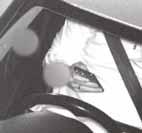
The images show drivers holding mobile phones in front of their face, to their ear while behind the wheel, sometimes with passengers – including children – next to them.
The cameras also found drivers, as well as adult and child passengers, not securely fastened in their seats or not wearing seat belts at all.
The findings were released during Brake Road Safety Week and in support of Greater Manchester’s Vision Zero Strategy and Action Plan to eliminate road deaths and life-changing injury by 2040.
The data will be used to inform future awareness campaigns and enforcement programmes; no-one has yet been prosecuted.
The Heads Up system recorded 812 drivers distracted by using mobile phones behind the wheel, and 2,393 incidents of seat belt non-compliance.
“Distractions such as using mobile phones while driving and not wearing seat belts are key factors in a number of road traffic collisions on our roads which have resulted in people being killed or suffering life-changing injuries," says Kate Green, Greater Manchester's deputy mayor for safer and stronger communities.
“This trial was launched so we could better understand the scale of this problem in Greater Manchester, and the images speak for themselves. They show drivers who are
needlessly putting themselves and others –including young children – at risk, and sadly we know that being distracted for just a second, or not wearing a seat belt properly, can have devastating consequences.
Despite the proven risks for road safety, too many drivers are still needlessly distracting themselves while in charge of their vehicle – and here’s the shocking proof
Manchester. In total, 64 people were killed over the course of the year – 25 of them pedestrians.
“I hope these images serve as a wakeup call for drivers and passengers on the importance of not driving distracted and seat belt compliance.”
In the last ten years nearly 10,000 people who live in, work in or visit Greater Manchester have been killed or seriously injured on the roads.
From 2018-22, pedestrians, cyclists and motorcyclists accounted for nearly two-thirds of those killed or seriously injured, while drivers and passengers made up 34% of casualties.
In 2022, there were 71 traffic fatalities or serious injuries every month in Greater
An action plan setting out how local authorities and partner agencies can achieve Vision Zero - the elimination of road deaths and life-changing injuries - will be considered by Greater Manchester Combined Authority on 29 November.
Dame Sarah Storey, active travel commissioner for Greater Manchester, said: "The results of the trial show the horrifying truth behind the number of drivers who still don't consider how their behaviour behind the wheel of their vehicle can affect themselves, their passengers and other people using the roads. Statistics show you are four times more likely to be involved in a collision if you use your phone while driving and twice as likely to die if you don't wear a seatbelt." ITS
Sadly we know that being distracted for just a second… can have devastating consequences “ “
Fiorentini: Almaviva is 'not done shopping yet…'
Enabling models of sustainable mobility
US-based ITS sector veteran Iteris has been bought for $335m by Italian digital specialist Almaviva. But who exactly is the new owner and what does it want? Adam Hill finds out…
Almaviva has completed its multi-million dollar acquisition of Iteris: but why does a company better-known for its involvement in the rail industry want to buy one of the best-known names in traffic management? Smeraldo Fiorentini, general manager of the transportation & logistics division at Almaviva, answers ITS International’s questions…
On the face of it, Almaviva does not seem to be an obvious fit with the transport industry. Leaving aside the acquisition of Iteris for the moment, can you tell me where transportation & logistics sits in Almaviva’s structure?
Almaviva is a leading Italian company in the information technology sector. Not only are we leaders in Italy in the field of digital technologies applied to the transport and logistics industries, but we are also increasingly expanding our presence in international markets. We have more than
25 years of experience in the creation and management of mission-critical systems for Gruppo Ferrovie dello Stato, one of the main rail operators in Europe. Given our considerable expertise in the rail industry, in 2016 we launched a development plan to position ourselves in all segments of the transport and logistics sector, both in Italy and abroad.
Can you explain your Moova mobility platform? What is it, how does it work, and who is currently using it?
It is no exaggeration to say that we have capitalised on and consolidated over 20 years' experience in Moova, an integrated, modular and seamless mobility platform, capable of connecting different modes of transport in a single and advanced technological framework. Moova benefits all those operating in the mobility sector, from authorities and transport operators across different transportation modes to transport infrastructure managers. It aims to enable new paradigms and models of sustainable
mobility, which are increasingly driven by global macro phenomena. These include climate change - caused by pollution for which the mobility sector is one of the main culprits – and significant demographic shifts, with population density in urban areas on the rise.
At Smart City Expo World Congress in Barcelona in September, you highlighted your traffic management work with Roma Mobility Services. Can you expand on that? And also, Almaviva CEO Marco Tripi said that you are “already leading significant mobility projects across the Middle East, the UK, various European countries, the Americas and North Africa”. Can you give us some more examples?
The command and control room we developed for Roma Servizi per la Mobilità offers a unique and operational view to manage, coordinate and monitor urban mobility in an integrated way. It is an important
efficiency, improvement of mobility accessibility and reduced environmental impact. Its capabilities, however, extend well beyond monitoring. We have also moved towards the development of flow-forecasting models based on the data acquired, which are capable of generating simulations supporting decisions on traffic regulation. Managing the complexities of mobility in the 'eternal city' has been a milestone moment for us and has raised awareness of our services abroad and helped to export and bring ‘Made in Italy’ into the IT sector. We have been conducting major international activities for years now. In the UK in 2020 we implemented two projects related to the equipment of on-board solutions for train fleets and the supply of the related software control systems, through our Moova platform. The delivery of the on-board systems has been completed and the fleets are now fully
Iteris, in particular, has a strong track record and brand recognition in the road and urban mobility industry
ling trains remotely. Furthermore, we have been carrying out a range of international projects in numerous countries other than the UK. For example, we contribute to the management of operation and maintenance systems for the underground in Riyadh, Saudi Arabia, and we provide on-board technology for infotainment and safety services for the underground in Washington DC. We launched a mobility app in Lausanne, Switzerland, and are currently creating the integrated ticketing system for Cairo, Egypt’s capital and most populated city. Last but not least, our passenger information system is operating in all stations in Finland.
Turning to Iteris: $335m is a lot of money
- why have you bought the company? It gives you a footprint in North America, but what else do you want from the acquisition?
We have completed a number of acquisitions in recent years in different territories, each of which reflects our ongoing strategy to strengthen our presence in high-potential markets with a focus on technology. Our objective is to enrich our product portfolio to position ourselves as suppliers of end-toend solutions and to speed up the launch of our offer in target markets. The acquisition of Iteris is the latest example of how we are working towards achieving this.
The Iteris brand is remaining for now – but do you think the brand will disappear eventually?
Our keyword is integration. We have used the same approach in all the acquisitions carried out in Italy and abroad: maintaining the brand identity of the companies that join our group. Iteris, in particular, has a strong track record and brand recognition in the road and urban mobility industry which, combined with our experience inand knowledge of - the rail and Mobility as a Service sector, will enable us to accelerate the development of increasingly innovative solutions and products for our customers, and increase our competitiveness in new and promising markets.
Marco Tripi also talked about you strengthening your presence “in highgrowth, technology-driven markets”. Are you considering other acquisitions in transportation?
We are always on the lookout for new opportunities and open to evaluating potential acquisitions which we align with our strategy and target markets. One could say we are not done shopping yet… ITS
Almaviva is creating the integrated ticketing system for Cairo
Sensory perception
At the Vision 2024 show in Stuttgart, Germany, a wide variety of traffic-related solutions were on display. Adam Hill takes the temperature of the industry with four attendees…
All companies need to adapt if they are to survive in ultra-competitive markets.
The vision technology sector is no different –especially when it comes to that subset which is concerned with providing products and solutions to enable smarter traffic management.
“Smart sensors with edge processing and IoT [Internet of Things] connectivity are the ‘new normal’ for vision technology,” suggests Jan-Erik Schmitt, CEO of Carrida Technologies.
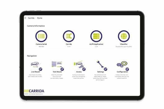
“This makes perfect sense if you look at the additional benefits that you can obtain therewith.” Cameras with Carrida software, for example, can identify cars by their licence plate and also recognise make and model – providing high reliability, if registered and recognised vehicle type match.
“In addition, it enables advanced traffic statistics that can be used to optimise services,” Schmitt continues.
“This is even more so, if the traffic sensors are interconnected and if, for example, travel time and traffic routes can be analysed. Of course this
requires GDPR-compliant and secure data handling, which is another ‘new normal’. AI, of course, also drives this development towards smarter solutions.”
‘New normal’
Jan-Friso Blacquière, vice president of sales at Hailo, sees the 'new normal' in the traffic sector characterised by the integration of advanced technologies and AI-driven solutions to improve safety, as well as streamline traffic management. “With the rise of smart cities, we see an increasing reliance on cameras and sensors to monitor traffic patterns, detect incidents and accidents,
“
“ We're seeing heightened interest in solutions that improve real-time analytics and enhance traffic management capabilities
Jan-Friso Blacquière
Hailo
and respond in real time,” he says. “The analysis of data accumulated from countless sensors and cameras allows for better planning and optimisation of traffic and public transportation management, while real-time insights and alerts allow for immediate resolution of situations that could be dangerous or create congestion.”
For Andrea Van Landingham, Theia Technologies VP business development, larger sensors and larger pixels are becoming the norm. “That makes finding a variety of suitable high-performance, affordable lenses more challenging,” she adds. “When the sensor is larger the image circle of the lens grows, often resulting in lenses larger in diameter and longer, resulting in more material and cost.”
“Cameras and image processing have long contributed to enhanced safety and planning - not just recently,” says Neil-Steven Sandhu, area sales manager of IDS Imaging Development Systems. “Technologies like AI are now making them even more powerful. For example, real-time traffic analyses can prevent congestion and intelligently manage traffic flow.”
“ “ We see larger sensors and larger pixels becoming the norm
Andrea Van
Landingham
Theia
traffic flow.”
One indicator of the direction of a sector is the type of products and services companies are receiving requests for. Van Landingham is very specific about what Theia’s customers are currently demanding: “100mm telephoto lenses for the larger >1 sensors for ANPR.”
Meanwhile, Hailo provides a portfolio of processors designed to run AI applications and process data - specifically video data - at the edge. “Our customers are particularly interested in solutions that allow for the seamless integration of AI capabilities into smart transportation systems for security, access control, tolling, behaviour analysis and more,” Blacquière says. “Our comprehensive software suite allows applications developed for smart transportation to be easily deployed across various platforms, such as edge boxes, NVRs and security cameras, enhancing flexibility and scalability for our customers. We're seeing heightened interest in solutions that improve real-time analytics and enhance traffic management capabilities, as well as those that drive safety and efficiency in video surveillance and smart city initiatives.”
Diverse market demands
For Schmitt at Carrida, the picture looks slightly different. “In the past, it was all about parking, where licence plate recognition simplifies booking and management, access control and payment, or smart city applications and law enforcement, where LPR is used to collect data in moving traffic,” he says. “Recently, we also get many requests
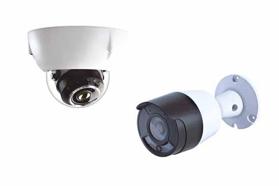
from companies in the field of EV charging and smart home automation. They integrate LPR into garage doors, install cameras to optimise the usage of small parking spaces and to manage e-mobility infrastructure. For EV charging applications, LPR also simplifies authentication. Our Plate-i ALPR camera series, with an extremely competitive price, enables such applications and we have received a very positive feedback from the market.”
IDS finds market demands are very diverse, notes Sandhu. “Notably, there is significant demand for embedded systems with light-sensitive, high-resolution image sensors and a high dynamic range,” he
“ The more precisely a neural network is trained and the better a camera understands what is expected of it, the better the results
Neil-Steven Sandhu IDS
explains. “The aim is to consistently obtain high-quality images even under varying lighting conditions. Additionally, more and more application scenarios are emerging for AI-capable cameras - for instance, in traffic monitoring systems for detecting and classifying vehicles and pedestrians. However, there is no ‘one size fits all’ solution. Our team at IDS carefully examines each application and recommends the appropriate vision technology to our customers.”
The ability to scan the horizon successfully is another way in which companies maintain relevance – and, crucially, profitability. Artificial intelligence is expected to play a big role in most industries going forward.
“AI expands the scope and capabilities of industrial cameras, especially when it comes to real-time data analysis for more efficient traffic control,” says Sandhu. “They assist in predicting traffic flows and can ideally prevent incidents before they actually occur. More generally, AI is capable of processing even large volumes of data very efficiently and drawing conclusions, which typically leads to increased efficiency and effectiveness.”
So what are the next big developments in vision tech going to be? For Van Landingham, it is: “Combining sensing technologies and harnessing their data for AI in digital twins and other ways for solutions development.”
There is already a lot underway, says Sandhu, but advanced AI algorithms for predictive traffic analyses and the development of smart city infrastructures with networked vision systems are set to become increasingly important. “Nevertheless, classical image processing still holds a firm place in the traffic sector, with trends moving towards smaller, faster, and more cost-effective solutions,” he adds.
Next big development
AI boosts the development of smart devices, and vision tech provides the necessary data,
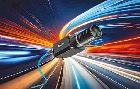
IDS NXT Malibu camera
IDS finds traffic market vision demands are ‘very diverse’
“
“ Smart sensors with edge processing and IoT connectivity are the new normal for vision technology
Jan-Erik Schmitt Carrida
says Schmitt: “We have been using AI to improve the reading results of our Carrida software and for additional features such as make and model recognition for a while already and the combination is very successful.” There will be further developments, he suggests: “On top, with cameras like our Plate-i series, that provide on-board licence plate recognition at a very competitive price, we’ll see even more appliances with cameras and LPR functionality in the future.”
The next big development in vision technology will be the rise of vision language models (VLMs), which integrate visual understanding with natural language processing, thinks Blacquière. “We believe this technology has the potential to transform how we interact with and interpret visual data,” he says. “As these models advance, we can expect systems to be able to analyse footage and generate summarisation and actionable insights based on both visual data and natural language queries. This will allow systems to not only identify objects but also understand their relationships and contexts
within a given environment. Additionally, the integration of VLMs into smart transportation systems could lead to more intuitive interfaces for operators and improved decision-making processes. We see AI as the foundation to all these transformations.”
All of this comes at a cost – and for customers in challenging economic times, price is always an issue. So are there tips and tricks to maximise the value of vision in the traffic sector? “Absolutely,” says Sandhu. “Depending on the application, utilising edge computing is advisable to reduce bandwidth and storage costs. To get the most out of an AI application, it is sensible to bring in the expertise of specialists - these could be research institutions or manufacturers like us. The more precisely a neural network is trained and the better a camera understands what is expected of it, the better the results.”
Van Landingham suggests: “Using varifocal instead of fixed focal length lenses can cover multiple focal lengths with minimal SKUs. Also, minimising set-up and downtime by using motorised lenses for remote focus and zoom. Using lenses with calibration data to combine with sensor level calibrations
at the [camera] factory to facilitate quickly finding focus in the field.”
Carrida LPR software is optimised to run on any embedded hardware and with minimal resources, says Schmitt. “This enables the development of extremely cost-effective solutions, be it for parking applications or LPR in fast-flowing traffic,” he adds. “We have also recently introduced the Plate-i Series of ALPR cameras. With its unmatched entry-level volume price below €500 it enables partners and OEMs to design completely new applications based on licence plate recognition.”
Applying AI analytics at the network edge is financially advantageous, as video data does not need to be streamed to the cloud, points out Blacquière. “Video analytics can take place on the edge, and only insights and metadata can be transmitted to the cloud for long-term storage,” he explains. “Using edge AI processors such as the Hailo devices is particularly beneficial, as these processors are designed to run AI on the edge at high efficiency, resulting in cost saving both on compute power as well as power consumption.” ITS
Carrida Plate-i
Cameras with Carrida software can identify cars by their licence plate and recognise make and model
You’re entering the dilemma zone
Indecision on the road can kill. Econolite’s Sunny Chakravarty and Vincent Mayeda present new data-driven dilemma zone and intersection safety strategies for a Vision Zero future
Despite advances in roadway design and planning, safety in the “dilemma zone” remains operationally problematic. According to Gazis, Herman and Maradudin’s original 1960s research, a dilemma zone is defined as the section of the roadway when approaching an intersection in which a driver is unable to stop safely before the stop bar or proceed through before the signal turns red.1
This area is known as the “Type I” dilemma zone. In the 1970s, further research by Zegeer and Deen and others considered distances from an intersection for “likely stop” and “likely go” scenarios relative to vehicle velocity and driver behaviour, which led to the concept of the “Type II” dilemma zone.2
This refers to the section of the roadway approaching an intersection in which a driver has to decide to either stop or proceed through the intersection before the signal turns red, and each individual driver may potentially make a different decision when presented with the yellow signal indication. This “decision” zone is a critical point to ensuring safety at the intersection for all roadway users. (Figures 1-2: Type I and II dilemma zone diagrams)
The enormous impact of vehicle collisions, particularly at intersections, is a major global challenge to Vision Zero. It is well-documented that crashes claim around 1.35 million lives annually with approximately 50 million people sustaining serious injuries and living with long-term health consequences.3 This negatively impacts economies, healthcare
systems, transportation networks and quality of life. New strategies for dilemma zone protection are needed to help reach a Vision Zero future.
Dilemma zone’s dilemma Intersection collisions and conflicts are, for the most part, due to driver misjudgment of the traffic signal transition from green-to-yellow-to-red. The misjudgment most often occurs when the driver perceives the traffic signal change to yellow and must decide to stop before the intersection or proceed through it, possibly violating a red signal. That is the classical “dilemma zone” problem.
“
“ The enormous impact of vehicle collisions, particularly at intersections, is a major global challenge to Vision Zero
Key statistics from sources such as the latest report from the Insurance Institute for Highway Safety (IIHS) underscore the importance of dilemma zone protection. According to the IIHS, red-light running collisions caused 1,109 deaths in the US in 2021, along with approximately 127,000 injuries.4 Half of the fatalities were other vulnerable roadway users, including pedestrians, bicyclists and other motor vehicle occupants hit by drivers who violated the red signal. These findings emphasise the challenge and importance of dilemma zone safety.
Under the principles of Vision Zero, fatalities and serious injuries due to
roadway traffic collisions - including intersection conflicts - can be prevented. However, dynamic data-driven strategies are needed to make more substantial and sustainable gains for dilemma zone safety.
Dilemma zone: solvable physics problem
The Type I dilemma zone problem can be addressed with appropriate yellow clearance, which is determined based on kinematics equations with an assumed speed and deceleration rate for a typical vehicle approaching the intersection.
The Type II dilemma zone problem is harder to address because it involves a decision component on the part of the driver. When Chang, Messer and Santiago defined the boundaries of the Type II dilemma zone (also known as “decision zone”) in terms of travel time to the stop bar, they observed that 85% of drivers stopped if their vehicles were three or more seconds away from the stop bar when the signal light turned yellow, but almost all drivers continued through the intersection if they were two or fewer seconds away from the stop bar.5 The length of the decision zone itself is determined as the area between the point until which ‘Most Stop’ and the point beyond which ‘Nearly All Continue’ when faced with a yellow signal indication. (Figure 3: Driver behaviour and decision zone diagram)
The Signal Timing Manual 2nd Edition, which provides trend-based guidance from previous studies, indicates that the decision zone usually exists between 5.5 and 2.5 seconds of travel time from the stop bar.6
The Signal Timing Manual quantifies these values in stop bar distance, dictated by various common approach speeds. This travel time-based definition is the simplest quantification and effectively applies physics to the decision zone, which can then be used in signal timing. But it should be used with caution as the decision zone problem involves individual human factors - including driving style, level of attention, and perception and reaction time - which often render “static” solutions to the problem ineffective. (Figure 4: The Signal Timing Manual 2nd Edition chart)
Role of signal timing
The appropriate length of yellow signal change and red signal clearance timing, paired with accurate detection technology for green or red signal extension activation, represents a standard way to help mitigate conflict at an intersection with other vehicles, as well as pedestrians and bicyclists.
The first objective when identifying a solution for a dilemma zone is to determine the green signal extension indication. Traditionally, the green signal timing interval is extended for drivers passing through advanced detection zone(s) positioned at various key locations along the roadway, ahead of the intersection based on the posted speed limit for the roadway. Each detector has its own green extension timer with preset timing pertinent to the travel time from that dilemma zone location to the stop bar at the designed approach speed.
However, after a certain point, it becomes unfeasible to continue extending the green signal interval. In this situation, the mitigation strategy relies on an appropriatelytimed yellow signal change and red signal clearance interval and extending the red clearance interval until all conflicting - and potentially conflicting - drivers have safely passed through the intersection. These strategies provide the second layer of mitigation when green signal extension is no longer feasible.
Velocity and other factors
Green signal time, yellow signal change, and red signal clearance intervals work together in providing dilemma zone protection. Chang et al presented an equation in terms of the driver’s position approaching the intersection in relation to the distance that the driver can travel at a constant approach speed, given the yellow signal change and red signal clearance time:
x + w + l <= v(Y+AR)
In this equation, x is the distance of the driver from the stop bar, w is the width of the intersection, l is the length of the vehicle, v is velocity of the vehicle approach, Y is the yellow signal change duration, and AR is the
FIGURE
FIGURE 1
Diagram
FIGURE 2
Diagram of the Type II dilemma zone or decision zone where a driver is able to stop before the intersection
FIGURE 3 Strategies to protect the intersection must include driver behaviour
> Non-intrusive system including high positioning tolerance
> Decoy function to strengthen the deterrent and educational effect on users
> Stationary solution for enforcement of multiple road traffic offences
> Smart traffic enforcement through 3D-LiDAR technology
red signal clearance duration. This equation stipulates that the distance a driver must travel to reach the far side of the intersection must be less than or equal to the distance the driver will travel at a constant speed for the duration of the yellow signal change and red signal clearance.
In addition to the distance travelled, Chang et al also noted that stopping distance is just as important to determining appropriate signal timing to enhance dilemma zone safety:
xs = v * t + v^2/(2*c)
This stopping-distance formula includes t as the driver’s perception-reaction time and d represents the deceleration rate. If the stopping distance xs is greater than x, or the distance the driver will travel for the duration of the yellow signal change and red signal clearance in the prior equation, then the driver will not be able to stop before the intersection, and the yellow signal change plus red signal clearance time will not be sufficient to provide safe passage through the intersection.
The Signal Timing Manual 2nd Edition provides a formula from the Institute of Transportation Engineers (ITE) to calculate the yellow signal change interval:
Y = t + 1.47v
2(a + 32.2 g)
In this formula, Y is the yellow change interval in seconds, t is the perception-reaction time to the onset of a yellow indication in seconds, v is the approach speed in miles per hour, a is the deceleration rate in response to
the onset of a yellow signal indication in feet per second per second, and g is the grade with uphill positive and downhill negative (percent grade / 100) (feet / feet).
The National Cooperative Highway Research Program (NCHRP) 731 report recommends a deceleration rate of 10 feet per second per second and a perceptionreaction time of 1.0 second for signal timing determinations.7 However, Chang et al recommend a longer perception-reaction time of 1.2 seconds, with some agencies applying an even longer reaction time factor of 1.5 seconds.
New technologies: new dilemma zone strategies
While the signal-timing design strategies and recommendations described above based on traffic studies and research are somewhat effective for dilemma zone protection, the challenge is that they do not take into consideration the dynamics of vehicle type (e.g. trucks and other large vehicles require longer stopping distances), trajectory or
specific driver behaviour. But the reality is that vehicles and drivers are unique and different, and different road conditions affect the dilemma zone problem in different ways.
Fortunately, new dilemma zone protection strategies can now be developed and implemented based on new capabilities powered by leading-edge sensor and software technologies that can instantaneously sense geopositional vehicle information, vehicle type/classification, and vehicle tracking information (including vehicle velocity). This additional vehicle data provides more accurate and dynamic information on vehicle type, trajectory and user behaviour, which can be used to develop more effective dilemma zone protection strategies. High-resolution, real-time sensor data combined with innovative traffic controller software can apply real-time signal timing changes to effectively address real-time roadway conditions and vehicle and driver behaviour to help reduce intersection conflicts.
(Figure 5: Video detection)
Similar to video sensors, speed-conditional motion zones can also be established with radar sensors
FIGURE 6
FIGURE 5
New video sensors can provide advance speed-conditional detection zones.
Leading-edge radar and video sensors now offer alternative solutions to fixed-point detection for dilemma zone configuration and protection strategies. Advance detection zones can be created as ‘motion’ zones to accommodate highly variable traffic condition elements to control the zone’s output.
Motion zones can be conditioned on attributes like vehicle approach speed, direction, class and ETA to enable different dilemma zone protection strategies for different kinds of vehicles and scenarios. It can also help address vehicles travelling below or above the posted speed limit, which may require significantly different decisionzone lengths. (Figure 6: Radar detection)
In addition, modern technologies and advanced software mean that monitoring, reporting and analysing real-time signal states can be leveraged to continuously study and develop new mitigation strategies. Timestamped events and signal performance measures (SPM) data fed to traffic simulation software can also be used to create simulations of vehicle trajectories and various actuations to understand problems related to the dilemma zone and assess different mitigation strategies before actual implementation.
Summary
The benefits of real-time, data-driven applications for dilemma zone protection strategies are profound. With sensor and software
technologies now providing situational awareness with high-resolution, real-time vehicle data that includes speed, location, trajectory, classification and ETA of all approaching vehicles, more intelligent strategies, including artificial intelligence applications with predictive capabilities, can now be employed. This opens the door for far-reaching mobility and other comprehensive safety enhancement strategies, helping us accelerate towards a Vision Zero future. ITS
References
1. Denos Gazis, Robert Herman, Alexei Maradudin, (1960) The Problem of the Amber Signal Light in Traffic Flow. Operations Research 8(1):112-132
2. Charles V. Zegeer, Robert C. Deen, (1978) Green-Extension Systems at High-Speed Intersections. Kentucky Transportation Center Research Report 835.
3. World Health Organization (WHO), Safety and Mobility (SAM), Social Determinants of Health (SDH), (2023) Global Status Report on Road Safety 2023. ISBN: 978-92-4008651-7
4. Insurance Institute for Highway Safety (IIWS), (2023), Red Light Running, https:// www.iihs.org/topics/red-light-running
5. Myung-Soon Chang, Carroll J. Messer, Alberto J. Santiago, (1985) Timing Traffic Signal Change Intervals Based on Driver Behavior. Transportation Research Record: Journal of the Transportation Research Board (TRB), No. 1027, TRB of the National Academies, Washington DC
6. Tom Urbanik, Alison M. Tanaka, Bailey Lozner, Eric Lindstrom, Kevin Lee, Shaun Quayle, Scott Beaird, Shing Tsoi, Paul Ryus, Doug Gettman, Srinivasa Sunkari, Kevin Balke, Darcy M. Bullock, (2015), Signal Timing Manual 2nd Edition, Report: National Cooperative Highway Research Program (NCHRP) 812, Transportation Research Board (TRB) of the National Academies, Washington DC
7. Transportation Research Board, National Cooperative Highway Research Program (NCHRP) Report 731: Guidelines for Timing Yellow and All-Red Intervals at Signalized Intersections offers guidance for yellow change and all-red clearance intervals at signalized intersections (2016). DOI: 10.17226/22700, Project Number: 03-95
CrossWIM is a modular system to help you weigh vehicle in motion, monitor and assess traffic.
www.cross-traffic.com
WEIGH-IN-MOTION
ABOUT THE AUTHORS:
Sunny Chakravarty (left) is vice president of engineering and Vincent Mayeda is marketing communications specialist for Econolite
Nervous about AV travel? You’ll get the Gist
Help is on the way for those slightly anxious folk who will accept rides from automated vehicles but will likely feel uncomfortable doing so, reports David Arminas
Scientists from South Korea’s Gwangju Institute of Science and Technology (Gist) say they have created strategies to make passengers feel safer in self-driven vehicles. Automated vehicles (AVs) may be part of the future urban mobility mix, but passenger trust remains a challenge. Providing timely, passenger-specific explanations for the decisions AVs make can bridge this gap - so Gist’s researchers have investigated a method of increasing passengers’ sense of safety and confidence in AV trips.
Their TimelyTale is a novel dataset designed to capture real-world driving scenarios and passenger explanation needs. The goal, they say, is to have the in-vehicle multimodal dataset in all AVs.
Driverless cars enable human users to engage in non-driving related tasks such as relaxing, working or watching multimedia en route. However, widespread adoption is hindered by passengers' limited trust. Understanding why AVs react a certain way can foster trust by providing control and reducing negative experiences. However, explanations must be informative, understandable and concise to be effective.
Existing explainable artificial intelligence (XAI) approaches majorly cater to developers, focusing on high-risk scenarios or complex explanations, which are both potentially
unsuitable for passengers. Instead, passengercentric XAI models need to understand the type and timing of information needed in real-world driving scenarios, said Professor SeungJun Kim, director of the HumanCentered Intelligent Systems Lab at Gist.
TimelyTale was created to include passenger-specific sensor data for context-relevant explanations which make people feel more confident about their trip. “Our research shifts the focus of XAI in autonomous driving from developers to passengers,” said Kim. “We have developed an approach for gathering passengers' actual demand for in-vehicle explanations and methods to generate timely, situation-relevant explanations for passengers.”
The researchers first studied the impact of various visual explanation types, including perception, attention and a combination of both - and their timing - on passenger experience under real driving conditions by using augmented reality.
They found that the vehicle’s perception state alone improved trust, perceived safety, and situational awareness without overwhelming the passengers. They also discovered that traffic risk probability was most effective for deciding when to deliver explanations, especially when passengers felt overloaded with information. Building upon these findings, the researchers developed
the TimelyTale dataset. This approach includes various types of data: exteroceptive (regarding the external environment, such as sights and sounds); proprioceptive (about the body's positions and movements) and interoceptive (about the body’s sensations such as pain).
The data was gathered from passengers using a variety of sensors in naturalistic driving scenarios, as key features for predicting their explanation demands. Notably, this work also incorporates the concept of interruptibility, which refers to the shift in passenger focus from so-called ‘non-driving-related’ tasks to ‘driving-related’ information. The method effectively identified both the timing and frequency of the passenger’s demands for explanations as well as specific explanations that passengers want during driving situations.
Using this approach, the researchers developed a machine-learning model that predicts the best time for providing this information. Additionally, as proof of concept, the researchers conducted city-wide modelling for generating textual explanations based on different driving locations.
"Our research lays the groundwork for increased acceptance and adoption of AVs, potentially reshaping urban transportation and personal mobility in the coming years," concludes Kim. ITS
Our research lays the groundwork for increased acceptance and adoption of AVs
SeungJun Kim
Gwangju Institute of Science and Technology
Weigh in Motion systems are not new. What is new is their ability to collect more data and –importantly – more accurate data about axle loading and vehicle weight. Despite the obvious benefits, including safer highways and possibility of automated legal weight enforcement, obstacles remain for faster uptake. David Arminas reports on the manufacturers’ perspective…
fatal crashes. Overloading increases vehicle stopping distances and risks tyre blow-outs, creating dangerous conditions for all road users. Unfortunately, overloading is still all too often viewed as a minor infraction, despite it costing millions in road damages and thousands of lives lost on the world’s highways annually.
client and supplier for successful use of the systems, says Florian Weiss, chief executive of Traffic Data Systems in Hamburg. “Most tenders tend to rely on parameters that were in the distant past, despite WiM technology having greatly moved on, especially in the area of dynamic WiM and law enforcement,” he says.
Vastly improving Weigh in Motion technology can help combat overloaded vehicles and improve the safety of the world’s highways. They can help road and bridge designers and also aid highway agencies and owners with enforcement of road weight restrictions.
The market is increasing for these systems. But while the technology is there and getting better in leaps and bounds, there remain issues and obstacles concerning the uptake of WiM, according to some leading manufacturers.
Not least among these is a lack of understanding by clients about what exactly WiM can do for them or what is required from
“The issue is really that the people writing the tenders are not familiar with the technology and they might use a consultant to write it.” This is the situation in Germany at least, where, he says, the market is at a virtual standstill. “It is one thing to supply the systems, it is another to maintain them
“
Overloading can cause travel disruption – and worse
“ Most tenders tend to rely on parameters that were in the distant past, despite WiM technology having greatly moved on
Florian Weiss Traffic Data Systems
or at least one motorway lane. This can be complicated and expensive for the client, road agency and motorway concessionaire.”
Also, another hindrance for a greater uptake of WiM is that it isn’t just a matter of slapping down a WiM system anywhere along an existing highway. It has to be carefully considered, explains Weiss. “At the moment, for a low-speed WiM system, you must have a parking area where the truck can pull off and roll over a WiM set-up at low speed. If they are suspected of being overloaded, then the driver must pull over and go through all kinds of inspections of the vehicle and a static weighing. This takes at least half an hour and much personnel to conduct the work.”
Global market
The market is growing, although perhaps not as fast as some would wish. “[We are] seeing significant growth for WiM systems globally,” says Oliver Bain, managing director of Q-Free UK and vice president of Q-Free Infomobility. “Road authorities increasingly recognise the social and financial benefits,
Managing these contracts based on performance typically results in improved uptime and higher data quality
anything from statistical reporting to direct [law] enforcement.”
He says that fully-automated enforcement systems are being adopted in more countries. “New operating models, such as Data as a Service and the decreasing cost of obtaining WiM data and acting on it, are making WiM systems more accessible to both local and central government departments.”
Road safety and cost reduction in road maintenance through fewer overloaded vehicles are constantly on the minds of road agencies, notes Wang Ping, WiM chief technical officer of Vanjee Technology, based in Beijing. “They are very sensitive to both issues, but in our experience, road safety is by far the more important factor.”
Infrastructure preservation and road safety are primary reasons for implementing highaccuracy WiM, explains Leonardo Guerson, WiM product manager and application engineer with Intercomp, headquartered in the US state of Minnesota. “These reasons are central to road enforcement efforts worldwide and WiM applications are prioritised in such contexts,” he says.
Another significant application that has gained momentum in recent years is the use of WiM data for pavement design and management. “Advanced pavement design methods, such as the US MEPDG [Mechanistic-Empirical Pavement Design Guide] integrate site-specific load data into their algorithms,” says Guerson. “High-quality WiM data is essential for accurate calculations and ensuring a road service life that meets design expectations.”
Unlike other data collection methodologies, such as video or classifiers, WiM systems offer a unique and invaluable resource, that of axle-loading data. This is indispensable for
understanding the impact of vehicles on road wear, freight movement, regulatory studies and bridge design - and for more effectively planning maintenance and other infrastructure investment.
“The field has witnessed notable advancements in sensor, hardware and software capabilities,” says Roy Czinku, vice president of ITS solutions and maintenance services at Quarterhill, headquartered in the city of Saskatoon in the Canadian province of Saskatchewan. “Thanks to these improvements, WiM systems provide more accurate, reliable and repeatable measurements than ever before. We've also seen improvements in how WiM handles vehicle dynamics and temperature variations. Improvements to connectivity have significantly expanded the scope of what WiM systems can achieve, particularly in terms of data accessibility and
Transformative change
The past two decades, in particular, have seen a transformative change in how WiM data is used, says Czinku, making it far more accessible to relevant stakeholders who stand to benefit the most. “There's a pronounced trend toward leveraging WiM technology for direct enforcement of vehicle weights to make commercial vehicle enforcement even more efficient.” This is because of “a growing momentum to implement legislation that permits direct enforcement based on WiM data”.
Václav Blahnik, product manager of WiM technology at Cross, based in the Czech Republic, believes the primary reason for WiM adoption is the cost savings on road repairs. “These costs can be quantified and then presented to state authorities and the public, thus justifying the investment in
Leonardo Guerson Intercomp
Intercomp
Virtual weigh station in Nevada
Data collection in Qatar
“Increased safety is also a decisive factor but its demonstration is problematic because it is not easily quantified and is rather subjective in nature, involving many difficult-to-grasp variables.”
Given the vast improvement in data accuracy that allows not least more law enforcement capability, what can be done to drive greater adoption of WiM, especially dynamic WiM? It might take some of the competitors to collaborate on educational initiatives. However, this would be a tough ask, says Traffic Data Systems’ Weiss. Competition among suppliers in Germany, for example, is high with only a few tenders for WiM in recent years.
Suppliers and manufacturers of WiM systems have believed, says Weiss, that dynamic low-speed WiM as a legal weight direct enforcement tool would drive the market. But regulations covering their use are slow in coming. “You can use such systems in Germany, but not for legal enforcement, which is the key. To allow for this, rules,
These costs can be quantified and then presented to state authorities and the public, thus justifying the investment in the acquisition of WiM systems
“ “
Václav Blahnik Cross
This is something that can take 10 to 15 years. You can use dynamic weighing for collecting statistics and preselection of vehicles to be statically weighed. But dynamic weighing for legal enforcement is where the systems can make money. We do not have the legislation to operate them.” Weiss believes that Germany is not unique among European countries.
Blahnik, from Cross in the Czech Republic, believes that for collaboration or cooperation there must be a legislative framework, especially for direct enforcement,
What’s what with WiM
The International Society for WiM (Iswim) is a global non-profit organisation based in Dübendorf, Switzerland. According to the society:
• Static weighing data can be used as reference values when testing and calibrating a WiM system. In many countries, static data is legally approved for direct enforcement or trade applications.
• Low-speed WiM is done in a dedicated area, mostly outside the traffic lane, on a flat and smooth platform, generally in concrete and longer than 30m, and at a velocity below 5-10km/h. This speed eliminates the dynamic effects of the vehicle and assumes that the tyre-impact forces are equal to the wheel-static loads. The systems use mainly load cell scales and are legally approved for direct enforcement or trade.
• High-speed WiM is carried out in the open traffic lanes at speeds from 60-100km/h and under freeflow conditions. The measurements are affected by the vehicle dynamics, such as geometry of the road, driver’s behaviour and the reaction of the vehicle suspension on these influences. In general, good, high-speed WIM systems on smooth roads have an inaccuracy of between ±5-10% for gross vehicle weight (GVW) measurements.
• Dynamic on-board WiM (OBW) systems are fitted to vehicles instead of to the infrastructure. An OBW system constantly measures the GVW, axle and wheel loads of the vehicle while it is moving. Typical measurement inaccuracy is from ±1-3%, depending on the sensing technology. The measured weight data of the moving vehicle may
rules. “In connection with it, the metrological authority must define clear metrological requirements and conditions under which such a WiM system can be operated,” he says. “All this should be in accordance with the needs of local authorities or the private sector, who should benefit from the operation of the WiM station, as well as with the capabilities of WiM manufacturers, who must be able to deliver WiM within the required parameters.”
Some form of collaboration between the private sector, departments of transport and local government authorities in WiM
be combined with location (GPS) data and stored during the vehicle’s trip. Such combined OBW systems can be used to manage heavy vehicle operations and monitor compliance in order to gain access to certain parts of a road network.
• Bridge WiM (B-WiM) is a form of dynamic weighing that has the sensors attached to the bottom side of bridge’s beams or the deck. The sensors typically measure strains due to the bending of the bridge caused by passing vehicles. In addition to the same vehicle information as provided by pavement WiM systems, B-WiM systems can collect data about bridge behaviour that can be used for safety assessment of the bridge.
For more information: www.is-wim.net
Overload control in UAE
applications has always been important and is likely to remain so, says Guerson from Intercomp. “This is because of a trend toward performance-based WiM contracts. WiM data collection is delivered as a service and all aspects of implementation are managed by a single company or a consortium of companies.”
Guerson believes that this model has proven effective globally, as the success of WiM applications depends on various factors, including site selection, installation, calibration, operation and maintenance.
“Consolidating responsibility within one party and managing these contracts based on performance typically results in improved uptime and higher data quality.”
Quarterhill’s Czinku agrees: “Historically, government entities such as highway and motor vehicle enforcement agencies have been instrumental in running and authorising traffic data and weight compliance programmes. However, as we witness more roadways operating with private investment, toll authorities also have an interest in critical enforcement and safety data.”
Evolutionary shift
He says there has been “an evolutionary shift in the funding model” for WiM systems. “For example, an ‘as-a-service’ model offers various levels of engagement ranging from purchasing full systems and managing them independently to adopting a hybrid approach or fully subscribing to a managed service. As a consequence of this, there's a clear need to consider a broader network of stakeholders in the design of WiM systems.”
The sphere of influence is expanding beyond traditional boundaries. Highway and enforcement agencies are increasingly blending their operations through combined, multi-use WiM systems. Investment by private industry is complementing this collaboration, with road operators providing valuable data to state agencies and enforcement authorities and WiM systems being used for pavement warranty auditing.
Advancements in technology, including tyre anomaly detection and Vehicle to Everything (V2X) communications, are enriching this data ecosystem. This benefits planners, road operators, drivers and safety and enforcement agencies. With the capacity for real-time data growing and technologies evolving to create interoperable networks, collaboration across jurisdictions and with a multiplicity of stakeholders is not just advantageous, but becoming necessary for overall system-efficiency gains.
WiM systems provide more accurate, reliable and repeatable measurements than ever before
Roy Czinku Quarterhill
Because WiM systems are getting more sophisticated and their data more accurate, it makes sense for the supplier and manufacturer to get much more involved in their use and performance. VanJee’s Wang Ping already sees a move away from the original contract type where departments of transport and local authorities fund construction and operation of a WiM system. The trend, he says, is for the private sector to build the WiM system and then help the departments and highway authorities to operate them.
“This will reduce the financial pressure on DoTs and local authorities,” says Wang. “And the purchaser will have more power and initiative to evaluate the services of the private sector over a longer period of time, rather than just a single acceptance, as is the case when purchasing a WiM product. There are so many benefits to DoTs and local authorities that they are more likely to favour such projects.”
at similar services in other areas - will now be under a lot of performance pressure in terms of product and service quality, as well as funding, says Wang.
General financial constraints are also being felt more and more by infrastructure planners, road operators and maintenance staff. It is something of a perfect storm for them. At the other end, they see road damage on the rise due to the increasing weight of personal and commercial vehicles. Payloads are up and heavy batteries are boosting the weight of the increasing number of electric passenger vehicles. In fact, this has inflated vehicle weights by around 25% in recent years, estimates Q-Free’s Bain.
“WiM allows planners to design roads and bridges for end-user trends while operators and maintainers use the data to optimise maintenance regimes on legacy road and bridge designs,” he says.“WiM systems can prevent lasting damage to legacy-design bridges by alerting authorities to risk vehicles in real time or applying a deterrent through post-incident enforcement.”
While the financial pressure on DoTs maybe reduced, it also means that private sector companies - unless they are very good
Even with some push-back from the public sector - which has concerns over the cost - there are enough forward-looking authorities and agencies to make the market look favourable for suppliers and makers of WiM systems. Bain believes that the arguments for the installation of more WiM systems are inescapable. “While the reasons for implementing WiM vary, more authorities and departments with different priorities are recognising its value. WiM is becoming more commonplace and used by a diverse range of customers to improve safety, reduce costs and make more informed infrastructure decisions. What's even more promising and exciting is the increasing collaboration between local and central authorities, together along with infrastructure vendors and suppliers such as Q-Free, to develop strategies and realise outcomes beneficial to all,” says Bain. “As public budgets tighten, collaboration will be essential for maximising the value and return on these investments to all stakeholders.” ITS
THE WORLD’S LEADING EVENTS ON MOBILITY & TRAFFIC TECHNOLOGY
Mark your calendar for Intertraffic events around the globe, the premier gatherings for traffic and mobility professionals worldwide. Whether you’re a visitor seeking cutting-edge solutions or an exhibitor aiming to showcase innovations, Intertraffic offers unparalleled
GET READY TO SHAPE THE FUTURE OF MOBILITY!
opportunities to network, learn, and grow your business. Don’t miss the chance to make your mark in achieving smart, safe, and sustainable mobility for all. This is where the future happens! Get in touch with our team on intertraffic@rai.nl or check out www.intertraffic.com.
From paved roads to data highways
The vehicles of the future are coming; and with them, so are the cities of the future. But only if cities are prepared to make the investment, suggests Yagil Tzur of Tactile Mobility
Imagine your personal vehicle using next-gen sensors to capture data on traffic congestion, road hazards, unsafe intersections, and the like. Your vehicle can then transmit that data in real time to the relevant personnel, alerting them that a pothole needs fixing or a dangerous intersection needs a traffic light.
As vehicles become more “intelligent”, so too will the cities they operate in. Smart vehicles collect data as they drive and share it with various stakeholders in the city. The city can then leverage that data for urban planning as well as improvements to the city’s design and function.
But it doesn’t stop at simply sharing data with road authorities and drivers – imagine vehicles transmitting data directly to city infrastructure. That level of communication could facilitate adaptive traffic management
systems in which vehicles and traffic signals dynamically respond to each other, creating a more fluid and efficient urban traffic environment.
Smart vehicles are already here, but urban traffic infrastructure is currently incapable of fully leveraging the data they produce. It’s time for cities to catch up.
Designing the city of the future
As urban areas become increasingly congested and complex, the need for real-time, granular information to manage and optimise city functions is critical. Smart vehicles will be at the forefront of this transformation, acting as mobile data hubs that continuously gather and share vital information.
Cities must invest in scalable cloud platforms capable of handling the vast amounts of data generated by the smart vehicles “ “
In future smart cities, the data from these vehicles will inform every aspect of urban management. For example, the data gathered from vehicle movements will help optimise traffic flow, enabling adaptive traffic control systems to minimise congestion, reduce travel times and lower emissions. The data collected from vehicles can help predict and manage traffic patterns, re-route vehicles in real time, and even provide individualised traffic information to drivers and autonomous vehicles. In addition, the ability to collect, detect, and map road conditions will be crucial in prioritising and optimising budget allocation for road maintenance.
To harness these advanced capabilities, cities must prioritise enhancing Vehicle to Infrastructure (V2I) communication. This involves deploying robust 5G networks as well as improving existing communication frameworks to support fast, high-bandwidth interactions. An essential upgrade includes installing and improving fibre optic cables to facilitate reliable, high-speed data movement. Additionally, cities should invest in edge computing, a technology that processes data close to where it is generated, minimising delays and enhancing the speed and efficiency of responses.
Because vehicles must communicate with traffic infrastructure in real time, the comms networks must operate with low latency. If there’s a lag time between a vehicle and a traffic light, that would lead to chaos and congestion.
How it works
For vehicles to collect comprehensive data about their surroundings, they must first be equipped with an array of physical and virtual sensors and communication capabilities. These sensors are critical for capturing detailed, real-time information about road conditions. Once the sensors collect the data, it must be transmitted to the cloud for analysis.
So, cities must invest in scalable cloud platforms capable of handling the vast
amounts of data generated by the smart vehicles. These platforms facilitate the aggregation and integration of data from various sources, including vehicle sensors, traffic management systems and urban infrastructure. A hybrid cloud approach, combining public and private cloud systems, can offer flexibility and control over data management. Cloud platforms should also support advanced data-processing capabilities, utilising machine learning and artificial intelligence to analyse data and generate practical insights.
Additionally, the ability of vehicles' ECUs to process the gathered signals ensures immediate, localised decision-making and reduces latency. This cloud-based infrastructure will be able to process and analyse the data in real time, transforming raw sensory input into useful information about traffic congestion, road hazards, wait times at intersections and overall road safety conditions. By aggregating data from numerous vehicles, the cloud system can identify patterns and trends that might not be visible from a single vehicle’s perspective.
Once the data is in the cloud, a variety of stakeholders can access it, including city officials, other vehicles on the road, and smart road infrastructure. Vehicle to Vehicle (V2V) and V2I communication can enhance this data exchange by enabling direct, real-time interactions. V2V communication
allows vehicles to share information about their speed, location and road conditions with each other, helping to prevent collisions and improve traffic flow. Meanwhile, V2I communication connects vehicles with traffic lights, road signs and other infrastructure. This interaction ensures a more synchronised and responsive urban transportation system.
Final thoughts
By enabling vehicles to communicate with the city and its people in real time, this technology is paving the way for a safer, more efficient urban environment. This dynamic interaction between vehicles, infrastructure and citizens represents a fundamental shift in how cities are managed and experienced.
It’s clear the vehicles of the future are coming; and with them, so are the cities of the future. But only if cities are prepared to make the investment. ITS
ABOUT THE AUTHOR: Yagil Tzur is VP of product at Tactile Mobility
How
do you protect personal privacy while
transportation?
still allowing data to be of use in intelligent
Ahmed Darrat of Inrix offers some thoughts on finding that balance
n today's rapidly-evolving transportation landscape, probe data from aggregated mobile devices and vehicles has become a critical asset for rapidly scaling mobility insights and traffic safety solutions.
This data has unlocked cost-effective solutions for managing traffic, increasing roadway safety, and planning equitable, sustainable and liveable communities. As the landscape evolves, data will continue to serve as the bedrock of innovation.
However, as regulators and data providers enact new data privacy policies, the intelligent transportation industry has moved past “peak GPS”. As an industry we must balance both protecting user privacy and maintaining data
for the public, rather than inputs like penetration rates.
To focus on outputs and outcomes in the current data paradigm, we must understand how anonymisation, data quality and data governance impact the pipeline of information from connected devices (e.g. phones and vehicles) in the field to your computer screen.
Data anonymisation
Anonymisation and de-identification techniques are designed to protect personal privacy by obfuscating, reducing or eliminating information that
could potentially identify an individual. This includes sensitive locations and any personal data such as unique device ers (like VIN, MAC address, etc), frequently-visited places or patterns of movement that can be linked to a specific person. Under-anonymising data could reveal personal information or provide the necessary insights to reverse-engineer and obtain sensitive information. On the other hand, over-anonymising can significantly reduce the data’s value for transportation solutions.
For companies seeking to protect not only their customers but also their brands, privacy must be a core value. By committing to protecting data as it is collected, companies can enhance handling practices to ensure privacy
protection goes beyond individual data provider standards. These practices include device ID rotation, data scrubbing, start and end point obfuscation, and other advanced anonymisation techniques.
Anonymisation is not new; for some companies, like Inrix, it has been an important practice since day one. Companies committed to data protection must continuously adapt methods to address evolving privacy requirements while ensuring data quality. As data sources evolve, so do methods of data care.
Transportation and mobility solutions rely on aggregated, anonymised data to provide valuable insights and improve safety. Key use cases include:
• Optimising signal timing based on traffic flow trends
• Identifying measures to improve road safety for all road users
For companies seeking to protect not only their customers but also their brands, privacy must be a core value “ “
For these applications and many others, individual user identification is neither necessary nor desirable. However, when selecting a vendor to provide the detailed information necessary to deliver these and other use cases, two primary factors should be considered:
• Commonly-visited locations can often include homes, workplaces, schools, places of worship or grocery stores.
• Device IDs enable connecting multiple trips to the same driver or vehicle. When both are known, bad actors could potentially identify behaviour of individual vehicles.
method takes a different approach to protecting personal privacy while supporting transportation use cases.
The table below visualises each of the most commonly-used methods.
Data quality
When identifying changes to the data by vehicle OEMs, logistics providers and mobile device companies, it is difficult to discuss the impacts to the outputs of products without venturing into a discussion about inputs. Most often, customers have questions about penetration rates because this is a relatively simple calculation. However, we have found that once the penetration rate is above a certain minimum threshold, any additional increase has limited impact on the products.
The two main areas of focus when evaluating whether a new data source meets users’ needs:
• Frequency of data: how often do we receive information from the vehicle or device?
• Reliability of the data: how sure are we that the data we receive best represents the ground truth?
The frequency of data pings allows for the most advanced use cases. High-frequency data allows us to observe a vehicle’s movement often enough that AI engines can determine much more in-depth information when mixed with detailed information about the context of the location.
Anonymisation techniques can include removing location data or rotating device IDs. Hiding, deleting or obfuscating either of these items increases personal privacy. There are currently at least four approaches to data anonymisation. Each
For example, even at relatively low penetration rates, metrics calculated with high-frequency vehicle data can be incredibly accurate with a mean absolute percent error of percent arrivals on green (less than 10% error) when compared to hardware-based systems. Additionally, high-frequency data allows us to calculate turning movement-level data and overall control delay, something low-frequency mobile data solutions and hardware cannot provide.
Data reliability is an especially necessary topic. As data providers restrict data usage based on privacy concerns, more data brokers have entered the market. Because many of these brokers have been paid on a ‘per point’ basis, they are incentivised to provide the largest number of data points possible. As a result, a fair number of these brokers have been plagued with fraudulent data, often replaying historic data. To counter this, solutions providers need to leverage other unplanned, real-time data sources such as incidents and closures to quickly flag and delist potential fraudulent data.
Data governance
When identifying the utility of data coming from a specific solution, it is essential that users understand the governance of that data from the point it was created until the insights and outputs are delivered. This can be done with qualitative information without revealing intellectual property or trade secrets.
When the industry faced a data disruption, solutions providers had a choice: obtain additional data sources or outsource processing and insights to a third party. Many solutions providers pivoted business models from obtaining raw data, applying their intellectual property, and delivering their own insights to visualising third-party insights.
While this approach may help to quickly go to market with a wide array of
Data from aggregated mobile devices and vehicles has become a critical asset for rapidly scaling mobility insights and traffic safety solutions
features, it can be a significant problem for the solutions providers’ end users. Without the vertical integration of raw data processing, delivery of insights, and development of user interfaces, end users are locked into a product even if a specific feature is missing or the product doesn’t work for them. For example, a solutions provider that only built a visualisation tool doesn’t have direct control of its supplier’s roadmap and cannot be fully responsive to improvements or corrections.
To the contrary, Inrix brought on numerous additional data sources to fill gaps and delivered a wide range of new algorithms that leveraged existing providers to be used across more products. In the end, we maintained complete control over their products and roadmaps.
Navigating the path forward
In this evolving landscape, organisations need to carefully evaluate their data sources to ensure they align with their privacy and data-utility goals. When assessing potential data providers, consider the following key questions and factors:
1. What is the source of the data (i.e. passenger vehicle, freight, local delivery or mobile devices)?
2. How accurate and frequent is the GPS signal?
3. What processes are in place to filter out non-transportation-related signals and identify potential biases?
4. How does the provider handle data fraud and ensure the integrity of its data?
5. What is the provider's approach to privacy and anonymisation practices, and how do they balance data utility?
6. How much control does the provider have over the processing of raw data to deliver and visualise insights?
The power of data lies in its ability to transform lives and solve complex problems. As privacy concerns take centre stage, companies that continue to innovate and develop privacy-preserving solutions that benefit our communities will drive the industry forward.
The end goal should be a connected device and probe data market that ensures the development of technologies that protect the privacy of individuals while enabling critical mobility and safety solutions. ITS
ABOUT THE AUTHOR Ahmed Darrat is Inrix chief product officer
POLARA LAUNCHES WPS FOR CROSSWALK UPGRADES
Polara Enterprises has launched the Wireless Ped System (WPS), an innovative solution designed to and cost. The system includes a wireless ped costly and disruptive excavation for foundations. eliminating the need for trenching and wiring saves www.polara.com
• Content produced in association with Polara Enterprises
AGD updates AI multimodal detector
extend functionality to cyclists and heavy goods vehicles, the manufacturer says. Originally management applications, including optimising and providing precise vehicle detection
A SIMPL IDEA FROM SEYOND
Seyond has introduced SIMPL, the Seyond Intersection intelligence and hardware to to dynamically optimise signal detection of all road users. The grades of electrical enclosures. The sensor has already proven itself in various applications, including in vehicles made in Shanghai that specialises in designing and developing electric vehicles. The hardware is the captured data. The associated to analyse the movements of vehicles, pedestrians and cyclists and ensure precise control of
Sernis has launched its latest innovation
studs feature a groundbreaking O-ring seal faster and cleaner. This new design replaces
making maintenance faster and cleaner.
maintenance crews to complete tasks more
compromising performance. Whether it's road studs are designed to withstand it all.
provides a robust and secure environment for all users. Its modular architecture allows for the comprehensive integration
incorporate their applications and data into the Studio platform. This reduces vendor lock-in while maintaining
end users. The platform enhances user experience
empowering transportation agencies to achieve more with fewer resources. Jarin
development process is ensuring a thoughtful user evolving and improving. And this allows us to create a needs of modern cities."
Tattile has introduced what it calls a next-generation AI red-light
product has evolved from a pure automatic number plate recognition
www.tattile.com
for all road users. These new studs set a new
authorities and contractors. www.sernis.com
• Content produced in association with Sernis
maintaining and updating supports comprehensive transportation management for
management. It enables cities to prevent high emission values through emission modelling
www.yunextraffic.com
• Content produced in
PTV HUB LAUNCHES IN SPIRIT OF CLOUD-BASED COLLABORATION
PTV Group has launched a cloud-based collaborative modelling platform for mobility planning, design and optimisation. The Software as a Service solution connects and manages desktop licences of PTV Visum, Vissim, Viswalk and Vistro. Christian U. Haas, CEO of
true cloud-based collaborative modelling platform in the market, and a key component of our Dynamic Multimodal Network Management concept - a revolutionary system for cities to plan, manage, and operate multimodal transportation networks. The aim is to empower cities to seamlessly integrate public transit, walking, cycling,
shared mobility services, as well as connected and autonomous vehicles.” The idea is that PTV Hub will be a central point through which to organise projects, manage licences and compute models in the cloud. Users can upload and download models from desktop software to cloud
PTV Hub’s Models app allows users to track and manage models, scenarios, revisions and results, making them easily accessible to both internal and external teams. The platform’s Dashboard app provides a virtual environment for project insights and analytics. www.ptvgroup.com
Axis fuses radar and video analytics in traffic camera
Axis has released its Axis Q1656-DLE Radar Fusion Camera. By this innovative solution provides accurate and detailed insights highways, and tunnels, the Q1656-DLE delivers real-time data and alerts, enabling swift responses to incidents and congestion. Its unique fusion of radar and video analytics allows for precise optimisation. The camera's robust design and weather-resistant housing ensure uninterrupted operation in harsh environments. With the Axis Q1656-DLE Radar Fusion Camera, transportation
www.axis.com
• Content produced in association with Axis
OPTIBUS GETS ITS MESSAGE ACROSS
Optibus has unveiled its Passenger Billboards, the company’s latest design automation tool to simplify converting complex service data into streamlined passenger-information displays. Optibus said that it works in any country with a standard timetable dataset. The result is a more reliable mobility network with “fewer operational pains related to time and cost”. Public transportation providers want to accurately communicate services, but traditional methods involve converting service data into print displays. Keeping those materials up-to-date across the network is time-consuming, resourceintensive and prone to errors that can incur unexpected costs. When display design is outsourced, the process can also
become costly and result in loss of project control. Through automation, Optibus Passenger Billboards streamlines the process of creating and updating static information displays at transportation stops, reducing work time from days
suggests optimal layouts for schedules, and users can then click and transform service data into visually-striking, custom service displays. Optibus said that the result is smarter, faster work processes for operators and agencies and more reliable information for passengers. It can make services accessible to diverse passengers by providing information in multiple languages. www.optibus.com
EUROPEAN EXTENSION FOR UTA ONE NEXT TOLL DEVICE
UTA Edenred has expanded the countries where its interoperable UTA One next toll device can be used, with the addition of Croatia and Slovenia. The 4G-compatible, electronic toll service on-board unit is now available in 18 European countries. This makes it the most comprehensive solution on the market, said UTA, a mobility service provider. The device can be quickly and easily activated by customers in the UTA Service Center and is installed via an over-the-air update. Alternatively, new devices can be ordered with the countries already installed. Olaf Schneider, director of tolls and business services at UTA Edenred, said UTA One next, like its UTA One predecessor, is
Customers can also look forward to several important enhancements this year. UTA One next is suitable
it ideal for companies that travel affected by the new German toll for vehicles over 3.5 tonnes, which came into force on 1 July. Support for the Czech toll system is in development and the device will be able to process tolls in Denmark from January 2025, when the country all-new independent toll system. The predecessor of UTA One next - UTA One - will also receive updates. From this month, it can be used for tolls in Croatia and from 2025, it will support Danish tolls. UTA One Move is UTA Edenred's interoperable toll device for cars and vans up to 3.5 tonnes. It
Caronte ferry services. https://web.uta.com/en
AI-INFRASOLUTIONS AND STEMMER GO THE FULL 360°
AI-InfraSolutions, a geospatial mapping technology business, has partnered with Stemmer Imaging to develop a 360°-degree panoramic camera head. It is designed for automated data collection in applications condition assessments and environmental monitoring. The technology enables
manage assets and adopt predictive maintenance strategies. AI-InfraSolutions
of geospatial mapping”. Engineered through machine vision specialist Stemmer’s More Engineering Services, the head delivers 180 MPixel resolution with 360° horizontal and 120° vertical coverage. It captures synchronised images every 5m at driving speeds of up to 100km/h, making it an ideal solution for large-scale geospatial mapping projects. Development of the head posed several technical challenges, including selecting optimal sensors, synchronising image capture with GNSS systems and minimising parallax for smooth
panoramic stitching. Stemmer's engineering expertise and precise intrinsic calibration were instrumental in addressing these challenges. This resulted in a robust solution capable of continuous high-speed recording for up to 247km, expandable to 496km. Once the images are captured, AI-InfraSolutions’ powerful AI-driven data-processing algorithms automatically prepare the data for further analysis. This system is particularly effective in areas such as infrastructure asset management
post-processing features, including tone mapping and panoramic stitching, ensure accuracy. “By combining our innovative approach with Stemmer Imaging’s leading
vision, we are elevating our solutions to an unmatched level,” said Jeroen Zanen, founder and chief executive of AI-InfraSolutions. www.ai-infrasolutions.com/en/