From Riyadh Metro to The Line: new mobility in Saudi Arabia

Also…


















Q-Free’s Whitney Nottage on life as an engineer: “My friends joke that I’ll make a spreadsheet about everything”

The technology of artificial intelligence has moved on quicklyso how is AI being used in the WiM sector now?
Kistler says its KiTraffic Digital WiM system is improving commercial vehicle overload inspections in Switzerland
A study has looked at what 20mph (30 km/h) speed limits mean in terms of safety for road users – and the answers are encouraging...
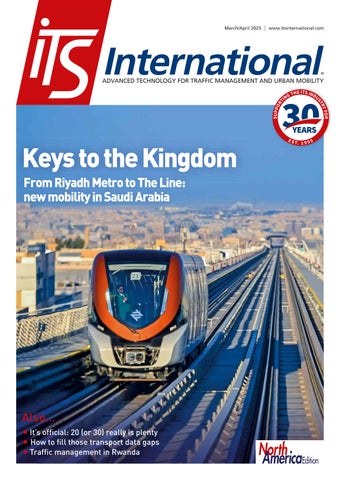
From Riyadh Metro to the controversial ‘vertical urbanism’ of The Line, Saudi Arabia is investing heavily in smart infrastructure
Missing information means the dream of safe and accurate trip planning and travel is not being fully realised



March/April 2025
Concerns over the potential vulnerability of GPS could have significant implications for toll agencies in the US
36
Even the ITS World Congress has an origin story. ITS Hall of Famer Eric Sampson explains how it came into being...
41
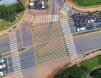
ITS improvements at just seven intersections could be the key to improving transportation in Rwanda’s capital, Kigali
47 PRODUCTS & INNOVATIONS
North America area only
01 Regulatory frameworks that keep pace with technology are key to the roll-out of autonomous, connected, electric and shared mobility, explains Scott Belcher














05 Canada’s Sunshine Coast is advocating harmony along Highway 101, with major funding to allow vehicles and VRUs to travel safely, side by side...




“DESPERATE


WTHIS”
e’re going round the world in this latest edition of ITS International: we travel to Saudi Arabia (p22) and to Rwanda in east Africa (p41) and to Wales, UK (p19) to check out urban mobility and traffic management projects which have the potential to make a real difference to people’s lives. The approaches in all countries are different, and cover the range of what ITS actually does, from smart cities to intersection management to speed enforcement.
The latter two of these remain part of the bread and butter of ITS, and for good reason: anywhere roads meet can create danger, and speed kills. The US Governors Highway Safety Association recently reported that there were 1,072 more pedestrian deaths during the first six months of 2023 than there were in the same period in 2014. 2014!
GHSA called this number ‘staggering’: well, that’s one word for it. ‘Appalling’, ‘unnecessary’ and – yes – ‘immoral’ are others. So what’s the problem in the US? There are several: a huge drop-off in traffic enforcement has emboldened dangerous
Editor Adam Hill
Email: ahill@ropl.com
Tel: +44 1322 612062
Sales Director
Dan Emmerson
Email: demmerson@ropl.com
Tel: +44 1322 612068
Web Manager
Sarah Biswell
Email: sbiswell@ropl.com
Tel: +44 1322 612078
Editorial Consultant
Geoff Hadwick
Design Team
Simon Ward, Andy Taylder
Data & Marketing Manager
Alan Cansick
Email: acansick@ropl.com
Tel: +44 1322 612061
Office Manager
Kelly Thompson
Email: kthompson@ropl.com
Production Manager
Nick Bond
Email: nbond@ropl.com
Tel: +44 1322 612066
“
“ ITS deployments have the capacity to save lives around the world. Let’s celebrate that

drivers; roads are often designed to prioritise fast-moving traffic and take no account of people walking; and there is a lack of basic infrastructure such as sidewalks, crossings and lighting. Another issue is that cars are getting much, much bigger. Call it carbloat, or autobesity, or whatever you like: if you’re hit by one, you’re now more likely to die. However, we also know that when vehicles are travelling more slowly, the chances of pedestrians surviving a collision are greater.
Around 40,000 people are killed each
Publisher/
Managing Director
Andrew Barriball
Email: abarriball@ropl.com
Tel: +44 1322 612057
CEO Roger Adshead
Email: radshead@ropl.com
year on the roads in the US – but the annual death toll worldwide is approximately 1.19 million, and more than half of these are vulnerable road users. The World Health Organisation says that 92% of fatalities are in low- and middle-income countries, even though they account for just 60% of the world’s vehicles. It is the leading cause of death among children and young adults aged between five and 29 years.
It is a dire situation but things don’t have to be this way. Slowing vehicles down to 20mph or 30km/h in key areas can help. Technology can help. So if, for any reason, you are desperate for some good news at the moment, then consider this: ITS deployments have the capacity to save lives around the world. Let’s celebrate that. And get on with it. ITS
Adam Hill EDITOR
Email me at ahill@ropl.com

@itseditoradam.bsky.social @adamhillwriter
@itseditor_adamhill

Printed by Warners (Midlands) PLC
ITS International (PE 13324) is published 6 times a year with combined issues in January/ February, March/April, May/June, July/August, September/October and November/December by Route One Publishing Ltd, Second Floor, West Hill House, West Hill, Dartford, Kent, DA1 2EU, UK.
Airfreight and mailing in the USA by agent named World Container Inc., c/o BBT 150-15, 183rd St, Jamaica, NY 11413, USA. Periodicals postage paid at Brooklyn, NY 11256.
POSTMASTER: Send address changes to ITS International, World Container Inc., c/o BBT 150-15, 183rd St, Jamaica, NY 11413, USA.
Air Business Ltd is acting as our mailing agent.
Subscription records are maintained at Route One Publishing Ltd, Second Floor, West Hill House, West Hill, Dartford, Kent, DA1 2EU, UK.
All editorial, advertising or circulation enquiries to:
ITS International, Second Floor, West Hill House, West Hill, Dartford, Kent, DA1 2EU, UK.
No part of the publication may be reproduced in any form whatsoever without the express permission of the publishers. Views expressed in this journal do not necessarily reflect the opinion of the Editor or Route One Publishing Ltd.
Reader Enquiry Service: data@ropl.com Tel: +44 1322 612061
Subscription Enquiries: subs@ropl.com
Global: Print ISSN 1463-6344
Digital ISSN 2057-3421
NA: Print ISSN 2632-4458
Digital ISSN 2632-5950
and manufacturing facility in Los Angeles. The company

inroads into the US market. The new facility will manufacture electric autonomous shuttles in the US. The shuttles can seat up to eight passengers
Transit Agency is to integrate onboard safety operators during a pilot programme.

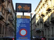
Populus has partnered with Milan’s Agenzia Mobilita Ambiente Territorio to launch the Populus Mobility Manager Platform in the northern Italian city. The platform will empower its shared bicycle and scooter programmes through access to better data. Populus said the rapid growth of shared mobility in Milan - with a population of around 3.2 million - has meant the need for a more robust management solution to monitor key challenges such as parking compliance and infrastructure use.
Transportation research specialist TRL is looking to expand worldwide following a
Blandford Capital. There are no
but Blandford has made "a
“This is an important milestone for TRL and we are delighted to partner with Blandford resources and momentum
solutions that are accessible to all".


and pedestrian crossings. The winning of the tender is part of a long-standing partnership
Systems. The framework contract will see AGD’s

signal detectors and nearside detectors to the Tees Valley
where the company says they
to reduce congestion and
New South Wales has
a programme of low-cost technology trials on highways throughout the Australian
will feature technology that solar-powered systems that can and tailored to local road conditions. system
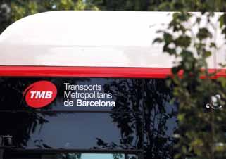
A pilot in Barcelona is using Hayden AI camera and data collection systems to automatically control buslane infringements in order
Transports Metropolitans de D20 bus routes where there are AI said that Barcelona’s pilot is the largest deployment of bus-mounted automated to date. The company also works with US public transport

Telent, a critical infrastructure technology provider, has been awarded a second contract extension to operate the digital connectivity network for England’s Strategic Road Network (SRN). This is the second contract extension
Telent has been awarded by the English agency National
half of 2024, down 2.6% from the year before. While that’s 88 fewer fatalities than 2023, the GHSA said that it represents a “staggering” 1,072 more pedestrian deaths than in 2014.
Telent will manage and operate digital technology services for the agency’s National Roads Telecommunications
connection of 36,000 critical services as part of the NRTS contract scope across the SRN, including CCTV and video, information and communication sensors.
of its payments system, HSL has enlisted ReceiptHero to supply its digital receipt service.
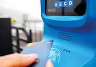
Helsinki Regional Transport Authority (HSL) has extended its contactless payment pilot to trams as part of a gradual roll-out. HSL is introducing contactless payment in the Finnish capital one mode of transport at a time, starting on the Suomenlinna ferry at the end of January. In February, it was extended to include metro stations and will eventually include commuter trains and orange trunk route buses. There will be 4,000 new contactless payment terminals across the modes; as part of this overhaul

GHSA laments
‘staggering’ trend in US pedestrian deaths
half of 2024 fell slightly from 2023 but they are 12% higher than 2019 - and up a “shocking” 48% since 2014. Over the past decade, deaths of people on foot have risen at a pace nearly seven times higher than US population growth, according to the Governors Highway Safety Association. Drivers killed
Sway Mobility and remotedriving technology company Mapless AI have set up a car-share pilot programme in Detroit using Kia Niro electric vehicles. Using Mapless AI’s technology, the remotelyoperated EV is driven to the customer in a process called teleoperation. The introductory minimum one-hour rental rate is $5 plus tax per hour. The pilot, supported by the State
through the Michigan Mobility Funding Platform, the Detroit






€189,000 deal with the Mobility Department of Santa Cruz in Tenerife to improve car park management at one of its tourist spots, Las Teresitas beach. The new




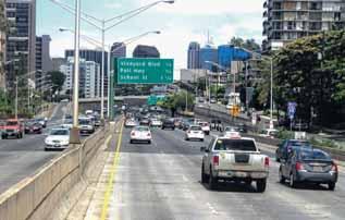
Hawaii Department of Transportation (HDoT) has begun issuing warnings from speed cameras at 10 intersections in downtown Honolulu. Cameras at these intersections have been issuing citations for red-light running since November 2022 - and this has seen a 69% reduction in major crashes, HDoT says. Adding speeding enforcement is designed to improve safety there. The warnings will continue until 29 April, after
issued. Incidents are captured by the system as still images and a 12-second video, and that data is transferred to a processing centre for preliminary screening.








entrance and exit of the car park, counting vehicles and calculating available spaces in real time. Three variable message panels have been placed along the 7km coast road leading to the beach, giving up-to-date information which allows drivers to choose alternatives, thus reducing congestion in the San Andrés area.






















FOLLOW ITS INTERNATIONAL




An initiative which brings together four regional ITS players
Charging Alliance (Apruca) was launched by ITS Taiwan, ITS Thailand, ITS India Forum and ITS New Zealand at the 2025 Smart Mobility Summit in Taipei, Taiwan. The organisations have signed a memorandum of understanding (MoU) which commits them to knowledge exchange and policy development.

38,000 vehicles per day, 43% of which are heavy goods vehicles, so extensive renovation work has already been necessary several times."


Charging gathering. FETC International and its parent company, FETC, co-organised the summit and "played a pivotal role" in supporting the alliance’s formation.


Flow Labs and Carahsoft Technology have announced a partnership to allow government agencies to management platform. Carahsoft will serve as Flow Labs' public sector distributor, making its solutions available through reseller partners and National Association of ValuePoint and Omnia Partners contracts. “This partnership speeds the procurement process for our mutual customers and enables us to rapidly scale our presence in the public sector,” said Jatish Patel, chief executive of Flow
platform integrates signal data, detection data and connected
Utah DoT has hired Econolite to detection systems - which work throughout the US state. The using Ouster’s 3D digital Lidar in combination with its BlueCity as part of the Saving Lives with Connectivity: Accelerating V2X Deployment initiative. Econolite has received an initial order for 15 Ouster BlueCity systems. The solution will support applications, such as VRU detection and V2X connected

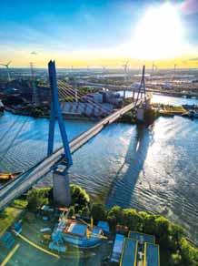
won a bridge Weigh in Motion contract from the Hamburg Port Authority in northern Germany.
The Köhlbrand Bridge across the River Elbe is one of the most important transport links in the port of Hamburg. "Fifty
Systems founder Florian Weiss.
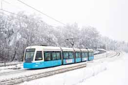
Swedish transport authority
Gothenburg and the surrounding region, has chosen Ridango to provide validators and a contactless
is the second-biggest public transport authority in Sweden, serving over 444,000 customers daily across several transport modes, including buses, trains, trams and boats. The project will include a replacement of 8,000 validators with Ridango’s next-generation validator and removing the existing closedloop equipment, explained Carl Järsberg, Ridango’s country manager for Sweden. The primary focus is on replacing closed-loop equipment, transitioning from card-based ticketing to an ID-based system and securing revenue.
has won a €3.6m contract from the European Space

detection solution using satellite data and AI. The deal comes through the ESA's Business Applications and Space Solutions programme, which aims to leverage space technology and data in markets such as transportation. Data analytics platform Lanternn by Valerann (LbV) for networks processes large volumes of current and historical data from sources including street-side sensors, third-party datasets and GNSS-derived mobility data to














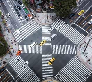
Partnering with Agencies to create a safer tomorrow, one intersection, community, and city at a time. Discover how intersection management solutions can empower advanced capabilities, data-driven decision making, and seamless operation of your traffic network. Get end-to-end transportation solutions including video detection, controllers, a full suite of optimization software, field service support, and more. What does the future of your city look like? Let’s find out.
cubic.com/transportation | cts.its.sales@cubic.com



Q-Free’s Whitney Nottage talks to Adam Hill about the importance of getting youngsters enthused about engineering – and about how the ITS sector could do with more collaboration




hitney Nottage, Q-Free’s executive vice president, traffic management, knew she wanted to be an engineer when she was in high school. “I just really knew I loved math and solving problems, so I decided to go for engineering,” she says. “At the time, I wanted to be an environmental engineer because I knew I was going to save the world!”
That desire did not last long at the University of Central Florida in Orlando. “I quickly learned that most environmental engineers end up in wastewater treatment and dealing with poo - for lack of a better word - for a living, which wasn’t my ideal career choice,” she smiles.
Nottage switched to civil engineering, and gravitated towards transportation, discovering the ITS world while interning at PBS&J (now AtkinsRéalis). On its 18-month transportation graduate training programme, she was meant to spend three months working on ITS - but ended up doing 12 months: “They had so much work, and I liked it so much!”
Problem-solving skills

She enjoyed the variety, and how it was possible to be working simultaneously on various projects. “I enjoyed how you could do such affordable things and cause such large impacts,” she laughs. “And it also made me feel like I was having a really big impact, but working with some really cool things, so I just stuck with it.”
The cliché about engineers is that they like precision and order. “It’s very true,” she smiles. “My friends joke that I’ll make a spreadsheet about everything; I like things in their place and organised.”





An engineering qualification offers a grounding in mathematical know-how, but also teaches other important things with wider business relevance. “I’m not doing calculus anymore, but the skills that you learn from calculus and solving problems and taking on those challenges are definitely carried through,” she says. “Once you reach a position of leadership in a company, regardless of the industry that it’s in, you’re going to get hit left-field with all kinds of things that are not in your wheelhouse. But if you can think about it logically and with an analytical mind, then the problem-solving skills that you started with, that core from university, can always help.”









My friends joke that I’ll make a spreadsheet about everything; I like things in their place and organised “ “

















One thing that’s changed in her time in the ITS sector is the mix of people. “The ITS industry, 15 years ago, was 100% civil engineers, and it made sense at the time, because we were primarily just throwing technology onto a road, and roads are what civil engineers did,” she suggests.




Different expertise





says simply. “But I also think it’s not the only answer. No one solution can solve the problems that we have on our road today, and it takes interoperability and collaboration for us to really get to where we want to go. Honestly, there’s changes in the technology, more connectivity, more information for our drivers. But I also think there’s a change in philosophy that our industry needs to take on.”
“And now we look at the ITS industry, and it is a healthy mix of civil, electrical, computer science, networking, and I think that’s absolutely necessary because we need skills from so many different facets of expertise. A lot of these new roles in our industry - software developers, data analysts - they’re very challenging to attract to our field. And given that we’re usually not quite as competitive as, say, an Amazon or Google, it’s hard to find good talent, but when you do, it’s usually people that are really passionate about it, and they bring a lot to the table.”
Much of this diversity has to do with the way the priorities of ITS have altered. Rather than simply expediting the movement of motor vehicles through cities or along freeways, other things –such as safety and the environment - have come to the fore.

“We have three pillars in our vision: Q-flow, Q-safe, Q-clean,” Nottage explains. “It’s about the efficiency of the road, the safety of the road, and the environmental impact of our road users. When I started, all we really were focused on, was moving cars as quickly as possible and [our clients] having the least amount of citizens calling and complaining. And now it’s very much focused on the emissions caused by congestion, and safety. We still have a long way to go, though, because in the US we had over 40,000 fatalities on our roads this past year.”
No single solution
While this makes the US an outlier among developed nations, Nottage points to some reasons. “The US is quite a bit different than most countries: we have much longer, high-speed roads. Going state-to-state in the US is like going from country-tocountry in Europe. And so we struggle a lot with distraction, tired drivers, not enough information for our road users. And that’s where I think technology can have a very large impact, because technology can help resolve or mitigate some of those challenges.”
The roll-out of Vehicle to Everything tech is a positive move but, as a professional engineer, Nottage is clear-eyed about its limitations. “I think it will inevitably reduce fatalities,” she



Rather than simply implementing a solution, agencies need to focus on how the solution relates to a specific issue. “We need to shift our philosophy, I think, to implement projects that are solving problems,” she insists. “So instead of saying, ‘I need to get my bus schedule more reliable’, it needs to be: ‘My road is unsafe, and I need to get my bus schedule more reliable’. [This] is going to be important to make sure that the people working on these designs have that at the forefront of every decision they make.”
Engineering is cool!
Nottage does see this being gradually ingrained in the industry: “I definitely think we’re getting there.” At a recent conference she was in the audience for the keynote speaker, ITS America president and CEO Laura Chace. “She talked a lot about the funding programmes that they’re working on putting together, but she also talked about safety. And one of the things that she said at the very end - she had a picture of her beautiful familyand she said: ‘I’m tired of saying “call me when you get there”. It’s something that I wish I didn’t have to say to my kids every time I knew they were getting in their car’. And so she’s making sure that we are all thinking of it. And I think everyone is starting to have that at the forefront of their decision-making.”
Other changes are required in the ITS sector. “To me, the biggest challenge is representation of women in our industry,” Nottage says. “Since I was in college, the growth of women in STEM has only been 7%. So improvement is great, but that’s slower than I would like to see in 20 years. And so I think it’s important for everyone in our industry - not just women - to be advocates for ITS, so that we can attract more people - again, not just women; all kinds of people - into our industry.”
She regularly visits schools and universities to talk about engineering and ITS. “Most people, especially in high school, don’t even really think of transportation as an industry - let alone ITS,” she explains. “So ITS is mostly unheard of; it’s always very new to people. But I think more than just ITS, it is just getting



There’s a change in philosophy that our industry needs to take on “ “






people into engineering in general. And one of the things that I learned, spending a lot of time in high schools and even middle schools, is that engineering is almost always talked about [in terms of] ‘look at this really cool thing you can build!’”
That fun aspect certainly works in attracting people to the subject, she thinks. “But what’s less often talked about is the impact that engineering can have on the world. And when you start talking about how what we do can save lives, can make people’s daily lives better, you start to attract other people that may not have really cared so much about how cool it is. And so I think talking about engineering in different ways and the different ways that it can be exciting for people, helps attract more people in.”

an opportunity to get them into the university, working with college kids, and for the industry to come in as well and expose them to the things that we’re doing in the real world,” Nottage says.
ITS folk should look at whether such programmes exist in their area – and if not, reach out to universities and see if you can help start them yourself, she suggests: “Usually, universities with engineering programmes love to get involved in those things, especially when they have ASCE [American Society of Civil Engineers] clubs or ITE [Institute of Transportation Engineers] clubs within chapters in their university.”

That said, Nottage really does think that ITS tech is cool. “We do have so many innovative things out on the market today that are really neat to work with. And then also there’s the softer side of it - there’s 40,000 fatalities on our roads every year, and if you’re in this industry, you have a real, tangible impact on that. And there’s a lot of underserved communities that don’t have access to transportation - or not enough access to transportation - and you can help them get that access. So it’s every facet of what we do and how we can help. And so it’s not a matter of ‘we should be talking about this, or we should be talking about that’. We should just be talking - and we’re not doing enough of it. Everyone in our industry should be advocates for ITS and out there talking about what great things we can do.”
ITS Georgia and ITS Tennessee’s Chattanooga Smart Summit earlier this year was a case in point, she thinks: “They did a great job, because they decided to host it at the University of Tennessee, Chattanooga, and then they allowed students to come at no cost, and sit in.”
Her alma mater, the University of Central Florida, already brings in students from the STEM courses in local schools to do different experiments, with companies also coming in to assist and give them an idea of how they work. “That’s a fantastic programme, because it was kids that you knew were already interested in STEM, and it was

Of course, it is also worth trying to stimulate young people’s interest before then: Nottage’s own daughter is in first grade. “I’ve started talking to the elementary school about their STEM days and their career days and how you get in there,” she says. “There’s a statistic that says most girls are interested in STEM as a little kid - my daughter’s favourite subject is science; she loves it. But towards the end of middle school is when they start to lose interest - so we have a small window between sixth and ninth grade to keep them interested and keep that going.”
So much for the future – the existing ITS sector can do more to help itself too, Nottage thinks, not least through more collaboration. At Q-Free, the tolling and traffic management sides of this international business are increasingly sharing best practice.
“We’re really starting to come together and talk about: what are our lessons learned? What are we doing great over here? What are they doing great over there? And how can we pull these things together? We’ve talked a little bit about collaboration, but it’s important to emphasise that it needs to be global.”
That can open up opportunities and solutions that perhaps people were not previously aware of. “And so we’re doing a lot now where our engineering teams in Norway and our engineering teams in the US are meeting regularly and talking about the things they’re doing,” she concludes. “And our project teams are meeting regularly and talking about some of the things they’re doing - so that we can try and take advantage of opportunities overseas and vice versa. But I think that should become an industry-wide thing.” ITS

> Stationary solution for enforcement of multiple road traffic offences
> Non-intrusive system including high positioning tolerance
> Decoy function to strengthen the deterrent and educational effect on users
> Smart traffic enforcement through 3D-LiDAR technology


Structural Health Monitoring (SHM) from Kistler provides continuous real-time information about the condition of any bridge. Sensors installed at key positions accurately track vibrations, changes in structure and other safety-critical parameters. With its dedicated sensors, signal processing units and cloudbased software solutions, Kistler partners with bridge engineers and operators worldwide to maximize service lifetimes and optimize user safety.
www.kistler.com

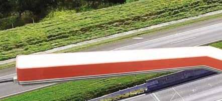


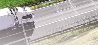















The technology of artificial intelligence has moved on quickly since ITS International last asked the Weigh in Motion industry in 2022 - so how is AI used in the WiM sector now?

David Cornu, head of business unit traffic solutions, Kistler
AI is poised to drive further developments in Weigh in Motion (WiM) systems. When dealing with large data sets, these technologies will have a significant impact. For example, a WiM system provides detailed information for each vehicle 24/7, including vehicle class, axle loads, gross weight and speed. Kistler’s most advanced WiM digital system now offers even more
The potential of AI is waiting to be unleashed here—predictive models can be established, and traffic patterns can be estimated in a much more advanced way than today

information, such as tyre status (underinflated or flat), driving position in the lane, and driving behaviours (acceleration, deceleration). Currently, most of this data has a single and punctual use. However, the potential of AI is waiting to be unleashed here—predictive models can be established, and traffic patterns can be estimated in a much more advanced way than today. Authorities can interrogate these large data sets with very specific questions, such as identifying spots and reasons for increased traffic safety issues related to flat tyres, speeding, lane changes, overloading, etc. We see much potential for transportation professionals and road authorities to better capitalise on the tons of information generated by a network of WiM systems. On the other hand, when investigating one of the major trends in WiM — the automated enforcement of overloaded vehicles — the application of AI becomes challenging. In this use case, the

interest of the user is not related to traffic in general but to individual vehicles. If a vehicle does not comply with legal weight limitations, an automatic penalty will be triggered. This requires a 100% validated measurement, which also necessitates legal certification of the equipment, with sensors, hardware and software. In this field, the AI approach and improving of results based on learning algorithms have less, and often no, acceptance by certification authorities compared to the classic approach following the laws of physics. The newest Kistler Digital WiM system computes weighing using advanced algorithms based on the laws of physics and was legally certified to the highest accuracy standards in the market (F5), from low to high speed. This is a good example of how the classic approach also still holds much potential to push technological advancement to the next level.
• The full weight of the law, p18

Leonardo Guerson, WiM product manager and application engineer, Intercomp
For strain gauge strip sensors, which are mechanical assemblies engineered for long-term performance, AI-enhanced quality control has led to more precise manufacturing processes. Automated defect detection, predictive analytics and machine vision inspection ensure sensor consistency, reducing variability and enhancing long-term reliability. While AI is bringing clear improvements, many of these technologies have evolved from longstanding methodologies, now benefiting from greater automation and efficiency. Besides the manufacturing of WiM sensors and components, the WiM sector as a whole has advanced with AI. Many pre-existing methods for data processing, like dynamic weighing compensation algorithms, algorithm-based classification, and data quality checks can now be AI-driven, improving the quality of the data that is delivered to the end users. As AI continues to refine both manufacturing and data processing in the WiM sector, it builds upon proven methodologies, enhancing precision, efficiency, and reliability while ensuring long-term performance and data integrity.

Many pre-existing methods for data processing, like dynamic weighing compensation algorithms, algorithm-based classification, and data quality checks can now be AI-driven, improving the quality of the data that is delivered to the end users

Daniel Kneubühl, MD, Haenni Instruments
AI has certainly played a transformative role in improving WiM technology, particularly in areas such as data processing. Machine learning algorithms have enhanced accuracy in vehicle classification and weight estimations, leading to better enforcement and road safety measures. However, alongside these advancements, there are significant challenges to consider—especially concerning legal metrology and regulatory compliance. The AI Act (Regulation (EU) 2024/1689) introduces stricter guidelines on the use of AI in high-risk applications, which could impact how AI-driven WiM solutions are deployed for law enforcement purposes. Ensuring compliance with legal metrology requirements remains a key concern, as AI-based systems must maintain traceability and reliability to be accepted in regulated environments. As AI continues to evolve, it is crucial to strike a balance between leveraging its benefits and adhering to legal frameworks. At Haenni, we closely monitor these developments to ensure our WiM solutions remain both innovative and compliant.
The AI Act introduces stricter guidelines on the use of AI in high-risk applications, which could impact how AI-driven WIM solutions are deployed for law enforcement purposes “




Ping Wang, WiM R&D director, VanJee Technology Co
Since 2022, the application of AI technology in the field of WiM has shown significant technological breakthroughs and scenario innovations. In response to the last time we talked about three major ‘bottlenecks’ for AI application in WiM, there are now different situations. First, we believe that with the continuous development of AI technology, many companies have begun to purposefully build WiM databases: we have established our own, and believe that the amount of data has been able to provide a data base for AI. Second, AI algorithms’ complexity - with the development of AI technology - has been gradually resolved. Third, there is still a contradiction with AI algorithms and metrological algorithms, which is why the VanJee team has not put AI technology into the core function of WiM at present. However, even though AI technology has not yet been used in the core function area of WiM, the VanJee team has gradually expanded the application of AI technology in the auxiliary function area. In our internal R&D process, high-precision Lidar combined with AI image recognition is utilised to accurately extract the vehicle model, axle number, and vehicle location to solve the problem of abnormal vehicle movement and lost vehicles in WiM systems. Meanwhile, it assists in weight estimation, analyses the changes in the road factors, vehicle driving habits, and the impact of these changes on the WiM system - and reduces the negative impacts of complex road conditions on WiM. We use AI search of vehicle images to solve the problem of vehicles with obscured or blurred licence plates that cannot be recognised. In addition, the VanJee team also actively cooperates with other organisations. In some provinces in China, we help metrology organisations to build inspection systems and use long-term application data to evaluate the data situation of WiM sites - to replace once-or-twice-a-year calibrations. And we are cooperating with the Ministry of Transportation in a pilot project to build a cross-regional, overloading risk, early-warning platform to solve the problem of inefficiency in overloading enforcement. We can assume that the use of AI in WiM systems has become very common, but there is still some reverence for the core WIM function (weighing). ITS
High-precision Lidar combined with AI image recognition is utilised to accurately extract the vehicle model, axle number, and vehicle location to solve the problem of abnormal vehicle movement and lost vehicles
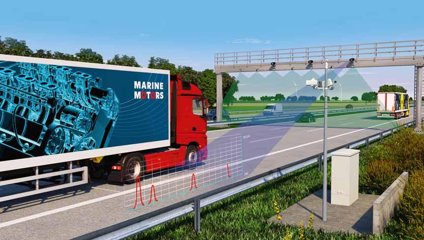







Kistler says its KiTraffic Digital WiM system is improving commercial vehicle overload inspections in Switzerland




Switzerland’s unique landscapes make it a magnet for tourists – but it is also an industrial nation and transit country in the heart of Europe. Truck numbers are rising and vehicles are becoming heavier; many are overloaded – a major problem both for road safety and infrastructure damage. Swiss police regularly carry out commercial vehicle overload inspections on behalf of the Federal Roads Office (Fedro). In 2023, 124,783 trucks, articulated lorries, delivery vans and buses were inspected, resulting in 24,240 complaints and 4,775 vehicles prevented from continuing their journey.
opted for the KiTraffi from Kistler to help. A WiM measuring point was set up near the Kefi area as part of a pilot project, looking to acquire accurate measurements of axle load and total weight of vehicles in traffi at normal speeds (from 10km/h to 130 km/h).
curacy as certifi Organisation of Legal Metrology), which means vehicle weights and axle loads are recorded with a deviation of less than 2.5%.
For pre-selection, Lineas Digital sensors are installed together with an ANPR camera at a suffi suspect vehicles appear immediately on the offi software displays the vehicle image, number


plate and weight data. Axle loads and total vehicle weights of suspicious trucks are checked again with static scales; at the same time, they are inspected for length and excess width. "Commercial vehicle overload inspections are particularly important because they play a key part in road safety,” says Andreas Keller, head of traffic monitoring at Thurgau’s Traffic and Lake Police. “Overweight vehicles have a longer braking distance and a longer stopping distance, so they put all other road users at risk.”
The system at Kefikon was initially set up on one lane and, following calibration, was

could be calibrated for all possible speeds, vehicle types and lane positions,” says Ingrid Sagorz, product manager, traffic solutions, at Kistler. “We then ran an extensive test programme together with Metas to determine and document the accuracy of the weight measurement.”
In 2022, the WiM system was installed in the opposite direction, and this was followed in May 2024 by the deployment of Lineas Digital sensors in the second lane and on the hard shoulder, increasing the total number of sensors per direction of travel from eight to 20. “The result is that we attain a very high level of accuracy for dynamic weight measurement,” Sagorz says.
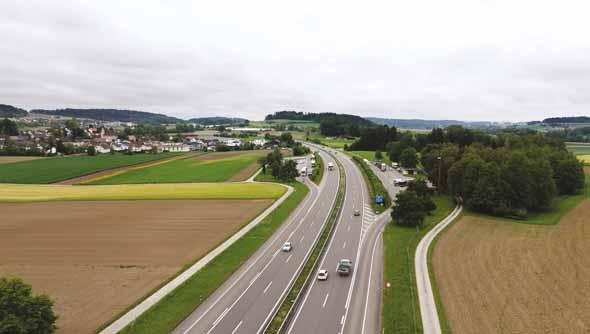
The system was installed ahead of the Kefikon South rest area on Switzerland’s A7 motorway
“The hit rate for commercial vehicle overload inspections is higher thanks to the system, because we can perform explicit and more c checks on moving vehicles that are too heavy,” agrees Keller.
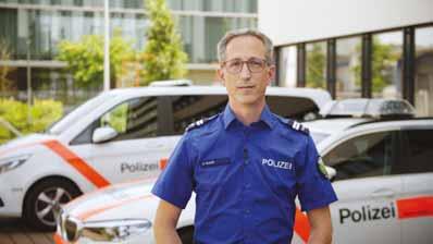
Ulrich Gloor, head of Traffic and Lake Police (pictured above), concludes: “Technology will have to give us increasing support with our work and in this context, I can imagine that we’ll be able to certify the system so we can automate law enforcement – especially in the low-threshold range – in a similar way to speed checks.”
At present there is no measurement between the lanes at Kefikon but Kistler says it is working on this new feature and a comprehensive re-certification of the system by the OIML is scheduled for 2025. More than 150 Lineas Digital sensors have so far been installed in Europe, US and Brazil. ITS



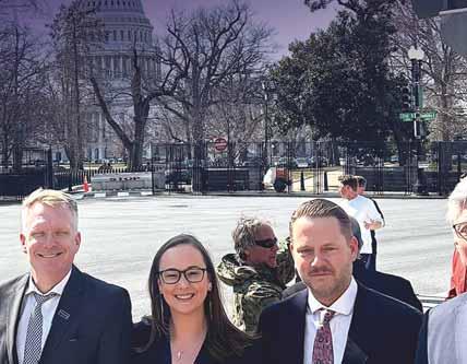


Regulatory frameworks that keep pace with technology are key to the roll-out of autonomous, connected, electric and shared mobility, explains Scott Belcher…
In March, the Aces Mobility Coalition organised a
“Fly-In” to Washington, DC, meeting with congressional committees, US Department of Transportation (USDoT) offi cials and congressional staffers who are jointly responsible for shaping transportation and transit legislation.
The Fly-In provided a platform to educate about the Coalition and its mission, and to advocate for the regulatory advancements and legislative initiatives necessary to drive the future of autonomous, connected, electric and shared (Aces) mobility.

accessible, safe and convenient mobility for all. Since its founding just 18 months ago, the Coalition has expanded from fi ve members to 30, a testament to the growing momentum behind Aces mobility.
We are dedicated to championing policies that facilitate innovation, reduce congestion and expand equitable transportation options

and engineering fi rms Michael Baker International and Miller Electric. There were also transportation policy advocates the Safe Coalition for Reimagined Mobility and Feonix Mobility Rising (the latter is also a social service mobility provider).

The Aces Mobility Coalition is a public sector-led organisation whose members comprise the complete ecosystem of public and private stakeholders, representing public transportation agencies, technology and software companies, autonomous shuttle manufacturers, infrastructure providers, engineering fi rms, academic institutions, and nonprofi t advocates for rural communities and accessible mobility.
Our shared goal is to reduce singleoccupancy trips, advance autonomous shuttle deployments, and ensure
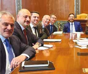
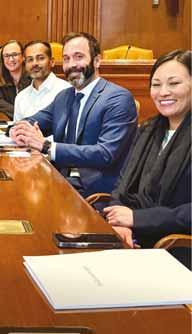
Led by our excellent legislative team from Holland & Knight, Fly-In participants included leading transit agencies, among them the Jacksonville Transportation Authority (JTA), Contra Costa Transportation Authority (CCTA), Metra (Chicago’s regional commuter rail operator), Smart (Southeast Michigan transit agency), and SporTran (Shreveport, LA transit agency). They were joined by technology innovators and industry leaders, including Adastec (software provider), Beep (autonomous mobility service provider), Benteler Mobility (Mobility as a Service solution provider and fi nancing partner), Holon (AV manufacturer), May Mobility (AV technology innovator and operator),
Following a strategy session, Coalition members divided into small teams and engaged in over 30 meetings with representatives from USDoT, congressional staff from the key House and Senate authorising and appropriations committees, and members and staff from important legislative offi ces. These discussions centred on breaking down regulatory barriers and promoting legislation that facilitates the adoption of autonomous and shared mobility solutions.
Key topics of discussion included:
• Regulatory modernisation: Updating outdated policies that hinder Aces vehicle deployment, including addressing outdated vehicle testing and certifi cation requirements that are ill-suited for autonomous vehicles
• Pilot programme set-asides: Advocating for dedicated funding for Aces pilots to accelerate real-world implementation
• Software funding parity: Ensuring that software acquisition and licensing are eligible for federal grant reimbursement, recognising that mobility innovations increasingly rely on advanced software solutions
• Streamlined grant access: Modernising policies to allow agencies to leverage federal funding to advance shared autonomous vehicle projects rather than getting bogged down in legacy regulatory requirements that hinder job creation and delay project implementation
A central theme of our meetings was the urgent need for new regulatory frameworks that keep pace with technology, clarify the rules of engagement, provide operators with technology options and ensure competition. The current structure inhibits the deployment of Aces technology. The great news: everyone we met was receptive to our concerns with several offi ces expressing interest in championing our initiatives.
But there was another profound outcome. We left encouraged that there is still strong bipartisan support for advancing transportation technology solutions. Despite the broader political landscape’s polarisation, both Republican and Democratic offi ces and staffers demonstrated a shared commitment to innovation and an acknowledgement that autonomous and shared mobility solutions are key to future transportation infrastructure, economic development, and ensuring all Americans have access to safe, convenient mobility choices.
Timing is everything and as most of you reading this are aware, Congress is preparing to negotiate the next major transportation funding bill, set to be fi nalised in 2026. We also left DC assured that the Aces Mobility Coalition and the broader Aces community will be part of the conversation. We are confi dent we’ll continue to have a voice in shaping policy, developing a workable regulatory structure and funding autonomous, shared mobility. It’s clear from our reception on Capitol Hill - particularly given so many members of Congress and transportation offi cials were willing to engage in these conversations so early in a new Congress and new Administration - that our members are the voice of the Aces


community. In less than two years, they have created a group with the collective expertise to tackle every facet of deployment, including fi nancing, vehicle manufacturing and software development, route planning and operations, public engagement and adoption, and even coordination with fi rst responders, labour and other stakeholders.
As we continue to build upon this foundation, the Aces Mobility Coalition remains dedicated to championing policies that facilitate innovation, reduce congestion and expand
equitable transportation options. The Fly-In reaffi rmed our role as a leading participant in the national mobility conversation - and that’s important, because in the same way connected and autonomous vehicle technology has advanced at breakneck speed, adoption of technology is advancing quicker than the regulatory infrastructure designed to support it. One of our members, Holon, is poised to invest more than $100 million to build a shared, autonomous shuttle manufacturing facility in Jacksonville, Florida, underscoring our position that these are not abstract conversations about futuristic technology. These are real deployments, happening now and boosting advanced US manufacturing, while solving real issues in American communities.
I am impressed by the commitment of the Coalition members and truly appreciate the time they took to join us in DC, because this conversation is just getting started. ITS

ABOUT THE AUTHOR:
Scott Belcher is executive director of the Aces Mobility Coalition, a leading ITS advocate and former CEO of the Telecommunication Industry Association and ITS America



Free POC try Nx Go out risk free.
Unlock the future of transportation management with Nx Go, leveraging the powerful infrastructure of Network Optix. Experience unprecedented visibility, efficiency, and safety through unified camera intelligence and real-time analytics.
Unified Sensor Intelligence: Transform standard traffic cameras into intelligent sensors delivering structured, GIS data.
Real-Time Insight: Harness live, spatially-aware data integrated seamlessly with GIS and city-scale traffic management systems.
Security: SOC2 compliant and extremely secure.
↑
MOBILITY REIMAGINED.



SWARCO McCain
Discover SWARCO McCain’s legacy of innovative Intelligent Transportation Solutions, including Traffic Management Software, ATC Controllers, Dynamic Message Signs, and our versatile and dependable ATC Cabinets. Driven



mccain.swarco.com





































































British Columbia is advocating harmony along its highway corridors: the Canadian province is setting aside major funding for projects to allow vehicles and other modes to operate safely side by side, reports David Arminas
Vehicle drivers and users of alternate transportation often face off when it comes to what type of infrastructure is needed or should take priority. Too much money is spent on yet more roads, says one side. Meanwhile, the other side insists that multi-use lanes are squeezing out drivers from road infrastructure that was intended for drivers in the first place.
But one Canadian province appears to be having a breakthrough when it comes to creating a harmonious environment for multi-use infrastructure development. British Columbia, up against the Pacific Ocean on one side and the Canadian Rocky Mountains on the other, has set up special funding mechanisms.
is less. The province cost-shares to a maximum of $500,000 per infrastructure project. Provincial cost-share portions are determined by the type and size of community applying for a grant.
Active transportation includes walking, cycling and forms of “rolling”, such as skateboarding, unpowered scooters and in-line skating. Infrastructure grants fund multi-use, protected travel lanes, pedestrian and cycling safety improvements, end-of-trip facilities and other amenities, including lighting and way-finding or signposting.
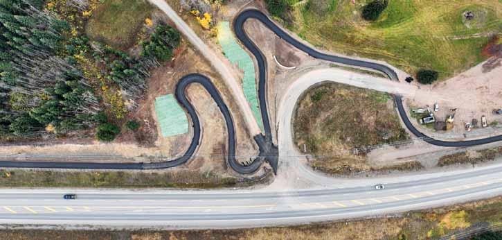
The 3.7km paved phase one – there are four phases – is now open, connecting to a low-income housing trailer park which has the highest-density population in the rural area. The Cycle 16 trail provides people who live in the park with an alternative, lower-cost option to commute to Smithers.
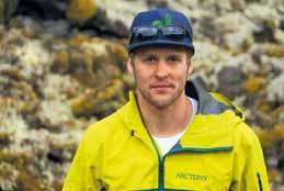
It has been a game-changer for getting people everywhere moving and for making them safer, says Allan Kindrat, who lives in Smithers in north central BC. He cycles to work simply because “it is just easy for me and I love to bike in the mountains”.
One particular multi-use path project has set the template for small communities to develop this type of infrastructure. The Cycle 16 project is named after provincial highway 16, whose right-of-way it uses for its 3m-wide lanes. The 12km trail will eventually link the communities of Smithers and the village of Telkwa, providing safe, non-motorised travel.

One, the BC Active Transportation Infrastructure Grants Programme, provides guidance and cost-sharing for communities to make it easier and safer for people who are not in motor vehicles. Active Transportation Network Plan (ATNP) funding is available for communities with a population of up to 25,000, to a maximum 50% cost-share or $50,000, whichever
Cycle 16: a ‘game-changer for getting people everywhere moving and for making them safer’


A senior transportation engineer for highways and roads with consultancy WSP, he is also project manager of Cycle 16. He worked closely with the stakeholders, pulling many pieces together and, in August 2021, completed the detailed construction design. “Before Cycle 16, I would never have anticipated I would become so involved in this type of project,” he says. “It is now almost exclusively what I do.”
Cycle 16 was “a people-intense type of engineering work”. His project management and construction experience and living and

working in a small community all come together. Creating multi-use paths are “community-building projects”, he says.
The Cycle 16 organisation has more than 1,100 members who strongly support the project. Kindrat notes that for context, Smithers has a population of around 5,000. “You are working with non-profits, people who are passionate about their community, wanting alternative options of transportation. With Cycle 16, I attended their board meetings as a volunteer. For four

communities along the 156km Highway 101 corridor.
The Sunshine Coast is an isolated area just north along the coast from Vancouver. It is bound by Howe Sound to the south-east, Desolation Sound to the northwest, the Pacific Mountain Ranges to the north-east and the Strait of Georgia to the south-west. The region is a heavy tourist destination because of its natural beauty, and Highway 101 follows the rugged coast line, linking many of the small communities.
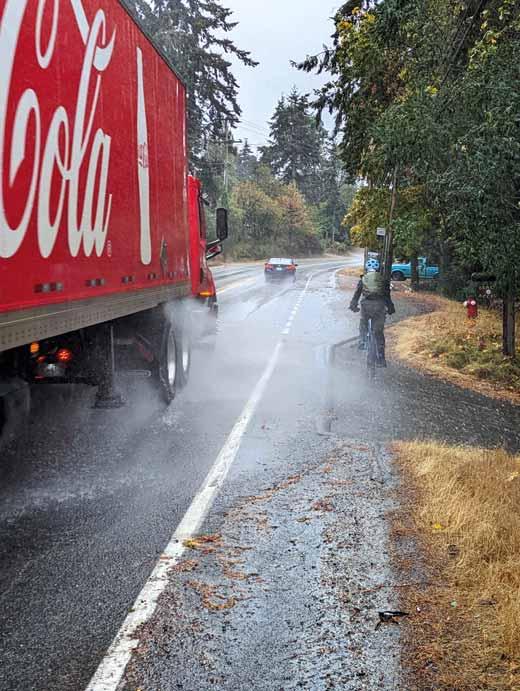
However, most of the highway is an exceptionally curvy, undivided two-lane route with few passing opportunities. Design challenges for any multi-use path will include busy highway crossings, environmentallysensitive areas, archaeological sites and varying widths of highway right-of-way.
The first segment of the Coast to Coast project is 30km from Langdale Ferry Terminal to the town of Sechelt and which has been divided into 22 segments for design purposes. Preliminary design work was completed in 2022 and the estimated cost is around $125 million.
As of February this year, progress is being made toward the conceptual design for the first priority segment, a 2.5km stretch from Pratt Road in Gibsons to Lower Road in Roberts Creek. It incorporates shared roadways, protected cycle lanes and multi-use paths. Connect the Coast Society received funding for planning work on this segment from the federal government, Sunshine Coast Regional District, Town of Gibsons, BC Cycling Coalition and private donors.
Kindrat believes that the 3m width is on the narrower side for these types of paths, on average. But wider sections can be permitted, depending on physical constraints. If pushing the width to 4m




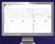
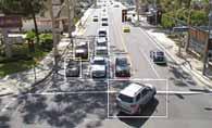
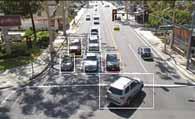
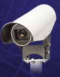
Autoscope® OptiVu is taking video detection to algorithms powered by AI and machine learning. The camera and processor provide high performance vehicle detection, bicycle collection in real-time, and Smart City readiness with connectivity to other systems.
Maximize your Autoscope OptiVu detection system with Centracs® +Detect, our revolutionary cloud-based data analytics, monitoring, and reporting platform. +Detect making and signal optimization.

















Every small community has a need for a multi-use path or bike lanes somewhere
“
Allan Kindrat WSP
means extending beyond the right of way, then property acquisition comes into play, increasing time and costs.
Kindrat believes the feasibility of connecting communities with off-highway multi-use pathways, like Cycle 16 and Connect the Coast, largely depends on the distance between communities or neighbourhoods within a larger municipality. Canada is not Europe, in that it often has large distances between rural settlements and towns with little in between, such as food stops, accommodation and shelter.
However, Cycle 16 has demonstrated that connecting communities around 13km apart is achievable - provided there is strong community support and dedicated leadership
Last year the BC government announced the Active Transportation Capital Fund, the first time the province has ever funded directly active transportation projects, says Kindrat. There is $85 million in the fund for 11 active transport projects, including Cycle 16.
Under the AT Capital Fund, projects can include building or enhancing infrastructure, such as multi-use paths, sidewalks, footbridges, separated bicycle lanes and connections to other roadways. This could include recreation trails provided they can be used for transportation, such as connecting to destinations, services or amenities. The

to drive early planning and feasibility studies. “However, the question remains: how far is too far? That threshold is unclear to me,” he says.
“Nonetheless, there is definitely change happening and it's exciting. We are seeing a lot of opportunities as every small community has a need for a multi-use path or bike lanes somewhere. Its feels like there is endless work to do to improve these communities and it’s an exciting place to be
fund can be used for enhancing active transportation infrastructure, including design considerations in which there may be no net gain in kilometres of infrastructure, but include quality improvements that support greater use.
The fund can also be used for providing or enhancing design features and facilities that promote active transportation, such as storage facilities, lighting, greenery, shade and benches. Money can be used for building or enhancing safety features that promote active transportation, such as crosswalks, speed bumps, fences and wayfinding signage.
as a design engineer.”
After a section of a multi-use path is finished and people are using it, they will usually ask when the next section will be finished. It’s a ‘seeing is believing’ moment, he says, where the desire for more is generated according to what is available.
Kindrat says that he also cycles the path, often taking with him his small children who like the experience. “I think they are pretty proud of me.” ITS



The new set of probe data-based performance metrics within ClearGuide® helps agencies reduce congestion by monitoring traffic signal performance and identifying deterioration at the intersection, without reliance on infrastructure.


iteris.com/signal-trends











A study has looked at what 20mph (30 km/h) speed limits mean in terms of road safety – and the answers are encouraging. Alan Dron speaks to transport researcher Aud Tennøy…
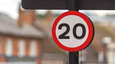
peed kills’ is a long-running slogan in the UK, aimed at encouraging motorists to think of the consequences of driving recklessly and to slow down. In recent years, there have been increasing attempts to lower the speed limit, particularly in urban areas, from 30mph to 20mph (48km/h to 32km/h), with the aim of reducing deaths and injuries, particularly among pedestrians. There is no doubt that there is a reduction in impact force and significantly shorter stopping distance when drivers brake at the lower speed.
But is there a definite, provable link between lower speeds and a reduction of injuries? A new study from the Institute of Transport Economics - Norwegian Centre for Transport Research looks at this, as part of a larger report into wider effects of lower speeds.*
The aim of the study was to see how moving from 30mph to 20mph could contribute to a more sustainable urban development, said Aud Tennøy, chief researcher, Sustainable Urban Development and Mobility at

Transportøkonomisk Institutt. The study notes that, in recent years, many European cities have introduced a 30 km/h and 20 mph speed limit in large zones or entire cities to achieve goals related to sustainable urban development. These can include not only greater safety, but also reductions in noise and pollution, change in travel behaviour and more vital, pleasant, safe and inclusive urban environments.
The
and their use. There are uncertainties and disagreements in the Norwegian professional community related to the positive and negative effects of increased use of the speed limit of 30 km/h in urban areas.”
proportion of drivers who drove at speeds of 24mph or lower went from 21% to 53%
- that’s a really big change
Aud Tennøy Transportøkonomisk Institutt “ “
Many Norwegian cities also want to increase the use of 30km/h speed limits and zones. “There are constant discussions about this between the cities and the regional and state authorities,” Tennøy says. “The Norwegian Public Roads Administration is now reviewing the speed limit criteria
The study has gathered evidence from several cities where this lower speed limit has been introduced, with the aim of creating a foundation for “more knowledgebased discussions related to the use of a speed limit of 30 km/h in large zones, entire cities or as a general speed limit in densely-populated areas in Norway”.
As part of the study, “we found that the measure contributed to a reduction in speeds and significant reductions in the number of traffic accidents in all the cities for which we found results, as well as to a number of other factors that contribute to more sustainable urban development”, she adds. The study revealed that “in all cases… reducing the speed limit to 30 km/h in large areas and entire cities has contributed to reduced speeds for car traffic and fewer traffic accidents”. This was particularly noticeable in the incidence of serious collisions and those involving pedestrians.
“Across cases, it emerges that the measure has also contributed to reduced noise and fewer nuisances due to noise, while it is uncertain whether it has resulted in reduced local air pollution. The measure may result in increased driving time for car and bus traffic, but it appears that the consequences of this is less than expected before the implementation of the measure.”
The results show that lower speed limits in larger areas have contributed to making it more pleasant and safer to walk and cycle in streets and areas, and that it may have contributed to the transition from cars to other means of transport and reduced traffic volumes.
“Evidence on traffic accidents is really convincing,” Tennøy told ITS International “There was a fairly consistent reduction in accidents. In all cases we found a reduction in accidents and injuries/casualties. The reduction in number of accidents is greater than the reductions in speed.”
Two of the most significant studies looking at the effect of lower speed limits on accident rates took place in two UK cities.
“Edinburgh and Bristol have the best analysis because they’ve been well studied. In Bristol, there was a 63% reduction in number of fatal accidents, when controlled for background trends, etc,” she said.
“In Edinburgh where the limit was reduced citywide, the number of accident victims were reduced by 43% but there was [also] a reduction in accidents in streets outside the speed-limited zones. In Edinburgh, this amounted to a 17% reduction in accident casualties across the city as a whole, compared to the three years before the introduction of the speed limits, and controlled for the background trend.”
This suggests that when lower speed limits are introduced in certain areas of a city, drivers become accustomed to operating at lower speeds and that this behaviour ‘bleeds across’ into areas where the original, higher speed limits remain in force.
“If you find a reduction in streets where the new limits apply, but also find reductions in streets outside the zones,” Tennøy explains. “If you reduce speeds in large areas across a city, you get a reduction in accidents in other streets. It seems that this is the understanding now.”
they are statistical significant.” This was because the studies had been carefully set up and analysed, taking into account certain variables.
One concern raised by some groups was that the new lower speed limits would mean that all journeys by public transport, as well as by private vehicles, would take longer. While there was evidence that public transport journeys did take longer, this had only marginal consequences. “In cities like Edinburgh there was more walking and cycling,” she says. “Residents said they enjoyed the experience more and that the roads felt safer. The public transport company said in the evaluation that the consequences for them were small.”
The lowering of speed limits appears also to have acted as a trigger for people to explore other methods of moving around the city. “With the exception of one study, the trend is unambiguous: the results indicate that reduced speed limits have contributed to the transition from cars to other means of transport,” the study says.
Other aspects of the study measured both noise and air pollution levels under the new, lower speed limits. Noise, and what was perceived as ‘noise nuisance’, was reduced “and this is unambiguous”. The reduction in noise and nuisance was particularly noticeable at night.
In terms of pollution, results were more varied; some urban studies found that pollution levels dropped significantly, some found no significant drop. In no cases, however, did pollution levels rise.

Previously this was understood as indicating that speed and collision reductions had other causes than the speed limit reduction. Tennøy cautions that it can be difficult to analyse reductions in accidents or injuries because they are not always analysed in the same way. However, she insists: “I would say that in the cases of Edinburgh and Bristol, the statistical analyses have been carried out in ways allowing to say that
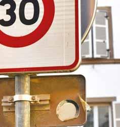
In September 2023, the Welsh government introduced a 20mph limit in all ‘restricted roads’, usually in residential and built-up areas, which accounted for around one-third of all roads.
This followed a trial of the new limit in eight districts, which led to a drop in motorists’ speeds. According to new statistics released in January 2025, the first year of the new limits saw the number of road deaths drop by 10 and the total of deaths and serious injuries by around 100. However, statisticians have cautioned that three years’ statistics will be required in order to draw meaningful conclusions as to the effectiveness of the lower limit.
The new limit aroused considerable anger in some quarters and the Welsh government has since issued revised guidelines, trying to fine-tune those areas where a 20mph limit makes most sense.
Tennøy said that the Welsh project was slightly different, in that it extended beyond individual zones in town or cities. Nevertheless, officials had found that motorists’ speeds reduced overall by 3.6mph, from 28.7mph to 25.1mph, in the affected zones. “The proportion of drivers who drove at speeds of 24mph or lower went from 21% to 53% - that’s a really big change. In terms of accidents, although there is only one year’s statistics to go by, the number of accidents dropped by 26% and the number of injuries dropped by 28%.” ITS
*Introduction of 30km/h speed limit in large zones and entire cities to achieve the goal of sustainable urban development (Aud Tennøy & Gry Rustad Pettersen)
One of the biggest ‘laboratories’ for testing the reduction of speed limits has been the country of Wales, which is part of the UK.







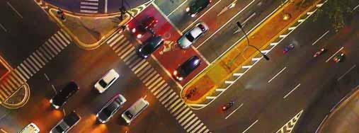
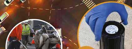

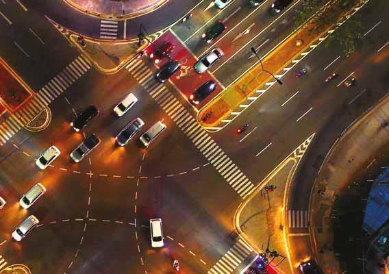



Inductive loops come with hidden headaches — full or crushed conduit and frequently broken during roadwork or from deteriorating pavement — requiring timeconsuming repairs and traffic-snarling lane closures.
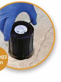
FlexMag3 wireless sensors deliver the same proven accuracy — up to 99.3% — with several advantages:
•Installed in minutes with a compact 8 cm (3.15”) hole
•Can be installed in all road conditions
•Ideal for bridge decks and resurfacing projects
•Wireless range for advance and mid-block detection
Why stay tied to outdated, failure-prone loops?
Upgrade to FlexMag3: Premium performance. Wireless flexibility.

Saudi Arabia is investing heavily in smart infrastructure projects. Zeina Nazer takes a look at them – from Riyadh Metro to the controversial ‘vertical urbanism’ of The Line

never been greater.
designed to meet the immediate needs of a growing population, but also to align with the nation’s long-term vision for a sustainable cient transportation system.

In addition to hosting one of the world’s biggest events - the 2032 Fifa World Cup football tournament – the Kingdom is actively pursuing economic diversification and urban expansion.
Saudi Arabia is enhancing its transport network to improve traffic flow and safety. With Riyadh's rapid expansion, the Ministry of Transport has launched an extensive fourphase road construction programme worth $13.3 billion. These projects incorporate advanced traffic management and ITS to optimise mobility and ensure safer roads.
The government’s efforts to enhance roads, bridges and tunnels are not only



Saudi Arabia’s transport projects are part of Vision 2030, which aims to increase the transport sector’s contribution to nearly $12 billion in annual non-oil revenues.
With an extensive 71,500km road network, including 5,000km of operational highways, Saudi Arabia is making significant strides in enhancing connectivity. The government has outlined plans to convert 49,000km of single-lane roads into doublelane highways, improving mobility and safety.
Additionally, a 5,330km railway network is in development, featuring key projects like the Haramain high-speed railway, to connect Makkah and Madinah.
At the heart of Saudi Arabia’s transformation lies its commitment to smart cities, a
key pillar of the Vision 2030 agenda. These advanced urban hubs are designed to serve as catalysts for economic growth, environmental sustainability and improved quality of life. By integrating intelligent systems into urban planning, the Kingdom says it is aiming to redefine the way cities function, making them more efficient, liveable and future-ready.
Neom & The Line
Neom is the most ambitious smart city initiative. Rising from scratch along the Red Sea in the north-west of Saudi Arabia, it will be made up of a number of regions – including its linear city The Line – as well as Oxagon, a “centre for advanced and clean industries”, plus “mountain destination” Trojena, “luxury island” Sindalah and various places on the Gulf of Aqaba.
Backed by a $500 billion investment, the plan is for Neom’s economy to be driven






by industries such as AI, IoT, biotechnology, media and advanced security. Positioned as a living laboratory, Neom is intended to operate entirely on renewable energy. Most of Neom’s population will live on The Line. According to plans, this ‘sidescraper’ is going to be a car-free, vertical city, 500m tall and 200m wide, stretching 170km and boasting high-speed rail.
The Line’s executive director Giles Pendleton calls this ‘vertical urbanism’, where you will live in ‘modules’ of 80,000 people, with most activities – e.g. work, leisure - within a five-minute walk. He writes: “Residents will be able to live on the 50th floor, for example, and go down in the lift to the 20th floor to a restaurant, hotel or dentist. Or even travel sideways to their office, university or a football match. All within minutes of home.”
The first residents are expected to arrive in 2026, with the population projected – by some estimates - to reach nine million by 2045.
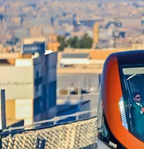
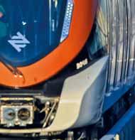
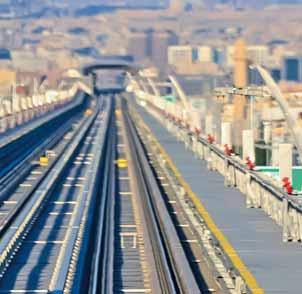
Saudi Arabia’s capital Riyadh plays a central role in achieving the goals of Vision 2030. One of its most significant projects is Riyadh
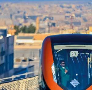
Metro, a driverless public transportation system designed to ease traffic congestion and promote sustainable mobility. Spanning approximately 176km across six lines and 85 stations, the metro will reduce dependence on private vehicles, improve air quality, and enhance urban connectivity. As such, the project is a key step toward improving the quality of life for both residents and visitors in Riyadh.


project focused on revitalising Diriyah, the birthplace of the Saudi state. This initiative seeks to create a dynamic cultural and tourist destination by preserving the area’s rich heritage while integrating modern infrastructure.

The
Line ‘sidescraper’ is going to be a car-free, vertical city, 500m tall and 200m wide, stretching 170km and boasting high-speed rail
“ “
Covering over 13km², King Salman Park is set to become one of the world’s largest urban parks, featuring extensive green spaces that support environmental sustainability. Meanwhile, the Diriyah Gate Development is a major cultural and historical restoration
Aligned with Saudi Vision 2030, the Green Riyadh Initiative aims to plant 7.5 million trees across the city, enhancing green spaces and improving environmental conditions. By reducing temperatures, improving air quality, and creating green corridors, parks, and urban forests, the project contributes to Riyadh’s sustainability goals and elevates the city’s liveability.

Qiddiya, an entertainment, sports, and cultural project on Riyadh’s outskirts, is designed to offer a diverse range of recreational activities and attract global visitors, positioning Riyadh as a key destination for leisure and tourism.
Riyadh’s ranking rose in the 2024 IMD Smart City Index, up to 25th (from 30th in 2023). This index evaluates cities based on their use of smart technologies to enhance urban life. Riyadh’s transformation under Vision 2030 tries to balance


























modernisation with cultural preservation, while addressing challenges such as rapid urban expansion and environmental sustainability. Its smart city initiatives aim to improve governance, public services, and sustainable development, ultimately driving economic growth and enhancing residents’ quality of life.
As Saudi Arabia’s second-largest city, Jeddah plays a pivotal role in the Kingdom’s non-oil economic growth, driven by its strong shipping and trade heritage and its function as a key transit hub for millions travelling to Makkah and Medina. Ongoing major infrastructure projects will support growth across industries, tourism, and logistics, reinforcing the region’s contribution to Saudi Vision 2030 and its long-term economic goals.
Jeddah Economic City, along the Red Sea, is designed to redefine urban living and attract global investors, tourists and businesses. Located between Makkah and Madinah and near King Abdulaziz International Airport, it integrates smart infrastructure, energy-efficient technologies, and an advanced road system, supporting sustainable urban development. It will feature residential, commercial and diplomatic quarters, along with academic institutions and training centres to foster innovation. With its coastal ports, luxury resorts and iconic architecture, Jeddah Economic City aims to become a global trade hub and a model for

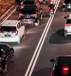
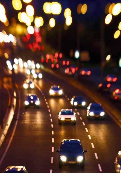
ABOVE: Jeddah is the site of a new ‘economic city’ BELOW: Traffic in Riyadh
modern urban development.
Through these strategic initiatives, Saudi Arabia says it is setting new benchmarks in urban planning and infrastructure development. By harnessing the power of technology and innovation, the Kingdom is not only enhancing its cities but also shaping a future where sustainability, efficiency, and connectivity define modern urban living. With smart cities and advanced infrastructure at the core of its Vision 2030, Saudi Arabia believes it is paving the way for a new era of progress and prosperity. ITS





In line with its Vision 2030, Saudi Arabia is developing smart cities that integrate advanced technology to drive innovation, sustainability, and economic diversification.
• Neom emphasises cutting-edge innovation, environmental sustainability and economic growth
• Riyadh Smart City focuses on smart transportation, digital healthcare, and e-government services to enhance urban efficiency


• Jeddah Economic City is designed to become a thriving economic hub, leveraging technology and innovation to attract global investment

Beate Kubitz finds missing information means the dream of safe and accurate trip planning and travel is not being fully realised – and asks how gaps can be plugged
Capital flows to monetisable goods and services, but the funding path for broader economic and social benefits is more obscure. And transport data is no exception.
The original journey planners - satellite navigation devices - were launched as ‘pay to use’ devices. Subsequent generations of journey planner have disrupted the paid-for models of TomTom et al. However, the driver-data ecosystem – from base maps to traffic flow and congestion data – has become rich, detailed and lucrative. It’s used not just for journey planning but also to optimise transport operations, for traffic system management and for directing investment.
Whilst public transport data has not been monetised to the same extent, it has developed (despite silos and fragmentation) over the past decade. There has been a recognition that better public transport unlocks broader economic gains and social benefits. Public transport authorities like Transport for London (TfL)

have published consistent open data to enhance their services and maximise their impact. Their ‘feeds’ are used in a large number of journey planners. The provision of global standards for transport data has supported these efforts – in particular the General Transit Feed Specification (GTFS) – maintained by MobilityData (an international non-profit organisation). However, much less reliable information available for journeys by foot, wheelchair or bicycle creates ‘gaps in the maps’, says Sandra Witzel, Skedgo journey planner. "We found that missing and inconsistent data is one of the biggest barriers to creating effective, inclusive travel solutions," she explains. "We often lack reliable details about accessibilityfor example, the quality of footpaths or whether stations have step-free access. Important details about cycling routes (are the lanes separated, how wide are they, how steep) are also hard to find. Even basic insights like real-time congestion, parking availability, and crowding on public transport can be fragmented or locked behind localised, non-standardised
systems. Without this information, it is hard for journey planners to present clear, safe and equitable alternatives to driving.”
Missing maps, rules and algorithms
There are several requirements for comprehensive transport data sets. These are roughly divided into: the base maps (which generally define the infrastructure); the rules (the ‘how’ – road rules, timetables, access to the infrastructure); and real-time information (such as vehicle position, congestion, usage). Algorithms combine information from the data sets - usually to suggest journey plans and routing but also for operational purposes. In addition, data is generated by trips that are actually made – people travelling - by car or public transport through ticketing and mobile phone data.




Whilst standardisation has been adopted around public transport data, there is not yet a consensus about kerbside, pavement and active travel mapping “ “


There is so much data that the gaps are often ignored. However, missing data has real impacts. It includes ‘undocumented’ services and infrastructure – and also extends to those people not travelling. In 2024 the UK's House of Commons Transport Committee heard evidence on





the future of transport data. Paul Howell, then an MP, put the problem succinctly. “Your grandmother doesn’t have the phone, so you don’t pick up the data," he explains. "In places like mine where we have villages with people with very low car ownership, very poor public transport, they won’t go from a place like Sedgefield to a place like Newton Aycliffe where there are 10,000 jobs because they cannot get there. There should be a demand pattern but there isn’tbecause nobody is going there because they can’t get there.”
The lack of data results in a disparity between the intense analysis of people travelling and the invisibility of those who are not; this exacerbates inequality, economic and social problems. In the realm of walking and cycling these gaps are greater. There are many levels of 'unknown unknowns'.
Data gaps create vicious cycles. “Poor data makes it difficult for people to know that a transportation option even exists," says Isabelle de Robert, regional director, Europe, for MobilityData. "It can also exacerbate inequalities in transportation access: when active travel routes are not adequately mapped, certain groups –particularly those with mobility challenges – are disproportionately affected. Also, without accurate and comprehensive data, it becomes difficult to identify dangerous areas or unsafe infrastructure, leading to increased risk for pedestrians and cyclists. A lack of reliable data also prevents governments and organisations from making informed decisions about where to invest in safety improvements or new infrastructure, perpetuating the cycle of unsafe environments.”
Routing, journey planners and other services sit on top of maps, so their accuracy and utility depends on the quality of the map it is based on. Other than Google

and Apple (which use their own maps) most journey planners use OSM – Open Street Maps – which are crowdsourced and updated by volunteers. The quality of the data can be variable globally and even from city to city or region to region.
“OSM as a source for pedestrian and cycle paths is as global as can be,” suggests Stephen Miller from the Transit journey planner app. “Whilst nothing is perfect, the openness of the editing process means we can fix inaccuracies or changes as they’re reported.”
Although at a larger scale, infrastructure looks fairly permanent, the reality is that it is affected by changes in details which are often slow to appear in mapping. New installations of street furniture will affect pavement width (which is important to families with young children in buggies or people in wheelchairs) and road works,
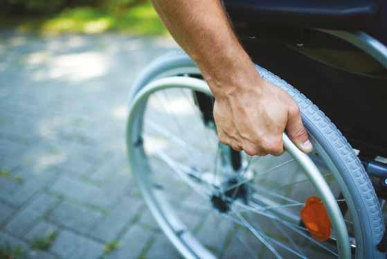
street lighting changes or temporary restrictions could mean that routes are no longer passable.
Maps are only as good as their most recent updates. “Local authorities are required to publish information about road closures and road works,” points out Liz Davidson, QRoutes chief marketing officer. “However, the reality is that sometimes the quality and usability of data comes down to who is doing the inputting. An example would be where work along a section of road means traffic is restricted to a single flow but the definition isn’t specific about whether the work means the bus stop is inaccessible.”
Not only can the infrastructure be modified more quickly than maps record, but their accuracy is also affected by less visible factors. Rules of the road are set by a combination of national transport authorities and local authorities (depending on road classification). They include speed limits, parking restrictions and overtaking regulations. Rules like speed limits and one-way streets are becoming more reliably encoded in digital maps. But newer infrastructure for active travel is not necessarily as well recorded.
For instance, there are around 5,000 roads with a ‘living street’ tag in Paris. Although these streets are intended as walking and cycling streets in the French capital, these rules aren’t reliably used by routing algorithms (a recent test by a contributor found that even Google occasionally routed vehicles down these roads and even through a ‘no entry’ sign). A lack of standardised, digitised rules means that journey planners don’t necessarily produce legal routes – and vulnerable road users are not necessarily protected from cars blindly following them.
In the UK, the Department for Transport has ordered the digitisation of Traffic Regulation Orders (TROs). These regulate
parking, vary speed limits and implement other rules. “Traffic orders used to be implemented and then pretty much put in a filing cabinet: digitisation makes them visible and available on an open platform,” says Keith Kelly from kerbside digital solutions provider Appyway.
The plan for digitised TROs in the UK is to provide a future API feed of street rules – from speed limits to parking bays – that can be used by automated vehicles to comply with the traffic law. Whilst there are no plans for unified, public-facing maps, those available through service providers like AppyWay provide a tantalising glimpse of the potential for granular and regularly-updated data on streets, pavements and active travel infrastructure.
Routing algorithms take the mapping data and rules they have access to in order to create routes, or perform other operational functions. Sometimes they can make smart use of their source information. The Transit cycle route ‘engine’ categorises routes based on characteristics that indicate the likely volume of on-street traffic and creates cycle navigation based on this.
Some authorities are starting to improve their active travel maps and rules. TfL has started work on digitising cycle infrastructure. Data Scotland’s Cycling Open Data portal brings together cycle counter feeds and featured data sets about training delivery and bikeshare. Apps like Go Jauntly have worked with local authorities to upgrade their maps and, in some cases, combine environmental data such as air quality with maps to suggest routes that are greener and calmer for pedestrians. However, this highlights the siloed nature of this data. Go Jauntly hosts a patchwork of maps – some gloriously rich and detailed where authorities and others have collaborated on mapping - and others much sparser with fewer contributors.

The biggest challenge is consistency. Sandra Witzel describes the process: “The
challenge is magnified by significant regional differences. Some areas provide comprehensive open data sets (for example, Finland), but in other places the information can be outdated or spread across multiple sources with little consistency. This means any attempt to incorporate real-time parking fees, footpath gradients or reliable cycle-lane details must be painstakingly customised for each city or transport network. As a result, travellers with disabilities, cyclists, or anyone who wants an accurate picture of both the convenience and drawbacks of driving often faces a frustrating lack of clarity.”
Whilst standardisation has been adopted around public transport data, there is not yet a consensus about kerbside, pavement and active travel mapping. Besides the Open Mobility Foundation’s Curb Data Specification there is also the Open Sidewalks schema proposal and the CurbLR data specification.
The potential that could be unlocked by better active travel mapping is likely to be underestimated. For instance, TfL calculated the economic benefit of its existing open transport data to provision to be over £100 million per year. Including better walking and cycling in this can only enhance it. After all, every public transport trip requires people to get themselves to a bus stop, railway or metro station.
A further benefit is that detailed mapping provides the basis from which to identify gaps in infrastructure and prioritise improvements. Unbroken safe routes enable people to make the trips they want and need to make. These are often trips about which, historically, no data exists because they could not be made.
Improving data requires action at many levels. The core of journey planning is detailed mapping. There is a frustration among those providing journey-planning tools (and other digital services that optimise operations) that government does not always recognise



the importance of providing granular data about the infrastructure it provides and the rules that govern it – nor that it is uniquely placed to keep this information up to date. It should understand the benefits that can flow from ensuring accessible, detailed and real-time geographic information for all its estate.
Additionally, a step towards breaking down data silos is the creation of suitable, easily adopted, standards for walking/wheeling, cycling and micromobility (in the way that GTFS has become the go-to specification for user-centric journey planning). This requires agreement on which features are important – from pavement widths to tactile paving, steps to lighting, as well as agreement on the structure of data provision. The mark of success would be that data held by local authorities (for instance on road regulations and infrastructure provision) could be used by journey planners.
Standardisation of behaviours and underlying rules or laws is also important. For instance, pavement parking is banned in London so pavement widths are more reliable for journey-planning purposes. Outside London there is a permissive regime and inconsiderate parking reduces actual pavement widths so wheelchair users and families with pushchairs can find safe routes impassable.
Standards for updating maps with permanent and temporary changes, time-dependent data (e.g. restrictions that are in force at certain times of day) and, eventually, real-time data are also required. Better standards and data will be necessary for the advent of connected vehicles to ensure that they comply with traffic laws and restrictions. However, this innovation should – in tandem - ensure that people on foot, wheelchair or cycles have accessible, well-described and protected space. The most beneficial journeys – for health and well-being as well as local economies and communities – should be the easiest and most pleasant. ITS




Routing, journey planners and other services sit on top of maps, so their accuracy depends on the quality of the map it is based on “



































ibtta.org/DENVER






APRIL
Spring Board of Directors & Committee Meetings
April 25-26, 2025 | Oklahoma City, OK
April 27-29, 2025 | Oklahoma City, OK www.ibtta.org/oklahomacity
JUNE
Communications, HR & Legal Workshop
Finance & Road Usage Charging Summit
June 1-3, 2025 | Portland, OR www.ibtta.org/portland



www.ibtta.org October

JULY
Maintenance, Engineering & Roadway Operations Workshop and IBTTAFoundation Annual Service Project
July 26-29, 2025 | Detroit, MI www.ibtta.org/detroit
SEPTEMBER
Global Tolling Summit
September 14-16, 2025 | Lyon, France www.ibtta.org/lyon


OCTOBER
Fall Board of Directors & Committee Meetings
October 10-11, 2025 | Denver, CO
93rd Annual Meeting & Exhibition
October 11-14, 2025 | Denver, CO www.ibtta.org/denver













Concerns over the potential vulnerability of GPS could have significant implications for the tolling industry. IBTTA’s Kathryn Clay explains it all to Adam Hill, and looks to the future…
Positioning, navigation and timing (PNT) data provided by the US’s satellite-based global positioning system (GPS) is important for any number of things, from cellular networks synchronisation to getting directions while driving. Deriving largely from the use of radio spectrum, PNT is therefore a vital resource. But relying on GPS alone to provide it creates an obvious vulnerability – which is why the US Federal Communications Commission (FCC) is looking for alternative solutions to complement GPS.
Step forward, geolocation company NextNav. In a recent filing to the FCC, it proposed rearranging the lower 900 MHz band to enable its use for terrestrial PNT services, as well as mobile broadband. There is only one problem, says Kathryn Clay, executive director and CEO of tolling organisation IBTTA.

“That portion of the spectrum is also used by the tolling industry for all of the transponders that communicate between vehicles and gantries,” Clay explains. “And that's what the tolling industry has relied
on for almost 40 years, to make sure that payment succeeds and that it's done in a very effective and reliable way.”
A very high level of accuracy - less than 0.05% - is required by many jurisdictions in the name of fairness, and tolling operators have a financial obligation to their bond holders to ensure their systems are able to receive payment appropriately, she points out.
“You can't be letting people go through and charging some and not others,” says Clay. “And if there's interference with the radio spectrum and that ‘handshake’ of data can't occur, that means lost revenue. And at the end of the day, that either hurts consumers - because tolls would have to go up to cover the shortfall - or it hurts states, because they would have to come up with other revenue sources to fill the gap that they were relying on from tolling.”


IBTTA says the NextNav proposal “would introduce a new system for PNT, and that class of systems can be part of a backup to GPS”. Clay accepts the argument about GPS’s potential vulnerability: “There
is a legitimate concern that GPS is a single point of failure, and that many things in our economy depend on GPS to function.”
However, Clay argues that NextNav is only “one of many solutions” in this space. “Many other companies also provide similar services, and most of the others do not require bandwidth in the lower 900 to operate as NextNav is putting forward that they would need,” she insists. “So our position is very supportive of the national security goals, but we encourage the FCC to look holistically at all of the different solutions for backing up GPS, including ones that would not rely on displacing incumbents in the lower 900 MHz, such as tolling.”
She is cheered by the FCC’s Notice of Inquiry (NOI), issued on 28 March, which casts the net wider in terms of possible back-up for GPS. “We're very encouraged,” Clay says. “Our read of the FCC is that they have heard us and others, including other competitors to NextNav, who are now stepping up and saying: ‘We also have solutions’. And the FCC has taken a step back to be more general. There are many industries that utilise this part of the spectrum








that would be disrupted. Normally, when you see a regulator moving towards a conclusion, they go from general to specific. We are really grateful to the FCC for their openmindedness and for their pivot to a more deliberative, open perspective.”
‘Existential threat’
For its own part, NextNav has also sounded a positive note regarding the NOI. “We’re looking forward to working closely with the chairman, commissioners and broader stakeholder community to accelerate the deployment of resilient, complementary technologies that build important redundancies into a system we rely on every day,” said NextNav president and CEO Mariam Sorond. In a statement, the company added: “Leveraging low-band spectrum in the band where NextNav already holds extensive licences, our approach provides terrestrial backup to GPS that harnesses the power and scale of 5G—without requiring taxpayer funding.”
Clay insists that it is incumbent on IBTTA “and all of the other industries that would be affected to keep making the case very strongly”. IBTTA plans to file extensive comments on the NOI: “We're also ramping up our engagement on Capitol Hill, as we know other industries are as well.”
Is there a plan B? “That's an excellent question,” she pauses. “I hope we don't get to the point where we have to figure out what Plan B is.”
This is because the NextNav proposal is, Clay believes, an “existential threat” to the tolling sector. “I think we might be looking at having to replace literally millions of transponders because of having to retune, and shift our operations, and rebuild,” she says. IBTTA believes this could mean an investment of “$2.4 billion-plus” to make systems compatible, along with “hundreds of millions of dollars of lost revenue”.
Toll agencies always have an eye on new technologies





But whatever happens, nothing is likely to happen particularly quickly, which perhaps offers a sliver of hope. “I suppose you could take some comfort in that,” smiles Clay. “You know, maybe Plan B is: today, that would be an existential threat for our systems; but 10 years from now, we may be transitioning away from transponders into connected vehicles - whether that's a sensor in the vehicle or it's in the tag and the licence plate. So maybe Plan B would be negotiating a 10-year waiting period, once the tolling industry has been able to evolve into the next stage of its technology.”
Many observers – even, or perhaps especially, within the industry itself – see tolling as quite conservative. There has been talk for years of moving from transponders, so there’s an argument that disruption could even be helpful for the tolling sector in accelerating the deployment of new technologies and solutions.




Clay is patient enough to indulge ITS International’s kite-flying. “That's a really interesting question,” she says. “I think that there could be a lot of truth in what you're saying, and the line between being destructive and [being] motivating would be the timeline of implementation. As big an industry as this is, and as distributed as the technology is among literally millions of users, I think that having an adequate timeline for rollout would be essential in that kind of scenario. But I also think that this industry doesn't need a disruptive force to make it think about the future. This is an industry that's already thinking very hard about how to bring the next generations of AI and machine learning and connected vehicles. And so I would push back a little bit about whether we need a NextNav to push us into being forward-thinking - because we already are a very forward-thinking industry.”
Clay’s experience of trade associations, US politics and of working across the aisle will serve IBTTA well as the organisation


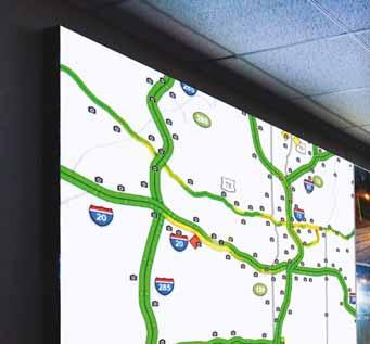


















I think that's actually to our favour - that tolling is hard to put into a bucket of ‘Republican or Democrat’

Kathryn Clay IBTTA



engages with policymakers and regulators such as the FCC. She was trained as a scientist, with a PhD in physics, and a master's degree in electrical engineering. “I first came to Washington, DC as a science advisor for a year to work for a senator,” she recalls. “I ended up getting caught in the DC orbit - just loved it. And the reason I loved it was I found that being in the role of a translator between science and technology and ‘policyspeak’ was something I was good at and that I really enjoyed. A career is about finding what's your best and highest use. And I think it's fair to say that there's a limited universe of people that are like me, who like talking tech and talking policy and like switching back and forth pretty rapidly. So every industry that I've had the privilege of working in since I left Capitol Hill has had that in common. They've always been industries that had a high tech component, that had something important they needed the government to understand about their role and what kind of support - or lack of intrusion - they needed. You're always going to have the technology side and the policy side, and that is my sweet spot.”



maintaining a sound, resilient, efficient national infrastructure. So we've got that base to start with: we all have somewhere we can begin with agreement.”

Does the Trump-Vance administration in the US present opportunities for tolling that perhaps weren't there under Biden-Harris? “Well, the first thing to say is that this is a wonderful industry to represent, because our transportation infrastructure, our roads, our tunnels, our bridges, they're not Democrat bridges and Republican roads - they're all bipartisan,” she smiles. “And I think that people of all political stripes agree that there is a role for government in providing and
She does see opportunities. “If you look at some of the Project 2025 information that was not part of the official Trump transition plan, some of those documents do nod towards user fees and the idea of using the market and paying for service, [so] those are resonating with the political philosophy of the Trump-Vance administration,” Clay points out. “The other thing that I'm learning – and [IBTTA president] James Hofmann is a wonderful resource on this history – is that over decades, it's almost as if the political parties switch on how they feel about [tolling]. There have been times when Democrats have been less supportive to tolling because they felt it was regressive. There have been other times where Democrats have pointed out that this is a great way to get roads built to serve underserved communities. There are times when Republicans feel like this is the market working, this is leaning into market forces. There are other times when Republicans say that tolling is just another form of a tax and ‘we're against taxation’. So I think it depends on the state government environment. It depends on the part of the conversation that the state is in: whether they've just built new tolling infrastructure or they're considering building it. So I think that's actually to our favour - that tolling is

hard to put into a bucket of ‘Republican or Democrat’. It's just about finding the arguments that resonate with whichever side is holding on to power in that state or in the White House.”

Predicting the future is always fraught with uncertainties, but IBTTA is giving it a go with its new, five-year strategic plan, led by Hofmann. “I think five years is the longest time frame IBTTA has ever considered in a strategic plan,” Clay suggests. “I really applaud the idea of thinking further out, because it's hard to imagine; it's hard to get out of our day-to-day, status quo thinking. And if you force yourself to think about five years out, you might actually get most people thinking about two-and-a-half years out, right? I don't think it had anything to do with the new administration coming in. I think it was just James's recognition - as a CEO himself - that with strategic planning, if you can get people to try to think longer term, you're more likely to get more creative ideas on the table. James has challenged us to think about five years, but then also to bring it back to ‘what do we want to do in the next year?’
In some ways this sounds like two kinds of strategic planning at the same time. “I don't know how it will play out, but I think it's a really worthwhile effort,” Clay concludes. “And you learn more by asking more questions. And so we'll ask people what they want to do in a year, and we'll ask people what they want to have their association look like in five years, and we'll get a lot of great feedback on both questions.” ITS

Who came up with the idea of an ITS World Congress in the first place? Adam Hill delves into recent history with one man who was actually there: ITS legend Eric Sampson
The origins of the ITS industry are not exactly clouded in mystery, but there were a lot of moving parts to it, several decades ago. Few people are better qualified to untangle this mixture of policy and private sector and history than ITS Hall of Famer Eric Sampson, CBE.
The retired senior civil servant worked at the UK’s Department for Transport, was on the European Commission’s High Level Advisory Group on ITS and chaired ITS UK and the Ertico – ITS Europe supervisory board. He also chaired the Congress board of directors for the ITS World Congresses in Paris 1994 and London 2006. Add to that he is a visiting professor at a number of universities as well and has been a transport strategy adviser to the governments of Denmark, Finland, Ukraine, Sweden and New Zealand in addition to the UK. So… how did it all begin?


“Like most things when you actually look and try to work out what the origin was, it's fuzzy and it's spread over various places,” Sampson smiles. “In Europe, we had the Eureka programme, which was a collaboration organised by the European Conference of Ministers of Transport, which is now the ITF [International Transport

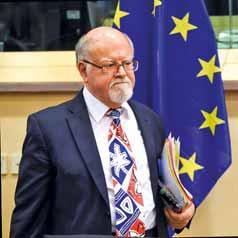
of chapters which were very far-sighted, like artificial intelligence and connected vehicles”
‘Collaboration encouragement’ Prometheus led the European Commission, under long-standing EU transport and mobility pioneer Fotis Karamitsos, to invent the Drive programme – ‘Dedicated road infrastructure for vehicle safety in Europe’. Sampson says this was aimed at “bringing the clans together” in Europe, at least.
Eric Sampson “ “

[Paris in 1994] was a great success twice over, because it signalled to the other regions that this mad idea works and it does attract attention, it does spread the word


Forum]. Their feeling was that we're not putting enough technology into traffic management. Then the Prometheus programme, which stood for ‘Programme for a European traffic with highest efficiency and unprecedented safety', came along in 1987. And when you look at what Prometheus actually covered, it was extremely broad: there were a number
“Fotis unashamedly told people - and none of them believed him - he said: ‘I'm using this as a mechanism to get you all to work together, because I think you're all competing stupidly. The competition is overseas - it's not between ‘you and him within Europe’. And so he was quite open and said it's a ‘collaboration encouragement’ programme.”
In 1991 or 1992, he can’t remember which, Sampson went to a conference on vehicle navigation in Yokohama, Japan, organised by Vertis. “And I can remember being stunned when I went in to a hotel corridor, and





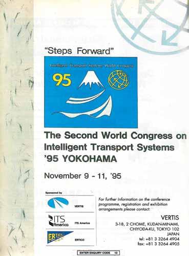
it was lined with about 12 different brands of in-vehicle navigation system: And we thought: ‘God, they are way ahead!’”
Sampson recalls a discussion with Russ Shields, who led Navigation Technologies – which later became Navteq, and is now Here – plus Hajime Amano from Vertis (which became ITS Japan) and the late Masaki Koshi from the University of Tokyo. “And the discussion was: ‘This was an extremely successful meeting because it was international, but we've got far too many little meetings, focusing on incredibly narrow subjects,” Sampson says. “What we want is something that's global and broader so we can learn by looking sideways as well as downwards. And Koshi said: ‘We need an ITS World Congress.’ Now, I would swear on my deathbed that was the first time those words, that expression, have been used.”
So where did Koshi get the phrase ‘ITS’ from? “I don’t know!” Sampson says. “Because up to then, Europe was talking ‘transport telematics’; America was talking ‘intelligent vehicle highway systems’, which became ITS America. In Japan they had Vertis. I don't know whether it was Koshi just playing with words but we thought: ‘Yes, that makes sense: we will have an ITS World Congress’. And the other thing we agreed was it had to be global. And the suggestion was made that it would rotate amongst the regions.”
The first ITS World Congress took place in Paris in 1994. Given that it was coming from a standing start, it now looks surprisingly big, with several ministers and the EC transport commissioner in attendance. “It was only three days,” says Sampson. “We realised that there was a lot of unmet demand for this sort of event. The

French government put a lot of energy into publicising it, and it was a great success twice over, because it signalled to the other regions that this mad idea works and it does attract attention, it does spread the word.”
Communications were tricky. “It was 2G telephony, GPS with the wobble, we’d just moved from 386 to 486 processors – so a thousandth of the horsepower you're now getting from a decent laptop,” Sampson explains. There was no email, so correspondence was by fax; there was no Eurotunnel so meetings in Paris with contractors required flights and took over two days from the UK. There was also no ITS International Daily News – that didn’t come until the ITS World Congress in Turin in 2000. To get a permanent record of what occurred at the first congresses, you “had your six or seven volumes of proceedings shipped to you at your home address”.






The material on display on the exhibition floor at the first two ITS World Congresses – in Paris and Yokohama – was very much focused on automotive. “It's never been so car-intensive,”
























industry: all the major manufacturers were there, all trying to show that they were up to speed with this marvellous new technology that suddenly appeared because previously ‘sensitive’ defence technology was made available.” It took a long time to move from the auto industry’s “This is what we sell; there are other colours” to asking “What is it that users need and how do we build it?”
If you’re looking for the genesis of ITS as a concept, then the automotive industry sounds like a pretty good place to start. But Sampson suggests it is more nuanced than that. “No, if somebody said ‘what was the origin?’, I think it was national and regional governments coming together in different places, essentially trying to make sense of ‘how the hell do I get my city unlocked? It's congested’. That's my feeling - it came from there. One of the things that was realised is we need to involve the vehicles: we can stop people getting lost in their trips with GPS position-fixing and navigation data.”
Therefore, urban mobility – rather than highways traffic - was always at the heart of ITS? “No, that’s also too simple,” Sampson muses. “I think it was a mix of ‘we need to do more to manage inter-urban and major roads, and we've got to do more to declutter what's going on in cities’. So you've got different things like the Scoot-style initiative - how do we manage what's going on in the city - and then rolling that out onto the inter-urban roads. And then, almost as the late entrants into the race, the demandmanagement idea - which is the code phrase for ‘road user charging’.”
Climate change didn’t enter the ITS sector’s thinking until about 10 years later, he thinks. “It was almost like the tobacco lobby - the causality hadn’t been accepted by everybody,” Sampson says. “It was in the
The focus on automotive in the early years of the ITS World Congress did not start to shift noticeably until Chicago in 2002 “ “
‘too difficult’ category so it was shoved to the side. But we started putting climate change -or an environmental impact topic – into congresses quite early on.”
The focus on automotive in the early years of the ITS World Congress did not start to shift noticeably until Chicago in 2002, he thinks.
But mass transit was part of the ITS sector from the beginning, particularly in Europe. “Not least because most mainland European cities subsidised public transport heavily,” Sampson explains. “It's one of the major problems why Mobility as a Service hasn’t shot through the roof: cities and governments cannot get it into their head that they’re going to have to subsidise a private operator rather than a public one.”
As we consider what’s coming next in ITS, it’s instructive to see that the main work packages of the European Commission’s Drive initiative – back in the late 1980s and early 1990s - included some familiar ideas: demand management, traffic and travel information, freight, public transport management, driver assistance and cooperative driving integrated into urban traffic management. In other words, what the ITS sector has been looking at doesn’t seem to have changed greatly for several decades.
“Well, there’s two ways of looking at this,” smiles Sampson. “If you go and look at a David Hockney picture you can say: ‘Well it’s just the same old red, yellow, green and
of the RAC Foundation] used to say my job is a bit like forestry: I'm planting transport infrastructure to last forever. The life of a bridge or something is decades, and it's very hard to change it. If you come along and say: ‘Hey, I've got a wonderful innovation’, everybody who has been brought up with existing infrastructure says: ‘We don’t like it because it's too disruptive’.”
Sampson suggests that, since the 1990s, there have only been a few genuinely revolutionary advances in transport: “If somebody said: ‘What's the big difference between 1994 and now?’ I think it’s the fact that the components work together. Integrated ticketing and payment, and smart card technology for payment; the impacts of social media and the arrival of connected and autonomous vehicles - that's revolutionary, everything else is evolutionary. We’ve taken what we've already got and made it work better and made it work in partnership with the system next door as well.”
What about AI and Big Data? Were they mentioned in the early days of ITS, or were they at least bubbling under in the debate?
“Well, AI was in Prometheus - so that's 1987 and the UK’s Lighthill Report was 1973. Big Data was later. That was a genuine case where guys working in the back room were able to do things that previously were unthinkable; the power of IT suddenly meant: ‘I've got the powerful tools and I've got the storage facilities - I can now do what I’ve wanted to do for ages’. And that has certainly fed into the automated and connected space.”
He concludes: “There's a constant stream of small techie disruptions, and occasionally a small one turns out to be very big – and if I could pick which ones they were, I'd be quite wealthy.” ITS





















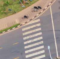

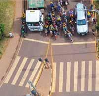
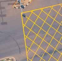

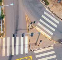


ITS improvements at just seven intersections could be the key to improving transportation in Rwanda’s capital: Shem Oirere reports from East Africa
Rwanda has proposed an urban transport project that promises to revolutionise mobility in the country’s capital, Kigali. The city is grappling with traffic congestion, poor linkages between public transport modes, and lack of non-motorised transport (NMT) infrastructure.
The east African country has reported an increase in vehicular traffic due to an estimated 6.6% rise in gross domestic product in 2024 - compared to Africa’s average of 4% for the same period. The government is implementing, through the Road Transportation Development Agency (RTDA), the first phase of the $120 million Kigali Urban Transportation Infrastructure (Kuti) project.
Kuti is part of the Kigali Master Plan –contained in a wider national transportation blueprint - that the government says will, by 2030, help reduce urban transportation costs, cut waiting times for travellers and reduce greenhouse gas (GHG) emissions from vehicles stuck in traffic jams for long periods.
“The City of Kigali aims to optimise its transport network by introducing dedicated bus lines, expanding non-motorised transport and implementing intelligent transport systems to alleviate congestion and improve

overall transportation efficiency,” RTDA director general Imenda Munyampanda said last December.
Japan International Cooperation Agency (Jica), which is expected to provide $12.5m as a parallel grant for the Kuti project, points up the problems in Kigali: “No-one knows when [the] bus will come because there is no timetable, and no one knows when [the] bus will leave at the bus terminal because [it] does not leave until it is full,” it says. “No-one knows which route the bus will go through because there is no bus route map.”
Rwanda has partially attributed the challenges in public transport in Kigali to the poor state of seven key junctions and lack - or non-utilisation - of ITS solutions whose improvement and upgrading forms the core of the Kuti project.
The seven junctions crying out for improvement are: Chez Lando, Gishushu, Gisozi, Kibagabaga, Rwandex, Kicukiro/ Sonatubes and Nyabugogo.
With the project, which is to be implemented before 2030, the government of Rwanda expects to address mobility problems with a proposal to upgrade three of the junctions in the first phase under four components: physical infrastructure

improvement as the main works; public transport decarbonisation; provision of e-mobility solutions; and institutional support and project management.
In December, RTDA floated a tender for consultancy services for the 30-month project construction period, as well as during the 24 months of defects-liability time, with financing from the African Development Bank (AfDB), Jica, ADF Climate Action Window (a strategic initiative designed to channel financial resources towards projects that address climate change in Africa) and Rwanda’s government.
The consultant will, among other assignments, review and approve the detailed designs of the three junctions - Chez Lando, Gishushu and Sonatubes - to be improved under Kuti for a more efficient, sustainable and accessible transportation network. More than 80% of Kigali’s road network is classified as unpaved, and it reportedly gets water-logged during the rainy season and dusty during dry periods, which contributes to vehicular traffic challenges.
Improving the physical infrastructure and introducing e-mobility solutions at the three junctions, as part of a wider transformation plan, is considered critical in tackling traffic congestion - especially during peak hours of 7am to 8am and 5pm to 6pm, when speeds are reduced to 17km/hour or lower.
RTDA says these road junctions are “functioning below acceptable levels and experiencing long queues with insufficient capacity especially during peak hours”.
At these three junctions, RTDA is constructing dedicated bus lanes and nodes, introducing e-mobility infrastructure, providing e-buses and developing the now lacking NMT such as footpaths, cycling tracks and traffic-calming crossings.
One of the latest project briefs by AfDB says the first phase of the Kuti project will “ease Kigali’s present and future urban mobility challenges and prepare the path for a just transition to a more sustainable and efficient urban transport system and thereby moving to a low-urban sector in line with the Paris Agreement”.
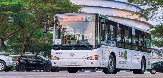
In the first component, estimated to cost $98m, the contractor will construct grade-separated junctions at Chez Lando, Gishushu, and Sonatubes as well as carry out geometric improvement of the roads on which the junctions are located.
For instance, at the Chez Lando junction, the contractor will construct grade separation by a 740m-long underpass tunnel, signalise the junction and upgrade the quality of the KN5 road’s elements such as shoulders, kerbs, friction, and carriageway breadth. The road crosses the roundabout in the east-west direction.
At the Gishushu junction, one of the six junctions that are signalised in Kigali and located at the main road to Kigali International Airport, the grade separation will be by a 500m-long flyover bridge and geometric improvement for the KN5 road that crosses the roundabout east to west. It has “high traffic volume compared with the south and north direction”, according to a previous study.
ABOVE: Rwanda now has the need for more robust and cost-effective public transport BELOW: Morning traffic in Kigali
signalisation and geometric improvement on the road.
At all three city junctions, there is installation of traffic signals but previous studies indicate that the current system “is outdated with a fixed cycle, stand-alone control”.
This means traffic police officers are needed to guide traffic flow manually during the peak hours.
The second component of the Kuti project, estimated to cost $5 million, involves the procuring of at least 10 electric buses and the installation of electric charging infrastructure at designated spots in line with Rwanda’s longterm National Transport Policy and Strategy.
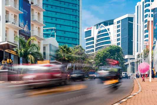
Junctions are functioning below acceptable levels and experiencing long queues with insufficient capacity “ “
According to official reports by the Ministry of Infrastructure (Mininfra) - under which RTDA falls - the policy proposes, among other initiatives, the development of technical standards for e-vehicles, including environmental standards and regulations for the recycling of batteries and electronic waste.
The policy also calls for the introduction of “incentives for electric mobility users and early adopters”. These incentives can include a reduction of import duty on specific components and “attractive electricity tariffs for charging stations”.
It says the government, in partnership with the private sector, will “develop sound business models for charging infrastructure and vehicles and plans for the efficient placement of charging infrastructure”.
Moreover, the state’s transport policy calls for improving the electric grid’s reliability and the establishment of “a protocol of cooperation with countries and companies to facilitate technology transfer related to electric vehicles”.
The Kuti project is not the first to push for increased uptake of e-mobility options in solving transportation challenges; after the 2017 unveiling of the Smart Cities Blueprint, a framework is serving as a catalyst to fast-track ICT-driven initiatives across cities in Africa, including Kigali. Part of the initiative includes the introduction of more than 400 buses with a 4G internet connection, allowing passengers on board to have full access to free super-fast internet.
In October 2023, the Rwanda Development Board partnered with electric bus pioneer BasiGo and AC Mobility - Rwanda’s provider of automated fare collection systems for public transport - to experiment with the first electric buses in the landlocked country, an initiative that incorporated a few transport operators.
The partnership was designed to make electric buses affordable and accessible to Rwandan bus-operating companies through BasiGo’s pay-as-you-drive financing. At least 200 new electric buses were expected in Rwanda by the end of 2024 using this model.

“Electric buses will be more cost-effective for operators while also dramatically reducing air pollution and CO2 emissions,” said BasiGo CEO and co-founder Jit Bhattacharya when the partnership was launched.
Rapid transformation
Rwanda’s rapid transformation has created the need for more robust and cost-effective public transport, said Jones Kizihira, CEO of AC Mobility Rwanda. “The electric buses will help ease the cost burden of public bus transporters and advance Rwanda’s transition to clean mobility,” he added.
Moreover, Jica has, in a separate report, pushed for the integration of the seven road junctions in Kigali to two separate control centres that are to be developed and operationalised to ensure the long-term success of the Kuti project and RTDA’s general Kigali city mobility development plan.
Jica says the first of these, a traffic control centre, comes with a signal control platform comprising advanced signal and sensor/detector systems.
Meanwhile, the city control centre comes with four signal control systems including bus control, road operation and maintenance, with the option of introducing other control systems in future.
Bus control comes with a public transport priority system and bus location information, while the road operation/maintenance system enables the utilisation of Weigh in Motion.
However, AfDB, the main promoter of the Kuti project, says the e-mobility component of the undertaking faces challenges including significant upfront expenditure for electric buses and charging infrastructure, as well as the difficulty of “adapting to new technology, ensuring reliability and sustainable energy supply, and
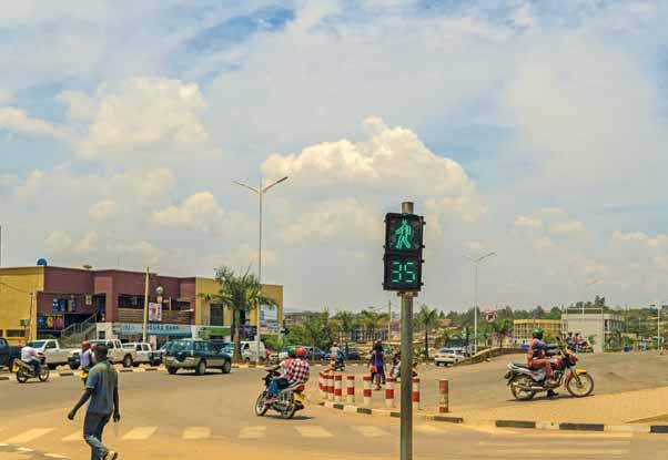
Rwanda has partially attributed the challenges in Kigali to the poor state of seven key junctions and lack of ITS solutions
$5.6m institutional support and project management.
RTDA director general Imena Munyampanda says Kigali is in dire need of a modern urban transportation system as the city grapples with increasingly busy roads. Improvement is also required because of the Rwandan capital’s emerging role as one of East Africa’s transportation hubs, connecting the Northern Corridor - a network of roads and railway lines anchored on the Kenyan Indian Ocean port city of Mombasa - to the Central Corridor, which connects the port of Dar es Salaam by road, rail and inland waterways to Rwanda, Burundi, Uganda and Democratic Republic of Congo.
“The City of Kigali serves as a central
Implementation of the Kuti project’s e-mobility component comes at a time when Rwanda is in the throes of strengthening the country’s ambitious EV regime. This comes with several incentives, despite a difficult transitioning period from inter nal combustion engine vehicles - especially buses - to electric ones.
The government has unveiled several incentives, such as capping of the electricity tariff for charging stations at the industrial tariff level, reduced tariff during the off-peak time for EVs and zero-rated VAT on EVs, spare parts, batteries and charging station equipment.
Other incentives for embracing e-mobility include exemption of import and excise duties on EVs, spare parts, batteries and charging station equipment as well as exemption of withholding tax of 5% at customs.
Private investors participating in the Kuti project are also likely to benefit from other non-fiscal incentives such as provision of rent-free government land for setting up charging stations, and provisions for EV charging stations in the building code and
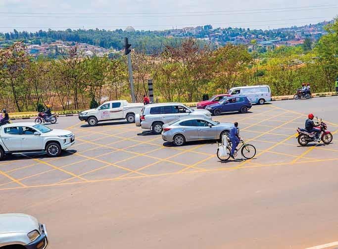
Furthermore, a Mininfra report says vehicles with green licence plates will get preferential treatment in parking, free entry into congested zones and free licence and authorisation for commercial EVs.
Mininfra says firms licensed to manufacture and assemble EVs including battery EVs and plug-in hybrids in Rwanda “are given other incentives in the investment code such as 15% corporate income tax and tax holiday, irrespective of the investment
At least five companies including Volkswagen, Ampersand, Safi Universal Links, Rwanda Electric Motorcycle Company, and Victoria Motors Rwanda have set up charging stations, battery-swapping stations, or introduced e-motorcycles or e-motos, many of them within the city of














Mark your calendar for Intertraffic events around the globe, the premier gatherings for traffic and mobility professionals worldwide. Whether you’re a visitor seeking cutting-edge solutions or an exhibitor aiming to showcase innovations, Intertraffic offers unparalleled






opportunities to network, learn, and grow your business. Don’t miss the chance to make your mark in achieving smart, safe, and sustainable mobility for all. This is where the future happens! Get in touch with our team on intertraffic@rai.nl or check out www.intertraffic.com.




Econolite has launched Autoscope OptiVu, the latest addition to its





www.econolite.com







has introduced the fare gate

sensor fusion, GenAI, and machine learning to detect
it’s happening - distinguishing through or climbing under also recognises legitimate scenarios, such as a mother incidents and generates detailed real-time reports for operations and enforcement actionable insights, helping hotspots, guide enforcement strategies, optimise station operations and create a more
www.cubic.com/transportation
www.theiatech.com •
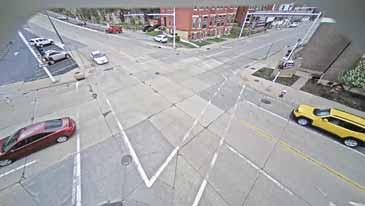
connected vehicle devices are transmitting
Licence plate recognition systems specialist MAV Systems has released a new
The MAV AiQ advanced ANPR camera is designed
"that each application is which "provide deeper operational insights and

www.iteris.com
and evidence reliability for
Since 2012, the first and only smart light bar has provided real-time video coverage across seven lanes, delivering continuous monitoring without additional roadside infrastructure. Equipped with automatic licence plate recognition (ALPR) and 360-degree video, it ensures complete situational awareness. Ekin Patrol G2 extends this capability as a mobile traffic unit, covering seven lanes while capturing high-resolution data on vehicle flow, speed and parking activity. It provides real-time alerts for traffic violations, congestion and hotlist detections. Designed as a fully self-contained system, it operates
www.anprcameras.com


without using trunk space, making it highly efficient for dynamic deployment. All units communicate seamlessly within a single ecosystem, ensuring 100% coverage through the Maestro backend platform. This integration allows for real-time data sharing, predictive insights, and coordinated traffic and parking management. The system acts as a serious force multiplier, helping law enforcement and city officials do more with less by automating tasks and optimising resources. ekin.com
• Contentproducedinassociation with Ekin




Oxa, a provider of autonomous vehicle software for industrial
NVIDIA Cosmos to accelerate industrial mobility automation (IMA) - the automation of repetitive driving tasks by work vehicles. These include
transportation, airport ground transportation (baggage, freight, passenger/crew), port and retail yard trailer/container shunting, asset monitoring, factory line parts logistics and hub-to-hub truck logistics. The tasks are currently performed by around 400 million work vehicles globally and are typically completed on uniform routes which are
location - making them prime candidates for automation. Oxa

including newly-announced Cosmos Predict models, to enhance its own training tools. The tools, which includes Oxa Sensor Expansion, sit within its development toolchain,
generate photo-real virtual world states as videos from multimodal inputs such as text and images. Through its collaboration with NVIDIA, Oxa is able to generate vast amounts of diverse and realistic synthetic data. This expedites the training and validation of
accelerating the development and deployment of safe, reliable
system development approach, powered by Oxa Foundry, uses a novel GenAI approach to train and assure its selfdriving software, Oxa Driver,
uniform and repeatable routes, transforming it from a generalist into a specialist. These GenAI techniques enable the creation of representative teaching and assuring Oxa Driver, with minimal and cost-effective source data requirements.
www.nvidia.com
FOLLOW ITS INTERNATIONAL ON SOCIAL MEDIA Facebook @ITSInt Bluesky @itsinternational.bsky.social LinkedIn @ITS International Magazine Instagram @itsinternational_magazine


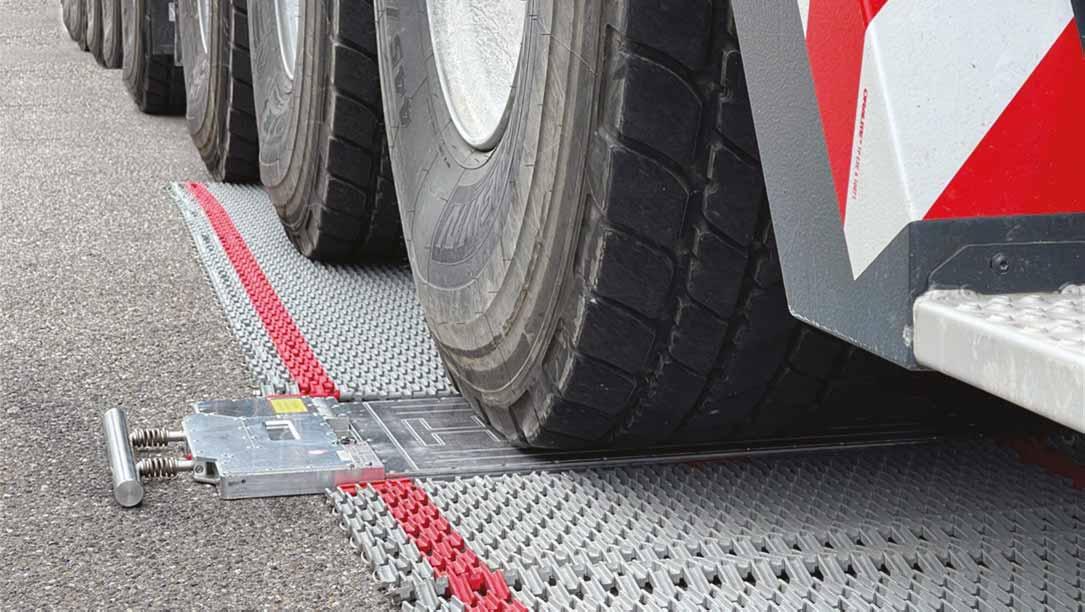











StreetLight Data, a subsidiary of Jacobs, has launched a freightplanning product in collaboration with Canadian company Altitude by Geotab. StreetLight said that the product accelerates and improves freight-planning decisions with the industry's most robust truck activity data from Altitude by Geotab available to StreetLight customers in minutes. It uses StreetLight’s machine learning and data science, along with Altitude’s comprehensive commercial
delivers actionable insights for agencies, businesses and planners to power critical decision-making around freight movement. The product includes aggregate truck volumes and congestion metrics for all major roads on an easy-to-use platform, saving time and ensuring precision with comprehensive coverage. It delivers rich analytics to understand the 'why' behind truck activity, with data by weight, industry and route type. It is available within the StreetLight InSight application where planners can contextualise truck activity with other modes of transportation, including personal vehicle, bike and pedestrian metrics. The ability to compare the distribution of




trucks to personal vehicles allows planners to see a more complete picture of travel patterns as an input for corridor planning, project prioritisation, safety, signal timing, roadway design and emissions modelling. In addition, understanding high-volume truck routes is critical for managing their outsized impact on the supply chain and economy. “StreetLight gives planners in the public and private sectors reliable transportation metrics and analytics anytime, at
and senior vice president of data and digital transportation at Jacobs. “As medium- and heavy-duty trucking accounts for nearly a quarter of US transportation greenhouse gas emissions, there’s
StreetLight applies proprietary machine-learning algorithms and its data processing resources to measure travel patterns of vehicles, bicycles and pedestrians, accessible as analytics on the StreetLight InSight SaaS platform. altitude.geotab.com www.streetlightdata.com
Cross Zlin p29 www.cross-traffic.com
Cubic p9 www.cubic.com/transportation
Daktronics p33 www.daktronics.com/tmc
Ekin p33 www.ekin.com
FETC p35 www.its-taiwan.org.tw
IBTTA p30 www.ibtta.org
Intercomp p14 www.intercompcompany.com
Intertraffic p45 www.intertraffic.com
Intetra p43 www.intetra.com.tr
Haenni p50 www.haenni-scales.com
ITS European Congress p46 www.itseuropeancongress.com
ITS World Congress p40 www.itsamericaevents2025.com/ropl
Jenoptik p29 www.jenoptik.com
Kistler p14 www.kistler.com
Parifex p13 www.parifex.com
www.ptv.to/hub
www.quarterhill.com Swarco
www.swarco.com Tagmaster p21 www.sensysnetworks.com/wireless Tattile p4 www.tattile.com
Traffic Data Systems p17 www.traffic-data-systems.com
TraffiQ p24 www.technolent.com.tr
Econolite NA7 www.econolite.com
Iteris NA8 www.iteris.com/signal-trends
Network Optix NA3 www.networkoptix.com Q-Free NA4 www.q-free.com