






Our toll collection systems can work with other systems and meet international standards, including the highest safety standards.

INTETRA provide services for both technical and commercial system operation. All the basic technologies are produced in-house.





Sampo Hietanen on being the first MaaS provider: “Most likely you’re going to be the ‘magnificent corpse’ out
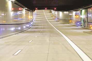
While improved safety is the main aim of Europe’s emerging C-ITS network, it is not the only one: lessons are being learned and functionality is expanding
The Connecticut Transportation Safety Research Center’s work means engineers can concentrate on developing more effective safety measures, rather than having to sort out raw crash data

The contrasting cities of Detroit, Venice and Varanasi have been chosen to take part in a new initiative by the Toyota Mobility Foundation...
Snapper Services CEO Miki Szikszai and Chris Carson, CEO of Hayden AI, talk about synergy and partnership –and explain how to make use of data once you’ve gathered it


30
AI-driven image review is a game changer for tolling industry efficiency. Rafael Hernandez of IntelliRoad outlines the importance of partnerships with service providers
33
A variety of technologies are available to monitor the health of critical infrastructure – and to keep drivers who use it safe by flagging incidents while reducing false alarms
36
The bosses of the three major international ITS organisations have put their heads together on a podcast
39 SMART CITIES
Promises of increased safety, less pollution, increased productivity and a better quality of life are just too good to be ignored, says Dany Longval of Teledyne Flir
42 ASECAP DAYS 2024
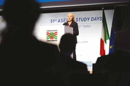
Milan conference covered environmental protection of road infrastructure, plus digital twin-based monitoring of highways and the impact of EVs
America area only


NA 03 Although the GHSA says annual US pedestrian traffic deaths fell for the first time since Covid, they are still above pre-pandemic levels. But why?







NA 05 New York may have thrown a curveball on congestion pricing, but it is a strategy that cities should adopt, argues Wes Guckert of The Traffic Group
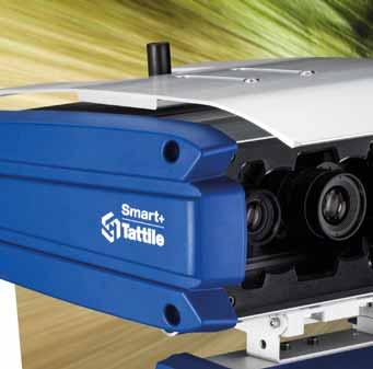




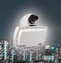
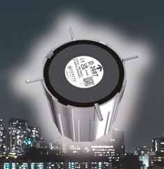
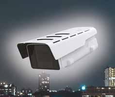
Neural plate and vehicle detection algorithms
Radar with POE connection
Coverage up to 3 lanes


“WHAT


Artificial intelligence: what is it? Obviously, in Hollywood it is Terminator’s Skynet, with a network of supersmart computers primed and ready to take over the world and destroy life as we know it. In this narrative, AI = superior consciousness = kill all humans.
Perhaps unsurprisingly, the doomsday scenario has quite a compelling hold on our collective imaginations. But it’s not (fortunately) the only example of how AI might be used, at least not in the intelligent transportation systems industry.
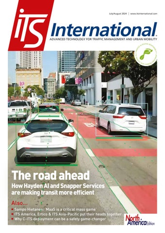
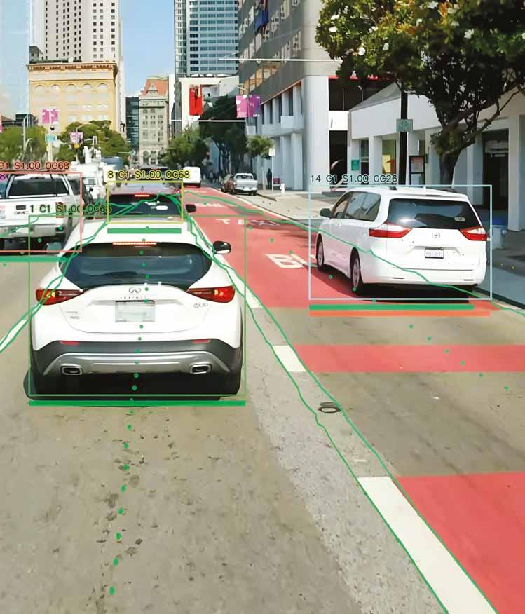
Our cover story in this issue of ITS International examines how Hayden AI’s mobile perception platform is installed on transit agencies’ buses to identify cars which have parked in a bus lane – and how this might, in turn, help improve user experience and aid decarbonisation of cities.
“We had ‘AI’ in our name before it was cool,” smiles Chris Carson, CEO of Hayden AI. “The power of AI is being able to capture data, build bigger, better
Editor Adam Hill
Email: ahill@ropl.com
Tel: +44 1322 612062
Editorial Director
Geoff Hadwick
Email: ghadwick@ropl.com
Tel: +44 1322 612013
Sales Director
Dan Emmerson
Email: demmerson@ropl.com
Tel: +44 1322 612068
Sales Team
Graeme McQueen
Email: gmcqueen@ropl.com
Tel: +44 1322 612069
Production Manager
Nick Bond
Email: nbond@ropl.com
Tel: +44 1322 612066
Design Team
Simon Ward, Andy Taylder
Office Manager
Kelly Thompson
Email: kthompson@ropl.com
IT & Data Services
Director
James Howard
Email: jhoward@ropl.com
Tel: +44 1322 612070
Data & Marketing
Manager
Alan Cansick
Email: acansick@ropl.com
Tel: +44 1322 612061
In this version
of
the story, the human race not only survives, it gets to work on time
“ “
models, and create insights and situational awareness.” (Nothing at all there, you notice, about eradicating the human race).
Carson’s thoughts on the excitement around AI are particularly interesting: “We’re technologists and AI is at our core,” he explains. In other words, yes –AI is exciting.
But he adds: “We’re also trying to be very focused on bringing something that is practical and that delivers real value. And often, in a lot of these different technologies or hype cycles, you’ll find that nothing real gets delivered that changes people’s daily lives.”
The message is clear: flash over substance doesn’t cut it. AI has to actually do something useful or all the hype in the world doesn’t matter. “It is a tool, and we’ve got to find practical applications for it,” Carson concludes.
So, fun though the homicidal robots from the future intent on changing history are, forget Terminator. There is a more prosaic version of the AI story where this extraordinary technology is actually used to help traffic enforcement and make public transit run more smoothly and efficiently. The human race not only survives, it gets to work on time. Hollywood really needs to make a movie out of it. I’d watch. ITS


Web Manager
Sarah Biswell
Email: sbiswell@ropl.com
Tel: +44 1322 612078
Social Media Manager
Tatyana Mechkarova
Email: tmechkarova@ropl.com
Publisher/
Managing Director
Andrew Barriball
Email: abarriball@ropl.com
Tel: +44 1322 612057
CEO
Roger Adshead
Email: radshead@ropl.com
Printed by Warners (Midlands) PLC
ITS International, USPS 13324, is published bimonthly by Route One Publishing Ltd, Second Floor, West Hill House, West Hill, Dartford, Kent, DA1 2EU, UK. No part of the publication may be reproduced in any form whatsoever without the express permission of the publishers. Views expressed in this journal do not necessarily reflect the opinion of the Editor or Route One Publishing Ltd.
All editorial, advertising or circulation enquiries to: ITS International, Second Floor, West Hill House, West Hill, Dartford, Kent, DA1 2EU, UK.
Reader Enquiry Service: data@ropl.com Tel: +44 1322 612061
Subscription Enquiries: subs@ropl.com
Global: Print ISSN 1463-6344
Digital ISSN 2057-3421
NA: Print ISSN 2632-4458
Digital ISSN 2632-5950
The US annual subscription price is US$173.00. Airfreight and mailing in the USA by agent named World Container Inc, 150-15, 183rd Street, Jamaica, NY 11413, USA.
Periodicals postage paid at Brooklyn, NY 11256.
US Postmaster: Send address changes to ITS International, Air Business Ltd, c/o World Container INC 150-15, 183rd St, Jamaica, NY 11413, USA.
Subscription records are maintained at Route One Publishing Ltd, Second Floor, West Hill House, West Hill, Dartford, Kent, DA1 2EU, UK.
Air Business Ltd is acting as our mailing agent.



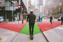
Neuron AI vision keeps Melbourne riders on right path
Neuron will launch the ScootSafe Vision camera system across its entire 1,250-strong
equipped with a front-facing camera that uses AI computer vision technology to detect and correct footpath riding. It will warn riders of pedestrians in


Fusion platform in Edinburgh

ITS World Congress - has
complete with solar-powered trams, which promotes nonGreen Spine project is designed most famous highways - Sheikh
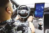
in the city of Darmstadt. The Kira project will see six autonomous shuttles eventually operate.
The AV operator is national rail and transport group Deutsche
and route planning is from software and hardware for the autonomous driving system. The project has required a Level
management from
data on road surfaces. The system, which was developed in-house, detects whether an e-scooter is on the footpath in under a second. Offending riders receive a real-time audio alert telling them: “Footpath riding detected; please ride on the road.”
authority in the UK to adopt
network control management platform. Yunex said that its multimodal network control management solution will help improve air quality and reduce journey times in the Scottish capital. The city has introduced Fusion on a corridor in one of its six Air Quality
Fusion will continuously monitor accurate indicators of congestion
travel modes and cleaner air outcomes are prioritised.

corridor which will anticipate
developing the project, which

system at the junction of
intersection in the US where
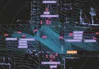
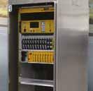
advanced sensor technology that can detect, count and track vehicles and other road users under any weather conditions.
engine, housed in a compact edge device, with Lidar sensors at each corner of the intersection, which create a digital twin.
GMV will supply central management systems for intercity public transportation in Spain’s autonomous regions of Castilla y León, Castilla-La Mancha, Murcia and Aragón. The company said that systems will make it possible to integrate all public transportation information and manage the necessary services for the general public, the government and operators. The Spanish government plans to bring better connectivity to the country’s rural areas where many elderly people live.
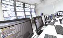
New Zealand transport minister Simeon Brown is considering tolling seven new “Roads of would speed their completion. Media reports noted that NZ Transport Agency Waka Kotahi (NZTA) said procurement and construction of the roads could start within the next three years.The projects are Belfastto-Pegasus, the Hawke’s Bay Expressway, SH1 Cambridgeto-Piarere, State Highway 29 Tauriko, Takitimu North Link Stage 2, Mill Road and Warkworth-to-Wellsford. NZTA already operates three toll roads.








Q-Free has deployed an adaptive signal system designed to reduce congestion, increase near Pittsburgh, in collaboration with Pennsylvania DoT. The project uses Q-Free’s Maxtime signal-control software, linking nine intersections along a busy signals during peak travel times and allows those same signals to operate independently during off-hours, all without an system. It can work locally at the intersection and is installed directly on the ATC controller, using the controller’s processing and memory to power adaptive signal control algorithms.


Vitronic has been selected by RDW, the Netherlands vehicle authority, to supply the observation service for national truck tolling expected to start in 2026. Vitronic will supply and install observation equipment, software and data processing to enable RDW to check if trucks comply with the new toll regulations. It will also provide all related services to RDW for a period of at least 10 years. Similar to neighbouring European countries, truck owners will pay a fee based on kilometres driven on highways and certain provincial and local main roads. The toll rate will be lower for trucks with lower emissions.


Pat Jones is to retire as IBTTA executive director and CEO after more than two decades in charge. A passionate advocate for diversity, equity and inclusion, and for sustainability and resilience in the industry, Jones has held the role since 2002 and will leave on 31 December this year. “Leading IBTTA has been an extraordinary privilege, one that has allowed me to work alongside a global consortium of both public and private members, an exceptional and diverse board of directors, and a dedicated, talented staff team,” he said.


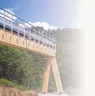
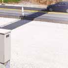


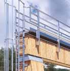
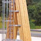
Gantry. The largely prefabricated toll gantry is made from renewable timber rather than steel or aluminium. The gantry's load-bearing core is made of glued and laminated spruce, with weather-resistant larch wood used for the outer layer. Installation of the gantry took "only about one day"
Electricity for operating the gantry equipment comes from its own photovoltaic system, with battery storage also installed to ensure it works at night and in bad weather.





Optibus and Stoneridge have partnered with Volvo Buses with the goal of giving Volvo customers easy access to new connected services and digital







contract with Metropistas in Puerto Rico - the US territory in the Caribbean - to implement additional barrier-free electronic tolling. It will be carried out on the existing dynamic tolling lanes (DTL) parallel to the PR-52 highway between San Juan and Caguas. The toll site will be located at the new access road connecting the PR-52 highway to the DTL near the overpass above the PR-177 avenue. Abertis chief executive Christian Barrientos says the alternative entrance to DTL “may save valuable minutes” for commuters.

Location specialist TomTom is extending its collaboration with Microsoft. The companies, which have worked together since 2016, already collaborate as part of the Overture Map Foundation and say they "will now develop AI-powered solutions for the automotive, logistics and broader mobility domains". Microsoft is already rolling out

Cubic has chosen SkedGo to power its Umo mobility app, which offers riders the ability to plan, book and pay for multiple transport options - from buses to car-share - alongside shared micromobility services such as e-scooters. The app will use SkedGo’s software development kit and application programming interface. "If we’re serious about getting North America to ditch the car then we need to make door-todoor travel more convenient and stress-free, with public and shared transport available at the click of a button," says John Nuutinen, CEO of SkedGo.






Flow Labs has partnered with Geotab Intelligent Transportation Systems. The collaboration will build upon Flow Labs’ existing data sources to offer new performance metrics and eventually platform features for freight and commercial vehicle insights. Geotab ITS works with anonymised and aggregated data from over 50,000 commercial government agencies. “We believe that supplementing our freight data into the Flow Labs platform will provide a solutionrich offering to help address performance,” said Nate Veeh, associate vice president of Geotab ITS.
TomTom Orbis Maps. “We look forward to further supporting them with the freshest and most accurate location data,” said Harold Goddijn, CEO of TomTom. “Through this collaboration, we will create innovative, AI-based products that are set to deliver customer value.”
Optibus’ public transport management software and intelligence fuel-advice solution are available to Volvo Buses’ customers as part of a pilot this year. “Our strategy is to create partnerships with companies at the forefront of digital development that will further strengthen our connected services offer,” said Vinicius Gaensly, business development director at Volvo Buses.
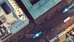
specialises in laser-based volumetric vehicle measurement and
Franchi: “The strong similarity in the founding values of both organisations, the same service orientation, and an almost overlapped customer portfolio, make the integration a natural step towards the generation of new high-performance and high-added value systems, based on the unlimited opportunities generated by AI.” Tattile says the acquisition will help drive
























From the pitfalls of being first in the market, to putting your effort into creating an ecosystem, and the difficulties in gaining critical mass, Sampo Hietanen tells Adam Hill how much he’s learned from the rise and demise of MaaS Global




obility as a Service (MaaS) was big news for a while: the world’s first MaaS company, MaaS Global, raised $75 million in funding from blue-chip investors including BP Ventures, Toyota and Mitsubishi, and employed over 100 staff at its peak. Its Whim app was rolled out in several global cities and regions. But earlier this year, MaaS Global filed for bankruptcy. Rotterdam-based Umob has acquired its technology, but for founder Sampo Hietanen it is time to step away – for a while at least.
“I’m glad MaaS Global has a nice home, it’s good to see,” he tells ITS International on the line from his home in Finland. “You know, the whole thing needs new blood, new fresh blood…” (he pauses)… “to suck”. Hietanen laughs. But he’s right - at times it must have felt as though the energy was draining out of him as he fought to keep the company afloat, carrying people’s hopes with him. The combination of Covid and other financial pressures “was quite a hot one”, he says with understatement. “We realised that with all the legacy and all the trouble that we had, MaaS Global itself became very hard to




invest in, put it that way.”
With good reason, Hietanen has been called the ‘father’ of MaaS. “Personally, running eight years, being founder, CEO, chairman, and not just that but also the guy having to push the whole MaaS concept as such - it’s been, let’s say, a lot of cognitive load. The last years were really not easy. In some ways it’s a relief to not be in the middle of all that, all the time. I realised that if I was the one who came up with the concept for the last eight years, I haven’t really used my brain for any kind of ‘music in your soul’. So hopefully there’s a bit of time for that, a bit of reflecting, maybe.”
Hietanen thinks he can help others with what he’s learned and has set up a consultancy, Aspectu. “I think I’ve been fortunate enough to see quite a lot from the inside, and also see what’s keeping us back a lot - and let’s see, hopefully I can use that to some benefit.”
‘Magnificent corpse’ Looking back, he thinks a number of factors explain MaaS Global’s demise. “The first was that I founded the company in

2015 and it was obvious to me that the likelihood that we were too early is very high. I was very, very much aware of this as the reality. Then you need to ask yourself: ‘Okay, there’s a chance of changing something really remarkable that could have a big impact on everything. And then there’s the timing: you’ll have the trouble of being the first one - most likely you’re going to be the ‘magnificent corpse’ out of all this. Should I not do it? What’s the outcome of that? Okay, everybody just waits, waits, waitsbecause somebody has to be the first one. So we went on, quite deliberately. The first steps were to prove that it’s even doable, technically and conceptually. Yes, it was. Second was that, yes, people love it this way - which is also very true, we were able to prove that. Also, we got to a point of proving that yes, you can actually make a profitable business out of it.”
He gets into his stride. “I mean, I remember the days when everybody said ride-hail will never work, micromobility will never work. And it is true until somebody gets enough money to make the UX [user experience] really good and scale it well enoughand that part we never got; that needs the rounds of hundreds of millions [of dollars].”
MaaS Global did attract significant financing. But in March 2020, Covid happened and the world shut down within days. This is where Hietenan made an error, he says. “You have to base your decisions on some kind of prediction of the world and there will be two choices: will Covid last for long or will it last short? We calculated that if it is up to six to nine months, then we should not ramp down the whole organisation and start really saving and putting everything on freeze because then the ramp-up would cost more. So we did not ramp down - which was a mistake. It lasted much longer. We were able to suffer and find enough funding so that we did have the chance, right after Covid, [to say] let’s go and show the world that yes, there’s growth in it.”
But then came Russia’s invasion of Ukraine in February 2022, which Hietenan says was a factor in making investors edgy about putting money into riskier ventures, such as MaaS. While this meant scaling up was not going to happen, Hietanen

pivoted. “We had been able to put together a very good product, very good tech, understanding all of that,” he explains. “What if we go for licencing and let’s try it differently. Take away the risk element of going with the Whim brand. Many players that have a lot of users are touching a bit on mobility but do not want all the trouble that comes with it. [They] don’t have the capacity to build the product, to build the relationships, to build the tech, so if somebody has that and has proven that it functions with consumers, we could licence it out. There is a lot of hidden willingness to invest in the markets, from insurance companies, telecom companies, real estate giants.”
And indeed there was some interest, he says, but ultimately it was not sufficient. “Even though we had very good partners, at some point it just didn’t work well enough. And the only way left was that, okay, we’ll have to shut it down.”
The world’s micromobility sector has seen considerable consolidation over the last few years, as its ‘Wild West’ period ends, and regulation and reality set in. Micromobility is a component of MaaS, so did this contraction have any bearing on MaaS Global?
“It was obvious, whether it’s MaaS or micromobility, that at some point there will be a consolidation wave - with every industry, that’s what happens,” says Hietanen. “I’d say that it has more to do with the drying up of big investments for growth. So the financial crisis is much bigger than probably people understand. When you have a completely new concept, for sure it needs big investment. MaaS is a critical mass game, however you look at it. And if you don’t have the capacity to get to critical mass, it’s going to be a struggle.”

User experience is all-important for MaaS



Ride-hail and micromobility had already reached this point, he says. “The bigger investments for growth dried up and of course there’s a certain amount for mobility and the [companies] that were there had a proven business case, so they took a big chunk out of it.”





We in mobility have thought that everything integrates to us, not vice versa “ “







Ride-hail is an easy-to-understand concept which has reached critical mass
If you don’t have the capacity to get to critical mass, it’s going to be a struggle “ “



Ride-hail and micromobility are also concepts that consumers can easily understand, whereas MaaS is both completely new and more complicated. So has one of the problems been that people simply didn’t understand what it offered them?
“I’d say yes and no,” Hietanen says. “Starting this, I was very scared that do people even want this kind of thing at all? I’m not worried about that [now] - we were able to prove strong enough that [the demand] does exist.” But, he goes on, it’s vital to get two things right or you risk drawing the wrong conclusions about the attraction of MaaS.
“Ride-hail and micromobility didn’t become a big thing until somebody had enough money to do two things: get the UX rightand this is not cheap. UX has to be top-notch or you’re not going to get any results out of it. You will not know whether people want it or not if you have a very poor UX. The second part is that you have to kind of bring in the phenomenon that ‘hey, this is doable, you can actually access very simply everything from a one-stop shop’. So a lot of the big things are, in a way, unproven due to nobody doing it properly.”
He is frustrated that conclusions are drawn about MaaS from “very poor pilot projects, with completely nonsense UX and then you say ‘well, people didn’t like it ‘– of course they didn’t!” For example, the difference between a five-second unlock time on a shared bike, and a two-second unlock time, “is enormous”. He adds: “And of course, if you just do a pilot project with not enough money for UX, you’ll end up with five seconds and people say ‘no, I didn’t like it’ - of course, because you didn’t do it properly.”
He is convinced there is a desire for one-stop access to mobility services in some segments: “What’s not known is: what’s the price perception, what are they willing to pay for it? It’s very hard to draw very big conclusions out of MaaS without very big market deployments.”
Is this MaaS?
And MaaS is happening without necessarily being called MaaS, he insists. “The likes of Uber and Bolt are doing MaaS: I mean, they have multiple modes and they’re doing it, yes, from their perspective, but it is exactly the same. They have got already


past the point that they have enough money to do the UX always properly. They are already multimodal, they do have the customer base, they do have the operations. So it’s very clear that they’re going to be the winners in this MaaS world - even if they don’t want to call it that way.”

There is another alternative path for MaaS, he thinks. “Mobility itself is not worth much, it’s more to help you get to other things, which could mean that the whole industry will be embedded into others,” he explains. For instance, in a supermarket app you could receive bonus shopping points if you visit a store using a shared bike or public transport. “I think it’s a very obvious case,” Hietanen says. “And these kinds of combinations do exist. It’s just that we in mobility have thought that everything integrates to us, not vice versa.” So instead of validating customer parking, retailers could validate customer mobility.
“I think it will come to that,” he insists. “The world of multimodality is not good from a user perspective at the moment because it’s siloed. So it’s not a comprehensive service to you.” Something else is required to get “even close to the point of what the car is now providing you; it provides the certainty of [getting from] any A to any B. Integrated UX will have to happen if we ever want to be anywhere near that level. [A supermarket] doesn’t really care - is it Uber? is it Voi? is it Tier? - they don’t really care, they just want you to get there.” In the mobility sector, “we’re the ones [who are lagging] behind. It wouldn’t hurt that we start being integrated into the rest of the world.”
This is something Hietanen had not realised at the beginning of his journey with MaaS Global. “Definitely,” he agrees. “Had we pushed it more towards that I think we would have had a much better chance of survival, really. So this is definitely a learning and really pisses me off!” He laughs once more. “I didn’t get it fast enough and make it strong enough.”
What other general learnings from his experience does he think would help other players in the mobility sector?
“There will be probably hundreds and hundreds of them,” he smiles. “I suppose the one good takeaway is: always focus first on the product/market fit. We were in some places a bit too fast just to get the different numbers here and there and I was
not stubborn enough to say that no, we really need to fix the product/market fit so that we are absolutely sure what we are then scaling. I knew it from the beginning but it’s so easy to stray from that. The user case is everything. We went too much with the idea that first let’s do this pay-as-you-go, that’s good enough for people. But we realised quite late that it’s not. Actually people do not see the value of you showing what kind of modes of transportation [are available] - that exists: Google and others are very good at that already.”
Differentiate a bit’
Even just having the capacity to make payments conveniently won’t be enough, he argues. “It’s not that they wouldn’t like it - it’s more that they don’t get it. They will ask: are you now a taxi app? Or are you a micromobility app? Or a public transport app? And many of your customers will use you for just this ‘one trick wonder’ and it’s very hard to be better than Tier or Voi in micromobility. You’re not going to be better than that. You’re going to be better in the combination of fast access to everything. You have to really get into the subscriptions - which was our original thing - but we never put enough effort into it. If the whole idea of MaaS is that it’s a multimodal service, then put your money where your mouth is because that’s how people get it. So we probably should have put almost all of our efforts and money into creating these packages, bundles, subscriptions, however you want to call them - and that we didn’t do: we kind of fell in to the trap that pay-as-you-go is easier to just get a lot of numbers, you just resell public transport tickets – and then you’re steering away from what the whole idea was.”

A MaaS subscription priced at less than the average monthly price of owning a car – which MaaS Global mooted when it launched in Birmingham, UK - was a really interesting offering. “If I would do it now I would just focus really on that one,” Hietanen admits. “You should really focus on subscription
because that’s a new thing. That’s a bold thing. It’s a harder sell but it’s the right way. Differentiate a bit.”
Despite now forming Aspectu, he doesn’t completely rule out coming back to MaaS full-time. “Never say never to anything,” he grins. “I do have passion for getting this done. Now I know much more that it’s not a one-man, it’s not a one-company, show. The ecosystem needs to be ready; you can’t be in the markets if the markets aren’t there.”
Creating that environment is “very, very demanding”, he points out with feeling.
“Now, if I could kind of dream a bit: if I can help the ones that should be setting the markets - meaning the cities and governments - in doing it properly, I would really love to help them [but] only if they want to listen to advice as well. I would really like to help the ones that are in MaaS to avoid maybe some of the [pitfalls] but it’s hard doing that without becoming a wise-ass.” He laughs again. “You know, you become easily too blind to your own thoughts but I suppose at least telling what happened, I think that they could avoid some things.”
He believes there could be mileage in talking to the automotive industry, too. “I think they’re a bit lost when it comes to mobility and what does it have to do with their cars? Many others are also struggling to get their head around what should they be doing in MaaS, so if I can help them with their strategy, those are the things that actually interest me. I think for the time being I’m much better in a role of being on a board or something like that.”




It’s not a one-man, one-company, show: the ecosystem needs to be ready “ “

Being a business owner, and a pioneer, is hard work. “These roles like what I had in MaaS Global, they kind of suck the life out of you,” he concludes. “Either you’re completely in or you’re not. I try to take comfort that I did know from the beginning the chances were very slight - but maybe if I can say that I shifted the world a bit towards something that’s right, then it’s been worth it.” ITS


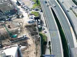
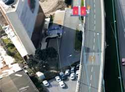
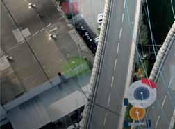
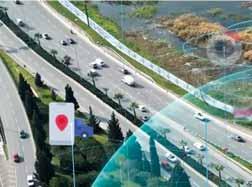
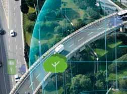
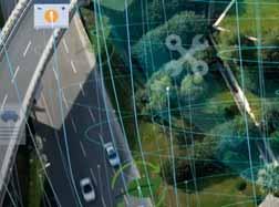
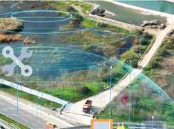
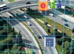
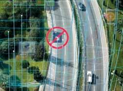


While improved safety is the main aim of Europe’s emerging C-ITS network, it is not the only one. Lessons are being learned and functionality is expanding. Andrew Stone reports on progress… manufacturers.”
Europe’s road network is evolving fast. The benefits of intelligent transport are spreading at accelerating pace from road operators and between the most common nodes on the network – vehicles.
A recent series of C-Roads seminars laid out the current state of progress, implementations completed so far, lessons learned and plans for the future for the Cooperative Intelligent Transport Systems (C-ITS) initiative.
Driven by transport ministries in the European Union and beyond, the project brings together road authorities as well as infrastructure operators, supported by the major car manufacturers.
The task? To implement at scale the technologies and practices needed to enable cars to communicate road network information both between themselves and the
network infrastructure they use.
The goal? Safety and efficiency. “Our vision is to increase road safety and traffic efficiency while reducing the environmental footprint,” says Niels Peter Skov Andersen, general manager, Car2Car Communication Consortium (C2C-CC), the European car manufacturers’ non-profit that now has other organisations including road operators as members.
It is an ambitious plan, says Martin Böhm, secretary general of the C-Roads Platform. “The aim is to link all our deployments across Europe to ensure that we have interoperability [whether vehicles are] travelling in Germany, Austria, Spain, Portugal or Sweden. European-wide C-ITS deployments are already a reality, thanks to cooperation between all the operators including cities, national road operators and, crucially, car
Eighteen European countries are already in the process of deploying C-ITS services and eleven other countries in Europe and beyond are preparing to make the next steps toward C-ITS, says Böhm.
Progress continues to be made to further enable interoperability and grow the network, he adds. “Work is underway on technical specifications, defining how to use standards for C-ITS deployments, and for C-ITS use cases, as well as cross-testing to verify interoperability prior to operational deployment.”
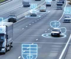
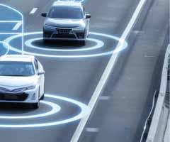
The platform uses a hybrid communication mix that combines short-range communication, and direct communication using 5G as well as cellular networks for longer-range communication.
Getting the technology mix is only a small fraction of the work needed to ensure successful implementation, however, Böhm
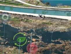
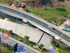
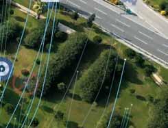

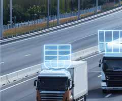
ABOVE: Progress continues to be made to further enable interoperability and grow the C-ITS network
explains: “Connectivity is an enabler for C-ITS but really the willingness to co-operate, the trust in all the partners, the trust between all stakeholders, is one of the key elements.”
Recent generations of passenger cars have been capable of Vehicle to Everything (V2X) communication for a while now. VW has been a leader in this regard, deploying the first iteration of V2X in 2019 with the Golf 8, which had local hazard-warning version 1.0 for incidents such as stationary vehicles, roadworks, accidents, emergency breaking and alerts for the end of traffic jams.
Other car brands have since joined with V2X capabilities and a second generation of local hazard warnings has also now launched, observes Jannis Fritz, in charge of function development and standardisation for V2X at VW. “Today we have over 1.3 million vehicles in 30 countries in Europe and our
European-wide C-ITS deployments are already a reality, thanks to cooperation between all the operators including cities, national road operators and, crucially, car manufacturers
Martin Böhm C-Roads Platform “ “
numbers are growing.”
The ability for vehicles to communicate real-time hazards to each other is a gamechanger. “Vehicles equipped with V2X can send messages to our vehicles,” says Fritz. “Therefore we can warn the driver of unexpected situations for mainly short-term road works and guarantee the safety of road workers. Another feature is the emergency vehicle warning, which can warn our drivers when an emergency vehicle approaches and then the driver can react in time. So, for example, if you have a traffic jam, the driver can make some space for rescue vehicles. This use case is also possible in urban areas.”
The feature includes an arrow to provide a visual indication to drivers of the direction from which the emergency vehicle is approaching along with a distance estimation, adds Fritz.
Further implementations of these dynamic features include warnings of people, animals or obstacles on the road, adverse weather warnings such as strong winds, as well as visual obstructions and slippery road warnings.
Europe-wide interoperability with various stakeholders is growing, adds Fritz: “We already enable C-ITS use cases today across Europe in Denmark, Germany, Austria and Italy - and not only with highway infrastructure operators but also with fire brigades, police and the Austrian Red Cross.”
Adding additional infrastructure operators is currently a work in process, he continues.
Austria’s motorway operator Asfinag has already implemented these use cases and last year it was possible to test them in Austria for the first time, says Fritz. “We had immediate success in our tests. It worked at the first try and it is a great success that this is now already in operation in Austria.”
Asfinag has committed to deploying C-ITS everywhere on its 2,265km road network and began operational deployment in 2021. It currently has 367 operational roadside units on, increasing to up to 550 units by the end of 2025, or one C-ITS road unit every four kilometres on average.
The first use case was road hazard warnings and use cases have been expanded since. The system is now capable of issuing warnings relating to roadworks, slippery roads, persons, animals or obstacles on the road, emergency vehicles approaching, emergency vehicle interventions, accidents, wrong-way driving, stationary vehicles and condition warnings.
Asfinag is also equipping road personnel with C-ITS capabilities, says Peter Meckel, the road operator’s programme manager, C-ITS: “We are putting C-ITS into every blue-light and yellow-light vehicle in our fleet.”
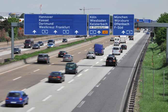
Implementation of C-ITS is also gathering pace in Germany



The yellow-light fleet consists of road maintenance vehicles, tolling enforcement vehicles and traffic manager vehicles. “These units disseminate emergency vehicle approaching and emergency vehicle intervention use cases automatically based on the status of the light signal,” Meckel explains. “They can also send out other hazardous-location notification messages manually if triggered. We are also putting units in trucks and motorbikes where they are disseminating slow-moving road running messages.”



Implementation of C-ITS is also gathering pace in Germany. Testing to enable vehicles to receive roadworks warnings began in 2021 and nationwide rollout of the service is underway. By the end of 2024, all maintenance centres in Germany will be equipped, amounting to around 1,200 safety trailers on the road sending out C-ITS messages.
Warnings in operation or soon to be implemented along the country’s motorway network include maintenance and emergency vehicle warnings, trafficjam-ahead alerts and roadworks warnings. Some police vehicles are already equipped with C-ITS capabilities and a range of pilot projects to expand capabilities are in train, says Susanne Schulz, head of the Cooperative, Networked and Automated Mobility Department for Germany’s Die Autobahn.
“Our next step is also to contract our private companies in Germany that are


C-ITS
is not only very valuable for road users, but also valuable for us as a road operator because we can get information from cars to get a really good overview about the traffic on the road
“ “
Susanne Schulz
Die Autobahn


safeguarding roadworks on motorways,” she says. “Our strategic goal is that we have services on the road to increase road safety and also the safety of our maintenance staff because they have a really dangerous job to do on the road. We want to do everything possible to save lives of our maintenance people and of course of other road users.”
One of the more advanced features of the C-ITS service on Germany’s autobahn network enables specially-equipped maintenance vehicles to roll along the hard shoulder to detect any damage on the road with light detectors that can then relay this information to the network.
An indicator of need for such C-ITS capabilities to be adopted both at scale and at speed from now is the fact that two out of four police cars equipped with emergency vehicle warnings have been written off in crashes. Presumably these may not have happened if more cars were equipped to receive dynamic traffic condition warnings, observes Schulz.


While improved safety is the main aim of C-ITS implementation, it is not the only one. The infrastructure being built out also provides valuable data that highways operators can use to enrich their own models and approaches to traffic management over time, adds Schulz. “C-ITS is not only very valuable for road users, but also valuable for us as a road operator because we can get information from cars to get a really good overview about the traffic on the road.”

C-ITS thus serves to improve both safety and the efficient use of the motorway network, says Schulz: “When we have less incidents on the roads, we also have more efficiency on the road.”

Operators and manufacturers have learned much about the technical requirements that are enabling C-ITS to work in practice.
There are two important categories of communication to consider, says VW’s Fritz. One is the broad requirement to aggregate ‘back-end’, high data-rate communication between service providers - for example in order to facilitate the requisite online apps and map updates that are vital for providing communications about accidents, traffic jams and road works warnings.
The second category involves more time-critical use cases, such as emergency braking, post-crash or emergency vehicle warnings for vehicles following immediately behind an incident, when direct




















Jenoptik provides innovative and sustainable smart mobility technology and services.
As an end-to-end solution provider, we support our customers with the provision of roadside equipment and software, including integration and installation through to full-service operation. Our strong global presence and installation base is supported by a reliable partner network.
With innovation as our driving force, Jenoptik is a world-leading enabler for smart mobility, making roads, journeys and communities safer around the globe.
Follow us! jenoptik.com/markets/public-safety




communication is necessary, says Fritz. “We really need low latency in these use cases. For us direct communication only fulfills the hard latency and quality requirements and it's the only technology that is permanently and freely available.”
C2C-CC’s Skov Andersen observes that the technical and data-transfer requirements of car-to-car communications only represent a small part of the entire endeavour, however.
The real challenge is establishing how the constituent parts of the service work together, he says: “Connectivity is a necessity, but the real work is not the connectivity. Only 1% of our requirements are related to the communication, the rest are functional requirements - basically, how do we talk between the cars? How do we talk with the road operators? How to talk with bikes etc. This is why we need cooperation.”
Communicating an apparently simple warning of roadworks, for example, is more complex than it may first seem. “The devil is in the detail, and this is where the cooperation comes in,” says Skov Andersen. “We need to be able to reflect in a proper way how such a road work is so we can send a proper warning. Say if a lane is closed, what speed limits [need to be implemented]? It's just one example of the cooperation [needed].”
The central importance of standardisation is another clear lesson from implementation work done to date, says Schulz. “It's really important to have at least a Europe-wide standardisation so that you can use this technology when you cross borders. This overcomes communication silos because we have only one technology and it's working for everyone.”
Meckel agrees: “C-ITS is one of the only systems that can overcome the silo problems that others have where only certain service providers send out a service that is only received by certain drivers over certain channels and most importantly for us C-ITS operates in the safety area…messages received can also intervene in other vehicle systems. C-ITS is about the only system that provides a fully-harmonised ecosystem in Europe. We have standards, we have stakeholder groups, we have a dedicated bandwidth available, and we have the trust.”
Meckel adds that any deployment now realises instant benefits given the existing state of deployment and the attendant safety benefits: “C-ITS deployments create instant value even on the current level of support.”
Even very small commercial, off-theshelf devices offer an instant use case for emergency vehicles, and it is not just the motorway networks that can benefit from C-ITS, adds Meckel. The urban use cases are already clear: “A lot of cities are replacing the proprietary systems which they use with

Our vision is to increase road safety and traffic efficiency while reducing the environmental footprint
Niels Peter Skov Andersen Car2Car Communication Consortium “ “

C-ITS that has a lot of potential for future use cases.”
Further use cases include greater collective perception functionality, parking data, in-vehicle signage and signalised intersection capabilities. There are also growing incentives for car manufacturers to hasten C-ITS adoption. “We see that Euro NCAP (The European New Car Assessment Programme) recognises the value of direct communication, so starting in 2026 you get more points if you use both direct communication and cloud communication,” says Meckel. Further out, as additional functionality



gets added over time, it may ultimately lead to a future that supports fully-automated driving, adds Skov Andersen.
But today, operators can already demonstrate measurable safety benefits that will continue to accrue further over time, adds Schulz. “We have learned a lot from the services we have on the road today. We are very happy with the technology and that we can save lives.” ITS
To watch all of the webinars in the C-Roads C-ITS series, subscribe to @c-roads4532 on YouTube






Control and Intelligent Automation
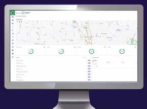
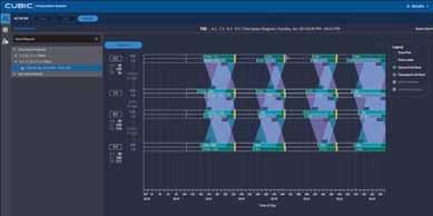
Econolite’s ® MobilityPlatform, the Advanced Transportation Management System (ATMS) now integrates PTV Flows, the predictive and reporting, signal/detection management, additional optimization services, and much more.














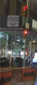
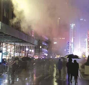





Although the Governors Highway Safety Association says annual US pedestrian traffic deaths fell for the first time since Covid, they are still above pre-pandemic levels, finds David Arminas
US pedestrian traffic fatalities fell 5% last year but remain 14% above the pre-pandemic level, according to data from the Governors Highway Safety Association (GHSA).
The data analysis also reveals just how much more dangerous it now is to walk in the US, says the association in its report Pedestrian Traffic Fatalities by State: 2023 Preliminary Data. Pedestrian deaths have increased 77% since 2010, compared to 22% for all other traffic deaths.
In 2022, light trucks accounted for 52% of all pedestrian deaths where the vehicle type was known, up from 44% in 2012. Also in 2022, 78% of pedestrian fatalities occurred at night - and the share of nighttime deaths has risen even more in recent years.
The report also highlights trends regarding when, where and how drivers strike and kill people who are walking. The five-year death toll surpasses 35,000 as dangerous driving, infrastructure shortfalls and larger vehicles contribute to perilous conditions for people walking.
Analysis found that drivers struck and killed 7,318 people in 2023 – down 5.4% from the year before but 14.1% above the 2019 pre-pandemic level (see bar chart). GHSA says that, while this modest year-overyear decrease is welcome news, pedestrian fatalities have been surging in recent years and reached a 40-year high in 2022.
The GHSA’s report is based on preliminary data reported by the State Highway Safety Offices (SHSOs) in all 50 states and the District of Columbia (DC) and builds upon a report the association issued earlier this year. The new report also includes an in-depth analysis of 2022 data from the National Highway Traffic Safety Administration (NHTSA) that reaffirms some troubling trends regarding deaths of people on foot happening at night, where there are no sidewalks and in crashes with SUVs and pickups. The data analysis was conducted by the research firm Westat.
GHSA points out that some authorities are taking steps to address pedestrian safety, including using traffic safety cameras, engaging with unhoused populations and funding equitable traffic enforcement to deter unsafe drivers who put pedestrians in danger.
“A decline in pedestrian deaths offers hope that after years of rising fatalities a new trend is starting,” said Jonathan Adkins, GHSA chief executive. “We know how to improve safety for people walking – more infrastructure, vehicles designed to protect people walking, lower speeds and equitable traffic enforcement. It will take all this and more, to keep the numbers going in the right direction.”
In addition to providing a first look at state-level fatality figures, the GHSA report examines 2022 data from NHTSA’s Fatality

Analysis Reporting System that examines when, where and how drivers strike and kill people on foot. According to this analysis, pedestrian deaths are increasing at a rate far faster than overall traffic fatalities.
Between 2010 and 2022, pedestrian deaths rose 77%, while all other traffic fatalities increased 22%. There were 294 more pedestrian deaths in 2022 compared to the year before, while there were 628 fewer fatalities from all other traffic crashes.
“ “ Pedestrian deaths have increased 77% since 2010
The number of pedestrian deaths involving passenger cars and light trucks - which include SUVs, pickups and vans - were largely similar for much of the 2010s. Beginning in 2020, however, light trucks accounted for a much larger share of pedestrian fatalities as their proportion of US new vehicle sales continued to climb.
Night-time fatal pedestrian crashes nearly doubled from 3,030 in 2010 to 5,798 in 2022. This is a 92% increase, compared to a 28% increase in daylight fatalities - from 1,092 in 2010 to 1,401 in 2022.
Multiple studies have documented that people of colour are overrepresented in pedestrian fatalities. Race and ethnicity data for 2022 pedestrian deaths were not available in NHTSA’s Fatality Analysis
Reporting System due to delays in processing death certificates. But researchers looked at changes between 2019 and 2021 and found that deaths involving pedestrians whose race was reported as white non-Hispanic fell from 43% to 40%, while they rose from 19% to 21% for Black non-Hispanic pedestrians.
In 2022, two-thirds (66%) of pedestrian fatalities occurred in locations where no sidewalk was noted in the crash report, up from 59% in 2017. Sidewalks can help protect people walking by providing a physical separation between them and motor vehicle traffic. But they are missing or in poor condition in many parts of the US. More than three-quarters (76%) of pedestrian deaths in 2022 were not at an intersection.
Non-freeway arterial roads, which typically carry large volumes of traffic at high speeds, are the most dangerous for people on foot, accounting for 60% of all fatalities in 2022. More than 1,300 deaths (18%) were on freeways. Stranded motorists exiting their vehicles, first responders and tow truck drivers are all examples of pedestrians who have been killed on freeways. All states have Move Over laws, but they are difficult to enforce. Digital alerting technology that warns drivers of vehicles on the roadside
can help reduce these types of crashes.
In 2022, 30% of pedestrians 16 years and older, who were killed in motor vehicle crashes, had a blood alcohol concentration (BAC) of 0.08 or higher. Looking at driver impairment, around 19% of fatal pedestrian crashes involved a driver with a BAC over 0.08. Alcohol and/or drug impairment by pedestrians can put them at risk while walking near vehicle traffic, but drivers bear the brunt of responsibility as
the operators of multi-ton machines with the kinetic potential to kill or injure someone.
This September, traffic safety, public health, law enforcement, technology, government, nonprofit, and business leaders will come together in Indianapolis for the GHSA 2024 Annual Meeting. They will discuss, among other things, recent changes in pedestrian fatalities and how to leverage the Safe System approach to help protect people who walk, wheel or ride. ITS
5.4% from 2022
14.1% from 2019
Source: GHSA
Discover SWARCO McCain’s legacy of innovative Intelligent Transportation Solutions, including Traffic Management Software, ATC Controllers, Dynamic Message Signs, and our versatile and dependable ATC Cabinets.



mccain.swarco.com




































































New York may have thrown a curveball on congestion pricing, but it is a proven global strategy for traffic management which cities should adopt, argues Wes Guckert of The Traffic Group
Asimple solution that can cut traffic and air pollution and get folks to work faster seems like an idea everyone should be able to agree upon. But the topic of congestion pricing can quickly turn into a heated debate. Ironically, both the hospitality industry and the utilities sector make use of this principle, but most don’t take a stance against it the way they do with transportation.
Congestion pricing involves charging drivers a fee to enter high-traffic areas during peak times. This economic incentive encourages drivers to change their travel behaviour by opting for public transportation, carpooling or travelling during off-peak hours. This, in turn, serves to reduce traffic volume during the busiest times, as well as air pollution. It also ensures that road space is used more efficiently and equitably.
The benefits of implementing a congestion charge are fairly obvious:
• Reduced traffic volumes Major cities like New York, Los Angeles and San Francisco currently face severe traffic congestion that hampers economic productivity and quality of life. Congestion pricing can significantly reduce traffic volumes during peak periods, leading to smoother traffic flow, reduced travel times and improved reliability of road networks.
• Environmental sustainability By decreasing the number of cars on the road and encouraging the use of cleaner transportation alternatives, congestion pricing contributes to reduced vehicle emissions. This is particularly important for cities struggling with air quality issues which are aiming to meet environmental sustainability goals.

• Revenue generation for public transportation The funds collected from congestion pricing can be reinvested into a city's public transportation infrastructure. This creates a positive feedback loop: better public transportation options encourage more people to leave their cars at home, further reducing congestion and pollution.
• Equitable use of road space By discouraging discretionary trips during peak times, congestion pricing ensures road space is available for those who need it most, such as emergency vehicles, public transportation and essential services.
Had New York moved forward, it would have opened up some breathing room for Los Angeles and San Francisco to take their fairly dormant proposals and revive them “
“


While the benefits of congestion pricing are clear, its implementation also presents a number of challenges which city officials need to address, among them:
• Equity and accessibility Ensuring that congestion pricing does not disproportionately impact low-income drivers is crucial. Measures such as exemptions or discounts for lowincome residents, improved public transportation options, and targeted investments in underserved areas can help address equity concerns.
• Public and political acceptance
Successful implementation requires strong political will and public buy-in. Transparent communication about the benefits, planned reinvestments and potential exemptions or mitigations is essential. Pilot programmes and phased implementation can also be instrumental in building support.
• Technological infrastructure
Implementing congestion pricing requires robust technological systems for monitoring, billing and enforcement. Investments in reliable, user-friendly technology are essential to ensure smooth operation and compliance.
While the benefits of congestion pricing are clear, its implementation also presents a number of challenges which city officials need to address “ “
Congestion pricing policies have proven to be extremely successful in relieving traffic in cities around the world and hold significant potential for major urban areas in the US grappling with chronic traffic issues – all of which makes New York Governor Kathy Hochul’s recent decision to scuttle a congestion pricing plan for Manhattan at the last minute all the more confounding.
Decades of discourse preceded the Big Apple’s decision to move forward with its plan. While transportation officials in New York have been advocating for similar measures going back to the 1970s, it was former mayor Michael Bloomberg who launched a serious push to impose a user fee on vehicles entering Manhattan’s
busiest streets in 2007.
The current plan, which would have had commuters who drive to work paying up to $15 daily to enter lower Manhattan starting June 2024, would have raised approximately $1 billion per year to help the city’s struggling transit system. But in a stunning, eleventh-hour decision, Hochul ordered the first congestion pricing programme in the US to be put on hold indefinitely, after years of staunchly supporting it.
The New York Times Editorial Board called her decision a “grievous misjudgment”. With 64% of people in New York opposed to the programme and 72% of suburban folks against it, according to a Siena College survey, it seems the decision was made in part because of politics. Another possible reason for the governor's decision was the financial impact on lowerincome individuals who need to drive into lower Manhattan daily.
The plan, which would have imposed a fee on vehicles entering the most congested parts of the city, was expected to encourage more commuters to use public transit, thus alleviating traffic and improving air quality. However, Hochul was concerned that the additional costs would disproportionately affect low-income workers who rely on their cars for commuting “at a time when inflation is still cutting into New Yorkers’ hard-earned



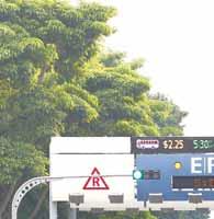
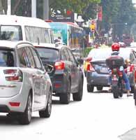
wages”. In a message announcing her decision, she worried that “one more added cost would make residents rethink living or working here altogether, hurting our recovery even more”.
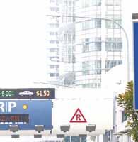
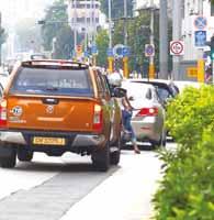
Rather than scrapping a project with substantial environmental and congestion benefits, some argue that the state could have explored alternative measures, such as reducing taxes, to mitigate the financial


impact on lower-income drivers.
The cancellation of the congestion pricing plan raises questions about equity and the distribution of benefits and burdens across different communities. While the plan
The Future is Here.
High-definition video and radar detection sensor with integrated artificial intelligence algorithms make Vantage Apex stand apart from anything else on the market today.

iteris.com/apex
was primarily focused on Manhattan, its
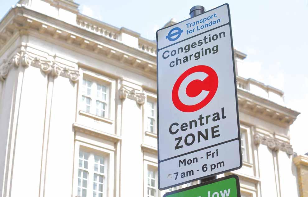
Congestion pricing has been in place in London since 2003. Today, London has seen a 30% reduction in traffic congestion within the central zone and generated approximately £2.6 billion by 2018. That money has been reinvested in improving public transportation, cycling infrastructure and road maintenance. And by and large, the people there have adapted to it.
Congestion pricing was unpopular in Stockholm when first implemented, so officials kicked off a six-month trial programme in January 2006, with a permanent relaunch in 2007. “The closer you get to implementation, the more the drawbacks stand out," Stockholm transportation director Jonas Eliasson noted in a Streetsblog NYC article. "If you survive this valley of political death, and people actually see the benefits, and also realise that, in addition to the benefits, it’s actually not as bad as you thought....then support starts going up again."
After the pilot, the Swedish government
released a referendum. Stockholm residents voted in favour—the first time any European residents elected to adopt a road charging system. In the years since, support has grown to over 70%.
These and other success stories provide compelling evidence that congestion pricing can be a highly effective approach to managing urban traffic congestion in diverse urban contexts, with significant benefits for environmental sustainability, economic productivity and quality of life.
None of this is easy and there are pitfalls that must be addressed if congestion pricing is to have any chance of success.
But the examples of several cities around the world in implementing it offer valuable lessons and evidence of the effectiveness of this policy.
For major US cities struggling with chronic traffic problems, congestion pricing offers a viable path forward. By carefully designing and implementing such policies, US cities can create more efficient, liveable
and sustainable urban environments.
As a seasoned traffic and transportation planner, I strongly advocate for the adoption of congestion pricing as a critical component of modern urban mobility strategies.
The time to act is now, harnessing the lessons from global pioneers to create a better future for our cities. ITS

SEPT 15-17, 2024
SEVILLE, SPAIN



SUMMIT HIGHLIGHTS
• Tours in Two Cities – Madrid and Seville!
• Program with expert tolling professionals from around the world

• Exhibit hall space still available in Meliá Sevilla





THERE ARE A MILLION REASONS TO ATTEND IBTTA’S
THERE ARE A MILLION REASONS TO ATTEND IBTTA’S
Exhibition CLEVELAND, OH
OCT 26-29, 2024 WE WILL HAVE: The largest exhibit hall in IBTTA history! KEY TRACKS:

• Road Safety featuring
• Risk Management
• Communications, HR, Legal
• Trend Talks

Follow us on and for the latest news. www.ibtta.org


• Network with industry leaders, policymakers, and innovators from across the Americas.
• Discover the latest technologies and strategies to address pressing urban mobility challenges.


• Learn how cities have successfully implemented sustainable transportation systems.
• Participate in discussions to influence future transportation policies and regulations.
• Position your organization as a leader in sustainable transportation and urban development.








The work of the Connecticut Transportation Safety Research Center means engineers can concentrate on developing more effective safety measures, rather than having to sort out raw crash data












The Connecticut Transportation Safety Research Center (CTSRC) is one part of the Connecticut Transportation Institute housed in the College of Engineering at the University of Connecticut (UConn). Its primary mission is to support the Connecticut Department of Transportation (CTDoT) in developing and maintaining a stateof-the-art crash collection and safety analysis system.
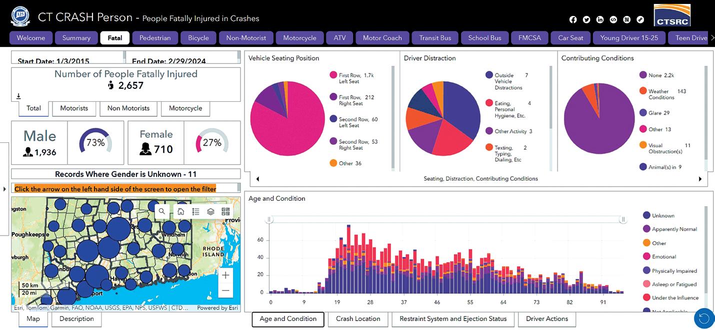
As part of that mission, the Center has developed the Crash Repository for Analytics, Statistics and History (Crash). Through a series of geographic information system (GIS)-based dashboards, Crash provides a comprehensive view of the crash, person and vehicle data within the state of Connecticut. All the information available in the dashboards is refreshed on a daily basis to keep it as current as possible.
The journey to the current application started with the use of crash data analytics in 2011 with the Crash Data Repository which presently has just under 2.7 million crashes that date back to 1995 and provides the underlying data for the Crash application. An advantage that Connecticut has, according to Dr. Eric Jackson, executive director of the Connecticut Transportation Institute and director of the CTSRC, is that all data gathered by the state is made publicly available. This makes realisation of a project such as Crash a far simpler task than in other locations where engineers can struggle to access the same levels of information.
The Center brought on board two specialists of its own - Aaron Nash as the GIS project manager and Jennifer Pawelzik as the GIS database administrator. The team expanded to include several PhD students to help bring the vision to life.

During the development of the tool, there were several permutations of trial and error within the application. “Several previous solutions were tried,” says Nash. “Performance of dynamic views was sub-optimal, and prone to time-out errors. We tried creating the geometry of the crash location using Python and later changed it to build the geometry using SQL.” The methodology the team nally landed on is a stored SQL procedure that is scheduled to run nightly. This updates a series of feature classes that are published as dedicated feature services.
A rst-phase solution provided crash-level location information for each emphasis area and was designed simply to provide a GIS front end to complement the Crash Data Repository. However, this has since been signi cantly expanded in phase two, which added more personlevel (age, gender, physical condition) and vehicle-level (body type, age, levels of
damage) data.
In total, there are 26 data queries for each focus of the data providing insight on different types of crashes - termed ‘emphasis areas’. The goal according to Nash, “is to provide a full and comprehensive view of the MMUCC data in an easy-to-access format”.


A separate service shows summary metrics which provide a high-level view of events.
How the data has been built up over time can be illustrated with the pedestrian emphasis area as an example. In the crash-level view of the data, users can access locational and temporal details, in addition to information on circumstances contributing to an incident - such as the manner of collision, the roadway surface condition and injury severity level. With the latest updates to the application, users can now view information speci cally pertaining to the person- and vehicle-level view of the crash. For each of the 26 emphasis areas, there are queryable dashboards centred around the way the data is
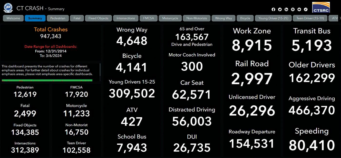
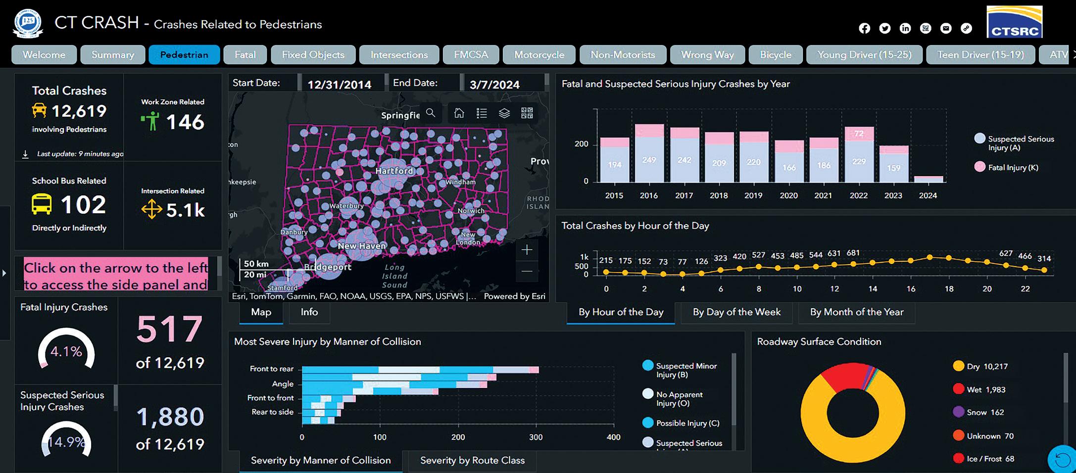
typically presented and analysed by safety analysts.
Access to the information is via a homepage which is designed to present information in an easily digestible format. A Story Map was developed with background on the data and instructions on how to navigate the application to ensure that even those who are unfamiliar with GIS and crash data are still able to access the information they require.
The Story Map is broken out into multiple sections describing the navigation of the dashboards, emphasis area definitions,
rest service access, and information on the Crash Data Repository. This was built out based on a combination of frequently asked questions and to show the underlying metadata used for Crash. The goal of the Crash application is to provide front-end users with convenient access to commonly-requested data queries that can be further drilled down using the filter options. As an example, if a user wanted to see all fatal and serious injury crashes involving a non-motorist in their town, they could navigate to the person-level, non-motorist dashboard and set the filters accordingly.
The development of the dashboards was accomplished using both Esri’s ArcGIS Experience Builder and Dashboard applications. The Crash team’s migration to ArcGIS Enterprise 11.2 has added functionalities, such as the ability for users to download data, a mobile dashboard view, and a reset option.
CTSRC has a standardised crash data workflow that pulls data from an SFTP site nightly. This enables daily updates. To ensure data accuracy, a team of crash coders scrutinises each crash reported for location checks and general report errors. Esri tools are used to geolocate incidents and cross-reference the locations from reporting officers based off-fields within the crash report and the crash diagram.
The review process can take between 30-60 days for property-damage-only crashes - but fatal, injury, and commercial vehicle crashes automatically jump to the front of the queue and are processed within 24 hours of receipt. Once a crash has been reviewed by the coders and marked as completed the information ends up in the crash data repository, and ultimately the Crash database.
With 110,000 crashes each year and a database that reaches back to 1995, the CTSRC is looking into how machine learning and artificial intelligence could be applied. This could include natural language processing of both the data itself for easier processing, but also leveraging AI to glean more information and insights from the intersection diagrams that accompany the crash reports.
Dr. Jackson notes that Connecticut’s data set is a unique asset, and one that is ripe for the application of machine learning and AI, as well as more advanced analytics. To that end, the Center has a number of graduate students, post-doctoral researchers and safety
engineers who are focused on leveraging the data to help drive safety research.
Just how all this helps CTDoT, and in particular local jurisdictions, is illustrated by the support the Center provides for Safe Streets and Roads for All grant awards.
“We’ve had a lot of requests for help with identifying which intersections are the most dangerous for pedestrians and cyclists,” says Jackson. “We’re starting to see impacts in terms of needing to demonstrate where our problems are, so that we can start finding countermeasures and solutions, and we’re right on the cusp of understanding how towns are going to start using this data to help improve their chances of getting funding.”
The Connecticut Roadway Safety Management System (CRSMS) and safety analysis tools, developed together with engineering consulting firm VHB, have the aim of improving those statistical methods and metrics; a next step is for Jackson and his team to organise a series of webinars which will help planning agencies better understand how to use these tools.
Having the crash data available in Esri's ArcGIS Enterprise platform allows for the Crash team to leverage the crash data and build out derivative datasets and applications to address needs within the state. An
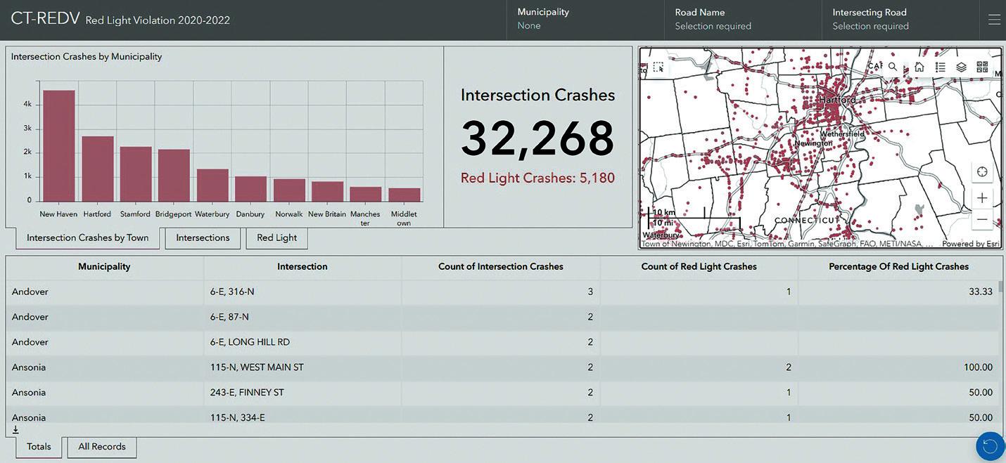
example of this is the CT-REDV, a red-light violation application which provides information for signalised intersections throughout the state.
Grant support is available for red-light camera installations at intersections, but local jurisdictions need to be able to supply data for why they have selected specific locations.
Pawelzik took data from a time subset
— January 2020 to December 2022 — for the build, although a wealth of data stretching back over quite some years has resulted in the ability to provide information for local as well as state roads. A challenge arose in terms of standardising the intersecting road names within the data, she says, depending on where precisely within an intersection a crash occurred could result in various combinations of road and route names being used on the crash report form.
Now, instead of having to comb through crash data, towns can see the data they need in a more digestible format. They can see the individual intersections which have sustained
red-light crashes, to help them prioritise those intersections for red-light camera installations. All of this can be broken out and downloaded as needed, and Pawelzik says that the app provides a good example of the kinds of emerging requests that CTDoT receives from towns that the CTSRC is able to help with.
The use of the Center to collect and manage the crash data, allows the safety engineers at CTDoT to concentrate their efforts on the development of more effective safety measures, without having to shoulder the considerable burden of “cleaning, geocoding and validating” the raw data, and the effort to manage a crash database with close to three million records.
As a result, responses to the solutions provided by CTSRC have been very positive, especially among the towns which have long-standing relationships with CTDOT and have been making regular data requests.
In particular, the migration to Enterprise 11.2 and the ability to download easily digestible information is proving to be a real bonus. And, although some of the information provided is highly granular, the presentation in GIS is proving useful to jurisdictions, helping them not only better understand their safety performance, but also to be more strategic when looking to make infrastructure and safety improvements. ITS


The contrasting cities of Detroit, Venice and Varanasi have been chosen to take part in a new initiative by the Toyota Mobility Foundation. Ryan Klem explains all to Adam Hill



Every city has its problems moving people around: but there is no one-size-fits-all blueprint for sustainable transportation. This is just as well, since Toyota Mobility Foundation (TMF) has selected three cities which are about as different as its possible to be for its Sustainable Cities Challenge.
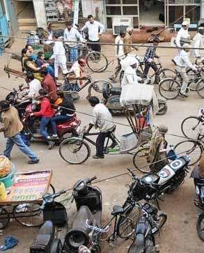
The trio, which will each receive $3m to solve their distinct issues, are Detroit, Michigan, US (where the challenge is to reduce fossil-fuel use and costs of freight operations in the Eastern Market); Venice, Veneto, Italy (increasing the use and adoption of existing sustainable transport modes); and Varanasi, Uttar Pradesh, India (making crowded areas of this ‘spiritual capital’ safer and more accessible for religious tourists and local residents).
“This is a $9m challenge aimed at bringing cities and innovators together to address some of the most complex mobility challenges,” explains Ryan Klem, director of global programmes for TMF. “The funding will go towards implementation of innovations into those cities: how do we move them from the cities of today to the cities of tomorrow?”
There is an emphasis on practicality, turning innovative concepts into actionable solutions. TMF was established in August

by Toyota Motor Corporation, and works in partnership with universities, governments, non-profits, research institutions and other organisations, creating programmes that are aligned with the UN Sustainable Development Goals to address mobility issues around the world.
Two-thirds of the population is predicted to live in urban areas by 2050. Cities consume 78% of the world’s energy and produce over 60% of the planet’s greenhouse gas emissions, which makes the need for innovative and sustainable solutions critical, TMF says.
How do we move them from the cities of today to the cities of tomorrow? “ “
TMF has led a range of initiatives, including the global Mobility Unlimited Challenge, Catch in Malaysia, InoveMob Challenge in Brazil and Stamp Challenge in India.
The key is to engage local stakeholders and organisations, with a view to unlocking growth opportunities and moving towards a sustainable future, identifying mobility barriers and leveraging data-driven solutions for lasting impact.
In addition to providing the $9m in







funding for the Sustainable Cities Challenge, the organisation will bring in other partners such as Challenge Works and the World Resources Institute, to help on sustainability and accessibility. “How do we really concentrate those efforts to move the needle on the challenges and initiatives we’re looking for?” Klem asks.
After 150 cities applied, the three were chosen from a shortlist of 10 worldwide, with their individual needs assessed. “It was difficult,” he adds. “We really had three broad categories: one was how do you use data to improve decision-making and sustainability in your city? The second is how do you remove mobility barriers from some of the underserved communities? The third was really around decarbonisation of mobility, of moving people and goods. And from there we chose three of those cities – Detroit, where we really focused on clean freight; Varanasi, looking at how do you take this historically rich cultural centre with 70 million people [visiting] per year and create a better experience for them? And then last, but not least, in Venice we have a lot of forms of shared transport but how do we actively get people to use it in a more proactive way? So, three amazing cities that are well-situated to work with us and welcome innovators in. And three broadly different thematic areas that really cover the gambit in terms of mobility for all.” ITS








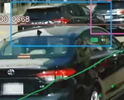





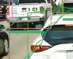




Snapper Services CEO Miki Szikszai and Chris Carson, CEO of Hayden AI, tell Adam Hill about synergy and partnership – and how to make use of data once you’ve gathered it
Every business has its origin story. Chris Carson, CEO of Hayden AI, was on a bus in San Francisco when he noticed the driver regularly taking his hand off the steering wheel to reach up and hit a button on a camera that was in the window.
Ironically, these cameras are often monitoring driver behaviour to make sure they’re not distracted – but every time a car was parked in front of him, causing an obstruction for the bus, the driver was pushing the button to index the video.
“And so here he is, driving a bus of passengers, and not just having to focus on driving, but also having to focus on hitting a button on a camera device,” recalls Carson. “My first thought was: we

could use AI to automate that. And that was, essentially, the genesis of the idea. We could build a mobile device, using AI, that would be much more scalable than fixed cameras.”
Fast-forward to now and Hayden AI’s mobile perception platform is installed on transit agencies’ buses to identify cars which, for example, have parked in a bus lane, slowing down commuters.
Earlier this year, the company signed an agreement with transit analytics specialist Snapper Services, whose Mosaiq Insights solution presents on-time performance data so that authorities and operators can pinpoint their priority areas for network improvement. The synergies are clear: the partnership is “really around enhancing data analysis for public

transit providers”, Snapper CEO Miki Szikszai explains.
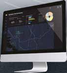
“Mosaiq Insights is all about making it easy for transit authorities and operators to understand where delays are happening in the network and it does all of that heavy lifting to analyse on-time performance, then presents it back to the user with intuitive dashboards to help transit authorities and operators pinpoint where are the highest-priority areas for improvement.”

Understanding exactly what might be causing problems is vital. “That's really where we see Hayden AI coming in,” says Szikszai. “Its vision AI platform gives transit agencies a highly location-accurate understanding of where illegal parking obstruction is occurring, particularly

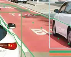



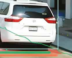


“ “ The power of AI is being able to capture data, build bigger, better models, and create insights and situational awareness
Chris Carson Hayden AI

around bus lanes and bus stops. And so using those two together, authorities can basically pinpoint low-performing services and strategically deploy these leadingedge solutions to change road behaviour and improve bus on-time performance. It really is around tying those two things


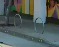


together, and allows operators and authorities to make targeted, effective and continuous changes to the network, rather than having to go through this whole thing which people seem to want to do, which is take five years to do a full overhaul fleet plan - they can just get in and do it now.”
Improving the passenger experience is the ultimate aim.
AI ‘before it was cool’
Artificial intelligence is, of course, having some time in the sun at the moment.
“Why is everybody talking about AI? We had ‘AI’ in our name before it was cool,” smiles Carson. “It's really interesting, the hype curve that's taking place with AI. There are a bunch of different



breakthroughs that are taking place right now. We're technologists and AI is at our core. That being said, we're also trying to be very focused on bringing something that is practical and that delivers real value. And often, in a lot of these different technologies or hype cycles, you'll find that nothing real gets delivered that changes people's daily lives. It is a tool, and we've got to find practical applications for it.”
Starting with customer problems and working out how to build tools and capabilities to improve those experiences is particularly important in public transport, says Szikszai. “It affects so many people and it's so up front and in the middle of the cityscape, whatever you do has to be evidence-based and
reliable. And I think what we're seeing here is this ongoing evolution of a trend towards basically people using the data that they have and collecting that data and applying all sorts of different technologies to effectively enable good decisions to be made out on the street day to day. Anything that we think can be done to empower those planners and depot managers and city managers to do those things really makes sense.”
Hayden AI operates in, among other places, Downtown Manhattan in New York: “A lot of the routes that we're on are quite challenging,” Carson says. “Every route has its unique characteristics. We have architected the system in a way that uses 3D mapping layers, and mapping layers as a super-sensor into the device. And by doing so, we can get down to the pixel level of each route. And so very clearly, we can annotate that route, and that annotation tells the device what to enforce. Just from a technology point of view we built something that's really sophisticated and robust, to be able to solve the most difficult challenges on any route. I think that what else is really interesting is that it is a mobile platform. And thus far, you really haven't seen companies with a mobile enforcement platform - they're typically fixed.”

As well as capturing temporal data, the cameras also capture spatial data “that I think
is very valuable to companies like Snapper”, Carson adds. “We wanted to do something that was a lot more innovative, because we're very interested in that geospatial data we can capture and how we can use that to allow cities to make more informed decisions, creating that smart city intelligence.”
“
“ We have increased urbanisation around the world: more people in the same constrained space, all with large singleoccupant vehicles - something's got to give
Miki Szikszai Snapper

significant. We see that buses spend about 50% of their time idling either at a bus stop, which makes sense, or a stoplight, which makes sense. But the other 50% of that time it's idling because it's stuck behind another vehicle. So that's just sitting there producing CO2. And so if we can move those vehicles out of the way, and speed those buses up, we can reduce the CO2 that they generate. But there's a secondary effect here, which is that as you speed buses up and more people ride the buses, they'll use [fewer] forms of transportation that are less efficient.”
It's not only about enforcement. As air quality becomes a real issue for urban areas worldwide, for instance, Carson suggests there is a role for the technology in decarbonisation - helping city agencies to mitigate the effects of public transportation emissions.
“By making buses run more efficiently, they spend less time idling, which helps reduce CO2,” he says. “And it can be quite
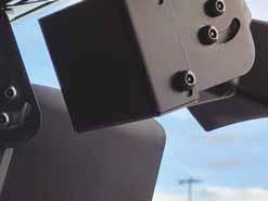
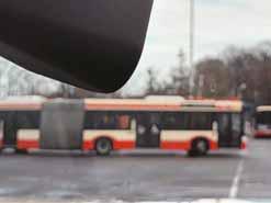
If public transport is efficient, then the lure of the private car becomes less appealing, Szikszai agrees. “Making sure that your transit network is frequent and reliable means that as a user, you go: ‘Okay, I know I can walk out the door and I can basically get to my endpoint without having to think about it - and I know I'm going to get there.’ That is the key. Once people do that, it obviously makes the case for adding more capacity to the network.”
Technology like Hayden AI’s can then help to make the case for dedicated bus lanes, for example, making city planning more responsive to people’s needs. “But you have to get that base service frequent and reliable so that people can use it,” Szikszai insists.



While reluctant to comment specifically on the surprising demise of New York City’s proposed congestion charge, Carson says that European-style low-emission zones approach the issue of congestion from a slightly different direction. “That would have been a really interesting way to market it [in New York] as more of an opportunity to reduce emissions within the city. But certainly there's synergy between what we do and what congestion pricing in hopes to achieve.”
Szikszai thinks the UK capital set the blueprint for tackling the issue. “The approach taken by London was very clear: make the existing public transit system great before introducing a charge so there is a genuine alternative for those customers. We're seeing cities around the world really struggling with peak traffic flow - but often it only takes moving 1-2% off that peak to basically move from something that's stopped to something that's moving.”
Humans being what we are, persuasion is needed. “I think the reality is in some places there needs to be an incentive and there needs to be also a disincentive to using some of these services - or to push people into using their vehicle at different timeframes,” he continues. “It's a reality of the fact that we have increased urbanisation around the world: more people in the same constrained space, all with large single-occupant vehicles - something's got to give.”
Moving forward, Carson expects his company’s technology to have myriad potential applications for cities, beyond public transit. Hayden AI’s vision platform is not only restricted to bus-lane enforcement.
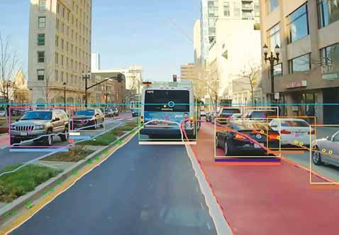

“What we're really focused on is the data collection and what we can do with the dataenforcement is just a data set,” he points out. “But there's a whole lot of other data sets out there that could be very important. We’ve focused on enforcement because it's a way to get a supercomputer inside vehicles: today, it’s transit buses; tomorrow, there'll be other vehicle types like street sweepers, garbage trucks, school buses - and even police cars.”
All of these vehicles travelling on different routes and streets could provide useful information, “a data network effect” which can be shared across agencies.
“That’s really our bigger vision,” he says. “Buses is just the first vehicle type.
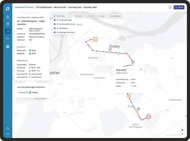
The power of AI is being able to capture data, build bigger, better models, and create insights and situational awareness. There's a whole host of applications. To build one device that is robust enough to identify multiple traffic violations, I think is pretty cool.”
For Snapper, by contrast, the focus will remain squarely on public transit performance, Szikszai explains: “How far can we go in terms of actually making that visible to planners? As we work with more partners like Hayden, we’re building this richer and richer and richer picture that enables planners and city managers and anyone who's involved in that public transit experience to be able to look at the performance of their network in the morning and go: ‘Oh, I'm going to make this change for the afternoon.’ And it's those kinds of things that just reflects the dynamic nature of that service. We have plenty to do in that area; there is loads more to go.” ITS ABOVE & RIGHT Mosaiq Insights’ dashboards
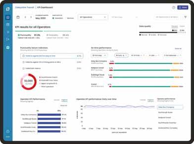



AI-driven image review is a game-changer for tolling industry efficiency. Rafael Hernandez of IntelliRoad outlines the importance of partnerships with service providers
As infrastructure continues to evolve in response to changes in where, when and how we drive, the efficiency and accuracy of tolling operations are paramount to ensuring a seamless customer experience and maximising revenue collection.
However, traditional tolling image-review processes have not kept pace with growth, remaining time-consuming, prone to errors and lacking adaptability. To support this evolution, artificial intelligence will be an essential tool in modernising the image-review process, ushering in a new era of efficiency, accuracy and operational excellence.
The conventional methods of image review face several challenges hindering their effectiveness. The absence of technology integration with manual review leaves the process vulnerable to human error, impacting the seamless execution of image-review tasks. Moreover, the lack of feedback loops encourages these processes to remain stagnant without the ability to adapt in response
to changing conditions or data collected from the tolling operations ecosystem.
Another challenge is that, even in instances where technology is implemented, those tools themselves are often outdated and struggle to meet the demands of modern tolling operations. Antiquated systems stifle innovation and inhibit progress, preventing tolling agencies from capitalising on advancements in technology. By clinging to legacy technologies, agencies inadvertently impede their capacity to optimise operations, enhance customer experiences and capitalise on opportunities for growth.
Proper image review is the cornerstone of tolling operations, serving as the first line of defence to ensure excellence in customer service, preventing errors in financial posting and toll invoicing while maximising revenue by reducing leakage.
Proper image review also enables tolling agencies to identify areas for improvement and implement proactive measures to enhance performance. By leveraging AI and machine learning, agencies acquire
operational insights and real-time alerts, empowering them to make data-driven decisions while optimising their operations for maximum efficiency and profitability.
AI holds tremendous potential for modernising the image-review process in tolling operations and can be integrated into every stage of the image-review workflow, from pre-processing to final validation. Through pre-processing AI algorithms, images can be enhanced and optimised for maximum automation potential, reducing the need for manual intervention and minimising processing time.
AI algorithms can also automatically identify and extract licence plate information, eliminating the need for manual data entry and reducing the risk of errors. This not only streamlines the image-review process but enhances the accuracy and reliability of transaction data, ensuring compliance with business rules and regulations.
AI also acts as a safeguard against errors by flagging discrepancies and anomalies in real time. By comparing incoming data to

predefined algorithms and business rules, AI can identify potential errors and inconsistencies before they escalate, allowing operators to take corrective action promptly and before impacting the customer and financial reconciliation.
Of course, any new methods for data collection and analysis raise understandable concerns over how data is collected, stored and utilised. It will be incumbent upon each agency and vendor to ensure their policies on these issues are updated to reflect new technologies, subjected to routine evaluation and revision as technology evolves and made readily available to public and regulatory scrutiny. As part of a technology upgrade, tolling agencies and vendors may also need to invest in enhanced data security measures.
In addition, it will be important to establish guidelines and redundancies establishing a checks-and-balances system between human and AI review. Communicating to the public how these new technologies will enhance - not replace - human oversight will hasten adoption and acceptance.
To facilitate this evolution, the integration of AI in tolling operations calls for strategic partnerships with best-in-class service
providers, which are crucial for ensuring the adoption of cutting-edge technology while also leveraging years of expertise and innovation that these providers bring:
• Technology: Best-in-class service providers facilitate the enhancement of legacy systems with advanced AI capabilities, ensuring a smooth transition and interoperability between old and new technologies. Their expertise helps tailor AI solutions that are both innovative and compatible with existing infrastructure, minimising disruption and maximising efficiency.
• Policy: Top-tier providers support the development and implementation of robust policies that govern technology use, ensuring compliance with regulations and maintaining high standards of data privacy and security. Their experience in navigating complex regulatory environments helps agencies implement AI solutions responsibly and ethically.
• People: Agencies benefit from comprehensive training programmes and support structures. These providers help upskill agency staff, enabling them to manage and operate advanced AI systems effectively, ensuring that the human element evolves in tandem with technology.
Working with best-in-class service providers not only brings technological advancements but also ensures that these innovations are implemented in a manner that is secure, efficient, and beneficial to both the tolling agencies and their customers. These partnerships are essential for agencies aiming to remain competitive in a rapidly-evolving digital landscape, helping them harness the full potential of AI to improve service delivery, enhance operational efficiency, and secure the future of tolling operations. ITS
Conventional methods of image review face several challenges hindering their effectiveness “ “




















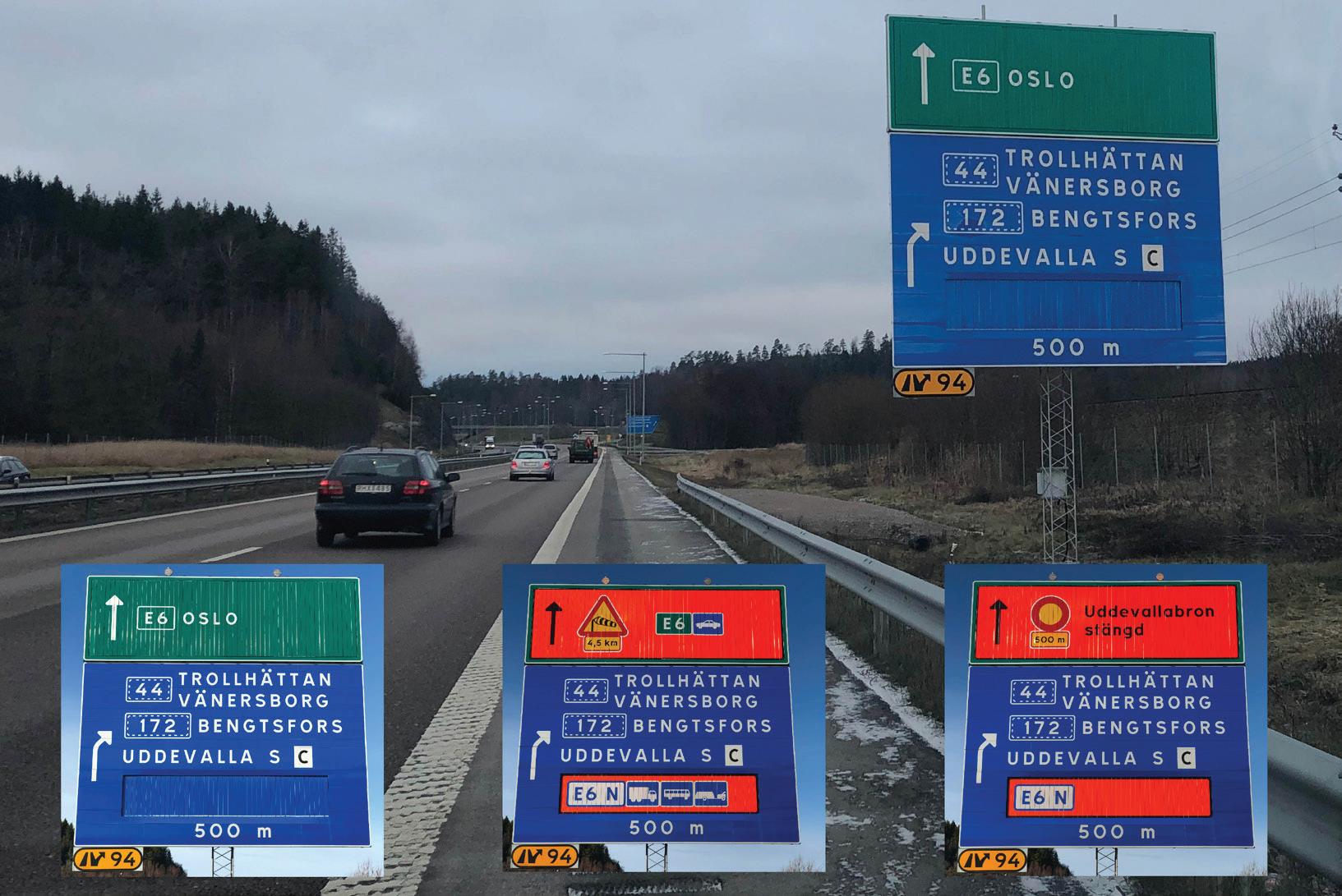

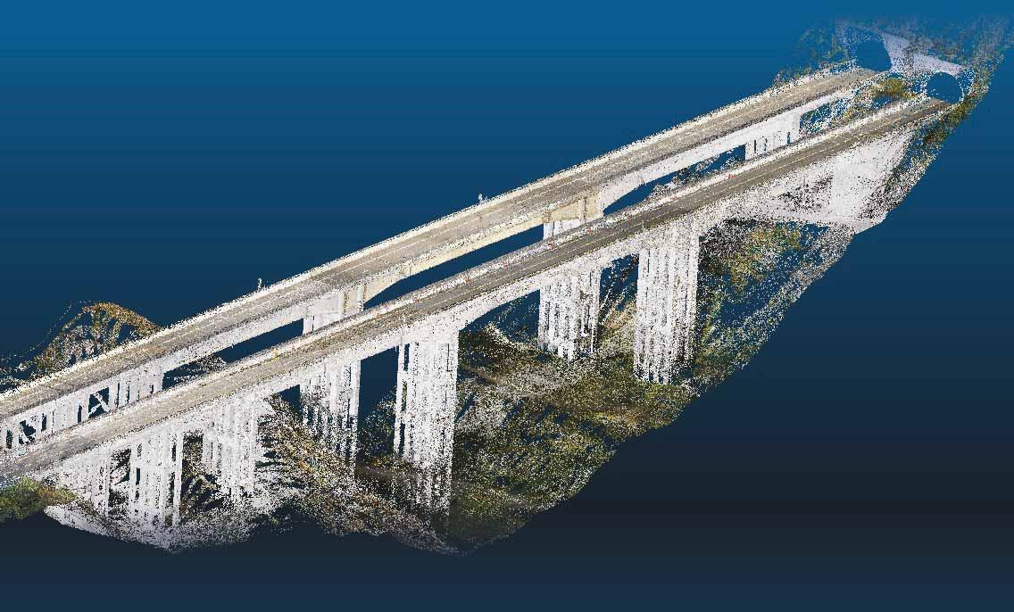
Drones, equipped with high-resolution cameras and Lidar, create Argo’s digital reconstruction
A variety of technologies are available to monitor the health of critical infrastructure – and to keep the drivers who use it safe by flagging incidents while reducing false alarms
The upkeep of the world’s infrastructure – in particular tunnels and bridges – is the source of constant concern to road authorities and concessionaires. Fortunately, there is a lot of technology around to help monitor these vital pieces of the road network, offering health checks of the fabric to ensure problems don’t become catastrophes – and also keeping eyes on obstructions and hazards to ensure that all road users stay safe.
Movyon’s Argo has been designed to help road infrastructure managers and inspection companies, optimising inspection processes and lifecycle management.
“Argo’s digital inventory collects, manages and controls the structural data of bridges, viaducts and tunnels in their individual components, the quality of information and processes,” explains Roberta Loiacono, marketing director at Movyon. “This is extremely important in order to guarantee data standardisation and transparency and an advanced data governance. Based on the data stored, the system then generates the simplified building information modelling [BIM] of the infrastructure, a crucial support for the inspector in remotely navigating the asset.”
Drones, equipped with high-resolution cameras and Lidar laser, perform a 3D scan of a bridge, for example. This process
generates millions of geo-referenced points, which are associated to real photographs of the asset, and transformed into an accurate digital reconstruction, helping the operator in remote inspections and providing advanced analysis.
Argo is scalable and modular. “It is a comprehensive platform with multiple, fully-integrated elements, from the digital inventory - the essential part of it - to the mobile app for on-site inspections, to the IoT [Internet of Things] sensors for structural monitoring, to digital twins,” says Loiacono. “In this way, road infrastructure managers and inspection companies can benefit from all - or part - of the solution, according to their needs.”
Meanwhile, correctly assessing that a vehicle has broken down in a tunnel or a pedestrian has strayed onto the highway over a bridge is vital for safety – but also for improving operational efficiency. Citilog supplies video-based automatic incident detection (AID) solutions for tunnels, bridges and highways, including for the UK's new Silvertown Tunnel, under construction beneath the River Thames in London.
The company will integrate its AID system to help reduce congestion in and around the tunnel between the London borough of Greenwich, the peninsula area,
and West Silvertown on the northern bank of the Thames. The 1.4km-long twin-bore tunnel will have two lanes per tunnel with dedicated lanes for heavy goods vehicles and buses. There will be no pedestrian or cycle access, although a shuttle bus has been considered for cyclists.
The AID system, that includes 59 CCTV cameras, will enhance safety and incident management with real-time incident detection and response and also will minimise false alarms while maintaining high detection accuracy. Using thousands of video clips will help train an advanced network to reduce false positives, allowing operators to focus on genuine emergencies. The AID system can also be easily upgraded and extended.
“Our long-standing partnership with Indra has been instrumental in providing the AID system for the Silvertown Tunnel,” said Volkert Samplonius, Citilog’s vice president for the Iberoamerica region, Israel, South Africa, Australia and New Zealand. “Our excellent detection rate, low false alarm rate and rapid incident response align perfectly with our commitment to safety and efficiency.”
The Silvertown Tunnel is not yet open, but Citilog points to case studies which prove the AID technology’s worth – not least in
focusing on genuine alarms. For instance, at an unnamed monodirectional tunnel in France, with two tubes of 330m each, and 24 surveillance cameras in place, the overall false alarm frequency was one per camera every three days. Primary reasons for the mistakes were light effects, which accounted for 67% of total false alarms, while weather effects (specifically, water on the road) were responsible for 14%, and vehicle projections 19%.
This changed with an upgrade which replaced those conventional detection technologies with Citilog's deep learning (DL)-based system. That cut the false alarms to one camera per 10 days, the company says - a reduction of approximately 75%. Furthermore, the DL system successfully eliminated all pedestrian-related false alarms which had been observed with the legacy system.
Also, the new technology mitigated 94% of the stop-related false alarms that were prevalent in the computer-vision-based system, Citilog says.
False alarms demand unnecessary attention from operational teams, taking them away from their main focus on security concerns. Substantially decreasing these translates into improved operational efficiency, enabling surveillance personnel to prioritise real threats and incidents with greater accuracy. ITS
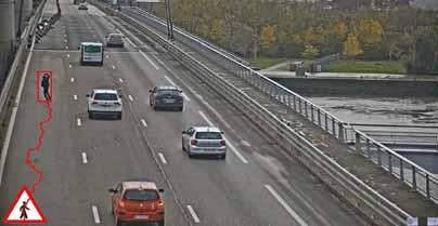
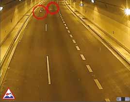
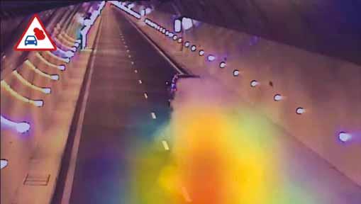
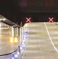
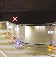

Allowing drivers to see exactly where they are going is one of the key elements in road safety. Sernis says its SR-T24 Tunnel road stud has been engineered to enhance safety and visibility in highway and urban tunnel
environments. Equipped with durable LED polycarbonate lens protection, it has high brightness levels day and night, and comes in customisable configurations to suit various tunnel requirements. Powered by electric energy,


SR-T24 features a reliable wired system with low power consumption, but is visible up to 1km away. LED colour options include white, red, amber, green and blue so is suitable for diverse applications and safety needs. With

IP68 and IK10 ratings, the SR-T24 offers superior protection against dust, water and impact, ensuring reliable performance. LED quantities: 12 (unidirectional), 24 (bidirectional), 9 (arrow on top), 10 (lines on top).



IntelliRoad, a division of Kyra Solutions, is a leading traffic safety and tolling solutions provider utilizing over20years ofexperienceto realizea futurewhereevery journeyis smarter and safer. Since its inception, IntelliRoad has been dedicated to revolutionizing how transportation agenciesandcommunitiesthinkaboutmobility.Comprisedoftwokeydivisions, IntelliManage (Tolling) and IntelliConnect (ITS), the company provides innovative solutions aimed at strengthening safety standards, enhancing operational efficiencies, and enriching customer satisfaction in the transportation sector. Committed to the well-being of motorists through digital transformation, IntelliRoad strives to turn data into action, enhancing highways into streamlined smart corridors of commerce and recreation.
Learnmoreat www.intelliroad.io
FollowonLinkedInat https://www.linkedin.com/showcase/intelliroad











The bosses of the three major international ITS organisations – ITS America, Ertico and ITS Asia-Pacific – have put their heads together on a podcast. Beate Kubitz listens in…
For a global oversight of ITS trends, few people are better placed to comment than Joost Vantomme, CEO of Ertico – ITS Europe; Laura Demeo Chace, president and CEO of ITS America; and Ace Yamamoto, secretary general of ITS Asia-Pacific. The three regional leaders took part in a discussion of their perspectives and common themes in global ITS in a conversation, hosted by Agne Vaitekenaite, Ertico partnership development manager for the Connecting Dots and Talks podcast.
Whilst regions differ in degree and approach to specific areas – for instance standardisation, integration and disaster preparedness - the importance to all regions of data, trust, breaking down silos, automation, generative AI and future mobility was clear.
Integrating emerging technologies –connectivity is key
There is increasing integration of emerging technologies into intelligent transport systems, according to Ertico’s Vantomme. Developments in 5G, AI and IoT are inevitable and intertwined: “Thanks to technology we can bridge the gaps.”
By this he means the gaps between the four major modes – road, rail, water and air - and also between the wide range of users of
these modes – from boats, trains and cars, to ‘soft’ and active mobility.
“We integrate the modes and this relies on connectivity – the roads with the cars, the traffic lights with control centres, the centres with safety messaging,” Vantomme says. “Connectivity means you need both short- and long-range connectivity and spectrum availability for this. It’s key to IoTthe Internet of Things – which joins all these together, and to automation and generative AI.”
Meanwhile, Chace discussed the role ITS America plays in promoting equity and accessibility in transportation adoption across the region.
“We develop policy at national scale to help guide the integration of transportation technologies,” she says. “One of the core functions we bring to the community is policy development on key issues. For instance, in July, ITS America released a new set of AI policy principles for policymakers, employers and even developers to shape how we should be thinking about implementing AI solutions in our transportation system in order to deliver the benefits we seek for society. In short, benefits in terms of improved safety for travellers, reduced climate impact from transportation, improved equity and accessibility in mobility.”


“
“ The huge amounts of data involved in self-driving vehicles and development of future applications through generative AI will enable cars, infrastructure and people to communicate
Ace Yamamoto ITS Asia-Pacific

Beyond policy, enabling people to adopt these solutions really requires knowledge sharing, capacity building and enhancing training and experience among the transportation practitioners. They make daily decisions on investment in technology and its integration with existing systems and try to ensure that the desired outcomes are achieved. Chace adds: “ITS America creates a lot of resources to help practitioners, federal government and other partners think about how these technologies can be integrated and ensure the latest technologies can reach all communities.”
At ITS Asia-Pacific, Yamamoto echoed many common themes other regions face – not least that all the countries within his region have their own unique geo-political cultures,

histories and industries – he pointed to their common struggle with disasters as a unifying theme.
With record-breaking rainfall and attendant disruption due to the effects of climate change in addition to the existing geological vulnerabilities to earthquakes, ITS plays an important part in disaster resilience.
Connected vehicles and systems are increasingly prevalent in Asia, so ITS services contributing to disaster resilience – for instance to determine which roads are passable in times of earthquake or flood – will have a higher profile in future.
Cross-border collaboration and standardisation
Europe has one distinctive feature – the European Union (EU). The European Commission founded Ertico to bring innovation in transport and mobility across the region. Whilst EU countries are very different, there is a strong impulse to transfer learning across the area. Ertico has a practical role in developing Europeanfunded projects to deliver connected and automated mobility across different countries. It champions interoperability and enables standardisation protocols as well as promoting links between cities to exchange use cases and best practice.
The federal system in the US dictates ITS America’s approach: creating national strategies and visions that all states and entities can work towards. Standardisation enables ITS to scale up, and reassures the private sector that products will work across all state contexts. This is true across technologies - automated vehicles, connected transportation, emerging technologies, digital infrastructure and data sets.
National and shared data sets are a key enabler of national transportation systems to create safer and more efficient mobility – however, the US is not at the point of standardisation. It is rather at the stage of determining what the data points are, how they could be collected and shared, with standardisation as a next step.
The future funding of road infrastructure is also in play. As electrification moves forward and the tax funding from fuel duties reduces, a different way to fund infrastructure is needed. ITS America is active in this discussion, as road usage charge would need data, interoperability and also cross-border working to be implemented.
With increasing numbers of connected and autonomous vehicles (C/AVs), Yamamoto pointed to the need to balance technological development with privacy and security con cerns. “The huge amounts of data involved in self-driving vehicles and development of future applications through generative AI
will enable cars, infrastructure and people to communicate,” he says. “However, these developments can also be vulnerable to failure and to attack by hackers.”
Protecting connected mobility from security breaches is crucial but the scale of development and of the threat implies that this should be a cooperative issue requiring skills and engineering that are in short supply. Collaboration on the security of ITS will require collaboration with Europe and the US, he notes.
In the US, the challenges of moving to a smart connected transportation system are funding, business models and adoption. Chace explains: “Technology in transport is currently funded through competitive grants – and that is not a recipe to scale these solutions and maintain. We need a sustained and certain funding stream for ITS technologies so that you can plan for them.”
This also implies that new business models and different types of public-private partnerships are needed. At the same time adoption of new technologies requires a level of trust.
For Yamamoto, the key words in Asia are ‘user-centric planning’ and ‘social-centric planning’: “In Japan we have a mid-term transportation plan, aligned with the national land formation plan where the first priority is energising local and rural areas. This is then reflected in policies.”
“
“ We need a sustained and certain funding stream for ITS technologies so that you can plan for them
Laura Chace ITS America

“ We integrate the modes and this relies on connectivity – the roads with the cars, the traffic lights with control centres, the centres with safety messaging

Joost Vantomme Ertico
This focus on where ITS should be deployed ties in with a forthcoming shift in focus away from big cities at the ITS World Congress in Korea in 2027 – where the Congress will showcase how ITS can solve problems in small to mid-sized cities.
For now, a range of topics will be highlighted at the ITS World Congress 2024 in Dubai, UAE, which takes place in September. The Congress promises to be a unique experience combining all three regional focuses. It is strongly supported by the Dubai Roads and Transport Authority (RTA), enabling visitors to experience live demonstrations and technical tours to try out ITS technologies themselves. These will run alongside a huge exhibition showcasing member products and services from across the world.
The Congress will launch with a high-level Summit on future mobility and sustainability in which government ministers and other key stakeholders from the three regions will discuss the contribution of ITS to carbon reduction.
The subsequent Congress programme includes more than 100 sessions over five days with academics, public authorities and private industry sharing research and developments in policy, technology and science.
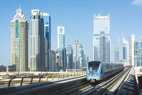
There are four major themes running through the Congress: connected and automated mobility; city urban mobility covering cleaner cities, better air quality and decarbonisation; resilience, safety and trust in the ecosystem; and multimodality and interoperable transport modes including public transport, air mobility and waterborne transport.
These themes will be showcased in live sessions organised by the ITS regions, covering data and AI for future mobility, innovations for integrated ITS and urban mobility, fleet electrification and energy provision challenges, Mobility as a Service and ‘de-silo’ing transport. Safety will be prominent – road safety, traffic safety and road user safety.
The ITS World Congress will be a one-off opportunity to get up to speed with sustainability, digitalisation, automation, safety of traffic and mobility. ITS
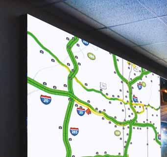











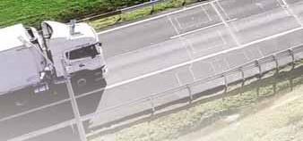












Promises of increased safety, less pollution, greater productivity and a better quality of life in smart cities are just too good to be ignored. Dany Longval of Teledyne Flir talks through some of the challenges
The world is seeing an acceleration in the deployment of smart cities. However, these have been slower than expected or even scaled back, often facing backlash. Even the definition of what constitutes a smart city has been changed, relative to concepts from 15 years ago when flying vehicles were foreseen. This article will discuss smart cities from the viewpoint of traffic management, which has proven to be one of the most challenging implementation areas.
Benefits and challenges
Promises of increased safety, less pollution, greater productivity and a better quality of life in smart cities are just too good to be ignored.
A city is a much more complex system than most people realise. Earlier expectations likely needed to be tempered. A good example is the congestion pricing programme in New York City, in which most passenger cars were to be charged $15 a day to enter a congestion zone below 60th Street in Manhattan. This contentious plan has been years in the making and was set to come online this year before New York governor Kathy Hochul’s decision to pause it indefinitely.

Either way, it exemplifies some of the challenges faced with traffic management systems. Let’s review some of the main challenges of traffic management in smart cities:
• Large scale The concepts of smart cities are best applied to larger urban areas. It is difficult to segment the deployment of a smart city project into a smaller, phased approach. Smaller deployments are fine for proof of concept, but not so much to realise the full benefits of what a smart city could be.
• Interconnected The real magic comes from diversified sensors, interconnected and working as an intelligent single entity. The connectivity between these sensors can be difficult to achieve from a network point of view, but also for software when each sensor has a different API and different ways to communicate. Smaller, narrowly-focused systems are fine within the limits of what they do but they cannot scale to a smart city system without interconnectivity.

• Everchanging A city is a dynamic, changing space in constant, rapid renewal. Traffic flow gets modified continually because of new developments, road repair, accidents and other occurrences.
The drive for densification brings new challenges in updating infrastructure in ways that could not have been conceived of during past urban planning.
• Privacy The concept of smart cities includes privacy risks as even more personal data is now available to commercial and government agencies. The risks of a data breach or system hacking can bring huge complications if sensitive data is exposed.
• Legal and political framework Technology is meant to support society and not the other way around. The deployment of technology with such societal consequences as a smart city must be thoroughly thought out. Legal and political frameworks advance at their own pace, lagging the lightning speed associated with technology development. There are also concerns about smart city data being used for litigation purposes.
The core promise of advanced traffic management is better traffic flow and reduced congestion.

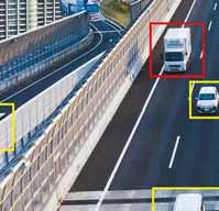
This has proved challenging to achieve. Early proofs of concept have often worked well enough to entice city managers to further explore large-scale deployments, only

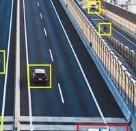

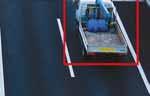




to be deflated by the complexities of these large-scale systems. One way to reduce the complexity is to process information right at the point of collection using an edgeprocessing architecture.
Edge processing delivers the ability to analyse data at the sensor level. Sensors can be of various kinds including vision-based detection, counting, classification, monitoring and more. Other sensors could measure air quality, weather conditions, road surface and noise level. Edge processing on any of these sensors can reduce data by filtering or even by making decisions locally.
By only transmitting results instead of the raw-data edge-processing architecture presents many benefits:
• Resilience An edge-based system is more resilient by nature as there is no single point of failure. Systems for smart cities are mission-critical and there are several things that can go wrong.
• Speed Such a system performs faster since it does not have to wait for data to be transmitted and processed remotely before making a decision, possibly facing a bottleneck in the processing queue.
• Scalability An edge-based system can be easily scaled up in size as the need expands. Capacity and coverage can be increased by simply adding more nodes without having to revamp the entire system.
• Privacy Edge processing offers the added benefit of reducing concerns around privacy. This approach minimises the quantity of raw data being exchanged within the system or finding its way to hosted cloud servers.
New solutions are emerging driven by combining innovations in edge processing and artificial intelligence. AI enables the merging of information from multiple sensors, identifying patterns and correlations in a way that classical algorithmic programing cannot do. AI is not a new topic and we have been talking about applying it to traffic for nearly 10 years. AI in its earlier iterations might have raised expectations beyond what was possible at the time. However, one of the most exciting features is how quickly it is evolving. Capabilities that were not possible yesterday may seem trivial today.
Architects of smart city infrastructure must take into consideration the evolving nature of AI. The infrastructure needs to be designed with components that are easily upgraded to tomorrow’s version of AI, preferably with software. To accomplish such a task, hardware components - including sensors - must offer flexibility and embedded processing capabilities, potentially GPU- or FPGA-based. In a camera system, that would imply the use of memory and a processing engine of some sort.
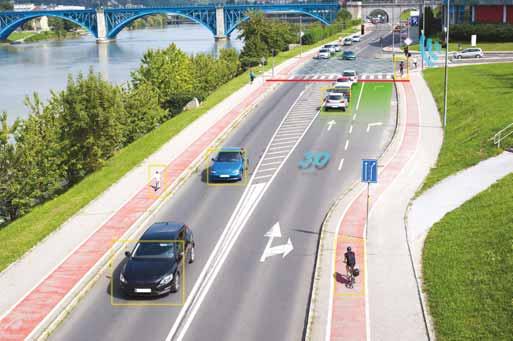
Cameras are a critical sensor in a smart city implementation. Cameras could be deployed at intersections, used for monitoring roadway traffic, and function as enforcement devices. To build flexible systems, cameras must also be specified with imaging capabilities that go beyond the immediate task at hand. Characteristics such as high resolution, better dynamic range and faster frame rate can be analysed with a future-looking mindset, allowing a solution to grow over time. Imaging sensors have evolved rapidly in recent years - just like the evolution we see with AI.
Having access to a wide camera portfolio is a way to future-proof a system. Recent advancements in camera technology have led to new features particularly useful for smart cities. For example, the ability to provide synchronicity in a multi-camera system – such as those found at intersections – or the ability to pare down the quantity of information being processed by using in-camera multi-regions of interest.
An architecture needs to combine intelligent edge sensors with central host capabilities to fully benefit from new AI capabilities and deliver on the full range of capabilities expected in a modern smart city system. The central host should ideally be deployed through cloud computing which – just like edge computing – is flexible and simpler to scale up. The components needed to build such a system are available today, including cameras with built-in processing or simpler machine vision cameras that are easy to connect to co-located embedded processor boards through USB ports.
This implementation strategy brings a new level of capabilities unseen until now, where a system can predict events in real time instead of simply reacting to a
condition. Indeed, when a traffic obstruction occurs, the system can do much more than issue warnings and block local intersections. Instead, it can re-adjust traffic flow across an entire neighbourhood by predicting how a local obstruction will impact a larger region. The need for a real-time response and prediction, rather than reaction, is a requirement for modern infrastructure management.
Some of the earlier examples of smart systems deployed in traffic applications were automated speed and red-light enforcement. In a smart city, we can now include much more advanced enforcement systems including distracted driving (mobile phone), dangerous driving (erratic manoeuvres and impaired drivers) and traffic flow obstructions. The high level of connectivity allows systems to communicate in real time with police enforcement and other agencies to provide real-time responses.
Other new capabilities enabled by this new technology include smart parking, dynamic speed limits, multimodal traffic flow management, smart traffic lights and more - all part of a fully interconnected intelligent system. Such a system delivers on the promises of increased efficiency and safety for all road users – from vehicles to cyclists to pedestrians. Ultimately these benefits translate into greener cities and a better quality of life. ITS






















Seddi, general secretary of Asecap


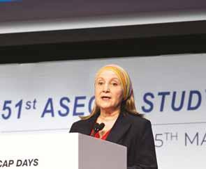




Asecap Days 2024 in Milan focused on environmental protection of road infrastructure, digital twin-based maintenance and monitoring of highways as well as the impact of electric vehicles, reports David Arminas
If having sustainable road infrastructure is the goal, then free-flow tolling is one of the best ways for highways agencies and concessionaire groups to attain it. That was the overall message from the Asecap Days 2024 conference in Milan, Italy.
More than 400 attendees from 22 countries braved periodic downpours in the northern Italian city to reach the venue, the prestigious Palazzo Mezzanotte, also known as Palazzo delle Borse, seat of the Italian stock exchange.
It was another thought-provoking event from Asecap, the European Association of Operators of Toll Road Infrastructure. Presentations and panel discussions focused on, among other things, sustainable development and environmental protection of road infrastructure, digital twin-based maintenance and monitoring of infrastructure and the impact of electric vehicles.
Asecap president Julián Núñez, who is also president of Spain's Association of Infrastructure Contractors and

Concessionaires (Seopan), set the tone of the conference with his opening remarks. He urged toll operators to pay more attention to sustainable operation of their infrastructure and ensure its resilience in the face of increasingly unpredictable climate changes. This is the new normal, he told the audience. The user-pay philosophy of tolling is the only way to finance such decarbonisation in the face of higher and higher operating costs, for construction as well as operating systems, which are getting more complex.
A sustainable tolling operation also means it is the safest tolling operation possible, noted Bill Halkias, president of IBTTA – the International Bridge, Tunnel and Turnpike Association - based in Washington, DC. “Road safety remains the most pressing issue for road operators,” he said. “But together, we all can make a difference. We have the tools to spread the message worldwide.”
One of those tools, he said, is IBTTA’s new global road safety campaign, Be Safe Together, which is endorsed by Asecap, International Road Federation

(IRF), World Road Association (Piarc) and Project Edward, the UK’s biggest platform for showcasing best practice in road safety.
Speaking with one voice “Road safety is about the little things, the small things that we all can contribute towards the safety of all road users,” Halkias explains. “Be Safe Together emphasises that drivers have choices that can make a real difference in other people’s lives.” By taking care to check the tyres and clean the windscreen before getting in the car, ditching the phone, using turn signals, yielding to others and moving over and slowing down for road workers, drivers can work together to create a safer community on the road.
IRF president Anouar Benazzouz said it is, now more than ever, fundamental for all organisations in the road infrastructure and tolling sector to speak with one voice when it comes to drawing up regulations. Meanwhile, he noted, alongside technical innovation, there needs to be social innovation.
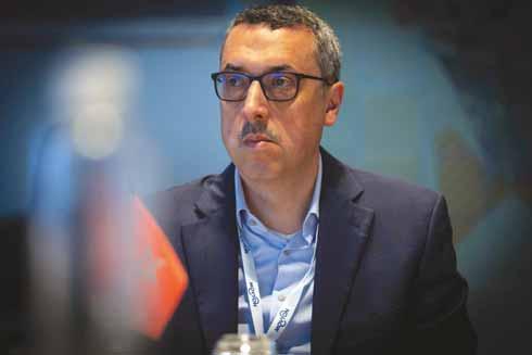
That is why the IRF is working hard to set up new programmes to foster greater communication among all players in the sector. This will be one of the topics at the IRF’s World Congress in Istanbul in October, said Benazzouz, who is also chief executive of the National Company of Motorways of Morocco.
Regarding technical innovation for toll operators, every new system and service introduced must add to a driver’s seamless experience, said Lorenzo Rossi, chief executive of Movyon, part of Autostrade per l’Italia Group. Other key issues that are getting more important for toll operators are the physical management of traffic flow, the collection and management of infrastructure data and the future use of autonomous vehicles.
Toll booths will be relegated to history as road operators strive to keep vehicles moving through payment systems that rely on number-plate recognition, as one example. Looking ahead, sensors in vehicles, in road furniture and embedded into the road surface itself will take over the transmission of data, Rossi explained. In fact, for Level 3 of autonomous driving – so-called conditional automation where the driver can temporarily take his or her eyes off the road – sensors will be mandatory.
Even so, it will be a huge step upgrading from Level 2 to Level 3 automation. From Level 3 onwards, a vehicle can temporarily take over driving tasks and the driver need not always be monitoring the system. But careful regulation for these operating systems will be needed, said Rossi, right across Europe to make them safe.
Such infrastructure will be expensive, said Erica Flesch, senior analyst with Moody’s infrastructure finance team. Along with technical regulation, there is even now a need for financial regulation to give private investors security about their investments.
Ten to 15 years may well be not enough for investors to recoup their investment. She said that terms of 40 years or more may become the norm as more and more technology is integrated into infrastructure and tolling management.
The move towards more and more digitalised traffic management – sometimes called digital traffic management - will continue – and bring with it more and more data. But can a road agency or concessionaire ever have too much data? That depends what is being analysed.
Dars, Slovenia’s national motorway company which operates and maintains the country’s motorway network and related infrastructure, has made digitised traffic management the focus of its operations, according to Ulrich Zorin, director of motorway management at Dars.
For some years Dars has been working closely with the police and emergency services to transfer road data. Sensors will detect what trucks are overweight and this information will be sent to the police for them to follow up.
Dars has also been working on thermal camera installation inside road tunnels. At any one time, said Zorin, Dars knows what truck is in what tunnel and if that vehicle is overheating, perhaps as it works its way slowly up an incline. An alert will be sent to the emergency services so they can monitor the situation before any incidents occur.
The Slovenian agency continues to upgrade its Dars Promet+ app, which allows the driving public and commercial vehicle operators to access current conditions on all major roads, said Zorin, who is also president of the Society of Traffic Engineers of Slovenia. Continuously updated information is available on traffic congestion, estimated arrival times, traffic information, road cameras and a list of rest areas.
Digital technology is also making cashless tolling, including contactless payment, easier to implement, said Aurelio Mortoni, strategy and innovation director with Milano Serravalle - Milano Tangenziali, the concessionaire until 2028 of the A7 from Milan to Serravalle Scrivia. It’s a triple-win situation for the environment, the driver and the concessionaire company. Since 2019, his company has been moving in this direction, starting with zero availability of contactless payment and rising to 60 pay-points by the end of last year.
From the concessionaire’s point of view, replacing traditional cash tolls with new cards and contactless systems has also brought several maintenance advantages. These include a 61% cut in maintenance and spare parts costs. There has also been a 70% reduction in major maintenance interventions.
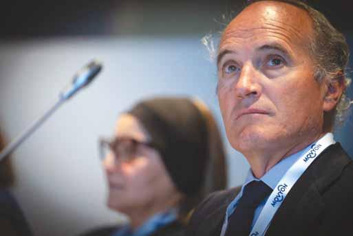


Mortoni said the introduction of contactless payment in 2023, which greatly cut vehicle idling time at toll booths, saved around 73 tonnes of CO2 emissions compared to 2019. The concessionaire estimated that this was nearly a 40% cut in emissions in 2023 compared to 2019. A lot of this was due to the implementation of NFC – near-field communication – readers; payment occurs when a mobile wallet (phone), credit or debit card is positioned near or against the reader.
However, Mortoni believes the future lies with electronic toll collection, an even faster payment option that can replace toll booths altogether. A radio signal from a roadside sender triggers a passing vehicle’s transponder which sends data back to the roadside unit. The data includes the vehicle’s use of the road. This information is sent to an electronic payment system and the vehicle toll is taken automatically from the driver’s account. All is done without the driver stopping.
Payment of toll fines also needs to be a seamless process, noted Alessandra Federico, director of legal and international affairs for the Association of French Motorway Companies (Asfa). The association is working to extend an agreement with gambling operator Française des Jeux which has payment points for Asfa’s service in tobacco dealers throughout France. At the moment, fines can be paid at 10,000 dealers and the hope is that this can be enlarged to 30,000.
Free-flow tolling is the future for many new toll road projects. But Benoît Rossi, business development director at tolling provider Emovis, said that converting from existing tolling infrastructure remains an issue for many concessionaire companies. This is due to the cost of dismantling old infrastructure and then investing in - and adapting - new free-flow technology. New projects are encumbered by these issues. Free-flow tolling is currently best when it is designed into the motorway during construction design stages.

On a little-mentioned topic, that of the impact of increased electric vehicle usage, Rossi pointed out some problems that lie ahead for road agencies and toll concessionaires. The market share of EV purchases might reach 60% by 2030, according to a report by HSBC Global Research. This is already having an effect on fuel tax revenue for governments, money that is often invested in new highway development by road agencies. Fuel tax has dropped by half in the past 15 years in Europe alone, as noted by the Organisation for Economic Cooperation and Development.
Of particular interest for concessionaires, said Rossi, is the greater weight of an EV as against that of a traditional petrol or diesel vehicle. A McKinsey and Company report said the average increase in road wear from
one EV versus one internal combustion engine vehicle is 2.4 times. If the amount of EVs on the roads is around 85% of all vehicles by 2050, looking ahead there could be some serious maintenance costs for toll road operators.
No matter how much of the latest technology is employed to make a tolling operation more efficient, this can’t be done at the expense of safety – the ultimate goal for all road agencies and concessionaires. Implementing this latest technology usually brings massively increased amounts of so-called Big Data that needs to be analysed, explained John Fagan, chief revenue officer of UK-based safety specialist Valerann. The data is coming from many sources – road sensors, highway cameras, weather conditions, highways agency traffic reports, navigation apps, police, emergency services, connected vehicles - even social media posts and phone calls.
Of course, it is essential to respond as quickly as possible to emergencies. However, Fagan told the audience during a session on technology and safety, the problem is that Big Data overload has led to what he calls alert fatigue.

Increasingly, systems using artificial intelligence are getting the attention of concessionaires
It is now most important to have information based on Big Data that tells you where incidents are likely to occur so emergency services can be one step ahead in any response situation. Toll operators should look for data partners that can analyse Big Data in order to prioritise the most important information – to create future scenarios based on past historical data. Simply put, it is the use of circumstantial evidence to piece together an incident.
More and more asset management is dependent upon improvement to Lidar-based road inspection. Increasingly, systems using artificial intelligence are getting the attention of concessionaires, said Bernardo Menezes, a civil engineer with Brisa Autoestrades. Brisa has five concessions in Portugal amounting to 1,500km of highway and 24 service areas.
Any type of monitoring of the road surface looks at roughness, mean profile depth, skid resistance, rutting and surface distress – where cracking characterisation is important. Brisa has been using Vaisala RoadAI that relies on video capture and automated analysis of the video.
According to Vaisala, the video captured by its RoadAI is used in combination with sensor data to form spatial information of visible objects. Video capture enables visual documentation to support communication
and verification of computer vision in automating inventories and producing notifications of detected changes.
Brisa inspects around 550km/lane of motorway annually, said Menezes. The images are collected through a smartphone application. This allows the identification and classification, by type and severity, of pavement surface distress, assessment of the pavement condition index (PCI) and, as well, easy visualisation of the processed data.
Visual inspection can cover around 40km a day and availability of analysis results can take two or more weeks – in graphic and linear representation. Meanwhile, RoadAI handles up to 200km per day and results are almost immediate – in graphic and georeferred with images.
Future refinements, said Menezes, will include more input of information into a concessionaire’s digital twin of the motorway. Also, improvement of the information quality will depend on the AI learning from the images.
Wrapping up the two-day conference were presentations about future challenges. Pedro Pinto, general manager for tolling at Ascendi, a Portuguese manager of infrastructure assets, including toll collection, operation and maintenance, urged national governments and road agencies to crack down on cross-border non-payment of tolls. If tolling, in whatever form, is to become more efficient, there must be more panEuropean regulations and processes for road agencies and concessionaires to capture this lost revenue. ITS


















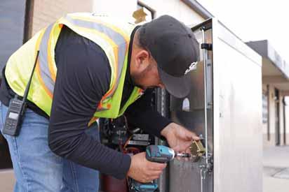
Moovit is further rolling out its cross-regional journey planning feature. Users of the mobility app can now plan and navigate public and shared transportation journeys country-wide, and plan journeys outside of their current region. Earlier this year, Moovit launched the service in France, Spain and the UK, but has now extended it to the more than 100 countries it covers. So long as users are travelling in the same country, the app now allows planning of start/end journeys in cities where they are not
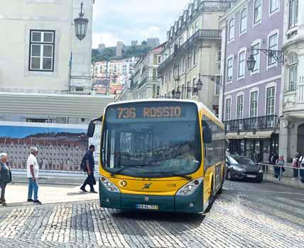

Innoviz Technologies, a supplier of automotive-grade Lidar sensors and software, said it will collaborate with an unnamed automotive manufacturer to advance its autonomous vehicle capabilities. This agreement adds Innoviz's new short-range
Level 4 autonomous driving platform. The company says it expects the collaboration will result in a series production
nomination in the coming months, pending agreement of commercial terms. Innoviz’s Short-Range Lidar joins the InnovizTwo product platform that includes InnovizTwo Long-Range and InnovizTwo Slim. The Short-Range Lidar, with its high-resolution detection and over 90-degree
on the InnovizTwo Long-Range architecture and is designed to meet the requirements for light
city; they can now plan and receive itinerary and guidance information for public transit journeys in, say, Porto. The app includes real-time arrival information for buses and trains, directions for the entire journeyincluding alerts telling you when to get off - and service alerts about disruption. “Since day one, Moovit has been committed to guiding people in getting around town effectively and conveniently using any mode of public and shared transportation,” said Ziv Kabaretti, VP product at Moovit.
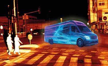
commercial vehicles, shuttles,
ramp up, we are happy to be able to provide a complete set of solutions to meet the needs of OEMs worldwide and support the acceleration of AV adoption
across all sectors,” said Omer Keilaf, chief executive and co-founder of Innoviz Technologies. The company is a Tier 1 supplier to automotive manufacturers worldwide, operating across the US, Europe and Asia.
Q-Free is bringing real-time road weather information into its Kinetic Mobility ATMS platform. It has launched Kinetic Weather, a module which enables weather-responsive data from weather stations on potentially unsafe roadway conditions - such as ice, managers in real time and can also be including lowered speed limits, VMS sign warnings and alerts via the web or other public-facing applications. “Kinetic Weather
for an intuitive solution to stay ahead of

Talbot, Q-Free CEO. “We’re committed to
management, to the largest department of transportation managing thousands of miles of roads.” Kinetic Mobility is a scalable ATMS platform that integrates all ITS devices into a single dashboard across freeway and arterial

Kinetic Mobility and its accompanying modules as the core ATMS for the CV Sync smart region project in California’s Coachella Valley.



PTV Group is launching a new data platform, PTV Access, which offers APIs to integrate location and mobility data into software solutions. While key markets for this data include urban and transportation planning, PTV is also targeting sectors which require location information for decision-making.
solutions can be discovered via the interface, creating competitive advantages for various industries, such as real
U. Haas, CEO of PTV Group. The information is derived from automatically-generated transport models and sources including points-of-interest data from public and commercial providers. PTV's algorithms


create new datasets from this, which means users can make objective, data-based comparisons of potential locations and are able to visualise mobility indicators. The PTV Accessibility Score API provides an accessibility index for various modes of transportation – bicycle, public transport, car or pedestrian –for any given address. The index ranges from 0 (poor) to 100 (very good), indicating how easily a destination can be reached in a given time. The system calculates times based on a multimodal geographic database comprising the current road network, available and up-todate public transportation route and schedule data, and bicycle infrastructure information.


Transport software specialist Flow Labs has announced a new, proprietary standard for intersection performance measurement in the US. Integrated Signal Performance Measures (ISPMs) offer a more comprehensive approach to signal performance decision support, and an entirely new strategy for addressing intelligence to integrate multiple datasets, including detection,
Signal Performance Measures (ATSPMs) and Probe-Based Signal Performance Measures (PBSPMs) both have their limitations,
in signal performance measures over the last several years, many signals across the country continue to perform poorly, causing endless gridlock in communities,” said Jatish Patel, founder and
impact on signal analytics and have allowed signal management to get closer to its destination. We developed ISPMs to get us the whole way there, simultaneously combining the strengths and eliminating the weaknesses of its predecessors.”








XenomatiX has entered the mobile mapping sector with its GPC360 that uses integrated Lidar-GNSS systems on moving vehicles to gather comprehensive 3D geospatial data. The company says that, apart from road information, the data captured by GPC360 encompasses intricate
light poles, parking spaces, power cables and vegetation. Applications include inventory and asset management, environmental monitoring and urban planning. Overall, the GPC360 – a compact all-in-one unit - has four key advantages: digital asset representation, precise geolocation, comprehensive 3D visualisation and dimensional analysis. The combination of Lidar and GPS



ensures accurate pinpointing of assets. The process is streamlined, with data collection and visualisation happening within minutes. Customer
kit. Because the GPC360 is compact, it affords easy installation and is suitable for any vehicle, with precise correction for vehicle ego-motion. The system is an integrated solution encompassing both hardware and software. It facilitates on-board data capture and storage, providing the necessary tools for real-time recording of environmental


functionalities for the meticulous creation of highly accurate geo-referenced digital models of the 360° environment.

Telenav, a provider of connected car and locationbased services, has chosen Iteris’ ClearData as its information. ClearData aggregates and validates mobility data such as incident, speed and connected vehicle probes. It then delivers it to public- and private-sector clients via subscription-based direct computer data feeds or application programming interfaces (APIs). Telenav is now leveraging ClearData to help inform and coach drivers in its Scout Maps application, a mobile and in-car app that provides live

alerts and navigation tips. Key functionalities include calculating and offering options of alternative safer routes,
speed updates and giving users a “safety score” which provides them with insights into their
driving behaviour - such as hard braking, speeding and hard acceleration. Iteris says that parents could monitor their teenagers' driving ability as they begin driving with a licence, for example. With
speed, incidents and more, the
get a more accurate estimated time of arrival at their destination during rush hours, avoid roads with congestions and accidents and choose routes with less probability of having accidents en route.

Experience innovative technologies!
Artificial intelligence, embedded vision and the tight interlocking of machine vision and automation create new possibilities – for the smart factory of tomorrow and for the steadily expanding non-industrial applications.
08 – 10 October 2024
Messe Stuttgart, Germany
www.vision-fair.de
Theia’s compact telephoto lenses have the resolution and features expected from high-performance lenses and have been adopted in ITS and ANPR systems
suitable for 4K sensors with pixels as

The telephotos are IR-corrected from
in IR illumination by focusing visible and NIR light to the same plane without identify plates at a variety of speeds and high-resolution cameras and the latest telephotos are able to capture plates at
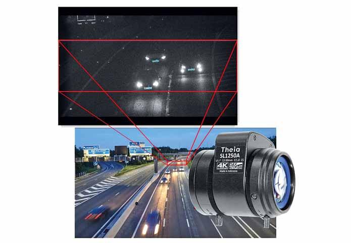
with motorised zoom and focus are immensely versatile providing the ability to
long - much more compact than the
Theia Technologies
Cross Zlin p23 www.cross-traffic.com
Daktronics p38 www.daktronics.com/tms
ESRI p9 http://go.esri.com
Hayden AI p31 www.hayden.ai
IBTTA p19 www.ibtta.org
Intercomp p38 www.intercompcompany.com
IntelliRoad p35 www.intelliroad.io
Intetra IFC www.intetra.com.tr
Interaffic p20 www.intertraffic.com
ITSWC Dubai p46 www.itsworldcongress.com
Jenoptik p17 www.jenoptik.com
Movyon OBC https://movyon.com/
TagMaster p25 www.sensysnetworks.com
Tattile p4 www.tattile.com
Traffic Nerds (ITS International) p35 https://www.itsinternational.com
Triple Sign p32 www.triplesign.com
Saudi Interoperability p32 https://informaconnect.com /saudi-intermobility-expo/
Vitronic p41 www.vitronic.com
Vision p50 www.vision-fair.de
Cubic
Econolite
Iteris
Q-Free
Edition
NA2 http://transportation.cubic.com
NA1 www.econolite.com
NA7 www.iteris.com/vantageradius
NA6 www.q-free.com
Swarco McCain NA4 http://mccain.swarco.com