May/June 2024 | www.itsinternational.com
International &
PO S T
ED RE
SP
• PRI
TP
U
CE
O
ED
RI N T
TO R
International
O Y• IBL
NT
D
NS
E
ADVANCED TECHNOLOGY FOR TRAFFIC MANAGEMENT AND URBAN MOBILITY
OU
R CARBON
FO
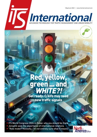
Red, yellow, green ... and WHITE?!
Get ready: C/AVs may need new traffic signals
Also… ITS World Congress 2024 in Dubai: why you should be there Jenoptik sees the importance of international relations “Role model? Honestly, I’m not entirely sure what it means”
North AmericaEdition
FLIR Intelligent Transportation Systems
Making Vulnerable Road Users Safe
FLIR AI SERIES We are constantly looking for new ways to enhance the safety and efficiency of cities around the world, through ground-breaking innovation and advanced technological excellence. This thinking has not only led us to find solutions that take care of road systems, but also, more importantly, take care of the people using them. Our FLIR ThermiCam AI for instance, features unique intelligent thermal imaging that can detect all road users, including the most vulnerable, when visibility is impaired; which is vital, especially in fog, smoke and complete darkness. This, we believe, is true visionary thinking. www.flir.com/traffic
Detect, Prevent, Protect
CONTENTS
Contents
10
May/June 2024
05 COMMENT
33 DIGITAL INFRASTRUCTURE Digitising roadways will be key to publishing real-time data with navigation apps – and it is not a distant dream, insists Kieran Holloway of Causeway One.network
06 NEWS DIGEST 08 CONTRACTS & DEALS 10 INTERVIEW
15
37 BUSINESS AWARDS
Rosa Rountree of AtkinsRéalis on tolling and technology - and why a passion for teaching doesn’t mean you have to be a teacher
Red Fox ID is one of only five companies to win two of the UK’s prestigious King’s Awards for Enterprise in 2024. CEO Steve Bird explains how
15 ENFORCEMENT
38 DATA & MAPPING
Stefaan Pinck of Flir explains how thermal imaging and AI help to safeguard cities against wrong-way drivers
Four of the biggest players in the world of mapping have joined forces to create easy-to-use, interoperable open data that will power the next generation of maps
19 ENFORCEMENT
SHOWCASE
45 RURAL MOBILITY
Latest solutions from Ekin and Tattile
Shantha Bloemen of Mobility for Africa, winner of 2024’s Movmi Empower Women in Shared Mobility Award, on why creative and practical solutions need investment
20 VISION TECHNOLOGY
20
Technology is always changing in the traffic management sector. Tobias Deubel of Jenoptik talks about the past, the future – and the importance of global partnerships
48 PRODUCTS & INNOVATIONS
North AmericaEdition
25 ITS WORLD CONGRESS
2024
Ertico – ITS Europe is organising the ITS World Congress in Dubai in September: find out why you should be there…
25
North America area only
29 C/AVS & V2X What on earth is ‘white phase’? Ali Hajbabaie from North Carolina State University explains why red, International yellow and green lights may soon no longer be enough at traffic lights
May/June 2024 | www.itsinternational.com
&
PO S T
ED RE
SP
• PRI
TP
U
CE
O
ED
RI N T
TO R
International
Red, yellow, green ... and WHITE?!
Get ready: C/AVs may need new traffic signals
Cover story
45
Phase four
Also… ITS World Congress 2024 in Dubai: why you should be there Jenoptik sees the importance of international relations “Role model? Honestly, I’m not entirely sure what it means”
l
Images: © ScorpionProduction Dreamstime.com © Martin Kucera Dreamstime.com
www.itsinternational.com - updated content every working day
l
O
Y• IBL
NT
D
NS
E
ADVANCED TECHNOLOGY FOR TRAFFIC MANAGEMENT AND URBAN MOBILITY
OU
R CARBON
FO
NA 01 Metro Vancouver sees the
value in seamless travel between modes and believes the RideLink project could make it a reality
NA 06 The Fifa World Cup will land
in the US in 2026 - and Seattle, one of the host cities, is getting ready for an extra 750,000 visitors
© ITS INTERNATIONAL MAY/JUNE 2024
03
Tolling+ BORN FOR MLFF
Two AI accelerators for 99.9% of detection rate
www.tattile.com
COMMENT
“RESEARCH IS PART OF THE LIFEBLOOD OF ITS”
Editor Adam Hill Email: ahill@ropl.com Tel: +44 1322 612062 Editorial Director Geoff Hadwick Email: ghadwick@ropl.com Tel: +44 1322 612013 Sales Director Dan Emmerson Email: demmerson@ropl.com Tel: +44 1322 612068 Sales Team Graeme McQueen Email: gmcqueen@ropl.com Tel: +44 1322 612069
“
Deploying technology is the way that the ITS sector can make the most difference
University used the International Road Assessment Programme methodology to assess the success of road safety projects. Its findings are staggering: looking at more than 1,000 cases across 70-odd countries, it estimated that nearly 700,000 deaths and serious injuries were prevented over eight years (p44). Furthermore, the paper projects that, by 2044, almost 3.2 million fatalities and serious injuries will be prevented. The message is clear: getting these improvements done in the first place was the key to saving lives. Finally, Ertico – ITS Europe’s first ITS Market Radar report was released in January but will be revisited in a special session at the ITS World Congress in Dubai in September (p26). As well as being a very useful tour d’horizon, packed with data about the industry today, it comes up with some
Production Manager Nick Bond Email: nbond@ropl.com Tel: +44 1322 612066
Web Manager Sarah Biswell Email: sbiswell@ropl.com Tel: +44 1322 612078
Design Team Simon Ward, Andy Taylder
Social Media Manager Tatyana Mechkarova Email: tmechkarova@ropl.com
Office Manager Kelly Thompson Email: kthompson@ropl.com Internet, IT & Data Services Director James Howard Email: jhoward@ropl.com Tel: +44 1322 612070 Data & Marketing Manager Alan Cansick Email: acansick@ropl.com Tel: +44 1322 612061
“
R
esearch is part of the lifeblood of the ITS industry. Without it, nothing would develop, we wouldn’t move forward. Take the humble traffic signal: ubiquitous on streets all over the world, it has not changed that much since Garrett A. Morgan’s three-position version was patented in 1923. It was eventually superseded by the three-light array – red, yellow, green – which is still in use now. But change may be coming: a fourth light – a ‘white phase’ may be introduced to make the most of the opportunities offered by connected and autonomous vehicles. How do we know this? Because academics such as Ali Hajbabaie spend time considering what lies ahead, and what it will mean for the rest of us. It’s helpful that they do and ITS International’s interview with him is a fascinating glimpse into the future (p29). Vehicles will drive differently and infrastructure may need to adapt. So much for the future, what about research into things that have already happened? A report from Johns Hopkins
Publisher/ Managing Director Andrew Barriball Email: abarriball@ropl.com Tel: +44 1322 612057 CEO Roger Adshead Email: radshead@ropl.com
www.itsinternational.com - updated content every working day
strategic recommendations. One of these is to “prioritise funding for deployment rather than R&D projects”. We need research, of course – but the Johns Hopkins study is a timely reminder that actually deploying the technology is the way that the ITS sector can make the most difference. Those 700,000 people will thank us and a pioneer like Garrett A. Morgan would approve. ITS
Adam Hill EDITOR @ITSeditorAdam @adamhillwriter @itseditor_adamhill @ITSInt
Have your say Email me at ahill@ropl.com
Printed by Warners (Midlands) PLC
ITS International, USPS 13324, is published bimonthly by Route One Publishing Ltd, Second Floor, West Hill House, West Hill, Dartford, Kent, DA1 2EU, UK. No part of the publication may be reproduced in any form whatsoever without the express permission of the publishers. Views expressed in this journal do not necessarily reflect the opinion of the Editor or Route One Publishing Ltd. All editorial, advertising or circulation enquiries to: ITS International, Second Floor, West Hill House, West Hill, Dartford, Kent, DA1 2EU, UK.
The US annual subscription price is US$173.00. Airfreight and mailing in the USA by agent named World Container Inc, 150-15, 183rd Street, Jamaica, NY 11413, USA. Periodicals postage paid at Brooklyn, NY 11256. US Postmaster: Send address changes to ITS International, Air Business Ltd, c/o World Container INC 150-15, 183rd St, Jamaica, NY 11413, USA. Subscription records are maintained at Route One Publishing Ltd, Second Floor, West Hill House, West Hill, Dartford, Kent, DA1 2EU, UK. Air Business Ltd is acting as our mailing agent.
Reader Enquiry Service: data@ropl.com Tel: +44 1322 612061 Subscription Enquiries: subs@ropl.com Global: Print ISSN 1463-6344 Digital ISSN 2057-3421 NA: Print ISSN 2632-4458 Digital ISSN 2632-5950
Published by © Route One Publishing Ltd 2024
© ITS INTERNATIONAL MAY/JUNE 2024
05
© Wang Song | Dreamstime.com
NEWS DIGEST
It's all Greek for Littlepay in Athens
IBTTA has launched a new global road safety campaign. Be Safe Together is part of a new initiative, IBTTA Global Road Safety Week, which will run from 24-28 June on toll roads everywhere. As part of the campaign, IBTTA and its members around the world will "promote the importance of community, empathy, and respect on roadways across the world". It will emphasise to drivers "that the little choices they make at each step of their journey can make a real difference in others’ lives".
$250m modernisation for Ohio Turnpike
© Cherezoff | Dreamstime.com
Lidar specialist Seyond has expanded its cooperation with the US city of Peachtree Corners, a test-bed for 5G and connected vehicle technologies in Metro Atlanta, Georgia. Seyond’s Lidar, OmniVidi Perception Service software platform and Blue-Band Integrator AI are already being tested. These collect real-world data that can be used to implement traffic and vulnerable road user signal solutions to make intersections safer and more efficient. With it, Peachtree Corners can adjust traffic signals, pedestrian crossing signals and intersection design to improve safety and efficiency.
King's Awards for Red Fox ID Quarterhill subsidiary Red Fox ID has been recognised by the UK King’s Awards for Enterprise scheme. Red Fox's "significant overseas market presence and exceptional growth in international sales over three years” have earned it the International Trade award. Its "technological prowess, demonstrated by the Quantum system—a synergy of real-time data interpretation software and Lidar sensors” secured the Innovation award. Of the 252 companies given awards in 2024, Red Fox ID is one of only five firms to receive trophies in two categories. • By royal approval, p37
© Curiosity Lab at Peachtree Corners
Ohio Turnpike and Infrastructure Commission
The Ohio Turnpike and Infrastructure Commission's new toll collection system has gone live on a 241-mile route comprising Interstate 80, I-90 and I-76. The $250 million construction project, funded by toll revenue, is the largest in Ohio Turnpike's history and includes upgrades to electronic tolling in some places and new message signs for motorists. The system now features a combination of open-road tolling lanes for E-ZPass customers and a gated exit system for non-E-ZPass customers who can pay by cash or credit card. E-ZPass entry and exit gates have been removed at 20 toll plazas.
Seyond expands Lidar testing in Peachtree Corners
© Keng Po Leung | Dreamstime.com
Be safe together, says IBTTA
Transit payments processing specialist Littlepay has begun a city-wide roll-out of contactless payments across all transport modes in Athens, Greece. The contactless payment initiative, led by the public utility Athens Urban Transport Organisation, is intended to simplify the daily commute and make public transportation more accessible. In the first phase, riders on the bus from Athens International Airport will be able to pay for their €5.50 flat fare using a contactless bank card or a mobile wallet. This will be swiftly followed by a full roll-out across the city’s metro, tram, trolleybus and bus services.
Snapper and Optibus link up on public transport intelligence Optibus and Snapper Services, which both provide data services for public transportation operations, have signed a global partnership. The companies have integrated Optibus’ Performance Suite with Snapper Services’ Mosaiq Insights transportation analytics platform, allowing transit operators to view complex data sets, improve runtimes, and monitor the impact of service changes on one platform.
FOLLOW ITS INTERNATIONAL ON SOCIAL MEDIA Facebook @ITSInt
06
Twitter @ITS_Int_News
© ITS INTERNATIONAL MAY/JUNE 2024
LinkedIn @ITS International Magazine
Instagram @itsinternational_magazine
youtube@itsinternational
www.itsinternational.com - updated content every working day
NEWS DIGEST
Tuscany sees renaissance in account-based ticketing An open-loop public transit payment system in Tuscany, Italy, has received hundreds of thousands of users in its first month of operation. Account-based ticketing system TipTap, provided by Kuba, was activated across Tuscany’s bus network and the city of Florence’s tramway - areas which are highly popular with international tourists. Transport operator Autolinee Toscane says that 400,000 passengers have used it, with about 650,000 ‘taps’ with bank cards and mobile wallets.
USDoT invites transportation agencies to get Smart The US Department of Transportation is accepting applications for the third year of its Strengthening Mobility and Revolutionising Transportation (Smart) Grants programme. Made possible by the Bipartisan Infrastructure Law, Smart will fund up to $500 million in grants over five years for public bodies "to conduct demonstration projects focused on advanced smart community technologies and systems that improve transportation safety and efficiency". Funding is available for transportation projects demonstrating technology such as coordinated automation, connected vehicles and traffic signals.
E-scooter firm Superpedestrian is partnering with the German city of Nuremberg for the next five years. The micromobility specialist closed its US operation in December, but its European business was acquired in April by Norwegian start-up Surf Beyond. Its Link shared e-scooters will continue in Nuremberg with "new operational conditions". These include the introduction of dedicated parking 'corrals' in the city’s historic centre; a fleet cap of 800 vehicles per operator for a city total of 4,000 vehicles; and a commitment to share real-time ridership and parking data.
Jenoptik Specs cameras for Manchester Jenoptik has secured an order from Transport for Greater Manchester to install the company’s Specs average-speed cameras across 25 routes in the English city. The deal marks the second phase of an upgrade project in the area to encourage better driver behaviour. In the first phase, last year, Jenoptik delivered 90 Vector SR spot-speed systems. Both contracts include the supply, installation and maintenance of the solutions for five years. The cameras from both phases are specifically used to enforce speed limits and do not automatically detect another offence. © Dedmityay | Dreamstime.com
© Nebasin | Dreamstime.com
Changes to road infrastructure and speed limits have prevented almost 700,000 deaths and serious injuries in 74 countries over the last eight years, according to research from Johns Hopkins University in the US. Using the International Road Assessment Programme (iRAP) methodology, it estimated the likely impact of road improvements in 1,039 infrastructure projects - from England and Australia to India and Colombia • And here's the proof, p44
Superpedestrian signs five-year German agreement
© Meinzahn | Dreamstime.com
Safety measures ‘prevent 700,000 road deaths’
Septa launches 3D fare gates pilot with Conduent Southeastern Pennsylvania Transportation Authority has launched a three-month pilot with Conduent Transportation, using 3D detection optical sensors at one transit station in the Philadelphia area to stop fare evasion - which costs $30-40m annually. Conduent’s 3D Fare Gate Solution allows travellers access, Conduent says, while detecting and deterring ticketing fraud. The gates - which were also installed in Paris by Transilien SNCF in 2019 - are 7' 8" tall and Septa plans to roll them out at other stations, including those with high reported incidents of fare evasion.
FOLLOW ITS INTERNATIONAL ON SOCIAL MEDIA Facebook @ITSInt
Twitter @ITS_Int_News
LinkedIn @ITS International Magazine
www.itsinternational.com - updated content every working day
Instagram @itsinternational_magazine
youtube@itsinternational
© ITS INTERNATIONAL MAY/JUNE 2024
07
S
© Angie Amil | Dreamstime.com
Emovis has embarked on a five-year customer service operations partnership with Florida Turnpike Enterprise (FTE) in the southern US state of Florida. With hundreds of miles of toll roads, Florida’s turnpike system is used by more than three million customers daily and is operated by FTE, part of Florida Department of Transportation. Emovis will establish, configure, staff and operate customer service centres throughout Florida, supporting FTE’s customers. It estimates around 2.3 billion toll transactions will be processed in fiscal year 2024, with about 5% annual growth for the foreseeable future.
ViaPlus has been selected by Harris County Toll Road Authority in Texas to provide image review services on freeflow highways in and around Houston. The 19-month base contract includes four oneyear extension options and will start after an implementation period of seven to nine months for software configuration, staffing and services. ViaPlus will provide automatic and manual processing of images, optimising the process with its optical character recognition software and machine learning algorithms and will manually review any outstanding postprocessed transactions.
Conduent has completed the $230 million sale of its Curbside Management Solutions and Public Safety Solutions businesses to Modaxo Group, the transportation division of Constellation Software. Modaxo has rebranded the kerbside management and parking business as Trellint, with Jim Vaca, former COO and GM with Conduent Transportation Solutions as its general manager. Meanwhile Elovate - the new name for the other part of its new business, which will focus on automated traffic enforcement solutions - is led by Robert DeSanti, former GM for TripSpark Technologies.
© Aleksandr Bondarchiuk | Dreamstime.com
Emovis at your service in Florida
© Ryhor Bruyeu | Dreamstime.com
Iteris is to lead an ITS modernisation project in the Philippines. The US Trade and Development Agency is funding the Philippines Department of Transportation, which aims to identify ITS solutions that can improve traffic management, reduce vehicle emissions, improve road safety, and make the movement of goods and passengers more efficient in and around the city of Cebu. Iteris is tasked with creating an 'ITS master plan' for the rapidly-growing city and 12 surrounding local government units. "Because of their large population and quick growth, the region is facing considerable challenges," Iteris says.
A Texas star for ViaPlus
Modaxo rebrands Conduent businesses
© Christoph Lischetzki | Dreamstime.com
Philippines ITS modernisation project for Iteris
© Bryan Roschetzky | Dreamstime.com
© Tatiana Kornylyeva | Dreamstime.com
CONTRACT & DEALS
Tallinn partners with Hayden AI enforcement The city of Tallinn in Estonia is to pilot Hayden AI’s automated bus lane and bus stop enforcement platform to prevent cars from blocking public transport. Hayden AI will install forward-facing, AI-powered camera systems behind the windshield of two transit buses to detect the number of parking violations which happen at bus lanes and bus stops. The pilot is part of the Test in Tallinn initiative, which aims to make the city a testbed for smart solutions worldwide, and will determine the impact of these obstructing vehicles on public transport service.
Kapsch signs Øresund bridge deal Kapsch TrafficCom has extended its maintenance support for the tolling operation on the Øresund bridge until 2031. The iconic structure - featured in crime drama The Bridge - runs between Copenhagen and Malmo, connecting Denmark and Sweden. The bridge is 8km (five miles) long and carries 600,000 vehicles each month. Kapsch will deliver ongoing maintenance of the existing tolling roadside system, including cameras and other sensors. Kapsch's new deal, which also includes point-of-sales software and hardware, is set to run from February 2026 until January 2031 and is worth up to €6m.
FOLLOW ITS INTERNATIONAL ON SOCIAL MEDIA Facebook @ITSInt
08
Twitter @ITS_Int_News
© ITS INTERNATIONAL MAY/JUNE 2024
LinkedIn @ITS International Magazine
Instagram @itsinternational_magazine
youtube@itsinternational
www.itsinternational.com - updated content every working day
ACCURATE
INTERVIEW
“HONESTLY, I’M NOT ENTIRELY SURE WHAT IT MEANS TO BE A ROLE MODEL OR WHAT THAT LOOKS LIKE IN PRACTICE” Rosa Rountree of AtkinsRéalis talks to Adam Hill about tolling, connections, technology, mentorship, acting intentionally - and why having a passion for teaching doesn’t mean you have to be a teacher
R
osa Rountree, US national operations director for AtkinsRéalis, has a guiding principle when starting any project: always begin by asking, “Why?” This has informed her work as an experienced and highly respected professional in the tolling industry. “We need to know the purpose,” she tells ITS International. “When we’re working with clients, we need to start with a ‘why?’ That’s why we can’t cut and paste solutions, Adam - because your ‘why’ is different from my ‘why’; because each customer’s needs and goals are unique.” Rountree is an accountant, and understanding how things work is key to how she operates. “I think technology and accounting have always aligned because we deal with hard numbers,” she says. In the mid-1990s, Rountree was hired by the Orlando-Orange County Expressway Authority (OOCEA now Central Florida Expressway Authority) to look at payment reconciliation as the agency put in Florida’s first electronic toll collection system, E-Pass. The implementation exposed several software vulnerabilities in the transaction postings process – and, unsurprisingly, Rountree found several potential problems that
10
© ITS INTERNATIONAL MAY/JUNE 2024
could lead to inaccurate revenue and reporting. “I said: ‘Here are the issues’, [and I] had them all lined up just like a good accountant with supporting documents,” she laughs. The response from her boss was simple: “Now go fix it.” Rountree was initially surprised at his response: “His philosophy was grounded in the idea that success is a collaborative effort, ‘their failure was our failure’ – it completely changed my way of thinking.” That accountancy role turned into a job offer as operations manager. “Since that point, I’ve always sought roles that allow me to be an integral part of the decisionmaking process,” she recalls. Rountree insists on a deep understanding of every tolling system she works on, from the schematics to the data structures to the real-world operational impacts. Understanding the ‘why’ With this nuts-and-bolts knowledge, Rountree understands how a system works, what data could be extracted from what piece of equipment, how vibrational changes in the roadway might affect results, what level of consistency should be achieved, and so on. www.itsinternational.com - updated content every working day
INTERVIEW
familiar figure at industry forums and is an honorary member of the International Bridge, Tunnel and Tolling Association, an accolade given only to individuals who have “made an outstanding contribution in furthering IBTTA’s mission”. Writing on the organisation’s website last year, she said: “Forty per cent of America’s roadway system is currently classified as being in poor or mediocre condition. According to infrastructurereportcard.org, the infrastructure backlog stands at $768 billion, with $560 billion required for roadway and bridge repairs. However, the federal gas tax, which is not indexed to inflation, was last raised to 18.4 cents in October 1993. If indexed, it would have reached 35.51 cents in 2022, keeping it in better alignment with related road-programmed costs. This has caused significant shortfalls and maintenance challenges, with $205 billion transferred since 2008 to maintain solvency.” The point about shortfalls is well made. Car drivers do not tend to see themselves as recipients of financial assistance from the government. And yet… “When people say, ‘transit is subsidised’ – well, so are roadways,” she continues, on a roll. “We tend to have an unfavourable view of transit funding in the US: the belief is that transit is subsidised by federal government while roads are not. But the person who doesn’t have a car pays federal taxes that goes into the general fund to support transportation infrastructure, regardless of their mode of travel.” It’s refreshing to hear. And this is probably part of the reason why she is a popular choice as a mentor. “The great thing about mentoring is the connection,” she explains. “If you invest in yourself, then I’m willing to invest in you, but if you’re not invested in yourself, then I’m just pouring into you, and it’s leaking out.” She laughs. She emphasises the importance of transparency and mutual learning in mentoring relationships, recognising that everyone has valuable insights to share. For some people, being mentored is a great experience, while for others it’s just a corporate box to be ticked. “I’ve had some of the best mentors,” Rountree says. “But I’ve had some good sponsors. For me, sponsors are the people who opened doors and create opportunities behind the scenes.” She had this when moving from OOCEA to Lockheed Martin IMS (now Conduent): “They weren’t looking for me, my sponsor recommended me.” She went to the interview and got the job.
© Tomasz Szymanski | Dreamstime.com
Mentoring and connections Talking to Rountree is fun, like playing tennis against someone when you’re not quite sure what’s going to come back over the net. Her returns are frequently slightly different in conversation to the ones you might expect. Her keen grasp of where dollars and cents are spent means that her opinions about the industry carry weight. She is a
“
I’m proud to have been the first African American woman to lead a toll authority, but at the time, it wasn’t something I focused on
“
“Almost everything I do, I start with the basics, understanding the ‘why’, understanding the purpose, and from that I can build on what’s behind it.” This comprehensive knowledge allows her to identify areas for improvement and implement solutions that address root causes, not just symptoms. “I firmly believe that investing the time and effort to do things correctly from the start is far more efficient than rushing through tasks and having to redo them later,” she adds. This meticulous approach has served her well in a career whose highlights include time as CEO of Egis Projects Inc, and executive director of Georgia State Road and Tollway Authority, before her current role at AtkinsRéalis. With an obvious interest in math, engineering, and technology throughout her career, does this mean she was analytical as a child, picking things apart and seeing what made them tick? “I think people have their own talents,” she says. “I think numbers and science was mine.” One of seven children growing up in Florida, her parents were entrepreneurs. Rountree started working in their tyre company at age 12: “I was the book-keeper and I remember complaining to my father that we had an accountant, but I did all the work.” Clearly, she understood the value of what she was contributing from an early age. But was accountancy her passion? “I had aunts who were teachers and principals and librarians, and I wanted to be a teacher,” Rountree recalls. “And my father would say: ‘If you truly have a passion for teaching, you’ll find a way to teach. But as an accountant, you’ll always be able to get a job’.” She laughs at the memory. “What I found throughout my career is that I always find an opportunity to teach, to lecture, to inform, to advocate for causes. I think the passion for what I do comes from my desire to understand the purpose behind things and then share that knowledge with others.” At a very basic level, take the concept of tolling itself, for instance. “Tolls don’t exist simply to collect revenue,” she suggests. “I don’t think that’s why tolls truly exist. There must have been a deeper cause, a need for mobility and access. The revenue is a necessary means to that end, but the purpose is to provide transportation options and improve people’s lives.”
www.itsinternational.com - updated content every working day
© ITS INTERNATIONAL MAY/JUNE 2024
11
INTERVIEW
“
“
Technology and solutions Rountree is a strong proponent of sharing knowledge and expertise with others. “So, I advise people: share your knowledge,” she goes on. “How much can you contain before it starts overflowing? We are happiest as individuals when we’re sharing. There’s a deep sense of fulfillment that comes from helping others grow and succeed.” This philosophy has driven Rountree’s commitment to mentoring throughout her career. “I find joy in seeing those I have mentored flourish, and it’s wonderful to see what they’ve accomplished. And there’s a part of me that feels like I’ve helped in some way.” Not that it’s about seeking credit, she emphasises: “It’s about making a positive impact, however small, in someone else’s journey.” You don’t need a formal teaching role to make a difference, she believes. “Mentoring at its core, is about sharing knowledge and supporting others. You can do that so many ways. We all have the capacity to teach and inspire. My father’s words have always stayed with me: if you have a passion for teaching, you’ll find a way to do it in whatever path you choose. And I strive to live that truth every day.” While others may view her as a role model, Rountree seems laser-focused on the work rather than any individual accolades. “I am deeply honoured when people see me in that light, but I don’t dwell on it too much,” she says. “My passion lies in finding solutions to complex problems. When discussing my work, I naturally gravitate toward technology and solutions - and even as we’ve been talking my go-to has gone back to solutions and solving problems.” As for being a role model, Rountree admits it’s not a label she actively seeks out. “Honestly, I’m not entirely sure what it means to be a role model or what that looks like in practice,” she reflects. “I simply try to do my best work, stay true to my values, and support others whenever possible. If that inspires someone else along the way, then I’m deeply grateful. But my focus is always on the work and the impact we can make together.” People talk to her about her ‘legacy’. “Oh my God,” she laughs again. “Does that mean I’m old? I’m proud to have been the first African American woman to lead a toll authority, but at
When people say, ‘transit is subsidised’ [by federal government] – well, so are roadways
the time, it wasn’t something I focused on. There was so much work to be done, and I was committed to making a difference in the communities we serve.” When she started, the authority had just one project, the Georgia 400, she recalls: “It was slated to be paid off and removed, but Atlanta had many pressing transportation needs.” For her part, she had a vision of managed lanes, truck tolling, high-occupancy vehicle lanes – and was prepared to chase the value-pricing grants to achieve them. “One of my staff said to me: ‘Your visions are our nightmares’, she laughs. “But we believed we could make the impossible possible, and we did.” “I may have had the vision, but it was the hard work and brilliance of my colleagues that made it all possible,” she insists. “Our legacy is not just about individual accomplishments, but about the collective impact we had on mobility, access, and quality of life for the people of Georgia. That’s what truly matters.” As the tolling industry evolves, she envisions a future where transportation infrastructure prioritises equitable access, quality of life and economic growth. With her understanding of technology, ability to build partnerships, and commitment to empowering future leaders, she will undoubtedly continue shaping the industry. Okay then, if she is not a role model, does she acknowledge that she is a leader? “I would say yes,” she admits. As a Black woman in the transportation industry, Rountree has held a plethora of senior roles. You sense that she is aware of the significance of this and her leadership is grounded in a sense of intentionality and accountability instilled by her father. “Failure is not an option,” she says. She acknowledges the added responsibility of being a trailblazer but focuses on letting her work speak for itself. “Be intentional,” she smiles. “And let the positive outcomes serve as an example.” ITS
© Rod Gimenez | Dreamstime.com
“ Georgia 400
12
© ITS INTERNATIONAL MAY/JUNE 2024
www.itsinternational.com - updated content every working day
Breathing the liveable city Every day, SWARCO products, systems, and solutions improve the quality of life, making travelling safer, quicker, more convenient, and environmentally sound. Get in touch with us to learn more about how we jointly can tackle air pollution, road congestion, and risks for vulnerable road users with Intelligent Transport Systems.
2024-05-06_Inserat_ITSInternational.indd 1
FURT HE R IN FOR MAT ION
www.swarco.com
07.05.2024 16:33:43
DECARBONISATION
Green light for Lisbon mobility A new green cycle and pedestrian bridge signals the start of what the Portuguese capital hopes will be a major shift from city-centre car use to greater use of alternative modes, says David Arminas
Lisbon's “green” cycle-pedestrian bridge
14
© ITS INTERNATIONAL MAY/JUNE 2024
Work on the bridge over Avenue Almirante Gago Coutinho will cost around €2.5 million and it should be open by the end of 2024. The plan is to allow greater connections between three green corridors, namely the central corridor and the Olivais and the eastern corridors of the city, also integrating the existing network of pedestrian and cycling paths, promoting connections to other areas, and in particular bus depots. According to a report in the local newspaper Lisbon for People, the bridge will have vegetation, shrubs and trees, especially along a central strip – green belt that separates cyclists from pedestrians, each having a 2.2m-wide path. The green strip will continue over the bridge to dovetail with the green areas that the bridge will connect. Work on the 105m-long bridge is being led by Emel, Lisbon’s own municipal company for mobility and parking. The new bridge will replace an old structure on the site and provide a level connection between existing nearby cycle paths, some of which are being revamped under a special grant. Last June, Lisbon received $400,000 from the BICI Program - Bloomberg Initiative for Cycling Infrastructure to improve school connections through active mobility and the connectivity of the city's cycling network. The goal is to connect 20 schools and 20,000 students through safe bike lanes. BICI is promoted by Bloomberg Philanthropies and the Global Designing Cities Initiative. Lisbon also recently embarked on a major public transport redevelopment strategy, Restart - Masterplan for Lisbon’s Multimodal Mobility Hubs project. Coordinated by Lisbon City Council and developed in partnership with Emel, it studies the creation of a network of large
mobility hubs in Lisbon by assessing scenarios for retrofitting the bus terminals of Campo Grande, Colégio Militar, Oriente, Pontinha and Sete Rios. As part of the tactics to redevelop the bus stations, the Mobility Hubs Design Guide was published last November. The guide was produced after two years of consultation with urban designers and planners, local agencies, engineers and thousands of public comments and suggestions. Its objective is to establish some guidelines, in particular the key elements to be considered in the design and retrofitting of these depots. “The primary reason cited for choosing individual transport is that people consider the public transport system ineffective in meeting their daily needs,” the guide says. “Only when we are able to offer a better user experience and ensure a high quality of service will we compete with car use.” ITS The Mobility Hubs Design Guide is free to download: https://www.emel.pt/fotos/editor2/ design-guide-mobility-hubs-volume-1.pdf
Mobility Hubs Design Guide Volume 1 - Introduction to the Guide
© Emel
L
isbon in Portugal is embarking upon a major shift away from city-centre car use to other means of transport. But it will take some planning, according to The Mobility Hubs Design Guide, a handbook for creating better bus connections. One of the biggest challenges that Lisbon - Europe’s second-oldest capital after Athens - faces in terms of mobility is to reduce motor traffic in the city centre. However, city officials believe it must be done. The guide notes that the latest census data for Lisbon shows around 48% of residents from other municipalities who regularly commute to Lisbon for work or study do so by car. Meanwhile, 73% of Lisbon residents use a car for their regular trips outside the city. The European Commission has set very ambitious goals that the municipality must meet as a signatory of the Covenant of Mayors for Climate and Energy. These goals include halving the use of conventionallyfuelled cars in urban transport by 2030, phasing them out in cities by 2050 and achieving essentially CO2-free city logistics in major urban centres by 2030. Better cycle-path connections are part of the plan for the city with a population of more than half a million, to get more people out of their vehicles. To this end, Lisbon has started construction of a new “green” cyclepedestrian bridge over a major city-centre road as part of the Portuguese capital’s integrated mobility plan.
www.itsinternational.com - updated content every working day
ENFORCEMENT
Safeguarding cities against wrong-way drivers
© Flir
Thermal imaging and artificial intelligence analytics provide the best path towards preventing deadly auto accidents, explains Stefaan Pinck of Flir
T
he number of accidents and fatalities from wrong-way drivers on US freeways has been increasing. The AAA Foundation for Traffic Safety says the average number of deaths a year from 2015-18 rose to 500, up 34% from 375 annual deaths from 2010-2014. While this may seem relatively small to some observers, the fact is that wrong-way driving (WWD) crashes are frequently head-on accidents, making them much more severe than other crash types, such as side swipes. Local and state government agencies overseeing roadway safety have an eye on the problem. To date, the response to the increase of WWD on freeways has been to implement technology for the detection and countermeasure decision-support systems. Many are using thermal ‘heat seeking’ detection cameras, due to the fact they are extremely reliable with a very low false-alarm frequency, no matter the lighting or weather conditions. Traffic authorities in the US have taken a multi-pronged approach to combat the WWD trend. Some targeted measures include
better traffic signage and road markings. However, more and more traffic agencies are now using dynamic incident detection and signalling to detect wrong-way drivers right at the highway’s entry point. Central to this tactic are thermal imaging cameras that utilise artificial intelligence (AI) video analytics. This measure can be one of the most effective detection technologies, allowing for more accurate detection with a lower false-alarm frequency at a further distance. The cameras will consistently detect the presence of wrong-way vehicles even at night and during rain or snow conditions - the times when wrong-way collisions are most likely to happen. Reliability of the detection system is key, so that the countermeasures can be taken swiftly and automatically in case requested. A successful WWD system goes beyond the initial incident detection by responding with countermeasures such as warning the travelling public of the potential hazard, closing nearby ramps or roadways, and assisting authorities with quickly intercepting the driver travelling in the wrong direction. To better protect citizens’ well-being in addition to critical infrastructure, an effective
www.itsinternational.com - updated content every working day
system needs to automate specific countermeasures that protect oncoming vehicles: • Detection of incident • Local flashing wrong-way signals to warn the wrong-way drivers • Confirmation of incident that driver did not stop for local wrong-way signals • Decision support software for operators • Public warnings via road sign messages for oncoming drivers • Traffic signal pre-empts and ramp closure notification • Inter-agency police alerts, also to other agencies, to notify of arrival timing at intercept points calculated by WWD speed Initial detection For initial detection, sensor systems should leverage video analytics to determine a passing vehicle’s direction and speed. Field tests conclude that thermal video analytics sensors are the most effective for detecting wrong-way drivers when compared to radar and visible-spectrum sensors, due to its very accurate detection in all weather and light conditions. © ITS INTERNATIONAL MAY/JUNE 2024
15
ENFORCEMENT Previously, systems mainly used visual cameras, which was not ideal as they would pick up the shadows of larger vehicles and trigger false alarms. By adding thermal cameras and AI to the equation, one is no longer looking at changes in pixel contrast rather, you are truly recognising the vehicle with analytics. Such systems make it much easier to detect vehicles at a greater distance with better accuracy – allowing for more timely and accurate alarm triggers. However, whichever type of system a city adopts, the event confirmation aspect will hold the utmost importance because an activity in the case of a false alarm is highly disruptive to traffic flows.
Visual confirmation Upon detecting a wrong-way vehicle through a traffic sensor, the system immediately triggers an audible alarm and showcases looping and live video footage of the event across all operator workstations and on the video wall in the traffic operations centre (TOC). These visual aids help operators in visually confirming the existence of the wrong-way vehicle. When reviewing an event, the operator can activate or dismiss system countermeasures with a single push of a button. Multi-detector confirmation To ensure accurate detection, each off-ramp is equipped with two consecutive detection zones comprising an intersection detector and a mainline detector pair. The first detection zone encountered by a vehicle is the intersection detector, responsible for sending the initial alarm to the TOC for confirmation. However, if a wrong-way vehicle traverses both the intersection and an adjacent mainline detector within a specified timeframe, the system can automatically validate the detection and activate countermeasures. This logic also extends to adjacent mainline detectors, which are employed to monitor wrong-way vehicles and update the appropriate countermeasures accordingly. Automated risk mitigation Timely response to a wrong-way event relies on the essential automation of countermeasures. Automation plays a crucial role in aiding operators to promptly react within the constraints of critical time
16
© ITS INTERNATIONAL MAY/JUNE 2024
Real-time decision support WWD systems use real-time maps, live and archive video, monitor walls and audible voice annunciation to update operators as the situation unfolds. Systems respond by: • Showing the current location on a georeferenced map • Animating active countermeasures • Updating video feeds and presets • Providing fresh information to law enforcement
“
Countermeasure release As the wrong-way driver passes from one detection zone to the next, countermeasures that are no longer applicable are automatically cancelled and released. This allows traffic to flow normally everywhere except those areas actively at risk. When the wrong-way event ends, operators can release countermeasures in a single click.
Encountering oncoming headlights on your side of the road makes for an incredibly terrifying experience
“
Confirmed detection To ensure accurate detection while avoiding time-wasting false alarms, systems typically deploy two methods to confirm wrong-way events. The primary method involves visual confirmation by an operator using an automated video call-up feature. Alternatively, confirmation can be done through a fully-automated process when an adjacent detection is triggered. Once the event is confirmed, a WWD system promptly initiates life-saving countermeasures.
many dispatches rely on 911 calls that often lack accurate location information. This can result in law enforcement officers wasting valuable time searching for the vehicle.
during a life-threatening situation. Once an event is confirmed whether through visual confirmation by the operator or automatic validation via the multi-detector system logic, the following automated countermeasures are implemented: • Public warnings Automatic posts to dynamic message signs warning of the oncoming hazard. • Ramp closures To prevent additional traffic from entering the freeway, systems can close on-ramps by sending commands to entrance ramp meters and traffic signal controllers to change the light to red. • Inter-agency alerts To enhance coordination among various agencies, regional public safety professionals can be equipped with WWD workstations, enabling improved inter-agency collaboration. The traffic system automatically notifies the police, allowing them to swiftly dispatch law enforcement officers to the scene. Alert messages provide crucial information such as the location of the wrong-way driver and estimated arrival times at predetermined interception points. These arrival times are calculated based on the speed of the wrong-way vehicle, measured by traffic detectors. As the offending vehicle is tracked from one location to another, the arrival times are continuously updated. Without such WWD systems,
Protecting roadways for all Encountering oncoming headlights on your side of the road makes for an incredibly terrifying experience, as wrong-way drivers pose an extreme and potentially fatal hazard to traffic safety, as head-on collisions are the deadliest. These incidents predominantly occur when a vehicle unintentionally enters an exit ramp, often during night-time or during inclement weather and is impacted by factors such as unclear signage or the driver's unfamiliarity with the city. To solve the problem and directly address this critical issue of WWD, it is essential for highway authorities and differing cities to implement effective traffic systems that promptly alert authorities and intervene. Specifically, adopting systems that leverage thermal cameras in combination with AI analytics to better detect and paint a picture of what is happening at a distance. By leveraging advanced technology for continuous monitoring, cities have begun to proactively intercept these tragic incidents before they even have a chance to occur. Such proactive measures are crucial in safeguarding lives and preventing the devastating consequences of wrong-way driving. ITS
ABOUT THE AUTHOR: Stefaan Pinck is VP business development at Flir
www.itsinternational.com - updated content every working day
Tailored Solutions
Safety as a Service Reliability
Civil Security (ANPR) Global Presence Sustainability
Road Safety Pioneer Decades of Experience
Widest Product Range
Driving Road Safety and Security Jenoptik provides innovative and sustainable smart mobility technology and services.
As an end-to-end solution provider, we support our customers with the provision of roadside equipment and software, including integration and installation through to full-service operation. Our strong global presence and installation base is supported by a reliable partner network. With innovation as our driving force, Jenoptik is a world-leading enabler for smart mobility, making roads, journeys and communities safer around the globe.
Follow us!
jenoptik.com/markets/public-safety
JEN-24-0004_Anzeigen_2024_EnablingSafer_SmarterMobility_GB_ITS_210x297_v4.indd 1
30.04.24 11:36
► COMPAS Automated Speed Enforcement System
> Advanced speed control to improve road safety > Compact, easy-to-use, and type-approved equipment for control at speedsfrom 30 to 250 km/h > No system installation check necessary to start a speed enforcement mission > Smart traffic management through 3D-LiDAR technology
www.parifex.com l info@parifex.com l +33 1 39 20 80 60 24.04.ITS_pub.indd 1
18/03/2024 16:15:39
MULTIMODAL
North AmericaEdition
Linking up in Vancouver Metro Vancouver sees the value in seamless travel between modes and is pushing ahead with a new pilot designed to make it a reality. David Arminas reports on the RideLink project
A
www.itsinternational.com - updated content every working day
The RideLink pilot brings together public and private transportation modes
© Jacksonville Transportation Authority
chosen number of residents in Metro Vancouver, Canada, have embarked upon a year-long pilot programme for a proposed multimodal app called RideLink. If successful, it could be rolled out to different types of public transport and also further afield to nearby regions. The RideLink mobile app is a partnered agreement between regional public transport authority TransLink, car share operatives Modo and Evo and bike-share operator Mobi (see the Who’s Who box). The app integrates transit, car-share and bike-share, putting all the travel options in one place. The 12-month pilot runs to April 2025. It allows participants to use their reloadable fare card - Compass Card - for easy access to all the services. The pilot will test the app's functionality and user experience in Metro Vancouver, which already has one of North America’s highest riderships (see box, TransLink ridership stats). Greater Vancouver occupies the south-west corner of mainland British Columbia (BC) province, with the majestic coastal mountains nearby. It takes in the lower reaches of the Fraser River and both banks of Burrard Inlet, making the city both an industrial and pleasure craft seaport. It is also one of Canada’s fastest-growing cities. Thirteen of the province's 30 most populous municipalities are located in Greater Vancouver, which covers nearly 2,900km². It is the most densely-populated region in BC - and growing quickly. The 2016 Canadian government census showed a population of around 2.47 million in Greater Vancouver, representing a 6.5% increase from the 2011 census. Meanwhile, data collected by Statista, a private global information company, suggested the population in 2022 was around 2.84 million.
© ITS INTERNATIONAL MAY/JUNE 2024
NA 01
MULTIMODAL North AmericaEdition
Fast-forward But, compared to many cities on the continent, Vancouver came late to developing ride-sharing services. Uber and Lyft began operating only in January 2020. But fast-forward only four years and the city is apparently making up for a somewhat slow start towards a more integrated public transport system. That is not to say that Vancouver is coming late to the idea, explains Julia Balsillie, project manager and lead for the RideLink project. In fact, the move started in 2017. Translink was determined to get the
right mobility partners on board and also to have the back-office functions ready for such a project to eliminate as many technical issues as possible before a pilot. “We have done a great job of making sure that we are starting only when the technology is ready to go,” she says. Balsillie has been at Translink for five years and is a senior member of the New Mobility and Innovation team. Previously, she contributed to the successful roll-out of RapidBus projects as part of the Bus Priority Programmes team. “The idea [for RideLink] was discussed extensively at TransLink’s first New Mobility Forum in 2017,” she explains. “It was identified by all parties present – industry, government, academics – as a top priority that we should collectively pursue. The following year the plan took shape through a partnership with Modo, Evo and Mobi to provide a shared mobility option to businesses for their employees’ work travel.” The first phase of the pilot, in 2018, sought to test technical service integration between the partners, such as account management and customer support using the existing Compass Card as a centralised access token. The first phase also examined how this product line would impact mode choice and travel experiences in Metro Vancouver. “Based on the success of the first pilot, partners determined they would like to expand into a customer-facing pilot
© Marc Bruxelle | Dreamstime.com
The TransLink bus service runs throughout Vancouver
NA 02
© ITS INTERNATIONAL MAY/JUNE 2024
“
There are many other mobility service providers with which we would like to explore the opportunity of working
“
The result is tremendous pressure on transport infrastructure and public transportation. Unlike many large North American cities, Vancouver has no freeways into or through the downtown area. The automobile remains the primary mode of transport, which means traffic congestion is monumental at times. One alternative to the private vehicle is the SkyTrain system, one of the longest fully-automated light-metro systems in the world. There is also an increasing number of purpose-built bicycle paths. The SeaBus is a passenger-only ferry connecting downtown Vancouver and the City of North Vancouver across Burrard Inlet. TransLink also operates a commuter railway, the West Coast Express.
Julia Balsillie RideLink supported by an app,” says Balsillie, who joined the project after it had started. “To keep the customer-facing pilot project to a manageable scope and scale, TransLink continued working with the original partners. However, there are many other mobility service providers with which we would like to explore the opportunity of working. Should the pilot project be successful, we’ll explore these opportunities.” Ultimately, the aspiration is that the travelling public can register for any transportation service in the region and then plan, book and pay for trips using any of those services via a single user-friendly app. “The goal here is to help make it as attractive and convenient as possible to get around using a combination of active and shared modes as it would be with a personal car. This would be accomplished by removing some of the friction currently involved in planning and making trips across multiple service providers.” True benefit Sandra Phillips, CEO and founder of shared transportation provider Movmi, told ITS International: “When people choose transportation options, 50% of their decision-making is based on how reliable a mode is. Having a fragmented ecosystem of alternative options isn’t really conducive to this need. By registering in the app once, customers gain access to 250 local bus routes, the SkyTrain and SeaBus network as well as 3,500 car-share vehicles and 2,000 shared bikes. Being able to plan all
www.itsinternational.com - updated content every working day
Superior Traffic Detection, Accuracy, and Reliability Delivering the Highest Levels of Accuracy and Performance Autoscope® Vision’s integrated High-definition (HD) camera-processor sensor delivers the highest levels of accuracy and performance for stop bar and advance vehicle detection, pedestrian detection, bicycle detection and differentiation, traffic data collection, and HD video surveillance. Maximize your Autoscope Vision detection system with Centracs® Mobility +Detect, our revolutionary cloud-based data analytics, monitoring, and reporting platform. +Detect supports informed traffic management decision making and signal optimization.
econolite.com
© Mitch Hutchinson | Dreamstime.com
© Klodien | Dreamstime.com
MULTIMODAL North AmericaEdition
Mobi bike-share
the modes through one app, removes the fragmentation and shows how truly reliable the network is. And that is the true benefit of RideLink in my opinion." The number of users of the app has been limited to 1,300, but many more would happily have taken part, explains Balsillie. A request for participation was sent out to people who were already using the services of the RideLink partners and more than 5,000 people registered their interest.
“We thought that 5,000 responses was a good indication of what customers might want and all we did was put out our media releases, post it to social media and our partners pushed it out to their customers. There was no big digital advertisement looking for participants.” The potential candidates – over 19 years old and possessing a credit card and smartphone - were then surveyed to get a cross-section of people who were sometimeusers of public transport, while others
were mostly car users and yet others were committed commuters on public transport. “I want a mix of real life,” says Balsillie, who will also be using the RideLink app. “I’ve used various trip planners, or various part solutions, such as Google, that tell you what you can do. I’ve not used anything that allows you to book and pay for your travel in a single place.” RideLink stores a Compass Card along with a credit card for payment. For TransLink trips, the Compass Card will be
Kinetic® Mobility MOBILITY REIMAGINED. Unify traffic operations and make faster, more informed decisions saving crucial time when every second counts.
NA 04
© ITS INTERNATIONAL MAY/JUNE 2024
www.itsinternational.com - updated content every working day
MULTIMODAL the payment method. For all other trips, the participant’s credit card will be charged for each journey. TransLink is not handling the payments for the various partners, which makes the process seamless. “Each transaction, other than transit trips, is handled by a thirdparty payment orchestrator which we have contracted to provide this service, which ensures all transactions are directed to the appropriate partner,” explains Balsillie. For this current, customer-facing pilot, collaboration among the partners will be key. “TransLink is covering most hard costs in terms of software and administration, while each partner is contributing staff time in kind to the project. All partners will be paid for the trips they provided based on their own fee structure – no revenue- or profit-sharing is contemplated at this point.” The Compass system already allows for open payment on transit, including Interac, Visa, MasterCard and Amex to tap in and out of the transit system at the adult cash rate – but discounted fare rates require use of the Compass Card. Currently, RideLink accepts both Visa and Mastercard as payments. Additional payment methods will be considered in the future. The pilot will be evaluated using a number of different key performance indicators. These include average number of trips before and during the pilot, percentage of people who tried a new mode during the pilot, percentage of people who replaced a personal vehicle by another mode, a customer satisfaction rating and net promoter score - a metric used in customer experience programmes and based on a single question: how likely is it that you would recommend the service to a friend or colleague? The future Even if the pilot is successful, a solid business case will still need to be established before any scaling up is done. Key reasons for not scaling up could include a lack of participant satisfaction and use of the app, little in the way of behaviour change or travel plan changes and costs incurred to both participants as well as Translink and its partners. Also, risks or liabilities identified through the business case for such a Mobility as a Service (MaaS) solution might outweigh expected benefits. It could also be that TransLink determines that its role in the MaaS ecosystem does not include building, maintaining and operating a MaaS app. Rather, it should focus only on helping to create the enabling policy and technology environment. At the end of the day, TransLink does not intend for RideLink to be the only such offering. TransLink’s primary interest, as the regional transportation authority for Metro Vancouver, is to create supportive
policy and enabling infrastructure so that trip planning, booking and payment APIs for all mobility service providers in this region are available to any third-party MaaS app interested in operating here. Some of these apps will be from global players and others may be locally or provincially focused similar to RideLink. Balsillie also stresses that the key for developing the app has really been the good partnership between Translink and the mobility providers.
North AmericaEdition
Scaling up a RideLink app will present many different challenges for the mobility partners, including TransLink, she notes. What will it mean for her current small team? Will TransLink have the right people and skills? “For us to move this to scale will be a big leap, to make sure we are well set up.” Nonetheless, the pilot is an opportunity to help do some of the initial heavy lifting, build some of the enabling infrastructure, as well as to test the value of such an offering to the public. ITS
Who's who TransLink was created in 1998 as the Greater Vancouver Transportation Authority, which became the South Coast British Columbia Transportation Authority. It is responsible for the regional transportation network of Metro Vancouver, including public transport, major roads and bridges. Mobi is the trade name of Vancouver Bike Share system and is administered by the city and owned and operated by CycleHop - a bicycle - sharing platform and
mobility company that operates bike-share systems in 15 cities in North America. Modo is a memberowned car-share operator based in the Canadian province of British Columbia and was the first car-share co-op in North America. Modo amalgamated with the Victoria Carshare Co-op in 2015. As of last year, Modo had more than 30,000
individual and business members and a fleet of around 1,000 vehicles. Evo, a car-share service in Greater Vancouver and Victoria, was created by the not-for-profit British Columbia Automobile Association. BCAA offers exclusively Toyota Prius Hybrid vehicles with roof-top bike racks and features one-way pointto-point rentals.
TransLink Ridership Stats Each week, according to TransLink, about 900,000 people take Metro Vancouver transit - the equivalent of onethird of the population. For the week of March 11-17 this year, there were nearly eight million boardings across the transit system. Overall, ridership has recovered to around 90% of pre-
www.itsinternational.com - updated content every working day
pandemic levels. In fact, many parts of the region have exceeded 100% recovery. SkyTrain is now the fourth-busiest rapid transit system in Canada and the US, behind only New York, Toronto and Montreal. Meanwhile, bus ridership is the third highest of all transit operators in Canada and the US.
© ITS INTERNATIONAL MAY/JUNE 2024
NA 05
© Cornelius20 | Dreamstime.com
EVENT TRANSPORT North AmericaEdition
On the ball Warming up! The Fifa World Cup will land in the US in 2026. David Arminas hears how one of the host cities, Seattle, is getting ready for an influx of crowds
NA 06
© ITS INTERNATIONAL MAY/JUNE 2024
Seattle. Apart from advising on the games, the app should also help people get around for shopping and sightseeing. Under an agreement with the Seattle International Soccer Local Organising Committee, the city provides temporary use of some public properties, such as parks and streets. Seattle will also provide coordination and support for transportation and infrastructure issues – a key element on any World Cup event. Importantly, Putney said a more collaborative approach between regional transportation authorities, especially when it comes to high-speed rail improvements, could make a big difference to people’s transportation experience in that summer of 2026. Many football fans will not have cars and will therefore rely on public transport; many others will not speak English, so will need easy-to-follow instructions. For those using taxis and ride-hail
“
services, an ongoing issue is that traffic apps which give drivers directions can often cause bottlenecks by having drivers detour onto smaller roads. Future transport apps must be exceptionally good at giving users more real-time information about route changes and detours, said Roland Behee, chief operating officer of the public agency Community Transit that operates buses in Snohomish County - the third-most populous county in Washington State after nearby King and Pierce counties.The apps must be designed to interface with other tools to future-proof them. Importantly, they must handle the coming need for much more on-demand or Uber-style transit. He believes this will be increasingly important, especially during the World Cup. Many foreign transit users will expect such access to immediate transportation. Clearly, the game will begin for Seattle and all the other cities well before the first match actually kicks off. ITS
“
Up to 750,000 people are expected to visit Seattle, presenting immense challenges moving people around efficiently
© Mikhail Kokhanchikov | Dreamstime.com
T
he whole world - or at least a large part of it - will be focusing on the Pacific Northwest of North America during the men’s Fifa World Cup soccer tournament in 2026. Seattle is one of 16 World Cup host cities in three countries: US, Canada and Mexico. While the draw for the World Cup games in July and August of 2026 has not yet been published, Seattle will host half a dozen matches – four in the group stages and two in the knockout part of the tournament - at Lumen Field. Ten other US cities plus Mexico City, Guadalajara and Monterrey south of the border will also host games. And Canada is making its debut as a host, with Toronto staging games as well as five group-stage and two knockout-round matches to be played in Vancouver, just north of the border from Seattle. An estimated four billion people will be watching, a TV audience six times larger than the Super Bowl. The tournament is unusual in attracting the attention of a huge number of non-sports fans for its five-week duration: it is a chance for cities to market themselves to the world – but for transit authorities it presents some head-scratching conundrums as urban populations swell with fans keen to see the action for themselves. During the games in Seattle, for example, between 400,000 and 750,000 people are expected to visit the city, and this will present immense challenges moving people around efficiently, said April Putney, chief strategy officer at local organising committee Seattle Fifa World Cup 2026 (Seattle FWC2026). If things go well, there should be a specific app for travel around the city, said Putney, during a panel discussion at the 91st IBTTA Annual Meeting and Exhibition in
Lumen Field, Seattle www.itsinternational.com - updated content every working day
Laser-Focused Photo/Video Speed Enforcement FINALS
StalkerRadar.com
Learn more about SWARCO McCain and our legacy of innovative Intelligent Transportation Solutions, including Traffic Management Software, ATC Controllers, Dynamic Message Signs, and our versatile and dependable ATC Cabinets.
mccain.swarco.com
READY. SET. SYNCHRO. SYNCHRO STUDIO v12 ™
The industry standard for traffic analysis, optimization and simulation is more powerful than ever. Now enhanced with: • • • • •
TripGen 11 Support* for Traffic Impact Analysis Enhanced Scenario Manager Highway Capacity Manual (HCM) 7th Edition New intuitive user interface See Synchro in action with 3D Viewer add-on
There’s more to love about Synchro Studio v12! Request a quote to upgrade today.
*ITE license purchase required
REQUEST A QUOTE TODAY. SCAN ME
transportation.cubic.com
CTS ITS AD_Syncro Studio V12 Ready Set_210x297.indd 1
5/9/24 1:59 PM
ENFORCEMENT SHOWCASE
Enforcement advancements in traffic & transportation
T
he Ekin Patrol G2 is the world’s first mobile smart patrol unit. The compact light bar design is compatible with any vehicle type. Built on innovative plug-and-play technology, the Ekin Patrol G2 turns any law enforcement vehicle into a smart patrol vehicle in minutes. Powered by AI and the latest speed enforcement and automatic plate recognition (ANPR) technology, it expands the reach of industry-leading law enforcement technology solutions across the cityscape. Delivering smart ANPR enforcement while on the move, the Ekin Patrol G2 captures a 360-degree field of view over up to seven lanes of incoming, outcoming and parked vehicles. To help improve data-driven policing and reduce response times, the Ekin Maestro OS provides a central location to securely store, access and analyse large amounts of video, image and other data collected across the city. With Ekin’s data management system, the Ekin Patrol G2 provides real-time data capture and analysis, matching incoming information against the industry’s leading ANPR database. By securing and managing Big Data effectively across patrol units and smart traffic systems, Ekin’s next-generation technology tools provide the information law enforcement officials need to reduce vehicle incidents, improve traffic flow, automatic infringement enforcement and more. Automated speed detection, parking management and ticketing are now available with the Ekin Patrol G2. To improve traffic congestion, reduce accidents, and enhance incident response, cities depend on the latest video surveillance technology. Real-time data collection and analysis coupled with automated enforcement tools provide the information city officials need to improve transportation infrastructure and save lives. Automated push notifications, 24/7 video enforcement coverage, and real-time data analysis powered by AI are improving how law enforcement officials and city planners use data to enhance pedestrian safety, reduce traffic accidents, and stop crimes before they occur. ITS Content produced in association with Ekin
Smart+ Speed: the most advanced speed-measuring camera
T
attile has developed an advanced speed camera called Smart+ Speed that takes speed enforcement and safety to a new level. It sets the industry standard for accuracy, reliability and efficiency. With its neural algorithms and on-edge processing power, this AI camera ensures the highest level of performance. Features and technical data Tattile Smart+ Speed can monitor up to three lanes in front and rear installations. It can accurately identify the speed and position of vehicles in the monitored area, even when they are moving at speeds up to 320 km/h (198 mph). The camera uses a multi-tracking radar connected to the camera via a plug-andplay POE connection, making installation easy and adaptable to different environments. The external radar can be adjusted to different angles, making it suitable for various scenarios, whether mounted on highways or city streets. Thanks to its integrated Stark platform, which is secure by design and IEC62443 certified, Smart+ Speed can be easily customised to meet specific user requirements and new features can be seamlessly added as needed. Using neural plate & vehicle detector algorithms, Smart+ Speed guarantees high performance. It can detect all passing vehicles with up to 99.5% accuracy in detection and up to 98% in recognition. Application When a vehicle exceeds the set speed limit, the object and transit detectors combine their information with the radar track to capture images of the vehicle, its licence plate and speed. In addition, the system collects relevant information such as date, time and country, along with the vehicle's brand, class, colour and model. All speed violations can be sent directly to the authorities in real time or stored on board. In summary, Smart+ Speed camera is the best option for anyone looking for a reliable and efficient speed-measurement solution. ITS Content produced in association with Tattile
www.itsinternational.com - updated content every working day
© ITS INTERNATIONAL MAY/JUNE 2024
19
VISION TECHNOLOGY
International relations
© Alex Polo | Jenoptik
Technology is always changing in the traffic management sector. Tobias Deubel of Jenoptik talks to Adam Hill about the past, the future – and the importance of global partnerships
20
© ITS INTERNATIONAL MAY/JUNE 2024
www.itsinternational.com - updated content every working day
VISION TECHNOLOGY
A
ll over the world - from Europe and the US, to Latin America, the Middle East, Africa and Australia - Jenoptik’s smart camera solutions are used for traffic enforcement work including red-light running, speeding and intersection safety. For Tobias Deubel, head of Jenoptik's Smart Mobility Solutions division, this global reach is partly down to the company’s longevity. “On the one hand, I think this is due to us being around for 90 years now,” he smiles. “The business has expanded and grown, and international growth is part of our story and strategy.” Jenoptik is particularly strong in its traditional European markets such as Germany and the UK, but these are – relatively speaking – becoming saturated. New opportunities
“
exist in emerging markets, for instance in parts of the Global South, where increased road infrastructure building brings with it challenges in terms of managing traffic and preventing collisions and fatalities. “There is a huge demand in these markets, like Latin America, for example, or Africa, where we are nowadays quite active,” says Deubel. “There’s growth potential, that's for sure.” As a market, Africa is vast and diverse. Deubel flatly refutes the idea that African countries are often looking for cheaper, low-end solutions. “My experience is that is completely not true,” he insists. “For example, in Nigeria they are interested in the latest technology, they want high-end products. But they need more: there is no
In our industry, every country - every customer - is slightly different: you just cannot build one product and sell it all over the world
“
Tobias Deubel Jenoptik
www.itsinternational.com - updated content every working day
network of companies that provide these solutions so we are really at the forefront with our partners.” Public-private partnership tends to be important here, with emerging markets often interested in the full value chain and comprehensive solutions rather than just purchasing hardware. “It’s one thing detecting the incident at the roadside, but then there's a whole process of processing the picture, invoicing, collecting the money and everything,” he explains. Creating international partnerships Operating in a number of countries is attractive, but there are practical differences doing business in, say, the UK and Ecuador or Nigeria in terms of logistics, culture, market maturity and language. So how does an international company oversee the creation of the right attitude and approach across different continents? “First of all, I think it's really important to build a strong partner network and to look after your partners,” insists Deubel. “We're really in close contact with our partners and we are quite open and transparent with them, we educate and train them. We disclose every technical detail about our systems to enable them to provide the best service to their customers.” Attempting to conduct international operations centrally is unlikely to be a recipe for success; some degree of local autonomy in decision-making makes sense. “We allow our partners and our local entities to be a bit more flexible, to customise and localise our products,” Deubel explains. “In our industry, every country - every customer - is slightly different. You just cannot build one product and sell it all over the world. There are slightly different requirements when it comes to software, when it comes to local legislation, so there needs to be this last 5-10% tweaking and customising to the system. And to me it's really important that we have strong partners that are able to do this.” Support then comes from central units in, say, Germany and the UK, where partners can access technical, engineering and R&D expertise. Identifying partners with whom you can work long-term is a complex business, involving significant amounts of due diligence. But Deubel says it is common for Jenoptik to have longstanding relationships. (He describes a partner event at Intertraffic Amsterdam 2024 as being “like a family meeting somehow”, for example): “There are people that we’ve known for 20 or 30 years sometimes, which is really nice. All our projects are very long-running and customers expect us and our partners to be available for at least five to 10 years once they buy a system.” © ITS INTERNATIONAL MAY/JUNE 2024
21
KAREEM WILLIAMS Safety Service Patrol Manager, NTTA Dallas, Texas
STAY BACK
STAY FOCUSED
STAY ALERT
THE LITTLE THINGS ADD UP.
JOIN IBTTA’S FIRST GLOBAL ROAD SAFETY WEEK JUNE 24-28 www.ibtta.org/besafetogether In Partnership With:
Above all, customers in sectors such as traffic enforcement – e.g. police forces or city authorities – require reliability. Jenoptik’s type approvals mean that “everybody knows that these systems are 100% rock solid”, Deubel says. AI and the future The ITS and vision sectors are always evolving, of course. Like every other company in the sector, Jenoptik is interested in the possibilities of artificial intelligence. “We're developing new features using artificial intelligence, of course,” says Deubel. “AI for us opens a whole new field of features and a whole new variety of opportunities.” Using camera and sensor technology such as loops or radar or Lidar to identify behaviour such as speeding is one thing: but there is a limit to what you can enforce. The
© Jeibmann Photographik, Torsten Proß | Jenoptik
As well as a direct sales function, selling systems to end customers, Jenoptik also has a team of area sales managers who support and manage partners. “They literally do market analysis, market intelligence, they understand the local markets,” Deubel explains. “They find partners if we need new partners in new places. The area sales managers are very experienced, so they understand within our industry what is important when it comes to partnerships.” Following a formal process of financial and legal checks, the first step is usually a pilot project. Given that ITS technology is well-developed and products within the industry are often roughly comparable in many ways, unique selling points can be hard to come by: this means that customer service can be a key differentiator. “In our industry, the main USP is trust and personal engagement of the people that are involved,” Deubel says. “As I said, all these projects are about five years, 10 years or even longer. And it's an investment, always, for the partners as well as for us: if you sign a contract and accept maintenance periods and spare-part availability for 10 years, that is an upfront investment so you need to be absolutely sure you're dealing with the right people. And therefore I personally see this very much as a people and relationship business.” That said, you won’t have a good relationship with anyone if the technology isn’t right. “It's got a lot to do with trust and relying on each other and being open,” he continues. “There's nothing better than experience. That makes a difference. You can't cover missing features or missing technology just with trust - but the trust and experience part is a key differentiator to us. But of course you are right: if the customer wants speed enforcement or red-light [enforcement], or some feature requests, you have to deliver this.”
© Archer Imagery | Jenoptik Robot GmbH
VISION TECHNOLOGY
www.itsinternational.com - updated content every working day
convergence of technologies will create new pathways. “These sensors are really important, still, to us because they provide the accuracy and the reliability that we need,” insists Deubel. “But detecting objects and then understanding a scene - that is where AI comes into play.” AI is not new, of course, but its rapid development means we seem always on the brink of something new in terms of AI’s applications – so are we anywhere near finding the limits of AI? “That's a really difficult question, to predict what I will be able to do in the future,” Deubel smiles. “I think you can't really say we have reached a limit. There will be new features and new possibilities and new things in the future that you probably don't even think about for the time being.” When it comes to traffic management and enforcement, the rise of autonomous vehicles throws up some potentially interesting challenges to the market. “You could easily think: ‘Well, if all cars are autonomous they won't speed, they won’t jump red lights, so it shouldn't be an issue anymore’,” Deubel muses. “The thing is, from my perspective, there's a long time ahead where there will be autonomous and non-autonomous vehicles [on the road together].” That being the case, enforcement technology such as Jenoptik’s will remain hugely relevant, whatever developments there are in the future. “What we can see from all the statistics, where you make use of our technology, numbers of fatalities are reduced so there will always be a need for this,” he says. “For the time being, we focus on law enforcement and what we're really good at, and trying to grow the company more internationally.” ITS © ITS INTERNATIONAL MAY/JUNE 2024
23
Premium Accuracy Detection
There’s a new leader in radar traffic detection
RTMS Echo is the newest addition to the expanding suite of premium accuracy traffic detection solutions by Sensys Networks. This next-generation radar sensor is ideal for count stations and traffic management systems on highways and arterials, offering transportation engineers an easy-to-use, cost-effective, and sophisticated traffic data solution. RTMS Echo delivers premium accuracy and premium features, such as: • Built-in Wi-Fi • Setup via phone or tablet • Optional camera for visual verification
Ping us for more info at sensysnetworks.com/nextgenradar
ITSInternational-SensysNetworks-RTMSEcho-2024-MayJun-v2.indd 1
5/13/2024 11:29:27 PM
ITS WORLD CONGRESS 2024 © Roads & Transport Authority Dubai
Dubai, UAE
Navigating the future: the 30th ITS World Congress in Dubai Ertico – ITS Europe is organising the ITS World Congress, which takes place from September 16-20 this year: here are some thoughts on why you should book your place…
T
his year, Dubai takes centre stage as it hosts the landmark 30th ITS World Congress organised by Ertico in collaboration with Dubai’s Roads and Transport Authority (RTA). Attracting up to 20,000 participants from over 100 countries, the Congress stands as a premier event in smart mobility and sustainable transportation. The ITS Congresses bridge the worlds of mobility, technology and innovation, gathering experts, policymakers, and stakeholders from industry and academia to advance the intelligent transport systems (ITS) field. Recognising that mobility challenges transcend borders, these Congresses address not only local and national concerns but also global ones, fostering a worldwide dialogue on smart mobility solutions. Driven by Ertico every two years in Europe and every third year in the EMEA region for the ITS World Congress, these events lead the charge in global ITS collaboration and innovation. This year’s congress in Dubai marks a landmark occasion as the first ITS World Congress in United Arab Emirates, spotlighting the strong partnership between Ertico and RTA. This partnership underlines a mutual commitment to pushing the boundaries of smart mobility, with Dubai’s innovative landscape and RTA’s
strategic vision creating an ideal backdrop for the Congress. The Congress will explore in-depth critical topics such as urban mobility, clean transportation, digitalisation and autonomous vehicles. With over 800 international speakers and more than 200 technical sessions, it promises groundbreaking research and transformative insights, positioning itself as a key platform for global leaders to exchange cutting-edge strategies and solutions. A highlight of this year's Congress is the Future of Mobility Summit. This exclusive event will bring together leading decision-makers from across the EMEA, Asia-Pacific and Americas regions, including governmental representatives and industry leaders, to engage in high-level dialogues that benchmark sustainable mobility efforts. Reflecting the Congress's broad appeal, the audience includes a balanced mix of public and private sector attendees, facilitating a unique blend of perspectives that enhance the dialogue and development of future mobility solutions worldwide. Attendees will also experience the latest technological innovations through exhibitions, live demonstrations and exclusive technical visits. These include advances in autonomous vehicles, traffic management systems, micromobility and innovative aerial services, showcasing the
www.itsinternational.com - updated content every working day
role of ITS technologies in fostering safe and sustainable urban environments. The Congress will also serve as a vital forum for thought leaders to share insights, tackling global challenges like urban congestion and climate action, and advancing the ITS industry’s agenda. Extensive networking opportunities will connect policymakers, industry experts and academics, fostering international collaborations and driving collective goals forward. Hosting the event, Dubai will demonstrate its integration of smart technology to enhance daily life and manage services efficiently. The city’s commitment to innovative urban planning will be showcased, serving as a model for global replication. As we look forward to the 30th ITS World Congress, we invite you to register now and secure your early bird passes for #ITSDubai2024. Whether you’re a start-up, a policymaker or a professional seeking networking opportunities, ITS Dubai 2024 promises to be an enriching experience that will shape the future of transportation. Join us in Dubai to contribute to and benefit from this transformative journey - your gateway to the future of intelligent mobility at a Congress that is more than just an event; it’s a nexus for innovation and progress in the global mobility landscape. ITS © ITS INTERNATIONAL MAY/JUNE 2024
25
© Nemar74 | Dreamstime.com
ITS WORLD CONGRESS 2024
Bringing ITS into focus Ertico – ITS Europe’s first-ever Market Radar report will be a hot topic of discussion at this year’s ITS World Congress. Joost Vantomme tells Adam Hill why it is needed
26
© ITS INTERNATIONAL MAY/JUNE 2024
“
“
E
rtico – ITS Europe’s first ITS Market Radar report was released in January but will be revisited in a special session at the ITS World Congress in Dubai in September. Devised as a series which will eventually take in eight sectors of the industry, the inaugural Market Radar edition this year focused on two areas: traffic & transport and service providers. The plan is that the other six sectors will follow in forthcoming editions over the next three years. Ertico CEO Joost Vantomme thinks it is useful to produce facts and figures annually, a type of McKinsey report approach, taking stock, “a finger on the pulse”. The ITS sector is famously broad – indeed, he sees it as a “conglomerate, like a holding company with all kinds of subsidiaries”. He told ITS International: “Some of them do traffic and transport stuff, like traffic lights or smart intersections. Some others are the users of the roads like vehicles or pedestrians or cyclists. Others are providing cloud services, way above our heads, these virtual things.” He wants Ertico’s research to highlight challenges and opportunities, and to give the organisation concrete data for its advocacy work. Vantomme sees increasing crossover within, and between, the service providers and the traffic & transport areas: physical infrastructure remains a key component of ITS, even as artificial intelligence, digital twins and Vehicle to Everything solutions grow in prominence. One particularly interesting element of Ertico’s Market Radar is the gentle insistence that, while research is necessary, deployment is even better. For example, robotaxis “work quite nicely in open traffic”, Vantomme says. “There are, of course, some hiccups, some pain points on connectivity, on cooperation with other ecosystems, but in terms of ITS I think we need to deploy.”
It is a call for action and a call for awareness
Joost Vantomme, Ertico
Europe cannot risk falling behind other regions of the world when it comes to maximising the benefits of new technologies. In other areas, such as skills (especially digital expertise) there is work to be done in order to gain a competitive advantage. A digital divide also exists in Europe. Investment happens largely (although not exclusively) at national level with some countries much more advanced in traffic technology than others: there are those which can afford to invest in connected and automated vehicle infrastructure, and those which need to spend their money on more basic transportation elements. The Market Radar, therefore, is
also to some extent a rallying cry, suggests Vantomme: “It is a call for action and a call for awareness - what do we want to do?” Data is crucial to all this – but much of it exists in a so-called ‘egosystem’ in which everyone keeps what they have to themselves. “There is a lot of data available, but not accessible,” Vantomme says. “Products have data, vehicles have data, cities have data with their smart infrastructure, travel information services, mobility. Data is available, but mostly for the company or the institution itself. What we need to do is make data accessible to third parties, to those who need to use it. We need to see to what extent should we, as Europe, ‘uniformise’ all the data sets so that we have comparability between all the data providers.” Of course there are legitimate questions of security and intellectual property here. “There are more challenges than answers today, but it's going in the right direction,” he smiles. ITS
Intelligent Transport Systems (ITS) Market Radar ITS sectorial and market study January 2024
www.itsinternational.com - updated content every working day
TRAFFIC CONTROL
EASING CITY TRAFFIC CROSS RS 5 | CROSS RS 4S Traffic Light Controllers
Powerful Cloud-based ATMS with Predictive Traffic Forecasts using AI Econolite’s Centracs® Mobility Platform, the industry-leading, secure, flexible, cloud-based Advanced Transportation Management System (ATMS) now integrates PTV Flows, the predictive traffic management solution that leverages AI to forecast travel times, enabling proactive signal control decisions.
Centracs Mobility, now with PTV Flows, is the ONLY ATMS capable of moving traffic signal optimizations from reactive to proactive. umovity.com a unified brand for
www.cross-traffic.com
© ScorpionProduction | Dreamstime.com
© Martin Kucera | Dreamstime.com
C/AVS & V2X
WHITE LIGHT What on earth is ‘white phase’? Ali Hajbabaie from North Carolina State University tells Adam Hill why red, yellow and green lights may soon no longer be enough at traffic lights
T
raffic signals have been around for a century. Garrett A. Morgan’s three-position signal was patented in 1923 and was used across North America before being superseded by the three-light version – red, yellow, green – which is still in use now. Both of these designs were based on three signals, or lights. So why are some academics suggesting that we might soon need to add a fourth - a white light or ‘white phase’ - to the three familiar colours? Put simply, because
connected and autonomous vehicles (C/ AVs) are coming and they will drive – or be driven – differently. The white phase is designed to exploit the ability of AVs to communicate with other AVs and with signals; their approach to lights would activate the white phase and human drivers – i.e. the rest of us – would simply follow the AVs, knowing it is safe to do so, meaning everyone goes through an intersection more efficiently. It may also be good for other road users too. A recent paper, Advancing the white
www.itsinternational.com - updated content every working day
phase mobile traffic control paradigm to consider pedestrians (Ramin Niroumand, Leila Hajibabai, Ali Hajbabaie), explores some of the issues and is exactly the sort of cutting-edge research needed if the widescale adoption of AVs becomes a reality. It is particularly important given the mixed environment AVs will inevitably work in for years – or indeed, perhaps forever. One of the paper’s authors - Ali Hajbabaie, associate professor, Department of Civil, Construction, and Environmental Engineering at North Carolina State © ITS INTERNATIONAL MAY/JUNE 2024
29
© Haiyin | Dreamstime.com
C/AVS & V2X
'White phase’ should see traffic moving more smoothly – if there are enough AVs on the road
Devil’s advocate For the system to work, when following on a white phase light you would have to be
30
© ITS INTERNATIONAL MAY/JUNE 2024
“
There is so much research that needs to be done when you want to touch a technology that has been out there for 100 years, like signals
“
University – talked to ITS International about the implications. The first point is that the white light could be a – well, a red herring. “We use the ‘white phase’ term for uniformity and simplicity,” explains Hajbabaie. “We haven't done research on what the colour should be.” Flashing two traffic light colours – e.g. red and green – together could be another possibility, he suggests: “Probably something like that is a better strategy because you don't need to change signal heads.” Anyway, for now ‘white phase’ is the shorthand to understand how the concept is going to operate. “When you don't have enough autonomous vehicles, the white phase is not going to be active: you’re going to go through green, yellow and red - that sequence,” he begins. “There will be a time that you have enough C/AVs in a particular intersection; if you have enough C/AVs that they can control the flow of traffic at some or all of the approaches, you're going to see the white phase.” When that happens, human drivers just need to follow the vehicle in front: “If they slow down, you slow down; if they speed up, you speed up. We have accounted for that in our models.”
going the same way as the vehicle in front; you cannot make a lane change to go in a different direction. “And you're not going to be allowed to make a lane change to, for example, pass a couple of vehicles in the intersection,” Hajbabaie adds. The obvious devil’s advocate play here is: what happens on those intersections where you have the option of using just one lane to either turn right or to go straight on? The simple answer is that the research is ongoing. “That's a good question,” Hajbabaie says. “We haven't considered shared lanes and that's something that we are focusing on.” Also, if an AV goes through on a white phase, just before the lights turn red, what’s to stop a red-light running human following them and causing a collision with traffic from another direction whose own lights are green? “But that is not going to happen: the light and AVs are working together,” Hajbabaie insists. “It’s not like now, when you have two decision-makers - one is a computer or a logic that controls the traffic signals, and then us drivers. The way that this
whole thing works is that you have a group of AVs and you have the controller. All of these are talking to each other consistently and the decisions are coordinated. So if an AV is going through, the AV is either told by the sensors in the intersection, or by its own sensors, that two human-driven vehicles are following it. If that AV goes, it means that it has negotiated with the traffic lights, and with other AVs, and there is enough time for that group of three vehicles to go through the intersection.” There are numerous variables with all this, from communication latency, to power outage, to the sheer unpredictability of human behaviour. “With the model that we have now, we can test latency in communication, latency in response,” Hajbabaie says. “We can test the effects of driver distraction and we can create scenarios for a loss of communication. There is so much research that needs to be done when you want to touch a technology that has been out there for 100 years, like signals. If you want to make a slight change there, you need to research how humans are going to react - a lot of different things: some of them we can do, some of them it's not our expertise. We need people from outside.” But Hajbabaie is convinced there is significant potential for improvement in traffic efficiency, and also safety, even if not every car is an AV. What sort of
www.itsinternational.com - updated content every working day
C/AVS & V2X
Levelling up ITS International’s (slightly tongue-in-cheek) working assumption is that AVs are always “about eight years away” – two years’ ago they were eight years away and in two years’ time they will still be eight years away. Hajbabaie laughs. “It depends on what level of automation you’re thinking about. We already have many cars that are Level 2: they have adaptive cruise control and lane-change capabilities. And if you have vehicles that do that in a reliable way, this algorithm can work with them if they can talk to each other and to traffic controllers. Now, if you ask when we get to 10% with Level 5 – that’s a really tough question. I don't know if anyone has a perfect answer for that because there are a lot of moving parts. You have the technology that has to be there: it looks like that it works
99% of time, but that 1% is an issue, right? You need one bad crash to put a huge dent in the trust of the end users. But I don't think, in terms of technology, we are that far on the vehicle side.” However, connectivity is the key to everything. “If AVs are not connected and cooperating with each other and with traffic control devices, we are not going to see huge improvements, especially now because they are programmed to be conservative, because we want to make sure they are safe.” In lieu of an imminent mass deployment of AVs across the world’s roads, perhaps the roll-out of Vehicle to Everything (V2X) and cooperative ITS (C-ITS) technologies might help to bring white phase to more prominence. “Think about it this way: if all vehicles are human-driven, white phase is not going to work,” says Hajbabaie. “Both connectivity and automation technologies are required. A lot of times, people think that when you have white phase the travel time of C/AVs is going to be reduced more than human-driven vehicles. This is not the case: the travel time of human-driven vehicles is going to be reduced; the travel time of autonomous vehicles is reduced - and in the most recent paper that we have, pedestrians’ travel time is also reduced. So it improves traffic operation for different users of the system.” White phase would work for pedestrians because the system speeds up traffic for everyone, he says: hence everyone spends less time waiting. It all sounds splendid: but
© Haiyin | Dreamstime.com
The public will need to be persuaded that this is safer than what we have at the moment
www.itsinternational.com - updated content every working day
“
People are sceptical and I think they have the right of being sceptical; it takes a lot to trust the technology
“
proportion of AVs would you need to make it work? “It's not just the proportion,” he explains. “Even if we [only] had 10% AVs uniformly distributed in the traffic - by that I mean that exactly every tenth car is an AV, in all legs of the intersection - you can see improvement. We could even activate white phase. But we never experience a perfectly uniform traffic distribution of AVs. So you need to get probably to 20-30% [of AVs on the road] so that you start seeing some improvements.” The more white phase activation you see, the more improvements will be apparent “because the number of phase transitions and lost time is going to reduce”.
explaining all these concepts to an audience which is neither engineers nor scientists, which doesn’t necessarily understand them, and is even likely to be wary of them, is a key consideration moving forward. How can the general public be persuaded, for instance, that this technology has the potential to be far safer than what we have on the roads at the moment? “Transparency has the most important role,” Hajbabaie agrees. “It's new technology. People are sceptical and I think they have the right of being sceptical; it takes a lot to trust the technology. It's important to make sure that we are not harming that process of building more trust by not looking at all angles of driving tests that the car has to be doing, [or] maybe pushing something a little bit too early.” So…what colour? To go back to where we started: ‘white phase’ is a phrase to describe something that is – at present – theoretical. It’s possible that a new indication on traffic signals – e.g. the existing green and yellow lights flashing together - could point the way to AVs and human-driven cars working harmoniously together. But then again, we may be looking at a fourth, new, white light, which would represent the first major change to road traffic signals in a century or so. “You know, we never know,” Hajbabaie smiles. “I think from a practical perspective, it's easier to add a new indication because you don't need to change the controller, you don't need to change the signal heads. Now sometimes, research shows that a new indication is going to cause far more confusion than adding a new light, because sometimes we don't see the flashing [or] I see it flashing yellow and someone else has it flashing red or green. So research needs to be done to say which one is best. And it could be adding a new colour; if we add a new colour, I don't know what that would be.” Research into drivers’ attitudes might show that it should be white, or perhaps another colour would make more sense. The most important thing is that people need to be made aware of the possibilities, and understand why the change is taking place. “The key is that we need to communicate with the public - not with C/AVs - with human-driven vehicles and pedestrians that now vehicles are going to drive a little bit differently,” he concludes. “And whatever signal communicates that message in the best possible way, that should be used.” ITS © ITS INTERNATIONAL MAY/JUNE 2024
31
Industry connections on social media Facebook @ITSInt
LinkedIn ITS International Magazine
Twitter @ITS_Int_News
Instagram @itsinternational_magazine
DIGITAL INFRASTRUCTURE
Timeliness and transparency Digitising the roadways will be key to publishing real-time data with navigation apps – and it is not a distant dream but an achievable reality, insists Kieran Holloway of Causeway One.network
For navigation apps like Waze, the priority is to deliver an optimal user experience
Accuracy and timeliness For navigation apps like Google Maps, Waze and Apple Maps, the priority is to deliver an optimal user experience, which hinges on the accuracy and timeliness of the data provided. The complexity of incorporating workzone data into these platforms stems from stringent requirements for precision and real-time updates. Traditional workzone reporting methods, often reliant on singlepoint data or road centre-line data, fall short of the necessary standards. Navigation providers demand comprehensive mapping with up to 3m accuracy for
specific closed lanes and the ability to update the status of workzones within a five-minute window. This level of detail ensures that drivers are aware of workzones ahead and receive reliable detour information, significantly reducing the risk of accidents and improving traffic flow. DoT challenges Integrating workzone data into navigation apps presents a multi-faceted challenge for
© Frank Armstrong | Dreamstime.com
I
n an era where digital navigation and real-time traffic updates have become integral to daily commuting, accurately reflecting workzone activities on popular navigation platforms remains a significant challenge. US state departments of transportation (DoTs) often find themselves at a crossroads, striving to share essential workzone data with navigation providers to ensure driver and workzone safety and minimise congestion. This does not have to be a secret formula to be able to have navigation providers publish your data constantly; it's already being done by state, county and even city DoTs across the country.
Navigation providers demand comprehensive mapping with up to 3m accuracy for specific closed lanes and the ability to update the status of workzones within a five-minute window
www.itsinternational.com - updated content every working day
state DoTs. The primary hurdle is aligning the data collection and sharing processes with the high standards set by navigation platforms. These standards require a departure from conventional data collection methods to adopt more sophisticated, geospatially accurate mapping techniques. Furthermore, many DoTs operate under the assumption that their data, once published to the Work Zone Data Exchange (WZDx), is automatically utilised by these apps. However, if the data does not meet the specific needs of navigation providers, it is often left unpublished, leading to a significant information gap. This discrepancy affects the reliability of navigation apps and compromises the safety of drivers navigating through or around workzones. Crafting the blueprint Accurate data is the cornerstone of seamless navigation app integration, emphasising the need for a multi-faceted data collection and sharing approach. At its core, a comprehensive permitting solution marks the initial step toward achieving this goal. This involves meticulously mapping data geospatially from the onset of work requests, covering everything from utility and capital improvement projects to public right-of-way permitting. By utilising detailed multi-point geometry mapping, rather than © ITS INTERNATIONAL MAY/JUNE 2024
33
DIGITAL INFRASTRUCTURE relying on outdated single-point data or road centre-line data, DoTs can ensure that every aspect of a workzone, including preapproved detours, is accurately represented. This precision allows navigation providers to incorporate planned detours directly, enhancing the overall navigation experience. Beyond the permitting phase, the emphasis shifts to providing DoTs at all levels with visibility into all approved, planned work. This visibility fosters improved interagency and cross-agency collaboration, offering a unified source of operational information. The integrity of this planned data is paramount, as it forms the basis for trust in the data shared with navigation apps. It's not just about mapping the workzones; it's about ensuring that the data accurately reflects all the aspects of planned workzones and the current conditions. Transitioning to live data The transformation of accurate planned data into live data represents a significant leap forward in workzone management. This process allows DoTs to notify navigation providers and the public within minutes of a workzone's activation or completion. Moreover, equipping first responders and roadside assistance providers with the tools to map live right-of-way disruptions facilitates a more dynamic response to emergencies. It ensures that drivers are promptly informed and can adjust their routes accordingly, and it even proactively navigates drivers away from disruptions, keeping the public and workers safer.
Strengthening publishing channels A vital component of this ecosystem is the established relationships with all major navigation providers and vehicle OEMs. These partnerships are crucial for delivering in-cab notifications directly to consumers and commercial truck drivers, ensuring that safety alerts and updates are disseminated effectively. Through this, drivers will have a point of contact in every mode possible: on their cell phones via navigation providers, via their in-cab entertainment system, and even for commercial truck drivers in their ELDS (electronic logging device). The collaboration between DoTs and these navigation giants is vital for pushing the envelope in road safety and efficiency. A success story: FDoT Florida Department of Transportation (FDoT) is a prime example of this ecosystem in action. Through the implementation of the Lane Closure Notification System (LCNS), FDoT has managed to map and publish over 30,000 lane closures, with over 89% published on more than one navigation provider in less than five minutes. This significantly enhances workzone safety. This pioneering approach has safeguarded drivers and workers and paved the way for future advancements in data-driven road management. Towards a collaborative future The journey towards integrating workzone data into navigation apps is complex yet imperative for the safety and efficiency of our roadways. As we navigate the digital age, the partnership between state DoTs and
navigation providers is more critical than ever. FDoT’s success story is a beacon, illuminating the path forward for DoTs nationwide. By adopting a detailed and automated approach to data accuracy, embracing geospatial mapping, and fostering collaboration across agencies, we can bridge the gap between traditional road management practices and the expectations of today's drivers. This transformation is not merely about technological advancement: it's a paradigm shift towards a more informed, safer and dynamic roadway ecosystem. As state DoTs rise to meet the challenge, the benefits extend beyond the immediate convenience for drivers. Enhanced safety, reduced congestion and improved public trust in both road management authorities and navigation platforms are within reach. Our collective commitment to accuracy, timeliness and transparency in workzone data sharing is the key. The future of roadway management is not a distant dream but an achievable reality. It calls for a united effort to elevate our infrastructure to meet the demands of the digital era. Together, we can ensure that every journey—whether through bustling city streets or serene rural landscapes—is guided by the most accurate, up-to-date information, marking a significant leap towards safer, smarter, and more connected communities. ITS
ABOUT THE AUTHOR: Kieran Holloway is marketing manager - USA
“
“
at Causeway One.network
© Lunamarina | Dreamstime.com
Integrating workzone data into navigation apps is complex yet imperative for the safety and efficiency of our roadways
Florida: success story
34
© ITS INTERNATIONAL MAY/JUNE 2024
www.itsinternational.com - updated content every working day
A BETTER WEIGH
Incorporating Strain-Gauge Accuracy & Stability
LP788™ Portable Scale
Strain Gauge STRIP SENSORS
LS-WIM® Weigh-In-Motion Axle Scale
intercompcompany.com +1 +44
763 476 2531 118 932 0578
ClearGuide Signal Trends_ITS Int AD.pdf 1 4/29/2024 10:14:10 AM
C
M
Y
ClearGuide® Signal Trends Intersection-level performance insights without connectivity
CM
MY
CY
CMY
K
The new set of probe data-based performance metrics within ClearGuide® helps agencies reduce congestion by monitoring traffic signal performance and identifying deterioration at the intersection, without reliance on infrastructure.
iteris.com/signal-trends
Worldwide UK
LTR788™ Dual Wheel Load Scale
THE WORLD’S LEADING PLATFORM ON MOBILITY & TRAFFIC TECHNOLOGY
29 - 31 MAY 2024 BEIJING / CN 17 - 19 JUN 2025 MEXICO CITY / MX 10 - 13 MAR 2026 AMSTERDAM / NL 24/7 NEWS, VIEWS & INSIGHTS INTERTRAFFIC WORLD MAGAZINE INTERTRAFFIC NEWSLETTER INTERTRAFFIC ONLINE PLATFORM
SMART MOBILITY • INFRASTRUCTURE • TRAFFIC MANAGEMENT • ROAD SAFETY • PARKING CONTACT US! INFORMATION AND EXHIBITING OPPORTUNITIES: RAI AMSTERDAM - INTERTRAFFIC WORLDWIDE EVENTS T +31 20 5491 212 E intertraffic@rai.nl W www.intertraffic.com
SUBSCRIBE TO OUR E-NEWSLETTER: The latest mobility developments and Intertraffic event news straight to your inbox.
INTERTRAFFIC.COM
AD_ITW_A4_ITS_03.2024_1.indd 1
25-03-2024 15:58
BUSINESS AWARDS
© Tomert | Dreamstime.com
By royal approval Red Fox ID is one of only five companies to win two of the UK’s prestigious King’s Awards for Enterprise in 2024. CEO Steve Bird explains how the firm did it
R
“
The awards provide us with global recognition of achievement and improve our commercial prospects in a tough, competitive world
“
ed Fox ID, specialist in automatic vehicle detection and classification technology, has won two prestigious UK business awards for innovation and for international trade. The company, a subsidiary of tolling and enforcement specialist Quarterhill, has been recognised by the King’s Awards for Enterprise scheme, which highlights outstanding achievement by UK businesses in the categories of innovation, international trade, sustainable development and promoting opportunity through social mobility. More than 250 companies were given awards in 2024 – but only five received trophies in two categories. Red Fox ID is one of them. The firm’s significant overseas market presence and “exceptional growth in international sales over three years” have earned it the King’s Award for International Trade. Its Quantum system – which brings together real-time data interpretation software and Lidar sensors - has warranted the Innovation award. Red Fox says the solution has "substantially enhanced tolling efficiency and accuracy", and reflects its commitment to R&D. "This is a true testament to the entrepreneurial spirit and ingenuity of our business,” said Steve Bird, CEO of Red Fox. “The King's Awards are the pinnacle of achievement for any British company. As is to be expected with an award of this calibre, the bar is set very high, and an award for International Trade is a proof statement that our organisation has achieved outstanding, year-on-year growth in overseas earnings. We have also been very fortunate to be awarded a second award, this time for Innovation. Our Lidar-based vehicle detection and
Steve Bird Red Fox ID
classification system has been recognised as truly innovative.” Bird says the amount of work required to prepare a submission is “considerable”. But he adds: “For an award of this significance I would not expect anything less. The awards provide us with global recognition of achievement and improve our commercial prospects in a tough, competitive world. The part I like the most is the huge boost to staff morale and company pride. The awards are a collective achievement and everyone can be proud of the part they played.” The King’s Awards were previously known as The Queen’s Awards for Enterprise and were renamed last year to reflect His Majesty King Charles' desire to continue the legacy of HM Queen Elizabeth II by recognising outstanding UK businesses. The programme, now in its 58th year, has awarded over 7,000 companies since its inception in 1965. ITS
King's Awards for Enterprise Started by the late Queen Elizabeth II, the initiative was renamed last year for King Charles III. But what do UK firms have to do to win these prestigious trophies? International Trade Companies must: • have made a minimum of £100,000 in overseas sales in the first year of entry and show year-on-year growth • prove ‘outstanding growth’ in overseas earnings relative to business size and sector • prove steep year-on-year growth (without dips) in overseas sales over three years - or substantial year-on-year growth (without dips) over six years
www.itsinternational.com - updated content every working day
Innovation Companies must: • have an innovation that has not been sold before and has been available on the market for at least two years • have recovered all the investments made or show that the innovation will recover its full costs in future • show outstanding commercial success as a result of innovation between two to five years
© ITS INTERNATIONAL MAY/JUNE 2024
37
DATA & MAPPING
The bigger picture Four of the biggest players in the world of mapping have joined forces to create easy-to-use, interoperable open data that will power the next generation of maps. Kevin Borras talks collaborative interoperability with Overture Map Foundation’s Marc Pioleau and TomTom’s Willem Strijbosch
W
e’re used to looking at three-dimensional maps on our smartphones, created by superimposing satellite images, aerial photography and GIS data onto a 3D globe, allowing users to swoop down to see cities, landscapes and, of course, their own homes, from numerous angles. However, map developers and creators face significant challenges. The task of collecting and updating high-quality data
from various sources is both costly and highly complex. It’s not uncommon for different datasets to use different conventions and terms even when describing the same entities, which in itself can create integration issues. Open for business Open map data is seen as being the answer to these taxing questions but, says mapping expert Marc Pioleau, formerly Meta’s head of
business development – mapping & location, open map data can have errors and might not have a useful structure for commercial applications. The purpose of the Overture Maps Foundation, founded in 2022 by Amazon Web Services, Meta, Microsoft and TomTom, is to address these challenges. Overture is dedicated to the development of reliable, easy-to-use, and interoperable
©TomTom
We’ll always have Paris: TomTom Orbis Maps combine open map data and the company’s proprietary data
38
© ITS INTERNATIONAL MAY/JUNE 2024
www.itsinternational.com - updated content every working day
DATA & MAPPING open map data that will power current and next-generation map products. The data is built through a collaborative process that combines technology, data, and support from a wide range of companies. “We needed to build a bigger community to bring together technology, engineering skills, and data,” says Pioleau, Overture’s CEO. “Our aim at Overture is straightforward: Elevate the realm of open map data to power current and next-generation map products. With the collective insights of our expanding community, it’s not just about amassing datasets. Instead, it’s a conscious effort to lay the groundwork for a future where map data remains current and interoperable, serving a wide range of applications. Overture is about harnessing available high-quality data sources and building bridges of cooperation. It’s a journey, and every step, every release, every partnership counts.”
Mapping IQ “We envision a world where the best maps are not proprietary assets but shared, open resources, built and enriched by the very people who rely on them,” Pioleau states. AWS, Meta, Microsoft and TomTom would traditionally be considered fierce competitors, but in the quest to provide interoperable open map data they are working collaboratively. “What’s interesting is that there are some technology areas that have become so complex that if they don't agree on some basic standards and some basic structures, it doesn't make sense - everyone's going to have to spend a lot of time and effort doing things that really doesn't have much value, but cost a lot of money and take a lot of time. The other issue I hear in automotive, especially in the autonomous vehicle side, is that to some extent you need the buy-in
of the cities,” Pioleau says. “The cities don't particularly want a situation where if you're in a car, you're safer than you would be if you were in another brand’s car because somebody made better maps. I think there's also a degree of public good around requiring everyone to be at a certain level.” For Overture steering partner TomTom’s Willem Strijbosch the value is in the layers of detail that the team effort engenders. “The goal of the Overture Maps Foundation is to create open interoperable maps for the world. I need to qualify that by insisting that it's about the base map. The term ‘base map’ has a lot of different meanings for different people, though,” he adds thoughtfully. “We're currently focusing on four layers of the map: the road network, or transportation layer; your basic PII [personal identification and identifiability] information, meaning name, latitude, longitude, the address, the category, and some contact details; administrative areas, such as country borders, provinces, states; and the fourth layer is building footprints. Those four together provide a framework where you can attach almost anything else. We want that information to be open with something we call GERS [global entity references system], which is a framework for structuring, encoding and matching map data to a shared universal reference.” All about the base Overture is building this common ID system to solve the difficult problem of integrating geospatial datasets in order to make it easier to share and sell map data, and to enable cooperation among companies, non-profits, government agencies and other organizations. “With GERS it becomes super easy to have data on top and not having to re-conflate it to the map every single time when a new map comes out. Reality doesn't change, so those IDs shouldn't change either.” Mapping companies have been looking at OpenStreetMap for a long time. “In 2017-18 we were all looking at and investing in OpenStreetMap,” he says. “We all did our own things with it but largely wrapped up into strategies that weren't entirely clear to the outside world. Essentially, OpenStreetMap is a map for mapmakers by mapmakers. It's a fantastic project but the target audience is mapmakers, and all four of us (AWS, Meta, Microsoft and TomTom) realised that pieces were missing. So we first tried to improve OpenStreetMap by editing it directly but then we realised this was only going to get us part of the way, but to really deliver on our vision, we need to do something like what Overture Maps became because we want enterprise grade maps that are open and an enterprise grade base map that is open.”
www.itsinternational.com - updated content every working day
© ITS INTERNATIONAL MAY/JUNE 2024
39
TIME FOR ACTION - JOIN US! Register for your free copy @ www.itsinternational.com/subscription
DATA & MAPPING
Future of mapping Having a lot of map experts in the same room together generates ideas. But Strijbosch cautions: “Maybe one thing that is good to add - because it usually takes a few times before people get this - is that we use parts of OpenStreetMap in Overture, specifically the road network. TomTom has a product called Orbis, where we take Overture but it's like a three-stage rocket. In Orbis we take Overture as a base layer and we add a lot of data on top. Overture is not a complete map so we add all that stuff on top to make it
“
The goal of the Overture Maps Foundation is to create open interoperable maps for the world
“
With Meta having already started their own improved version of open map data (called Daylight), the mapping industry was now taking notice of a need that was in the process of being met. “It was barely known about,” adds Strijbosch, “but that's how we all came together. We agreed that we need to do the open base map the right way, make it enterprise grade, give it stable identifiers and make it normalised and standardised. Nobody wants big, automated processes running, but for an enterprise grade map, you do want and need that big automatic processes applying AI, applying big global data sources.”
Willem Strijbosch TomTom
a map that is suitable for our customers.” Although Marc Pioleau was appointed Overture’s CEO a year ago, he had spent the previous 18 months working on and with the Foundation in his previous role with Meta. The four big partners were in place, and within a few short months the numbers had swelled to 28, but despite that success Overture’s organisational plans were not about to change.
Pioleau explains: “We didn't want to come in and say, ‘Hey everyone, we thought this all out, we know the plan, we have the idea. Here's the roadmap’. We really wanted people to be able to join and have their own impact on it. I think being in mapping for a lot of years builds a little bit of humility, because it's a really hard task. And you're never done. The map is never done, anyone in mapping would know that. The ethos of an open project, as we are, is that the Open Data is a collaboration and it evolves over time. And so there's not the moment where you have the trumpets blaring - everything becomes a step on the way,” he elaborates. “This is one of the things that we've tried to maintain in terms of our public posture – everything is a step on the way and there are some big steps.” From A to B… Talking of steps, April saw the release of Overture’s first beta version, after 12 months of alpha releases. “That was honestly more about us practising how to build data than anything else. We started releasing monthly last summer, and we've been releasing monthly as alpha which is basically us saying ‘here's the data, you can look at it, you're welcome
©TomTom
TomTom says Orbis includes Overture’s data and adds additional features and attributes to enable geospatial and navigational use cases
www.itsinternational.com - updated content every working day
© ITS INTERNATIONAL MAY/JUNE 2024
41
©TomTom
DATA & MAPPING
Amsterdam ©TomTom
“
We envision a world where the best maps are not proprietary assets but shared, open resources, built and enriched by the very people who rely on them
“
Marc Pioleau Overture Map Foundation
Let’s work together The advent of the Overture Maps Foundation doesn’t mean that it’s the end of the road for other mapmakers. In fact it’s quite the opposite, according to Pioleau. “The best maps end up being the maps that are used the most. If you're an individual company, you have to ask: ‘Do we have enough critical mass that we can make a really good map? Or are we better off partnering with people who we consider rivals, to aggregate and get a better map?’ The level of detail that is now in modern navigation apps is much higher than ever. So if you think about that, you still have
42
© ITS INTERNATIONAL MAY/JUNE 2024
London ©TomTom
to try it. It's open data, but we don't guarantee it's not changing’. In fact, it probably is changing and evolving. Our model is to build really good high-quality open base layers, build a method of attachment, and then let the ecosystem evolve around data that's attached to it. If you're a data provider you can pull data from a lot of different places, but when it all works together, it works in a more interoperable way. That's how our vision of how the markets can evolve.” No discussion about maps is complete in 2024 without mentioning autonomous vehicles. For instance, will AV maps be an incredible, all-knowing, high-accuracy product – or does the car figure it out by itself? “The answer is probably somewhere in the middle,” says Pioleau. “You need to know a certain amount of things about what the roads, what the speed limits are, as that way you just remove some of the computational load, and then the vehicles that move through the space will have to realise things that have changed. That could be other cars, it could be pedestrians, it could be something has changed on the map. The more you can tell the car what to expect, the less the computational load on the car.”
Singapore TomTom Orbis Maps is an integrated map of various data layers including dynamic data layers
the problem of knowing the roads and the architecture and the connectivity and the classification. But the amount of data that's attached to that has just exploded. If you think about AVs it explodes even more with even higher accuracy. The really interesting thing in any of these automotive applications is data that gets piled on top of that, and that is growing without bounds. So in that model, it also makes sense to collaborate on the base and make that open.” Pioleau is almost evangelical in his belief that collaboration is the best way forward in the ever-evolving universe of digital mapping, and encourages those intent on ploughing their own furrow to have a look at what the Overture Maps Foundation is offering.
“I think one of the things we're saying is there is plenty of room for companies to add, collaborate, or to add their own proprietary things to make things different and to add things, but there are also areas where things need to interoperate,” he says. “Even the navigation experience is not you as an individual, it's you as an individual on a roadway shared by thousands of other individuals, which the government is sometimes changing and closing. That it's a very dynamic, interactive thing and that interoperability is a growing part of mapping.” ITS For more information visit: www.overturemaps.org
www.itsinternational.com - updated content every working day
Digital mobility solutions
Aimsun transportation solutions enable: • Robust long-term strategic planning • Near-term operational planning for traffic works and events • Accurate data-driven predictive analysis – online and offline • Live situational awareness & incident detection • Data insights for network performance - live and historica • Simulation-based decision support for real-time operations
THE CLEAR CHOICE FOR YOUR TMC The same company you trust for digital roadway displays now has a solution for Traffic Management Centers.
DAKTRONICS.COM/TMC
WATCH THE VIDEO
ROAD SAFETY
© Dmitry Kalinovsky | Dreamstime.com
It doesn’t have to be like this
The proven route to safer roads Research from Johns Hopkins University suggests nearly 700,000 deaths and severe injuries were prevented over eight years in road safety projects which used the International Road Assessment Programme methodology
C
hanges to road infrastructure and implementing safer vehicle speeds have prevented almost 700,000 deaths and serious injuries in 74 countries, according to a new report. The report – based on a paper from Johns Hopkins University in the US city of Baltimore - modelled the year-by-year impact of the changes since 2016. It looked at projects where the methodology and tools of the International Road Assessment Programme (iRAP) – a charity dedicated to saving lives by eliminating highrisk roads throughout the world – were used. This is a robust, evidence-based approach to prevent unnecessary deaths and suffering. Importantly, iRAP works in partnership with governments, road authorities and research organisations to inspect high-risk roads and develop star ratings, risk maps and safer roads investment plans. The paper - Statistical estimation of fatal and serious injuries saved by iRAP protocols in 74 countries - estimates the likely impact of road improvements in 1,039 infrastructure projects. It shows the application of the iRAP model will have prevented an estimated 699,768 deaths and serious injuries between January 2016 and the end of 2024. Further, the paper projects that by 2044, the existing road treatments will prevent almost 3.2 million fatalities and serious
44
© ITS INTERNATIONAL MAY/JUNE 2024
injuries, given the average effective lifespan of 20 years. The authors say this is the first study to measure the impact of road projects financed and implemented by governments, development banks, non-government organisations and private-sector road operators using the iRAP methodology and tools. The iRAP Star Rating Methodology provides an objective measure of road safety levels built into the road for vehicle occupants, motorcyclists, bicyclists and pedestrians. It presents an evidence-based measure of the likelihood of a crash occurring and its severity. A 1-star-rated road is the least safe while a 5-star road is the safest. Examples of projects where the iRAP methodology has been used include: • Karnataka state in India, where deaths were reduced by 54% and injuries by 42% on a 62km-section of the Belagavi-to-Yaragatti highway. • In Victoria, Australia, deaths fell by 77% and hospital bed days were reduced by 74% on 1,730km of key highways. • On a section of Highway 4028 in Thailand, zero fatalities and an 89% fall in injuries were noted. • In Shaanxi, China, road deaths fell 33% and injuries more than halved on 850km of roads.
• Meanwhile, in Albania, road deaths fell 23% following treatment on 1,335km of the nation’s busiest primary and secondary roads. • England recorded a 54% drop in deaths on more than 7,000km of strategic network roads • In Bogotá, the Colombian capital, speed limit reductions informed by iRAP assessments resulted in a 22% reduction in fatalities. Rob McInerney, chief executive of iRAP, says: “What this research shows is that countries and organisations that are making use of the iRAP methodology and tools to inform investment in safer roads – such as sidewalks and crossings, bicycle lanes, safety barriers and traffic calming – are having a real and measurable impact." Globally, road deaths and injuries have declined for the first time on record, according to the latest data from the World Health Organisation, which identified improving standards of roads as an important factor. “The Safe System approach emphasises safe road infrastructure as an essential component of its framework, said Abdulgafoor Bachani, report co-author and director of Johns Hopkins International Injury Research Unit. “Consequently, prioritising its integration into urban planning and development initiatives should become imperative in every city, country and region.” ITS
www.itsinternational.com - updated content every working day
RURAL MOBILITY
Low-carbon mobility, one village at a time Shantha Bloemen of Mobility for Africa, winner of this year's Movmi Empower Women in Shared Mobility Award, talks to Beate Kubitz about creative and practical solutions for transportation in the world’s rural areas – and why investment is still needed
N
et Zero demands that countries in the Global South will short-circuit the internal combustion engine and grow their economies on sunshine (and other renewables). This is the decarbonisation dream - but what does that actually look like? The winner of this year's Movmi Empower Women in Shared Mobility (EmpowerWISM) Award - Mobility for Africa - is a visionary organisation which provides a pattern for green growth and community
resilience that should inspire hope. Based in Zimbabwe, in the south of the continent, it is built around selling low-cost, robust, electric, three-wheeled vehicles, called the Hamba. And in much the same way as Tesla when it first launched, it has built an ecosystem that will enable them to charge and the enterprise to scale up. The potential is huge as the Hamba is designed for rural environments where there are transport deficits. Crops go to waste if they cannot get to market and people spend upwards of 30% of their income on
www.itsinternational.com - updated content every working day
transport. This is no peripheral matter: 70% of Zimbabwe's population lives and works in rural agricultural economies, mainly in smallscale farms. Mobility for Africa is reaching the people who feed and nourish the nation – and firing up the rural economy. However, like the canals and the railways which charged the industrial revolution in Europe, the Hamba and its ecosystem is a means to get goods to market, galvanize local economies, free up women’s time and bring in income to the families that need it most. Design for the rural context can best be © ITS INTERNATIONAL MAY/JUNE 2024
45
RURAL MOBILITY described as ‘challenging’. Shantha Bloemen, who launched Mobility for Africa in 2018, sets out the issues: “You have to consider that the grid is not there and the roads are poor quality, unpaved beyond the main road and people – mainly women - are travelling for hours every day by foot.”
“
We really need creative and practical thinking and we’re still a long way from solutions if we’re not willing to experiment
“
Pilot sites Mobility for Africa has based its designs on research and pilot projects to adapt to this environment. It started in 2018 with focus groups with women in rural areas in Zimbabwe. In a result that should surprise absolutely no one (but appears to be very overlooked) it turns out that carrying water, seeds, fertiliser and produce on your back for several hours a day is exhausting, painful and takes huge amounts of time that could be more productively spent. The initial pilot projects were set up in rural and peri-urban (that is, with sparse development) areas, in different types of economies and with different typical distances travelled and on different roads. The Hambas were piloted with groups of women farming and growing in a defined area. The group would share the cost of a vehicle and use it to transport produce to market. They worked on a cooperative model, paying for the vehicle rental out of their combined sales and splitting the profits. At other sites, Mobility for Africa trialled a profit-share with drivers which proved harder to administer. They hit on their driver recruitment model in the third pilot. One thing all the pilot sites had in common was a more diffuse population. Homes and crops are necessarily spread out across farming lands. The routes driven varied from more level to more hilly terrain, and across various grades of rougher and
towards trading, poultry farming and carrying materials. These initial pilots enabled Mobility for Africa to develop its technology and the roll-out model for each site.
Shantha Bloemen Mobility for Africa
smoother off-road tracks. Generally people travelled around 3-4km between their fields and homes and often further – 10-15km - to sell their crops. In more peri-urban areas the distances to market are shorter (but still 3-4 km carrying weight is challenging on foot) and the types of activities more skewed
About the Hamba Mobility for Africa is built around the Hamba, a robust, low-speed electric trike with a 400kg payload – able to carry multiple people or goods. It has a range of just under 100km per charge. After its trial deployments in different types of area it was reinforced with stronger tyres, bigger mudflaps and increased engine size (along with stronger braking) to provide the rugged, all-road surface vehicle that is needed in rural areas. Rather than lead-acid batteries, which require eight hours of charge and degrade every two years, the Hamba has an LFP battery developed to be safe and long-lasting – with 8-10,000 cycles of life expectancy (typically 13 years of use) that charges in five hours. It’s suitable for using as a storage battery to power homes as well (particularly useful during the latter part of its life). “One of the things I noticed is that rural use is hard on vehicles,” explains Bloemen. "Motorbikes with petrol engines seem to have a two- to three-year lifespan. We’re really pleased to say that our original trikes from the pilot projects in 2019 are all still operational in 2024.” Pilots also enabled Mobility for Africa to develop the charging structure for the vehicles, condensing its technology into an integrated unit, combining a solar array, inverter and charger. It can also combine grid charging with its generation when power is available – making it more versatile and adaptable. It’s particularly key because grid
Recruitment is aimed at women drivers, who are then trained
46
© ITS INTERNATIONAL MAY/JUNE 2024
www.itsinternational.com - updated content every working day
RURAL MOBILITY
“
We need practical solutions for the challenge of climate change and the creation of the green economy
“
power is not consistent and many homes are not connected. Technical skills to repair and service EVs are still developing worldwide – however in Zimbabwe, Mobility for Africa has already developed a curriculum and manuals for institutions to be able to deliver the technical knowledge to manage charging stations and service electric motors. Each deployment covers a 30-40km2 area, with a main charging hub at its centre, and additional battery collection points for outlying areas. This supports a fleet of 40-50 Hambas with a solar-powered charging station (which can also connect to the grid). Sites employ two to three people who cover practical management – charging the batteries, servicing the Hambas and managing spare parts - as well as communication and recruitment of new drivers. Recruitment is aimed at women drivers, who are invited to apply to drive. They sign up to a ‘lease to own’ model which buys the vehicle over the course of a year. They are trained on the Hambas and also agree to rent four batteries a week – equivalent to 400km driving. There’s a typical Hamba driver that sees the opportunity and likes to hustle. They are creative with a business eye. They will typically charge a minimum fee for school transport mornings and afternoons, while
driving harvests or fertiliser between fields and homes during the day or taking people to clinics. And they are keen on the Hamba. Driver Irene Maodza (24) says: "I’m a mother of one and a farmer as well as into buying and selling. I use my monthly savings to buy farming inputs and other household expenses. The weekly income from sales is $70. I am looking forward to starting other projects that will help me increase my income.” Room for investment So why isn’t Mobility for Africa everywhere already? “I didn’t think it would take this long," Bloemen confessed to ITS International. Having highlighted the massive potential – 2.4 million people in Zimbabwe alone (and more broadly the 60% of all Africans living more than 2km from an all-seasons paved road) - and developed both the solutions and business models that work in this context, it’s still an
uphill task to convince investors. “Investors want to see tech solutions with the potential for instant massive scale when in Africa we don’t have the basic power or mobile communications grid to support them,” she adds. Instead, the Hamba and its ecosystem (not unlike canals and railways) are capexheavy and focused on robust engineering. Rather than waiting for OEMs to trickle down technology from dense, rich, urban areas to the diffuse, less well-off rural hinterlands, Mobility for Africa has a system that can work in - and is replicable across - rural, traditionally difficult, use cases. “We need practical solutions for the challenge of climate change and the creation of the green economy," Bloemen says. "We really need creative and practical thinking and we’re still a long way from solutions if we’re not willing to experiment." However, she and her team have demonstrated creativity and practicality in spades. Their EmpowerWISM Award win indicates that they’re on the right track. Investment for Mobility for Africa to reach its potential should surely follow. ITS
Carrying water on your back for several hours a day is exhausting, painful and takes huge amounts of time that could be more productively spent
www.itsinternational.com - updated content every working day
© ITS INTERNATIONAL MAY/JUNE 2024
47
PRODUCTS & INNOVATIONS
Intercomp launches LTR788 Dual Platform Scale Intercomp, a global manufacturer of portable vehicle weighing and measurement products, has launched the LTR788 Dual Platform Scale, NTEP-certified for commercial vehicle weight enforcement. Intercomp created the LTR788 Dual Platform Scale for direct measurement of individual tyre loading in a dual-tyre configuration. Historically, tyre failures within dual-tyre set-ups have occurred more frequently on inner tyres than outer tyres. However, it was also assumed that individual tyres in a dual-wheel configuration carry near equivalent loads. This
was because there was no scale which could directly measure individual tyre weights. It is
now possible with the LTR788 Dual Platform Scale to identify and correct unequal weight
distribution within a dual-tyre configuration by setting the tyre air pressures to properly load both tyres. With a platform height of just 0.86" (22mm), the lightweight and low-profile design makes the LTR788 easy to move and simple for drivers to position the vehicle. The scale is battery operated and features a solar panel that minimises the need to manually charge the batteries. These fully electronic, self-contained, low-profile wheel-load scales can be used in sets of two-to-six scales or alongside single-platform wheelload scales for commercial vehicle inspection operations.
FOLLOW ITS INTERNATIONAL ON SOCIAL MEDIA Facebook @ITSInt
Twitter @ITS_Int_News
LinkedIn @ITS International Magazine
Instagram @itsinternational_magazine
youtube@itsinternational
ITERIS HAS CLEAR GUIDE FOR TRAFFIC SIGNALS
© Kevin Sousa | Dreamstime.com
Iteris has launched ClearGuide Signal Trends, a probe data-based solution for improving traffic signal performance. Signal Trends complements Iteris’ detection and traffic analytics software by enabling agencies to enhance performance at the intersection level without the need for equipment connectivity. The solution helps agencies easily identify maintenance and congestion problems at more intersections, including where there are no traffic sensors or communications infrastructure. The new solution within ClearGuide provides signal performance data and visualisation by region or sub-region and promptly notifies operators of abnormal conditions. It eliminates the need for traffic-counting studies and helps agencies better prioritise signal retiming with a data-driven rather than calendar-based, approach to retiming. Signal Trends leverages anonymised trajectory data from cloud-connected vehicles to identify when and where there are signal performance issues and how they have changed over time. This enables agencies to make timely adjustments to reduce delays and improve traveller satisfaction. Signal Trends integrates seamlessly with ClearGuide Roadways, ClearGuide Safety and ClearGuide SPM. Together, the comprehensive diagnostic solution generates reports, alerts and recommendations to improve the safety and efficiency of traffic signals and arterials in one user interface.
XYZT.AI ADDS TIME TO THE MOBILITY EQUATION Location information has revolutionised the transportation industry, giving organisations pinpoint accuracy of vehicles, hazards and other road users across a variety of ITS applications dealing with traffic monitoring, autonomous driving, collision avoidance, pedestrian safety and others. Belgian company XYZT. ai has taken this visibility one step further by adding timestamps to critical ITS data, allowing organisations to drive additional insights that take travel time and time of day into account. The company then presents this data in a visually appealing way that makes it easier for users to
48
© ITS INTERNATIONAL MAY/JUNE 2024
understand and work with the data in a meaningful way. The City of Hamburg, for example, uses XYZT.ai for mobility analytics with floating vehicle data from Inrix. According to Bart Adams, the company’s CTO, most companies look at data in the aggregate to identify trends and patterns - but it’s also important to be able to look at individual events that take place at a certain time. This includes a fleet manager tracking delivery timeframes, a delivery service optimising routes during the morning rush hour or a traffic engineer auditing travel times displayed on variable message signs.
www.itsinternational.com - updated content every working day
PRODUCTS & INNOVATIONS
TOLL TRANSACTION HANDLING UPDATE FROM Q-FREE'S INTRADA INSIGHT
Entering the ANPR sector with Plate-i Dome Carrida Technologies has launched the Carrida Plate-i Dome licence plate recognition camera. The company, based in Ettlingen, Germany, says the camera expands the cost-effective and universally applicable Plate-i family with a model that features optical zoom and a detection range of up to 16m. Version 4.9.3 of its Carrida ANPR software can be used on Carrida cameras and any other hardware it identifies. The product reads all licence plates worldwide and has AI-optimised functionalities for recognising vehicle make and model. Carrida says that with its “unrivalled entry-level price of less than e500”, the Plate-i cameras
open up new applications, such as management of smaller parking spaces and charging stations for electric cars as well as in the smart home sector. The cameras come with an integrated AI chip that enables make-and-model recognition directly on the camera without affecting the onboard ANPR processing. The Plate-i Basic has a detection range of up to 7m while the new upgraded version with an integrated zoom can detect licence plates and vehicle types at up to 16m. With its glass dome, the new model also offers increased protection against vandalism and maximum robustness for outdoor applications.
Q-Free has upgraded its Intrada Insight software for optimising end-to-end video toll transaction processing. The firm says the latest update "emphasises efficiency in handling vast data volumes in challenging network topologies with limited bandwidth". Contemporary all-electronic toll collection systems (AETC) collect "substantial" amounts of data, Q-Free says: Intrada "facilitates scalable data downloads and transfers, optimises bandwidth usage, and supports multiple data streams, enhancing operational flexibility". “Intrada Insight, through innovative technology and meticulous attention to detail, shows our dedication to providing agencies with optimal revenue generation and cost efficiency," says Marco Sinnema, Q-Free’s VP of image review solutions. "We leverage every advantage possible to maximise revenue and deliver the lowest operating expense on the market." The software collects vehicle data from cameras and sensors mounted on toll roads, and "assigns a digital fingerprint that enables unique automation-rate-increasing features like grouping". Q-Free says key features include a human-machine learning feedback loop for improved automated plate reads, reduced reliance on manual review and "advanced technologies such as multi-OCR engines and deep neural networks".
FOLLOW ITS INTERNATIONAL ON SOCIAL MEDIA Facebook @ITSInt
Twitter @ITS_Int_News
LinkedIn @ITS International Magazine
Instagram @itsinternational_magazine
youtube@itsinternational
APPLIED AND CURRUX PARTNER TO PROVIDE TRAFFIC MANAGEMENT SOLUTIONS
www.itsinternational.com - updated content every working day
and connected vehicle infrastructure. The platform's analytics identify, document and warn of near-misses, speeding and red-light running as well as proactive management of physical signs, traffic lights and roadside units. “The collaboration will achieve a breakthrough in communications between transportation infrastructure, road users and managers, opening vast new opportunities with connected and autonomous vehicles, traffic safety and data-driven and efficient city planning,” says Alexander Colosivschi, founder and CEO of Currux Vision. Bryan Mulligan, president of Applied Information, adds: “This is the promise of artificial intelligence coming to fruition to make the world a better, safer place.”
© ITS INTERNATIONAL MAY/JUNE 2024
© Praphat Chungyampin | Dreamstime.com
Applied Information and Currux Vision have partnered to provide traffic management solutions. The firms will integrate Currux’s Smart City ITS intersection AI technology with Applied’s Glance Smart City Supervisory platform. Cloud-based software solution Glance streamlines management of traffic infrastructure and ITS assets by enabling remote monitoring and real-time control. It is deployed in 1,200 locations across the US and Canada, and can be accessed via smartphones, tablets or desktops. Currux's Vision Smart City ITS delivers real-time, autonomous control systems for traffic management including vehicle, incident and pedestrian/bicycle detection, data analytics and alerts, real-time signal-timing optimisation
49
PRODUCTS & INNOVATIONS
FLIR BOOSTS TRAFFIC FLOW WITH TRAFIBOT AI CAMERA Flir has introduced the TrafiBot AI 4K visible camera system for interurban traffic intelligence. The company says that the closed-circuit traffic camera offers the most robust artificial intelligence (AI) for the highest detection performance. It provides the most reliable traffic data collection along interurban roadways from highways to tunnels without sacrificing imaging resolution or data loss due to bandwidth issues. TrafiBot AI uses two Flir proprietary AI models developed from millions of Flir-captured images collected across the world during the past 30 years. One model identifies and classifies fallen objects. Meanwhile, the other classifies vehicles, including unusual objects such as e-scooters and car-hauler trucks, along with vulnerable road users such
as pedestrians and bicyclists. Combined with the patented 3D world tracker, TrafiBot AI features a greater capacity to detect incidents within a scene. As vehicles enter its field of
view, the camera anticipates vehicle speed and trajectory, even if tracked objects become occluded or obscured by other vehicles, objects or road infrastructure. TrafiBot AI
can also detect sudden lane changes, tailgating or wrongway drivers, providing critical data to traffic managers to better manage safety incidents while reducing false alarms.
FOLLOW ITS INTERNATIONAL ON SOCIAL MEDIA Twitter @ITS_Int_News
LinkedIn @ITS International Magazine
Instagram @itsinternational_magazine
youtube@itsinternational
© 123elis | Dreamstime.com
Facebook @ITSInt
QUEST CHOOSES SAMSARA TO BOOST FLEET SAFETY Quest has selected Samsara, developer of Connected Operations Cloud, to enhance the safety of its fleet operations. By harnessing Samsara’s video-centric safety solution, Quest says it is set to use AI dash cams, driver-coaching tools and data to improve fleet safety. Samsara’s platform enables organisations that depend on physical operations to harness Internet of Things (IoT) data to develop insights and improve their operations. The company
50
© ITS INTERNATIONAL MAY/JUNE 2024
says that it has tens of thousands of customers across North America and Europe in sectors such as construction, transportation and warehousing, field services, manufacturing, retail, logistics and the public sector. Quest says that in conjunction with an existing programme that focuses on annual driving behaviour training, Samsara’s AI Dash Cams and driver-coaching tools are poised to deliver tangible benefits, including the reduction
of accidents, the prevention of false claims, and a decrease in operational costs. The video-driven safety solution leverages advanced AI technology and g-force accelerometer data to provide real-time insights to fleet managers. Among these insights are the detection of distracted driving, instances of harsh braking and acceleration and tailgating. Audible in-cab alerts draw attention to high-risk behaviour and incidents.
www.itsinternational.com - updated content every working day
PRODUCTS & INNOVATIONS
YUTRAFFIC STUDIO: REVOLUTIONISING TRAFFIC MANAGEMENT Yutraffic Studio isn’t just another software solution; it’s a product of direct conversations with customers. By listening to their needs and incorporating real-world insights, Yunex Traffic has created a platform that addresses the daily demands faced by transportation professionals. Key features 1. High-quality planning: Yutraffic Studio equips traffic managers with powerful planning tools. Whether optimising traffic flow during rush hour or managing special events, the platform ensures efficient and effective solutions. 2. Real-time monitoring: The system ingests massive amounts of local and third-party data, including information from connected vehicles. Real-time data is the lifeblood of effective traffic management, and Yutraffic Studio leverages it to the fullest.
3. Predictive capabilities: By integrating Yutraffic Insights' intersection optimisation analytics and Aimsun’s simulation engine, Studio offers predictive capabilities. Agencies can anticipate traffic patterns and proactively address congestion. 4. Modular and scalable: Yutraffic Studio is offered as a Software as a Service (SaaS) solution. Agencies can tailor it to their specific needs, adding monitoring or analysis capabilities as required. It’s the ultimate in scalability, suitable for both small and large agencies.
mobility for each situation—whether it’s traditional vehicles, pedestrians, cyclists or transit.” Future-proofing transportation networks As technology evolves, so do transportation needs. Yutraffic Studio future-proofs agencies by offering a cloud-based solution that adapts to changing requirements. It’s a smart investment for agencies that want comprehensive data and analytical capabilities. In summary, Yutraffic Studio is more than a traffic management tool; it’s a catalyst for smarter, safer, and more efficient urban mobility. As cities grow and evolve, this platform will play a pivotal role in shaping transportation networks for years to come. For more information, check out the Yunex Traffic website.
A new perspective on mobility Michael Gaertner, head of product & systems for Yunex Traffic US, emphasises: “Yutraffic Studio looks at mobility through a fresh lens. It’s no longer about pushing as much traffic as possible through a corridor; it’s about choosing the right modes of
Content produced in association with Yunex Traffic
Advertisers INDEX Company
Page
Website
Company
Page
Website
Aimsun
p43
www.aimsun.com
RedFox ID
p9
www.redfoxid.co.uk
Cross Zlin
p27
www.cross-traffic.com
Swarco
p13
www.swarco.com
Daktronics
p43
www.daktronics.com/tmc
TagMaster
p24
www.sensysnetworks.com/nextgenradar
Ekin
OBC
www.ekin.com
Tattile
p4
www.tattile.com
FLIR
IFC
www.flir.com/traffic
IBTTA
p22
www.ibtta.org/besafetogether
Intercomp
p35
www.intercompcompany.com
Intertraffic
p36
www.intertraffic.com
Iteris
p35
www.iteris.com/signal-trends
NA8
http://transportation.cubic.com
ITS World Congress
p28
www.itsworldcongress.com
Econolite
NA3
www.econolite.com
NA5
www.q-free.com
North AmericaEdition Cubic
Jenoptik
p17
www.jenoptik.com/markets/public-safety
Q-Free
Parifex
p18
www.parifex.com
Stalker Radar
NA7
www.stalkerradar.com
PTV
p27
www.umovity.com
Swarco McCain
NA7
http://mccain.swarco.com
www.itsinternational.com - updated content every working day
© ITS INTERNATIONAL MAY/JUNE 2024
51