
Monotch and CCTA link up California traffic lights
Monotch and US agency Contra Costa Transportation Authority (CCTA) are to launch a one-year live demonstration to show how real-time connected mobility services can be enabled using US traffic signal standards. The real-world demo will be live on Treat Boulevard in Concord, California, and uses Monotch’s TLEX platform, which connects road infrastructure, road users, applications, AI models, and data-exchange networks. “TLEX already supports largescale connected mobility ecosystems in Europe,” Monotch CEO Menno Malta said. TLEX establishes a real-time, bidirectional connection with Cubic traffic light controllers in accordance with US standards.

MTA starts snapping NYC speeders
New York’s Metropolitan Transportation Authority (MTA) has activated speed cameras at active construction zones on bridges and tunnels as part of a speed enforcement campaign. An unmarked vehicle equipped with radar and camera equipment will be stationed in active work zones and operate during work hours. There will be signs alerting drivers to the presence of cameras posted ahead of these active construction sites. Motorists who are recorded driving more than 10mph (16kph) above the posted speed limit will be subject to a warning or a fine, the MTA said.
New head of ITS Nationals elected
Europe’s Network of National ITS Associations (ITS Nationals) has elected a new chair. Steve Schneider of German ITS organisation ITS Mobility was elected following a vote by


the 30 members. He succeeds Dónal Hodgins and will be in post until 2028. Marc Verhage of Connekt/ITS Netherlands has been re-elected as vice chair of ITS Nationals. The European umbrella organisation for national ITS associations, ITS Nationals was launched in 2004 and seeks to promote members’ interests and champion cross-border cooperation for the implementation of ITS and networking with relevant industry stakeholders.
Traffic ops take centre stage at ITSWC 2027
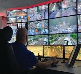
A real-life version of the West Midlands Regional Transport Coordination Centre (RTCC) will be built within the venue of next year’s ITS World Congress in Birmingham, UK. The Operations Centre zone at the NEC will feature staff from the 24-hour RTCC, which coordinates traffic and incident response across


the central English region’s roads and transport network. It will include video screens showing CCTV and live data feeds featuring local and strategic road management, public transport operations, emergency services and roadworks management through the seven metropolitan borough councils.
IBTTA’s Be Safe Together focus on distracted driving
IBTTA is making a $25,000 investment in distracted-driving education and prevention as part of its third Be Safe Together campaign. The international tolling organisation partnered with lobby group EndDD.org (End Distracted Driving) for the campaign this year, whose theme is Put Your Mind in Drive. The focus on distracted driving will include a global safety pledge, industry case studies
and educational outreach, as EndDD.org and IBTTA aim to expand age-appropriate education for middle and high school students during the 2026–27 school year.

Three toll projects for Kapsch in New Zealand
Kapsch TrafficCom has won three video-based tolling contracts with NZ Transport Agency Waka Kotahi, worth a combined $NZ8.5 million ($US5 million) and set to be delivered between late 2026 and early 2028. The first is a second gantry on the Tauranga Eastern Link, which supports one of the Bay of Plenty’s most important transport corridors. Kapsch is also delivering the tolling system for the first stage of the Takitimu North Link, which runs between Tauranga and Ōmokoroa. Finally, the Ō Mahurangi – Penlink project involves a new 7km highway connecting Whangaparāoa Road with State Highway 1.

Venice challenge rewards shift away from cars
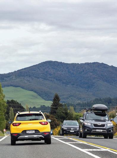
The Toyota Mobility Foundation has named two winners in its Sustainable Cities Challenge in Venice. Both have been piloting their solutions, for which each received $180,000. They will now receive an additional $500,000 to scale solutions across the Italian city. BetterPoints’ Bella Mossa app replaced 45,000 car journeys and recorded 1570km cycled by non-habitual cyclists between October 2025 and February 2026. The other winner is Factual Consulting, whose platform Andemo achieved 1750 downloads in its pilot, with 87% of users opening it an average of three times daily.

Hayden AI bus cameras receive UK certification
Hayden AI’s camera enforcement tech has been given a significant boost in the UK ITS market with a key approval. The UK’s Vehicle Certification Agency has approved Hayden’s forward-facing camera system, which is mounted behind bus windscreens, to detect and enforce vehicles
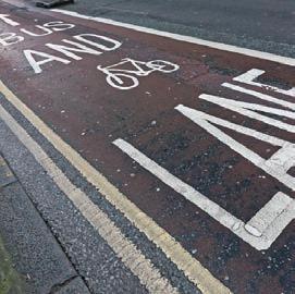
illegally using bus and cycle lanes and other restricted routes in England. The certification means evidence of contraventions – vehicles and their number plates and the location – can be detected with the technology and transmitted to local authorities for review.
Stellantis, Wayve and Uber partner to scale robotaxis
Automaker Stellantis, AI company Wayve and mobility platform Uber have formed a partnership to develop and deploy Level 4 driverless robotaxis on a global scale. Stellantis will design and manufacture vehicles built on its L4-Ready Platforms. These vehicles will feature embedded sensor suites engineered with the safety and redundancy required for highutilisation driverless operations. Wayve will provide the AI driving software to enable the vehicles to navigate complex urban

environments. Uber will deploy the AVs, connecting riders to autonomous trips through the Uber app.
Verra hired to cut speeding in City of Angels
Verra Mobility and the Los Angeles Department of Transportation (LADoT) are to begin implementation of automated speed enforcement at 125 sites across the city.

The contract was awarded by Los Angeles City Council and will focus on corridors where data shows high-speed driving and speed-related crashes. Morgner Construction Management, a Los Angeles minority business enterprise (MBE), will install the cameras. In 2024, more than 300 Angelenos were killed in


traffic collisions, with one in five of those deaths attributed to speeding. Verra already operates similar contracts in California’s Bay Area, in Oakland and San Francisco.
Viva takes in views of New York City
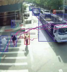
Viva’s sensors, piloted in 2023, are now to be used at 100 locations in New York City to assess how various road users move about. The pilot involved 20 sensors, and another 80 will now be added across the five boroughs. Mounted on existing infrastructure, such as traffic signal poles, the sensors anonymously map how different users move, counting people and vehicles, measuring speeds and capturing turning movements. They can improve pedestrian safety, for example, by identifying streets where pedestrians are habitually crossing mid-block instead of at crosswalks.








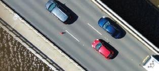


A survey by ITS Australia has found consistent support across the intelligent transport sector for a transition to a road user charging (RUC) model. ITS professionals view the model as necessary and desirable. Respondents highlighted RUC’s role in revenue sustainability and improving fairness across the network. “There is clear support for a measured transition to road user charging - one that starts simply, prioritises fairness, and builds trust with the community through transparency and strong privacy protections,” ITS Australia CEO Susan Harris said.











Image: Sean Pavone/Dreamstime.com
CONTRACTS & DEALS



Quarterhill
to buy
Conduent’s
toll business for $70m
Quarterhill is to buy Conduent Transportation’s tolling business for $70 million in a deal which is expected to close before the end of the year. It follows Conduent’s sale of its public transit arm to Modaxo for $164m in May. Modaxo also bought Conduent’s kerbside management and parking businesses for $230 million in 2024. The tolling business operates in the US and UK and covers all electronic tolling, roadside and back office payment processing, image review, automated licence plate recognition, violation enforcement and analytics. Conduent said it supports more than 14 million transactions per day.
Tattile’s mobile traffic monitoring deal in Spain
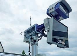
Tattile has begun deploying mobile traffic monitoring units for an unnamed Spanish client following a successful pilot.
The deployment consists of 33 mobile traffic data collection (ETD) stations, developed for deployment across road networks and capable of providing advanced traffic analytics while ensuring rapid deployment and fullyautonomous operation.
The solution integrates an advanced ANPR system to support vehicle identification and traffic flow analysis, using Tattile’s Vega53 camera.
The units had to operate autonomously for several days in real-world conditions, powered by batteries and solar energy systems.
TfGM signals five-year extension for Yunex
MLFF toll launched on Delhi–Jaipur route
Swarco marks UK expansion with Hi-Way buy
Austria-based ITS group Swarco has acquired a familyowned UK provider of road marking services. Based in the south-eastern English county of Kent, Hi-Way Services operates from three bases with 60 staff and annual revenue of £10.8 million. As well as being a basic road safety requirement, clear road markings are increasingly an important element in advanced intelligent transportation technologies such as in-vehicle lane-assist platforms and the safe running of autonomous vehicles.
“We are taking another targeted step to strengthen our market position in the UK,” Swarco CEO Michael Schuch said.

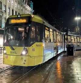
Yunex Traffic has been awarded a five-year extension to its traffic signal maintenance contract with Transport for Greater Manchester (TfGM) in the UK. The two have worked together since 2011, and Yunex points to the delivery of a large-scale retrofit and modernisation programme across more than 1800 signal sites in that time. This has involved replacing over 52,000 traditional signal aspects with energy-efficient LED technology, reducing energy usage by 50% and providing annual cost savings of around £750,000, Yunex said.


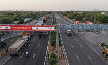
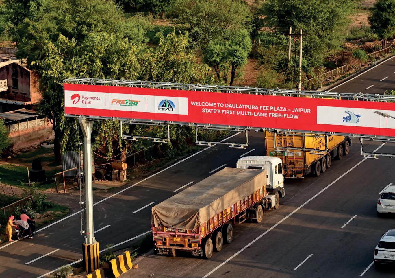
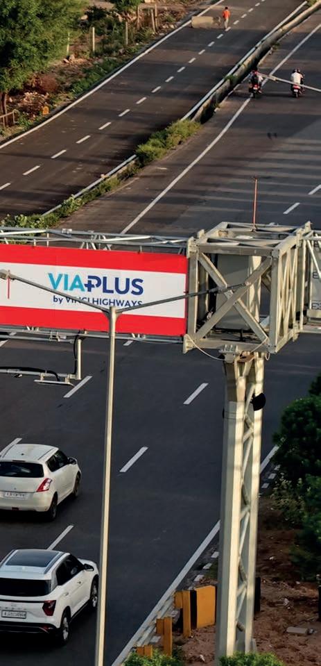
A multi-lane free-flow (MLFF) electronic toll system has opened in India, one of the first in the country and part of a growing trend towards deploying barrier-free operations at scale. It is located in Daulatpura on the Delhi–Jaipur Expressway, the 242km (150-mile) six-lane expressway which connects New Delhi with the state of Rajasthan on the NH-48, carrying 10 million vehicles each year. The deployment features Sidra Systems’ Parsec lane controller system and Star Systems International’s Titan Pro readers and Avior antennas. ViaPlus is systems integrator for the project. ITS Go with the flow, p23
Q-Free wins multi-year Norway toll deal


Q-Free has been awarded a deal by Norwegian toll road operator Ferde. The multi-year project will see Q-Free replace roadside infrastructure at six tolling stations across the west of the country, in Førde and on Bømlo. The company will be responsible for delivery, installation and commissioning of new roadside equipment, as well as the dismantling of existing installations and structural upgrades. Work is scheduled for later this year and is expected to be completed within two weeks with local partners. The solution is based on Q-Free’s three-portal gantry architecture and is fully-aligned with Norway’s AutoPass requirements, the firm said.


Image: Tattile
Swarco












RAPID DETECTION RECOVERY
DRILL. DROP. DETECT.
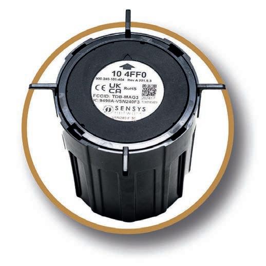
FlexMag3: the faster fix for failed detection.
FlexMag3 is wireless - bypassing failed or damaged infrastructure entirely. Just drill, drop, and seal each sensor into the pavement to restore signal actuation in minutes. No trenching or cable pulls required.
• Replaces any detection technology
• 5-minute deployment per sensor
• Removable and reusable

“WE NEED TO BE THINKING ABOUT A PATH TO TOMORROW”
IBM is not necessarily a name you think of when it comes to transport, but that may be changing. ITS International spoke to the group’s Donovan Guin and Gary Rosenfeld about the appeal of mass transit, data-driven decisions and the importance of ‘vision’.
Mention the name ‘IBM’ to anyone and they’ll probably think ‘computers’ rather than ‘transport’. But transportation is in the global group’s DNA.
The company’s public transportation lead, US, Donovan Guin explained that IBM was formed from the merger of four companies acquired in the early 1900s. The dominant business involved Hollerith punch cards, whose first big commercial gig was counting passengers and freight for the New York Central Railroad, before those cards became the primary medium for programming in the early days of computing. Add in basic traffic counters using pneumatic tubes, tolling and air traffic control, and then space flight (as NASA tech partner for the Apollo and more recent Artemis missions), and IBM’s transportation pedigree is clear.
“And then there’s the equipment that’s been developed through the years: RFID [radio-frequency identification] has its has
its roots in IBM,” the company’s business development leader – state and local government Gary Rosenfeld said.
“The ticket vending machine at a transit station has its roots at IBM, so there’s always been a leadership role in transportation, in bringing new technologies to bear.”
But, speaking to ITS International at June’s ITS America Conference & Expo in Detroit, history is not what’s occupying the two men’s minds.
“We’re seeing a lot of our technology being used by clients to try to process all the data that’s coming in from roadside equipment, public sources, traffic, weather, whatever, and they’re struggling a little bit on how to put it all together as the pace of technology keeps changing so quickly,” Guin said.
IBM’s role is to help clients integrate that data more quickly and start to automate it through whatever dynamic means companies have available, from signal control to road pricing.
“This next step for us is utilising the innovation that’s available today with a look-see into tomorrow and bringing those tools to play to allow agencies and leadership to get beyond the buzzwords of data-driven decisions and actually have data-driven decisions – beyond a KPI [key performance indicator],” Rosenfeld said.
Measuring organisational performance, however, requires looking beyond conventional KPIs.
“The depth of the true data is what is necessary so that an organisation can make policy, interact with other organisations, bring all the levers of control together, so that it appears seamless to the end user,” Rosenfeld said.
“But there are a lot of wheels turning and a lot of gears meshing so you can drive your car comfortably from point A to B, or you have complete mobility within your community for everyone in the community so they can get from point A to B to C to D in a given day or week, or whatever the case may be.”
Image: Prime Global Publishing
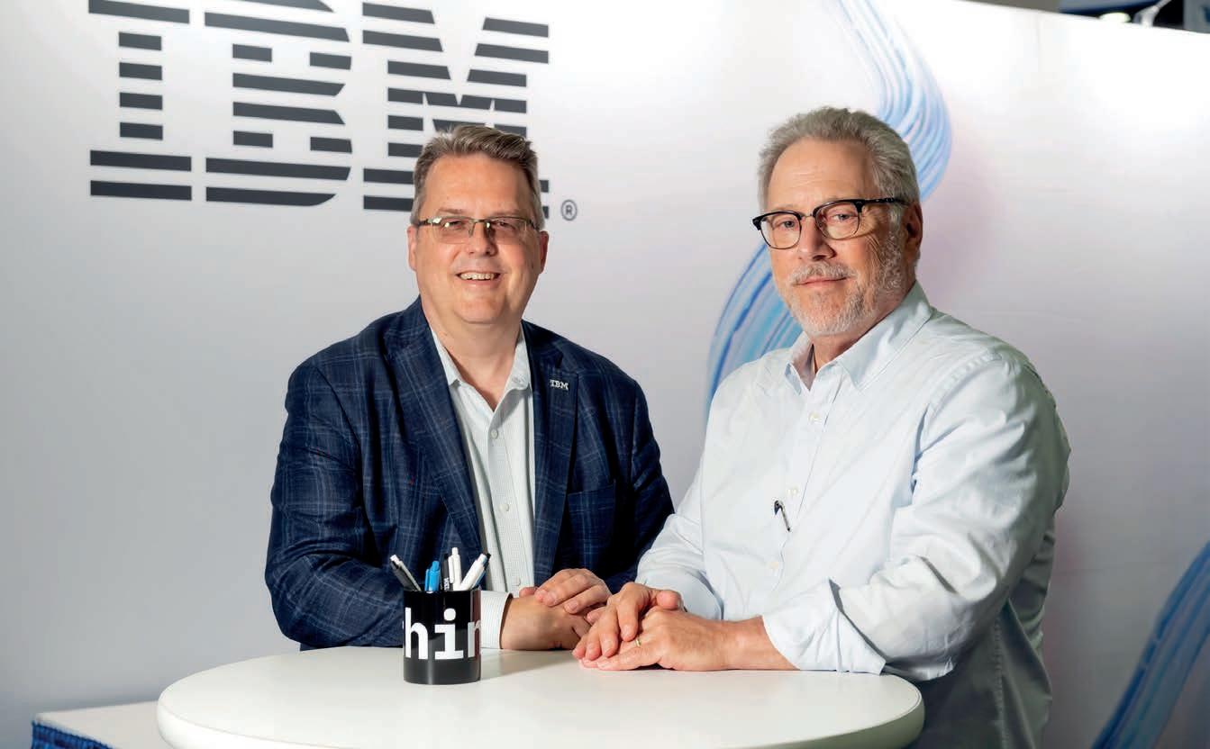
L–R: Donovan Guin and Gary Rosenfeld of IBM.
Being able to get different organisations to utilise the same data sets is important because it brings credibility to their decision-making.
“So if we can utilise data from tolling and transit and parking garages and kerb time and traffic incidents and weather and everything else like that, we can forecast what might happen,” Rosenfeld said.
“You can use that data to take definitive steps to change the behaviour of the public, but at the same time you’re getting them to take advantage of where there’s capacity, to reduce their dependence where there’s not capacity, and now we get the greatest ROI [return on investment] out of public investment, because you might not have to build another lane.”
The ‘vision’ thing So far, so clear. But there is currently something missing.
Guin believes it’s the ‘vision’ thing. To explain, he references the excitement of the World’s Fair held in New York in 1964.
“We’re talking today in Detroit, the Motor City, and as I was flying in here, I was thinking about the history of visions of future cities, going back to the ’60s,” he said.
“Let’s say, with GM sponsoring a World’s Fair concept, maybe Frank Lloyd Wright helped to design around a car-centric city future. Well, a lot of those ideas were put into action, for better or worse, the highways and wide boulevards, at the expense of pedestrians.
“And we’re moving to some kind of post-car world, let’s say a future digitaldriven world, but we have no similar concept being expressed. We’re just throwing out the term ‘V2X’, and everyone’s trying to say, ‘My thing is the way’.
“But, really, there’s something missing at the middle. It’s not only an approach to technology, but it’s a technology connected to a vision that’s really driven by outcomes that would benefit communities far into the future. So think about over a 50-year sweep of time; what is mobility going to look like in our communities, and between our communities?”
Guin cites the example of Dallas, Texas.
“It is becoming maybe the third largest metro in the US, over the next few years, but they can no longer build their way out of the congestion problem as they’ve always done,” he said.
“They’re saying, ‘Ah ha, there’s a future that does not look like what it did in the past, so what got us here isn’t going to get us there’. But what is there? No-one’s really got that idea yet.
“Even the folks that manage the roads there are starting to have conversations about, ‘How are we going to continue to grow if we can no longer move, and we
don’t have a landscape that was designed for transit or pedestrians? What are we going to do?’”
There is no single answer that Guin, or even any one company or organisation, can provide.
“I think it’s a collective reckoning we all need to come to terms with,” Guin said. “But it’s not just about technology; it’s about policies that drive what we do with that technology. We’re going to try to step up as IBM to help facilitate that conversation.”
The goal is to find a blueprint with which public and private entities can move forward with the best interests of travellers in mind. IBM seems to be striking a philosophical note, perhaps encouraging us to think differently about what we mean by transport and mobility.
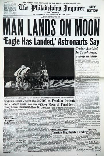
IBM’s transport heritage includes the Apollo space missions.
‘Sausage-making in the backroom’ Rosenfeld was previously chief executive officer (CEO) of Memphis Area Transit Authority for eight years, but he never saw his job simply as running buses and trains.
“I have people that run buses and trains,” he said with a smile. “[My job was to] look out for economic activity in the community and how I can support that, whether it be through how we invest our resources, how we design our systems, to what will have the greatest impact.
“Because, as a public administrator, my role is to guarantee the tax base of the community, to make sure it remains steady or grows, so that we can continue to provide goods and services.”
It’s this “sausage-making in the backroom”, as Rosenfeld somewhat colourfully puts it, that must influence transportation.
“We have to be thinking about this,” he said.
Guin expands on the idea.
“Every trip represents an increment of economic activity,” he said. “So even if I’m just getting my car and I drive in a loop through town and come back, I just consumed some gas, which eventually I’ll have to pay at the pump.
“People are generally not driving in a loop; they’re getting their kids to school, often it’s shopping or it’s to work, and that’s the same with transit. And the thing with transit is that it can move more goods, people, services around more efficiently than anything else.
“There is a reason why New York City, which is the economic capital of the country that has the largest economy in the world, is not the biggest city in the world by many measures, and yet it has the biggest economic impact of any single city in the world. Why? The MTA [Metropolitan Transportation Authority] is the largest transit system in the world by miles of track and many other measures: they move more goods, people, services around more efficiently.”
Every time someone’s on the New York subway, they have an economic impact, according to Guin.
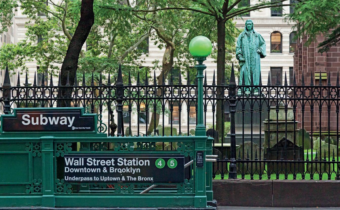
“The kid who lives in the northern part of town can still get to their job in the Wall Street area for $3 a trip. It’s amazing,” he said. “So we have to start thinking about transportation as a public good and deal with the fact that no one likes traffic –what they want is better quality of life, better outcomes for all of us.”
So how does the industry start looking at transportation as a strategic asset locally, nationally, internationally? Guin thinks IBM’s global footprint and roots in the technology world will help.
“We are often sitting with secretaries of transportation, governors, policy shapers, as well as the technology people and operations people, and I think we just need to start reconnecting those threads again,” he said. “So people don’t come over to me and say, ‘I want to get some hardware and put it in cars’, and I say, ‘Why?’, and they can’t process what I’m saying.
“We should all be understanding the mission that we’re on; let’s reboot that mission. We’re trying to use the position that we have in the market to help clarify what that vision might be and create a better path forward, a roadmap for them to get there.”
Data-driven decision-making
Rosenfeld believes a major issue is that people only tend to see their individual piece of a wide transportation problem.
“[Each company] provides a little bit of the information and tools necessary
Image: Alain Lacroix Dreamstime.com

for an organisation to deliver the mobility that the community is asking for,” he said. “What we’re trying to do at IBM is bring together the information that all these little bits are generating and bring them into a web, so we can then provide that insight to the organisations that are buying all these various different things.”
Bringing all that into one place should allow for the true, data-driven decisionmaking that Rosenfeld champions.
Putting transport at the centre of land use planning would be a big help.
“When transportation is brought to the table after the fact, it’s usually about three or four times more expensive to deal with,” Rosenfeld said. “Somebody will say, ‘Oh, and we want a subway’, and you go, ‘Wait, the subway needed to be part of the initial plan’.
“Same thing with a bus route, same thing with a bicycle path – these need to be part of that early discussion for maximum efficiency in the delivery.”
That’s not to say plans can’t change as community needs alter, but having key information from a number of sources will help improve the services on offer.
“Say you’ve got all the data of what’s going on at a convention centre, and what impact that has on hotel occupancy, and what impact hotel occupancy has on your transit ridership on given routes on Sunday afternoons at 2 o’clock,” Rosenfeld said. “These insights can be brought together if you have this overarching web of information, bringing together all the results of those little individual cases.”
So is IBM saying we need more public transit? Or that we should be mobilityagnostic but we need to make better use of what we already have?
“I think it’s both,” Rosenfeld said. “Some communities need a lot more investment in public transit: either the economic realities of the communities are such that people can’t afford cars, or there is a high percentage of the population that can’t drive.”
We should all be understanding the mission that we’re on; let’s reboot that mission
Donovan Guin IBM
Meanwhile, the definition of mass transit is expanding.
“It’s not just buses, it’s not just trains or commuter rail or streetcars or anything else,” Rosenfeld said. “You’ve got the shared-ride experience, you’ve got ondemand services that are being integrated into the overall scheme of things to deliver service. I don’t think you can have too much public transit. ‘Too many options’ is something I’d like to test in the future.”
Rosenfeld believes the way to get people to best use public transportation is to create a situation where they don’t have to think about it.
“So when you can walk out of your office in the afternoon, step down to the street corner, and the bus is there within two or three minutes, that takes you to the subway station, and that train arrives three minutes after you get to the platform, and it takes you where you need to go, and you get off at your suburban community, you go into the parking garage, and you drive out and the signals to get you onto the street know to go into a certain routine five minutes after the train arrives,” he said.
“All of this flow, if you will, is integrated so that as the end user you’re never thinking about it.
“Like when you turn on the water faucet in your kitchen, you don’t think about what’s going on in the delivery of that water, right? When you flip on that switch in the morning, you don’t think about where the electricity is coming from, you just want to know that when you flip the switch, the lights go on. The same thing has to happen with mobility.
“People have to have the trust and the understanding that public transportation can, when done properly, be just as easy as getting in your car and driving from A to B.”
‘One more lane will fix it’
Many engineers and planners are still wedded to the ‘one more lane will fix it’ idea, but Rosenfeld counters that thinking.
“There’s plenty of data to show that one more lane does not solve the problem,” he said.
MTA: the largest transit system in the world.
Image: Erin Cadigan stockdotadobedotcom
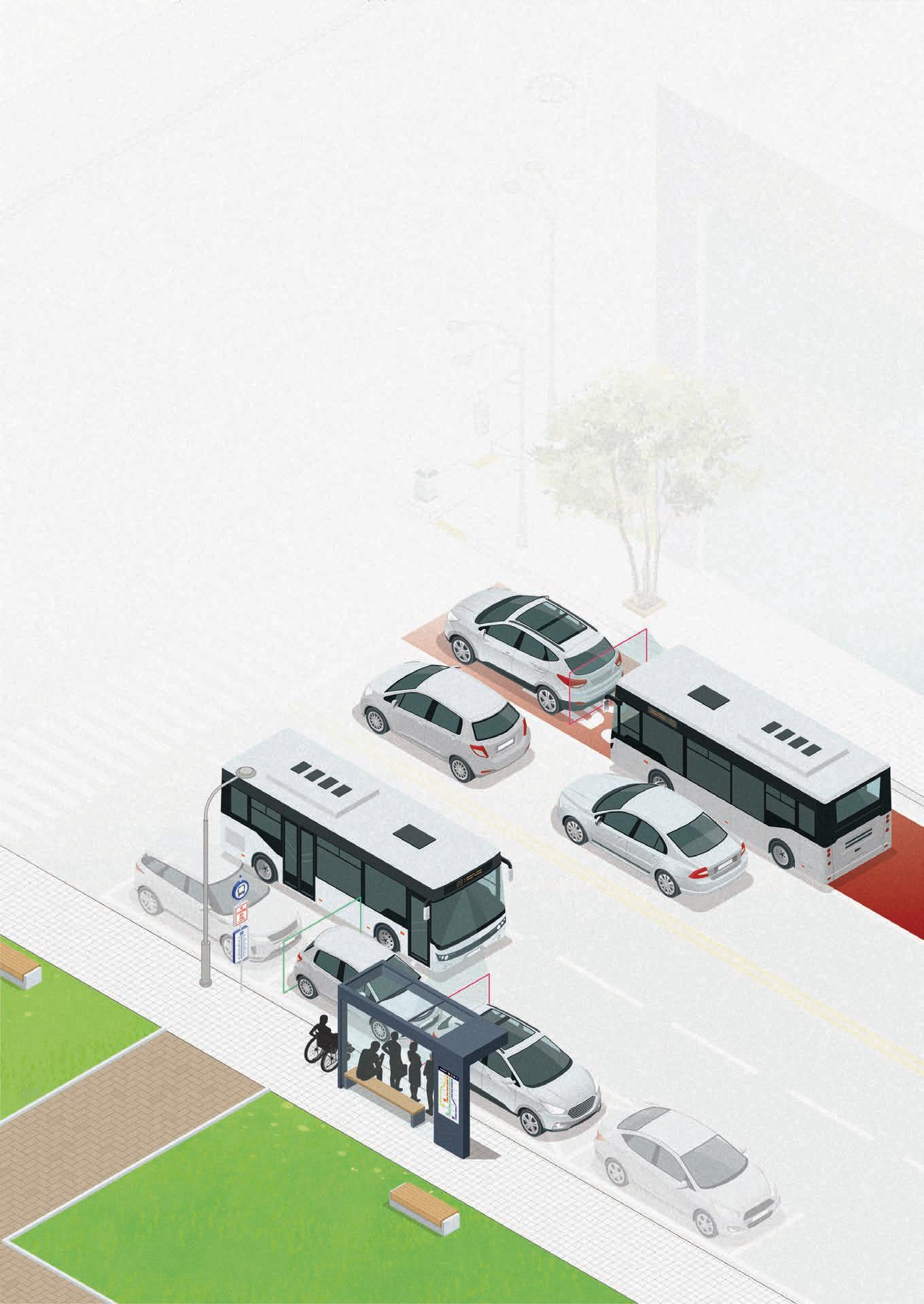
Keep cars and trucks out of bus zones. With the bus.
Illegally parked vehicles in bus lanes and bus stops make safe, reliable, and accessible bus service impossible.
Hayden Al is changing that. Our bus-mounted vision Al platform helps transport authorities change driver behavior and keep dedicated bus zones clear for buses, not cars. Cities across the globe use our automated enforcement solutions to improve transit performance and safety for everyone.
Learn more at www.hayden.ai
Guin agrees with his colleague.
“And every lane that you add actually diminishes the additional efficiency,” he said. “So if you have two lanes and then you go to three, you’re not getting a proportional improvement, because now you have more options and there’s more movement between the lanes, so the actual throughput of all the lanes starts to go down.”
“And the safety aspect goes down as well,” Rosenfeld said.
“That’s the reality we’re grappling with,” Guin said. “Part of what we’re trying to do is not just enable them to use this data, but get more proactive about how they use it. If we could get 5% of people off the roads and onto transit, the finances of transit would change dramatically.”
You want to know that when you flip the switch, the lights go on: the same thing has to happen with mobility
Gary Rosenfeld IBM
Guin recounts what should have been an hour-long commute that ultimately took him two-and-a-half hours.
“About halfway through that trip, I’m like, ‘If there was a transit station here, I’d get off right now and get on that train’,” he said.
“What if MassDoT [Massachusetts Department of Transportation] sent me an alert in the morning saying, ‘This is going to be a heavy traffic day but here’s a free ticket to take the commuter rail today’? I would have said: ‘You know what, I’ll probably do it’.”
Rosenfeld sees the answer as making public transport a more obvious choice.
“What we really need to do in order to be effective with the public is have a situation where they’re not having to think about it: they just know the bus is going to be there every five minutes, the train during peak periods is going to be there every three minutes,” he said
Getting this right will also mean taxpayers get more for their money, but it can be challenging to ask people to think differently.
For example, extending the life of infrastructure such as roads and bridges
would be helped if vehicles moved more efficiently. In other words, finding budget for dynamic signal control and finding budget for civil infrastructure upkeep are complementary activities – but not all traffic engineers may see that.
“Mass has force when it’s accelerating, and we want that force to have a limited downward impact on bridges by keeping them moving,” Guin said.
“But if they’re just sitting there on the bridge, that bridge is going to decline in structural health more quickly over time, and you’ll have to spend more money, more frequently to keep restoring it to a state of good repair.”
Rosenfeld is clear that IBM wants to “embrace” companies that are innovating in mobility.
“They need help identifying and understanding the data that they create, so they make good decisions to maybe bring product to market faster, maybe to be more efficient in that delivery of product,” he said. “We need to be thinking about the past, we need to be thinking about how it affects today, and we need to be thinking about how we establish a path to tomorrow – and it’s exciting.” ITS



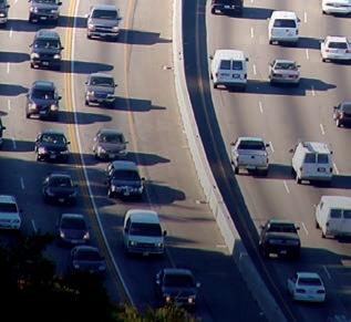
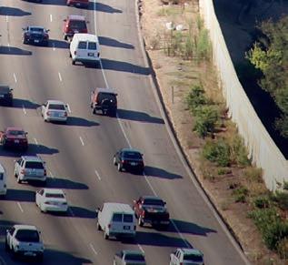
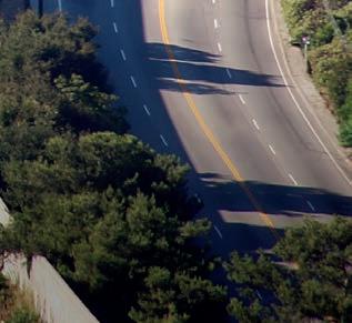


What if one more lane doesn’t fix it?



The missing piece in ITS deployment
An ITS Australia delegation’s recent visit to Japan highlighted a shift in the industry’s focus – from innovation to integration – a trend being echoed in transport networks around the world.
For more than three decades, the ITS sector has focused on advancing technology. Connected vehicles, artificial intelligence (AI)-powered traffic management, digital twins, autonomous mobility, predictive analytics and real-time operations platforms have all matured significantly.
Yet despite the rapid pace of innovation, the challenge of institutional coordination continues to determine whether these technologies succeed beyond pilot projects.
The lesson emerging from transport agencies around the world is clear: technology may enable transformation, but coordination enables deployment.
“We often talk about connected vehicles, but what really matters is connected institutions,” ITS Australia chief executive officer (CEO) Susan Harris said. “Technology can only scale when governments, operators, industry and academia are working from the same playbook.”
Whether the goal is connected vehicle infrastructure, road user charging, autonomous transport, integrated traffic management or data-driven operations, the technologies themselves are no longer

the biggest challenge. Success depends on governments, operators, regulators, technology providers and industry bodies aligning around common standards and long-term implementation.
Mobility innovation only delivers its full value when stakeholders are connected into a coordinated network rather than operating independently.
Beyond the technology question
At ITS Australia’s recent Roads, Tolling and Tech 2026, the idea that technology is no longer the primary barrier was a recurring theme across presentations on AI, connected mobility and digital infrastructure.
Presentations from several ITS Australia members demonstrated that advanced technologies already exist to improve safety, optimise traffic flow and support smarter operations.
AI-enabled video analytics can identify incidents in real-time; digital twins can predict network conditions before congestion occurs; connected vehicle systems can warn drivers of hazards beyond line of sight; cloud-based operations platforms can integrate data from thousands of devices. It’s all there, ready to go.
Yet all of these solutions rely on something less visible: trusted data-sharing, interoperable systems, harmonised standards, and coordinated governance structures.
As transport networks become more connected, institutional fragmentation becomes a greater risk than technological limitations.
A digital twin is only as effective as the agencies willing to share data into it; connected vehicles only work at scale if infrastructure operators, vehicle manufacturers and governments agree on common protocols. National road user charging systems cannot function efficiently if jurisdictions adopt different standards and operating models.
The industry’s challenge is shifting from innovation to integration, and few countries illustrate this better than Japan.
Tokyo story
When an ITS Australia delegation visited Tokyo in April, it examined how Japan has successfully moved from transport innovation to large-scale deployment. What stood out was not simply the sophistication of the technology, but the coordination model supporting it.
Japan’s ITS Connect cooperative vehicle infrastructure platform now operates across more than 700,000 vehicles and 114 infrastructure sites. Toyota reports that the system has delivered a 38% reduction in right-turn collision incidents and a 7.7% improvement in emergency vehicle response times.
These are operational outcomes, not pilot results. This is where the rubber is (literally) hitting the road.
The deployment reflects years of alignment between the Japanese Ministry of Land, Infrastructure, Transport and Tourism (MLIT), vehicle manufacturers, infrastructure operators, local governments and ITS Asia Pacific.
ITS Asia Pacific itself plays a critical coordinating role, acting as a bridge between government, industry, academia and users. Rather than focusing solely on technology development, the organisation helps align stakeholders around common objectives, standards and implementation pathways.
“Our experience has shown that successful ITS deployment is built on trusted partnerships,” ITS Asia Pacific secretary general Akio Yamamoto said.
“When ministries, infrastructure operators, vehicle manufacturers, technology providers and researchers work together, innovation can move from demonstration to everyday operation.”
The result is an ecosystem in which connected vehicles, roadside infrastructure, traffic operations and policy reform evolve together.
Japan’s approach to driverless vehicles offers another example. Level 3 automated driving was legalised in 2020 and Level 4 in 2023. MLIT established its Autonomous Driving Society Realisation Headquarters in January, signalling that automated mobility is being treated as national transport policy rather than a collection of isolated trials.
The message for other countries is significant: successful deployment requires institutions to move together.
Behind this need for alignment sits an often overlooked but decisive force. The standards that define how systems communicate, interpret data and ultimately interoperate at scale.
Perhaps the most important lesson is that some of the most transformative work in ITS is often the least visible.
Standards development rarely attracts headlines, yet behind every connected vehicle application, smart motorway and road-pricing system sits an extensive framework of agreed protocols, data definitions, interoperability requirements, as well as dozens of people aligning opinions and capabilities.
The US recognised this challenge decades ago in its vehicle-to-everything (V2X) and digital infrastructure work through the US Department of Transportation (USDoT) ITS Joint Program Office. The programme was designed to ensure different systems could exchange and interpret data consistently, enabling regional and national interoperability. USDoT describes interoperability as essential to achieving the full potential of ITS deployment.
Similarly, ITS America continues to prioritise policy harmonisation, interoperability and scalable deployment as key objectives for connected transportation. Its V2X programmes focus not only on advancing technology but on removing regulatory barriers and ensuring systems can operate consistently across jurisdictions.

Technology can only scale when governments, operators, industry and academia work from the same playbook
Susan Harris ITS Australia
“Interoperability is not a technical feature; it’s an essential deployment principle,” ITS America president and CEO Laura Chace said.
“Without common standards and cross-jurisdictional coordination, connected transportation systems simply cannot deliver their full value.”
This principle applies equally to road user charging.

Policymakers across Europe, North America and Australia are recognising that future charging systems will only be viable if users experience seamless interoperability. Drivers should not need different accounts, devices or payment systems when crossing state or national borders.
The technology to enable this already exists. The challenge is coordinating institutions around common frameworks.
Europe’s collaboration model Europe offers one of the strongest examples of institutional coordination supporting the deployment of innovation with the ambition of bringing safer roads to citizens and all users.
For 35 years, Ertico – ITS Europe has operated as a neutral platform connecting more than 120 members spanning governments, industry, research organisations and transport operators.
Its role, like ITS Australia, is not to build technology directly but to support and facilitate the strategic alignment of stakeholders around innovation, research and deployment.
Ertico describes its contribution as bringing together public and private actors, unifying priorities and enabling cooperation at scale. Its long-standing collaboration with the European Commission has helped support harmonised approaches to mobility policy, ITS deployment and interoperability across multiple countries.
“Europe’s experience has shown that innovation alone is not enough,” Ertico CEO Joost Vantomme said. “The greatest breakthroughs occur when public authorities, industry and researchers align around common goals and shared implementation pathways.”
This coordination function becomes increasingly important as transport systems become more entwined.


Japan’s ITS Connect cooperative vehicle infrastructure platform has delivered a 38% reduction in right-turn collision incidents.






The
greatest breakthroughs occur when public authorities, industry and researchers align around common goals and shared implementation pathways
Joost
Ertico
Connected and automated vehicles, for example, must communicate across manufacturers, jurisdictions and infrastructure networks. As European standards experts have noted, without interoperability, technology risks remaining trapped in pilot projects rather than delivering real-world benefits.
Europe’s experience demonstrates that institutional architecture can be just as important as technical architecture.
Australia faces many of the same challenges as other federated nations. Transport responsibilities are distributed across states and territories, technology procurement often occurs independently, data governance frameworks vary, infrastructure operators work across different regulatory environments. The list goes on.
Yet encouraging examples of coordination are already emerging.
Australia’s C-ITS National Harmonisation Pre-Deployment Research Trial represents one such effort, bringing together jurisdictions to establish common approaches ahead of wider deployment.
Similarly, New Zealand Transport Authority’s strategy to transform multiple transport operations centres
into a nationally integrated and resilient system demonstrates how institutional coordination can support operational consistency at scale.
Research initiatives from organisations such as the University of Technology Sydney and Deakin University demonstrate how collaboration between academia, government and industry can help turn research into practical solutions.
Working with transport agencies and technology providers, these institutions have contributed to projects in areas such as connected and automated vehicles, data analytics, AI, traffic management and road safety.
By testing new technologies in real-world environments, these partnerships help to ensure innovations can be deployed at scale and deliver tangible benefits for transport networks and their users, so when the technology does hit the ground it’s primed and ready to run the marathon.
The challenge is in maintaining that momentum.
As AI, automation and connected mobility become mainstream, transport agencies will need mechanisms for shared decision-making, common standards and coordinated implementation.
The ITS industry often talks about digital infrastructure, but institutional infrastructure deserves equal attention.
The countries making the greatest progress in connected mobility are not necessarily those with the most advanced technologies. They are often the ones with the strongest coordination mechanisms.
Japan’s cooperative ITS ecosystem; Europe’s harmonised deployment frameworks; America’s emphasis on interoperability; Singapore’s integrated Smart Nation approach to digital governance.

Interoperability is not a technical feature; it’s an essential deployment principle
Laura Chace ITS America
Each reflects the same underlying principle that technology performs best when institutions are aligned.
The future of transport will undoubtedly be powered by AI, connected vehicles, digital twins and automation. But if the next decade of ITS deployment has a defining lesson, it may be that the most important innovation is not technological – it is organisational.
“The transport sector has solved many of the technology challenges,” Harris said. “The next challenge is institutional. The jurisdictions and organisations that move fastest will be those that align policy, operations, standards and data governance behind a shared vision.” ITS

Our experience has shown that successful ITS deployment is built on trusted partnerships
Akio Yamamoto ITS Asia Pacific










Vantomme
Digital twins are a useful predictive tool for traffic operations.
USDoT has been heavily supporting V2X rollouts.
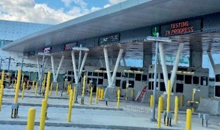

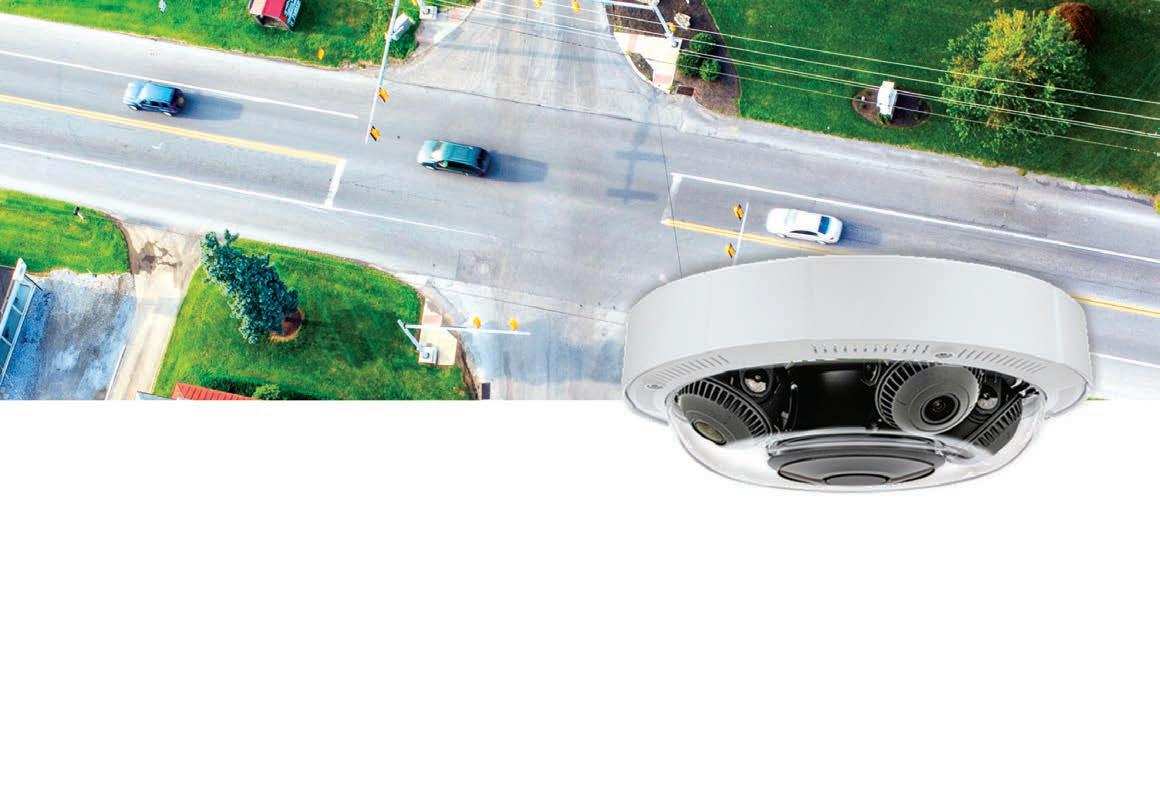

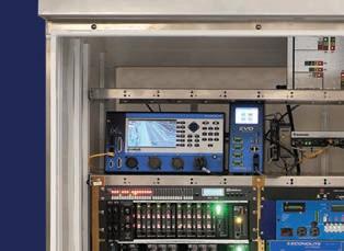
AI-powered, single-mount detection delivers stop-bar coverage across all approaches with a quad-camera design. Install in as little as 90 minutes* and expand reliable detection across smaller, constrained intersections.








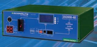





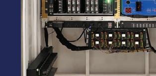
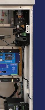
From extreme temperatures to storm-related power outages, resilient backup power helps maintain intersection safety and mobility.
•Reliable Backup Power: Keeps critical traffic signals operating during power outages
•Built for Harsh Conditions: Engineered for extreme temperatures and severe weather with no impact on performance
•Maintenance-Free Technology: Eliminates ongoing maintenance and frequent replacement costs, including shelf-life limitations of lead-acid batteries



•Long-Term Resilience: 20+ year operational life, regardless of the load conditions or number of chargedischarge cycles
•Realtime Voltage and System Monitoring: Enables verification of operational status over the network




•Seamless UPS Integration: Replaces lead-acid batteries for nearly every UPS manufacturer
•True Green Energy Solution: No hazardous chemicals
Econolite Super Capacitors: because every second of traffic signal uptime matters.












Chace: ‘There’s so many use cases that don’t require the latency of Direct V2X’

The evolution of V2X
Information silos are out, integration is in: the message from ITS America 2026 Conference & Expo was clear.
Integration of technologies is going to be key to the continued development of vehicle-to-everything (V2X) deployments, according to two senior ITS figures.
Laura Chace, ITS America president and chief executive officer (CEO), and Marc Williams, Texas Department of Transportation executive director and chair of the ITS America board, spoke to journalists at ITS America 2026 Conference & Expo in Detroit.
Chace cited the advance of Direct V2X solutions in metropolitan Atlanta and the Connecting the West project across Utah, Wyoming and Colorado. But there is also a realisation that Direct V2X – where information is broadcast from the side of the road into vehicles for safety-critical items like intersection conflicts – is not the only game in town.
“You’re seeing a real increase in cloud-based and network-based V2X applications and solutions,” Chace said. “There’s so many use cases that don’t require the latency of Direct that can be handled by the network side, and so I think you’re seeing a much bigger increase in integrating those throughout not only these deployments but also much broader throughout the country.
“That’s one evolution that we’re seeing on the V2X front.”
Williams believes the key point is integration.
“It’s not that we’ve gone away from a point of emphasis on V2X, that’s still very much there,” he said. “But what we’re seeing is a more effective integration across different providers.
“Over the past couple of years, the industry has been investing in V2X solutions, but some of that has been somewhat siloed or not a real cohesive infrastructure system.”
There is therefore a greater emphasis on the importance of integrating the technologies that you do have.
“So regardless of what platform you’re on, you have that opportunity to gain the benefits from the other platforms that are in that ecosystem,” Williams said.
For Chace, interoperability of new technology with existing networks is crucial. Whether it is human-driven or automated vehicles or freight or transit, “you want to see that data integration, not only between public sector agencies but also within those private sector industry partners”.
Williams said infrastructure owners and operators (IOOs) are increasingly aware of the importance of digitalisation.
“We’re not only just looking at the physical infrastructure that we have, but we’re also recognising and developing the digital infrastructure, either the digital model that is a virtual representation of that infrastructure
itself or the digital transmission of information related to how that system is operating: drivers on the road, pedestrians in place, delays, traffic signal timing,” he said.
Digital infrastructure information already exists, but it is often in silos.
“So in Texas, the city of Houston collects a lot of that information, but they may not share it seamlessly with us; or, if we receive it, it’s different than what we received from Dallas and Fort Worth,” Williams said. “And then we certainly are not doing as effective a job as we would like to be doing in sharing that information with Louisiana and Oklahoma in a common compatible framework.”
The US Department of Transportation (USDoT) is set to offer grants to encourage states and jurisdictions along common corridors to begin to work together on a framework system to seamlessly share that information.
“Because your car doesn’t understand when it’s crossing a boundary,” Williams said. “If you’re a truck driver and you’re receiving information, that information should not look any different just because you went from the Texas side of the state line to the Arkansas side of the state line.
“It ought to be a seamless operation, so that’s one of the things that has been a top priority of USDoT.” ITS

Howe the bridge has taken shape
Following some well-publicised delays, the Gordie Howe International Bridge between Canada and the US looks finally ready for cross-border traffic.
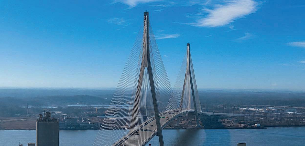
The Gordie Howe International Bridge, the longest cable-stayed bridge in North America, runs between Windsor, Canada, and Detroit, US. It will provide a new cross-border route between the two countries, easing pressure on the nearby tolled Ambassador Bridge and providing a direct connection between Canada’s Highway 401 and Interstate 75 in the US.
Suppliers of ITS equipment and solutions have been eagerly awaiting the first day of official operation (see Ledstar for lane management , page NA7)
The Canada-based not-for-profit Windsor-Detroit Bridge Authority (WDBA) has been testing intelligent transportation systems for the bridge since February 2025. The systems will make the six-lane crossing one of the smartest road structures in the world (see On your marks , page NA8).
There was considerable excitement at the ITS America Conference & Expo in Detroit in early June that the bridge would open during the event. A ribbon-cutting ceremony had been scheduled for June 12, and the Michigan Department of Transportation proudly
displayed a large and much-admired model of the bridge on its booth in the Huntington Hall convention centre.
However, on the morning of June 11, the WDBA published an announcement saying the authority was taking a “collaborative approach” in talks to get the bridge open.
“Canada and the US have agreed to delay the opening of the bridge, taking the necessary time to resolve any outstanding issues,” the statement read. “We appreciate the efforts of workers on both sides of the border to get the bridge to its current state of readiness.”
The delay appears to have been temporary. After weeks of negotiations, Canada and the US agreed to a series of cooperative measures focused on toll governance and transparency and cleared the way – at the time of publication – for the bridge to open on a new date of July 27.
The bridge has been ready for traffic for some time, but the US government had held off on approving its opening, suggesting that the original agreement did not provide a sufficient deal for the country.
Subsequent negotiations focused on tolling arrangements and how the
financial benefits of the crossing would be distributed.
Under the project’s original agreement, Canada fully financed construction of the bridge, as well as the US port of entry and work on the Michigan I-75 interchange, including land acquisition in Michigan. Ownership of the bridge is shared between Canada and the state of Michigan.
The new agreement changes the arrangements around tolling revenue. Canada will continue to recover construction and operating costs through tolls, while the US will receive a share of net toll revenues for 15 years. The US funds will be directed towards a regional economic development fund intended to benefit communities surrounding the crossing, including Delray, a Detroit neighbourhood affected by construction.
While attention has been focused on the new bridge, it is only one part of a major transportation corridor project. In addition to the ITS tech, new and upgraded highway infrastructure supporting access to the bridge is as important as the bridge itself.
In 2015, the Canadian government completed the Herb Gray Parkway, a
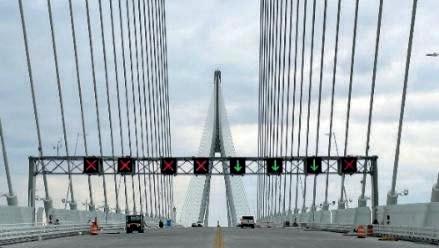
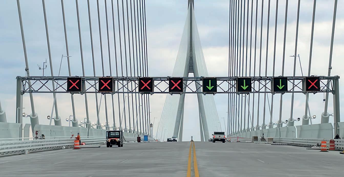
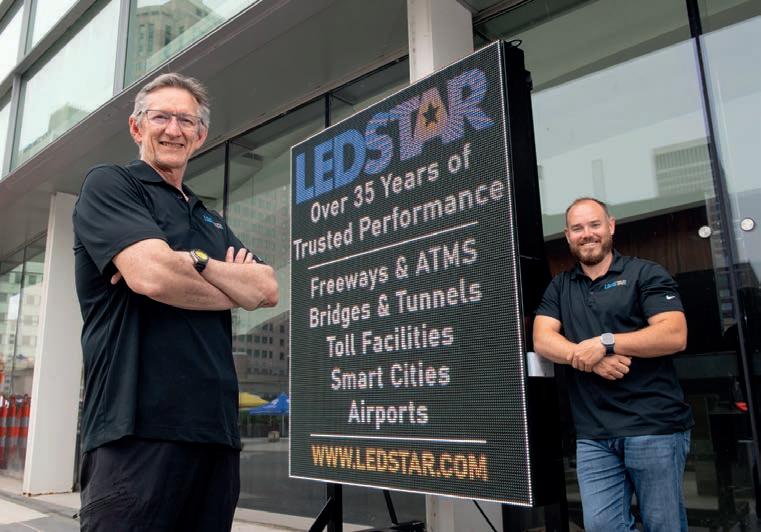
Instead of using typical blank-out style X and arrow signs on the Gordie Howe, Ledstar provided its RDLS comprising 176 full-matrix dynamic displays.
Image: Ledstar
six-lane, 11km route that runs from the bridge to Highway 401, the major motorway artery across southern Ontario. The parkway features 1.2km2 of green space and more than 20km of recreational trails, with seven bridges and two tunnels separating the trails from roads. The cost was around US$1 billion.
In the US, the existing routing of Interstate 75, just outside Detroit, remains unchanged, but a connecting road was constructed from the Gordie Howe to a new interchange with access



ramps to both directions of I-75. In addition, around 3km of the highway was rebuilt and widened, local roads were improved and new pedestrian bridges added. Noise walls were also built to mitigate impacts to the southwest Detroit neighbourhood.
In the interest of mobility, the WDBA in 2017 announced a dedicated multi-use path to accommodate pedestrians and cyclists, connecting to local streets and trails on both sides. This will be part of the Trans Canada Trail, linking networks in both



countries, including the Canadian Great Lakes Waterfront Trail, as well as the American Iron Belle Trail and the Great Lakes Way.
To reduce border waiting times for pedestrians and cyclists, there are dedicated customs facilities on the US and Canadian sides that prevent intermingling with road traffic, and the crossing is toll-free.
The new facilities are loaded with the latest tolling infrastructure. The US port of entry connects directly to I-75, while the Canadian port of entry has border inspection facilities, toll collection and bridge maintenance facilities.
The crossing also incorporates a wide range of sophisticated ITS equipment, designed to support the movement of commercial and passenger vehicles, plus pedestrians and cyclists.
For the business communities and residents on both sides of the Canada–US border, as well as the thousands of people who worked on the bridge, the opening represents the culmination of years of construction and anticipation. After watching the bridge steadily rise above the Detroit River, they now wait to see the structure move from a long-running construction project into full operation.

















































































































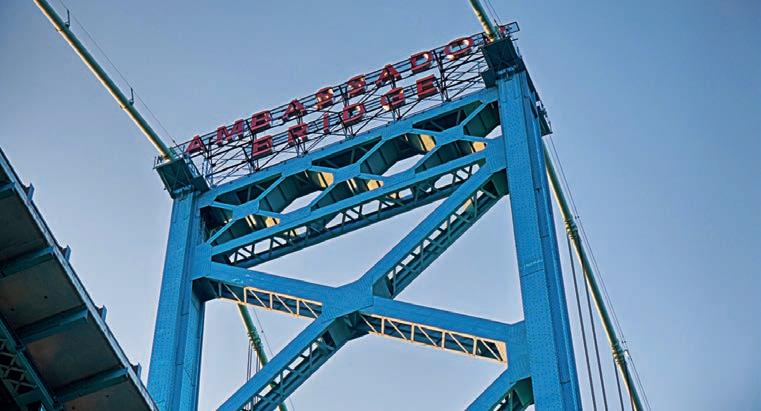
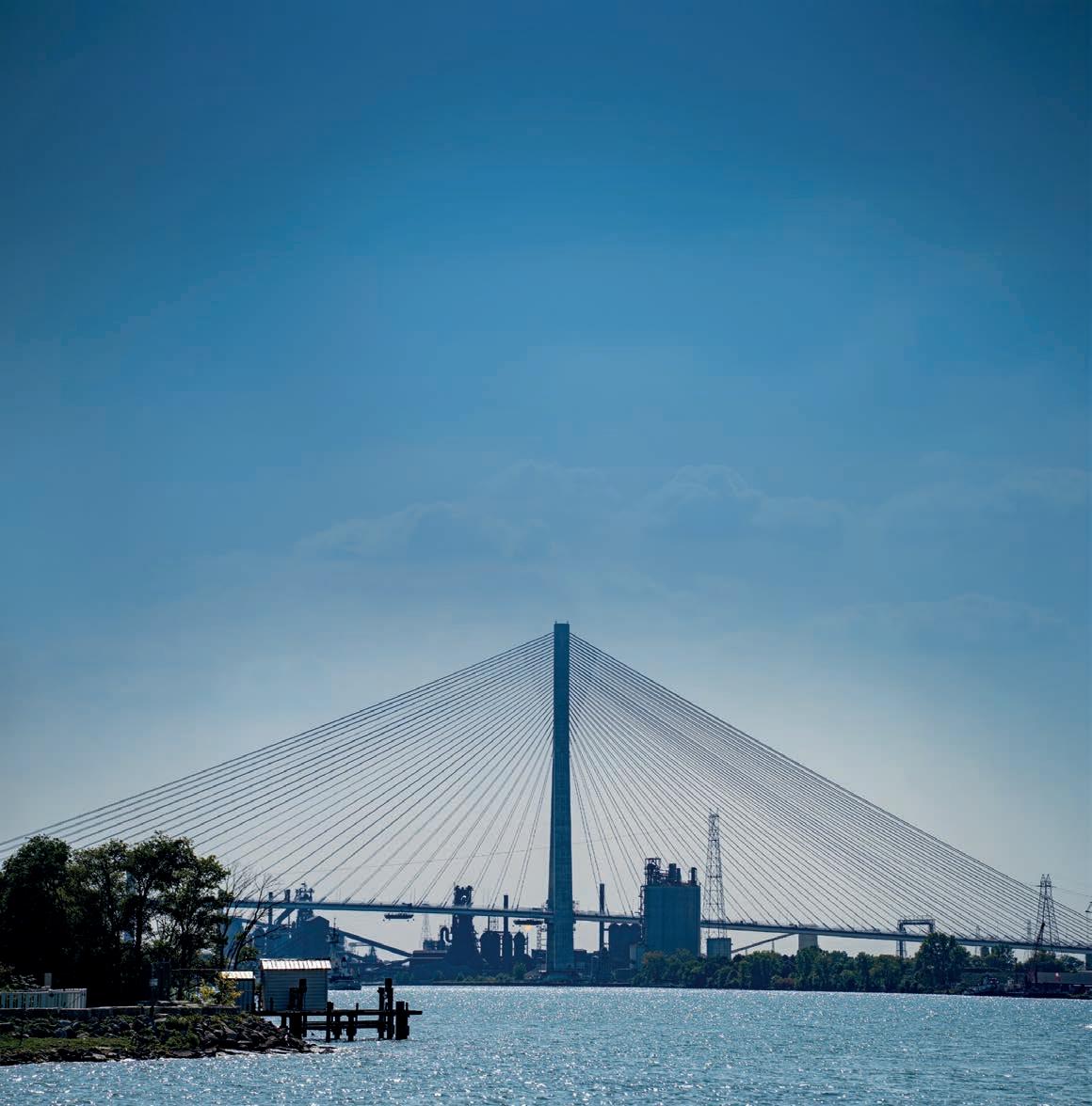
Gordie Howe will ease congestion on another nearby corridor, the tolled Ambassador Bridge.
Ledstar for lane management
One of the major traffic management features on the Gordie Howe
International Bridge is a reversible dynamic lane system (RDLS) from Ledstar, a manufacturer based in Sanford, Florida.
Standard reversible systems are designed to balance bi-directional traffic flow according to traffic demand; however, the bridge’s dynamic message approach has much more capability than the standard red X and green arrow lanedesignation system.
Instead of using typical blank-out style X and arrow signs, Ledstar provided its RDLS comprising 176 full-matrix dynamic displays.
There is a comprehensive fault and conflict monitoring failsafe system, along with 80 border plaza high-resolution dynamic message signs (DMS).
“The system is designed with dependable utility in mind for today, flexibility for tomorrow, and allows for multiple scenarios,” Ledstar vice president of business development Greg Bartlett said.
There are four main use scenarios: apportioning bi-directional travel lanes according to real-time demand; traffic managers can create clear-space safety for maintenance and traffic incident mitigation; a vehicular shoulder-use for

overflow or other mitigation conditions; a restricted-use lane designation capability beyond lane-open or laneclosed messages.
Ledstar often refers to these signs as ‘mini-DMS’. Other than size, they



With over 40 years of manufacturing expertise and a team deeply rooted in the traffic industry, Hi-Tek Electronics delivers high-quality, full-turnkey electronic contract manufacturing built for the intelligent transportation systems (ITS) sector. Our U.S.-based advanced manufacturing facility combines precision, efficiency, and scalability to support your traffic products at every stage of production — from start to finish.
Our BABA-compliant capabilities ensure dependable, end-to-end manufacturing for every project. For more information, email BABA@HiTekQuality.com

Image: Prime Global Publishing
L–R: Ledstar’s Greg Bartlett and Kyle McEwan.
are essentially the same technology used in large over-the-road DMS that are ubiquitous on roadways around the world, with the addition of interconnectivity and advanced conflict monitoring.
The high-resolution mini-DMS are capable of displaying any text, symbols or manual on uniform traffic control devices (MUTCD) graphics. This opens the systems for new uses.
For example, if the bridge management or authority wants the left lane to be designated as a highoccupancy vehicle (HOV) lane at certain times or during events, the solution is as
On your marks
Gordie Howe’s two A-shaped bridge towers stand 220m tall on each bank of the Detroit River, and 216 cable stays hold up the six-lane road deck. It has the longest main span of any cable-stayed bridge in North America at 853m, with a total bridge length of 2.5km. At its highest point, it is 46m above the water.
The bridge also has a wide range of ITS technology to help keep traffic moving, efficiently and safely:
• Tolling infrastructure: radiofrequency identification (RFID) tag readers, payment processing systems and customer account integration have been assessed for reliability.
• Trafficmanagementcentre: sensors, cameras and data systems are calibrated to provide accurate, real-time traffic information. Meanwhile, screens, software and communication
simple as changing from green arrow to the HOV+2 symbol.
Or there can be a Nexus-only lane, for Americans and Canadians holding the Nexus pre-approved border crossing permit designed to speed up customs clearance for low-risk travellers. Or, in the future, a vehicle-to-everything (V2X)-enabled-vehicle-only lane as well as a bus-only lane. In times of very heavy commercial traffic, the right lane or lanes may be designated as commercial vehicle-only.
“Whatever scenario the bridge authority requires, the Ledstar system can adapt and make lane changes
happen dynamically and, importantly, immediately,” Bartlett said.
In addition to the throughput efficiency inherent to the reversible lane system itself, there is a dramatic future-proofing through flexible lane designation, allowing operations to adapt as demands evolve.
“Who knows what kind of regulations, types of vehicles or other demands or constraints will occur five or 10 years?” Bartlett said. “But Ledstar’s reversible dynamic lane system in place will be ready to answer those future demands without the need of costly upgrades or replacements.” ITS
tools in the centre have been tested to manage activity and respond to incidents at toll lanes, both ports of entry and on the bridge. Dynamic lane management has been set up, with electronic signs, signals and barriers verified to redirect lanes safely based on traffic demand.
• Borderinspectiontechnologies: scanning, imaging and detection equipment is set up at primary inspection lanes and client processing buildings to meet governmentmandated requirements.
• Large-scaleimagingtechnology: X-ray and scanning systems for transport trucks have been inspected to ensure accurate, reliable detection for security and customs inspections.
• Securityinfrastructure: CCTV cameras, access controls, fire alarms and emergency response systems
have been evaluated to provide fully-integrated coverage for safety and security.
• Lighting: on-site and aesthetic lighting systems have been validated for proper operation, visibility and safety while meeting architectural and visual design standards.
• Communications: roadside messages, public alerts and staff networks have been checked to ensure timely, accurate information delivery.
• Heating,ventilation and air-conditioning: systems are audited to maintain proper temperature, airflow and air quality in operational facilities, control rooms and primary inspection booths.
(Source: Windsor – Detroit Bridge Authority)
Image: Erman Gunes Dreamstime.com





Cabinet under fire
Traffic



cabinets are a familiar roadside sight, and in our highly-connected transport environment, they are also high-value targets for bad actors. But help is at hand, Cisco says.
AAs roadways become increasingly connected, the traffic cabinet has evolved from a simple enclosure into a critical cyberphysical asset – and a high-value target for bad actors. For pedestrians, motorists and departments of transportation (DoTs) alike, the security of this foundational infrastructure is no longer optional; it is a prerequisite for public safety.



the vulnerability of our roadside assets. Attendees explored how easily physical access or weak credentials can be weaponised to disrupt traffic operations, turning essential infrastructure into a liability for the public.

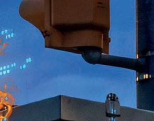
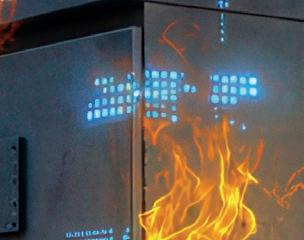
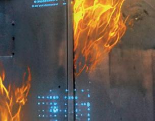
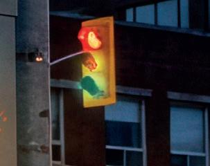
At the recent ITS Americas 2026 Conference & Expo in Detroit, Cisco addressed this reality head-on with ‘Cabinet Under Fire’, an immersive demonstration that showcased the stark difference between vulnerable and resilient roadside environments.
The demonstration highlighted a critical industry shift: moving from legacy, insecure systems to intelligent, securityfirst infrastructure. This is not merely a technological shift, though partnering with market leaders that fuse security and networking into their platforms is essential. It is a fundamental change in mindset and community engagement.



“Our traffic management systems are critical infrastructure and must be treated as such,” Cisco senior business solutions architect, transportation, US Public Sector Mark Knellinger said. “Leaving them vulnerable isn’t simply a technology risk; it’s a public safety risk.
“The consequences of a breach are real: nation-state actors can implant persistent threats, disable intersections, manipulate traffic operations or push false emergency messages during major public events. These are not hypothetical scenarios; they are risks we are seeing today.

As an industry, the ITS community must recognise, as other critical infrastructure segments have, that we are much stronger together through open understanding, disclosure and collaboration regarding cyber maturity.
The session functioned as a highstakes, live attack-and-response simulation using a fully-equipped traffic cabinet populated with real-world ITS endpoints. To illustrate the relative fragility of current systems, the attacker demonstrated how easily physical access, unsecured devices, and weak credentials can be leveraged to disrupt traffic operations.







“As we demonstrated, addressing these threats requires the entire transportation ecosystem to work together. The industry must move beyond viewing these assets as passive infrastructure and begin securing them with the visibility, resilience and practical cybersecurity controls they demand.
“Our communities depend on these systems every day, and it’s time we protect them with the urgency that critical infrastructure deserves.”
Because many existing cabinets lack the visibility to detect a breach in progress, the defender stepped in to show how modern secure networking systems, such as those found in Cisco’s market-leading industrial stack, can fundamentally change the equation.

Attendees watched in real-time as the attacker gained lateral movement across the cabinet environment, exposing the inherent dangers of flat, unsegmented networks.
The discussion in the room centred on the real-world implications of


Nation-state actors can implant persistent threats, disable intersections, manipulate traffic operations or push false emergency messages during major public events

Mark Knellinger Cisco


In real-time, the defender showcased how this architecture enables granular segmentation and proactive threat detection. When the attacker attempted to move laterally, the network’s built-in intelligence instantly contained the threat.

By deploying these systems, coupled with cyber best practices, the attendees learned how compensating controls – visibility, segmentation, inspection and remediation – can be affordably deployed directly at the edge. The defender established a robust security perimeter that was previously impossible to maintain.


By combining physical hardening with this advanced endpoint protection, the defender transformed a vulnerable, exposed cabinet into a secure, adaptable node, proving the path to resilient infrastructure starts with securing the edge.
The importance of this demonstration extended far beyond the show floor in Detroit. It served as a vital wake-up call for the transportation industry, providing DoTs and infrastructure partners with a clear, actionable roadmap to move beyond basic connectivity.


By visualising these ‘what-if’ scenarios, the session proved that while the threat landscape is rapidly evolving, the ability to build secure and resilient roadway infrastructure is well within reach.
Attendees left the demonstration with the technical insights necessary to strengthen their own ITS environments, ensuring the future of our roadways remains safe, reliable and protected against the next generation of cyber threats. ITS
































































Go with the flow




India is entering a new era of highway mobility. The world’s most populous country, with nearly 1.5 billion people, has massive potential for the intelligent transportation industry, and improving the way vehicles move on the country’s highways is an obvious point of entry for companies whose products can make a difference to traffic management.
The importance of ITS to the Indian market was underlined when the 5G Automotive Association (5GAA) and ITS India signed a memorandum of understanding last year to drive innovation in connected and autonomous mobility.


Safety is one of the most pressing reasons for the interest in ITS: 173,000 people were killed on India’s roads in 2023, with 463,000 people injured.


The Telecom Regulatory Authority of India’s (TRAI) recent consultation document on the use of vehicle-to-everything (V2X) technology, Regulatory Framework for V2X Communication, sets out the road safety case and explains how V2X can help prevent collisions; for example, by sending warning messages to and from vehicles, drivers and infrastructure.
TRAI was leaning towards the third-generation partnership project (3GPP) cellular vehicle-to-everything (C-V2X) radio along with European







India is embracing multi-lane free-flow tolling. ViaPlus, Star Systems International and Sidra Systems praise the value of cooperation in a new deployment on the Delhi–Jaipur highway.
Telecommunications Standards Institute (ETSI) ITS stack, which it said “is emerging as the most suitable choice for India due to its scalability, communication modes and alignment with future 5G networks”. So things are definitely moving.


Kapsch TrafficCom is set to deliver what it described is India’s first cooperative ITS (C ITS) project on a highway near the capital, New Delhi. Implemented with Indian infrastructure specialist Superwave Communication and Infrasolution, the pilot is designed to demonstrate how realtime connectivity and artificial intelligence (AI)-powered situational awareness can improve road safety and traffic efficiency on one of India’s key highway corridors, with a “strong focus on high risk and dynamic situations” such as temporary work zones, Kapsch said.



Drivers will receive timely, direct warnings about roadworks, maintenance vehicles, hazardous locations, traffic queues, and temporary virtual signage directly into their vehicles, allowing them to anticipate situations in advance and adapt their driving accordingly. Selected locations along the corridor will be equipped with Kapsch’s AI enabled video sensors.

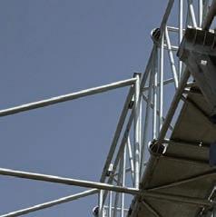
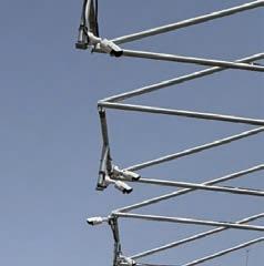
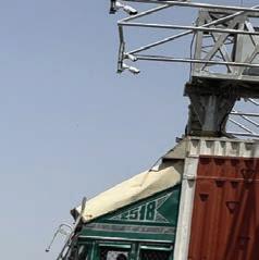
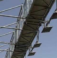







Image: Sidra Systems
The deployment at Daulatpura on the Delhi–Jaipur Expressway.




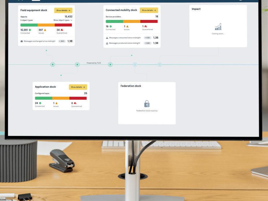


The major update to TLEX® makes deployment easier, integration faster, and scaling more controlled.
A plug-and-play ecosystem with fine-grained governance and accelerated application and AI integration enables organisations to move faster from integration to operation, delivering highimpact mobility services with greater ecosystem control and measurable results.
Discover how simplicity unlocks scalable impact.
Get a demo: monotch.com/demo

Digitising infrastructure
Along with safety, smooth travel is also an important economic driver, and there are other ITS technologies in operation on India’s roads. The introduction of multi-lane free-flow (MLFF) tolling systems across various key transportation corridors is perhaps the most visible representation of a growing trend towards digitising the country’s transport infrastructure.
The Government of India’s stated vision is to deliver citizen-centric services by “leveraging technology for enhancing ease of living and ease of doing business”, and deploying barrier-free operations at scale fits this bill. Such MLFF systems, according to the National Highways Authority of India (NHAI), “facilitate faster travel, reduce congestion, save fuel, and enhance commuter convenience”.
In addition to collecting fees from road users, part of NHAI’s wide remit is to develop, maintain and manage the country’s arterial roads (which carry an ‘NH’ prefix) for inter-state movement of passengers and goods, connecting national and state capitals, major ports and rail hubs and linking up with border roads and foreign highways.
And although the 100,000km (62,137-mile) NH network, including expressways, constitutes of only around 2% of India’s roads, it carries 40% of the total road traffic.
Enhancing transparency, reducing operational costs associated with setting up of physical toll plazas and improving overall efficiency in toll operations are the prizes MLFF offers for Indian authorities. Such systems enable vehicles to travel at highway speeds while automatically paying for tolls, which are identified, validated and processed in real-time.

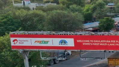
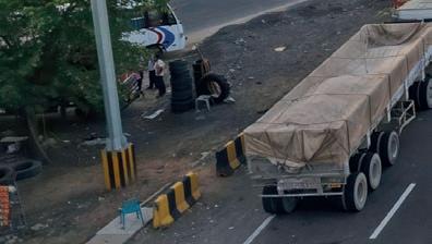

Indeed, NHAI has successfully launched MLFF-based tolling systems at the Chorayasi Toll Plaza on the Surat–Bharuch section of NH-48 in Gujarat and at the Mundka Bakkarwala Toll Plaza on the Urban Extension Road-II (UER-II) in Delhi.

This is 24/7. It cannot fail. A missed transaction is lost revenue. A stopped lane is a stopped highway
Carl
Brown Sidra Systems

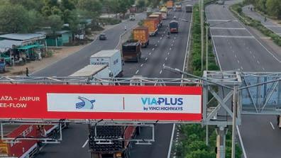
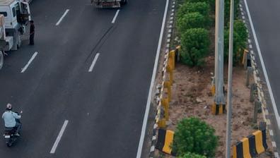
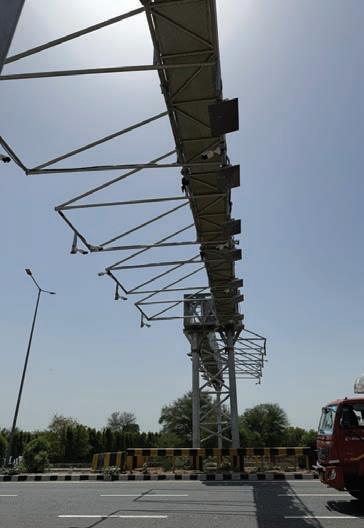
The latest such scheme to open is located in Daulatpura on the Delhi–Jaipur Expressway, the 242km (150-mile) six-lane expressway which connects New Delhi with the state of Rajasthan on the NH-48, carrying 10 million vehicles each year.
The deployment features Sidra Systems’ Parsec lane controller system and Star Systems International’s Titan Pro readers and Avior antennas. As the systems integrator, ViaPlus led the endto-end delivery of the Daulatpura project in just five months, in partnership with Airtel Payments Bank for Indian Highways Management Company Limited (IHMCL), a joint venture led by NHAI.
“Daulatpura is a milestone for ViaPlus and for India’s transition to barrier free tolling, demonstrating our ability to deliver at speed and scale on one of the country’s busiest corridors,” India at ViaPlus chief

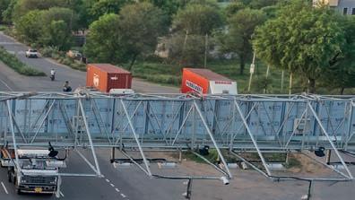
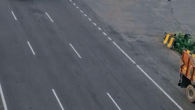


More MLFF deployments are planned as India moves to smarter roads.
The deployment features Sidra’s Parsec lane controller system.
This is NHAI’s third MLFF deployment to date.
executive officer (CEO) and country head Shreenivas Prabhakararao said.
Behind the deployment is a technology ecosystem designed to keep traffic moving while processing millions of tolling transactions in real time.
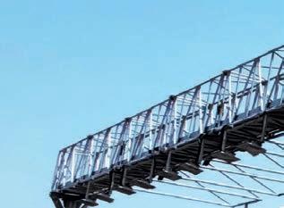
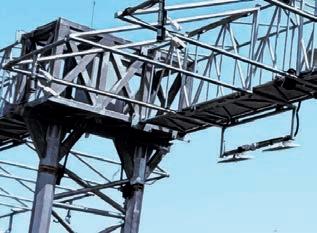
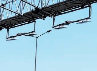
The site features a new lane system, overhead vehicle detection and classification sensors, and ViaPlus’ Alpha backoffice platform and AI-based Sightline image review technology to process licence plate transactions.
Vehicles are identified by their onboard FASTag – India’s electronic toll collection system – or by automatic number plate recognition (ANPR). The Daulatpura project “marks another significant step towards NHAI’s vision of providing a world-class, efficient, and technology-driven highway network across the country”.
Highway users need to ensure their vehicles are equipped with a valid and active FASTag, and that they have sufficient balance in their FASTag accounts to avoid
any inconvenience during travel. If there is insufficient balance, or an invalid or non-functional FASTag, users are issued an e-notice, with payment required within 72 hours. The user fee will then be charged at twice the normal rate of the vehicle category.
Since India’s tolling ecosystem is built on FASTag and the National Electronic Toll Collection (NETC) framework, MLFF cannot operate as a standalone system; it must interact seamlessly with the existing acquiring bank and issuer bank infrastructure.
Ensuring MLFF-generated transactions are correctly formatted, timestamped and routed through the NETC switch in a way that mirrors conventional toll plaza behaviour requires careful protocol alignment. Any deviation risks settlement failures or disputes with issuer banks.
For ViaPlus, it was a challenge unique to the Indian market and which required close coordination with IHMCL, National Payments Corporation of India (NPCI) and its acquiring bank partner to get right.
The subsidiary of Vinci Highways is already embedded into India’s

Daulatpura is a milestone for ViaPlus and for India’s transition to barrier free tolling
Shreenivas Prabhakararao ViaPlus
transportation ecosystem. In 2025, ViaPlus’ Alpha platform processed more than 2.7 billion of the country’s electronic toll collection (ETC) transactions, a significant chunk of the company’s activity: ViaPlus facilitates over 4.2 billion mobility transactions globally each year.
“This success builds on our strong foundations in India,” Prabhakararao said.
“Our back-office platform already processes over 40% of India’s ETC transactions and was enhanced within the five-month delivery period to support free-flow transactions, violations and multiple vehicle classifications.
“These modifications … reinforce our leadership in advancing multi-lane freeflow tolling for faster journeys and more connected highways.”
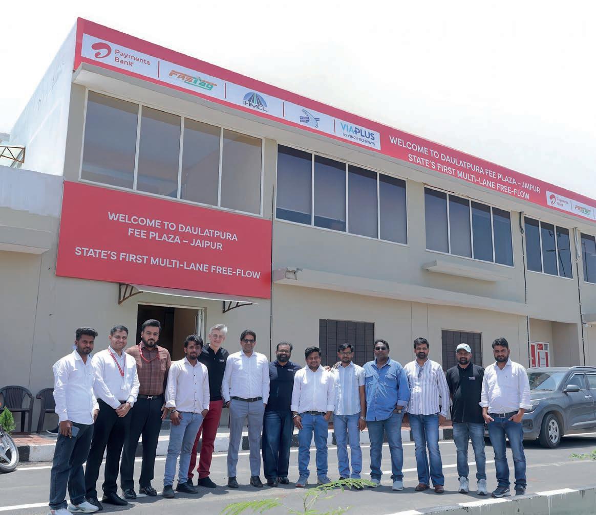

The team at ViaPlus India.

































‘Four hard problems’ MLFF deployments are, by their nature, collaborative.
“Free-flow tolling demands uncompromising performance,” Tarun Ahlawat, director of Star RFID and Systems India, which provides the readers and antennas for Daulatpura, said. “Our highperformance reader and antenna systems provide rich datasets to ensure maximum transaction accuracy and deliver the seamless free-flow experience.”
According to Sidra Systems CEO Carl Brown, free-flow tolling presents “four hard problems” that have to be solved, the first of which is at the roadside.
“We define the gantry design and geometry,” he said. “Then we deploy Parsec, our software and hardware road controller. Parsec detects the vehicle with RFID [radio frequency identification], AVI [automatic vehicle identification], LiDAR [light detection and ranging], and radar, and classifies it.”
This allows the tolling transaction to be carried out at highway speed.
The second hard problem is related to data; specifically, “getting that data home”.
“Parsec holds transactions on the road for seconds or weeks, whatever it takes,” Brown said. “Then it replicates them redundantly to multiple back offices through Sidra Nebula. Nothing gets lost.”

The third issue is toll collection.
“ViaPlus took our base design, engineered the site, built it, and deployed Parsec on it,” Brown said. “They ingest the transactions into their back office and turn them into tolls actually paid. That work is as hard as the roadside. We hand off clean data, they close the loop.”
The fourth problem is perhaps the toughest: making sure all aspects of an MLFF deployment keep running.
“This is 24/7,” Brown said. “It cannot fail. A missed transaction is lost revenue. A stopped lane is a stopped highway. We built Sidra to operate these systems, not just install them.”
With Daulatpura now operational, attention is already turning to the next stage of India’s MLFF rollout
Brown described working with ViaPlus as an “excellent” experience, and he is looking forward to the companies’ next deployment together.
“Badarpur is starting now, and I expect we will run even faster next time,” he said.
The Delhi–Faridabad Skyway at Badarpur, New Delhi, sits along one of northern India’s busiest corridors, serving hundreds of thousands of daily commuters. Again, the contract is awarded through Indian banks under IHMCL.
ViaPlus will once more deliver its Alpha back office platform, integrate

Free-flow tolling demands uncompromising performance
Tarun Ahlawat
Star RFID and Systems India
roadside systems in collaboration with Sidra, and implement the Sightline image review technology to process licence plate transactions for vehicles without FASTag.
And this is emphatically not the end of the road for MLFF in India. NHAI is planning to change toll plazas at Shahjahanpur and Manoharpur to MLFF systems, making commuting on the busy Delhi–Jaipur section seamless and barrier-free.
NHAI wants a world-class, efficient, and technology-driven highway network across the country.
Safety is an issue that will undoubtedly rise to greater prominence for ITS providers as time goes on. But, for now, MLFF highlights that the technology to enable smarter roads is here, and India is determined to take advantage. ITS
The expressway carries 10 million vehicles each year.










Routemasters




Simplifai Systems is using an AI-powered solution to control traffic signals and help Glasgow’s buses to run on time. Kevin Borras jumps on board.
Simplifai Systems’ patented artificial intelligence (AI)-powered solution is designed to dynamically control traffic signals and optimise urban road networks – and it has made the public transport system run more efficiently in the Scottish city of Glasgow.
The cloud-based software aims to reduce congestion, manage event traffic, and improve bus reliability and air quality. The technology was developed in collaboration with Professor Mauro Vallati, director of the University of Huddersfield’s Centre for Autonomous and Intelligent Systems, and his AI4UTMC research team.
A fundamental shift
While Vallati sees myriad opportunities for AI to make a difference to the inner workings of a city, he suggests the integration of connected and autonomous vehicles (C/AVs) into urban traffic control and management systems as perhaps the most salient.
“For the first time, C/AVs offer traffic authorities the ability to directly influence and control traffic flow through individual vehicles, rather than relying solely on indirect mechanisms such as signal timing and infrastructure-based interventions,” he said.
This represents a fundamental shift in how traffic can be managed.
“C/AVs act not only as road users but also as distributed, mobile sensing




platforms, capable of capturing and transmitting real-time data from areas that are currently under-instrumented,” Vallati said.
“This significantly enhances situational awareness for traffic authorities.
“In this context, AI becomes a critical enabler for managing the resulting complexity and leveraging the new possibilities.”
The practical implications of this shift are already becoming evident in cities applying AI to address long-standing transport challenges.
Brian Davison, engineering officer at Trafficom, Glasgow City Council’s traffic department, was tasked with solving the seemingly complex problem of Glasgow’s bus reliability.
The city’s baseline was roughly 1000 signal-controlled sites, with close to 600 using SCOOT (split cycle offset optimisation technique) adaptive control and a bus-priority layer that ingests operator geolocation, covers 150 junctions, handles up to 70,000 bus priority requests daily, and automates assistance for about 10,000 buses.
“We’d been talking with Simplifai for a number of years about what might be possible, and they’ve shaped their algorithm and their system to try and point it towards what we’re trying to do,” Davison said.
“SCOOT’s our preferred method of controlling the traffic because Glasgow’s a really dense city and it works really well.



And we have a bus priority system sitting on top of SCOOT where we already scrape data from bus operators.
“We track all their buses in real-time, and we’ve shared geolocations for key intersections with them. That’s already in place.
“But we’ve noticed SCOOT eventually gets to a point where it starts to freak out and it says, ‘I can’t do anything with all this traffic’ and it starts intentionally dropping the cycle time and reducing stage lengths just to keep everything going.”
The results were more significant than Glasgow had anticipated.
Glasgow City Council did not want to spend cash building another system to check its existing system – or, even worse, building all-new detection systems.
Glasgow chose Simplifai because it could use existing SCOOT detection data rather than requiring new roadside infrastructure. The platform analyses historical patterns to predict upcoming peak periods and recommends improved signal plans.
Trafficom ran a test that found journey times of around 600 seconds on the outbound route in the evening.
“Simplifai reckoned it could get it down to 230 seconds, which is a massive difference,” Davison said.
His next job was manually entering the plans that the AI had created.
“We’ve been experimenting at different times of day with AI-written

They’ve shaped their algorithm and their system to try and point it towards what we’re trying to do
Brian Davison Trafficom
plans tosee if they are as good as the AI thinks they are, as a way of testing the model,” Davison said. “And, so far, it’s been pretty accurate.
“One of the early things the Simplifai system did was discount pedestrian crossings, but we discovered that pedestrian crossings on the test corridor at certain times of day are really busy and they have a massive detrimental effect on the flow.
“The model was wrong when the crossings were busier, so Simplifai re-did the model to encode the pedestrian crossings. And that’s the stage we’re at now: refining.”
But achieving better outcomes is only part of the challenge; earning operators’ trust is just as important.
“In the early stages, we’re allowing it to make its models and make its suggestions,” Davison said. “And then we’re deciding to put them in.
“We’re monitoring them very closely to see how accurate they are and then, as we identify issues – which we have done – the accuracy should improve. Then we’ll get more confidence that what it’s suggesting is going to be closer to the truth.
“One of the things we also have is an entirely separate journey-time system based on Bluetooth, and we’re going to use that to compare journey times on the target route with what Simplifai thinks the journey times are. And that will continue, even when we’re a bit more confident that its predictions are accurate. We’re still going to use that for checks and balances.”
AI is not actually changing plans, according to Davison.
“What it is going to do is suggest to our operators that you should change plans,” he said. “And then the operators can decide ‘yes’ or ‘no’ depending on a number of factors, such as if there’s a huge concert in the city or a football match coming up.”
Building bridges
Glasgow, then, has seemingly taken Simplifai and its AI-powered solutions on a slight detour.
The city is using the system almost as a supplement to its existing system. Far from merely filling in the gaps, though, it’s using it to construct bridges over yawning chasms of missing data.
And Simplifai chief executive officer (CEO) Keith McCabe is more than happy with that.
“We’re complementing their existing control techniques,” he said.
“From our point of view, we want to work with authorities that are prepared to try new things and often the motivation to try something new is based on a frustration with the ability of their existing systems to solve the problems.”
In simple terms, Glasgow, like most local authorities, wants its buses to run on time and for key corridors to have reliable journey times to help ensure people don’t get frustrated moving around the city.
High notes: buses are now running more smoothly in Glasgow.
“I think in the past you could look at a typical morning peak and a typical evening peak and just create something for that scenario, as it solves 90% of the problems,” McCabe said. “But in Glasgow, like with all cities, the situation changes from day to day, and the reasons people and goods move around changes most days, too.
“Our starting point is exactly that: if you have tools that can deal with it you’ve got the possibility of coming up with outcomes that you want, because you’re dealing with the real problem, not an imagined problem.”
McCabe, who until recently was chair of the ITS UK Smart Environment Interest Group, has been working in AI for decades, as have the co-founders of Simplifai and co-inventors of the technique.
“We tend to look at it as a toolbox of techniques, and what you’re trying to do

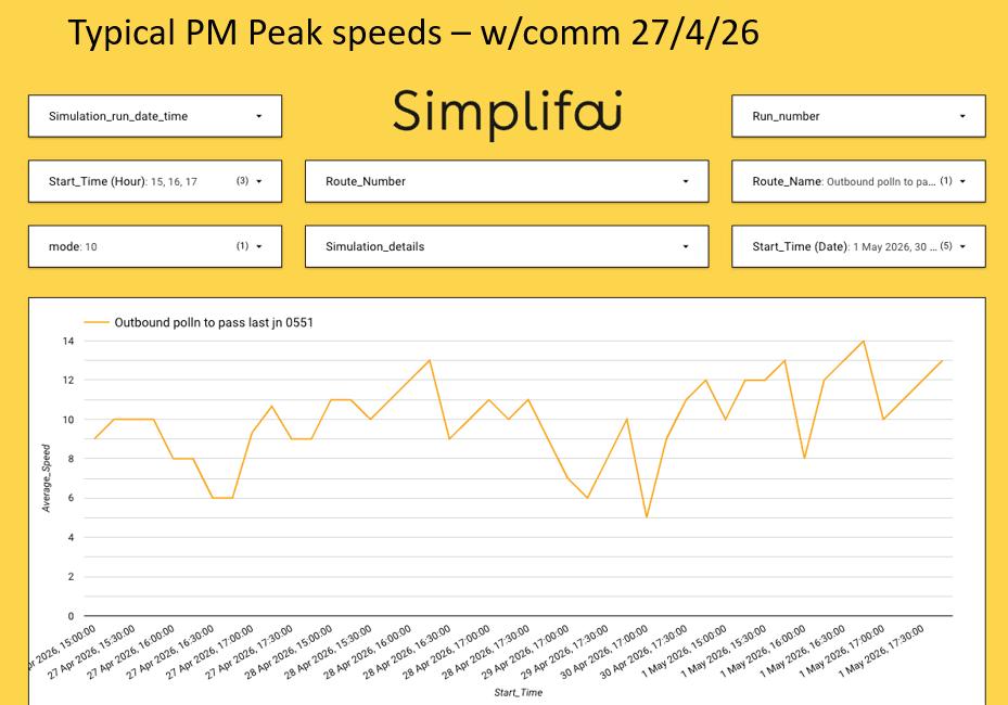
is find the most appropriate techniques to solve the problem that you’re looking at,” McCabe said. “We don’t take the approach that AI will solve all. It’s about, ‘What is the technique you need to use to address this issue and how should the technique be applied?’”
Rather than attempting to replace traffic engineers, McCabe said Simplifai’s approach was to capture their expertise
and apply it at greater scale. The company ultimately adopted a planningand-scheduling technique that embeds traffic engineering knowledge into the AI, enabling it to analyse complex scenarios and recommend solutions in real-time.
“The key to an effective solution is to have the humans, in this case the city authorities, at the helm of the AI system,” he said.

The Prime Mover in Intelligent Traffic Solutions
Q-Free delivers open, secure, and scalable systems that advance tolling, transform traffic management, and pioneer new road user charging models. Trusted across Europe, Asia, Australia, and the Americas to modernize mobility and simplify every journey.
Modern mobility starts here.

The key to an effective solution is to have the humans, in this case the city authorities, at the helm of the AI system
Keith McCabe Simplifai
For McCabe, the Glasgow project demonstrates that AI delivers its greatest value when paired with local expertise.
Collaboration is clearly key to a project’s success, but it would be wise not to underestimate the power of local knowledge, an invaluable attribute that AI doesn’t necessarily possess.
“The technique we’ve invented is best used in conjunction with innovative cities like Glasgow and towns such as Blackpool, McCabe said. “We’ve had approaches from other cities around the world about using this technique, but also from those technology partners, both large and small, who want to make that technical leap to invent the stuff for the next 30 years for their country.


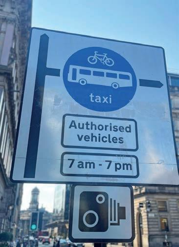
“Those are the ones we really want to collaborate with; the innovative cities, of course, but also the technical partners in each country who can then customise it to what their local needs are.”
McCabe believes local knowledge is the ability to understand the nature of the problem you’re trying to solve.
“We have the ability to either think beyond what’s gone before or actually collaborate in a way that creates something








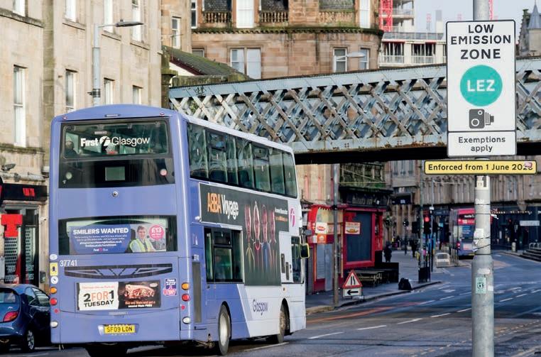
that is more than the knowledge of the individual parts and make an intellectual breakthrough,” he said.
“A lot of that local knowledge is through data, because the data gives you an insight into the way a city works and then creates solutions, but you need the people in the control room to validate those solutions and to really understand whether it’s achieving what you set out to achieve.
“Through the analytical side and the solution side, people who have been working in control centres for years will start to learn new things and understand more about the complex nature of the thing that they have been managing almost without thinking.
“Now it makes it into a conscious thought process that they can then work through as a problem.” ITS
EASING CITY TRAFFIC

Bus operating in Glasgow’s low-emission zone.
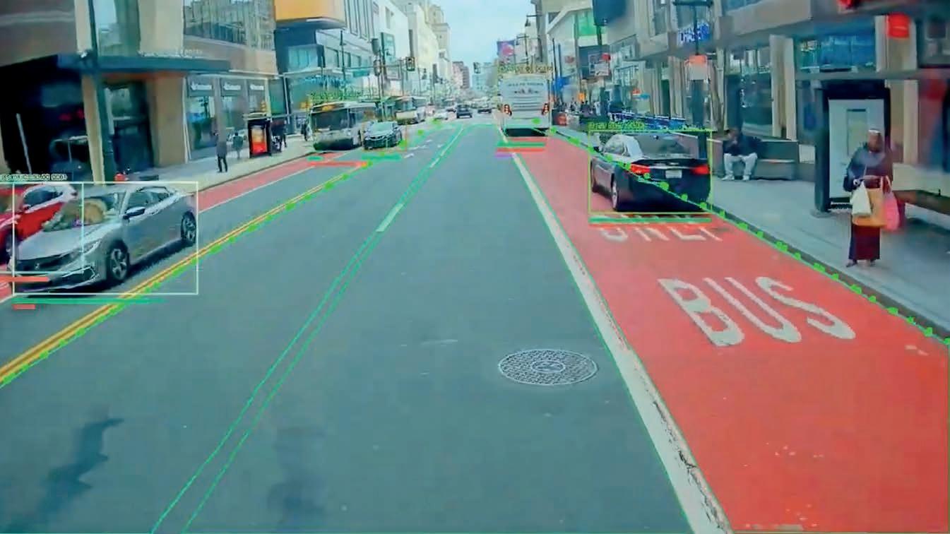
Make way for the bus
In just a year, Philadelphia significantly improved bus service with automated camera enforcement. Here’s how.
Philadelphia is known for many things: cheesesteaks, the Liberty Bell, and winning Super Bowls, to name a few. But we should add “clear bus lanes” to that list.
Since April 2025, the Philadelphia Parking Authority (PPA) has pioneered a new way of enforcing parking violations that obstruct public transit bus services. In partnership with the Southeastern Pennsylvania Transportation Authority (Septa), PPA worked with Hayden AI to install our vision artificial intelligence (AI) technology on 152 Septa buses and 38 trolleys.
Unlike stationary cameras, Hayden installs automated camera enforcement technology on transit vehicles themselves – the buses and trolleys that connect riders with destinations across the city every day. This enables cities to enforce entire transit corridors, not just certain stops or blocks. Mobile camera enforcement increases the coverage of enforcement technology and expands its impact on transit reliability, accessibility and safety. Hayden AI’s vision AI technology, with forward-facing cameras mounted behind the windshields of transit vehicles, detects parking violations automatically and on the edge. Instead of recording hours and hours of video footage that must be manually reviewed, this system generates only short video clips documenting each potential violation, which PPA parking enforcement officers review before issuing
a ticket by mail to the registered vehicle owner of the violating vehicle.
This method has resulted in a significant decrease in parking violations in bus lanes, no stopping zones, and bus stops in Philadelphia – in just a year. Here’s how the PPA, Hayden AI, and other stakeholders brought bus-mounted camera enforcement in Philadelphia.
Raising average bus speeds
Like many cities, Philadelphia’s bus lane network is growing. The City of Philadelphia established multiple bus lanes in Center City – Philadelphia’s downtown core – over the last five years, but illegal parking in these lanes makes it challenging for transit riders to reap the full benefits.
Philadelphia’s average bus speed is roughly 8mph, well below the 13–14mph national average. As ITS International reported last year, Philadelphia city officials have estimated that Center City congestion costs Septa riders a combined 1.7 million hours of delay annually and adds more than $15 million a year to the transit agency’s operating costs. Illegallyparked vehicles at bus stops were also creating accessibility problems, since a single car blocking a bus stop can prevent a bus operator from safely deploying a wheelchair ramp, and thus a person using a wheelchair from safely boarding.
To learn how frequently parking violations were occurring in Philadelphia’s bus lanes and bus stops, and how these violations impacted transit service, Septa
conducted a pilot project with Hayden AI in the spring of 2023. AI-powered cameras were mounted inside seven Septa buses running routes 21 and 42 through Center City and West Philadelphia, and the technology automatically detected vehicles parked illegally in bus lanes and at bus stops along Chestnut and Walnut streets. No tickets were issued.
The results were striking. The technology detected 36,392 total parking obstructions along these two bus routes in just 70 days, and, there were 4174 obstructions in bus lanes in Center City. The number of illegal parking events at bus stops in West Philadelphia was significantly higher: 32,218 instances of cars and trucks blocking accessible and safe boarding for transit riders.
The pilot’s findings led directly to action. On November 9, 2023, then-mayor Jim Kenney signed Bill No. 230489 into law, authorising camera-based enforcement of parking, stopping and standing violations that interfere with mass transit in Philadelphia.
The ordinance covers Center City and Market, Chestnut, and Walnut streets and JFK Boulevard between Front Street and 63rd Street (the City’s western limits), as well as all streets with trolley service. This gave the PPA, working with Septa, the ability to take what Hayden AI had demonstrated in the pilot and turn it into an enforcement programme that could issue tickets and change driver behaviour.
The system generates short video clips documenting each potential violation.
Image: Philadelphia Parking Authority
The PPA launched its Automated Bus Camera programme in partnership with Septa in April 2025. It started with just 25 Septa buses equipped with Hayden AI technology enforcing three critical, highridership routes, including 21 and 42, the two pilot routes. By June of that year, 152 buses were equipped with this technology to enforce parking violations in bus stops, no-stopping zones, and double parking, along 16 bus routes.
PPA’s first full year of data shows this technology making a significant impact. Comparing June 1–27, 2025 – the first month where all 16 routes were being enforced – with June 1–27, 2026, nostopping violations decreased from 7445 to 3645, a 51% drop. Bus stop violations fell from 6014 to 4376, down 27%. The scale of the decline shows that drivers are learning, in large numbers, to not park illegally in no-stopping zones, bus lanes, and bus stops.
Block-level data
The block-level data tells an even clearer story. At the blocks where violations were highest at the start of the automated enforcement programme, the reduction in violations has been dramatic. In Center City, Chestnut Street at S 16th Street went from 545 no-stopping violations to 56, a 90% reduction. Market Street at S 13th Street fell from 515 to 22, down 96%, one of the largest declines anywhere in the programme. Market Street at South 10th, 8th and 11th streets each saw drops between 70–83%.
Bus stop violations show the same pattern. In West Philadelphia, Walnut Street at S 42nd Street dropped from 448 violations to 99, a 78% reduction. In Center City, S 19th Street at Moravian Street – a bus stop right above Rittenhouse Square, one of Philadelphia’s busiest parks –posted similar results, with 78% fewer bus stop parking violations.
For a rider waiting at one of these bus stops, these reductions in bus stop parking violations are the difference between a bus that can reliably pull up to the kerb and one that can’t.
Philadelphia’s results mirror the impact that Hayden AI’s automated enforcement technology makes in other US cities.
In Santa Monica, where the city’s Big Blue Bus buses are equipped with the same Hayden AI technology utilised in Philadelphia, there were 67% fewer bus lane parking violations and 40% fewer bus stop parking violations in March 2026 compared to July 2025, when the programme began. At the location with the highest number of bus lane violations, the drop was 73%.
In March 2026, the PPA and Septa expanded the programme to trolleys, launching automated camera enforcement of parking violations that obstruct trolleys and trolley-stop zones. This made Philadelphia the first city in the US to enforce trolley zones with trolley-mounted cameras. It also marked a milestone for Hayden AI: the company’s first successful installation on trolleys, expanding its impact beyond buses and parking enforcement vehicles to a third vehicle type.
The PPA’s bus-and-trolley automated camera enforcement programme is also a useful example for any city wrestling with competing demands on kerbs. Kerb space is becoming more contested, from delivery vehicles picking up or dropping off to cyclists utilising new bike lanes to drivers looking for on-street parking. Mobile automated enforcement can give cities data on how kerbs are being used – and abused – to help determine changes, such
as changing the length of bus stop zones or creating dedicated loading zones.
Genuine impact
In just over a year, the PPA has demonstrated what’s possible when cities deploy bus-mounted, vision AI technology to enforce parking violations that obstruct buses. No-stopping violations in the enforcement area were cut in half. Bus stop violations decreased by 27%. At the worst blocks, violation reductions range from 70% to 96%.
These gains represent thousands of transit trips where a bus could pull to the kerb, safely deploy a wheelchair access ramp, and keep moving on schedule. Driver behaviour has changed, and the data shows it’s holding. Everyone at Hayden AI is proud the technology is helping make a meaningful impact on the safety, reliability, and accessibility of bus service in Philadelphia. ITS






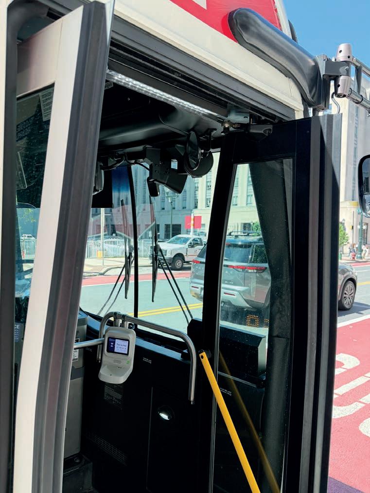
Image: Hayden AI
Unlike stationary cameras, Hayden installs automated camera enforcement technology on transit vehicles themselves.
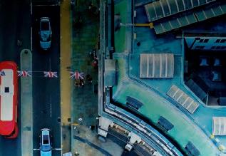


IN SYNC

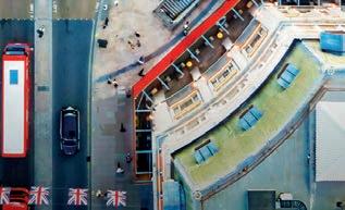



A
European research project is looking to advance multimodal traffic management to create more resilient transport networks: Synchromode.
Managing urban and regional transport networks is becoming an increasingly significant industry challenge. Traffic management centres and public authorities are no longer dealing solely with private vehicle flows and fixed traffic signal plans; they must now coordinate public transport, logistics, demand-responsive mobility, connected vehicles, roadworks, major events, incidents and changing travel demand – often under severe time pressure.
Such a growing complexity requires a new generation of traffic-management solutions. Cities and regions need tools that can combine data from multiple sources, assess the reliability of that data, predict how traffic conditions will evolve, test alternative responses, and support coordinated action among stakeholders.
Across Europe, research organisations, technology providers and transport authorities are now working together to develop more integrated and predictive approaches to traffic management capable of responding to these growing demands.
One such initiative is Synchromode, a Horizon Europe research and innovation project that brings together 16 partners from six countries and focuses on the development of advanced traffic management solutions for synchronised and resilient multimodal transport services.
Synchromode solutions aim to enhance multimodal network and traffic management by developing
novel methods, algorithms, tools and stakeholder collaboration mechanisms. Its objective is not only to improve how traffic is monitored but to support better decisions before, during and after disruptions. This includes planned events, roadworks, incidents, recurrent congestion and new multimodal service concepts.
At the centre of the project is the Synchromode Toolbox, a modular framework designed to support public authorities, traffic management centres, transport operators, logistics providers and technology partners in planning and operational environments.
Its four-pillar structure reflects the reality of modern traffic management.
Better decisions require more than isolated data feeds or individual control measures; they require a connected workflow in which data are collected and checked, mobility patterns are analysed, traffic conditions are predicted, management scenarios are tested, and selected strategies are coordinated among the relevant actors.
The project is focused on advancing several key capabilities:
Integration of multi-source data quality assessment and enhancement
Traffic-management systems increasingly rely on data from road sensors, floating car data, public transport systems,
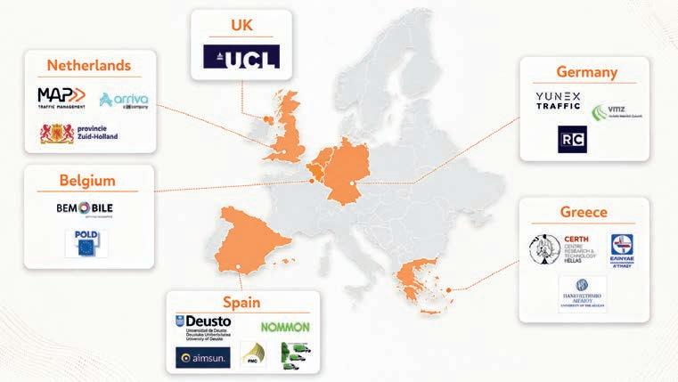
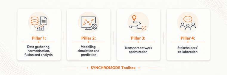
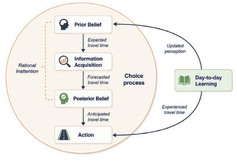
navigation services, events, incidents and other operational sources. However, these datasets are not always complete or consistent.
Synchromode therefore gives strong attention to assessing data quality and improving the usability of data before they are used for prediction, simulation or decision support.
Traffic pattern analytics
Synchromode provides a more detailed understanding of how vehicles move, where bottlenecks form, how turning movements evolve, and how traffic spreads across main and secondary roads. This supports operational monitoring and the calibration of simulation models.
Behavioural response to information-rich decision-making
Synchromode advances the way trafficmanagement models represent travellers’ responses to information. In real-world situations, travellers do not always react immediately or perfectly to traffic alerts, route guidance or disruption messages. They may rely on habit, ignore minor changes, or update their expectations only when conditions change substantially.
The behavioural-response work developed in Synchromode captures this more realistic decision-making
Behavioural learning and decision-making under imperfect information.
process by modelling how travellers form expectations, process information, and learn from experience over several days. This is particularly relevant for roadworks, incidents and planned events, where the effectiveness of trafficmanagement measures is influenced by the actions of authorities and the way travellers interpret and respond to the information provided.
Travellers start from prior beliefs about travel time, process available information selectively, form updated expectations, and choose an action such as route or departure time. The experienced travel time then feeds back into day-to-day learning, gradually updating future expectations.
Advanced
rapid metamodels
Synchromode developed fast metamodels that can approximate the results of detailed traffic simulations. This is important because full traffic simulations can be too slow when authorities need to compare many possible roadwork plans, capacity restrictions or disruptionmanagement strategies.
The metamodel acts as a surrogate: it learns from many simulated scenarios and can then estimate the likely traffic impacts of new scenarios much more quickly. This allows planners and traffic-management
centres to screen alternative interventions, identify problematic road sections, and support optimisation without running a full simulation.
The metamodel not only provides a predicted impact but also helps assess uncertainty, which is valuable for operational decision-making in that it shows where the model is more confident and where predictions should be treated with caution.
GNN-based network representation and prediction
Synchromode further explored graphbased prediction methods that represent the transport network as a connected system rather than isolated road links.
In this approach, road segments are treated as connected elements and the model learns how congestion or changes in one part of the network may affect other parts over time. This is especially useful for regional networks, where roadworks, major events or seasonal demand can create knock-on effects across multiple corridors.
The developed spatio-temporal graph model is designed to support networkwide prediction of traffic indicators such as speed and travel time, with applications
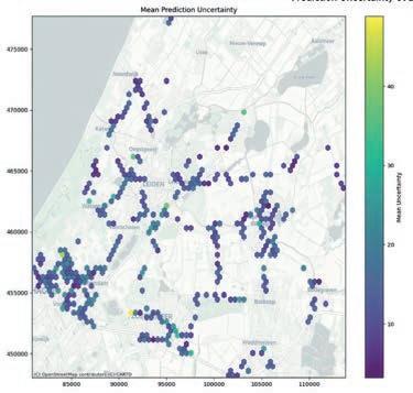
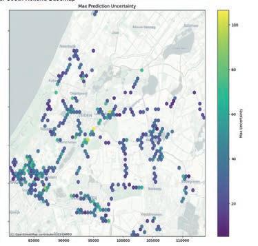
Spatial distribution of metamodel prediction uncertainty.
The Synchromode Toolbox four-pillar structure reflects the reality of modern traffic management.
in Thessaloniki and South Holland case studies, including event-related traffic management.
The Synchromode approach has been tested through three complementary case studies, each of which addresses a different multimodal traffic management challenge, allowing the Toolbox to be tested across urban, regional and serviceplanning contexts.
The focus in Thessaloniki, Greece, is on multimodal traffic management for urban and peri-urban transport networks.
Better decisions require more than isolated data feeds or individual control measures
The city faces congestion caused by planned events, roadworks, major activities, accidents, extreme weather and peak-hour over-utilisation of infrastructure. These conditions lead to increased travel times, bottlenecks and environmental impacts.
More than 800km of road network is monitored in real-time, including 10 main corridors, 77 signalised intersections, 10 city areas and three major multimodal hubs: the airport, the intercity bus station, and the railway station. More than 10 multi-source datasets are ingested and
fused, while the system has processed more than one million planned and unplanned events.
The case study reports more than 96% accuracy for multi-source and multihorizon prediction, and more than one million congestion and incident reports shared through the GPS navigation app Waze, informing or rerouting more than 15,000 unique drivers.
In the Netherlands, the project focuses on Zuid-Holland, a densely-populated region facing major challenges related to housing growth, sustainability, road safety and ageing infrastructure. Road construction works and large-scale seasonal events can create significant disruption, making smart mobility planning and intelligent traffic management essential.
The Dutch case study supports datadriven roadworks planning and smart traffic management. It demonstrates the value of a common operational picture, where real-time and historical information, prediction models, dashboards and in-car communication can be shared among stakeholders. In the Keukenhof area between Amsterdam and The Hague, the approach supported improved navigation, cooperation with more than 18 stakeholders, 124,000 in-car messages, 67 comprehensive traffic reports and a reported 21% reduction in incidents.
In Madrid, Spain, Synchromode focuses on enhanced collaboration between mobility and logistics operators. The case study examines the integration of public transport, demand-responsive transport (DRT) and last-mile delivery services, and the objective is to explore how people and goods can be transported more efficiently by coordinating public buses, DRT services and logistics vehicles.
The Madrid case tests modules for public transport and DRT demand prediction, freight-on-transport, route optimisation and public transport service key performance indicators (KPIs). It supports strategic and operational decision-making, including the identification of poorlyserved areas, demand prediction, scenario assessment, cost estimation, service monitoring and optimal integrated route planning. The results show that integrating public transport, DRT and logistics can improve system efficiency, optimise existing resources, reduce kilometres travelled and emissions, and enhance coverage in low-demand areas.
While each case study addressed different operational challenges, together they highlight the broader capabilities and benefits of the Synchromode approach.
Across the case studies, Synchromode
A BETTER
























Synchromode reports expected benefits including 5–10% reduction in traffic congestion … 10–25% reduction in empty vehicle trips … and 5–10% fewer transportrelated emissions
directly relevant to future multimodal traffic management. These include:
• vehicle trajectory processing
• multi-source data quality assessment
• roadworks planning and impact assessment
• network load balancing
• social routing optimisation, including connected and automated vehicles
• real-time bottleneck identification
• traffic state and disruption prediction
• AI-assisted activation of traffic management scenarios
• integration with commercial navigation services
• DRT demand estimation
• public transport KPI assessment
• synchronisation of public transport, DRT and logistics services.
The project’s impact targets are equally important and Synchromode reported a range of measurable operational and environmental benefits, including:
• 5–10% reduction in traffic congestion

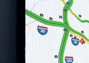
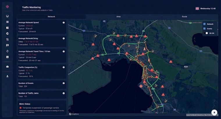
• 5–10% shorter journey times
• 10–25% reduction in empty vehicle trips for public transport and logistics deliveries
• 5–10% fewer transport-related emissions, including CO2 (carbon dioxide), SOx (sulphur oxides), NOx (nitrogen oxides) and noise.
The Toolbox has also attracted interest beyond the project sites, including from Athens and Dublin, and can be used either as a standalone solution or integrated with

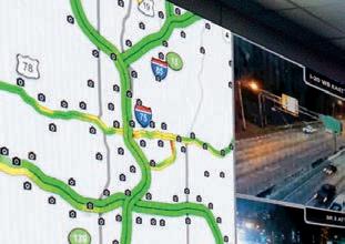
existing commercial systems. ITS
The research reported in this article has been supported by European Union’s Horizon Europe research and innovation programme under Grant Agreement No 101104171, project Synchromode.
For more information about the project, contact coordinator Evangelos Mitsakis (emit@certh.gr) or scientific and technical manager Manos Chaniotakis (m.chaniotakis@ucl.ac.uk), or visit www. synchromode.eu




same company you trust for digital roadway displays now has a solution for Traffic Management Centers.










Real-time network monitoring.












Invisibility is the true measure of success


Drivers expect their toll accounts to function seamlessly across regions and agencies.
Scalable architecture and data-driven optimisation point the way to seamless mobility systems that operate with accuracy, consistency and trust, Pankaj Lembhe writes.
Interoperability is a key objective of tolling systems. Drivers expect their toll accounts to function seamlessly across regions and agencies. They want trips recognised, charged accurately, and reflected correctly in their accounts, without concern for agency boundaries.
For agencies, meeting this expectation requires a complex technical and operational framework. Interoperability involves more than just reading transponders; it requires coordination across roadside systems, back-office processing, customer service, financial reconciliation, data governance, reporting, and interagency agreements.
More than transponder compatibility
The most visible aspect of interoperability is the transponder. A customer drives through a toll facility, the system reads the device, and the trip is posted to the correct account.
Behind the scenes, many questions must be answered correctly within seconds or minutes. Is the transponder valid? Which agency issued it? Is the account in good standing? What protocol was used to read the device? What toll amount applies? Which agency receives the transaction? How should the revenue be allocated? What happens if a transaction was initially treated as a violation but later identified as a valid interoperable trip?


These kinds of questions highlight that interoperability is primarily a transaction processing challenge. Reading a transponder is only the beginning; consistent interpretation across all downstream systems is essential. While the objective may seem straightforward, achieving true interoperability is anything but simple. Tolling agencies regularly operate different technologies, business rules, data structures, and customer account systems. One agency may use a particular transponder protocol, while another may use a different format; one back-office system may classify transactions differently from another; agency codes, state codes, vehicle classes, account status, file formats, and settlement rules may vary. When these systems interact, even minor differences can cause significant operational issues. Valid customers may be misclassified, transactions may be misrouted, revenue may be misallocated, and customer service or reporting teams may encounter inconsistent data. Therefore, interoperability requires precise design. High-level agreements must be translated into clear business rules, system requirements, validation logic, exception handling and reconciliation processes.
A robust toll interoperability framework should include five core components: 1. Agencies need reliable identification logic: The system must determine which agency issued the transponder or account, what protocol is being
used, and whether the transaction is eligible for interoperable processing.
2. Agencies need validation rules: A transaction should be checked against authoritative data sources to determine whether the customer or transponder is valid. This helps prevent valid customers from being incorrectly placed into violation workflows.
3. Agencies need transaction-classification logic: The system must decide whether a trip should be treated as an electronic toll transaction, a video toll transaction, an exempt transaction, a violation, or an adjustment. This classification affects customer experience, revenue, enforcement, reporting and reconciliation.
4. Agencies need processes for correction and amendment: Interoperability often requires revising earlier classifications as new data emerges. Systems must update payment methods, revenue fields, transaction status and reporting accordingly.
5. Agencies need robust reporting and reconciliation controls: Interoperability is only complete when financial, operational, and customer service systems accurately reflect each transaction, including agency ownership, revenue allocation and exception follow-up.
Data governance is central
Data governance is one of the most essential elements of interoperability.





Agencies must maintain consistent definitions for agency identifiers, state codes, transponder statuses, account statuses, vehicle classes, revenue categories and exception codes.
Without strong data governance, interoperability becomes unreliable. Transactions may be technically readable but operationally ambiguous, leading to inconsistent interpretations across systems and discrepancies between customer service and financial records. Interoperability depends on trust, and trust depends on consistency of data and formal review processes.
Success depends not only on handling routine transactions but also on managing the exceptions that inevitably arise.
Real-world conditions can cause data delays, incomplete information, unreadable transponders, unclear licence plates, changing account statuses, late files or interrupted system communications.
A mature interoperability framework must define how exceptions are managed. This includes missed reads, duplicate transactions, invalid agency codes, conflicting account statuses, late-arriving validation data and transactions requiring manual review.
Clear exception logic reduces customer complaints, protects revenue and maintains confidence among partner agencies.
Behind every successful interoperability program is a network of organisations working toward a common objective.
No single agency can achieve interoperability on its own. It requires collaboration among toll authorities, transportation departments, systems integrators, roadside technology teams, back-office providers, financial teams and customer service organisations.
And effective collaboration requires more than regular meetings. Agencies need shared governance, clear decision rights, common technical standards, test plans, issue resolution processes and production support agreements.
Each participant must understand its own system and impact of its decisions on partners.
This is especially important during implementation. Requirements must be reviewed across organisations, test scenarios should cover real-world edge cases, and go-live planning should include fallback procedures, monitoring and post-deployment support.
Creating that level of coordination starts with clearly defining how the system is expected to behave.
A key lesson in toll interoperability is the importance of strong requirements architecture. While often seen as administrative, requirements form the foundation
The future will involve broader interoperability and more account-based systems.
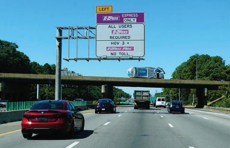
for successful implementation in complex transportation programmes.
Good requirements translate policy goals and interagency agreements into a precise system operation. They define what happens when a transaction is read, validated, converted, modified, routed, reported or rejected. They provide common language to business users, developers, testers, architects, operators and external partners.
In interoperability programmes, vague requirements can cause significant downstream problems. An undefined business rule can impact thousands of transactions, a missed exception can create customer service issues, and poorly-defined data fields disrupt revenue settlement. For this reason, requirements should be scenariodriven, testable, traceable and reviewed by all affected stakeholders.
Before an interoperability framework can be trusted in production, it must be thoroughly tested under realworld conditions.
Testing for interoperability must go beyond ordinary functional testing. Agencies should validate full transaction lifecycles, including roadside capture, validation, classification, adjustment, customer posting, agency settlement, reporting and exception handling.
Important test scenarios include valid interoperable transponders, invalid transponders, unreadable devices, plate-based fallback, duplicate reads, late account status updates, misclassified violations, agency code mismatches and monetary adjustments. Go-live readiness should include controlled deployment, sample transaction review, monitoring dashboards, operational reports and hypercare support. Since tolling systems impact customers and revenue in real-time, post-deployment monitoring is essential.
Looking forward
The future will involve broader interoperability, more account-based systems, increased use of licence plate recognition, mobile payment options, connected vehicle data and integrated mobility platforms. As such technologies evolve, the need for strong interoperability frameworks will only grow. Agencies should begin preparing by modernising data governance, standardising interfaces, improving transaction traceability, and building flexible, configuration-based systems.
Interoperability should be viewed as long-term capability, not a one-time projected mobility. It enables drivers to move between regions without friction and enables agencies to collaborate to provide reliable transportation services.
When it is well-designed, interoperability is nearly invisible. Drivers enjoy seamless experience, agencies receive accurate transactions, customer service teams have clear records, financial systems reconcile properly, and reports reflect actual operations.
This invisible reliability is the true measure of success. In modern transportation, the best interoperability framework enables customers to travel freely across regions while systems operate with accuracy, consistency and trust. ITS

ABOUT THE AUTHOR
Pankaj Lembhe is senior business analyst at Sun-IT Solutions, supporting interoperability initiatives for the Florida Department of Transportation.




Red light for speed cameras in Canada




November 14, 2025 was a day to remember in the Canadian province of Ontario: municipalities province-wide had to turn off their speed cameras. In fact, the use of such cameras was banned.


The ban was a small part of a widespread provincial enactment, Bill 56, Building a More Competitive Economy Act 2025, which made amendments and changes to other laws and acts.
Bill 56 dealt with, among other things, clean water, forest sustainability, drug and pharmacy regulations, healing arts, radiation protection,









Data from Ontario shows that speeding increases with the loss of roadside photo radar cameras, yet many Canadians are keen on different traffic-calming measures.
infrastructure heritage preservation and “consequential amendments in respect of the Species Conservation Act”. Included within Bill 56 was the banning of speed cameras.
The reason for last year’s ban was ostensibly very simple: elected officials in Ontario believed that the fines levied were a “cash grab” by councils and had to stop. But the ban ran counter to accumulated data and myriad reports suggesting the cameras reduce speeding.


The Ontario experience raises a broader question for transport authorities worldwide: what happens when perception outweighs operational evidence?







As governments continue to balance public sentiment with proven safety interventions, the province’s decision offers a case study in how policy choices can reshape road safety programmes, infrastructure investment and the role of intelligent transport technologies.

Increased traffic calming
In place of the cameras, according to a CTV News report on that November day, Ontario would spend $210 million to support increased use of traffic-calming infrastructure, such as more speed bumps, raised crosswalks and roundabouts, as well as high-visibility signage and












Ontario’s Bill 56 has shown a red light to automated traffic enforcement.
increased police enforcement. This would be in school zones and community safety zones where municipal speed cameras were previously located.
To gain access to the provincial funding, municipalities would have to submit a plan to the province explaining how they will effectively manage the school zones.
City mayors, town councils and emergency services organisations decried the move. But, as the law required, changes had to be made.
Canada’s capital city Ottawa issued a statement. As a result of Bill 56, automated speed enforcement cameras were to be replaced with specific school zone signs that meet the legislation’s outlined design and dimension requirements.
While many schools across the city already had school zone signage in place, it did not align with the standards outlined in Bill 56. The city would have to work with provincial authorities on installing the required signage at the 72 schools where automated speed enforcement (ASE) cameras were working and would be turned off.
“ASE cameras were owned by Verra Mobility, the vendor who supported the maintenance and operation of these cameras for the city,” City of Ottawa senior engineer for road safety studies Kunjan Ghimire said.
“In coordination with the city, the vendor removed and retained the camera equipment, including the flashes and housing units, by mid-December 2025. Staff have requested that the poles remain in place so they can be reused for signage improvements, such as warning signs or speed display boards, where feasible.”
Ottawa had 60 active ASE camera sites, with an additional 24 sites scheduled to become operational by November 5 last year, just before the ban was to be announced. Of these 84 sites, 72 were near schools.
“In accordance with provincial requirements, the city is required to install four oversized signs at each former school ASE site,” Ghimire said. “One ‘School Zone/ Area’ sign and one ‘School Zone/Area Ahead’ sign in each direction of travel, to better alert drivers.”
Ghimire said each site is reviewed individually to ensure it is safe and feasible to install the signage, including completing any required utility checks before work begins. Some of the signs are larger than standard traffic signs and require flashing beacons, in which case specialised posts and foundations are needed.
“To date, 158 signs have been installed across 62 locations, either partially or fully. Staff are actively working to install the remaining signs, with all signage expected to be in place across the 72 sites by the
end of summer,” Ghimire said. “Installation of the flashing beacons is contingent upon receipt of the required equipment from the province. Depending on when the equipment is received, the beacons are expected to be installed in 2027.”
On the day before the Ontario Government announced the ban, polling and market research firm Abacus Data released a province-wide survey that found half of Ontarians preferred trafficcalming measures such as speed bumps, raised crosswalks, signage, roundabouts and increased police enforcement over automated speed cameras.
The poll found only 33% of respondents preferred automated cameras, while 17% were unsure.
The survey also found broad confidence in traffic-calming infrastructure. Four in five respondents (80%) said these interventions cause them to slow down, while speed bumps were viewed as effective by 84% of respondents and increased police enforcement by 80%.
Support for the government’s approach increased further when respondents were told speed cameras would be replaced with provincially funded traffic-calming infrastructure. Nearly 60% said they would be more supportive of removing the cameras under those circumstances, including 31% who said they would be much more supportive.
Speeding effect
Fast-forward to April of this year. Ottawa has documented the effect of losing speed cameras, especially in school and playground zones.
A report completed for Ottawa’s public works and infrastructure committee found that speeding was up where the cameras had been located, particularly in school zones, five months after removing or decommissioning the camera equipment.
This is in addition to the fact Ottawa estimates the withdrawal of the cameras will cost the city $15 million in lost fines this year. In what some have said is a virtuous circle, the money from fines went into further road safety measures to discourage speeding.
That lost $15 million is around half the budget of Ottawa’s Road Safety Action Plan for 2026, an educational and information programme targeting specific ITS and safety issues and infrastructure.
Meanwhile, Ottawa’s long-term data indicates speed cameras ensured compliance with speed limits, and showed continuous improvement year-on-year over four years – from 16% before the cameras were installed to 87% after four years. In addition, high-end speeding went

notes that speeding had increased in school zones five months after removing or decommissioning speed cameras.



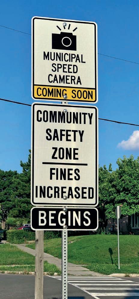

Ottawa
The introduction of cameras has been controversial.
down from 14% before camera installation to 0.3% after four years.
A week after removal of the cameras, compliance with the speed limit fell from 87% to 62%, while high-end speed incidents rose to from 0.3% to 2.2%.
Furthermore, 12 weeks after removal, compliance dropped to 41% and reports of speeding were at 4.5%.
These results also highlight a broader challenge for transport agencies. Safety technologies are increasingly expected not only to improve outcomes but to demonstrate those outcomes in ways that build public trust. As jurisdictions weigh enforcement against infrastructure investment, evidence may prove just as important as engineering.
Ottawa recorded and compiled data at several locations that detailed speeding increases and high-speed incidences increasing dramatically (see box: ‘How speed increases when cameras aren’t there’).
While the controversy over the use of speed cameras goes back many years, so does accumulated international data collected by reputable groups.
For example, a 2017 study by the London School of Economics drew upon data from the UK’s Department for Transport and local town and city councils. It analysed collision outcomes before and after cameras were installed across 2500 sites in England, Scotland and Wales.
The report based on the study noted that, in the period from 1992 to 2016, speed cameras reduced accidents by 17–39% and fatalities by 58–68% within 500m of the cameras.
Extrapolating the results, the report found adding another 1000 cameras to British roads could save up to 190 lives annually, reduce up to 1130 collisions and mitigate 330 serious injuries.
The Ontario situation is the latest among similar moves by provincial governments in Canada.
Prior to the Ontario ban, the Alberta Government prohibited photo radar on numbered provincial highways and limited its use to school, playground and construction zones.
“This is something that has been a long time coming,” Alberta transportation minister Devin Dreeshen told the Global News Network at the time.
Dreeshen said photo radar had been penalising drivers without improving road safety.
“The whole point of getting rid of these cash cow locations is to make sure that photo radar is used as a traffic safety tool and not as a revenue generator,” he said.
Alberta is now encouraging municipalities to use traffic-calming measures with

HOW SPEED INCREASES WHEN CAMERAS AREN’T THERE
In the week after Ottawa removed enforcement cameras, drivers put their feet on the gas. Data collected across several locations showed a sharp increase in both speeding and high-speed incidents.
Longfields Drive
October 2025: 91% compliance
December 2025: 62% compliance
March 2026: 38% compliance
April 2026: 25% compliance
Average speed recorded in October 2025: 35km/h
Average speed recorded in April 2026: 45km/h
Innes Road
October 2025: 88% compliance
December 2025: 50% compliance
March 2026: 38% compliance
April 2026: 35% compliance
Average speed recorded in October 2025: 54km/h
Average speed recorded in April 2026: 63km/h
Bayshore Drive
October 2025: 88% compliance
the creation of a fund to help upgrade roads and intersections “that pose demonstrated safety risks”. The Traffic Safety Fund is set at $13 million over the next three years for the 25 municipalities that used photo radar devices.
Rural Municipalities of Alberta president Kara Westerlund welcomed the move.
But Alberta Municipalities president Tyler Gandam said his organisation supports local governments using automated traffic enforcement (i.e. cameras) for safety reasons, since the data shows it reduces deaths, injuries and property damage.
December 2025: 32% compliance
March2026: 34% compliance
April 2026: 31% compliance
Average speed recorded in October 2025: 34km/h
Average speed recorded in April 2026: 44km/h
Watters Drive
October 2025: 88% compliance
December 2025: 38% compliance
March 2026: 23% compliance
April 2026: 24% compliance
Average speed recorded in October 2025: 36km/h
Average speed recorded in April 2026: 45km/h
Meadowlands Drive
October 2025: 90% compliance
December 2025: 51% compliance
March 2026: 26% compliance
April 2026: 35% compliance
Average speed recorded in October 2025: 35km/h
Average speed recorded in April 2026: 43km/h
(Source: CTV/City of Ottawa Open Data)
Ontario’s experience illustrates that the debate over automated enforcement is unlikely to disappear. But it also demonstrates the growing importance of robust data collection, transparent evaluation and clear public communication.
For transport authorities and technology providers alike, the challenge is no longer deploying safety technologies, but demonstrating – through transparent evidence and measurable outcomes –that they deliver the safety benefits they promise. ITS


Direction finder
ITS America Conference & Expo 2026 in Detroit, Michigan, was a celebration of future-looking traffic technology.
Over the next few pages, we throw a fresh spotlight on some of the products and innovations that are at the forefront of the industry’s continued evolution.
More than 3,000 industry professionals were on hand at the event, breaking attendance records, with 170 exhibitors highlighting solutions which ranged from artificial intelligence (AI) to traffic management, from connected vehicles to cybersecurity, from data to multimodal mobility. There was also a visit from Michigan governor Gretchen Whitmer, who met with industry leaders.
Go to www.itsinternational.com to see our Daily News magazines from across the event, and we of course look forward to seeing you at the 2027 Conference & Expo in Salt Lake City, Utah, from April 12–15 next year. ITS




Ettifos positioned for US V2X market

For years, the US vehicle-to-everything (V2X) market has been defined by pilots, demonstrations and early-stage testing. Today, however, that conversation is beginning to shift. With connected mobility initiatives gaining federal backing and agencies preparing for broader implementation, attention is increasingly turning towards technologies capable of supporting deployment at scale.
In Detroit, Ettifos focused on the practical realities of bringing V2X deployment into real-world environments.
Rather than positioning connectivity as a future concept, the company is aligning its solutions with the operational challenges agencies and deployers face today – from infrastructure integration and procurement requirements to interoperability and scalability. Responding to these evolving market demands, Ettifos showcased V2XAIR, the company’s compact, BABA (Build America, Buy America Act)-compliant aftermarket V2X device designed to extend connected vehicle capabilities across existing fleets. Developed to meet current Build America, Buy America requirements, the device supports federally-funded projects while helping agencies reduce sourcing and compliance delays.
Ettifos believes aftermarket connectivity will play an increasingly important role as cities and transportation authorities seek practical ways to expand connected environments beyond
newly-manufactured vehicles. By enabling broader participation across public safety fleets, maintenance vehicles and commercial operators, deployment can move faster and at greater scale. Ettifos also highlighted its broader V2X ecosystem, including roadside units, on-board units and software solutions designed around interoperability and evolving C-V2X deployment frameworks. As the US market moves closer to large-scale implementation, Ettifos sees the industry entering a more execution-focused era, where deployment readiness may matter as much as innovation itself.
www.ettifos.com

ITS America Conference & Expo 2026 in Detroit broke attendance records.
Jane Lee of Ettifos.
Umovity features AI-driven proactive transportation management
Econolite and PTV Group, together as Umovity, introduced Centracs Predict in Detroit, a next-generation AI-driven transportation management solution that transforms mobility network operations.
Built on Econolite’s leading multi-tenant, cloud-native advanced traffic management system (ATMS), Centracs Predict integrates the predictive analytics of the PTV Flows and machine learning to forecast and anticipate traffic congestion before it happens. This predictive capability enables agencies to proactively optimise signal operations instead of reacting to traffic congestion after it has already occurred.
By combining Centracs with AI-driven predictive intelligence and vast volumes of historical and real-time traffic data, Centracs Predict represents a transformative advancement in mobility operations. It enables agencies to forecast traffic
Smarter signals and
Inrix was in Detroit to show how data-driven intelligence helps agencies deliver measurable outcomes without adding costly hardware. The company monitors more than 304,000 signalised intersections, which it said is the largest
conditions up to 60 minutes in advance, shifting traffic signal operations from reactive to proactive. As a result, agencies can actively optimise overall signal performance and maintain smoother transportation over an entire network.
Leveraging PTV’s AI-powered analytics, Centracs Predict anticipates travel times and evolving traffic patterns. It
continuously analyses real-time and historical traffic data, generates forecasts, detects emerging congestion, and recommends or executes timing changes. Built on a scalable cloud architecture, Centracs the self-learning Predict is designed to ensure performance improvements and more efficient and resilient operations. www.umovity.com
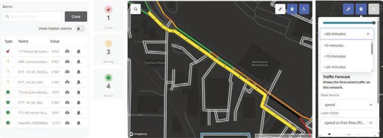
traffic intelligence from Inrix
probe-based signal performance network of its kind, featuring elements such as floating car travel times and movement boundaries. These allow engineers to tailor approach and departure lengths to match real-world conditions. Inrix is set to
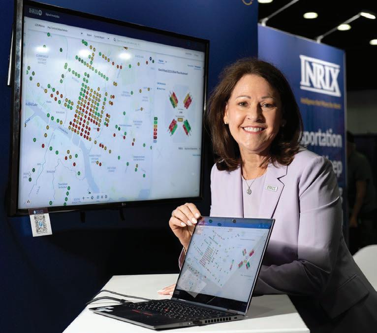
release its 2026 Signal Scorecard, which benchmarks signal performance globally.
The next generation of Inrix traffic products use advanced algorithms to deliver superior speed accuracy in heavy congestion, stop-and-go conditions, and high-speed corridors. New specialised roadway intelligence covers high-occupancy vehicle (HOV), reversible, and exit lanes – features operators have long needed to better understand real performance and prevent cascading delays.
Expanded network coverage, powered by enhanced location referencing, now captures infrastructure elements that were previously beyond reach. Improved incident intelligence, built on real-time feedback loops from professional drivers, creates a continuous cycle of faster, more accurate hazard detection and reporting.
As autonomous vehicles, delivery fleets, ride-hailing, and micromobility reshape how cities use their most contested real estate, Inrix is helping agencies move from curb planning to curb action: AI-powered compliance monitoring detects violations in real-time; contactless payment systems prepare cities for a future of driverless drop-offs and commercial loading; performance-based pricing, driven by measured and modelled occupancy data, helps cities maximise revenue and accessibility simultaneously. www.inrix.com
Terri Johnson of Inrix.
Centracs Predict.
Sensys detects vehicles with RTMS Echo
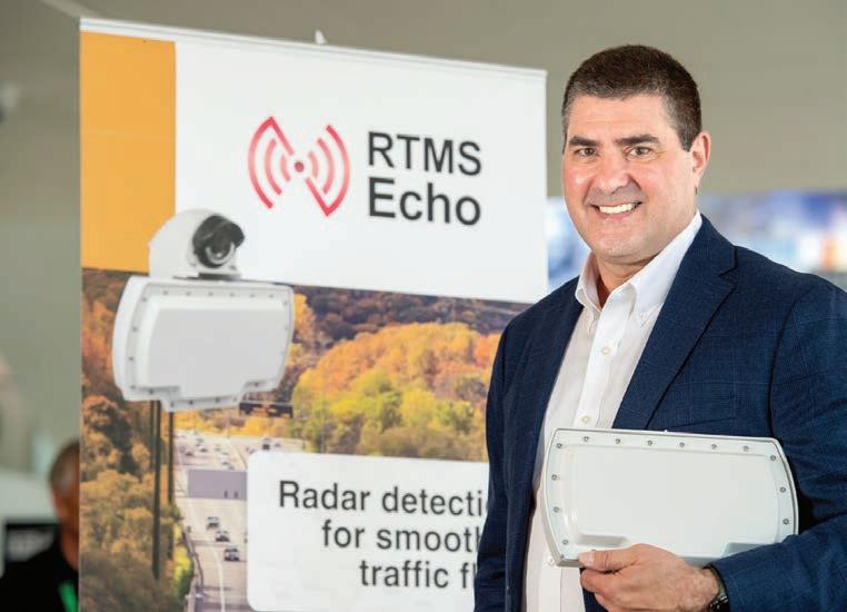
Sensys Networks showcased its RTMS Echo radar at the expo, highlighting a solution designed to modernise highway vehicle detection at scale.
The device delivers accurate, pervehicle data across up to 12 lanes from a
MaxCell expands conduit capacity without disrupting infrastructure
Transportation networks are under growing pressure to support the 24/7 demands of signalisation, V2X communication, and electrification, often within limited or ageing conduit infrastructure. MaxCell Solutions was in Detroit to showcase its flexible fabric innerduct, which is engineered to conform to the shape of the cables placed within, eliminating the wasted space associated with rigid innerduct. Designed specifically for transportation applications, MaxCell offers a full portfolio of purpose-built solutions that help agencies expand capacity without disruption in challenging environments such as bridge crossings and road, river and rail bores.
The company’s fabric innerduct solutions increase cable density by 300% or more and can be installed twice as fast while conforming to bends and irregular pathways.
Data collected by independent consultancy Bent Branch Strategies
single pole-mounted device, reducing the number of sensors required for wide roadway coverage. The company emphasised how this approach helps agencies simplify infrastructure, lower installation costs and streamline long-term maintenance.
The system features a modern, IP-native architecture with a single Cat5x or Cat6x connection and built-in Wi-Fi, enabling fast on-site configuration through a browser-based interface. Virtual aiming tools further reduce calibration time, allowing crews to complete installation in minutes rather than hours.
For agencies concerned about longterm data control, RTMS Echo supports industry-standard National Transportation Communications for Intelligent Transportation System Protocol (NTCIP) protocols and application programming interface (API) integration. This allows agencies to incorporate detection data directly into existing traffic management systems without proprietary middleware, avoiding vendor lock-in.
The technology has recently been deployed at scale by major US highway agencies in Florida and Tennessee, replacing hundreds of detection locations following field evaluation. These projects demonstrate both the technical capability and the responsive support model Sensys Networks brings to large-scale ITS programmes. www.sensysnetworks.com

found MaxCell can reduce material and labour costs by up to 50% and cut carbon emissions by more than 80% compared to traditional high-density polyethylene (HDPE) innerduct. Additionally, the lightweight design reduces shipping and freight costs by up to 33%.
MaxCell featured its MaxWrap and MaxSpace solutions for limited and congested conduits. MaxWrap is an OSP fabric mesh solution that encompasses the cable as the cable is being installed, reducing pulling tension by up to 85%. www.maxcellsolutions.com
Terry Stanoch of Sensys Networks.
Eric Coulsell of MaxCell.


Inrix manoeuvres Cleverciti parking data into platform





Inrix has teamed up with Cleverciti, part of the ParkHelp Group, to deliver real-time parking space availability information to drivers. The firms said this will help cities to better manage kerb space and parking lots while supporting data-driven parking policies. Use cases range from demand-based pricing and kerbside compliance to parking guidance and smarter allocation of limited urban space. This is an area of interest to Inrix, which secured a similar deal with Automotus at the beginning of the year. The integration uses Cleverciti’s parking detection technology, based on street-level overhead sensors and computer vision, adding parking occupancy data to the Inrix platform. Cleverciti clients will now



BABA compliance for Ouster Rev8 Lidar




Ouster has said its Rev8 family of OS digital Lidar sensors complies with the Build America, Buy America Act (BABA), which establishes a domestic procurement preference across all federally-funded infrastructure projects. With its compliance, Ouster said, the company’s Rev8 sensors are eligible for deployment by state and local transportation agencies, engineering firms and system integrators in US government-funded infrastructure upgrades. These include intelligent transportation systems, smart cities, transit networks and tolling systems. Ouster noted that the Rev8 BABA compliance also extends to Ouster BlueCity, its traffic management solution combining 3D digital Lidar
receive kerb data from Inrix directly in CleverPortal. “Drivers spend too much time circling for parking because cities often lack accurate, real-time visibility into kerb availability,” Inrix chief product officer Ahmed Darrat said. “We’re helping cities and mobility providers turn kerb data into actionable insights that improve traffic flow, reduce emissions, and create a better driver experience.” Inrix will use its cloud-scale platform and analytics to contextualise and distribute the continuously verified, real-time observation of kerbside occupancy across the broader mobility ecosystem in a bid to aid urban traffic flow. www.inrix.com www.cleverciti.com
with proprietary AI software. Now with Rev8, Ouster BlueCity provides advanced detection over 500 feet (152m) and optional native colour. This delivers what the company said is “unmatched situational awareness” for multimodal actuation, alerts and analytics. Combined with BABA compliance, Ouster BlueCity with Rev8 enables municipalities and transportation agencies to leverage federal funding to modernise their transportation infrastructure. “We are making it possible for our customers to leverage federal funding to deploy cutting-edge physical AI and perception technology on American roadways and transit systems,” Ouster chief executive Angus Pacala said. www.ouster.com
US safety products manufacturer
National Signal has announced a new API integration for its HS Connect software. The company is embedding the Flow Labs API into its smart work zone product line to deliver sensor-based speed data directly to field devices. “Real-time data is the backbone of effective smart work zone deployments,”
HS Connect VP ITS development Pete Krikelis said. “The Flow API gives us a powerful, scalable data source that integrates seamlessly with our HS Connect platform, so we can deliver better outcomes for our customers and safer conditions for road workers and drivers.” According to the Federal Highway Administration, the US sees

800 fatalities in work zones annually. National Signals’ software processes real-time data to identify vehicle queue formation in active construction areas. Motorists receive advanced warnings regarding changing road conditions via portable message signs, which are updated by HS Connect. The cloud-based API provides continuous tracking of travel times across existing US road infrastructure, and state DoTs can access the information to view performance analytics. This approach lowers installation costs while maintaining data coverage, removing the need for dedicated roadside hardware. www.flowlabs.ai www.nationalsignalinc.net

National Signal integrates Flow Labs API











Cohda’s MK6 RSU gains CPOC Level 1
Cohda Wireless’s MK6 roadside unit (RSU) has passed CPOC Level 1 evaluation in Europe, with TÜV Informationstechnik (TÜViT), an accredited Common Criteria test lab. The Level 1 evaluation, conducted under the CPOC – C-ITS Point of Contact - protocol confirms that Cohda’s MK6 platform complies with the European Union’s stringent security and trust framework. This is a critical requirement for safe and scalable cooperative intelligent transport systems (C-ITS). CPOC acts as a central trust mechanism for Europe’s connected transport network. It gathers security certificates issued by national and regional authorities and compiles them
into a trusted list that C-ITS devices use to verify messages from other vehicles and roadside infrastructure. The MK6’s CPOC Level 1 evaluation adds to a growing list of independent certifications and regulatory approvals for the platform, including OmniAir Consortium, FCC in the US, CE & E1 (R10, R118) in Europe, UKCA in the UK, ISED in Canada and KC in South Korea. “Like the US, we are seeing very meaningful progress in Europe as connected vehicle technologies move from trials toward real-world deployment,” Cohda chief executive Paul Gray (pictured) said. Cohda launched the MK6 in late 2022. www.cohdawireless.com




Stark Controller centralises ANPR camera management



Tattile has launched Stark Controller, a software platform designed to simplify the management of ANPR cameras, sensors, and related data infrastructure. With an interface accessible from PCs and tablets, it enables centralised configuration deployment across single devices or entire groups, thus reducing set-up time and ensuring uniform system settings throughout the network, the manufacturer said. Software and




firmware updates can be distributed remotely from one platform, which minimises maintenance while reducing manual intervention and downtime. Stark Controller offers real-time visibility into device status, connectivity and system performance, with a full historical log of events and activities available to help with troubleshooting. Users can see the precise location of every connected device on an interactive map, simplifying asset management and field operations.



Key features include an integrated data lake, designed for centralised and scalable data management: the platform receives, collects and securely stores information which users can filter and retrieve with customisable criteria. Organisations can also adapt processes to their internal procedures and project requirements, tailoring Stark Controller to different deployment scenarios. www.tattile.com

Roadlite is V2X-connected to protect VRUs
A production-ready e-bike with vehicleto-everything (V2X) technology is being trialled on streets in Germany and the Netherlands prior to it going on the market. Creation of the e-bike, the Roadlite:ON V2X, is a collaborative effort led by bike manufacturer Canyon. Developed with V2X technology from the German company Cubesys, an Nfiniity company, the Roadlite:ON V2X can communicate with cars, public transport and street infrastructure. Car maker Volkswagen was involved for interoperability testing. The goal is to provide riders with intuitive alerts, such as subtle haptic (sense of touch) – feedback in
the grips, when a potential hazard is detected, even if it’s hidden around a blind corner. With the V2X technology package nestled in the bike’s downtube and the V2X/GPS antenna in the bike’s head tube just below the handlebar stem, the Roadlite:ON can send V2X signals so in-vehicle screen displays alert drivers to the presence of bikes. When a car approaches, the e-bike alerts the rider with a vibration on the left and/ or right side of the handlebar grip. This allows the cyclist to keep their eyes on the road. www.nfiniity.com www.canyon.com
Image: Cohda Wireless
Iteris’ BlueToad Spectra CV gets OmniAir certification
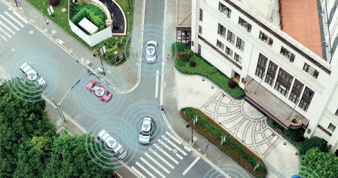
Iteris’ BlueToad Spectra CV roadside unit (RSU) has achieved OmniAir Consortium certification. At a time when vehicle-toeverything (V2X) infrastructure rollouts are becoming more common, certification is a sign to transportation agencies that deployed systems will integrate smoothly with a diverse ecosystem of vehicles, devices and software platforms. “It reaffirms our commitment to delivering solutions that are interoperable, reliable, and
ready for real-world deployments,” Iteris chief product officer Will Cousins said. BlueToad Spectra CV combines connected vehicle communications with Bluetoothbased travel-time detection in a single device, eliminating the need for multiple pieces of hardware in the field. Customers can support advanced safety and mobility applications while collecting performance data such as travel times, speed, vehicle counts and origin-destination insights.
BlueToad Spectra CV has existing certifications from the National Electrical Manufacturers Association and the US Federal Communications Commission. Iteris has received OmniAir certification for its V2X Connect software application, which is recognised as Qualified Test Equipment to verify connected vehicle communications. www.iteris.com www.omniair.org
Advertisers INDEX
Cross Zlin
p33 www.cross-traffic.com
Daktronics p39 www.daktronics.com
Hayden AI p13 www.hayden.ai
Intercomp p38 www.intercompcompany.com
Intertraffic p15 www.intertraffic.com
ITS America p19 www.Itsamericaevents.com
ITS World Congress p22 www.2026itsworldcongress.org
Network Optix OBC www.networkoptix.com
PTV IFC www.umovity.com
Q-Free p32 www.q-free.com
Sensys Networks p9 www.sensysnetworks.com
Sidra p29 www.sidra-sys.com
Star Systems p27 www.star-int.net
Econolite
Hi-Tek Electronics
www.vision-fair.de
www.cubic.com/transportation
www.econolite.com
www.hitekquality.com Iteris
www.iteris.com Ledstar
Swarco McCain
www.ledstar.com
www.mccain-inc.com