Produced by

















Produced by
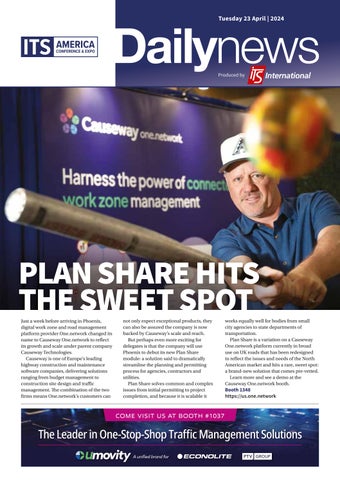
Just a week before arriving in Phoenix, digital work zone and road management platform provider One.network changed its name to Causeway One.network to reflect its growth and scale under parent company Causeway Technologies.
Causeway is one of Europe’s leading highway construction and maintenance software companies, delivering solutions ranging from budget management to construction site design and traffic management. The combination of the two firms means One.network’s customers can

not only expect exceptional products, they can also be assured the company is now backed by Causeway’s scale and reach.
But perhaps even more exciting for delegates is that the company will use Phoenix to debut its new Plan Share module: a solution said to dramatically streamline the planning and permitting process for agencies, contractors and utilities.
Plan Share solves common and complex issues from initial permitting to project completion, and because it is scalable it
https://us.one.network Tuesday 23 April | 2024






works equally well for bodies from small city agencies to state departments of transportation.
Plan Share is a variation on a Causeway One.network platform currently in broad use on UK roads that has been redesigned to reflect the issues and needs of the North American market and hits a rare, sweet spot: a brand-new solution that comes pre-vetted.
Learn more and see a demo at the Causeway One.network booth.
Booth 1348






Interact with Carmanah’s new connected crosswalk and cloud platform in booth #1245






























































OTT Hydromet is showcasing its road weather information systems (RWIS) this week at ITS America in Phoenix – one of which is a mobile solution that allows you to fill gaps in highway networks or runway condition reporting. Easily transferred between vehicles, the Lufft MARWIS software and sensor solution calculates temperature, dew point, ice percentage and other weather measurements.
The company’s LufftCommunicator (LCOM) can be used for data collection and telemetry as well as data visualisation and analytics for weather and road conditions. Its WS600 is the only sensor to offer Doppler Based Precipitation measurement.
And the NIRS31 measures salt concentration on the road and includes freeze point measurements. Booth 2246 www.otthydromet.com
Belden is showcasing its traffic management solutions at ITS America in Phoenix this week. The company’s traffic control centre networks enable remote connectivity and real-time data orchestration for customers who are modernsing road infrastructure while enhancing travel efficiency and safety. Booth 2151 www.belden.com
Publisher / MD
Andrew Barriball
Editor Colin Sowman
Editorial team
Adam Hill, Andrew Bardin Williams
Pete Goldin
Sales director
Dan Emmerson
Design
Andy Taylder
Photography
James Robbins
Production
Nick Bond










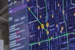
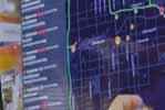


Flow RT is a cutting-edge realtime digital twin platform designed to provide agencies with minute-by-minute data on traffic conditions, signal operations and roadway incidents. According to Flow Labs, Flow RT removes uncertainty from traffic management by delivering accurate insights at lightningfast speed.
Flow Labs founder and CEO Jatish Patel says: “With Flow RT, traffic managers can access high accuracy insights in real-time, at scale across an entire region. There’s no more using outdated information to fix yesterday’s problems.”
IT & website director
James Howard
Website + Social Media
Sarah Biswell, Tatyana Mechkarova
Office manager
Kelly Thompson
Printed by O’Neil Printing
Contact us
The Daily News office can be contacted at media@ropl.com

Visitors to the company’s booth can experience Flow RT in mixed reality, viewing the platform through Apple Vision Pro headsets to amplify the traffic management experience.
“By combining the Flow platform with mixed reality, attendees can immerse themselves in a true digital twin experience where they can fly through the entire Maricopa region and see how easy it is to access the accurate insights they need to make decisions at lightning speed,” says Patel.
Flow Labs RT integrates seamlessly with existingFlow
Labs solutions including Traffic Signal Management, Roadway Safety Management and Mobility Management and is powered by data from multiple sources, including Flow Labs’ partner TomTom. According to the company, this means Flow RT can deliver a vehicle data penetration rate up to five times the current industry standard, enabling agencies to make the correct decisions quickly using the most accurate, reliable and instantaneous insights in the industry.
Booth 2046
www.flowlabs.ai
Today ITS America’s Conference and Expo 2024 hits the ground running and to help you plan your day, here is a summary of some of the main highlights
8.00am – 9.30am
SIS06: New MUTCD provisions to support safe ADAS and ADS deployments: If you are confused by, or have questions about, what will be in the new edition of the Manual on Uniform Traffic Control Devices (MUTCD), then you are far from alone. This session (in 106C West Building) is designed to provide some answers to these questions along with resources for those interested to learn more and engage in the process. Experts from the highway and automotive industries present their views on the new material, how it will help, and what might be material to consider for the next MUTCD update.
10.00am – 11.30am
State DOT Roundtable: State DOTs across the US are increasingly investing in connectivity and deploying digital infrastructure solutions to save lives, increase transportation mobility and improve sustainability within the nation’s transportation system. Please join ITS America and some of the leading public sector deployers of these technologies, for a roundtable discussion (Main Stage, Exhibit Hall) in which they will share some of their best practices, lessons learned and successful strategies on how to enhance our physical infrastructure with proven digital solutions.


11:30am – 6:30pm
At the Outdoor Demonstration Area, Canyon on Third. Visitors can experience an autonomous vehicle ride in a May Mobility AV. Nearby will be a demonstration of real-time incident detection and safety alerts using mobile and CV technology
1.00pm – 4.00pm
Digital Infrastructure Workshop:
Continuing the digital theme, this workshop in room 301AB West Building aims to build and expand the stakeholder collaboration and partnerships required to support multimodal, multi-jurisdictional and integrated national-scale digital infrastructure. The workshop aligns a number of ongoing strategic efforts around building a committed and diverse stakeholder community that can meaningfully support the continued and sustained evolution of digital infrastructure to support national transportation priorities. Guiding the discussions will be the FHWA’s John Corbin and ITS America’s Laura Chace plus Timothy Drake and Brock Aun from Haas Alert.

3.00pm – 4.00pm
Table Topic Networking:
Attend the Table Topic Networking sessions in the Networking Lounge to reconnect and build new high-value relationships with ITS leaders and practitioners from the public and private sectors. Join these interactive conversations and learn about challenges, opportunities, and best practices across the ITS industry through facilitated group discussions. Table Topic Networking will take place every day and each day will focus on new themes – today’s focus is on Emerging Technologies including AI, digital twinning and quantum and also Creating efficiencies and equitable mobility.
5.30pm – 6.30pm
Exhibit Hall Welcome Reception: Don’t miss this opportunity to connect with your intelligent transportation peers and to unwind and enjoy a drink while networking with some of the nation’s best ITS professionals.



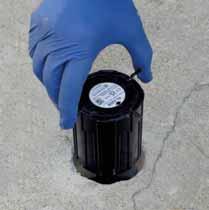
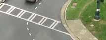

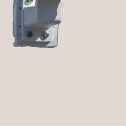
Introducing FlexMag3 with EZ-Out, enabling swift sensor removal for replacement or relocation. Minimize traffic disruptions and detection downtime for:
•Repaving projects - remove and reinstall intact after resurfacing
•Easy replacements - swap sensors instantly without lengthy lane closures
•Relocation - move temporarily for work zones or permanently for redesigned lanes



















It is showtime at Swarco McCain’s booth, where new product announcements and updates, live demos and expert discussions will take place.
Visitors can learn about the latest refinements to the company’s Advanced Transportation Controllers (ATCs) and cabinets, traffic management software and dynamic message signs.
Centre stage is undoubtedly the MyCity Solution Suite.

MyCity enables transportation professionals to proactively manage traffic flow and promote mobility through realtime traffic data collection and management tools.
The MyCity software platform has been re-engineered for future growth while boasting a new and improved look and a wide range of feature enhancements. There are two new product additions to the MyCity software suite: MyCity
Representatives from traffic management solution provider
Valerann are spending their time at ITS America in Phoenix this week talking to potential customers about redefining the concept of modern mobility by improving roadway operations.
The company’s Lanternn by Valerann gives road traffic authorities insights into realtime road traffic situations and accident risk predictions, improving situational awareness and empowering them to take
accurate, actionable and timely decisions.
The solution works by applying artificial intelligence (AI) and computer vision algorithms to information collected across multiple sources to deliver a clear and holistic overview of the entire road situation in real time. According to the company, customers have seen a 10 to 15 percent reduction in accident rates as a result of implementing the solution. Booth 752 www.valerann.com

Smart Priority and MyCity TrafficPlanIQ.
MyCity Smart Priority is a scalable cloud-based solution designed for customised priority requests at traffic lights for buses, emergency vehicles and bikes. It makes virtual prioritisation more costeffective, easier to implement and environmentally sustainable.
MyCity TrafficPlanIQ streamlines all workflows

for traffic engineers, acting as a single comprehensive solution for collecting data and generating timing plans in a fraction of the time compared to traditional methods. With the enhanced MyCity Solution Suite, users can proactively manage traffic flow, obtain valuable analytics, optimise transport routes and make informed decisions.
Booth 1637
www.swarco.com/mccain
Gain comprehensive control over your LaneLight systems from any location with LaneLight Connect, which will be demonstrated at the LaneLight booth 1949 at ITS America Expo. LaneLight Connect integrates LaneLight products with the web, allowing users to adjust lighting schedules, review device information, manage settings, or analyze logs and graphs, with just a simple click. No phone app installations are required, ensuring hassle-free setup. LaneLight eliminates tiered cloud service – customers can access all the cloud features free for 3 years and $79 each year thereafter per system. Only one device per location requires LaneLight Connect, and all other devices at that location connect locally to the primary.
LaneLight Connect logs every activation, providing valuable insights for data-driven decision-making. It also provides notifications about system status, enabling rapid response.
Users can adjust settings and schedules remotely, providing flexibility and control with encrypted security. LaneLight Connect can also be integrated into other systems. Booth 1949 www.lanelight.com


















Miovision is here in Phoenix to answer the question everybody in transportation management is asking: How can traffic agencies chart a path to the emerging world of ubiquitous digital infrastructure?
Delegates eager to find the answer should head to the company’s booth to view its growing array of solutions to improve intersection efficiency and road safety for all road users - be they
drivers, cyclists, pedestrians, transit riders or emergency responders. Exhibits cover its full array of solutions from the V2X offerings of its latest acquisition, Traffic Technology Services (TTS) and the Miovision One platform which brings all the solutions together.
Miovision is also the premier sponsor of the Digital Infrastructure conference theme and on Tuesday 23 April its product VP Ben
Geotab ITS Altitude Platform – one of four solutions you can see at the Geotab booth 1353 – delivers millions of connected vehicle insights for smarter city and state planning and operations. Based on observed, real-world journeys instead of modeled representations, the product helps agencies understand contextualized people and goods movement behaviors.
Geotab ITS Origin & Destination helps DOTs understand commercial vehicle and freight activity on their roads. Users can examine key behaviors affecting freight corridors, from vehicle purpose to aggregate route analysis; zoom into underlying transportation data to understand the nuances influencing commercial vehicle movement across areas of any size; and make key infrastructure and


Newell will be contributing to the 2050 Within Reach discussion, envisioning what infrastructure could look like and how to get there.

The following day, Wednesday 24 April, Miovision CEO Kurtis McBride will participate in the Plenary Rethinking Infrastructure in the New Digital Era and join the panel session Unleashing the Potential of Digital Intersections. Also on
policy decisions with confidence. Geotab ITS Stop Analytics allows public and private entities to distinguish between vehicle stops and parking patterns on individual roads, within zones of interest or across national highways. The product enables safe roadway planning, placement of EV infrastructure and efficient curbside management.
Geotab ITS Roads combines commercial vehicle and freight data with open-sourced street data to provide an expansive and granular picture of road traffic flow – from individual segments to combined streets. Users can access municipality and citywide road traffic data to improve traffic flow and minimize accidents.
Booth 1353
www.geotab.com

Wednesday, Brent Rogerson, sales engineering director at Miovision will participate in the City DOT Roundtable exploring the emerging application of digital twins to optimise planning and execution.
Finally, Thursday 25 April will see Miovision’s CFO Lyne Jacques participating in the City of Montreal Case Study session. Booth 1041 www.miovision.com
AI-driven platform Rekor Command offers a rapid and comprehensive view of incidents on the roadways. Rekor’s product detects events by transforming raw roadway and mobility data into actionable insights, allowing agencies to respond quickly, improving traffic flow, minimising risk of secondary crashes and enhancing safety while enabling the insights needed to analyse past performance and drive improved performance.
Meanwhile, Rekor Discover’s Class, Count, and Speed application, along with Rekor Edge Series, utilises state-of-the-art AI and edge processing to automate the safe and efficient capture of FHWA 13-bin vehicle classifications, vehicle counts and speeds. Booth 1045 www.rekor.ai
Intersection-level performance insights without connectivity
The new set of probe data-based performance metrics within ClearGuide® helps agencies reduce congestion by monitoring traffic signal performance and identifying deterioration at the intersection, without reliance on infrastructure.

iteris.com/signal-trends
Join us at booth #641
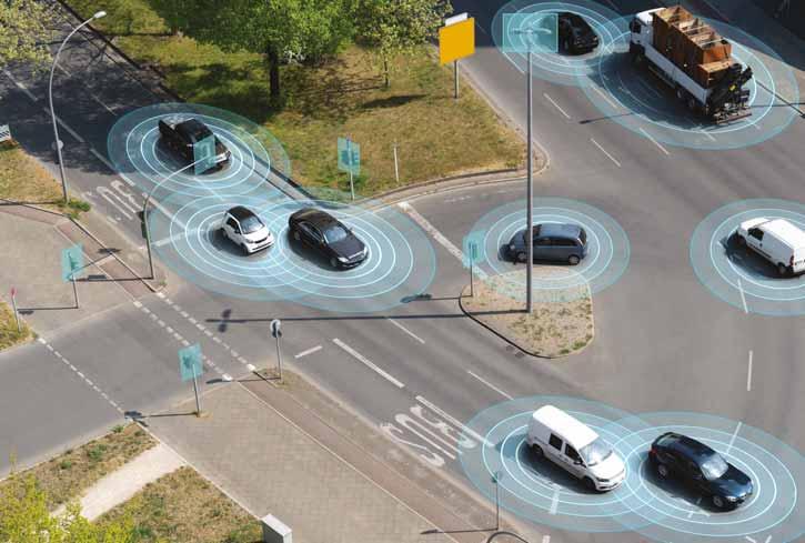
















































Econolite and PTV Group, under the unified brand Umovity, are exhibiting some innovative, predictive ITS applications. The company will highlight the ongoing software integration developments designed to provide data-driven capabilities that will deliver more sustainable, safer and accessible mobility.
Representatives from Econolite and PTV will be available to demonstrate how both companies’ applications are being integrated, including leveraging artificial intelligence to predict traffic conditions in order to proactively optimise traffic management operations. Umovity experts will also demonstrate solutions developed through the integration of Econolite’s Centracs Mobility Platform with PTV’s Vistro and Flows software.
Centracs Mobility, together with the newlylaunched PTV Flows, offers a cloud-based predictive traffic management solution that uses AI to forecast traffic and travel times for an entire road network up to one hour in advance. The application combines what is said to be the largest and most detailed historical traffic database and PTV’s forecast modelling, with the power of Centracs.
The integration of Centracs with Vistro provides quick analyses of signal timing programs and sends new optimised timing patterns back to Centracs for field deployment. This enables traffic signal data to be automatically synchronised between the ATMS and modelling software, enabling agencies to make decisions using the latest traffic information.
Visit Umovity’s booth between 2pm and 3pm on Wednesday 24 April for its gourmet pretzel social hour and meet members of the Umovity team. Booth 1037 www.econolite.com









LYT and Transpo Group signed a new agreement with the City of Tempe, Arizona, and the Maricopa Association of Governments (MAG), for a pilot of LYT. emergency, the company’s emergency vehicle preemption (EVP) solution. LYT harnesses the power of a single secure edge device installed in a traffic management center, enabling emergency vehicles to speak directly to networked traffic signals through the LYT. speed cloud platform.
The pilot will initially be launched through MAG’s Emerging Technology Program for the corridor along South Kyrene Road and continuing onto West Baseline Road, just a few miles from the Phoenix Convention Center.
LYT.emergency will be deployed in collaboration with Safety Cloud® by HAAS Alert, with the goal of improving emergency vehicle safety and travel times by intelligently adjusting traffic lights to clear traffic along their path. Signals are adjusted based on realtime congestion.
Tempe Fire Department vehicles are equipped with HAAS Alert devices, which provide response information for LYT’s green light technology. HAAS Alert’s Safety Cloud collision prevention solution delivers realtime notifications from active emergency vehicles to nearby motorists over cellular networks. Emergency vehicles equipped with Safety Cloud can communicate directly with LYT’s EVP solution. This partnership
will enable public safety fleets to deploy true preemption capabilities in any vehicle, making emergency response and roadways safer throughout Tempe.
“A reliable emergency vehicle preemption solution plays a critical role in protecting Tempe,” said Tim Menard, CEO and Founder of LYT. “Implementing a state-of-the-art preemption system is not just a technological upgrade; it’s a commitment to the livelihood of this community.
By clearing the path for first responders, we’re improving critical response times. This is not just a matter of convenience; it’s a matter of life and death.”
Booth 1037
www.lyt.ai











visitors to Q-Free’s booth can see the ‘demolition’ of transportation silos in action in the form of Kinetic Mobility. The modular system is said to transcend operational boundaries and demolish the silos that hamper traffic management and intelligent transportation systems.
Whether it is hardware that won’t communicate with software, data that doesn’t transfer between different vendors’ products or local intersections isolated from intercity or regional operations, Kinetic Mobility is designed to unify ATMS operations at all levels.
Q-Free describes the system as a comprehensive, holistic solution that facilitates collaboration, communication and connectivity among communities, regions and vendors to maximise performance by integrating detectors, signals, cameras and signs and to automate workflows. In doing so, it
improves safety and response times, enables proactive response to recurring conditions and frees up operators to focus on complex scenarios that require adaptive thinking and manual intervention.
Mix and match Kinetic modules include: Corridors (integrated corridor management), Counts (traffic counts and classification), Events (event detection, management and response), Signals, Signs and Video (both distribution and wall).
The combination of these modules allows agencies of all sizes to tailor a comprehensive solution to meet operational needs. Combined with cloud-hosted infrastructure and flexible Software as a Service (SaaS) billing, Q-Free says advanced traffic management systems have never been more accessible. Booth 441 www.q-free.com
Arcadis says its cloud-based TravelIQ product offers precision traffic management through timely updates on congestion, incidents and road work. Meanwhile, InSight ATMS provides realtime insights into network conditions, enabling operators to swiftly respond to disruptions with controllable video coverage and message displays. OpenTripPlanner provides customisable multimodal trip plans based on standardised data sources, offering high performance and scalability for transit agencies and governments globally. Transit Data Suite enhances transit operations by leveraging industry-standard open data formats like GTFS and GTFS-real-time, optimising seamless transit management. Booth 1351
www.arcadis.com
GridMatrix is using artificial intelligence (AI) and machine learning (ML) to make cities safer, more efficient and more livable, according to Ellee DeGhetto, a business development manager for the company. While at the show, representatives of the company are highlighting an analytics dashboard that collects data from existing roadway sensors and visually presents the data. Sensor feeds are processed in the cloud to create insights into congestion, signal performance, emissions and safety. The company’s hardware-agnostic approach allows its algorithms to integrate with any sensor type – including cameras, LiDAR, radar and loops.
Booth 141
www.gridmatrix.com
Jasper Electronics designs and manufactures traffic control power supplies which are fully-compliant to California DoT (CalTrans) Transportation Electrical Equipment Specification (TEES) for use in Caltrans TEES 332, 334, 336, 342, 344, and 346 Series cabinets. Jasper also offers compliant units for use in advanced transportation controller highvoltage cabinets, Nema cabinets, traffic intersection control systems, modern LED road signs and other related applications. For upgrades to older systems, Jasper says it offers smaller, lighter, more efficient and more reliable units than legacy supplies.
Booth 1839
www.jasperelectronics.com


























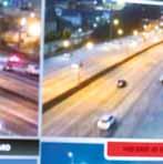
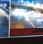
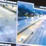
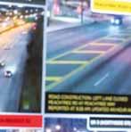





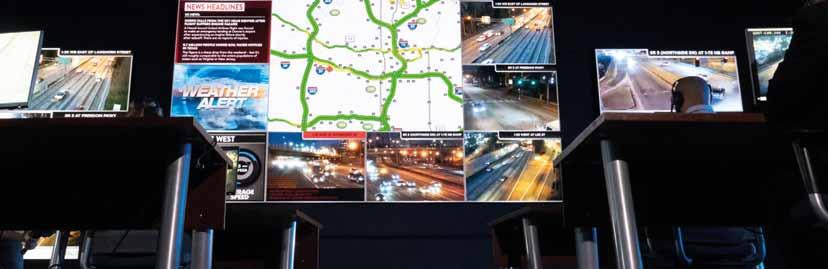
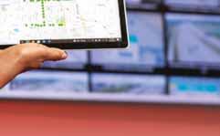
If the staff in your traffic management centres (TMCs) are sometimes overwhelmed by the volume of data and video feeds used to monitor and manage the flow of traffic, then help could be at hand at Daktronics’ booth.
The company has introduced direct-view LED displays said to create a seamless, common operating picture that provides critical information to operators via an efficient display which is essential for making real-time decisions. Content can be zoned, take

in unlimited camera feeds, maps, news, weather, DOT data feeds and more and the display can be any size with every detail visible from any angle in any lighting.
“Efficient decision making is about timing,” says Jason Morison, ITS, parking & public transport market manager at Daktronics (pictured). “We are proud to provide the capabilities of directview LED, especially to create greater efficiencies in command centres which ultimately leads to safer roads.”
Learn how smart and connected corridors provide complex road safety services for emergency first responders – stop by the Commsignia booth.
The company’s Protected Corridor solution improves response times for first responders while ensuring safety for all road users in the area, including blue light vehicles.
The Commsignia Protected Corridor consists of vehicle-toeverything (V2X) roadside units (RSUs) integrated with traffic light controllers to provide preemption for ambulances and fire trucks. The RSUs also




To ensure quality and longevity, the company conducts end-to-end testing on components including measuring light output and colour properties to check direct-view LED displays perform from any vantage point in any light.
“With images and information on direct-view displays always visible regardless of ambient lighting the team can see what they need for real-time decision making,” Morison concludes.
Booth 848 www.daktronics.com
Global manufacturer Advantech has arrived at ITS America Conference & Expo in Phoenix to show off how its Embedded Box IPC systems can be used in ITS solutions.
use data from roadside cameras and other sensors to detect road users, determine whether the road is clear, and warn of potential hazards. The RSUs can even actuate traditional amber LEDs or variable message signs to alert non-connected road users – especially pedestrians – about the arriving prioritised vehicle.
Ambulance drivers get road safety notifications right on the vehicle dashboard, while other vehicles receive alerts to yield the right of way.
Booth 1256 www.commsignia.com
The first demo, with Intel, will showcase the Advantech MIC-770 V3 IPC powered by an Intel 12th/13th Gen Core i CPU. The unit captures environmental dimensions and shapes via Lidar cameras, and relays the data to the GPU that then generates detailed 3D models of roadways.
The power and scalability of the joint solution makes the solution ideal for Artificial Intelligence of Things (AIoT) applications that require deep learning and edge inference— particularly in Lidar-based sensing.
The second demo, with Ouster, will feature the Advantech MIC-733-AO, a system designed to grow transportation and smart city trends in Video AI. The system’s high processing capabilities, versatile video input options and wireless connectivity make it ideal for advanced video AI and 5G applications on the edge of the network.
Booth 1748 www.advantech.com






Control and Intelligent Automation
Econolite’s ® MobilityPlatform, the Advanced Transportation Management System (ATMS) now integrates PTV Flows, the predictive and reporting, signal/detection management, additional optimization services, and much more.

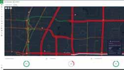




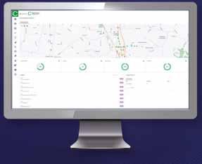
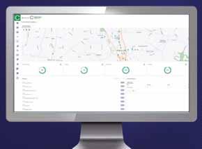




Iteris is demonstrating Signal Trends, its new set of probe data-based metrics within the ClearGuide traffic analytics software solution. It is designed to help agencies reduce congestion by identifying deterioration at the traffic signal level without reliance on infrastructure.
This latest suite of tools allows agencies to identify signal maintenance or traffic congestion problems at more intersections, including those without traffic sensors installed. It does this by using anonymised trajectory data from cloud-connected vehicles to provide signal performance visibility across regions or corridors, spotting issues and swiftly notifying operators of abnormal conditions.
Using Signal Trends, agencies can adopt a data-driven, rather than calendar-based, approach to signal retiming on all signalised intersections nationwide, without costly
Derq is bringing the power of AI to traffic safety performance monitoring, dynamic traffic control and C-V2X alerts – all exhibited at the ITS America Expo.
Derq’s Platform ingests and fuses data from IoT traffic cameras and sensors and runs real-time edge analytics to enable infrastructure perception and V2X/5G applications as well as actionable safety and traffic insights.
Through predictive alerts and safety insights, Derq empowers transportation agencies to reduce congestion and traffic incidents, optimizing traffic flow and improving overall


data collection. The approach allows for the rapid discovery of delays to help improve traveller satisfaction, even in situations where field device communication is limited.

Signal Trends integrates seamlessly with ClearGuide Roadways and SPM (signal performance measures), collectively generating reports, alerts and recommendations to remotely manage all traffic signals and arterials in a single user interface. Iteris offers both probe SPM and controller-based automated signal performance measures (ATSPM) solutions.


Tiffany Symes, senior director of product management at Iteris, said: “With Signal Trends, Iteris continues to expand its intersection offerings to create the industry’s most complete solution for intersection operations, maintenance and safety.”
Booth 641 www.iteris.com


road network performance. Demonstrated at the Expo, Derq Insight enables real-time analysis of traffic safety and performance, empowering cities to make smart decisions for safer and more efficient roads.
Also at the Expo, Derq Sense & Control is a realtime sensing application that broadcasts actionable insights for connected and autonomous vehicles, connected pedestrians, and smart infrastructure – including controllers and crosswalks – to help improve efficiency and safety.
Booth 1745 en.derq.com












South Korean Vehicle-to-Everything (V2X) startup Ettifos is using ITS America in Phoenix this week to introduce its communications solutions to the North American market.
Gaining notoriety last year as the first company to complete compatibility testing of the world’s first 5G-V2X modem, Ettifos seeks to connect road entities to enhance road safety, improve traffic efficiency and enable new applications for transportation systems.
The Ettifos V2X-AIR is a compact alternative to conventional V2X on-board units (OBUs). Meant for installation in vehicles, the device allows drivers of public and private vehicles to receive real-time safety and efficiency services on their smartphones. Potential ITS applications include intersection movement assist, slow or stationary vehicle warnings and traffic signal pre-emption.
Ettifos Sirius is the company’s 5G-V2X Sidelink Platform for research institutions. The device helps analyse communications capabilities and enables rapid prototyping of advanced connected cars.
Booth 1157 www.ettifos.com















Phoenix is one of
America’s fastest
growing
cities
and we talked to Brent Cain, Director of Arizona DOT’s Transportation Systems Management and Operations Division about what that means for transportation professionals
Over the past decade the Phoenix metropolitan area’s population has grown 20% to almost 5 million while the traffic on Interstate 10 close to the Convention Centre has increased by about 50%. This is happening in a state with a huge diversity of landscapes and weather, with freeways travelling through areas that experience dozens of inches of snow a year while blowing dust can dangerously reduce visibility in other locations. That’s why ITS are so important not just in operating a state highway system but also in integrating those systems with our partners who manage the local roadways.
“ADOT’s vision is safely connecting people and empowering our economy. Making the most efficient use possible of existing infrastructure is essential in a fast-growing metropolitan area such as Phoenix” , Cain explains. ADOT is expanding the freeway infrastructure around Phoenix according to the Regional Transportation Plan developed by the Maricopa Association of Governments (MAG). Delegates arriving by plane may experience the expansion of

Interstate 10 near Sky Harbor Airport where the road turns toward the East Valley and if they travel to north Scottsdale, they will see lanes being added to the Loop 101 Pima Freeway.
Cain says the ITS being installed is less obvious but no less important in enabling ADOT and its local partners to operate the transportation system as safely and efficiently as possible.
We ask, so how do you prioritise which challenge to tackle first?
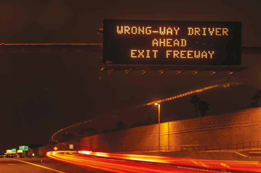
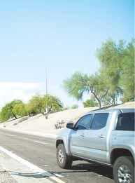
“Safety is always a DOT’s top priority and all prioritisation flows from that commitment” , he says, citing ADOT’s first-in-the-nation use of ITS to reduce the risk from wrong-way driving on Phoenixarea freeways. The detection and warning system utilises thermal cameras normally used to detect vehicles at traffic signals to provide rapid notice when a vehicle enters a freeway in the wrong direction and get that information quickly to State Troopers and other drivers (via dynamic message signs or DMS). “The results have been positive and we are expanding use of this technology,”

he says before adding that “it does not address the societal challenge of impaired driving that’s behind nearly all wrong-way incidents.”
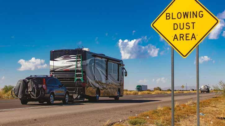
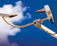
Arizona is the second driest state in the US and in another first-of-its kind use of ITS technology, ADOT is testing a dust detection and warning system along Interstate 10 between Phoenix and Tucson. The blowing dust can suddenly reduce visibility to near zero and the system, which uses sensors to detect dangerous levels of dust, integrates with DMS and variable speed limit signs which can reduce the legal limit from 75 mph to 35 mph if necessary.
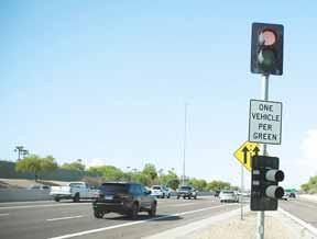
For many drivers the most obvious ITS development is an expanding network of adaptive ramp meters to help balance the overall amount of traffic on a freeway, optimise the flow and provide additional room between vehicles entering the freeway to reduce the crash risk. Nearly all Phoenix-area ramp meters operate using adaptive technology and the latest versions can respond to traffic conditions farther away and have helped improve traffic flows
heading to sporting events and concerts or when weekend construction closures are taking place.
Authorities are often accused of operating in silos but, Cain stresses, not in Arizona. “As we expand ITS technology along interstates beyond the city, we are also laying down a fibre-optic backbone into rural Arizona - starting with Interstate 17 between Phoenix and Flagstaff and along Interstate 19 between Tucson and Nogales. The broadband fibre enables us to deploy more cameras, variable speed signs and DMS beyond metropolitan areas while also allowing private broadband providers to install, operate and maintain telecommunications equipment within ADOT’s right of way using conduit.”
Several years ago, ADOT began displaying current travel times beyond the metropolitan area using Inrix’s real-time traffic data so now DMS inform northbound drivers on Interstate 17 which of two state highway routes offers the shorter travel time to Sedona. During the winter, this system informs drivers about the impact of snow on high-country highways.
Beyond Phoenix and Tucson, there are a growing number of communities along the state highway system where remote communications allows signal timing adjustments during incidents or unplanned major congestion. Another reoccurring benefit is when a signal stops working because of detection issues. Using the remote access, a technician can access the signal’s controller and provide a temporary fix until a technician can attend in person.
To escape the summer heat, city dwellers often drive to the higher elevations at weekends leading to remote locations recording considerable traffic volumes on specific corridors – mostly in small towns that experience traffic volumes during the week. “Remote communications also allow our staff to deploy time-of-day signal timing plans to better handle the increased traffic volume in these smaller cities and towns.”
The creation of the AZTech Regional Partnership allows all major transportation agencies in the Phoenix area to work together to enhance regional traffic management and enabled the deployment of Adaptive Signal Systems across

jurisdictional boundaries in locations hosting special events. These systems are usually cloud-based and control the intersections based on traffic demand. “There could be a mix of state and municipality-controlled signals - but drivers would not know the difference,” says Cain.
Another example is the ongoing Loop 101 Mobility Project involving a freeway that passes through seven Phoenix-area cities.
Work zone safety remains a priority and a recent Federal grant is funding the use of ITS to incorporate emerging technologies such as intelligent cones that alert workers if a vehicle presents a danger, traffic flow activated smart rumble strips that slow vehicles through the work zone, and emergency light alerts to warn drivers of construction and emergency vehicles.
Another collaboration is considering vehicle-to-infrastructure technology with a recent test on Valley freeways confirming the ability to alert drivers to curves, slowdowns and work zones. This study used geofence technology and a cellular provider as a proof of concept and positions the partners well for when V2X becomes commonplace.
Phoenix is also at the forefront for testing autonomous technologies. ADOT stays in close contact with autonomous ridehail vehicle operator Waymo, and other companies, and ensures they operate within the law. This positions Arizona well to understand how the technology can safely be part of the transportation mix.
“If you’re like me, you probably won’t leave Phoenix without trying one of Waymo’s autonomous ride-hail vehicles,” Cain concludes.
• All pics courtesy of ADOT























The Intersection of Strategic Partnership and Capital




















If removing and replacing sensors at the intersection is a recurring nightmare then visit Sensys Networks’ booth where, it says, ‘you can hold the future of traffic detection in your hands’ in the form of the EZ-Out system for its FlexMag3 sensor.
Unlike loops, the wireless sensor is fast to install with deployment times of minutes rather than hours. Moreover, the EZ-Out introduces a new dimension of flexibility, building on the FlexMag3’s durability and rapid deployment capability and
making it possible to swap sensors in seconds.
The EZ-Out cup and clip system enables swift removal of FlexMag3 for instant sensor swaps with minimal traffic disruptions. This combination of wireless resilience and rapid replacement makes it much easier for agencies to keep traffic detection systems operational.
During repaving projects, the sensor can be removed and then reinstalled intact after the roadway has been resurfaced, eliminating the risk (and cost) of destroying
Tapco’s Wrong-Way Alert System detects wrong-way drivers and encourages them to self-correct via warning alerts. Previously, the system relied on thermal technology but now leverages Video as a Sensor tech powered by Bosch.
The integration of Bosch ITS cameras provides real-time triggers when a vehicle travelling in the wrong direction is detected. Engineered to fit any ramp configuration, the systems flash warning alerts which can be LED-enhanced BlinkerSigns, beacons or LegendViz internally-illuminated signs.
If the driver continues down the ramp, a second layer of alert communications is triggered to inform TMCs, DoTs or law enforcement agencies via Tapco’s smart city software platform BlinkLink.
Each Wrong-Way Alert System is also equipped with Haas Alert technology to further optimise roadway safety by delivering warning messages to right-way drivers in the vicinity of the potential wrong-way driver via in-vehicle navigation. Booth 845 www.tapconet.com


detection investments. The sensors can even be relocated – temporarily for work zones or permanently for redesigned road infrastructure.

The speed and efficiency that EZ-Out offers when replacing or relocating sensors minimises traffic disruptions and detection downtime, avoiding the lengthy lane closures needed for loop repairs.
Booth 1448 www.sensysnetworks.com

You trust Daktronics over your roadways. Now count on us for your Traffic Management Center.
Daktronics designs and manufactures high-resolution, direct view LED displays. Your team can view multiple camera feeds, news, weather and DOT data feeds on a reliable, seamless screen configured into active zones. Stay informed and improve response time with clear viewing from any angle – from low light to direct sunlight.
DAKTRONICS.COM/TMC