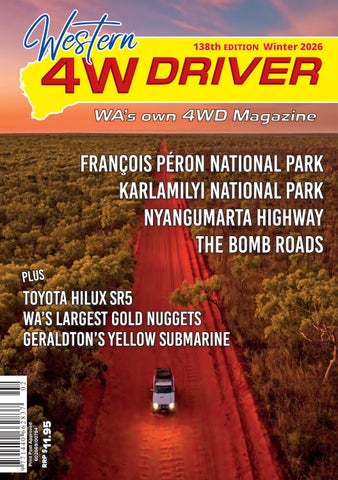
138th EDITION Winter 2026
PLUS
RRP $
11.95
TOYOTA HILUX SR5 WA’S LARGEST GOLD NUGGETS geraldton’s yellow submarine
Print Post Approved 602669/00784
WESTERN 4W DRIVER 138th EDITION Winter 2026
François Péron National Park KARLAMILYI NATIONAL PARK NYANGUMARTA HIGHWAY THE BOMB ROADS
BE PREPARED
Arm yourself against fatigue. Regularly get 7.5 hours sleep a night. On long drives take a break every two hours and swap drivers if you can.
MAXTRAX.COM.AU
Make every journey safe. wa.gov.au/rsc/fatigue
RSCOBH0131-A5_148x210mmh Fatigue press-Western 4WDriver.indd 1
8/8/2025 10:15 am
G R OW N , GAT H E R E D & S H A P E D BY C O U N T RY
21 AU GUS T - 5 S E P TE MB E R
A curated program of immersive food, culture and travel experiences set across one of Western Australia’s most extraordinary regions. From long table lunches in lush Carnarvon plantations to coastal feasts beneath the stars in Exmouth, the 2026 program brings together chefs, producers, storytellers and communities through unforgettable place-led experiences. C ARNARVON | EX MOUTH | DIRK HARTOG ISL AND
TICKETS ON SALE NOW
GA S C OY N E F O O D F E S T I VA L .C O M . AU western4wdriver.com.au |
1
CONTENTS Edition 138 | Winter 2026
ADVENTURES
18
6
6
The Bomb Roads
Travel the great deserts of Central Australia with Ron and Viv Moon
28 François Péron National Park Matt Payne discovers there's more to Shark Bay if you're willing to venture a little further
60 WA's Hidden Desert Highway Glenn Marshall explores the Great Sandy Desert from Lake Auld to the coast on the Nyangumarta Highway
70
28
Roughing it in Rudall
Amanda Burton takes us on a bone-rattling journey through a landscape of red cliffs, spinifex, and unforgiving tracks
80 Old Onslow Ghost Town
Colin Kerr's Pilbara side trip reveals the fading remains of a once-busy town
60
REVIEWS 18
The Workhorse Reborn
Toyota HiLux SR5
102 Miarco Travel Cat 400 109 Red Roads Riser 112 Dehytray Solar Food Dehydrator 116 Kickass 12/24V Electric Blanket 2 | Western 4W Driver #138
70 FEATURES
REGULARS
38 A Taste of Broome's Timeless Culture
4
The Front Matter
119
Out There
122
The Things You See
126
Bush Mechanics
128
Country Stargazing
132
Outback Survival
134
Fishy Business
138
Gear to Go Camping
142
Clewed Up
144
Smart Photography
148
Goings On
152
Capture the Moment
153
Now We're TAWKing!
157
Quarterly Crossword
158
Subscriptions
159
Advertiser Directory
160
Silly Snaps
Connect to Country and culture with Mayi Harvests
42 The Largest Gold Nuggets Discovered in Western Australia Are there still surprises waiting under the surface in WA?
50 Geraldton's Yellow Submarine A quirky addition to the city's foreshore
54 Hooked on Country
Indigenous guide Sam Birch reveals how he turned a lifelong passion into an unforgettable touring experience
86 The Road Less Travelled Photo Feature by Matt Deakin
96 Snakes in Western Australia
Snakes are a fact of life in WA, but understanding them—rather than fearing them—is the key to staying safe
western4wdriver.com.au |
3
Vanguard Publishing
ABN 70 616 133 870 26 John Street, Northbridge WA 6003 PO Box 50, Northbridge WA 6865 Phone: (08) 9422 4330 admin@western4wdriver.com.au www.western4wdriver.com.au EDITION 138: Editor Brayden Edwards Graphic Design Karen Morton Content Brayden Edwards Michael Collins Advertising Brayden Edwards brayden@western4wdriver.com.au Matt Clarke matt@western4wdriver.com.au Natalie Du Preez natalie@vanguardpublishing.com.au Administration Steve Larcombe Sally van Heemst Printing Vanguard Print Cover image: Dampier Peninsula Sunset by Matt Deakin
Disclaimer: The views expressed in this publication are not necessarily those of Vanguard Publishing or the editors but those of the authors who accept sole responsibility and liability for them. While every care is taken with images and photographs, and all other material submitted, Vanguard Publishing accepts no liability for loss or damage. Vanguard Publishing reserves the right to amend publication schedules and frequencies. Edition 138 Winter 2026
4 | Western 4W Driver #138
T
here's something about the turn of the season that just makes you want to load up the 4X4 and point it north. The campfires are burning, the flies have (mostly) retreated, and that first cold snap in the morning air carries with it the unmistakable feeling that the best time of year to be exploring WA has arrived. For those of us south of the line, that means rugging up and heading bush. For the lucky ones among us, it means heading north and leaving the cold entirely behind. Either way, winter is here, and Edition 138 is packed with enough desert adventure to keep you dreaming by the campfire well into August. Ron and Viv Moon take us deep into the great desert heart of Australia along the legendary Bomb Roads, tracing the extraordinary network of tracks built by Len Beadell and his Gunbarrel Road Construction Party across some of the most remote country on Earth. Glenn Marshall tackles the rarely driven Nyangumarta Highway from Lake Auld all the way to the Indian Ocean, navigating limestone corrugations, scrub-choked dune country and a landscape steeped in cultural history. Amanda Burton takes us willingly through the bone-rattling magnificence of Karlamilyi National Park, from the intimate beauty of Jarra Pool to the bracingly cold waters of Desert Queen Baths, reminding us that the reward for the tough tracks is always worth it. And Matt Payne discovers there's a whole lot more to Shark Bay if you're willing to air down and venture past Monkey Mia, exploring the red sand dunes, wild camp spots, outstanding fishing
T H E F R O N T M AT T E R WITH MICHAEL (SPIKE) COLLINS and stunning coastal scenery of François Péron National Park. On the features front, Colin Kerr uncovers the slowly disappearing sandstone ruins and fascinating colonial history of Old Onslow, a once-busy pearling and pastoral port now quietly fading back into the Pilbara landscape. We also pay a visit to Geraldton's wonderfully eccentric yellow submarine, a 1969 two-man vessel built to catch tropical crayfish that spectacularly failed at the job but has since become one of the Coral Coast's most talked-about roadside attractions. We celebrate two extraordinary Kimberley experiences in this edition as well. Pat Torres shares the remarkable food and country knowledge behind Mayi Harvests in Broome, connecting visitors with thousands of years of Indigenous plant knowledge, sustainable harvesting practices and the natural remedies of the West Kimberley. And Sam Birch reveals how he turned a lifetime on Country into Birchy's Fishing Tours, taking guests barramundi fishing and deep into Balanggarra, Kija and Jaru Country in ways that leave most visitors quietly changed. These are the kinds of experiences that remind you why WA is simply incomparable. The reviews in this edition are equally solid. Matt Payne puts the new ninthgeneration Toyota HiLux SR5 through its paces at Wilbinga, assessing a completely redesigned cabin, the new electric steering, the 48-volt V-Active battery system and a fresh exterior that Toyota is calling Cyber Sumo, telling us what they got right, what still needs work and whether it's enough to finally rattle the Ranger off the top of the sales charts.
We also look at the Miarco Travel Cat 400, an inflatable catamaran-style vessel that packs down small enough to store in a trailer and launches off any beach without a ramp, a crane or a prayer, and which might just be the smartest fishing and diving setup ever conceived for the serious remote-area tourer. And for those cold nights that even a Pilbara desert can't entirely escape, Matt also reviews the Kickass 12/24V electric blanket, a surprisingly capable and very affordable piece of cold-weather kit that deserves a spot in every swag kit heading out this winter. There is also news on great upcoming events on the Coral Coast and throughout the Gascoyne as part of this year's Gascoyne Food Festival. As the region continues its recovery from Cyclone Narelle, which struck in late March, it's important to remember that our regional communities up north need our tyres on their roads, our dollars in their towns, and our presence at their campfires. The Ningaloo region is open, the whale sharks are waiting, and operators like Murray Pattison at Live Ningaloo and Edwina Shallcross at Bullara Station are ready to welcome visitors back with some genuinely compelling reasons to make the drive. As always, whether you're heading to the desert, the coast, or simply warming your hands around a campfire somewhere off the blacktop, get out there and make the most of the best season on the WA calendar. Cheers, Spike western4wdriver.com.au |
5
Along the Anne Beadell
THE
BOMB ROADS BY RON & VIV MOON
Discovering the great deserts of Central Australia and the history of the roads that opened this vast region up for keen adventurers is a right of passage for today’s desert travellers, as Ron and Viv Moon have discovered.
6 | Western 4W Driver #138
W
e first travelled these far-flung roads, known as the ‘Bomb Roads' or the ‘Beadell Roads’, in the mid-1980s on two separate trips that took in all of the roads constructed by the legendary Len Beadell and his Gunbarrel Road Construction Party (GRCP). Between then and 2020, we’ve been back on numerous occasions, never tiring of the country, its hidden oases and its often-understated grandeur. Now, over the last three years, we’ve returned to these isolated desert pathways, driving all of them, sometimes more than once, leading, or helping to lead tag-along tours for my son’s tour company (see: moontours.com.au).
rocket range once covered 270,000 sq km and stretched from Woomera to the Indian Ocean north of Port Hedland. Today, managed by the RAAF, it’s still testing missiles and drones (shhh!), but only covers 122,000 sq km, though it is still the largest land-based missile testing range in the western world. Shortly after establishing Woomera, Len was called on to find a distant site for a bomb test; he chose a flat bare patch of earth about 250km west of Coober Pedy that was ideal for landing an aircraft on that he called 'Emu Claypan'. So, the desert road network began.
The Gunbarrel Highway west of Mungilli Claypan
In all, there were over 6,000km of desert tracks constructed by the GRCP, the most important being the east-west Gunbarrel Highway. While the Gunbarrel was the first link across central Australia from east to west, others followed, including the Anne Beadell Highway and the Gary Junction Road, along with an interconnecting grid of northsouth roads.
These ‘Bomb Roads' cover the vast desert country of western South Australia and adjoining Western Australia, north of the Indian-Pacific Railway line and south of the Kimberley. They were constructed in the 1950s and 60s to provide a road network and access for the Woomera rocket tests and the atomic bomb trials carried out at what we know as Emu and Maralinga.
While a few other graded roads now cut across this huge landscape, many are restricted in use to the aforementioned mining companies and Aboriginal communities. The one big exception to that is the Great Central Road (GCR), which is a well-maintained dirt road stretching from Laverton in the west to Yulara in the very heart of the country. Today, with ever-increasing long sections of bitumen, this road is slowly transforming access to this remote region.
Len Beadell chose the site of Woomera and its rocket range after WW2 when our country and ‘The West’ were deep into the Cold War and Britain wanted to test its long-range rocket capability and its A-bomb-making and detonation competence. The Woomera
For more info on the history and the Bomb Road routes, get hold of the excellent small guide, The Beadell Roads at meridianmaps.com.au. For more info on Len and his GRCP, along with his books and CDs of his talks, see: lenbeadell.com.au western4wdriver.com.au |
7
BEFORE YOU GO
You’ll need permits for all the Bomb Roads and while most are easy and quick to get, make sure you do it in plenty of time just in case there is a hiccup. They can get closed after wet weather, for Aboriginal ‘Men’s Business’, and for weapon testing from Woomera, amongst others. See each track's info below for details on permits. Fuel is a worry for many, especially at the moment, but every place we’ve spoken to recently have indicated that they have plenty of fuel. The cost? Good question, but it’ll probably only be a $1/ litre more than it was last season; it’s always expensive out there, and is that enough to put off your trip? Forget fuel going back to the price it once was at the beginning of the year—I don’t think that is ever going to happen!! All the tracks traverse very remote country, and are a long way from help if anything happens, so you need to be well prepared with a well-set-up and reliable vehicle. That doesn’t mean a jacked-up vehicle sitting on 37-inch tyres or loaded with the latest electronic gizmos; in fact, contrary to what you might read from your favourite influencer, the closer you have the vehicle to standard, the less issues you’ll have.
Have decent comms. A mobile phone is NOT good enough. An in-dash UHF with a decent external antenna for convoy comms and highway travel is a must wherever you go. An HF radio, sat phone or Starlink for long-distance comms is not a luxury. An emergency communicator such as a ‘Spot’ is a great back-up—and the absolute minimum you should have if you haven’t got an HF radio, sat phone, etc. Carry a good first aid kit (ARB’s topline kit is a good start), and somebody in your party should be up-to-date with the latest first aid methods. Know the contact details for the RFDS base nearest to where you plan to go. Have a good tool kit and spares such as fuses, tape, an assortment of cable ties, some electrical wire and connectors, WD-40, an assortment of glues and sealers, a multimeter for those electrical issues (one of the most common problems out there) and an OBD2 diagnostic scanner suitable for your vehicle (see: autophixaustralia. com.au as a start point). Ensure you have enough water for all in your vehicle and be conservative with it. We see so many carrying way too much water so they can have a shower each day—give me a break! For a two-week trip in this country for two Along the Gary Highway
8 | Western 4W Driver #138
people, around 100 litres (or less) should be ample. Water equals weight, and excess weight will cause breakages no matter the vehicle or the aftermarket suspension or trailer you have. Have an emergency plan if you break down and can’t fix it. Recovery insurance is a great backstop, but remember that the state Auto Associations that many of us belong to don't cover you for these remote tracks, even with their premium cover—check before you leave! Club 4x4 insurance would cover you anywhere in Oz, but it can be expensive. The FB group ‘Desert Recovery’ may be of help, but I’m not sure how good they are. While we’d recommend Andy from Outback Tilt Tray & Recovery Services, in Laverton, ph: (0428 196 306), for any recovery, there are other recovery services scattered across the region.
THE GUNBARREL HIGHWAY
The Gunbarrel Highway was built in the mid-1950s, linking the Stuart Highway to Carnegie Station and eventually Wiluna. While parts of the original route have been bypassed or are now closed, most adventurous travellers love the 830km stretch from Warburton to Carnegie. There is no fuel or supplies between these two places. Warburton has fuel, a store, and camping. From the Great Central Road, head via the Heather Highway to join the Gunbarrel. The track has no sand dunes but can be rough with corrugations and washouts. Highlights include the many Beadell plaques along the way; Camp Beadell (a good spot to stop); Mt Beadell and its monument; Everard Junction, where the Gary Highway heads north from; and
The Gunbarrel Highway does have a bend or two in it!
western4wdriver.com.au |
9
Geraldton Bore (good water, camp and birdlife). Near Mungili Claypan (detour around the southern edge if wet), a track to the south leads to a distant Empress Springs. Conditions improve west of the claypan, though corrugations remain to Carnegie, where fuel and camping are available. From there, it’s 340km to Wiluna on a generally maintained gravel road, with fuel, supplies, and the Canning-Gunbarrel Discovery Centre worth a visit once you are at this outback township. Permits and Info Permits: ngaanyatjarra.org.au/permits Warburton Roadhouse: warburtonroadhouse.com.au Carnegie Station: (08) 9981 2991 Wiluna Caravan Park: 0474 255 543
ANNE BEADELL HIGHWAY
This east–west route offers a more remote and challenging alternative to the Gunbarrel or Gary Junction Road. Stretching 1,380km from Coober Pedy to Laverton, conditions vary from smooth to heavily corrugated, while the Serpentine Lakes near the WA–SA border can be slippery and boggy after any rain. The track mainly follows the interdunal valleys, though it does cross some dunes, which can be tricky. This year, the section east of Emu Junction has been graded, improving that part of the drive. You need four separate permits to travel this route, so apply for them well beforehand. Fuel and limited supplies are only available at Ilkurlka Roadhouse, so check ahead. Highlights include the Tallaringa Conservation Park, Len Beadell’s plaques and the Totem-1 and Totem-2 atomic test sites near Emu Junction. West of the border, track conditions improve towards Ilkurlka, and along the way there are a couple of pleasant camp spots. West of Ilkurlka is Neale Junction, where the Connie Sue Highway crosses the Anne Beadell. Here you’ll find a Beadell post and marker, with pleasant camping nearby.
Typical Beadell blazed tree with plaque this one on the Gunbarrel Highway
10 | Western 4W Driver #138
The Totem-2 monument near Emu Junction
Beyond here, the road stays much the same, passing the peak of Bishop Riley’s Pulpit and entering the Yeo Lakes Nature Reserve before arriving at the Yeo Homestead and its hut and reasonable camping area. Further west again, you’ll come into an area of much more recent mining activity, with numerous tracks here and there and pass the ruins of the Yamarna HS. From Yamarna a better dirt road continues to Laverton.
CONNIE SUE HIGHWAY
This is a fabulous drive through remote desert country, but sadly many of the highlights that lay some distance off the road, which had been open for travellers to visit, have been closed by Aboriginal TOs in recent years. Still, there’s much to enjoy as you turn off the Great Central Road and head south to distant Rawlinna or head north from the railway line.
Maralinga Tjarutja Lands & Mamungari Conservation Park: Ph: 08 8625 2946; Email: reception@maralinga.com.au
In all it is about 635km from Warburton to Rawlinna but there is no fuel or services at Rawlinna, the closest being Cocklebiddy on the Eyre Highway, 160km south.
Tallaringa Conservation Park: parks.sa.gov.au/parks/tallaringaconservation-park
Ngaanyatjarra Council: ngaanyatjarra.org.au/permits
Permits and Info
Woomera Prohibited Area: defence.gov.au/bases-locations/sa/ woomera/access/forms Ngaanyatjarra Council: ngaanyatjarra.org.au/permits
Permits and Info
Warburton Roadhouse: warburtonroadhouse.com.au Cocklebiddy Roadhouse: (08) 9039 3462
Ilkurlka Roadhouse: (08) 9037 1147
On the Connie Sue at Rawlinna
western4wdriver.com.au |
11
GARY HIGHWAY
This north-south route begins at Everard Junction on the Gunbarrel Highway and meets with the Gary Junction Road 355km north and east of Kunawaritji. The closest places for fuel are Warburton and Carnegie HS in the south and Kunawaritji in the north, which means you’ll travel over 600km between fuel stops. The southern section of the route from Everard Junction to Windy Corner has been the most traversed in recent years. You’ll pass some burnt-out vehicles along the way from spinifexinduced fires and skirt along the edge of Lake Cohen, which is a great spot to camp at any time and is magical if it has water in it. North of Windy Corner the route is more overgrown in some sections of the track and has been flooded for long
periods of time. Not sure what the latest cyclones have done to the route, but it was challenging a couple of years back. Veevers Meteorite Crater and McPhersons Pillar are worthwhile detours, but the track to Veevers is pretty overgrown these days from what I’ve heard. Permits and Info No permits are required for this route but you need them just to reach the start or end. Ngaanyatjarra Council: ngaanyatjarra.org.au/permits Warburton Roadhouse: warburtonroadhouse.com.au Kunawaritji Store: (08) 9176 9040 You may be lucky enough to come across a Thorny Devil
Lake Cohen rarely has water in it ... but when it does it makes a magical camp
12 | Western 4W Driver #138
GARY JUNCTION RD
This long-distance route, often called the Kintore-Kiwirrkurra Rd, leads from the west coast north of Port Hedland to Central Australia, and Alice Springs is a favoured drive of ours. In all, it covers some varied and delightful desert country, so take your time and enjoy the route. From Marble Bar, inland from Port Hedland, to Alice Springs it is around 1,700km depending on which way you go between Alice and the Aboriginal community of Papunya. In all, there is about 1,500km of unsealed road, varying from smooth and sandy to badly corrugated, especially east and west of Papunya. Our favourite camps are Well 33 just out of Kunawaritji, Jupiter Well, Mount Tietkens in the Buck Hills, Liebig Bore west of Mt Liebig and the Finke River
at the 2-Mile, at the western end of the MacDonnell Ranges. There are a number of Len Beadell plaques along this route as well as his burnt-out ration truck at Kiwirrkurra. Permits and Info Ngaanyatjarra Council: ngaanyatjarra.org.au/permits Central Lands Council: clc.org.au/permits Punmu Store: punmu.com.au/fuel.php Kunawaritji Store: (08) 9176 9040 Kiwirrkurra Store: (08) 8956 4935 Kintore Store: (08) 89568575 Papunya Store: (08) 8956 8658 Len's burnt-out ration truck at Kiwirrkurra
Len's border marker on the Gary Junction Road western4wdriver.com.au |
13
SANDY BLIGHT JUNCTION ROAD
Probably my favourite road in the region, this route, constructed in 1960, heads south from the Gary Junction Road near Kintore to the Great Central Road near Docker River, some 230km west of Yulara. In all, it is about 350km from one end of the Sandy Blight road to the other. At the northern end, Mt Leisler dominates the scene, and we love camping close to where the now-lost Tietken Tree once stood with Mt Leisler rearing up close behind us. Heading south there are a number of Len’s blazed trees and plaques to discover, while some of the stands of whispering desert oaks are pure magic to camp amongst. A side track to a high vantage point in the Sir Frederick Range is not to be missed. Further south again a track to the west leads a short distance to the Bungabidy Rockhole tucked in amongst rugged hills of the Walter James Range. Permits and Info Central Lands Council: clc.org.au/permits
CALLAWA TRACK – THE NYANGUMARTA HIGHWAY
For all intents and purposes, the Wapet Road come Kidson Track, now called the Nyangumarta Highway, has superseded the Callawa Track which was first completed by Len and the GRCP in 1963. The Callawa Track is no longer used and is grown over. The Nyangumarta Highway, which has taken its place, runs from Kunawaritji to the Great Northern Highway just south of Sandfire Flat RH, a total distance of 650km. It is very remote country and little traversed. Permits and Info Nyangumarta Warrarn Council: nwac.org.au/https/nwac/ nyangumarta-hwy-permit Ngaanyatjarra Council: ngaanyatjarra.org.au/permits Kunawaritji Store: (08) 9176 9040 Sandfire Flat Roadhouse: (08) 9176 5955 For a map of the Nyangumarta Highway go to: 4wda.com.au/ wp-content/uploads/2021/12/ NyangumartaKidsonTrackMap.pdf
Kintore Store: (08) 8956 8575 Docker River Store: (08) 8956 7368
Bungabiddi Rockhole can be found off the Sandy Blight Junction Road
14 | Western 4W Driver #138
Dingoes are often seen — including these black and tan ones
VOAKES HILL ROAD
This road runs south 275km from the Anne Beadell at Voakes Hill Junction to the railway town of Cook on the Trans Australian Railway Line. While it’s an easy drive, it is extremely remote country and the route is little used.
MT DAVIES ROAD
The Mt Davies Road which once ran from the Gunbarrel Highway to Surveyor Generals Corner is badly overgrown, and permits to use it are impossible to obtain.
Permits Maralinga Tjarutja Lands & Mamungari Conservation Park: Ph: 08 8625 2946; Email: reception@maralinga.com.au
MARALINGA
No wandering on the Beadell Roads is complete without a visit to Maralinga where seven A-bombs were detonated along with a heap of lesser nuclear trials between 1957 and 1963. Len had selected the site for the tests at Maralinga in 1953, and the road from Emu to the new bomb site was built in 1955. Sadly, this road has been closed to travellers for years. However, today you can join a tour and camp at the Maralinga village before taking a tour to the bomb sites. It might sound expensive, but it is worth it.
Taranaki was the biggest A-bomb detonated on the Australian mainland
Permits and Info maralingatours.com.au
Maralinga test site saw seven A-bomb explosions
western4wdriver.com.au |
15