1 minute read
ST. MULLINS SITE STUDY.


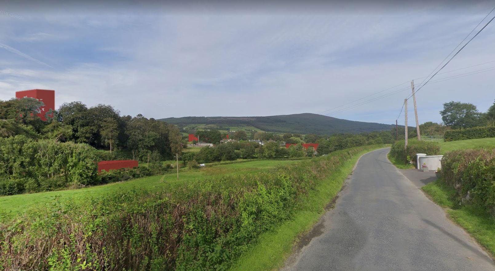
As a group we evaluated the aerial and plan views of St. Mullins and came to a conclusion that they were not an effective method of understanding the place and Covid-19 restrictions prevented us from visiting the area in person. This led us to use the technology we had at hand to virtually visit the area. Our process began by using Google Street View to virtually walk around St. Mullins. By noting down features unique to the area, we began to gain an understanding for what makes the village of St. Mullins unique. The village had no strict planning but instead took a naturally dispersed approach. The analysis of building locations in relation to their environment informed our spatial perception.
The aim of this investigation was to site ourselves correctly in this close-knit village so as to avoid our architecture being intrusive. In order to do this, the group decided on a series of Google Street view photographs which covered the majority of the views of the village. We then began placing red objects into these photographs to see what they provided spatially. The key to this process was reflection and taking a critical approach in order not to harm the existing atmosphere of the area which we did not want to impede upon.
Advertisement
Once we were happy with the architectural objects’ locations, we thought it helpful to map their locations in plan to gain an understanding of their dispersal. Our conclusion after this process was that we had achieved our goal of discovering sites that would mesh with the existing fabric of St. Mullins.
Through planometric existing such as ruined dense them termendous as if giving
My thinking brownfield our study environmental secondly, characteristics prominent adding