2 minute read
Fall in Love with Peoria Historical Sites


Fall in love with Peoria Historical Sites
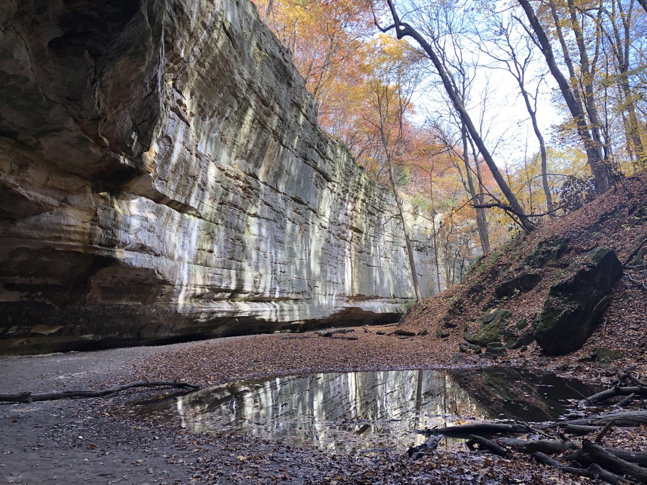
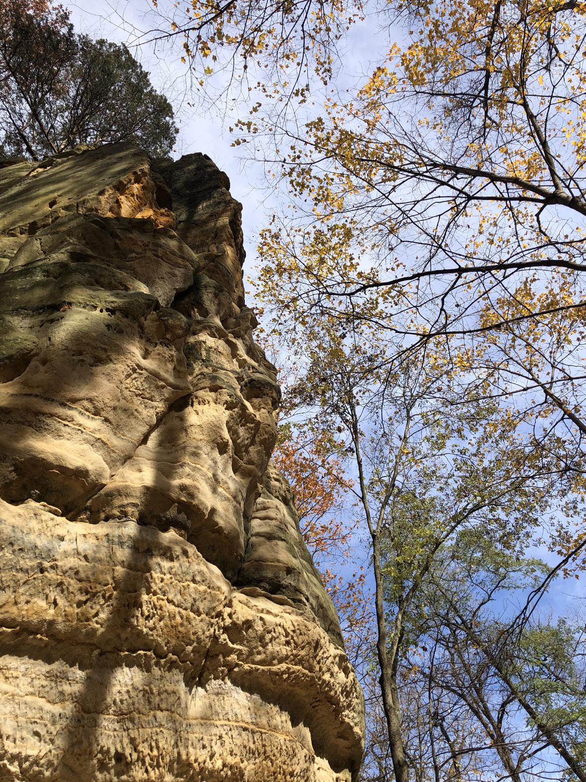
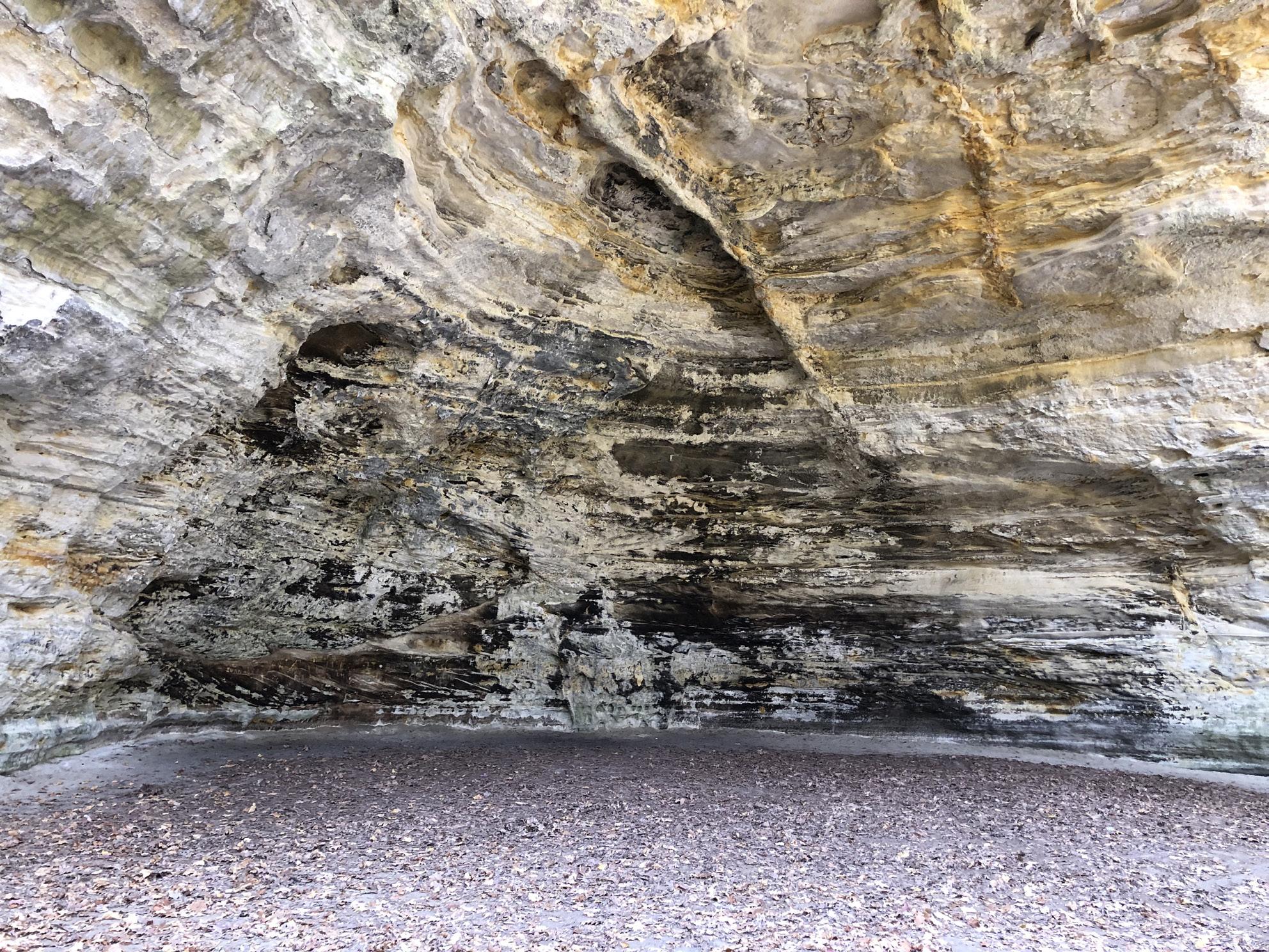
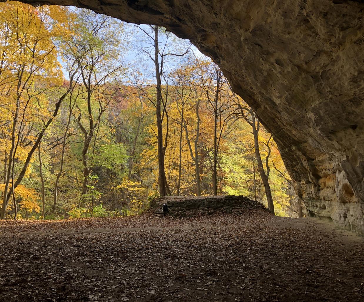
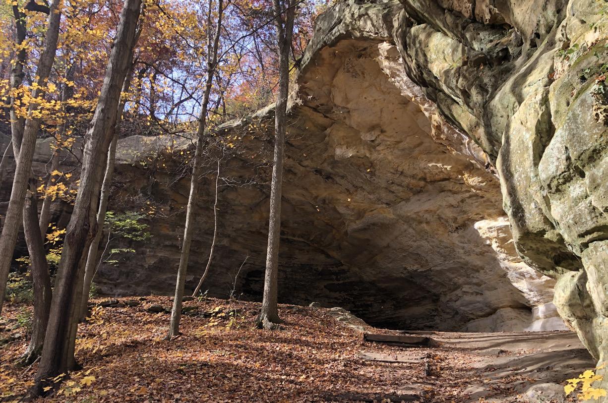
Plum Island
Inside this natural cave-like structure, soot remains on the wall from the fires of the Peoria Annual Council Meetings. They were held at Plum Island in Illinois.
The Mounds at Lewiston (Dickson Mounds) is a Native American settlement site and burial mound complex near Lewistown, Illinois. It is located in Fulton County on a bluff which overlooks the Illinois River. It is a large Burial complex containing at least two cemeteries, ten superimposed burial mounds and a platform mound. The site was established in 800 CE and was in use until after 1250 CE. This site is of great importance to the Peoria due to the extensive presence of the Peoria within the Illinois River Valley.
Plum Island is the traditional site of the Peoria Annual Council meeting and was a common meeting place for Peoria and Kaskaskia Tribal citizens alike. Today it is an eagle sanctuary which helps protect a population of wintering bald eagles. It is near The Grand Village of the Kaskaskia, Le Rocher and Matthiessen State Park.
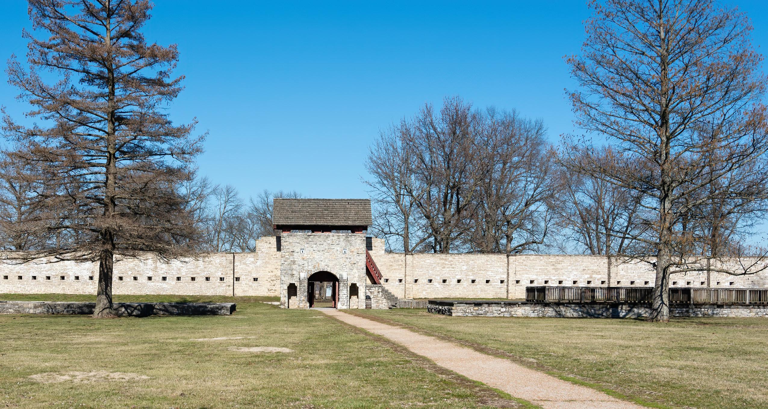
Fort de Chartres
Fort de Chartres was a French fortification first built in 1720 on the east bank of the Mississippi River in present-day Illinois. It was used as an administrative center for the province. Due generally to river floods, the fort was rebuilt twice, the last time in limestone in the 1750s in the era of French colonial control over Louisiana and the Illinois Country. It was also a major point of trade for the Peoria and Kaskaskia tribes.
This image is of the Fort De Chartres Parade Ground where celebrations of the history of this site are still celebrated today. http://www.fortdechartres.us/
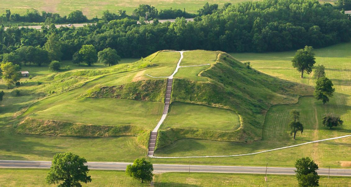
The Cahokia Mounds
The Cahokia Mounds State Historic Site is the site of a Pre Columbian Native American city (which existed c. 1050–1350 CE) directly across the Mississippi River from modern St. Louis Missouri. This historic park lies in southwestern Illinois between East St. Louis and Collinsville. The park covers 2,200 acres (890 ha), or about 3.5 square miles, and contains about 80 mounds, but the ancient city was much larger. At its apex around 1100 CE, the city covered about 6 square miles and included about 120 manmade earthen mounds in a wide range of sizes, shapes, and functions. At the apex of its population, Cahokia may have briefly exceeded contemporaneous London, which at that time was approximately 14,000–18,000.
Monks Mound (Below) is the largest man-made mound at Cahokia as well as North America. To view an interactive map of all of the documented mounds at Cahokia: visit https://cahokiamounds.org/cahokia-map/
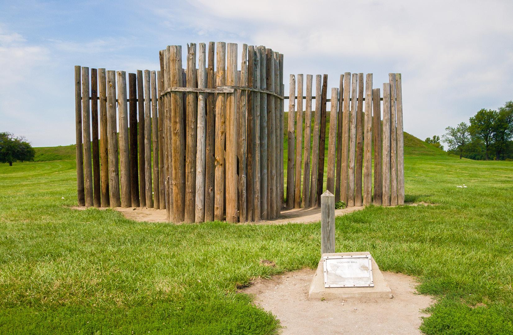
Excavations in the 1960s revealed stockade walls (Below) that were started around A.D. 1100 and rebuilt multiple times. The stockade walls surrounded parts of the Cahokia Mounds, but without evidence of invasion at Cahokia, the exact purpose remains unknown. These oak and hickory logs were built up to 20ft tall, were evenly spaced and, sometimes, built in a hurry; however, the walls could have served as a social barrier in the communities as well.