2 minute read
Study Area


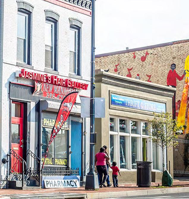
The geographic focus of this project is a portion of Washington D.C. that spans from U.S. Joint Base Anacostia-Bolling in the south to the D.C.Maryland border in the north. For the purposes of this project, the area is referred to as the Anacostia River Corridor or the River Corridor.
The Anacostia River Corridor contains multitudes. It includes the neighborhoods of Barry Farms, Anacostia, Fairlawn, Dupont Park, Greenway, Mayfair, Eastland Gardens, and Kenilworth. It also constitutes most but not all of Wards 7 and 8. The area interfaces with metro transit, freight rail, and numerous bus routes, and contains low-, medium-, and high-density residential areas as well as industrial and brownfield sites.
Advertisement
Running directly though the River Corridor is a 6-mile stretch of DC-295, which is D.C.’s only state highway. The highway serves as an important regional and local connector, but is also a significant barrier for nearby residents.
Though its history of disinvestment remains clear, the river corridor still sports a wealth of assets and a strong community.
As of 2020, there are 136,653 residents living in the River Corridor, which accounts for about one fifth of the entire District of Columbia population (701,974). Despite being a large portion of the overall population, demographics across the Anacostia River look notably different across income and race.

The median income of households in Anacostia ($37,803) is significantly lower than DC ($82,604), as is the number of people living in poverty, with 28 percent in the study area versus the District’s 15 percent.
The study area is predominantly Black and AfricanAmerican, accounting for about 90 percent of the total population, compared to the District’s even share of White and Black residents (roughly 45% each).
28% below the poverty line vs.
15%
17% bachelor’s or advanced degree
About 27 percent of the River Corridor’s population falls under the age of 18 and only 12 percent are above the retirement age of 65. Almost half of the population (49 percent) falls between the ages of 18 and 54. The District sees less children under the age of 18 (18 percent) and about the same residents over the age of retirement (12 percent). Both populations’ single largest age category from ACS data is between 25 and 34 years old, with 17 percent for the study area and 23 percent for the District.
Educational attainment numbers show that about 40 percent of the study area’s population over the age of 25 has graduated from high school as their highest form of education, with only about 10 percent of the population with a Bachelor’s degree and 9 percent with a master’s, professional, or doctorate degree. Data for the District shows that 17 percent of the population graduated from high school as their highest attainment, with 25 percent graduating with a Bachelor’s and 35 percent with a Master’s degree or higher.
As the significant differences in racial makeup, income, and educational attainment demonstrate, the Anacostia River Corridor stands out from the rest of the city. The history of segregation and disinvestment covered in the introduction reveals itself in this demographic overview, further highlighting the importance of addressing the harm I-295 has caused this long-standing D.C. community.
History of the Anacostia River Corridor


Industrial Waterfront
Anaquash
The indigenous Nacotchtank inhabited what is now D.C. for an estimated 10,000 years before the arrival of English colonizers. In the early 1600s, about 300 tribe members lived in villages mostly along the eastern banks of the Anacostia River. The river was referred to as ‘Anaquash,’ or ‘village trading center’.

Agrarian Transformations

John Smith’s arrival in 1608 heralded the rapid settlement of the land east of the Anacostia by English landowners.

The Anacostia River offered the potential for deep-water ports and was poised for significant harbor development Dredging, dumping, and walling the Anacostia ensued.