11 minute read
Devilbend - From Quarry to Reservoir to Natural Features Reserve


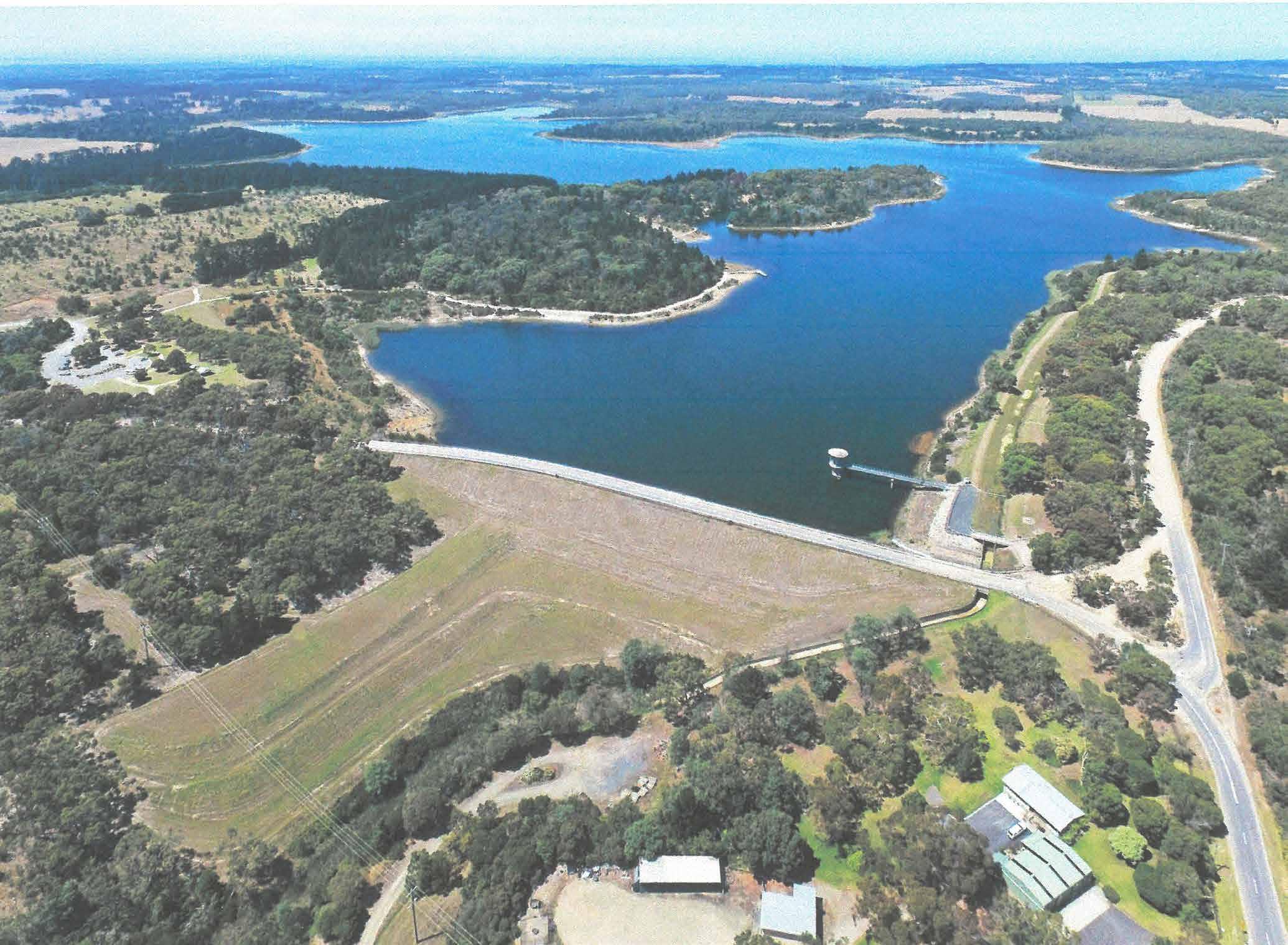
Above: An aerial photo of Devilbend
By Val Wilson, Peter McCullough and Lance Hodgins
The Devilbend Natural Features Reserve is a 1,005 hectare (2,480 acres) park which includes the largest inland body of water on the Mornington Peninsula. As well as hosting a large variety of flora and fauna, it caters for recreational activities such as walking, cycling, horseriding, fishing and non-powered boating. However, the area had several quite different lives before it was proclaimed the Devilbend Natural Features Reserve in 2007.
Turner’s Quarry
Robert Turner, born in Scotland, came to Australia in 1854, married Ellen O’Donnell, and they had seven children. This included James who was born in 1863. By the last decade of the nineteenth century the Turners owned a number of blocks of land in the Tuerong area. As can be seen on the map, James owned the block on the south-east corner of the intersection of Hodgins Road and Loders Road Extension; it was inclined to be swampy and in due course was the site of the Bittern Reservoir.
As young men, James and his brother Joseph were eying the exposed rock in the walls of the deep valley which ran through part of the Turner land; rock which was in demand by the new shire councils for building roads throughout the peninsula. It was on the land diagonally opposite James’ block that they started what became known as Turner’s Quarry.

The quality of the stone from Turner’s Quarry was excellent and there are several instances in the minutes of the Frankston and Hastings Council meetings of 1904-1905 where it is compared favourably with maintenance metal from elsewhere. As late as 1936 it was reported: “In the East Riding it is proposed to repair Stumpy Gully, Graydens and Hodgins Roads with metal obtained from Turner’s quarry.”
Because of its remote location, the stone from the quarry was transported by wagon, drawn by a team of bullocks. In the late 1890’s the Hastings Battery was armed with 40 pounder Armstrong guns. Although a team of horses could move them a short distance if the ground was firm enough, mobility of the guns was not great. The possibility of using a bullock team was aired and quickly embraced by 34 year old James Turner who was already in the Battery and able to supply the animals needed for the task. Consequently, the October 1897 gunnery practice was an outstanding success and each quarterly practice thereafter saw the guns being transported further and further from the gun shed.
While it proved to be a profitable venture for the Turner family , quarry work was not without its hazards. On 2 February 1907 the following report appeared in the local newspaper:
“A serious accident occurred at Turner’s Quarry, near Tuerong, on Wednesday. Messrs John and Louis Connell were engaged in blowing out stone, a hole had been drilled and three pounds of blasting powder put in, when an accident happened with the fuse. The fuse ignited the powder while they were standing over the hole. Both had a narrow escape from being blown to pieces, and they received injuries to face, arms and body. Dr. Hornabrok attended to the sufferers.”

Devilbend Reservoir
The Bittern Reservoir, supplied by pipeline from Melbourne’s metropolitan catchments, was constructed in the 1920’s as a water supply for the growing population of the Mornington Peninsula. By the 1950’s there was a need for additional water and a decision was made to establish a much larger reservoir some 500 metres to the north-west of the Bittern Reservoir. The two reservoirs were linked by an often-dry drainage channel and were along the course of Devilbend Creek, a tributary to the much larger Balcombe Creek. Devilbend Creek gorge was ten metres deep and extended south for several hundred metres from Graydens Road; it was the ideal site for a dam wall. Quarrying for the construction of the wall revealed the underlying geology of the area that can be seen today. The rocks include sandstones, slates and cherts and are among the oldest rocks on the Mornington Peninsula.

Devilbend and Bittern Reservoirs have small natural catchments and the construction of the catch drain around the southern and western perimeters of both reservoirs was intended to protect water quality by preventing run-off into the reservoirs. Concerns had been expressed that the run-off from neighbouring properties may contain agricultural contaminants and that there could be salinity issues. So Devilbend Creek was highly modified and flowed through the reserve primarily via a catch drain, returning to the natural course of the creek to the north of the reserve via a concrete spillway.
Although the decision to build the reservoir was made in 1956, the process of compulsorily acquiring the land required, road deviations and then the actual construction, was protracted. Consequently, it was 28 January 1965 before the reservoir was officially opened by Premier Henry Bolte. The purpose of the reservoir, which cost one million pounds to build, was to supply water to the towns between Dromana and Portsea, and the Western Port area. Its capacity was 14,600 megalitres, much larger than the Bittern Reservoir which was 573 megalitres (Note. An Olympic pool holds one megalitre.)
In December 2000 both reservoirs were made redundant with the completion of a water pipeline from the Cardinia Reservoir to Pearcedale.


Devilbend Natural Features Reserve
In 2002 the Minister for Environment and Water formed a working group to discuss the future of the reserve and a summary report was presented in 2004. In January 2006 the Minister announced the government’s intention to establish a new Devilbend Park. Then in September most of the area was transferred to the Crown and the Minister announced that the area would become a Natural Features Reserve to protect the less than 5% of Mornington Peninsula’s original bushland habitat that remained. The Minister also announced that 40 acres of land north of Graydens Road would be sold and the proceeds would be allocated to the management of the new reserve. It was officially proclaimed on 8 March 2007.
Meanwhile, the Devilbend Foundation was formed in January 2004 to promote a ‘Community Vision’ for Devilbend. This multitude of conservation groups evolved into the Devilbend Foundation Inc. in October 2006. It had strong views on some matters such as its opposition to fishing and horse riding which resulted in some compromises when the Reserve was officially opened to the public in 2012. The Foundation still exists and works with Parks Victoria to establish and maintain this beautiful nature reserve.
The fact that pipeline water was no longer available for these former reservoirs was a cause for concern. Modelling indicated that if run-off continued to be directed by the catch drains, then Bittern Reservoir would dry up and the water level at Devilbend Reservoir would drop to two thirds capacity. Following detailed investigation it was decided, previous concerns about water quality notwithstanding, to replenish Devilbend from its original source after a 61 year hiatus: “Up to 17 million litres a day will enter the reservoir during peak flow times. The flows will raise water levels in the reservoir and ensure its sustainability over summer months… this seasonal flow will boost its general health and biodiversity and create better habitats for bird and fish.” (Mornington News, 26 September 2017.)
The catch drain would still of course be available to dispose of water not required for ‘topping up’ and to provide relief should there be severe flooding of Devilbend Creek which would lift high water levels to such an extent that they might threaten to breach the dam wall.
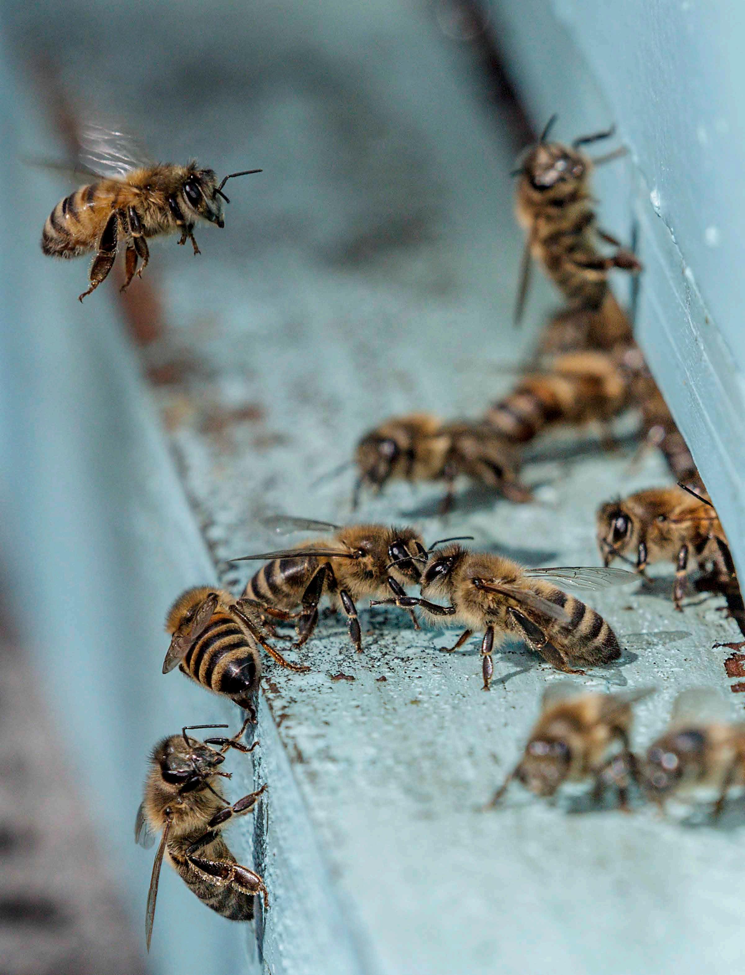
Today Devibend Natural Features Reserve supports more than 200 species of native flora and 195 indigenous species of fauna, including multiple threatened species. The reserve is recognized as an ‘Important Bird Area’ by Birdlife Australia, being globally important for the conservation of bird populations. There have been 158 bird species recorded at Devilbend, including the bluebilled duck (listed as endangered) and the reserve is the only known nesting site on the Mornington Peninsula of the white-bellied sea eagle (listed as threatened). Frogs including the Growling Grass Frog, Dwarf Galaxias and Red-eared Slider Turtles are noted water species. Significantly, past restrictions on public access during the reservoir era have created favourable conditions for wildlife habitat.
The reserve is an important remnant of native vegetation as much of the surrounding land has been cleared for orchards and grazing. Its total area of 1005 hectares includes 422 hectares of native vegetation and 328 hectares of non-native vegetation (predominantly in the form of grazed land.)
The 250 hectares of water surface includes a designated area of 33 hectares located in the northern arm of the former Devilbend Reservoir which has been set aside for non-powered watercraft (canoes, kayaks, paddleboards and windsurfers.) There are five designated fishing zones available for keen freshwater anglers: four in the watercraft area of Devilbend Reservoir where fishing platforms and pontoons are available, and one zone in the Bittern Reservoir. Since 2010 the two reservoirs have been stocked with large numbers of brown trout, rainbow trout and estuary perch.
The other activity which was subject to debate in the past was horse riding and it is only permitted in a limited area in the vicinity of the Bittern Reservoir.
At the northern end of the Devilbend Reservoir is a 5 hectare picnic area which has electric barbeques, picnic tables, shelter and toilets. From this base Devilbend can be explored by the scenic
walking tracks that wind around the reserve, ranging from the easy boardwalks to the more adventurous 11.5 kilometre Devilbend Circuit Track. Bittern Reservoir also has a small picnic area and a circuit which is accessible off Hodgins Road. This walk gets close to the water’s edge and provides a good vantage point for bird watching.
And The Name?....Devilbend?
‘And the hobyahs cried “Pull down the hut, eat up the little old man, carry off the little old woman.”’ Readers of some vintage will remember the story of the hobyahs which featured in the second grade reader in Victorian schools. Generations of children experienced nightmares as a result of this gruesome tale and the ‘Letters to the Editor’ columns featured complaints on an annual basis.
As well as the hobyahs, aboriginal stories of man-eating swamp dwellers called ‘bunyips’ gave parents sufficient grounds to warn their children of the dangers lurking in the nineteenth century Australian bush. To the inhabitants of Schnapper Point (Mornington), the interior of the Peninsula was something to be feared. Snakes were real, murders on the Tubarubba goldfields were unsolved, and children were constantly being saved when they wandered away from home.
The few houses along Three Chain Road (today’s Moorooduc Highway) marked the limit of safety. Beyond this lay an area which was rugged bushland; a ‘shatterbelt’ of complex hills and valleys, its waterways twisted and disrupted by the repeated uplift of the land mass along several fault lines.
In his recently published book ‘A Never Ending Journey’ Malcolm Gordon comments : “The original locality name was ‘Devil’s Den’. According to local legend it was considered ‘such a wild place anything could come out of it’. The Den was a dangerous place in the gully and children were warned not to play there. Devil Bend eventually became the name.”
A glance at a map of the area before it became a reservoir shows that Devilbend Creek, after crossing Hodgins Road, meanders in a northerly direction before making a loop to the south and then heading back towards the north. Apparently at this point the loop was in a gorge about ten metres deep; it was a ‘devil bend’.
References:
Gordon, Malcolm H.B., ‘A Never Ending Journey. The Story of Victoria’s Mornington Peninsula’, Ranlagh Publishing House, 2021.
Parks Victoria ‘Devilbend Natural Features Reserve Management Plan’, September 2017