Outside Lands San Francisco History from Western Neighborhoods Project Volume 21, No.3 Jul–Sep 2025
OUTSIDE LANDS History from Western Neighborhoods Project (Previously issued as SF West History)
CONTENTS 1
Executive Director’s Message
2
Where in West S.F.?
contributors: Richard Brandi, Paul Judge, Nicole
4
At Home at the Lucky Deli
Board of Directors 2025
8
Refuge on the Ocean Road
14
Josephine Dows Randall and the Golden Age of Recreation
Jul-Sep 2025: Volume 21, Number 3 editor: Chelsea Sellin graphic designer: Laura Macias
Meldahl, Margaret Ostermann, Kristine Poggioli, Chelsea Sellin, Amanda Tewes
Carissa Tonner, President Edward Anderson, Vice President Joe Angiulo, Secretary Kyrie Whitsett, Treasurer Lindsey Hanson, Rebekah Kim, Nicole Smahlik, Alex Spoto Staff: Nicole Meldahl
Advisory Board Richard Brandi, Christine Huhn, Krissy Kenny, Woody LaBounty, Michael Lange, John Lindsey, Alexandra Mitchell, Jamie O’Keefe, and Lorri Ungaretti
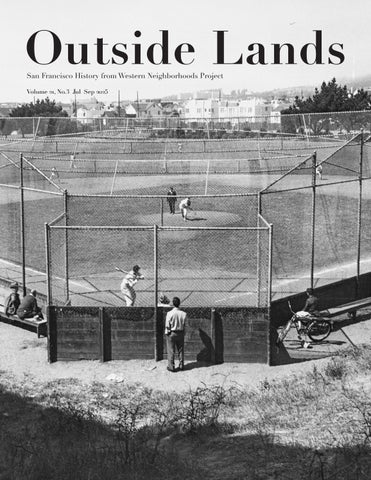
Western Neighborhoods Project 1617 Balboa Street San Francisco, CA 94121 Tel: 415/661-1000 Email: chelsea@outsidelands.org Website: www.wnpsf.org facebook.com/outsidelands instagram.com/outsidelandz Cover: Rossi Playground, 1950s. (Courtesy of a Private Collector / wnp26.1526) Right: View east on Taraval from 21st Avenue, August 24, 1923. (Photo by Horace Chaffee, SF Department of Public Works; courtesy of a Private Collector / wnp36.03106)
© 2025 Western Neighborhoods Project. All rights reserved.
by Margaret Ostermann by Paul Judge
by Richard Brandi and Chelsea Sellin
by Amanda Tewes
20
Inside the Outside Lands
21
Foggy Memories by Kristine Poggioli
EXECUTIVE DIRECTOR’S MESSAGE Nicole Meldahl Summer, especially as it transitions into early fall, is always the busiest time of year for us at Western Neighborhoods Project. As our calendars fill up and our calls for volunteers to help staff events go out, I’m constantly reminded that the best part of my job is getting to work with all of you. We have the best crew, one that is rapidly but thoughtfully expanding this year—a subject I shed light on with this issue’s Inside the Outside Lands. I learn so much from our members, volunteers, and collaborators. Case in point: Art Siegel, a member of our hardworking team of volunteers who answer your queries about images on OpenSFHistory, shares tools he uses to pinpoint historical details. Art is one of the best researchers I’ve ever met. Recently, he shared a San Francisco Planning Department website (sfplanninggis.org/1938) that allows you to interact with composite aerial photos of San Francisco by toggling between 1938 and other years, giving a side-by-side comparison of how each city block has changed between then and sporadically subsequent decades up to 2024. Images we’ve digitized and shared with other organizations, like the David Rumsey Map Center, make these kinds of tools possible. As I zoomed around this website for far longer than I probably should have, I began thinking about how many layers of history this city holds—each one resting on top of the other, each year made possible by the one before, each person impacting the lives of others that come after them. It’s easy to lose sight of this when you don’t look for the past in the present. Luckily, we don’t have that problem here. In this issue, Richard Brandi and Chelsea Sellin allow us to experience 19th century San Francisco with the fourth installment exploring early roads through the Outside Lands, this time helping us navigate the Ocean Road. Margaret Ostermann and Charlie the History Poodle make this view into the past possible in every issue with Where in West S.F.?; this quarter, you’ll get a dog’s-eye-view of Taraval Street near one of my favorite breakfast spots in the city: the New Taraval Café. Speaking of favorite places to get a bite to eat, we’re giving you a glimpse of the scene at Lucky Deli at 46th Avenue and Cabrillo Street in the 1970s and 1980s. This article evolved out of memories and photos shared by Paul Judge and Dennis O’Rorke without intention, aside from the communal practice of sharing. I love when history comes to us like this, and I’m always trying to find the right way to share with a broader audience what you all are kind enough to send me. In this piece you’ll meet Mary Bezat, Lillian Faria, Terry Collins and his horse, and you’ll possibly crave a slice of pineapple upside down cake when you get to the end. But nobody has more fun sharing stories with us than Kristine Poggioli, who takes us back in time as we learn more about her magical San Francisco in this issue’s installment of Foggy Memories. Another article in this issue by Amanda Tewes will either introduce you to, or help you better know, a remarkable woman named Josephine Randall. Few people have had as great of an impact on our recreation spaces in San Francisco as Josephine, who is the namesake of the Randall Museum in Corona Heights Park. The park just squeaks into our definition of “western neighborhoods” since we formally expanded our borders to Divisadero/Castro where it intersects with Market Street. These new(ish) boundaries have made so many more histories available to us to tell, and we’re having a ball finding and sharing them. That’s the beautiful thing about cities, right? They’re always changing and around every curve in the road, you meet people that illuminate where you’ve been and, hopefully, where you’re going. That’s what I hope our history does for you; hence why our logo is a streetlamp. All my best,
outside lands
1
WHERE IN WEST S.F.? By Margaret Ostermann It’s a neighborhood with rather floppy-feeling borders. The earliest cottages from 1908, craftsmen-inspired bungalows, and all manner of revival architecture reveal the Parkside’s age relative to the broader Sunset District, which its later stucco-faced homes carelessly bleed into. Although the neighborhood’s perimeter may feel loose, there’s no debating that the heart of the Parkside beats along the Taraval Street commercial corridor.
View east down Taraval Street from 21st Avenue, 1947. (Courtesy of a Private Collector / wnp27.4766)
Just as any streetcar district’s homes follow a transportation line’s patterns of development, businesses hug the tracks closer still. Before the municipally-operated L-Taraval started rumbling down the corridor in 1919, the growth pattern along Taraval had already been set in motion. In order to sell the Parkside’s remote lots, the developer created the Parkside Transit Company, which included a local streetcar line snaking through the sand dunes and stretching down Taraval, connecting residents with the longer streetcar routes heading downtown. Those streetcar tracks help narrow down the location of our mystery photo, but the Parkside Theater’s neon blade made the view east from Taraval and 21st Avenue a dead giveaway for David Berelson, Roger Goldberg, Harry Henderson, Judy, Kris Smith, Martin Szeto and Pete Tannen. These blocks of Taraval were arguably the densest hub of the corridor’s activity, where a post office, pharmacies, and delicatessens made errands a neighborhood affair when this 1947 photo was taken. Tim Dineen shared that he worked at Pirro’s Pizzeria in the 1960s and early 70s when it was located near the 21st Avenue intersection. Baronial Bakery—visible on the right side of the mystery photo—provided one of Tim’s sisters with her wedding cake in the mid-1970s. When the 1,329 seat Parkside Theater opened on December 28, 1928, the San Francisco Chronicle glorified Taraval as “a bustling business center” in a district “which is but a few years removed from the sand dune stage.”1 Typical of such early theaters, the architecture was atmospheric. Spanish-styling and Moorish touches enveloped movie goers below the theater’s blue sky ceiling and canopy-covered balconies. 2 JUL-SEP 2025
Parkside Theater, December 1928. (Jack Tillmany Collection, courtesy of a Private Collector / wnp67.0101)
Charlie the History Poodle takes a stroll down Taraval. (Courtesy of Margaret Ostermann)
David Volansky bemused about his neighborhood movie house: “Why can’t I remember anything I saw there? Because I saw everything there.” Julie Alden recalled: “I think the last movie I saw there was Elmer Gantry!! By that time, seating was only in the balcony, with the kids daycare down on the main floor.” Fox Parkside Theater, July 7, 1965. (Courtesy of Jack Tillmany / wnp5.50220)
Just one decade in, the Parkside Theater undertook its first makeover. Wanting to appear contemporary, the long curving lines of streamline moderne architecture smoothed out the theater’s intricate facade, and the Spanish elements disappeared. With a neon sign towering high above its neighbors, the crimson glow of “Parkside” proclaimed not just the theater but the entire neighborhood’s sense of place. With the purchase of a bulk ticket package as school let out, children of the 1950s and early 60s spent their summers at the Parkside’s matinees. As kids in the balcony pelted popcorn and candy upon those seated below, Abbott and Costello films illuminated the screen. The theater’s 1965 overhaul into the Fox Parkside is widely considered to be the beginning of the end. Programming shifted to the reserved-seat roadshow style once used to debut the latest films. Stripping away its own charm, the depression-era murals flanking the screen were covered with heavy curtains, and the facade turned into a plain slab where the “Fox” name was now the emphasis. The conversion proved unpopular, giving way to yet another modification in 1976. An independent operator took over the theater, showing films only in the evenings; balcony-only seating looked down upon the toys of a daycare using the main floor.
These days, the old theater’s facade looks purposefully bland. The Stratford School operates a private preschool and pre-kindergarten program out of the Taraval-facing section of the building, with the main entrance off their 19th Avenue-facing playground. The bulk of the building, which backs onto 20th Avenue, was completely gutted in the early 2000s and converted into 13 condominium units. Banks and restaurants still line this active section of Taraval, but to see the latest films, you’d find yourself at Stonestown’s generic multiplex. 1. “New Parkside Theater Will Be Dedicated By District Residents Tonight,” San Francisco Chronicle, December 28, 1928.
What is this mysterious and evocative structure? Send your guesses and memories to chelsea@outsidelands.org
outside lands
3
At Home at the Lucky Deli
By Paul Judge 4 JUL-SEP 2025
For some it was the hot roast beef sandwich. For others it was the avocado chicken sandwich. The regular customers knew the portions of food were generous, which is why they kept coming back. Sandra (Faria) Gold, known as Sandi, says she piled a quarter pound of sliced meat on every sandwich she made. Lucky Grocery and Delicatessen, on the northeast corner of 46th Avenue and Cabrillo Street, was the place neighbors shopped, and locals and day workers went for lunch. Customers felt comfortable and welcomed by owners Lil and Glen and the employees who worked there. Neighborhood kids stopped by most every day to purchase treats. Riders of the 38-Geary bus line, which terminated blocks away at Playland at the Beach, stopped in after work to pick up a few items for dinner or for the next day’s meal. Lucky’s (or by some still referred to as “Lil’s”) was like scores of small neighborhood grocery stores or pocket markets occupying street level corner retail spots, or sharing a cluster of commercial business, throughout the western neighborhoods. The Cabrillo Super on 45th Avenue, Joe's on Cabrillo between 46th and 47th, and the Little Woman market on Clement between 28th and 29th come to mind. Many establishments depended upon not just nearby residents but also the passengers riding Muni bus and streetcar lines. Those pocket markets were the kind of place a mom would hand their child a dollar bill and say, “Run down to the market and pick up a loaf of sandwich bread, a quart of milk, and a head of iceberg lettuce and bring me the change.” Neighborhood kids gathered to socialize in front of stores, enjoying their purchases or chatting over what they anticipated doing next. Kids short of pocket money would scrounge the neighborhood collecting empty soft drink bottles to return for the cash deposit. A few coins here and a few more cents there, and you could have enough for an Eskimo Pie. Or, if you really scored enough pop bottles, the amount could purchase tickets to a matinee movie with friends.
outside lands
5
Debbie (Faria) Pennington (left) and Mary Bezat (right) working at Lucky Deli. (Courtesy of Sandra Faria Gold)
Little Woman Variety & Foods, 2722 Clement Street. (Courtesy of Dennis O’Rorke)
Joe’s Grocery on Cabrillo Street, a block west of Lucky Deli. (Courtesy of Dennis O’Rorke) 6 JUL-SEP 2025
Anne's Delicatessen & Liquors, Irving and 10th Avenue, October 1980. (Photo by Meg Oldman; (Meg Oldman Collection, Glen Park Neighborhoods History Project / wnp119.00023)
Lucky Deli, circa 1980. (Courtesy of Sandra Faria Gold)
Terry Collins with his dog, Scam, and horse, 1972. (Courtesy of Terry Collins)
“I can't count how many times I'd walk in and ask Glen ‘What's for dinner?’ His reply would be ‘How much you got?’” Jim Nelson remembers that when his family moved into the apartment at 4448 Cabrillo in 1960, the single-story corner building next door housed a painting contractor. Lucky Deli occupied the building from 1970 to about 1984. Owned and operated by Lillian Faria and Glen Sartain, their daughter Sandi recalls that Lillian enjoyed gambling. She bought the building with her jackpot winnings from playing the slots (approximately $510,000) and, without previous retail experience, opened the delicatessen. The name “Lucky Deli” was a reference to her gambling winnings. The family lived behind the store at 790 46th Avenue. Lillian made many of the hot plate dishes and salads. “Some menu items such as potato salad were made 50 pounds at a time,” Sandi remembers. She and her sister Tina worked the counter and filled deli orders. Tina and her daughter Debbie (Faria) Pennington worked weekends alongside Mary Bezat, who was employed there in the mid-late 70s or early 80s. Sandi worked on weekdays, and also worked at Playland at the Beach, selling tickets for the amusement park rides. That is where she met her husband Marvin Gold, who lived on 48th Avenue. Lil was very gregarious with the customers; Glen was less outgoing, but was actively engaged in the store. As the reputation of Lucky’s grew, “Locals would bring in friends from elsewhere and challenge their buddy to see who could eat the most,” according to Terry McDevitt. Sandwiches were hefty, usually 1/4 pound, and flavorsome. Sandi explains that “We used really good ingredients and our toaster oven worked constantly making our sandwiches tastier. Prices at time: $1.10 for a baloney sandwich to $1.70 for a combination sandwich.” Terry Collins remembers that “back then, you could buy A LOT for only a few bucks or less!” Sandi said one regular referred to his favorite order as “the battleship sandwich.”
The deli’s customers were varied—from neighborhood and local regulars to Muni bus drivers, SFPD and SFFD, people who wandered up from Playland, and hungry surfers from Kelly’s Cove. Jim Nelson’s sister Susan recalls, “Mom and I would buy food at Lucky’s all the time. My favorites were chocolate ice cream on a stick and their baklava. The owner knew us but as a youth I never spoke with him a length.” One hirsute customer, a regular, never spoke a word—he just pointed to what he wanted to purchase. Another customer was fixated on Lil’s pineapple upside down cake topped with whipped cream. As the customer base grew, it also helped business that, through a family connection, the deli had an arrangement supplying menu selections to local television stations Channel 5 KPIX and Channel 2 KTVU. Tony Villa has great memories of Lucky Deli. “I was fond of Lily’s hot sandwiches! It was a place we get a sandwich and a beer then find a place in the sun out of the wind and ‘chill’ for the entire afternoon.” Terry Collins once arrived at the deli on horseback, having ridden all the way “from Palomar stables next to Skyline Boulevard in Daly City.” Terry McDevitt was another loyal customer. He lived next door for a time in 1976-77. “I can't count how many times I'd walk in and ask Glen ‘What's for dinner?’ His reply would be ‘How much you got?’ Then he'd proceed to put together a meal from the dishes on hand and charge me less than their marked price. Lucky Deli felt like home. And they really took care of all the local surfers among Kelly's Cove crowd.” Hmmm, I think I’m ready for a slice of that pineapple upside down cake to go with my cup of coffee.
outside lands
7
Refuge on the by Richard Brandi and Chelsea Sellin
This article is the fourth and final in a series about early roads through the Outside Lands. During the 19th century, there were four ways to reach the Pacific Ocean traveling on horseback across the west side: the Central Ocean Road (dissolved into sand; see the OctoberDecember 2024 issue of this magazine), the Mission and Ocean Beach Road (Portola Drive/ Sloat Boulevard; see the January-March 2025 issue), the Point Lobos Road (Geary Boulevard; see the April-June 2025 issue), and the Ocean Road (Ocean Avenue).
8 JUL-SEP 2025
Today’s Ocean Avenue is one of the oldest roads in San Francisco, opening in 1854 as the Ocean Road. It began at the County Road (today’s extension of Mission Street) and ran westward, following today’s Ocean Avenue to just past Sunset Boulevard. At one time it extended all the way to the Pacific. Unlike the Central Ocean Toll Road, the Mission and Ocean Beach Toll Road, and the Point Lobos Toll Road, the city owned the Ocean Road and did not charge tolls. The toll roads were privately owned and paved (at least initially), while the city-owned Ocean Road was unpaved well into the 20th century. San Francisco did spend a substantial amount to construct a bridge over
Ocean Avenue near Ashton Avenue, circa 1908. (Marilyn Blaisdell Collection; courtesy of a Private Collector / wnp37.01882)
Ocean Road Islais Creek (today’s Alemany Boulevard). In 1855, the city paid George Treat $2,000 to build a bridge 189 feet long and 19 feet wide. George and his brother John arrived in 1849 and settled in the Mission District. You can read more about the Treat brothers in the first article in this series, on the Central Ocean Road. For many years the road was called the Ocean House Road, because it went to the Ocean House, one of two roadhouses on Lake Merced. It was a popular route and boasted a daily stagecoach from downtown San Francisco out to the resorts. By 1859, traffic was heavy enough to warrant running larger omnibus vehicles carrying 20 passengers. But when the Cliff House
opened in 1863, traffic dropped as people flocked to Point Lobos instead of Lake Merced. For more on the Lake Merced roadhouses, read the second article in this series. For many years the Ocean Road saw scattered farming, a few roadhouses, and a series of mostly failed attempts at land speculation. During the late 19th century, two racetracks brought more activity to Ocean Road: the Ingleside Racetrack (horse racing) and the Ingleside Coursing Park (dog racing). But the major presence along the road was the House of Refuge, located where Balboa Park and City College of San Francisco now stand.
outside lands
9
The Ocean Road on the 1869 U.S. Coast Survey Map of the San Francisco Peninsula. (David Rumsey Map Collection, Stanford Libraries)
House of Refuge In the wake of the Gold Rush's rapid urbanization, parentless children began to appear on San Francisco’s streets. The city looked for a way to handle this problem and adopted the national concept of building a "House of Refuge": a residential institution to house neglected, abandoned, and delinquent children under the age of 19. An out-of-the-way location on Ocean Road proved attractive to sequester them away while providing instruction and structure. In 1854, the City and County of San Francisco bought 100 acres for the House of Refuge in the southern part of San Miguel Rancho from the Horner brothers for $10,000 (or $15,000, sources differ). It was located at the intersection of San Jose Road and Ocean Road. The San Francisco and San Jose Railroad (later Southern Pacific) ran through the parcel, about where Interstate 280 runs today. Part of the reason why the city purchased so much land was the expectation that the facility would grow its own crops and be as selfsufficient as possible. Similar institutions had big sites for a farm, such as the Catholic Orphan Asylum’s 53 acres at Hunters Point.
10 JUL-SEP 2025
However, the city didn’t have the funds to build and it was only after the State of California passed the Industrial School Act in 1858, which chartered a state reformatory, that the city moved forward. With the act, the institution was named the Industrial School instead of House of Refuge. This was the first of several penal institutions on the site over the next 80 years. Armed with state funds, the city hired a high-status architect, Reuben Clark. In 1853 Clark had designed a building for the notable Bank of Lucas, Turner & Company—the structure still stands on the corner of Montgomery and Jackson Streets, home of William Stout Architectural Books. For the Industrial School, Clark designed a substantial three-story brick building with a central hall flanked by two wings facing San Jose Road. He employed a design with a Mansard roof inspired by the Second Empire style, which was commonly used for institutional buildings from the 1850s through the 1870s. It seemed Clark’s plans were too ambitious for a city with limited funds, and construction proceeded in stages. The San Francisco Industrial School opened on May 17, 1859 with one wing and an unadorned façade. The site was surrounded by a 12-foot high fence. The partially-
Opening Day at Ingleside Racetrack, November 28, 1895. (Photo by Isaiah West Taber; courtesy of a Private Collector / wnp26.721)
completed building cost $23,000. Six years later the city finished the structure after receiving $34,000 from the state. The building’s cost of $57,000 compares with $30,000 to build the Protestant Orphan Asylum at Laguna, Octavia, Page and Webster Streets. The Industrial School took in children from across the state; it housed 30 children in 1862 and 250 in 1872, ranging in age from 6 to 21 years old. Although originally co-ed, this proved problematic, and girls were soon sent to the Magdalen Asylum, at the site of today’s San Francisco General Hospital, under the care of the Sisters of Mercy.
House of Correction Meanwhile, another penal institution was established on the House of Refuge lot in the 1870s. The House of Correction was “intended to serve as an intermediary incarceration facility for offenders who were eligible to be sent to State Prison, but who fell into a category of less serious offenders who it was felt could be ‘reformed.’”1 The building—a central octagon with two wings—stood alongside the Industrial School, separated by a fence. The most outward difference between the two facilities was that the House of Correction had armed guards.
Greyhound Master Rocket and trainer Dick Roberts Jr. at Ingleside Coursing Park, October 15, 1902. (Courtesy of a Private Collector / wnp27.5451)
outside lands
11
House of Refuge lot on Bancroft's Official Guide Map Of City And County Of San Francisco, 1873. (David Rumsey Map Collection, Stanford Libraries)
An August 7, 1876 San Francisco Chronicle article on the new building noted that the farm “will be divided between this institution and the Industrial School, and half will be tilled by each, the prisoners from the House of Correction who work outside being compelled to support a ball and chain.” The first prisoners arrived in 1876, but within a year, “regular” county jail prisoners were moved into the House of Correction to relieve overcrowding at the two jail facilities in North Beach. There were 127 combined inmates by mid-1878, with county jail inmates vastly outnumbering the House of Correction inmates. The remote location of the House of Refuge lot—on the one hand an appealing site for a jail—proved to be a daily headache when it came to transporting prisoners to and from the Hall of Justice at Portsmouth Square. The Industrial School closed in 1891 after a checkered history. According to historian Angus Macfarlane: “Crises, controversies, and scandals plagued the Industrial School…Finally, with the opening of the State Reform schools in Whittier and Ione in 1890 and 1891, the Industrial School sent its last inmates away.”2 The building was taken over by the San Francisco Sheriff’s Department and used as a women’s jail; an obvious choice with the House of Correction sitting right next door. Shortly afterwards, both facilities were renamed the Ingleside Jail, and a third wing was added to the House of Correction building. The 1906 earthquake left the old House of Correction building largely unscathed, but the old Industrial School—the women’s jail—suffered far more damage. 12 JUL-SEP 2025
Ingleside Jail (House of Correction), 1920s. (Emiliano Echeverria/ Randolph Brandt Collection; courtesy of Emiliano Echeverria / wnp30.0129)
Women's Jail at Ingleside (old Industrial School); demolished portion visible at left, October 13, 1915. (Photo by Horace Chaffee, SF Department of Public Works; courtesy of a Private Collector / wnp36.00959)
San Francisco Industrial School. (San Francisco Municipal Reports for the Fiscal Year 1865-6)
One of the wings had to be demolished. Meanwhile, bits and pieces of the House of Refuge lot were given to other city departments in the early 1900s, including the beginnings of Balboa Park in 1909. The original House of Refuge site was whittled down to about 30 acres. In 1930, over 300 prisoners were killed in a fire at the Ohio State Penitentiary, which was made of wood. A national outcry demanded fire-safe public facilities, and in San Francisco, attention turned to the wood-constructed House of Correction. (The old Industrial School was brick). The idea of a replacement facility in a new location was bolstered by the fact that neighborhoods were now starting to surround the once-remote House of Refuge lot. In 1934, the last Ingleside Jail inmates were transferred to the new county jail in San Bruno.
From Refuge to Education The Ingleside Jail site was transferred to the Recreation Department (which was separate from the Park Department until 1949), marking a hopeful turnabout in the lot’s use as a place to instruct the city’s youth. The Junior Recreation Museum opened on the site in 1937; it was renamed the Randall Museum when it moved to Corona Heights in 1951. But the biggest development on the House of Refuge lot was the creation of a permanent home for San Francisco Junior College (today’s City College).
centralized campus on Ocean Avenue were approved in 1937 and the Recreation Department gave over most of the Ingleside Jail site to the Education Department. The old jail facilities were demolished and the Junior College campus opened in 1940, where it stands today, an anchor of Ocean Avenue.
View northwest of men grading land on the future City College athletic fields site, circa 1937. (Courtesy of a Private Collector / wnp26.1548)
Richard Brandi is a historic preservation consultant and was a WNP board member for 20 years. His latest book, Garden Neighborhoods of San Francisco: The Development of Residence Parks 1905-1924 is available for purchase through the WNP website. 1. https://www.sfsdhistory.com/eras/the-ingleside-jail-1876-1934. 2. https://www.outsidelands.org/house-of-refuge-lot.php.
The Junior College had opened in 1935 in temporary facilities downtown and in the Marina District. Faculty and students were constantly shuffling between over 20 different sites on public transit. Plans for a new,
outside lands
13
Josephine D. Randall and Gloria Terbovec at the Lux Playground dedication, January 28, 1931. (Fang family San Francisco Examiner photograph archive © The Regents of the University of California, The Bancroft Library, University of California, Berkeley. This work is made available under a Creative Commons Attribution 4.0 license / BANC PIC 2006.029)
14 JUL-SEP 2025
JOSEPHINE DOWS RANDALL AND THE GOLDEN AGE OF RECREATION
On a sunny Friday afternoon in June, I took a stroll with a friend around the grassy acreage of Angelo J. Rossi Playground in Lone Mountain, at the corner of Arguello Boulevard and Anza Street. Named after former San Francisco Mayor Angelo Rossi and wedged between the edge of the University of San Francisco campus and the Columbarium, the park teemed with dog walkers, tennis players, a grounds crew, and of course, children running around play structures. This, my friend assured me, was not even the busiest time of day. Even while we observed park goers enjoying the modern courts and the playspace, I was on the hunt for the more historic remnants of the park. After doubling back to the curlicue Art Deco staircases on Arguello, I finally found what I was looking for: a bronze plaque with a green patina. The plaque reads: “Improved by Works Progress Administration 1935-1936.” Rossi Playground indeed opened in the midst of the Great Depression, when municipal government budgets for building projects were heavily dependent on federal New Deal dollars for support. Despite the hard times that hit San Francisco and the nation during the 1930s, one historian explains that the decade was actually “the golden age of municipal recreation and playground expansion and improvement in San Francisco… Never again would San Francisco see such a wellbalanced, extensive, and effective system of public recreation designed to serve the needs of ordinary San Franciscans.” Moreover, “The Depression was a national catastrophe that turned out to have beneficial effects for local recreation.”1 The architect of that local success in San Francisco was an unlikely candidate: a woman named Josephine Dows Randall.
BY AMANDA TEWES outside lands
15
Civilian Works Administration leveling the former Odd Fellows Cemetery during construction of Rossi Playground, December 26, 1933. (Courtesy of a Private Collector / wnp14.2426)
Thanks in part to an impressive résumé, including time as a playground director in San Diego and a field worker for the National Recreation Association, and to her work as the lead author on a 1924-1925 study of available recreation in San Francisco, Randall became the city’s first Superintendent of Recreation from 1926 to 1949. Under her 25 years of leadership, recreational spaces for San Franciscans of all ages flourished. Indeed, when Rossi Playground broke ground in Lone Mountain, the San Francisco Examiner reported that “1,500 families…will be amply served by the playground and another fine link will be welded into San Francisco's wonderful chain of parks.” Randall herself predicted the new playground “will be one of the finest in the west.”2 And Rossi Playground was one in a long line of Randall’s recreational additions to the city’s western neighborhoods. Of the eleven new playgrounds and schoolyards “added” in the City by the Bay in 1928, four—Ocean View, West Portal, Francis Scott Key, and Laguna Honda—were located in communities comprising the former Outside Lands. Randall’s vision for expanding San Francisco recreation meant more than playgrounds and after-school activities supervised by trained recreation leaders. She also fought for what became the Junior Recreation Museum.
16 JUL-SEP 2025
San Francisco Recreation Department Pamphlet Number Nine, January 2, 1941. (San Francisco Public Library History Center)
View north over Rossi Playground from Arguello and Edward, 1930s. (Courtesy of a Private Collector / wnp26.1635)
Randall, a graduate of Stanford University in botany and zoology, hailed from Sonoma County and valued her exposure to the natural world. She had long been dubious of the “changing conditions of modern life” and its conveniences, particularly its impacts on childhood development and a “growing juvenile delinquency.”3 She therefore argued, “‘Playgrounds are more necessary now than in the past because home conditions and methods of living have changed very materially during the past few years, while the natural instincts of the child have remained the same.’”4 Due to this outlook, Randall later admitted, When I took charge of recreation in San Francisco, I felt sorry for many of the children. They no longer had woodsheds where they could “make things,” they had no place to house collections or make a garden and no way to learn about the birds and insects and small animals that country children know so well. I felt that the finest form of recreation I could provide for the city’s children was a place where they could work at all kinds of crafts; where they could handle small animals, have their own gardens, and learn about many forms of living things. In other words, she thought a cushy city life was stunting the growth of San Francisco’s children. Randall concluded, “A Junior Museum seemed to be the answer.”5
The first iteration of the Junior Recreation Museum— later named after Randall herself—opened in February 1937 and was located on the west side, “at 600 Ocean Ave.” on the old Ingleside Jail site. A brochure from 1939 promised that the new museum was “easily accessible via No. 12 car on Mission St.”6 However, just two years later, another brochure advocating for the future site at Corona Heights explained that the first building was a “far-from-central location” and a “fire hazard” (the latter issue being one of the primary reasons why the Sheriff’s Department had left the old jail site).7 Still another informational brochure shared that Ocean Avenue, on the edge of what is now the City College of San Francisco, had lost the natural charm that planners like Randall sought for the city’s children: “The site was originally surrounded by considerable undeveloped land…Then the advance of civilization began to take over the area, and favorite collecting spots disappeared until finally the outdoor activities were confined to the backyard area between the wings of the building.”8 The western neighborhoods had become too crowded and urbanized for the mission of the Junior Recreation Museum. Fortunately for Randall and the Recreation Department, in 1947, San Francisco voters passed a $12,000,000 bond for parks and recreation, of which “$622,000… was set aside” for an updated museum.9 After several outside lands
17
Balboa Park with Junior Recreation Museum kids garden in background, 1930s. (Courtesy of a Private Collector / wnp26.1632) 18 JUL-SEP 2025
Ocean View Playground with Montana Street in background, 1930s. (Courtesy of a Private Collector / wnp26.1641)
years of construction, the newly-minted Josephine D. Randall Junior Museum moved to its permanent home atop Corona Heights in 1951. Despite the loss of the Junior Museum, over her tenure as Superintendent of Recreation, San Francisco’s western neighborhoods benefited tremendously from Randall’s vision for citywide recreation—what one paper called “her playground faith.”10 Indeed, Randall’s legacy speaks for itself: “When she started, the department had 22 playgrounds; when she retired in July, 1951, it had 67 playgrounds and a $1.4 million budget.”11 Today, recreational sites like Rossi Playground in Lone Mountain stand as living monuments to the work of Randall and her team. And to be certain, Rossi Playground has changed over the years. What started as an Odd Fellows Cemetery and was graded by workers in the employ of the New Deal in the 1930s, has since welcomed updates to the pool and playground. Now, my friend tells me, local families are pushing for another renovation of the playground, which was last revamped in 2007. All these changes speak to the ongoing importance of the playground to the neighborhood and its residents. Surely Josephine Dows Randall would approve of that. Amanda Tewes is an Assistant Professor of History at Saint Mary’s College.
View southeast from Buena Vista Park to Corona Heights, April 10, 1926. (Courtesy of a Private Collector / wnp14.1070) 1. Randoph Stephen Delehanty, “San Francisco parks and playgrounds, 1839 to 1990: The history of a public good in one North American city” (PhD dissertation, Harvard University, 1992), 408. 2. “Rossi Playground Deeds Okayed,” San Francisco Examiner, October 5, 1935. 3. “Chest Plans Recreation Center for Children,” San Francisco Bulletin, April 16, 1926. 4. “Former Local Girl Boosts Playgrounds,” Santa Rosa Press Democrat, May 1, 1924. 5. Josephine Randall, “Science Yields a Humanitarian,” in Stanford Mosaic: Reminiscences of the First Seventy Years at Stanford University, ed. Edith R. Mirrielees (Stanford University Press, 1962), 68-69. 6. Junior Recreation Museum: A Synopsis of Nature Study and Handicraft (San Francisco Recreation Department, Number One, January 16, 1939). 7. Corona Heights: A Permanent Site for the Junior Museum (San Francisco Recreation Department, Number Nine, January 2, 1941). 8. Josephine D. Randall Junior Museum brochure, c. 1951. 9. Randall, “Science Yields a Humanitarian,” 69. 10.“Former Local Girl Boosts Playgrounds.” 11.“Josephine Randall Is Dead—A Recreation Pioneer,” San Francisco Chronicle, April 4, 1968. outside lands
19
Inside the Outside Lands In June, we hosted our very first Board Retreat with the help of a new volunteer, Bruce Marcus, who has over 38 years of experience in nonprofit management and consulting. We met Bruce by chance during Open Reference, a collaborative program hosted with Problem Library. The timing could not have been more perfect. Fresh on the heels of returning to a one-person workforce in May, Bruce helped us strategize how to restructure what we do at WNP, to prioritize what’s important, and outline how we want to grow (or not grow) the nonprofit over the next five years; sometimes bigger or more isn’t always better. At a time when funding is often politicized and charitable giving is at a historic low, there’s strength in staying small and scrappy. This retreat provided clarity, energized us as a group, and was a great reminder of how lucky we are to have a Board of Directors filled with talented, positive, and generous people. If you know anything about nonprofit management, you’ll know our field often suffers from toxic dynamics, but not here at WNP. We pride ourselves on fostering a workplace culture that places fun and camaraderie co-equal to academics and administration. Three cheers for Ed Anderson, Joe Angiulo, Nicole Smahlik Chernev, Lindsey Hanson, Rebekah Kim, Alex Spoto, Carissa Tonner, and Kyrie Whitsett for all they do to make our Good Vibes Only approach possible. So, what’s important to WNP? People: their stories, their well-being, and their time. Knowing we must streamline internal operations with one less staff member, we’re reinvesting in our volunteers. This year, WNP created an Advisory Board to make space for volunteers who go above-and-beyond, but might not want the responsibility of nonprofit governance (which is completely understandable!). A key facet of this group is a network of Neighborhood Ambassadors who will help us stay connected to what’s happening throughout the west side, beyond the Sunset and Richmond Districts where we have a strong presence. We’re focusing on
the OMI (Ocean View-Merced Heights-Ingleside) and Cole Valley to start, and will expand from there. We’re not just doing history, we’re committed to creating community around a history practice. That’s why we’ve completely restructured our volunteer program. Historically, we’ve onboarded new volunteers individually and then found a project that aligned with the skills they brought to the table and those they hoped to acquire. But this isolated people, as everyone worked on their own, and created a log jam, as everyone waited for the Executive Director to craft instructions and review their work. Now, volunteers are assigned to a team and onboarded as a group that works together to problem solve and evolve projects over time. Everyone who donates 10 hours or more of their time per month will be offered a free WNP membership, because time is valuable—it is a financial contribution. We’re also scheduling field trips, like behind-the-scenes tours of local museums and archives, and regular appreciation parties at the WNP Clubhouse, only available to volunteers. The first new group of volunteers to be onboarded this year will be to our Podcast Team, helping us transcribe and translate episodes; create videos to unlock new followers on YouTube; and make posters that will be distributed throughout the west side. As people move away from social media, it’s more important than ever to make the Outside Lands San Francisco podcast accessible to more people, meeting them where they’re at and investing in analog, tangible marketing so you can discover what we do out in the real world. Next on the horizon will be our Collections, OpenSFHistory, Public Programs, and Oral History Teams. It’s truly an exciting time to be part of WNP. If you’re looking for a chance to have a substantial impact on our work in one of these areas, email your resume and a short statement on how you’d like to contribute to nicole@outsidelands.org.
HISTORY HERO OPPORTUNITY Keep your neighborhood stories alive for the next generation. Would you consider adding a monthly $5, $10, or $25 boost to your WNP membership? Just an extra $5 a month pledge would go a long way in saving historic photos, producing this magazine, creating neighborhood events, and more. Thank you!
outsidelands.org/give
20 JUL-SEP 2025
FOGGY MEMORIES BY KRISTINE POGGIOLI Was Your Family Weirder Than Mine? Prove It. As I walked with friends to Lafayette Grammar School, or later Presidio Junior High, I had no idea I was growing up in an incredibly diverse place. Sure, I knew Edna and Faye were Chinese, Yoko and Tad were Japanese, David, Ruth, and Mimi were Jewish. Maryanne and Pavel’s parents had escaped Poland. But as kids, what stood out wasn’t our cultures—it was our families. Faye’s house had plastic slipcovers on every surface. Weird! Mimi’s mom was a sleepwalker who once sat on me while I slept during a slumber party. Mimi was mortified. Was Pavel’s dad so grumpy because he grew up in a communist country? And then there was Milton Marks—his dad was some kind of senator!
And I love learning about your stories, too. Yes, we’re fascinated by San Francisco icons like Lillie Coit or Alma de Bretteville. But I’m just as captivated by my neighbors and classmates with immigration journeys, unique traditions, or small businesses that helped shape the city. Even newcomers bring vibrant new colors to this ever-evolving tapestry. You—and your story—are part of what makes this place magical. So now, I gotta know: Did you grow up thinking your family was different? Do you still feel that way, or have you come to celebrate it? Tell me. I’d love to hear: walksf49@gmail.com
My mom used a wheelchair and my parents wore Salvation Army uniforms to church. I never thought it was weird. Didn’t everyone know the Salvation Army is a church, and that helping people is part of their faith? My parents, and all my grandparents, were ordained ministers in the “Army.” It all felt normal. Until I got older. Maybe you’re like me; in my teenage years, I just wanted to fit in. Wheelchairs, uniforms, religion? Not cool. I distanced myself from it all. Years later, when I finally learned about the Salvation Army’s incredible history (especially in San Francisco), my view changed. For example, I discovered the red Christmas kettle tradition began right here in 1891, when Captain McFee set up a pot on the docks to collect funds to feed the hungry. City leaders like Adolph Sutro praised the Army’s dedication to the poor. I was floored—and proud. That connection to my history changed how I saw myself. Has it been like that for you? Learning about your roots, your community, your people—has it made you prouder? For me, it’s thanks to history groups like WNP. They research, interview, dig deep, and share stories that connect us and make us feel like we belong.
My wonderfully "weird" family in front of our home on 36th Avenue, circa 1971. Three generations of Salvationists on our way to church. My mom in a wheelchair, everyone in uniform, and me rocking those knee socks.
And thank you for being part of this fantastic group of WNP storytellers with me. Let’s keep these stories alive—together. Kristine Poggioli (Po-jo’-lee) volunteers regularly with WNP, and co-authored “Walking San Francisco’s 49 Mile Scenic Drive.”
outside lands
21
Prsrt Std U.S. Postage
Western Neighborhoods Project 1617 Balboa Street San Francisco, CA 94121
PAID
San Francisco, CA
www.wnpsf.org
Permit No. 925
Historical Happenings
Wed Nov 19 at 7pm: WNP Film Club @ 4 Star Theater John Martini and Chelsea Sellin celebrate movies filmed on location in San Francisco; November’s screening is David Fincher’s 1997 thriller The Game, starring Michael Douglas and Sean Penn. Prefilm presentation will provide background about the movie and featured locations, including “then and now” comparison photos. $20 General Admission, $17.50 for seniors and children.
Sat Dec 6 at 1pm: Holiday Open House Stop by the WNP Clubhouse (1617 Balboa Street) to chat with neighborhood historians, see historic artifacts, and enjoy light holiday refreshments. We’ll have gifts to purchase and WNP members will get an extra special treat as a token of our gratitude. Free; RSVP appreciated but not required.
wnpsf.org
Outside Lands magazine is just one of the benefits of giving to Western Neighborhoods Project. Members receive special publications as well as exclusive invitations to history walks, talks, and other events. Visit our website at outsidelands.org, and click on the “Become a Member” link at the top of any page.