Kerry McEwan | Drew Collins
Richard Crighton | Mark Easton
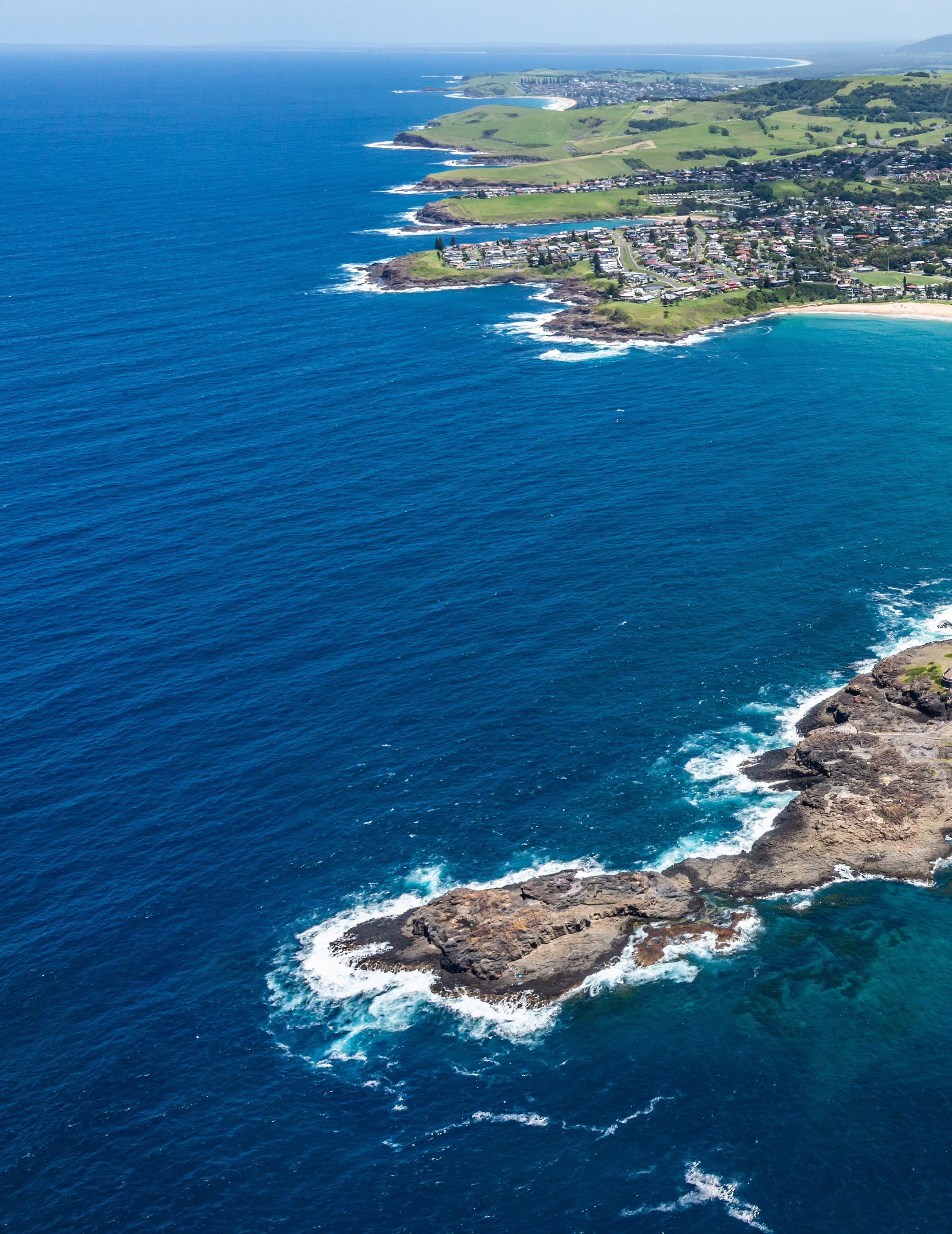
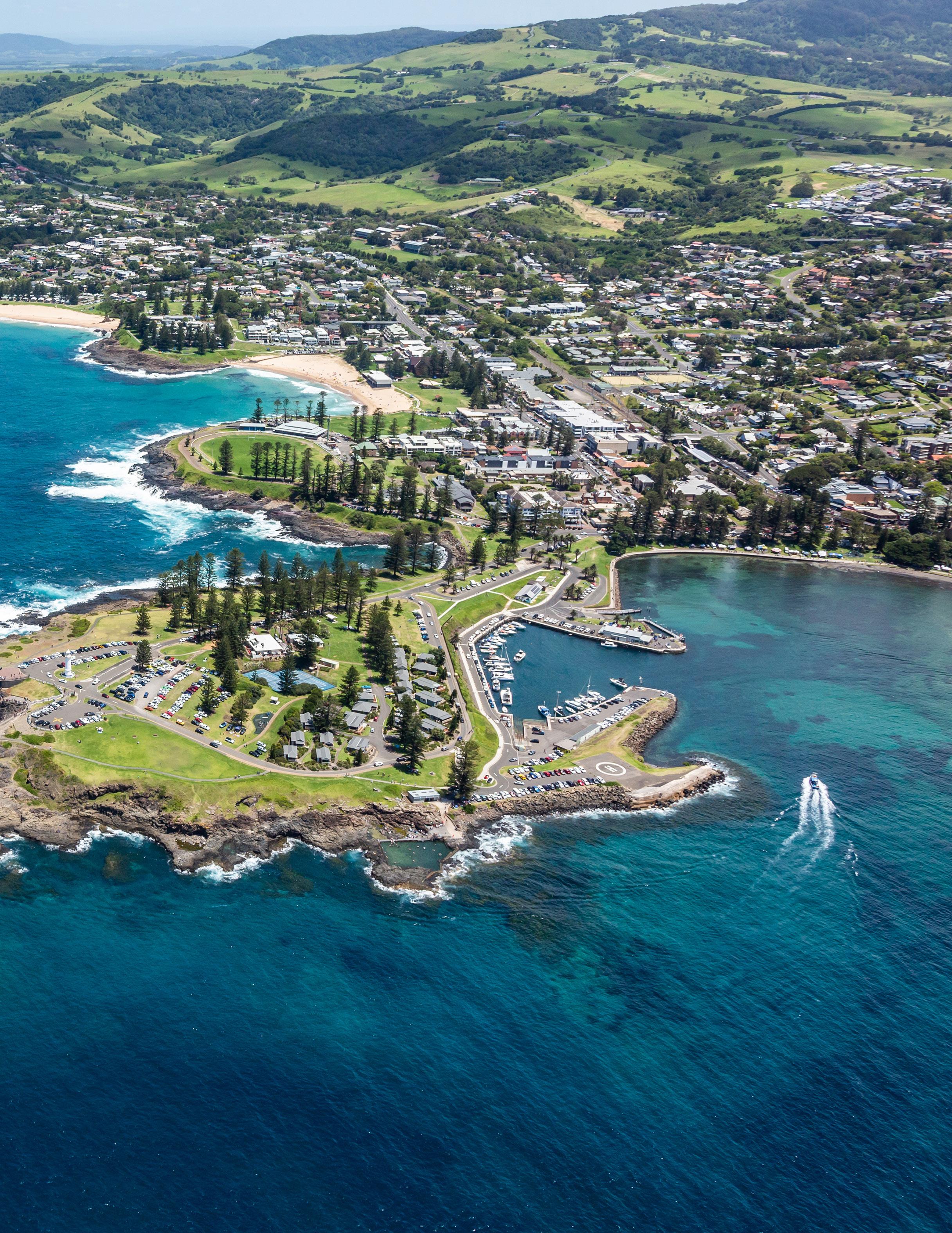
Aboriginal and Torres Strait Islander peoples, as well as early European colonists to Australia, made decisions about where to live based on the availability of resources they needed to survive, such as water, food and shelter. The factors that influence where people live today are more varied. In addition to access to food, water and shelter, political, environmental, social and economic factors can also influence where a person ends up living. Political factors involve the actions of government, including the provision of services and access to infrastructure, such as hospitals and schools. Environmental factors can include clean air and climate, as well as access to natural resources such as beaches, parklands and rivers. Social factors, such as our connections to family, friends and places, as well as economic factors, such as work and property prices, can also influence where we live. In retirement, many people choose a sea change or tree change to enjoy a more relaxed lifestyle.
5A Where do Australians live and why?
Lesson 5.1 Why we live where we do
Lesson 5.2 Where early Aboriginal peoples lived
Lesson 5.3 Where Australians live now
Lesson 5.4 Living in large cities
Lesson 5.5 Living in rural areas
Lesson 5.6 Living in coastal areas
Lesson 5.7 Living in remote areas
5A Skills in context: Port Melbourne skate park survey
5B How do people connect to places?
Lesson 5.8 Living in communities
Lesson 5.9 Aboriginal and Torres Strait Islander communities
Lesson 5.10 Feeling connected
Lesson 5.11 Liveability in communities
Lesson 5.12 Building safe communities
5B Skills in context: Exploring your community
Lesson 5.13 Review: The places we live
Learning intentions and success criteria
liveability an assessment of what a place is like to live in, based on factors such as access to schools, safety and health care
The liveability of any place is closely linked to how suitable and enjoyable people find that place to live in. How liveable you find a place to be depends on your own wants and needs, and whether they are met. There are four main categories of factors that can influence how liveable we perceive a place to be. They are:
• pol itical factors, which include actions of government such as funding decisions, policies, commitment to the provision of services, safety and support to individuals and communities
• environmental factors, which are characteristics of the natural and built environment, including climate, slope, noise, green space and proximity to natural resources such as beaches, bushland and rivers
• social factors, which enable access to human connection with family, friends, community, culture and language
• economic factors, which include availability and access to infrastructure (roads, transport, housing, sporting facilities, health, education, water and sanitation, electricity and communication) and employment opportunities. What we like about places will depend on our age, income, cultural background, lifestyle, values and beliefs. The following questions will help you determine the features of places that make them most liveable to you.
Access to services and facilities that allow us to do the things we enjoy influences what we think of the place we live. This, in turn, increases how highly we rate its liveability.
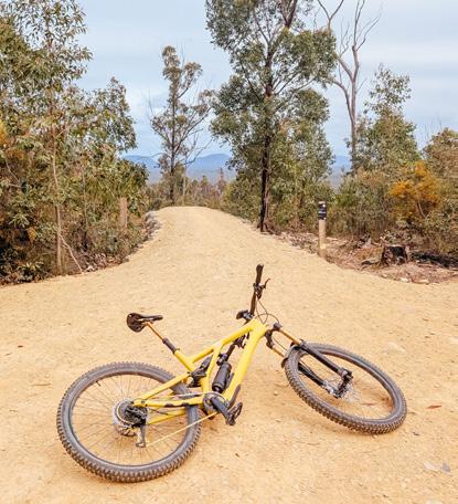
Sport and recreation play an important part in our lives. Team sports (such as netball, football and soccer) can be played in most places. Community facilities (such as sports stadiums and sporting parks) are provided in most communities. If your passion is surfing, you might consider a coastal town more liveable than an inland town. Mountain bikers might prefer to live in a rural area or on the edge of a city, close to open spaces where they can ride their bikes on suitable trails.
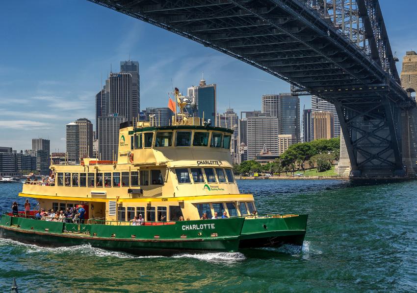
The places we like to go to, and how easy they are to get to, also affect the liveability of a place.
Where do you spend most of your time? Do you like to catch up with friends, go to the movies, or shop at the local shopping centre? How do you get there? Do you walk, ride a bike, or catch a bus, tram or train? Think about how easy it is for you to travel from your home to where you like to go. Is it difficult? This could make you feel negatively about where you live, decreasing its liveability. Is there another place you could live that might make it easier for you to travel to where you like to go? If so, this would increase the liveability of that place for you.
We all have places that are special to us. There are many different reasons for this. Some places are appealing because of the way they look. This is known as the aesthetic appeal. Others appeal to us because they are familiar or are attached to memories of things we have done. This is known as sentimental appeal. We may even have a spiritual connection with a place. As the Traditional Custodians of Australia, Aboriginal and Torres Strait Islander peoples have very strong cultural and spiritual connections to places. Places are a dominant feature of Aboriginal and Torres Strait Islander stories and lives. These connections can also increase the liveability of one place over another.
Every year about 5,000 Australians are asked to take part in a survey about the factors that they believe make a place liveable. Their replies are often like the replies of people from all around the world when asked the same question. Most people agree that a liveable place:
• feels safe
• has high quality health services
• has affordable, decent housing
• has reliable and efficient public transport
• has good job prospects.
Check your learning 5.1
Check your learning 5.1
Review and understand
1 In your own words, define “liveability”.
2 What characteristics of a place attract us? List these characteristics and write a short description of each one.
3 Describe some things that you like to do. Where would be a good place to live that enables you to do these things?
4 Describe some places you like to go. Where would be a good place to live that enables you to go to these places?
Apply and write geographically
5 What are some important aspects of liveability that do not require a lot of money?
6 E xplain how a person of your age and a much older person might have different ideas about the liveability of a place.
7 Distinguish between spiritual and sentimental values that influence how people view a place. Remember, when you distinguish between two things you should talk about how they are different.
Evaluate and create
8 Discuss the special places in your life with a partner. Why do you have a special connection to this place?
9 Look at the places shown in Source 1 and Source 2. Explain how the liveability might differ between these two places.
It is estimated that the first people arrived on the land now called Australia at least 65,000 years ago. At that time, sea levels were lower than they are today. The islands of Indonesia were part of the Asian mainland, and over time, people walked and undertook short sea voyages to reach what is now northern Australia. Over thousands of years, these people gradually moved south, eventually reaching the south-western and south-eastern corners of Australia. As sea levels rose, Australia became an island, and the cultures and traditions of Aboriginal peoples developed and continued independently from those in other parts of the world.
Key content video: Where early Aboriginal peoples lived
Australia: Location and distribution of Aboriginal and Torres Strait Islander peoples in 1788
Source: Oxford University Press
Source 1
Enlarged map: Australia: Location and distribution of Aboriginal and Torres Strait Islander peoples in 1788
Learning intentions and success criteria
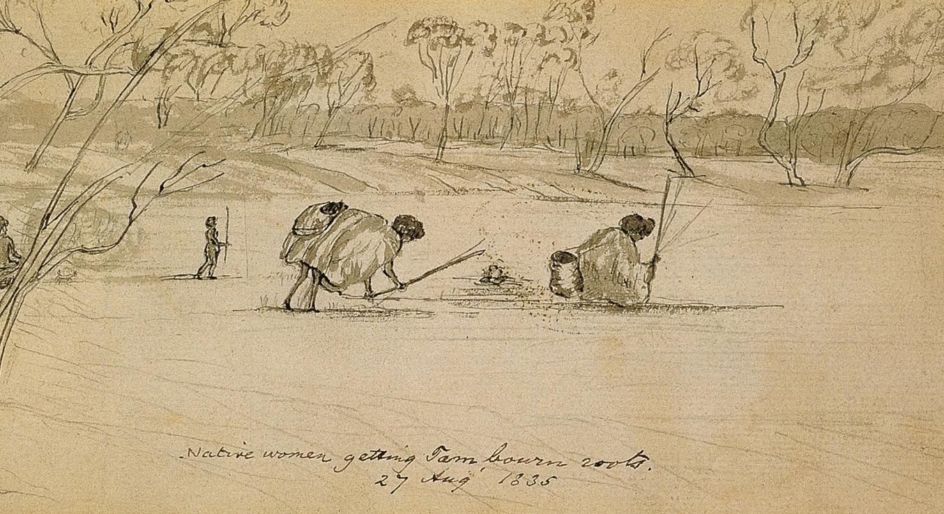
On reaching the Australian continent, early Aboriginal peoples looked for the most liveable places – those that supplied the resources needed to survive and prosper. Many settled along the northern, eastern and southern coasts as well as along what we now know as the Murray River. In these places, Aboriginal peoples found the resources they needed to survive, particularly fresh water and abundant food.
Aboriginal peoples developed a way of life that sustainably used natural resources by taking only what was necessary from the land. Country was listened to and treated with respect. Trees provided many important resources, including bark for making shelters, canoes and shields, and wood for building fires and crafting spears.
Aboriginal peoples fished the rivers, in some places building elaborate stone traps to catch eels and fish, and hunted larger game such as kangaroos and wallabies. Birds and lizards living in the trees also supplied much of the food. Shells, stones, plant fibres, coloured clay and bones all had their uses, but a reliable supply of fresh water, usually a river or stream, was perhaps the most important resource.
Further inland, resources were much scarcer. Aboriginal communities who lived there developed a different way of life suited to the resources that were available. Throughout much of Australia, fresh water is hard to find, and there are few large animals to supply food. In these desert regions, Aboriginal peoples had a more seasonal way of life than the coastal and river Countries. Liveable places changed according to the season, so many groups travelled to follow the natural cycle of monsoon rains, the movement of animals and the fruiting of plants.
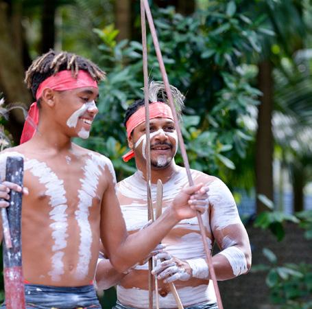
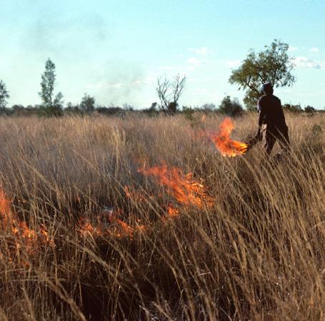
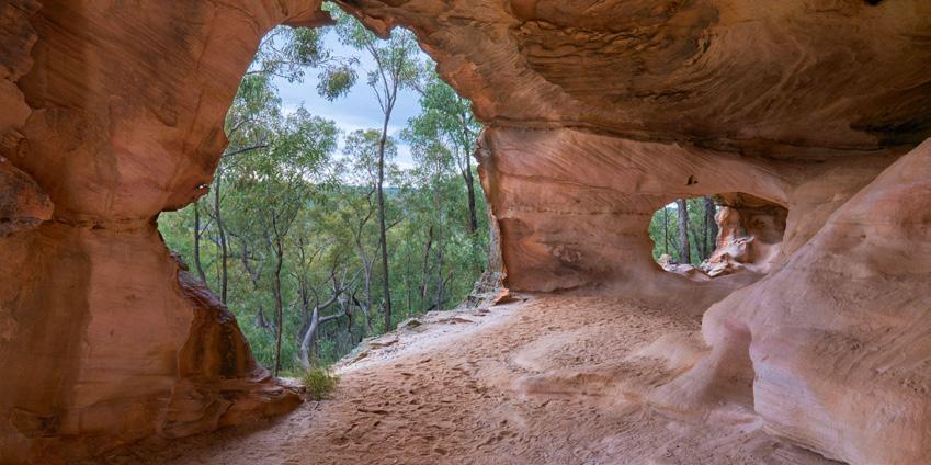
Aboriginal peoples became excellent hunters and were able to survive in some of the harshest environments on Earth, with very hot climates and little access to fresh water. They found water in the most unlikely places, even in the roots of desert plants and the bodies of dormant (hibernating) frogs. Much of the food came from animals such as insects, grubs and reptiles, as well as from plants such as the bush tomato.
Long before colonisation, Aboriginal peoples developed a deep connection with the physical environment that supported them. While there were hundreds of different nations with different cultural practices and languages, the importance of the physical environment was a common belief held by all Aboriginal peoples, and is still upheld today.
Aboriginal peoples do not see themselves as separate from the natural environment but as part of it. They refer to this environment as Country, seeing it as both owned by them and as something they belong to. Their perception of liveability is based on the principle that the land is much more than just a resource to be used.
Caring for Country was and remains an integral part of Aboriginal peoples’ connection to the natural environment. In many Aboriginal cultures, it is believed that you should only take from the land what you need and what you are able to give back. This is shown in the way Aboriginal peoples looked after and preserved the environment that provided for the community. Today, caring for Country is a right given to Aboriginal and Torres Strait Islander peoples in areas that are covered by native title law, including national parks and protected areas. Aboriginal and Torres Strait Islander peoples also care for Country on privately owned property and agricultural land.
Country the physical environment that a particular Aboriginal and Torres Strait Islander peoples’ group has a spiritual relationship with; this includes lands, waters and the sky. For Aboriginal and Torres Strait peoples, Country both owns and is owned by the people
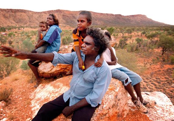
Place for Aboriginal peoples, special places that exist within Country, including places of ceremony and learning, and landmarks related to the ancestor spirits and creation. For Torres Strait Islander peoples, spaces (including lands, waters and sky) that individuals or groups occupy and regard as their own
ancestor a person in your family who lived a long time ago
Part of the reason that Country is such an important concept to Aboriginal peoples is because their Dreaming stories, songlines, their way of life and their ancestors are all part of their homelands. Country provides a sense of deep connectedness and belonging with the past, present and future, as well as with ancestors and culture. For some Aboriginal peoples, when they are on their Country, their spirits and ancestors keep living through them.
Place is another significant concept for Aboriginal and Torres Strait Islander peoples. It means the special places within Country. These can include places of ceremony, initiation, birth and learning, as well as places for Sorry Business. They also include landmarks related to the ancestor spirits and creation. For Torres Strait Islander peoples, Place refers to spaces that individuals or groups occupy and regard as their own. Place may have spiritual significance and includes lands, waters and the sky.
Review and understand
1 Describe how Aboriginal and Torres Strait Islander peoples first reached Australia.
2 Why did many Aboriginal peoples live along the coast or beside rivers?
Apply and write geographically
3 E xamine Source 1.
a What is the purpose of this map?
b Using the PQE method, describe the location and distribution of the population of Aboriginal and Torres Strait Islander peoples in Australia in 1788.
4 Compare the ways of life of Aboriginal peoples who lived in the inland desert and those who lived near rivers in south-eastern Australia. What were some of the similarities and some of the differences?
5 E xamine Source 2.
a What natural resources have been used to create these hunting tools?
b How might these resources have been used in other ways to enhance the liveability of early Aboriginal and Torres Strait Islander peoples?
6 A re the factors that influenced the liveability of places for early Aboriginal and Torres Strait Islander peoples similar or different to those that influence your ideas on what makes a place liveable? Give reasons for your answer.
Evaluate and create
7 Brainstorm ways in which early Aboriginal and Torres Strait Islander peoples may have used each of these resources: shells, stones, plant fibres, coloured clay, fire and bones.
Many Australians make choices about where they live based on how liveable they perceive a place to be. In the past, people would often choose where to live based on whether the place gave them access to the basics necessary for survival, such as water and food. Today, however, many things have changed. Now, modern technology and infrastructure have made food and water available across Australia, even in the driest and most remote parts of the desert, which would have been very difficult to live in, if not uninhabitable, in the past. As a result, the factors that influence where Australians live have changed, leading to a distinct pattern of population distribution that offers diverse experiences (Source 1).
Learning intentions and success criteria
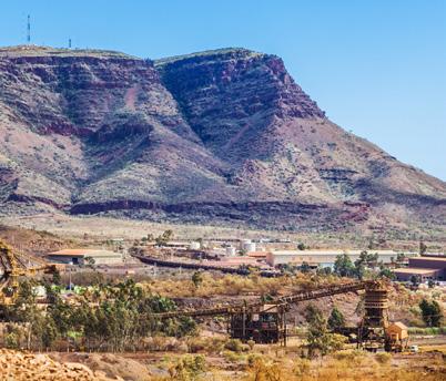
Few Australians live in remote areas, away from towns and cities. Those who do often have to overcome challenges such as a lack of infrastructure and limited access to services like health care, entertainment and shopping. Some remote communities have been built to service mines for minerals such as iron ore, gold and coal.
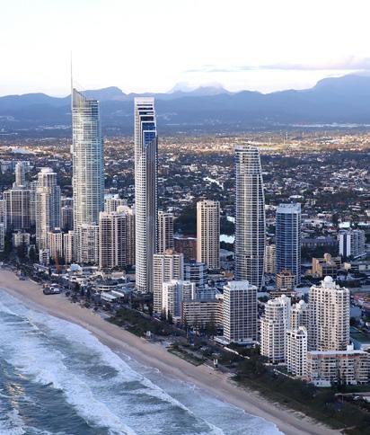
Eight in 10 Australians live within 50 kilometres of the east and south-east coast, spreading along the narrow strip that extends from Cairns to Adelaide. Coastal parts of Australia are considered liveable due to the climate and the environment. The average temperature in coastal areas tends to be lower than in the drier, warmer interior of the country. Many people also like to holiday at the coast and, increasingly, people who have lived in cities are retiring there.
Two-thirds of all Australians live in large cities. This is one of the highest rates in the world. People choose to live in these places because there tends to be better access to services in cities, including health care, education, shopping, banking and professional services such as accountants and lawyers. Cities typically have more jobs available with a greater variety of positions. Cities also provide a wider range of entertainment such as music venues, nightclubs, concerts, theatres and large sporting arenas.
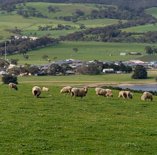
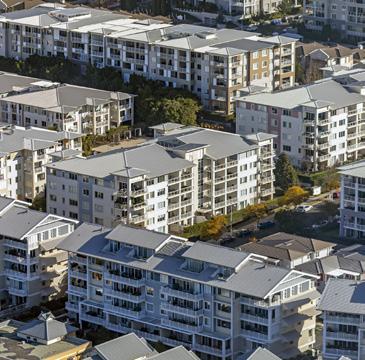
One in 10 Australians live in small towns of fewer than 10,000 people. Some features of small towns and rural areas make them more liveable than large cities – for example, housing is cheaper, and the air is cleaner without pollution. However, some services, such as specialist health care and universities, can be more difficult to access, as they tend to be located in cities. There are about 135,000 farms in rural Australia.
Check your learning 5.3
Check your learning 5.3
Review and understand
1 Identify the area in which most Australians live.
2 Identify the area where the least number of Australians live.
3 Pick one of the locations listed below and write a short paragraph describing why people choose to live there:
– cities
– coastal areas
– regional areas
– r ural areas.
Apply and write geographically
4 In which of the four locations in question 3 do you live?
a Describe why you live there.
b List some of the things you enjoy about living in this place.
c Brainstorm three strategies that could be used to improve the liveability of your area.
5 E xamine (look closely at) the map in Source 1.
a Identify the type of map and explain its purpose. See Lesson 1.5 Maps to help answer this question.
b Identify how many Australian cities have more than one million people.
c Using the PQE method, describe the distribution of the population around Australia.
Evaluate and create
6 In which of the four locations listed in question 3 would you least like to live and why?
7 Do you think the answer to question 6 would be the same for everyone? Justify (give reasons for) your answer.
Most Australians choose to live in large capital cities. The greatest growth in capital cities usually takes place around the outer edges of metropolitan areas. New suburbs appear on what was once farmland in areas now known as the rural–urban fringe. As new housing estates are built in these areas, other services are attracted to these new suburbs to service the growing population. Schools, shopping centres, medical centres and sporting facilities are among the services built in these areas to meet the needs of residents. Industrial services, such as power or recycling stations, are often established in these areas because they offer more affordable land and rent compared to inner-city suburbs.
Key content video: Living in large cities
Learning intentions and success criteria
metropolitan a term used to describe a city and its surrounding suburbs
rural–urban fringe the areas on the edge of a city where the city ends and country or farming areas begin
The suburb of Oran Park is in the Camden Council local government area located on the fringe of the metropolitan area of Sydney. It is just under 60 kilometres from the Sydney central business district (CBD). It is one of the fastest-growing areas in Australia. In two decades it has grown from horse paddocks, a motor raceway to a thriving residential neighbourhood in Sydney’s rapidly expanding South West.
At the 2011 census, the area had a population of 195, but this has since grown to over 21,000. Source 1 shows the change over time in the Oran Park suburb between 2007 and 2022.
What features make Oran Park liveable?
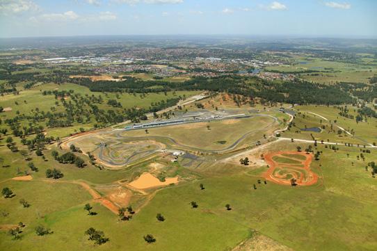
Oran Park is linked to other parts of Sydney and its CBD by a road and a nearby rail network. Oran Park is conveniently located near the M5 motorway, which means that Sydney’s centre is within a 60-minute drive away (in good traffic conditions). It is also only 18 kilometres from Sydney’s second airport, Nancy Bird-Walton Airport. In addition, a Metro line is proposed for the future.
Oran Park also attracts new residents, particularly migrants. Many new migrants, particularly those with young families, are attracted by more affordable housing in the area, with house prices 20 per cent lower than for Sydney as a whole.
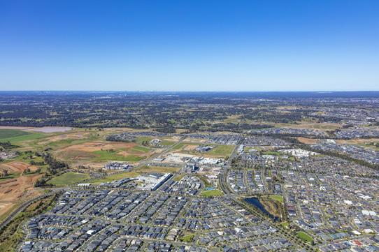
water play area. Shopping in large retail centres is within a 10-minute drive. Public clubs and community groups, such as the Oran Park Rovers Football Club, offer residents a way to connect with each other and build a sense of community. What features threaten the liveability of Oran Park?
There are many reasons for Oran Park’s liveability. There are eight new schools already built in the immediate area, as well as a new library and the Oran Park Study Centre, part of Notre Dame University, where students can begin their degree program locally, all of which make access to education easy for residents. Residents can enjoy swimming at the Oran Park Leisure Centre, which, in addition to an indoor 50-metre pool, also houses a learn-to-swim 25-metre pool, a full gym, indoor basketball courts and a rapid
Like any rapidly growing area, Oran Park struggles at times to meet the demands of all its residents. For example, despite recent expansion and upgrades, Campbelltown Hospital, located 15 kilometres away, is sometimes unable to treat emergency patients quickly due to high demand, sending patients on to Liverpool Hospital.
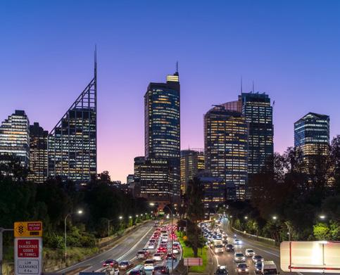
Many residents of Oran Park work in the Sydney CBD and inner-city suburbs and drive to and from work. During the week, this puts
thousands of cars on the road at the same time each morning and afternoon. The road system struggles to cope with this heavy demand, as the number of vehicles on the road causes traffic jams and long delays. More than onequarter of Oran Park’s residents spend more than two hours every day travelling to and from work. The tolls on major motorways to the CBD add an additional $30 each way if driving. The demand for public transport is increasing, with the carparks for the closest train stations at Leppington and Edmonton Park filled by 7 am.
Nearly 100 people move into Oran Park each week. This continuous population growth puts demands on services in the region now and will continue to do so in the future.
Birthing centres and hospitals, preschools, kindergartens, and primary and secondary schools all need to find spaces in the next few years to accommodate this growing population.
Oran Park’s new masterplanned neighbourhood attracts many new residents. Homebuyers from inner Sydney, especially young families, are drawn to the area by the affordable housing, as are migrants. As the population grows, more amenities will need to be built to accommodate the growing number of people.
Without major infrastructure improvements, such as building new roads, constructing the proposed metro station, or adding new bus routes, traffic around Oran
Park is likely to get worse. A further challenge and employment opportunity is the Nancy BirdWalton Airport as a full-service, curfew-free 24-hour airport.
The local population is predicted to increase significantly in the next 15 years.
Creating
Graphs are used in geography to display data and make it easier to understand. Raw data often appears as a confusing table of numbers, so turning data into graphs makes it easier to
recognise and analyse trends and patterns. A line graph is a commonly used graph in geography. Line graphs are used to show trends over time (for example, the growth of a city’s population).
To draw a line graph, follow these steps:
• Step 1 Examine the data carefully to decide on the axes and the scale you should use so that all the data fits. It is important that the scale on each axis is even. For example, 1 centimetre equals one year.
• Step 2 Construct your axes and your scale using a ruler.
• Step 3 Plot the data carefully using a small, neat dot for each entry on your graph.
• Step 4 Join the dots with a smooth, freehand line.
• Step 5 Label each axis with a description of the data and give your completed graph a title.
Practise the skill
1 Using the data provided in Source 4, create a line graph showing the forecast population of Oran Park.
Source 4 The predicted growth in Oran Park. Data provided by idcommunity.
Year 2026 2031 2036 2041
Extend your understanding
1 Use the data from your graph to describe the forecast changes in the population of Oran Park.
2 Ex plain why the population in Oran Park is expected to grow at the rate shown in your graph.
1 Identify where the greatest growth in
2 Describe the change that takes place as suburbs spread to the rural–urban fringe.
3 Copy this table into your notebook and add factors to each column.
that make Oran Park a liveable place
4 Look closely at the Google Earth images to compare them and answer the questions that follow:
a How liveable was Oran Park in 2015? Give reasons for your answer.
3 P ropose one strategy that could be used by the NSW government to support Oran Park’s population in 2041.
For more information on collecting and representing data, see Lesson 1.3 Processing geographical information and Lesson 1.9 Data and graphs.
b Identify five new factors that have made Oran Park a more liveable place.
c What evidence is there that many of Oran Park’s residents are young families?
5 Using the SHEEPT method, analyse the factors that draw people to live in large cities. Refer to Using the SHEEPT method in Lesson 1.3 Processing geographical information to help you write your answer.
Evaluate and create
6 Write a diary entry from the perspective of a person who has lived in Oran Park area since 1990. Include their thoughts and feelings about their growing suburb.
Rural areas are those areas located outside major cities. In Australia, many rural areas are used for farming, raising animals and growing crops for food. Living in rural areas can be very different from living in a city. There are many advantages to living in rural areas, including a strong sense of community in small towns and a more relaxed way of life compared with the hustle and bustle of big cities. Farms are often family-run businesses, which gives some farmers the opportunity to be their own boss. There is also less air pollution, noise and traffic in rural areas. In recent years, advances in information and communication technology (ICT) have significantly increased the liveability of rural areas.
However, rural areas do not provide the same convenient access to amenities as large cities. They are much less populated and, as a result, have fewer amenities, including schools, shops and healthcare services.
Key content video: Living in rural areas
The largest industry in rural Victoria is dairy farming. There are more than one million dairy cows in the state, and they produce more than 6 billion litres of milk a year. There are three main dairy farming regions in Victoria – in the north near Echuca; south-east of Melbourne; and in the Western District around the city of Warrnambool.
Near the small town of Condah in the Western District of Victoria, lies the dairy
Learning intentions and success criteria
farm of Sam and Kristy Cheetham. Like many farms in Australia, this dairy farm is a family-run business. The farm has grown over the years as the family has bought more land. Several workers are employed to help milk the cows twice a day and carry out other farm jobs. These workers and their families also live on the Cheetham's farm.
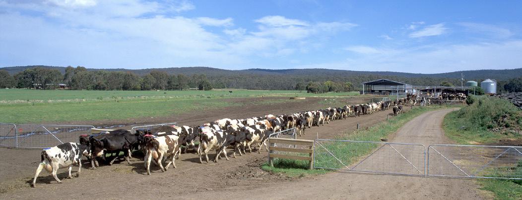
The Cheetham's farm is close to several small towns, but it is some distance from larger towns and cities. The small towns of Condah and Branxholme have very few shops, and the Cheethams only visit these places for basic items, such as bread.
To use amenities such as the bank and supermarket, the Cheethams must travel to the town of Heywood, which is 24 kilometres away. Heywood has a population of 1,800, which is
Interpreting a proportional circle map
Source 2 is a map of the Western District dairy farming region. On the map, each town is shown in the centre of a circle. The size of each circle is determined by the number of people living in the town. The bigger the population, the bigger the circle. This makes it easy to see where the larger towns and cities are located and reveals a pattern in this distribution. These circles are called proportional circles, and when they are represented on a map like this, it is called a proportional circle map.
For more information on identifying patterns and relationships, see Lesson 1.3 Processing geographical information and Lesson 1.5 Maps..
Practise the skill
1 E xamine Source 2. Name the towns in the map with a population of over 10,000 people.
2 Estimate the population size of Port Fairy. Explain how you formed this estimation.
3 Compare the interconnections of Warrnambool and Koroit.
Enlarged map: Victoria: Western District dairy farming region
large enough to support a wider range of retail shops and other services than the smaller towns. These include a doctor, a vet and several schools.
To access major services, such as the international airport or specialised healthcare, people in this region must travel to Melbourne. Similarly, people in rural areas must travel to the state’s capital for major sporting and entertainment events, which are not held in regional areas.
Source: Oxford University Press
Source 2
Check your learning 5.5
Check your learning 5.5
Review and understand
1 Identify Victoria’s three main dairy farming regions.
2 Identify where the Cheetham family would go to buy or access each of the following:
a a loaf of bread
b a new car
c an AFL football match.
A pply and write geographically
3 Describe how living in a rural area is different to living in a city.
4 Look carefully at Source 2.
a Identify the three largest towns.
b Determine (decide) the approximate population of the largest town.
c Explain why you think there are many small towns and only a few large towns in this area.
d Explain why proportional circles are useful on a map.
Evaluate and create
5 Think about the liveability of rural areas compared with larger cities.
a Rank the top three features of rural areas that make them more liveable than large cities.
b Rank the top three features of rural areas that make them less liveable than larger cities.
c Justify (give reasons for) your rankings and share them with the class.
Eighty-five per cent of all Australians live within 50 kilometres of the coast. As a result, nine of our 10 largest cities sit on the coast. As well as large cities such as Sydney and Melbourne, there are hundreds of smaller communities dotted along our coastline. Outside the capital cities, these coastal communities tend to be the fastestgrowing regions in each state. In Queensland, for example, it is the Gold Coast and the Sunshine Coast, and in New South Wales, it is the Illawarra-Shoalhaven coast, with the town of Shellharbour forecast to grow 36 per cent by 2041, driven by new housing development.
Due to a range of factors, coastal towns and cities are growing in size and population across Australia. Many people decide to move to the coast because they want a more relaxed lifestyle near natural features such as beaches, bays and other landforms. Geographers refer to this trend as a “sea change”.
Key content video: Living in coastal areas
Learning intentions and success criteria
Shellharbour is located in New South Wales on the Illawarra coast, about 100 kilometres south of Sydney. It has long been a popular holiday destination, particularly during the warmer summer months.
The permanent population of Shellharbour is around 84,275 people. This number can double on summer weekends as people travel from Sydney and Canberra to take advantage of the beaches and relaxed lifestyle of this coastal town.
The permanent population of residents in Shellharbour is growing. By 2041, it is expected to be over 109,000.
What features make Shellharbour a liveable place?
There are many features that contribute to the liveability of Shellharbour. The environment in this area provides residents with several beaches and walking tracks to enjoy. In addition, there are several beachside cafes and wineries within a short drive of town. These amenities add to the liveability of Shellharbour by offering residents ways to relax and enjoy themselves.
There are many primary and secondary schools, as well as a range of places for shopping, including Aldi and Woolworths. This gives sea changers and permanent residents access to important amenities without having to travel.
However, residents may need to travel to nearby Wollongong for access to healthcare services or entertainment. Shellharbour is only 25 minutes from Wollongong and 90 minutes from Sydney’s CBD. This gives residents the opportunity to commute to work in these bigger cities by car or public transport. There is infrastructure in place to enable this, including the Princes Highway and the intercity train, both of which run from Shellharbour to Sydney.
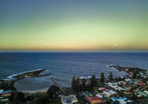
Shellharbour also attracts many retirees. In some cases, retired people move permanently into holiday homes they already own, and in
other cases, they build new homes to live in. As more Australians reach retirement age, it is expected that the demand for new homes and services such as health care, education and roads will increase dramatically in sea-change towns, including Shellharbour.
As the population in Shellharbour grows, the seaside town will need to adapt to support its growing number of residents. While real estate agents and builders welcome the new residents, not everyone feels the same way. Some residents are concerned that Shellharbour will become exactly the type of suburban development that seachangers are trying to escape.
A number of retirement villages and housing estates are being constructed in Shellharbour to support its growing population. This construction has significantly altered the natural landscape in some places, including farmland and sand dunes. In some cases, caravan parks, which have been an important feature for summer visitors, have been redeveloped to make space for these new housing estates.
Locally-run businesses with deep roots in the community are also under threat as large hardware stores and food outlets such as McDonald’s arrive in town. Additionally, there
Reading population pyramids
are several primary schools and kindergartens in Shellharbour, but only three overcrowded secondary schools. This could create a problem in the future as the population grows and the demand for local access to secondary education increases.
Population pyramids are bar graphs that show the percentage of males and females in different age groups in a population. They help geographers compare different groups within a population and identify trends. Follow these steps to read a population pyramid:
• Step 1 Read the title of the population pyramid to find out which population is being studied. Also read the labels running along the bottom (percentage or total population) and through the middle of the pyramid (age groups).
• Step 2 Read the graph to understand how it represents the data. Population pyramids are organised so that younger age groups are at the bottom and the older age groups are at the top. Percentages (or numbers) of males are always shown on the left side, and percentages (or numbers) of females are shown on the right side.
• Step 3 To compare the percentage of males and females in the same age groups, read across the rows. The scale on the male side begins at zero and increases from right to left. The scale on the female side begins at zero and increases from left to right.
Think, pair, share
• Think about how living in Shellharbour is different from living in a big city like Sydney.
• Pair up and discuss your ideas with a partner.
• Share and your thoughts with the class.
• Step 4 To compare the percentage of only males or only females, look up and down the columns.
Practise the skill
1 Using Source 3, answer the following questions:
a A re there more men or women aged over 85 in Shellharbour? Use evidence to support your answer.
b Identify the age group with the highest population in Shellharbour.
c T here is a large group of Shellharbour residents aged between 55 and 59. Explain why this is the case.
For more information on this key skill, see Lesson 1.3 Processing geographical information and Lesson 1.9 Data and graphs.
Check your learning 5.6
Check your learning 5.6
Review and understand
1 Describe how living in a coastal area is different from living in a city.
2 Identify the features that have made it possible for residents in Shellharbour to enjoy both a coastal and city life.
3 In your own words, define the term “sea change”.
Apply and write geographically
4 E xamine Source 1.
a Identify three towns on the Illawarra coast.
b Describe where you think people on the Illawarra coast would go to shop at department stores or purchase expensive items such as cars.
c How do main roads contribute to the liveability of towns like Shellharbour?
5 “ Some people are concerned that Shellharbour will become exactly the type of suburban development the sea changers are trying to escape.” Explain why some people feel this way.
Evaluate and create
6 Source 3 tells us that one of the largest population groups in Shellharbour is children aged between 5 and 9.
a How does access to education contribute to the liveability of Shellharbour for these people?
b Predict how this might change in the next five years, when this age group reaches high school.
7 Discuss the liveability of Shellharbour with a partner. Is this somewhere you would like to live?
Much of Australia's interior land is desert or semi-desert, with long distances between towns and settlements. Geographers refer to these areas as remote because they are far away from amenities such as shopping centres, public transport and cinemas. People who live in remote areas have access to clean air and wide, open spaces. Additionally, remote areas with small populations provide their residents with a strong sense of community.
However, these areas do not have the same reliable access to food or water, and often lack proper road infrastructure. In addition, communications technology, such as the internet, tends to be much slower in remote areas.
In Australia, Aboriginal and Torres Strait Islander peoples represent 45 per cent of all people living in very remote areas. As the Traditional Custodians, Aboriginal peoples have a deep spiritual relationship to the land, which connects them to their identity and ancestors. For many Aboriginal peoples, living on and caring for the land is an extension of themselves. This is known as living on Country.
While lifestyle is a significant factor influencing where many Australians want to live – for example, retirees moving to the coast for a more relaxed life – it is important to recognise that living on Country is much more than a lifestyle choice for Aboriginal peoples. Connecting to and caring for the land is an important factor that contributes to the liveability of a place for Aboriginal peoples in Australia.
Key content video: Living in remote areas
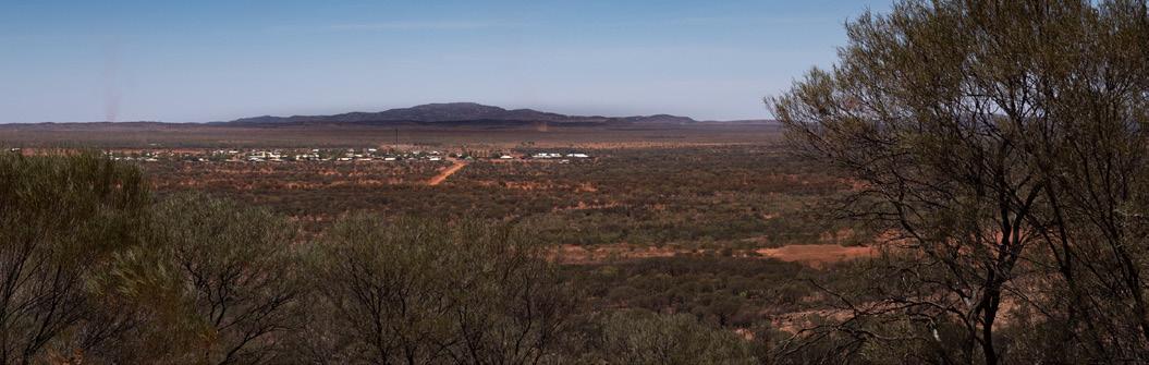
Yuendumu is a remote community about 300 kilometres north-west of Alice Springs in the Northern Territory. Located on the edge of the Tanami Desert, it is one of the most remote places in Australia and is only accessible by four-wheel drive or plane. The drive from Alice Springs to Yuendumu takes about 4 hours and is largely on sealed highways, but the last 100 kilometres or so are unsealed, making it difficult to drive after heavy rain. It is so remote that few locals have ever seen the sea. The population of Yuendumu is between 750 and 1,000 people, of whom almost 85 per cent are Aboriginal peoples. The community of Yuendumu is mainly made
Learning intentions and success criteria
up of Warlpiri peoples, who have inhabited the area for more than 40,000 years and have a deep connection to the land. Yuendumu is also home to residents who work or study there.
What features make Yuendumu a liveable place?
The area, while remote, is vibrant, with several community-oriented amenities including an arts centre, a women’s centre and a summer football program. The Yuendumu Magpies Football Club, which plays in the Central Australian Football League, helps foster a sense of community for both players and spectators.
The Yuendumu School offers access to preschool, primary and secondary education. In addition, the Yuendumu Kurdu Kurdu Kurlangu Childcare Centre runs a playgroup and creche for the youngest members of the community.
The Yuendumu Health Centre provides medical and public health services to people in the area, assisted by the Royal Flying Doctor Service in emergencies.
What features threaten the liveability of Yuendumu?
Water scarcity is a serious problem threatening Yuendumu. Due to its desert location, Yuendumu is an arid region with a hot climate and little
a About one-third of the town’s electricity is generated by solar dishes, which collect and store the Sun’s energy.
b In 1999, the whole town was connected to a sewagetreatment plant, which replaced individual septic tanks at each house.
c The Yuendumu airstrip provides access to planes from Alice Springs, including flights from the Royal Flying Doctor Service.
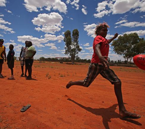
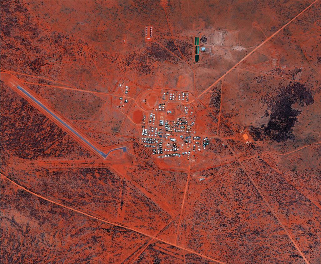
d The drive from Alice Springs takes about 4 hours and is largely on sealed highways, but the last 100 kilometres or so are unsealed, making it difficult to drive on after heavy rain.
e The Yuendumu Art Centre supports a thriving community of over 600 artists. It is an important hub for social activity and a source of pride for the region.
f There is one school (the Yuendumu School) that caters for 260 students. Some lessons are in English while others are in Waripiri.
g The Yuendumu Mining Company is one of the town’s major employers. It operates shale and gravel mines.
h Water is accessed from a series of bores 10 kilometres from the town. From there the water is pumped to the town dam.
aquifer, and many bores have been drilled in the area to improve the water supply. However, frustrated residents have found that the government does not always communicate well with locals about water searches. According to Warlpiri Elder Harry Jackamarra Nelson, the government “didn’t even bother to come and ask us where we can look for water ”
In such a remote community, there are fewer job opportunities than in large towns and cities. About one-third of adults in Yuendumu are unemployed, and among those who are employed, many work at the same place: Yuendumu School. As a result of limited job opportunities, incomes are relatively low.
Check your learning 5.7
Check your learning 5.7
Review and understand
1 Identify the services that are difficult to supply to remote areas.
2 Outline why the local Warlpiri people do not move to a different area with better access to services.
3 Describe some of the differences between living in your local area and living in Yuendumu.
Apply and write geographically
4 Use the information provided in Source 2 to create a table of the services available in Yuendumu. List each of the services under the following headings: water and sanitation; transport; power; industry; education; and recreation.
5 Write a short paragraph to summarise the factors that contribute to and threaten liveability in Yuendumu.
Evaluate and create
6 Water scarcity is a serious problem in Yuendumu.
a Identify the main factor that contributes to water scarcity in Yuendumu.
b Propose (put forward) one strategy that could be implemented to help with water scarcity in Yuendumu.
7 Use Google Maps (a link is provided on Oxford Digital) to answer the following questions:
a Identify the absolute location (latitude and longitude) of Yuendumu.
b Measure the straight line distance from Yuendumu to Alice Springs.
c “The remoteness of the Yuendumu community is a threat to its liveability.” To what extent do you agree with this statement? A lot (strongly), a little bit (somewhat) or not at all? Write a short paragraph explaining your position.
In 2024, the City of Port Phillip council in inner Melbourne announced a plan to redevelop the Port Melbourne skate park. The council asked a skate design company to plan a new park, and then wanted to find out how the local residents felt about the design. Residents were asked to provide feedback by completing an online survey.
Like all communities, the City of Port Phillip is made up of individuals, each with their own ideas about what makes a place liveable. For example, skaters and their friends are likely to see a skatepark as making a place more liveable. However, other people may see it as making it less liveable.
One hundred and five people responded to the survey, with people under the age of 15 being the most common respondents. The survey found that most people supported the plan to redevelop the skate park and remove some carparks to increase the park's size. Some people felt that the
Conducting a survey and collating the results
To explore how people perceive the liveability of their local area, you have to ask them! The purpose of this survey is to explore how different students at your school perceive liveability in the local area. Follow these steps to conduct your survey:
area could be made safer by improving the park's lighting. Others were concerned that adding lighting would increase the noise from the park at night.
One question in the survey asked about new features people felt should be included in the new design. The graph in Source 1 shows the responses to this question.
• Step 1 Begin with a big question or theory that your survey will aim to answer. For this survey, the theory is “ The more that students use a place, the more they perceive it as having a positive impact on liveability ” .
• Step 2 Create a list of 10 places in your local area that you believe each person in your survey group will know.
• Step 3 Decide on the questions you are going to ask. You should ask closed questions with only a few possible responses, rather than open questions. For this survey, you have been provided with two questions to ask in Source 2.
• Step 4 Create a survey form to record your responses. An example form is provided in Source 2.
• Step 5 Decide how many students you are going to survey and provide a survey form to each of them.
• Step 6 Collate your results. Gather the complete survey forms and document the results in a table. An example has been provided on Oxford Digital.
For more information on conducting fieldwork, see Lesson 1.2 Acquiring geographical information and Lesson 1.8 Fieldwork. List of local places
Ask survey participants to record their answers in the survey form.
1 Following the steps above, conduct a survey in your class or school about the liveability of the local area.
2 Ex amine the results of your survey by completing the following tasks:
a R ank the places in your local area from the most visited to the least visited.
b R ank the places in your local area from the most positive to the most negative.
How would you describe the impact of this place on the liveability of the local area?
Write your questions in your survey form so you can easily collect results and interpret them later.
3 T hink about the theory from the beginning of the survey: “ The more that students use a place, the more they perceive it to have a positive impact on liveability ”. Did you prove this theory to be correct or incorrect? Write a short paragraph explaining your answer, using examples.
1 Using the results of your survey, create a graph showing the average liveability score of each local place.
2 Describe the data displayed in your graph.
A community is a group of people who share something in common. It may be the place where they live, their religion, their interests or hobbies, their ethnicity, their school or their language. Every person on Earth is a member of one or more communities, some by choice and some just by being who they are. To make sense of all the world’s communities, geographers consider the features that all members of a community share.
Learning intentions and success criteria
ethnicity the background, nationality or culture of a person, or group of people
One way to classify these features uses the five Ps shown in Source 2:
• Past
• Place
• Perspective
• P urpose
• P ractice.
While some people feel strongly connected to communities, others feel isolated and poorly connected, which can affect their perception of liveability in their area. About 15 per cent of Australians feel socially isolated, a figure that increased markedly during and after the lockdowns associated with the COVID-19 pandemic. Researchers believe that a sense of social isolation can affect a person’s mental and physical health.

1
Irene Verins, the Strategy and Advisory Manager at Beyond Blue, believes that “ The most effective way to reduce loneliness is to make people feel connected to their community. Those communities may not be geographic – for example, they may be online for LGBTIQ+ youth or rural young people – but what's important is they share common interests and develop meaningful connections.”
Source 2 The five Ps that define a community are “ Past, Place, Perspective, Purpose and Practice ”
Past Communities of past are made up of people who share similar histories, such as family, language and ethnic groups. War veterans are a community of past, as are the separate ethnic groups that make up the population of Australia, for example, Greek Australians or Vietnamese Australians.
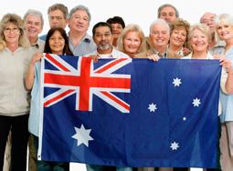
Place Communities of place are made up of people who live in the same area, such as a neighbourhood, region, town or country. Aboriginal peoples are members of a community of place, as are the residents of individual towns, such as Broken Hill or Broome.
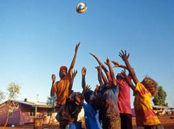
Perspective Communities of perspective are made up of people who share similar beliefs and values, such as members of religious communities or political parties. The Australian Greens and Roman Catholics are both communities of perspective.
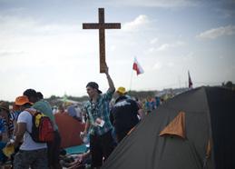
Purpose Communities of purpose are made up of people who share similar goals and visions, such as being members of a particular volunteer organisation, such as Surf Life Saving Australia or volunteer fire brigades. Communities of purpose often work to improve the lives of people other than themselves.
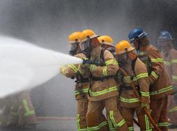
Practice Communities of practice are groups of people who have activities in common, such as the work they do or the hobbies they enjoy. Health workers such as nurses and doctors belong to a community of practice, as do members of a book club or sporting group.

Key content video: Living in communities
Drawing a concept map
A concept map is a visual tool used to show the links between different ideas or pieces of information. Each piece of information is usually represented in a circle or box and the relationship between two ideas is shown by a line or arrow connecting them. Words on the line or an arrow explain the relationship between the two ideas. Concept maps can be hand drawn or prepared using computer software.
To draw a concept map, follow these steps:
• Step 1 Draw and name the focus, central idea or main problem you are trying to explore. In the example in Source 3, this is “My communities”
• Step 2 Build the concept map by adding ideas related to the central idea.
• Step 3 Add a title to help the reader quickly understand your concept map. For more information on collecting and representing data, see 1.3 Processing geographical information and Lesson 1.9 Data and graphs.
I used to think, now I think
Reflect on your learning about different types of communities and complete the following sentences:
• I used to think
• Now I think … What has changed in your understanding?
Practise the skill
1 C onstruct your own concept map to show the communities you are connected to. Place your name in the centre of the box. Add the types of communities to the connecting lines. Choose from the five types of communities shown in Source 2, such as place.
Check your learning 5.8
Check your learning 5.8
Review and understand
1 Define the term “community” in your own words.
2 Identify the five Ps that geographers use when describing communities.
Apply and write geographically
3 Consider your own community.
a Do you feel strongly connected to your local community? Why?
b Explain why the answer to this question might be different for different people.
4 Classify each of these groups under one of the five types of communities:
a the Australian Labor Party b employees at a supermarket
c residents of Ocean Grove in Victoria
d a Scout group e your family.
5 Members of a soccer team are members of a community of purpose. Describe why it is likely that they are also members of a community of place.
6 E xplain how a person’s connection to their community might affect their perception of liveability.
Evaluate and create
7 Using an example, explain how the communities a person belongs to are interconnected.
8 Collect images of communities from newspapers and magazines. Display these on your classroom wall using the five Ps of community to place them in groups.
9 Propose (put forward) reasons why the number of people who felt isolated increased during the COVID-19 pandemic.
In Australia today, Aboriginal and Torres Strait Islander peoples make up 3.8 per cent of the total population. Aboriginal and Torres Strait Islander peoples live all over the country, in different places and as part of many different communities.
Aboriginal and Torres Strait Islander communities are examples of communities of the past. This is because members of these communities share an ethnic background, have strong family ties and a millennia of shared history and culture. The spiritual ties that Aboriginal and Torres Strait Islander peoples have with the land also make them members of a community of place.
Key content video: Aboriginal and Torres Strait Islander communities
No matter how much the country changes, Aboriginal and Torres Strait Islander peoples’ strong connection to Country remains. Queenslandbased Aboriginal scholar Bronwyn Fredericks writes about this, explaining that:
Aboriginal peoples still have Indigenous belonging and Indigenous ownership of place [in cities]. This exists regardless of whether multi-storey buildings, freeways, sports grounds, houses and places of worship have been built within that geographic locality.
There are two recognised groups of First Nations peoples in Australia. The largest group is Aboriginal peoples from mainland Australia and Tasmania. The second group is from the Torres Strait Islands, which are islands located between Australia and Papua New Guinea. All the islands are considered part of Australia, even though islands such as Saibai and Boigu are only a few kilometres from the southern coast of Papua New Guinea.
For more information on this key concept of Place, see Lesson 1.1 Geographical concepts.
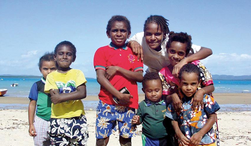
First Nations peoples people who identify as Aboriginal peoples from mainland Australia and Tasmania and Torres Strait Islander peoples from the Torres Strait Islands, located between Australia and Papua New Guinea
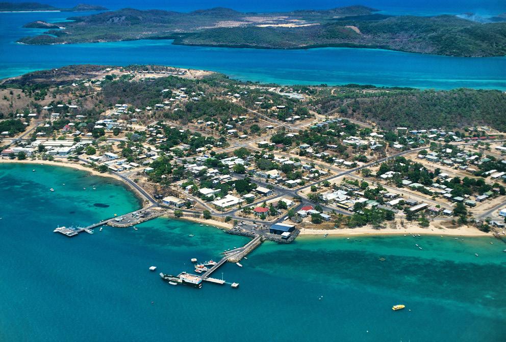
Thursday Island (Waibene) lies in a cluster of islands in the Torres Strait just off Cape York, the northernmost tip of Australia. It has the largest population of all the Torres Strait Islands and is where most of the local government functions for the islands are located. Thursday Island and the inner island cluster are located on the lands of the Kaurareg peoples.
As it is the administrative centre of the Torres Strait Islands, Thursday Island’s 2,800 people have access to excellent facilities, including several schools, a TAFE college, hospital, childcare centre, library, sports stadium with a swimming pool, and parks and gardens. There is little fresh water on the island,
Thursday island: topographic map
so a pipeline brings water from nearby Ngurapai (Horn Island). Daily flights from Cairns to Ngurapai, followed by a short ferry ride to Thursday Island, reduce the isolation of life on the island.
With year-round warm temperatures and easy access to tropical reefs, the beach is the main focus of most leisure activities for children on Thursday Island. The islanders are keen fishers, and the warm waters support a great variety of marine life. Many islanders are also passionate about sports, with NRL player Dane Gagai and basketballer Patrick Mills, both of Torres Strait Islander descent, being particular favourites.
Check your learning 5.9
Check your learning 5.9
Review and understand
1 Where is Thursday Island located?
2 Identify three community services that are located on Thursday Island.
Apply and write geographically
3 E xplain why Aboriginal and Torres Strait Islander peoples’ spiritual connection to place remains strong, no matter what part of Australia they are in.
4 Source 2 is a topographic map. Examine the map and answer the following questions, using Topographic maps in Lesson 1.5 Maps to help you.
a Describe the purpose of a topographic map.
b Identify the spot height of Rose Hill.
c What are the advantages and disadvantages of living on Thursday Island?
d How do you think the geographical features of Thursday Island have influenced where the urban centre was built?
Evaluate and create
5 Would you consider Thursday Island to be a highly liveable place? Write a short paragraph in response to this question and give reasons for your answer.
While most people in Australia feel socially connected, many do not. Researchers believe that feeling isolated and lonely can have a significant impact on a person’s mental and physical health. It can also affect their feelings about the liveability of their place.
Studies have shown that almost one in seven Australians feel socially isolated, meaning they have little meaningful contact with other people. The age group most at risk of feeling isolated is those aged between 15 and 24. The lockdowns associated with the COVID-19 pandemic generally increased this social issue, with one-quarter of young males feeling isolated at this time.
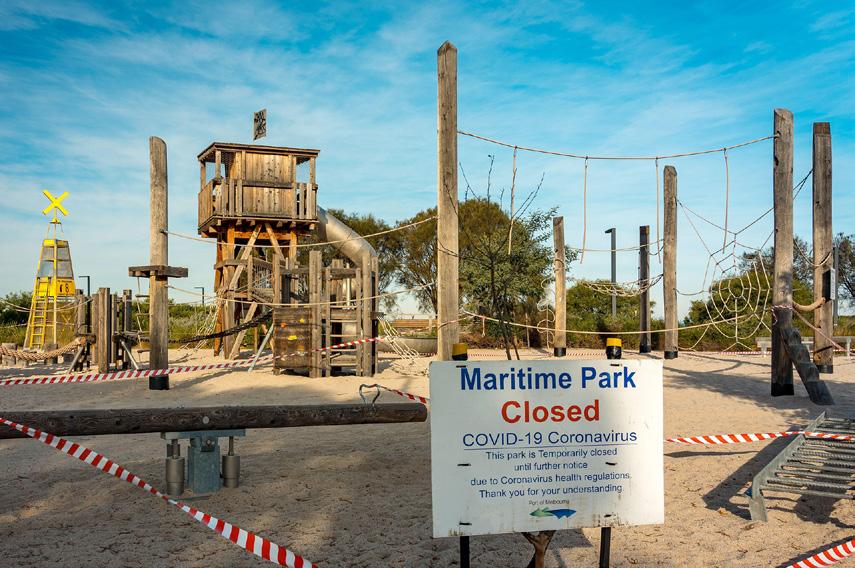
The reasons why many people feel disconnected and socially isolated are complex and personal. For example, some people build strong social connections on social media, while others use the online world to escape real-world social interactions. However, most studies on social isolation have found that joining an interest group, perhaps through volunteer work, can reduce feelings of isolation.
Geographers can also play a role in reducing social isolation within our community by considering how our infrastructure is designed and built. A reliable and affordable public transport system, for example, can make it easier for people to connect with others. Spaces such as libraries, parks, swimming pools, leisure centres and shopping centres where people gather should also be designed to encourage, rather than discourage, social interaction.
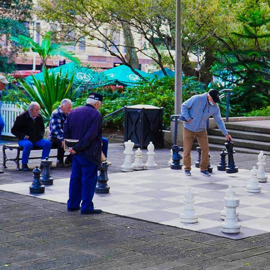
Earlier in this module (Lesson 5.2 Where early Aboriginal peoples lived and Lesson 5.9 Aboriginal and Torres Strait Islander communities), you learnt about the important concepts of Country and Place and the powerful spiritual and cultural connection that Aboriginal and Torres Strait Islander peoples have with the land, water, sea and sky. This connection and the rich cultures of Aboriginal and Torres Strait Islander peoples have been passed on from generation to generation.
Following the colonisation of the continent by Europeans, however, which began in 1788 when the British wrongly claimed that the land belonged to no one (terra nullius), many Aboriginal peoples were forcibly removed from their homelands. The Europeans took these lands from them, and violent massacres occurred. Families were separated, and many children were stolen. Traditional languages were not allowed to be spoken, leading to a severe disruption of cultures and the loss or concealment of stories and knowledge.
While much knowledge and many cultural practices still exist, previous experiences have led to ongoing, deep feelings of injustice and disconnection for many Aboriginal people. A New South Wales Government report in 2020 found that “Aboriginal people in Australia have persistently said that they do not feel like they belong, that they do not feel welcome”.
Check your learning 5.10
Review and understand
1 In your own words, explain the term “social isolation”.
Apply and write geographically
2 What are some examples from your local area of places that encourage social interaction?
3 What are some improvements that could be made to places in your local area to increase social interactions?
Evaluate and create
4 D iscuss the links between social connection and liveability. How does one affect the other?
5 S ource 4 lists some of the lockdown rules in Melbourne.
a Which of these rules do you think had the greatest impact on people’s feelings of isolation? Give some reasons for your answer.
b Which groups in society were most impacted by these rules?
c How were you impacted in your ability to connect with other people during the COVID-19 pandemic?
Source 4 Some of the lockdown rules in Melbourne from 2020 to 2021
Some of the lockdown rules in Melbourne from 2020 to 2021
• Five reasons to leave home: essential shopping, exercising for up to 2 hours, care or caregiving, authorised work or education and getting vaccinated.
• Work from home where possible.
• One person per household per day allowed to shop.
• Curfew from 9 pm to 5 am.
• Mask to be worn outside the home.
• No travel beyond 5 kilometres from one’s home.
• No visitors to homes.
• No visitors to aged care facilities.
• No one to leave Greater Melbourne. There was a period when this was enforced by police roadblocks supported by the Australian Defence Force, a so-called “ring of steel” around Melbourne.
Learning intentions and success criteria
The word “community” can be used to describe groups such as neighbourhoods, towns, workplaces, schools, sports clubs, church groups, or very large groups, such as members of the same religion or citizens of the same country. A community of place
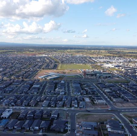
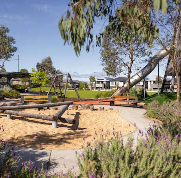
Source 1 Marsden Park is a masterplanned suburb with 108 hectares of open space and recreation facilities.
refers to a group of people with a common interest or goal. This common interest may be linked to where they live, work or spend a large part of their time. People connect with places where they feel included and safe. In this lesson, we will use the north-west Sydney suburb of Marsden Park and its surrounding areas to explore how people feel connected through community services, job opportunities, and entertainment and recreation facilities.
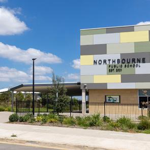
Governments and local councils supply a range of services to different communities. These services include schools, hospitals, libraries, transport, parks and rubbish removal.
Not all communities need the same types of services. For example, a community with a younger population might require more schools and public facilities such as playgrounds, skate parks or cinemas. In comparison, a community with an older population might require greater access to healthcare and retirement villages.
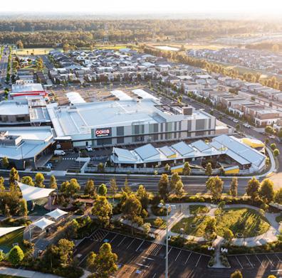
Local communities provide people with access to places of work, training and education. As well as jobs, businesses provide services to the community. Businesses found in many local communities include shops, hairdressers, plumbers, banks and solicitors. Shopping centres are often an important source of jobs within a local community. An industry may be a one-person operation or a large manufacturing business that employs hundreds of people. Industrial areas are usually grouped together in areas with flat land and access to power and transport links.
Leisure facilities such as basketball courts and skate parks are provided and maintained by local councils. Special areas are also set aside for recreation, such as parklands and sporting fields. These areas allow residents to socialise and exercise outdoors. In addition to these recreation areas, councils set up special conservation zones to protect native plants and wildlife.
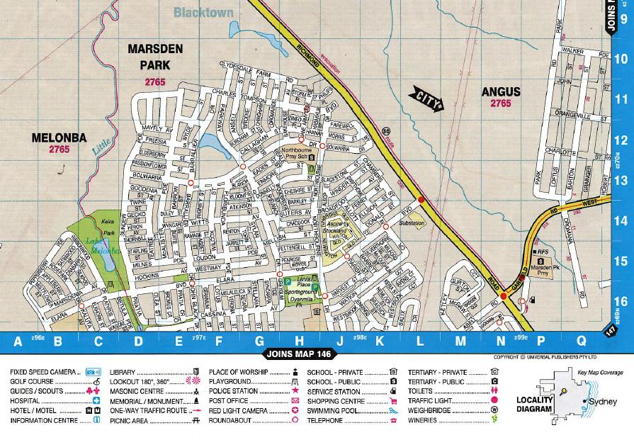
Source 5 Street directory map of Marsden Park and surrounding areas. A larger version of this image is available on Oxford Digital, where you can zoom in and out to find features and places on the maps.
Enlarged map: Street directory map of Marsden Park and surrounding areas
Check your learning 5.11
Check your learning 5.11
Review and understand
1 What is a community of place?
2 List some of the ways in which individuals connect to their local community.
Apply and write geographically
3 L aunch the digital version of the map in Source 5 on Oxford Digital. Look closely at the map to locate a grid reference for:
a a recreation facility
b a community facility
c a source of employment
d an education facility.
4 Marsden Park is mainly populated by families. Describe evidence from this lesson that suggests the local community is made up of many families.
Evaluate and create
5 To what extent are communities important when determining the liveability of a place?
To what extent do you agree with this? A lot (strongly), a little bit (somewhat) or not at all? Write a short paragraph to explain your position.
Key content video: Building safe communities
The most liveable cities are those where people feel safe – not only for themselves, but also for their families and their property. Fear of crime can affect a person’s quality of life, reducing social interaction and forcing people to avoid certain places.
Safety in the community is not just about crime rates but also about how safe people feel in their community. Surveys of local areas help authorities identify the key issues and map problem areas. With this information, they can then work to find solutions to these problems. One of the most reliable sources of information comes from surveys conducted by Australia’s Bureau of Statistics (Source 1).
Governments and local councils are always trying to improve the design of local environments to create safer places and encourage community-based activities. This helps to make places more liveable and motivates people to be active members of their communities.
Learning intentions and success criteria
Key skill worksheet: Asking questions & conducting research: Investigating who makes policy in Australia
it: Building safe communities
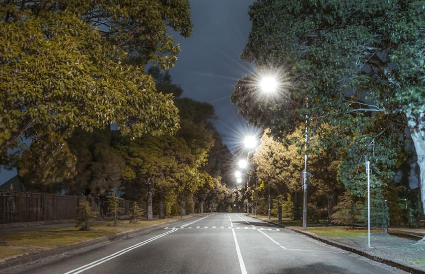
A key step towards improving local safety has been making public areas more visible. This is achieved through various methods, such as designing buildings to face public spaces, removing bushes to provide a clear line of sight, improving lighting and introducing surveillance cameras. These strategies help reduce crime by making places, and therefore any criminal activity, easier to see.
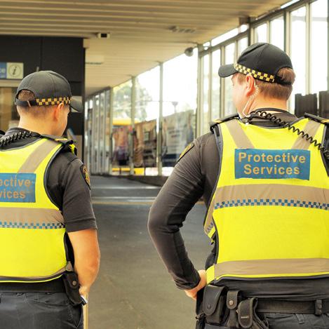
In recent decades, police have developed community programs to build stronger ties with the general community. The goal is to involve members of the community in keeping their own streets safe. One of the most successful of these programs has been Neighbourhood Watch. The police work with local communities to educate people on safety and security issues and to encourage them to look out for and report any suspicious behaviour. The program also encourages community members to get to know each other, share safety concerns and support one another in staying safe.
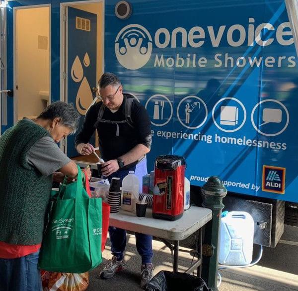
Many government and not-for-profit groups work within local communities to provide outreach services for the most vulnerable members of the community. These services include things such as:
• temporary and permanent housing
• food trucks for those who are homeless or have low incomes
• support services for victims of domestic violence
• rehabilitation programs for those with substance abuse issues
• d rop-in centres for disadvantaged youths
• home services, such as Meals on Wheels for older citizens.
These services help to protect and care for those in our communities who need it most.
Review and understand
1 Why is safety one of the most important liveability factors for communities in Australia?
2 Identify an example of how police work with the community to reduce crime and increase feelings of safety.
3 What are some strategies used to help increase visibility in public places to prevent crime?
Apply and write geographically
4 Look closely at Source 1.
a Do you think this data is reliable? Explain your answer.
b Identify three trends that you notice from the data in this graph.
c Give an explanation for one of these trends.
Evaluate and create
5 A re there times when and/or places where you feel unsafe in your local area?
a Discuss this with a partner and then with the class.
b Identify any common times and/or places where members of your class feel unsafe.
c What do you think could be done to improve feelings of safety in your community?
6 Design and complete a survey that asks five people about whether or not they feel safe in their local community. Use the steps in the skills in context: task in 5A Skills in context Port Melbourne skate park survey to help you.
For most people, the area in which they live is the basis of many of their communities. For example, you probably go to school within a few kilometres of where you live and you are more likely to join a sporting team close by, rather than one several suburbs or towns away.
But how much do you really know about your local community? Before you complete the activities in this task, guess the answers to the questions in Source 1 in relation to the people who live in your postcode. Add them to the “My guess ” column.
Source 1 Survey questions about your local community Survey question My guess QuickStats
How many people live in your postcode?
What percentage of people in your postcode identify as being of Aboriginal or Torres Strait Islander origin?
What are the three most common countries of birth in your postcode?
What percentage of people in your postcode have both of their parents born overseas?
Other than English, what are the three most common languages spoken at home in your postcode?
What percentage of people in your postcode take the train to work?
What percentage of people in your postcode live alone?
In Australia, we have a very reliable source of data and information about our people and where they live. This is because every five years, every Australian household must complete a form that asks questions about the age, country of birth, work and education of household members. All this data is then processed and made available online. This data and its collection are known as the Census. Most countries in the world have a similar process, and Australia’s is considered one of the most reliable and accurate.
The Census is a very important tool for planners and governments as it provides information that helps them plan for the future needs of Australians. It is also a useful tool for you in your geography studies!
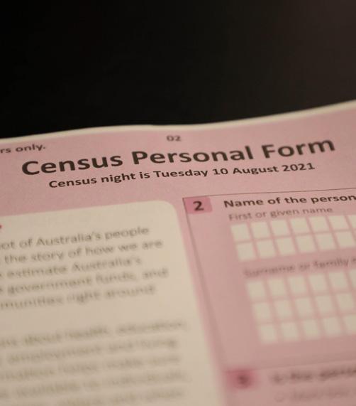
Source 2 Australians complete a census every five years and can complete the form either online or on paper.
Follow these steps to find the latest Census data for the people in your local community. The Census tools can be used to divide the population into various groups, but postcode boundaries are a useful division to use.
• Step 1 Open the Census data portal at www. abs.gov.au/census. A link is provided on Oxford Digital.
• Step 2 Click on “ Find Census data” and then on "Search Census data".
• Step 3 In the search bar under “ Search by area name ”, add your postcode. This should open a map of your postcode. If this doesn’t
Average age:
work, you may need to search by your address and then select the postal area option in the drop-down menu.
• Step 4 In the box below the map, click on the blue “All persons ” button. This will open a QuickStats page containing the most recent Census data for the people who live in your postcode.
• Step 5 Scroll down the page to view the Census data.
Most common marital status:
Most common country of birth:
Most common religion:
Number of registered vehicles:
For more information on this key skill, see Lesson 1.2 Acquiring geographical information and Lesson 1.9 Data and graphs.
ABS Census data
Most common occupation:
Most common industry of employment:
Most common family composition:
Source 3 Profile of a typical resident
Practise the skill
1 Access the most recent Census data for your postcode and use this data to complete the “ QuickStats ” column in Source 1.
2 W hat aspects of your local community did you guess accurately?
3 W hat did you find out about your local community that surprised you?
4 W hat else would you like to know about your local community? Where would you find this information?
5 C omplete the profile of a typical resident in your local community in Source 3.
6 W ho, if anyone, do you know that most closely resembles this “ typical ” resident?
1 A s the QuickStats page also displays data for both the state and the country, you can compare your local community to the state and the country as a whole.
a W hich statistics for your local community in Source 1 and Source 3 are quite different from the broader Australian community?
b P ropose reasons for these differences.
2 You can also compare your community today to the way it was in a previous Census. Go back to the “ Search Census data” and change the date to 2001 before moving on to selecting your postcode. Compare the data from the 2001 Census to the most recent Census.
a How has the size of the population changed over time?
b W hat other features of your local community have changed over this time?
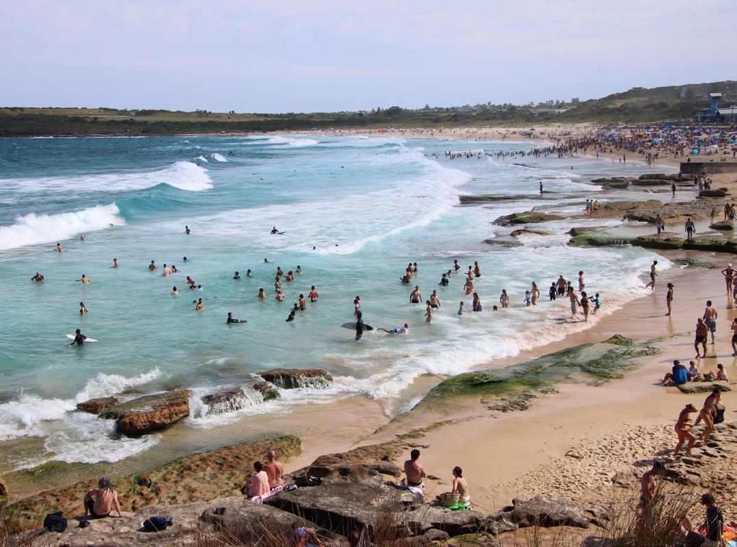
Use Source 1 to answer the following questions.
Australia’s Aboriginal and Torres Strait Islander population
Australia is home to the world’s oldest continuous cultures. Aboriginal and Torres Strait Islander peoples have lived on and cared for this continent for tens of thousands of years.
The source below displays data relating to the population distribution of Aboriginal and Torres Strait Islander peoples in Australia today.
1 Identify three areas of Australia that have large populations of Aboriginal and Torres Strait Islander peoples. Use compass directions and the names of states in your answer. (3 marks)
a Some Aboriginal communities are located in remote areas, further inland within Australia. Summarise two advantages and two disadvantages of this. (4 marks)
b Using the PQE method, describe the distribution of Aboriginal peoples in New South Wales. (3 marks)
2 M any non-Indigenous Australians share the belief that most Aboriginal peoples live in remote areas of Australia rather than in cities. Use evidence from Source 1 to evaluate the extent (how much) this belief is true. Write a paragraph that explains your answer. (10 marks)
(Total: 20 marks)
map: Distribution of Aboriginal and Torres Strait Islander population, 2021