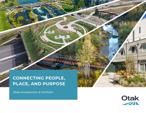
At Otak, our work begins with a connection to the communities where we live, work, and experience everyday life. That connection shapes how we approach every project, grounding our work in what matters most to the people it serves. As a multidisciplinary planning, design, engineering, and project management firm, we work across natural and built enviro nments throughout the United States to create places that are more connected, functional, and meaningful.
Since 1981, our teams of architects, engineers, planners, landscape architects, urban designers, surveyors, and project managers have brought together practical expertise and creative problem-solving to address complex challenges. Whether integrating transit into a dense urban neighborhood, working with communities to shape new development, or contributing to sensitive and significant environments, we focus on solutions that respond to context and are grounded in real-world conditions.
We approach every project as a true partnership, listening closely, understanding each client’s vision, and aligning our work with their goals. Together, we create connected, resilient, and well-functioning environments that anticipate change, inspire possibility, and support communities sustainably into the future.
OUR MISSION
In partnership with our clients, Otak creatively solves the complex challenges of our world.
We envision, design, and build innovative, resilient, and thriving communities.
We leverage the diverse experiences, capabilities, and passion of our team members.
With a focus on client care, growth, and delivering exceptional service, we are committed to employee wellbeing, mentoring, and life-long learning.
PLAN, DESIGN, AND MANAGE
LIVE, WORK, AND PLAY FUTURE GENERATIONS
PARTNERS
LIVE OUR VALUES DESIGN EXCELLENCE
GROWTH
PRESERVATION OTAK IS ABOUT PEOPLE CREATE CIVIC SPACES DELIVER GREAT PROJECTS
LASTING RELATIONSHIPS
PLACE
LEARNING NATURAL SYSTEMS CHARITABLE
Executive Leadership & Directors
Nico Vanderhorst, PE
Interim President, Puget Sound Regional Director
Nico is a hands-on principal with over 30 years of civil engineering experience. His work includes the management and design of transportation, trails, site development, and storm drainage projects for numerous public agencies. Nico has managed many of Otak’s most significant Puget Sound area projects and has developed a strong reputation for assisting clients from start to finish.
Henry Alaman, PE Colorado Regional Director
Henry serves as the regional director for Otak’s Colorado offices, bringing over 30 years of proven leadership and superior management skills. He oversees and collaborates closely with teams across multiple disciplines in the region, including water resources, construction management and inspection, transportation, and infrastructure, structural, and planning/architecture.
Jon Yamashita, PLS OR and SW WA
Regional Director & Director of Survey
Jon serves as the Regional Director for Otak’s Oregon and Southwest Washington offices, where he provides strategic leadership and operational oversight across the region. Jon brings over 30 years of experience to his role and is known for fostering a culture of precision, accountability, and collaboration.
Sarah Oaks Director of Project & Construction Management
Sarah is committed to the success of both her team and her clients’ projects. With a diverse portfolio spanning various project types and markets, she excels in navigating complex, high-stakes endeavors. Sarah’s leadership is marked by her commitment to delivering value beyond her client’s baseline objectives and her capacity to build trust within teams.
Chad
Weiser, PLA, CLARB, LEED AP Director of Federal Practice
Chad is a professional landscape architect and certified planner with over 33 years of experience managing multidisciplinary teams. His expertise extends from feasibility planning and visioning to detailed site design including expertise in sustainable design practices, visitor experience, environmental compliance, permitting, and working with federal land management agencies.
Kevin Timmins, PE Director of Water & Natural Resources
Kevin has over 23 years of experience in the design and management of surface water systems, including streams, wetlands, and urban drainage systems. Kevin has a comprehensive understanding of the planning, design, permitting, and construction process for projects that must strike a balance between natural resource areas and the built environment.
Doug Sarkkinen PE, SE
Director of Bridges & Structures
Doug has over 30 years of experience in structural engineering and bridges. He has significant experience with bridge design, load rating, rehabilitation, and TS&L studies. Doug is also a hands-on, proactive project manager and engineer who understands scheduling and delivery coordination among various disciplines to deliver successful projects with tight timelines and strict budgets.
David Sacamano, PLA
Director of Planning & Landscape Architecture
David is an accomplished and client-focused landscape architect and urban design professional with a proven track record in delivering exceptional master planning, site design, and land development services. He is adept at fostering collaboration with clients, project partners, and communities to create innovative and sustainable public facilities and urban spaces.
Business Unit Leadership
Casey McKenna, AIA
Senior Associate, Mixed-Use & Private Architecture, Oregon & SW Washington
Matt Neish, AIA
Senior Associate, Residential, Commercial, & Public Architecture, Oregon & SW Washington
Emily Carter, AIA, NCARB
Studio Leader, Residential, Commercial, & Public Architecture, Colorado
Cliff Lind, PLA, LEED AP Business Unit Leader, Planning & Landscape Architecture, Colorado
Tracy Emmanuel
Business Unit Leader, Water & Natural Resources, Colorado
David Graff, PE
Business Unit Leader, Bridges & Structures, Colorado
Shawn Klinkner
Business Unit Leader, PM/CM & Owner’s Representative
Tyson Hounsel, PE, SDE
Business Unit Leader, Water & Natural Resources, Puget Sound
Bob Doherty, PE
Business Unit Leader, Bridges & Structures, Puget Sound
Patrick Pease, PE
Business Unit Leader, Construction Management & Inspection
Amanda Owings, PE
Business Unit Leader, Transportation & Infrastructure, Oregon & Washington
Scott Nettleton, PE
Business Unit Leader, Bridges & Structures, Oregon & SW Washington
Walter Tarr
Business Unit Leader, Project Controls
Kevin Dooley, PE
Business Unit Leader, Transportation & Infrastructure, Colorado
Sue Tsoi, PLS
Business Unit Leader, Survey & Mapping, Oregon & SW Washington
ARCHITECTURE
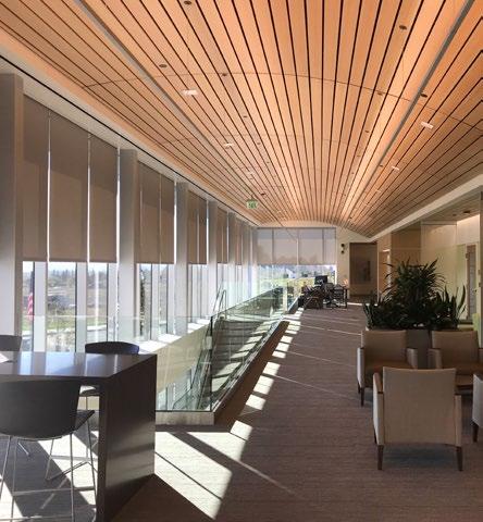
Otak’s architecture team partners closely with clients to create thoughtful, community-focused designs across multi-family housing, civic, recreational, and mixed-use projects—all supported by the strength of our multidisciplinary practice.
PM/CM & OWNER’S REPRESENTATIVE
Otak’s construction management and inspection services team provides clients with the tools to keep their projects on track. From design development through project closeout, we work as part of the project team.
CIVIL ENGINEERING
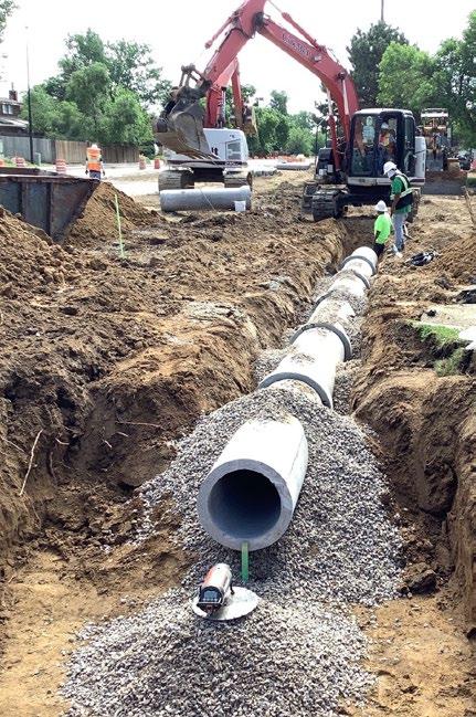
Otak delivers local infrastructure to support the homes in which we live, the water and utility systems that keep our cities running, and the transit systems that ease congestion.
SURVEY & MAPPING
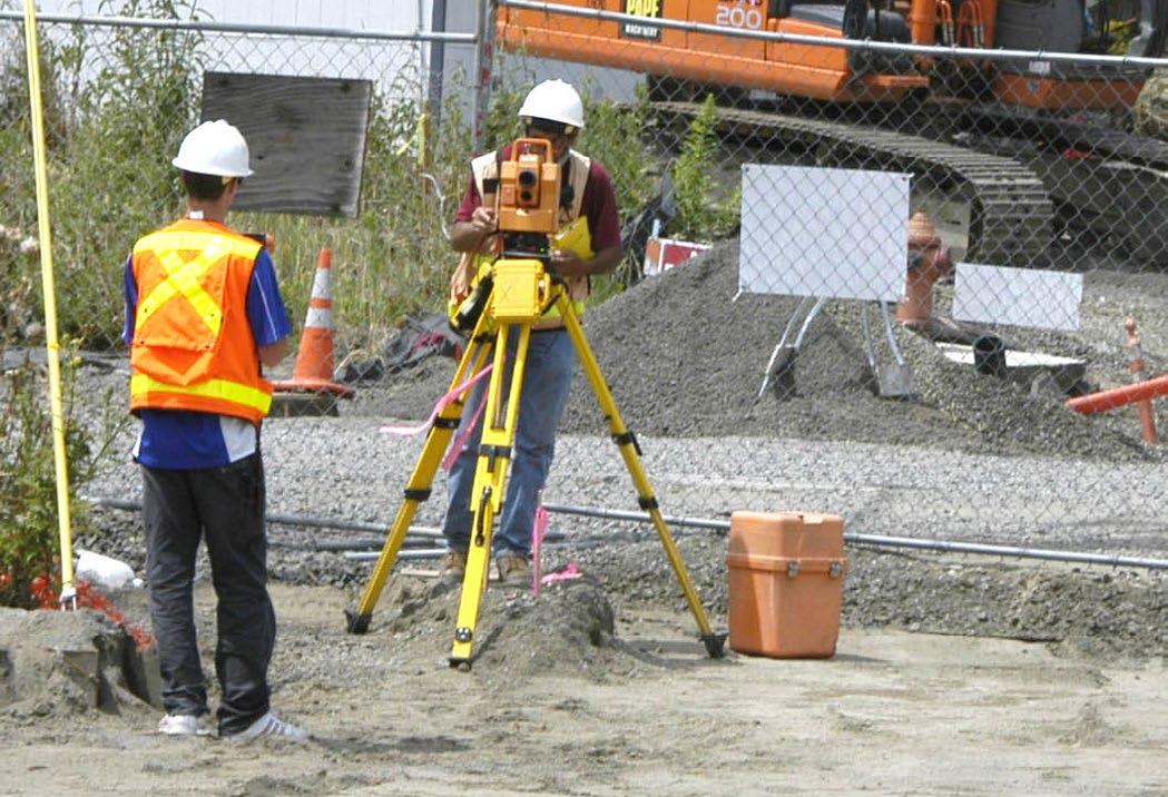
By relaying the relationship between locations, conditions, and uses of the land, our team sets the stage for project success. Otak is a pioneer in electronic data accumulation and its translation into formats for many applications.
CONSTRUCTION MANAGEMENT & INSPECTION
Otak’s construction management team keeps projects on track from design through closeout, providing hands-on oversight, quality assurance, and proactive issue resolution to ensure successful delivery.
STRUCTURAL ENGINEERING
Providing structural engineering services at Otak means delivering solutions that support the full spectrum of built infrastructure— from bridges and culverts to complex vertical structures.
LANDSCAPE ARCHITECTURE
Otak’s landscape architects blend site planning, park and trail design, habitat restoration, and community-driven placemaking to shape outdoor spaces that are functional, resilient, and reflective of each community’s character.
TRANSPORTATION
Otak’s transportation engineers and designers bring the expertise needed to support, enhance, and connect all modes of mobility—from roads and bridges to transit, trails, and active transportation networks.
PLANNING & URBAN DESIGN
Otak’s planning practice focuses on two fundamental objectives: creating livable communities and setting the stage for feasible implementation. Services range from neighborhood design and long-range planning to regional policy analysis.
WATER & NATURAL RESOURCES
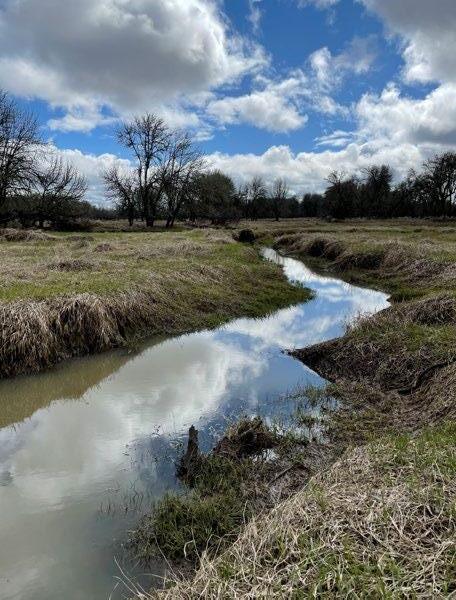
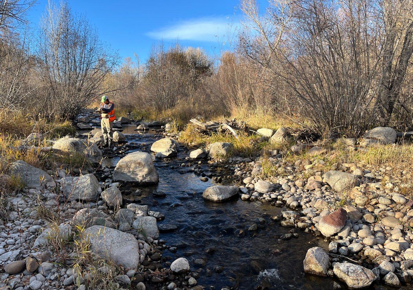
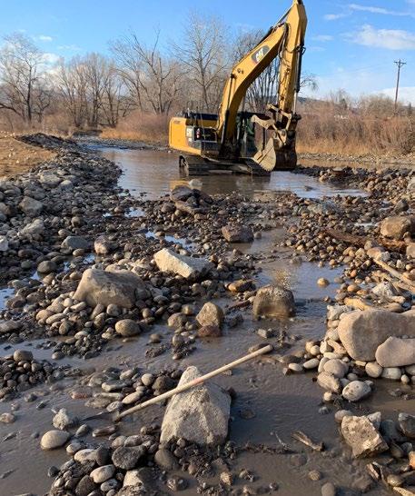
With deep experience in river and stream restoration, fish passage and diversion design, hydrologic and hydraulic modeling, and floodplain and stormwater management, the Otak team develops resilient, ecologically-driven solutions that strengthen communities.
Architecture
SERVICES
• Architecture
• Urban Design and Planning
MARKETS
• Public
• Private
• Residential
• Mixed-Use
• Hospitality
Wecoma Place
LOCATION: Lincoln City, OR
CLIENT: Stewardship Development
SIZE: 44 Units
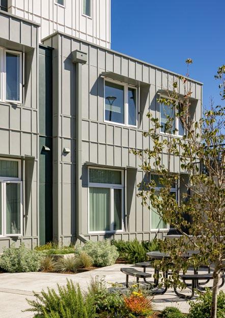
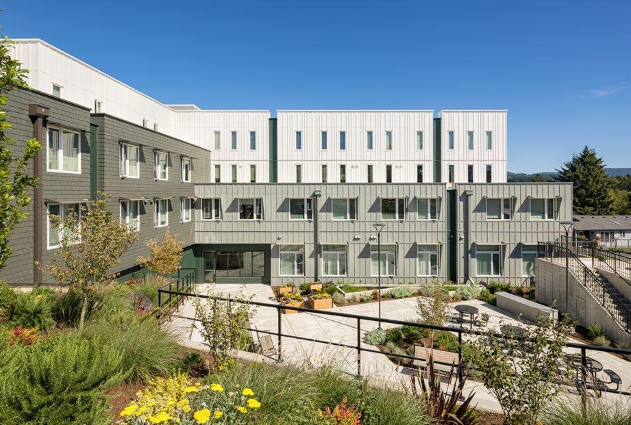
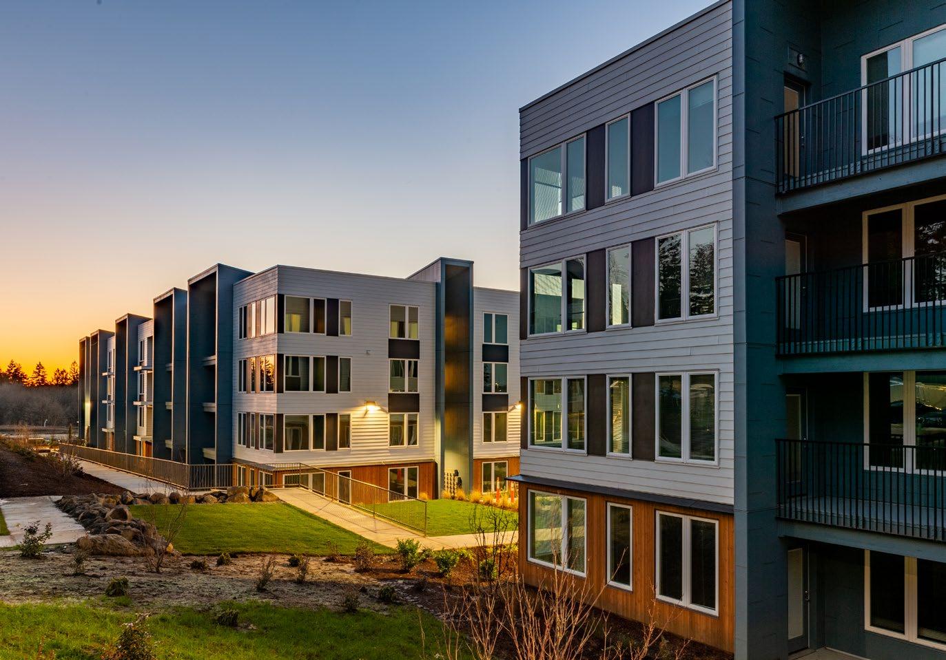
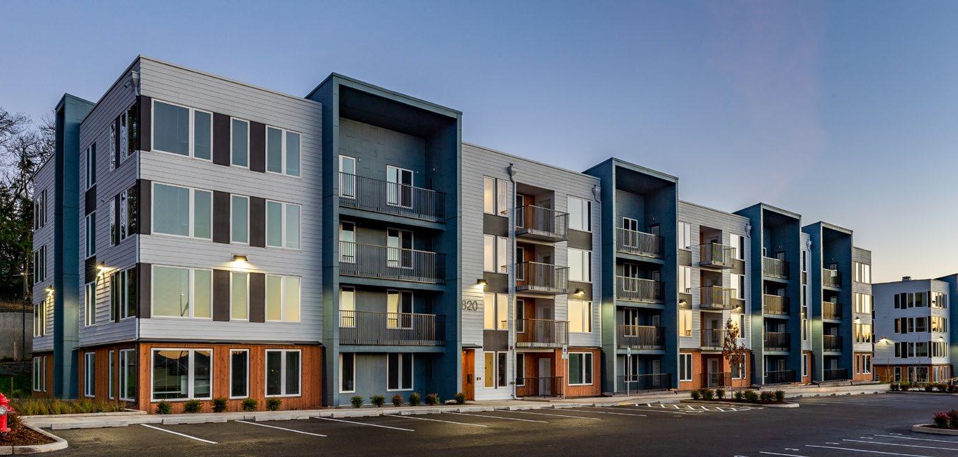
In designing Wecoma Place, Otak drew inspiration from the site’s surroundings to emulate the enduring nature of the Oregon coast. Wecoma Place is comprised of three masses that resemble the large geomorphic shapes along the beach. The various patterns in the siding battens represent the wind-swept grasses found along the coastal landscape. The 44-unit building provides a place to live for residents of Lincoln County displaced by The Echo Mountain Fire in 2020. The units are designed to maximize natural light in the coastal environment and the building is oriented around a courtyard that provides space to recreate and acts as a buffer between the building and Highway 101.
Hotel Indigo
LOCATION: Vancouver, WA
SIZE: 138-room hotel, 40-condominium units, 318,114 sf (Gross Lease Area)
AWARDS: 2023 DJC Oregon Top Projects, Second Place - Hospitality
Project of the Year 2019, Vancouver Business Journal
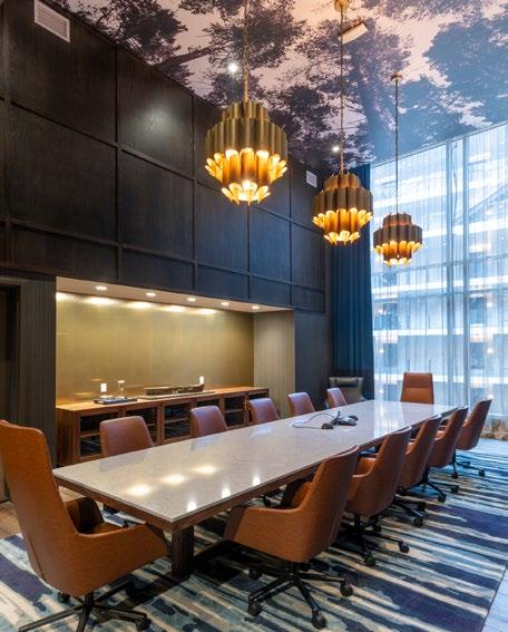
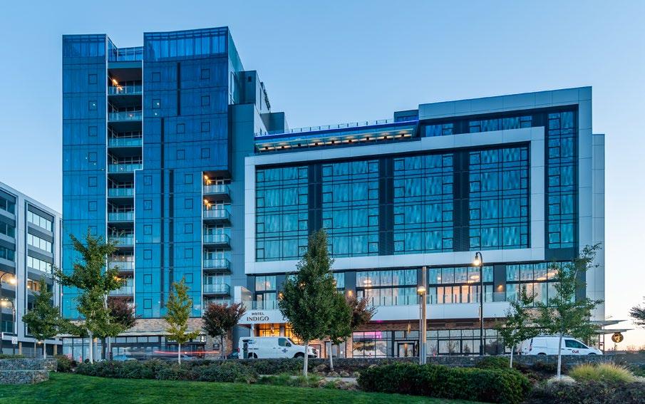
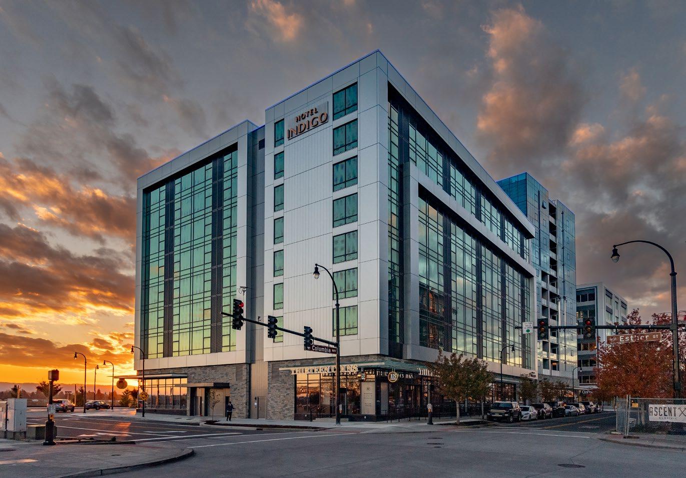
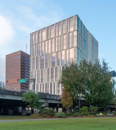
Otak provided comprehensive planning and design services for the mixed-use property, which also includes 10,000 sf of retail and 7,700 sf of restaurant space. The tower’s mixed use also includes luxury condominiums across its twelve stories. The design highlights the hotel chain’s signature brand while creating an iconic destination on the prime site. A six-story atrium, secondlevel meeting and conference hall, rooftop bar, expansive terrace, and valet parking provides visitors and residents with luxury amenities and an inviting setting to enjoy the riverfront festival street and parks. The hotel, one of the few Indigo properties west of the Mississippi, is within easy walking distance of downtown Vancouver.
Cascade Administration Building
LOCATION: Everett, WA
CLIENT: Community Transit
SIZE: 70,000 sf
AWARDS: DJC Top Project2nd Place, Tenant Improvement and Major Renovation
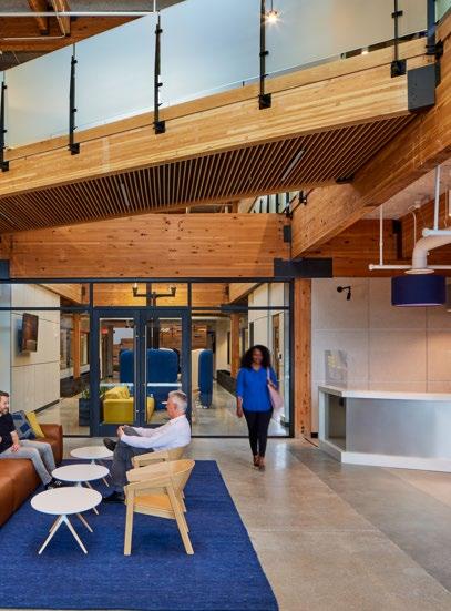
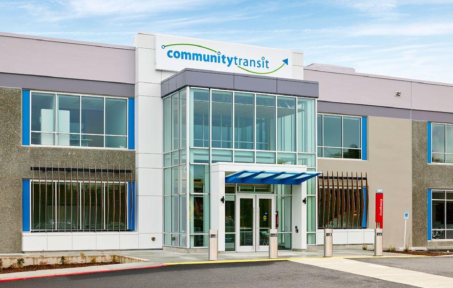
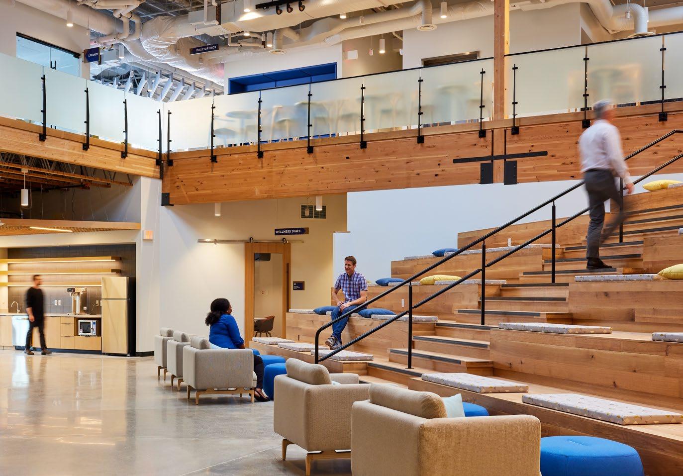
Originally constructed in the 1970’s, the two-story structure of the Cascade Administration Building finds new purpose as an administrative headquarters for a bustling transit company, Community Transit. The complete rehabilitation of 70,000 sf of the concrete tilt panel building involved full design from our team, from programming through construction documents, and ultimately became the new home for several groups’ operations.
The adaptive reuse of the Cascade Administration Building included upgrades to nearly all building systems to meet current building, fire protection, energy, and electrical codes. Expanded windows and new skylights add daylight throughout the building to further the energy efficient design provided by high-performance mechanical systems, LED lighting, and integrated controls. Extensive structural upgrades to meet seismic requirements and an added data facility that required enhanced security were additional issues solved in the renovation plans.
Fields Apartments
LOCATION: Tigard, OR
CLIENT: DBG Properties, LLC
SIZE: 264-units; 100,000-sf office space; 24 acres total
Otak provided the design of a 264-unit affordable multi-family development and approximately 100,000-sf office development in Tigard. The project site is 24 acres and includes a total of five apartment buildings, a clubhouse building with a green roof, and three-story office buildings. The landscape includes trails, a playground, outdoor pool, and a water garden.
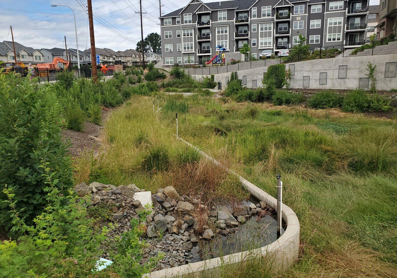
One of the main urban design challenges of this project was the steep grade and close proximity to existing homes. The design incorporated a stepped building and infrastructure placement that is responsive to existing view corridors and vegetation. This project required coordination with Washington County, Oregon Department of Transportation, Clean Water Services, Department of State Lands, and the United States Army Corps of Engineers.
Rocky Mountain Arsenal
National Wildlife Refuge Administration Building
LOCATION: Denver, CO
CLIENT: U.S. Fish and Wildlife Service
SIZE: 4,200-sf headquarters; 1,000-sf annex; 56-space parking lot
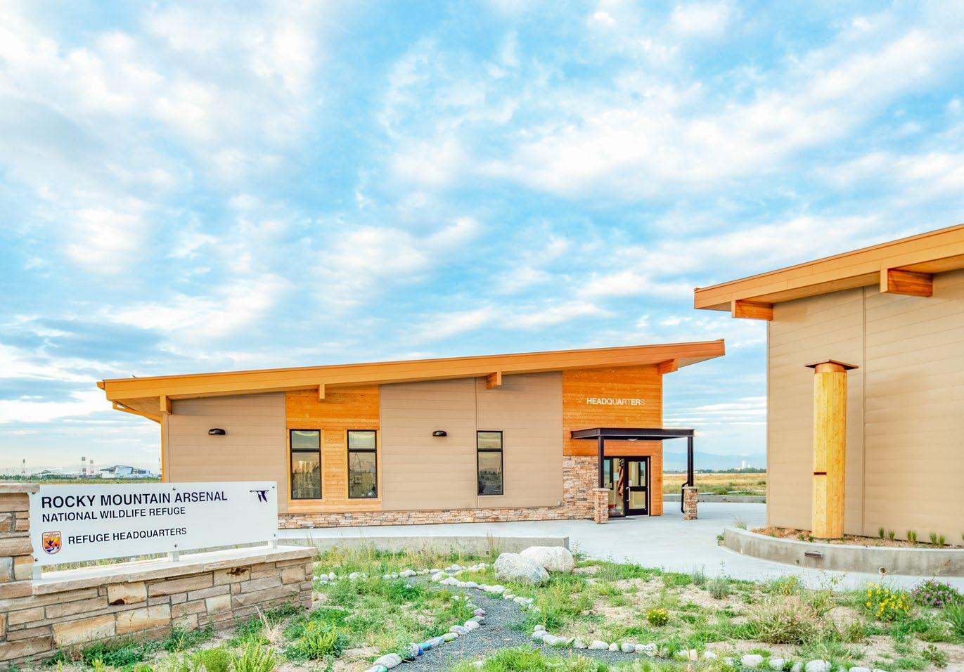
Now the nation’s premier urban National Wildlife Reserve, Rocky Mountain Arsenal has evolved over the decades. The site once served an Army facility associated with weapons manufacturing during WWII before being decommissioned and transitioning to its current use as a wildlife refuge. With increasing park use, new administrative facilities would be designed and built to improve operations as well as visitors’ experiences.
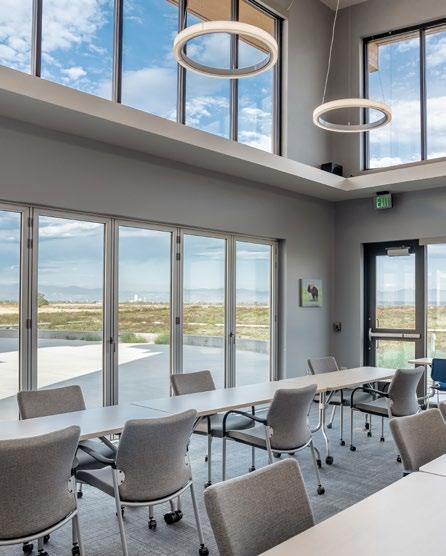
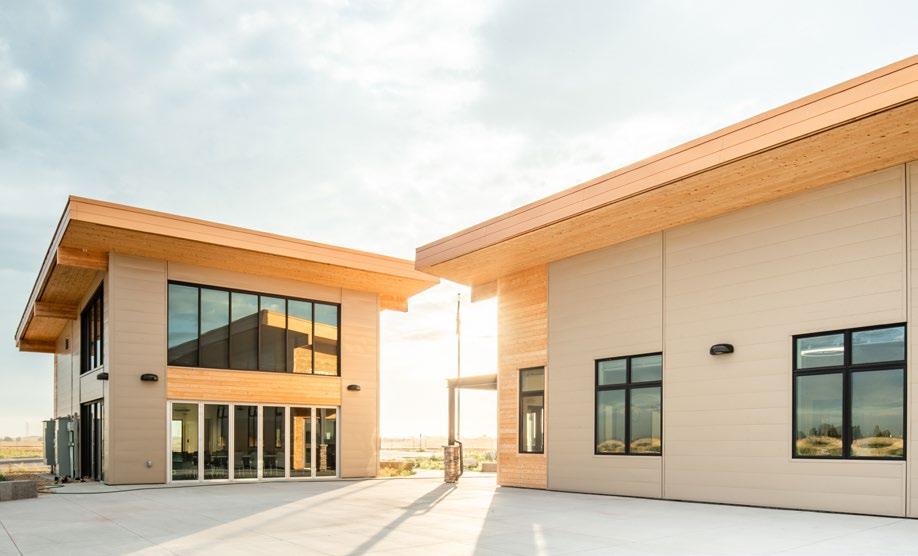
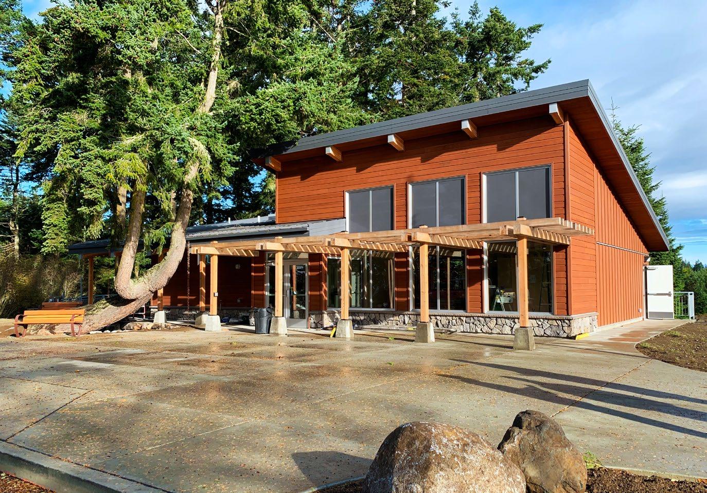
Otak, as a subconsultant, provided architecture, landscape architecture, and structural design services for a new headquarters building and meeting facility for the U.S. Fish and Wildlife Service (USFWS) administrative staff, separate from visitor facilities. With a focus on sustainability, the new facilities were designed with a minimum LEED Gold standard. Solar readiness and daylighting strategies were included to lower the energy requirements for lighting and cooling, while the stone siding was locally sourced. The project consists of a 4,200-sf headquarters building, a 1,000-sf meeting annex building, a 56-space parking lot, realignment of entrance driveways and gateway features, expansion of the existing parking lot and associated hardscape, landscape, and utility systems.
American Camp Visitor
Center at San Juan Island
National Historical Park
LOCATION: San Juan Island, WA
CLIENT: National Park Service
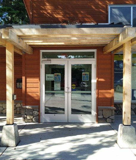
In replacing a temporary, 1,448-sf visitor center, the National Park Service (NPS) aimed to update facilities for visitors and staff alike. A 2,500-sf permanent visitor center would ultimately be constructed in its place. Otak led the design of these park improvements.
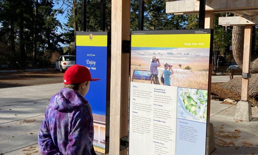
After studying potential locations for a new visitor center, the site of the existing double-wide trailer originally installed in 1977 was chosen for its replacement. The new design provides space for visitor orientation, seating for an updated audiovisual program, fully accessible exhibits, public restrooms, and office and storage space for ranger staff. With the goal of improving visibility and safe access to the site from the public roadway, the project also includes a realigned entry drive. Other site improvements include a new entry monument sign, an expanded parking lot, an outdoor interpretive plaza for education programs, new outdoor exhibits, upgraded power and communication service, and replacement of the septic system. The visitor center, parking lot, exhibits, audiovisual program and public restrooms will be fully accessible, allowing visitors of different abilities to learn about and experience park resources.
Civil Engineering
SERVICES
• Site Development
• Utility Infrastructure MARKETS
• Public
• Private
• Residential
• Commercial
• Mixed-Use
• Industrial
Portland South Waterfront
Master Plan and South Waterfront - Alamo
Manhattan Blocks
LOCATION: Portland, OR
CLIENT: Alamo Manhattan
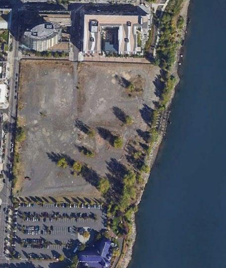
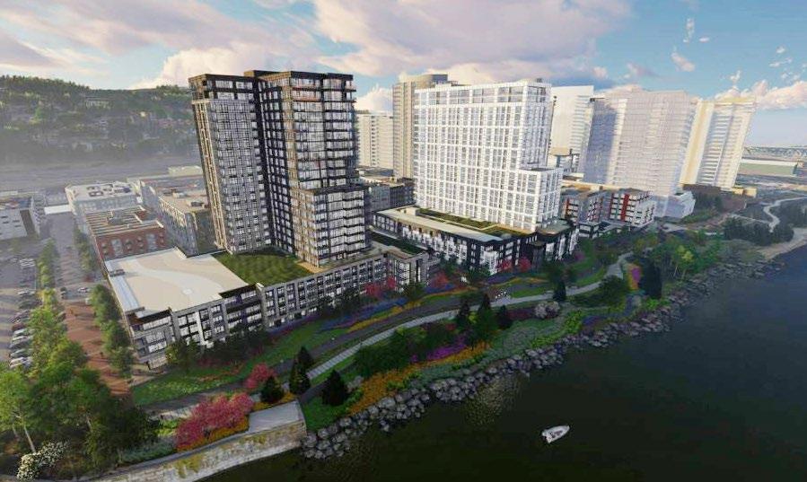
Several new city blocks of mixed-use buildings were developed as part of continued growth and restoration of the South Waterfront along the Willamette River in Portland, Oregon. With a combination of engineering, planning, design, and environmental science, Otak’s multidisciplinary approach placed an emphasis on multimodal connectivity in designing these four blocks with direct access to public spaces within the riverfront greenway.
Work to extend a riverfront greenway set the stage for the creation of a new district that added four new mix-use buildings in the South Waterfront. This follows earlier efforts in delivering the Oregon Health Science University Building and development of the Central District that initiated growth in the area. In addition to the public roadways and pedestrian accessways that shape the new city blocks, engineering and planning would lead to 800 feet of new greenway along the Willamette River. To support the new recreational open spaces, a cleanup and enhancement of the riverbank was required. Decades of industrial debris and contaminated sediment were excavated while large wood, root wads, and boulders were added to reconstruct the slope with revegetation and encourage more natural river functions.
North Bethany Concept Plan and Implementation Projects
LOCATION : Beaverton, OR
CLIENT: West Hills Development
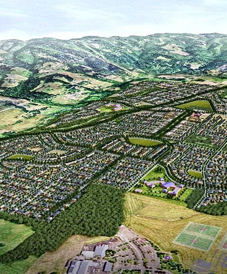
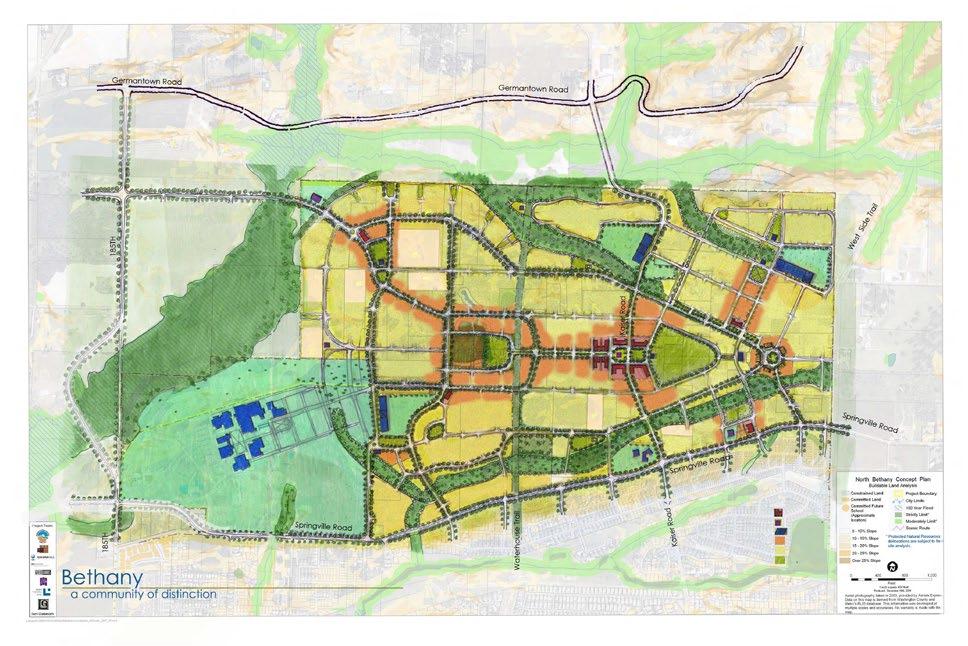
Otak was the prime multidisciplinary consultant working at various stages of master planning, landscape design, civil engineering and architectural design for four major private development projects in the North Bethany Plan Area, an urban community in Washington County. Otak created concept master plan alternatives, led the preferred master plan selection process, and further developed the master plans to submit Planned Development, Design Review, and final design applications for the numerous phases of each project.
The client, West Hills Development, selected Otak for its multidisciplinary and integrated design approach to design these communities. Otak previously designed the North Bethany Concept Plan, setting the framework for future development in the area. As a joint civil engineering and urban design project, Otak provided master planning, land use planning, civil engineering, survey, stormwater management, architecture, landscape architecture services and construction administration.
River Terrace East
Multi-family Development
Regional Stormwater Facility
LOCATION : Tigard, OR
CLIENT: City of Tigard
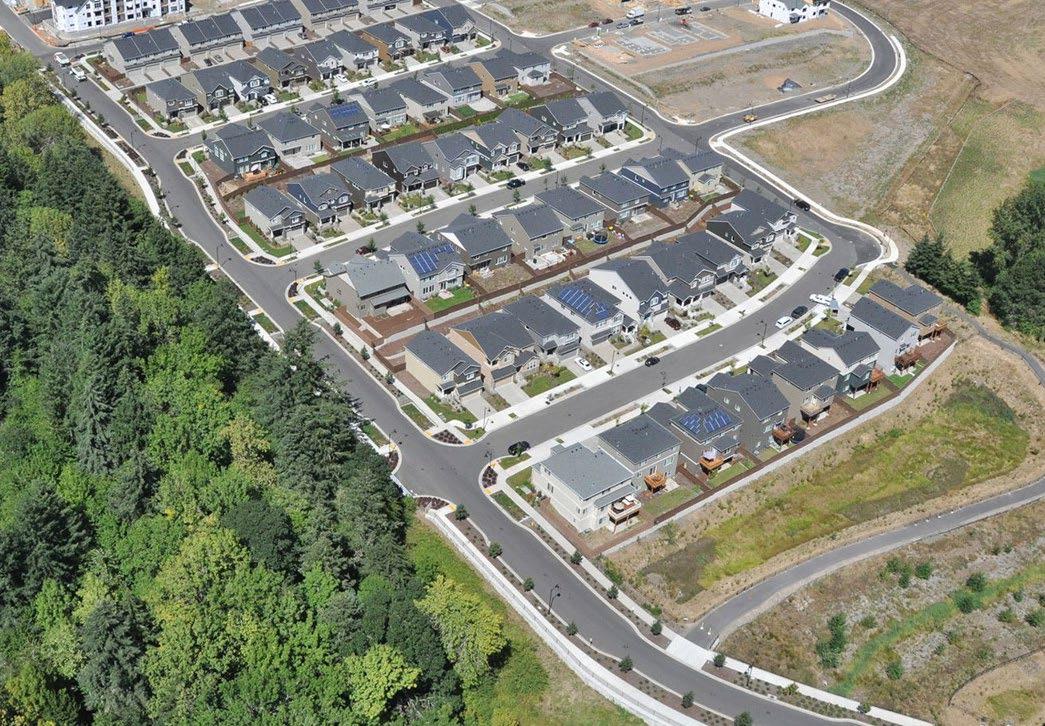
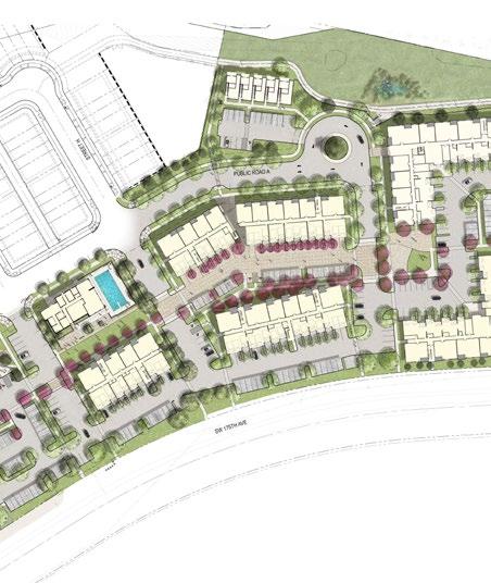
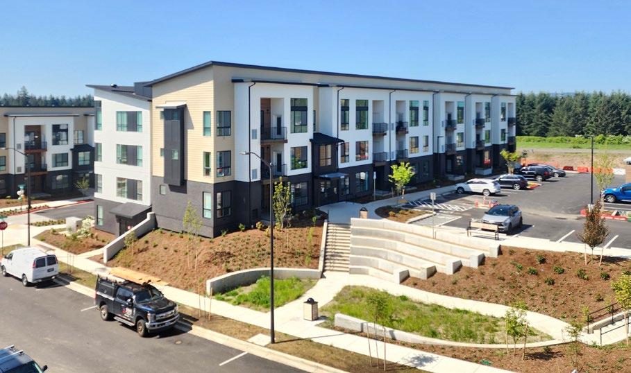
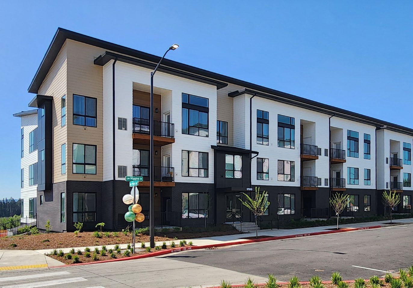
Otak designed the regional stormwater facility with community amenities for a multifamily development in River Terrace, following the River Terrace Stormwater Master Plan design requirements. Otak also provided land use planning, survey, civil engineering, architecture, and landscape architecture services for a 141-unit, 9-building multi-family project within the River Terrace area of Tigard, east of 175th Avenue and south of Scholls Ferry Road. The project involved a complex land use process, extensive coordination with City staff, and review and approval by the Planning Commission.
UWB Husky Village Redevelopment
LOCATION: Bothell, WA
CLIENT: University of Washington-Bothell
SIZE: 4.4 acres
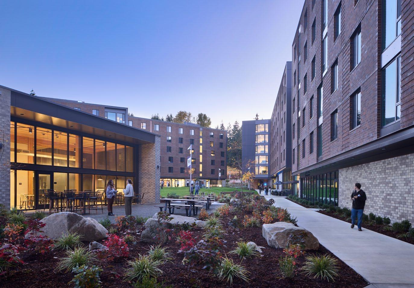
The UWB Husky Village Redevelopment consists of comprehensive civil infrastructure improvements supporting the redevelopment of a 4.4-acre student housing site at the University of Washington Bothell. The project provides site civil design and public right-of-way improvements necessary to support a new high-density Residential Village accommodating more than 1,000 students, including three multi-story residential buildings with ground-level commercial, office, and dining uses.
Public infrastructure improvements include widening approximately 950 linear feet of Beardslee Boulevard to add an eastbound travel lane, removal of the existing eastbound on-street bicycle lane, and construction of a new 13-foot-wide shared-use nonmotorized trail separated from vehicular traffic by landscaped buffers. Additional roadway work includes pavement overlay, pedestrian and traffic signal modifications, new roadway and trail lighting, and utility undergrounding.
Scappoose Industrial Subdivision
LOCATION: Scappoose, OR
CLIENT: AirPark Development
SIZE: 330 acres
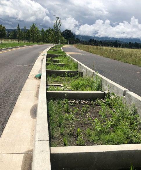
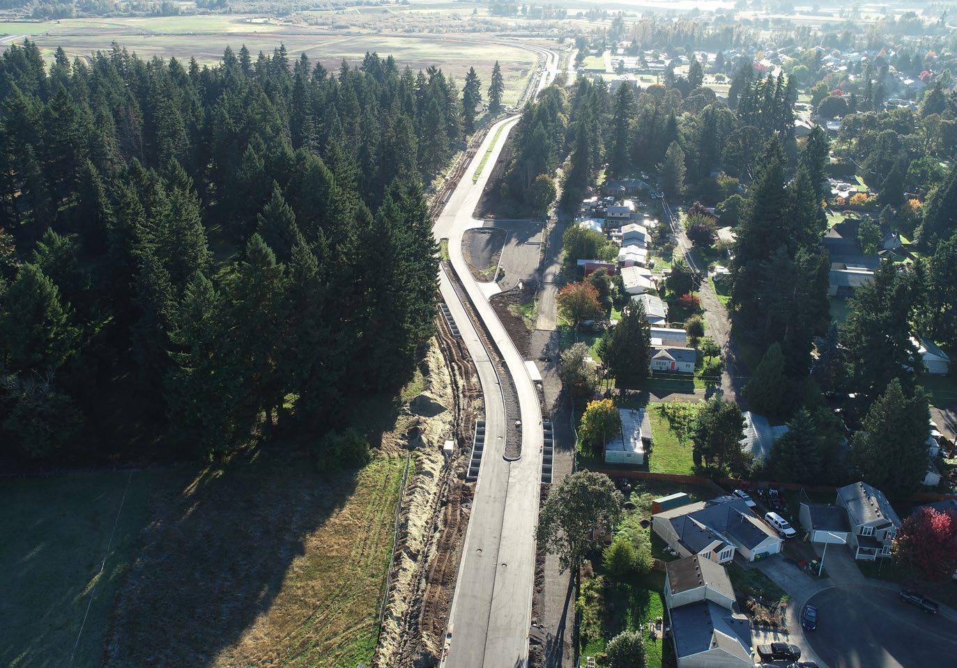
The 330-acre Scappoose Industrial Subdivision project is located just south and east of the Scappoose Industrial Airpark. This phased project includes a 6,700 lineal feet extension of Crown-Zellerbach Road east of West Lane Road. The Crown-Zellerbach Road is a collector street comprised of two travel lanes, a center median, planter strips, LDIA stormwater facilities, and 12-foot wide bike/pedestrian pathways. Utility extensions include an 18” water main and 12” sewer main to service the industrial subdivision.
The project also includes a new trailhead and parking lot to provide improved access to the existing regional pedestrian trail. Notable utility improvements include: drilling a new water well (by City) and routing the additional raw water supply to a treatment facility, adding two sanitary sewer lift stations, upsizing the existing sewer main in Columbia Avenue from 18-inch to 30inch pipe (~2,400 lineal feet of sewer), and grading two stormwater facilities that will work in coordination with the required wetland mitigation sites (approximately 6 acres).
South Cooper Mountain: Amity Orchards
LOCATION : Beaverton, OR
CLIENT: Wishcamper Development Partners
SIZE: 164 units; 40,000 sf commercial space
The Amity Orchards development is a public-private partnership that consists of three multifamily buildings that add 164 affordable housing units and community facilities, as well as 40,000 sf designated for commercial space, as part of the South Cooper Mountain community plan. With a focus on sustainable design, community amenities, and access to transit, Otak managed everything from land use planning and entitlement to site surveying and construction documentation to complete this mixed-use development.
The site design includes low-impact stormwater management techniques including vegetated planters and swales. To save and incorporate mature trees on the property, an urban public plaza was also included in the design to complement the project’s varied utilization.
Construction Management & Inspection
SERVICES
• Construction Administration
• Constructability Review and Scheduling
• Construction Inspection
• Claims Support
MARKETS
• Public
1st and Strand Street –St. Helens Waterfront
LOCATION: St. Helens, OR
CLIENT: City of St. Helens
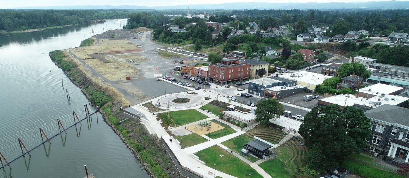
Enhancing the connectivity and functionality of its waterfront, the design along 1st and Strand Streets establishes a more defined downtown core for the City of St. Helens, Oregon.
A multidisciplinary Otak team led planning and subsequent engineering aimed at further developing this area of the city and accentuating its value as a public asset.
Following a planning effort to outline further development of the downtown waterfront, including the site of a former mill, roadway improvements in the area enhance access for both vehicles and pedestrians while also setting the stage for expanded public use. A new multiuse path and more clearly defined parking areas increase accessibility to the waterfront and its amenities. Its design allows for a portion of Strand Street to host festivals with minimal disruption to traffic by incorporating a new circle turnaround and converting part of Strand to a one-way street that had previously caused congestion between the courthouse and City Hall.
Boones Ferry Road Improvements, Phase 1
LOCATION: Lake Oswego, OR
CLIENT: City of Lake Oswego
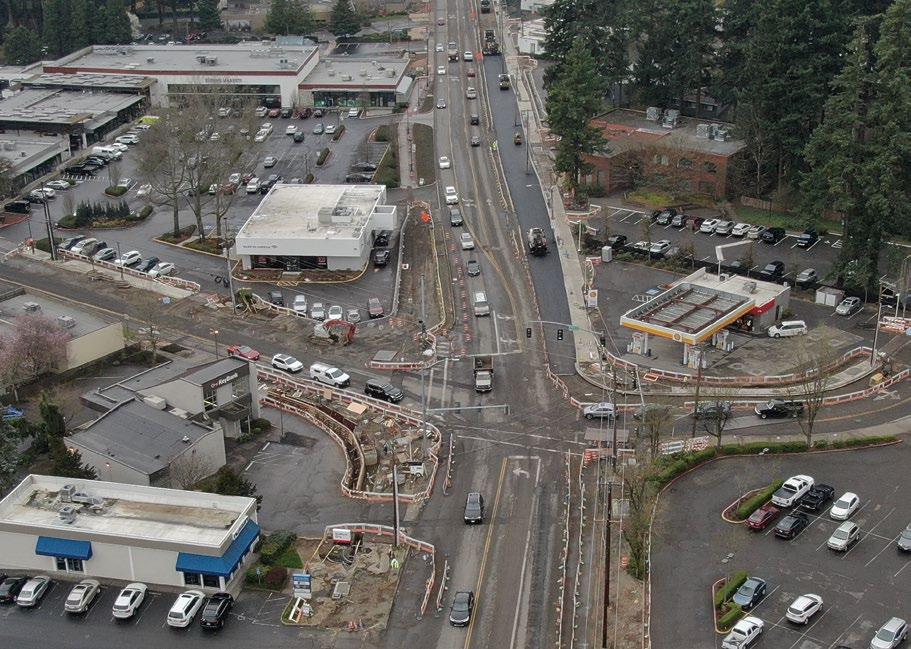
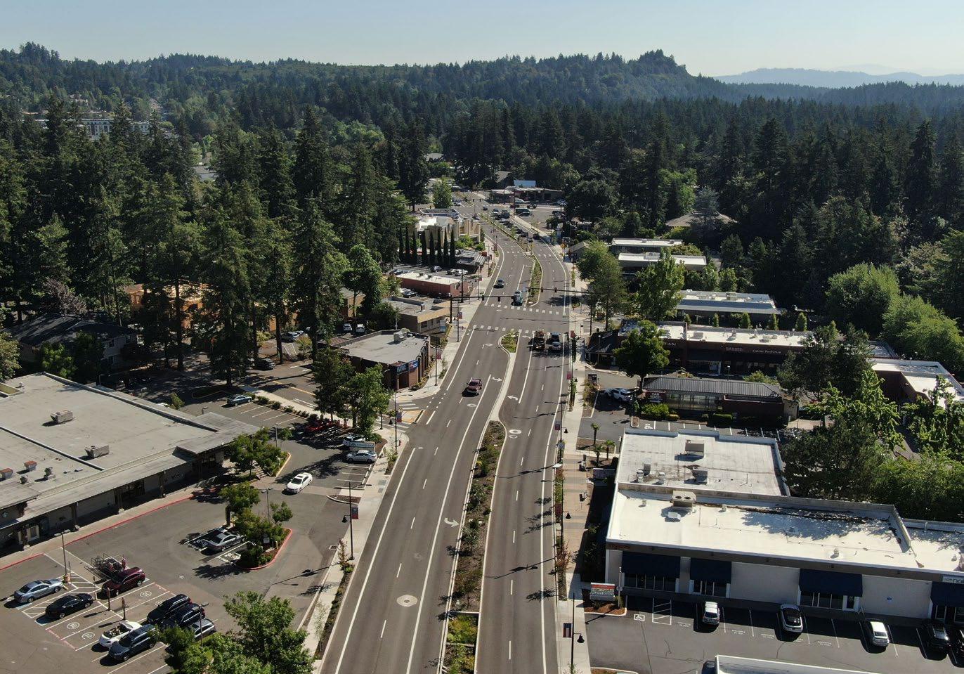
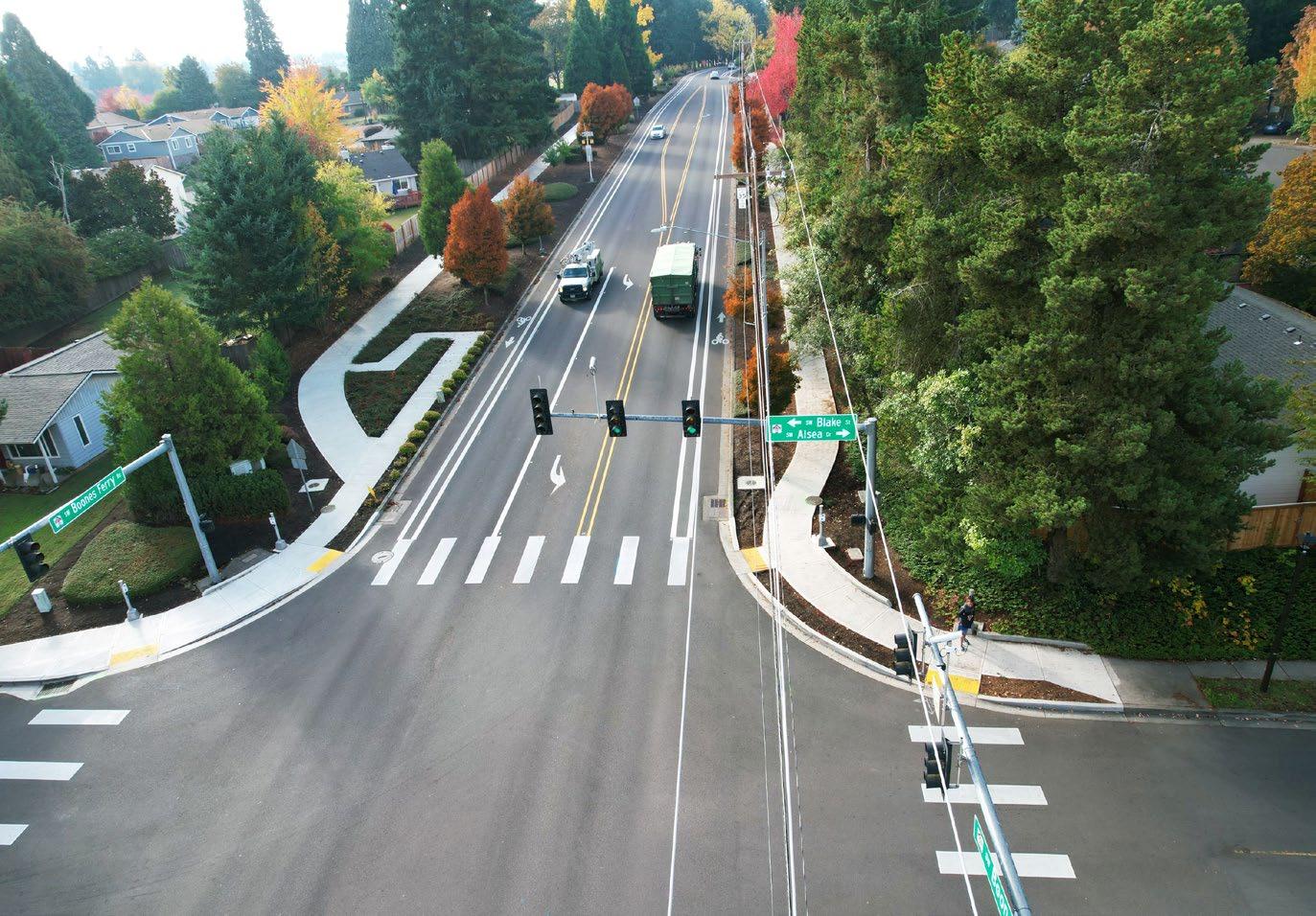
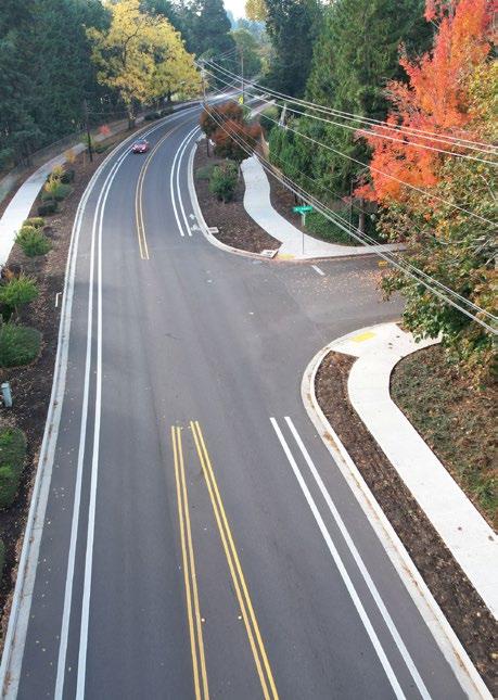
Otak provided owner’s representation, third-party construction management, and inspection services for construction on this $23 million project to improve pedestrian, bicycle, and vehicular safety and access on Boones Ferry Road from south of Madrona Street to north of the Lanewood Street intersection. The project provides proper drainage and improvements to stormwater quality and aesthetic improvements to enhance the business corridor including landscaped medians and planter strips, underground utilities, new signs, traffic signals, and sidewalks. Otak’s role began with pre-construction, including review of 95 and 100 percent PS&E; constructability, schedule, and staging review; and contractor procurement.
Fire Station 11
LOCATION: Vancouver, WA
CLIENT: City of Vancouver
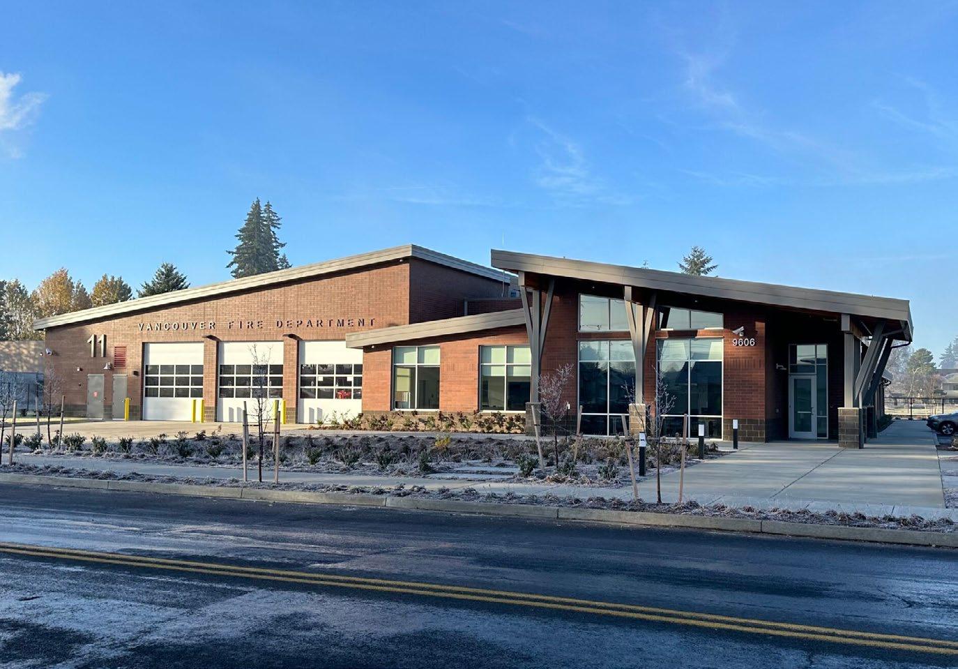
With high growth in the Orchards-Sifton neighborhood of Vancouver, WA, the City planned the addition of a Fire Station in the area to maintain their standards of quick call times and great service to the community. The City’s Capital Projects team was already stretched thin delivering a separate, robust construction program as construction of Fire Station 11 approached, leading to a need for construction support. Otak recommended effective ways to not only augment their capacity but amplify their impact. The construction management team built a plan focused on using the right information to add the right skills in the right place at the right time. Operating as an extension of the City’s team, Otak’s construction manager and inspector integrated their approach with established processes, tools, and culture. In completing construction on-time and within budget, Fire Station 11 was able to begin serving the community on schedule.
CO 7 and 119th Intersection
Construction
LOCATION: Lafayette, CO
CLIENT: City of Lafayette
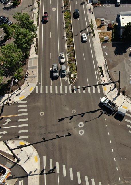
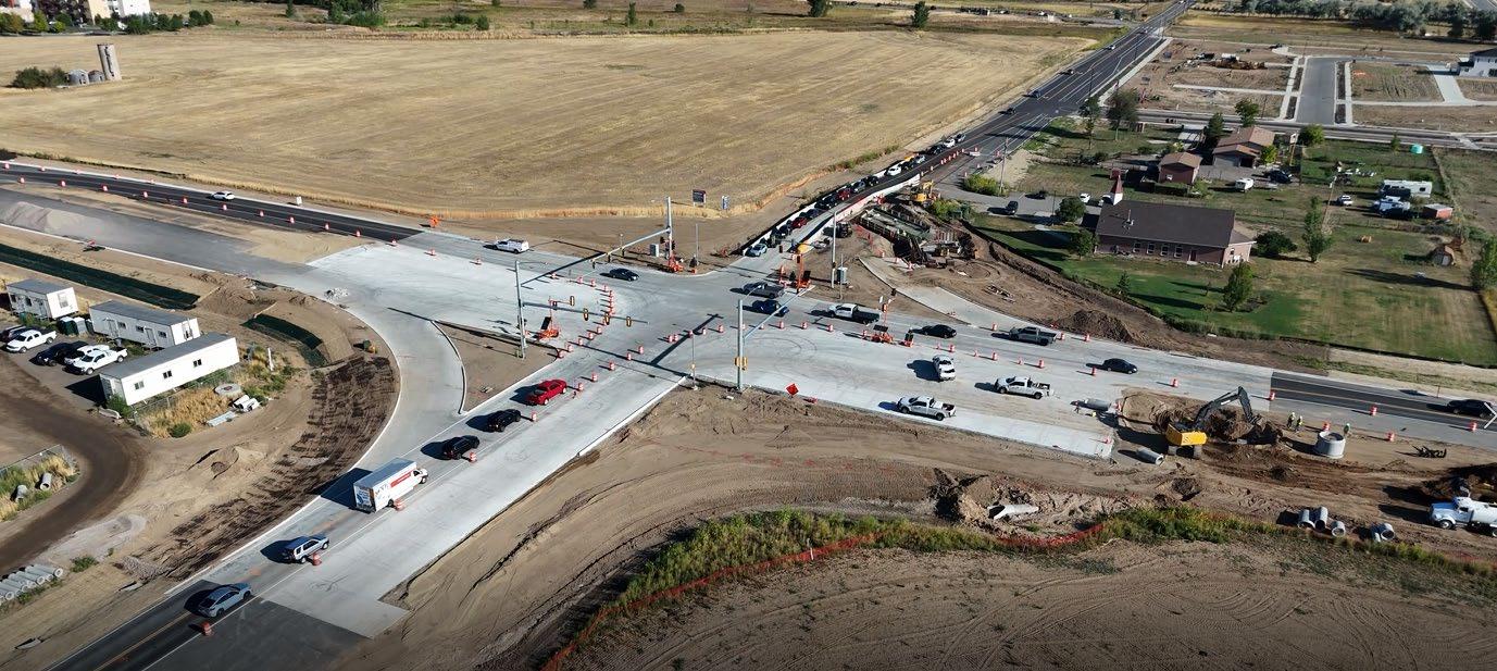
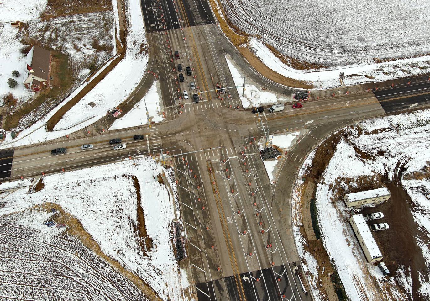
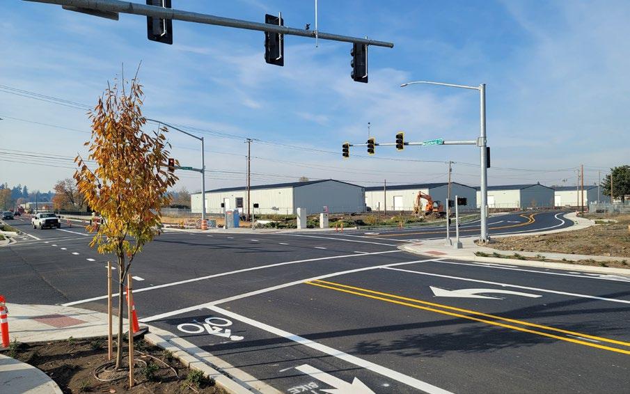
In the southeastern portion of Boulder County, approximately one-mile northeast of downtown Lafayette, this was originally a four-way, signalized intersection with one travel lane in each direction. Along with capacity expansion, additional left turn lanes and right turn deceleration lanes were included. Transit queue jump lanes, bike lanes, and sidewalks on the western side of the intersection were among the multimodal design features. Bus rapid transit (BRT) stops were also built in the northwest and southwest quadrants of the intersection. Additional right-ofway (ROW) was required to complete these improvements as part of larger goals for increased connectivity for the community. Otak led the construction management of this project which aligns with a broader vision by the city for improvements throughout the corridor.
South Boulder Road
Widening
LOCATION: Lafayette, CO
CLIENT: City of Lafayette
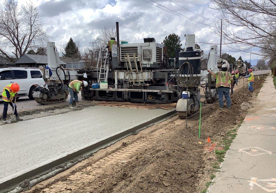
Working with the Boulder County Transportation Department and the Colorado Department of Transportation, South Boulder Road would be widened with two thru-lanes; a center turn lanes; and bike lanes. The 10-foot wide concrete multi-use path runs along Merlin Drive from South Boulder Road up to the Alicia Sanchez Elementary School, and along Front Range Drive from South Boulder Road to the Lafayette Park-n-Ride. The path is accompanied by at 6-foot wide sidewalk as well as the reconstruction of the Lamont parking lot that expands parking space while also adding additional green space. A new signalized intersection at South Boulder Road and 120th Street aimed to improve traffic with turn lanes on the north, south and west legs and a dual left-turn lane for traffic traveling eastbound on South Boulder Road and turning left onto 120th Street.
Vancouver ADA Curb
Ramp and Pavement
Preservation
LOCATION: Vancouver, WA
CLIENT: City of Vancouver
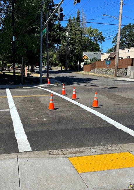
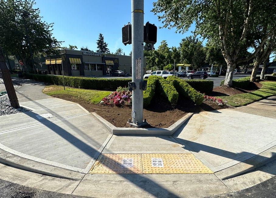
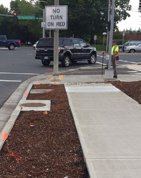
Otak provided construction management and inspection services for the City of Vancouver, Washington’s 2023 Curb Ramp Program. Otak managed the construction and inspection of 72 ADA compliant curb ramps, creating a safe transition from the street to the sidewalk and improved accessibility. Our team of ODOT certified inspectors have overseen the construction of hundreds of curb ramps, giving them deep expertise in what it takes to form and pour an ADA compliant curb ramp right the first time. We set our expectations with the contractor on day one, know the plans inside and out, start every day with a strategy and meticulously document every step.
Landscape Architecture
SERVICES
• Master Planning
• Landscape and Urban Design
• Park, Trail, and Open Space Planning and Design
• Interpretive Planning and Design
• Public Outreach and Community Engagement
• Native Plant Restoration
• Streetscape Design
• Irrigation Design
• Planting Plans
MARKETS
• Public
• Residential
• Mixed-Use
Elizabeth Austin
Playground
LOCATION: Vancouver, WA
CLIENT: City of Vancouver
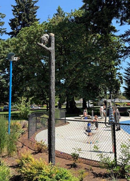
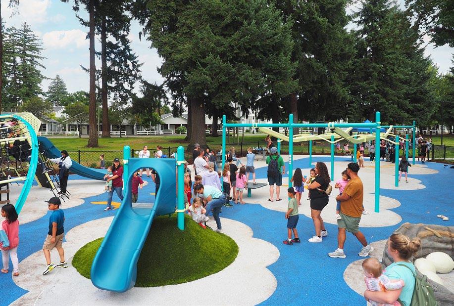
Focused on a fully inclusive design, Elizabeth Austin Playground incorporated extensive community input to establish final features and playground equipment as part of broader master planning for improvements to Fruit Valley Park. The Otak team (in partnership with Learning Landscapes) led public outreach along with master planning, construction documents, and permitting services to develop this public space designed to celebrate the natural beauty and habitat found in the Vancouver lowlands. While most playgrounds incorporate basic ramps and a few wheelchairaccessible play options, those accommodations only address some mobility disabilities making inclusive play spaces a priority for Vancouver Parks, Recreation & Cultural Services. An emphasis on inclusive play equipment, from ADA-approved poured in place rubber surfacing to fencing that supports the safety of children with specific developmental and neurodiverse needs, as well as bird sculptures and houses, altogether highlight the design theme.
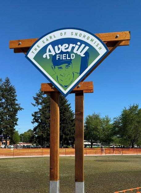
The Park at Averill Field
LOCATION: Snohomish, WA
CLIENT: City of Snohomish
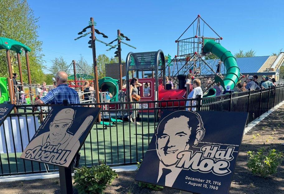
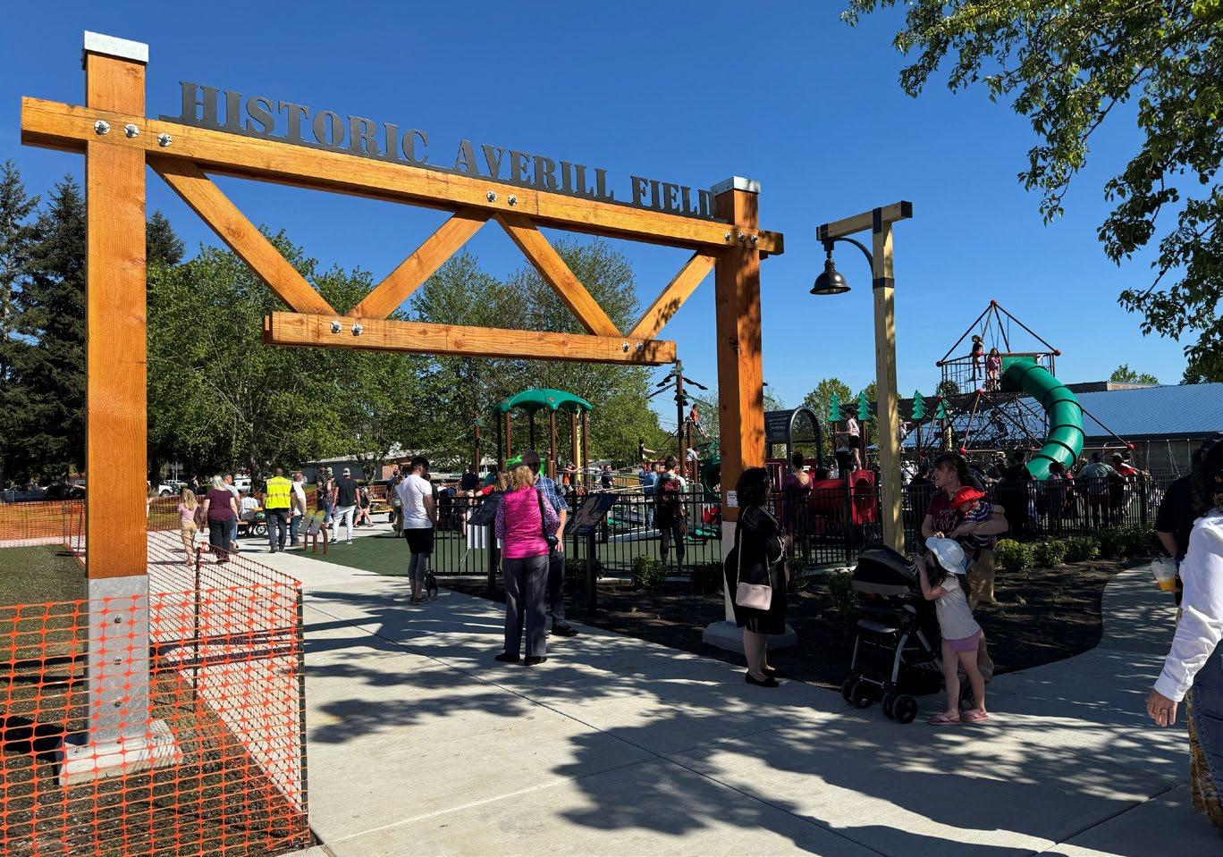
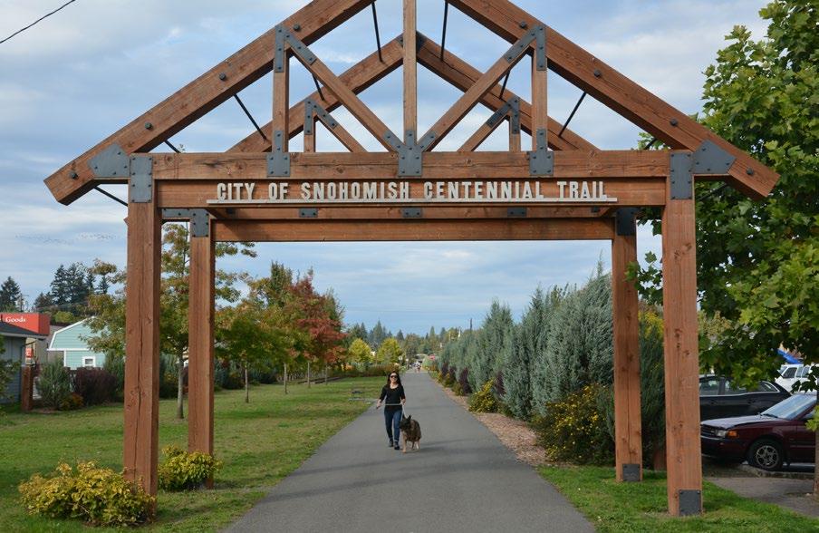
Situated next to Centennial Trail, as well as the local Boys and Girls Club, the design of Averill Field was guided by feedback from the community. It’s named after Snohomish native and Major League Baseball Hall of Famer Earl Averill. Three virtual town hall meetings with presentation graphics were conducted to gather community input on amenities, materials, theme, and overall layout of the park master plan. A fly-through video of the preferred alternative was created to get final comments and buy in from the city and community members. Phase 1 included design of circulation paths, underlying drainage field, timber signage, lighting, plantings, and dedication plaques all in association with a new play structure. Small improvements to the accessible parking were included as well as a raised speed table in the parking lot to create a safe, direct pedestrian connection to the Centennial Trail.
Adams County
Veteran’s Memorial
LOCATION: Brighton, CO
CLIENT: DHM Design
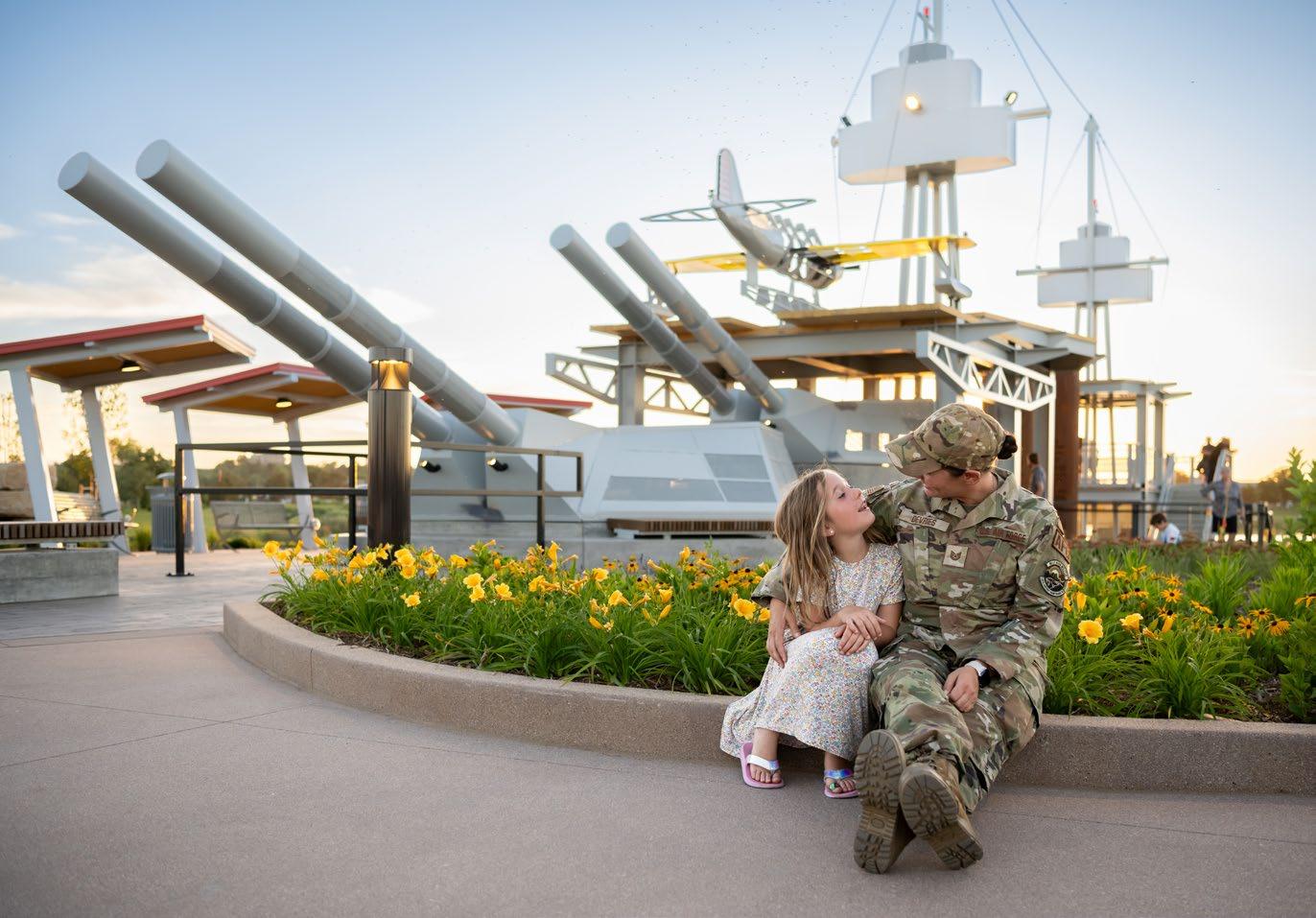
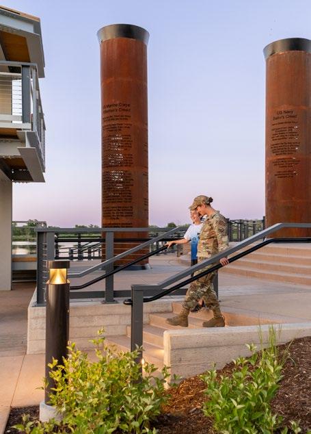
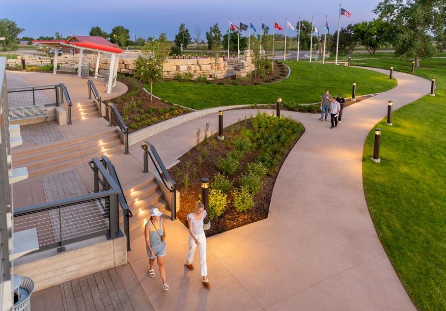
With a design that extends into Mann-Nyholt Lake, the veteran’s memorial recreates detailed features of the USS Colorado including everything from the battleship bow to the turrets, cables and smokestacks. An interpretive wall and military panels honor the 43 service members who died – along with 198 injured – when the vessel itself suffered hull damage in the Pacific Ocean. Accessibility is a critical factor in the design to accommodate all abilities and provide easy access to park amenities. Development to surrounding Riverdale Regional Park includes a new roundabout and parking lots that enhance an existing trail to improve public access. Given its position on the waterfront, no-rise analysis and floodplain development permitting also supported the design process. Multiple Otak teams led the design and supporting services necessary to make this memorial a reality.
Maroon Creek
Multi-Use Trail
LOCATION: Aspen, CO
CLIENT: City of Aspen
AWARDS: Top Project in Pedestrian/ Bike Infrastructure - Infrastructure Construction Excellence Awards
2025 ACEC of Colorado Engineering Excellence - Honor Award
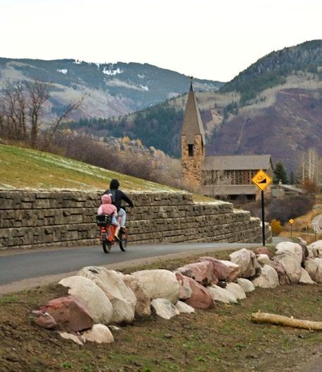
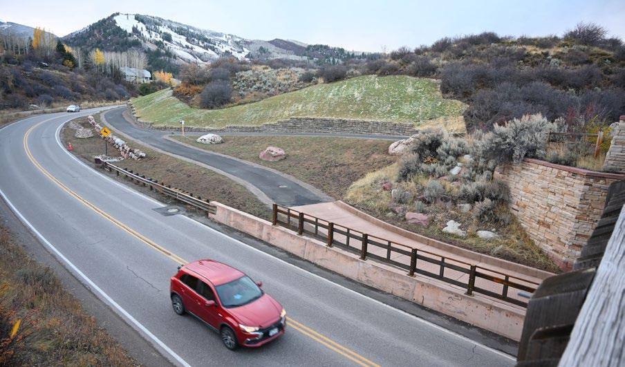
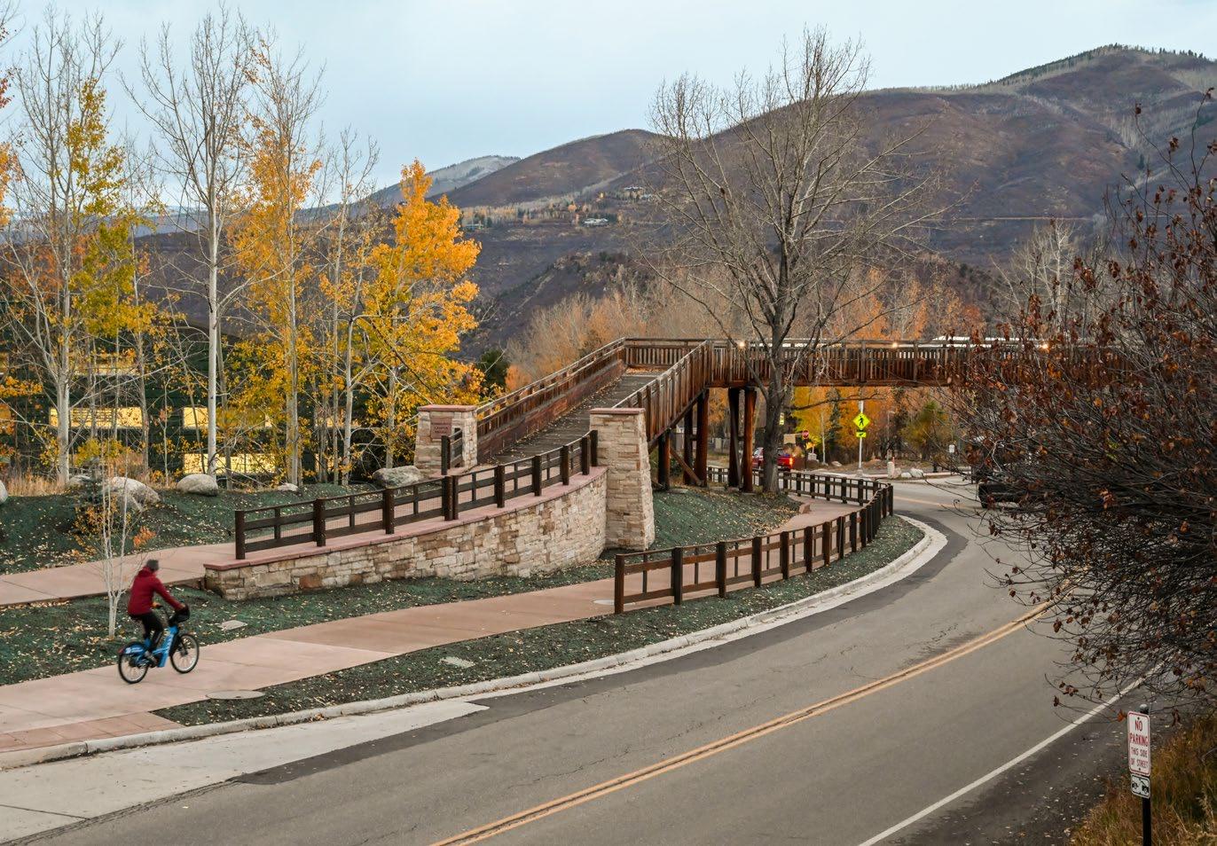
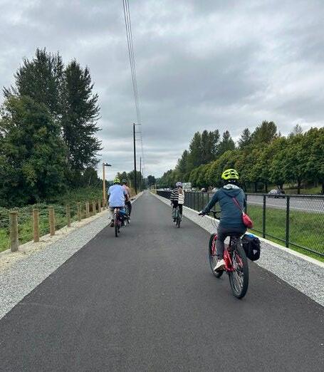
An amenity for locals and tourists alike, the world-renowned mountain destination of Aspen features a trail system that enhances active transportation across the area including Snowmass, Woody Creek, Basalt, and the greater Pitkin County. The Maroon Creek Multi-Use Trail connects the SH 82 roundabout with the Aspen Recreation Center and its busy transit station, where a previously poorly defined mixture of pathways created potential conflicts between vehicles, pedestrians, and bicyclists. With updates providing the ability to clear snow, the path is now available for use in all seasons. Careful consideration of impacts to adjacent properties included increased separation from the road as well as from the Aspen High and Aspen Middle School pathways, while the design also integrates with well-established nordic trails in the area. Intersection safety improvement measures, drainage upgrades, realignment of an existing pedestrian bridge approach, and transit stop enhancements were also among the features of this multimodal project.
Centennial Trail
Extension
LOCATION: Snohomish, WA
CLIENT: City of Snohomish
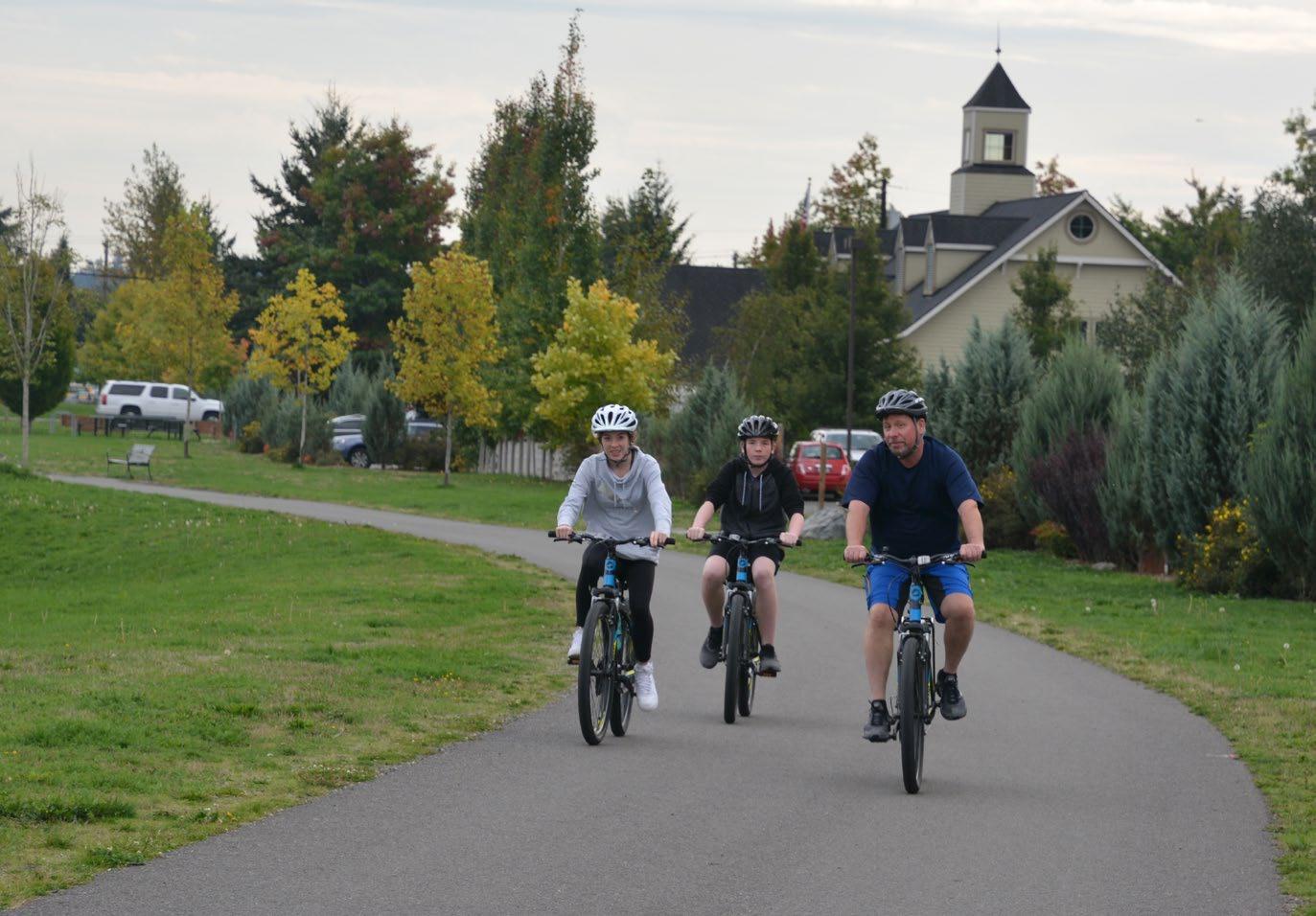
First developed during Washington state’s hundred-year anniversary, the Centennial Trail is a 30-mile multi-purpose network that follows a former rail corridor through Snohomish County. In creating a convenient alternative to driving, the Centennial Trail is also popular recreationally for pedestrians, bicyclists, hikers, and equestrians. The 12-foot-wide asphalt trail includes parking facilities, frontage improvements at street crossings, four acres of landscaping, park signage, and related park amenities.
Otak’s integrated specialists led the public and County through a thorough master planning process and both designed and managed the construction of the new trail. Features include arrival landmarks with wayfinding and historic interpretation opportunities, gardens, picnic sites, and a large market plaza near the library.
Yellowstone National
Park Canyon Rim Trails and Overlooks
LOCATION: WY
CLIENT: National Park Service
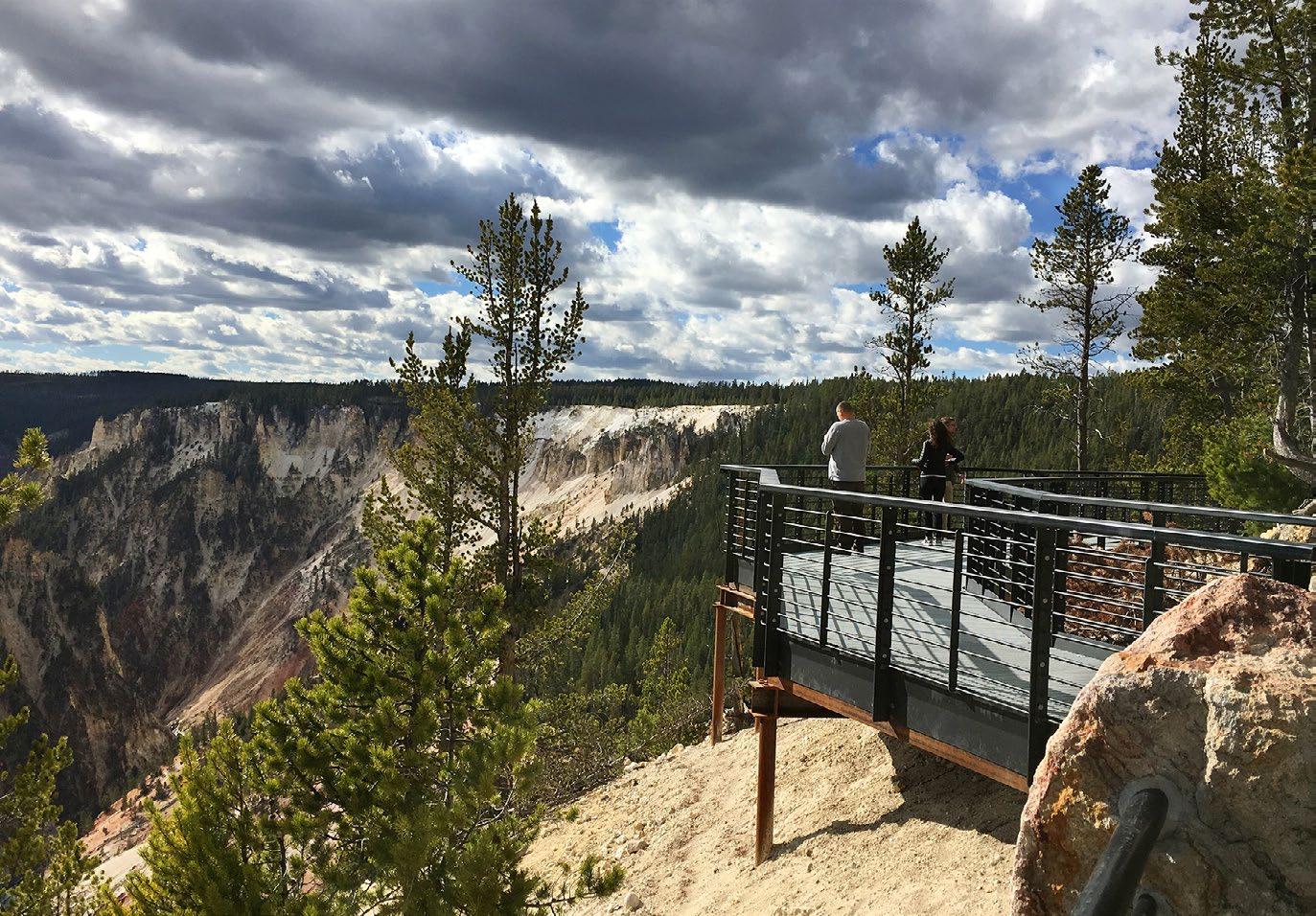
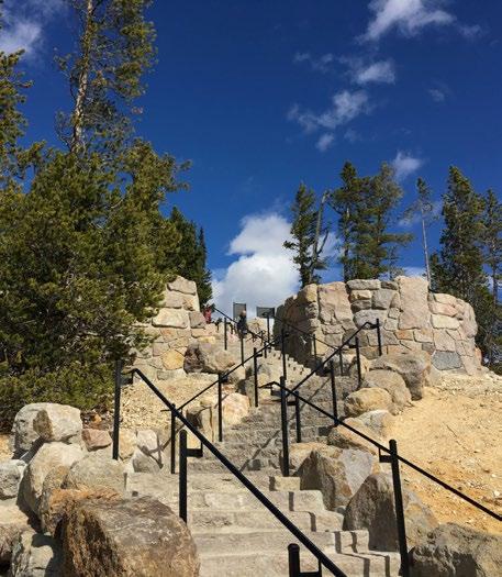
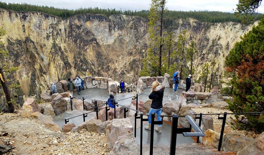
To enhance the visitor experience and create future stewards of Yellowstone National Park, this much-needed restoration made improvements to the deteriorating north and south rim trails and overlooks, which wrap the Canyon Rim from Inspiration Point to Artist Point.
The multi-phase project included design of a new trail system and overlooks as well as the rehabilitation of historic elements at Inspiration Point. In enhancing the Canyon Rim Trail system, the design also created new trails, overlooks, and parking improvements at the Brink of the Upper Falls and Uncle Tom’s Point. The design materials and features reflect the rustic design style synonymous with Yellowstone National Park. Design solutions include re-routing trails away from dangerous areas and installing stone and boulder barriers; connecting historic overlooks with new walkways; creating safe, accessible viewing areas with new wayfinding and informational signage; constructing new visitor pavilions and kiosks with peeled logs and stone masonry columns; and using natural materials to integrate the infrastructure into the spires and canyon cliffs.
Planning & Urban Design
SERVICES
• Long-Range Planning (Comprehensive and Subarea Plans)
• Master Planning
• Land Use Planning
• Public Outreach and Community Engagement
• Code Development and Amendments
• Corridor Planning and Scenic Byways
• Policy Development
• Grant Writing
• Growth Management
• Feasibility Studies
• Transit-Oriented Development
MARKETS
• Public
• Private
• Commercial
• Mixed-Use
• Residential
Regional Growth Center
Subarea Plan
LOCATION: University Place, WA
CLIENT: City of University Place
Otak helped the City of University Place develop a subarea plan for its town center and commercial core in response to the Puget Sound Regional Council’s designation of the area as a regional growth center. Regional centers are relatively small areas of compact development where housing, employment, shopping, and other activities are in close proximity. The University Place Growth Center is a 465-acre area that includes a mix of commercial, civic, single and multifamily residential, and light industrial uses. It will be divided into three districts—the Northeast Business District, the 27th Street Business District, and the Town Center District. Otak’s work involved community visioning, goal identification, policy and action strategy development, capital facility planning, architectural design, and conceptual plan drawing.
HQ Mixed-Use Development
LOCATION: Vancouver, WA
CLIENT: Hurley Development
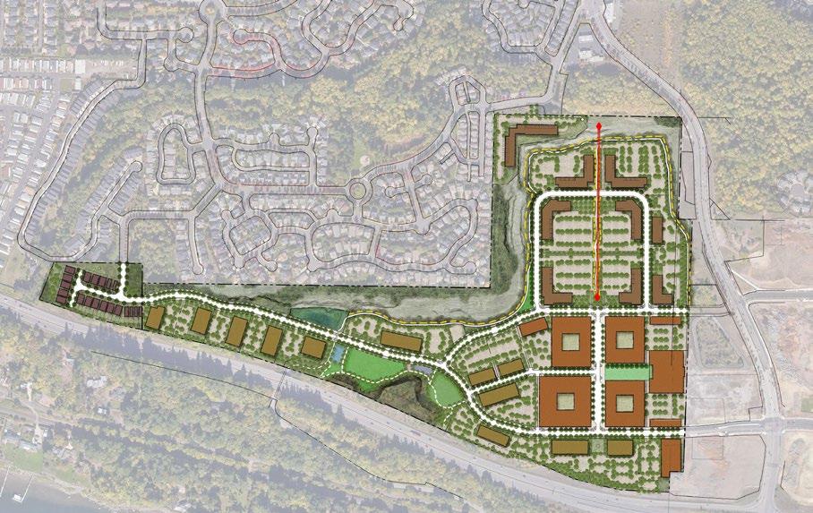
Otak was retained by Hurley Development to initiate due diligence and concept master planning for the 98-acre rock quarry site located at the junction of State Route 14 and SE 192nd Avenue (west side), in Vancouver, WA. This 98-acre site is located in the City of Vancouver (City) Riverview Gateway Subarea. Otak previously assisted the City with preparation of this subarea plan. Similar to our work on the Columbia Palisades Master Plan, Otak was tasked with refinement of the quarry reclamation plan to be consistent with the envisioned redevelopment of the site. Preparation of a concept and preliminary proposed master plan was a significant endeavor, including our planning, urban design, civil design and landscape architect team members.
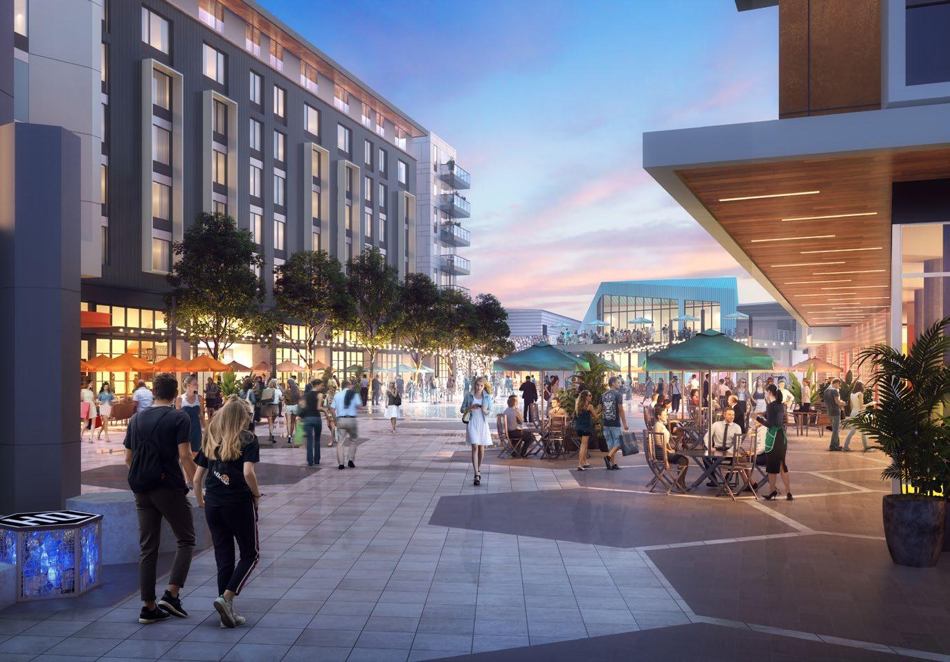
In addition, Otak’s architecture team contributed to the site plan and roadway layout from a building layout and design perspective, and prepared concept building and site renderings.
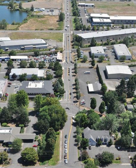
Lynnwood City Center + Alderwood Subarea Plan and Citywide Comprehensive Plan Update
LOCATION: Lynnwood, WA
CLIENT: City of Lynnwood
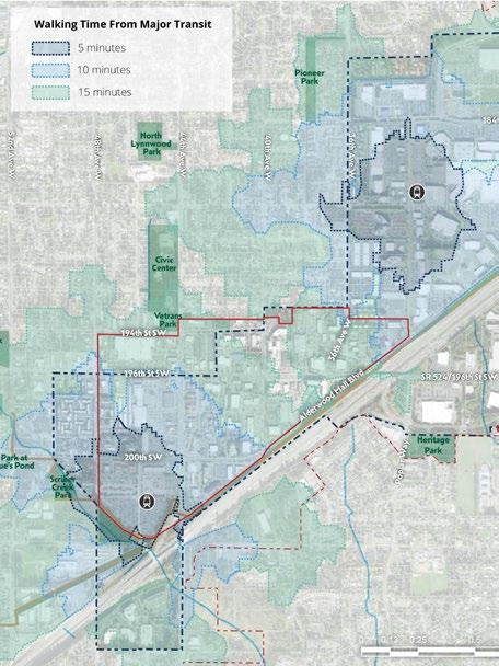
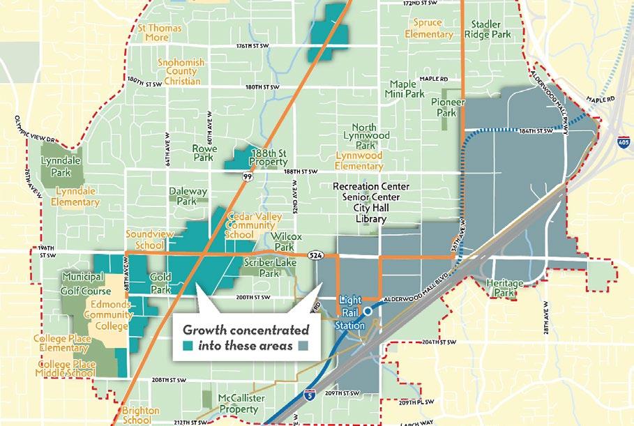
With an overarching theme of Imagine Lynnwood, this comprehensive plan was shaped through inclusive community engagement—gathering ideas from the community and bringing them to life through policy. Extensive public participation included a community wide visioning poll and more than a dozen public events and meetings. More than 600 responses to the poll and other input gathered from the public, along with in-depth data that examined current and future conditions, were referenced to help identify future opportunities. The plan includes specific goals and policies supporting the community’s core values and priorities, including an emphasis on livability, expanded housing choices, orientation to transit and walkability, and creating a strong future for Lynnwood’s regional center. The regional center encompasses districts surrounding Alderwood, the City Center, Convention Center, and two high capacity light rail stations.
South Cooper Mountain Main Street Development
LOCATION: Beaverton, OR
CLIENT: Wishcamper
SIZE: 164 units; 30,000 sf commercial space; 10 acres
Together with national developer Wishcamper, Otak has been instrumental in the design and approval of the ambitious South Cooper Mountain Main Street project in Beaverton, OR. The mixed-use development project encompasses affordable housing, as well as commercial and civic space, across ten acres adjacent to Mountainside High School in the heart of the South Cooper Mountain community.
Otak’s design for the South Cooper Mountain project includes 164 units of affordable housing, 30,000 sq feet of commercial space—office, daycare, café, and retail—potential civic use space, a public park, and a plaza. The park site is home to a number of large sequoia trees, which Otak was intent on preserving in the overall design, further reinforcing a sense of place with character and connection to the land. An underground parking garage is planned beneath an open-air plaza, which will also be home to a farmer’s market.
Mill Creek Boulevard
Subarea Plan and Comprehensive Plan Update
LOCATION: Mill Creek, WA
CLIENT: City of Mill Creek
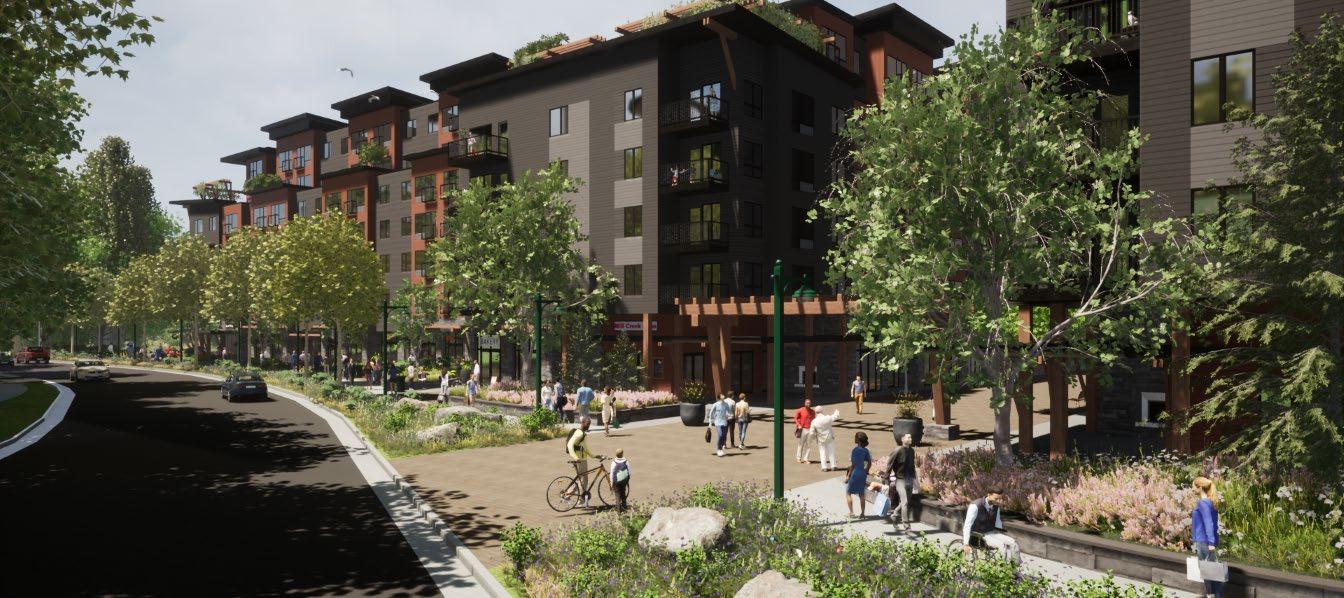
The comprehensive plan is centered around a vision to make the City of Mill Creek a highly desirable place to live and work. It highlights distinctive neighborhoods, including a dynamic Town Center and South Town Center subarea, as well as scenic surroundings accentuated by parks, greenbelts, and natural areas. The Plan’s goals and policies will chart a course for change across eight different plan elements. Among a variety of initiatives within those elements are encouraging mixed-use neighborhoods near commercial areas in land development, adding a wide variety of residences for all income levels as part of housing, accelerating the recovery of salmon as part of environmental considerations, and enhancing multimodal accessibility to public spaces within parks and recreation. The Plan continues to support better access to Community Transit’s Swift Bus Rapid Transit lines and an extensive trail system (including the North Creek Trail) as part of its transportation element.
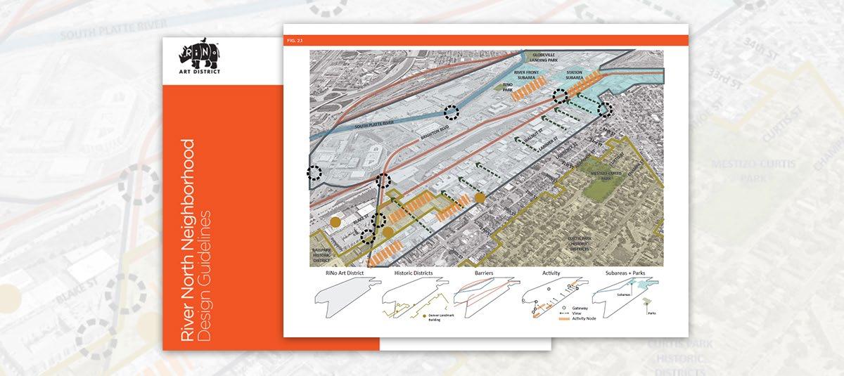
RiNo Arts District
Design Guidelines
LOCATION: Denver, CO
CLIENT: RiNo Business Improvement District (BID)
To help the BID leverage peer pressure in this process, Otak created a rating system associated with the design guidelines that will celebrate excellent projects. Otak presented the ideas and concepts to key community stakeholders, to the three RiNo boards, and at public meetings. As a result of feedback through this community process, and the anticipated future additional density around the 38th and Blake commuter rail station, RiNo felt that more powerful tools were necessary. To address this, the team led a community process to create a RiNo Design Overlay Zone. This overlay zone will provide stronger protection for key community values and require affordable housing for larger projects. Otak developed these ideas for RiNo, but former City Council President Brooks and Community Planning and Development also intended to use these ideas for the entire station area, including the affected parts of Globeville, Cole, and Elyria-Swansea.
PM/CM & Owner’s Representative
SERVICES
• Program Management
• Project Planning
• Decision-Making & Prioritization Facilitation
• Stakeholder Engagement & Public Outreach
• Master Budget & Schedule Management
• Risk Assessment
• Procurement & Bidding
• Contract Management & Administration
• Design & Construction Coordination
• Construction Management
• Jurisdictional Coordination
• Quality Assurance/Quality Control (QA/QC)
• Project Transition, Turnover, & Close-Out
• Furniture, Fixtures & Equipment (FF&E)
• Change Management
• Facilities & Operations Support
MARKETS
• K-12 and Higher Education
• Healthcare
• Public
• Private
• Mission Critical Facilities
• Federal
North Clackamas
School District
LOCATION: Clackamas, OR
CLIENT: North Clackamas School District
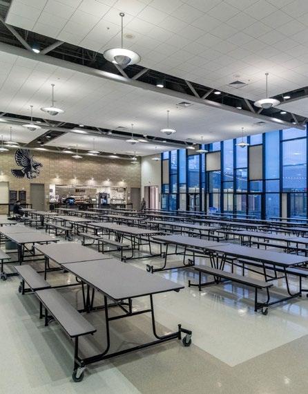
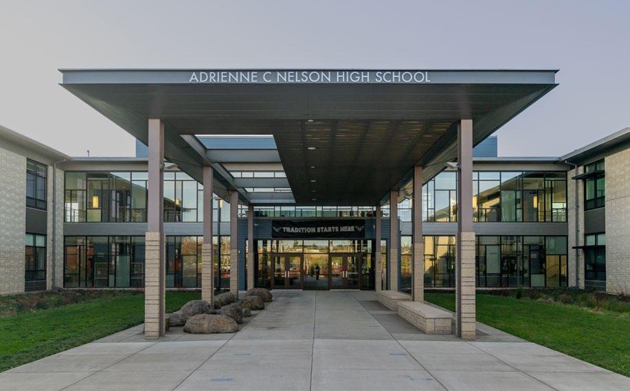
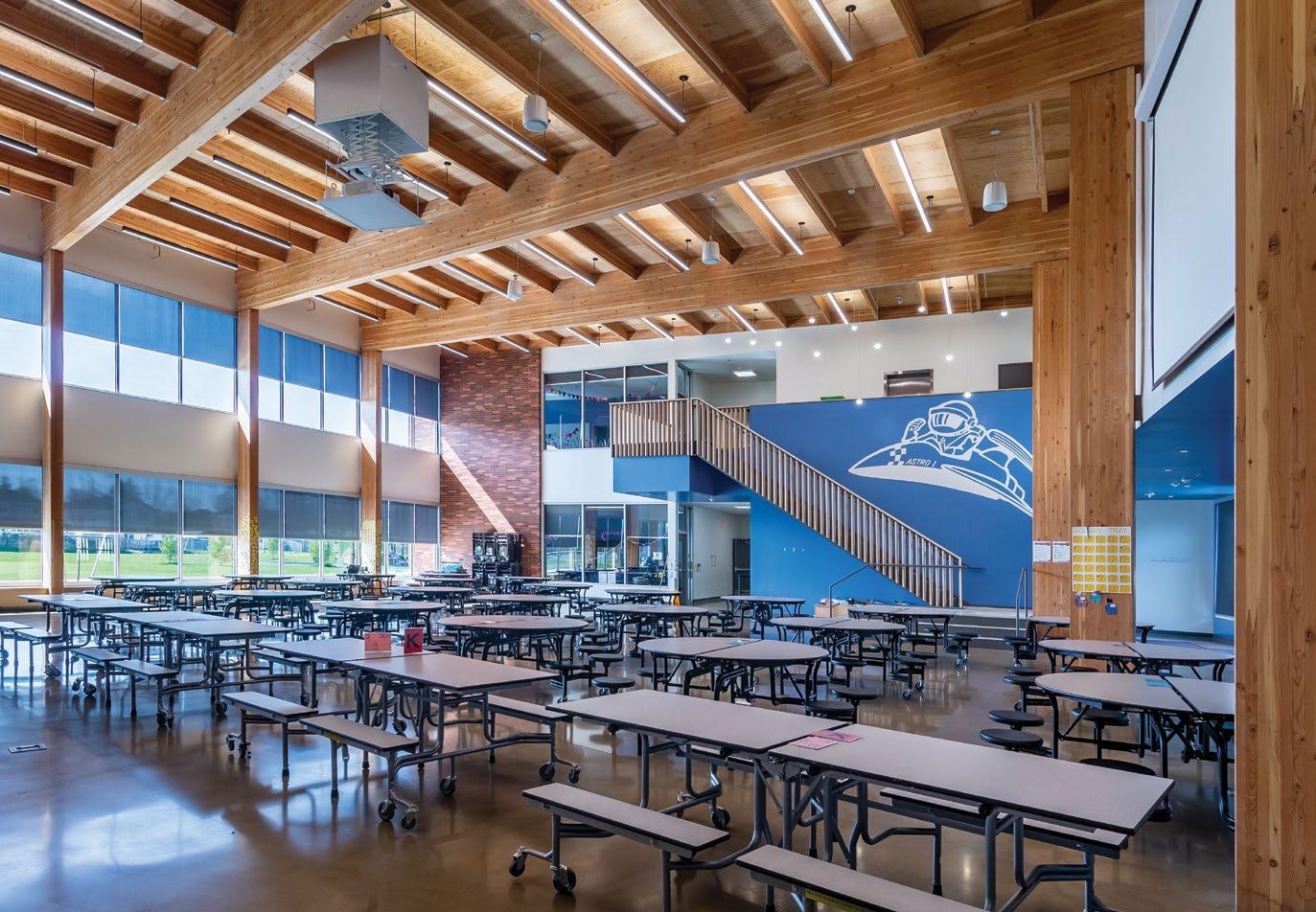
Otak CPM has provided owner representation and project management services for the North Clackamas School District (NCSD) Bond Program since 2016. The original $433 million bond expanded to over $523 million through state grants and careful financial management. Our team has overseen new construction, major renovations, and system upgrades across 34 schools and support sites and involvement extended from early planning and entitlement to construction management and closeout, leveraging both CM/GC and design-bid-build delivery methods. Our scope included modernizing occupied elementary schools, creating and upgrading CTE spaces, enhancing athletic facilities, and district-wide safety and security improvements. In addition to managing projects, Otak CPM partnered with NCSD to create a dedicated role for Facilities Management Integration. This role served as a strategic liaison with district facilities staff, ensuring that their recommendations were fully integrated into bond projects.
Multnomah County Central Courthouse
LOCATION: Portland, OR
CLIENT: Multnomah County
SIZE: 461,000 sf
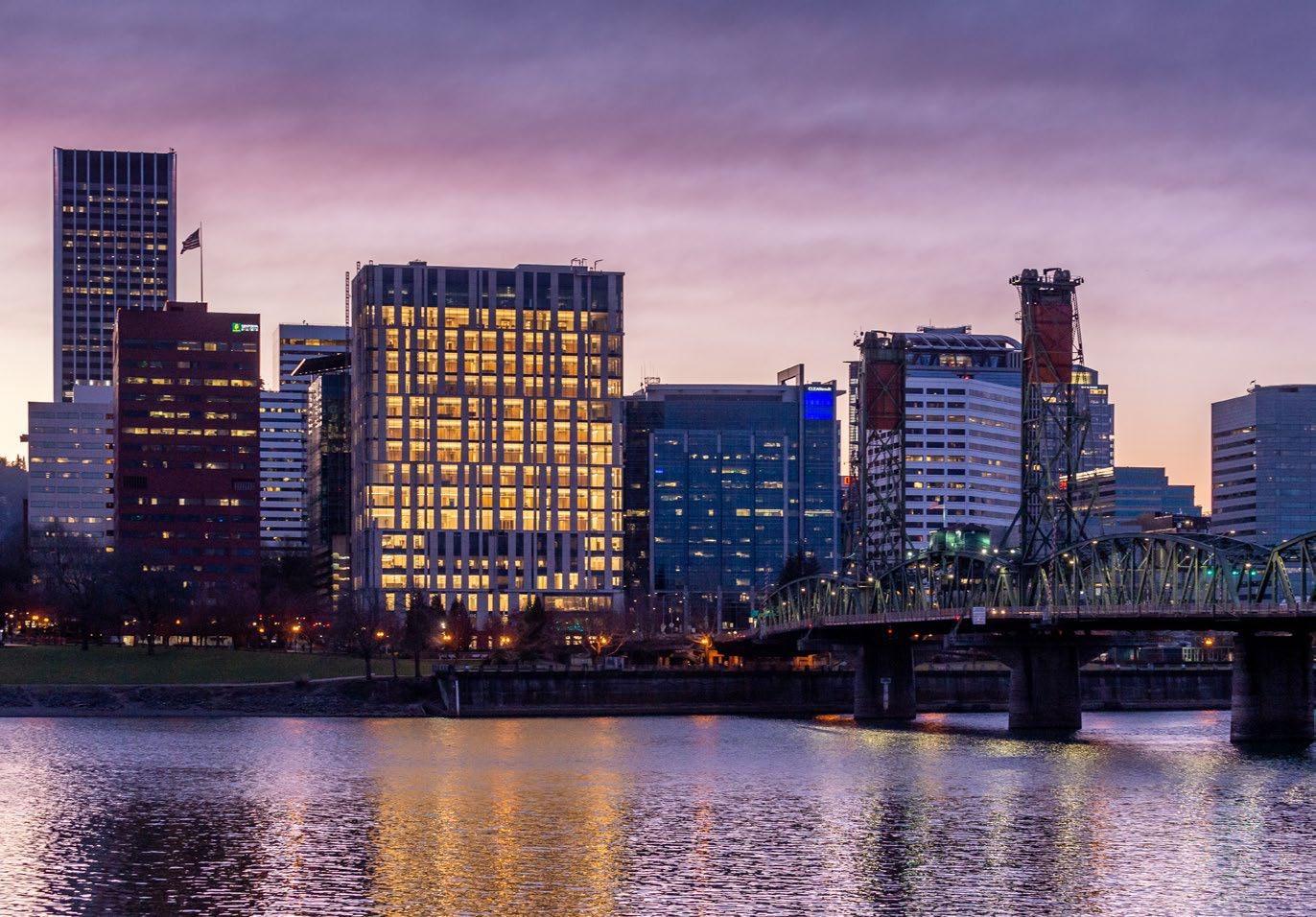
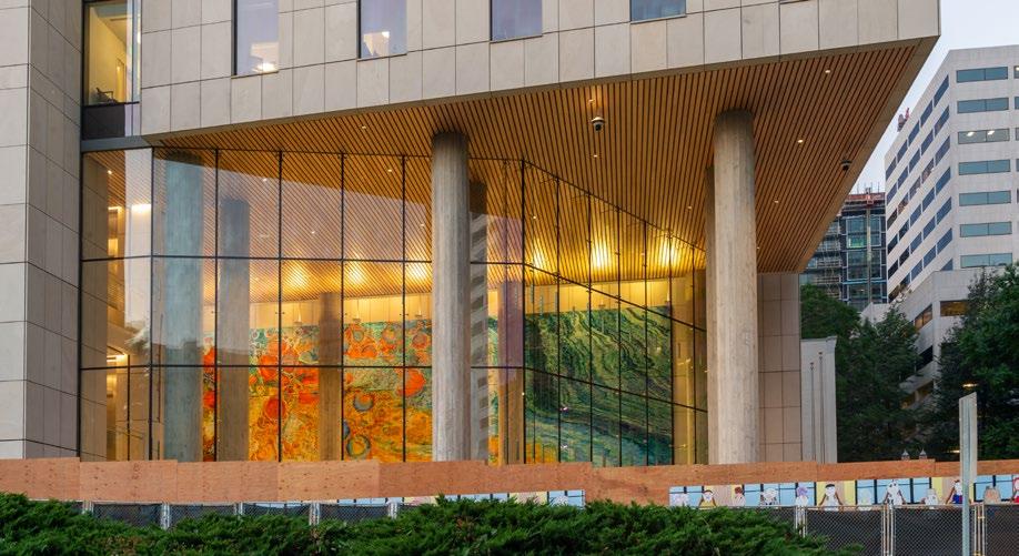
Otak worked closely with Multnomah County to provide comprehensive owner’s representative services and manage the process for the new courthouse within the City Central area of Portland, Oregon. Otak oversaw contracts for design, construction, and other administrative duties related to the project. The work involved intensive site selection, blocking and stacking studies along with the design and construction of a 461,000-sf, 44-courtroom facility. This project was delivered in a Collaborative Delivery Method (CPD) utilizing a CM/GC delivery model.
The project incorporated best practices in operations, security, and design, resulting in a courthouse that will be capable of adapting to the changing needs of the community over a planned 100-year useful life. For example, the building will be seismically resilient by employing innovative technology including seismic dampers that allow for up to three inches of controlled movement in each direction in the event of a large-scale earthquake.
Salem-Keizer School District
LOCATION: Salem, OR
CLIENT: Salem-Keizer School District
SIZE: $600 Million | 70 School facilities
As owner’s representative, Otak provided program management services for the Salem-Keizer School District construction bond that included additions and upgrades to twentynine schools and numerous repairs throughout the remaining forty-one facilities. The major projects included adding additional capacity to support enrollment and educational programs, increasing seismic safety as well as the safety and security systems. Improvements upgraded technology in a number of areas while also updating facilities to reach ADA standards. Additional upgrades included new roofs, window replacements, flooring, HVAC, plumbing, electrical, and parking lot refurbishment. Salem-Keizer School District is the second largest district in Oregon with over 40,000 students and 5,000 employees.
Multnomah County Library Capital Bond Program
LOCATION: Multnomah County, OR
CLIENT: Multnomah County Library
SIZE: 34,000 sf community space; 6,500 sf youth space; 50,000 sf outdoor space
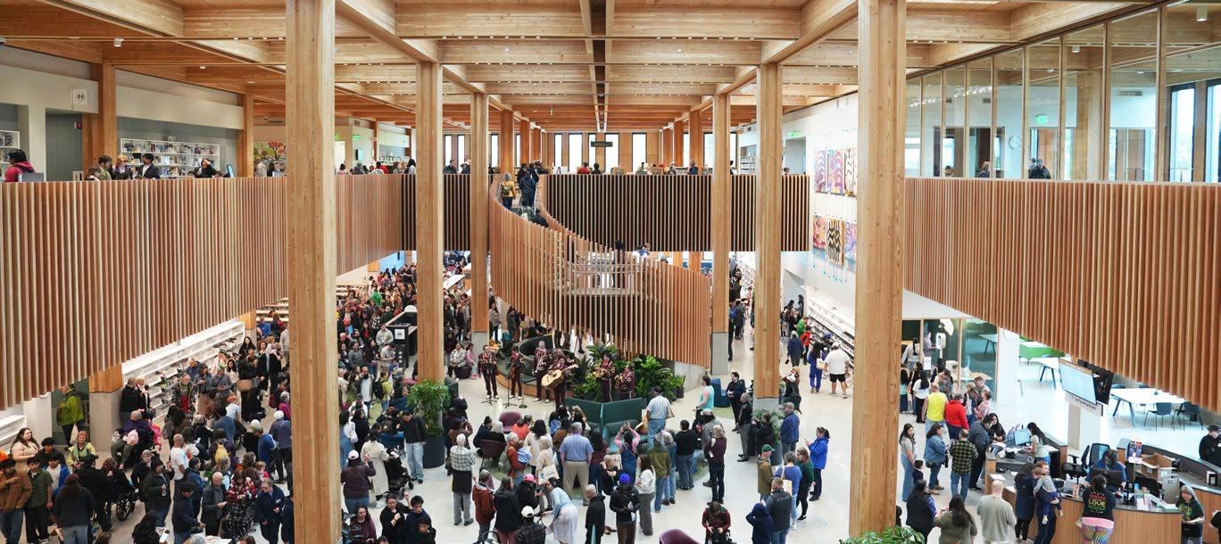
In a major transformation across their facilities, Multnomah County Library expanded spaces and upgraded technology to benefit the community through a comprehensive capital bond program.
The Otak owner’s representative team provided leadership and overall program management for the entire $450 million program.
The library renovated and expanded five buildings while building four more, one of which was an Operations Center for sorting materials and housing library outreach teams. The new and expanded libraries offer a wide range of features focused on representing diverse cultures through art as well as space for youth to play, study, and express themselves creatively. The projects add more than 34,000 sf of new community space; 6,500 sf of youth space; and 50,000 sf of outdoor space. An estimated 395,000 new books and media went on shelves as well.
Bend Public Works Campus
LOCATION: Bend, OR
CLIENT: City of Bend
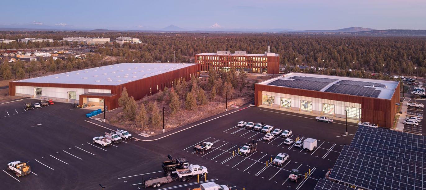
Otak CPM provided owner representative services including project oversight of the progressive design-build (PDB) process, selection of the PDB team and specialty subconsultants and suppliers, budget management, project controls, pay application reviews, and leading and facilitating the change management process. The Public Works Campus is a new development located in the Juniper Ridge Subdivision on approximately thirty-five acres of previously undeveloped land. The campus houses the City of Bend’s Public Works departments including Utilities, Fleet, Transportation and Mobility, Facilities, Engineering Infrastructure & Planning, and Water Lab. The campus consists of three main primary buildings and ancillary buildings and structures. The campus also has a non-secure public and employee vehicle parking lot, secure City of Bend motor pool parking, secure on-site vehicle parking and storage, a bulk storage yard, a magnesium chloride storage facility, and a decant facility.
Vancouver Clinic
LOCATION: Vancouver, WA
CLIENT: The Vancouver Clinic
SIZE: $135M, Ridgefield (15,400 sf), Camas / Columbia Palisades (26,400 sf), Salmon Creek (80,225 sf)
AWARDS : DJC Top Projects 2020 - 3rd Place: Healthcare and Life Sciences
Vancouver Business Journal Awards 2019 - Top Project Award
DJC Top Projects 2021 - 1st Place: Healthcare
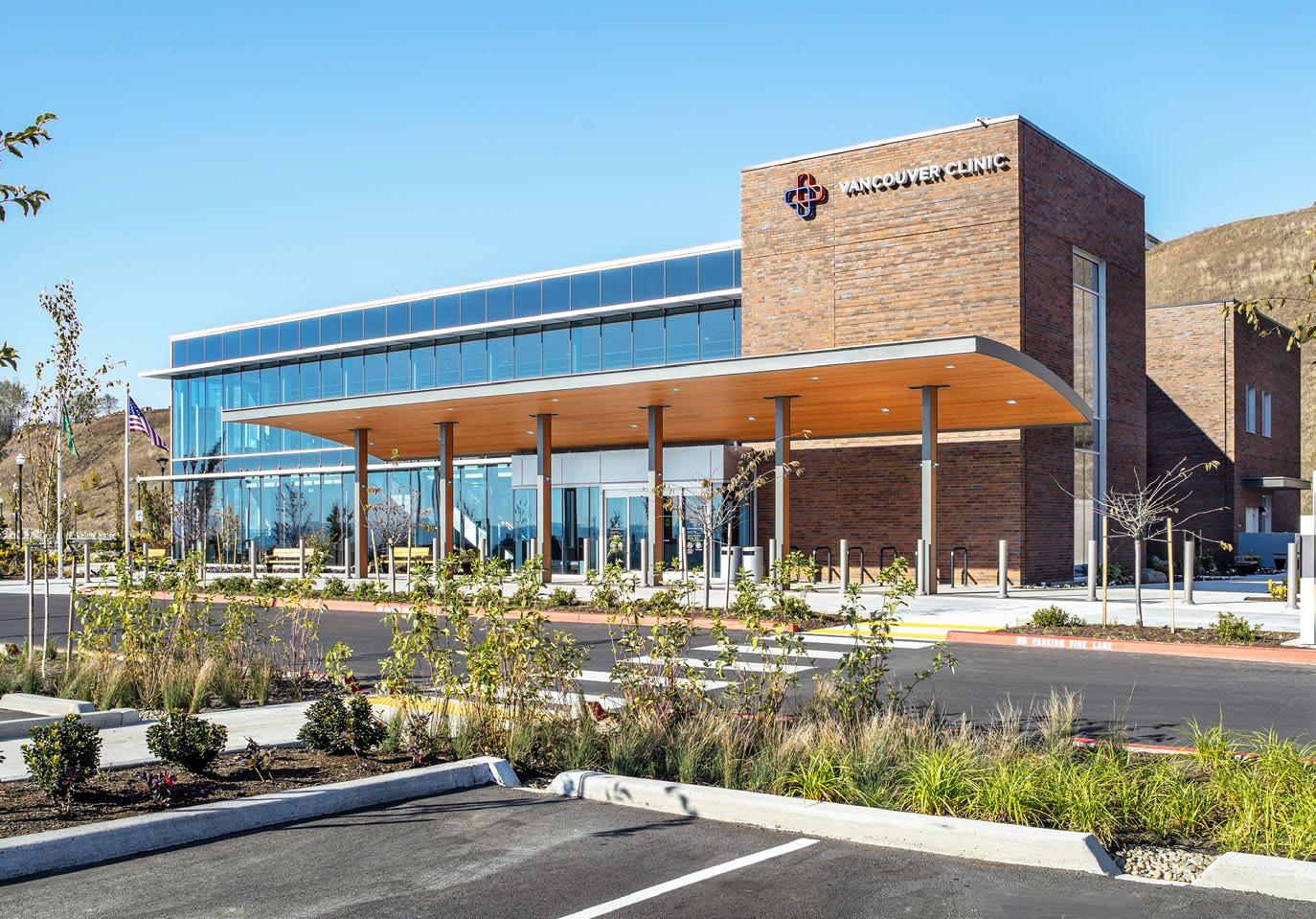
Utilizing a Lean Integrated Design / Design Build approach, the Vancouver Clinic expansion designed all three facilities concurrently. The design processes were augmented by full-scale mock-ups to confirm functionality while leveraging the experiences of clinical staff and medical consultants to prioritize patient care with optimal clinic workflows. An established governance process including the Vancouver Clinic’s executive sponsorship team and two physician board structures led to efficient approvals while maintaining a high degree of integration with Vancouver Clinic operational leadership. In providing a full scope of owner’s representation across each expansion, the Otak team managed planning and design, medical equipment coordination, construction management, as well as move in and close out. For the Salmon Creek expansion, the team guided the project through various jurisdictional approval processes, including a full Certificate of Need application in Washington state. After a change in financing brought on by the pandemic, the team’s role shifted to become a strategic advisor through the completion of construction. This effort helped the client convert the project from an owner financed and constructed project to a turn-key build-to-suit with Pacific Medical Buildings, retaining all original design-build team members.
Survey & Mapping
SERVICES
• GIS and Remote Sensing
• Topographic Survey
• Boundary Survey
• ALTA Survey
• Construction Staking and Verification
• Right-of-Way Mapping
MARKETS
• Public
• Residential
• Mixed-Use
• Commercial
• Federal
Willamette Water Supply Program
LOCATION: Clackamas and Washington Counties, OR
CLIENT: Tualatin Valley Water District and City of Hillsboro
District and the City of Hillsboro to develop an additional source of drinking water from the Willamette River at Wilsonville. This water transmission pipeline project includes facilities and more than 30 miles of pipelines from Wilsonville to Beaverton and Hillsboro.
Otak is a subconsultant working with prime consultants on various segments of the WWSP’s new pipeline on the design, bidding phase and services through construction. Our services include aerial control and mapping, survey control, utility locates, right-of-way resolution, potholing, topographic mapping, legal descriptions, and exhibits and record of survey.
Columbia Bottomlands Restoration
LOCATION: Multnomah County, OR
CLIENT: Oregon Department of Transportation (ODOT)
SIZE: 88 acres
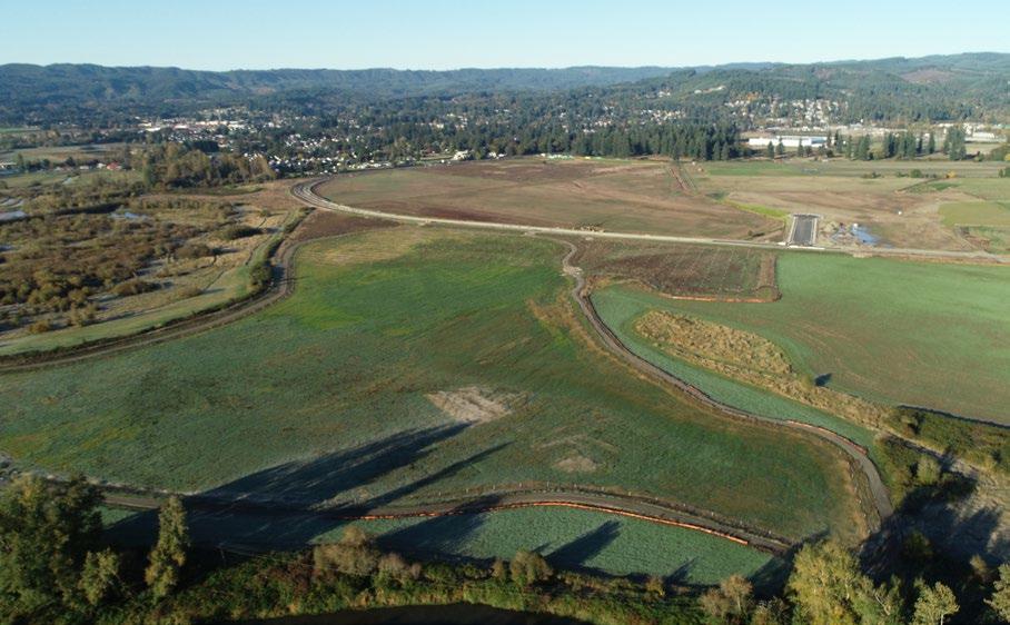
The restoration of 88-acres of wetland on the Columbia River near Scappoose is aimed at reversing the impacts of agricultural activity. Hydrologic and hydraulic analysis would inform the restoration of habitat for endangered salmonids, as well as the creation of a wetland mitigation site. In leading the design, geomorphology, and surveying, the Otak team also provided support on coordination with landowners and other key stakeholders. Despite site accessibility limitations for surface and groundwater monitoring, by using modified schedules during low tide the team kept monitoring on track while informing the restoration design. In accounting for these limitations, drone surveying was utilized to capture water level change over time across the expansive floodplain area. The effort included a complex hydrologic regime caused by riverine tributaries like Scappoose Creek and Teal Creek, including tidal backwater conditions and flood flows from the Columbia River.
Boones Ferry Road
Corridor Improvements
LOCATION: Lake Oswego, OR
CLIENT: City of Tualatin
This 1.9-mile corridor was part of the Tualatin Moving Forward bond program. The project provided sidewalk and bicycle lane infill and repaired sidewalks, pathways, and bike lanes that did not meet current standards from Tualatin Sherwood Road to Norwood Road.
Otak provided final design along with surveying services. Our surveying services included project control along the corridor, topographic surveying and mapping, utilities, right-ofway resolution, legal descriptions and exhibits for right-of-way, permanent easements and temporary construction easements to support the project design, acquisition staking to facilitate negotiations with property owners and pre-construction record of survey at the proposed acquisition locations.
Union Pacific Railroad Survey and Mapping
LOCATION: California, Oregon, Arizona, Montana, Wyoming, Washington
CLIENT: Union Pacific
With over 32,000 miles of routes across the United States, Union Pacific represents an integral component of the country’s supply chain infrastructure. As the shipping franchise continually expands its system of railroads and land access, Otak is on-hand to ensure projects get off the ground and are properly mapped. When it comes to property acquisition and easements along railroads for Union Pacific planning, this on-call project involves varying requirements from one location to the next. Spanning the western United States (including California, Idaho, Oregon, Nevada and Arizona), meeting various jurisdictional requirements and safety certifications is central to that work. Union Pacific has built reliability and efficiency into the surveying practice with a consistent team that travels to each site. Through that consistency comes a deep knowledge of past projects and research that’s applied to anticipate the specific standards each circumstance presents.
Amtrak Stations
LOCATION: Colorado, Oregon, Washington, Montana, California
CLIENT: Amtrak
As part of Amtrak’s Accessible Station Development Program is the need for land surveys and engineering topographic site surveys. The federally mandated program upgrades rail stations so they comply with the Americans with Disabilities Act.
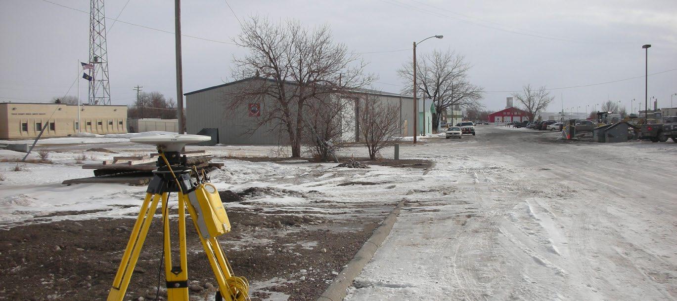
Beginning in the middle of the winter, our survey crews visited the first sites in Montana and endured blizzard-like conditions with a wind-chill factor of 50 degrees below zero. In addition to the Montana sites, we performed topographic design surveys and boundary surveys at sites in Oregon, Washington, California, and Idaho. Otak continues to perform work at Amtrak sites in various locations across the country.
Chelatchie Prairie Railroad Bridges
LOCATION: Vancouver, WA
CLIENT: Clark County
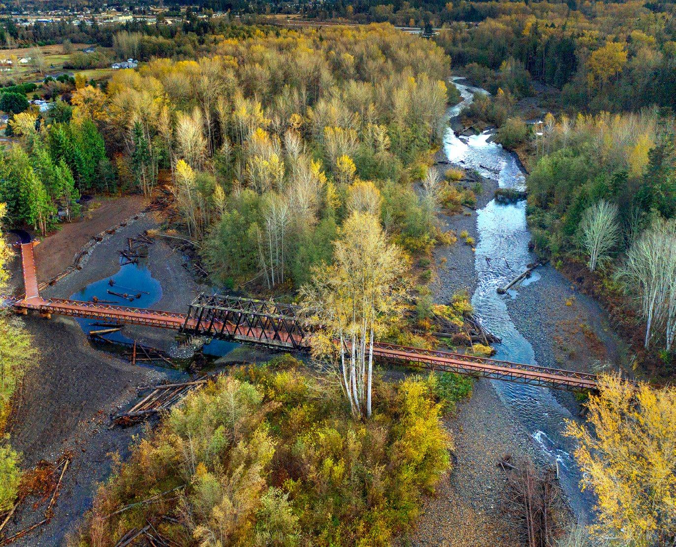
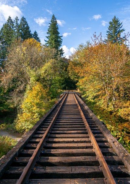
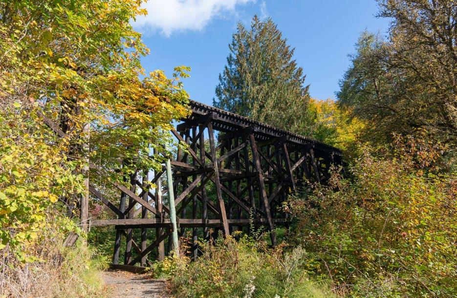
Ranging in size from 50-feet to over 500-feet, the Chelatchie Prairie Railroad Bridges were originally built in the early 1900’s and had no previous drawings available. To support the production of asbuilt drawings needed for repairs, the survey crew used scanning technology to gather thousands of points on the structure. Data sets were then used to create a 3D model of the structure that could be used to generate the line work with as-built drawings. The density of the data allowed engineers to measure elements such as pile size without having to gather more data from the field. Utilizing this approach, the retrofit design for the bridges ultimately included replacement of stringers and braces, posting of decayed sections of timber piles, and rebuilding approaches and wingwalls. Special consideration was given in the design to minimize permitting requirements for the projects by ensuring all work stayed within the limits of maintenance and repair.
Structural
SERVICES
• Structural Design and Analysis for Bridges, Buildings, and Specialty Structures
• Inspection, Evaluations and Assessments
• Rehabilitation, Repair, and Retrofit
• Load Rating and Structural Capacity Studies
• Specialty Structure and Site Engineering
• Construction Support
• Programing, Planning, and Feasibility Studies
• Peer Review and Quality Assurance
• Permitting and Regulatory Support
• Emergency, Safety, and Risk Services
• Type, Size, and Location (TS&L) Studies
• Noise and Retaining Walls
MARKETS
• Public
Lincoln Avenue Bridge
LOCATION: Fort Collins, CO
CLIENT: Interwest Consulting Group
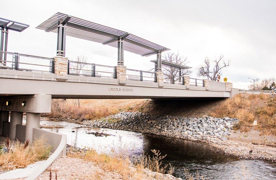
In providing a gateway to the several prominent breweries located in this area, the Lincoln Avenue bridge is the focal point of the design reconstructing East Lincoln Avenue from Willow Street to Lemay Avenue in Fort Collins, Colorado.
The asymmetric, two-span structure is 195 feet long and 65.5-feet-wide. In reducing structure depth for hydraulic and path clearance purposes, the bridge uses side-by-side concrete box girders. The plaza on the north side of the bridge creates an urban parklet while pergolas and benches were designed as places to meet and relax. Brick pavers add to the sense of space and irrigated planters act as bollards to provide additional safety. Otak (as Loris and Associates) provided the bridge design for this improved corridor and community connection.
The Dalles River Bridge Deck Replacement
LOCATION: The Dalles, OR
CLIENT: Oregon Department of Transportation (ODOT)
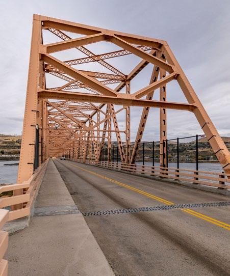
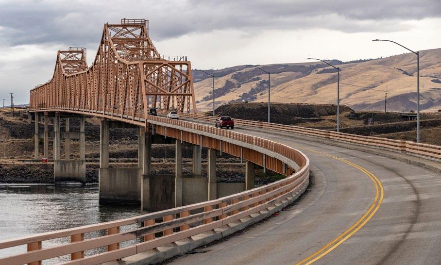
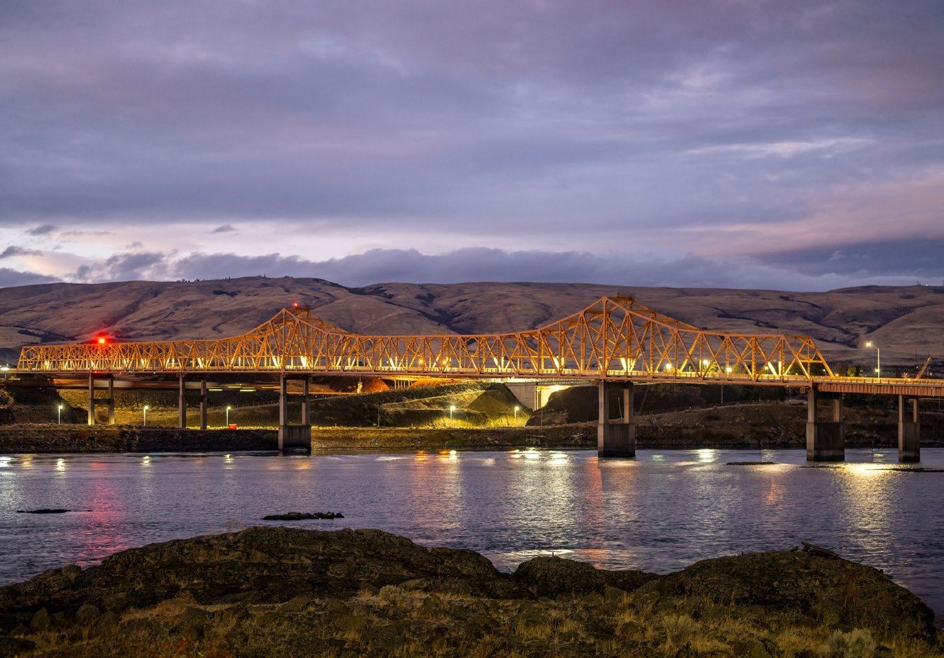
Originally constructed in 1953, the deck of the steel-truss-cantilever Dalles Bridge on U.S. 197 had degraded to the point of needing to be replaced. As an important connection between Washington and Oregon over the Colombia River, it’s an extremely visible and important project to keep goods and services moving in the region. To maintain traffic as much as possible during construction, an accelerated bridge construction approach avoided long-term closure of the busy bridge. Decking was pre-cast in an adjacent staging area, then moved to the bridge and installed per section as the old decking was cut, raised, and hauled away. Significant technological material improvements made use of ultra-high performance concrete and premixed polymer concrete overlay to complete the project. The final configuration also increased sidewalk widths to adhere with ADA compliance along the approach structure. In managing the project to completion the team performed RFI and submittal review while running weekly meetings.
Inspections at two sites (in the casting yard and on the bridge) were completed while reviewing labor compliance, and performing detailed review of the project master schedule.
Glacier National Park
Bridge Preservation
LOCATION: Glacier National Park, MT
CLIENT: National Park Service
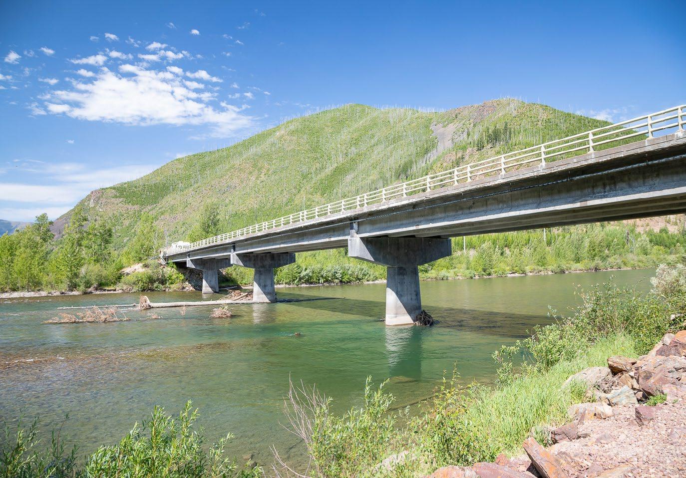
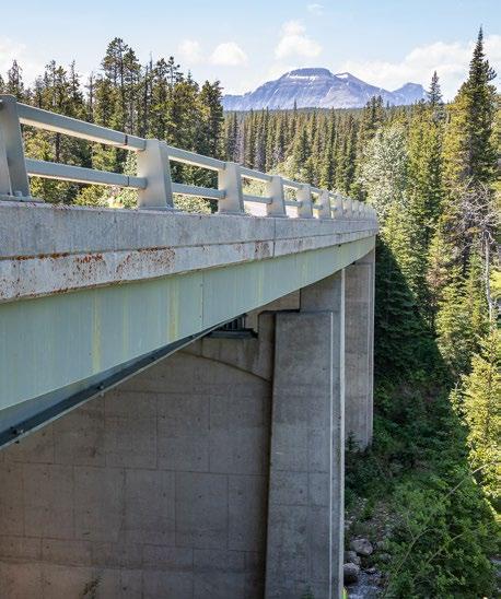
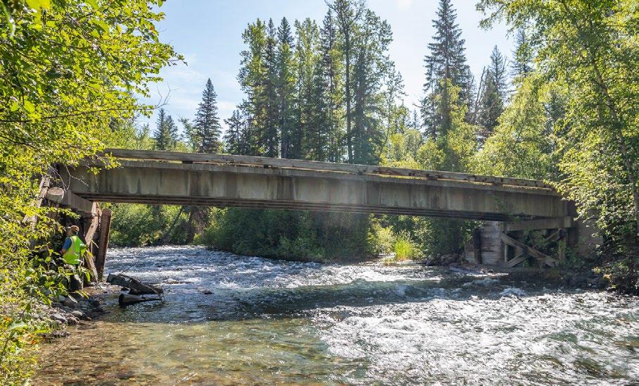
Otak completed repair and rehabilitation design for 13 vehicular bridges located within sensitive environments throughout the park. Work included a range of maintenance and repair treatments for bridge decks, roadway approaches, wingwalls, timber piles, expansion joints, and railings, incorporating concrete repair, roadway improvements, hardware replacement, timber replacement and preservation, drainage improvements, mechanically reinforced backfill, and painting. Otak assessed scour conditions and developed recommendations and designs for scour mitigation, adapting standard FHWA countermeasure methods. Scour protection such as buried riprap, stacked boulder revetments, and gabion baskets were implemented throughout the project. Bridge types included timber, prestressed concrete multi-girder, steel girder, concrete culvert, prestressed concrete tee beam, and prestressed concrete slab beam structures. Otak also performed onsite independent bridge assessments and inspections to confirm repair needs and completed all phases of design and construction documentation, as well as providing construction engineering services.
19th and 23rd Street
Bridges, University of CO
LOCATION: Boulder, CO
CLIENT: University of Colorado
AWARDS: 2021 ACEC of Colorado
Engineering Excellence - Merit Award Winner
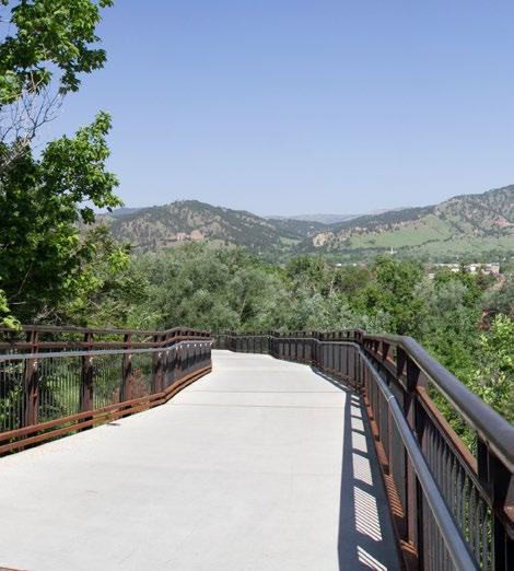
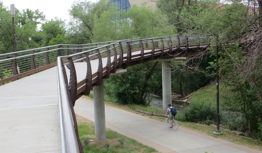
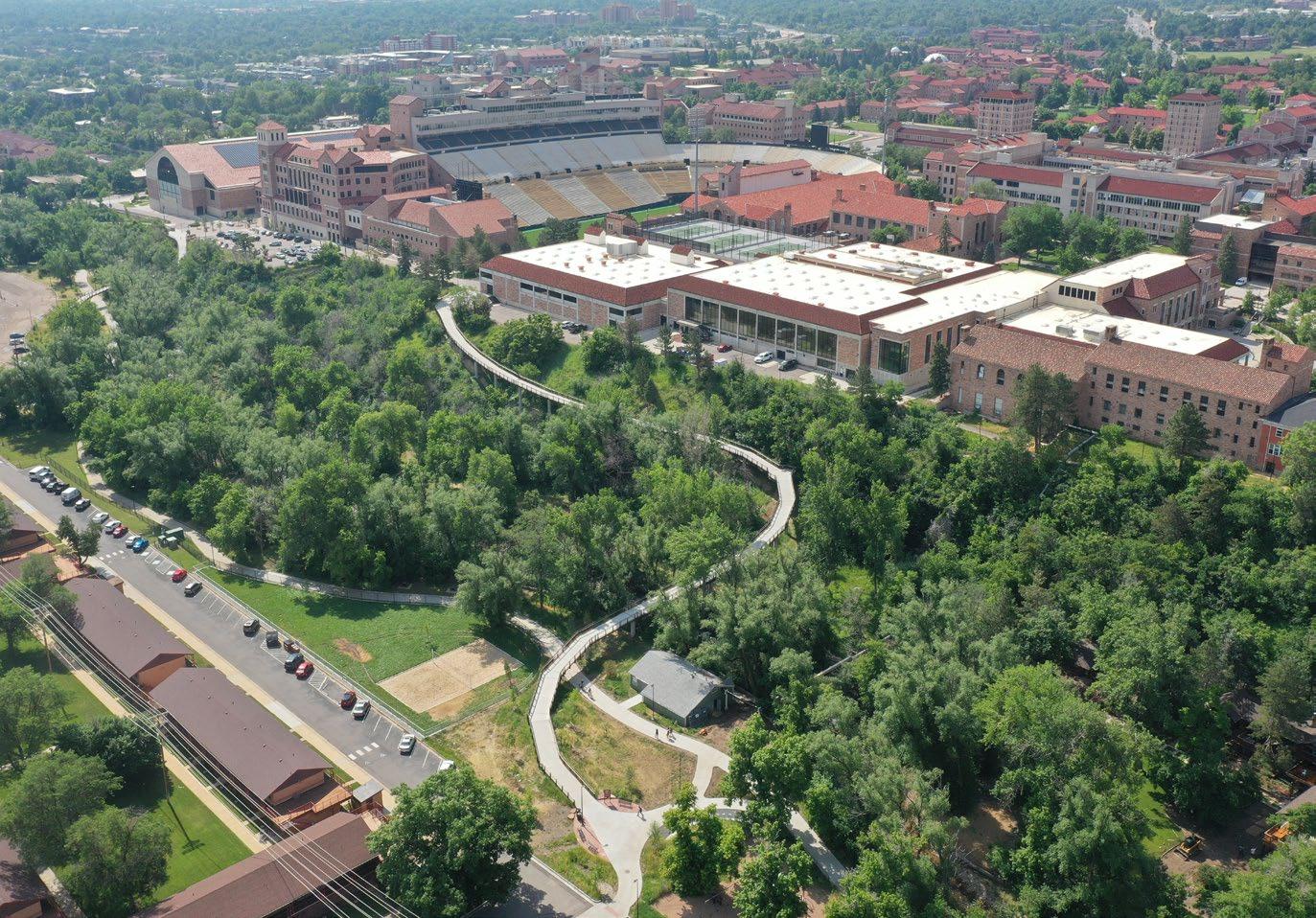
With the opening of the 19th Street & 23rd Street pedestrian bridges in Boulder, the University of Colorado (CU) has not only created better ADA compliant connectivity between the campus and the surrounding community but now has an iconic landmark that will help define the campus’s identity for decades to come. These two innovative pedestrian bridges, designed by Otak Colorado’s structural team, in coordination with CU Facilities Staff and Design Review Board, are the culmination of engineering ingenuity and practical problem solving incorporating lessons learned as the first of the two bridges (23rd Street) was being constructed. The overall project involved the design and construction of the 23rd Street Bridge, completed in 2018, and the 19th Street Bridge, completed in 2020. For both bridges, the design team considered different alignments to find the optimum balance between cost, aesthetics, ease of construction and minimizing site impacts, especially along the steep and marginally stable hillside. As they were also charged with mandates to avoid significant tree removal, preserve historic rock walls, and create a path that was pleasing to the user, the resulting design essentially weaves across the creek and up the hillside through the abundant canopy of trees.
Rock Creek at SE Summit
Landsburg Road Culvert
Replacements
LOCATION: Kent, WA
CLIENT: City of Kent
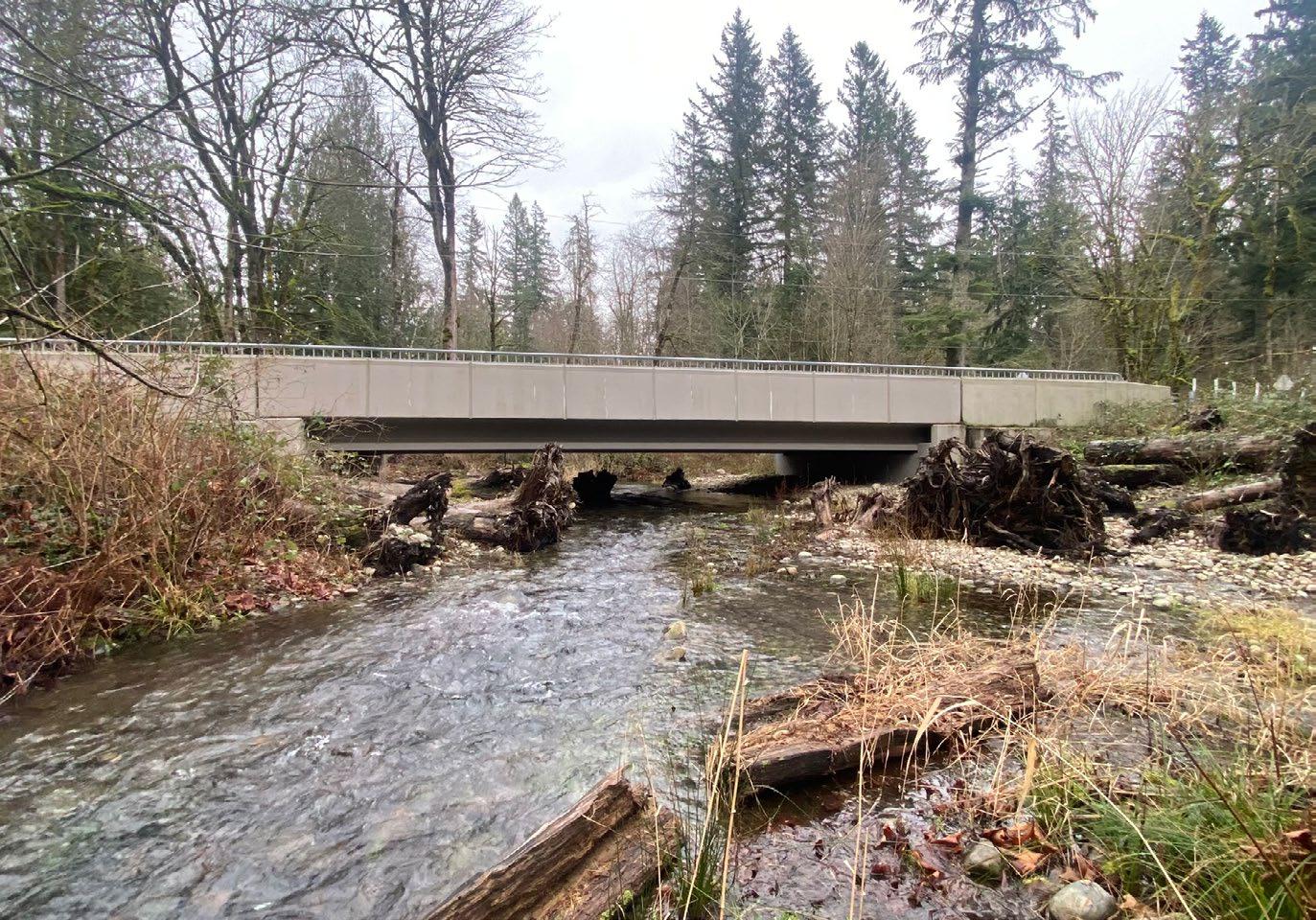
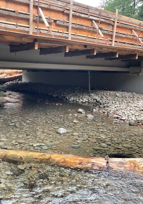
Otak provided design services to replace three 36-inch diameter pipes under SE Summit Landsburg Road with a new fish passable structure. Through the analysis for the structure TS&L report, Otak recommended a 54-foot single-span bridge to clear the stream simulation width using prestressed deck bulb tee girders with adequate room to accommodate the utilities on the bridge. Otak also provided environmental and permitting support services, including ensuring conformance to the ESA Biological Opinion and coordination with the Tribes related to streambed sediment and placement of large woody debris, preparation of construction documents, cost estimates, construction support, and bridge load rating analysis.
Dungeness River Railroad
Trestle Replacement
LOCATION: Sequim, WA
CLIENT: Jamestown S’Klallam Tribe
AWARDS: Best in State Gold Award: Social, Economic, and Sustainable Design Considerations - ACEC WA (2024)
Engineering Excellence, Bronze AwardACEC WA (2017)
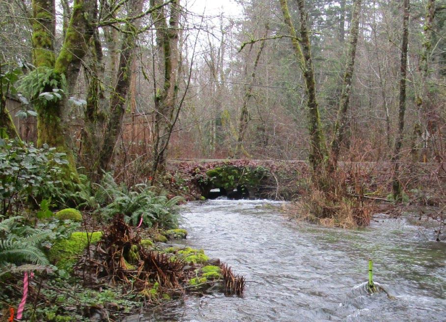
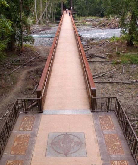
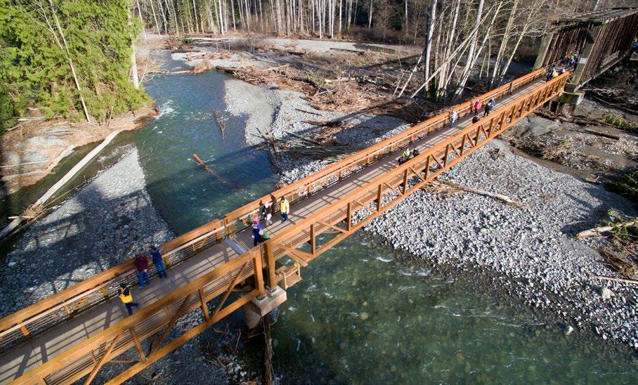
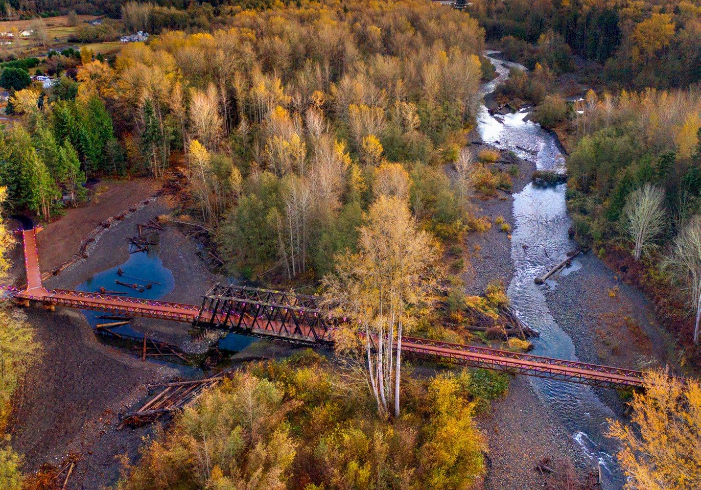
Once constrained by a 585-foot-long railroad bridge, the Dungeness River floodplain was restored while reusing that existing trestle structure to design its river-worthy, salmonfriendly replacement. Located on the Dungeness River at Railroad Bridge Park in Sequim, this multifaceted project supports Olympic Discovery Trail and the broader redevelopment of the Dungeness River Nature Center. The restoration and structural design was accomplished in coordination with the Jamestown S’Klallam Tribe with the goal of redesigning multiple features that constrained the floodplain process. Along with the railroad trestle, a parking lot would also be replaced with 350 feet of side-channel and log revetments. Along with levee setbacks, these improvements enhance the local salmonid rearing and spawning habitat. A unique no-rise analysis including two-dimensional hydraulic modeling and large wood stability calculations was used for the dynamic river setting. From preliminary to final design and preferred alternatives, the Otak team prepared each step of the process including permitting, technical specifications, costs, and bid documentation.
Transportation
SERVICES
• Transportation Planning
• Roadway and Highway Engineering
• Transit Planning and Design
• Active Transportation and Trails
• Bridge and Transportation Structures
• Environmental and Regulatory Support
• Construction Management and Inspection
• Parking Facilities
MARKETS
• Public
• Residential
• Mixed-Use
• Commercial
McGilchrist Street
Arterial Improvements
LOCATION : Salem, OR
CLIENT: City of Salem
SIZE: ~5,300 Linear Feet
As a major east/west arterial, McGilchrist Street carries significant traffic volumes for the area surrounding Salem, Oregon. The corridor, which provides a vital connection to downtown access as well as I-5 via Highway 22, would undergo multiple phases across three segments of roadway improvements aimed at traffic, railway, bicyclist, and pedestrian use. In leading the roadway design, Otak prepared a corridor analysis and feasibility study, as well as the engineering design and stream analysis to accommodate multiple creek crossings. The roadway design of McGilchrist Street traverses existing railroad tracks along with crossings at Clark Creek as well as the East and West Forks of Pringle Creek. Widening throughout the corridor with additional turn lanes at major intersections featuring new traffic signals – including the realignment of the 22nd Street intersection to a four-leg intersection – aim to reduce traffic congestion while bike facilities including a 10-foot-wide protected cycle track and pedestrian crossings encourage active transportation.
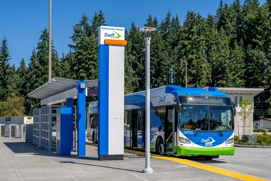
Swift Bus Rapid Transit Orange Line
LOCATION: Snohomish County, WA
CLIENT: Community Transit
AWARDS : ACEC WA Engineering
Excellence Silver Award for Social, Economic, and Sustainable Design
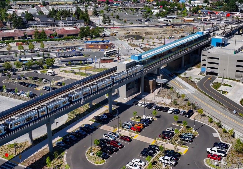
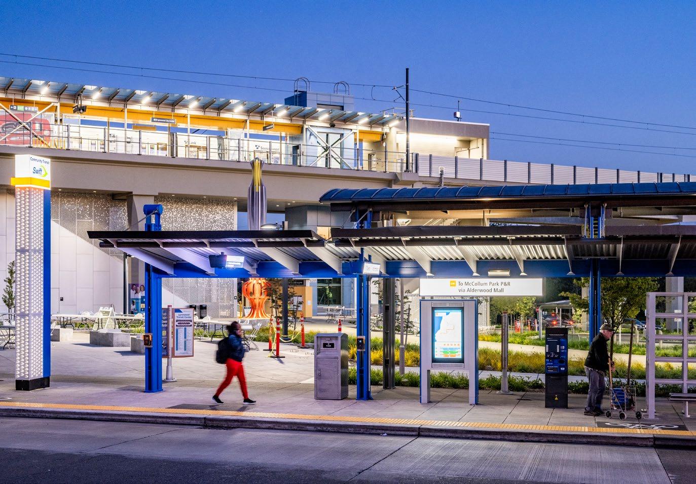
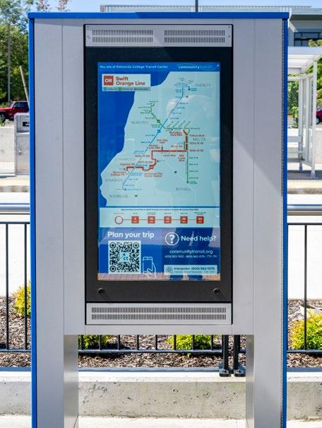
As part of Washington State’s first bus rapid transit (BRT) line, the 11-mile Orange Line connects service between Edmonds College, Lynnwood city center, Alderwood Mall, Mill Creek, including four park-and-rides and three future Sound Transit Link light rail stations. Project elements include a new transit center for the western terminus at the Edmonds College, construction of 21 BRT stations along the new Orange Line corridor and one additional station along the Blue Line, retrofitting five Green Line stations to dual-function as Orange Line stations, reconstruction of the transit center at the McCollum Park Park-and-Ride, and roadway and signal improvements at 14 intersections to improve transit speed and reliability. Otak team efforts included alternatives analysis, preliminary and final design, environmental permitting, PS&E preparation, and jurisdictional coordination and permitting for the stations and termini including all associated roadway, signal, structural, and pedestrian improvements and construction engineering support.
Redmond Central Connector, Phases 2 and 3
LOCATION: Redmond, WA
CLIENT: City of Redmond
AWARDS: ACEC WA Engineering Excellence Bronze Award
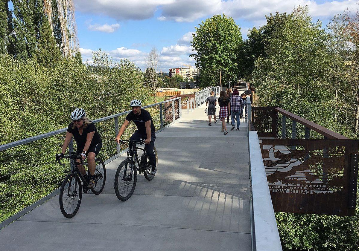
Otak recently completed design for Phase 3 of the Redmond Central Connector, a 1.6-mile regional trail linking the Cross Kirkland Trail and Eastrail at NE 124th Street and connecting downtown Redmond to the Willows business district. Our team also designed and provided construction management for Phase 2, a 1.3-mile segment featuring a natural trail and an urban section adjacent to Willows Road, warehouses, and offices.
A signature element of the project, the Sammamish River trestle, unifies the surrounding districts and natural river environment, serving as a key connection, historical reference, and scenic overlook. The bridge was a central focus for permitting, shoreline restoration, and adherence to critical project timelines.
Phase 3 included four fish-passable stream crossings requiring USACE 404/401 and WDFW HPA permits. Otak also prepared NEPA Categorical Exclusion documentation, a Critical Areas Report, a water quality monitoring plan, and a buffer mitigation plan to support permitting and environmental compliance.
30th and Colorado
Underpass
LOCATION: Boulder, CO
CLIENT: City of Boulder Public Works
AWARDS: American Public Works Association (APWA) - Project of the Year
American Council of Engineering Companies (ACEC Colorado) - Honor Award, Transportation
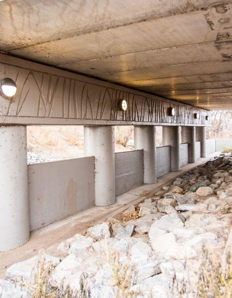
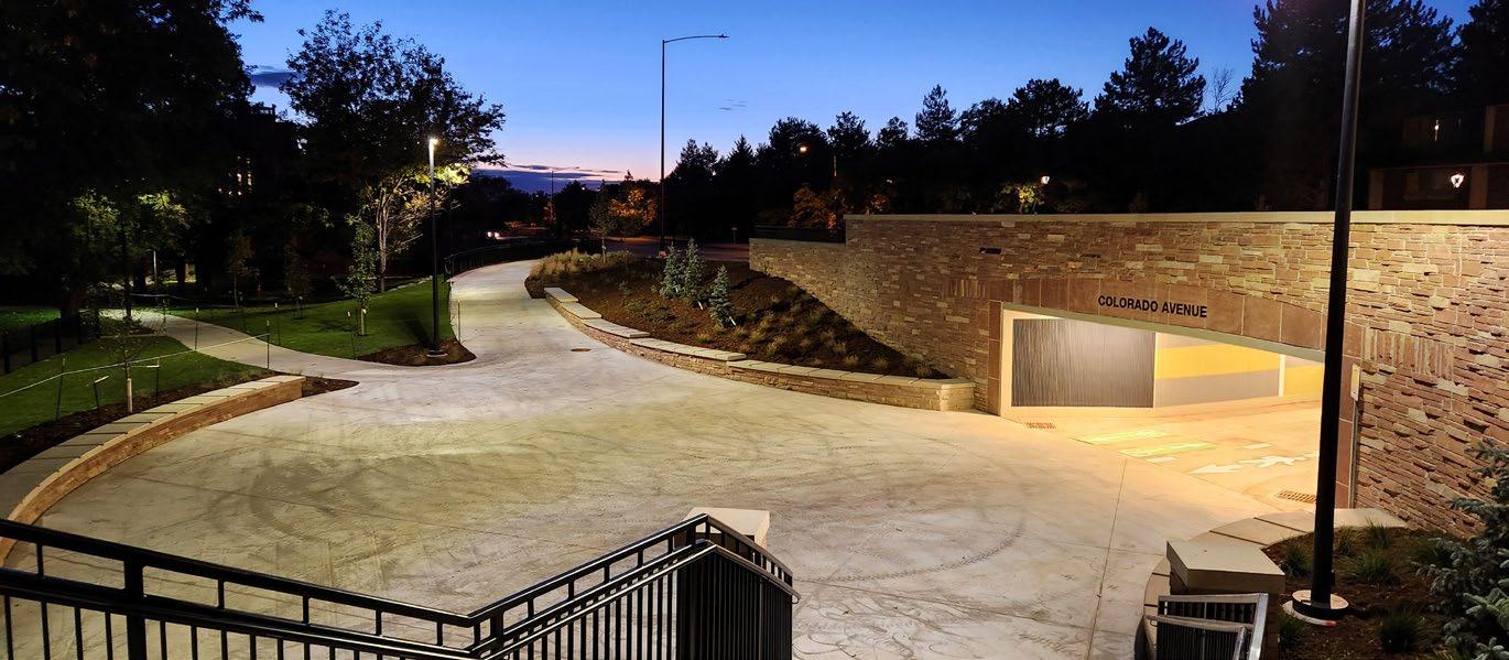
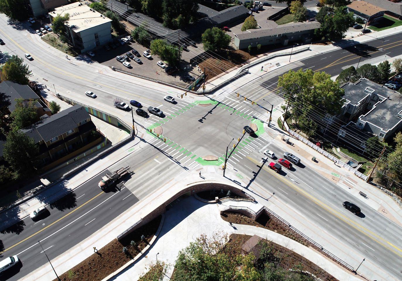
As essential transportation routes for the University of Colorado and commuting for the general public, updates to these corridors were a priority for the City of Boulder. With the goal of improved multimodal transportation, aesthetic enhancements, and a future master plan for land use in mind, the 30th and Colorado Underpass project would provide important safety accessibility and drainage improvements. An emphasis on multimodal transportation (pedestrian, bicycle, transit, and vehicle) at the intersection of 30th and Colorado also included a grade-separated crossing that was functional and minimally impactful to the surrounding area. The design features two pedestrian and bicycle underpasses as well as a protected intersection. Connected infrastructure to nearby sidewalks, bike lanes and multiuse paths and a reconstructed transit stop improve access to these corridors.
Tualatin Moving Forward
LOCATION: Tualatin, OR
CLIENT: City of Tualatin
Otak partnered with the City of Tualatin on a variety of projects included in their Tualatin Moving Forward (TMF) bond program. Throughout the process, our team has built a trusted relationship with both the contract manager and City staff to address unique, caseby-case elements within the projects. Otak met regularly with City staff to increase lines of communication and ensure that project deliverables were in alignment with current information. Otak led the design of several TMF projects as a subconsultant including Phases 1 and 2, Martinazzi Ave & Sagert Street Inspection, 95th & Avery Street, and Boones Ferry Corridor Bike Lane and Sidewalk Improvements.
Roaring Fork River Trail
LOCATION: Glenwood Springs, CO
CLIENT: City of Glenwood Springs
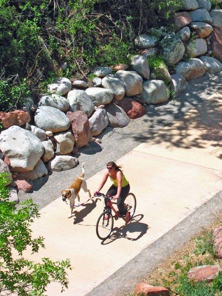
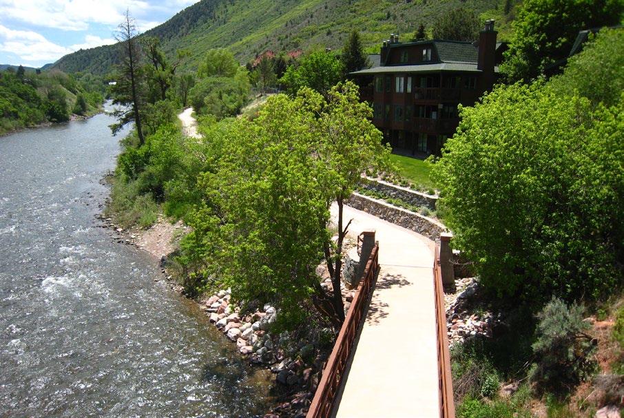
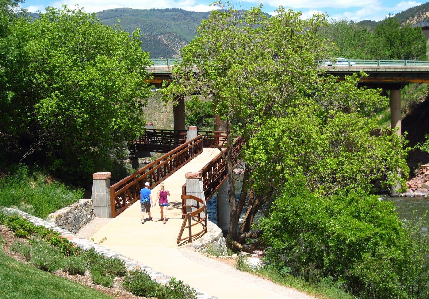
In collaboration with the City of Glenwood Springs, 1.3 miles of trail along Three-Mile Creek and the Roaring Fork River was designed to benefit the community. A portion of the trail is located between the western bank of the Roaring Fork River and the historic Atkinson Canal.
Our team worked closely with the City of Glenwood Springs Community Development and the River Commission to develop a plan for a 10-foot-wide concrete path with two-foot soft surface shoulders; a four-span pedestrian/bicycle bridge underpass at the Sunlight Bridge; trail amenities such as overlooks, picnic shelters, and beach access; and improvements to the trailheads. We designed the trail with minimal environmental and hydraulic impacts because of the sensitivity of the surrounding area.
Water & Natural Resources
SERVICES
• Stormwater Management
• Floodplain Management
• Hydraulic Engineering
• Natural Systems Design
• Environmental Science
• Stormwater Planning
• Environmental Permitting
• Fish Passage
• Hydraulic and Hydrologic Modeling
• Geomorphology
MARKETS
• Public
• Commercial
• Industrial
Tigard Stormwater Master Plan & Implementation
LOCATION: Tigard, OR
CLIENTS: City of Tigard
Otak completed a comprehensive stormwater master plan for the City, which had a range of issues to be addressed. The watershed-based plan evaluated stormwater conditions for each of eight study areas within Tigard, including natural channels, piped conveyance, culverts, outfalls, and water quality facilities. The plan provided a database of existing issues, a geomorphic risk assessment of natural drainages, a prioritized list of capital improvement projects, system management and maintenance programmatic recommendations, and various fact sheets summarizing plan recommendations.
Otak worked closely with the City’s project manager to involve a large cross-departmental stakeholder group and an advisory committee in the planning process to ensure buy-in and facilitate future implementation.
LOCATION: Clackamas County, OR
CLIENT: Clackamas County Water Environment Services (WES)
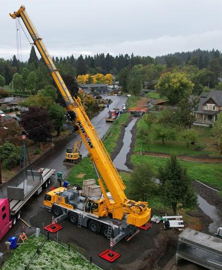
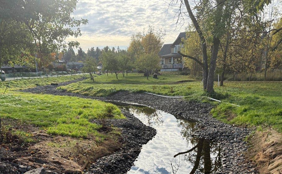
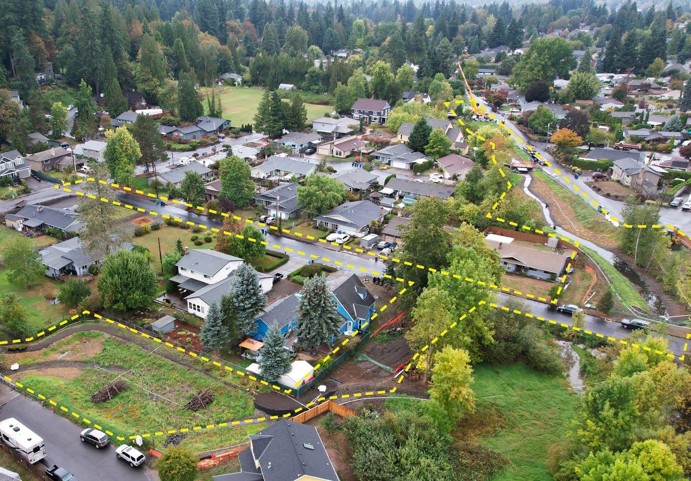
Building on Otak’s CIP development in Clackamas County for Clackamas Water and Environmental Services during previous master-planning efforts, Otak developed solutions to nuisance flooding through a combined stream restoration and stormwater management approach. The efficient project wrapped three CIPs into one project effort to leverage American Rescue Plan Act (ARPA) grant funding to address flooding on roadways and private property by creating off-channel storage, rerouting stormwater, and restoring stream reaches for stability and fluvial function. The work was entirely on private property, so we actively engaged multiple landowners in the area to share our vision for a restored Kellogg Creek, while improving each driveway crossing to give the creek more space to thrive. Our work included field hydraulics and geomorphic assessments, site survey, technical analysis, alternatives development, hydrologic and hydraulic modeling, FEMA no-rise analysis, and PS&E development. The project was on a short timeline to meet ARPA funding deadlines, so we instituted a novel bid approach at 60% to serve the client’s needs.
Upper Kellogg Creek Capital Improvements
Monroe Avenue NE Storm System Improvements
LOCATION: Renton, WA
CLIENT: City of Renton
AWARDS: ACEC WA Engineering Excellence Gold Award for Uniqueness and/or Innovative Application of New or Existing Techniques
APWA WA Project of the Year Award, Sustainability – Envision
APWA WA Project of the Year Award, Environment $5 to $25 Million
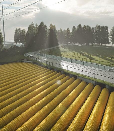
Persistent flooding along Monroe Avenue in the City of Renton was addressed through a comprehensive green stormwater infrastructure (GSI) solution centered around an infiltration facility. An alternatives analysis led to the selection of a treatment train approach that begins with a hydrodynamic separator and a flow splitter, which diverts water quality treatment flows to a Filterra Bioscape treatment system. From there, treated runoff is conveyed to three isolator rows, allowing for additional settling and fine sediment removal before infiltration into the ground. High stormwater flows that bypass the bioscape unit are also directed to the isolator rows, ensuring full use of the facility’s infiltration capacity. This system not only eliminates localized flooding but also recharges cool, clean groundwater that feeds into the Cedar River. Overall, the facility delivers both flow control and enhanced water quality treatment tailored to the Renton Highlands subbasin.
NE 40th Street
Trunkline Extension and Water Quality Facility
LOCATION: Redmond, WA
CLIENT: City of Redmond
AWARDS: ACEC WA Engineering Excellence Silver Award for Successful Fulfilment of Client/ Owner Needs
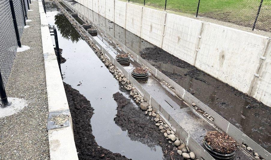
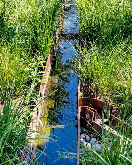
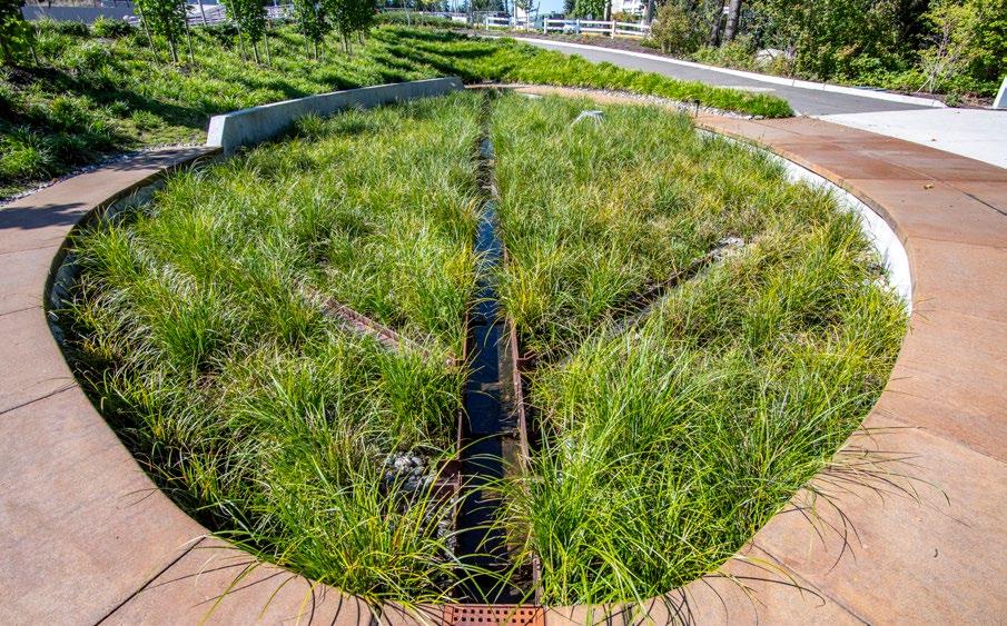
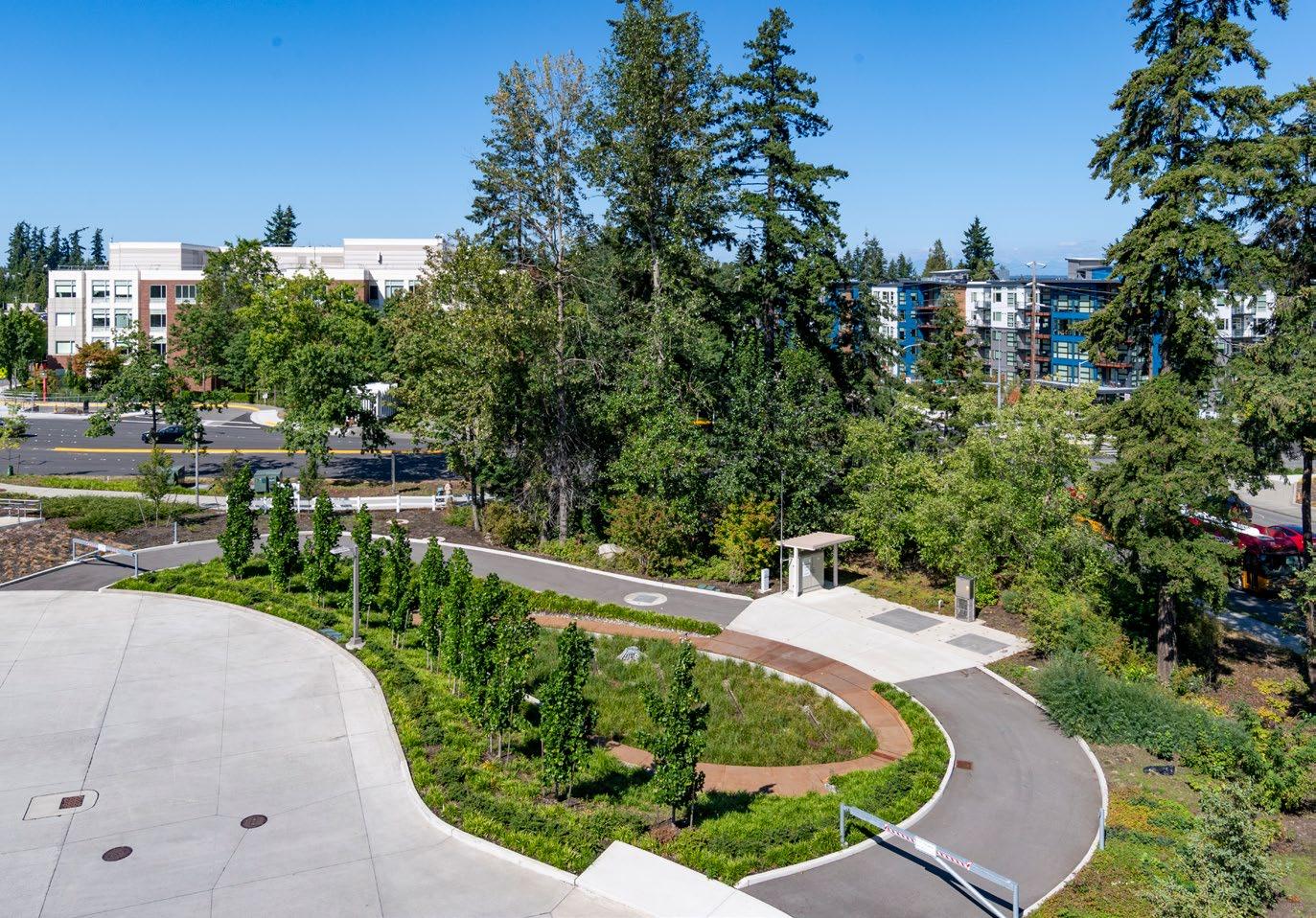
Located alongside busy highway SR 520, a unique pump system diverts stormwater runoff through a custom soil mix and vegetated facility designed for biofiltration before eventually reaching the outfall at Lake Sammamish. The resulting bioretention maintains treatment function over time as a custom steel distribution system spreads flow evenly to optimize the footprint across the facility and prevent scouring. Data collected to inform the Basin Surface Water Master Plan was used to identify the optimal location for capturing polluted runoff while continued monitoring refines the runoff model and better defines pollutants. An integrated approach including landscape architecture focused on urban design led to a facility that resembles a leaf. Otak also supported the city in obtaining an ecology grant for the stormwater retrofit by building a report that demonstrates how the facility would function and how the water quality benefits would benefit the community.
Longmont Supply Passage and Stream Restoration
LOCATION: Longmont, CO
CLIENT: Boulder County Parks & Open Space
As part of the 2013 flood recovery efforts within the St. Vrain Creek watershed, the multi-phase restoration project re-establishes floodplain connectivity, enhances the health of local ecology, and adds resilience to the area’s communities from future flooding. With funding from a disaster relief planning grant, those efforts include the reconfiguration of a reach where creative solutions were necessary to meet numerous objectives and stakeholder needs. An alternatives analysis evaluating various bypass structure design and channel alignments was developed to address a variety of project constraints, including the minimization of water surface rises to avoid a conditional letter of map revision (CLOMR), protecting the existing Preble’s Meadow Jumping Mouse habitat, and avoiding disturbance to ditches’ ability to divert legally decreed water rights. The final design increases floodplain connectivity while adding low-profile features that complement the natural function and variability of the river, restoring native riparian and aquatic habitat in the process. The resulting passage of native fish and sediment, reduction of flood energy, and improved water quality benefit local communities and ecology alike.
WSDOT NW Region GEC for Fish Passage Program
LOCATION: WA
CLIENT: WSDOT
With sites throughout the Puget Sound region, a multidisciplinary team developed WSDOT Preliminary Hydraulic Designs (PHD) leading to Final Hydraulic Designs (FHD) to restore fish passage at roadway crossings. Topographic and survey data were used to develop hydraulic models in SRH-2D to characterize existing and future conditions. Analyses of scour, stream channel slope, and alignment informed an understanding of prevailing geomorphic processes, which guided structure design and construction approaches. Fish presence and habitat evaluations supported restoration of aquatic habitat and improved wildlife connectivity for ESAlisted salmonids. As part of a GEC team, Otak collaborated closely with project stakeholders and co-managers, including WDFW and Tribal partners, to develop designs consistent with Water Crossing Design Guidelines, the Stream Simulation method, and WSDOT’s Hydraulics Manual. Under separate task orders, Otak also provided land surveying and wetlands assessment and compliance services.
OREGON
Portland Headquarters
808 SW Third Ave. Suite 800
Portland, OR 97204 (503) 287-6825
WASHINGTON
Redmond Office 11241 Willows Rd. NE Suite 200
Redmond, WA 98052 (425) 822-4446
COLORADO Bend Office 1001 SW Disk Dr., Suite 205 Bend, OR 97702 Salem Office 3400 State St., Suite G730 Salem, OR 97301
Louisville Office 371 Centennial Pkwy., Suite 210 Louisville, CO 80027 (303) 444-2073
Everett Office 2828 Colby Ave. Suite 401
Everett, WA 98201 (425) 493-5221
Vancouver Office
700 Washington St. Suite 300 Vancouver, WA 98660 (360) 737-9613
Denver Office 410 17th Street, Suite 1190 Denver, CO 80202 (303) 444-2073