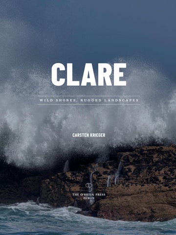
CLARE W I L D
S HO R E S ,
R UG G E D
L A N D S C A PE S
CARSTEN KRIEGER
CON T E N TS
Introduction: A Tour of County Clare
7
1. The River and the Sea: South and West Clare
23
2. The Burren: North Clare
71
3. Rolling Hills and Tranquil Lakes: Mid and East Clare
117
Kilbaha Harbour.
I N T RO DUC T IO N
A TOUR OF COUNTY CLARE
I n t roduc t ion: A Tou r of Cou n t y ClaR e
7
I
N 1998 (OR THEREABOUTS) my then girlfriend, now
clear as quickly as it had arrived, and headed
wife, and I came to Ireland for a two-week
west towards Kilkee.
tour of County Clare. We flew into Shannon
It is only 13 kilometres from Kilrush to
and took a bus to Ennis, where we rented bikes
Kilkee, a distance you can make easily in under
to set out on our adventure the next morning. Our
an hour on the bike. On this morning, it took us
tour would take us from Ennis to Kilrush, then
almost three hours. The wind and rain refused to
to Lahinch, Lisdoonvarna, Ballyvaughan, Doolin,
clear, and when we finally reached the outskirts
Miltown Malbay and eventually back to Kilrush
of Kilkee, our enthusiasm had very much
and Ennis.
dissipated. We were exhausted, wet and cold. So
This wasn’t our first visit to Ireland, but it was the first time we would be on bicycles. The
we let Lahinch be Lahinch, and knocked on the door of the first B&B we could find.
idea was to enjoy the slower pace and explore
I often wonder how different our lives would
the landscape that had sparked my interest in
be if we hadn't knocked on that particular door.
Ireland in the first place – the Burren – for a
The door opened, Sheila (to this day one of our
whole week. Little did I know that this journey
dearest friends) took a quick look at us and while
would change the rest of our lives.
we were getting the pleasantries out of the way –
It was late April when we set out on the first
where we were from, where we’d come from on
leg of our trip which would bring us to Kilrush.
this miserable day, where we were planning to
At the time the stretch of the N69 between Ennis
go and why we would travel Ireland on bicycles
and Kilrush was still a nice enough road to cycle
to begin with – she shoved us into a wonderfully
on. There was traffic – the N69 is, after all, the
warm kitchen and minutes later we had hot soup,
main road leading west – but, unlike today, it was
even hotter tea, and ham and cheese sandwiches
fairly safe.
in front of us. Things were looking up.
It was the perfect day to spend on the bike,
As it so often does in Ireland, the rain cleared
a light easterly breeze pushing us along and
and the winds eased quickly after all, and the
broken clouds letting the warm spring sunshine
soft spring sunshine had made a reappearance
through. We arrived early in Kilrush, had
by early afternoon. Just like the weather, we also
lunch at the Quayside restaurant, and spent the
had recovered and were wondering what to do
afternoon exploring the town, the marina and the
with the rest of the day when Sheila knocked on
shores of the Shannon Estuary at Cappa.
the door of our room. She offered us a ride into
Of course, the weather did not hold. The
town and a few minutes later we found ourselves
following morning greeted us with threatening
standing at Kilkee’s West End, looking out on the
clouds, pelting rain and a strong westerly wind.
Pollock Holes and George’s Head. ‘Just follow the
Our destination for the day was Lahinch, and
path’, Sheila had said. ‘You won’t regret it.’ So we
after breakfast we hopped on our bikes, still
followed the path, known and famed as Kilkee’s
fairly enthusiastic and hopeful the deluge might
Cliff Walk.
OPP O SI T E : Lough Cullaunyheeda.
I n t roduc t ion: A Tou r of Cou n t y ClaR e
9
It didn’t take long to fall in love with the place.
in Kilbaha, on the westernmost end of the Loop
We spent the afternoon sitting on the warm
Head Peninsula, where we have been living ever
rock, watching waves crashing against the cliffs,
since. I had come home.
marvelling at the pink flowers forming large carpets or growing right out of the rock (thrift or
County Clare has been my home for almost a
sea pink, the pride of west Clare, as we learned
quarter of a century now, and I still can’t imagine
later) and gazing at a seal’s head popping out of
another place I would rather be. Even on those
the ocean every once in a while. It was one of
cold, wet, windy and dark winter days, the soaked
those rare experiences that forever stick in my
and battered landscape has a melancholy beauty
memory, one of those moments that – in retrospect
that can’t be denied. What makes County Clare
– was a changing point in my life.
special is its diversity. You can circumnavigate
We left Kilkee the following day to catch
the area easily by car in a day but, at the end of
up with our schedule but decided to return the
the journey, you will feel that you have been on
following year to spend more time in west Clare,
a much longer one, one that encompasses vastly
and to visit Sheila. And return we did, over and
different landscapes and sceneries.
over again. For me, west Clare became the place
Let’s start in the county’s capital: Ennis, a
where I felt most at home, the place I longed to
vibrant but relaxed market town on the shores
return to and a place to heal.
of the River Fergus. After a walk around the
Back then, I was a paediatric nurse working
narrow streets, head south, out of the town
in the oncology department, on the ward for bone
and along the Fergus Estuary which joins the
marrow transplantation in a hospital in southern
larger Shannon Estuary at Kildysart. This is a
Germany. At the time, this procedure was still
landscape of undulating hills, small woodlands,
fairly new, a matter of last resort, and the little
vast mudflats, cosy harbours, and a wide-open
patients and their parents I cared for were
sky. You can sense the rawness of the nearby
staring death in the face. This time in my life
Atlantic coast, but at the same time feel sheltered
was an emotional rollercoaster ride, rewarding
and comfortable in the many bays and inlets of
and devastating in equal measures, and west
the twisting and turning shoreline.
Clare became my place to recharge and regain
From Kildysart, the road turns west towards
perspective. Still, after ten years, I had reached
the Atlantic Ocean. With every kilometre
my limits and was close to a burnout. I knew I
travelled, the scenery becomes a bit more rugged,
needed a change.
the estuary gets wider, the water rougher and
In 2002, my wife, who was also a nurse
the landscape more open and exposed. Towns
and working with me on the same ward, and
and villages will be our stepping stones along
we gave up our jobs and everything else in
the way: Labasheeda, Knock, Killimer, Kilrush,
Germany, and moved into a cottage in Shragh,
Moyasta, Querrin, Doonaha, Carrigaholt, Kilbaha.
near Doonbeg. A year later, we bought a house
Eventually you will reach Loop Head, the most
OPP O SI T E : Aughinish, the Burren.
10
C L AR E – W I LD SHOR ES, RUG GE D LA N DSC A PES
I n t roduc t ion: A Tou r of Cou n t y ClaR e
11
southwesterly point of the county, crowned by
Doonbeg, Quilty, Miltown Malbay, Lahinch and
its seventeenth-century lighthouse which sits on
Liscannor. The Atlantic is churning to your
30-metre-high vertical sandstone cliffs. You are
left and a flat patchwork of fields and pastures
now in west Clare and this is a very different
stretches out to your right. The roar of the
landscape: gone is the gentle appearance of the
Atlantic Ocean and the cries of gulls are your
estuary and instead you are faced with sheer
soundtrack, and the air smells of salt and turf
cliffs and rocky shores battered by wave after
smoke. After 80 kilometres through this rough
wave, lonely sea stacks and rocky islands rising
and windswept landscape, past the surfers’
from the choppy waters of the Atlantic, sandy
paradise of Lahinch and the famed Cliffs of
beaches and windswept dunes constantly being
Moher, we reach Doolin.
reshaped by the strong westerly winds. Travel north along this mesmerising coast through its small towns and villages: Kilkee,
A B OV E : The bandstand, Kilkee.
12
C L AR E – W I LD SHOR ES, RUG GE D LA N DSC A PES
Here, there is another unmissable change in the landscape: suddenly, grey is the dominating colour. Grey rock platforms, grey boulders,
grey cliffs and grey terraced hills make up the
to yet another change in scenery. The landscape
scenery. This is the Burren, a karst limestone
of east Clare rises and falls in gently rolling hills.
landscape that covers the northern half of
The hilltops are blanketed in bog and heath or
County Clare and parts of southern County
Sitka spruce plantations, the valleys feature lakes
Galway. It’s a landscape that appears barren and
of all shapes and sizes, and the surrounding
desolate, but it’s utterly fascinating and strangely
countryside holds old hedgerows, lone trees and
beautiful. During spring and summer, dots of
small woodlands. This is picture-perfect Irish
blue, yellow, red and white are scattered over this
countryside, including birds singing in the trees,
landscape and hint at the exceptional flora of the
pheasants gallivanting on the road and cattle
Burren, which has made this area a focal point
grazing in the meadows. Eventually, you come
for botanists for centuries.
to Lough Derg, a vast body of fresh water and
The road continues north through this
the eastern boundary of County Clare. The road
unexpected landscape, through the small hamlet
leads south along the lake before veering west
of Fanore, with its golden beach where the Caher
again to return you to the starting point of your
River tumbles into the sea, around the stark
journey. But before that, take in the views across
hillside of Black Head, and then ventures east along Galway Bay and on towards Ballyvaughan. Leaving the Atlantic Ocean behind, the scenery mellows a bit. County Clare’s northern coast is an intricate collection of bays, inlets, peninsulas and islands, backed by the Burren’s beckoning limestone hills, which tell stories of an ancient ocean, vast glaciers, wandering hunter-gatherers, venturing farmers and lone hermits. Shortly after passing the sheltered bay of Bell Harbour, veer away from the coast to travel along the northeastern border of the Burren. As you travel, the limestone hills disappear in the distance and are replaced by a vast limestone plain, criss-crossed by drystone walls and dotted with lakes. This is an area known as the Burren Wetlands, a jigsaw of lakes, ponds, turloughs, fens and marshes, which mark the eastern boundary of the Burren region. Further eastward, the exposed limestone disappears under fields and pastures, giving way
A B OV E : Clogher Beach.
I n t roduc t ion: A Tou r of Cou n t y ClaR e
13
14
C L AR E – W I LD SHOR ES, RUG GE D LA N DSC A PES
the lake to the hills of County Tipperary, and
which is not only County Clare’s longest river
the towns and villages along the way: Whitegate,
but also connects to the Shannon Estuary, once
Mountshannon, Scariff, Tuamgraney and
the main trading route into and out of the west
Killaloe. On the way back to Ennis, stop for a
of Ireland. As a consequence, this place was of
walk along the River Shannon at O’Briensbridge,
some importance, eventually lending its name to
enjoy views of Slieve Bearnagh, visit 12 O’Clock
the entire county.
Hills, Cratloe Wood and Mooghaun Hill Fort,
Clare is also known as the Banner County,
Ireland’s largest Bronze Age settlement, before
but how this nickname came to be is not entirely
reaching Bunratty and finding yourself back at
clear. One oft-cited explanation is the county’s
the Shannon Estuary. From here, Ennis is just a
obsession with banners in the eighteenth and
few minutes up the motorway.
nineteenth centuries. At the time, each trade guild had its own banner: bakers, butchers,
County Clare, known as An Clár in Irish, got its
brogue makers, coopers, nailers, dyers, masons,
name from the Irish word for ‘plank bridge’ –
harness makers, cartwrights, stone cutters
clár – referring to a bridge over the River Fergus
and many more tried to outdo each other in
at what is today Clarecastle, a small town near
producing the most beautiful and enticing
the county’s capital, Ennis. In medieval times,
banner. Banners were also used often and widely
this was the main crossing over the Fergus,
to make political statements and show support
A B OV E : The Shannon Estuary at Cappa. OPP O SI T E : Pollock Holes, Kilkee.
I n t roduc t ion: A Tou r of Cou n t y ClaR e
15
for or welcome visiting office-holders and other
to start from scratch, travelling around west
political figures.
Clare, up to the Burren and over to east Clare,
County Clare emerged from the Kingdom of
revisiting places I hadn’t been to in years, and
Thomond: established in the twelfth century and
discovering some new spots along the way.
ruled by the O’Brien clan, it consisted of today’s
The result is a collection of images that
counties Clare, Limerick and Tipperary. The
represent ‘my’ Clare, images of places and
O’Briens managed to defend their realm for over
sceneries I cherish and can’t get enough of. It’s a
300 years against the invading Normans, as well
homage to the place I call home.
as other Irish clans. However, they were forced to give up their independent rule in the sixteenth century when the Kingdom of Thomond became an earldom under English sovereignty. It was then that the current boundaries of County Clare were established by the English administration. The line of the O’Briens continued until 1741, when the heirless Henry O’Brien passed away, and his land and title were divided between cousins and nephews, effectively marking the end of Thomond. The whole story is, of course, considerably more complicated and would fill a book of its own, with stories of victory and defeat, politics, heroic deeds and cowardly betrayal. This book has been in the making for almost 30 years, starting with an image of the Burren’s limestone pavement at Poll Salach, made in another millennium with a medium-format camera on slide film. Even after all these years, County Clare is still a special and exciting place to me; I continue to discover new places and always want to revisit the familiar ones. Selecting the images was almost an impossible task. After digging through my archives and ending up with almost a thousand images, I picked a few personal favourites and then decided
16
C L AR E – W I LD SHOR ES, RUG GE D LA N DSC A PES
A B OV E : Mullaghmore in winter, Burren National Park.
I n t roduc t ion: A Tou r of Cou n t y ClaR e
17
TOP : Lough Graney. B O T TOM : Shannon Estuary at Inishmurray Quay. OPP O SI T E : Forest floor, Dromore Nature Reserve.
18
C L AR E – W I LD SHOR ES, RUG GE D LA N DSC A PES
I n t roduc t ion: A Tou r of Cou n t y ClaR e
19
A B OV E : Loop Head.
20
C L AR E – W I LD SHOR ES, RUG GE D LA N DSC A PES
I n t roduc t ion: A Tou r of Cou n t y ClaR e
21