I S S U E 1 2 2 | W I NTE R 2 02 6
Measuring success together
T H E M AGA Z I N E O F S U RV E Y + S PAT I A L N E W Z E A L A N D
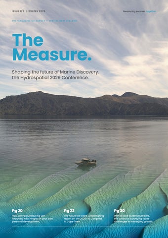
The Measure.
Shaping the future of Marine Discovery, the Hydrospatial 2026 Conference.
Pg 20
How are you Measuring Up? Reaching new heights in your own personal development.
Pg 22
The Future we want. A fascinating report on the 2026 FIG Congress in Cape Town.
Pg 30
With record student numbers, the School of Surveying faces challenges in managing growth.
E D I TO R I A L
Matariki in spatial technology Rachel Harris, Editor Matariki marks the start of the Māori New Year in Aotearoa, a time to reflect, remember and turn our attention to the year ahead with our loved ones and communities. It’s a unique celebration in Aotearoa, with several spatial groups and organisations that have now initiated projects. These combine GIS tools and platforms with Matariki knowledge and cultural values, storytelling and land connection. There are many excellent examples including The University of Otago’s Matariki Project that uses high-resolution satellite imagery for environmental monitoring of glaciers, erosion and snow in real time with rapid response mapping. Southland District Council’s Wayfinding Pou Trail combines GIS and cultural heritage across the district, installing pou at key locations to reflect each of the nine Matariki stars. Digital Future Aotearoa’s 3D Matariki Star Map is an educational project for students to use GIS and
Tinkercad to plot the Matariki star cluster in 3D. The project aims to blend digital technology education with cultural values, an excellent learning tool for spatial planning and cultural connection. In this winter edition of The Measure, we’re showcasing survey and spatial professionals working across the industry from spatial specialists to surveyors in the business sector. Recently returned from South Africa, S+SNZ President Andrew Blackman, shares his insights and professional learnings from the presentations and meetings at this year’s FIG World Congress 2026. The Hydrospatial Professional Stream leadership report on this year’s Hydrospatial 2026 conference in Wellington. This highlights how the sector is evolving, and how the hydrographic community is helping to shape the future. And lastly, Richard Hemi discusses growing student numbers and additional teaching staff in his final University Happenings column for The Measure.
Hydrographic Surveying Collecting precise data of waterways has never been easier
CHCNAV Apache 4 Now available to hire or buy Built-in Single Beam Echo Sounder Compatible with Common ADCPS Smart Positioning and Navigation with Dual GNSS & IMU
0800 453 422 WWW.GLOBALSURVEY.CO.NZ
CONTENTS
The Measure Issue 122 Winter 2026 A publication of Survey and Spatial New Zealand Tatai Whenua. ISSN 3021-551X surveyspatialnz.org EDITOR Rachel Harris surveyingspatial@gmail.com CREATIVE & MARKETING DIRECTOR Rick Hopkinson All rights reserved. Abstracts and brief quotations may be made, providing reference is credited to The Measure. Complete papers or large extracts of text may not be printed or reproduced without the permission of the editor. Any correspondence relating to literary items in The Measure may be addressed to the editor. Papers, articles and letters to the editor, suitable for publication, are always welcome. Papers published in The Measure are not refereed. All correspondence relating to business aspects, including subscriptions, should be addressed to: The Chief Executive Surveying and Spatial New Zealand PO Box 5304, Lambton Quay Wellington 6140, New Zealand +64 4 471 1774 www.surveyspatialnz.org admin@surveyspatialnz.org Design & Print Many Hats www.manyhats.co.nz steve@manyhats.co.nz To Advertise admin@surveyspatialnz.org or contact Tara Ranchhod +64 4 471 1774
4
THE MEASURE | ISSUE 122 | WINTER 2026
Measuring success together
In this winter edition of The Measure we bring you a raft of interesting stories and insights impacting our growing profession. We take a closer look at who’s shaping the future of marine discovery, where we are heading with our Spatial Stream, and Dr Kat Salm tells us what’s happening in the field of advocacy.
6 CEO update CEO Ashley Church, comes face to face with Sir Graham Henry. Exciting times ahead!
20 How are you Measuring Up? A new look at CPD.
8 Hydrospatial 2026 Conference The Hydrospatial 2026 conference makes a big splash in Wellington.
22 The Future we want Council President, Andrew Blackman, goes to FIG in Cape Town and brings back some fruitful insights.
10 Professional Stream profile Spatial Stream’s Sam Smith, stars in the latest S+SNZ careers video and talks about the unique challenges for the future.
28 Business management Passwords are one of the biggest security risks for business today. What can you do to increase your security?
12 Professional profile S+SNZ Stakeholder and Advocacy manager, Dr Kat Salm, asks for feedback and encourages members to get involved.
30 Record student numbers Te Kura Kairūri /School of Surveying welcomes its highest intake of new students.
16 Business profile We take another look at professional surveyors in the business sector with Global Survey’s Lennon Bedford. 18 Professional membership S+SNZ Board Chair, Andrew Perry, talks to Creative & Marketing Director, Rick Hopkinson, about the exciting changes to our structure.
32 Obituary We say farewell to Dr. Chris Pearson. 34 Professional insight Is Ctrl F all it’s made out to be? A meaningful shift in accessing professional knowledge. 36 Where have all the trees gone? Giving cities tools to make better decisions for the future.
5
Advertorial
Introducing Daniel Williams Most people across the survey and spatial sector will already know Daniel Williams. Over the past three decades, Daniel has built a reputation as a trusted leader, strategic thinker, and passionate advocate for our profession. He served as Chair of Survey and Spatial New Zealand for nine years, was awarded a Fellowship in 2022, and spent 32 years helping grow Woods into one of New Zealand’s most respected professional services firms.
During his time at Woods, Daniel helped grow the business to more than 230 people before stepping away from the Managing Director role in 2022. His career has been defined not only by business success, but by a commitment to people, culture, and the future of the industry. Now, we are excited to share the next chapter in Daniel’s journey. Daniel has joined 84 to help launch a new Executive Search and Advisory Division, bringing decades of experience supporting organisations through growth, change, and complex decision making. Daniel’s career includes leading work on significant developments including Dannemora, Gulf Harbour, Long Bay, Stonefields, Millwater, Albany Town Centre, and Pegasus Town. Woods also established its Christchurch office in 2008 and later delivered survey and engineering work through SCIRT following the 2011 Canterbury earthquakes. Woods was also recognised as an Aon Hewitt Best Employer in both 2017 and 2018, reflecting the strong culture and values that underpinned the organisation. Through his partnership with 84 Recruitment, Daniel will provide Business Advisory and Executive Search services across growth, succession planning, leadership, organisational change, and employer value proposition. His experience in building high performing teams and strong workplace cultures brings valuable insight to organisations looking to attract, retain, and develop the people they need to succeed.
What sets Daniel apart is not only the strength of his network, but his ability to challenge thinking, ask the right questions, and help leaders see opportunities from a different perspective. If your organisation is navigating growth, change, or succession planning, we encourage you to connect with Daniel or Mark directly. Daniel and Mark will also be attending the S+SNZ Annual Conference and look forward to connecting with members in person. We are delighted to welcome Daniel to the team and look forward to the impact his experience and leadership will bring.
84recruitment.co.nz
WORD FROM THE CEO
Success is Built Through Teamwork
A new membership structure, a strong conference programme (including Sir Graham Henry) and a willingness to listen. Our profession is in good heart.
Ashley Church, CEO S+SNZ
There’s a lot happening across S+SNZ at the moment, and most of it points in the same direction: a profession that’s growing in confidence, becoming clearer about its standards, and continuing to invest in its future. Membership remains strong, with 1,599 members recorded at the beginning of June and retention still above 95 percent. Those numbers matter, but the more important point is that people are joining, progressing through the profession, and choosing to remain part of our community. By the time you read this, our new membership structure will be in place. The new pathway moves us from the old mix of categories to a clearer progression through Student Member, Member, Professional Member and Certified Professional Member, with Retired Member continuing to recognise those who’ve stepped away from active practice. It’s more than a change of names.
8
THE MEASURE | ISSUE 122 | WINTER 2026
It gives members a clearer sense of where they are in their professional journey and what the next step looks like. As part of the transition, 417 Associate Members will move to Professional Member status, better reflecting their experience and contribution. The structure will also make it easier for employers, clients and the wider public to understand what our membership levels represent. Professional recognition should mean something, both inside the organisation and beyond it. Of course, moving forward doesn’t always mean pressing ahead regardless. Following feedback from members, we’ve delayed the proposed cadastral certification policy that was due to come into effect on 1 July 2026. That was the right decision. The feedback made it clear that parts of the policy needed further work and, rather than introduce something that wasn’t quite right, we’ve established a
Measuring success together
working party to review and improve it. We expect to release a stronger version later this year. That’s how a member organisation should operate. We should be prepared to lead, but we should also be prepared to listen. Delaying a policy isn’t a sign of weakness when the purpose is to make it better. It’s a sign that the process is working. We’re also looking ahead to our Auckland conference in September, which is shaping up to be one of the highlights of the year. It’s a chance to reconnect with colleagues, hear new ideas and take stock of where the profession is heading. It’s also one of the best opportunities members have to build meaningful CPD into their year. CPD can sometimes sound like an obligation, but at its best it’s much more than that. It’s about staying current, challenging our thinking and learning from people who bring a different perspective. This year’s programme will provide plenty of that, and
we’re delighted to have Sir Graham Henry joining us as a guest speaker. Most New Zealanders know him as the coach who led the All Blacks to Rugby World Cup victory in 2011, but his experience of leadership, pressure and building successful teams reaches well beyond rugby. When we talk about measuring success, it can be tempting to focus only on membership numbers or event registrations. Those things matter, but success is also found in stronger professional pathways, a willingness to improve and a growing sense of connection across the profession. On those measures, S+SNZ is in good heart. There’s still plenty to do, but the momentum is real. I’d encourage you to be part of it – and, if you haven’t already registered for the conference, now would be a very good time to do so. For everything you need to know, go to our stand alone website: www.surveyspatialnzconference.org
9
H Y D R O S PAT I A L 2 0 2 6 C O N F E R E N C E
Hydrospatial 2026 Conference Shaping the future of Marine Discovery Hydrographic Professional Stream Leadership Hydrospatial 2026 brought hydrographic and marine geospatial professionals from around the world to Wellington in March for the Asia–Pacific region’s leading hydrographic surveying conference. Over three days delegates from across government, defence, research, industry and academia convened to examine how the Hydrospatial sector is evolving, why those changes are significant, and how our hydrographic community is helping shape the future of marine discovery. Held at Shed 6 on Wellington’s waterfront, the conference attracted 170 people from 12 countries. Organised by the New Zealand Branch of the Australasian Hydrographic Society (AHS), the Hydrospatial 2026 programme had a distinctly New Zealand flavour and was packed from start to finish. Adam Greenland, the New Zealand National Hydrographer (and recently elected IHO Director), opened the conference with an exciting keynote presentation. He highlighted the collaborative global development of the new International Hydrographic Organization’s S-100 navigation products, and the revolutionary impact these will have on vessel routes, cargo optimisation and the entire maritime sector. Across the three days, sessions included coastal mapping & bathymetry, collaborative seabed mapping efforts, challenges to seabed mapping and a look at innovation. Presentations reflected the increasing integration of new technologies, data standards and partnerships, alongside ongoing challenges relating to coverage, consistency and access to seabed data. Several S+SNZ Hydrographic Professional Stream members attended and had a key role in delivering the conference either as presenters or part of the organising
10
THE MEASURE | ISSUE 122 | WINTER 2026
Below Photo (left to right): Hydrospatial Professional Stream Leadership: Hayes Ballantyne, Declan Stubbing, Rhys Davies, Emily Tidey, Brad Cooper, Kevin Smith, Stuart Caie representing S+SNZ at the Hydrospatial 2026 Conference.
committee, led by Brad Cooper from Land Information New Zealand. Their involvement reinforced the close relationship between professional development, standards and technical practice within the growing hydrographic community. On professional certification, Rebecca Cussack from the Australasian Hydrographic Surveyors Certification Panel (AHSCP) announced the Australasian Hydrographic Society as their new Australian partner alongside S+SNZ in New Zealand. She provided an update to the governance structure following the recent disruptions. Kat Salm, S+SNZ National Operations Manager also joined us for a day to begin discussions on a new Memorandum of Understanding between S+SNZ, AHS and ASHCP. Beyond the conference sessions, a range of events helped foster connection and inclusions within the industry. A Women in Hydro Breakfast attracted 30 people (including supporters), while the Early Career/Student Breakfast provided an opportunity for those new to their career to connect. Delegates also had the opportunity to visit Kaharoa II, Earth
Measuring success together
Hydrospatial 2026 set a high benchmark for regional hydrographic conferences, combining technical depth with inclusive networking and a strong sense of community.
Sciences New Zealand’s new vessel which was berthed at Wellington’s Queens Wharf during the conference. Student participation was a highlight of Hydrospatial 2026. Six students attended with sponsorship support from AHS, and a dedicated session showcased excellent student presentations. Topics included the impact of anchoring on the seafloor, use of autonomous technology to record marine heatwaves, use of Uncrewed Surface Vessels, and characterisation of the seafloor to support marine protected areas. Industry engagement was also strong, with 18 exhibition stands displaying a
wide range of hydrographic and marine geospatial technologies. The exhibition provided delegates with opportunities to explore new tools, discuss operational challenges and strengthen relationships between surveyors, researchers and technology providers. Hydrospatial 2026 set a high benchmark for regional hydrographic conferences, combining technical depth with inclusive networking and a strong sense of community. The organisers are to be congratulated for delivering a well run and impactful event, and thanks are also due to all speakers, sponsors, exhibitors and delegates who contributed to its success.
11
P R O F ES S I O N A L S T R E A M P R O F I L E
S+SNZ Spatial Stream
After Sam Smith recently starred in the latest S+SNZ Careers video, we asked him to tell us a little more about Spatial.
For several years, the ‘and Spatial’ element of Survey + Spatial New Zealand has presented a unique challenge for our professional body to define and support. On the one hand, surveying is spatial, and on the other, spatial is so large and ubiquitous that it is something entirely different as well. Spatial data has always been a core tenet of the surveying profession. However, in a world where spatial data has become the frontier for everything from geography to environmental sciences, from the automotive industry to the film, television, and video games industries; it has become an increasingly complicated proposition to define - where surveyors and spatial professionals alike find their place, and keep pace, within a rapidly changing world around them that is more and more reliant on spatial data every day. For our members, every stream at S+SNZ is collecting, curating, creating, or consuming spatial data to deliver successful outcomes to our clients, collaborators and project stakeholders. So, for a professional body which already supports spatial, the key question the stream has sought to answer most is, how do we take spatial to the next level? Not just for our members, but for those who work with, and depend on, spatial data every day. How can we elevate what we already do, yet further open ourselves up to an increasingly important concept and provide further pathways for surveyors? This would offer a professional home for the hundreds and thousands of spatial professionals who do incredible things built on the data we collect. While this is a huge concept to tackle and the stream is comparably small, we’ve had an energetic end to 2025 and start of 2026. Setting ourselves up to start building on what the Spatial Stream offers in a few different areas with an eye towards supporting our
12
THE MEASURE | ISSUE 122 | WINTER 2026
existing members and attracting new members. Also supporting the next generation of spatial professionals from school, into tertiary study, and into the workforce. We are focussed on four key long term objectives for the stream: • Develop an end-to-end CPD Programme that helps our members develop the skills to become industry leading spatial professionals. • Develop an accessible CPD Programme to attract GIS Professionals to join Survey + Spatial New Zealand, so that they may bring their expertise and further establish themselves as spatial professionals in their own right. • Support school students onto spatial career pathways. Not only in the surveying certificates, diplomas and degrees that are available, but into the industries and professions working with survey and spatial data. • Build stronger relationships with our universities and polytechnics. To help students get connected to the organisation and each other so as they begin their careers, they are ready to hit the ground running, with connections and relationships already established. The spatial stream is also working towards using the CPD programme as a foundation to build a world class certification programme for spatial professionals. While this remains a long term goal for the stream, and other possibilities exist to offer this working with international partners, we want this to be something built by our members for our members. It is a momentous task to undertake, and the spatial stream is always looking for volunteers to help execute on this vision. So for any members interested in being a part of the stream at this exciting time, you can express your interest by emailing us at: spatial@surveyspatialnz.org
Measuring success together
L to R On the shoot of the new S+SNZ careers video - Paul Mockridge, Sam Smith, Olive Barnes and Director Johnny Barker.
13
P R O F ES S I O N A L P R O F I L E
Dr Kat Salm, S+SNZ Stakeholder & Advocacy Manager
We are asking for feedback on changes, it’s really useful to hear the positive, supportive comments as well as the concerns.
What is your industry professional background? Following graduation with a PhD many years ago, my experience has overwhelmingly been in the spatial consulting and digital enablement areas, working across roles in the tertiary sector, government, not for profit, and private sectors. When I’ve not been working directly in those sectors, I am often working across them as a consultant, often in roles that encourage collaboration and connection, both across NZ and Trans-Tasman. I’ve been involved in Survey and Spatial for a long time now in various volunteer roles (including as President a few years ago!) and more recently as a contractor. Whilst I am a Spatial professional by background, my involvement has also given me a greater appreciation for both the depth and breadth of what surveyors do. This also involves the challenges they face, the great opportunities our industry provides, and how our different areas are so complementary!
14
THE MEASURE | ISSUE 122 | WINTER 2026
What is your current role? In my current role I contract to Survey and Spatial NZ supporting the National Operational Manager, Advocacy, and Stakeholder Engagement functions. What does your role in advocacy entail? My role in advocacy has a variety of functions. In particular, it’s about engaging with external organisations and promoting the perspectives of surveyors and spatial professionals in both formal feedback rounds. This includes raising or promoting other issues of relevance to our members proactively where required. We are also now trying to include webinars for major changes to help members understand what’s coming up, and to provide another forum for feedback and discussion. Additionally, I coordinate submissions, synthesise member insights into clear positions, track policy developments, and collaborate with partners.
Measuring success together
My background in the industry has given me a really solid, holistic view of different drivers and perspectives of the various types of organisations
we connect with and influence. Having worked in relevant industry roles, with and within government and education sectors, I have a broad view and a wide network.
Dr Kat Salm, S+SNZ Stakeholder & Advocacy Manager
How long have you been involved with advocacy and Survey & Spatial NZ? I have been involved with advocacy for Survey and Spatial for two years now. However, I have had roles involved with advocacy in the past at various points across my career. How did your background in the industry prepare you for this role? My background in the industry has given me a really solid, holistic view of different drivers and perspectives of the various types of organisations we connect with and influence. Having worked in relevant industry roles, with and within government and education sectors, I have a broad view and a wide network. I understand how things connect within and across these areas. My focus has been on how we make sense of complexity and connect between the sectors in ways that align to the outcomes we all want, supporting better collaboration and informed decision-making.
Advocacy can be challenging, especially trying to best represent the range of views from our members into a coherent (and constructive) submission. However, it is rewarding when people are interested and engaged with advocacy, especially when the work we do impacts a decision for the benefit of our members and the industry. How can members and professionals get involved? Attend our Advocacy webinars, read the Advocacy emails and let us know your thoughts on things when they come up via our Advocacy ‘Have Your Say’ surveys. It’s really useful to hear the positive, supportive comments as well as the concerns. It allows us to provide a much more balanced and representative view to the organisations we are providing feedback to. Also, please always reach out if there is something you think we should be providing input to or lobbying on, from Branch/Local Council level through to Central Government.
15
S+S N Z A N N UA L C O N F E R E N C E 2 0 2 6
Survey+Spatial 2026 Conference Get ready for our biggest and most inspiring annual conference yet.
9–11 September 2026, Cordis Hotel, Auckland
16
THE MEASURE | ISSUE 122 | WINTER 2026
Measuring success together
Join professionals from across land development and urban design, resource management, civil engineering, surveying (cadastral, hydrographic, and engineering), positioning and measurement, and the spatial/GIS sector for two days of insights, innovation, excitement and connection. Set in the heart of Auckland at the Cordis Hotel, this year’s event promises an expanded programme, leading experts, hands-on learning, and unparalleled networking opportunities. With registration now open and with close to 200 registrations already received, this is the industry event you won’t want to miss. To register, go to: www.surveyspatialnzconference.org 9–11 September 2026, Cordis Hotel, Auckland
17
B U S I N ES S P R O F I L E
Lennon Bedford, Global Survey
This edition we’re taking another look at professional surveyors in the business sector with Global Survey’s Lennon Bedford.
What is your surveying experience and professional background? I spent the early part of my career as a graduate surveyor at Davis Ogilvie & Partners in Christchurch. I was fortunate to be mentored by some fantastic senior surveyors, including Barry Grieg, Russell Benge and Tim Liley. They taught me the fundamentals of good survey practice that I still rely on today. I have fond memories of my time in the field, especially working on rural cadastral projects in the Canterbury back country. A helicopter trip to access control marks along the Kaikoura Ranges was a particular highlight! Working for a larger New Zealand company allowed for relocating between offices, and we were fortunate to spend two and a half years in Nelson. This exposed me to challenging land development projects on steep terrain. After becoming a Licensed Cadastral Surveyor, I was ready to see the world. I took a punt applying for a role at the Leica Geosystems headquarters in Heerbrugg, Switzerland and, to my shock and excitement, was offered the job. I spent the next nine years in Switzerland working on the development of GNSS systems, including reference stations, rovers and machine control solutions, drawing on my experience to help shape the products that many Surveyors around the world are using today. I never expected my survey degree to take me to Finland to install GNSS guidance systems on drill rigs or ski fields in the Austrian Alps to test GNSS guided snow groomers! What is your current role? I have a dual role at Global Survey. The customer focussed component is leading our Reality Capture team (working with drones, airborne LiDAR, static and mobile laser scanners), and I am also the Branch Manager for our South Island office based in Christchurch. As part of the Senior Leadership Team I’m involved in strategic planning and developing the business nationally.
18
THE MEASURE | ISSUE 122 | WINTER 2026
What does your role entail? My role is focused on helping our customers succeed. That starts with meeting together with Surveyors and other professionals and developing a deep understanding of the challenges and opportunities they face in their business. We equip them with the right technology and support them with training and technical support to help get the best possible return on their investment. I’m a technical specialist in what we term Reality Capture technologies. This includes laser scanners, UAVs and advanced software for data processing and delivery. I need to keep on top of the technologies and customer applications, to be the expert means making time for my own training and development. It’s a big part of my work. One of the things our team is most proud of is the launch and growth of the Autonomy & Reality Capture Hub (ARCH NZ). This user group offers genuine help and advice via webinars and in-person events, supporting Reality Capture practitioners from all sorts of industries. Especially rewarding is witnessing the time and effort invested by New Zealand professionals into sharing their projects and expertise for the benefit of the community. I’ve been with Global Survey for eight and a half years. The time has flown by! What products and services does Global Survey provide? Our mission is to help drive a geospatial technology led transformation of the construction industry. We are the Leica Geosystems distributor for New Zealand and provide a full suite of measurement and positioning technology. We are backed by a nationwide team of dedicated experts who service the instruments and provide high quality technical support to our customers. Global Survey also owns and operates SmartFix, New Zealand’s largest Network RTK service, with 128 stations located close to where our customers work.
Measuring success together
What are some of the challenges and rewards in what you do? Technology moves incredibly quickly these days. Whether it’s new hardware, software, GNSS signals, cloud hosted services or communication technologies. It’s important for us to stay focused on what our customers actually need and provide the guidance and support that helps them thrive in a competitive industry. Working with a high calibre team is pretty rewarding, we’re all focussed on the same thing - seeing our customers succeed with the help of our technology and expertise. I feel fortunate to have helped with the laser scanning of both the Forsyth Barr Stadium in Dunedin and the new Te Kaha Stadium in Christchurch, and various pro-bono heritage projects such as the Lyttelton Tug and the Akaroa Lighthouse. I’ve flown UAVs over the Castle Hill rocks for a university research project, and scanned the underground tunnel network at the fortress on Ripapa Island in Lyttelton Harbour. The diversity of the projects our customers are involved with always keeps my job interesting! How did your background prepare you for this? Working as a Surveyor gave me a strong understanding of the challenges and pressures
Surveyors face day-to-day and the consequences when technology fails. I know what it’s like to have a concrete truck waiting to pour while your survey controller refuses to connect to the instrument. My years at Leica Geosystems also gave me an indepth understanding of how survey technology works behind the scenes, along with a strong global network of experts that I still rely on today. What opportunities are available to graduates and industry professionals at Global Survey? Working for a technology provider can be a rewarding career for people who enjoy problem solving and working closely with customers. We’re also fortunate to be deeply connected with the wider surveying community and get hands-on with a variety of projects, everything from day-to-day work up, to major infrastructure projects. Finally, the fact that Surveyors are such a good bunch of people to work with makes the job really enjoyable. The industry offers a great mix of technology, innovation and practical problem solving and I never hesitate to recommend the profession to young people looking for an exciting, varied and rewarding career.
Lennon Bedford at Forsyth Barr Stadium
19
P R O F ES S I O N A L M E M B E R S H I P
S+SNZ Board Chair, Andrew Perry, discusses the membership changes with Creative & Marketing Director, Rick Hopkinson.
20
THE MEASURE | ISSUE 122 | WINTER 2026
Measuring success together
The exciting evolution of Professional Membership If you are a member of Survey and Spatial New Zealand (S+SNZ) you will probably be aware by now that we have just officially launched our brand new membership framework. Dropping on July 1, 2026, this modern, staged model is a major shift for the profession. It sets up a crystal clear career path that links your real-world experience, ongoing education, and professional recognition, perfectly capturing the spirit of our industry core messaging, ‘Measuring success together’. For years, Kiwi surveyors have dealt with an outdated membership model that was pretty tough to explain to boss level managers and new graduates. The old setup mixed up historical categories, and the ‘Associate’ tier often became a lower cost default option. To future proof our industry and boost the prestige of our profession, the S+SNZ Council rolled out this fresh tiered system to ensure we are all growing, collaborating, and ‘Measuring success together’ as a unified community. Inside the New Membership Framework Under the live structure, climbing the ranks is transparent, logical, and tied directly to how you grow your skills. The old Student, Associate, and Voting Member tiers are officially retired. Say hello to the new five tier system: • Student: Still here to back you while you finish your studies.
• Member: The newer baseline tier for newer working professionals. • Professional Member: For those with more professional experience and an advanced track record. • Certified Professional Member: For those holding advanced S+SNZ technical certification. • Retired Member: A smooth landing pad for when you finally exit the workforce. Existing members are being moved over automatically and voting rights are the privilege of Professional and Certified members. What You Need to Do Right Now Since the July 1, 2026 launch date is now officially live. It is time to check your credentials and make sure everything looks right: Check Your New Tier: Log in at www.surveyspatialnz. org to see where you landed and make sure the automated shift fits your experience. Prep for Fee Tweaks: Keep in mind that annual fees are going up by about 5% starting this cycle. Clean Up Your Dashboard: Update your preferred Professional Stream, contact info, and CPD points directly on the S+SNZ Member Dashboard. By bringing professional recognition into the modern era, S+SNZ is charting a bold new course for the future of New Zealand Surveying and Spatial professionals.
21
M E AS U R I N G U P
How are you Measuring Up?
At S+SNZ we are here to help our members by ‘Measuring Up’ to reach new heights when it comes to their own personal development. ‘Measuring Up’ is the new title to describe our ongoing CPD programme of webinars, events, seminars, etc that we offer members. ‘Measuring Up’ provides members with the opportunity to elevate standards and unlock their ultimate future potential. It’s just another example of how we are ‘Measuring success together’. For instance, we recently held a very informative and valuable AI Seminar for S+SNZ members at the Novotel Auckland Airport. Over 70 enthusiastic attendees from around the country flew in to find out more about how AI is affecting our growing profession.
22
THE MEASURE | ISSUE 122 | WINTER 2026
As S+SNZ members we need to be moving forward together as a group. When we get together like this it’s amazing what we learn, not only from the speakers, but from each other. It’s ‘Measuring Up’ CPD events like this that are so important and worthwhile. Keep an eye open for future seminars, webinars, and of course our popular annual S+SNZ conference. You can check out our ever-expanding events page on the S+SNZ website for the latest information. www.surveyspatialnz.org
Measuring success together
THE NZ MANUFACTURED PLASTIC BOUNDARY PEG • Improved & Strengthened Peg • Drill Auger for hard surfaces • NZ’s Original Plastic Boundary Peg • Be aware of an inferior imported SURPEG copy PHONE: +64 21369804 ORDER ONLINE: WWW.SURPEG.COM EMAIL: GREGAR@SURPEG.COM SURPEG and all surveying supplies also available from: NI www.surveysupplies.co.nz SI www.surveymarks.co.nz
23
2 8 T H F I G C O N G R ES S - CA P E TO W N
The Future we Want
Report on 28th FIG Congress in Cape Town Andrew Blackman, S+SNZ President
From 24 to 29 May, I attended the six day 28th FIG Congress in Cape Town, South Africa. Officially, there were 1479 delegates attending from 87 countries worldwide. The below map shows the distribution of delegates: There were four registered from New Zealand, however with the sad passing of Dr Chris Pearson, only three attended. They were Surveyor General, Anselm Haanen, Simon Ironside and myself. There were also 24 from Australia and the three Kiwis kept in close association with them. The venue was the Cape Town International Convention Centre which was a top quality facility. The General Assembly The first day and the last morning were allocated to the General Assembly, which is effectively the FIG AGM. FIG has ten commissions and these are all transitioning, with new chairs officially starting at
24
THE MEASURE | ISSUE 122 | WINTER 2026
the beginning of next year. Commission One is Professional Standards & Practice and the new incoming chair is Mark Scanlon from Australia. Within this commission, four working groups are proposed and these are: • International Ethics & Standards • Women in Surveying • Promotion of the Profession • Business of Surveying These topics are all relevant to us and I feel it would be a measure of solidarity for us to try to arrange some of our members to assist with these working groups. Within FIG there are three regional capacity development networks and the one relevant to us is the Asia Pacific network. This can be further broken down into the ASEAN Federation of Land Surveying and Geomatics (AFLAG) and the Pacific Geospatial
Measuring success together
Commission One had a session on the Business of Surveying and
Mapping, which generated so much interest that only about half of those wanting to attend could fit into the room allocated for it.
& Surveying Council (PGSC). These are individually discussed in more detail later. For some time now, a number within the FIG community have been interacting with the UN-GGIM, (United Nations Committee of Experts on Global Geospatial Information Management). This committee was mentioned quite often as a useful way to gain access to political decision makers. With the 150 year anniversary of FIG approaching, they have been busy producing a document to record the last 50 years of FIG, as the first 100 years were already well covered. This is entitled FIG - A 50 Year Perspective, 1979 - 2028 and it should be available very soon. Elections: Since this event was the full Congress, which occurs every four years, there was the added drama of the election of a new President and a number of new Vice Presidents. There was no shortage of candidates and much campaigning. As a result, the new incoming FIG Council from the beginning of 2027 will be: President • Michalis Kalogiannakis from Greece Vice Presidents • Winnie Shiu from Hong Kong (4 yrs) • Stephen Djaba from Ghana (4 yrs) • Peter Ache from Germany (2 yrs) • Qin Yan from China (2 yrs) There were also two bids for the host city for the 2030 Congress. Qingdao, on the coast between Beijing and Shanghai in China, being the successful one. Upcoming Working Weeks • 2027 Working Week in Stavanger, Norway • 2028 Working Week in Paris, France (150 yrs) • 2029 Working Week in Halifax, Canada Four Day Technical Programme The theme of the Congress was ‘The Future We Want - The SDGs and Beyond’. The SDGs are the United
Nation’s 17 Sustainable Development Goals, which aim to end poverty, protect the planet, and ensure peace and prosperity. These goals, together with climate change and the problems it is causing, had a really high profile at the Congress. Each day started with a plenary session, with high level speakers covering the main sub themes: • Shaping our Future • Actioning Climate-Resilient Futures • Building Connected Digital Futures • Delivering through Partnership & Knowledge Following these there were ten or more concurrent sessions. Through his long term role on a number of working groups within Commission Four - Hydrography, Simon Ironside was involved as a presenter and chair for a number of the concurrent sessions. One session that he chaired was called Enhancing Flood Resilience in the Face of a Changing Climate. I attended this session which was most interesting, in particular, a paper considering the reliability of monitoring the flood prone Mekong River using satellite data between widely spaced water level gauges. Commission One had a session on the Business of Surveying and Mapping, which generated so much interest that only about half of those wanting to attend could fit into the room allocated for it. Hopefully this illustrates to the FIG organisers that there is a need to adjust their expectations, as it is not only academics and government servants attending, but also a good number in private practice. The session was described as excellent by those attending and some of the papers have been published so a wider audience will benefit. Guidelines on Ethics There was the soft launch of a new edition (after 28 years) of the Statement of Ethical Principles and Model Code of Professional Conduct. This is a high level document produced by FIG, currently with 22 pages, which will shortly be distributed to member associations for review. The intention is for member associations to later be able to review their own ethics documentation against it. Continued overleaf >
25
2 8 T H F I G C O N G R ES S - CA P E TO W N
Continued from page 23
Digital Transformation Session Surveyor General, Anselm Haanen, presented a paper detailing the latest proposed changes to Landonline, as they work to develop a digital plan viewer. He also talked about LINZ’s efforts to get Australian jurisdictions to adopt the JSON encoding format, as a replacement for the outdated LandXML format. This will help with data exchange and create a bigger market to attract software vendors. Interestingly, after Anselm’s paper, some South African academics presented a paper that reviewed New Zealand’s move to Landonline some 25 years ago, and whether they could follow a similar path in South Africa. It was concluded that unfortunately South Africa’s current land administration system was much too varied and incoherent internally. Therefore, first they would need to bring everything together into one system, within one organisation, before they could start to adopt a digital process.
Meetings: The gathering that occurs at FIG Working Weeks and Congresses provides a great opportunity for all manner of meetings: FIG Member Association Forum This was only a very brief discussion, mostly about aspects of the conference itself, although there was discussion over the need for an annual return for member associations. Pacific Geospatial & Surveying Council (PGSC):
Social Events There was a good collection of social events including the Welcome Function, Commission Dinners, the main Gala Dinner, an impromptu Australasian Night and the Farewell Event. The South African culture was proudly on display throughout, and Cape Town’s Victoria & Albert Waterfront provided a good nearby venue for much of the socialising.
Above New FIG President Michalis Kalogiannakis (centre) being congratulated after his election win by Dutch Association President, Ron Rozema & myself.
26
THE MEASURE | ISSUE 122 | WINTER 2026
Above Welcome Function Entertainment, and Gala Dinner Entertainment.
Measuring success together
The PGSC is an independent regional body with the aim of advancing geospatial and surveying standards and capacity within the Pacific. There had been a PGSC meeting in Fiji in mid-April 2026, however we were unfortunately unable to attend. Because of this, I reconfirmed our commitment to support this initiative. ASEAN Federation of Land Surveying & Geomatics (AFLAG). The 18th South East Asian Survey Congress (SEASC) will be held in Kuala Lumpur in August this year. Fortunately, Simon Ironside has stepped forward to represent us at this event. He is self-funding this, although the Malaysians that are organising the event are also providing some assistance to him. My understanding is that the SEASC event is every two years and it moves around the region. We have held it in the past, including 2007 in Christchurch, combining it with our own conference. We could consider offering to do this again at some point in the future and potentially benefit from hosting a larger more international event. Commonwealth Association of Surveying & Land Economy (CASLE) Meeting: In the past, New Zealand was well connected to CASLE, and for a long while this was mostly due to Brian Coutts. With Brian’s retirement and some difficulties with the management of CASLE, this has recently been viewed as a little less relevant to us. However, the organisation has recently been adopted by the Royal Institution of Chartered Surveyors (RICS) and it is doing much better now. James Kavanagh, a Director of RICS, has become the force behind it. This resurgence has also been assisted by the close association of Michelle Blicavs from Surveyors Australia.
Above Pacific Geospatial & Surveying Council (PGSC)
I attended the meeting, at Michelle’s suggestion and found that we are still considered members, although perhaps rather inactive. I would recommend a renewed commitment to this. Forum of Regional Bodies Meeting This was a meeting where a number of separate regional bodies reported back to FIG. These bodies were: CASLE: Commonwealth Association of Surveying & Land Economy CLGE: Council of European Geodetic Surveyors AFLAG: ASEAN Federation of Land Surveying & Geomatics PGSC: Pacific Geospatial & Surveying Council FGF: Federation of French Speaking Surveyors Locally under PGSC, Michelle Blicavs of Surveyors Australia reported on the planned Pacific Surveying Leadership Congress, scheduled for mid-May 2027 at Natadola Bay in Fiji. This is being jointly organised by Surveyors Australia and our own CSNZ division. Dr Chris Pearson Dr Chris Pearson was a regular contributor at FIG Working Weeks and was well known and highly respected internationally. His sudden passing just prior to the FIG Congress was a shock to many within the FIG community. Chris had been working as a Geodetic advisor to Trimble. Ganesh Bhatta, a FIG Vice Presidential candidate from Nepal, chaired Anselm’s digital transformations session and he introduced the session with a tribute to Chris and his work in Nepal. Dr Craig Roberts, from the University of New South Wales said Chris was so important in the development of modern kinematic datums. On a more personal note, I first met with Chris about 25 years ago, when he taught short courses to assist practising surveyors to understand GNSS thoroughly. Towards the end of the FIG event, I was approached by Louise Friis-Hansen, who leads the FIG office in Denmark and asked if we could arrange for some flowers and kind words to be sent to Chris’s funeral on behalf of FIG. Summary Overall, the event was well run. It was educational and enjoyable and it provided an incredible opportunity to connect with a great number of international surveyors and their organisations. Next year, the FIG Working Week will be held in Stavanger, Norway and I would encourage any New Zealand surveyors to go.
27
B U S I N ES S M A N AG E M E N T
Password Security Tips: Protect Your Business and Data Edward O’Leary, Abtrac
Passwords are still one of the biggest security risks for businesses today – and one of the easiest ways for attackers to get in. In the current times cyber threats are smarter, faster, and often automated. A weak password can be cracked in minutes, and compromised credentials remain a leading cause of data breaches. In fact, research shows just how quickly hackers can break weak passwords: https://tech.co/cybersecurity/ how-long-hacker-crack-password The good news? With a few simple changes, you can dramatically improve your security. Why It Matters Even with modern tools like multi-factor authentication (MFA) and passkeys, passwords are still widely used across the following: • Business systems • Project management tools • Accounting and financial platforms Weak or reused passwords remain one of the top causes of breaches, especially in small and medium sized businesses. And many people are still using easily guessable passwords. See the latest list of commonly used weak passwords here: https://www.securitymagazine.com/articles/102132the-25-most-vulnerable-passwords-of-2026 1. Use Long Passphrases (Not Short Passwords) Length matters more than complexity. • Aim for 12–16+ characters • Use phrases instead of random strings • Example: blue-h@rbour-47-coffee-t@ble 2. Never Reuse Passwords If one account is compromised, reused passwords can expose multiple systems. Use unique passwords for every login.
30
THE MEASURE | ISSUE 122 | WINTER 2026
3. Enable Multi-Factor Authentication (MFA) MFA adds an extra layer of protection: • Authenticator apps • SMS codes • Device approvals Even if your password is stolen, MFA helps keep your account secure. 4. Use a Password Manager A password manager: • Generates strong passwords • Stores them securely • Saves time with autofill This is now a standard best practice for teams. 5. Watch for Phishing Attempts Be cautious of: • Unexpected emails asking for login details • Fake password reset links • Urgent “account verification” messages Always verify before clicking. 6. Monitor for Compromised Credentials Security isn’t “set and forget”. Use tools or alerts to: • Detect breaches • Respond quickly 7. Move Towards Password-less (Where Possible) Technologies like passkeys: • Reduce phishing risk • Remove password reuse issues • Improve user experience Common Password Mistakes to Avoid • Using simple or predictable passwords • Storing passwords in unsecured documents • Sharing passwords between staff • Reusing passwords across systems
Measuring success together
Password Security for Teams and Businesses Password security is not just an IT issue – it’s a business risk. A compromised account can lead to: • Financial loss • Data breaches • Project disruption • Reputational damage For teams managing projects and client data, secure access is essential.
Key Takeaways You don’t need complex systems to stay secure. Focus on: • Long, unique passwords • MFA on all critical systems • Password managers • Team awareness These steps prevent the majority of attacks.
31
UNI HAPPENINGS
Growing Capacity
Richard Hemi, University of Otago Survey School
This edition of University Happenings begins on a sad note with news of the sudden and unexpected passing of Dr Chris Pearson, Honorary Research Fellow and former lecturer at the School of Surveying. Chris was a highly respected geodesist, researcher and educator whose contributions to surveying extended well beyond Aotearoa New Zealand. He was also a valued colleague and friend to many within the School. A full obituary is included elsewhere in this edition of The Measure. Haere rā e hoa. The academic year certainly started in memorable fashion at Te Kura Kairūri | School of Surveying. We welcomed our largest ever first professional year intake, with 80 students progressing into the Bachelor of Surveying programme. This was particularly challenging during our annual field camp at Orangapai in February, where accommodation and facilities were operating close to capacity. While the larger cohort stretched both staff and resources, the camp was a success. Students gained their first practical experience in traversing, levelling and GNSS surveying, and apart from a little wear and tear on some of the older facilities, and more than a few cases of student sunburn, the week ran smoothly. The impact of these larger numbers continues throughout the teaching year. In several first professional papers, BSurv students share classes with students from the GIS, Land Planning and Development BSc programmes, resulting in enrolments
32
THE MEASURE | ISSUE 122 | WINTER 2026
exceeding 100 students. While growth is naturally welcomed by the University, and I suspect the S+S industry, it brings greater challenges for teaching staff through increased supervision requirements, marking workloads and administration. Fortunately, the University has acknowledged this growth with approvals for additional teaching positions. As a result, the School is pleased to welcome two new members of staff to our team: Fardin Seifi and Nic Donnelly. Fardin joins the School as a Lecturer in Surveying. He holds a BSc in Surveying and MSc in Hydrography from the University of Tabriz, Iran, a PhD in Surveying from The University of New South Wales, and has also worked in the industry. Prior to joining Otago, he worked as a surveyor and data analyst before moving into teaching roles at Curtin University, TAFE and RMIT University. He brings a strong interest in ensuring that teaching reflects current industry practices and standards, and recognises the important role the School plays as New Zealand’s sole provider of professional surveying degrees. Many members will already be familiar with Nic Donnelly, who joins the School as a Teaching Fellow. Nic graduated from the University of Otago in 2005 with a BSurv(Hons) and a BSc in Physics before joining the geodetic team at Toitū Te Whenua Land Information New Zealand (LINZ). During his time at LINZ, Nic played key roles in maintaining New Zealand’s geodetic infrastructure and was heavily involved in the recovery
Measuring success together
of geodetic and cadastral systems following both the Canterbury and Kaikōura earthquakes. He completed his PhD at the University of New South Wales in 2020, researching the integration of radar, GNSS and cadastral data for deformation modelling. More recently, Nic has been involved in the development of the Geodetic Database, and contributed to the LINZ Geospatial Incident Management Team, supporting emergency response efforts such as those following Cyclone Gabrielle. Both Fardin and Nic bring valuable expertise and experience to the School and will contribute across teaching and research, particularly in survey measurement, geodesy and field based instruction. The School’s new home in Ōwheo has now been operational for several months and, while the move has meant a slightly longer walk for students and staff to lecture rooms, we remain optimistic that the Survey School culture is being maintained and continues in our new whare. The larger computer teaching spaces, including the new Trimble Technology Lab, have been particularly beneficial as our student numbers continue to grow. Looking ahead, the School faces another challenge in managing growth. This year’s introductory surveying paper has also recorded its largest enrolment on record. While these classes also traditionally attract students from related disciplines such as geology and geography, along with a number of international
students, enrolments remain exceptionally strong even when these groups are accounted for. This suggests another large first professional cohort is likely in 2027. On a personal note, this will be my last University Happenings contribution as Tertiary Representative on the Survey and Spatial New Zealand Council as I will be handing the role over to Tony Moore, Dean of the School of Surveying at this year’s AGM. Tony brings a broad range of experience and perspectives to the position, including a strong background in spatial science and GIS, which will be particularly valuable as the Institute continues to strengthen engagement across this stream. I have greatly enjoyed the opportunity to represent the tertiary sector on Council and contribute to the governance of the Institute. While not every decision is universally agreed upon, I have always been impressed by the commitment shown by Council and Board members to carefully consider differing viewpoints and always endeavouring to act in the best interests of both members and the wider profession. I have also appreciated working alongside fellow Council members who contribute significant amounts of their own time to support the Institute. Together with the Board, and the Head Office team, they work very hard behind the scenes to ensure Survey and Spatial New Zealand continues to serve and advance our growing profession.
33
O B I T UA RY
Obituary Dr. Chris Pearson The research and professional Aotearoa New Zealand and international surveying community was saddened to hear of the passing of Dr. Chris Pearson on May 19 2026, aged 74. He was in South Africa, where he was preparing for the XXVIII FIG Congress, and to convene a two day Technical Seminar on Reference Frames in Practice, in his role as co-chair of FIG Commission 5 Working Group 5.2 (“3D Reference Frames”). He had a varied, impactful and illustrious career, mainly in the critical application of surveying to earth deformation research. Chris has had significant job roles throughout his career. He worked for the US National Geodetic Survey (NGS) as Geodetic Advisor for the state of Illinois for a decade in the early part of this century. He has had geophysicist roles as a postdoc at Columbia University, in Auckland, and at the start of his working life in the late 1970s, at the renowned Los Alamos National Laboratory, New Mexico. But it is for the research, professional and teaching work Chris did in New Zealand that he will perhaps be most remembered. In particular his association with Ōtākou Whakaihu Waka – University of Otago, Trimble and FIG is of significance. This phase started nearly forty years ago with a PhD supervised by Prof. Peter Koons in Otago’s Department of Geology (‘A study of seismic and geodetic strains along the PacificAustralian plate boundary through the South Island of New Zealand’). His association with Surveying was over 30 years strong, starting as a research fellow on nationally funded projects with Dr. Paul Denys in the School of Surveying. By the time they first met in 1995, Chris was already involved in some of New Zealand’s earliest studies of crustal deformation using the, then new technology of GPS. He played a leading role in planning, carrying out fieldwork, and analysing data from South Island GPS networks, which later became part of a nationwide monitoring programme. Chris was heavily involved in managing research funding, working closely with GNS Science, now Earth Sciences New Zealand. Together, they worked on a major South Island earth deformation programme that used GPS technology, now known as GNSS, to measure the movement between the Pacific and Australian tectonic plates. Remarkably, this programme continued for 30 years. In 2000, they secured funding for two major projects. The first, undertaken with colleagues from GNS
34
THE MEASURE | ISSUE 122 | WINTER 2026
Science and the United States, involved establishing a network of 14 GPS receivers across a 70 kilometre profile, from Karangarua on the West Coast, to Mt John in Canterbury. The network was designed to measure the uplift of the Southern Alps and a number of the sites are still in operation today. The second project involved installing GPS receivers at four of New Zealand’s long term tide gauge sites to measure vertical land movement at the tide gauge sites and thus better understand the effect of sea level rise in New Zealand. Chris made a major contribution to the success of both projects. He was involved in every stage — from site selection and site construction to telecommunications, data processing and analysis. Whenever technical challenges arose, Chris’s ability to think creatively and find practical solutions helped the team overcome them. The second New Zealand phase, after the NGS role, started in 2011 and saw Chris contributing to the GPS earth deformation campaigns that had begun in the mid 1990s. Following the Christchurch earthquakes, he played a key role in organising and leading biennial surveys to monitor post-earthquake ground movement. This work also led to an Environment Canterbury project to measure the land subsidence in eastern Christchurch (typically around the red zone). It turns out that the subsidence is significant and will have long term implications for Christchurch’s coastal regions when combined with sea level rise. Following the 2015 Nepal earthquake, Roger Bilham from the University of Colorado asked Chris to help Nepal’s Survey Department rebuild its geodetic framework. This required Chris to spend extended periods in Kathmandu, working closely with local surveyors and the Nepalese Survey Department. Chris and Paul helped process reference frame data and, more importantly, Chris developed a deformation model for Nepal to better manage the region’s ongoing tectonic movement. In doing so, he applied many of the methods and techniques that had been developed and refined in New Zealand by Toitū te Whenua Land Information New Zealand (LINZ). Chris’s experience in the Asia-Pacific region was extensive, with further earth deformation modelling, reference frame definition and teaching workshops undertaken in Taiwan, the Philippines and Fiji. In the latter part of his career, Chris was a regular contributor to the International Federation of Surveyors
Measuring success together
(FIG) workshops on ‘Reference Frames in Practice’ and to other international working groups focused on positioning and earth deformation. Chris became co-chair of FIG Commission 5’s Working Group 5.2 (3D Reference Frames) in 2022. Over the next four years, he organised reference frame seminars in the United States, Ghana, Australia and South Africa. His extensive geodetic knowledge, international connections and passion for capacity building were put to excellent use in this role. Chris had a long connection with GNSS manufacturer Trimble Inc, having been a Trimble Certified Trainer back in the 1990s and early 2000s. In July 2018 Chris gave a lunchtime seminar on the results of a study comparing the performance of the Geoscience Australia – LINZ SouthPAN service with Trimble’s RTX. There was a 26cm difference between RTX coordinates and NZGD2000 coordinates in the test area. Chris eventually determined that the majority of this offset was caused by 5 years of tectonic plate motion, the difference between NZGD2000’s reference epoch of 2000.0, and the 2005.0 epoch used by RTX. In January 2019 Chris commenced a newly created role as Geodetic Advisor at Trimble, motivated by the National Spatial Reference System (NSRS) 2022 modernisation program in the USA. The two themes – applying time dependent datum transformations and supporting the NSRS2022 modernisation – defined Chris’s work with Trimble since then. Chris, along with two of his colleagues, won Trimble’s Innovation Award in 2022 for their work on implementing time dependent transformations in Trimble’s software. Chris’s work literally covered the globe. His expertise was called upon by dozens of nations across Europe, Asia, the Americas, and Australasia. Chris represented Trimble on a number of international organisations: The Open Geospatial Consortium, the ISO geodetic registry board, FIG Commission 5 and the UN Global Geodetic Centre of Excellence. Over a long career, Chris’s contribution to surveying and geodesy was widely appreciated. His achievements were recognised by Survey and Spatial New Zealand when he was made a Fellow of the organisation. This is due not least to his considerable input into S+SNZ, and before that, the NZIS. He was head of the National Technical Committee for the S+SNZ annual conference for several years, as well
as chairing and presenting in various plenary and workshop sessions in general. Chris also contributed significantly to teaching in the School of Surveying at Otago, drawing from his deep knowledge and experience to supervise postgraduate students and to impart nuggets of wisdom to a generation of future surveyors on BSurv papers in geodesy, survey measurement, network adjustment, hydrographic surveying and remote sensing, an impressively broad range. He was a popular lecturer, including the field camps, twice receiving the ‘Award for Excellence in Staff Assistance in Field Courses’ for the SURV399 Third Year Field Course. Since 2017 he was able to continue his important research investigations, participating in national and international initiatives with surveying organisations, and the odd teaching gig, as an Honorary Senior Research Fellow at the School. What made Chris unique was his ability to combine his understanding of geology and geophysics with the practical disciplines of surveying and geodesy. He approached problems from different angles, often finding solutions that others had not considered. He was an innovative and creative thinker who never stopped looking for better ways to understand and solve complex challenges. Chris has contributed such a lot to the School of Surveying, University, Survey Industry and beyond, and we will miss him, his enthusiasm, and his energy. Most of all, we will remember him as a scientist, a colleague and friend, and someone whose curiosity, insight, and lateral thinking made a lasting contribution to the surveying industry and to all of us who have worked with him. Our sincere condolences and love go out to his wife Kathy, daughter Rose, son Nelson, and brother David.
35
P R O F ES S I O N A L I N S I G H T
From Ctrl+F to ClauseLevel Intelligence
Toby Stoff, Clark Fortune McDonald
The Problem Ask any surveyor, planner, or land development consultant how they find a specific requirement in a code of practice, and the answer is usually the same, press Ctrl+F and hope the search term matches the exact wording used by the authors. If it does not, they scroll. If the requirement might be in one of several documents, they search each in turn. If they are not sure which applies, they ask a colleague. This works, but it relies on a mental index that is personal, non-transferable, and incomplete. Graduate staff do not have it yet. Senior practitioners have it for their domain, but not others. And as the corpus of relevant guidance grows – new standards, updated codes of practice, council specific requirements layered on top of national standards. Even experienced professionals miss things. The author is a CPLDE at a small to medium size consultancy in Otago, working across subdivision engineering design, stormwater management, and flood modelling. The daily reference corpus runs to well over 300 documents. The challenge of navigating it efficiently was the motivation for building RAG2, a fully local AI powered document search system designed specifically for land development practice. How It Works RAG2 runs entirely on a high-end consumer gaming PC that has an NVIDIA RTX 5070 GPU with 12GB of dedicated memory. No cloud connectivity, no enterprise IT, no subscription. Three AI models run simultaneously: an embedding model that converts text to numbers, a reranking model that scores results, and a language model (Qwen 2.5 14B, broadly comparable to GPT-3.5) that reads retrieved passages
36
THE MEASURE | ISSUE 122 | WINTER 2026
and generates answers. The approach is called Retrieval Augmented Generation, or RAG. Standard AI assistants are unreliable for professional use because their knowledge has a cutoff date. They sometimes confidently invent requirements that do not exist, a phenomenon known as hallucination. The author’s early testing confirmed this, a language model without document access invented QLDC stormwater criteria from thin air. RAG solves this by grounding the AI in real documents. Instead of drawing on training data, the system searches a local library for passages relevant to the question, then instructs the model to answer based only on what it has been given. With RAG enabled, the same model that previously invented criteria, instead cited real clause numbers with page references. Making Documents Searchable Converting 300 PDFs into something intelligently searchable required careful design. RAG2 splits documents at natural section boundaries, creating chunks that correspond to complete subsections, each prefixed with a breadcrumb showing its location in the document hierarchy. For example “QLDC Code of Practice > 4.3 Design > 4.3.5.2 Freeboard”. Every retrieved passage therefore carries its structural context, making it easier to interpret and verify. Search uses two methods in parallel: semantic search (which understands meaning, so a question about floor height above flood level retrieves passages about freeboard even without using that word) and keyword search using BM25 (which excels at exact terms, clause numbers, standard references like AS/NZS 3725, measurement values). Results are merged, then reranked by a model that reads each
Measuring success together
RAG2 runs entirely on a high-end consumer gaming PC that has
an NVIDIA RTX 5070 GPU with 12GB of dedicated memory. No cloud connectivity, no enterprise IT, no subscription. Toby Stoff, Clark Fortune McDonald
candidate passage alongside the original question. In evaluation, 82% of correct answers were placed at rank one after reranking. The system also supports intelligent query rewriting to match the terminology of technical documents, and a mode that generates a hypothetical answer first, then searches for real passages that resemble it. Particularly effective for highly technical queries. Practical Results The system is in daily use. Each response displays retrieved passages ranked by relevance, with a clickable link that opens the original PDF at the exact page. This is a deliberate design principle: RAG2 navigates, the professional judges. The source document remains the authority. A question about pipe trenching, bedding, backfill, and bulkhead requirements returned a consolidated answer drawn from two separate documents. The QLDC Code of Practice for bulkhead spacing on steep grades, and Watercare reticulation guidelines for bedding standards under AS/NZS 3725 and AS/NZS 2566. A query of this complexity would previously have required opening and manually searching multiple documents. A question about intersection sight distance returned ASD, SISD, and MGSD requirements from the correct Austroads guide, correctly identifying that QLDC defers to Austroads for road design, even though the query named QLDC specifically. The system also handles the limits of its knowledge. A question about rain garden freeboard returned an explicit statement that no specific requirements exist in the referenced documents. A hallucinating system would have invented values, potentially with serious consequences.
Limitations PDF tables are poorly handled. Numerical values in multi column tables can become separated from their headers during text extraction, reducing accuracy for table-heavy documents such as those containing pavement design charts or runoff coefficients. The current implementation also serves a single user, extending it to a shared network environment would require additional GPU memory, and while the hardware exists, GPU memory remains expensive at the capacity required. Conclusion Production quality document intelligence is now achievable for small land development consultancies without enterprise infrastructure, cloud dependency, or specialised IT support. The core components, opensource language models, vector databases, and PDF processing libraries, are freely available. Hardware is available although at a cost. The investment is perhaps less than you might expect. The system was built over several weeks in the author’s spare time, driven more by curiosity than by a formal project mandate. But the result retrieves the right clause 97% of the time, cites its source precisely, opens the original document at the correct page, and, critically, knows when to say it does not know. For surveyors, planners, and CPLDEs navigating an increasingly complex regulatory environment, that is a meaningful shift in how professional knowledge can be accessed, verified, and applied.
The author developed RAG2 as a personal productivity and knowledge base tool.
37
NEWS
AI tool maps tree loss to improve city planning University of Canterbury
Christchurch has lost 14.5 per cent of its urban tree cover; now a University of Canterbury AI tool shows exactly where, helping cities act faster on climate and planning. A new artificial intelligence (AI) tool developed by researchers at Te Whare Wānanga o WaitahaUniversity of Canterbury (UC) is revealing where trees are being lost across Christchurch, including individual residential properties, which is opening the door to healthier, safer and cooler neighbourhoods. The study, led by UC PhD candidate David Pedley, a recipient of the Geospatial Research Institute (GRI) PhD Scholarship, and Professor Justin Morgenroth from UC’s School of Forestry, uses a combination of aerial imagery, LiDAR data and deep learning to detect and measure changes in urban tree canopy over time. The research, Detecting and measuring fine-scale urban tree canopy loss with deep learning and remote sensing, was published in the ISPRS Open Journal of Photogrammetry and Remote Sensing. “Urban trees play a critical role in making cities more liveable,” Pedley says. “They help cool neighbourhoods, improve air quality and support wellbeing. But until now, it’s been difficult to track exactly where and why we’re losing them.” Focusing on Christchurch, the research mapped tree canopy loss between 2016 and 2021 with a level of detail not previously possible. The results show 14.5 per
cent of the city’s urban tree canopy was lost over that period, with the majority occurring on residential land. “What’s new here is the level of precision we can achieve with data. We can now identify tree loss at the scale of individual properties, which creates opportunities to better understand the drivers behind it and respond more effectively.” Professor Morgenroth says the ability to pinpoint where canopy loss is occurring could support more targeted decision making by councils, planners and relevant communities. “If we want to maintain the benefits of urban trees, we need good data to inform our decisions. This kind of insight can help guide planning, policy and investment to protect and grow urban forests where they are needed most,” he says. Urban trees are increasingly recognised as critical infrastructure in cities. They help to reduce urban heat, manage stormwater and support biodiversity, as well as contributing to the local population’s mental health and overall quality of life. The researchers say their approach could be applied in cities around the world, using publicly available data to better understand urban tree dynamics and support more sustainable urban development. “This isn’t just about measuring loss, it’s about giving cities the tools to make better decisions for the future,” Pedley says.
ARTEC 3D Scanners
SOUTH GNSS
South NS30 Robotic Total Station NZ$ 29,600+GST Phone 64 -7-262 2110 info@surveysolutions.co.nz www.surveysolutions.co.nz
38
Training | Repair |Technical Support | Affordable Solutions | GNSS from $ 6,900+GST
THE MEASURE | ISSUE 122 | WINTER 2026
Discover the New Leica RTC Series Faster Capture | Better Imagery 3” Tilt Accuracy | Survey Workflows
0800 453 422 WWW.GLOBALSURVEY.CO.NZ 40
THE MEASURE | ISSUE 122 | WINTER 2026