15 minute read
HEALTH AND SAFETY


How we travel not only influences our quality of life, but also our safety and our health. Certain modes of transportation promote good health, like walking, bicycling, and taking transit. Other modes can be harmful to our health and the environment, in particular, motor vehicles. Recognizing that health and transportation are intrinsically connected, transportation and health officials are partnering to encourage individuals to use more active-based and sustainable commute modes.
It was not until well into the 20th century that most American households had cars. While cars have undoubtedly provided greater mobility and individual travel independence that enhances personal freedom and facilitates expanded access to work and recreation options, it has come at a significant price to our health and environmental wellbeing.
Land use patterns have contributed significantly to transportation-related health issues. New developments have separated workers from jobs, central shopping districts from housing, and communities from public transit. Origins and destinations have become further apart because of the convenience of the automobile. To connect these more distant locations, we have built roadways, many of which cannot accommodate bicycle and pedestrian traffic, that facilitate greater automobile use.
Health considerations and policy initiatives have emerged in multiple sectors to address the adverse health and safety impacts of transportation. Transportation planners and public health officials have forged alliances to discover how strategic transportation planning can contribute to public health goals. The Community Health Assessment (CHA, 2018) developed by the Napa County Public Health Department used an in-depth cooperative process to create the Live Healthy Napa County (LHNC) collaborative which acknowledges that how people travel and their access to mobility plays a role in both physical and mental health. The CHA, in which NVTA plays an active role, will guide the development of the Community Health Improvement Plan (CHIP) to establish specific goals for improving the health and wellbeing for people who live and work in Napa County. LHNC embarked on this most current strategic planning process in 2017. Since the completion of the first health assessment and improvement plan in 2014, LHNC has increasingly focused on addressing social determinants of health and health inequities among Napa County residents. The social determinants of health include economic, social, physical, and environmental factors, and are the strongest predictors of illness and mortality.
LHNC adapted the Livable Communities Framework14 strategies developed by the World Health Organization, describing eight domains that address the social determinants of health:
TRANSPORT
OUTDOOR SPACE & BUILDINGS
COMMUNICATION & INFORMATION HOUSING
SOCIAL
DETERMINANTS SOCIAL PARTICIPATION
COMMUNITY SUPPORT & HEALTH
CIVIC PARTICIPATION & ENJOYMENT RESPECT & SOCIAL INCLUSION
Each of these domains is grouped into three segments:
The focus on addressing local health concerns related to transportation falls within the Built Environment.
SOCIAL ENVIRONMENT SOCIAL PARTICIPATION, CIVIC PARTICIPATION AND EMPLOYMENT, AND RESPECT AND SOCIAL INCLUSION
BUILT ENVIRONMENT HOUSING, TRANSPORTATION, AND OUTDOOR SPACES AND BUILDINGS
COMMUNITY HEALTH ENVIRONMENT COMMUNITY AND HEALTH SERVICES, AND COMMUNICATION AND INFORMATION
HEALTH EFFECTS OF TRANSPORTATION
America’s current transportation system has resulted in several significant health challenges. The CHA community survey highlights some of the conditions in Napa County that contribute to health challenges including but not limited to:
y 79% (nearly four out of five people) who commute to work drive alone y Less than one percent of people list public transportation as their primary mode of transportation to work y Only two in five people surveyed stated that they regularly walk for transport, fun or exercise y Most cities in Napa County are considered moderately
“car-dependent” for errands and activities This last bullet is corroborated in NVTA’s 2020 Travel Behavior Study15 (see Figure 31) which shows the majority of trips (63 percent) are five miles or less and that 31 percent of trips are under two miles. Many shorter trips could be converted to active modes, such as walking or bicycling, if the right infrastructure were in place. The geographic environment is conducive to active mode trip making, since most of Napa’s population resides on the Valley floor where it is flat and the climate is relatively moderate, and the central business districts are relatively small.
SAFETY AND VISION ZERO
In the U.S. during 2018, there were 36,560 people killed and more than 2.7 million injured in motor vehicle collisions.16 In California, nearly 3,600 people die each year in traffic collisions and more than 13,000 people are severely injured.17 Collectively, these traffic collisions cost California over $53.5 billion.18 Napa County had 90 serious collisions in 2018; 14 were fatal, while 76 collisions resulted in severe injuries.19 More than 50 percent of the Napa County collisions in 2018 occurred on a state highway, 7.8 percent involved bicycles and 10 percent involved pedestrians. In Napa County, a total of 14 people were killed and 131 were severely injured in 2018. These conditions are prompting a new approach to eliminate collisions on highways and roadways called Vision Zero.
WHAT IS VISION ZERO?
Vision Zero is a policy-based strategy that seeks to eliminate fatalities and serious injuries from roadways. Sweden was the first country to introduce the concept in 1997 and it has achieved significant success in reducing severe and fatal injuries on roadways using various proven countermeasures. A significant achievement for Vision Zero occurred in 2019 when both Oslo20 and Helsinki21 reduced severe and fatal injuries among bicyclists and pedestrians to zero. The Federal Highway Administration (FHWA) is committed to making safety a top priority on the nation’s roadways and coordinates efforts with the states under the Highway Safety Improvement Program (HSIP).22 FHWA has determined that nearly 40 percent of severe and fatal roadway collisions occur on local roads, and encourages local stakeholders to form task force teams using data-driven, proven countermeasure approaches to affect change.
Teams should include, but not be limited to: y Public Health y Law Enforcement y Elected Officials y Transportation Departments y Emergency Medical Services
Vision Zero requires this type of multi-layer coordination to be successfully implemented. There is commonly a champion who drives the change, and government agencies play an instrumental role in the approach. These local stakeholder teams can pool knowledge, data, and resources to create local roadway safety plans that use data-driven approaches towards improving safety on local streets and highways. More importantly, an elected public official who champions the implementation of the strategy is often the catalyst.
A NEW APPROACH TO ROADWAY SAFETY
The traditional notion that roads should be designed to maximize vehicle travel is increasingly challenged as cities and counties rethink the function and purpose of their streets to accommodate all types of road users, including bicyclists and pedestrians.
16 National Highway Traffic Safety Administration. Traffic Safety Facts Annual Report Tables. https://cdan.dot.gov/tsftables/tsfar.htm. 17 California Office of Traffic Safety. California Highway Safety Plan 2019. https://www.ots.ca.gov/wp-content/uploads/sites/67/2019/06/2019-Highway-Safety-Plan-HSP.pdf. 18 This estimate was calculated by the University of California, Institute for Transportation Studies using Strategic Highway Safety Plan data and the
National Safety Council’s Guide to Calculating Costs of Motor-Vehicle Injuries. 19 Safe Transportation Research and Education Center (SafeTREC). Transportation Injury Mapping System. (University of California Berkeley, 2020). https://tims.berkeley.edu 20 Walker, Alissa. “How Oslo Virtually Eliminated Pedestrian and Cyclist Deaths.” Curbed. Curbed, January 3, 2020. https://archive.curbed. com/2020/1/3/21048066/oslo-vision-zero-pedestrian-cyclist-deaths. 21 SmartCitiesWorld. “Zero Pedestrian Fatalities in Helsinki Traffic in 2019.” Smart Cities World. https://www.smartcitiesworld.net/news/news/zero-pedestrian-fatalities-in-helsinki-traffic-in-2019-5002. 22 Federal Highway Administration. “Zero Deaths – Saving Lives through a Safety Culture and a Safe System.” https://safety.fhwa.dot.gov/zerodeaths/
Statistical data points to speed as the number one cause of severe injury and fatalities in motor vehicle collisions. Moreover, traffic fatalities and serious injuries exponentially increase with vehicle speed. This holds particularly true for auto-pedestrian and auto-bicycle collisions. Figure 36 illustrates the severity of a vehicle versus pedestrian collision related to speed.
IF HIT BY A VEHICLE MOVING AT:
20 MPH
PERSON SURVIVES THE COLLISION:
90%
RESULTS IN A FATALITY:
10%
30 MPH
60% 40%
40 MPH
20% 80%
Source: U.S. Department of Transportation, Literature Reviewed on Vehicle Travel Speeds and Pedestrian Injuries, March 2000.
FIGURE 36 . HOW VEHICLE SPEED IMPACTS THE SEVERITY OF A COLLISION
Bicyclists and pedestrians have particular challenges when sharing the road with cars and trucks. Collisions involving bicyclists and pedestrians tend to be under-reported since most do not require emergency room visits or cause significant vehicle damage. Nonetheless, collision data shown in Figure 37, indicates that reported bicycle collisions account for almost eight percent and reported pedestrian collisions account for nine percent of the total severe or fatal injury collisions within the county.
9% 7% 74%
OTHER PEDESTRIAN BICYCLE
Source: Transportation Injury Mapping System, 2020.
FIGURE 37 . NAPA COUNTY SEVERE AND FATAL COLLISIONS BY TYPE (2018)
SAFETY AND SPEED
While roadway safety has long been the primary consideration in establishing speed limits, speeding-related fatalities continue to represent a large portion of California’s total traffic fatalities. Current procedures for setting speed limits in California rely on the 85th percentile methodology,23 an approach developed decades ago for vehicles primarily on rural roads. While the California Manual for Setting Speed Limits was updated in February 2020, no substantial changes were made to how speeds are calculated and the 85th percentile methodology is still the most common method.
Greater flexibility to allow local jurisdictions to establish speed limits would provide an expanded toolbox to address rising traffic fatalities and injuries, especially for the most vulnerable roadway users.
SPEED FEEDBACK SIGNS PROVIDE MOTORISTS WITH INFORMATION ABOUT THEIR SPEED TO COMPARE TO THE SPEED LIMIT .
SAFETY FIRST POLICY
Vision Zero is a straightforward reduction to zero trafficrelated deaths and severe injuries; however, achieving it requires a fundamental paradigm shift in the way traffic collisions are viewed, how streets are designed, and how public agencies work together to improve driver behavior.
A simple step forward is to stop describing crashes as “accidents,” which suggests they are not preventable.
Authorities and stakeholders should focus on preventing severe and fatal collisions begins by examining the main causes and locations using a data-driven and systematic approach. Data often shows that these collisions involving severe or fatal injuries occur on only a small percentage of roadways, typically highways, arterials, and other higher speed roadways, allowing efforts and limited resources to be focused on the highest injury networks.
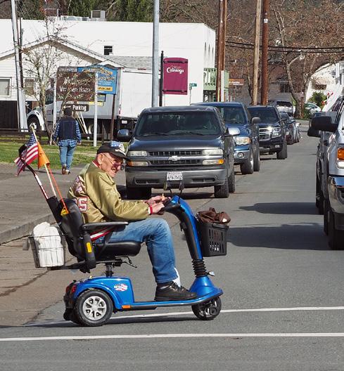
Vision Zero applies to all roadway users, traffic collision injuries, and traffic-related deaths. It is a particular focus to protect vulnerable users, including people walking; elderly persons or persons with disabilities; people using skateboards, scooters, or electric-assist vehicles; people riding bicycles; and those using other mobility devices. This requires a change in the traditional approach to roadway safety.
WE MUST AFFIRM THE FACT THAT EVERY ROADWAY DEATH AND LIFE-ALTERING INJURY IS PREVENTABLE.
—THE VISION ZERO NETWORK
Figure 38 shows how Vision Zero differs from traditional traffic safety approaches:
TRADITIONAL APPROACH
• TRAFFIC DEATHS ARE INEVITABLE • PERFECT HUMAN BEHAVIOR
• PREVENT COLLISIONS • INDIVIDUAL RESPONSIBILITY
• SAVING LIVES IS EXPENSIVE
VS
VISION ZERO
• TRAFFIC DEATHS ARE PREVENTABLE • INTEGRATE HUMAN FAILING
INTO APPROACH
• PREVENT FATAL AND SEVERE CRASHES • SYSTEMS APPROACH
• SAVING LIVES IS NOT EXPENSIVE
Source: Visionzeronetwork.org
FIGURE 38 . TRADITIONAL VS VISION ZERO APPROACH
VISION TO ACTION
The Advancing Mobility 2045 plan will establish the framework to achieve a zero severe and fatal injury goal in Napa County using a data-driven, cooperative approach. The Vision Zero Network notes that programs that are successful in meeting a Vision Zero goal include the following criteria:
1. A clear goal of eliminating traffic fatalities and severe injuries has been set 2. Elected officials are committed to Vision Zero 3. A Vision Zero plan or strategy is in place, or elected officials have committed to doing so in a clear timeframe 4. Key departments (including police, transportation, and public health) are engaged in the effort
COMPLETE STREETS ARE HEALTHY STREETS
The California Department of Transportation (Caltrans) adopted a complete streets directive in 2010, which requires the design and implementation of facilities that support all modes of transportation, including biking, walking, and transit. The implementation of Complete Streets in the Bay Area is a requirement to receive regional funding. All Napa County jurisdictions have adopted complete streets policies into their general plans.
Improving multimodal infrastructure is key in achieving a zero fatality goal. This includes ensuring adequate bicycle and pedestrian infrastructure. Efforts to build out the bicycle and pedestrian network in Napa County have been successful in recent years. Combined, the jurisdictions in Napa County have invested over $9 million through the Active Transportation Program for Multiuse (Class I) facilities that will provide safe corridors for walking and bicycling. The County, Cities, and Town have also made significant progress identifying gaps in their pedestrian networks which is reflected in the adopted Countywide Pedestrian Plan (2016). The 2019 update to the Countywide Bicycle Plan includes recommendations for over 500 miles of new bicycle infrastructure to create a safer, more connected network with a focus on reducing the level of traffic stress (a measure used to reflect the perceived stress by bicyclists on roadways).
HEALTH
The obesity epidemic is prevalent throughout the entire population, affecting both adults and children. Locally, the obesity rate for adults is on the rise. In Napa County, the adult obesity rate, measured using body mass index, rose from 26.4 percent in 2011–2013 to 29.3 percent in 2014–2016—an increase of 11 percent. The 2014–2016 Napa County adult obesity rate is also higher than the statewide level of 27.6 percent.
OBESITY
The County Department of Health and Human Services has identified obesity as one of the County’s high priority health issues. Although diet plays a major role in this phenomenon, a sedentary lifestyle is also major factor. Studies have shown a correlation between communities with high automobile ownership and poor health.
As reported in the 2018 Napa County Community Health Assessment (CHA)24, “obesity is a serious, chronic disease that increases the risk of heart disease, stroke, type 2 diabetes, certain cancers, infertility, mental health, and death (all-causes). In fact, if the obesity epidemic is not addressed, the current generation of children, for the first time in 100 years, is expected to have a shorter life expectancy than their parents.” The CHA will inform the update of the Community Health Improvement Plan (CHIP) which is currently being updated.
Figures 39 and 40, show the obesity rate charts for Adults and Children in Napa County. While all these figures are alarming, active transportation modes provide an opportunity to improve the general health of the community and help curb these illnesses. Building and expanding infrastructure for bicyclists and pedestrians such as sidewalks and bicycle paths can encourage the population to use alternatives modes of transportation and maintain a healthy lifestyle. A key strategy in the 2014 CHIP is to build capacity for people to be more physically active each day by walking or biking to school, to work, or on short trips. To implement this strategy the CHIP recommends: y Providing opportunities for the community to learn how to safely ride bicycles for increased exercise and active transportation y Increasing the proportion of individuals who use active transportation for trips of two miles or less
TRANSPORTATION AND RESPIRATORY ILLNESS
Vehicle emissions are a primary cause of respiratory diseases, such as asthma and Chronic Obstructive Pulmonary Disease, as well as other health-related effects, including cancer. While automobiles are much cleaner today than earlier generations, the steady increase in vehicle miles traveled (VMT) means that local air quality continues to be negatively affected.
FIGURE 39 . PERCENTAGE OF THE ADULTS THAT ARE OBESE IN NAPA COUNTY AND CALIFORNIA
29% 28%
NAPA COUNTY
CALIFORNIA
Source: California Health Interview Survey, 2014–2016
FIGURE 40 . PERCENTAGE OF STUDENTS WITH AN UNHEALTHY BODY COMPOSITION IN NAPA COUNTY AND CALIFORNIA
17% 20%
NAPA COUNTY
Source: California Board of Education, 2017
CALIFORNIA
In fact, Napa County is in the worst quartile of counties in California with respect to asthma prevalence.25 The Bay Area as a whole has a non-attainment status for California air quality standards for ozone and particulate matter, including PM 2.5, which has been shown to be a leading contributor to respiratory disease in children. NVTA’s efforts to reduce overall VMT in the county are an important local contribution to the regional (and even global) efforts to reduce air pollution.
LONG COMMUTES AND TRAFFIC CONGESTION CAN CONTRIBUTE TO STRESS AND MENTAL HEALTH ISSUES
Studies have linked stress levels to the frequency of traffic congestion, and the satisfaction with, and the duration of, the commute. Individuals who endure traffic congestion report significantly higher levels of stress than those subject to infrequent traffic congestion. Similarly, individuals with longer commutes report higher levels of stress compared to those with shorter commutes. More importantly, those who are satisfied with their commutes are the least likely to be stressed.26 The average commute to work time for Napa County residents (2014-2018) was 24.9 minutes, a few minutes less than the statewide average of 29.3 minutes. This ranks Napa County 33rd among the 58 California counties.27
Stress, especially chronic stress, has been linked to a wide range of negative health effects. The biochemistry of stress lowers immunity and disrupts the normal functioning of digestion, excretory, and reproductive systems. Over extended periods, routine chronic stress can promote more frequent and severe viral infections, such as the flu or common cold, as well as render certain vaccines, such as the flu shot, less effective. According to the National Institute of Mental Health, over time, routine stress may lead to serious health problems, such as heart disease, high blood pressure, diabetes, depression, anxiety disorder, and other illnesses.28
Reducing traffic congestion and commute times will result in healthier communities. This can be achieved by rethinking how we commute and how we plan our communities so that walking, bicycling, and taking public transit are more enjoyable, safe, and practical ways to travel for daily needs.
25 California Department of Public Health. County Asthma Data Tool. https://www.cdph.ca.gov/Programs/CCDPHP/DEODC/EHIB/CPE/Pages/CaliforniaBreathingCountyAsthmaProfiles.aspx 26 Haider, Murtaza & Kerr, Kenneth & Badami, Madhav. (2013). Does Commuting Cause Stress? The Public Health Implications of Traffic Congestion.
SSRN Electronic Journal. 10.2139/ssrn.2305010. 2013. 27 Statistics from American Community Survey 2018: 5 Year Estimates, United States Census Bureau Table DP03 as found on California Average Commute
Time by County. http://www.indexmundi.com/facts/united-states/quick-facts/california/average-commute-time#map 28 National Institute of Mental Health. “5 Things You Should Know About Stress.” http://www.nimh.nih.gov/health/publications/stress/index.shtml