5 minute read
News in brief

BACKING OUR BOAT
NIWA’s forecasting team is strapping in for an intense couple of months ahead as Emirates Team New Zealand prepares to head out on the Hauraki Gulf to defend the America’s Cup. NIWA is providing race-critical support to Emirates Team New Zealand as the official supplier of weather forecasting and marine current information to the defence campaign. Members of the public can get a taste of what that involves – both above and below the water – by heading down to Spark’s 5G Race Zone at Auckland’s Wynyard Quarter. The free, 60-minute experience runs through till the end of March and includes interactive displays explaining how NIWA science is helping a fast boat, sail even faster.
Advertisement
CYCLONE WATCH
Forecasters are keeping a close watch on conditions north of New Zealand as this summer’s La Niña weather pattern raises the cyclone risk. New Zealand normally averages one ex-tropical cyclone per season, but the last La Niña weather event during the 2017/18 summer brought ex-cyclones Fehi, Gita and Hola. The heightened cyclone risk comes as New Zealand experiences a third marine heatwave in four years and follows last year’s record warm winter which saw temperatures 1.14°C above average. Seven of New Zealand’s 10 warmest winters on record have occurred since the year 2000.
Dave Allen
TAONGA AT RISK
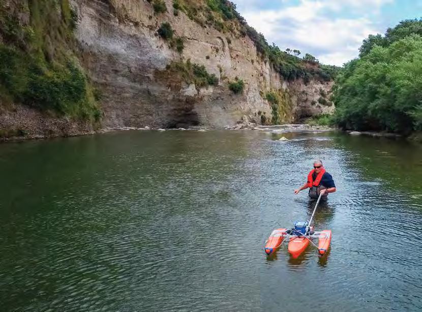
Seven native freshwater species are at particular risk from climate change. New research, carried out by Te Wai Māori Trust and NIWA, looked at 10 taonga freshwater species. Each was measured for its exposure to climate change and its ability to respond. Tuna (longfin eel) and piharau (lamprey) were ranked as most at risk. Tuna (shortfin eel), kākahi (freshwater mussels) and three fish species (īnanga, banded kōkopu and kōaro) were all rated as highly vulnerable. Kōura (freshwater crayfish), giant kōkopu and aua (yellow-eyed mullet) were found to be at moderate or low risk.
OCEAN LOCKDOWN
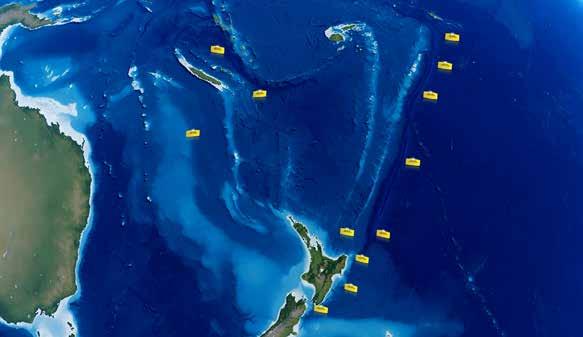
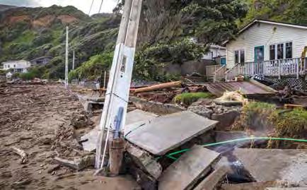
Ocean monitoring duties amid a global pandemic saw research vessel Kaharoa and her six-person crew face a gruelling 75-day voyage deep into the Indian Ocean. Covid-19 restrictions meant the crew could not disembark during the two-and-a-half-month voyage, making it the longest single trip Kaharoa has made. The team successfully deployed more than 100 ocean monitoring floats in the waters west of Australia as part of the Argo international science project. Argo maintains a worldwide network of more than 3,800 floats, monitoring ocean conditions and the role they play in our climate and weather systems.
Argo deployment voyages by RV Kaharoa.
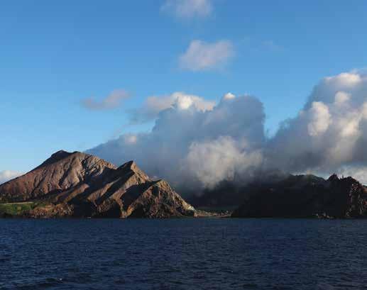
SUBMARINE SCAN
NIWA scientists returned to the waters around Whakaari/White Island in August 2020 to survey the seafloor after the 2019 fatal eruption. The area is known for its underwater canyons and thermal vents, and researchers were scanning the island’s submarine environment for significant physical changes or new areas of volcanic activity. Marine geologists aboard RV Tangaroa used multibeam echo-sounders to track large sediment deposits caused by the eruption and to detect gas traces bubbling through the water column. Methane and carbon dioxide readings taken during the 9-day voyage will also help build a detailed map of features on the seafloor.
Pascale Otis Alvin Setiawan
HATCHING A NEW CATCH
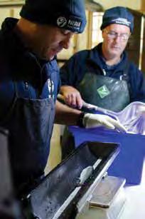
A breakthrough by aquaculture scientists at NIWA’s Northland Marine Research Centre (NMRC) looks set to pay dividends for New Zealand’s salmon farming industry. Commercial operators want to scale up Chinook salmon production, but existing hatcheries are struggling to generate the number and quality of juvenile fish required. Recent trials at NIWA’s land-based aquaculture facility at Ruakākā show production can be ramped up if hatchery densities and conditions are optimised. The next stage of the programme will NIWAsee young salmon transferred to the NMRC’s recirculating aquaculture system to assess the benefits.
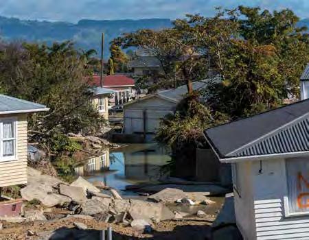
FLOOD PLANS
A NIWA-led research team has launched an ambitious five-year programme to create the first comprehensive analysis of the country’s flood risk associated with climate change. Flooding is already one of New Zealand’s most costly natural hazards and flood events are expected to increase as a warming climate brings higher rainfall and rising seas. However, our current understanding of flood hazard and vulnerability varies widely across regions. The $15.3 million research project will draw together iwi, councils, central government and industry, with land-use information helping to map flooding hotspots across the whole of New Zealand. The Endeavour-funded programme aims to build flood-resilient communities and will involve widespread collaboration with other CRIs, National Science Challenges and universities.
Dave Allen
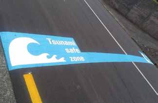
HIGHER GROUND
About 430,000 New Zealanders live within tsunami evacuation zones, according to an investigation carried out by NIWA scientists. The national assessment was carried out to improve disaster management by identifying vulnerable populations living within tsunami risk areas. It found nearly 10 per cent of New Zealanders – including 150,000 children and elderly – currently live within designated evacuation zones. Population exposure is highest in Auckland, followed closely by Canterbury and the Bay of Plenty. A total of 139 retirement homes were identified within existing evacuation zones.
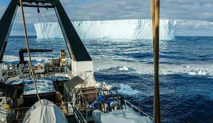
DEEP SOUTH
NIWA’s Tangaroa will arrive back in Wellington in mid February with a wealth of new Antarctic oceanographic data after a 45-day research expedition to the icy waters of the Ross Sea. About 40 NIWA researchers and crew, along with colleagues from Otago University, have been working round the clock as Tangaroa carefully tracks her way along the coast of the southern continent. The main focus of the multi-disciplinary scientific voyage is to investigate key environmental and biological processes in Antarctic waters and to assess likely responses of the Ross Sea Marine Protected Area to future change. The Ross Sea is the largest Marine Protected Area in the world, and the voyage is part of New Zealand’s long-term commitment to scientific monitoring in the region.