1 minute read
Sea level


As the world’s oceans become warmer and glaciers melt due to increasing global temperatures, the volume of seawater rises. In some areas, this is offset to some extent because the land is still rising after the removal of the weight of ice following the end of the last ice age. This means that some areas will experience rising sea levels while others will experience falling sea levels (Figure 9).
Sea level rise can degrade habitat or lead to its loss in coastal areas. It also makes coastal areas more vulnerable to storm surges. This can impact the distribution of important habitat-forming species such as eelgrass and kelp.
Advertisement
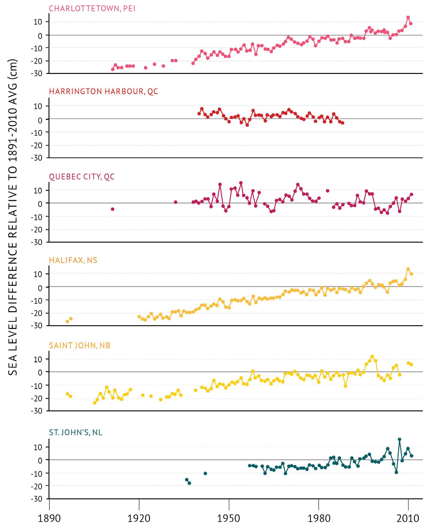
Changes in sea level are measured using tide gauges and satellite measurements. In some areas, data are available from the late 1800s. For others, data starts in the mid1900s. The trends are reported in relation to the average sea level measurements for 1981–2010 in each area.
STATUS AND TRENDS
• To the south, sea level is rising 2 to 4 mm per year (for example, Halifax,
Saint John, Charlottetown, St. John’s). • In the north, sea level is falling 2 mm per year (for example, Nain). • The direction of sea level change along the northern Gulf of St.
Lawrence coast varies. It is falling in Harrington Harbour and rising at
Sept-Îles. In the southern St. Lawrence
Estuary there is very little evidence of changing sea level at this time. RELATIVE SEA LEVEL DIFFERENCE (cm)
Figure 9 : Sea level difference for locations across the Atlantic bioregions relative to the average for 1981–2010 in each area (See Figure 1 for locations.). Glacial melt along with ocean warming is causing sea level to rise in many areas along the Atlantic coast at a rate of 2 to 4 mm/year while falling in others.
A view from Signal Hill, looking down towards Fort Amherst in St. John’s, Newfoundland. Credit: Laura Lefurgey-Smith.


