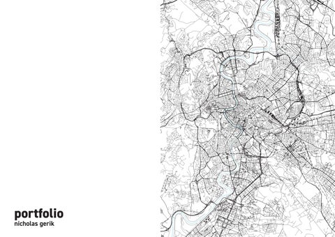
portfolio nicholas gerik
the thread reconnecting austin
Located five kilometers north of downtown Austin, Texas, the Hancock Center is a mid-century automotive relic that has suffered over two decades of steady decline. Compounded by its proximity to Interstate 35, the sprawling development currently acts as a physical barrier, severing local communities and isolating adjacent neighborhoods from historically African American and Hispanic areas to the east. In response, our 2026 ULI Hines Student Competition entry reimagines the site as a vibrant, walkable, mixed-use district centered on residential density and multimodal transit. Operating within strict competition parameters, the master plan preserves two key anchors, the existing H-E-B grocery store and a medical center in a repurposed Sears, while seamlessly incorporating TxDOT’s upcoming I-35 expansion through 2030. Backed by a robust financial pro forma, the proposal proves both the physical transformation and economic feasibility of reconnecting these neighborhoods. The plan prioritizes public health, multimodal transit, and expansive green infrastructure. At its heart is The Thread, a central trail network that seamlessly integrates the project with the surrounding urban fabric. By extending TxDOT’s cap-and-stitch mitigation efforts through proposed highway caps, pedestrian bridges, and sunken transit corridors, the design dampens noise pollution, restores neighborhood mobility, and equips surrounding communities with equitable access to public space. Beyond physical density, the project reduces auto-dependency while expanding access to employment, education, healthcare, and civic life. Bioswales, open lawns, and urban agriculture hubs promote active recreation and local food production—a focus particularly crucial given the site’s adjacency to historically underserved districts. Equally vital is the plan’s capacity for social repair. By incorporating community porches, shared spaces, and accessible neighborhood amenities, the project creates an inclusive public commons where residents can gather, transit, shop, and reinforce local identity. Ultimately, The Thread serves as connective tissue: stitching together fractured neighborhoods, repairing historic divides, and bridging transportation, culture, and opportunity.
site plan* *produced in collaboration with University of Arkansas students
greenway rendered perspective
transportation diagram interstate 35 redevelopment, phase 1
interstate 35 redevelopment, phase 3 PUBLIC GARDENING SPACES AS STUDENTS ARE A HIGH RISK GROUP FOR FOOD INSECURITY
RAIN GARDENS IN BUILDING GAP TO MAXIMIZE ON SITE WATER RETENTION
BUS STOPS INTEGRATED INTO THREAD LOCATIONS TO PROMOTE MULTI-MODEL CIRCULATION
Hancock Commons
Student Housing Garden
43rd Street
The Weave
Grainline Access Road
The Thread 41st Street Parking Lot
42nd Street
42nd Street
north-south section
isometric thread diagram*
COMMUNAL SEATING TO PROMOTE CONNECTING WITH NEIGHBORS
CONNECTING BIKING & WALKING “THREAD” PATH FROM THE STITCH COMMUTER LINE STOP
centerton new town integrated urbanisms
In the fall semester of 2025, I was personally recruited by the Department Head of Landscape Architecture to participate in Integrated Urbanisms: an exclusive, interdisciplinary four-person studio co-taught by the Dean of the Fay Jones School of Architecture and Design alongside leadership from the Northwest Arkansas Urban Land Institute (ULI) district council. Centerton, Arkansas, is a rapidly expanding suburb adjoining Bentonville, the global headquarters of Walmart. Seeking to match Bentonville’s pivot toward a vibrant, dense urban core, Centerton engaged our team to conceptualize a new civic heart for the municipality. Working directly with city officials, conducting group site analysis, and synthesizing data from ULI’s Technical Assistance Panel (TAP) Report, our team authored Centerton New Town—a resilient, mixed-use district seamlessly integrated into regional transit and trail networks. The master plan anchors the municipality’s future growth with a robust civic framework, including a public library, library gardens, a sculpture park and flood basin, a central pavilion and event lawn, a town square, and hundreds of mixeddensity housing units. Bisecting the development is the Coffelt Trail, a primary active-transportation spine named after Centerton’s native Coffelt apple. In addition to running through the site, the trail intersects four secondary trail networks and integrates directly with Bentonville’s trail network. To mitigate severe flash flooding characteristic of the Ozark ecoregion, Centerton New Town embeds green infrastructure directly into the site plan. The layout utilizes continuous green spaces as retention catchment zones, using subtle topography to guide stormwater run-off toward Centerton Lake and the regional fish hatchery. Positioned near the headwaters of the Elk River Watershed, the plan prioritizes downstream water quality, protecting aquatic ecosystems and communities within the Cherokee Nation reservation boundaries. Water quality is actively managed using bioswales, pervious paving, green roofs, and internal residential courtyards that maximize groundwater infiltration and reduce urban run-off. The project concluded with a comprehensive financial pro forma detailing development phasing, capital expenditures, and projected revenues from the master plan level down to per-unit metrics. At the semester’s end, our team presented the final master plan to municipal leaders and regional developers at the Urban Land Institute Northwest Arkansas Conference in Fayetteville, Arkansas.
site plan
*produced in collaboration with University of Arkansas students
CENTERTON RETAIL DISTRICT
NEW OLD TOWN
ARTS & CULTURE DISTRICT
existing conditions
APPLEWORK PARK
CENTERTON PLAZA
urban axon
proposed trails
centerton square isometric
density before design
density after design
twin arches bridging the gap
Standing at 192 meters, the Gateway Arch in St. Louis, Missouri, remains one of the most iconic monuments in the United States, symbolizing the city’s historical role in westward expansion, trade, and river travel. Directly across the Mississippi River in East St. Louis, Illinois, sits Malcolm W. Martin Memorial Park—a underutilized parcel anchored by a defunct geyser and a modest viewing platform. East St. Louis has suffered decades of industrial disinvestment and population decline following the collapse of the regional steel industry. Twin Arches Park transforms this neglected riverfront into a vibrant civic landmark designed to foster exploration, community gathering, and economic revitalization while respecting the visual prominence of the Gateway Arch. Located a short walk from the St. Louis Metro and historic Eads Bridge, the master plan integrates the existing riverfront trail and establishes future multi-modal greenway extensions eastward along Trendley Avenue. The site features a flexible multi-use lawn, a public outdoor amphitheater, and a heavy-duty event promenade designed to accommodate festival staging and service vehicles. Dominating the eastern portion of the site, the Gateway Lagoon expands the legacy geyser reservoir into an interactive water feature complete with artificial islands, winding boardwalks, and scenic overlook points. The lagoon is recharged by daylighting a previously culverted creek, which overflows into an adjacent bioswale network to the south—providing essential flood mitigation, stormwater filtration, and ecological habitat restoration. At the heart of the site stands the relocated Blues Museum, celebrating St. Louis’s seminal contributions to American musical heritage. Positioned near the amphitheater, the museum bridges indoor educational exhibits with live outdoor performances. Spanning the Gateway Lagoon is the Twin Arch Bridge. With it’s shape designed to resemble an arch from several angles, the Twin Arch Bridge serves as both a sculptural monument complementing Saarinen’s original Arch and a symbolic gateway celebrating the historical connection between East and West. The bridge’s elevated deck preserves sightlines toward the St. Louis skyline, framing the iconic monument across the river.
site plan
twin arch bridge rendered perspective
gateway lagoon rendered perspective
island section Parking
Continental Grain Ave. Eads Bridge
Parking Gateway Stage
Auxillary Event Space
Front St.
Mississippi Riverfront
Backstage Tunnel
P
P
P
P
N. Gateway Lagoon (WIP)
P Boathouse
Ferry Dock
Mississippi Stage
P
National Blues Museum
P
Twin Arch Bridge
Trendley Ave. East St. Louis
Event Space
Gateway Lagoon (WIP) Event Space
Central Grounds
Tallgrass Preserve
Wetlands Area
P
Parking
amphitheater section
festival and event areas map
circulation diagram *Green represents accessibility for amenities, merchandisers, and vendors during events and festivals
existing site and surrounding context Twin Arches Park East St. Louis, Illinois Outside Connections
l’ascenzione dell’arte unlocking the canvas
Villa Ada Savoia is a 180-hectare public green space located in Municipio II, Rome, Lazio, Italy. Like many city parks in Europe, it began as a hunting park for nobility, particularly the House of Savoy, before gradually opening to the public. L’Ascensione dell’Arte was conceived through extensive travel throughout my summer in Rome. Throughout my travels to London, Malta, and Madrid, I took notice of the various public art canvases around the cities. While public art is far more common in Europe than other parts of the world, legal public art canvases are still quite uncommon, with Rome having no such place anywhere within the city limits. In addition, Rome has quite a young culture compared to many other European cities and a vibrant nightlife. When tasked with designing, the only constraint I was presented with was that the site must possess a path that crosses the hill on its eastern side. In order to create a path that climbs the nearly 30-meter hillside, a vast amount of retaining walls would have to be used, which inspired me to pursue a public art canvas. The two precedents that I studied for this project were Graffiti Pier in Pennsylvania, USA, and the Waterloo Graffiti Tunnel in London. Both of these public canvases take advantage of vast amounts of concrete used for infrastructural purposes, and both are very successful. Successful enough, in fact, that when creating the renderings for this project, I used personal photos of public art from the precedent sites as examples.
section a
section b
The site serves both the local community and the larger Comune di Roma by offering public spaces, cafés, and play mounds for children. The local residential area greatly benefits from improved access to Villa Ada as well as a multi-modal transit connection to the local suburban rail line. An additional task when designing was to design around the Sustainable SITES v2 design protocol, which scores different sites into rankings depending on their sustainability, energy use, environmental effects, and impact on the local community. This design was able to successfully achieve 13 goals through design. The L’Ascensione dell’Arte project seeks to create a functional western entrance to Villa Ada as well as a community space and cultural landmark for the city of Rome. By facilitating a public canvas for legal street art and mural creation on its long retaining walls, the design will not only create a recognizable landmark and destination for the city of Rome, but it will also create a site where citizens are free to express the arts publicly—a concept that the city of Rome is very acquainted with.
villa ada and surrounding urban context
site plan
rome sketches analyzing the city Throughout my time in Rome I took to sketching various piazzas, buildings, roads, and other aspects of the city. My primary motivation was to improve my understanding of the city as one whole, analyzing corridors, transit networks, public spaces, and separation of spaces designed at a human scale. In the case of l’Ascenzione dell’Arte, sketching was a key component in improving my understanding of how the west side of Villa Ada Savoia interacted with the rest of the park as well as with neighboring residential and community areas. Additionally, sketching different sides of Villa Ada enabled me to separate the site into unique character areas, which allowed me to mentally condense the massive size of the space into a much more understandable version.