5 minute read
Safety Awareness Range Safety and Design


By Karl Powell, Geographic Information Systems Analyst
Imagine seeing the world not just as streets and landscapes but as data layers revealing hidden patterns and connections. That’s precisely what geospatial technology does: it transforms ordinary maps into powerful tools helping us choose ideal locations for military exercises, track logistical movements or even find the fastest pizza delivery route.
Whether through GPS guiding military movements, satellite imagery monitoring the battlefield or Geographic Information Systems helping military installations design smarter infrastructure, geospatial technology is the ultimate backstage pass to how the world really works. The best part is it’s only getting more advanced, making everyday life more efficient, sustainable and way cooler.
The Range Safety and Design Geographic Information Systems (RS&D GIS) team plays a crucial role in the U.S. Marine Corps by ensuring the safe and efficient use of training areas and ranges for live-fire activities. Using advanced geospatial analysis, the team develops danger zones and tools enabling live fire in areas that might otherwise be restricted, ensuring safe separation between training activities and non-participating personnel.
To optimize training areas while maintaining strict range safety standards, the team conducts technical assistance visits, assessing and documenting current conditions. Additionally, they support developing and maintaining the Range Manager’s Toolkit (RMTK), a suite of tools designed to help range personnel and warfighters conduct live-fire exercises safely. The RS&D GIS team plays a key role in testing new releases of tools, disseminating software updates and providing end-user support for RMTK across installations, ensuring the toolkit effectively meets operational needs.
As the functional data set leads for the Military Ranges and Training dataset, the RS&D GIS section is responsible for the final approval, ensuring accurate and up-to-date data serving as the foundation for various geospatial products, including Military Installation Maps (MIMs). These maps are designed primarily for military training and land navigation and produced in accordance with the USMC Range and Training Area Management (RTAM) MIM specification documents.
The RS&D GIS team is responsible for developing these maps and ensuring data from the Military Ranges and Training dataset is accurately represented. Once MIMs are created, they undergo an internal review to verify accuracy and compliance with Marine Corps and National Geospatial-Intelligence Agency (NGA) standards. They are then submitted through the official task tracking system for review by Range Control and USMC Installation Commands Installation Geospatial Information and Services Installation Managers.
The Range Control Officer acts as the Action Officer in the first round of official reviews for the MIMs to assess the maps for relevance to training and ranges on the installation before a final review is conducted by GS-15 or colonel-level senior leadership. Once approved, the maps are cataloged on the NGA print-ondemand site, ensuring high-quality, reliable maps are available for USMC training.
To maximize the efficiency of the Marine Corps, Department of Defense and U.S. Government resources, MIMs are designed for long-term use, typically spanning three to five years.
These maps are mass-produced, printed and assigned a Reference Number by the NGA, along with a National Stock Number by the Defense Logistics Agency, ensuring easy access and distribution. The RTAM Branch recommends updating MIMs at least every five years to refresh elements such as the declination diagram and magnetic declination, maintaining their accuracy for ongoing use. In addition to standard MIMs, MIM-ICS (Military Installation Map – Installation Commander Special) products are created for short-term, mission-specific needs. These maps are customized based on existing MIMs to address unique planning requirements, such as temporary training areas, future construction, airspace requirements or specialized operational needs.
While MIMs and MIM-ICS are the primary focus, the RS&D GIS section is also supported by an NGA Defense Geospatial Co-Production Program team. This team assists in fulfilling foundational geospatial intelligence responsibilities related to Marine training by generating geospatial features, producing geospatial products and providing geospatial training to Marines and civilians. This effort is particularly valuable for forwarddeployed Marines, providing them with accurate geospatial data and tailored mapping products for their specific training needs worldwide.
In an era where precision, safety and efficiency are paramount, the RS&D GIS team is vital in optimizing Marine Corps training areas for mission readiness. The team provides critical mapping and intelligence to support live-fire exercises, land navigation and operational planning through advanced geospatial analysis, meticulous data management and collaboration with key defense agencies. As geospatial technology evolves, the RS&D GIS team remains at the forefront, adapting to new challenges and enhancing Marine Corps training effectiveness. Their work safeguards personnel and resources and strengthens the foundation for future military operations, ensuring Marines have the tools and data to train smarter, safer and more effectively.
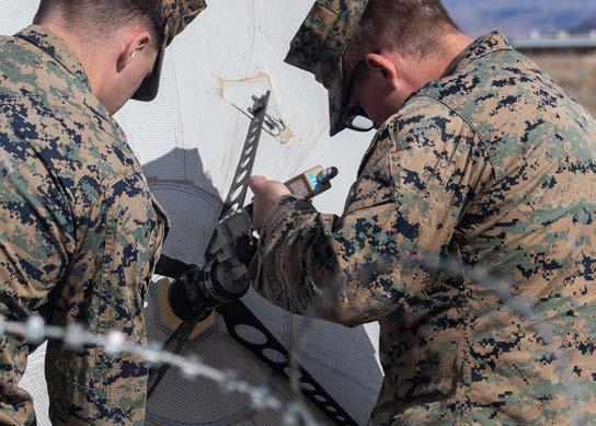
Photo Credit: U.S. Marine Corps Cpl. Bretton Coke, left, a digital wideband systems maintainer and Cpl. Trey Smith, an intelligence surveillance reconnaissance systems engineer, both assigned to the operations control element with 1st Radio Battalion, I Marine Expeditionary Force Information Group, assemble an inflatable satellite antenna at Naval Air Station Fallon, Nevada, during Exercise Resolute Hunter 25-1, Oct. 31, 2024. (U.S. Marine Corps photo by Staff Sgt. Nate Carberry)