Select Work Urban Design & Planning
Multistudio is a multidisciplinary architecture, design, and planning practice with five studios nationwide, each with the mission to enrich communities and the human experience through the built environment. Diversity of thought, people, and practice areas enables us to explore place and spark economic, social, and environmental change. And although we take on a variety of projects, neither size nor type dictates their importance—their impact does.
Founded 1974 Employee Owned
Our Studio
Kansas City
Lawrence
New Orleans
Phoenix
San Francisco
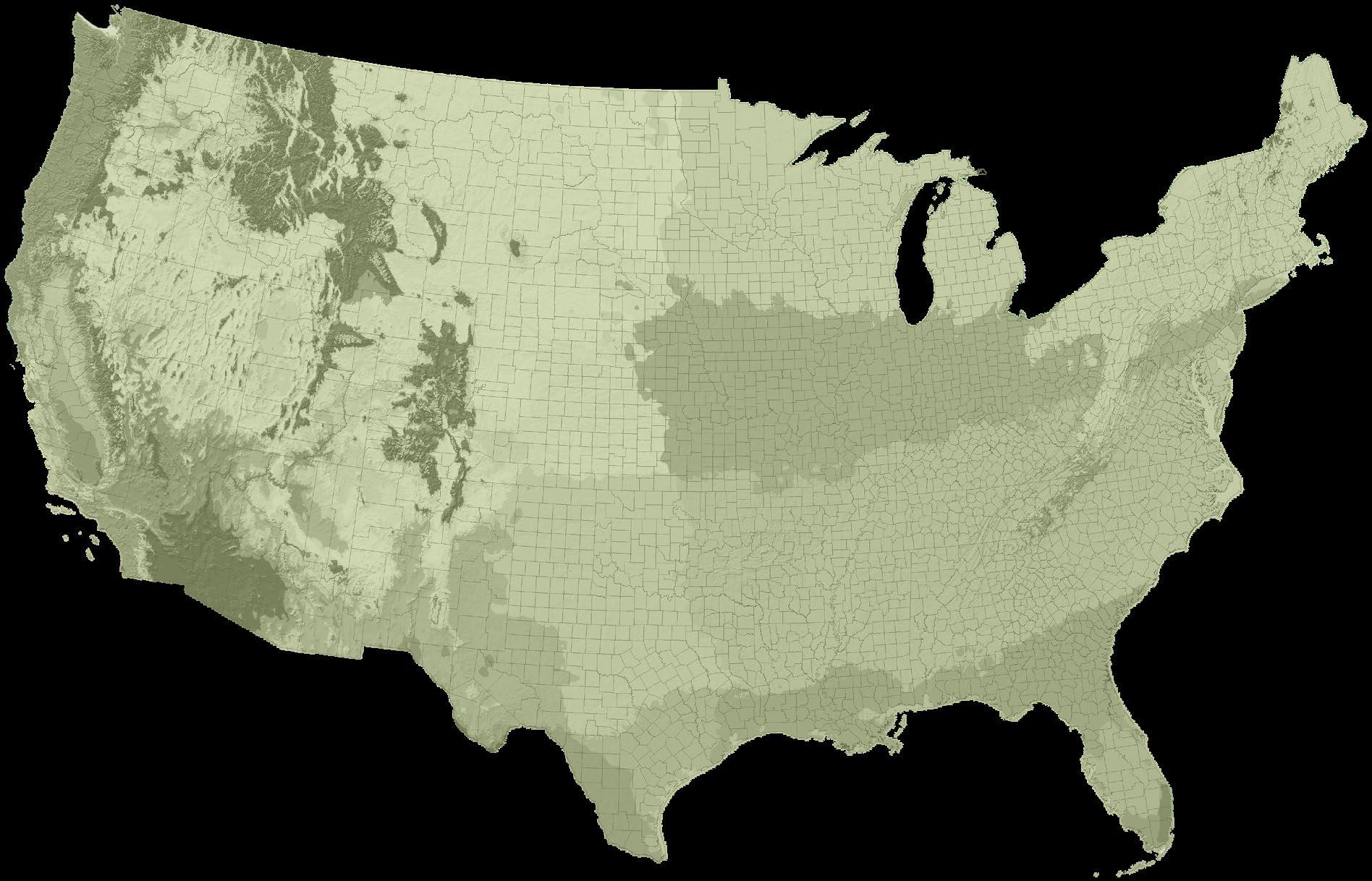
Rooted in place, our work extends beyond geography to address shared challenges.
Since its founding in 1974, Multistudio has grown into a socially engaged architecture, design, and planning studio that pushes the boundaries of a service-based practice. We draw on the expertise of our network to deliver sustainable, place-specific solutions, leveraging the connections that we maintain within the regions we serve.
Our studios are embedded in the communities we call home, giving us a deep understanding of regional landscapes, cultures, and challenges. Yet the issues shaping cities today—housing, mobility, climate resilience—extend far beyond any one geography. When projects align with our expertise and shared values, our teams collaborate across studios to bring ideas, insight, and energy wherever they are needed.
Phœnix
New Orleans
Lawrence
Kansas City
San Francisco
Approach
We are multiple disciplines, and everevolving in the field of design to meet future needs. We believe design is inherent in everything we do and carries multiple responsibilities to positively impact people, organizations, communities, and the environment.
Elevating Diverse Voices
Great design begins with people. At Multistudio, we cultivate a culture that encourages curiosity, mentorship, and accountability across disciplines. By embracing a wide range of perspectives, we ensure that our ideas are richer and our solutions more enduring. This inclusivity strengthens both our practice and our projects, allowing every team member to bring their full identity and expertise to the work. The result is design that not only reflects creativity and skill but also honors the lived experiences of those who shape it.
Building Trust Through Partnership
We view our partners—clients, consultants, and collaborators—as integral to the design process. Transparent dialogue and shared accountability enable us to align on goals and elevate each other’s expertise. By working closely with cost estimators, construction managers, and community stakeholders, we build trust and momentum at every stage. This collaborative framework results in designs that are both resilient and precise, shaped by the collective intelligence of many. Our partnerships are not transactional—they are the foundation for delivering environments that endure and inspire.
Designing with Community Insight
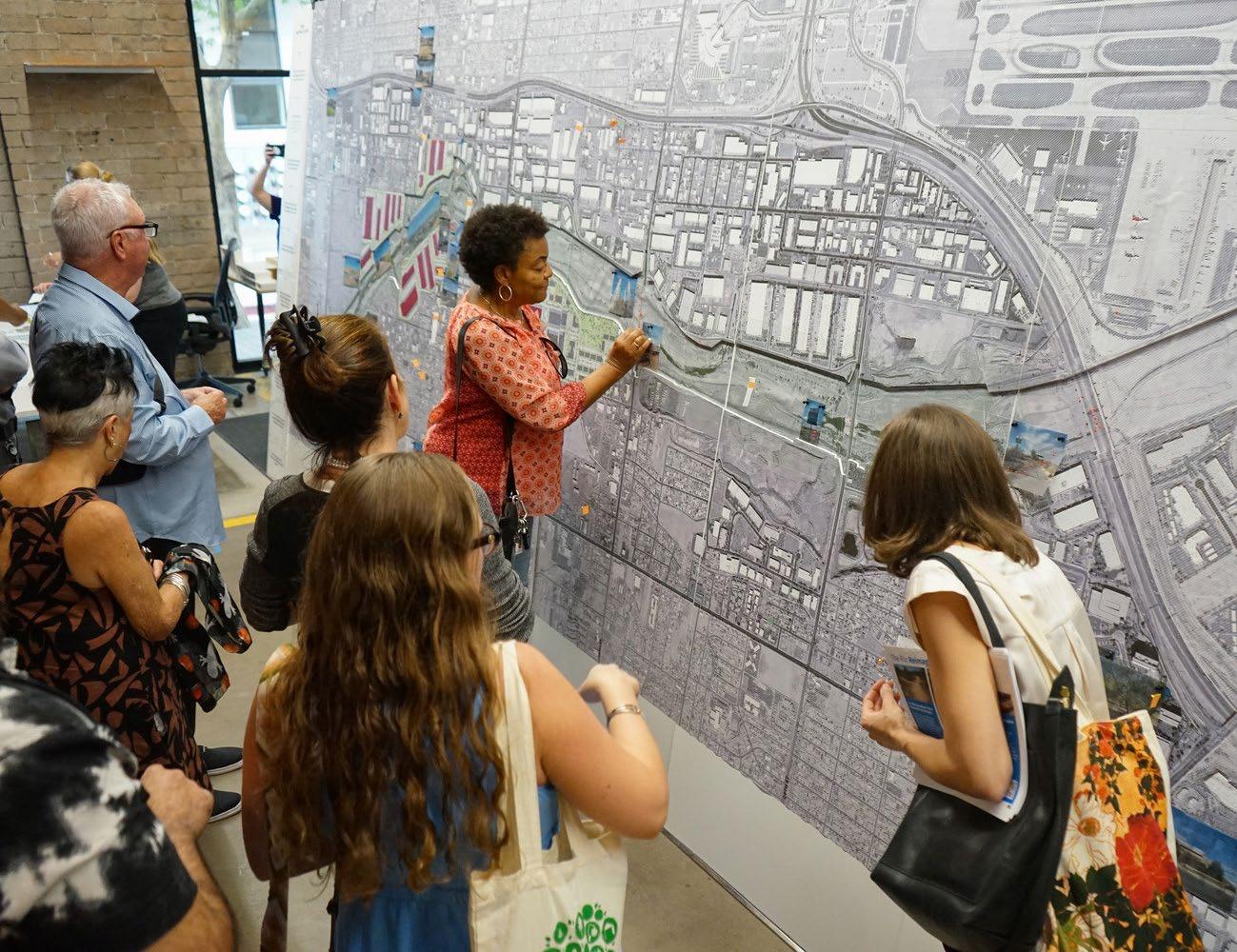
Communities are central to our work, shaping spaces that foster identity, pride, and belonging. We engage directly with diverse voices to uncover needs and aspirations, weaving their insights into every stage of design. From rural school districts to urban neighborhoods, our projects are catalysts for connection, well-being, and shared prosperity. We recognize that authentic community engagement requires more than listening sessions—it means building trust, elevating local knowledge, and designing with transparency. By amplifying these perspectives, we create environments that feel rooted in place and culture while preparing for future change. Each project is an opportunity to strengthen bonds, expand access, and spark lasting impact that extends beyond the building itself.
Advancing Climate Responsibility
We design with the understanding that environmental stewardship is inseparable from social responsibility. Climate change poses profound challenges, particularly for vulnerable communities, and our work addresses these realities head-on. By prioritizing healthy materials, low-carbon strategies, and adaptable systems, we create environments that safeguard human health while restoring ecological balance. Our designs not only minimize harm but actively advance resilience, wellness, and equity. At Multistudio, sustainability is more than a checklist—it is a commitment to shaping places that inspire future generations to thrive.
How We Integrate
Design is expansive—a dialogue across disciplines and scales. When these elements are in conversation, they form environments that are cohesive, intentional, and lasting.
We think of design as a set of concentric circles, each reinforcing the next: at the largest scale is city design, followed by architecture, interiors, and finally, brand. Each discipline contributes to a greater whole—from the structure of a city block to the typography on a sign.
Every layer matters, and together they shape more than just a building—they define the identity, value, and lasting impact of a place. When these layers are in synchronicity, design becomes more inclusive, more intentional, and more capable of serving the diverse communities it touches.
A Shared Vision
City design, architecture, interiors, and brand work as one—no silos, no delays.
Real-Time Partnering
Designers and strategists are in constant dialogue, making decisions as projects evolve.
Fluid Communication
Each of our teams stays in sync, so decisions keep pace with your project.
Built-In Flexibility
We move fast—responding to change with clarity, creativity, and confidence.
Seamless Execution
Ideas that translate into action, with every discipline reinforcing the next.
Proactive Solutions
We anticipate needs and deliver integrated solutions before they're requested.
Great cities are shaped through intentional design that supports connection, identity, and shared experience.
From Vision to Implementation
Cities are the physical manifestation of communities’ priorities, values, and aspirations. The way they are organized and shaped ultimately defines how they are experienced in everyday life.
That experience matters. It is through shared, everyday experiences that community is built—through the streets we walk, the spaces we gather, and the environments we inhabit. These experiences shape identity, foster connection, and ultimately support the long-term resilience and success of a city.
Our approach responds directly to this understanding. It is inherently integrative and focused on the communities we serve. We work across the full spectrum of citybuilding—from vision through implementation—ensuring that decisions remain grounded in community culture and character, and that what is ultimately delivered reflects the places and people it serves.
Vision & Strategy
We translate aspirations into clear and actionable frameworks. Our master planning work organizes land use, mobility, infrastructure, and open space into cohesive systems that guide growth over time. We approach each project with a deep understanding of its context—physical, cultural, and economic—ensuring that plans are both visionary and grounded.
By integrating community insight, environmental systems, infrastructure investments, and development potential, we create frameworks that are adaptable, legible, and positioned for long-term success.
Urban Experience & Community
We see the public realm as the stage for civic life—where experience is shaped and communities are formed and strengthened. Through placemaking, we translate this approach into tangible environments - streets, plazas, and corridors that become the framework for development and the setting for daily life, where identity is expressed and relationships are built. When designed well, these places support economic vitality, invite people back, and strengthen long-term resilience. By keeping this lived experience at the center, we align planning, design, and policy to create places that are not only functional, but meaningful, inclusive, and alive.
Policy & Implementation
It needs to be easier to build great cities. Our City Design practice engages communities on all aspects of citybuilding. We shape local aspirations and address civic needs with policies, design frameworks and regulatory tools that reflect the uniqueness of each setting, are selfsustaining, and are simple to use. We translate vision into clear, actionable implementation—ensuring that projects can move forward and that ideas can be realized.
Places and Opportunities
We connect design vision with development objectives. Our urban development work brings together urban design, mobility systems, and development thinking to shape places that are inclusive, compelling, and viable. Equitable transit-oriented development is a core pillar of our approach, aligning development feasibility with sustainable transportation, housing, and local economic opportunity to expand access and support long-term community stability.
Services
→ Urban & Public Realm Design
→ Zoning Codes & Development Regulations
→ Transit-Oriented Development Planning
→ Trail-Oriented Development Planning
→ Master Planning
→ Comprehensive Planning
→ Corridor, District, & Neighborhood Planning
→ Landscape Architecture
→ Community Engagement
→ Sustainability Planning
→ Public Sector On-Call Services
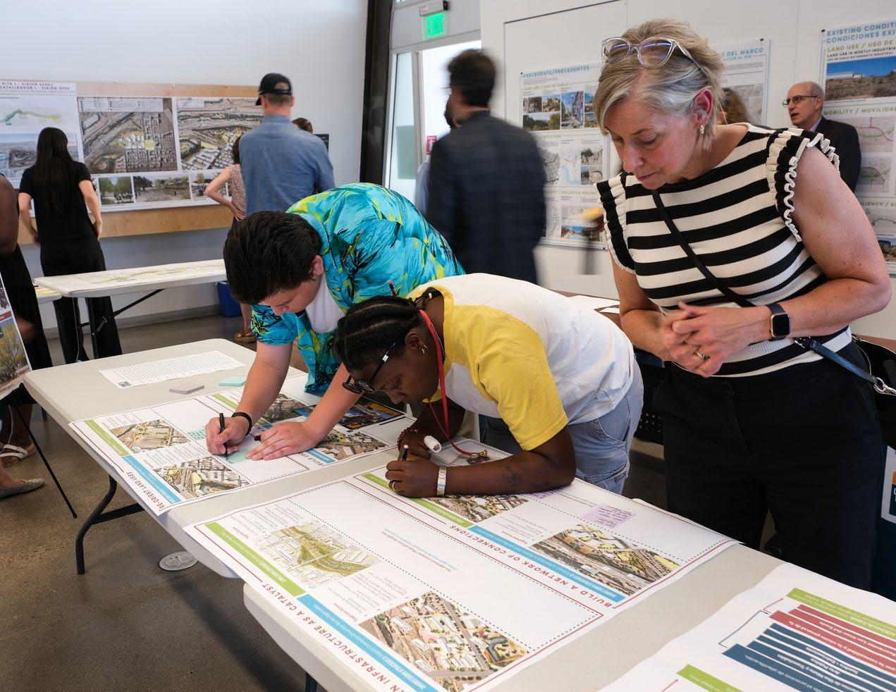
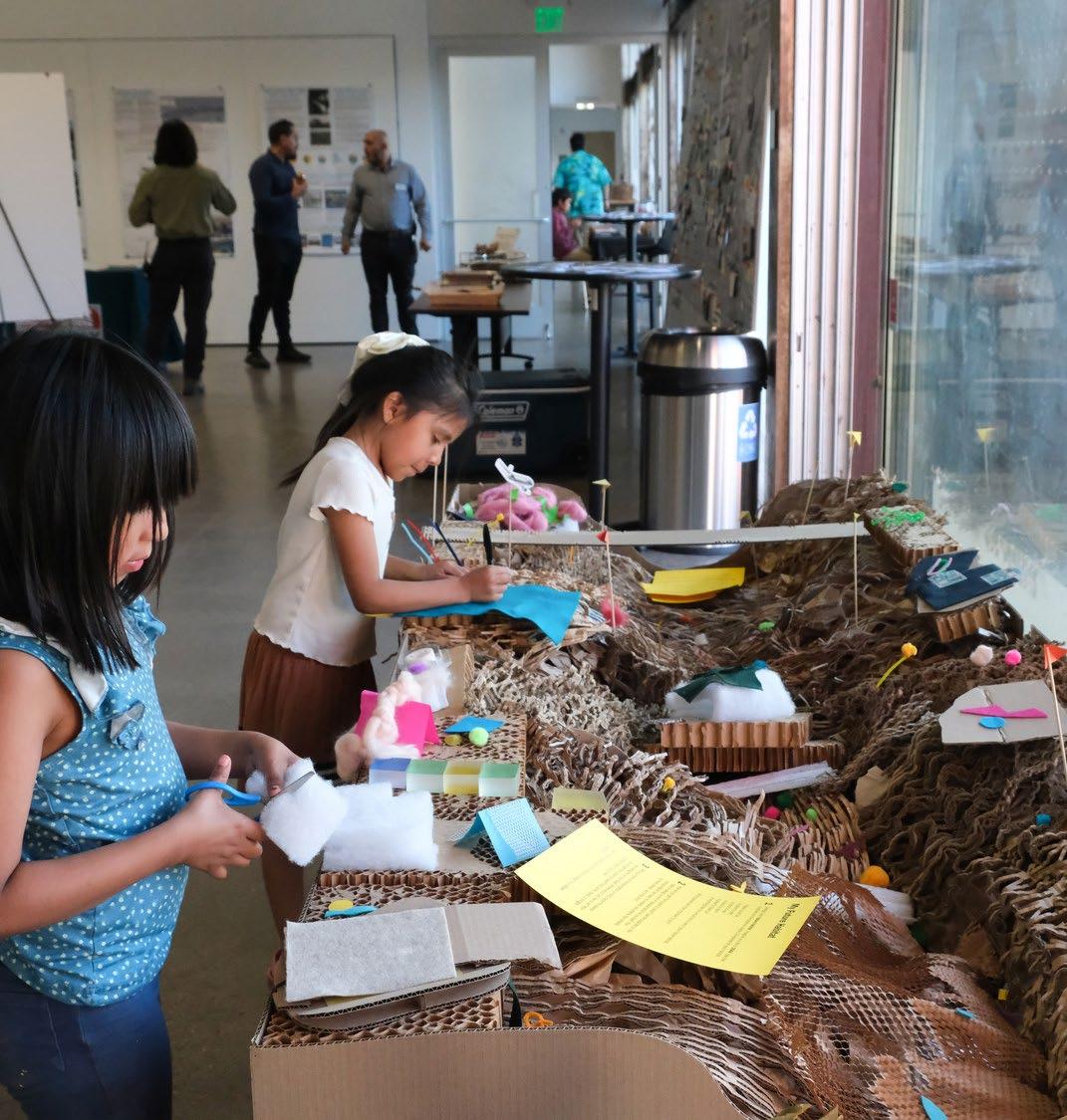
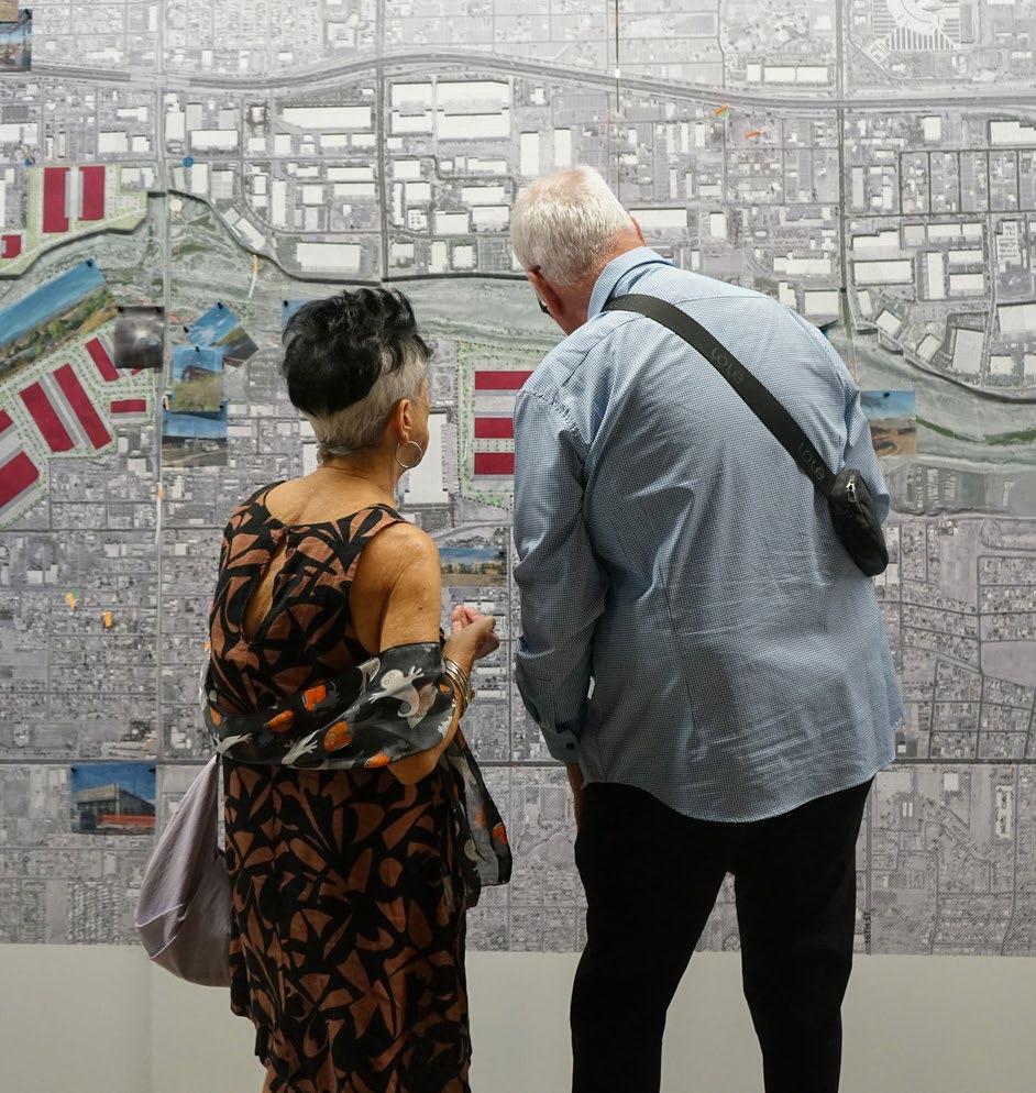
Community engagement shapes the foundation of our design process.
Multistudio approaches community engagement as both a listening framework and a design tool, ensuring our solutions reflect the lived experiences, cultural histories, and future aspirations of the communities we serve. We believe the more voices are engaged in shaping the built environment, the more resilient and equitable the outcomes become. This commitment to inclusion informs every phase of our work, from early visioning through implementation.
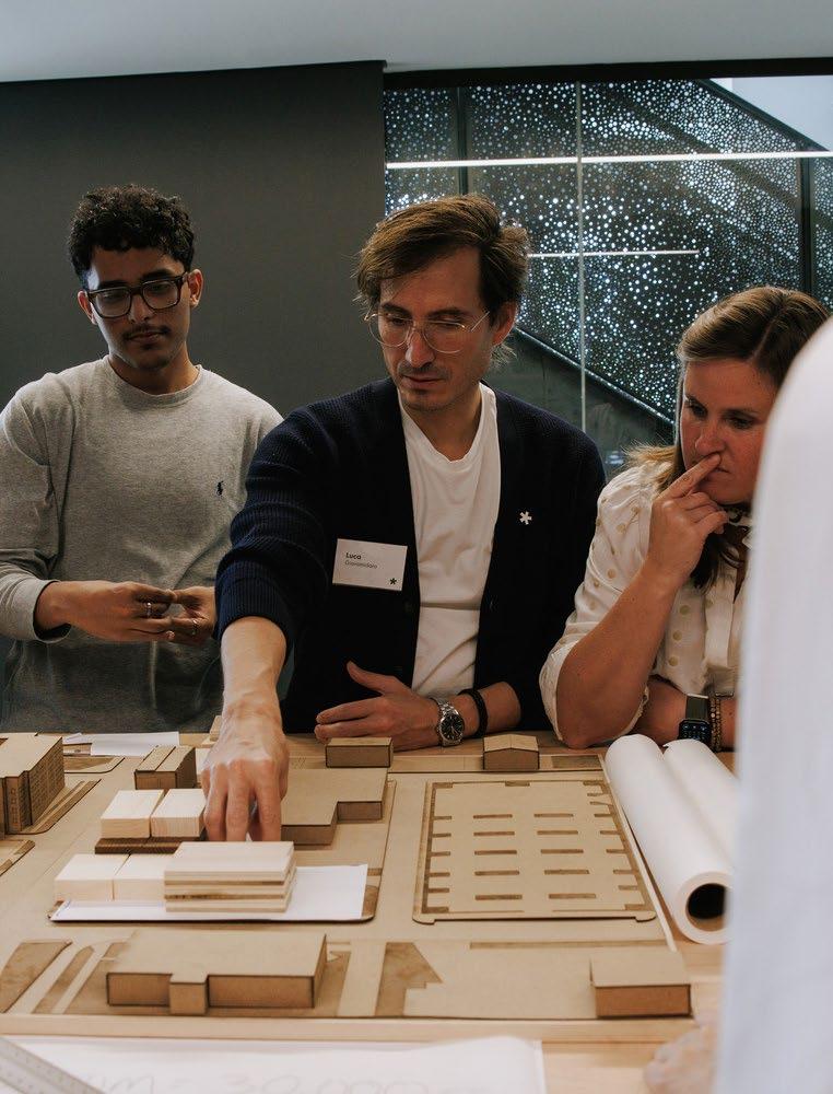
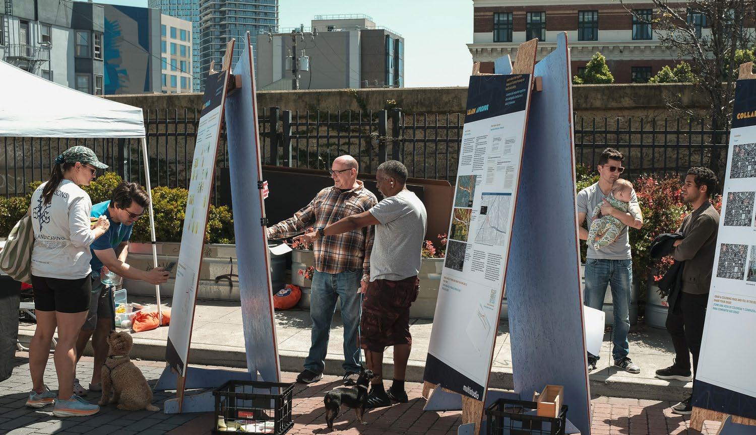
Our process prioritizes equitable access to participation through varied outreach techniques, culturally responsive facilitation, and partnerships with trusted local organizations. We convene engagement in formats that meet people where they are, from workshops and small-group dialogues to interactive pop-ups and neighborhood events that create space for both broad input and deeper conversation while building trust.
Equally important is how engagement translates into action. We structure conversations to align community insight with technical analysis, feasibility considerations, and long-term investment strategies. By visualizing alternatives and facilitating transparent dialogue with public and private partners, we help build consensus around design directions that are both aspirational and implementable.
While each project is unique, our approach remains consistent: engagement is continuous and iterative. By pairing inclusive dialogue with technical rigor, Multistudio advances design solutions and implementation strategies that are community-informed, culturally grounded, and positioned to foster long-term resilience.
We conceive engagement as inviting, inclusive, and engaging. We are committed to creating moments where people of all ages and walks of life can contribute ideas, explore possibilities, and see their aspirations take shape. We believe participation in shaping the places we live is foundational to strengthening community connections, and we approach engagement as a joyful, shared experience—one that builds trust, fosters dialogue, and transforms collective aspirations into meaningful, lasting places.
Select Work Master Planning
RIO PHX City of Phoenix, AZ
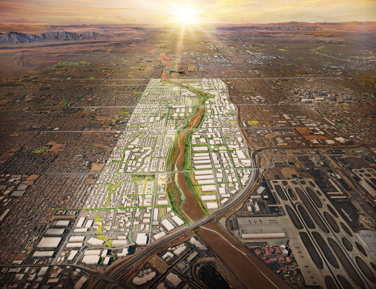
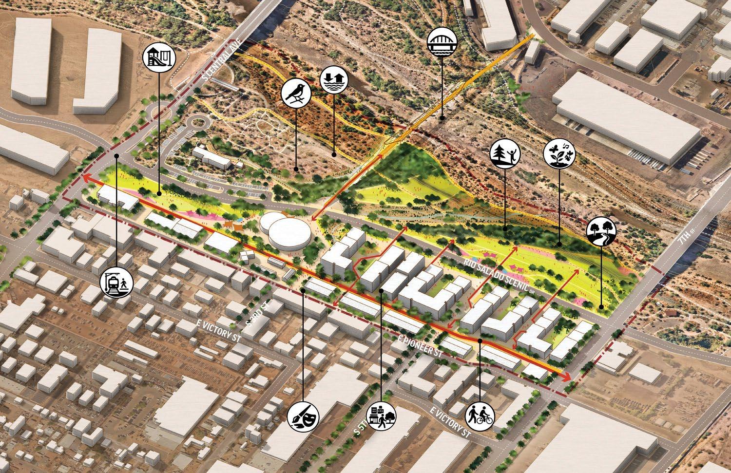
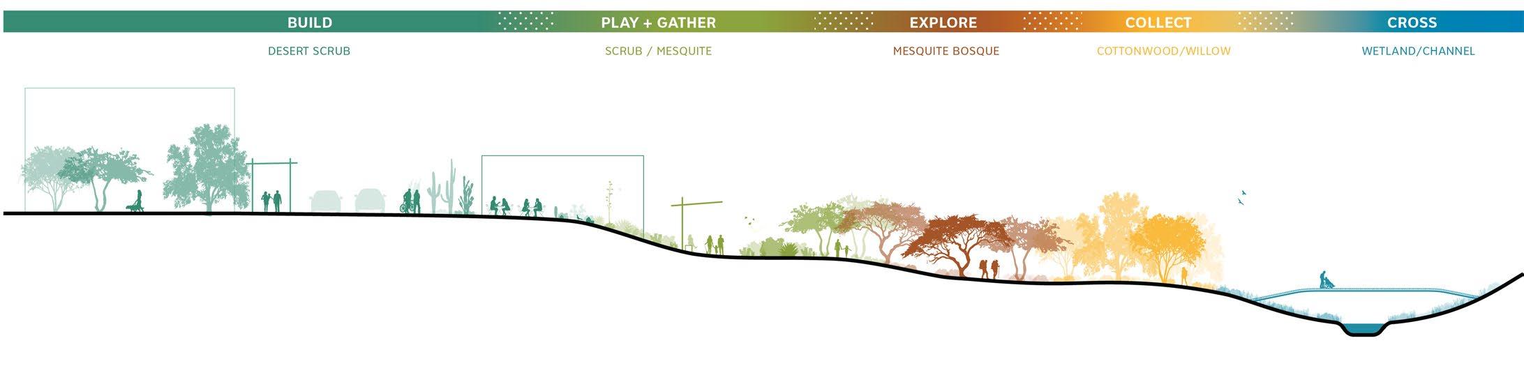
RIO PHX, formerly known as Rio Reimagined PHX, is an urban design and planning framework led by Multistudio, in collaboration with SCAPE Landscape Architecture, reimagining the Rio Salado corridor as a connected, ecologically-grounded civic corridor for Phoenix. Rooted in resilience and ecology, the project extends the river beyond its banks into surrounding neighborhoods through a layered system of green infrastructure that manages desert storm events, mitigates heat, and introduces ecological systems into traditionally underserved communities and industrial areas.
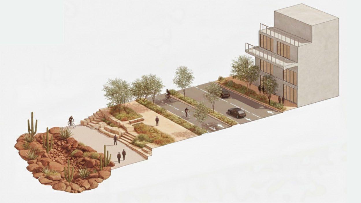
Access and connectivity are central to the spatial strategy. The plan establishes a coherent extension of the fragmented urban grid to support a more walkable and bikeable environment and improve access to the river. A network of "green connectors," local streets, and paseos links neighborhoods to the river with shaded pedestrian and bicycle routes and intuitive wayfinding, tying directly into the Rio Salado trail system and reinforcing the river as a destination.
The plan also introduces the "River Drive," a continuous, multimodal loop that creates a distinctive river experience through varied speeds, landscape, and river views, framing the corridor as a shared civic destination.
Transit integration is fundamental to the framework. RIO PHX aligns existing and planned transit infrastructure to connect Rio Salado communities to downtown Phoenix and the broader region, building on Multistudio's work on the South Central Transit-Oriented Development (TOD) Plan and leveraging access to the Pioneer/Central Avenue Station to link high-capacity transit with housing, employment, and river ecology.
Project Data
→ Phoenix, AZ
→ 20-mile Rio Salado Corridor
→ Land Use Policy Plan(s)
→ Planning, Visioning, Urban Design, Community Engagement, Education Campaign & Collateral
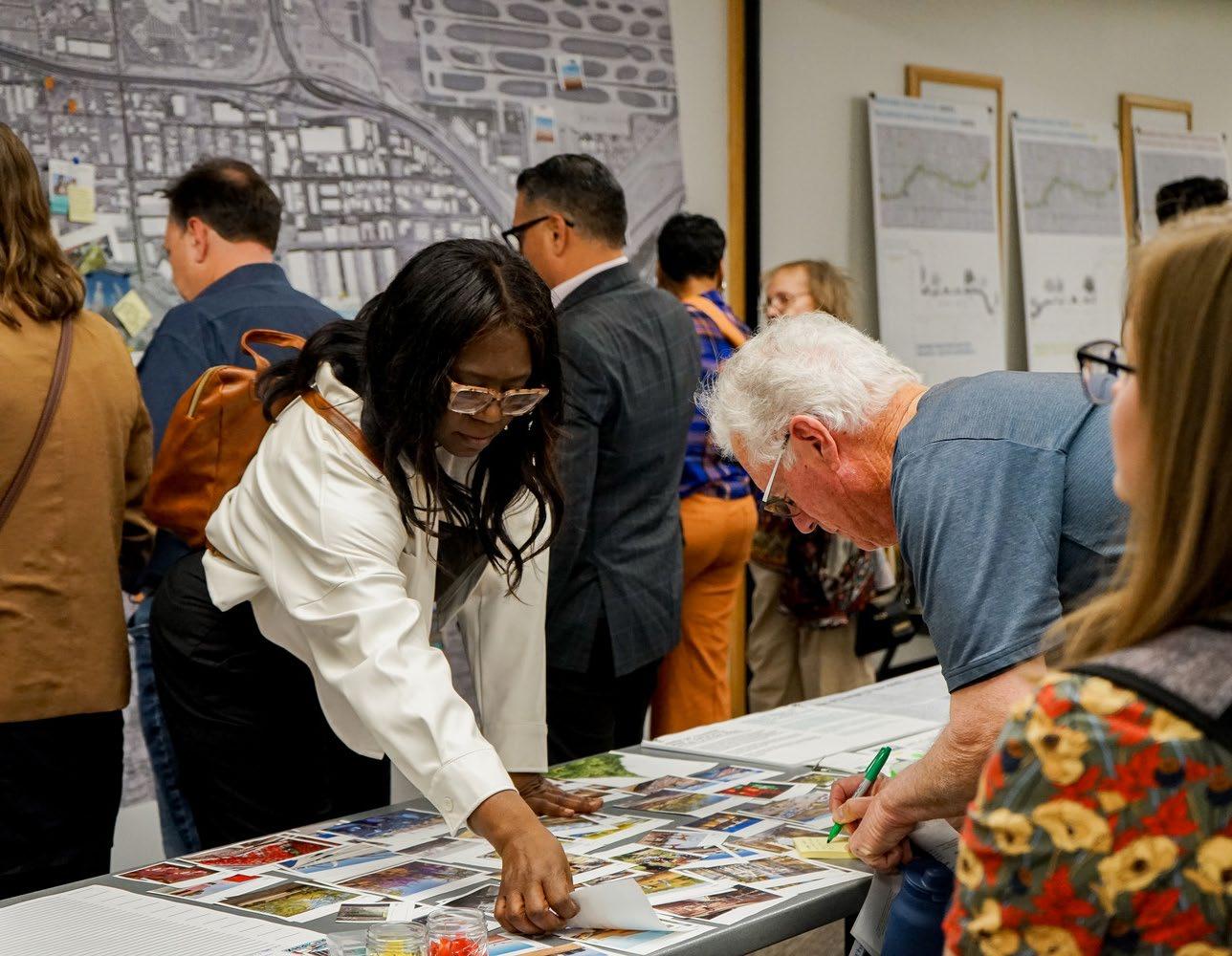
Community Workshop #2: Engagement and capacity building to define "What We Want" to set a Vision for the Future
Reimagining the Rio Salado as Environmental Infrastructure and a Catalyst for Community Investment
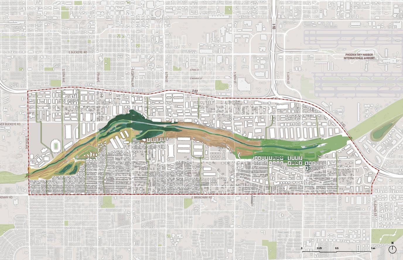
Phase I (Rio Salado Phoenix) Boundary Map: The boundaries for the first phase, are Interstate 17 (north), Broadway Road (south), 32nd Street (east), and 19th Avenue (west).
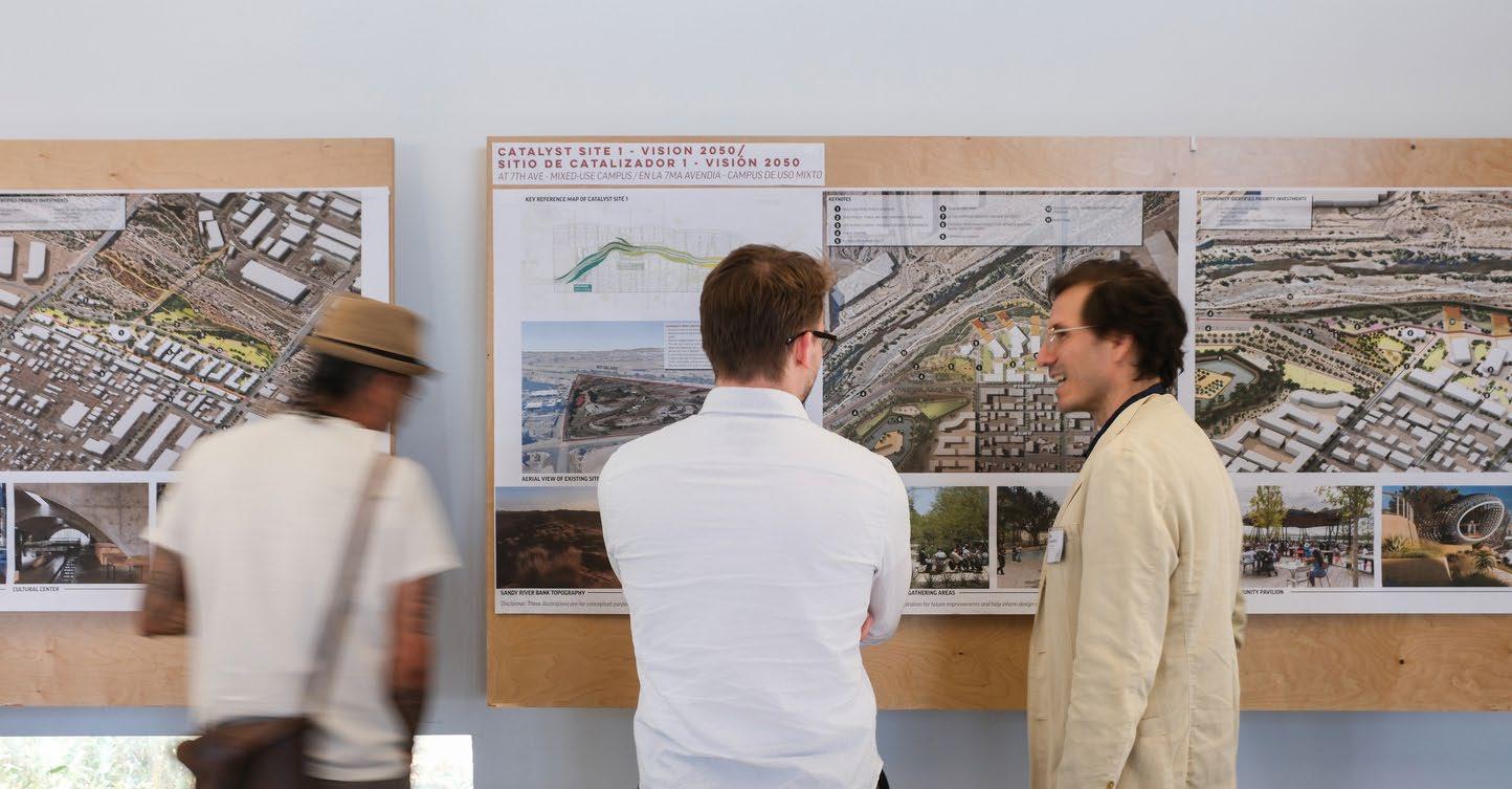
Community Workshop #3: Engagement and capacity building to define "How We Get There" for Implementation of the Plan
IndyGo Transit-Oriented Development Plan Indianapolis Public Transportation Corp.
Indianapolis and Marion County are underway implementing a new Bus Rapid Transit (BRT) system.
The system will improve transit connectivity throughout the City/County and provide improved access to a greater portion of the community population. The system intentionally connects people to destinations, jobs, healthcare, education and services, improving the quality of life for residents and patrons.
To ensure the transit investment is leveraged to the benefit of the community and currently under-served populations, the City of Indianapolis, IndyGo, the transit provider, and the Indianapolis Metropolitan Planning Organization are supporting an update to the development regulations. The update is focused on enabling and encouraging transit-oriented development in proximity to the current and future BRT lines.
Delineated from station area master plan prototypes, regulatory updates have been designed to create compact, connected, and diverse development patterns to support the transit service, build the development and business markets, improve access locally and regionally, create place, and improve community value.
Implementation of the transit-oriented development policies are being realized through form-based changes to the current zoning ordinance that focus on the design of specific community elements.
Designed in association with Toole Design.
Project Data
→ Indianapolis, IN
→ Transit-Oriented Development
→ 18 Miles of Dedicated Transit Lanes & 20 Electric BatteryPowered Buses
Regulatory Changes
→ Regulatory Changes
→ Creation of pedestrian oriented public space through improved street design standards.
→ Support of compact development patterns
→ Improving station area and neighborhood place design standards
→ Addressing parking standards appropriate to support transit
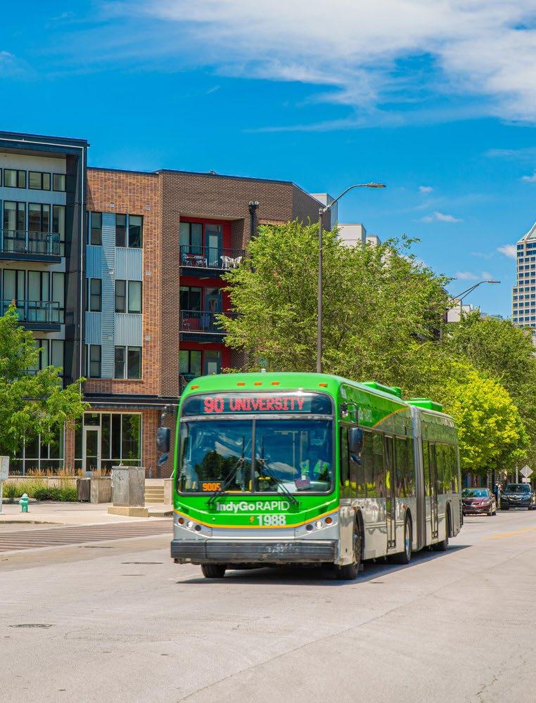
Indianapolis and Marion County are expanding Bus Rapid Transit (BRT) and updating zoning to foster vibrant, transit-oriented communities. These changes enhance connectivity, support local economies, and improve urban livability.
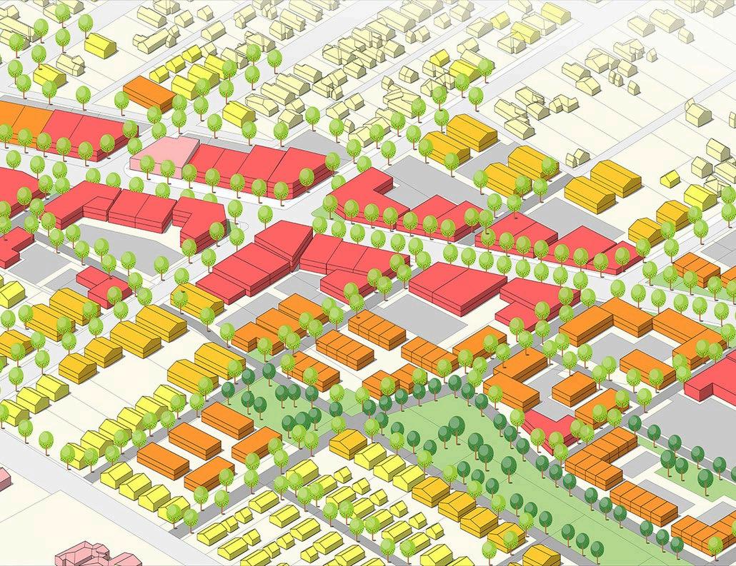
A conceptual illustration of a station area along the Blue Line that encourages transit-oriented development.
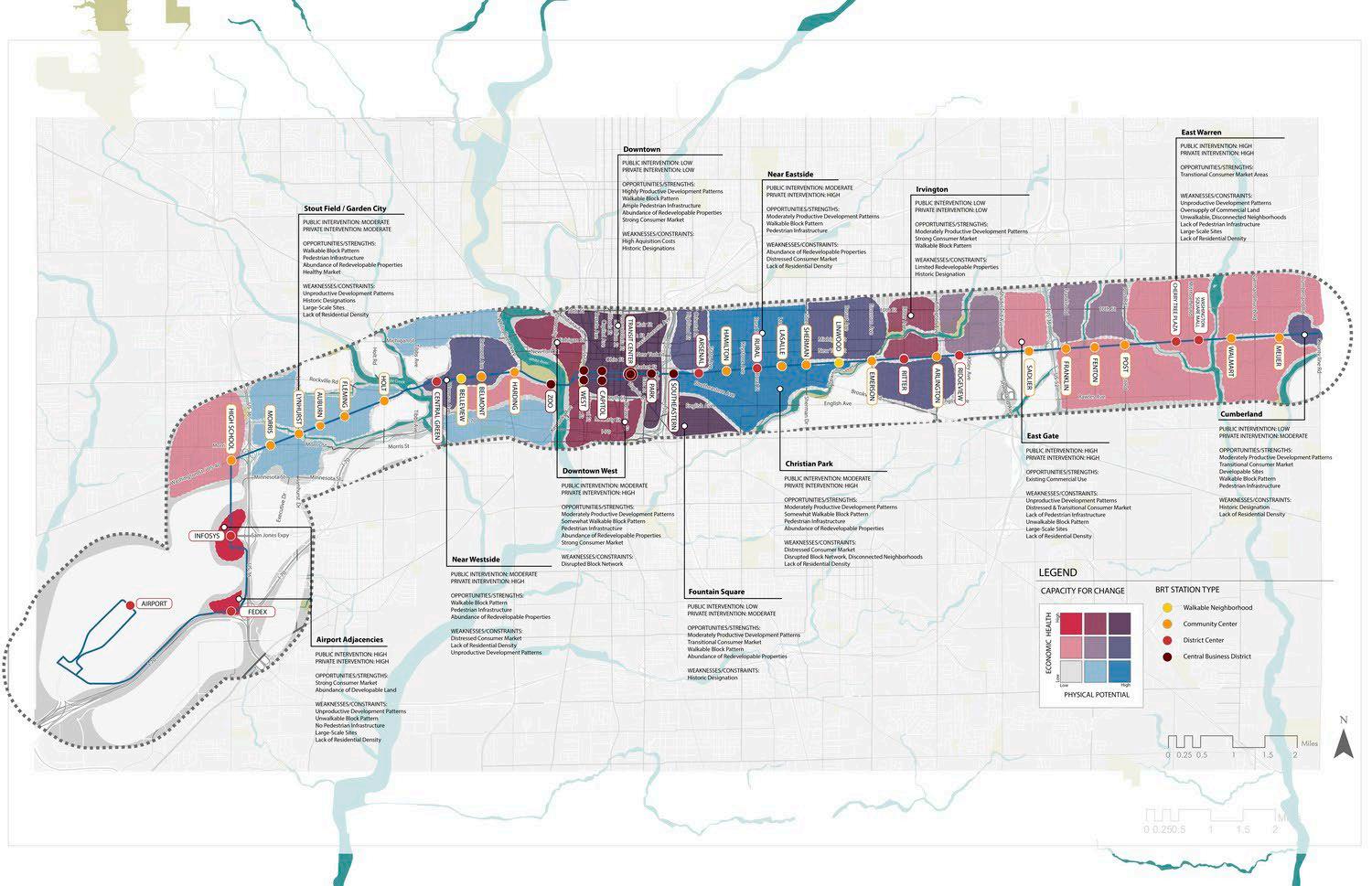
A capacity map highlighting the potential change within a half-mile radius of the Blue Line.
Westport District Master Plan
City of Kansas City, MO
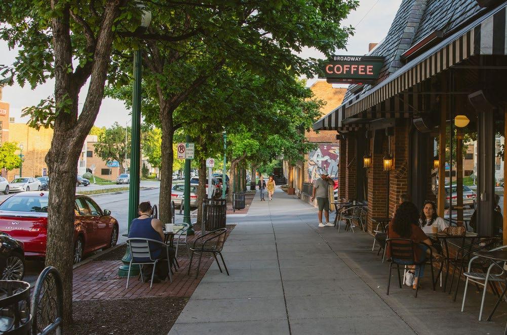
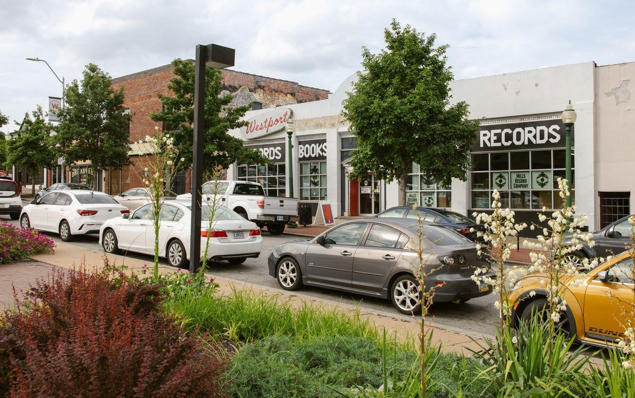
As one of Kansas City’s most distinct and walkable places, Westport's master plan provides a framework for its continued growth.
The Westport district is incredibly economically productive for the city, business owners, neighbors, property owners, and patrons, but it faces the typical challenges of any rapidly evolving neighborhood. With a popular historic entertainment destination at its core, the community recognized a need to manage growing redevelopment pressures, accessibility needs, and preservation. As a continually evolving district, the Westport District Master Plan is a neighborhood-scale “form-based plan” providing direction for both public and private improvements in order to support the physical qualities and attributes that make Westport unique and valuable.
The Westport District Master Plan, organized by the plan components, physically characterizes and offers specific recommendations to guide public and private improvements in each distinct context of the overall district. This organization guided the implementation discussion to support the desired evolution of the different contexts, or places, of Westport.
The implementation strategy of the plan recognizes a need for strategic rezoning, local historic designation, and various overlay districts afforded by Kansas City, Missouri to achieve its vision. The rezoning strategy identifies specific properties in most need of expanded or reduced development form or use and provides a more appropriate zoning category to guide future development. The plan recognizes the residential potential as a priority for historic districts designation to maintain the rare context of Westport’s limited residential neighborhoods and outlines the process and responsibilities for initiating that process.
Building on this work, Multistudio was subsequently engaged to advance implementation through a zoning overlay for the district and the design of a cohesive branding, signage, and wayfinding system—extending the plan’s vision into both regulatory tools and the public realm experience.
Project Data
→ Kansas City, MO
→ Development Plan
Recognition
→ Westport Historical Society, Kemper Award for Achievement in Historic Preservation
→ APA Missouri Chapter, 2019 Outstanding Plan
South Central Equitable Transit-Oriented Development City of Phoenix, AZ
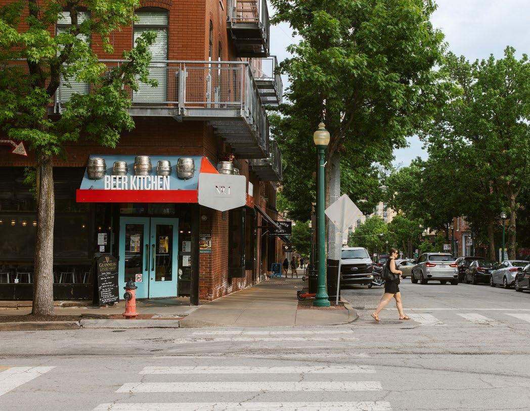
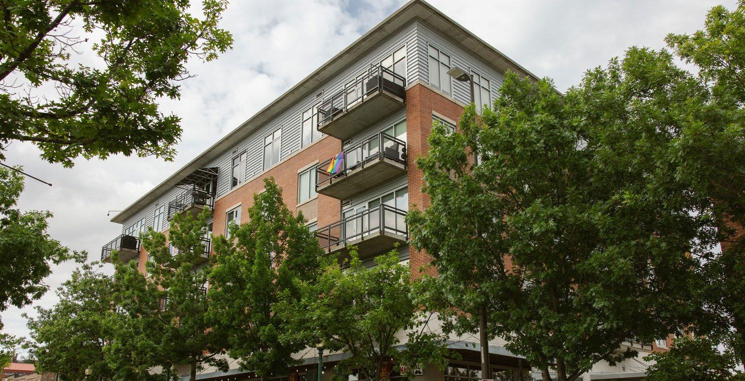
The City of Phoenix was awarded a federal grant to engage the community, support local businesses, and plan for the future development along the light rail extension. The goal of the planning process was to create compact, pedestrian oriented, mixed-use, community destinations supported by the transit investment. The South Central Corridor Plan will provide a living document that represents the voices of the community to create authentic places that provides for residents.
Through a variety of engagement activities, the residents and businesses in the South Central corridor identified their primary concerns and desires for the future. Concerns included displacement, loss of neighborhood character, and lack of local investments, while desires include additional goods and services, green improvements, and affordable housing opportunities. Through transit-oriented development principles, each station area was planned for mixed-use development and improvements that respect and relate to the surrounding neighborhoods. Housing policies are focused on infill, redevelopment and preservation of the housing stock, to create new opportunities while maintaining and expanding the affordable housing in the corridor. Public improvements focus on the supporting the transit investment and connecting people to places.
The South Central Corridor Plan provides the policies, strategies, and actions necessary to allow the community to evolve in an authentic manner. Improvements include multimodal transportation investments that support local connectivity, shade and stormwater improvements to green the corridor and neighborhoods to reduce to the heat island affect, and enhancements to the park and open space system. Corridor development emphasizes compact, contextual, and diverse growth that serves the community and provides new opportunities. To ensure that development occurs in an appropriate manner, application of the Walkable Urban Code has been proposed for the corridor.
Project Data
→ Phoenix, AZ
→ Transit-Oriented Development
→ 5 square mile plan around 7 light rail station stops
→ Community Outreach, Visioning, Business Assistance Plan, Land Use Planning Services
Recognition
→ AIA Arizona Urban & Regional Planning Award
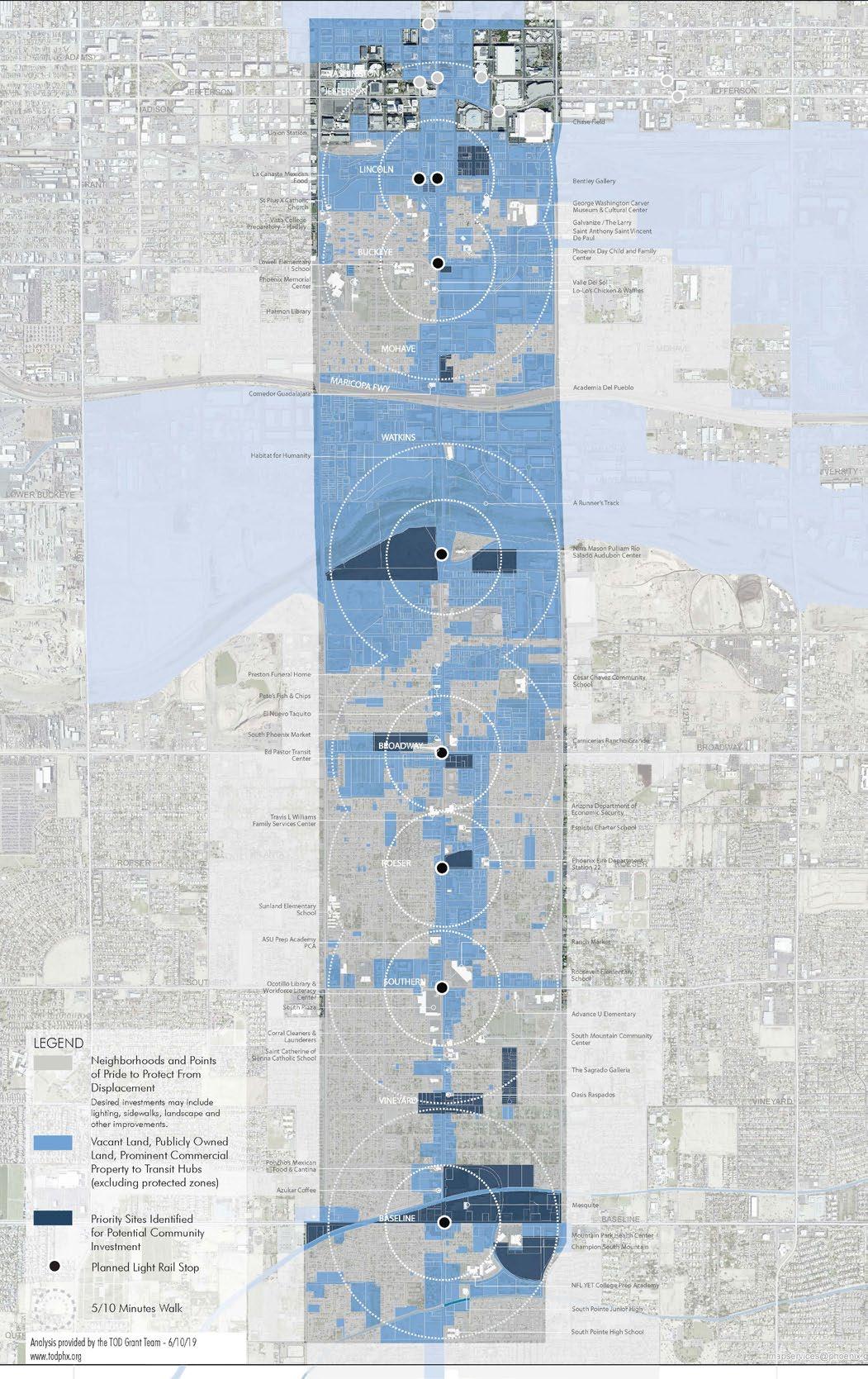
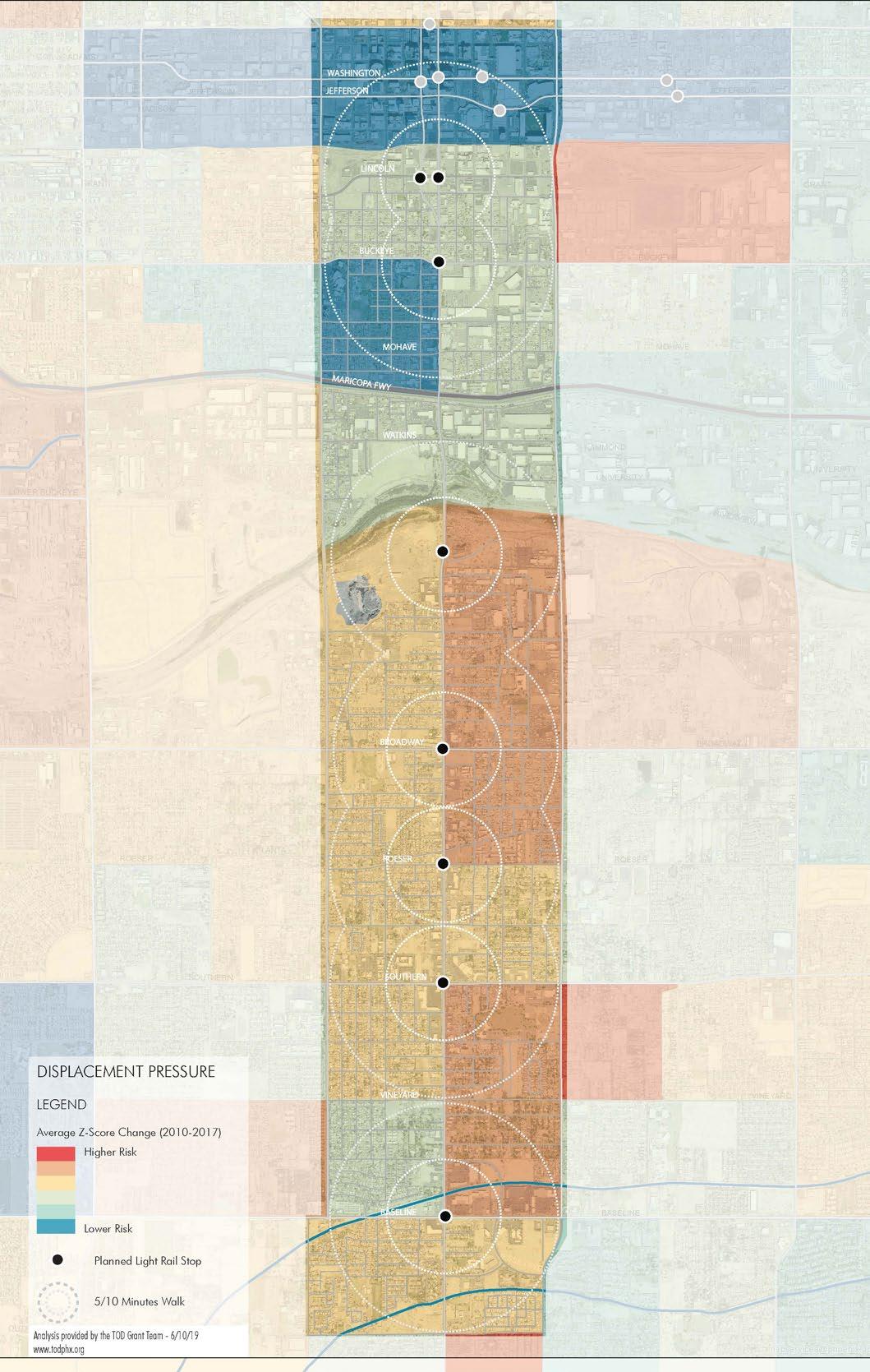
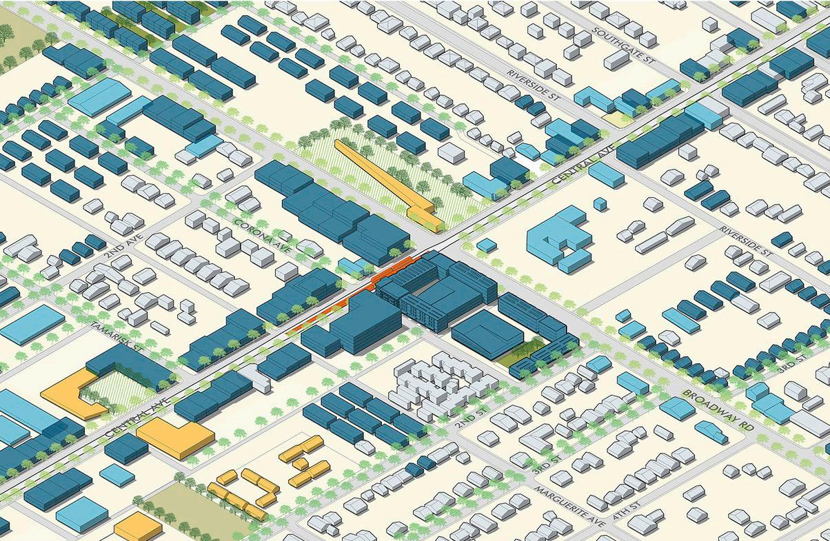
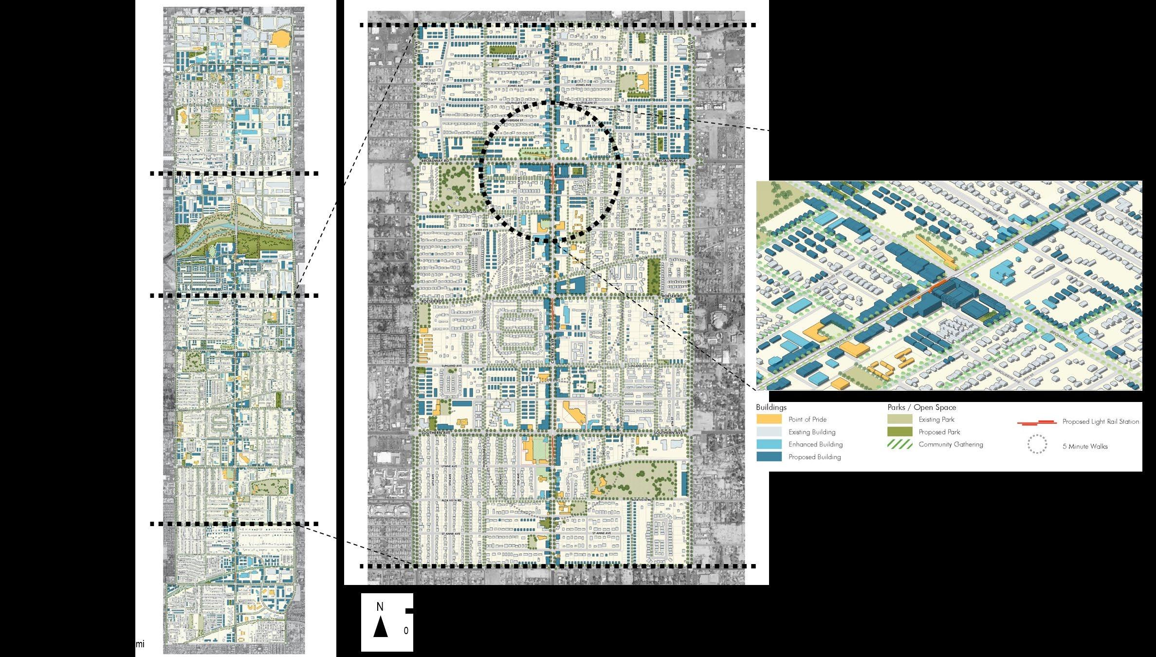
The plan calls for appropriately scaled commercial and mixeduse infill along Central Avenue to preserve views of the mountains and character of the community.
Street network planning focuses on infill and redevelopment within an existing connectivity network and prioritizing multi-modal street improvements.
The South Central Corridor is generally bound by the Union Pacific Railroad (north), South Mountain Avenue (south), 7th Avenue (west), and 7th Street (east).
"For almost a decade it has been a pleasure to collaborate with the Multistudio team and South Central partners on affordable housing, home ownership, design empowerment, and wealth building throughout the South Central Corridor."
—Patricia Duarte, Executive Vice President, Chicanos Por La Causa, Inc.
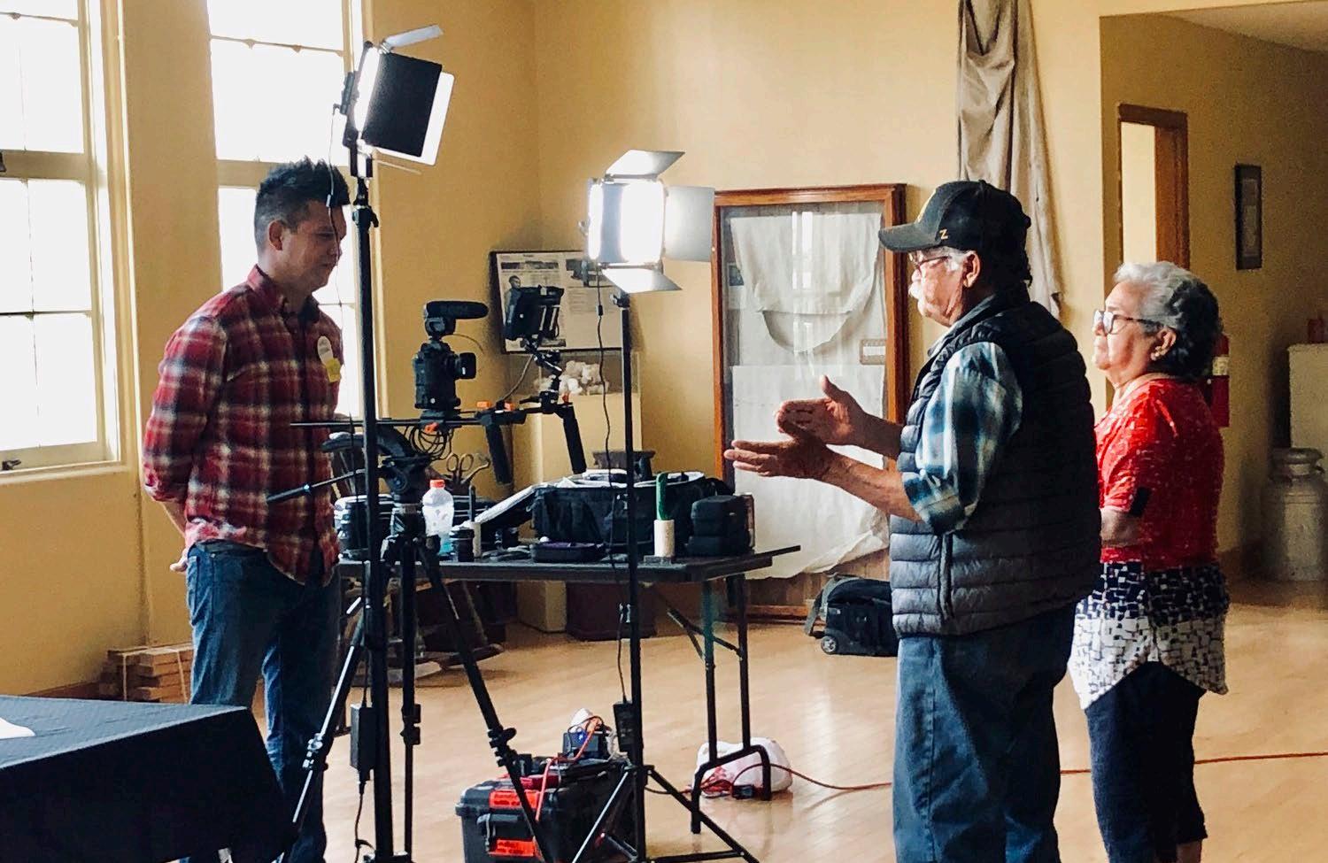
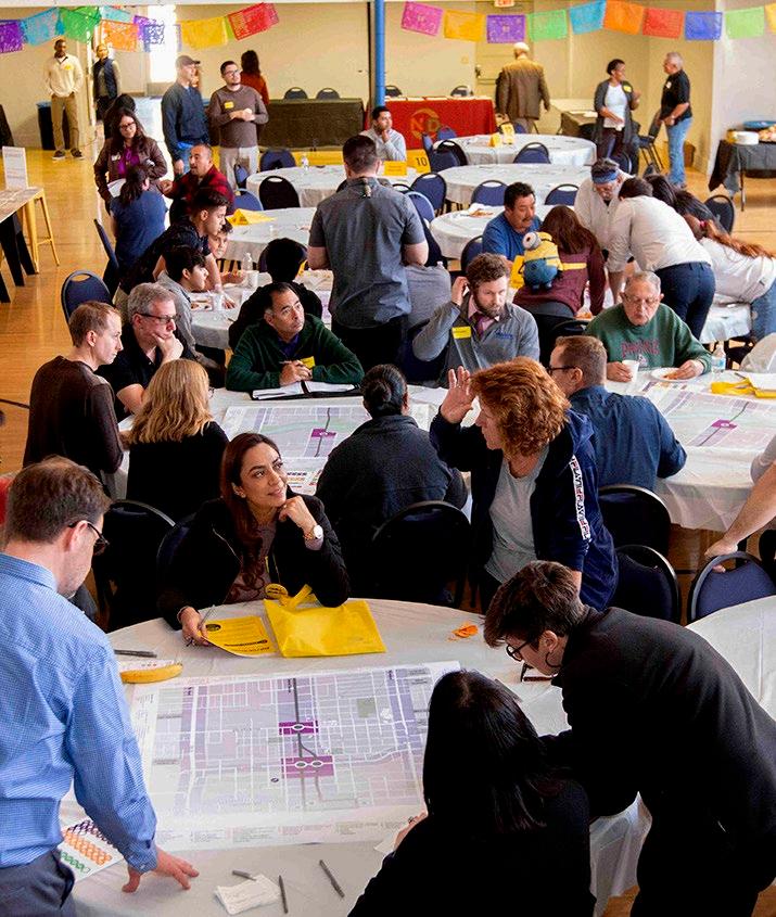
By collaborating with various local organizations and prioritizing trust-building, communication, and accountability, we amplified community voices and cultivated a shared vision for a vibrant, inclusive future.
Through innovative approaches to engagement, we fostered dialogue and ownership of the master plan within the community.
The South Central Corridor Plan provides the policies, strategies, and actions necessary to allow the community to evolve in an authentic manner. Improvements include multimodal transportation investments that support local connectivity, shade and stormwater improvements to green the corridor and neighborhoods to reduce to the heat island affect, and enhancements to the park and open space system. Corridor development emphasizes compact, contextual, and diverse growth that serves the community and provides new opportunities. To ensure that development occurs in an appropriate manner, application of the Walkable Urban Code has been proposed for the corridor.
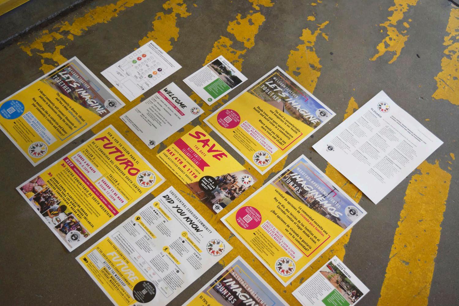
A process of engagement and public education campaign tailored to the needs of different demographics, with collateral provided in both English and Spanish.
Select Work Urban Development
Central Station GMH Communities, Medistar, CBRE, and City of Phoenix, AZ
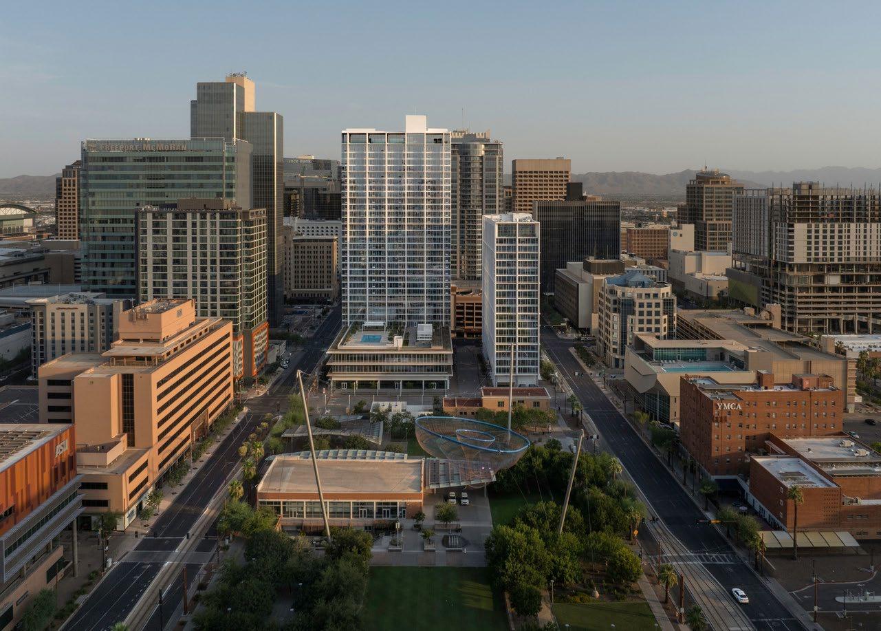
Central Station is a transit-oriented, 1,000,000+ SF redevelopment that stitches together two residential towers, office space, retail, and the reconfigured transit center on 2.5 acres at the intersections of Central Avenue, 1st Avenue, and Van Buren Street.
It is designed as a new civic landmark: two high-rise residences—a 33-story market-rate tower and a 22-story student-housing tower—rising from a porous ground plan that integrates into Civic Space Park and the Arizona State University Downtown Phoenix campus.
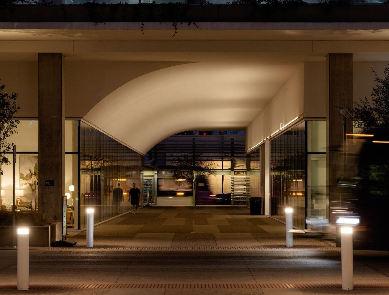
The project’s ground plane is conceived not as a fortified solid podium, but as an open civic plaza. Here, residents, commuters, employees, and the public can flow between bus bays, light rail, bike facilities, retail/restaurants, and shaded seating. This ground-level porosity creates a fine-grained, textured urban fabric, positioning Central Station as a model for multimodal development in the 5th largest city.
The two towers are intentionally complementary: one delivers skyline living for professionals and families; the other anchors students in the heart of downtown life. Together, they form a residential ecosystem in direct dialogue with the city’s academic, cultural, and civic anchors. Shared lounges, fitness amenities, and terraces serve as connective tissue, supporting both individual wellness and collective belonging.
Central Station brings 338 units, 629 student beds, and 7% workforce housing (east tower only) into downtown Phoenix, expanding housing access for a range of incomes and life stages. Office space and ground-floor retail complete the program mix, ensuring activity across the day.
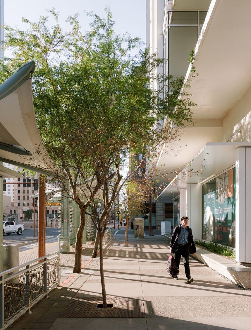
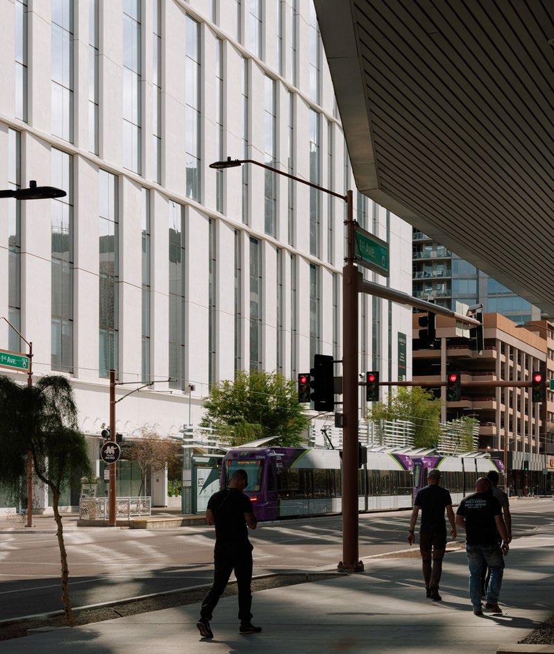
Phoenix requires shade before anything else. Central Station responds with a series of common-sense yet elegant strategies. Every fourth floor, slab extensions support vertical fins, creating deeply protected facades on the north and south elevations where glazing can be more expansive. On the east and west, larger selfshading inflected panels limit glazing and shield residents from harsh morning and late-afternoon sun. Deep overhangs, arcades, canopies, and breezeways extend this logic to the pedestrian level, where landscape, textured hardscape, and urban furniture foster comfort in the desert climate.
Central Station’s delivery structure is as ambitious as its design. The City of Phoenix retains ownership of the land and transit center operations, while private partners deliver the vertical development through a long-term ground lease. This hybrid framework creates both challenges and opportunities: balancing the pro forma and programmatic needs of a large-scale mixed-use project while ensuring the civic mission—a safe, accessible, and welcoming transit hub—remains paramount.
Project Data
→ Phoenix, AZ
→ 2.5 Acres; 1,032,706 SF; 338 units, 629 student beds
→ P3 Redevelopment
→ Full Architectural Design Services, Interior Design
→ LEED Gold (Pursuing)
Recognition
→ Mixed-Use Project of the Year, AZRE Magazine RED Awards
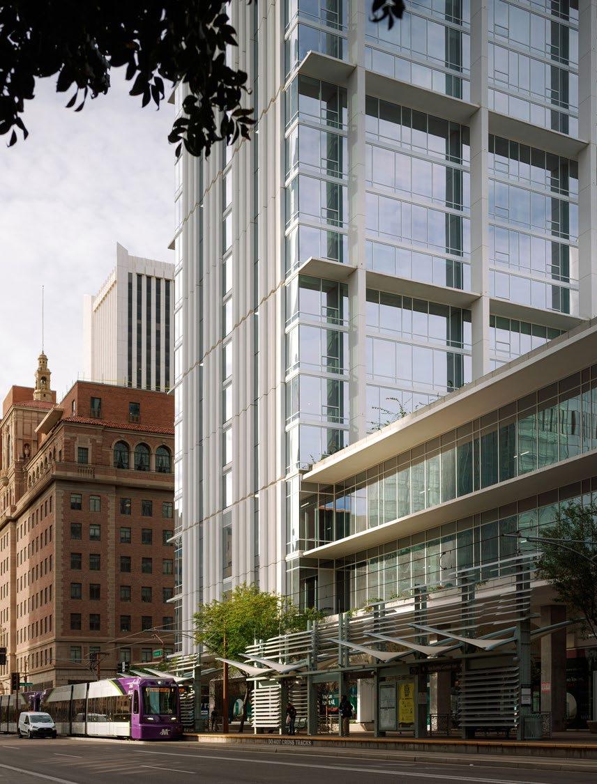
The non-negotiable return of all bus routes to their original positions drove the design’s organizational clarity. With bus bays at the site’s heart, residential lobbies, retail frontages, and circulation paths were deliberately wrapped around them to ensure visibility, activation, and safety. Rather than conceal transit, the project foregrounds it, making riders part of the site’s social life.
Central Station suggests a replicable model for cities everywhere: embed shade and multimodal access into a ground plane that is as public as it is private, then layer in housing and work to create genuine 24/7 urban life. By coupling a flexible architectural system with durable civic commitments, the project demonstrates how public–private partnerships can achieve density without sacrificing community.
The light-rail stops on both sides of the site: the west side heading south on 1st Avenue and the east side heading north on Central.
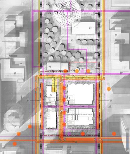
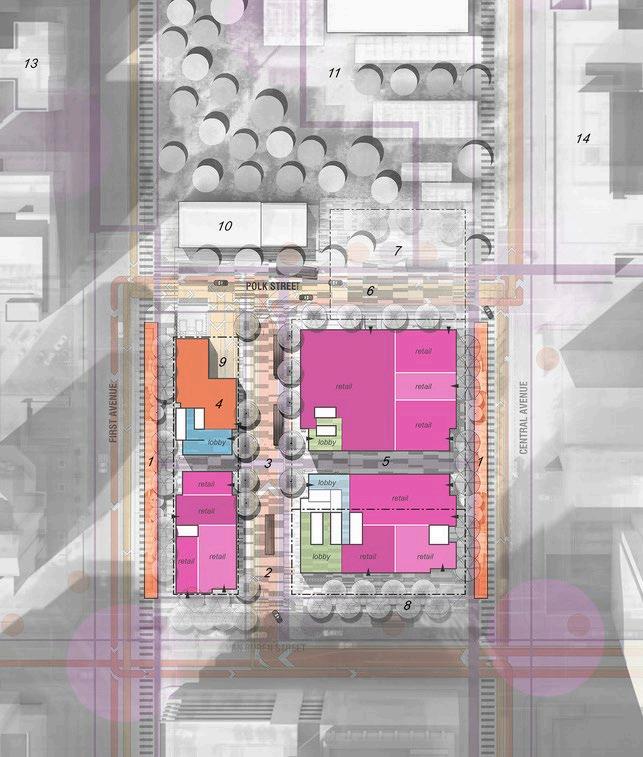
Overall Site Plan
The porous ground plane is activated by a series of multimodal transit stops, residential lobbies, co-working spaces, amenities, retail storefronts, and the transit department, all anchored by a direct connection to Civic Space Park to the north. Open and accessible from every edge, the site has no defined "back"—every frontage is engaged.
Level 1 Plan
“ Downtown Phoenix is becoming a hub, and Central Station sets a new benchmark for transitoriented development, enhancing the city's energy. Projects like Central Station are key reasons why more people are choosing Phoenix as their new home over any other city in the U.S."
—Mayor Kate Gallego, City of Phoenix, AZ
1335 Webster Align Real Estate
The 1335 Webster Street Redevelopment transforms a former Safeway and its expansive surface parking lot into a vibrant, high-density, mixed-use community at the heart of San Francisco’s historic Fillmore District. The proposal introduces nearly 1.8 million square feet across four new buildings, delivering approximately 1,800 new homes above a full-service grocery store and a network of active ground floor uses.
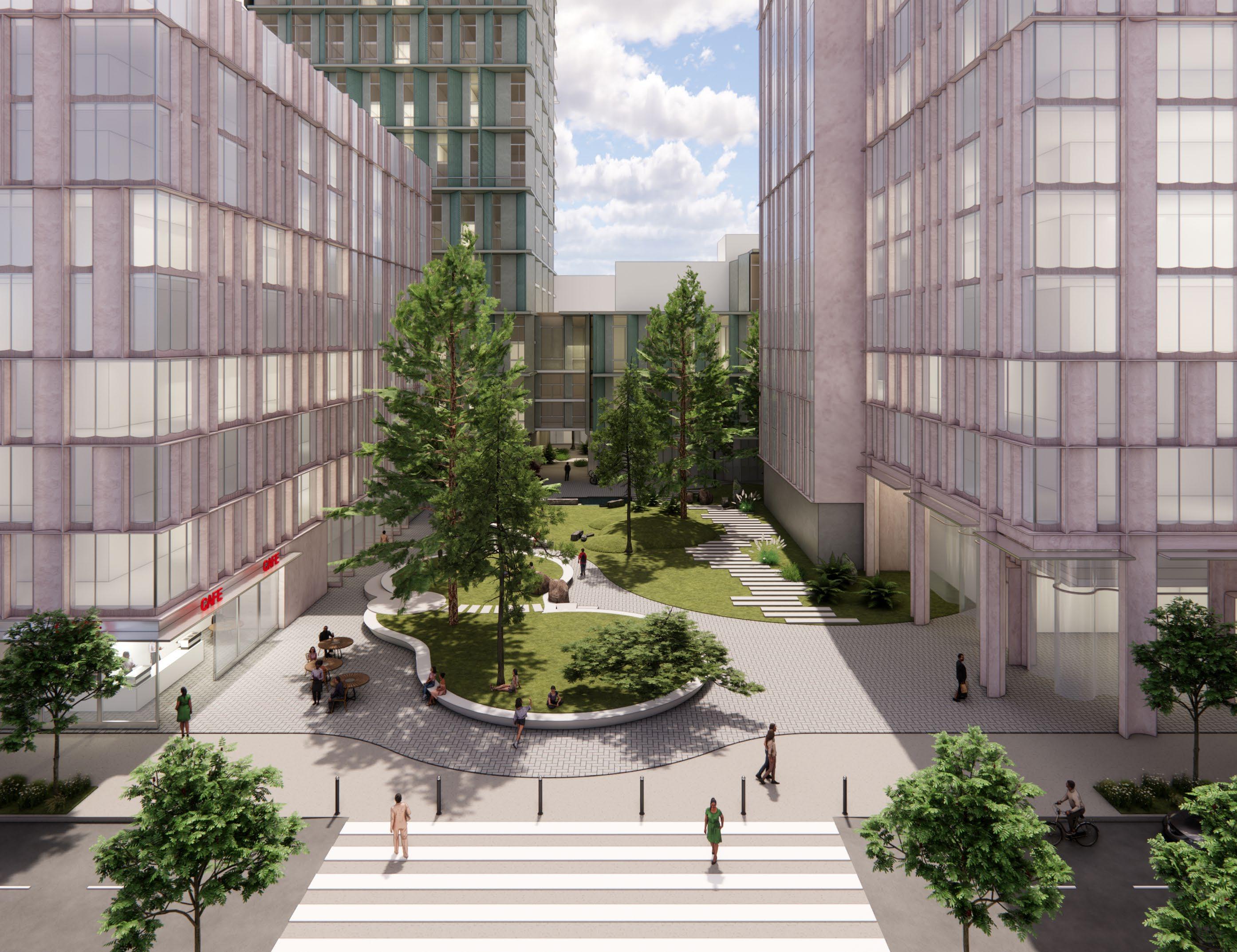
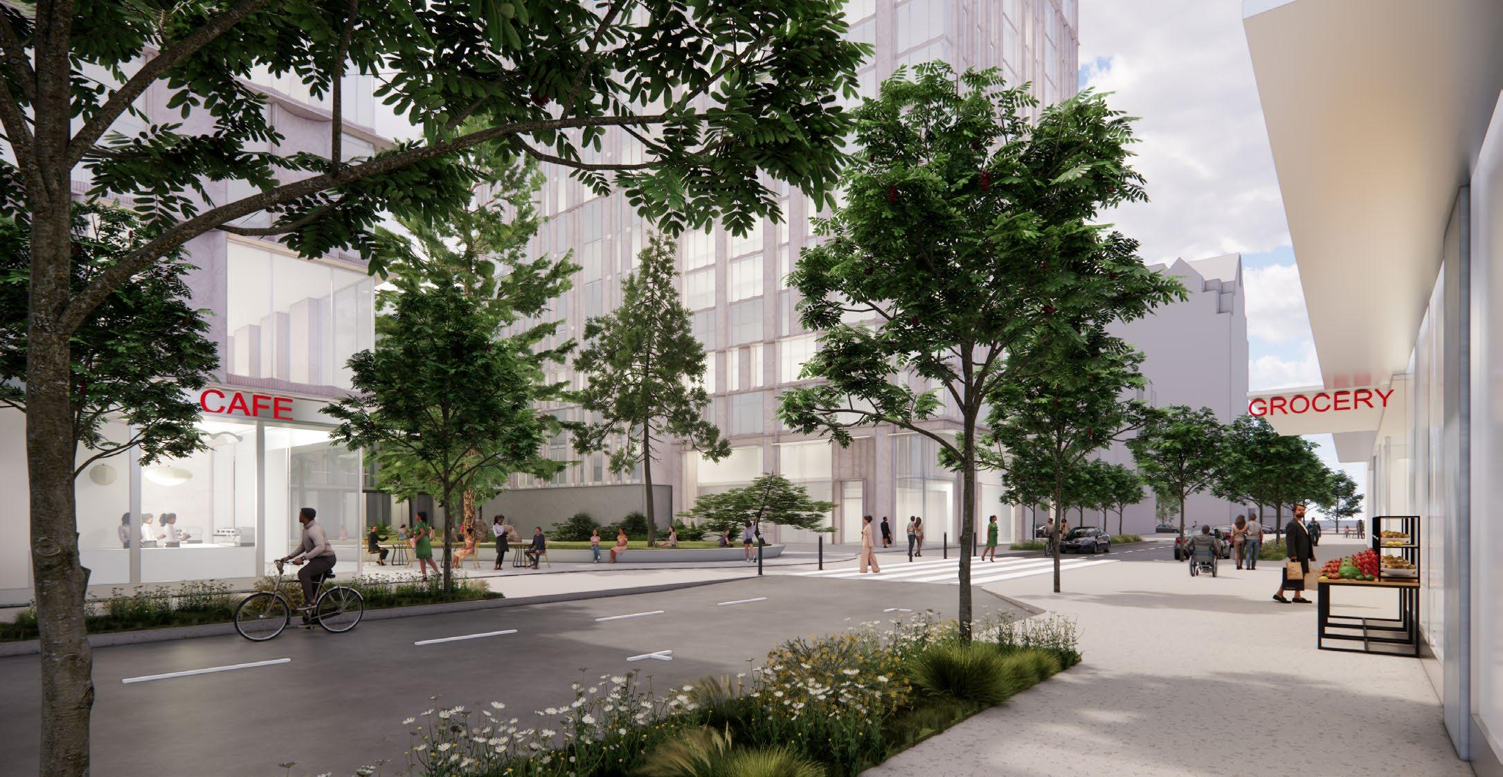
The master plan centers on repairing the urban fabric, replacing a single-use, auto-oriented parcel with a finegrained, pedestrian-first neighborhood framework. A new internal street reconnects Webster, Ellis, and Fillmore Streets, while a central community plaza anchors the site—creating a welcoming public realm where residents, grocery shoppers, and neighbors converge. Active ground floor uses reinforce this civic spine, establishing a safe, inviting, and socially connected environment.
A key component of the redevelopment is the replacement of the shuttered Safeway with a modern grocery store serving the Fillmore and Japantown communities. Above the retail podium, a mix of marketrate and on-site affordable housing expands access to housing in a transit-rich area and supports San Francisco’s broader housing goals. Building massing and circulation are organized to enhance walkability, with a thoughtful system of pedestrian-only and pedestrianpriority passages shaping the site’s internal mobility network.
Project Data
→ San Francisco, CA
→ 3.8 Acres; 1,400,000 SF
→ Redevelopment Master Plan
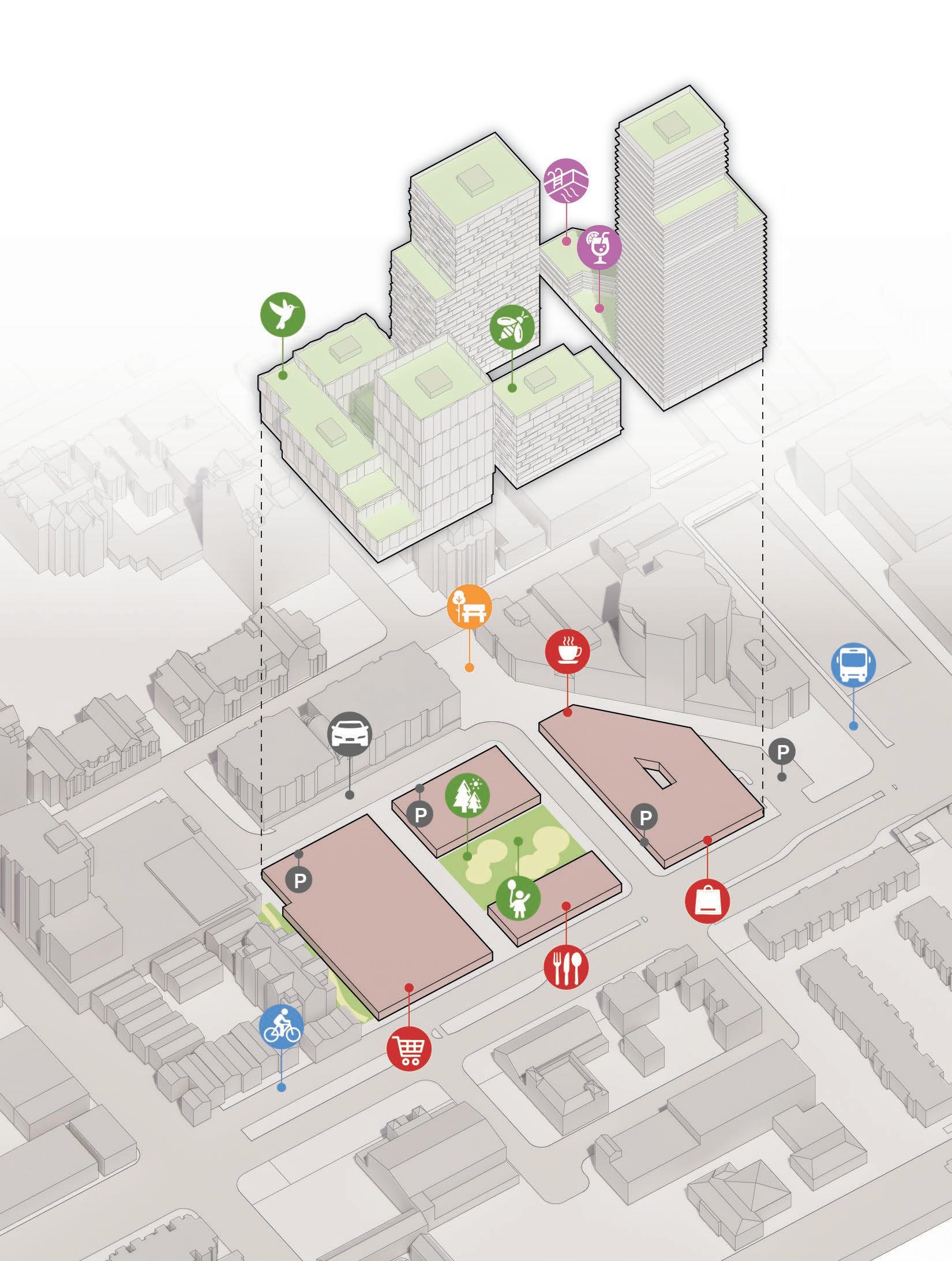
The public spaces are conceived as a lush, biophilic framework that supports urban resilience while offering comfortable, human-scaled outdoor areas for residents and visitors. A limited but efficient underground parking structure reduces surface parking and supports a shift toward transit, walking, and cycling.
The redevelopment fulfills and advances the city’s vision for high-quality infill within established neighborhoods. By reintroducing housing, essential retail, and a connected public realm, the project reimagines the site as a community asset—restoring vitality and creating a long-term anchor for the Fillmore District.
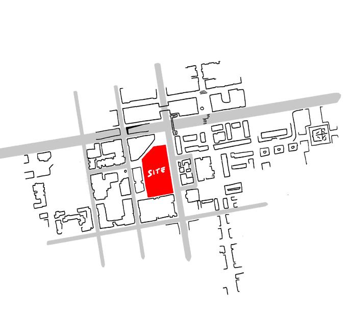
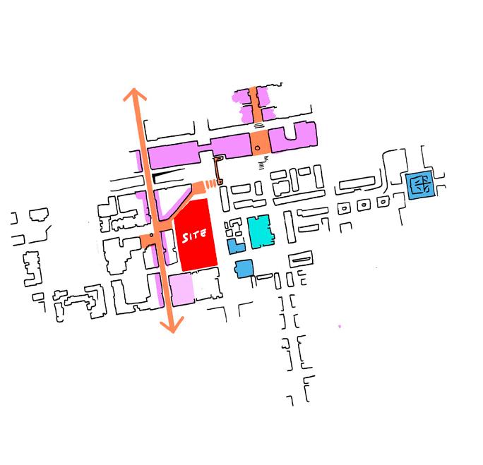
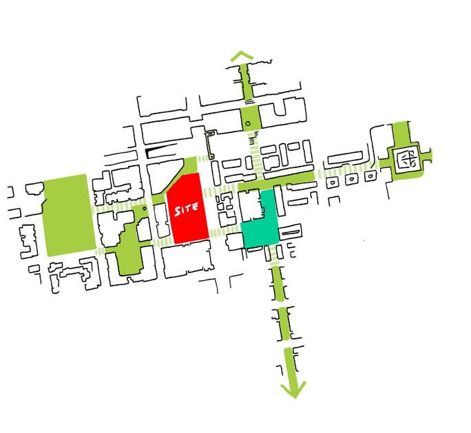
Site Context Overview
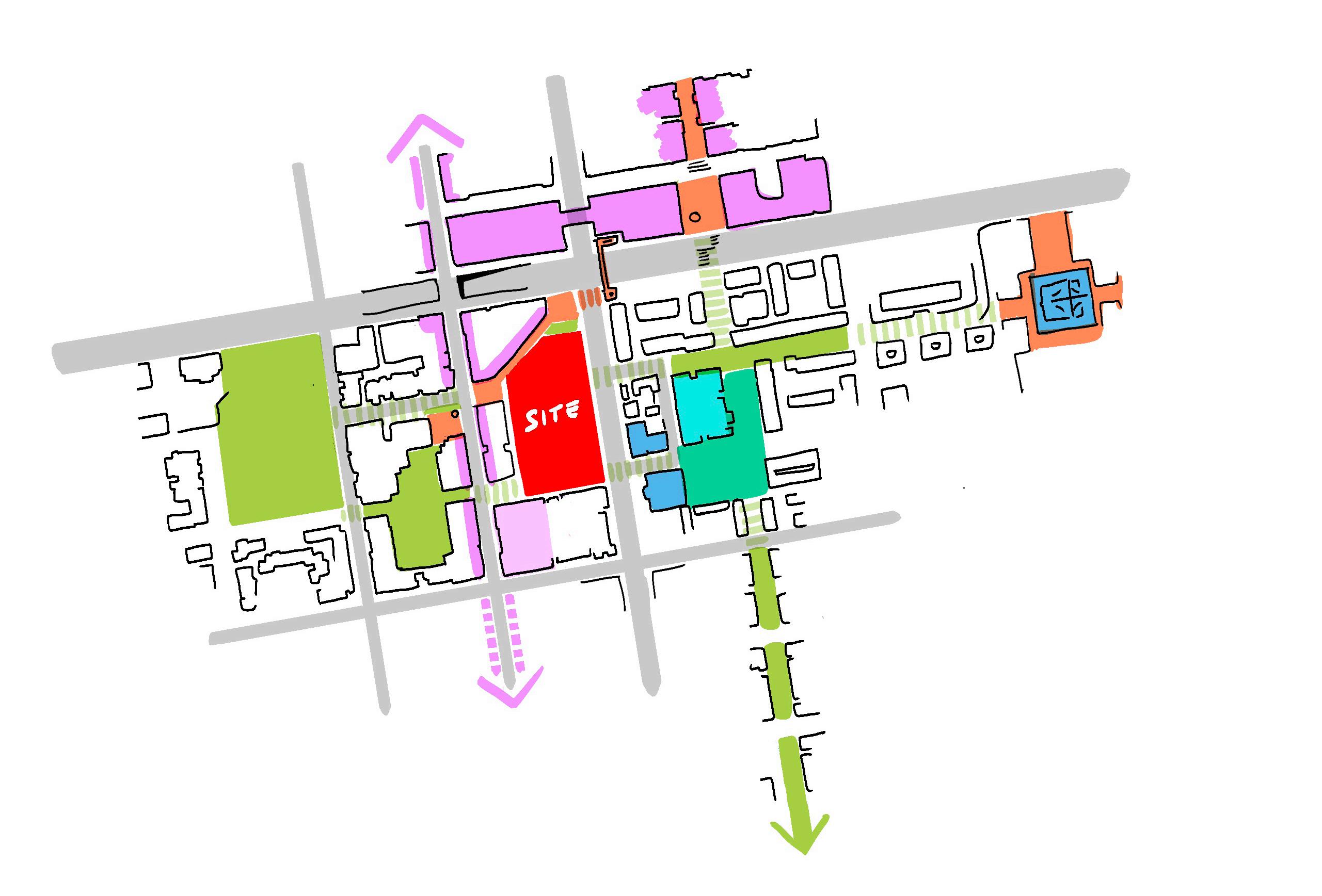
Street Network
Commercial Context
Open Space Context
Plaza Tennis Courts Redevelopment Grayson Capital and City of Kansas City, MO
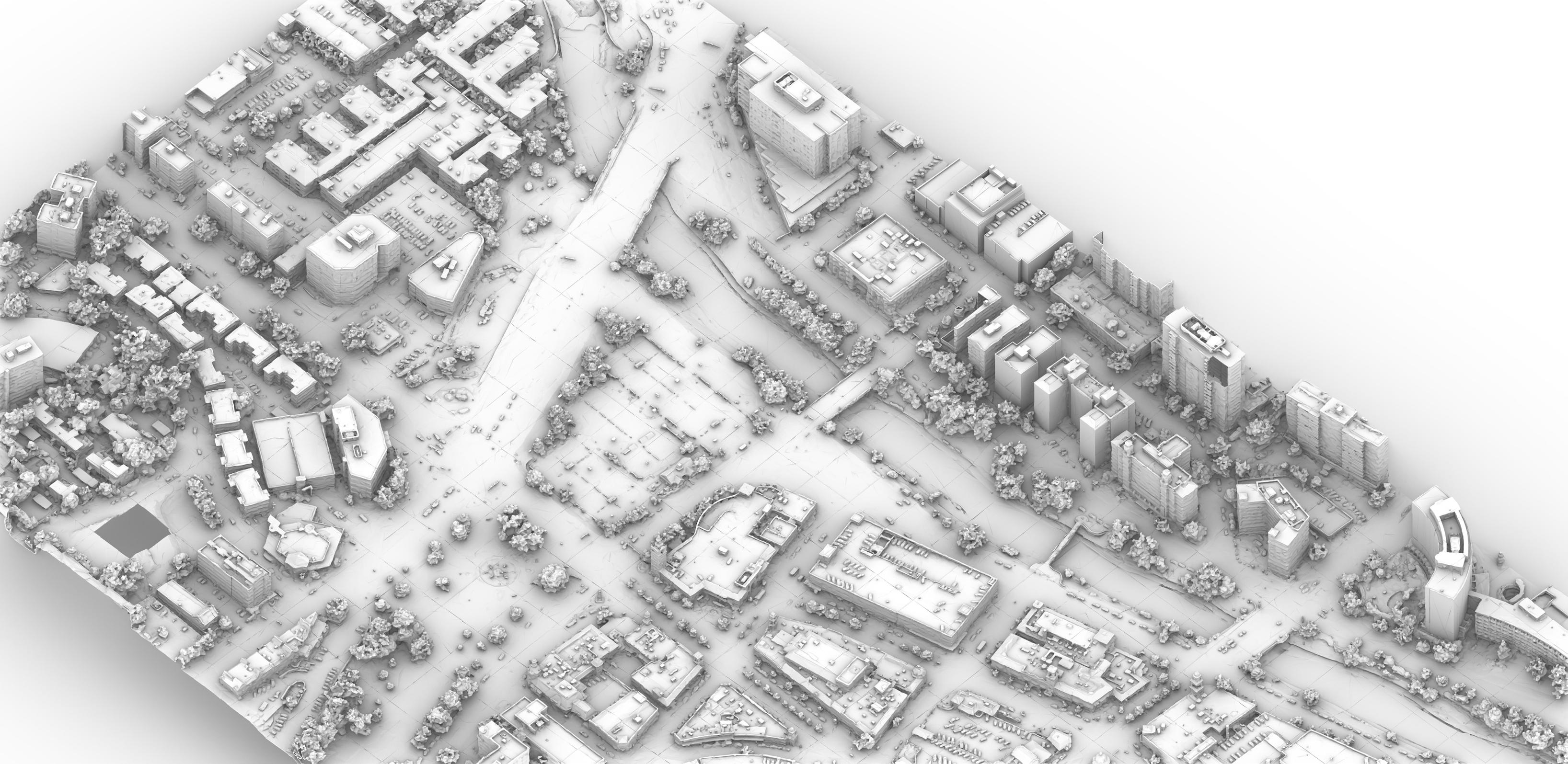
The Plaza Tennis Courts Redevelopment proposal reimagines the former tennis facility within Kansas City’s iconic Country Club Plaza, transforming it into a vibrant, accessible mixed-use urban destination.
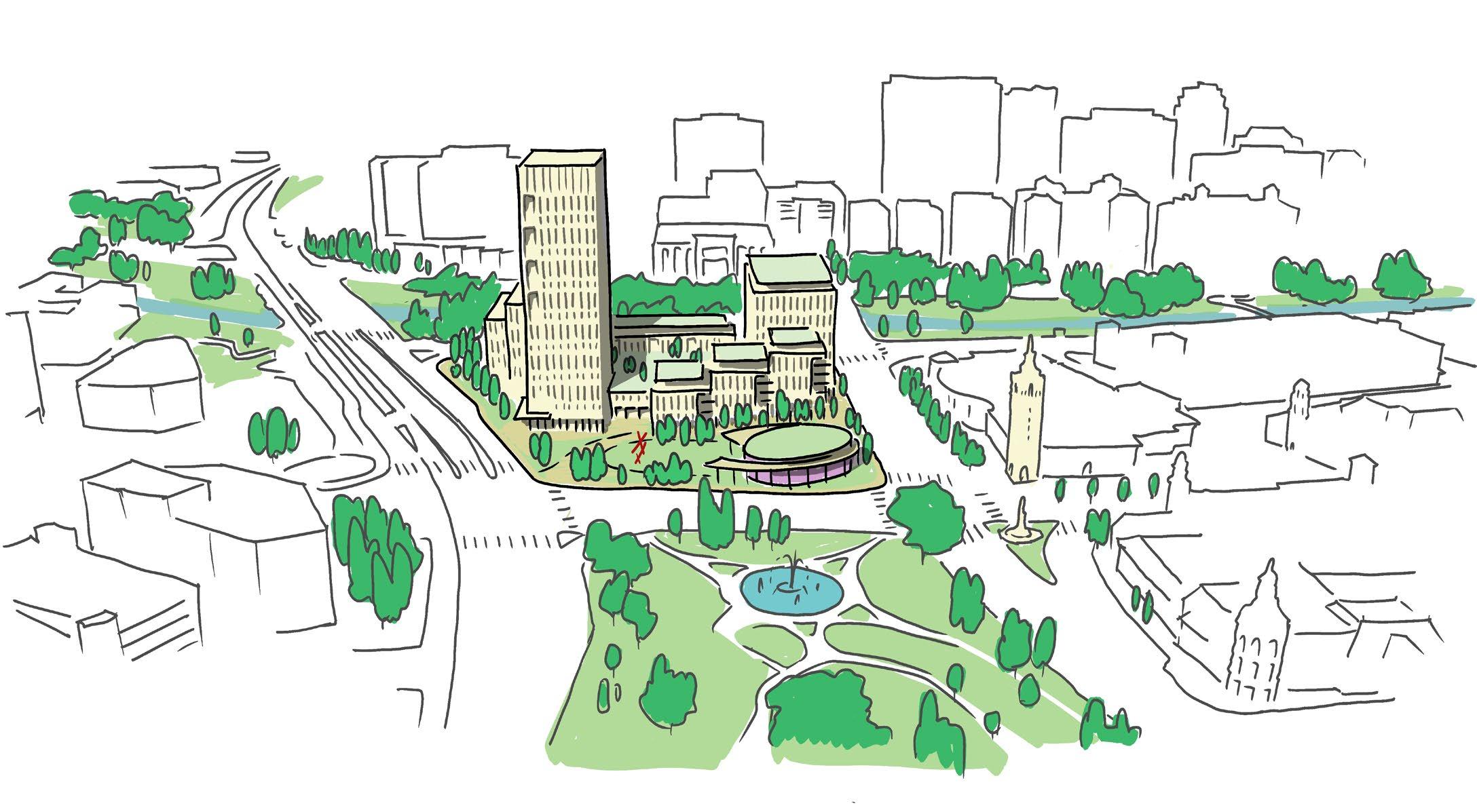
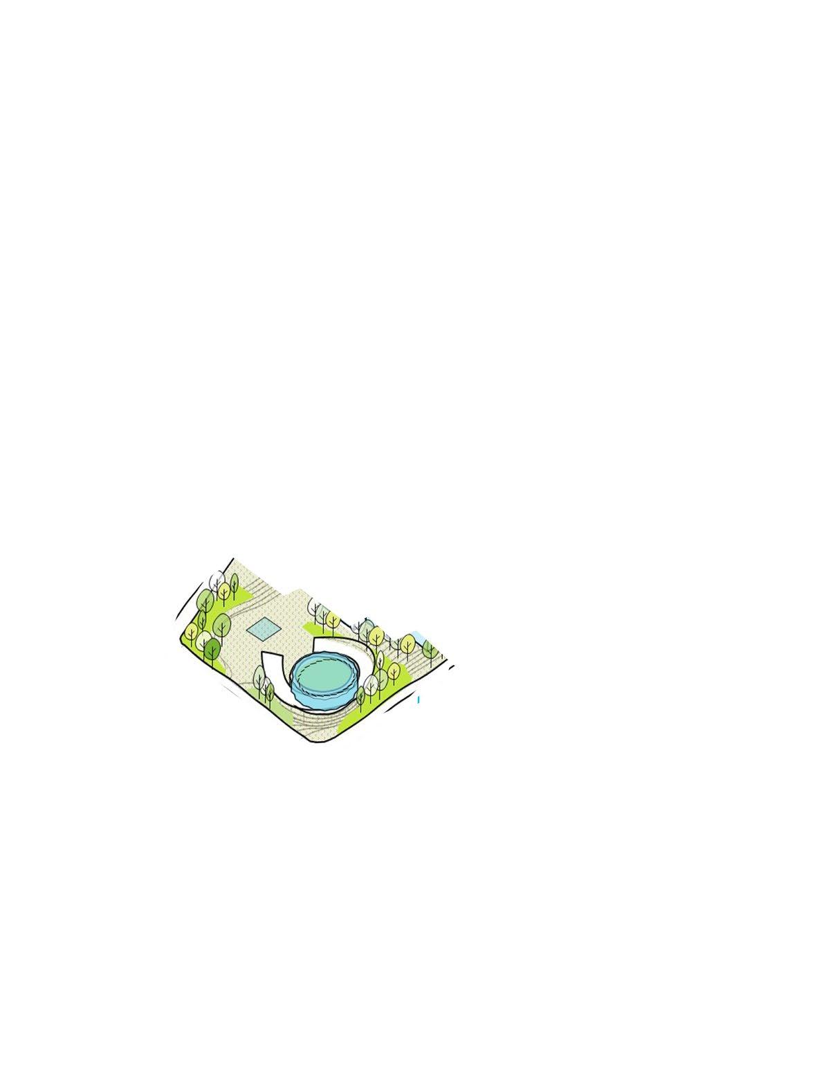
A significant portion of the site is dedicated to a new park, seamlessly extending the experience of Mill Creek Park into the site and connecting southward to Brush Creek. This new public realm prioritizes pedestrian connectivity and placemaking, creating an inclusive and inviting environment for residents and visitors alike.
At the heart of the park stands the Jazz Pavilion, a new cultural anchor and gathering space envisioned for community events, music performances, and everyday recreation. The pavilion serves as a cultural catalyst for the district, enriching the community with opportunities to enjoy live music and other activities in a welcoming outdoor setting.
A new pedestrian promenade spans the site from east to west, addressing the park with a dynamic mix of retail, food & beverage options, hotel and residences. This promenade is designed to encourage social interaction, ensuring a vibrant experience for both local residents and passersby. The enhanced public realm prioritizes walkability and bicycle access, integrating seamlessly with Kansas City’s broader multimodal transportation network, including the adjacent streetcar corridor.
The architectural proposal respects the rich heritage of the Plaza, drawing inspiration from the unique Plaza’s Spanish Revival styles that define its character. Through a modern interpretation of the historic vernacular, the design incorporates locally sourced materials such as brick and limestone, anchoring the project in Kansas City’s architectural traditions. Sustainability is central to the design, with advanced stormwater management systems, green roofs, and native landscaping employed to combat urban heat island effects and promote ecological health.
This redevelopment honors the Plaza’s historic identity while embracing the needs of contemporary urban lifestyles. By integrating cultural, environmental, and community-focused elements, the Plaza Tennis Courts Redevelopment ensures a sustainable and vibrant future for Kansas City, reestablishing the site as a cherished community destination.
Project Data
→ Kansas City, MO
→ 3.9 Acres; 735,000 SF
→ Redevelopment
→ Full Architectural Design Services
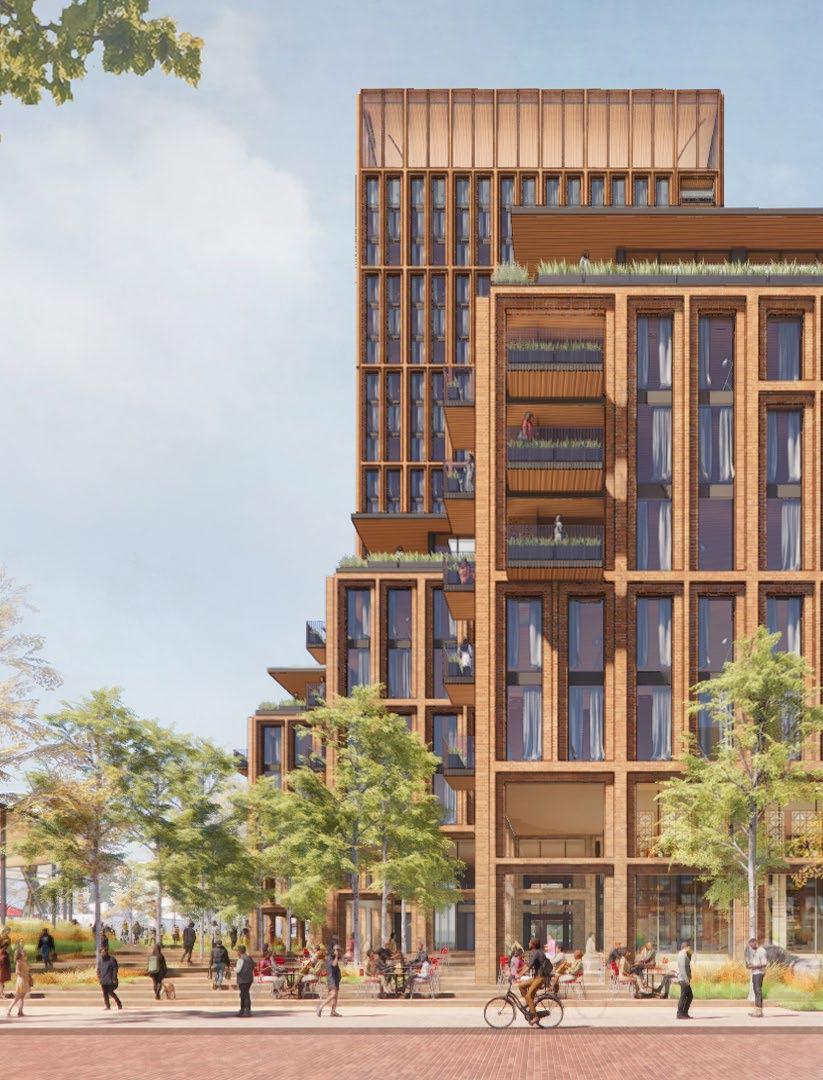
By prioritizing transit access, pedestrian circulation, and bike connectivity, the development serves as a model within the city's framework for transitoriented development and multi-modal connectivity.
Negro Leagues Baseball Museum Campus Development Grayson Capital
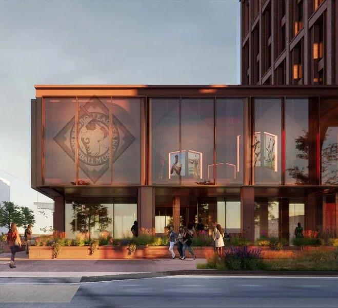
A transformational vision is taking shape in Kansas City’s historic 18th & Vine District, where Grayson Capital, Corbella LLC, and the Negro Leagues Baseball Museum (NLBM) have partnered to reimagine an entire city block at 18th and The Paseo. Anchored by a major 30,000-square-foot expansion of the NLBM and a new museum-themed hotel, the project brings together culture, hospitality, housing, and community infrastructure to create a vibrant, walkable destination rooted in the legacy of Black economic and cultural achievement.
Planned to be delivered as a unified district, the program includes an expanded museum with immersive exhibits and tech-enabled galleries; a 50,000 SF, 80-room hotel designed as the official hotel of the NLBM; a new 10,000 SF connection to the historic Paseo YMCA—birthplace of the Negro Leagues; and a 150,000 SF, 180-unit mixedincome housing community. A shared 460–480-space parking garage will support the campus and the surrounding 18th & Vine neighborhood, with future phases considering additional mixed-income residences wrapped around the structure.
Multistudio serves as master planner and core-and-shell architect, shaping the overall framework and leading the design of the museum and hotel. Pendulum, the museum’s longtime collaborator, is guiding the exhibit and interior experience, while DRAW Architecture is leading the multifamily housing component. Together, the design partners are working closely with the City and community stakeholders to ensure the campus reflects both the neighborhood’s historic character and its evolving future.
At the heart of the project is a deep commitment to place. The team’s role is as both steward and innovator—listening closely to community voices, honoring the district’s legacy of jazz, baseball, and Black entrepreneurship, and shaping architecture that feels both familiar and forward-looking. Context, scale, and materiality guide every decision. The museum and hotel establish a welcoming “home plate” at the corner of 18th and The Paseo, marking the gateway between the historic 18th & Vine neon sign and the broader city. Throughout, subtle gestures nod to baseball culture: brick inspired by infield clay, rhythmic vertical elements recalling dugout bat racks, and architectural moments that reference the line between spectator and player.
The district’s housing—developed with DRAW—supports a vision for long-term neighborhood vibrancy. Targeting deeply affordable rents, the new homes respond directly to community needs and build on a tradition of East Kansas City as a center of Black culture, business, and civic life. With active street fronts, shared parking, public art, and proximity to the Urban Youth Academy, the development is envisioned as a wraparound experience where daily life, history, and craft converge.
Project Data
→ Kansas City, MO
→ New Construction and Expansion
→ 240,000 SF; 180 Units
→ Master Planning, Full Architectural Design Services
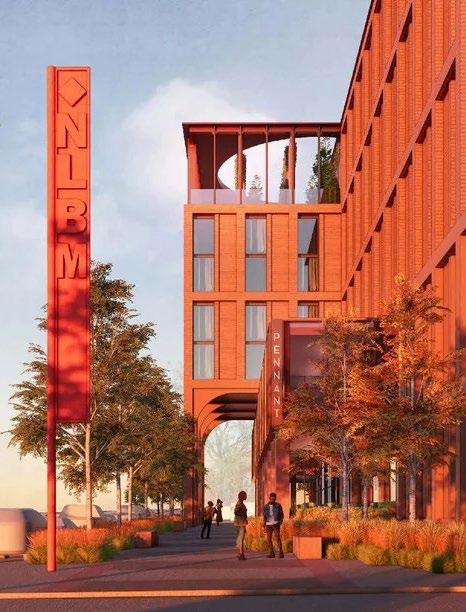
Together, the museum expansion, hotel, housing, and public realm improvements represent a catalytic investment—projected at $125 million—that positions 18th & Vine for the next generation. More than a collection of buildings, the project is a celebration of legacy, a commitment to community, and a bold step forward for one of Kansas City’s most storied neighborhoods.
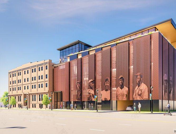
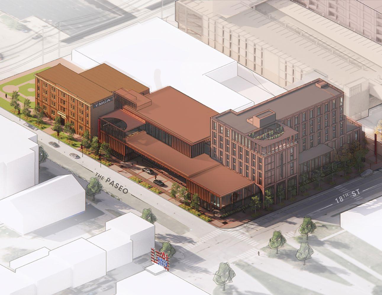
The museum is returned to the historic Paseo YMCA, where Andrew "Rube" Foster formed the Negro National League in 1920.
The expansion includes the Buck O'NEil Education and Research Center and establishes a civic anchor at the birthplace of Black professional baseball.
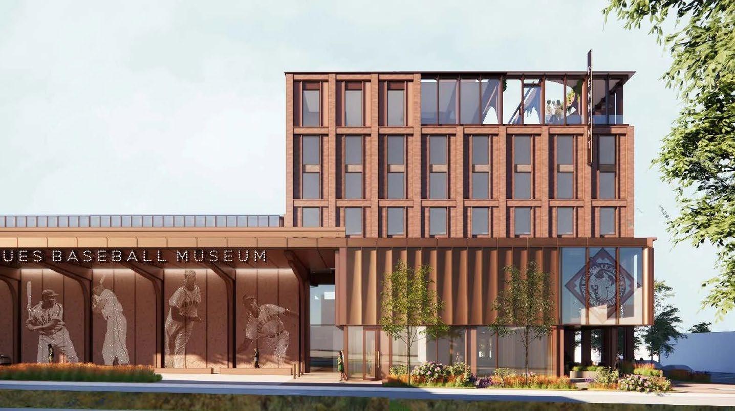
The project addresses existing spatial constraints and features expanded galleries, flexible event spaces, a larger museum store, changing exhibitions, and improved visitor amenities.
Select Work Public Realm
Market Street Reimagined ULI San Francisco and Civic Joy Fund
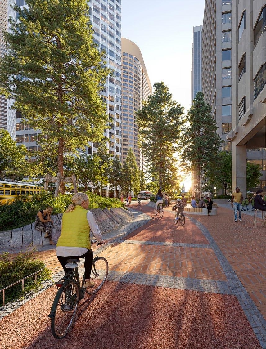
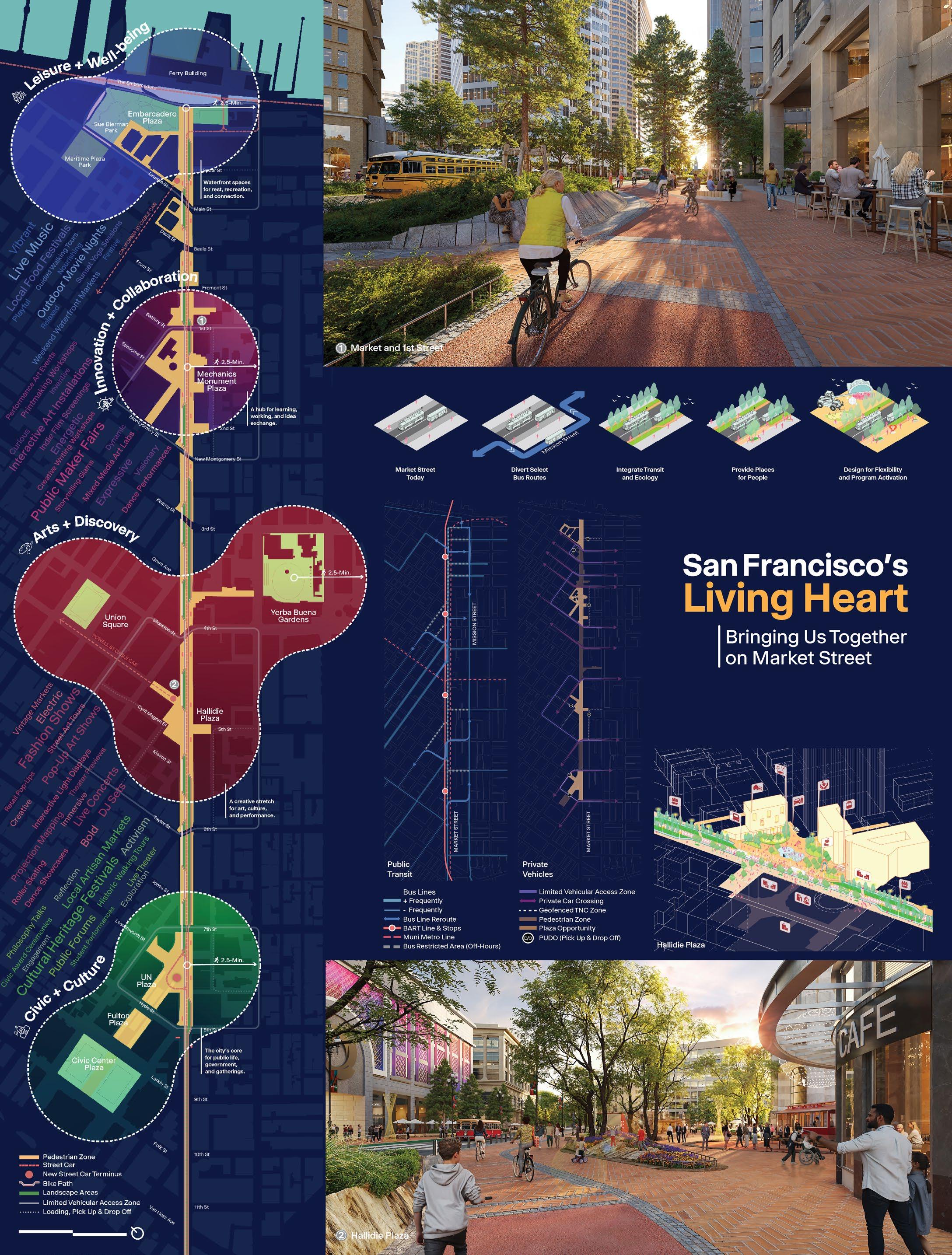
Winner of the 2025 ULI Market Street Reimagined Ideas Competition, this proposal envisioned a bold transformation of Market Street from a movement corridor into a pedestrian-first civic destination. Awarded 1st place in the Placemaking and Connected Neighborhoods category, the vision reframed Market Street as San Francisco’s Living Heart: emotionally resonant, ecologically grounded, and socially magnetic.
Acting as the lead for a diverse, multidisciplinary team, Multistudio brought forward a systems-thinking approach that combined bold vision with implementable strategies. Working seamlessly with our collaborators in landscape architecture, mobility, and programming, our team provided an inspiring yet practical framework for one of America’s most recognized urban corridors.
Post-pandemic, as many downtowns continue to face the challenge of redefining their identity and path to recovery and prosperity, our proposal expanded the role of Market Street beyond mobility, reimagining it as a nature-immersed, people-prioritized corridor. The design prioritized transit integration, people-centered mobility, and layered public realm strategies that connect jobs, institutional anchors, housing, and cultural assets to reignite vibrancy along this important urban corridor.
Four zones unfold like chambers of a living heart: the relaxed pace of the waterfront, inventive pulse of innovation, expressive beat of the arts, and grounded rhythm of civic life. Each introduces anchoring moments of gathering, culture, and community, ranging from cultural performances, civic and social events to everyday activity.
In the jury’s words:
“There were multiple entries that used strategies to amplify the nodes or activity zones that already exist in some form but enhancing them in smart ways. The jury felt this entry best described a workable strategy. It imagines Market Street not just as a place you pass through because of its excellent transit, but as the heart of the city itself. It invests in four nodes by better integrating transit and ecology, designing for flexibility, creating more places for people, and strengthening the connections of these four areas to their adjacent areas off Market Street.”
Project Data
→ San Francisco, CA
→ Competition
→ Planning, Visioning, Multimodal Corridor Integration, Placemaking Strategy, Urban Design, Public Realm Strategy
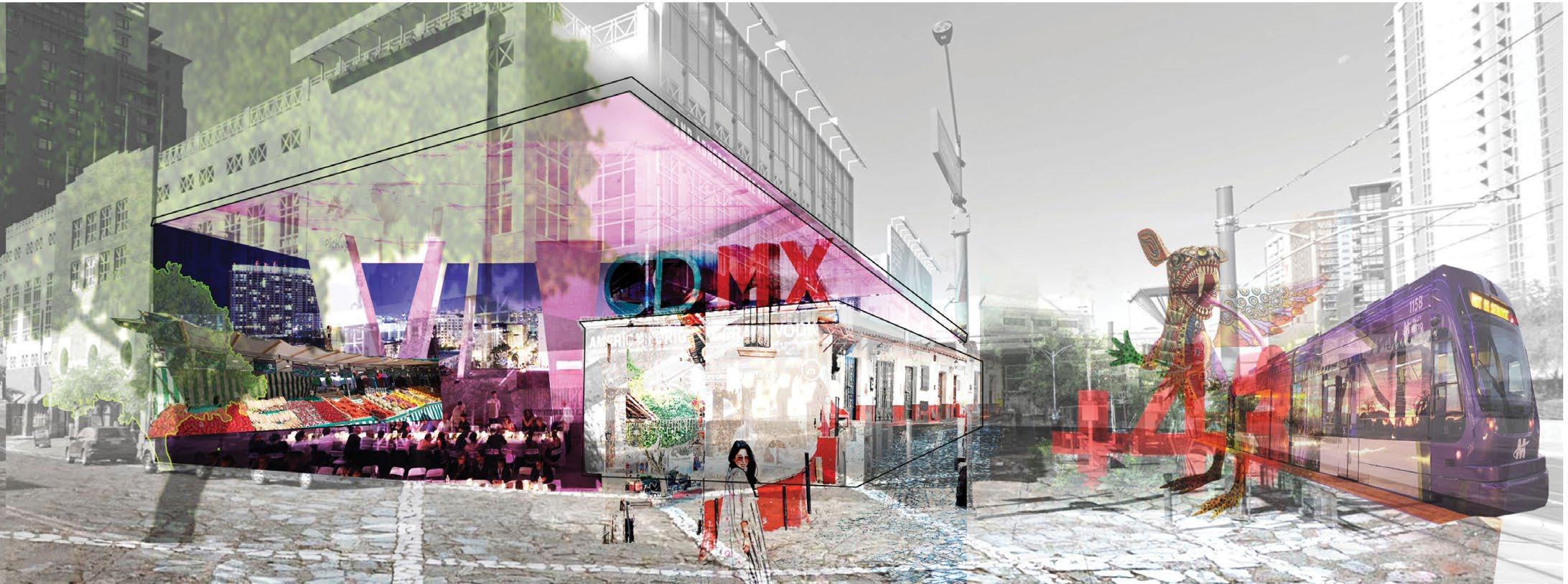
Downtown Phoenix Entertainment District City of Phoenix, AZ
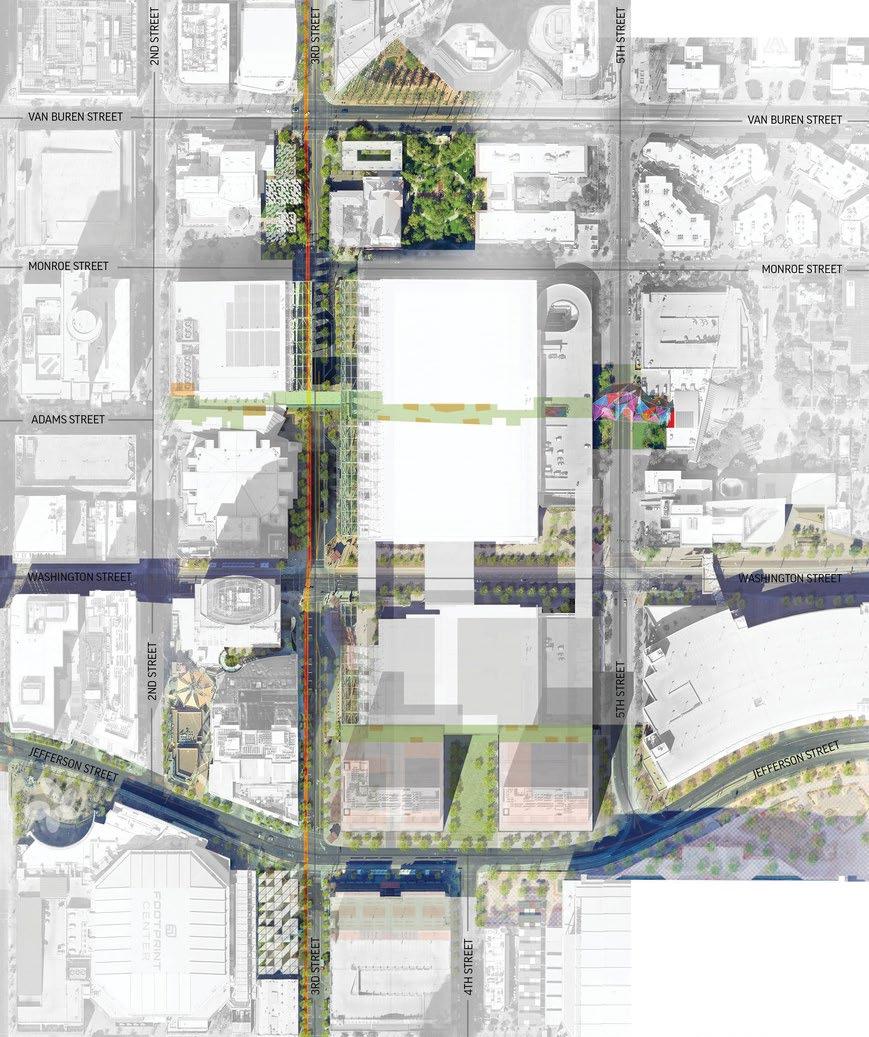
HR&A and Multistudio partnered with the City of Phoenix to advance the vision for a downtown entertainment district adjacent to the Phoenix Convention Center, PHX Arena, and Chase Field. The effort strategically aligned new development with the adaptive reuse of existing buildings to create vibrant, destination-oriented spaces for world-class programming and attractions. Work began with a comprehensive assessment of existing conditions—including site, market, zoning, and regulatory analysis—followed by stakeholder engagement to frame opportunities and shape a shared vision.
A primary challenge involved defining a clear district boundary within the context of urban sprawl and the need to prioritize infill development that strengthens downtown’s fabric. Interest in expanding the geography risked diluting the impact of concentrated investments essential to an authentic “district,” underscoring the need for coordinated public-private alignment.
To support this work, Community and Economic Development convened an Advisory Committee of downtown leaders, complemented by one-on-one stakeholder interviews that created space for candid dialogue around priorities and catalytic strategies.
The effort culminated in a report delivered for internal review and to guide discussions with the public, Mayor, and City Council on next steps. Supporting research, including analysis of the broader Main Line beyond downtown, continues to inform future planning and implementation.
Project Data
→ Phoenix, AZ
→ Implementation Plan
→ Urban Design, Planning & Assessment, Boundary Phasing, Community & Advisory Council Engagement
"We're very pleased with the outcome and high-quality work the team put into the Entertainment District study. It was great working with you all and we look forward to working together on future projects."
—Eric Prochnow, Program Manager, City of Phoenix Community Economic Development
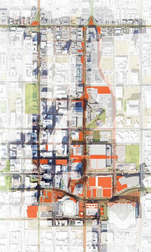
Streetscape Map with proposed design interventions and Overall Site Study Area with identified opportunities and open space
Indianapolis Cultural Trail Indianapolis Cultural Trail, Inc.
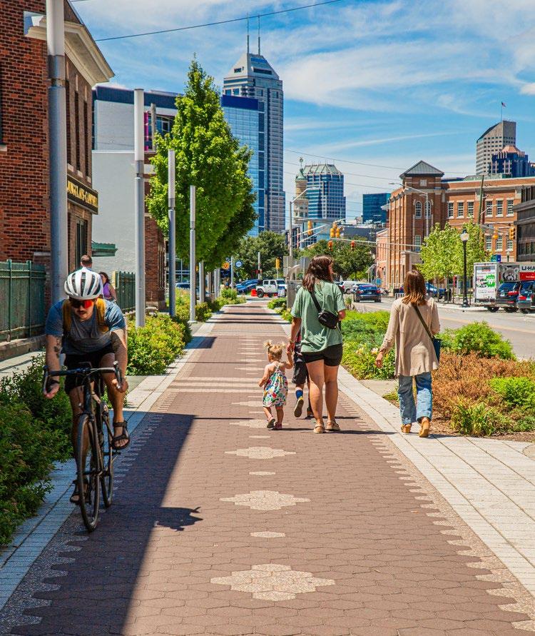
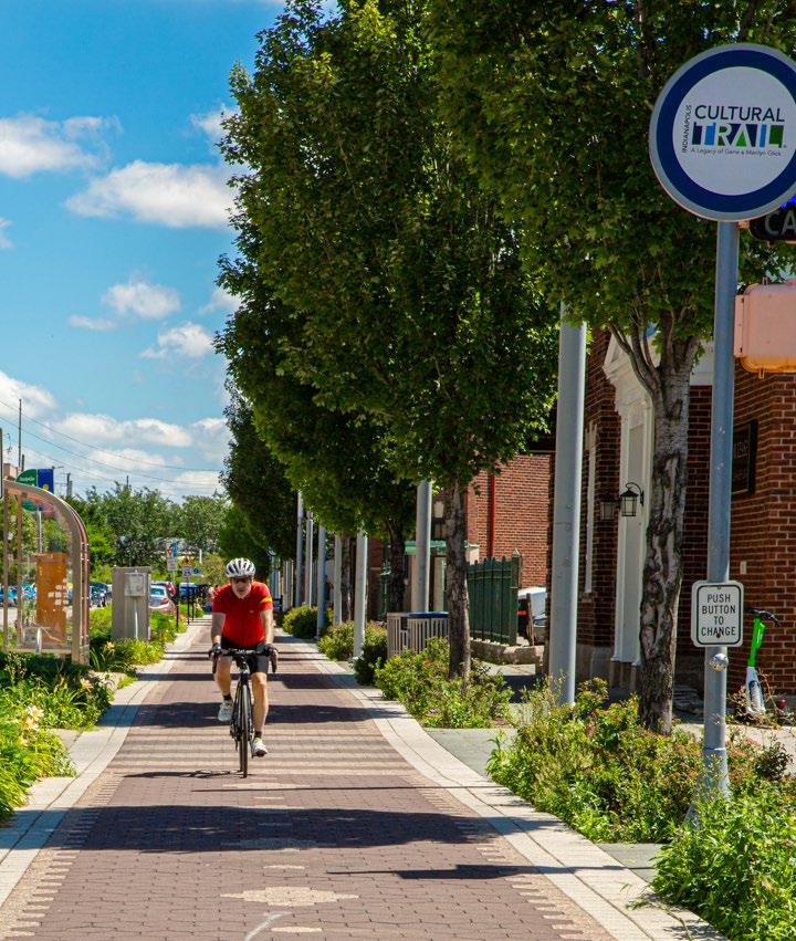
Multistudio worked on a new phase of growth and development for the Indianapolis Cultural Trail: A Legacy of Gene and Marilyn Glick.
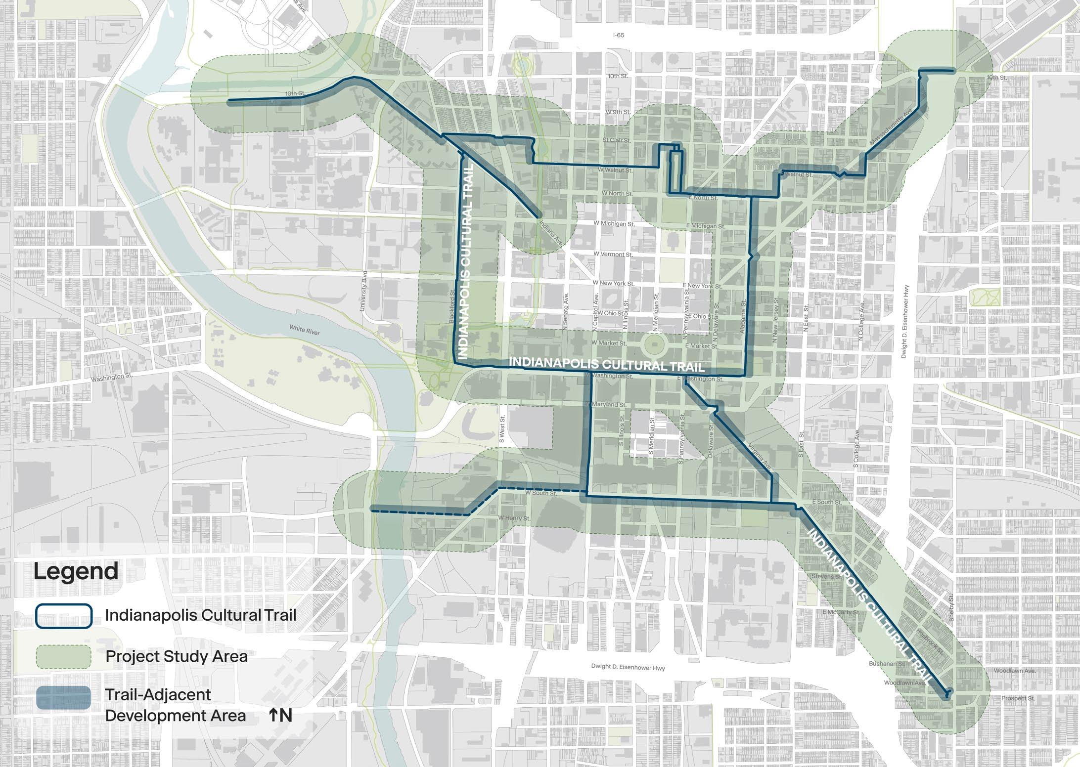
In partnership with REA, JLP+D, Taft, Monumental Gestures, and Policy Analytics, Multistudio developed a trail-oriented development strategy to create a stronger and mutually supportive relationship between the Cultural Trail, surrounding development, and the public realm. The project recommends a suite of best practices designed to strengthen the Cultural Trail as an organization, as a transportation facility, and as a world-class artistic and recreational amenity integral to the experience and identity of Downtown Indianapolis.
Multistudio structured the work around four key phases:
→ Diagnosis: Understanding the context, challenges, and purpose of the project.
→ Vision: Establishing a shared vision with key stakeholders for long-term stewardship of this vital community asset.
→ Alignment: Developing concepts grounded in research and community feedback.
→ Deliverable: Preparing development standards and design guidelines to protect, prioritize, and guide future investment along the Cultural Trail.
The project reinforces the Cultural Trail's role as a cultural connector and recreational amenity that supports sustainable growth and thoughtful development.
Project Data
→ Indianapolis, IN
→ Trail-Oriented Development; Trail Enhancements
→ Planning & Assessment, Public Ream Strategy, Visioning, Development Standards & Design Guidelines, Community Engagement
Rock Island Bridge Flying Truss, LLC
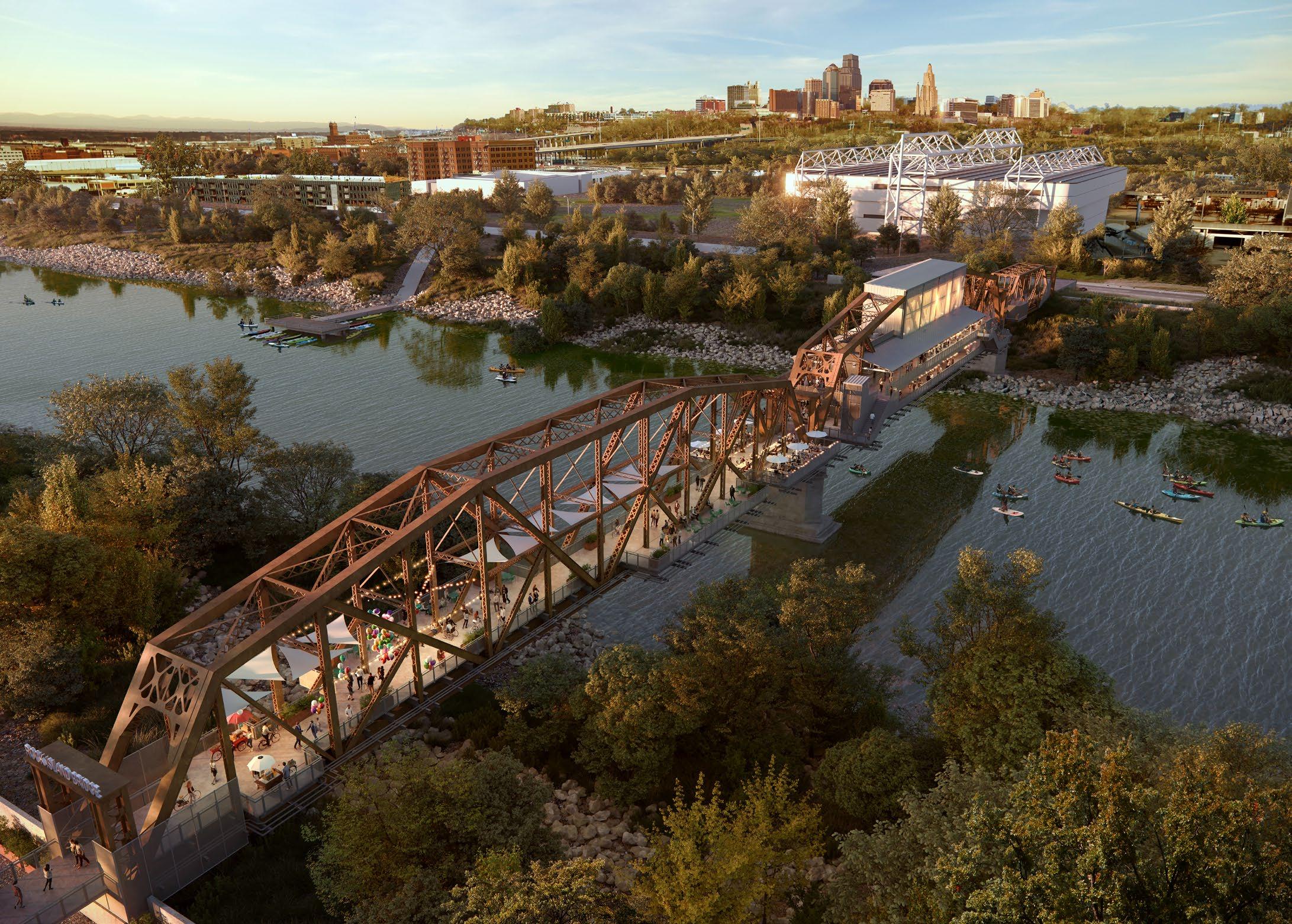
Completed in 1905 as a vital artery of railway transportation, the Rock Island Bridge had been vacant since the 1970s. Connecting Kansas City across the Kansas-Missouri state line, the structure is being repurposed and transformed into America’s first trailhead and entertainment district over a river.
The Rock Island Bridge is a proud member of the esteemed High Line Network, a high honor as it attains recognition as an infrastructure reuse project. Not only does the project salvage 1,200 tons of blighted steel, but this affiliation underscores its commitment to fostering vibrant public spaces, civic connections, promoting environmental resilience, and championing equitable community development.
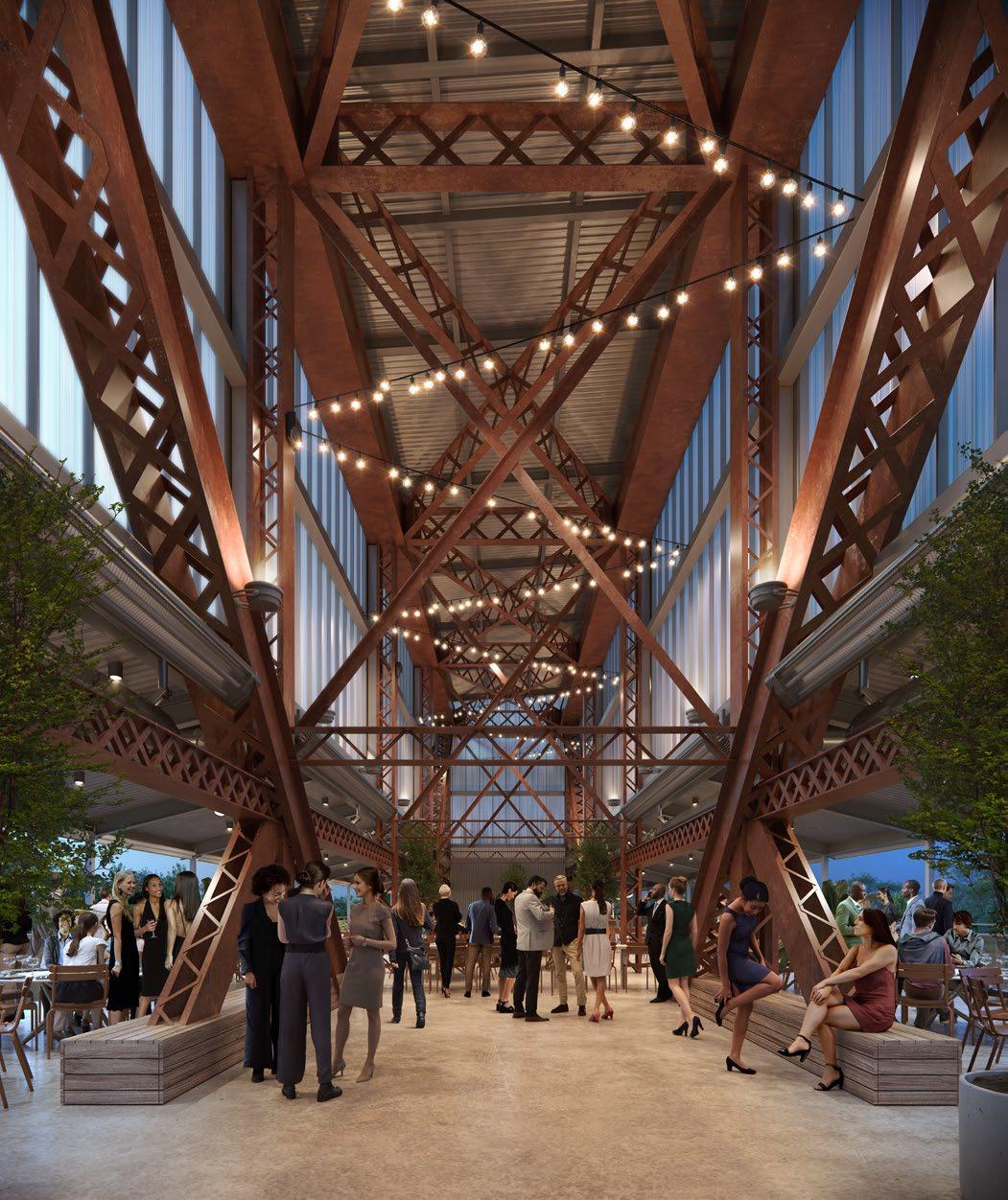
Spanning 750 feet long, the reimagined Rock Island Bridge is comprised of three trusses and two decks. The central truss is over 100 yards long and the primary Entertainment District, a hub of communal activity with plenty of seating, a wrap-around bar, and a variety of dining options. The south side of the central truss has a spacious walkway that interconnects with trailhead services, providing a public crossing for pedestrians and dismounted bicyclists that links levee trails on both sides of the bridge.
The approximately 8,000 SF deck resides 12 feet above the central truss, featuring a 50-foot bar with excellent views. This second level is programmed as an event space that can accommodate 250 people indoors and another 100 outdoors, acting as a venue for year-round entertainment and private events like corporate events, family and class reunions, community events, fundraisers, and weddings.
The west truss hosts the Community Zone, providing open-air community spaces with viewing platforms that can host local farmer’s markets, art fairs, nonprofits, fitness classes, or other community activities.
Project Data
→ Kansas City, KS
→ 35,000 SF
→ Adaptive Reuse
→ Master Planning, Programming, Full Architectural Design Services, Fundraising Support
"Bridging
the rivers helped build the early Kansas City economy. But in the process, the railroad tracks cut us off from our waterfronts. This project reconnects us to the water."
—Daniel Serda, Local Initiatives Support Corporation
Select Work Policy & Regulatory
Prairie Village Vision 2.0 City of Prairie Village, KS
Prairie Village, Kansas is a dynamic suburb of Kansas City, Missouri, comprised of walkable neighborhoods served by multiple village centers, neighborhood parks, and commercial centers.
While the community is well-established, changing residential and commercial market dynamics have prompted a necessary update to the original plan. Throughout the comprehensive planning process, Multistudio collaborated with the community, Planning Commission, and City Council to prepare Village Vision 2.0.
The community, Planning Commission, and City Council identified five frameworks that will all impact the future of Prairie Village:
1. Quality Public Space
Policies preserving and enhancing the streets and public spaces, including multimodal facilities within the public realm.
2. Strong Neighborhoods
Pragmatic approaches for expanding housing types and supporting the needs of residents.
3. Commercial Centers
Business and institutional diversification, as well as multimodal access needs.
4. Sustainability
Strategies for the public and private sector to work cooperatively towards advancements in stormwater mitigation, energy alternatives, and reinforcement of walkable development patterns.
5. Productivity
Clear direction for the City to manage its long-term investment in the public realm and its infrastructure, while sustaining fiscal solvency.
Project Data
→ Prairie Village, KS
→ Comprehensive Plan
A collective vision for the future of Prairie Village.
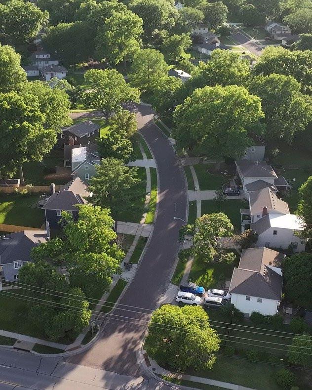
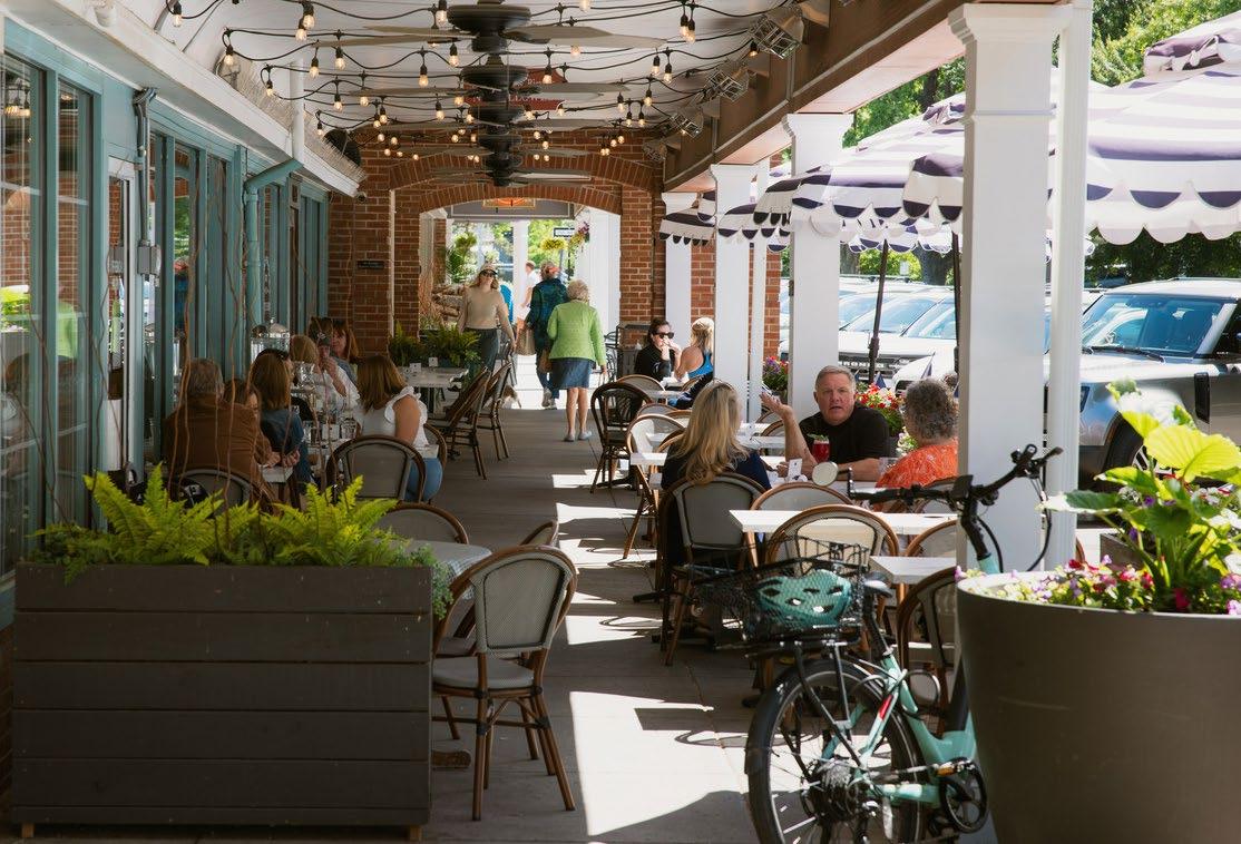
The public realm and land use plans enable both the economically productive and people-centric evolution of city development.
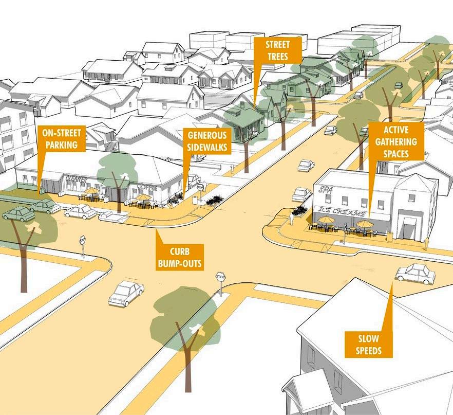
In support of the five frameworks, the plan creates a Public Realm Plan and Land Use Plan.
The Public Realm Plan details the design of the public realm throughout Prairie Village, defining and providing policies around street types, open space types, and citywide multimodal networks.
The Land Use Plan details the variety of “place types” – both for numerous residential and activity contexts –to provide policies and strategies that enable both the productive and people-centric evolution of development pattern and use while maintaining characteristics and qualities valued by residents. Finally, implementation is documented through the strategies, opportunities, and actions that fulfill the community’s vision.
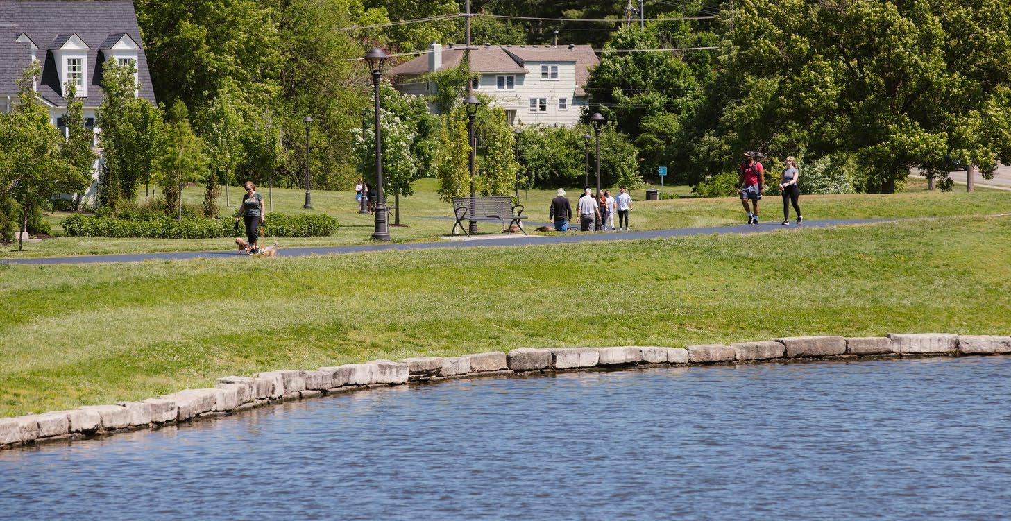
CodeNext Englewood Unified Development Code Update
City of Englewood, CO
An award-winning, comprehensive update
to the Englewood's land development code brings clarity and innovation to a growing town.
Englewood’s CodeNext project is a comprehensive update to the city’s land development code, including zoning ordinances, subdivisions standards, administrative procedures, and community design guidelines. Adoption of the updated development code in September of 2023 culminated over seven years of strategic and comprehensive planning work by the consultants and staff.
The development code is rooted in the plans and policies of the city including the defined priority areas:
→ Neighborhood Dimension and Design
→ Neighborhood Character
→ Housing Attainability
→ Parking and Walkability
→ Sustainability and Green Infrastructure
A Context-Based Approach to Design
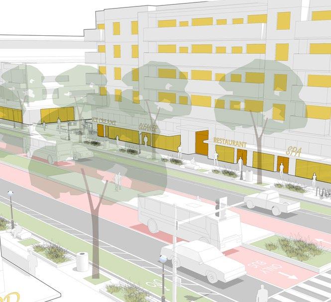
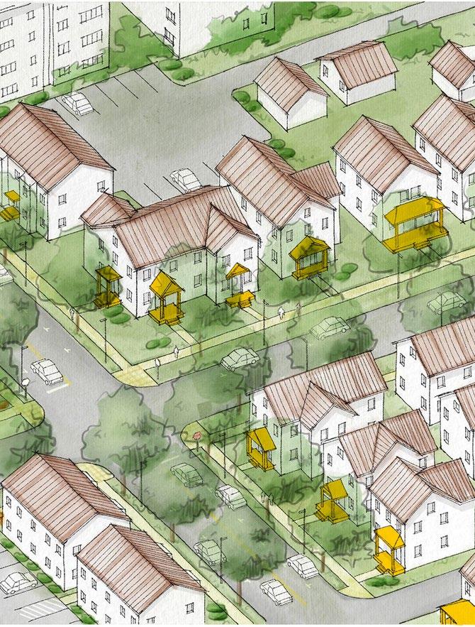
A key change in the code is a shift from use and density standards to form and design standards. The plan promotes more affordable and attainable housing, diversifying the types of housing available, promoting mixed use and transit-supportive development along key corridors, and addressing the changing dynamics of employment and industrial lands within the city.
Communicating Options Through Visualizations
The Multistudio team used visual models and renderings to explore innovative housing options. Assessing tradeoffs and implications of options on affordable housing has helped to right-size Englewood’s approach to this crucial community challenge.
Improved Planning Procedures
The simplification of the code more clearly communicates guidelines. The team also improved planned zoning processes and techniques for added levels of flexibility and improved expectations and outcomes.
A Robust Public Engagement Strategy
Our innovative engagement process integrated online platforms, surveys, and in-person workshops to build consensus support for code elements.
Project Data
→ Englewood, CO
→ Development Code Update
Recognition
→ APA Colorado Chapter, 2024 Planning Excellence Award
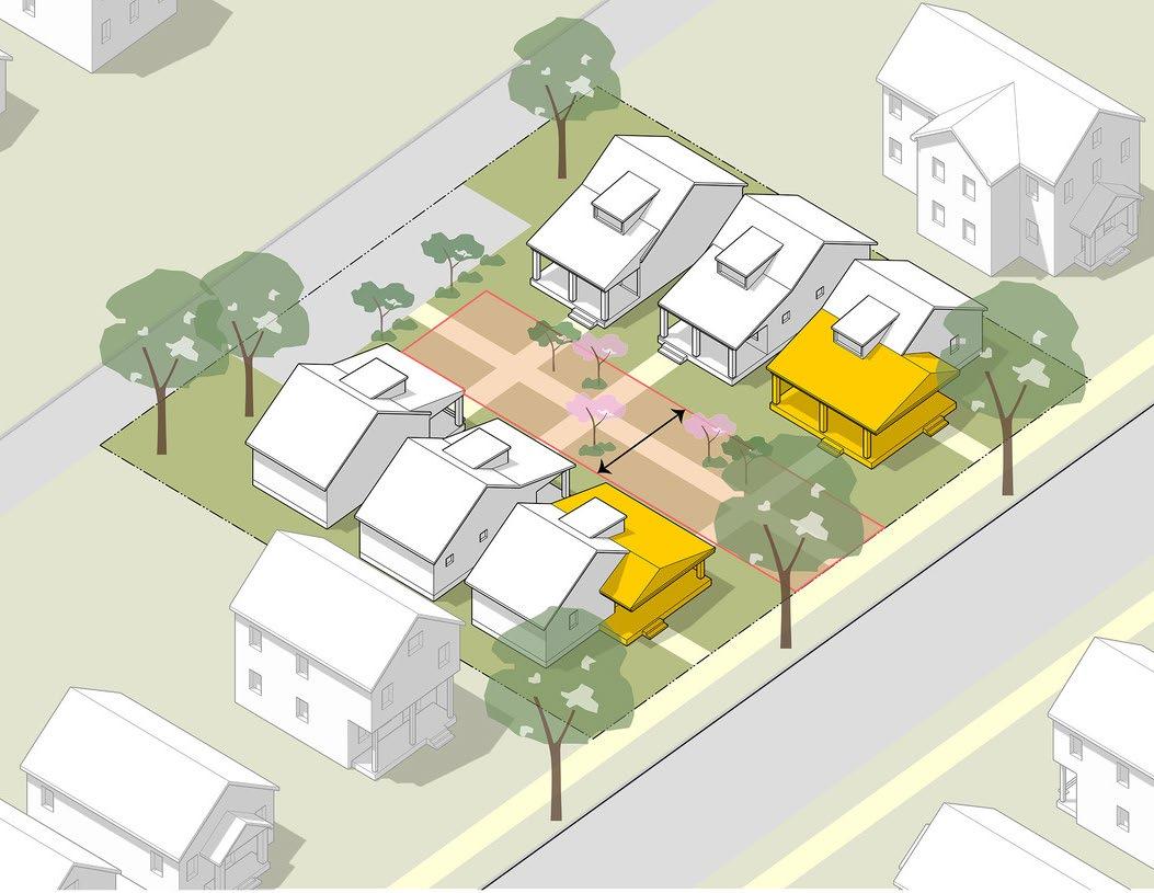
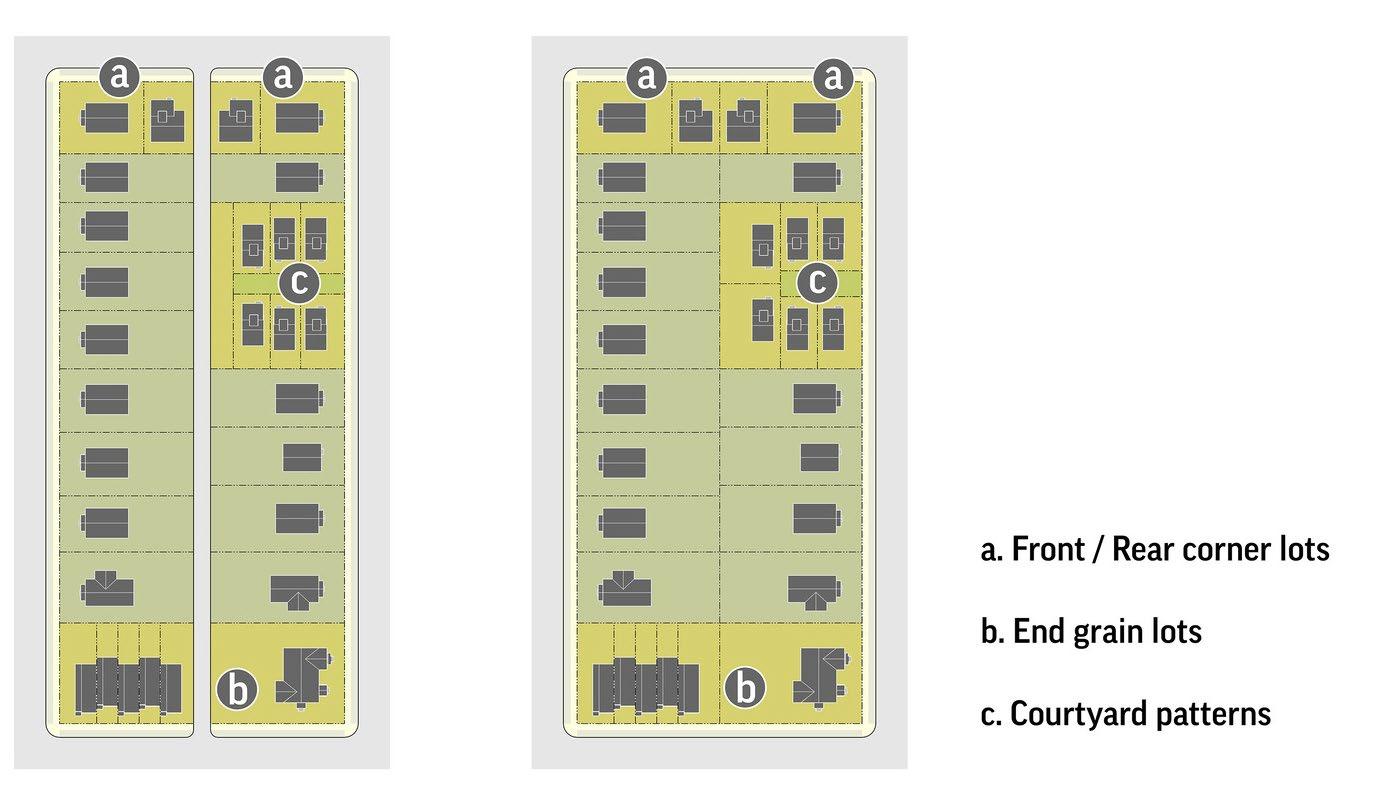
The Multistudio team used visual models and renderings to explore innovative housing options.
Overland Park Forest Plan City of Overland Park, KS
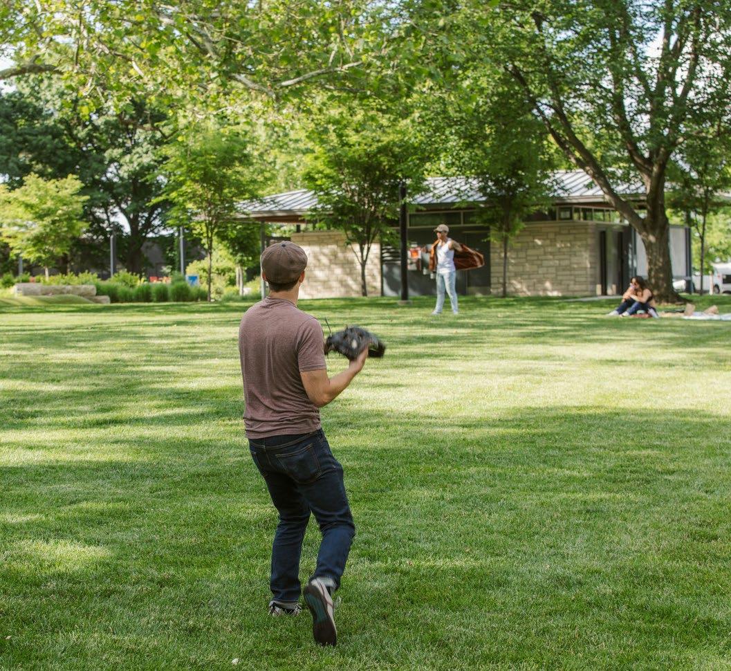
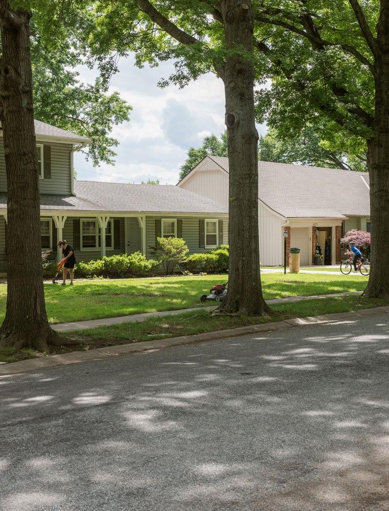
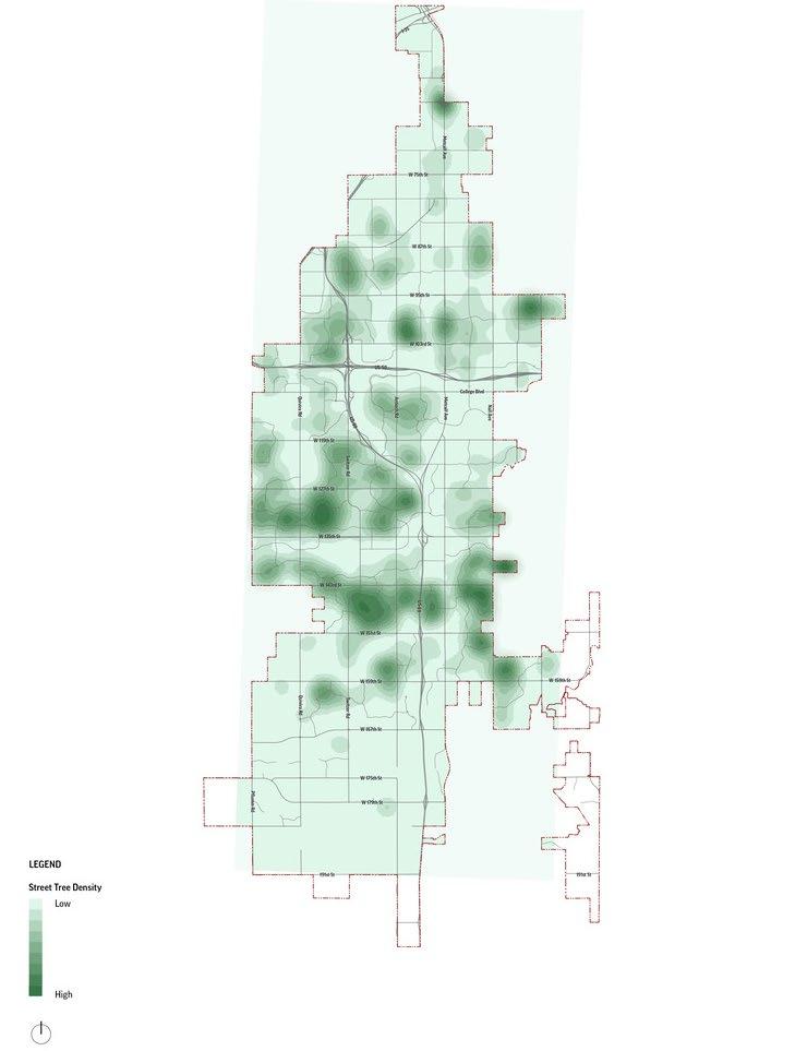
The Overland Park Urban Forest Plan aims to create a more resilient city for both people and wildlife.
Overland Park benefits from a powerful legacy of excellent parks, open spaces, and of a well-managed urban forest. As the city invests and plans for growth and development, it is critical to understand and protect this highly-valued resource.
The urban forest plan draws on community priorities, goals, and leading research to provide guidance to the city for the stewardship and expansion of the urban forest.
Community Engagement
Over 1,000 responses to the online survey provided feedback on community priorities. Stakeholder discussions engaged the Legacy of Greenery Committee, Neighborhood Executive Committee, Environmental Advisory Council, and the Parks & Recreation Advisory Committee.
The resulting plan provides guidance to:
→ Understand the Existing Urban Forest
→ Document existing forest conditions
→ Assess species mix, canopy cover, threats and challenges, and partnership support.
Grow the tree canopy
Improve tree canopy in every neighborhood. Prioritize access in high need neighborhoods. Recommend improved planting conditions and tree inventory Protect Existing Trees.
Assess existing tree protections for public and private land. Recommend incentives for tree preservation and protections.
Maintain the Urban Forest
Recommend best practices to maintain and expand forest. Includes tree inspective cycles, maintenance staff, and equipment.
Improve coordination among organizations
Improve coordination among public agencies, related city departments, and stakeholder groups. Minimize conflicts between trees, infrastructure, and utilities.
Celebrate, Communications & Outreach
Share benefits of City’s urban forest. Improve communication with community on tree activities and advance volunteer opportunities. Collect and share resident’s stories about the trees they love.
Project Data
→ Overland Park, KS
→ Forest Plan
Tonganoxie Downtown Regulating Plan
City of Tonganoxie, KS
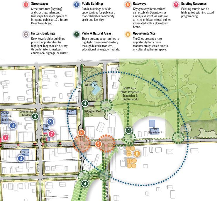
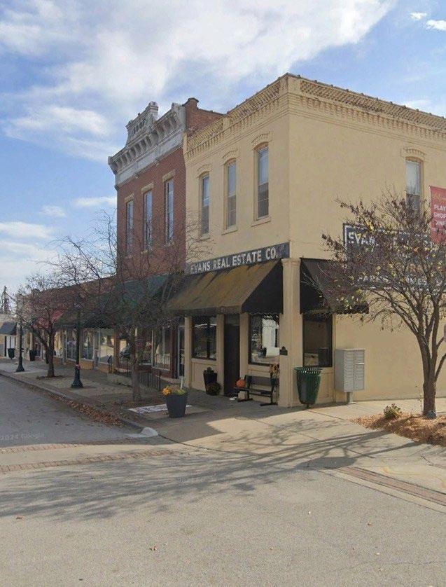
This 20-year guidebook expresses the community’s vision for investing in, evolving, and celebrating Downtown Tonganoxie.
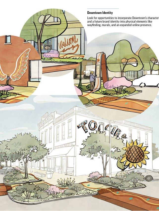
The Tonganoxie Downtown Regulating Plan articulates the community’s vision for downtown’s next chapter and translates that vision into actionable strategies. The plan focuses on celebrating downtown’s identity, reinvesting in public spaces to elevate it as a local and regional destination, and promoting redevelopment opportunities.
Prior to working with Multistudio, Tonganoxie faced regulatory barriers to reinvestment, development, and activation. The existing code lacked standards to ensure new infill would enhance district character, while the community sought pedestrian-focused street improvements and stronger public spaces.
The adopted plan prioritizes implementation by integrating public space design with targeted code updates, enabling permit-ready development and a block-by-block regulating framework. It includes quickbuild strategies to demonstrate early progress while supporting long-term initiatives.
Engagement with local businesses and residents highlighted a desire for a vibrant, safe, and connected network of streets, social spaces, and gateways. The plan emphasizes pedestrian safety and regulatory flexibility to support creativity while maintaining character.
The plan focuses on three priorities:
→ Investing in public spaces to support a pedestriancentered downtown
→ Enabling flexibility for businesses through tailored design standards
→ Strengthening the district with new housing aligned with its historic character
The plan celebrates Tonganoxie’s identity while supporting long-term investment, activity, and community life
Project Data
→ Tonganoxie, KS
→ Downtown Development Framework
ProspectUS Equitable Transit-Oriented Development Strategic Implementation Plan City of Kansas City, MO
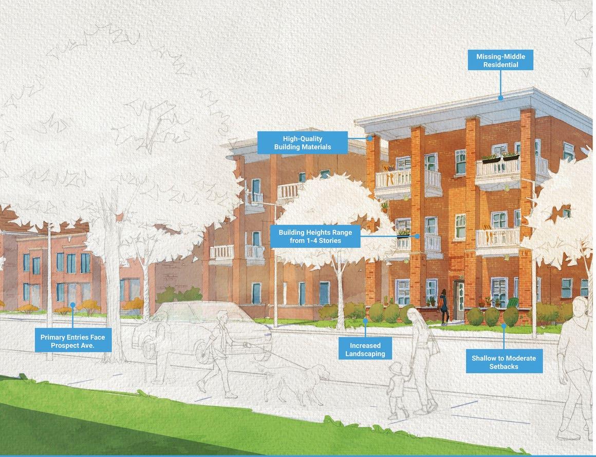
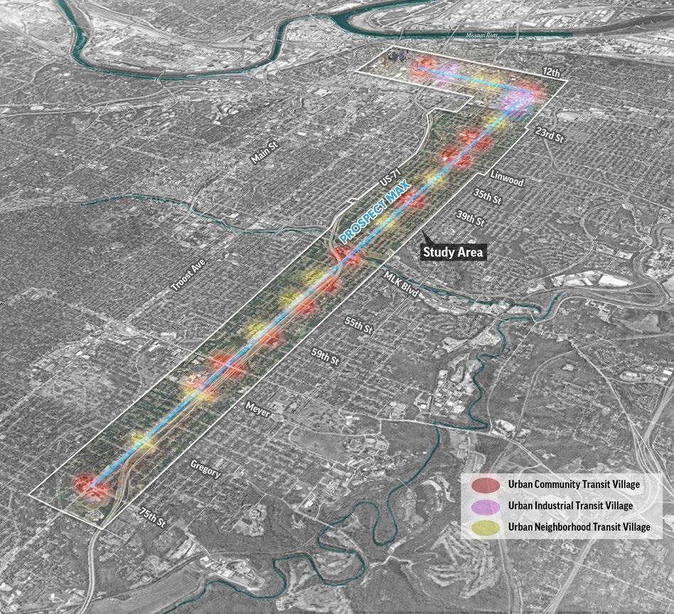
Creating equitable neighborhood development with walkable access to robust, high-frequency public transit. The ProspectUs Equitable Transit-Oriented Development Plan promotes development along an active corridor of Prospect Avenue, encompassing the city's highest bus ridership route in the regional transit system.
Currently, the Prospect Corridor is a “bedroom community”, with destinations going largely outside the area. To navigate development without displacement, this process engaged the community, developers, and the city to set growth targets, create design guidelines, and identify strategy opportunities to create more complete communities.
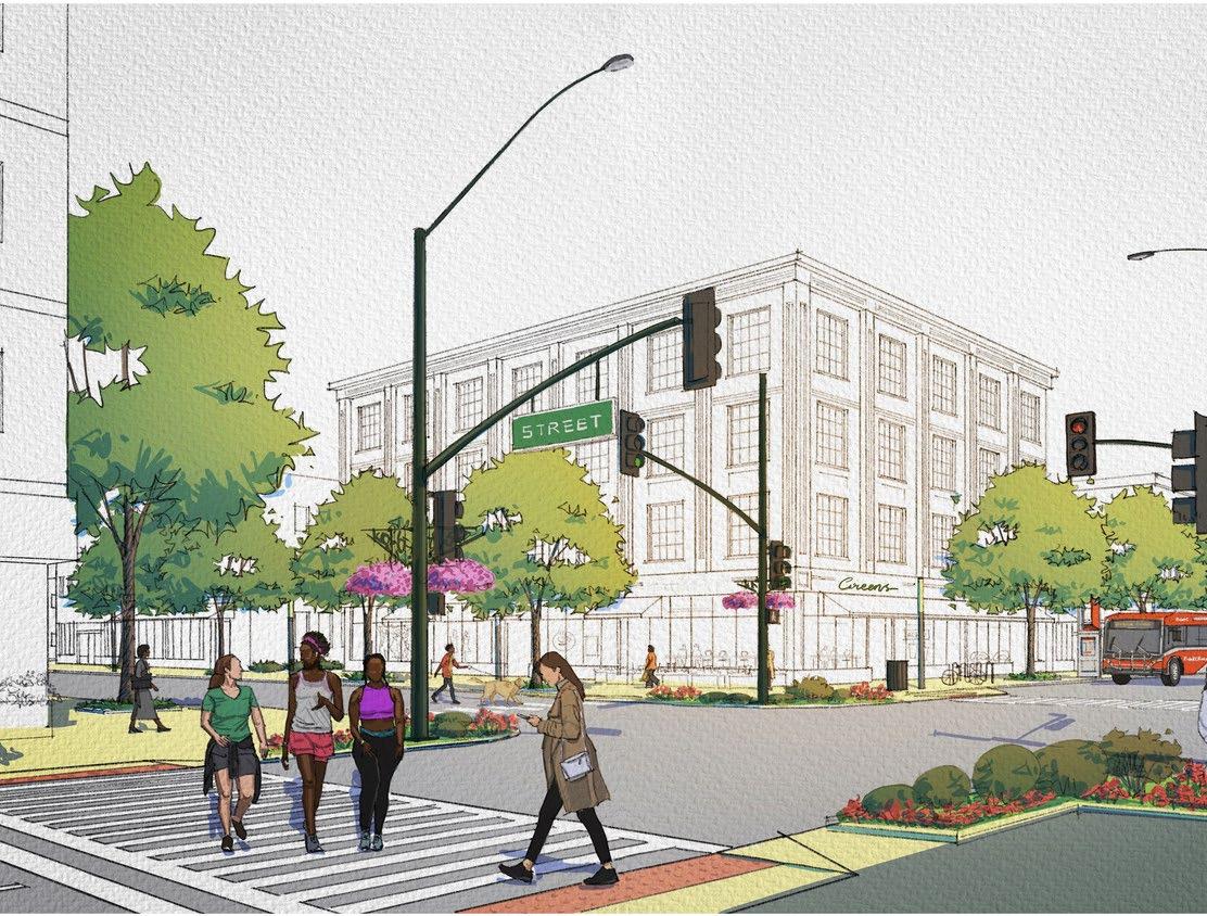
Development guidelines accommodate high-density, middensity, and pedestrian spaces. Key intersections were identified for denser commercial hubs to grow access to goods, services, jobs, and multi-family housing in close proximity to bus transit. Smaller-scale development is planned for neighborhood-oriented areas.
Design guidelines include an overview on building heights and first floor activation, frontage and street design, and public realm attributes.
Project Data
→ Kansas City, MO
→ Transit-Oriented Development Plan
→ 10-mile Development Plan and Regulatory Overlay
Kansas City
4200 Pennsylvania Avenue
Kansas City, MO 64111
816.931.6655
Lawrence
706 Massachusetts Street Lawrence, KS 66044
785.842.3800
New Orleans
1501 Religious Street, Suite A New Orleans, LA 70130
504.681.6303
Phoenix 521 South 3rd Street, Suite 100 Phoenix, AZ 85004
602.234.1140
San Francisco
156 South Park Street San Francisco, CA 94107
415.844.2110
Contact possibilities@multi.studio www.multi.studio