3 minute read
Waterfalls of North Georgia


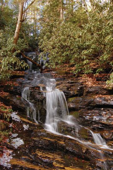
Becky Branch Falls
The 20 foot Becky Branch Falls is easily observed from a wooden bridge which crosses the stream. Becky Branch Falls is accessed via the Bartram Trail.
Directions: From Clayton, Georgia go east on Warwoman Road (County Rd. 5) for just less than 3 mile to Poll Creek Road. Park on left side of road by a small branch. Follow the trail on the right side of the branch for about 200 yards to a bridge at the base of the falls.
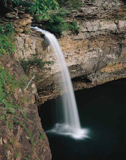
Anna Ruby Falls
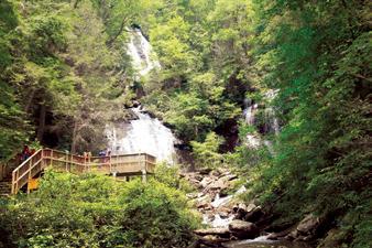
Curtis Creek falls 153 feet and York Creek drops 50 feet down the slopes of Tray Mountain in twin waterfalls. The very steep 4/10 mile Anna Ruby Falls Trail is paved and has benches along the trail for sitting or resting while enjoying the beauty of the area.
Directions: from Helen, take GA 75 North one mile. Right on GA 356 for 1.5 miles, left on the entrance road to the falls.
Dukes Creek Falls
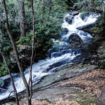
A well-designed trail winds its way into Dukes Creek Gorge, ending at the base of the falls which drop about 150 feet down sheer granite canyon into Dukes Creek.
Directions: Take GA 75 north from Helen for 1.5 miles. Turn left on GA 356 (75 Alternate) for 2.3 miles to the Richard Russell Scenic Highway. Turn right, go 2 miles to Dukes Creek Falls Recreation Area.
Minnehaha Falls
The Minnehaha Trail, .4-mile in length, follows Fall Branch until it dead ends at Minnehaha Falls. This waterfall is approximately 100 feet high (falling and shoaling).
Clayton/Rabun County Area: Take U.S. 23/441 north from Tallulah Falls for three miles to the Rabun Beach Recreation Area sign. Turn left onto Old 441. Go 2.5 miles and take a left on Lake Rabun Road. Go 1 mile past Recreation area. Take a left on Low Gap Road. Follow Bear Gap road which forks to the left. Go 1.5 miles to the sign marking the trail on the right side of the road.
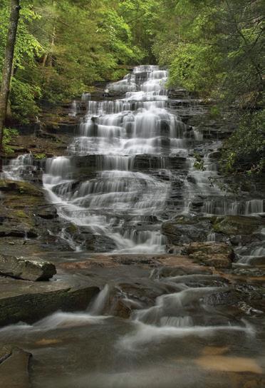
DeSoto Falls
Three falls along a 3 mile section of the DeSoto Falls Trail are maintained for the hiker’s viewing convenience, and are designated as the lower (cascading 20 feet), the middle (falls about 80 feet) and the upper (about 200 feet) DeSoto Falls.
Directions: From Dahlonega travel north on US 19 for 13.5 miles to Turners Corner. At this intersection, turn left and proceed on US 129 for 4.2 miles. Shortly after the Walasi-yi Center is a left turn for the park.


