Jamie Polley, Wausau & Marathon County Parks, Recreation & Forestry Director
LINCOLN COUNTY
Dean Bowe, Lincoln County Forestry, Land, and Parks Director
WI DNR
Mike Duke, Recreation Liaison – Bureau of Parks and Recreation Management
RIVER DISTRICT DEVELOPMENT FOUNDATION OF MERRILL
Jon Krohn, President
Greg Hartwig
Bill Bertram
MSA PROFESSIONAL SERVICES
This document was prepared by MSA Professional Services, Inc. with assistance from the above Steering Committee members.
PAGE RESERVED FOR MARATHON COUNTY RESOLUTION
PAGE RESERVED FOR LINCOLN COUNTY RESOLUTION
I. INTRODUCTION
Chapter One provides an overview of the Wausau to Merrill Trail Master Plan (henceforth referred to as the ‘Plan’).
This chapter describes the project’s purpose, background, and objectives which motivated the creation of the plan and outlines the planning and public engagement process further described in Chapter Three.
Project Purpose
This Master Plan is an investigation into the feasibility of developing a trail to connect the City of Wausau in Marathon County to the City of Merrill in Lincoln County. In examining the possibility of routing and constructing a regional trail, the Plan recognizes that success will require cooperation from a diverse group of municipalities, counties, nonprofit organizations, and individual private stakeholders.
Based on a thorough existing conditions analysis and public engagement process, the Plan identifies primary and alternative trail route opportunities and provides actionable recommendations and cost estimates for construction in a phased build-out strategy.
The trail linking Wausau to Merrill will strengthen connections between communities and celebrate the natural beauty of the region. The trail will expand recreational opportunities for bicyclists and pedestrians, promoting public health and tourism while supporting natural resource conservation. Aligning with the Wisconsin Department of Natural Resources’ (WDNR) Wisconsin Trails Network Plan (2003), this segment of Corridor 18 could— over the long term— become a state trail that links corridors in the North and South-Central regions of Wisconsin.
PLAN ORGANIZATION
CHAPTER ONE describes the project’s purpose, background, and objectives which motivated the creation of the plan.
CHAPTER TWO provides a comprehensive overview of the existing conditions within the project area and a review of local ordinances and relevant plans.
CHAPTER THREE builds on the existing conditions outlined in Chapter Two to identify liabilities and challenges to trail routing and construction; the chapter also reviews the public engagement process and its effect on the Plan's goals and strategies.
CHAPTER FOUR presents a comprehensive set of recommendations aimed at establishing and enhancing the trail network.
CHAPTER FIVE highlights opportunities for funding resources and potential partnerships to guide the trail’s development and construction.
BACKGROUND
The WDNR Wisconsin Trails Network Plan identifies Corridor 18 as a future state trail, eventually establishing a continuous route from Lake Superior to the Wisconsin-Illinois state line. A portion of this segment would connect the City of Wausau with the City of Merrill. Marathon County and Lincoln County, in partnership with local organizations, have expressed interest in determining a feasible route for this segment of the corridor.
Within this segment, a potential path was identified via a corridor owned by Wisconsin Public Service (WPS) previously secured for a trolley line. The trolley line does not have any current or future plans for construction. As stated in the WDNR Plan, “From the LincolnMarathon County line, a trail following a power line corridor that extends south from State Highway 64 near Merrill to north of
Wausau is recommended. Marathon County also recognizes the value of this utility corridor along the scenic Wisconsin Riverway for trail purposes” (p. 49). The WPS property is also identified in the Marathon County Bicycle and Pedestrian Plan for the Wausau Area Metropolitan Planning Organization as a trail segment that could connect Wausau North to Merrill.
While this plan utilizes the WPS corridor as a starting point for proposed trail route, no formal agreement with WPS to develop the trail through their property has been established as of this Plan’s adoption. While they are open to the possibility of entering into such an agreement with Marathon and Lincoln Counties at some point in the future, such negotiation was not within the scope of this master planning process.
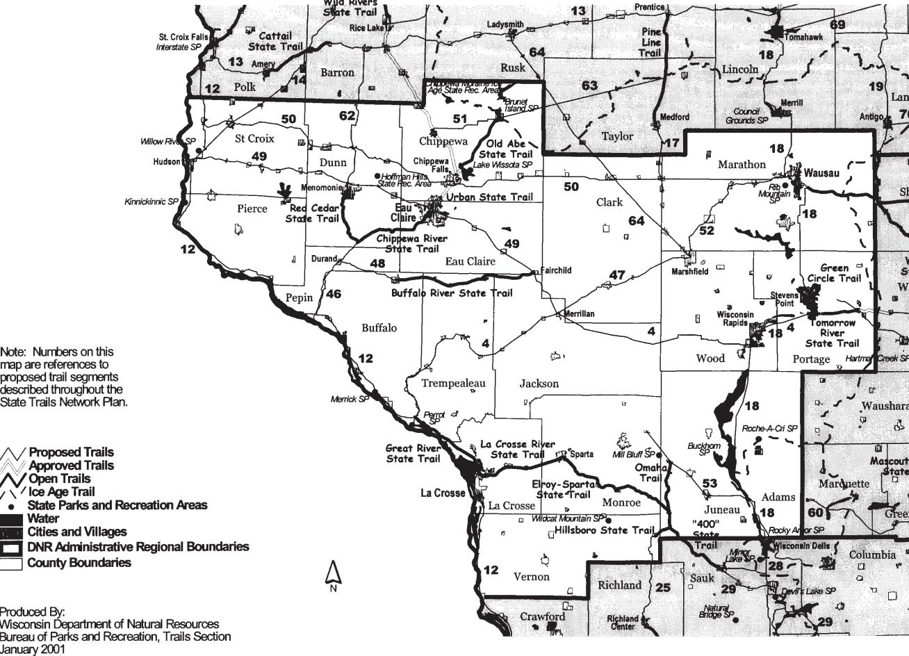
Map of planned State trail corridors in the West Central Region, Wisconsin Trails Network Plan (WDNR, 2003).
WPS owns the corridor from Goetsch Rd in Wausau north to approximately 0.32 miles southeast of County Road WW in Brokaw for a total of approximately 1.5 miles. WPS also owns another corridor starting about 1.3 miles north of County Road WW to the Lincoln County Line or approximately 5.8 miles. Within this corridor Ahlstrom-Munksjo Mosinee LLC owns a section approximately 0.36 miles northwest of County Road WW in the Village of Maine. Wisconsin River Traction and Power Company, of which WPS is a part, owns a similar corridor in Lincoln County to the WPS corridor in Marathon County. This corridor starts at the Lincoln County line and goes North to approximately a 0.5 mile south of the city limits of Merrill. There are some gaps within this corridor where land is owned by private individuals.
OBJECTIVES
Areas of focus for the Plan include:
• Review of existing trails, public facilities, and environmental conditions between the City of Wausau and the City of Merrill.
• Explore routing and construction opportunities to connect the City of Wausau’s existing River Edge Trail to the City of Merrill’s River Bend Trail, with special consideration for connections to the WPS Corridor.
• Addressing trail routing challenges created by highway crossings, rivers, and wetlands.
• Present a segmented approach to the trail, with recommendations for trailhead design, alternate routes, and phased construction.
Planning Process
A Steering Committee was also formed to oversee the development of the proposed route and planning process. This committee was composed of representatives from the Marathon County Parks, Recreation & Forestry Department, Lincoln County Forestry, Land, and Parks Department, WI Department of Natural Resources (WDNR), and River District Development Foundation of Merrill. This committee met four times over the course of 2024 to review and discuss the plan’s progression.
The public engagement process included an online survey and mapping tool, two public input meetings, and outreach to landowners and key stakeholders. Individual property owners who may be impacted by the trail route were contacted between May 2024 and February 2025. Additional information about the public engagement process is provided in Chapter Three.
Following the two public input meetings in June 2024, the proposed route and alternatives were finalized over the latter half of 2024 incorporating the feedback received. The planning process extended into early 2025 after the October 2024 announcement of a potential American Transmission Line (ATC) project— likely to utilize portions of the WPS corridor— to assess impact to the proposed route.
The final plan was adopted by Marathon County on [X DATE], and Lincoln County on [X DATE].
PLANNING PROCESS OVERVIEW
PHASE 1
March 2024
• Steering Committee Kick-Off Meeting
• Existing Conditions Analysis
PHASE 2
April – June 2024
• Trail Corridor Inventory & Assessment
• Steering Committee Meeting #2
• Online Survey
• Public Input Meetings (Wausau/Merrill)
PHASE 3
July – September 2024
• Preliminary Route Development
• Trailhead & Route Concepts Development
• Steering Committee Meeting #3
PHASE 4
October 2024 – February 2025
• Steering Committee Meeting #4
• Trail Route & Alternatives Finalization
• Plan Development & Finalization
II. PROJECT SITE & ANALYSIS
Chapter Two provides a comprehensive overview of the existing conditions within the project area. It includes a detailed description of the project site, featuring a matrix of existing parks, trails, and recreational amenities throughout the area. The matrix highlights the location, existing characteristics, classification, and amenities of these facilities.
This chapter additionally provides a review of local ordinances and relevant plans adopted by Lincoln County, Marathon County, the City of Wausau, the City of Merrill, and the Wisconsin Department of Natural Resources. This Plan’s existing conditions analysis aims to establish a clear understanding of the current infrastructure and regulatory framework, which will inform the development of future trail connections and improvements.
Project Site
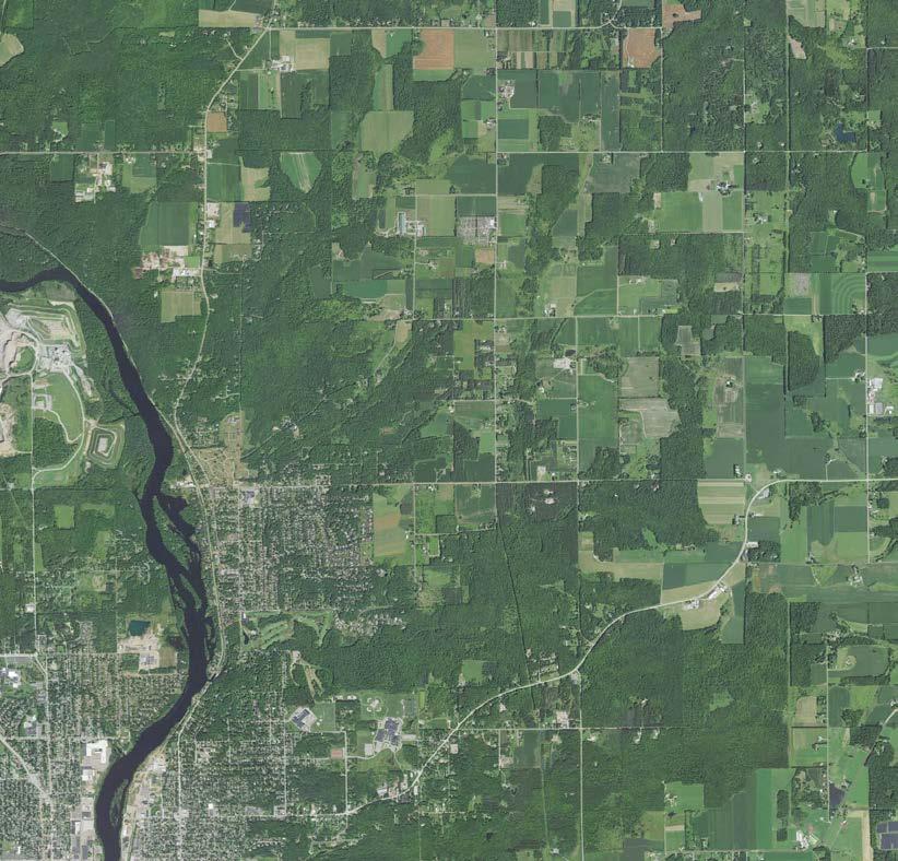
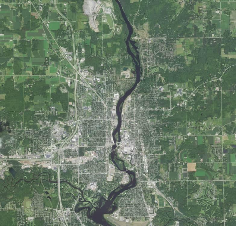
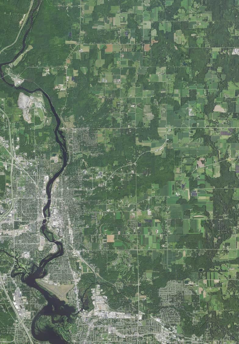
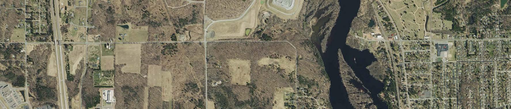
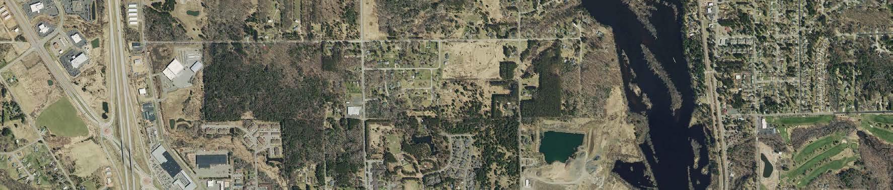
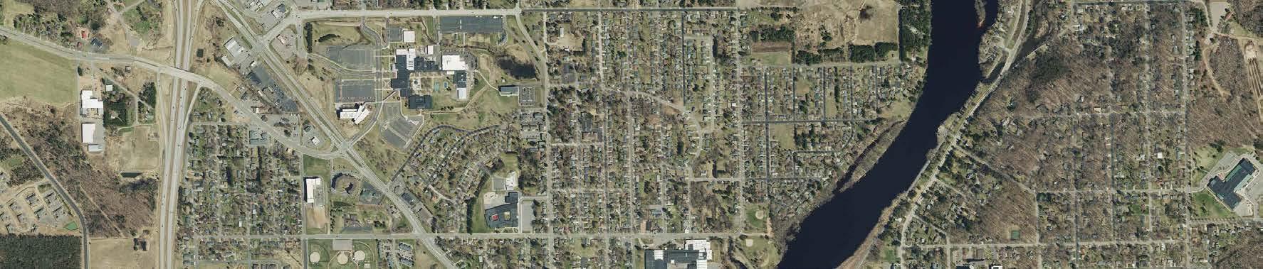
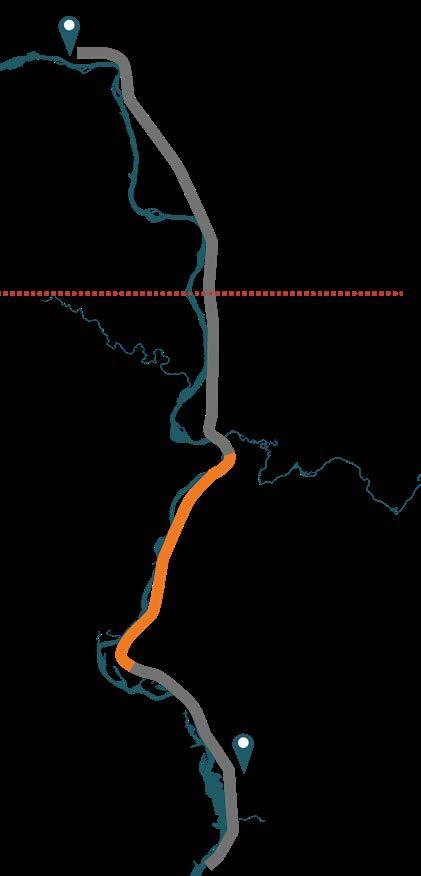
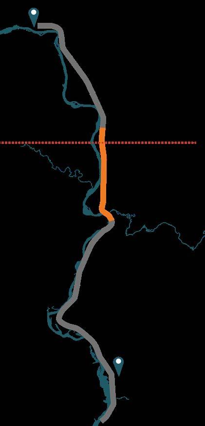
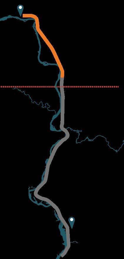
The Wausau to Merrill Trail is a 15.5-mile proposed trail corridor largely parallel to an existing railroad to the east side of the Wisconsin River, running north-south from the City of Wausau to the City of Merrill.
The trail corridor would connect Marathon and Lincoln counties, passing through the Town of Texas, Village of Maine, and Town of Pine River. From the south, in the City of Wausau, the proposed route would connect with the existing River Edge Parkway trail system near 6th St. To the north, in the City of Merrill, the proposed route connects to the existing River Bend Trail.
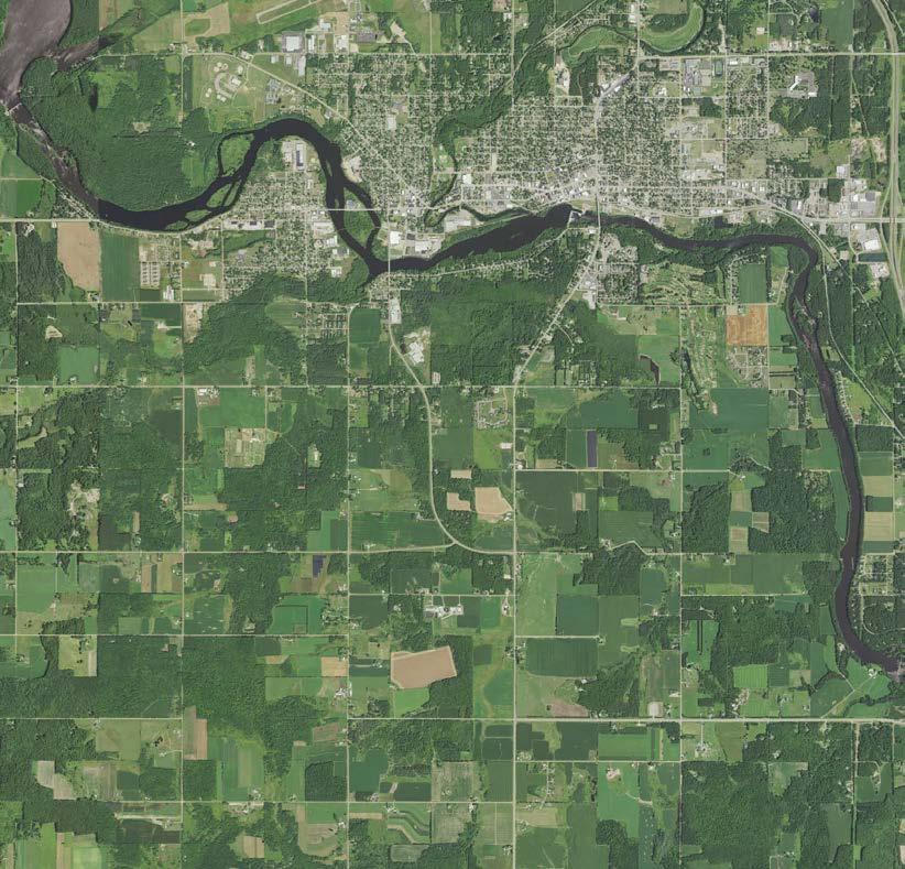
If completed, the Wausau to Merrill Trail would connect into a larger 105mile bicycle and pedestrian network within the Wausau metropolitan area. The full project location map can be found in Figure 2.1
Figure 2.1 - Overview of Project Site
Parks & Trails Inventory
Several existing county and municipal recreation areas are located within the proposed trail corridor as part of this Master Plan, these existing recreational facilities were assessed for potential connectivity, trail head locations, and other amenities for the future Wausau to Merrill Trail. Table 2.1 summarizes the existing park/trail amenities within or near the project area.
EXISTING TRAILS
RIVER EDGE PARKWAY
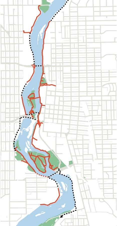
This trail consists of a total of 7 miles of mostly paved trail in the City of Wausau, though there are existing gaps in the trail network with planned extensions. Primary uses include walking, running, and biking. This trail has some accessibility limitations according to the 2020 River Edge Parkway Master Plan. Running along the Wisconsin River, the trail has amenities such as benches, park plazas, playgrounds, restrooms, and access to natural areas. Trail connections include the downtown residential and commercial areas, numerous parks, and riverfront access. Future connections include the proposed Wausau to Merrill Trail.
RIVER BEND TRAIL
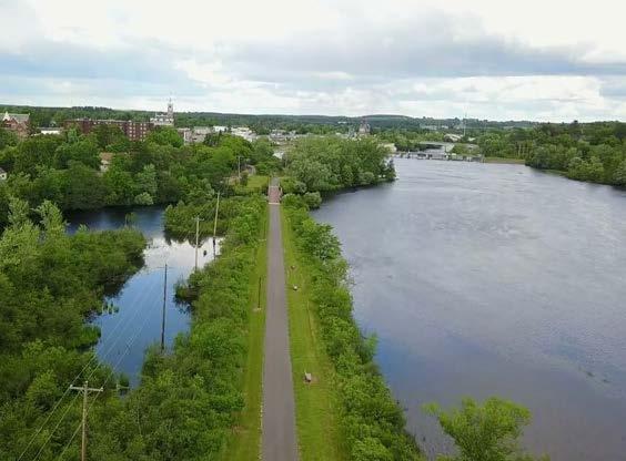
This trail consists of 5 miles of paved trail in the City of Merrill for walking, running, and biking. The trail is both ADA and stroller accessible. Nearly half of the trail runs directly along the Wisconsin River. Amenities along the trail include restrooms, shelter, a playground, benches, and green space. The trail provides connectivity to the Merrill Area Recreation Complex, riverfront, and downtown. Future connections include the proposed Wausau to Merrill Trail.
MOUNTAIN-BAY STATE TRAIL
This state trail runs 83 miles starting in the Village of Weston, just outside of Wausau, and ending in Howard Memorial Park near the City of Green Bay. Trail landscapes include farms, forests, wetlands, and woodland areas as well as running through small communities on its route. 18 miles of the trail system is within Marathon County. The Ice Age Trail follows
River Edge Parkway Master Plan (City of Wausau, 2020).
Mountain Bay Trail (Marathon County Facility Directory).
River Bend Trail and Wisconsin River (River Bend Trail, 2018).
the Mountain-Bay State Trail in Marathon County and in the east, the trail connects with the Wiouwash Trail. In Marathon County, walking and biking are permitted on the trail year-round. During the winter, the trail is open to snowshoers, cross country skiers, walkers, and bikers. Snowmobiles are permitted in the winter when the trail is considered open at discretion of the county.
Table 2.1 - Existing Park & Trail Amenities
Park / Trail
River Edge Parkway, City of Wausau 7-mile trail
Forest Park, City of Wausau
4.0 acres
Gilbert Park, City of Wausau
6.0 acres
Brokaw County Park, Marathon County
74.2 acres
Jesse Park / Community Park, Town of Texas
23.8 acres
Wisconsin River Forest Unit, Marathon County
303.0 acres
Stange’s Park, City of Merrill 11.6 acres
Riverside Park, City of Merrill
22.0 acres
River Bend Trail Park, City of Merrill 5-mile trail
Existing Amenities
• Fishing Access / Pier
• Paved Path
• Playground
• Picnic Tables / Seating
• Tennis / Pickleball
• Boat Landing
• Fishing Access / Pier
• Grills
• Undeveloped / Natural Area
• Restrooms
• Ball Diamond
• Basketball
• Boat Launch/Pier
• Hiking Trails
• Shelter/Kitchen
• Restrooms
• Basketball
• Boat Landing
• Picnic Tables / Seating
• Volleyball
• Shelter
• Shelter
• Pavilion
• Picnic Tables / Seating
• Pedestrian Bridge
• Horseshoes
• Shelter
• Paved Path
• Picnic Area
• Picnic Tables / Seating
• Hiking Trails
• Playground
• Shelter
• Picnic Tables / Seating
• Snowmobile Trails
• Playground
• Walking Trail
• Restrooms
• Playground
• Disc Golf
• Horseshoes
• Benches
• Fishing Pier
Plan Review
The following section provides a summary of active planning documents from the counties, municipalities, and stage agencies with relevance to trail development. Existing plans were reviewed to ensure that this Plan aligns with the policies and goals set forth by each community.
STATE PLANS
WDNR 2003 TRAILS NETWORK PLAN (2023 UPDATE)
This plan identifies potential trail corridors to link existing trails, public lands, natural features, and communities. Through a statewide network of rail-based trails and utility corridors, this interconnected system will feed into smaller state, county, and municipal trails. There are also opportunities to incorporate natural feature corridors such as the Ice Age National and State Scenic Trails into the overall network. Segment 18 of the proposed trail corridor extends from the end of the Bearskin/Hiawatha Trail in Tomahawk and through Merrill to the Wisconsin Dells; this corridor could extend south to Wausau, where the trail could connect to the Mountain Bay Trail via road corridors.
WI STATE BICYCLE TRANSPORTATION PLAN (1998)
The Wisconsin Department of Transportation (WisDOT) created this plan to establish goals, objectives, and policies to guide the state-wide implementation of bicycle accommodations. The plan addresses two primary goals: to increase levels of bicycling throughout Wisconsin and to reduce crashes involving cyclists and motor vehicles. Considering trail development, the plan identifies a Priority Corridor for trail construction and funding opportunities for rails-to-trails in partnership with the WDNR.
COUNTY PLANS
MARATHON COUNTY COMPREHENSIVE PLAN (2016)
This comprehensive plan was created to guide long-term decisionmaking in Marathon County; the plan is centered around community values of promoting health and safety, protecting the environment, and providing cultural, recreational, and economic opportunities.
The plan recommends a variety of infrastructure and transportation improvements to increase public safety. According to the 2015 Health County Rankings for Wisconsin, 82% of adults in Marathon County drive alone to work. While the plan focuses on maintaining existing infrastructure and localized urban transportation, it references the Wausau Metropolitan Planning Organization’s (MPO) Bike-Ped Subcommittee and regional trails including the Mountain Bay State Trail and Ice Age National Scenic Trail.
MARATHON COUNTY COMPREHENSIVE OUTDOOR RECREATION PLAN (2020-2024)
Goals from Marathon County’s Comprehensive Outdoor Recreation Plan (CORP) emphasize protecting natural, historic, and cultural resources, promoting outdoor recreation through education, and maintaining park/forest facilities to accessibility standards. The plan identifies bicycling (both road and off-road) as a high priority need in the Western Sands region, with the most popular destinations for recreation near Wausau being the Ice Age Trail and Rib Mountain State Park. The community desires regional trail connections with connections to Marathon County’s parks, many of which are also in close proximity to Wausau.
LINCOLN COUNTY COMPREHENSIVE PLAN (2022-2031)
The Lincoln County Comprehensive Plan identifies areas for development and preservation, recommends land uses, and identifies the necessary community facilities to serve future land uses. The comprehensive plan describes “desired ten-year outcomes” in which the county will improve its recreation resources and attract more tourists by enhancing trail corridors. Considering the county’s natural resources, the plan provides objectives to protect water quality and wildlife, emphasizing public education. The plan also states the importance of promoting Lincoln County’s trail systems and intentions to “develop inventory of existing trail systems to determine what is most important and feasible to market."
LINCOLN COUNTY COMPREHENSIVE OUTDOOR RECREATION PLAN (2022-2026)
The Lincoln County Comprehensive Outdoor Recreation Plan (CORP) inventories various trails, city parks, forests, and state recreational facilities to assess current needs and opportunities for improvement. The plan’s public survey found that 88% of respondents most frequently participate in walking and hiking, and many respondents would like to see more trails in the county; based on this feedback, the plan recommends an established Wisconsin River Bike Path and pursue “off-road bike & pedestrian trail development between Merrill and Wausau.”
MARATHON AND LINCOLN COUNTY MASTER FLATLAND BIKE PLAN (2024)
This plan proposes a bike trail system that encompasses the greater Wausau region via the Wisconsin River Loop, the River Edge Parkway Loop, the Lake Wausau Loop, and the Mosinee Flowage Loop. In order to develop the Wausau Area as a biking destination, the plan recommends the following improvements:
• Bicycle infrastructure (well-designed bike lanes, multi-use paths)
Efforts to enhance biking connectivity face distinct challenges in urban and rural settings. Urban areas benefit from existing bike infrastructure and shorter travel distances, but they also pose greater safety risks for cyclists due to higher congestion and crowded streets. In this context, it is recommended to promote awareness and implement proper infrastructure design, to ensure biking safety. Differently, rural areas encounter unique obstacles such as long transit distances, limited public transit, and low-density development, making it difficult to justify adding bike infrastructure. The plan suggests several recommendations for rural areas, including adopting the first mile/last mile approach, leveraging new technologies, and improving bike connectivity to address equity gaps.
Additionally, the plan outlines strategies to create an inclusive biking network: ensuring that biking infrastructure extends to all neighborhoods, prioritizing under-served areas, and offering affordable biking options.
MUNICIPAL PLANS - CITY OF WAUSAU
CITY OF WAUSAU STRATEGIC PLAN (2022)
The City of Wausau adopted this Strategic Plan in 2022 with the mission to "Enhance [the] community’s quality of life and foster a sense of belonging for generations to come." The plan identifies core community values of Professionalism, Accountability, Integrity, Respect, and Innovation. Considering objectives related to trails and recreation, the plan sets performance measures to continue development of the River Edge Trail and support alternative transportation (bike paths/lanes. sidewalk improvements, etc.). The plan also identifies the City's goal to explore regional collaboration, working with neighboring jurisdictions to cultivate a regional identity and provide community services efficiently and sustainably.
CITY OF WAUSAU COMPREHENSIVE PLAN (2017)
Wausau’s Comprehensive Plan recognizes the Wisconsin River as the City’s most important natural resource; the plan provides objectives and action items intended to protect and enhance the quality of Wausau’s significant natural resources. The 2017 plan’s public engagement process found that the public overwhelmingly supports the use of public funds to maintain sidewalks and bike paths and expand river access and riverfront trails. When asked about the City’s current assets, the public responded positively to parks and trails and more negatively to roadways, bike lanes, and pedestrian safety. The Comprehensive Plan also references other Wausau plans (the River Edge Master Plan and MPO Bike and Ped Plan) with relevance to trail development efforts.
CITY OF WAUSAU COMPREHENSIVE OUTDOOR RECREATION PLAN (2023-2027)
Wausau’s Comprehensive Outdoor Recreation Plan (CORP) “intends to guide the continual improvement of the City’s park, forest and trail systems to maintain its eligibility for State and Federal park and recreation grants.” The plan established goals that include promoting bicycle and pedestrian facilities and providing high quality parks and recreation throughout Wausau. This plan also references regional needs highlighted by the Statewide Comprehensive Outdoor Recreation Plan; as part of the Western Sands region, Wausau and Marathon County are high priority for more bicycling (road riding and mountain-biking), hiking, walking, trail running, and backpacking.
WAUSAU MPO BIKE PED PLAN (2021)
The Wausau Bicycle Pedestrian Plan is based on “the five E’s”: Evaluation of existing conditions, Engineering of physical infrastructure, Encouragement to increase biking and walking, Education on pedestrian safety, and Enforcement of the rules of the road to protect all users. The plan establishes guidelines for future bicycle/pedestrian improvements, including but not limited to:
• Municipal bike/ped infrastructure shall be designed based on guidelines provided by WisDOT and the 2022 AASHTO Guide for the Development of Bicycle Facilities
• Communities in the Wausau area should adopt ordinances to provide secure, accessible and well-lit locations for bikes to be locked at the end of a ride (i.e. civic buildings, parks, commercial developments)
• Pedestrian crossings should be provided at least every one-half mile in developed areas over or under physical barrier to connectivity (i.e.: major highways, the WI River).
The MPO Bike Ped Plan also identifies ideal locations on the Wisconsin River for new crossings:
• Isle of Ferns Park to East Sherman Street/Riverside Park
• Barker-Stewart Island Park to the 1st Avenue Corridor
• Scholfield Park to Winton Street
• Crocker Street to Spring Street
• Packer Drive to CTH NN across the Big Rib River using the old railroad trestle
RIVER EDGE PARKWAY MASTER PLAN (2020 UPDATE)
The River Edge Parkway Master Plan was created to study the Wisconsin River within the City and to provide a vision for trail development and increased access to the riverfront. The master plan’s 2020 update describes the trail network as “a conduit for alternative transportation,” allowing cyclists and pedestrians access to residential and commercial areas throughout the corridor. The community’s goals for the River Edge Parkway include access to the trail and river for all, views and connections to the Wisconsin River, a complete and connected trail network, and safety along the trail for bicyclists and pedestrians. The master plan identifies several focus areas with opportunities to improve trail conditions, add pedestrian-oriented amenities, and design safe paths crossing the river.
WAUSAU CENTER URBAN DESIGN AND TRANSPORTATION MASTER PLAN (2019)
This 2019 master plan was created to re-envision the built environment and street network surrounding Wausau Center. Through public engagement and existing conditions analysis, the planning team identified three design principles to guide improvement: design for all users, create proper sidewalk zones to accommodate all users and necessary elements, and build upon the existing streetscape to create a unified sense of place in downtown Wausau. In addition to rerouting streets and modifying streetscapes, the master plan proposes a network of paths for non-motorized activities. This bikeway system is designed to “reinforce access to downtown, add recreational value, and augment an active riverfront open space.”
WAYFINDING SIGNAGE DESIGN (2015)
In 2015, the City of Wausau hired Corbin Design to analyze the City’s wayfinding strategies and recommend improvements to signage design and location. As described in Corbin Design’s presentation, a successful wayfinding program should direct first time visitors, structure information at key decision points, support intuitive routes based on the surrounding environment, and be easily updated as needed. Wausau’s existing wayfinding system can evolve to include the future tail by directing visitors to key destinations, likely connecting to Wausau’s established Downtown and riverfront trail network. The trail’s planned route should incorporate Downtown’s circulation patterns and notable landmarks around the district center.
MUNICIPAL PLANS - CITY OF MERRILL
CITY OF MERRILL STRATEGIC PLAN (2020-2024)
Merrill’s Strategic Plan is a brief statement of the community’s values, strengths, opportunities, and actions to address key strategic issues. The plan highlights north-south expansion of the River Bend Trail as an opportunity to improve quality of life and “attract more people (young and old) to live, work, and play” in Merrill.
CITY OF MERRILL COMPREHENSIVE PLAN (2017)
This comprehensive plan provides a rational basis for local land use decisions with a twenty-year vision for future planning and community decisions in the City of Merrill. The plan establishes goals and objectives to guide agriculture, housing, community facilities, transportation, economic development, and land uses. Based on this plan’s 2016 public survey, 74% of respondents would like to walk and bike more, and over 200 respondents expressed support for the expansion of river access and riverfront trails in Merrill.
Relevant plan objectives for trail development include:
• Utilize river corridors for multi-use trail development.
• Implement recommendations in the Merrill Bike and Pedestrian Plan (2015).
• Include appropriate bicycle and pedestrian infrastructure on all arterial and collector roads when undergoing resurfacing or reconstruction.
• Encourage collaboration between the City of Merrill and neighboring jurisdictions with regard to planning initiatives and development policies.
CITY OF MERRILL COMPREHENSIVE OUTDOOR RECREATION PLAN (2023-2027)
This document provides an inventory of Merrill’s existing recreational facilities and an assessment of outdoor recreation needs. A 2022 public survey found that respondents’ most frequent outdoor activities included walking/hiking (79%) and bicycling (41%), and that the public wanted to prioritize developing more bike trails. The plan’s goals and objectives support the development of the River Bend and Great Pinery Heritage Waterway Trails and pursuit of an Ice Age Trail Community designation.
CITY OF MERRILL BICYCLE AND PEDESTRIAN PLAN (2015)
This plan was created to develop a more bicycle and pedestrian friendly transportation system in Merrill and includes a review of the City’s existing conditions, bike route planning, a vision with goals and objectives, and policy-based implementation strategies.
Trail-related recommendations from this plan include:
• Create better outdoor recreation wayfinding and trailhead signage, especially on routes and paths not on main roads, directing cyclists to common civic, commercial district, and park destinations.
• Where paths are needed, but asphalt or concrete are not desired, provide flat, hard-packed surfaces that are wide enough to allow wheelchairs to navigate a path during a rain event (at least 5 feet wide).
Local Ordinance Review
Ordinances for all impacted jurisdictions were reviewed to ensure that the proposed trail routing, construction, and daily operations complies with county, municipal, and state policy. The summary provided includes relevant ordinances organized by theme; governing bodies that have adopted these ordinances are indicated via subscripts outlined in the box to the right.
ADMINISTRATION & IMPLEMENTATION
Ordinance Subscripts
MC – Marathon County
LC – Lincoln County
M – Merrill
W – Wausau
D – WI DNR
• The Park Commission makes rules and recommends ordinances for the regulation of the use and enjoyment of the County parks, trails and recreation lands. MC
• The Forestry/Recreation Committee shall build, improve, and maintain forest roads, trails, and fire breaks, and secure easements for accessway across private lands. MC, LC
o Easement purchases need County Board approval, while the Committee shall mark roads or trails as needed.
• The Committee shall establish rules for the use of the County Forest and recreational facilities, trails, parks, waysides, special use areas, playgrounds, beaches, boat landings, campgrounds, lakes, streams and the facilities thereof. LC
TRAIL DEVELOPMENT & MAINTENANCE
• Monitor and recommend policy for the development and maintenance of recreation trails including County-sponsored trails and State-funded trails. MC
• No person shall use a recreational trail or facility that requires a user permit or fee without first acquiring the proper permit and paying any associated fees. MC, LC
o Rules/regulations govern use of all lands, structures and property owned, leased, or administered by the County and under Department supervision. No person shall disregard posted rules/regulations or engage in activity contrary to posted notice. MC
• Uses which do not require the issuance of a zoning permit and which may involve wetland alterations only to the extent specifically provided:
o The construction and maintenance of piers, docks, walkways, observation decks and trail bridges built on pilings, including limited excavating and filling necessary for such construction or maintenance. W
• Required buffer yards or landscaped areas shall be used for passive recreation, including pedestrian or bike trails, as long as required landscaping is preserved and the total area and width of required buffer yard is maintained. W
o Paving in these areas is limited to necessary access or across the subject property for passive recreational uses like multi-use trails or pedestrian walkways.
• All on-building and pedestrian signs shall have a minimum clearance of 14 feet above a drive, alley, or street and a minimum of eight feet above a sidewalk, path, or trail. W
BICYCLES
• Bicycle routes shall be specified in the Wausau’s Long-Range Transportation Plan and Marathon County’s Bicycle and Pedestrian Plan and comply with all applicable codes. MC
HUNTING & TRAPPING
• Archery hunters must be 100 feet from a designated trail or center of any established road. MC
o Hunting/trapping not allowed north of Bear Trail Road on Wirth Special Use Property. LC
• No person may discharge a firearm, airgun or gas operated gun, slingshot, bow or crossbow or other weapon in any Lincoln County park/recreational facility. LC
• No person shall take, catch, kill, hunt, trap, pursue or otherwise disturb any wild animals or birds in any County park or recreational facility unless authorized. LC
OPEN SPACE
• Monitor, preserve and protect the County’s open space, water, historical, cultural, natural and economic resources. MC
• Open space shall remain undivided and may be owned and managed by a homeowners' association, the township, or a recognized land trust or conservancy. MC
o Public land dedication of up to ten percent of the total development area may be required by the township, through open space, to facilitate trail connections.
SUBDIVISIONS
• When land in a major subdivision is identified for a public park, open space, trail, school or other public facility, the Committee shall have the option to require that the land be reserved in the final plat. MC
• The subdivision shall provide for recreational needs through trails, parks, dog runs, or other passive recreational space or facilities. LC
o Where an adopted plan recommends a park, trail, or other recreational facility for the proposed plat area, the subdivider shall make reasonable accommodation for the recommended facility.
o The subdivider of land whose actions result in the creation of a major subdivision shall dedicate adequate land to provide for park, trail, water access, recreation and open space needs or provide a fee.
• Paths available for public use may be required to implement recommendations from the comprehensive plan, official map, outdoor recreation plan, or the affected town board. LC
o Provide adequate pedestrian circulation or access to destinations within and near the subdivision; and/or as part of a proposed conservation neighborhood development.
o Such paths shall be across lands dedicated for public use, over public access easements, or across lands held in common by lot owners in the subdivision or condominium.
ROADWAYS
• To improve bicycle access to schools, parks, playgrounds, or nearby roads, the Committee may require unobstructed easements for bike paths and/or trails. MC
• No person shall operate any vehicle at a speed that exceeds 15 mph or violates official traffic signs in any County park or County trail. MC
• All County Forest roads, trails and fire lanes that are cabled, gated, rocked, bermed, signed, stumped or closed by another means by the direction of the County Forestry, Land and Parks Administrator shall be closed to all vehicular travel. LC
VEHICLES
• No person shall operate a snowmobile as in any park, except on snowmobile trails approved by or for events authorized by the Park and Recreation Committee. MC, W
o No person may operate a snowmobile on approved snowmobile trails except during snowmobile season. MC
o The City Council allows snowmobiles and ATVs on certain public trails under specific conditions. Trails will be marked, and the Chief of Police and the Park, Recreation, and Forestry Department Director will post signs in the proper locations and will develop and maintain a trail map and post it on the Marathon County website. They have discretion over which public properties are open to these vehicles and under what terms. W
o Snowmobiles and ATVs are prohibited on unposted or unmapped City-owned or leased property. W
• No person shall operate or park any motor vehicle (some provisions) upon any paved trail, hiking trail, beach area, playground, picnic area or any other area other than established roads, parking areas, boat ramps and service areas or contrary to posted notice or within any park seasonally closed to vehicular traffic. MC, W
o No person shall operate any motor vehicle (no provisions) in any park, playground or public ground where pathways or trails have been developed and/or designated for walking, hiking, jogging, running, bicycling, cross-country skiing, sledding or other pedestrian use. W
o No person shall operate any unapproved motor vehicle, ride a horse/bike on a snowmobile trail, all-terrain vehicle trail, or cross country ski trail, on Lincoln County Forest lands, or on the Hiawatha Recreational Trail from December 1 - March 31, after maintenance activities (dragging) for these trails have commenced. LC
• No other motorized vehicles other than an all-terrain vehicle (ATV) or utility task vehicle (UTV) shall be operated on a designated ATV/UTV trail on park property with the exception of authorized personnel. The Wausau and Marathon County Parks, Recreation, and Forestry Director may designate ATV/UTV trails following due consideration of recreational value and possible dangers, public health, liability concerns, and terrain. MC
o The Director shall establish ATV/UTV trail opening and closing dates for each year posted to Marathon County’s website.
III. TRAIL NEEDS & DEMANDS
This chapter builds on the existing conditions outlined in Chapter Two to identify liabilities and challenges to trail routing and construction. Challenges include not only environmental and safety concerns, but also navigation of private property owners and regulatory framework. Identifying the severity of these challenges influenced the identification of a primary route with alternatives to address each contingency.
Chapter Three also provides a summary of the project’s community engagement findings, through online survey results and the public input meeting. Both the liabilities/challenges exercise and a review of public input were considered in the development of the Plan’s goals and strategies.
Project Liabilities & Challenges
The trail planning process identified various liabilities and challenges to address for the trail’s route and phases of construction. Wetlands, the Regulatory Floodway owners are identified as the most significant liabilities that could stall the trail’s construction and increase project costs.
A complete book of the project’s liabilities and challenges mapping is provided in Appendix B of this Plan.
ENVIRONMENTAL CHALLENGES
Wetlands: There is a significant presence of wetlands along the trail corridor, especially near Pine River and Trappe River, which will require the construction of bridges, boardwalks, or re-routing of the trail. As the trail approaches the City of Wausau where it would connect to the existing pedestrian networks (marked bike lanes, existing trails), there are few last wetlands to maneuver.
Slopes Greater Than 20%: The trail will need to navigate difficult terrain with slopes greater than 20% throughout the route and within these notably challenging areas:
• WPS-owned and privately-owned lands near the Wisconsin River (See Liabilities Map 4 in Appendix B)
• Crossing conditions around the Pine River (Liabilities Map 5)
• WPS lands west of the Wisconsin River near the Town of Texas (Liabilities Map 8) and near private land owned by Mathy Construction (Liabilities Map 9 and 10)
• County-owned undeveloped lands in Brokaw County Park (Liabilities Map 10)
• WPS lands between the Wisconsin River and County Road WW (Liabilities Map 12)
• Existing paths leading into Wausau and Gilbert Park (Liabilities Maps 14 and 15)
1% Annual Chance Flood Hazard: Certain areas along the trail are prone to flooding, which poses a challenge. Areas of the proposed trail route that may be impacted by the 1% annual chance flood hazard include:
• Lands surrounding the proposed Pine River crossing (Liabilities Map 5)
• Lands surrounding the WPS corridor and Wisconsin / Trappe Rivers (Liabilities Map 8)
• WPS lands near Anderson Road and Granite Heights Road (Liabilities Map 9)
• Wetlands near the Wisconsin River and the edge of the City of Wausau (Liabilities Map 12)
• Existing paths leading into Wausau and Gilbert Park near the Regulatory Floodway (Liabilities Maps 14 and 15)
Pine River (MSA Professional Services, 2024).
River Crossings: A major project liability occurs as the Pine River tributary joins the Wisconsin River. Not only is there a river crossing, but also a high potential for wetlands over approximately 2,000 Linear Feet. The next major tributary into the Wisconsin River is the Trappe River. This river also creates potential liabilities for the trail corridor. The current utility easement crosses approximately 3,000 linear feet of medium to high potential wetlands areas, as well as the mouth of the Trappe River.
Existing Parks and Forests: The trail route must integrate with existing county and municipal parks and forests: areas of note include Gilbert Park in Wausau, Brokaw County Park in Marathon County, Jesse Park in the Town of Texas, and Riverside Park in Merrill.
Urban Integration: The trail must connect to existing pedestrian networks in Wausau while avoiding remaining wetlands.
SAFETY CONCERNS
Highway 51 Crossing: The necessity of crossing USH 51 was identified as a challenge early in the planning process. The proximity of the trail to the railroad corridor near Highway 51 poses safety and logistical concerns; alternate routes involve more private property owners.
Vehicular Traffic: High traffic roadways such as Highway W are hazardous for pedestrians.
Farm Crossings: Existing farm equipment crossings will require reinforced trail material and safety notices for trail users.
REGULATORY / OTHER CONFLICTS
Regulatory Floodway: The trail planning process must consider potential restrictions and increased project costs associated with the regulatory floodway. Structures within the floodway require approval from the WDNR and Army Corp of Engineers. Construction in the floodway could potentially cause an increase in flooding or negative impact on local ecosystems (natural water flow, plants, and wildlife habitats) if standards are not met. Due to higher scrutiny from multiple jurisdictions, floodway construction may be harder to approve for large areas of the proposed route, which could create disconnects within the overall route.
Private Property Owners: Negotiations and permissions from private property owners will be required, particularly for alternate routes and re-routing of the trail.
ATC Transmission Line: In October 2024, the project team was informed of a potentially conflicting project by the American Transmission Company (ATC) to install a power line through the WPS easement. ATC identified the WPS corridor as their preferred route with the intention to file applications with the Wisconsin Public Service Commission (WSPC) and WDNR in early 2025.
Permitting and Approvals: Coordination with the WDNR (and in some instances, the Army Corp of Engineers) will be necessary for the approval of culverts, boardwalks, and bridges.
Community Engagement
The project’s community engagement process included online outreach with a survey and digital story-mapping exercise and two in-person input meetings.
ONLINE SURVEY
The project’s engagement process included an online survey, which was available for public response from May 27 to July 29 in 2024. Of the 319 survey respondents, nearly half (49%) were over the age of 55. Twenty-five percent (25%) of those surveyed state that they have at least one child under the age of 18 living at home. Most respondents currently live in the City of Merrill (26%) or the City of Wausau (21%); others frequent responses include Lincoln County (15%), Marathon County (11%), and the Town of Pine River (10%). 74% of respondents have lived in the Lincoln/Marathon County area for over twenty years.
83% of those surveyed agree or strongly agree with the statement that “this trail connection [between the Wausau and Merrill] is an important tourism opportunity for both Marathon and Lincoln Counties.” Considering potential trail uses, responses indicate strong support for walking/ pedestrian use (92%), bicycles (90%), and e-bikes (70%). Respondents suggest that the trails should not allow for ATV’s/UTV’s (81%), and there is mixed support for snowmobiles (17% support, 67% oppose) and horseback riding (15% support, 47% oppose). A notable suggestion in the “other” category was support for allowing cross-country skiing.
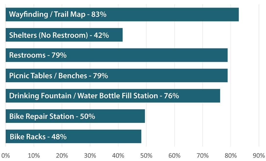
Those surveyed would like to see trailhead amenities, including wayfinding/trail maps (83%), picnic tables (79%), restrooms (79%), and drinking fountains/water bottle fill stations (76%). When asked if the trail should be closed during firearm deer hunting seasons, responses were mixed; they were evenly split between “Yes” (34%), “No” (35%), and “Unsure” (32%). Forty-four percent (44%) of the survey’s open comments were generally positive, highlighting the trail’s potential for increased tourism and attracting young families to live in the area; the 18% of comments which were generally negative cited concerns for construction and maintenance costs and safety. A full output of the survey responses is available in Appendix A.
Figure 3.1 - Desirable Trail Amenities
PUBLIC INPUT MEETINGS & STORY MAP
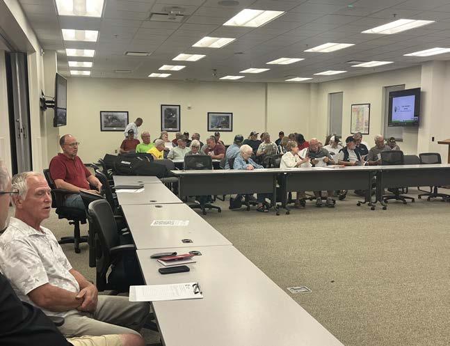
The first of two public input meetings (PIM) was held on June 20, 2024, in the City of Merrill in the Lincoln County boardroom. A brief overview of the planning process and purpose was provided followed by an open question and answer period; the online survey was also promoted. Approximately 50 people were in attendance. The primary feedback gathered during this meeting was concerning private landowners adjacent to the WPS corridor as well as homeowners along Bluebird Lane, which is perpendicular to Big Eddy Road and parallel to the railroad. These citizens did not support a potential trail route passing through or adjacent to their property, expressing concerns related to safety, vandalism, and trespassing and well as potential trail user conflicts. Other meeting attendees expressed concerns about the total cost of the project, especially for taxpayers. In response to these concerns, the proposed trail route within Lincoln County was largely moved off of the WPS corridor and to existing road right of way along Big Eddy Road or Highway 51 and County Road W (see Chapter Four for additional information).
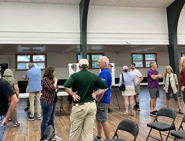
The second public input meeting was held on June 27, 2024, in Eastgate Hall at Marathon Park in the City of Wausau, and followed the same meeting structure as the Merrill PIM. Approximately 30 people were in attendance. Attendees expressed similar concerns regarding potential safety, vandalism, and cost. Other attendees expressed support for the project as a potential economic driver for the region, making it a destination for high quality, scenic outdoor recreation.
STORY MAP
At both of the PIMs, as well as the online survey and other community networks, an online map of the proposed trail corridor was available for interested citizens to leave location-based comments and concerns. Three comments were gathered via this map. A comment located south of the City of Merrill, just west of County Rd W, expressed concerns related to trespassing through their property and conflicts with farming and hunting, which occurred on either side of the railroad and WPS corridor. Another comment was located along the Wisconsin River in the Town of Texas near Jesse Park, expressing concern for protecting riparian habitat and boat/ kayak access near the confluence of the Trappe and Wisconsin Rivers. Finally, a comment north of Wausau and south of Brokaw County Park next to the Wisconsin River expressed a desire for the future trail to allow snowmobile access during the winter to tie into an existing snowmobile trail within Brokaw County Park.
Wausau PIM (MSA Professional Services, 2024).
Merrill PIM (MSA Professional Services, 2024).
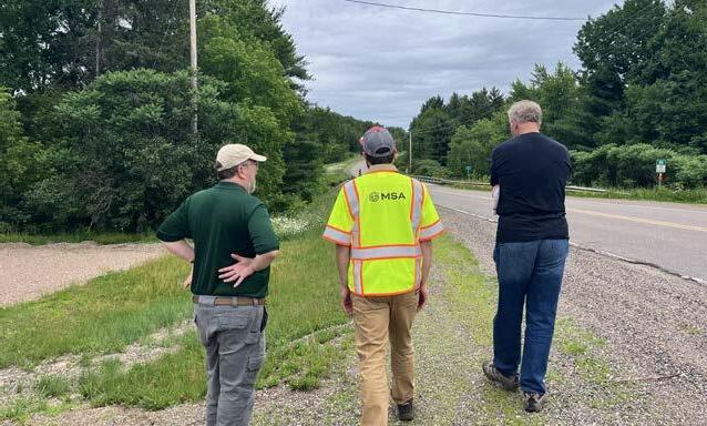
Project Team Site Visit (MSA Professional Services, 2024).
Goals & Strategies
Goals and strategies for trail development were derived from feedback from staff, the steering committee, and the community, with special consideration for best practices and alignment with the National Recreation and Park Association (NRPA) and WI Bike and Pedestrian State Trail Standards.
GOAL 1
Identify a route between Wausau and Merrill that balances cost feasibility with recreational benefits while prioritizing safety needs for bicyclists and pedestrians.
• Design the trail to include scenic views, parks, and points of interest to enhance the recreational experience.
• Physically separate from vehicular traffic and limit roadway crossings as much as possible.
GOAL 2
Develop a trail route and plan that is supported and celebrated by the community and governing agencies, including local municipalities, counties, state agencies.
• Consult and involve stakeholders— including direct engagement with private landowners— to understand priorities and address concerns with transparency.
• Clearly communicate the benefits of the trail, such as improved health and well-being, economic opportunities, and enhanced connectivity.
GOAL 3
Create a route that is comfortable for a wide variety of users, including young people, seniors, and people with disabilities.
• Include rest areas, benches, and accessible facilities at regular intervals and access points along the route.
• Regularly seek feedback from trail users, especially those with disabilities, to identify areas for improvement.
GOAL 4
Mitigate the trail route’s impact to the natural environment, especially to preserve the integrity of regional wetlands.
• Design the trail route to bypass wetlands and other environmentally sensitive areas whenever possible.
• Construct elevated boardwalk segments where necessary through wetland or floodplain areas.
• Restore areas with native vegetation to support habitat where construction of the trail disturbs the landscape.
GOAL 5
Provide a regional recreational trail experience, with quality amenities and trail design to accommodate long-distance trail users.
• Install clear and informative signage for navigation, distance markers, and information about nearby amenities and attractions.
• Connect the trail to other regional trails and transportation hubs to facilitate access and extend the trail network.
• Explore long-term opportunities to pursue state trail designation, which can provide additional funding, recognition, and support for the trail.
Service Area
This future trail would primarily serve the residents of the Cities of Wausau and Merrill, as well as Marathon and Lincoln Counties given its intention as a regional link between the communities. The table below summarizes the Wisconsin Department of Administration (WDOA) 2024 population estimates. The trail is also likely to draw in visitors and users from adjacent counties within north-central Wisconsin, including Langlade, Shawano, Portage, Wood, Clark, Taylor and more. Additionally, if the trail did indeed become designated as a state trail over the long-term, it would connect into the broader state trail system that serves the entire state population.
Figure 3.2 - Trail Service Area (2 Miles)
Table 3.1 - 2024 Population Estimates
IV. RECOMMENDATIONS
This chapter presents a comprehensive set of recommendations aimed at establishing and enhancing the trail network. These recommendations are the result of the existing conditions analysis and community input processes described in Chapters Two and Three.
By implementing these recommendations, the counties will foster a robust and interconnected trail system that promotes outdoor recreation, supports local communities, and enhances the overall quality of life for residents and visitors alike.
General Recommendations
Primary and alternate routes are presented in this chapter in four segments, starting in the City of Wausau and traveling north to end in the City of Merrill. Primary routes for the overall trail network were selected during the planning process to maximize connectivity and accessibility while balancing input from stakeholders and private property owners. Alternative routes are explored where applicable to ensure that the trail network can adapt to future needs.
It is important to note that the trail as presented in this Master Plan is largely dependent on the use of the WPS corridor. Allowances for the installation of a trail were discussed with WPS throughout the planning process, but no formal agreement has been arranged between WPS, Marathon County, or Lincoln County at the time of this plan’s adoption. Attempts were also made to connect with all private property owners who are potentially impacted by the proposed routes. Coordination regarding official agreements/negotiations with WPS and landowners will be pursued after the adoption of the Plan.
PROPOSED TRAIL ROUTE & USE
The initial routing of the trail originated with use of the WPS corridor; the final route departs from the easement in some areas to address impact to wetlands and responses from the community. Individual segments were refined throughout the planning process to account for public feedback and anticipate conflicts with affected landowners.
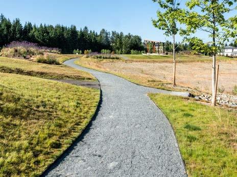
The construction material for the trail is assumed to be compacted stone (crushed limestone) aggregate, unless otherwise noted. Additional trail types include boardwalk, bridge, sharrow, and existing trails (see Figure 4.1 for descriptions of each trail type). Cost assessments associated with the trail are available in the Capital Improvement Summary (see Chapter Five and Appendix C).
It is recommended that snowmobile use should be allowed on trail in compliance with Marathon and Lincoln county ordinances.
TRAILHEAD / ACCESS FACILITIES
Three of the four trail segments identify a potential trailhead location and proposed trailhead design. Potential trailheads are spaced regularly along the trail and located within existing parks in Wausau, Marathon County, and the Town of Texas. The final trail segment leading into the City of Merrill will connect to the existing River Bend Trail’s access points and trailhead facilities.
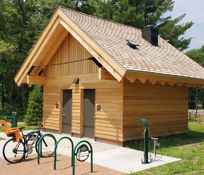
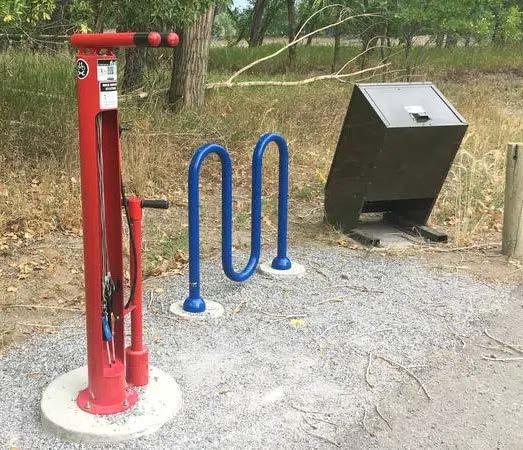
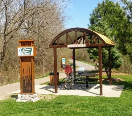
Trailheads will provide amenities to improve user experience and accessibility, including parking, wayfinding signage, areas of respite with shade and seating, and bike racks. Examples of trailhead facilities are provided in Figure 4.2.
CROSSINGS
Where applicable, trail recommendations provide detailed renders illustrating proposed bicycle/pedestrian crossings for potentially hazardous conditions, including USH 51 and the Pine River.
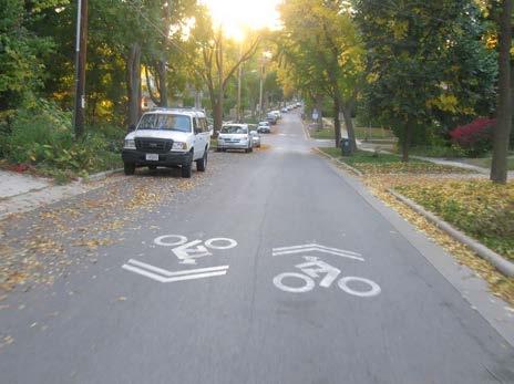
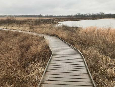
4.1 - Types of Trails
TRAIL
Typical multi-use bicycle/pedestrian trail, compacted stone aggregate for cost-efficiency
SHARROW
On-road with vehicular traffic with appropriate safety markings; only for use in low traffic areas
BOARDWALK
For use in sensitive wetland areas
BRIDGE
For bicycle and pedestrian use only at river crossings
4.2 - Trailhead Amenities
Figure
Figure
Wayfinding Maps
Shade Shelter, Resting Areas (Picnic Table, Benches)
Mile Markers
Anti-Motor Vehicle Barrier
Bike Repair Station, Bike Racks, Trash Receptacles
Restrooms
Segment 1: River Edge Parkway / Gilbert Park to Brokaw County Park – City of Wausau
PRIMARY ROUTE
The primary route begins with a trailhead at the southernmost end of the trail, connecting to the end of the existing River Edge Parkway Trail south of Gilbert Park. The route travels north to use the existing bike lanes along County Highway W from Spring Street to Evergreen Road and proposes new bike lanes from Evergreen Road to Goetsch Road. The final stretch of this segment would include typical stone aggregate trail with bridges and boardwalks through the WPS corridor ending in Brokaw County Park (with a trailhead to be completed in Segment 2).
ROUTE BENEFITS
• Scenic views of the Wisconsin River
• Direct connections to existing Wausau bicycle routes and River Edge Parkway
• More of the trail is separated from roadway traffic
• Trailhead amenities for Gilbert Park
ALTERNATE ROUTE 4
ROUTE CHALLENGES
• Railroad crossing within Gilbert Park
• High wetland potential within WPS easement will require boardwalk
• Steep slopes
• Will require permissions from a private property owner located between WPS easement and Brokaw County Park (approx. 1,490 feet of trail)
The alternate route for Segment 1 (labeled as Alternate 4 on the map) breaks away from the primary route at Goetsch Road; in place of the WPS easement, the route provides an off-road trail on the west side of County Road W’s right-of-way to County Road WW. The off-road trail would continue along the south side of County Road WW terminating in Brokaw County Park.
ROUTE BENEFITS
• Avoids potential wetlands and boardwalk construction
• Avoids potential private property conflict
ROUTE CHALLENGES
• Trail users will be closer to (but still separated from) roadway traffic
• Added complexities due to working within the road right-of-way
• Rock blasting / riprap cut slopes expected
PROPOSED TRAILHEAD: GILBERT PARK
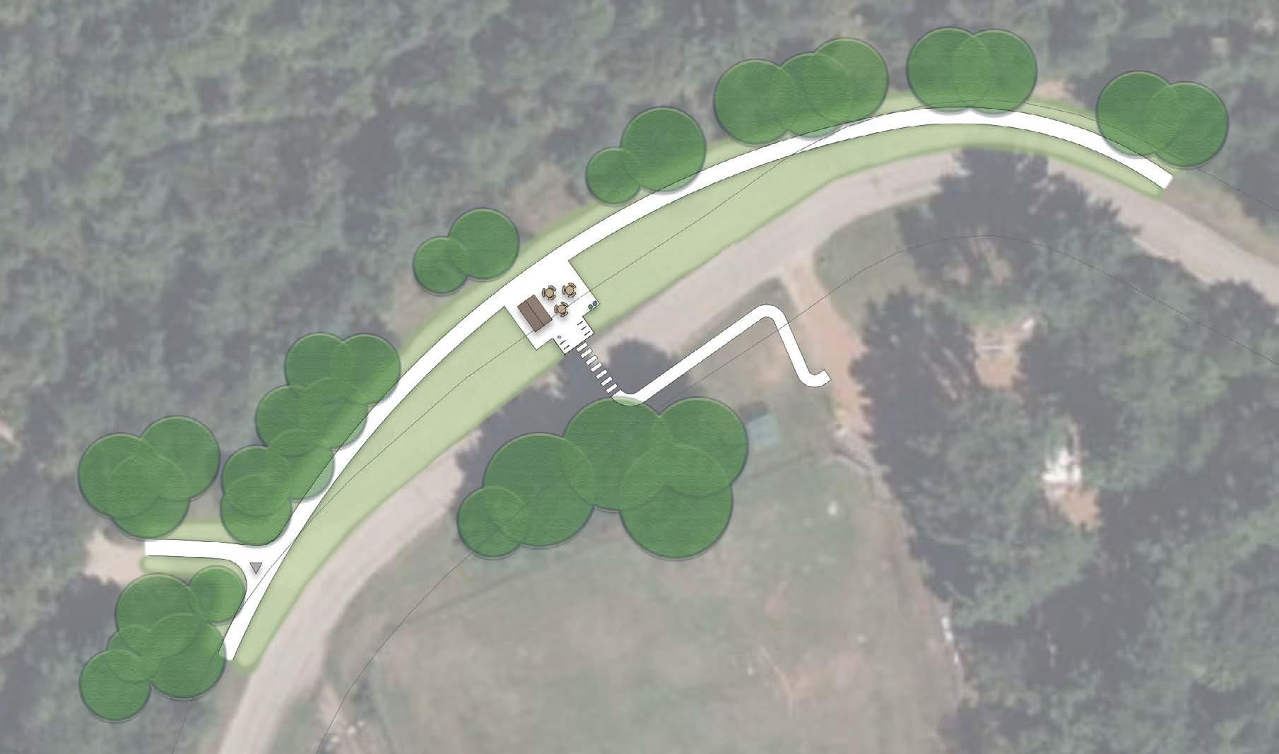
As an existing park in Wausau, Gilbert Park is an ideal trailhead location; the importance of future trail connections to Gilbert Park are emphasized in the City of Wausau’s 2020 River Edge Parkway Master Plan. The design illustrated below incorporates the park’s existing driveway, parking lot, and boat launch into an area of respite with shade, wayfinding signage, and a bike repair station. This trailhead would not provide restroom facilities due to the close proximity to the railroad.
WISCONSIN RIVER
Gilbert Park Trailhead
Figure 4.4 - Segment 1: Gilbert Park Trailhead
Segment 2: Brokaw County Park to Wisconsin River Road – Marathon County
PRIMARY ROUTE
Segment 2 starts with the Brokaw County Park trailhead; the primary route then heads north on new trail through the park into private lands owned by Mathy Construction and WTTC Land Management. This route takes a more upland path away from the WPS lands, though some boardwalk will still be necessary. The route converges back with WPS-owned land between the railroad and the Wisconsin River (near Granite Heights Road). One additional private property crossing near Wisconsin River Road is expected. Segment 2 ends near Wisconsin River Road and County Road W, where a trailhead is proposed near Jesse Park (to be constructed with Segment 3).
ROUTE BENEFITS
• Less potential wetland crossing than primary route
• Provides trail amenity within Brokaw County Park
• Separation from roadway traffic
• Scenic route through forested land
ALTERNATE ROUTE 3
ROUTE CHALLENGES
• Private property owners north of Brokaw County Park, Anderson Road, & Wisconsin River Road
• High wetland potential will require some boardwalk, large culvert will increase costs
• Setback from scenic views of Wisconsin River
The alternate route for Segment 2 (labeled as Alternate 3 on the map) generally runs on WPS property from west of Brokaw County Park to Wisconsin River Road; private property crossings (Ahlstrom-Munksjo) between the park and WPS corridor are anticipated. This alternate route includes extensive boardwalk lengths and one large culvert under the trail.
ROUTE BENEFITS
• Scenic views of the Wisconsin River
• Segment entirely separated from roadway traffic
ROUTE CHALLENGES
• Extensive boardwalk lengths and
• Private property owner between park & WPS corridor (Ahlstrom-Munksjo)
• Private property conflict and private structure located close to trail
Figure 4.5 - Segment 2: Brokaw County Park to Wisconsin River Road
PROPOSED TRAILHEAD: BROKAW COUNTY PARK
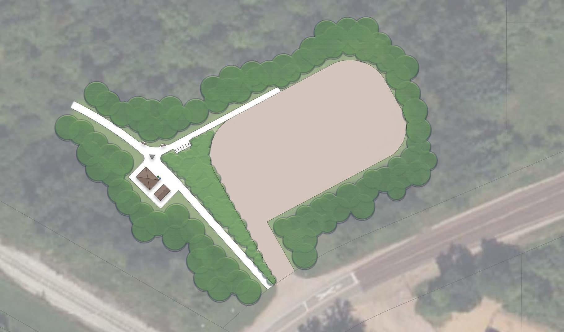
There is support from Marathon County to construct a future trailhead within Brokaw County Park. The proposed trailhead illustrated below is located on undeveloped county land; this site is currently occupied by an unpaved gravel parking lot which will serve the trial head (there are no plans to pave the lot at this time). This trailhead would provide a shade shelter with restrooms, bike racks and a repair station, seating options, and wayfinding signage.
COUNTYROADWW
RAILROAD
Figure 4.6 - Segment 2: Brokaw County Park Trailhead
Segment 3: Wisconsin River Road to River View Avenue – Marathon & Lincoln Counties
PRIMARY ROUTE
This segment starts with the Jesse Park trailhead in the Town of Texas, adjacent to the intersection of County Road W and Wisconsin River Road. The trail then follows WPS-owned land north, requiring boardwalk segments and two pedestrian bridges (one over the Trappe River and another running parallel to a railroad bridge over an unnamed stream). The segment ends at the intersection of WPS-owned land and River View Avenue.
ROUTE BENEFITS
• Scenic views of the Wisconsin River
• Segment entirely separated from roadway traffic
• Trailhead amenities for Jesse Park
ALTERNATE ROUTE 2
ROUTE CHALLENGES
• Extensive boardwalk lengths and pedestrian bridges will increase costs
The alternate route for Segment 3 (labeled as Alternate 2 on the map) pivots east to become a sharrow on Wisconsin River Road, which would receive no improvements outside of minor markings and signage. The route then moves into the east right-of way on County Road W with a bridge crossing over the Trappe River. The trail would then cross County Road W to converge with the primary route through WPS-owned lands.
ROUTE BENEFITS
• Reduces length of required boardwalk and pedestrian bridges by a substantial amount
ROUTE CHALLENGES
• Additional review needed to confirm that the off-road path on County Road W could fit within the right-of-way
• Trail users will be closer to—and in some areas, integrated into— roadway traffic
• Setback from views of Wisconsin River
• Riprap fill slopes and timber trail railing would be required in a very challenging area behind road guardrail
Figure 4.7 - Segment 3: Wisconsin River Road to River View Avenue
ALTERNATE ROUTE 6
There is a strong likelihood that an ATC line will utilize the WPS corridor parallel to County Road W within this segment. While there is a possibility for the trail and ATC line to coexist within the WPS corridor, an alternate path is provided if such an arrangement is not able to be reached.
This alternate would move the trail route to be within the right-of-way of County Rd W, connecting into the primary route. This alternative would connect back into the WPS corridor just south of Pine Bluff Rd, where the ATC East Route turns west. The primary benefit of this alternative is to accommodate potential conflicts with a future ATC line.
PROPOSED TRAILHEAD: JESSE PARK
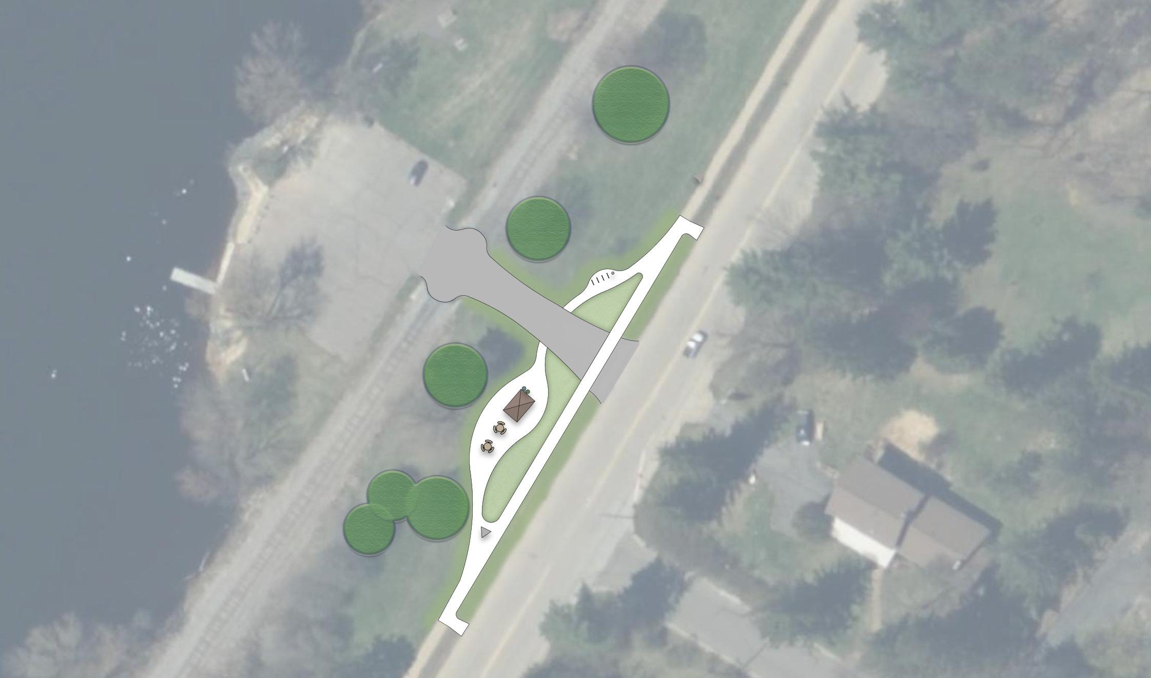
The trailhead at Jesse Park will serve as the trail’s primary access point in the Town of Texas. The concept for this trailhead proposes a pedestrian crossing and sidewalk extension, street parking, and an area of respite with shade and a bike repair station. The trailhead would not provide restroom facilities due to distance and lack of access to utility services.
Figure 4.8 - Segment 3: Jesse Park Trailhead
Pedestrian Crossing WISCONSINRIVERRD
Segment 4: River View Avenue to River Bend Trail – City of Merrill
& Lincoln County
PRIMARY ROUTE
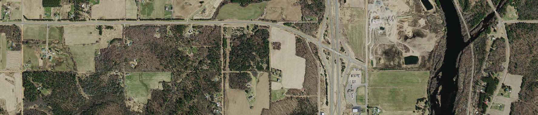
The final trail segment begins at River View Avenue, utilizing the existing Old County W roadway with no improvements outside of minor marking and signage. At County Road W, the trail will continue north as an off-street path on the west side of County Road W’s right-of-way. A pedestrian bridge will be required at the Pine River Crossing. The trail turns west on Center Road to cross under US Highway 51. The segment continues in the right-of-way on Big Eddy Road and ends along Wisconsin 64 with the connection to the existing River Bend Trail.
ROUTE BENEFITS
• Connection to existing River Bend Trail
• Segment is more separated from roadway traffic (especially high-speed highway traffic) than the alternate route
ALTERNATE ROUTE 1
ROUTE CHALLENGES
• Steep slopes will require long sections of riprap
• Pine River bridge will be costly
• At least two large culvert pipe extensions will be required
• Crossing under US Highway 51 will require a large structural retaining wall
• Space is limited in the right-of-way on Big Eddy Road
The alternate route of Segment 4 (labeled as Alternate 1 on the map) diverges from the primary route at the crossing of US Highway 51. In anticipation that Big Eddy Road may not be suitable for an off-road trail, this route continues north on the west side of USH 51’s right-ofway until reaching the Walmart shopping area. The route crosses private property to Pine Ridge Avenue to connect with the River Bend Trail on Wisconsin 64.
ROUTE BENEFITS
• Wider right-of-way allowance than Big Eddy Road
ROUTE CHALLENGES
• High-speed traffic on the highway would require greenway and partnership with WisDOT
• Potential private property conflicts on Pine Ridge Avenue
Figure 4.9 - Segment 4: River View Avenue to River Bend Trail
This final segment does not include a new trailhead location; within the City of Merrill, the trail will connect to the River Bend Trail’s facilities and wayfinding.
PINE RIVER PEDESTRIAN BRIDGE
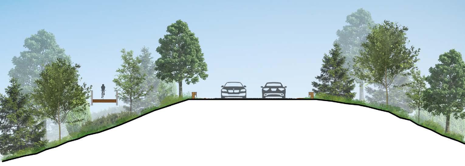
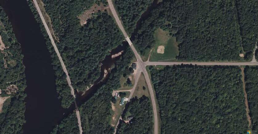
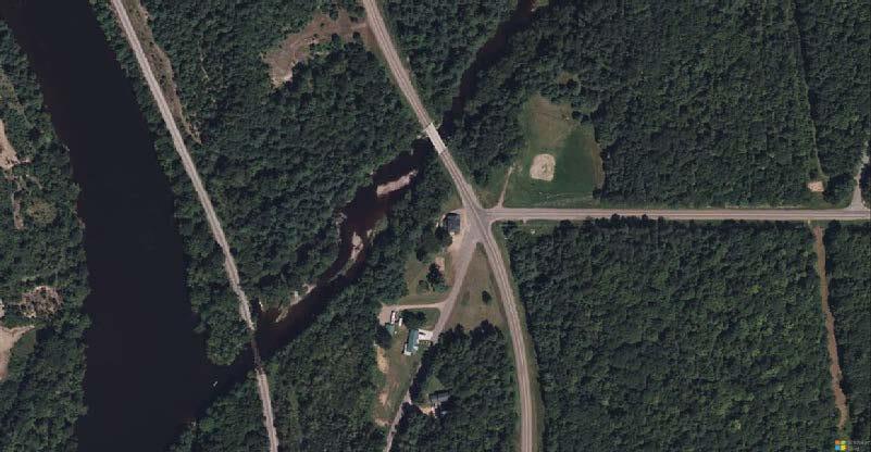
Due to the narrow width of County Road W’s existing bridge, crossing the Pine River will require a separate pedestrian bridge. The diagram below illustrates crossing conditions over the Pine River, which will require riprap fill and timber trail railing to construct.
Figure 4.10 - Segment 4: Section Render of Pine River Crossing
USH 51 CROSSING AT CENTER ROAD
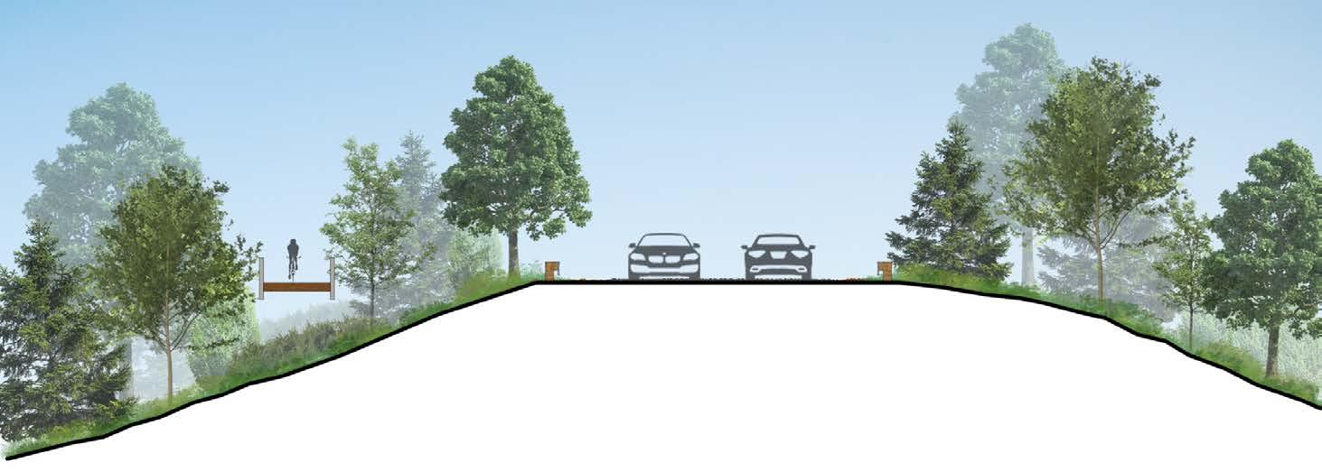
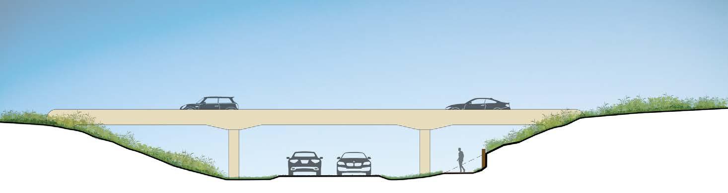
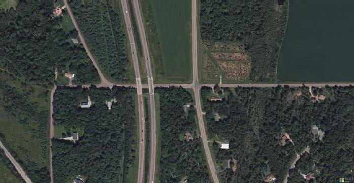
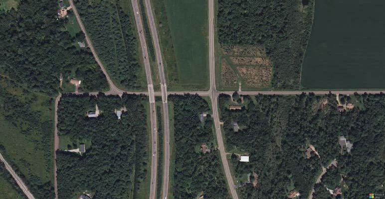
Crossing US Highway 51 at Center Road provides less hazardous conditions than crossing at a higher-traffic intersection on the highway. The diagram below illustrates the proposed crossing under USH 51, which would require a large structural retaining wall in order to locate the trail between the north bridge piers and north abutments.
The final chapter of this Master Plan provides resources to guide the trail’s development and construction. It includes a summary table of recommendations from Chapter Four, outlining estimated costs by segment for both priority and alternate routes.
Chapter Five also highlights funding opportunities, presenting a table of common state and federal grant programs, including information on maximum awards and application due dates. Additional resources, partnerships, and next steps are also outlined.
Capital Improvement Summary
Based on the recommendations detailed in Chapter Four, the total cost of constructing the complete primary route would be approximately $47,274,100. The total estimated construction costs with all alternate routes would amount to $47,197,300. Contingency and inflation are factored into these total project costs. Table 5.1 (page 50) outlines the anticipated costs to construct each segment.
Improvement costs were estimated based on the following assumptions:
• Construction is anticipated to begin in 2030.
• Some real estate acquisitions will be required.
• Geotechnical exploration and preliminary access to the site will be required.
• Railroad coordination will be needed for crossings and flagging / bonds / insurance.
• Temporary wetland disturbance for construction access will exceed 10,000 SF and will likely require purchase of mitigation credits; wetland areas were determined from the WDNR surface water data viewer and categorized into low, medium, and high probability. Boardwalk was planned at all high and some medium areas. Bridges were planned at stream crossings where sizable flow is expected.
• A small amount of EBS and poor soil subgrade stabilization was included.
• Small culverts were included throughout.
• Assume no trail centerline pavement markings.
• Assume 30' wide clearing and 40' wide trail easement.
• Assume no lighting.
• Trail cross section and boardwalk were planned to meet Wisconsin Bicycle Facility Design Handbook and be eligible for TAP funding.
• Professional services for engineering, administration, and state review costs assume pursuit and use of a federally-funded grant program (TAP or similar).
For a detailed overview of the proposed capital improvements, including a summary of recommendations by trail or route and estimated cost tables, please refer to Appendix C.
Table 5.1 - Cost Estimates from Capital Improvement Summary
Wausau to Merrill Trail, Lincoln County / Marathon County, Wisconsin Segment Summary
Wausau to Merrill Trail, Lincoln County / Marathon County, Wisconsin Segment Summary Using All
Alternate Routes
Funding Opportunities & Next Steps
Table 5.2 on the following page identifies common state and federal park, transportation or related grant programs including information on maximum awards and application due dates.
NEXT STEPS
The full realization of this project is dependent upon collaboration and partnerships across a number of entities. Important among them will be Marathon and Lincoln Counties’ continued partnership with the non-profit River District Development Foundation of Merrill, who made this planning project possible and are important champions of recreational trails within the region given their work to develop and support the existing River Bend Trail.
The cost to develop the trail will likely be paid through a combination of private donations and public grants, including those outlined in Table 5.2. Collaboration with the WDNR and WisDOT will also be essential, as well as many departments within both Marathon and Lincoln Counties, and with private firms. Developing the full extent of the trail will likely require these partnerships to be sustained over a decade or more.
In the immediate term, critical next steps include:
• Continued outreach and coordination with private landowners, WPS, and ATC to negotiate real estate acquisitions and public access easements
• Final determination between primary and alternate routes
• Design and construction engineering
ADDITIONAL RESOURCES
THE GREAT BIKE INFRASTRUCTURE PROJECT
Created by PeopleforBikes to advance bike projects and policies across the Unites States; the heart of this program features a national database and interactive map of over 1,000 bicycle infrastructure projects. The organization also provides a comprehensive legislative guide that outlines effective approaches to expanding bike infrastructure and working with state and local funding mechanisms.
WIBIKE COMMUNITY TOOLKIT
Created by the Office of Outdoor Recreation in partnership with the Wisconsin Bike Fed, Rails to Trails Conservancy, International Mountain Biking Association, and Wheel and Sprocket to guide communities in developing new trails. The toolkit provides general direction through nine project phases and resources for additional guidance.
Table
Grant Name Description
WisDOT
Transportation Alternatives Program (TAP)
Transportation Economic Assistance (TEA)
Source
Funding for transportation projects through the BiPartisan Infrastructure Law (BIL) and state budget WisDOT Varies by project
Provides matching state grants to governing bodies for projects that help attract employers to Wisconsin or encourage in-state business and industry expansion
Knowles-Nelson Stewardship Grant
Recreational Trail Program (RTP)
Federal / Other
Safe Streets and Roads for All
Single application to wide group of grants funding recreational development and conservation land purchases for local governments and nonprofits
Reimbursement for development, rehabilitation, and maintenance of recreational trails and trailrelated facilities
WI DNR
$3.4 million per year, will fund 50% of eligible project costs OR $5,000 per job created/retained (whichever is less)
Funding may be awarded through various state and federal grants
WI DNR
Supports the development of a Safety Action Plan and additional funding opportunities for Implementation of projects listed in the Action Plan
Active Transportation Infrastructure Investment Program (ATIIP)
Congestion Mitigation and Air Quality Improvement Program (CMAQ)
Rails to Trail Conservancy (RTC)
Created by the Bipartisan Infrastructure Law (BIL) to construct projects to provide safe and connected active transportation facilities.
Provides funds to States for transportation projects designed to reduce traffic congestion and improve air quality, particularly in areas of the country that do not attain national air quality standards.
Support for organizations and local agencies to develop and connect equitable trail networks (must serve multiple user types: bicycling, walking/ hiking, riding, etc.)
Next project solicitation anticipated in 2025
Applications are ongoing on a first come, first serve basis.
Projects must begin within 3 years of grant award
Pedestrian and bicycle facilities, recreational trails, safe routes to school projects, community improvements and historic preservation
Road, rail, harbor, and airport projects (environmental testing, traffic control and safety, road and railroad construction, etc.)
Applications due May 1 annually
Land acquisition, trail and path construction, naturebased recreation projects
Up to 80% of eligible project costs
Applications due May 1 annually
Existing trail maintenance, Development of trailhead facilities and linkages, new trail construction, acquisition of easements for trail corridors)
- Development of Action Plan
FHWA
Over $1 billion overall in 2024,
Multiple opportunities anticipated in 2025.
- Implementation of projects and strategies in the Action Plan to address a roadway safety problem (infrastructure, behavioral, or operational)
USDOT/ FHWA
Federal cost share of 80%, project minimum cost of $100,000 for planning and design grant, or $15 million for construction grant
USDOT/ FHWA Varies by project
Annual application cycle (March - June) through 2026
- Planning, design, and construction of connected active transportation networks and amenities
- Priority to projects that connect key community institutions, particularly schools, and those that benefit disadvantaged communities
Applications due September 30 annually
Projects that reduce traffic congestion and improve air quality, including bike and pedestrian facilities.
RTC
$200,000 overall, grants will range $5,000$25,000
2024 applications were due June 9, grants will be awarded Fall 2024. Projects must begin by September 2025
Project must support one or more of the Trail Nation
Playbook strategies: vision, coalition building, acquisition, mapping and analytics, matching funds, community engagement