Waunakee-Westport Comprehensive Bicycle, Pedestrian, and Outdoor Recreation Plan 2023-2027
WAUNAKEE - WESTPORT
Comprehensive Bicycle, Pedestrian, and Outdoor Recreation Plan
2023-2027
ACKNOWLEDGEMENTS
VILLAGE STAFF
Sue McDade, Community Services Director
Bill Frederick, Public Works Director
Jeff Skoug, Recreation Supervisor
Tim Semmann, Community Devlopment Director
VILLAGE PARKS & RECREATION COMMITTEE
Gary Herzberg, Chairperson
Tim Luttrell
Bob Khouri
Susan Rather
John Pomeranke
Phil Willems
Sam Kaufmann
TOWN STAFF
Dean A. Grosskopf, Administrator/Clerk-Treasurer
Jessica Duffrin, Executive Assistant
TOWN PARKS COMMITTEE
Amy Freidig, Chair
Mick Holm
Dave O’Malley
Michelle Wing
Deanna Lowenhagen
Ben Buss
PREPARED BY:
This document was prepared by MSA Professional Services, Inc. with assistance from Village and Town staff and the Joint Waunakee-Westport Parks Committee.
Project #: 1631006
TABLE OF CONTENTS
Chapter 1: Introduction
1.1 Plan Purpose
1.2 Planning Process
1.3 The Role of Parks, Recreation & Trails
Chapter 2: About Waunakee & Westport
2.1 Local & Regional Context
2.2 Transportation & Circulation
2.3 Demographics
2.4 Physical Character & Environmental Resources
2.5 Existing Land Use
2.6 Future Land Use
Chapter 3: Park, Open Space and Recreation Inventory
3.1 Existing Park Facilities
3.2 Existing Bicycle & Pedestrian Facilities
3.3 Privately-Owned Facilities
3.4 School Facilities
3.5 County Facilities
3.6 Regional Facilities
Chapter 4: Analysis of Needs and Demands
4.1 Quantitative Analysis - Parks
4.2 Geographic Analysis - Parks
4.3 Qualitative Analysis - Parks
4.4 Biking & Walking Suitability Analysis
4.5 Regional & State Trends
Chapter 5: Goals, Objectives, Policies & Programs
5.1 Goals, Objectives, Policies & Programs
Chapter 6: Recommendations
6.1 Existing Park Facilities
6.2 New Park Facilities
6.3 Off-Road, On-Road , and Intersection Recreational Trail
Improvements
6.4 Other Recommendations
Chapter 7: Implementation
7.1 Tools & Mechanisms to Fund Implementation
7.2 Plan Adoption & Amendments
7.2 Capital Improvement Summary
Appendix A: Survey Summary
Appendix B: Maps
Appendix C: Town of Westport Press Release - Wesport Conservancy
This page intentionally left blank
Chapter 1 INTRODUCTION
1.1 Plan Purpose
1.2 Planning Process
1.3 The Role of Parks, Recreation & Trails
CORP & GRANT FUNDING
The Wisconsin Legislature created the Knowles-Nelson Stewardship Program (Stewardship) in 1989. Named for two of Wisconsin’s most revered conservation leaders, Warren Knowles (Governor 19651971) and Gaylord Nelson (Governor 1959-1963, U.S. Senator 1964-1981), the purpose of the program is to preserve valuable natural areas and wildlife habitat, protect water quality and fisheries, and expand opportunities for outdoor recreation. The conservation and recreation goals of the Stewardship Program are achieved through the acquisition of land and easements, development of recreational facilities, and restoration of wildlife habitat.
The Stewardship grant program is the most widely used recreational grant program in the state. Eligibility for the program requires that a community maintain a local comprehensive outdoor recreation plan (CORP), updated every five years, and that the project for which grant funding is sought is described in the CORP. Many other similar state and federal recreational grant programs have similar requirements or have shown a tendency to favor those grant applications which are supported through previous community planning efforts.
1.1 PLANNING PURPOSE
Parks, recreation, trails and open space are important elements in the quality of life for all communities. Not only do parks, open space and trails provide a safe and healthy place to recreate, they also serve to beautify, protect the natural environment and influence the patterns of development in and around the community.
The Village of Waunakee and Town of Westport realize the importance and benefits its parks, open space and trail systems have on the communities’ character and quality of life and are committed to providing for the recreational needs of current and future residents. This plan intends to guide the continual improvement of the Village’s and Town’s park, open space and trail systems to maintain both communities’ eligibility for State and Federal park and recreation grants. This plan envisions a connected system of parks, open spaces, and trails throughout Waunakee-Westport, related to the communities’ natural resources, geography and neighborhoods.
The plan is also intended to be a support document to the Waunakee-Westport Joint Comprehensive Land Use Plan. This plan along with the communities’ other longrange plans and development-related ordinances, will be used to implement Waunakee’s and Westport’s parks and recreation program.
Specifically the plan provides:
• Information regarding demographic trends
• An inventory of existing park and recreational facilities,
• An analysis of parkland and recreational needs and demands,
• General policy direction regarding park and open space and bicycle and pedestrian facility planning and maintenance,
• Recommendations for improving existing park facilities and bicycle and pedestrian facilities,
• Recommendations for new park, bicycle and pedestrian facilities, and
• Implementation strategies.
This plan identifies conceptual locations and recommendations for different types of parks, trails, natural areas, and recreational facilities. In nearly every case, more detailed planning, engineering, study,
budgeting, and discussions will be necessary before decisions are made to actually acquire land or construct recreational facilities.
1.2 PLANNING PROCESS
Recreation and bicycle and pedestrian planning are essential components of long-range community planning in Waunakee-Westport. In 2016, the Village and Town contracted with MSA Professional Services, Inc. to assist with an update to the Waunakee-Westport Joint Bicycle and Pedestrian Plan (2005), Waunakee’s CORP (2009) and Westport’s CORP (2009), the end result being a combined, joint Comprehensive Bicycle, Pedestrian and Outdoor Recreation Plan. In 2022, The Town and Village again contracted with MSA to update their joint CORP. The planning process occurred over the course of 2022 and was adopted in February 2023. Assistance with the development of this plan was provided by Village and Town Staff and Parks and Recreation Committees.
Early in the planning process Waunakee and Westport facilitated an online community survey to gather citizen feedback on desired public park, trail and recreational facilities (Refer to Appendix A). Three meetings of the joint Town and Village Parks Committee were held to provide updates on the planning process. Finally, a public hearing was also held prior to plan adoption.
It’s the Village’s and Town’s intention to update this plan every five years, in-part to remain eligible for park and recreation grants (see left side bar), and as best practice to ensure that the plan remains relevant to both communities’ needs.
This plan was developed following the Guidelines for the Development of Local Comprehensive Outdoor Recreation Plans of the 2019-2023 Wisconsin State Comprehensive Outdoor Recreation Plan (SCORP) created by the Wisconsin Department of Natural Resources (WDNR). The plan content and format have been tailored to fit the needs of Waunakee-Westport.
PROJECT MILESTONES
MAY 2022
• Staff Kick-Off Meeting
JUNE 2022
• Joint Parks Committee - Review Previous Plan Recommendations, Draft Online Survey, and Existing Parks & Trails Map
JULY 2022
• Joint Parks Committee - Park Tours
• Online Survey Open
AUGUST 2022
• Joint Parks Committee - Review Quantitative and Geographic Analysis and Survey Results
OCTOBER - DECMEBER 2022
• Joint Parks Committee - Review Preliminary Recommendations
• Plan Development
JANUARY 2022
• Joint Parks Committee - Review Draft Plan
FEBRUARY - MARCH 2023
• Public Hearings
• Village and Town Adoption
1.3 THE ROLE OF PARKS, RECREATION & TRAILS
The benefits of parks go far beyond simply being spaces where people can recreate. Parks contribute to the physical and mental health of individuals and provide public safety, environmental, economic, and social equity benefits to our communities. Recently, parks have come to the forefront of public health discussions due to COVID-19. The pandemic has put parks in the spotlight as more people seek opportunities to be outdoors and socially distance themselves. It is important to remember the benefits parks provide to the communities they serve, which include:
BELONGING
Public parks are a unique amenity because they have the potential to be accessible to anyone in the community, regardless of age, gender, ability, socioeconomic status, race, or ethnicity. Though we often find that disparities exist in the distribution and quality of parks and recreation amenities, many parks and recreation departments across the U.S. are rethinking how to engage and provide benefits to residents who currently lack sufficient access to parks. If parks can become more inclusive, they have the potential to function as a nucleus of neighborhood activity. They can be places where residents gather for social events, recreational activities, and meetings about local issues, increasing social interaction and creating an overall sense of community.
COMMUNITY HEALTH
According to the National Recreation and Parks Association (NRPA), when individuals use green spaces, they have fewer health issues, improved blood pressure and cholesterol levels, and reduced stress— which leads to a lower incidence of depression and a greater ability to face problems. According to NRPA’s report The Economic Impact of Parks, “diabetic individuals taking 30-minute walks in a green space experienced lower blood glucose levels than [those] spending the same amount of time doing physical activity in other settings. Thirty minutes of walking in nature resulted in larger drops in blood glucose than three (3) hours of cycling indoors.”
ECOLOGICAL HEALTH
While parks, forests, and trails provide opportunities to improve the health of residents, they also contribute to the greater ecological health of a community. Parks are often tied together with environmentally sensitive areas such as wetlands, floodplains, surface waters, or significant woodlands which can include trails. These areas provide food and shelter for local wildlife and naturally retain stormwater. Individual parks can provide important “rooms” of natural resource activity;
however, they become even more functional when they can be linked together through environmental corridors, or “hallways.” Wildlife, plants, and water all depend on the ability to move freely within the environment, or from room to room.
ECONOMIC PROSPERITY
Leisure time is an important component of everyone’s lifestyle and increasingly people are choosing locations to live based on quality-of-life factors such as recreational amenities. According to the NRPA’s Engagement with Parks Report, four out of five adults in the US sought high-quality parks and recreation when choosing a place to live. The ability to retain and attract new residents has direct economic benefits to the Town and Village. For this reason, having a great park, recreation, and trail systems contributes directly to economic development.
According to a study completed by NRPA and George Mason University, of 70 studied communities, 72% used parks and recreation images in their economic development materials. The study notes that parks and recreation contribute to economic development through business and talent attraction, retention, and expansion. If a park system is designed with connections to regional destinations, it can also bring in additional visitors. This additional tourism can be a significant benefit to local businesses. The Town and Village’s plan aligns with regional and state plans to promote outdoor recreation in the greater area.
CONNECTIONS
Well-connected trail systems can provide an important alternate means of traveling for those who prefer to bike for health or environmental reasons and for those who lack other means of transportation due to age, income or disability. Shared-use paths also provide important connections to public transit. According to the National Household Travel Survey conducted by the Federal Highway Administration, 85% of transit trips begin and end with walking and nearly one in six walking trips is made for the purpose of accessing public transit.
IMPACT OF COVID-19
With the COVID-19 pandemic, communities across the country have seen increased usage of trails and parks. This increase is coupled with new uses for parks (e.g. wi-fi hot spots), resulting in new design challenges and opportunities. It is likely these shifts will impact parks well into the future. We also anticipate the way parks are funded to shift, with a more diverse set of funding sources likely becoming available.
Chapter 2 ABOUT: WAUNAKEE & WESTPORT
2.1 Local & Regional Context
2.2 Transportation & Circulation
2.3 Demographics
2.4 Physical Character & Environmental Resources
2.5. Existing Land Use
2.6 Future Land Use
2.1 LOCAL & REGIONAL CONTEXT
Waunakee and Westport are located in north central Dane County. Westport borders the north shore of Lake Mendota and is adjacent to Madison and Middleton on its south side. Waunakee is approximately 5 miles north of Madison. Between 1980 and 2020, the population of Waunakee has grown by over 250% and Westport by over 50%. Both Waunakee and Westport’s population are projected to outpace the State of Wisconsin through 2040, and the Village is projected to outpace Dane County.
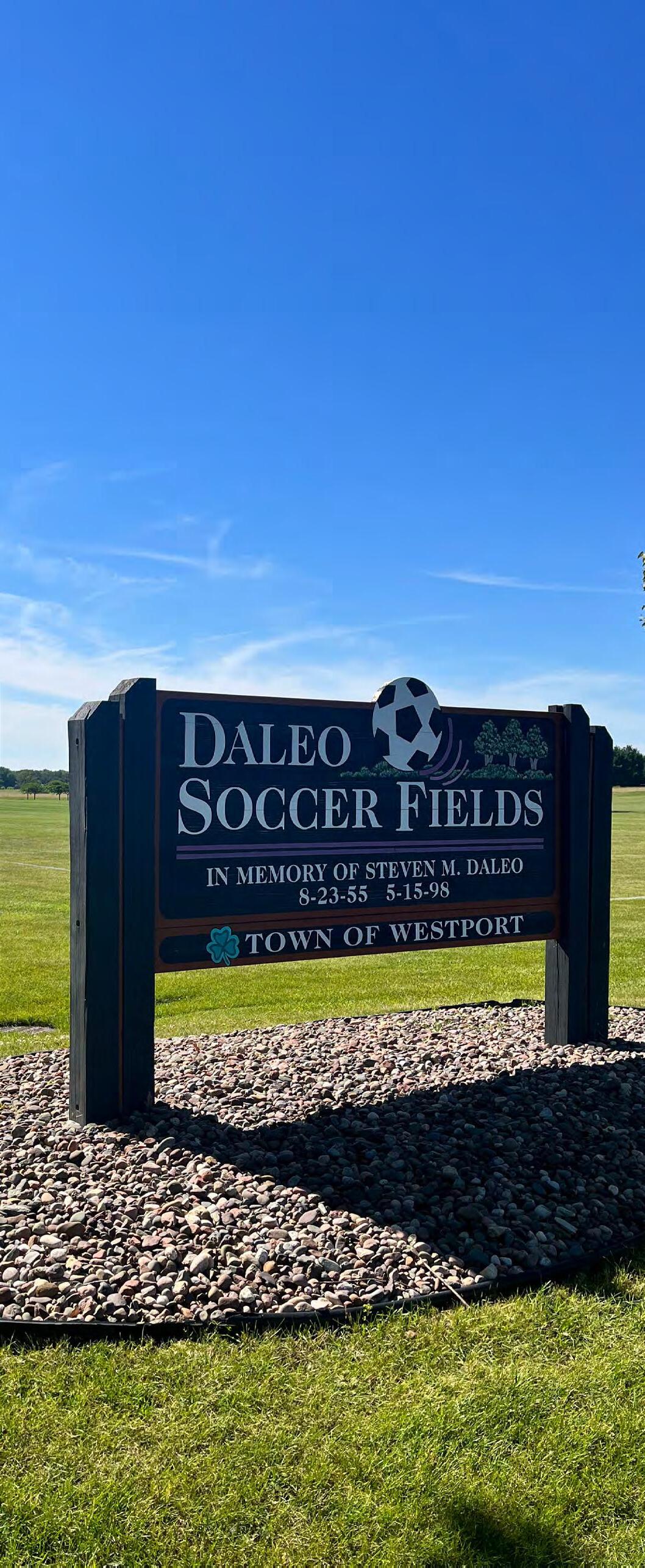
Waunakee and Westport residents have many opportunities to enjoy the outdoors through their parks and bike/pedestrian facilities. Westport is home to the popular Governor Nelson State Park, and the highly-used Daleo Soccer Fields which also offers tennis courts, fishing in the on-site pond, and ice skating/ hockey during winter months. Westport is also home to Jackson Landing Conservancy Park which offers a boat launch and a scenic walk/trail. One of Waunakee’s most popular parks, Ripp Park, is frequently used for youth soccer and baseball leagues. Another popular area is Centennial Park which hosts Waunakee’s annual Waunafest each summer. Waunafest features a 5k and 10k race, carnival/midway, beer garden, parade, music, volleyball and softball tournament, food and arts and crafts.
Waunakee and Westport are both desirable communities to live in because of the high quality of life offered. Residents enjoy the popular Village Center, quality homes, an excellent school district, numerous parks and open space, all while being a short drive away from the retail, restaurant and entertainment offerings in the City of Madison.
2.2 TRANSPORTATION & CIRCULATION
Highway 113 (Northport Drive) provides the main access into Westport and Waunakee from the east side of Madison. The other highway that runs through Waunakee is WIS 19. The other highways that run through Westport include CTH M, CTH K, CTH I and CTH Q. A network of local and town roads completes the transportation network. Biking is allowed on County
roads within the area. However, narrow shoulders and high traffic speeds and volumes, especially on CTH M, make biking uncomfortable for most.
Most of Waunakee’s roadways have sidewalks and there is a wide bike lane on Woodland Drive plus several off-street multi-use paths. Most roadways in Westport do not have sidewalks. Westport also has a trail that runs south of the Westshire subdivision and connects to Blue Bill Drive.
Waunakee experiences traffic congestion along its two primary arterials, Main Street (WIS 19) and Century Avenue (WIS 113), which are regional arterials that carry a significant amount of through-traffic. Westport also experiences congestion along its major arterial, CTH M. There are no options for public transportation in Waunakee or Westport. However Dane County does offer transportation options for older adults and those with disabilities.
A line of the Chicago and Northwestern Railroad, operated by the Wisconsin & Southern Railroad Company, passes through Waunakee and Westport, running generally northwest to southeast. The line currently provides freight service and is designated as an active line in the long-range rail transportation plans of the WisDOT and the Dane County Regional Planning Commission.
2.3 DEMOGRAPHICS
This section describes historic demographic trends for the Village and Town as it pertains to population, age composition, housing and school enrollment. The section includes data from the U.S. Census Bureau’s Decennial Census and the American Community Survey (ACS), which is reported as a rolling average over a 5-year period
POPULATION
According to the 2020 Decennial Census, Waunakee’s population is 14,879—a 285% increase from 1980. By the year 2040, its population is expected to increase an additional 27% to 18,832. The most recent census estimates Westport’s population is 4,191, or a 52% increase from 1980. By the year 2040, Westport’s population is estimated to increase by 12% to 4,718. These population projections are sourced from
the Wisconsin Department of Administration’s 2012 estimates, adjusted based on the results of the 2020 Census.
AGE COMPOSITION
The age composition of Waunakee and Westport residents is quite different. This is evident in the median age for each community: in Waunakee the median age is 39.3, while the median age in Westport is 47.4. Westport’s median age however fell from 52.7 in 2010, while Waunakee’s median age increased from 37.8 in 2010. 31% of Waunakee and 22% of Westport residents are considered school age (0-19 years old). 18% of Waunakee and 38% of Westport residents are considered at retirement age (60+ years old). Westport’s higher percentage of retirees is due primarily due to the presence of retirement communities like Westshire Village and other senior living options. Meanwhile, Waunakee has a higher proportion of families with children.
HOUSING
The number of households in Waunakee increased alongside its significant increase in population. Between 2000 and 2020 Waunakee experienced a 67% increase in its number of households. The average household size of 2.76 was constant between 2000 and 2010, but increased to 2.81 in 2020. The percentage of households with individuals under 18 decreased slightly from 46% in 2010 to 44% in 2020.
Westport saw a 31% increase it its total households between 2000 and 2020. The average household size fell in Westport from 2.2 in 2010 to 2.04 in 2020. Unlike Waunakee however, the percentage of households with individuals under 18 increased from 21% in 2010 to 23% in 2020.
SCHOOL ENROLLMENT
The Village and Town are both part of the Waunakee Community School District. The public and private schools in Waunakee and Westport are listed in Chapter 3. The 2021-2022 enrollment for the entire district was 4,426. Westport is also served by the Middleton-Cross Plains School District.
2.4 PHYSICAL CHARACTER & ENVIRONMENTAL RESOURCES
WATERWAYS
Six Mile Creek
Six Mile Creek originates in the Waunakee Marsh, Dane County’s second largest wetland, located about a mile west of Waunakee in the Town of Springfield. The creek flows northeast into the north part of the Village, then southeast and south through the Town of Westport, and eventually joining with Dorn Creek to empty into Lake Mendota. The Castle Creek Conservancy is located in the central part of the Village on the west side of Six Mile- Creek. The Village owns land along the creek in the north, from Highway 113 to Highway 19, as well as land south of Castle Creek Conservancy. This Creek corridor is considered an excellent location for a recreational path system.
Dorn Creek
Dorn Creek (also known as Spring Creek) originates in the Town of Springfield and flows six miles southeast through the Town of Westport to join Six Mile Creek and empty into Lake Mendota. A fairly large area of wetlands surrounds the creek in Westport.
Yahara River/Cherokee Marsh
The Yahara River originates in the marshy areas of southeastern Columbia County and flows as a small, meandering creek through farmland to empty into Cherokee Marsh, and eventually Lake Mendota at the southeast corner of the Town. Cherokee Marsh is part of a large complex of over 2,000 acres of streams and wetlands. Southern portions of the area have been ditched, changing the habitat to more of a wet prairie. The marsh has a complex hydrology, and supports many species of mammals, amphibians, reptiles, and birds. Activities in the marsh include hunting, fishing and canoeing.
Lake Mendota
At 9,842 acres, Lake Mendota is the largest lake in Dane County. The lake is heavily used for recreational activities such as boating, canoeing, fishing and swimming. It provides habitat for a variety of aquatic flora and fauna, though the lake is stressed by agricultural and urban runoff. Skipper Buds, a large marina, is located at the northernmost point of Lake Mendota, in the Town of Westport. A large portion of Westport’s Mendota shoreline is occupied by Governor Nelson State Park, in the southwestern corner of the Town.
NATURAL VEGETATION
Wetlands within Waunakee and Westport are primarily found in Governor Nelson State Park and adjacent to the Yahara River, Cherokee Marsh and Six Mile Creek and its tributaries. A majority of these lands have been protected as conservancy lands.
Empire Prairies State Natural Area
Empire Prairies contains prairie remnants and a small oak opening that were once part of the extensive Empire Prairie, which stretched across southern Columbia and northern Dane counties. The 14-acre natural area consists of two prairies: Westport Drumlin Prairie -- a small but diverse prairie containing more than 100 native plant species, and Koch Prairie, which contains over 60 native species and is dominated by the relatively uncommon prairie drop-seed. Empire Prairies is owned by the DNR and private landowners and was designated a State Natural Area in 1984. The area is accessed from Bong Road, east of Highway 113.
WILDLIFE
The Wisconsin Department of Natural Resources maintains a Natural Heritage Inventory which locates and documents rare species and natural communities, Including federal threatened and endangered species. A comprehensive list can be found through the WDNR’s Natural Heritage Inventory (http://dnr.wi.gov/topic/ nhi/).
The natural resources of the Village and Town are many and varied and provide an attractive character to the community and also the potential for varied recreation opportunities. Perhaps the greatest recreation potential for these environmental corridors is as linear parks and trail corridors linking the Village’s and Town’s recreation, employment, commercial and school sites.
2.5 EXISTING LAND USE
According to the United States Census Bureau, the Village has a total area of 6.38 miles of land and 0.01 miles of water. Using 2020 Decennial Census data the population density of the Village is 2,332 inhabitants per square mile. The Town has a total area of 22.2 square miles and 5.0 square miles of water. The population density of the Town is 154 inhabitants per square mile.
The primary residential areas within the Village are located north of WIS 19 and east and west of WIS 113; south of WIS 19 and west of the railroad tracks; and south of Arboretum Road and east of the railroad tracks. The primary residential areas in Westport are adjacent to the south boundary of the Village, west of the railroad tracks; between Lake Mendota, WIS 113 and CTH M; in the southwest corner of the Town off of CTH M; and there are several residential clusters between River Road and the Yahara River.
Commercial land uses in Waunakee are primarily located near the intersection of WIS 113 and WIS 19; as well as south of WIS 19, north of the rail line. Commercial land use in Westport is primarily located near the intersection of WIS 113 and CTH M.
Industrial land uses in Waunakee are located between WIS 19 and the rail line in the Waunakee Business Park. Industrial land uses in Westport are primarily located near the intersection of WIS 113 and CTH M, north of the existing commercial use.
The effect of the existing land use, transportation network and environmental resources divides the communities into neighborhoods and can limit access to recreational facilities. The primary barriers in Waunakee and Westport include the roadways already mentioned, Six Mile Creek and its tributaries, and the rail line.
2.6 FUTURE LAND USE
The future growth of the Village and Town are guided by the joint Waunakee-Westport Comprehensive Plan (2017). This Comprehensive Plan was developed concurrently the previous CORP (2017-2022), and sets forth the desired development pattern for the communities over the comprehensive planning period. The plan also gives guidance to accommodated projected population, household, and employment growth; the infrastructure and institutions required to serve residential, commercial and industrial uses in the communities; and the communities’ agricultural and natural resource base.
Within the planning area of the Village and Town (1.5mile radius around Village limits), future residential uses are planned north of Easy Street and west of Schumacher Road; south of Easy Street and west of Schumacher Road; north of Arboretum Drive and west of WIS 113; north of Kennedy Drive and east of Moonlight Drive; west of CTH M and south of Oncken Road; west of CTH Q and south of Balzer Road; south of Woodland Drive and west of CTH Q; north of Woodland Drive and west of Spahn Drive; west of Hellenbrand Road and south of Kopp Road; and north of Kopp Road and south of the rail line.
Recreation lands and the future parks and recreation needs of planned residential areas should be considered as these areas develop, including linkages to existing Village and Town neighborhoods, parks and businesses via bicycle and recreational trails.
Figure 2.3 Future Land Use (South)
This page intentionally left blank
Chapter 3 EXISTING FACILITY INVENTORY
3.1 Existing Park Facilities
3.2 Existing Bicycle & Pedestrian Facilities
3.3 Privately-Owned Facilities
3.4 School Facilities
3.5 County Facilities
3.6 Regional Facilities
3.1 EXISTING PARK FACILITIES
The Village of Waunakee manages 35 parks which total 397 acres and the Town of Westport manages nine parks which total 111 acres. Note that land owned by the Village and Town that is currently being used as trail is not included in these calculations. Waunakee’s and Westport’s systems are represented by six types of parks: mini-parks, neighborhood parks, community parks, special purpose parks, nature preserves and undeveloped parks. A brief description of each park classification is as follows:
Mini parks include specialized facilities that serve a concentrated population, limited population or specific group such as small children or senior citizens. Typical size is 2 acres or less, preferably a minimum of ¼ acre.
Neighborhood parks are areas for multiple recreational activities. Facilities may include athletic fields, sports courts, playgrounds, and picnic areas. Neighborhood parks may or may not have permanent restroom facilities. Desirable size is between 3 to 10 acres.
Community parks are areas of diverse recreational activity and usually include an array of facilities such as athletic complexes, baseball fields, tennis courts, concessions stands, and parking. These parks typically have permanent restroom facilities. They tend to be greater than 10 acres in size but may vary depending on facilities offered.
Special use parks typically have specialized or single purpose recreational activities, such as indoor recreation facilities or skate parks.
Nature preserves are established for protection and management of the natural or cultural environment with recreational facilities as a secondary objective.
Undeveloped parks are parcels that have been reserved as future park lands but currently offer no recreational facilities.
Table 3.1 (page 26) lists each Village or Town park, acreage and amenities. The location of each park is shown on the Existing Parks and Recreational Facilities map on page 28 and in Appendix B.
JOINT - OWNED FACILITIES
Bolz Property
A 10.7-acre undeveloped park located at the intersection of Mill Road and the Railroad. There are currently no facilities at this park.
V ILLAGE- OWNED FACILITIES
Arboretum Woods
A 7.8 acre nature preserve along Arboretum Dr. close to the Savannah Village Subdivision and the Montondon Addition. This area land has been kept in natural state and is generally not maintained.
Augusta Park
A 0.8-acre neighborhood park on Augusta Drive serving the Six Mile Creek Subdivision neighborhood. The park is heavily used by young children in the neighborhood. Facilities at the park include playground equipment and a tot lot.
Blue Ridge Park
A 1.6-acre neighborhood park that is heavily used by children in the surrounding Blue Ridge Addition neighborhood. Park facilities include a shelter, drinking water, playground equipment, tot lot, basketball court and tennis court.
Bolz Conservancy
A 12.4-acre nature preserve located in the southern portion of the Village at the south end of Division Street. The conservancy park occupies a hilltop overlooking the Southbridge Neighborhood and Tierney Park to the south. The park is currently maintained as a natural prairie. Facilities at the Conservancy include parking and a scenic walk/view.
Breu-Kal Farms Park
A 1.5 acre neighborhood park located on Hillcrest Dr. serving the Heritage Hills Subdivision. Its facilities include playground, tot lot, and small shelter.
Castle Creek Conservancy
A 36.95-acre nature preserve located along Six Mile Creek between Division Street and Woodland Drive. The park is bounded on the east by the railroad corridor. Facilities at the Conservancy include a scenic walk/view and three pedestrian bridges. There is a small entrance area on the portion of the park fronting on Division Street.
Centennial Park
A 16.5-acre community park located along South Holiday Drive. The park functions as a festival park for Waunafest, which is the Village’s primary festival held every summer. Facilities at the park include a shelter, drinking water, restroom, concession stand, parking, playground equipment, tot lot, baseball-softball field, basketball court, soccer field, football field, and two tennis court. Centennial Park’s athletic facilities are heavily used.
Dublin Park
A 0.6-acre mini park located on Dublin Way. Park facilities include a fire pit, walking path and pagoda.
Hanover Park
A 10.5-acre community park that serves the Montondon Addition to Savannah Village. The surrounding neighborhood has a high proportion of young families and the park is heavily used by children. Park facilities include a shelter, drinking water, portable toilet, parking, playground equipment, baseball-softball field, lighted basketball court and two tennis courts.
Kilkenny Farms Park
A 5.4-acre neighborhood park located in the Kilkenny Addition. Park facilities include a shelter, drinking water, restroom, concession stand, parking, playground equipment, basketball court, tennis courts, six designated pickleball courts, sand volleyball court, and an open-air gazebo..
Laubmeier Park
A 0.9-acre neighborhood park located on Prairie View Dr. Its facilities include lighted a pickleball court, a shelter with restrooms, a playground, tot lot, and parking.
Lions Park
A 2.0-acre special use park located on Prairie View Drive. Park facilities include a portable toilet, parking, and a skateboard ramp. The park is adjacent to the Ice Pond.
McWatty Playground
A 2.1-acre neighborhood park adjacent to the Waunakee Public Library on Pleasant Dr. Park facilities include playground equipment and parking.
Meadowbrook Park
An 11.9-acre community park that serves the Meadowbrook Subdivision and other areas in the northwest portion of the Village. Meadowbrook Park is a heavily used park - especially for youth baseball. Park facilities include restrooms, parking, playground equipment, two baseball fields, basketball court, a tennis court, park shelter, drinking fountain, and a scenic walk/view.
Montondon Park
A 3.4-acre nature preserve adjoining the Savannah Village Subdivision and the Montondon Addition. Park amenities include a scenic walk/view.
Northridge Park
A 5.5-acre neighborhood park serving the North Ridge Estates Subdivision and the northeast portion of the Village. The park adjoins several stormwater management basins and is linked to Scenic Valley Park by an open space trail corridor. Park facilities include restrooms, parking, playground equipment, tot lot, baseball-softball field, basketball court, a tennis court, park shelter, and drinking fountain.
O’Malley Marsh
A 83.9 acre undeveloped area near West Main Street. This area currently in its natural state and has no facilities.
Peaceful Valley Park
A 4.7-acre neighborhood park located in the Kilkenny Addition. Park facilities include a shelter, drinking water, restroom, concession stand, parking, playground equipment, tot lot, basketball court and tennis court.
Prairie Park
A 4.03-acre neighborhood park on North Madison Street serving the north and north central neighborhoods east of Century Avenue. Prairie Park is heavily used by the immediate neighborhood. Park amenities include playground equipment, basketball court, soccer field and tennis court.
Pulvermacher Park
A 1.7 acre mini park located on Lynn St. Its facilities include a shelter, drinking fountain, and fire pit.
Reeve Park
A 0.7-acre mini park located on East Main Street that includes the former railroad depot. The former railroad depot is currently leased to the Waunakee Area Chamber of Commerce. Amenities include parking.
Ripp Park
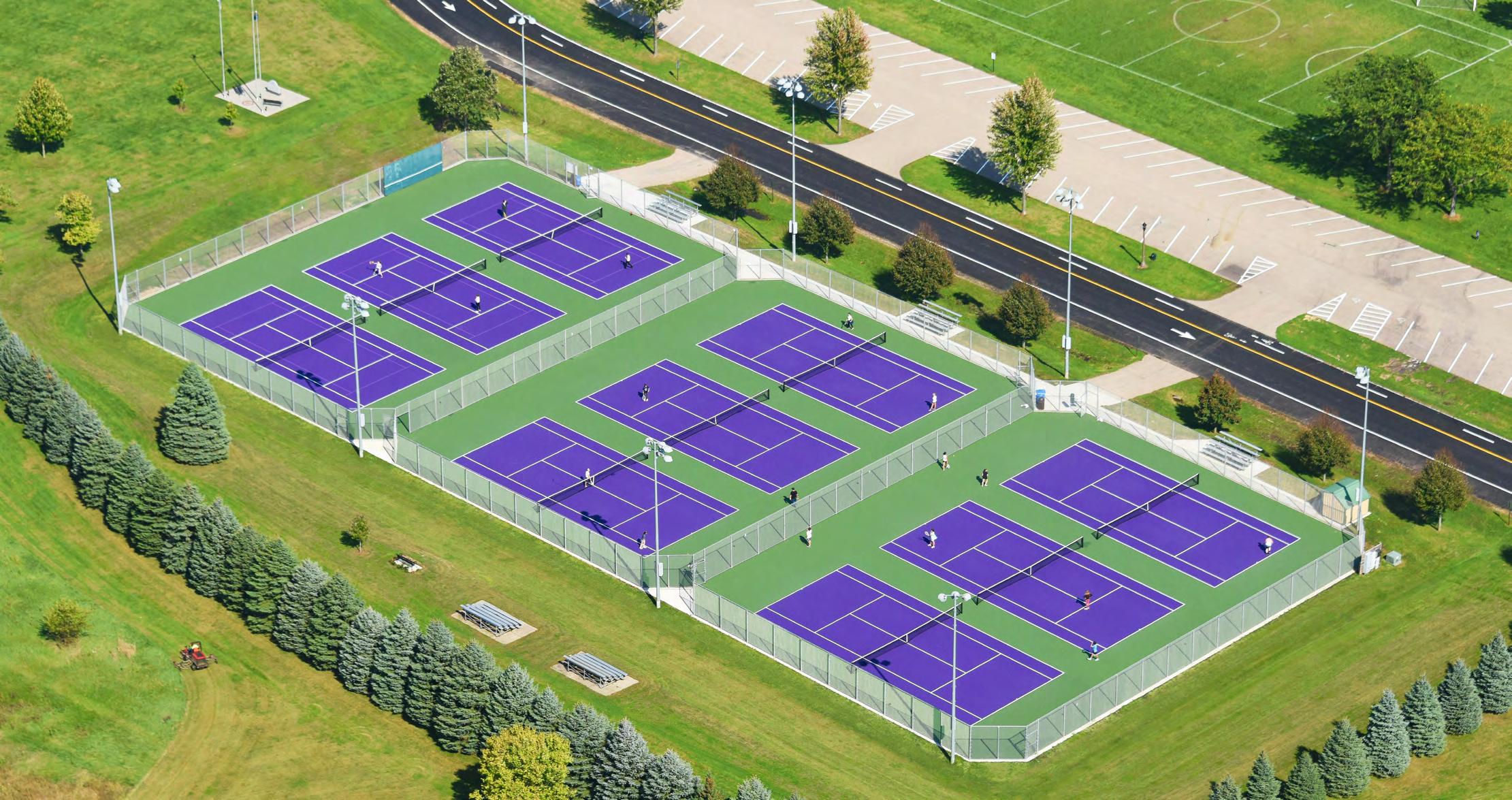
An 86.0-acre community park which is heavily used for youth soccer and baseball leagues. Park facilities include two shelters, drinking water, restrooms, parking, playground equipment, baseball-softball field, batting cage, soccer fields, nine tennis courts, a scenic walk/view, dog-exercise area, a 9-hole disc golf course, and a sledding hill. The park is home to the Waunakee High School tennis teams.
Savannah Park
A 3.3-acre neighborhood park on Arboretum Drive serving the Savannah Village Subdivision. Savannah Park is heavily used by residents of the adjoining Savannah Village Subdivision. Park facilities include a shelter, drinking water, grills, portable toilet, playground equipment, baseball-softball field, basketball court, tennis court, in-line hockey and ice skating.
Scenic Valley Park
A 2.8-acre neighborhood park on Badger Lane serving the North Ridge Estates Subdivision neighborhood. Park facilities include a shelter, playground equipment, tot lot and basketball court.
Settlers Park
A 1.5-acre mini park located in the Ashlawn Addition with has good views of the State Capitol. Due to plat restrictions, improvements at Settlers Park have been minimal. Facilities include parking and a scenic walk/ view.
Six Mile Creek Subdivision Trail Corridor
A pedestrian trail corridor, surrounded by undisturbed vegetation, located between Fairbrook Dr. and Century Ave. and directly adjacent to the Six Mile Creek neighborhood. Its primary feature is a walking path connecting the Troon Ct cul-de-sac and N Fairbrooke Dr.
Tierney Park
A 25.6-acre community park that serves the Southbridge Neighborhood. Tierney Park is connected to extensive public open space and conservancy lands to the south-extending southward to Governor Nelson State Park. To the north, Tierney Park adjoins the Bolz Conservancy Park. Park facilities include a shelter, drinking water, restrooms, concession stand, parking, playground equipment, tot lot, baseball-softball field, basketball court, soccer field and tennis court. The park is used for youth football and lacrosse.
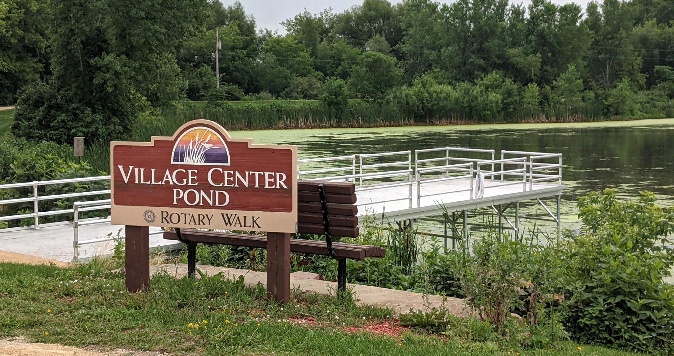
Village Center Pond Conservancy (Rotary Walk)
A 9.0-acre nature preserve west of the Village Center. The land was formerly part of the Stokely canning plant. Now the pond serves as the primary stormwater management basin for the historic downtown area and is an important recreation area. Facilities include parking, fishing and a scenic walk/view.
Village Hall Rotary Plaza
A 0.1-acre special use park located on West Main Street, adjacent to Village Hall that has been improved by the Rotary Club. Facilities include parking.
Village Park
A 14.3-acre community park located in the central Village. It is one of the Village’s most heavily used parks. Park facilities include two shelters, drinking water, restrooms, concession stand, parking, playground equipment, tot lot, baseball-softball field, basketball court and scenic walk/view. The park also contains Veteran’s Monument and three bridges (built as part of Franklin Roosevelt’s New Deal Program).
Watertower Park
A 4.1-acre neighborhood park serving the Capitol Estates Neighborhood. An important feature of the park is the sledding hill, which is heavily used in the winter. The park also has playground equipment.
Water Wheel Park
A 13.2 acre undeveloped park located between Simon Crestway and Ireland Dr. This park currently has no facilities.
Waunakee Business Park Hillside Conservancy
A 1.7-acre nature preserve on a wooded hillside at the north end of the Waunakee Business Park Phase 2. The site was acquired to protect the wooded slope and provide public open space within the business park. This conservancy land has been kept in natural vegetation and is generally not maintained. The site includes a scenic walk/view.
Westbridge Park
An 11.5-acre community park serving the Westbridge Neighborhood. Park facilities include a shelter, drinking water, restroom, concession stand, parking, playground equipment, tot lot, baseball-softball field, basketball court, tennis court and sand volleyball court.
Woodland Wayside
A 1.7-acre mini park serving the Kilkenny Addition to the Southbridge Neighborhood. The site has shelter and scenic walking path.
PROGRAMMING
The Village Center is an indoor recreational and community space on South Madison Street. The Village’s Community Services Department offers a wide variety of programming, including nearly 200 programs throughout the year for youth and adults. Examples of programming for youth include the Play in Your Park program, Ice Skating, and Tennis. Examples of programming for adults include Tennis, Ballroom Dance, Group Fitness and Yoga classes. For current offerings visit www.waunakee.com/recreation
TOWN - OWNED FACILITIES
Bishops Bay Park
A 4.3 acre undeveloped park along Bishops Bay Parkway. This park currently has no facilities.
Carriage Ridge Conservancy Park
A 4.6-acre undeveloped park serving the Carriage Ridge neighborhood. The site has no facilities.
Christina Park
A 0.5-acre neighborhood park serving the Larwood Hills Subdivision. Park facilities include playground equipment.
Mary Lake Park
A 1.4-acre neighborhood park located at Rainbow and Riveredge Roads. Park facilities include playground equipment and a basketball court.
Steeplechase Park
A 0.6-acre neighborhood park adjacent to the Steeplechase Condominium development. Park facilities include a shelter and playground equipment.
Sunrise Park
A 0.3-acre mini park located in Middleton’s Sunrise Neighborhood. This park is maintained by neighborhood residents and requires little to no maintenance or supervision from the Town. Facilities include a small fishing pier.
Town Center Park / Daleo Soccer Fields
A 20.5-acre community park adjacent to the Westport Kennedy Administration Building. Park facilities include a shelter, drinking water, restrooms, concession stand, parking, fishing, playground equipment, tot lot, soccer field, and tennis court.
Jackson Landing Conservancy Park
A 73.5-acre nature preserve located on the north shore of Lake Mendota. Facilities at the site include a shelter, parking, boat ramp and scenic walk/view.
Westport Conservancy
A 105-acre nature preserve aquired by the Town in November 2022. The land reaches north and east of the corner of County Highway M and Woodland Drive and is bordered by Town Center Park to the East and homes on Mary Lake Road to the North. The park is currently undeveloped.
3.2 EXISTING BICYCLE & PEDESTRIAN FACILITIES
Connecting parks and recreational facilities, downtowns, libraries and schools is a central component of bicycle and pedestrian planning. The map on page 28 shows existing bicycle and pedestrian facilities in Waunakee-Westport. There are many opportunities to connect existing trails within Waunakee-Westport and to other communities nearby.
The existing bicycle and pedestrian facilities are categorized into three general groups:
• Unpaved Multi-Use Path: Facility separated from a roadway and intended for non-motorized user types, such as bikes and pedestrians. These paths are not paved and possibly have an earth, gravel, woodchip or grass surface.
• Paved Multi-Use Path: Facility separated from a roadway and intended for multiple non-motorized user types, such as bikes and pedestrians. These paths are generally surfaced by asphalt but may include concrete. They are generally 10’ in width, but may be 8’ in width due to legacy construction practices
• Bike Route: A segment of a system of on-and-off street bikeways designated by the jurisdiction having authority with appropriate directional and informational markers, with or without a specific bicycle route number. These portions of road can be designated by striping, signage and pavement markings (lane, sharrow, etc.) for the preferential or exclusive use of bicyclists.
In addition, the map on page 28 also labels water trails which are recreational routes on a waterway with a network of public access points supported by broad-based community partnerships, as well as snowmobile trails maintained by Dane County.
BICYCLE COMPATIBILITY
Determining how existing traffic operations and conditions impact a bicyclist’s decision to use or not use a specific roadway is the first step in determining the bicycle compatibility of the roadway. Dane County has conducted a roadway suitability analysis for shared bicycle/motor vehicle use for county and state roadways. The scale has three levels: “most suitable”, “may be suitable”, and “least suitable.”
The map on the following page shows the bicycle compatibility of roadways as characterized by Metropolitan Planning Organization (MPO) (note: not all roadways are categorized). Of the roadways listed in the paragraph above, Hwy 113 (north of Highway 19 and south of CTH M) is listed as a rural road that is most suitable for biking. River Road, Bong Road, Oncken Road and Balzer Road are all listed as rural roads that may be suitable for biking. The remaining rural roads shown on the map are listed as rural roadways that are least suitable for bicycle facilities.
The Existing Bicycle Functional Class Map for Dane County from the Bicycle Transportation Plan (2015) shows Primary, Secondary and Other Bicycle Facilities throughout the County (see Figures 3.3 and 3.4). Descriptions of the route types as taken from the plan are listed as follows:
Primary Bikeways typically have high bicycle volumes or are comfortable, direct routes for the majority of bicyclists linking neighborhoods and destinations. Primary bikeways typically include routes on shareduse paths, buffered and protected bike lanes, bike lanes on moderate-volume streets and low-volume streets or bike priority streets. They are typically spaced every half mile to mile. In rural areas, primary bikeways connect cities and villages. In suburban areas, they collect cyclists from large catchment areas and provide continuous pathways to other communities.
Secondary Bikeways fill in the gaps between primary bikeways and provide neighborhood access to the primary bikeway system. Secondary bikeways typically consist of routes on continuous low-volume streets, short segments of shared-use paths, or moderatevolume highways with shoulders. The combined primary and secondary network typically provides two to four routes per mile. In rural areas, secondary bikeways connect towns and villages. In suburban
areas, they form a network of connected streets and paths that cyclists follow to navigate within their communities.
The Existing Bicycle Functional Class for Dane County shows Woodland Drive as the primary bicycle route connecting the Town of Springfield to Westport and Waunakee before it heads south on Division Street and Woodland Drive to connect to County Highway M. Highway M is where it connects to Highway 113 and heads into Madison and north to Windsor and DeForest via River Road.
The map also shows Highway 19 as a primary bicycle network connecting the Town of Springfield to Waunakee, Westport and through to Windsor, DeForest and Sun Prairie. This map also shows another primary route stemming from Highway 19 in Waunakee and going south to Westport via North Division Street and Woodland Drive to County Highway M where the route heads into Madison on Highway 113 and Middleton on County Highway M. There are a handful of secondary bikeways in Waunakee and Westport.
3.3 PRIVATELY OWNED FACILITIES
Ice Pond
This is an indoor hockey and ice skating facility that is operated by Waunakee DeForest Ice Rink Inc., a non-profit organization. Activities offered at the Ice Pond include open skate, an adult hockey league, ice/ figure skating and hockey lessons. The facility is home to three high school hockey teams: Cap City Cougars, Waunakee High School and Norski High School. The following youth teams also use the facility: Wildcat Youth Hockey and DC Diamonds Girls Youth Hockey.
Tierney Field
This is a 3-acre park owned by a church on Mary Lake Road. The park is used for soccer, and also includes a softball backstop and benches.
Willows Tavern
This restaurant/bar is located directly adjacent to the Jackson Landing Conservancy Park property owned by the Town. Sand volleyball courts and a softball
diamond are available for use by patrons. The softball field is located on Town-owned land and operated by Willows Tavern.
There are also several quasi-public and private open spaces in Waunakee and Westport that are protected through ownership and zoning. These areas include:
• Privately-owned conservancy lands that are protected through Conservancy zoning.
3.4 SCHOOL FACILITIES
Arboretum School (Arboretum Drive)
Facilities include playground equipment and playfields.
Heritage Elementary School (South Street) Facilities include playground equipment and playfields.
Madison Country Day School (River Road) Facilities include playfield and track field.
Mary Lake Montessori (Mary Lake Road) Facilities include playground equipment and playfield.
Prairie Elementary School (N. Madison Street) Facilities include playground equipment and playfields.
St. John’s School (3rd Street)
Facilities include playground equipment, basketball courts and playfields.
Waunakee Community Middle School (South Street) Facilities include playground equipment, basketball courts and playfields.
Waunakee Community High School (South Street) Facilities include athletic fields, basketball courts and playfields.
Primary (Shared-Use Path)
Primary (On Street)
Secondary (Shared-Use Path)
Secondary (On Street)
Other Bicycle Facilities
Other Existing Shared-Use Paths
Future
Bicycle Functional Class Madison Area
Primary Bicycle Network
Primary (Shared-Use Path)
Primary (On Street)
Secondary Bicycle Network
Secondary (Shared-Use Path)
Secondary (On Street)
Other Bicycle Facilities
Other Existing or Planned Shared-Use Paths
Figure 3.3
Figure 3.4
Waunakee Intermediate School (Woodland Drive) Facilities include playground equipment, basketball courts and playfields.
3.5 COUNTY FACILITIES
Dane County Shooting Range
The Firearms Training Center in the Town of Westport has five firearms shooting ranges. The facility also has a training building with multiple classrooms for general and physical training programs. The Wisconsin Air National Guard uses the facility for training of general military personnel assigned to Truax Field, as well as the Air Security Police detachment. The master plan for this facility includes future expansion by the addition of an emergency vehicle operations training course and future shooting ranges dedicated for public use. During October and November, the facility is open to the public during restricted hours for sighting in rifles in preparation for the annual deer hunting season.
Indian Lake County Park
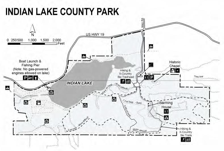
Indian Lake County Park is a 442-acre County park located west of Westport and Waunakee in the Town of Berry. The park has outstanding natural and historic resources. Facilities include extensive hiking and crosscountry ski trails and a shelter. There is a boat launch for non-motorized boats on Indian Lake. There is also a dog park at the western end of the Lake. The park is managed and maintained primarily as a passive recreation area.
Ella Wheeler Wilcox Historical Marker
The Ella Wheeler Wilcox historical marker is located adjacent to an open field eastbound on Easy Street, about a half-mile east of its intersection with County Road I, at or near 5202 Easy Street. Ella Wheeler Wilcox was an author and poet who grew up on a farm in the Town of Westport. She wrote forty books, numerous magazine articles and had a nationally syndicated advice column. Her best known work was Poems of Passion which included the poem “Solitude”, and the famous lines, “Laugh, and the world laughs with you; weep, and you weep alone”.
Mendota County Park
Mendota County Park is a 20-acre county park located in Westport with approximately 300 feet of frontage on Lake Mendota. Facilities include park shelters, picnic
areas, swimming beach, tennis and basketball courts, boat mooring lagoon, and a 25-unit campground with showers, electricity and trailer dumping areas. Dane County recently added a filtration system to the park’s swimming area as part of a pilot program aimed at keeping swimming safe and tolerable. Shallow water near the shore is being run through filters and ultraviolet treatment. A reinforced plastic curtain is setup to separate the clean filtered water from the rest of Lake Mendota. The County is also updating the master plan for this park.
Schumacher Farm County Park
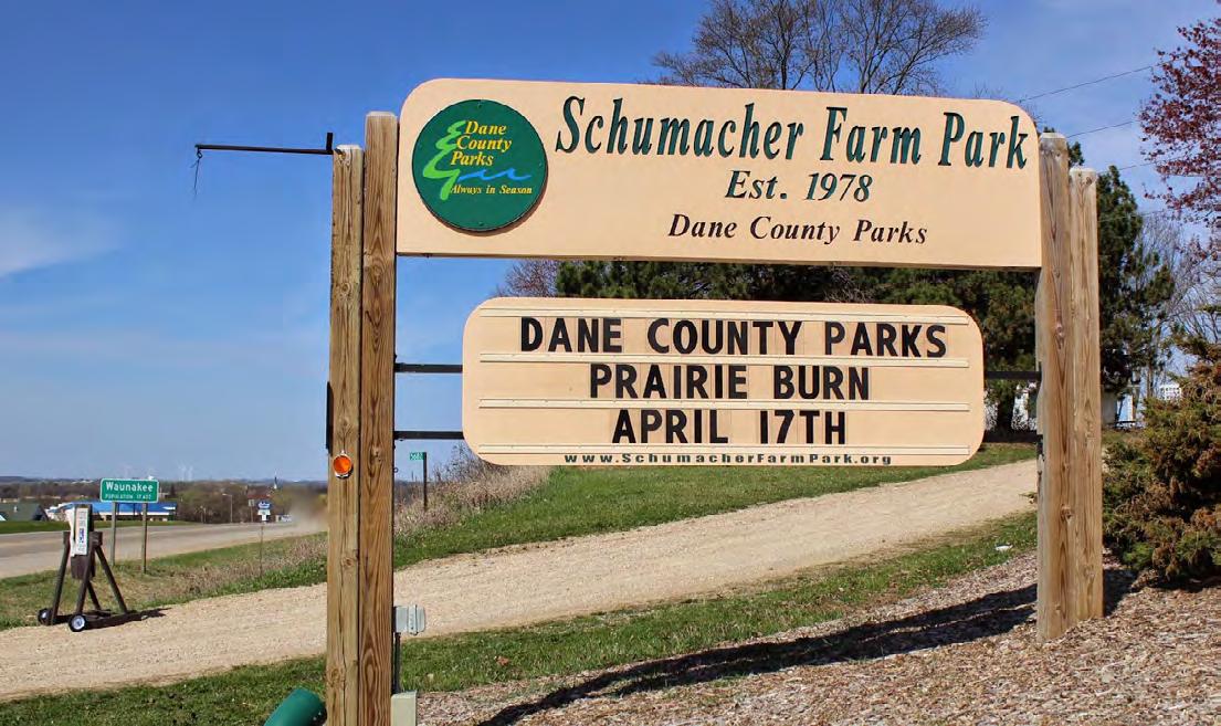
Schumacher Park is a 117.85-acre natural resource area located on the north side of Highway 19 in the Town. The park includes a historic farmstead, demonstration gardens, prairie restoration and natural trails. The Park includes an outdoor museum depicting local farm life during the 1920’s and 1930’s. The site also contains an agricultural education and meeting facility which is in a large barn. The park is open year round during daylight hours for picnicking, cross country skiing, volunteer opportunities and Friends of Schumacher Farm programs. Programming and development are sponsored by the Friends of Schumacher Farm.
North Mendota Natural Resource Area
North Mendota Natural Resource Area is 170-acres and is located northeast of the Steeplechase Neighborhood in Westport. The following recreational uses are currently allowed at the property: hiking, fishing, cross-country skiing, snowshoeing, wildlife observation, nut, berry and mushroom picking, nature
study, archery hunting (by permit only), on-leash dog walking (by permit only), metal detecting (by permit only), geocache (by permit only), star gazing (by permit only).
Six Mile Creek Resource Area
Six Mile Creek begins in the Waunakee Marsh and flows through the Village into the Town, eventually joining with Dorn Creek to empty into Lake Mendota. It is the second largest remaining wetland in Dane County. Water quality in Six Mile Creek’s 12-mile length is generally good, supporting a limited forage fishery west of Highway 113, a diverse forage and warm water sport fishery from Highway 113 to Lake Mendota, and abundant spawning area.
Yahara Heights County Park
Yahara Heights County Park is a 385 acre site that contains Cherokee Marsh, the largest remaining wetland in Dane County and the major wetland in Lake Mendota’s watershed. The park contains a 20-acre dog park, which is suitable for (careful) recreational walking, and a canoe and kayak launch.
Bike and Pedestrian Facilities
Dane County bike facilities include County Q from Waunakee to Middleton; County K from County Q to County M and east to US 12; County M from Middleton to Highway 113; and County I from the intersection of US 113 and US 19. Counties Q and K have paved shoulders 4 feet or wider, County M has a 3 to 4-foot paved shoulder.
3.6 REGIONAL FACILITIES
Cherokee Marsh/Yahara Heights County Park
Cherokee Marsh is an approximately 1,000-acre publicly-owned conservancy area and wetland-
complex located along the Yahara River. The area is owned and maintained jointly by Dane County, the Wisconsin Department of Natural Resources, and the City of Madison. While maintained primarily as a conservancy area, there are extensive recreational trails and other passive recreation facilities within the Cherokee Marsh area. As mentioned on the previous page, a portion of the parkland adjacent to Highway 113 is managed as a dog park.
Dorn Creek Conservancy
This 300-acre site between Highway M and Highway Q on the north side of Oncken Road is currently owned by WDNR. The County owns and maintains a trailhead on Oncken Road with limited parking.
Governor Nelson State Park
Governor Nelson Park is a 422 acre-State park located in the Town on County Highway M. The park has extensive picnic, hiking, cross-country skiing and boating facilities. There is also a swimming beach.
Ice Age Trail
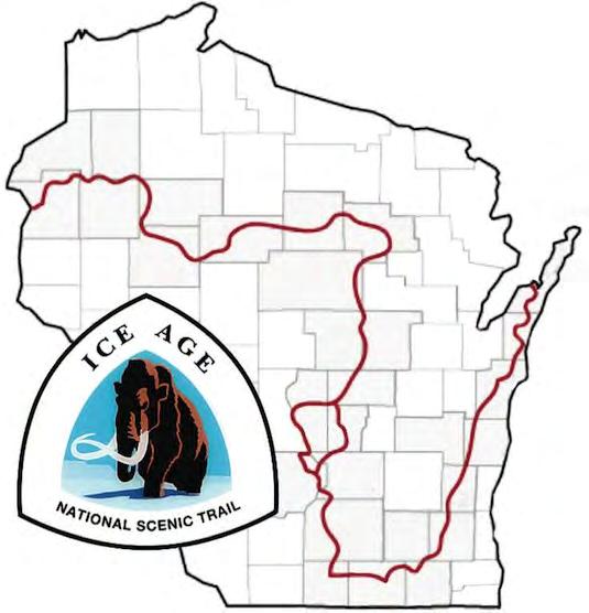
The Ice Age Trail does not run through the Village or Town, but is located just a few miles west. The Ice Age Trail is a thousand-mile hiking path entirely within Wisconsin that highlights the State’s Ice Age landscapes. There are two parking locations for the Trail in Indian Lake County Park. The ability to connect to this trail along various routes, such as the potential Dorn Creek corridor and the US 12 bike path would be a great amenity for the community.
Metropolitan Refuse Site
The former metropolitan refuse site on Century Avenue is a 137-acre site managed for recreational use. The site is owned jointly by the City of Madison, City of Middleton, Village of Shorewood Hills and Metropolitan Refuse District. The primary facilities at the site include a dog park and soccer complex.
Pheasant Branch Conservancy
The diverse topography of this 160-acre site provides a panoramic view of the Capitol, the downtown Madison skyline and Lake Mendota. Native Americans were the first to appreciate the vistas from this point, as they chose this site for burial mounds. Opportunities for recreational walking, bird watching, snowshoeing and nature interpretation make this a very popular destination. This area is located approximately 1.5 miles north of Century Avenue (Highway M) on Pheasant Branch Road, just west of the Town. Dane County, WDNR and the City of Middleton all own parts of the Conservancy lands.
Upland Prairie
This small piece of native prairie is owned by the WDNR, and lies in the midst of quarries north of Bong Road and east of Highway 113.
Waunakee Marsh
Waunakee Marsh is an approximately 100-acre wetland complex located several miles west of Waunakee that is owned and managed by the Wisconsin Department of Natural Resources as a conservancy area.
State of Wisconsin Bike and Pedestrian Facilities
WIS 19 has 5-foot paved shoulders west of Waunakee, and 3-foot paved shoulders east of Waunakee. WIS 113 also has paved shoulders; shoulder width is unknown.
Please see the map on the following page for the locations of items discussed in Sections 3.3, 3.4, 3.5 and 3.6.
This page intentionally left blank
Chapter 4 ANALYSIS OF NEEDS & DEMANDS
4.1 Quantitative Analysis - Parks
4.2 Geographic Analysis - Parks
4.3 Qualitative Analysis - Parks
4.4 Biking & Walkability Suitability Analysis
4.5 Regional & State Trends
This chapter presents an analysis of how well the Village’s and Town’s existing park and recreational facilities satisfy current needs in the communities. The adequacy of the Village’s and Town’s existing park and recreation systems are evaluated using the following methods:
• Quantitative Analysis - a comparison of existing parkland acreage and population projections versus park and recreational facility service guidelines, and the amount of parkland available to Village and Town residents.
• Geographic Analysis - an analysis of the geographic distribution and accessibility of park facilities in the Village and Town.
• Qualitative Analysis - a summary of public input regarding Village and Town parks and recreational facilities gathered through the community survey.
• Regional & State Trends - a summary of the demand trends in recreational amenities at the county and state level.
4.1 QUANTITATIVE ANALYSIS - PARKS
An analysis of existing recreational land area is provided to determine if the recreational needs of residents are being met. This analysis is limited to an evaluation of park land, and does not include off-road trails not located in parks.
WAUNAKEE
Currently the Village is providing approximately 397 acres of parkland, not counting school facilities, county facilities or private facilities. This translates to 0.0267 acres of parkland per person, or 26.7 acres per 1,000 residents. Using WI DOA population projections, if no new parkland is added in Waunakee, in 2040 there will be approximately 21.1 acres per 1,000 residents.
Table 4.1 summarizes the current and projected supply and demand for total parkland acreage based on Village population. For the purpose of calculating anticipated parkland demand, a service level of 15 acres per 1,000 residents was assumed. Since 2009 it has been the policy of the Village to strive for 15 acres of parkland per 1,000 residents.
Using this level of service standard, the Village currently has a surplus of 173.8 acres. Assuming the population projections are correct, and the Village does not add additional parkland, the total surplus will shrink to 114.5 acres by the year 2040.
WESTPORT
The Town is currently providing 216 acres, which translates into 0.0516 acres of parkland per person, or 51.6 acres per 1,000 residents, nearly double the rate for Waunakee. If no additional parkland is provided in Westport, in 2040 the Town will provide approximately 45.8 acres of parkland per 1,000 residents (using WI DOA’s population projections).
Table 4.2 summarizes the current and projected total parkland acreage based on Town population. For Westport, a service level of 12 acres per 1,000 was assumed; this is the standard set by the National recreation and Parks Association (NRPA). Using this level of service standard, the Town currently has a 165.8 acre surplus. Assuming the population projections are correct and the Town does not add additional parkland, the total surplus will shrink to 159.4 acres by the year 2040.
Based on national data provided by the NRPA, both Waunakee and Westland have higher rates of parkland per 1,000 residents than many of its peers across the country. As seen in Figure 4.1, the median nationally for municipalities with less than 20,000 residents is is 12.9 acres per 1,000 residents, with the upper quartile reaching 21.7 acres per 1,000. Both Waunakee
Table 4.1 Waunakee Total Park Acreage Surplus/Deficit
Total Park Acreage Surplus/Deficit (in acres)
Table 4.2 Westport Total Park Acreage Surplus/Deficit
Acres of Parkland per 1,000 Residents (jurisdiction pop. <20,000)
(at 26.7 per 1,000) and Westport (at 51.6 per 1,000) therefore exceed the upper quartile for similarly sized municipalities.
It is important to note that school-owned properties were not included in the analysis for Waunakee and Westport. School-owned properties do play a vital role in filling the community playfield needs of the residents of both Waunakee and Westport; however, because access and maintenance are not regulated by the Village or Town these facilities were not included in our analysis. County and private recreational facilities were also excluded.
Although the total acreage of park and recreation lands is an easy indicator of the presence of parks and recreation space, it is not the only indicator of whether a community is able to meet the park and recreation needs of its residents. The NRPA advocates that the location of parkland, and the types of recreational facilities offered on that land, are just as important as the total acres of parkland.
A community with an abundance of parkland, but few recreational facilities, is less likely to meet the needs of its residents than a community which has a lesser amount of parkland, but has a larger variety of recreational opportunities. Fortunately for Waunakee and Westport residents they have access to a wide range of recreational facilities as summarized in Chapter 3, Sections 3.1 - 3.6.
4.2 GEOGRAPHIC ANALYSIS - PARKS
The location of parks and open space facilities in relation to the Village’s and Town’s residents is an important indicator of how well existing facilities are dispersed
throughout the communities. The National Recreation and Park Association, in partnership with the Trust for Public Land and the Urban Land Institute, promotes the 10-Minute Walk Campaign (https://10minutewalk. org) which advocates that “there’s a great park within a 10-minute walk of every person, in every neighborhood, in every city across America.” Using the 10-Minute Walk as a guiding principal, Figure 4.2 on page 42 (and in Appendix B) indicates areas of the Village and Town that are not currently served by a Village or Town park. Areas currently zoned for residential uses that fall outside of these service areas are highlighted in yellow.
The map shows minimal deficieny in parkland within an easy walking distance of residential areas in Waunakee. In Westport, there are swaths of residentially zoned land along its southern boundary that fall outside the current 10-minute walk radius, as well as residentially zoned land scattered in the northeast and southwest corners of the Town. However, it is important to note that this analysis only focuses on Village and Townowned property. Much of the residentially zoned land in Westport that is outside the aggregate green 10-minute walk radius is directly adjacent to parkland owned by other entities such as Dane County and the State. So while not Town-owned, these properties are very accessible to many Westport residents, and likely within a 10-minute walk of many their homes. This includes the Yahara Heights County Park, Cherokee Marsh Natural Resource Area, Governor Nelson State Park, and the Dorn Creek Wildlife Area.
4.3 QUALITATIVE ANALYSIS - PARKS
As part of the update to this plan, the Village and Town Parks Boards administered an online community survey to gather resident’s opinion regarding Village and Town Park facilities and recreational programs. The survey was available from June 6, 2022 through July 10, 2022
In total 989 individuals started the survey. Since respondents were not required to answer every question, the number of respondents for each subsequent question varies (see Appdenix A for full survey results and the number of respondents per question). Approximately 74% of those who took the survey live in Waunakee and 22% live in Westport. The following is a summary of responses to key questions.
Community members were asked how often they walk for exercise and for transportation to and work,
stores, and restaurants. 65% reported walking for exercise three or more times a week, however, nearly 50% of survey respondents reported walking zero times in the past year as a form of transportation. For individuals that lived in the Town of Westport, 74% of respondents had walked zero times in the past year as a form of transportation to work, stores, or restaurants. Incidences of biking for exercise and as a form of transportation in 2016 for the previous CORP and in 2022 were lower than rates for walking. These results align with perceptions of pedestrian and bicyclist safety reported throughout the survey.
When asked if there are any destinations in Waunakee or Westport that cannot be reached safely by bike or foot, many survey respondents commented that they do not feel safe biking or walking to most places in the community. In particular, many open-ended comments noted difficultly traveling along county Hwy M, Q, K, and 113 as a pedestrian and cyclist due to the lack of protected bike lanes and fast-moving car traffic, in addition to downtown Waunakee and local schools. Common locations people cited as difficult to reach by foot or bike included: Athens Grill, Governor Nelson State Park, the library, and the Kwik Trip, Culvers, and dog park off of Main St. These locations were all also commonly cited as priority areas for new or improved bike trails and routes. Many survey respondents also wanted to see more connections to bike trails in the cities of Madison and Middleton. Many of the roadways discussed above were cited in 2016 as well for increased investment in bicycle and pedestrian safety.
The most popular responses for desired new, improved, or expanded amenities included:
Waunakee Residents:
• Off-Road Walking/Biking Trails (41%)
• Outdoor Pool (41%)
• Splash Pad (37%)
• Canoe/Kayak Facilities (32%)
• Restrooms (27%)
• Indoor Pool (27%)
Westport Residents:
• Off-Road Walking/Biking Trails (47%)
• Canoe/Kayak Facilities (47%)
• Restrooms (34%)
• Outdoor Pool (33%)
• Beaches/Lake Access (33%)
• Indoor Pool (21%)
Regarding new recreational programs and services, many survey respondents expressed interest again in a centrally located pool and splash pad, another dog park, cooking classes, archery, more inclusive programming for children with disabilities, cross country skiing in Ripp Park, curling, and expanded evening programming for families that work during the day. There were also many comments wishing for pre-pandemic adult fitness classes to return and more adult leagues for activities such as bocce ball, pickle ball, ballroom dancing, hiking/walking clubs, yoga, and Zumba. A significant number of open-ended comments also requested lighting at the skate park. Finally, when asked if anyone in your household participated in a Village of Waunakee recreation program in 2021, roughly 50% of respondents replied ‘yes’. This is a significant change from 2016 when 60% of respondents reported someone in their household participating in a Village sponsored recreation program in the previous year. This change is likely attributed to the impact of the COVID-19 pandemic on indoor activities.
Overall, survey respondents believe that the top priorities for the Village and Town over the next five years should be:
• improving bicycle infrastructure along Hwy M, K, Q and 113
• investing in trail connections to Middleton, Madison, and Governor Nelson State Park
• building an all ages, inclusive aquatic center
While desire for an aquatic center was a popular comment among respondents, some individuals were concerned about the high cost of developing and operating a pool, instead preferring a near-term investment in a splash pad. Ripp Park was cited as the preferred location for such a splash pad several times. Many open-ended comments also requested expanding the timeframe in which park restrooms are open (before May 1st and after October 1st), and improving awareness of the range of recreational programming offered in the community.
4.4 BIKING AND WALKING SUITABILITY ANALYSIS
Connecting parks and recreational facilities, downtowns, libraries and schools to each other and the population is a central component of bicycle and pedestrian planning. The following is a summary of key
trip destinations in Waunakee and Westport:
• Parks, natural and recreational areas
• Community buildings and schools
• Downtown areas
• Residential neighborhoods
Barriers for bicycles and pedestrians include both a lack of facilities and unsafe facilities. Where sidewalks do not exist, it is difficult for pedestrians to access necessary services. Streets with heavy vehicle traffic, particularly those that are narrow, pose a danger to on-street cycling. Lack of safe pedestrian or bicycle crossings of busy streets also poses significant danger. As mentioned previously, according to survey results the most common destinations residents can’t reach by bike or foot and/or locations that need to be improved for bicycle or pedestrian safety include:
• Highway M
• Highway Q
• Main Street
• Governor Nelson State Park
• Mary Lake Road
• Woodland Drive intersection for school crossing
• Roundabouts in Waunakee
• Areas without sidewalks
• Businesses and restaurants in downtown Waunakee
Railroad tracks and creeks can also pose a barrier to bicycles and pedestrians. Separate bicycle and pedestrian crossing facilities are often not provided, and auto intersections can be difficult or dangerous on bike or on foot. The railroad tracks in Waunakee pose an east-west barrier. Six Mile Creek through the Village provides an opportunity for facilities along the creek corridor, although this opportunity presents the challenge of crossing the creek at key locations.
4.5 REGIONAL & STATE INSIGHTS
INSIGHTS FROM THE WISCONSIN STATEWIDE OUTDOOR COMPREHENSIVE RECREATION PLAN (SCORP), 2019-2023.
The recently updated Statewide Outdoor Comprehensive Outdoor Recreation Plan (SCORP) features a Recreation Opportunities Analysis (ROA).
The ROA examines existing outdoor-recreation opportunities compared to future opportunities in eight regions throughout Wisconsin. Dane County is located in the Southern Gateways region. The Southern Gateways region contains a variety of environments - rolling hills in the south, the centrallylocated Wisconsin River, and large marshes in the east - the combination of which provides a wide array of recreational opportunities.
The region also has a number of important geologic features, including Devil’s Lake - one of Wisconsin’s most popular recreation destinations. The rapid development around Madison (including the Town and Village) has also increased demand for urban-based recreation opportunities such as dog parks, bicycle trails and developed sports facilities.
The ROA found that residents of the Southern Gateways region participate in the following activities at higher rates than the State average:
• ATV/UTV riding
• Bicycling on surfaced trails, mountain biking and single track
• Tent camping
• Canoeing/kayaking
• Cross-country skiing/snowshoeing
• Fishing from shore, boat, canoe and kayak
• Hiking, walking and running on trails
• Big game hunting (deer, bear)
INSIGHTS FROM THE DANE COUNTY PARKS & OPEN SPACE PLAN (POSP), 2018-2023.
In it’s 2018-2023 POSP, the Dane County Parks Department compared recreation uses that require purchase of a permit in 2011 and 2016 to identify trends for these park uses. Findings included:
» An increase in number of nights camping from 2011 (9,691 nights) to 2016 (12,867 nights).
» Lake access, dog exercise areas and disc golf continue to be very popular uses in Dane County Park lands. For instance, disc golf permit sales increased from 776 in 2011 to 1,417 in 2016. Mountain biking permit sales also doubled during this time period.
The plan proposes several off road trails throughout the County, inclduing a 3.8 mile North Mendota Trail that would extend from Woodland Drive in the Town of Westport to Mendota County Park in the City of Middleton. The plan notes that the Town and Village would be responsibel for developing the trail from Woodland Dr. to Governor Nelson State Park.
INSIGHTS FROM THE DANE COUNTY BICYCLE PLAN, 2015.
The Dane County Bicycle Plan notes that the overall proportion of commuters bicycling and walking to work in Dane County is relatively small compared to the entire workforce. According to 2013 ACS data, Waunakee had a bike commute mode share of 0.4% which is lower compared to the national average bike commute mode share in large U.S. cities (1.0%) and the City of Madison (5.3%). Waunakee does show a positive increase in Bike Mode Change (+0.4%) between the 2000 Census and 2013 ACS estimates. The Plan also shared the following trends:
• Younger commuters are more likely to bike to work (most likely due to the low cost of cycling). Individuals less than 25 years old are much more likely to walk to work compared to individuals over age 25.
• According to 2012 ACS data, male respondents are about twice as likely to commute to work by bicycle (4.1% in Dane County). Males and females are nearly equal in terms of walking to work (5.4% in Dane County).
• Individuals identifying as “two or more races” report a higher bike commute mode share of 8.0%.
• In Dane County, commuting to work by bicycle, taxicab, motorcycle or other generally declines as household incomes increase until household
incomes reach about $60,000, at which point they begin to increase.
The plan lists a regional, shared-use Hwy 19 path from Waunakee to DeForest as a planned priority to be completed between 2036 and 2050. A shared-use path from Bishops Bay to Waunakee is listed as a priority to be completed between 2020 and 2035. The plan also lists the Sherman Flyer Path (from Troy Drive in Madison to Waunakee) as a priority shared-use path to be completed between 2036 and 2050.
This page intentionally left blank
Chapter 5 GOALS, OBJECTIVES, POLICIES & PROGRAMS
5.1 Goals, Objectives, Policies & Programs
This is a joint plan adopted by both the Village of Waunakee and the Town of Westport. Both communities will utilize this plan to guide development of subsequent parks, recreation, open space and bicycle and pedestrian facilities. Most of the goals, objectives, policies and programs are relevant and appropriate in both jurisdictions. Any items specific to only one jurisdiction are explicitly identified.
Goals and objectives are presented here as desired outcomes; objectives are added under a goal only when there is the need to describe multiple desired outcomes not adequately captured in the goal statement. Policies and programs include both actions and policy rules –they are the methods proposed to achieve the goals and objectives.
5.1 GOALS, OBJECTIVES, POLICIES & PROGRAMS
GOAL 1 -PROVIDE A SUFFICIENT AMOUNT OF ACTIVE AND PASSIVE RECREATIONAL LANDS TO MEET CURRENT AND FUTURE RECREATIONAL NEEDS OF THE COMMUNITY.
Objective 1- There will be a range of park types and sizes to meet the varied needs of the community.
Objective 2- The number of parks in the community will increase in relation to growth in new development.
Objective 3 - Acquire additional lands for active and passive recreational use based on current deficiencies, demands created by increasing populations, or the environmental and recreational significance of the land.
Shared Policies & Programs
1. The park system will include a range of park types including:
a. Mini-parks, such as Village or Town Center plaza spaces, typically less than one-acre in size, including features such as gardens, fountains, memorials, gazebos, and benches
b. Neighborhood parks and playgrounds, typically
2-5 acres in size, including features such as play equipment, picnic areas, tennis and basketball courts, and playfields suitable for informal activities, such as soccer or ball games.
c. Community parks and playfields, typically 5-20+ acres in size, including features found in neighborhood parks in addition to walking paths, community event space, shelters with restroom facilities, off-street parking, athletic facilities suitable for organized recreational, team and tournament play.
d. Nature Preserves/Greenbelts/Historic Markers, size varies, typically includes either woodlands, prairies, floodplains, wetlands, streams, critical wildlife habitats and other areas having cultural, scenic, or natural values.
2. Require new developments to provide land or fees-inlieu-of land dedication sufficient to meet the parkland and trail needs generated by such development, based on the adopted parkland acreage policies of each respective community identified in this plan (see Village Policy #1 and Town Policy #1).
3. Land which is undevelopable (i.e. contains wetlands or floodplains) or proposed for stormwater management facilities shall not be counted toward the required amount of parkland dedication for new subdivisions.
4. Pursue additional land acquisition where existing neighborhoods are underserved by recreational land or where opportunities arise to add strategic parkland to the community which serves to implement one or more recommendations of this plan.
Village Policies & Programs
1. Maintain a level of service of at least 15 acres per 1,000 residents.
2. Collect park impact fees from new developments sufficient to meet the anticipated cost, on a per household basis, of providing park improvements at a level equivalent to the park standards adopted in this plan.
Town Policies & Programs
1. Maintain a level of service of at least 12 acres per 1,000 residents.
GOAL 2 -PROVIDE ADEQUATE ACCESS TO PUBLIC PARKS AND RECREATIONAL FACILITIES WITHIN SAFE WALKING DISTANCE.
Objective 1 - New parks will be strategically located within the neighborhoods that they are intended to serve in order to meet the geographic park service standards identified in this plan (see Shared Policy 1 and 2 below).
Objective 2 - New residential subdivisions will have access to both neighborhood and community parks.
Objective 3- Provide barrier-free access to public parks and recreational facilities.
Shared Policies & Programs
1. New residential subdivisions should be designed such that all residential lots are within a 1/3-mile or less distance from some type of public park and open space facility.
2. New residential subdivisions should be designed such that all residential lots are within a 1.5-mile or less distance from a community park or community playfield.
3. Neighborhood parks should be sited and designed to enhance neighborhood cohesion and provide a common neighborhood gathering place.
4. It is the preference of the community to dedicate larger neighborhood or community parks capable of supporting a range of recreational facilities as part of land dedications requirements in lieu of dedicating multiple small mini-parks and neighborhood playgrounds.
5. New parks and recreational facilities will meet Americans with Disabilities Act (ADA) requirements and existing park facilities will be improved to meet ADA requirements as facilities are upgraded.
Village Policies & Programs
1. New parks should provide off-street parking spaces sufficient to meet the anticipated uses of the park. In many cases, smaller pull-in parking lots (e.g. those at Westbridge Park) can be utilized for neighborhood parks; however, larger off-street parking lots should be used for community parks and playfields to accommodate the increased number of users.
GOAL 3 -PROVIDE A DIVERSITY OF RECREATIONAL FACILITIES TO MEET THE VARIED NEEDS AND INTERESTS OF THE COMMUNITY.
Objective 1- The community’s park system provides recreation opportunities for people of all ages, races, and socio-economic status.
Objective 2- The variety of recreational facilities will increase within the community.
Objective 3- The community’s park system provides opportunities for multi-seasonal recreation activities.
Objective 4- Recreational tourism will increase within the community.
Shared Policies & Programs
1. Parks should be designed to include a range of age appropriate playground equipment. For example, play equipment for children ages 6-23 months, 2-5 years old, and 5-12 years old. Play equipment should be properly signed to denote the intended age range of the equipment.
2. New parks, or upgrades to existing parks, should consider opportunities to provide new types of recreational facilities not already found within the community in addition to traditional facilities such as playgrounds.
3. Pursue the development of revenue generating recreational facilities and activities, or those uses which can bring an influx of tourists to support area businesses, which can aid in the development of new facilities and/or the maintenance of existing facilities.
Village Policies & Programs
1. Recreational programs should provide opportunities for participation by residents of all ages, interests (i.e. sports and non-sports) and abilities.
GOAL 4 -PROVIDE WELL MAINTAINED AND SAFE PARK AND RECREATIONAL FACILITIES.
Objective 1- Prevent and minimize injuries to users of public parks and recreational facilities.
Objective 2- Continually monitor and maintain existing park equipment and vegetation to ensure its longevity and safety.
Shared Policies & Programs
1. Facility development and installation will be reviewed with safety in mind, adhering to accepted standards prior to installation including applicable Consumer Product Safety Commission (CPSC) standards, American Society for Testing Materials (ASTM) standards, or American’s with Disabilities Act (ADA) requirements.
2. The Village/Town will make every effort to repair, replace, or remove park facilities that become broken or otherwise become a safety hazard. Upon learning of any defective park facility the Village/Town may post notice of a park closure or park facility closure until such time as corrective measures can be taken.
3. The Village/Town will make every effort to maintain the landscape at existing parks in good condition.
4. Investigate the increase use of low-maintenance ground cover in parks and conservancy areas.
5. Incorporate tree planting into neighborhood, community and special purpose parks.
Town Policies & Programs
1. Any new tree planting will include no more than 25% of any one tree species. Only native tree species will be planted (no invasives).
GOAL 5 -ADEQUATELY FUND PARK AND RECREATIONAL PROGRAMS.
Objective 1- Recognize the importance of an adequate park budget, which can financially address existing park maintenance and allow for future parkland acquisition and facility development.
Objective 2- Maintain a park and open space system that is sustainable with respect to annual maintenance and operations costs and servicing capacities of the community.
Objective 3- Continue funding the replacement of old and deteriorating recreation equipment in all Village/ Town parks.
Objective 4 - Continue funding to allow for future parkland acquisition and new facility development.
Objective 5- Invest funds for the development of facilities that will maximize existing park and recreation areas and providing recreational programs, with the intention of increasing park use.
Objective 6 - Use all available funding resources to further enhance the quality of the community’s park system.
Shared Policies & Programs
1. The Village/Town will maintain a capital improvements plan to replace worn or damaged recreational equipment and facilities.
2. Use this plan as a guide to establishing future capital improvement plans and annual budgets.
3. As new lands are added to the park system, the Village/Town will budget sufficient funds for on-going maintenance and operations of park and outdoor recreation facilities. Long-range maintenance and operations costs should be taken into consideration at the time new parklands are acquired though land dedications or other means.
4. Pursue grant funding from state, federal, recreation associations, or corporations which can aid in the purchase and/or development of desired park system improvements.
5. Nurture existing positive relationships with public and private organizations for donations and volunteer help to aid in park system development.
6. Provide residents an opportunity to make a tax-deductible charitable gift to assist with the maintenance and development of the Village’s/Town’s park and recreational facilities (e.g. endowment fund).
7. Utilize fees in lieu of land dedication to upgrade the local park system.
8. Review parkland dedication requirements, fees in lieu of land dedication, and park impact fees on an annual basis and update as needed to reflect changes in official policies or market conditions.
Village Policies & Programs
1. Establish a process for planning for and funding major regional recreational and athletic facilities that are not a part of the typical neighborhood and community park facilities. Examples of facilities with a broad regional benefit include:
a. Swimming Pool/Water Park/Splash Pad
b. Indoor Athletic Complex
These are “special purpose” facilities that generally have a targeted user groups and are usually funded by a combination of private and governmental sources.
GOAL 6 -PRESERVE AND ENHANCE ENVIRONMENTAL CORRIDORS AS PERMANENT OPEN SPACE AREAS.
Objective 1- Coordinate siting of active parklands with environmental corridors.
Objective 2 - Link active parklands together via environmental corridors
Objective 3- Use park and recreational lands as a means to promote environmental education and community history.
Shared Policies & Programs
1. Utilize drainage ways, greenways, and environmental corridors as part of a permanent open space system suitable for passive recreation use, including nature walking, wildlife habitat preservation, and trail development. Such environmental areas are generally not suitable as neighborhood or community parks because of topography and drainage limitations.
2. Where feasible and in the best interests of the community, consider siting active parklands adjacent to environmental corridors in order to expand the total amount of open space and to facilitate trail connectivity from active parklands to environmental corridors.
3. Encourage public awareness of environmental and cultural resources by installing interpretative signage or historical markers within Village/Town parks. The Village/Town encourages the use of park facilities for outdoor environmental education.
GOAL 7 -COORDINATE PARK AND RECREATION PLANNING AND DEVELOPMENT.
Objective 1- Coordinate park and open space planning and development with adjacent governments, school districts, Dane County, state and federal agencies and other owners and managers of public, quasi-public and private open space lands in the community.
Objective 2- Coordinate the public use of indoor and outdoor school recreation facilities.
Objective 3 - Coordinate subdivision review with all departments responsible for providing or maintaining adequate park facilities.
Objective 4- Preserve areas planned for future parks and recreational trails from development.
Objective 5 - Complete regular reviews and updates of this plan in coordination with the Village/Town Comprehensive Plan.
Objective 6- Provide opportunities for public participation in park and recreational facility development.
Shared Policies & Programs
1. Provide copies of this plan to adjacent governments, Dane County Parks Department, the Wisconsin Department of Natural Resources and non-profit bike and recreation associations operating in the area.
2. Review and comment on parks and recreational plans of other adjacent governments.
3. Participate in regional planning of parks and recreational needs, including staying in regular contact with the Capital Area Regional Plan Commission, the Dane County Parks Department, and the Wisconsin Department of Natural Resources.
4. Where feasible and in the best interests of the community, consider siting active parklands adjacent to school properties in order to expand the total amount of open space and shared use of facilities.
5. Consult and incorporate the needs identified in this plan before annexations, land divisions, or subdivision plats are approved to identify the appropriate types and locations of parklands, facilities, and trails impacted by the land use request.
6. The Village/Town may use its Official Mapping powers to dedicate future park areas, recreational trails, bicycle and pedestrian facility rights-of-way in advance of development in order to prevent the loss of strategic public lands to other uses.
7. Acquire lands suitable for park and recreation use by explicitly stating acceptable characteristics of land in the parkland dedication ordinance.
8. This plan will be adopted as a component of the Village/Town Comprehensive Land Use Plan.
9. The Village/Town will update this plan every five years as a matter of best practice and to maintain eligibility for state and federal park and recreational grant programs.
10. Citizen involvement in planning and design of park and open space areas is encouraged.
11. Encourage cooperative Village/Town/School/Sports Association development projects to help improve and expand recreational opportunities throughout the community in a cost-effective manner.
12. Develop and maintain formal use/revenue/ maintenance agreements between the Village/Town, State, other local governments, school district, or public recreation associations to help operate and maintain public recreation facilities in the Village/Town where appropriate. Agreements should be reviewed at least every five years, or annually as necessary.
Village Policies & Programs
1. Require developers to stub new water, sewer and electrical lines on the park side of the street, or bring a lateral to the park side of the street, so the Village can easily provide future water, sewer and electrical service to the park as it develops.
GOAL 8 -REDUCE MOTOR VEHICLE DEPENDENCY BY ENCOURAGING A MULTIMODAL TRANSPORTATION NETWORK, ENSURING ACCESS TO BIKING AND WALKING ROUTES FOR ALL WHO CHOOSE OR REQUIRE THEM.
Objective 1- Plan for pedestrian and bike connections between major generators and destinations of bike trips (such as residential neighborhoods, schools, and shopping).
Objective 2- Incorporate bicycle and pedestrian facilities in all new development projects, redevelopment projects, and reconstruction of existing roads.
Objective 3- Emphasize facilities that enable children to safely walk or bike to school.
Shared Policies & Programs
1. Make improvements to better accommodate bicyclists and pedestrians as part of all new or upgraded road projects.
2. Support the further study of the feasibility of establishing a pedestrian/bike ferry service across Lake Mendota, connecting Westport with downtown Madison.
3. Consider re-striping lanes to allow wider curb lanes with room for bicycles and narrower auto lanes as part of any new overlay or improvement project.
4. Provide signed and marked crosswalks in school zones, at signalized intersections, 4-way stops, and at midblock locations where there is a need to accommodate crossings. Consider adding advance crosswalk warning beacons and audible crossing signals where additional warning is deemed necessary, particularly along Main Street and Century Avenue. Consider using specially-surfaced, colored, and/or raised crosswalks in high-traffic areas.
Village Policies & Programs
1. In the Village of Waunakee, sidewalks (minimum width noted in parenthesis below) are recommended in the following locations:
a. Commercial and industrial streets (five feet): Both sides of new and existing streets.
b. Residential streets (five feet): Both sides of all residential streets, allowing exceptions due to environmentally sensitive areas or constraints
Town Policies & Programs
1. Residential streets in the Town of Westport should be designed with four-foot paved shoulders along both sides to accommodate pedestrians and bicyclists.
GOAL 9 -PROVIDE SAFE AND EFFICIENT PEDESTRIAN AND BICYCLE ACCESS BETWEEN RESIDENTIAL NEIGHBORHOODS, SCHOOLS, PARKS, AND OTHER RECREATIONAL SITES.
Objective 1- Refer to this Plan in review of development proposals (e.g. add it to a development review checklist), making sure that recommendations are included in developer’s plans.
Objective 2- Update comprehensive plans, park and open space plans, and zoning and subdivision ordinances as needed to ensure bicycling and pedestrian access.
Objective 3 - Connect new neighborhoods with each other and to existing development to provide a variety of safe and efficient transportation options for bikers and walkers.
Objective 4- Promote the creation of new trails/paths to link existing residential areas and existing/proposed greenspace areas.
Shared Policies & Programs
1. Design neighborhoods to provide for multiple safe and direct bike and pedestrian connections in all directions.
2. Link major activity centers such as schools, libraries, parks, employment centers, and shopping areas through bicycle and pedestrian facilities.
3. Provide shortcuts to bicyclists and pedestrians wherever possible, through continuing paths from dead-end roads, across railroad tracks, or through long residential blocks and other barriers.
4. Plan for new destinations and activity centers in locations that are accessible or are made accessible to pedestrian and bicycle travel.
5. Provide connections between and within residential areas and major destinations with off-street bicycle and pedestrian facilities.
GOAL 10
-INTEGRATE THE WAUNAKEEWESTPORT AREA BICYCLE AND PEDESTRIAN SYSTEM WITH OTHER SYSTEMS.
Objective 1- Coordinate the planning of recreational trails between neighboring and overlapping jurisdictions, such as Deforest, Middleton, Madison, Dane County, and the Wisconsin Department of Natural Resources.
Objective 2- Continue to work with neighboring and overlapping jurisdictions such as DeForest, Middleton, Dane County, and the State on future bicycle and pedestrian system planning and improvements. Utilize enhancement grants when available.
Objective 3- Link the bike and pedestrian system with environmental corridor protection, community planning, and road improvement processes.
Objective 4 - Emphasize pedestrian and bicycle connections with and between regional and state recreational areas, such as Governor Nelson State Park.
Objective 5 - Coordinate planning efforts of new transportation corridors, especially the proposed North Mendota Parkway, to ensure proper consideration of trail connection development, and adequate green space protection.
linkages between communities should be planned and routed.
Shared Policies & Programs
1. Waunakee and Westport should make this Plan available to all communities and counties, state agencies, and non-profit agencies operating in the area.
2. Waunakee, Westport, Dane County, and the Madison Metropolitan Planning Organization should refer to this Plan when making transportation and land use plans and policies.
3. Seek to develop multi-use trails and footpaths along environmental corridors, such as Six Mile Creek and Dorn Creek, which are pleasant to use and provide logical travel corridors.
4. Protect and preserve the rail corridor running through Waunakee and Westport for future uses, including a potential mass transit option.
5. In the event that the existing rail corridor is abandoned, preserve the corridor for future recreational trails and transportation needs.
6. Support the designation of Six Mile Creek downstream from Mill Road bridge as part of the Dane County Yahara Waterways Trail system.
7. Consider contributing local funds towards efforts for planning and land acquisition for regional county or state trail projects that would enhance the local trail system
GOAL 11 -FOLLOW APPROVED STANDARDS TO CREATE A SAFE, CONVENIENT AND EFFICIENT BICYCLE AND PEDESTRIAN SYSTEM.
Objective 1- Promote the convenience of pedestrians and bicyclists with the same level of support as motorists— people should be able to bike or walk anywhere they can drive.
Objective 2 - Consider the safety of pedestrians and bicyclists in an effort to reduce bicycle and pedestrian accidents.
Objective 3 - Design all new facilities to recognized standards, such as AASHTO (American Association of State Highway and Transportation Officials), NACTO (National Association of City Transportation Officials), ADA, (American with Disabilities Act), etc.
Objective 6- Adopt a policy that clarifies where trail
Objective 4 - Provide on-street facilities for cyclists wherever possible, including bike lanes on arterial street and collector streets.
Objective 5 - Provide appropriate levels of facility maintenance, such as ensuring that paved shoulders and bike lanes remain free of gravel and debris.
Objective 6- Provide facilities for safe traffic interaction at road and driveway intersections.
Objective 7 - Trail plans and new trail corridors are coordinated in a manner that prevents incompatible uses or trail designs.
Shared Policies & Programs
1. Waunakee and Westport should adopt zoning and subdivision standards (as applicable) that meet the needs of pedestrians and bicyclists, including the following:
a. Sidewalks on both sides of all new streets in the Village, and on new streets serving medium and high density residential areas, schools, and commercial areas in the Town;
b. Site planning standards designed to get pedestrians and cyclists safely from the street and sidewalks to the entrances of commercial, industrial, institutional, and multiple family residential projects;
c. Block lengths no greater than 800 feet in sewer service areas, 1,200 feet in unsewered areas or areas with larger lots;
d. New mid-block connections on existing long blocks (including blocks of parkland), where possible, to make bike and pedestrian connections more convenient (Waunakee: see ordinances Sec. 129-194);
e. Mid-block connections where new development such as schools and shopping areas is proposed next to residential uses, to allow for easy travel;
f. Bike lanes, routes, or paths in new developments to connect new development to existing bike lanes, routes, or paths;
g. Bike racks in all new commercial and multi-family residential developments;
2. Consider implementing the following facilities and practices to make biking and walking more safe and pleasant:
a. Bike-safe sewer grates, railroad crossings, and other infrastructures;
b. Demand-actuated traffic signals that respond to bicycles;
c. Neck-downs and other traffic calming modifications on busy street at street intersections and mid-block crossings.
3. Provide restrooms, drinking fountains, information kiosks, supply shops, wayfinding signage, and similar facilities along bicycle and pedestrian paths or routes.
4. Adopt access control regulations for arterial and collector streets with existing or planned parallel multi-use paths, to reduce the number of access drives.
5. On-street bicycle routes, lanes, and paved shoulders are preferred in the following locations:
a. Streets that have rights-of-way wide enough to provide for adequate separation between bicycles and moving and parked motor vehicles.
b. Streets having speed limits of no more than 35 miles per hour.
6. Discourage off-street bike paths along major streets where there is a high number of turning movements and side friction (e.g. multiple driveway access points).
7. Consider restricting “right turn on red” at intersections where significant pedestrian/bicyclevehicle conflict exists.
8. Maintain and upgrade bicycle and pedestrian facilities in the Village and Town. Basic maintenance and upgrades of existing sidewalks and bicycle trails/ lanes should be included in the capital improvement programs and annual budgets. Work with community groups, neighborhood and homeowners associations to assist in maintenance.
9. Limit motorized vehicle access to bicycle and pedestrian facilities to those vehicles necessary to provide access for persons with disabilities or impaired mobility.
GOAL 12 -DEVELOP AND IMPLEMENT AN EDUCATION AND AWARENESS PROGRAM.
Objective 1 - Support the school district on a youth education program for schools.
Objective 2- Provide a map of the entire bike system, and update it as new facilities are provided.
Objective 3- Educate the general public on needs and improvements for the system.
Objective 4- Integrate environmental awareness into signs and exhibits along the route system.
Objective 5 - Respect and integrate historical and cultural resources into bicycle and pedestrian facilities when possible. Work with the appropriate state and local historical groups on historic and cultural review processes and any existing regulations.
Shared Policies & Programs
1. Post bike route and wayfinding signs directing users to various paths, activity centers, and other destinations.
2. The Village and Town should work with the Dane County Sheriff’s Department, the Waunakee Police Department, schools, and non-profit groups to facilitate an education and public awareness program. The program should include educating pedestrians, bicyclists and motorists about the law, and providing residents, employees, and visitors with a user-friendly map of the bicycle pedestrian system and destinations. Examples of activities include:
a. Encouraging events during Bike-to-Work Week (the third week in May).
b. Working with employers to promote alternatives to driving, like carpooling, and facilities for bicyclists, such as bike racks and shower/locker facilities.
c. Working with local media outlets to promote and increase awareness about bicycle and pedestrian safety and rights.
3. Distribute a full bicycle/pedestrian system user map as the system develops, and update this map as needed to reflect new routes or safety information.
This page intentionally left blank
Chapter 6 RECOMMENDATIONS
6.1 Existing Park Facilities
6.2 New Park Facilities
6.3 Off-Road, On-Road, and Intersection Recreational Trail Improvements
6.4 Other Recommendations
The quantitative, qualitative, and geographic analysis discussed in Chapter 4 reveals the need for improvements to existing facilities, as well as the acquisition and development of new sites for future recreational use. It should be noted that some of the recommendations may require considerable cooperation with others, including the citizens of Waunakee and Westport, local civic and business associations, neighboring municipalities, Dane County, and State agencies. In nearly every case, more detailed planning, engineering, study, budgeting, and/ or discussion will be necessary before decisions are made to actually acquire land or construct recreational facilities.
The recommendations of this plan are divided into four major sections: (1) existing park facilities; (2) new park facilities; (3) off-road trails; (4) on-road bicycle
improvements; (5) intersections; and (6) miscellaneous recommendations. Acquisition projects will be implemented through donation, dedication, purchase, or a combination thereof.
The timeline for completion of the recommendations is within the next five years, or the life of this plan. Due to budgetary constraints it is unlikely that all of the recommendations within this chapter will be implemented in the next five years. Maintenance and improvement projects will be prioritized on an annual basis by the Village staff team in Waunakee and the Town Administrator in conjunction with each community’s Parks Committee as part of the Village’s/Town’s annual budget. Many of the recommendations regarding locating new park facilities will be coordinated with the annexation or approval of development proposals; therefore, the timing is much more variable.
6.1 EXISTING PARK FACILITIES
The following is a bulleted list of recommendations for improvements to existing parks. Some of the recommendations identified within this section are remnants from the 2017 Joint Waunakee-Westport CORP. These recommendations have been highlighted (*) where they occur.
WAUNAKEE
The Village Parks and Recreation Committee has prioritized the recommendations listed under each park, with each recommendation’s priority level listed in parenthesis. items with a (1) are high priority and should be completed in the next are one to three years. Items with a (2) are medium priority and should be completed in three to five years. Items with a (3) are low priority and should be completed in five or more years.
Mini Parks
Dublin Park
• Plant one more tree in the NE corner of the park (1)
• Add screening west property line to offer privacy for park usage vs. neighbors back yard (3)
Reeve Park
• Install park sign (2)
• Re-do brick patio and landscape (1)*
• Work with Chamber of Commerce on plan for the property and improving the drainage and walking surfaces (1)
• Replace or remove edging (1)
• Address issue of picnic table balanced on the round hole (1)
Settlers Park
• Replace park sign (2)
Woodland Wayside
• Install a light where the internal path meets the Woodland Dr. path (2)
• Add a sign near Woodland Dr. (2)
• Install a bike repair station along Woodland Dr. bike path (3)
Neighborhood Parks
Augusta Park
• Consider installing a paved path to playground (2)
• Plant trees (1)*
• Improve/fix perimeter fencing (2)
• Update barrier around the playground (similar to the low brick wall like at Peaceful Valley Park) (2)
Watertower Park
• Extend paved path from sidewalk to playground (2)
• Consider Veridian’s concept for adding an ice skating pond to the park (1)
• Continue work to retain sledding hill (1)
• Add parking for current and future park users (2)
• Add picnic table (1)
Blue Ridge Park
• Replace sand in playground area with EWG or recycled rubber (2)
• Fix washout and low spots on paths (1)
• Add sign on Ashford Ln. side of the park (2)
Kilkenny Farms Park
• Consider installing lights in pickleball courts (3)
• Tree planting (1)*
• Plant more trees near the pickleball courts (1)
Northridge Park
• Extend paved walking path to playground and baseball/ softball area; Add trail to park that connects facilities within the park (2)*
• Plant more trees along Easy St. side of the park/behind the tennis court and in the SE corner of the park (2)
• Build up area around shelter with top soil and new seeding. Backhoe sand in sand area (2)
• Install sign pointing out trail to Scenic Valley Park (3)
Peaceful Valley Park
• Extend paved path to playground/swing area (2)
• Install a drinking fountain/water bottle filling station (2)
• Plant another locust tree along the retaining wall by swings to fill in the existing gap (2)
• Address large gap under fence in northeast corner of tennis court (1)
Prairie Park
• Install a crosswalk and curb cuts where sidewalk ends (perpendicular to Madison St.) to create safe connection to Scenic Valley Park (1)
• Extend paved walking path to swing set area (2)
• Add picnic tables (1)*
• Install a picnic shelter (1)*
• Install a new park sign (1)
• Replace wood chips in playground with recycled rubber.
• Update swing set (2)
• Add a port-a-pottie during the summer in the SE corner (2)
Pulvermacher Park
• None
Savannah Park
• Consider replacing playground in the near term (appears to be older than many other facilities in the Village) (2
• Install permanent bathroom facilities (currently has one free standing pot-a-pottie) (3)
• Repave area/path around the grills (2)
• Add water source for the rink (2)*
• Repaint dugout in the southern area of the park and fill in holes (1)
• Fill in large gaps by building’s posts to keep water from entering and causing concrete damage (1)
• Investigate the possibility of off-street parking space (2)
Scenic Valley Park
• Upgrade basketball backboard and rim (1)*
• Resurface basketball court (1)*
• Add more sand under swings (1)
• Add a curb cut and sign where sidewalk meets Lexington Dr. (1)
• Improve path towards Northridge Park (2)
• Add another tree near Madison St., just south of existing trees. Plant/terrace trees near Badger Ln. between park sign and NE corner of the park (1)
• Improve directions where trail ends on Lexington St. (2)
Westbridge Park
• Replace wood chips with recycled rubber (2)
• Add trees along west park border to act as a windbreak (1)
• Add more sand to volleyball court (1)
Breu-Kal Farms Park
• Install park sign (1)
Laubmeier Park
• Plant tree at the SW corner of Quinn and Prairie View Intersection (1)
Community
Parks
Centennial Park
• Plant a few more spruce evergreens behind the baseball outfield along S Holiday Dr. (2)
• Terrace trees along S Holiday Dr. in the NE and SE corners of the park (2)
• Update swing set (2)
Hanover Park
• Continue paved walking path to baseball diamond (2)
• Install permanent bathrooms (currently has one stand alone port-a-pottie) (3)*
• Consider painting parking stall lines in parking lot (currently none) (2)
• Plant 1-2 more trees along the south end of the walking path (1)
• Add more trees and bushes to the east of the shelter (1)
• Add a border to define the sand box (2)
• Budget in coming years to repave and line the parking lot at the south end of the park (2)
Meadowbrook Park
• Replace old wooden bench (2)
• Install a paved path to playground area (1)
• Extend sidewalk along Kopp Rd. all the way to parking lot when it is resurfaced; plan for resurfacing in the near future (1)
• Relocate the trees between the tennis courts and the ditch at the east end (where the future road is shown on the master plan) after parking lot resurfacing 2)
• Pet Exercise Area- Add a connection to boardwalk at Ripp Park (2)*
• Pet Exercise Area- Install structures for dogs to play on/ around (2)*
• Pet Exercise Area- investigate safety ingress and egress safety (2)
• Pet Exercise Area- plant a few trees to fill in the gap in the treeline in the SW corner of the park (1)
• Replace boardwalk and find way to create canoe/kayak access point along it (1)
• Resurface Ripp Park Rd. (2)*
• Resurface walking path that leads to boardwalk (1)
• Add a ADA ramp to boardwalk entrance (1)
• Have an actual post marking sixth tee (rather than current sign on fence) in disc gold course (2)
• Move bench in north playground back 15 feet so adult can watch entire playground (2)
Tierney Park
• Extend paved path to playground area (2)
• Paint picnic shelter (2)*
• Plant trees (1)*
• Complete master plan for the enlarged park (2)*
• Add a small south picnic shelter with restrooms and drinking fountain (3)*
• Develop a trail through the park and add connections to nearby trails (2)*
• Make a regional trailhead connection to Governor Nelson State Park and Middleton Parks (2)*
• Add a new layer of material to the ball diamond (2)
• Replace or re-paint benches by ball diamond (2)
• Update play equipment (2)
Village Park
• Resurface/reconstruct basketball courts (1)*
• Long-term, connect park with Village Center Pond (3)
• Add a canoe/kayak landing; potential location could be the mowed area on Madison St. south of Village center (2)
• Fix retaining wall by the Main St. bridge (2)
• Remove old, under-utilized grill by the gazebo bathrooms (1)
• Repaint Murphy Field Sign (2)
• Resurface Division St. bike path (2)
• Update larger play equipment with a new barrier wall and sand (2)
Special Use Parks
Lions Park
• Plant trees behind south skate ramp (1)*
• Make a plan to replace the skate ramp material in the near future (2)
• Resurface parking lot adjacent to the park in the near future (2)
• Add a picnic table (2)
• Provide a fence along the south property line to separate the park use from private property (2)
Village Hall Rotary Plaza
• None
Nature Preserves
Arboretum Woods
• Add more wood chips to define the path (2)
• Install signs by BrightStar and by the main entrance (1)
Bolz Conservancy
• Add trellis and/or informational kiosk (2)*
• Redo path above Monticello Ln. (2)
• Add more gravel to path along the hill (just after the first condo path) (1)
• Install a new sign at Wimbleton Way entrance; move closer to the road to improve visibility (currently blocked by plants) (1)
• Add more benches (2)
• Refresh the gravel through the park (2)
• Update interpretive prairie signs (1)
• Install directional sign at Monticello Ln. and redo path above it (2)
Castle Creek Conservancy
• Investigate if bridges meet ADA guidelines (very steep pitch) (1)
• Add directional and interpretive signage as well as an overall map (2)*
• Resurface/reconstruct third bridge (relocating it 10-12 feet further north to avoid muddy track) (1)*
• Add a second entrance at the end of Wimbleton (1)*
• Develop a trailhead (2)*
• Develop a trail connection from the end of Wimbleton Way to the rest of trails within the park (2)
• Complete trail to Mill Rd. (2)
• Note: In 2021, the Village hired Strand Associates to assist with planning for a path along Six Mile Creek, From Castle Creek Conservancy to Mill Road. Strand developed a total project cost estimate, which is listed on page 85 within Table 7.3. Considerable work is still required to bring this project to fruition.
• Mow one large loop on piece of village-owned land lying north of MERI and across the railroad tracks from Castle Creek Conservancy. (Longer term, develop an “underpass” below the tracks connecting the loop to the CCC trails) (2)
Montondon Park
• Add directional and interpretive signage (2)*
• Make trail improvements (2)*
• Acquire Don’s land adjacent to park so all the park property is under Village ownership (3)
• Install directional signage off of Lawton Ln. and Brookside Ln. (existing sign isn’t legible) (2)
• Connect the trail to Six Mile Creek on the other side of the railroad tracks (2)
Village Center Pond Conservancy
• Add outdoor ice skating facility with warming shelter (2)*
• Improve access to creek side of the park (in the SE
corner with grade) (2)
• Level out path connection to Meadow Oak Trail with more crushed limestone and prune overhanging trees. Add trail directional sign (1)
• Plant a tree between the path and path just west of the north entry to the park (1)
• Add a sign at 3rd St. directing the way to the pond (2)
• Longer term, add small bridge across creek and clear land east of creek (3)
Waunakee
Business Park Hillside Conservancy
• None
Undeveloped Parks
Bolz Property (Joint Owned)
• Add a creek access point with a small parking lot (2
• Add interpretive signage detailing the history of the mill property (2)
O’Malley Marsh
• Add park sign (1)
• Add parking (3) Water Wheel Park
• Loop Peaceful Valley-Bellewood path stub up to this park to create a big walking loop (2)
Other Facilities
Six Mile Creek Conservancy Trail Corridor
• Install signage on at entrances to paved path that cuts through nature area: Troon Ct. culd-a-sac and N Fairbrook Dr. (2)
• Develop a “downtown trailhead” and parking area (2)*
• The mowed property just west of Madison St. should have trees, a small creek access point, restored prairie, or some other use/amenity other than just grass (2)
• Add a bench in the middle of the park (2)
WESTPORT
The Town Park Committee has prioritized the recommendations listed under each park, with each recommendation’s priority level listed in parenthesis. items with a (1) are high priority and should be completed in the next are one to three years. Items with a (2) are medium priority and should be completed in three to five years. Items with a (3) are low priority and should be completed in five or more years.
Mini Parks
Sunrise Park
• None
Neighborhood Parks
Christina Park
• Replace sand in sandbox, or at a minimum pull weeds (1)
• Install a paved path from street to playground and sandbox (3)
• Upgrade play equipment. Ensure it is suitable for children under 5 years old (3)*
Steeplechase Park
• Re-do path from street to gazebo (2)
• Install paved path from gazebo to playground and swings (3)
• Install a stand-alone piece of play equipment for younger children (< 5 years old) to fit in existing play area (2)*
• Budget and schedule replacement of all park equipment (3)*
• Consider installing walking path from road to basketball court and playground (3)
• Add a medium-to-large shelter (3)*
• Install new trash cans (2)*
• Add soccer nets to field (1)
• Add gaga ball pit (3)
Community Parks
Town Center Park / Daleo Soccer Fields
• Add field shelters for players and referees (3)*
• Expand trails (2)*
• Add new trash cans (2)
• Add swing set (3)
• Add a dedicated pickleball court (3)
• Add water bottle filling station (1)
• Replace equipment in sand area (1)
• Install shade structures (1)
• Expand winter attractions (3)
• Consider park for a frisbee golf course (3)
Nature Preserve
Westshire Conservancy/Jackson Landing
• Replace boardwalk out to south overlook (3)
• Improve parking area. (3)
• Plant a prairie in the corn field (2)
• Refurbish or replace west boardwalk overlook (3)
• Improve welcome area directory (3)
Undeveloped Parks
Bolz Property (Joint Owned)
• Add a creek access point with a small parking lot (2)
• Add interpretive signage detailing the history of the mill property (2)
Bishop’s Bay Park
• None Carriage Ridge Conservancy Park
• Add trail map to parking area (3)
• Update signage for trail system (2)
• Create a trail connection though Reis Land to connect Southbridge Trail (3)
6.2 NEW PARK FACILITIES
The Village and Town should develop new park and recreational facilities in areas that are underserved by existing facilities, where future residential expansion is expected to occur, or where the acquisition of park and open space will advance the goals and policies of this plan or the Waunakee/Westport Comprehensive Plan.
See the Figure 6.1 Potential Parks & Open Space Map on page 66. These are generalized locations used for planning purposes only. These location were generated via conversations with Village of Waunakee Staff.
6.3 OFF-ROAD, ON-ROAD, AND INTERSECTION RECREATIONAL TRAIL IMPROVEMENTS
The off-road, on-road, and intersection improvement recommendations identified within this section are adapted from the 2017 Joint Waunakee-Westport CORP. See Table 6.3, 6.4, and 6.5 on pages 66 - 68, and well as Figures 6.2 and 6.3 on pages 69 - 70.
Additional recommendations relating to trails that apply to both communities include:
• Improving bicycle infrastructure along Hwy M, K, Q and 113
• Investing in trail connections to Middleton, Madison, and Governor Nelson State Park
• Considering the inclusion of bike and trail facilities within Official Maps
The Village of Waunakee additionally recommends the creation of a more detailed active transportation plan that includes specific standards or guidelines for multi-modal transportation options (e.g. on which streets should bike lanes be included, should motor vehicle parking be required on both sides of the street when bike lanes are used, to what extent should standards for wayfinding signage be created, etc.).
6.4 OTHER RECOMMENDATIONS
Other community-specific recommendations include the following:
WAUNAKEE
• Ensure all park bathrooms have a baby changing stations (2)
• Install more bubblers and water bottle filling stations throughout the park system (2)
• Install more bike racks throughout the park system (2)
• Maintain green space from Bolz Conservancy Park, through Tierney Park, southwest along the Bolz Conservancy Path (incorporating the 13-acre Water Wheel property) out to County Q south of Buck and Honeys (2)
• Long term: When they become available, acquire commercial properties along Division Street to
ultimately connect Castle Creek Conservancy to Village Center Pond to create a natural space along Six Mile Creek and beautiful nature corridor along the railroad tracks (3)
• Create and distribute maps of the park system (1)
• Consider adding a volleyball court (3)
• Tennis and basketball court resurfacing: the Village has created a community-wide plan that prioritizes the order in which tennis and basketball courts are maintained and repaired. Continue this work (1)
• Make improvements to athletic fields (2)
• Add sculptures/public art to parks (3)
• Make the decorative landscape park sign at Augusta Park the standard for all Waunakee Parks (2)
• Continue with aggressive tree planting (2)
• Light more ball diamonds and open play fields (2)
• Include more off-street parking in parks (2)
• Add more pickleball courts (2)
• Consider the addition of championship-style facilities (e.g. soccer, baseball) (3)
• Install creative play structures (e.g. castle or pirate themed play equipment) or nature-based play equipment (e.g. boulders to climb, multisensory garden to explore) (2)
• Add bocce ball court (2)
• Add outdoor ice skating facilities (2)
• Set a goal of selectively adding small flowering trees, lilac bushes, and magnolias to add to the variety in our parks and offer experiences with color and aroma and seasonal beauty. Mulch all trees throughout the park system at the base for tree health (2)
• Install restrooms in parks that currently don’t have them (2)
• Install trail signage and trails maps throughout the park system (2)
• Retrofit all park and park facilities to be accessible (2)
WESTPORT
• Retrofit all park and park facilities to be accessible (1)
• Playground Safety Surfaces and Play Structure Inspection: cover surfaces directly under play equipment and a safe zone around play equipment (1)
• Playground Safety Surfaces and Play Structure Inspection: conduct a safety audit/inspection of all existing play structures (1)
• Improve existing playlots and playgrounds as neighborhood gathering places for all ages (2)
• Develop prioritized park maintenance list (1)
• Create a unifying signage system for all of Westport’s parks that indicate they are part of the Westport Park System (2)
• Improve bicycle infrastructure along Hwy M, K, Q and 113 (2)
• Invest in trail connections to Middleton, Madison, and Governor Nelson State Park (2)
easement for portions of route not on Village property. Construct an off-street rural walkway along Six Mile Creek. Two bridge crossings will be required to cross the Creek. Third
on
Third
Third
Third
Acquire land and construct a 15,000 foot paved off-road trail.
Paved multi-use path along River Road of the Yahara River.
Paved multi-use path along railroad right-of-way.
Add unpaved path, signage. Third
Third
Third
Third
Blueridge to Oncken County K to Oncken Road
Paved multi-use path along creek bed.
North Hwy 113 connection Hwy 113 path, north of Verleen, to Easy Street
Savannah Village east Arboretum Drive south along Hogan’s Run Creek to intersect with Six Mile Creek trail, then west along drainage to Woodland Drive Paved multi-use path.
North Mendota Parkway Hwy 19 to Hwy 12, generally south of County K (detailed alignment not yet available) Paved multi-use path.
Waunakee
Intersection Improvements
v Main Street and Division Street
Westport
Intersection Improvements
d County M and Woodland Drive with trail
signals, refuge median).
g County K and County M Bike turn lanes, driver warning lights and/or
h County M and Mary Lake/Kupfer Road
i Woodland Drive and potential trail crossing below Cobblestone Lane
x Six Mile Creek Crossing Bridge over crekk, east of Woodland , south of Arborteum.
S O U T H : P R O P O S E D B I C Y C L E & P E D E S T R I A N F A C I L I T I E S S O U T H : P R O P O S E D B I C Y C L E & P E D E S T R I A N F A
This page intentionally left blank
Chapter 7 IMPLEMENTATION
7.1 Tools and Mechanisms to Fund Implementation
7.2 Plan Adoption & Amendments
7.3 Capital Improvement Summary
This chapter summarizes tools and mechanisms that the Village and Town can use to fund implementation of the park and open space recommendations discussed in Chapter 6, plan adoption and plan amendments.
7.1 TOOLS AND MECHANISMS TO FUND IMPLEMENTATION
Maintenance and operational expenses of the Village’s and Town’s Parks and Recreation Department are generally funded through property taxes and user fees. As the park system grows the need to increase funding to meet the basic maintenance and operational costs also grows. Often there are insufficient funds to undertake major capital improvement projects. There are a wide variety of potential funding sources to assist with up-front capital costs, including acquisition of land and the development of new recreational facilities.
GRANT PROGRAMS
An important source of funding is grant programs offered by state and federal agencies, especially the Wisconsin Department of Natural Resources. Table 7.1 provides a summary of common state and federal park and recreation grant programs. The table is not an exhaustive list of grant programs, rather those that are typically used by municipalities. Other grant programs may exist and information regarding funding details shown in Table 7.1 should be verified with grant providers prior to seeking grant funding.
COMMUNITY FUND-RAISING & VOLUNTEER GROUPS
Community groups and civic organizations are sometimes willing to organize fundraising efforts to assist with these costs, and they may also be able to marshal volunteer labor to assist with small development projects such as trail creation or playground installations. Local business and corporate support should also be sought. Both non-profit and forprofit organizations can be rewarded for their support with acknowledgement on a plaque or sign at the site.
501(C)3 FOUNDATION
The Village and Town can each set up an endowment fund as an additional means of providing continual financial support for park acquisition and development. An endowment fund works like a permanent savings account. The amount individuals give, which is the principal, is never spent. Only the interest income is
spent, thereby providing a continual source of monies. A park endowment fund can provide a means for residents to either bequeath money or provide ongoing donations to the Village’s or Town’s park system, with the certainty that the money donated will only be used for the advancement of recreation in the community. Gifts to an endowment fund are typically tax deductible under federal and state law.
TAX INCREMENT FINANCING (TIF)
As part of a broader plan to redevelop an area, the Village and Town can use tax increment financing to assist with parkland or trail acquisition and development. There are some limitations to what revenues from a TIF district can be used to pay for, generally the costs of constructing public buildings can not be funded with TIF.
The Town has no active TIF districts. The Village currently has seven active TIF Districts: TID #3, #4, #5, #6, #7, #8, and #9. The TIDs were created for the purpose of stimulating redevelopment and new public and private investments. Tax increment could be used for land acquisition and site development, but could not be used for construction of park shelters.
Under state statute 66.1105 a municipality can use tax increment to complete public improvements within a 0.5-mile radius of the TID, so long as the use of the funds supports and benefits the TID. Therefore it may also be possible to use TID #3, #4, #5, #6, #7, #8, and #9 increment to pay for trail improvement projects within each district and within 0.5 miles of each district.
TRANSPORTATION IMPROVEMENT PROGRAM (TIP)
Waunakee and Westport should work with the Madison Area MPO and WisDOT to include major recommendations of this Plan in annual updates of the Transportation Improvement Program, to facilitate access to federal and state funding support. In particular, the communities should request that “first priority” projects get included in the TIP.
PARKLAND DEDICATION AND IMPACT FEES
The Village’s and Town’s Municipal Codes both include regulations regarding parkland dedication requirements. Within the corporate limits of the Village and Town, subdividers are required to dedicate sufficient land to provide park, recreation, and general open space to meet the anticipated neighborhood needs of
Table 7.1 Grant Funding Opportunities
Funding Programs By Category
Knowles-Nelson Stewardship Program
The Stewardship Program was established in 1989 to preserve Wisconsin’s most significant land and water resources for future generations and to provide the land base and recreational facilities needed for quality outdoor experiences. These goals are achieved by acquiring land and easements for conservation and recreation purposes, developing and improving recreational facilities, and restoring wildlife habitat. This is an umbrella program that funds the following grants:
Aids for the Acquisition and Development of Local Parks (ADLP)
• Helps to buy land or easements and develop or renovate local park and recreation area facilities for nature-based outdoor recreation purposed (e.g., trails, fishing access, and park support facilities).
Urban Green Space (UGS)
• Helps to buy land or easements in urban or urbanizing area to preserve the scenic and ecological values of natural open spaces for nature-based outdoor recreation, including noncommercial gardening.
Urban Rivers (UR)
• Helps to buy land on or adjacent to river flowing through urban or urbanizing areas to preserve or restore the scenic and environmental values of riverways for nature-based outdoor recreation.
Acquisition of Development Rights Grants (ADR)
• Helps to buy development rights (easements) for the protection of natural, agricultural, or forestry values, that would enhance nature-based outdoor recreation.
Funding Programs By Category
Land and Water Conservation Fund (LAWCON)
• This fund is used to implement projects that are identified by both the local and the state Comprehensive Outdoor Recreation Plan.
• In general, land acquisition, development, and renovation projects for public outdoor recreation purposes are eligible LWCF projects. LWCF does not include the “nature-based outdoor recreation” restriction that the Stewardship Local Assistance Programs do.
Recreational Trails Program Grant
• Eligible projects include: maintenance and restoration of existing trails, development and rehabilitation of trailside and trailhead facilities and trail linkages, construction of new trails, and acquisition of easement or property for trails.
• May only be used on trails which have been identified in or which further a specific goal of a local, county or state trail plan included or reference in a statewide comprehensive outdoor recreation plan required by the federal LAWCON.
Urban Forestry
Provides technical service and financial assistance to communities for developing urban forestry programs. Priorities include:
1) Communities needing to develop an urban forestry plan;
2) Communities needing worker training; and
3) Communities needing to conduct a street tree inventory.
Eligible projects include 1) Undertaking street tree inventories; 2) Training for Village tree workers; 3) Developing urban open space programs; 4) Developing urban forestry plans; 5) Developing a tree ordinance; 6) Developing a public awareness program; and, 7) Tree planting and maintenance
Lake Protection and Classification Grants
• Designed to assist lake users, lake communities and local governments as they undertake projects to protect and restore lakes and their ecosystems. Eligible projects include:
• Purchase of property or a conservation easement
• Restoration of wetlands
• Development of local regulations or ordinances
• Lake classification projects that allow counties to design and implement local land and water management programs that are tailored to specific classes of lakes in response to various development and recreational use pressures (these grants are limited to $50,000).
• Lake protection projects recommended in a DNR-approved plan including watershed management, lake restoration, diagnostic feasibility studies, or any other projects that will protect or improve lakes.
Recreational Boating Facilities Grant
• Construction of capital improvements to provide safe recreational boating facilities and for feasibility studies related to the development of safe recreational facilities.
• Also includes purchase of navigation aids, dredging of channels of waterways, and chemically treating Eurasian water milfoil.
Sport Fish Restoration Funding
• Sport Fish Restoration - Fishing Pier (SFR-FP) grants may be used to construct fishing piers that are primarily designed to provide public access for shore fishing.
• Sport Fish Restoration - Boat Access (SFR-BA) grants may be used to construct motorboat access projects. Eligible components include boat ramp construction and renovation, along with related amenities such as parking lots, accessible paths, lighting, and restroom facilities.
Up to 50% of the total project costs of a recreational trail project. Payments are reimbursements on costs incurred after project approval.
Grants range from $1,000 to $25,000.
$200,000 maximum per project.
residential and development areas, as such park development is determined necessary or desirable by this plan.
In addition to parkland dedication, the Village also requires that the subdivider grade and contour for proper drainage and anticipated use of the area and cover the areas to be seeded with four inches of quality topsoil. The Town requires that all park lands have frontage on a public street and that the subdivider install or provide for installation of water and sanitary sewer lines to the property line of all dedicated land, where such services are to be provided to the adjacent property.
Village Requirements - Parkland Dedication
» Land equal to 10% of the total area proposed to be subdivided
Village Requirements - Fees in Lieu
If parkland dedication is not possible, at the sole discretion of the Village Board a subdivider may satisfy the requirement for provisions of such park, recreation and general open space by payment of a fee in lieu of land. These fees are collected and used for purchase, development, improvement and maintenance of parks, playgrounds, open spaces and other recreational sites and facilities. Payments are required before the plat is submitted for final approval. The schedule for fees in lieu of dedication in 2022 were as follows:
» $475 per single-family dwelling unit(DU)
» $315 per duplex or multi-family DU
Village Requirements - Impact Fees
In addition, at the time building permits are issued for new construction of single-unit, multi-family, or group quarters residential units, a one-time fee is assessed and paid as a special charge (impact fee) for park development. This fee does not apply to commercial/ industrial properties, and is adjusted annually for inflation. In 2022, the cost of parkland impact fees per residential unit were as follows:
» Single-Family: $2,789.63
» Duplex or Multi-Family: $1,896.94
» Group Quarters: $929.88
Town Requirements - Parkland Dedication
» 2,200 SF minimum per DU
Town Requirements - Fees in Lieu
If parkland dedication is not possible, at the sole discretion of the Town Board a subdivider may satisfy the requirement for provisions of such park, recreation and general open space by payment of a fee in lieu of land. These fees are collected and used for purchase, development, improvement and maintenance of parks, playgrounds, open spaces and other recreational sites and facilities. Payments are required before the plat is submitted for final approval. The schedule for fees in lieu of dedication is as follows:
» $717.67 per multi-family DU (1 bedroom or less)
» $1,158.07 per other residential DU
Town Requirements - Impact Fees
The Town of Westport does not charge impact fees.
COMPARABLE COMMUNITIES
When looking at impact fees in nearby communities, the Waunakee’s and Westport’s fees are lower than the City of Sun Prairie and Village of DeForest, but higher than the Town of Middleton (See Table 7.2). Waunakee’s fee is approximately half the value of the Village of DeForest’s fee (including both park land and park improvements for single-family dwelling units); Westport’s fee is 21% of the Village of DeForest’s fee. DeForest has one of the highest park impact fees of the comparable communities (second only to the City of sun Prairie). The City of Verona calculates impact fees on a per bedroom basis.
The land dedication requirement for residential development in Waunakee is calculated as a percentage of land of the total area proposed to be subdivided (10%), while all the comparable communities all have land dedication requirements based on number of dwelling units. Additionally, Waunakee’s fees in lieu of land dedication are significantly lower than comparable communities.
Westport’s land dedication requirements are higher than most comparable communities, but are lower than the Village of Windsor (4,356 SF per DU). The fees in lieu of land dedication in both Waunakee and Westport are much lower than the City of Verona, City of Middleton, Village of DeForest and City of Middleton.
Calculation method: (1) Value A, required
acreage: Multiply the total number of dwelling units by 0.10 acres; (2) Value B, acreage to apply fee in lieu to: Subtract from the value calculated as Value A above the amount of land, acres, being dedicated as parkland; and (3) Fee in lieu owed to Town: Multiply Value B by $14,035.00 (adjusted as of January 1 of each year utilizing the Consumer Price Index for All Urban Consumers (CPI‐U): U.S. city average from the U.S. Bureau of Statistics
Dane County: Determined by Town Board. Minimum amount cannot be less than the last official equalized value of the required public land.
7.2 PLAN ADOPTION & AMENDMENTS
The previous CORP was adopted as a component of the Village and Town Joint Comprehensive Plan, however this plan will be adopted as a stand alone document. The adoption of this plan will follow the procedure highlighted below:
Park Committee Recommendation
Both the Town and Village’s Parks Committees shall meet jointly to review the plan and pass separate motions to recommend approval of the plan or plan amendment.
Plan Commission Recommendation
Both the Town and Village Plan Commissions shall meet (separately or jointly) to review the plan and pass separate motions to recommend approval of the plan or plan amendment.
Public Hearing
Prior to adopting this plan, or plan amendment, the Village and Town may hold at least one public hearing (separately or jointly) to discuss the proposed plan or plan amendment. A Class 2 notice must be published that contains at minimum, the following:
• The date, time and location of the hearing,
• A summary of the proposed plan or plan amendment,
• The local government staff who may be contacted for additional information,
• Where to inspect and how to obtain a copy of the proposed plan or amendment before the hearing.
The notice should also provide a method for submitting written comments, and those comments should be read or summarized at the public hearing. The public hearing may be held by either the Plan Commission or Village/Town Boards.
Plan Adoption
This plan and any future amendments become official Village and Town policy when the Village and Town Board each pass, by a majority vote of all elected members, an adoption resolution. The Village and Town Boards may choose to revise the plan after it has been recommended by the Park Committee and Plan Commission, and after the public hearing.
Plan Amendments Requiring Joint Approval
From time to time the Village and/or Town may find reason to make minor amendments to the goals, objectives, policies, programs, or recommendations found in this plan. Any amendments to the shared goals, objectives, policies, programs or recommendations in this plan will require approval of both communities using the procedures previously discussed. If the proposed amendment only affects one community (e.g. a Villageonly policy or Town-only park recommendation) then joint approval of both communities shall not be necessary in order to amend the plan. However, it shall be considered best practice to inform and consult the other community prior to taking any action that would amend independent policies or recommendations in this plan. Any individual community amendments shall still follow the same adoption steps as previously outlined (i.e. Parks Committee recommendation, Plan Commission recommendation, Public Hearing, Town Board adoption).
Plan Amendment vs. Plan Update
Amendments can be made at any time, but the Village and Town should not amend the plan more than once each per year. A common recommended approach is to establish a consistent annual schedule for consideration of minor plan amendments. This plan should be updated every five years in order to maintain eligibility for Wisconsin Department of Natural Resources Stewardship Funding. Unlike an amendment, a plan update should revisit the entirety of the plan content and include more robust opportunities for public participation.
7.3 CAPITAL IMPROVEMENTS SUMMARY
To aid capital improvement planning over the next 5 years, Tables 7.3 and 7.4 present the individual park recommendations listed in Chapter 6 with associated cost estimates (in 2022 dollars). The table also listed the priority time frame for completing each recommendation, with high priority projects ideally completed in the next 1-3 years (by 2025), medium priority projects in the next 3-5 years (by 2027), and low priority projects in the next five years or more (beyond 2027).
park sign.
brick patio and landscape.
Work with Chamber of Commerce on plan for the property and improving the drainage and walking surfaces.
Replace or remove edging.
Address issue of picnic table balanced on the round hole.
Install a light where the internal path meets the Woodland Dr path.
a sign near Woodland Dr.
Install a bike repair station along Woodland Dr bike path.
trash can.
Plant one more tree in the NE corner of the park.
Add screening west property line to offer privacy for park usage vs neighbors back yard.
barrier around the playground (similar to the low brick wall like at Peaceful Valley Park).
paved path from sidewalk to playground.
Consider Veridian's concept for adding an ice skating pond to the park.
Continue work to retain sledding hill.
Maint.
Augusta Park
Watertower Park
Mini Parks
Reeve Park
Settlers Park
Neighborhood Parks
Woodland Wayside
Dublin Park
Add parking for current and future park users.
Add picnic table.
Replace sand in playground area with EWG or recycled rubber.
Fix washout and low spots on paths.
Add sign on Ashford Ln side of the park.
Consider installing lights in pickleball courts.
$15,000
$8/SF
$5,000
$5,000/ea. Tree planting.
Plant more trees near the pickleball courts.
Extend paved walking path to playground and baseball/softball area; Add trail to park that connects facilities within the park.
Plant more trees along Easy St side of the park/behind the tennis court and in the SE corner of the park.
Install sign pointing out trail to Scenic Valley Park.
Extend paved path to playground/swing area.
Install a drinking fountain/water bottle filling station.
Plant another locust tree along the retaining wall by swings to fill in the existing gap.
Address large gap under fence in northeast corner of tennis court.
Install a crosswalk and curb cuts where sidewalk ends (perpendicular to Madison St) to create safe connection to Scenic Valley Park.
paved walking path to swing set area.
a picnic shelter.
a new park sign.
a port-a-pottie during the summer in the SE corner.
Consider replacing playground in the near term (appears to be older than many other facilities in the Village).
Install permanent bathroom facilities (currently has one free standing pota-pottie)
Repave area/path around the grills.
Add water source for the rink.
$10,000-$26,250
$500/ea.
+ Repaint dugout in the southern area of the park and fill in holes.
Maint.
Fill in large gaps by building's posts to keep water from entering and causing concrete damage.
Investigate the possibility of off-street parking space.
Scenic Valley Park
Upgrade basketball backboard and rim.
Add more sand under swings.
Add a curb cut and sign where sidewalk meets Lexington Dr.
$5,000 Improve path towards Northridge Park.
Northridge Park
Kilkenny Farms Park
Blue Ridge Park Prairie Park
Peaceful Valley Park
Add water source for the rink.
$5,000 + Repaint dugout in the southern area of the park and fill in holes. High Maint. Fill in large gaps by building's posts to keep water from entering and causing concrete damage.
Investigate the possibility of off-street parking space.
Scenic Valley Park
Upgrade basketball backboard and rim.
Add more sand under swings.
Add a curb cut and sign where sidewalk meets Lexington Dr.
Improve path towards Northridge Park.
Add another tree near Madison St, just south of existing trees.
Plant/terrace trees near Badger Ln between park sign and NE corner of the park.
Improve directions where trail ends on Lexington St.
Breu-Kal Farm Park Westbridge Park
trees along west park border to act as a windbreak.
Centennial Park Laubmeier Park
tree at the SW corner of Quinn and Prairie View Intersection.
Community Parks
Plant a few more spruce evergreens behind the baseball outfield along S Holiday Dr.
Terrace trees along S Holiday Dr. in the NE and SE corners of the park.
Hanover Park
Install permanent bathrooms (currently has one stand alone port-apottie).
Consider painting parking stall lines in parking lot (currently none).
Plant 1-2 more trees along the south end of the walking path.
Add more trees and bushes to the east of the shelter.
Add a border to define the sand box.
$20/LF Budget in coming years to repave and line the parking lot at the south end of the park
Meadowbrook Park
$72,800 Replace old wooden bench.
Install a paved path to playground area.
Extend sidewalk along Kopp Rd all the way to parking lot when it is resurfaced; plan for resurfacing in the near future.
Relocate the trees between the tennis courts and the ditch at the east end (where the future road is shown on the masterplan) after parking lot resurfacing.
$1,200-$3,000 Pet Exercise Area- Add a boardwalk connection to Ripp Park.
Add more trees and bushes to the east of the shelter.
$200-$500/ea. Add a border to define the sand box.
$20/LF
Budget in coming years to repave and line the parking lot at the south end of the park
Replace old wooden bench.
Install a paved path to playground area.
Extend sidewalk along Kopp Rd all the way to parking lot when it is resurfaced; plan for resurfacing in the near future.
Relocate the trees between the tennis courts and the ditch at the east end (where the future road is shown on the masterplan) after parking lot resurfacing.
Pet Exercise Area- Add a boardwalk connection to Ripp Park.
Pet Exercise Area- Install structures for dogs to play on/around.
Pet Exercise Area- investigate safety ingress and egress safety.
Pet Exercise Area- plant a few trees to fill in the gap in the treeline in the SW corner of the park.
Replace boardwalk and find way to create canoe/kayak access point along it.
Resurface Ripp Park Rd.
Resurface
Add a ADA ramp to boardwalk entrance.
Have an actual post marking sixth tee (rather than current sign on fence) in disc gold course.
Move bench in north playground back 15 feet so adult can watch entire playground.
Tierney Park
Extend paved path to playground area.
$1,200
- $300,000
$82,800
Maint.
$4,200 Paint picnic shelter.
Complete master plan for the enlarged park.
Add a small south picnic shelter with restrooms and drinking fountain.
Develop a trail through the park and add connections to nearby trails.
Make a regional trailhead connection to Governor Nelson State Park and Middleton Parks.
Add a new layer of material to the ball diamond.
Replace or re-paint benches by ball diamond.
Maint.
- $200,000
$10,000
Maint. - $1,200 EA. Update play equipment.
$16,000
Ripp Park + Dog Exercise
Meadowbrook Park
Make a regional trailhead connection to Governor Nelson State Park and Middleton Parks.
Add a new layer of material to the ball diamond.
Replace or re-paint benches by ball diamond.
Update play equipment.
Village Park
$150,000 - $200,000
$10,000
basketball courts.
Long-term, connect park with Village Center Pond.
Add a canoe/kayak landing; potential location could be the mowed area on Madison St south of Village center.
Fix retaining wall by the Main St bridge.
Remove old, underutilized grill by the gazebo bathrooms.
Repaint Murphy Field Sign.
Resurface Division St bike path.
play equipment with a new barrier wall and sand.
Plant trees behind south skate ramp.
Special Use Parks
Make a plan to replace the skate ramp material in the near future.
Resurface parking lot adjacent to the park in the near future.
Add a picnic table.
Provide a fence along the south property line to separate the park use from private property.
None -Add trellis and/or informational kiosk.
Nature Preserves
$5,000-$8,000 Redo path above Monticello Ln.
Add more gravel to path along the hill (just after the first condo path).
Install a new sign at Wimbleton Way entrance; move closer to the road to improve visibility (currently blocked by plants).
Add more benches.
Refresh the gravel through the park.
interpretive prairie signs.
Install directional sign at Monticello Ln and redo path above it.
Add more wood chips to define the path.
Install signs by BrightStar and by the main entrance.
Investigate if bridges meet ADA guidelines (have a very steep pitch).
$25/LF
Maint. - $5,000
$5,000/ea.
Village Hall Rotary Plaza
Arboretum Woods
Bolz Conservancy
Lions Park (Skate Park)
Castle Creek Conservancy
Add directional and interpretive signage as well as an overall map .
Resurface/reconstruct third bridge (relocating it 10-12 feet further north to avoid muddy track).
Add a second entrance at the end of Wimbleton.
Develop a trailhead.
Develop a trail connection from the end of Wimbleton Way to the rest of trails within the park.
Complete trail to Mill Rd.
Mow one large loop on piece of village-owned land lying north of MERI and across the railroad tracks from Castle Creek Conservancy. (Longer term, develop an “underpass” below the tracks connecting the loop to the CCC trails.)
Add directional and interpretive signage.
Make trail improvements.
Acquire Don's land adjacent to park so all the park property is under Village ownership.
Install directional signage off of Lawton Ln and Brookside Ln (existing sign isn't legible).
Connect the trail to Six Mile Creek on the other side of the railroad tracks.
access to creek side of the park (in the SE corner w/ grade).
Level out path connection to Meadow Oak Trail with more crushed limestone and prune overhanging trees. Add trail directional sign.
Plant a tree between the path and path just west of the north entry to the park.
Add a sign at 3rd St directing the way to the pond.
term, add small bridge across creek and clear land east of creek.
Business Park Hillside Conservancy
Undeveloped Parks
Add a creek access point with a small parking lot.
$5,000/ea.
- $75,000
- $10,000
$2,055,712
Peaceful Valley-Bellewood path stub up to this park to create a big walking loop.
- $90,000
Village Center Pond Conservancy (Rotary Walk)
Montondon Park
Bolz Property (Mill Road)
Water Wheel Park
O'Malley Marsh
Loop Peaceful Valley-Bellewood path stub up to this park to create a big walking loop.
Install signage on at entrances to paved path that cuts through nature area: Troon Ct culd-a-sac and N Fairbrook Dr.
Develop a "downtown trailhead" and parking area.
The mowed property just west of Madison St should have trees, a small creek access point, restored prairie, or some other use/amenity other than just grass.
- $60,000 Add a bench in the middle of the park.
Neighborhood Parks Mini Parks
Community Parks
Table 7.3 Town of Westport Capital Improvements Summary
Community Parks
Nature Preserves
Undeveloped
Bolz Property (Mill Road)
Bishop's Bay Park
Carriage Ridge Conservancy Park
Westshire Conservancy/Jackson Landing - Westport
Town Center Park / Daleo Soccer Fields - Westport
This page intentionally left blank
Appendix A: SURVEY SUMMARY
WAUNAKEE-WESTPORT COMPREHENSIVE BICYCLE, PEDESTRIAN AND OUTDOOR RECREATION PLAN
1. WHAT IS YOUR AGE? (989 responses)
2. WHAT IS YOUR GENDER? (987 responses)
Prefer
Responses
3. WHICH OF THE FOLLOWING BEST DESCRIBES YOURSELF? (979 responses)
4. WHERE DO YOU LIVE? (985 responses)
Responses
Responses
Most Common Other Responses below:
• Middleton
• Town of Springfield • Town of Vienna
• Back nine bishops bay • Lodi • Madison
Northside Madison
• Cross Plains
5. HOW LONG HAVE YOU LIVED IN WAUNAKEE OR WESTPORT? (988 responses)
Responses
6. HOW OFTEN DO YOU....(812 responses)
OVERALL SURVEY
Bike for transportation from home to work, stores, restaurants, etc.
Walk for transportation from home to work, stores, restaurants, etc.
3 or more times per week
1-2 times per week
1-2 times per month
1-2 times per year
0 times in the past year
WESTPORT
Bike for transportation from home to work, stores, restaurants, etc.
Walk for transportation from home to work, stores, restaurants, etc.
Bike for exercise
3 or more times per week
1-2 times per week
1-2 times per month
1-2 times per year
0 times in the past year
Walk for exercise
WAUNAKEE
Bike for transportation from home to work, stores, restaurants, etc.
Walk for transportation from home to work, stores, restaurants, etc.
Bike for exercise
3 or more times per week
1-2 times per week
1-2 times per month
1-2 times per year
0 times in the past year
Walk for exercise
7. ARE THERE ANY DESTINATIONS IN WAUNAKEE OR WESTPORT THAT YOU CAN'T SAFELY REACH BY BIKE OR FOOT? (429 responses)
(WESTPORT: 117 responses)
Most Common Responses Below:
• Governor Nelson Park
• Anywhere along Highway M and the north side of Lake Mendota
• Highway Q, K and M are dangerous and I’m not aware of a path to help. Specifically, on Ken road needs widened and a path as well. That street is a hazard.
• Entire River Road area, Bong Road area to anywhere.
• Westport Kwik Trip
• Athens Grill/kwik Trip
• Yes 90% of all locations outside of subdivisions
• We live in Larwood Hills in the Town of Westport and we feel like we live in an island. My children cannot safely bike to Waunakee.
(WAUNAKEE: 295 responses)
Most Common Responses Below:
• Crossing Main Street is difficult in Waunakee. Easy Street is also dangerous without a shoulder or designated bike/walk lane.
• downtown/high school/groceries
• Schumacher Farm park is difficult to reach safely.
• The roundabout on Main Street is dangerous for bicyclists.
• Governor Nelson State Park
• Ripp Park dog park
• Hwy M from Woodlawn Dr to 113.
• Highway 12 bike path
• The Westport area along Highway M east of the new bridge to get from Woodland to the Northport neighborhood. Would be great if the bike path extended to that stretch of road.
8. WHERE WOULD YOU PRIORITIZE THE LOCATION OF NEW OR IMPROVED BIKE TRAILS/ROUTES? (463 responses)
(WESTPORT: 117 responses)
Most Common Responses Below:
• Along Highways Q, M, K, and 113
• Along HWY M, from Woodland to Bluebill Parkway.
• Connection from Westport/Waunakee to Governor Nelson State Park and a connection to a bus route
• River Road especially 113 to 19
• Bishops bay to downtown Waunakee
• Connect all schools with safe bike trails
• A connection to Middleton and the east side of Madison and a safe path to the businesses along Cty M
• Through natural areas, not always along roadways.
• Extend the North Mendota Trail at Woodland Drive to Hwy 113 along County Hwy M.
(WAUNAKEE: 329 responses)
Most Common Responses Below:
• Along major transportation arteries such as HI ways M, Q, K and 113.
• Complete the path from Southbridge behind carriage ridge to Gov. Nelson
• Connecting neighborhoods to main corridors and each other, or little paths that can open up new areas and quicker routes for people
• Highway 19 or Highway Q so bikers can safely stay off of the highways
• Main Street. Near the high school
• Woodland Dr toward Hwy 12 to connect to Hwy 12 bike trail
• Would like to safely bike to Pheasant Branch trails
• More trails around Six Mile Creek
• Extend the path near the library
• Woodland past the Intermediate School, Kingsley, Meffert, HWY19, Hwy K, Hwy Q all the way into Middleton
9. WHERE WOULD YOU PRIORITIZE THE LOCATION OF NEW OR IMPROVED PEDESTRIAN TRAILS/ROUTES? (367 responses)
(WESTPORT: 103 responses)
Most Common Responses Below:
• Along Highway M
• Would love to see the wooden path on M extended east to 113
• River Road
• Westport Road to Willow Road (access to Athens and others).
• Same as above, along highways Q, M, K and 113
• Downtown and neighborhoods
• North side of Lake Mendota, connecting Westport to the neighboring communities.
• Arboretum to Mill Rd to Woodland and through the Waunakee business park
• Hwy 19 going east
• Extend Castle Creek trails.
• Safe route along M corridor; connection to Middleton
• Governor Nelson Park
(WAUNAKEE: 252 responses)
Most Common Responses Below:
• A better pedestrian trail would be nice connecting Woodland to the Waunakee business park to downtown Waunakee most segments exist but need to be connected to one another.
• Would love to see a complete pedestrian path go from Waunakee to Governor Nelson State Park
• Waunakee business/industrial park and near the schools
• Downtown - cross walks, village park, continuation of library path trails
• Six Mile creek to the east and south of town beyond Waunakee toward lake
• Pedestrian along Q and M
• More lighted cross walks in town
• Along HWY 19 west of Waunakee to Ripp Park and dog park (to Hellenbrand Rd or Wipperfurth Rd)
• Connecting city parks. Placed off main busy streets
• Complete the path from Southbridge behind carriage ridge to Gov. Nelson
10. WHAT TYPE OF BIKE FACILITY DO YOU FEEL SAFE USING? CHECK
ALL THAT APPLY. (739 responses)
I use the sidewalk even if there is a bike lane
Dedicated bike lane with physical barrier from cars Dedicated bike lane, no barrier from cars Paved off-road trail Unpaved off-road trail
11. HOW CLOSE IS THE NEAREST PARK OR TRAIL TO YOUR HOME? (797 responses)
Responses
Responses
12. WHAT IS YOUR FAVORITE PARK TO VISIT IN WAUNAKEE OR WESTPORT? (650 responses)
15. WHY DO YOU FREQUENT THIS PARK THE MOST IN WAUNAKEE OR WESTPORT? (590 responses) (WESTPORT: 131 responses)
Most Common Responses Below:
• Closest to my house
• Beautiful prairie, woods and wetlands
• Kids sporting events
• Because I like the amount of trails there are.
• Lots of equipment for kids
• Pickleball courts
Most Common Responses Below:
• Proximity to my home
• The size and area of the park. Love how there is a play area as well as soccer fields, baseball and the view
• Kids sports
• There are bathroom facilities
• Walk the dog through the paths; meet friends there for events (Waunafest, sports games, etc).
• Lots of space, good playground, typically not too crowded
16. ARE THERE ANY EXISTING FACILITIES IN ANY OF OUR PARKS THAT YOU FIND UNSAFE OR INACCESSIBLE?
Most Common Facility Concern Responses Below:
• Bridges at Castle Creek are hard to get across.
• Mary Lake Park needs bathroom facilities and updated equipment. No bathrooms at Hannover and Savannah Parks!!
• Would like the bathrooms in the parks with baseball/soccer fields to be open a little earlier and a little later in the season
• Ripp Park’s wooden trail. Could be amazing but it’s a bit dangerous
• Need lights on baseball fields
• Some of the playground equipment in village park is very dated. Not very safe for kids.
• North Mendota along Woodland is awesome, but trails are somewhat unsafe due to maintenance issues.
Other Parks or Trails in Dane County
Highway 12 Bike Trail
Waunakee Wildlife Area
Pheasant Branch Conservancy Area
Cherokee Lake/Marsh Fishery Area
Dorn Creek Fishery Area
Governor Nelson State Park
Yahara Heights County Park
Schumacher Farm County Park
Mendota County Park
DeForest Athletic Complex
Town of Westport Parks
Village of Waunakee Parks
WESTPORT
Other Parks or Trails in Dane County
Highway 12 Bike Trail
Waunakee Wildlife Area
Pheasant Branch Conservancy Area
Cherokee Lake/Marsh Fishery Area
Dorn Creek Fishery Area
Governor Nelson State Park
Yahara Heights County Park
Schumacher Farm County Park
Mendota County Park
DeForest Athletic Complex
Town of Westport Parks
Village of Waunakee Parks
WAUNAKEE
Other Parks or Trails in Dane County
Highway 12 Bike Trail
Waunakee Wildlife Area
Pheasant Branch Conservancy Area
Cherokee Lake/Marsh Fishery Area
Dorn Creek Fishery Area
Governor Nelson State Park
Yahara Heights County Park
Schumacher Farm County Park
Mendota County Park
DeForest Athletic Complex
Town of Westport Parks
Village of Waunakee Parks
3 or more times per week
1-2 times per week
1-2 times per month
1-2 times per year
0 times in the past year
3 or more times per week
1-2 times per week
1-2 times per month
1-2 times per year
0 times in the past year
18.
DO
YOU OR MEMBERS OF YOUR HOUSEHOLD
COMMONLY (AN AVERAGE OF AT LEAST ONCE PER MONTH) DRIVE SOMEWHERE OUTSIDE OF WAUNAKEE OR WESTPORT TO USE SPECIFIC RECREATIONAL FACILITIES? (696 responses)
No 33%
Most Common Facility/Activity Responses Below:
• Indian Lake county park
• Middleton pool
• Sauk city bike trail
• Sun Prairie Aquatic Center
• Splash Pads
• Ice Age Trail
• Governor Nelson State Park
• Pheasant Branch Conservancy
• DeForest Bike Paths & Kayak Trails
• Token Creek for the dog park and walking.
• Keva in Middleton
• Madison City-wide bike trail, military ridge bike trail.
• Other waterfront parks and paved trails
• State parks and wildlife areas
19. WHEN VISITING VILLAGE OR TOWN PARKS WHICH ACTIVITIES OR FACILITIES DO YOU OR MEMBERS OF YOUR HOUSEHOLD MOST COMMONLY PARTICIPATE IN
OR USE? CHECK ALL THAT APPLY. (684 responses)
Trails
Playground Equipment
Biking
Bird/Nature Viewing
Athletic Fields (soccer, football, etc.)
Picnic Facilities (grills, shelters, etc.)
Dog Park
Tennis Courts
Ball Diamonds
Boating/Fishing
Pickleball Courts
Basketball Courts
Disc Golf
Ice Skating/Hockey
Other (please specify)
Skate Park
Fire Pit
Walking
Ice Skating/Hockey
Fire Pit
Dog Park
Pickleball Courts
Waunakee
Westport
Overall Responses
(WAUNAKEE: 40 responses) (WESTPORT: 13 responses)
Most Common “Other” Responses Below:
• Splash pad
• Hiking and Nature Photography
• Outdoor music
• Kayaking/paddle boarding
Most Common “Other” Responses Below:
• Kayaking and paddle boarding
• Snowshoeing
• Band concert in park
20. W0HICH OF THE FOLLOWING AMENITIES WOULD YOU LIKE TO BE ADDED, IMPROVED OR EXPANDED IN WAUNAKEE OR WESTPORT EITHER BY PUBLIC OR PRIVATE ENTITIES? MARK UP TO 6 PREFERENCES. (497 WAUNAKEE; 156 WESTPORT; 653 TOTAL)
Off-road walking/biking trails
Canoe/Kayak facilities
Restrooms
Outdoor pool
Beaches/Lake Access
X-country skiing
Indoor pool
Lake & shoreline restoration
On-road bicycle facilities
Splash pad
Dog park
Off-road mountain biking trails
Pickle ball courts
Snowshoeing
Park landscaping/Trees
Fitness course
Sledding hill
Obstacle/adventure course
Playground equipment
Indoor athletic complex (for multiple…
Fishing facilities
Golf driving range
Camping areas
Archery/Trap shooting range
Other (please specify)
Sidewalks
Disc golf course
Zip line
Shelters
Site furnishings (benches, tables, grills,etc.)
Sand volleyball courts
Bocce ball courts
Boating facilities
Park parking lots
Golf course
Tennis courts
Park signage/Directional signage
Lighted Athletic Fields
Equestrian Trails
Indoor ice skating/hockey rink
ATV trails
Outdoor ice skating/hockey rink
Soccer fields
Curling rink
La crosse fields
Ball diamonds
Basketball courts
Snowmobile trails
Skateboarding facilities
Horseshoe pits
Football fields
Waunakee
Westport
20 CONTINUED:
Most Common Responses Below:
• Biking safe lanes/trails
• Creek access
• A baseball complex with fields, lights, a shelter, concession stand.
• Adequate off road parking at parks
• A few more scattered picnic tables throughout the parks
• Space for outdoor yoga
21.
OF
THE SELECTIONS YOU MADE IN THE QUESTION
ABOVE, DO YOU HAVE A PREFERENCE FOR WHERE YOU WOULD LIKE TO SEE THESE NEW, IMPROVED OR EXPANDED AMENITIES? IF SO, PLEASE ELABORATE BELOW. (290 responses)
(WESTPORT: 62 responses)
Most Common Responses Below:
• Anywhere within the bounds of Westport / Waunakee.
• Outdoor pool and splash pad
• The playground at the Westport building needs updating
• Allow current restrooms to be open for a longer season.
• Off road bike/walking trail in river rd/hwy m
• Anywhere with access from Governor Nelson State Park by walking, biking, xc skiing
• Nearer to Westport and Town Center Park.
• Kayak storage
(WAUNAKEE: 220 responses)
Most Common Responses Below:
• Waunakee needs a pool, great for indoor and outdoor use splashpads in neighborhood parks
• Would be great to connect to nearby bike trails
• Village Park, Centennial Park and/or Ripp Park
• Six Mile Creek
• Bike/walking paved path on Hwy Q
• North Mendoza Natural Resource Area
• More walking/biking trails in the direction of Middleton with the hopes of eventual connection
• Canoe and Kayak launch on creek
• Access to majority of community
22. SHOULD YOUR COMMUNITY ALLOCATE ADDITIONAL FUNDS TO BE SPENT ON? (683 responses)
Bicycle Facilities/Trails
Tree Plantings/Shade
Sidewalk Facilities/Pedestrian Enhancements
Installing New Park Facilities/Equipment
Park Maintenance (maintain existing grounds/facilities)
Outdoor Aquatics Facility
Parkland Acquisition
Indoor/Outdoor Aquatics Facility
Not Sure/Need More Information
23. DO YOU THINK THE APPLICATION OF PESTICIDE/HERBICIDE IN OUR PARKS IS...(614 responses)
Average Number - Overall Results: 58 (on 100 point scale with 0 being 'not enough', 50 'just right', and 100 'too much')
Average Number - Westport: 61
Average Number - Waunakee: 58
DANCE,
25 CONTINUED: WESTPORT
WAUNAKEE
26. PLEASE USE THE SPACE PROVIDED BELOW TO IDENTIFY A TYPE OF NEW RECREATION PROGRAM OR SERVICE THAT THE VILLAGE OR TOWN SHOULD CONSIDER OFFERING. PLEASE ALSO NOTE IF YOU HAVE A PREFERENCE FOR WHERE YOU WOULD LIKE THIS PROGRAM OR SERVICE TO BE LOCATED. (199 responses)
(WESTPORT: 44 responses)
Most Common Responses Below:
• Outdoor/indoor swimming pool
• Bike/walking trail along Hwy M, all the way to Middleton's trail (near Pheasant Branch Conservancy).
• Off road biking trails
• Better bike lanes on Highways M, Q, & 113.
• Splash park either in Waunakee or Westport
• Pickle ball courts
• Native prairie establishment and maintenance
• Expanded public lands development.
(WAUNAKEE: 150 responses)
Most Common Responses Below:
• Outdoor aquatic center.
• Bike trails to safely connect to the schools
• Youth programs for kids during summer.
• More adult leagues and programs.
• Lighting at the Waunakee skatepark and Murphy Baseball field
• Keeping areas for wildlife
• Any programs for kids under 5 would be great.
• Pickle ball
• Mountain bike trails
• Archery (expanded so more people can attend)
• Boat launch and docking
27. WHAT SHOULD BE THE NEXT PARK OR TRAIL PROJECT THAT THE VILLAGE AND/OR TOWN FOCUSES ON? (306 responses)
(WESTPORT: 74 responses)
Most Common Responses Below:
• Bike/walk trail connecting Waunakee to Middleton along Hwy M.
• Bike trail connecting to Middleton on Hwy M
• Connected bike and running trails for entire area.
• Expanding the hiking and biking trails
• Pool
• Bike trail through Bishops Bay development connecting to Pheasant Branch in Middleton.
• More access to Governor Nelson
• Lakeshore protection and lake access
• Develop the North Mendota Park area-ski/hike trails, bike park
(WAUNAKEE: 224 responses)
Most Common Responses Below:
• Bike trails connecting to other bike trails outside Waunakee
• Outdoor Pool and Splash Pad
• Connecting Waunakee to Middleton with bike trails
• Trails from the Village of Waunakee to Schumacher Farm Park with safe access to cross Highway 19.
• Wimbleton Way to Castle Creek, followed by Ripp Park dog park connection to rest of village.
• Continuing bike/walking path that ends at Hwy M/Hwy K. Continue it on Hwy K and Hwy Q to meet up with Woodland drive to it is a full path.
• Playground/park, trails through wooded area, more nature label trees and plants for kids to learn from, conservation
• Mountain biking trails in the dane county park off woodland drive
28. PLEASE USE THIS SPACE TO PROVIDE ANY OTHER COMMENTS RELATING TO PEDESTRIAN, BICYCLE, PARK AND RECREATION SERVICES OR FACILITIES IN WAUNAKEE OR WESTPORT. (170 responses)
(WESTPORT: 39 responses)
Most Common Responses Below:
• It would be great to have a sports complex built in the area
• Connecting the neighborhoods
• Including benches, or pavilion areas on the trails
• Need bike trail along M into Middleton
• Trails through more wildlife areas would be nice.
• Safe access extending from existing trails
• Clean beaches
• Add safe bike and pedestrian paths along (or near) Century Ave.
• Getting more in person morning classes at Village Center
(WAUNAKEE: 127 responses)
Most Common Responses Below:
• Adding public pool facilities
• Having paved bike trails the connect with existing paved trails surrounding Waunakee and Westport would be sensational.
• Bike lanes need to be improved in both Waunakee and Westport
• Bike Access from Waunakee to Highway 12 Bike system
• Keep bathroom facilities open longer (open earlier in the year and stay open longer
• Lights at skatepark and expansion would be great
• Outdoor band shell in new development at corner of Hwy Q and Woodland Dr.
• Provide safe bike travel to all schools & parks
Appendix B: Maps
Map 1: Village & Town Existing Parks and Trails
Map 2: Other Existing Parks, Recreation, and Open Space
Utility, Finance, IS Manager, Deputy Ckrk/Treasurer
Jessica J. Duffrin
ExecutiveAssistant
TOWN BOARD
Kenneth R. Sipsma, Chair
Joseph Pichette
Mary Manering
Mark A. Trotter
John Cuccia
FOR IMMEDIATE RELEASE
I am pleased to announce that on, November 22, 2022, Westport has completed the purchase of 105 acres of open land to the west of Westport’s Town Hall and Administrative Building, by the unanimous vote of Westport’s Town Board led by its Chair, Ken Sipsma. The land formerly owned by the principals of Bagels Forever had been zoned and planned as a bagel factory for many years but has recently been for sale. The land reaches north and east of the corner of County Highway M and Woodland Drive and is bordered by the Town of Westport’s Town Center Park to the East and homes on Mary Lake Road to the North. This purchase is the culmination of a quest to buy and preserve the property by the Town’s Electors, John VanDinter (then Chair), and the entire Westport Town Board back on April 10, 2007.
Immediately after the purchase, Westport entered into an agreement with Groundswell Conservancy to preserve and protect the property from any development or use that would alter the nature of the property from the beautiful unspoiled open space that it is today. In return, Groundswell Conservancy has made this all possible by assisting the Town in negotiating two large donations prior to the purchase, and has pledged to seek local, County, and State funds to finance much of the remaining funds needed.
Congratulations Westport! This wonderful property is now available for all of us to enjoy forever, without the threat of commercial development.
Dean A. Grosskopf Administrator/Clerk-Treasurer
Town of Westport (Dane County, WI)
5387 Mary Lake Rd. Waunakee, WI 53597
608-849-4372
As the end of the year approaches, Westport would like to remind interested parties that contributions to the Town’s Park fund are tax deductible and would help fund this purchase.