PARK & RECREATION PLAN


2022


Bill Waller, City Administrator
Chris Fortsch , Administrative Assistant
Jason Ludwigson , Sustainability Coordinator
Diana Adamski
Maseray Bangura
Marge Loch-Wouters
Patricia Martell
Paul McLellan
Teresa O’Donnell-Ebner, City Council
Jon Steffes
Sarah Wetterlin
City Council
Mike Poellinger, Mayor
Ryan Hutchinson
Cherryl Jostad
Teresa O’Donnell-Ebner Dale Williams
Natural Resource Advisory Group
Phyllis Feiock
Betsy Knowles
Jim Nissen
Ruth Nissen
Craig Thompson
Mary Thompson
Randy Urich
Betsy Knowles
Prepared by: This document was prepared by MSA Professional Services, Inc. with assistance from city staff and the Parks & Recreation Commission of La Crescent, Minnesota.
Project No.:12759005

CHAPTER 4: ANALYSIS OF NEEDS AND DEMANDS 4.1 Quantitative Analysis 4.2 Geographic Analysis 4.3 Qualitative Analysis 4.4 State Insight
CHAPTER 5: RECOMMENDATIONS 5.1 Existing Park Facilities 5.2 New and Expanded Park Facilities 5.3 Trail Improvements 5.4 Other Recommendations

Parks, recreation and trails are important elements of quality of life in all communities. Not only do these elements provide a safe and healthy place to recreate, they also beautify and protect the natural environment, as well as influence development patterns in and around a community.

The City of La Crescent realizes the benefits its parks, open space and trail systems have on its character and quality of life and is committed to providing for the recreational needs of its current and future residents. This plan intends to guide the continual improvement of the city’s park, recreation and trail systems over the next decade and beyond. This plan envisions a connected system of parks, open spaces and trails throughout La Crescent that highlight the city’s natural resources, geography and neighborhoods.
The plan intends to be a support document to La Crescent’s Comprehensive Plan, as well as align La Crescent with local and state initiatives to promote outdoor recreation. This plan along with the city’s other long-range plans and developmentrelated ordinances, will be used to implement and promote its parks and recreation program.
Specifically, this plan provides:
• Information regarding demographic trends;
• An inventory of existing park and recreational facilities;
• An analysis of park and recreational needs and demands;
• General policy direction regarding park, recreation, open space, bicycle, and pedestrian facility planning and maintenance;
• Recommendations for new and improving existing park, bicycle and pedestrian facilities; and
• Implementation strategies.
This plan identifies conceptual locations and recommendations for different types of parks, trails, natural areas, and recreational facilities. In nearly every case, more detailed planning, engineering, study, budgeting, and discussions will be necessary before decisions are made to actually acquire land or construct recreational facilities.
Recreation, bicycle and pedestrian planning are essential components of long-range community planning in La Crescent. Currently, the city has a Park and Recreation Plan that was adopted in 2012. In 2021, the city contracted with MSA Professional Services, Inc. to assist with updating this plan and create master plans for Eagles Bluff, Vetsch/ Vollenweider/Stoney Point, Horsetrack Meadows, and Wieser Park.
Early in the planning process La Crescent facilitated an online community survey to gather citizen feedback on desired public park, trail and recreational facilities. The process also included a public walking tour and pop-up booth at the farmers market. This meeting was held to obtain input from the public and surrounding communities on desired park and recreation improvements. Near the end of the planning process a public open house was held to get feedback on the draft recommendations and master plans (Refer to Appendix A for all public feedback received and Chapter 4 for a summary of the public involvement meeting).
The benefits of parks go far beyond simply being spaces where people can recreate. Parks contribute to the physical and mental health of individuals and provide public safety, environmental, economic and social equity benefits to our communities. Recently, parks have come to the forefront of public health discussions due to COVID-19. The pandemic has put parks in the spotlight as more people seek them out as natural refuges from the virus. It is important to remember the benefits parks provide to the communities they serve, which include:
Public parks are a unique amenity because they have the potential to be accessible to anyone in the community, regardless of age, gender, ability, socioeconomic status, race or ethnicity. Though disparities often exist in the distribution and quality of parks and recreational amenities, many parks and recreation departments across the U.S. are rethinking how to engage and provide benefits to residents who do not currently have sufficient access to parks. If parks can be more inclusive, they have the potential to function as a nucleus of neighborhood activity, where residents can gather for social events, recreational activities, and meetings
SEPTEMBER 2021
• Staff Kick-Off Working Session
• Existing Conditions Review
• Park Needs Review
SEPTEMBER 2021
• Park & Recreation Committee (PRC) Meeting #1
OCTOBER - NOVEMBER 2021
• Community Survey
• Farmers Market Pop-Up Booth
• Public Hiking Tour
• PRC Meeting #2
DECEMBER 2021 - FEBRUARY 2022
• Preliminary Park Needs & Draft Master Plans
• PRC Meeting #3
MARCH - APRIL 2022
• PRC Meeting #4
• Public Open House
MAY - JUNE 2022
• PRC Meeting #5
• Draft Plan
JULY 2022
• PRC Meeting #6
AUGUST 2022
• Planning Commission Review
OCTOBER 2022
• City Council Review & Approval
about local issues, increasing social interaction and creating an overall sense of community.
According to the National Recreation and Parks Association (NRPA), when individuals use green spaces, they have fewer health issues, improved blood pressure and cholesterol levels, and reduced stress—which leads to a lower incidence of depression and a greater ability to face problems. According to a report by the NRPA titled: The Economic Impact of Parks, “diabetic individuals taking 30-minute walks in a green space experienced lower blood glucose levels than spending the same amount of time doing physical activity in other settings. Thirty minutes of walking in nature resulted in larger drops in blood glucose than three hours of cycling indoors.”1
While parks, forests and trails provide opportunities to improve the health of residents, they also contribute to the overall ecological health of cities. Parks are often tied together with environmentally sensitive areas such as wetlands, floodplains, surface waters, or significant woodlands which can include trails. These areas provide food and shelter for local wildlife and naturally retain stormwater. Individual parks can function as important “rooms” for natural resource activity; however, they become even more functional when they can be linked together through environmental corridors, or “hallways.” Wildlife, plants and water all depend on the ability to move freely within the environment from room to room.
Leisure time is an important component of everyone’s lifestyle, and increasingly people are choosing locations to live based on quality-of-life factors such as recreational amenities. The ability to retain or attract new residents has direct economic benefits for cities, and for this reason, having a great park, recreation and trail system contributes directly to a city’s economic development. According to a study completed by the NRPA and George Mason University, 72% of 70 communities studied use parks and recreation images in their economic development materials. The study notes that parks and recreation contribute to economic
development through business and talent attraction, retention and expansion.2
Additionally, if a park system is designed with connections to regional destinations, it can also attract outside visitors. This additional tourism can be a significant benefit to local businesses. The City of La Crescent’s plan will align with regional and state plans to promote outdoor recreation in the greater area.
Connecting parks and recreational facilities to each other and the general population via trails and sidewalks is important to encourage safe, alternative modes of transportation. These paths can provide an important alternate means of traveling for those who prefer to bike for health or environmental reasons and for those who lack other means of transportation due to age, income or disability. Shared-use paths can also provide important connections to public transit.
With the COVID-19 pandemic we have seen increased usage of trails and parks, which has forced us to redesign common areas and improve pedestrian and bicycle flow to maintain social distancing. It is likely these shifts will impact parks well into the future. Along with this redesign of park and recreation spaces, we are anticipating the way in which parks are funded will shift— there will likely be a more diverse set of funding sources and partnerships for park and recreation projects. A final anticipated impact is a greater prioritization of health equity and social justice in parks programming by parks and recreation departments.
1. https://www.nrpa.org/parks-recreation-magazine/2018/june/recognizing-parks-and-recreations-role-in-economic-development/ 2. https://www.nrpa.org/contentassets/f568e0ca499743a08148e3593c860fc5/2022economicimpactreport.pdf
The City of La Crescent, Minnesota is located primarily in northeast Houston County with a small portion extending into southern Winona County. The city is bordered by La Crescent Township and Dresbach Township. The city is located directly across the Mississippi River from La Crosse, Wisconsin and is part of the La Crosse-Onalaska Metropolitan Statistical Area.

Three major roadways intersect within the city: US Highway 14/61 and Minnesota State Highway 16. US 14/61 enters the city from the east via “the pike” (from La Crosse) and runs north toward Winona, MN where it meets Interstate Highway 90. MN
16 enters east via the pike and runs south from La Crescent toward Hokah and Houston as the Historic Bluff Country Scenic Byway. US Highway 14’s connection south to MN 16 and MN 26 is also designated as the Great River Road Byway; this segment and the Historic Bluff Country Byway are both as National Scenic Byways. From the north, Winona County Road 1 enters La Crescent as the Apple Blossom State Scenic Byway, and from the west, County Highways 6 and 25 enter La Crescent from Houston County.
Pedestrian travel through the city is accommodated on sidewalks in most locations. The city requires the installation of sidewalks/trails on all local streets with the exception of cul-de-sacs. In places where streets lack sidewalks, the city generally includes the addition of sidewalks as part of reconstruction projects.
The Mississippi River Trail Bikeway (designated as U.S. Bike Route 45) runs from the Minnesota State
line (just north of New Albin, IA) to the Mississippi headwaters and is located on the east side of the city primarily along US 14/61 and MN 16. The Wagon Wheel Trail connects the city to the west bank of the Mississippi River. There is also a neighborhood bikeway and several bike lanes throughout the city.
The city is a participant in the “Beyond Coulee Vision 2040” (2020 Metropolitan Transportation Plan) which was prepared by the La Crosse Area Planning Committee. The plan supports the development of an integrated, multi-modal transportation system to facilitate the efficient movement of people and goods throughout the region.
This section describes some of the historic demographic trends for La Crescent as it pertains to population, age composition, housing, and school enrollment. This includes data from the U.S. Census Bureau’s American Community Survey (ACS) which is reported as a rolling average over a 5-year period. Because ACS data are only estimates and contain a margin of error, they may not always represent conditions as accurately as Decennial Census data. However, the data is generally more reliable at the county and state levels.
According to the 2020 U.S. Census, the city’s population is 5,276. From 1980 to 2020, the population of La Crescent grew by 43.6%, slightly higher than the overall growth rate in the state (40%) (U.S. Census).
The city is expected to add an additional 538 residents between 2020 and 2040. This is a 10.2% increase over a 20 year period, or 0.39% annual growth rate. This projection is equal to the growth projected for the state as a whole. New parkland and facilities will be necessary to meet the demand of additional future residents.
Age composition is an important consideration in park and recreational planning, as the needs and desires of individuals across age cohorts vary due to different physical abilities and interests. The table on the right summarizes the age
Table 2.1 Population History & Projections

Source: US Census Bureau, Minnesota State Demographic Projections
Table 2.2 Age By Range
Source: 2019 ACS 5-Year Estimates

composition of the city’s population circa 2019 (ACS). Approximately 22.5% of the population is considered youth (<20 years old), which is below the 2010 Census count of 24.4%. Approximately 27.2% of the population is considered at retirement age (>60 years old), which is higher than the 2010 Census count of 19.9%. This number is projected to grow as Baby Boomers continue to age; this parallels similar trends seen across the nation. The median age of the city increased slightly from 41.2 in 2010 to 42.2 according to the 2015-2019 ACS estimate, which is above the state median of 38.0.
Based on 2015-2019 ACS estimates, the majority of the population in La Crescent is white (92.6%), followed by persons of two or more races (4.5%), Asian (1.2%), Black (0.7%), persons of some other race (0.5%), American Indian/Alaska Native (0.4%), and Native Hawaiian and other Pacific Islander (0.1%). Approximately 1.7% of the population is Hispanic or Latino. Compared to the 2010 Census, there has been a decrease in the percentage of population that is white (-3.9%) and Black (-0.1%). Persons of two or more races increased by 2.7% since 2010, and the percentage of all other races nominally increased during this time period. The Hispanic population increased by 0.6% from 20102019.
The median household income in La Crescent is $65,074 according to 2015-2019 ACS estimates. On the lower end of the income spectrum, 10.4% of households made less than $24,999 in the past 12 months, with another 11.6% making between
$25,000 and $34,999. Low to moderate income households in La Crescent tend to be located in the eastern and southern portion of the city. 65% of households in La Crescent made between $50,000 and $150,000 or more in the last 12 months. These figures do not take into account the potential impact of the COVID-19 pandemic on families’ annual incomes.
Based on 2015-2019 ACS estimates, there are approximately 2,352 households in La Crescent, 28.6% of which include at least one child under 18 years old. The total number of households is up 364 since the year 2010; however, the number of households with at least one child under 18 years old declined from 33.1% of all households in the year 2000. The average household size is 2.16 individuals, which is a decrease from the year 2010 (2.41). It is likely that this number will continue to decrease, following national trends (and other communities across the state) which show decreases in average household size attributed to smaller family sizes, increases in life expectancy, and increases in single parent households.
The city is part of the La Crescent-Hokah School District. The public and private schools in La Crescent are listed in Section 2.8. Total 2018-2019 enrollment (public and private) was 1,928, an 11% decline since 2010.
La Crescent is bounded by the Mississippi River and its associated impoundment Blue Lake. Highways 14/61/16 separate the community from the Mississippi River and its adjacent lowland area, which is a significant barrier to pedestrian and bicycle movement. Pine Creek, which streams approximately 1-mile west of New Hartford to the Mississippi River, runs along the southernmost boundary of the city.
The Mississippi River Corridor is the largest natural waterway in the city and is surrounded by many areas of natural wetlands and flood zones. These backwaters extend in a “crescent” around the
city, from the upper end of Shore Acres to below Barron Island, and include Blue and Target Lakes. Blue Lake and Target Lake (south of the city) are considered high quality wetlands by the US Fish and Wildlife Services because of the diverse species it hosts. Wetlands and flood zones are located along Pine Creek near the southern corporate limits of the city.
The city is surrounded on three sides by prominent bluffs. The bluffs to the north and west feature some urban development and parks, providing some recreational access to these areas. The bluff to the south remains largely undisturbed. These features are also important constraints on the city’s development and growth, allowing little room for horizontal expansion.
Blue and Target Lakes, and other sections of backwaters in proximity to the city, are classified as having high value fish and wildlife habitat that is unique and irreplaceable on a national basis or within the eco-region. Most notable and visible are migratory bird species, including Wood Ducks, Ruddy Ducks, Hooded Mergansers, Least and American Bitterns, Common Morrhends, Night Herons, Sandhill Cranes, Tundra Swans, Black Terns and others.
To protect nesting birds, fish nurseries and furbearers, Blue Lake and the upper end of Target Lake were designated as seasonal Slow, No Wake Areas by the U.S. Fish and Wildlife Service in 2006. Each year from March 16 through October 31, watercraft must travel at slow, no-wake speed and no air-boats or hovercraft are allowed in this area. Year round public access continues, with an emphasis on non-motorized boats that generate less disturbance to this valuable habitat.
La Crescent is a Minnesota GreenStep City, which is a voluntary challenge, assistance, and recognition program to help cities achieve their sustainability and quality-of-life goals. The free program is based upon a menu of 29 optional best practices. Each best practice can be implemented at three different levels from a list of four to either specific actions. The different categories the best practices fall under include: Buildings, Land Use, Transportation, Environmental Management, and Economic and Community Development.
This plan’s recommendations for parks (Chapter 5) include some of the best practices from this program.
According to the United States Census Bureau, La Crescent has a total area of just over 3.82 square miles and a population density of 1,514 inhabitants per square mile.
A little more than 40% of the land area in the city is classified as conservation, open space, parks & recreation and water. Slightly less than 30% of the city is classified as residential. The remaining 30% of the city’s land area is commercial, industrial, public/institutional, utility, transportation and vacant lands. See Table 2.5 for a detailed breakdown of the city’s existing land use, and Figure 2.6, the city’s Existing Land Use Map.
Table 2.4 Land Use Statistics
Source: Comprehensive Plan 2016
Acres %
Commerical 31.2 1.4% Industrial 39.9 1.7% Public % Insitutional 94.6 4.1% Residential 656.4 28.7% Vacant 65.8 2.9% Conservation/Open Space 492 21.5% Agricultural 0.0% Parks & Recreation 194.1 8.5% Utility 5.8 0.3% Water 300 13.1% Transporation 409.7 17.9%
Total 2,289.5 100%
The future growth of the city is guided by the city of La Crescent Comprehensive Plan (2016). The current plan sets forth the desired development pattern for the city over the comprehensive planning period. The plan also gives guidance on how to accommodate projected population, household and employment growth; the projected amount of land needed to serve residential,
business and industrial uses in the city; and the city’s agricultural and natural resource base. The preferred locations for new housing are within the city (i.e. through infill and redevelopment) and west along County Highway 6 (refer to Figure 2.6).
Completed in 2017, the plan was adopted as an adjunct to the 2016 Comprehensive Plan to make the downtown more visible and accessible to visitors from all directions. Specific city actions outlined in the plan include property acquisition, designs for street reconstruction and recommendations for actively working with developers on specific parcels and projects. Also, the plan calls for completion of a pedestrian bridge over US 14/16 that will eventually connect the Root River Trail to the Wagon Wheel Trail.
The Blufflands
Also completed in 2017, the city adopted a Blufflands Plan to protect these lands from future development. This plan is a starting point for further discussions with bluffland landowners about the conservation of highly visible and sensitive lands. Any protection that occurs, whether through conservation easements, outright land purchase or other means, will occur cooperatively with willing property owners. Likewise, the plan identifies recreation improvements that will lead to a more cohesive system of trails and recreational amenities in the city’s bluffland areas. This 2017 plan was adopted following the completion of a regional (La Crosse metropolitan area) blufflands plan (adopted in 2016).
In 2013, the city participated in the preparation of the Coulee Vision 2050, a long-term, regional transportation and land use plan facilitated by the La Crosse Area Planning Committee. This plan envisions limits on new road construction, enhanced public transit systems, and more compact development patterns throughout the region.
In 2013, the City of La Crescent completed a bike and pedestrian plan to improve these elements in and around the city. The plan was updated in 2017 by Alta Planning and Design. The primary principles of the plan include fixing infrastructure that needs repair, improving intersections for bicyclists and pedestrians, improving integration of bike and pedestrian-friendly policies in everyday activities, and developing a connected system for bicyclists and pedestrians throughout the city. The plan recommends improvements in order to provide continuous, safe facilities for people traveling by a variety of transportation modes.
This 2006 plan is a guide for the administration and management of the Upper Mississippi River National Wildlife and Fish Refuge through 2021. It’s 43 measurable objectives include land and bluffland protection, water access improvements, habitat restoration and public information campaigns.
This plan was prepared in 1998 by Architectural Environments for the Winona County Planning Department, The Apple Blossom Scenic Drive Coalition and Winona County Commissioners. It addressed natural landscape and scenic beauty protection, as well as housing and commercial development along the Scenic Drive.
This “Development, Use and Management Plan” was prepared in 2004 under the auspices of an ad hoc park board to prepare recommendations for the development of the Winona County Apple Blossom Overlook Park.
The following contains information about cityowned facilities, trails and recreation programs.
La Crescent | Park & Recreation Plan


Privately-owned parks are not included in this analysis because they are only typically open to private neighborhoods and the city has no jurisdiction over these parks.
Table 2.8 contains a summary list of city parks and their acreages. Recommendations for individual parks can be found in Chapter 5.
Mini parks are specialized facilities that serve a concentrated or limited population or specific group such as tots or senior citizens. Desirable size is 1 acre or less.
Located in a residential area at the intersection of Valley Lane & Crescent Avenue, this 0.5-acre park provides playground equipment, benches, and a picnic area. The parking lot can accommodate up to six cars.
This 2-acre site is located on N. Elm Street and includes a large play-field, playground, picnic tables, and benches.
Neighborhood parks are areas for multiple and sometimes intensive recreation activities, such as field games, court games, crafts, playground equipment, skating facilities, areas for picnicking, wading pools, and the like. Desirable size is between 3 to 10 acres.
This park is located in a residential area at the intersection of Juniper Street and S. 11th Street. Playground equipment, a play-field, sledding hill, and picnic tables are located on this 4-acre site.
Wieser Memorial Park
This 5.9-acre park is located at 1811 County 6. Facilities at the park include a restroom, playground, baseball field, volleyball court, openair shelter, and parking lot.

Community parks are areas of diverse environmental quality and may include areas suited for intense recreational facilities, such as athletic complexes
Community Parks 41.6
Abnet Field 10.4
Frank J. Kistler Memorial Park 5.4
Old Hickory Park 17.8
Veteran's Park 8
Mini Parks 2.5
Crescent Valley Park 0.5
John S. Harris Park 2
Nature Preserves 205.8
Eagles Bluff Park 107.1
Horsetrack Meadows 51.8
North End Park 10
Vetsch Park 25
Volleweider Park 11.9
Neighborhood Parks 9.9
Valley South Park 4
Wieser Memorial Park 5.9
Protected Blufflands (not official City Parks)66.6
Between Vollenweider & Vetsch 7
Stoney Point 59.6
Special Purpose Parks 5.6
Blue Lake (canoe/kayak launch) 5.6
Grand Total 332
and large swimming pools. Desirable size is at least 10 acres.
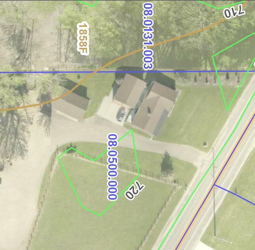
Located on 520 S. 14th Street, this site is located adjacent to the La Crescent Community Ice Arena. Park facilities include two baseball fields, a soccer field, playfield, open-air shelter, picnic tables, and a parking lot.
The 5.4-acre site is located at 608 S. 7th Street and includes the La Crescent aquatic center. The park also includes three tennis courts, playground equipment, and parking lot.
Located at 1200 Johnathan Lane, this 17.8-acre site includes an open-air shelter, restrooms, playground equipment, soccer fields, a baseball field, basketball court, volleyball court, picnic tables, outdoor ice skating/hockey, and parking lot.
This 8-acre park is located at 595 Veterans Parkway. Facilities include playground equipment, baseball fields, a soccer field; the city’s skate park is also located on site. Bike and walking trails provide pedestrian connections.

Nature preserves are typically established to conserve forest lands, marshlands, floodplains, prairies, wildlife habitat, bluffland, and other areas having cultural, scenic, or natural values. Desirable size varies, depending on function.
This 107.1-acre property is located between Red Apple Drive and McIntosh Road E and contains four hiking trail loops. The property sits on top of a prominent bluff providing 360 degree views of the area around La Crescent including the Mississippi River.
This is a 38.9-acre property off of County Road 6 on Trifecta Avenue, and is part of a new residential
14 La Crescent | Park & Recreation Plan Old Hickory Parksubdivision. Pine Creek borders the property on the south side. Currently there is a trail that runs along the perimeter of the property.
This park is located off of Apple Blossom Drive on Ambrosia Street. The property was a former apple orchard and consists almost completely of steep slopes. There are no park or trail amenities on the property.
Stoney Point is a 59.6-acre park located off of Stoney Point Road. The park includes trails and a scenic viewpoint with a wide variety of wildflowers: https://www.cityoflacrescent-mn.gov/vetschpark-and-stoney-point-wildflower-guide/
Vetsch Park is a 25-acre property located on North 2nd Street. The property is adjacent to the La Crescent Water Treatment Facility. The park includes on-street parking, trails, and an observation point. Vetsch also includes a variety of wildflowers which are detailed in the guide above.
Vollenweider Park is an 18.9-acre property located on Crescent Hills Drive. The park is heavily wooded

and currently does not have any park or trail amenities.
Special use parks are areas for specialized or single purpose recreational activities, such as golf courses, nature centers, skate parks, and ball diamonds.
The Blue Lake Canoe/Kayak Launch is located on the south side of highway 14/61 on the pike between La Crescent and La Crosse, at the end of Strupp Avenue.
For more detailed information on city-owned facilities and their amenities, see Table 2.10.
Figure 2.9 also provides an overview of existing trails in the city. In total there are 15.3 miles of city-owned/maintained trails (not including trails within parks) in La Crescent. Recommendations for trails are found in Chapter 5.
Recreational programming for both adults and children are provided in the city by the La CrescentHokah School District through the “Community Education” program. The program offers a wide array of activities including hobbies training, health and wellness, travel and other activities.


Recreational activities include (but are not limited to) hiking camps, yoga, fitness classes, snowshoe rental, volleyball leagues, and many other activities. The school district provides a catalog of all available activities on the district’s website.
Schools can also fulfill local park needs in communities as they provide many of the same facilities found in neighborhood parks, such as playground equipment and athletic fields.
The La Crescent-Hokah School District operates one elementary school and a combined middle/ high school. The following two schools are within the city’s borders:
La Crescent-Hokah Elementary School
La Crescent-Hokah Elementary is located in the center of the city on S. Oak Street. According to 2015-2019 ACS data, it enrolled 453 students. The school property includes a playground, ballfield, and open playfield
La Crescent-Hokah Secondary School
La Crescent-Hokah Secondary School is the combined Middle/High School located on Lancer Boulevard. The school serves grades 5-12. According to 2015-2019 ACS data, it enrolled 699 students. The school property includes ballfields, basketball courts, a track, and football field.
Crucifixion Catholic School
Crucifixion Catholic School is a private preschool/4K through 6th grade located at 420 South Second Street. The school property includes a playground, tennis court, basketball court, and open playfield
Crescent
La Crescent Montessori & STEM school is a charter school that serves preschool/4K through 12th grade and is located at 1116 South Oak Street. The school property does not contain any park or recreation amenities, however it is less than a ten minute walk from Abnet Field.
Houston County is in the eastern portion of the Minnesota DNR’s Central Region (No. 3) and is well-served by regional parks and open spaces. There are several park and recreational facilities within close proximity to La Crescent under public ownership. The following list provides the most significant facilities within the county that La Crescent residents are most likely would use. It is not an exhaustive list, but provides a variety of recreational activities.
Wildcat Park and Landing is located on the Mississippi River south of Brownsville, MN and is leased by Houston County from the US Army Corps of Engineers. The Park features 62 campsites, 3 picnic shelters, 2 boat landings, and one fishing pier. Over 2/3 of the campsites include water and electricity.
The land known as Bob Botcher Park consists of approximately 40 acres located on County 10 and was donated to Houston County by Robert H. Botcher in 2006. The Park is to be maintained in its natural pristine state with no development allowed on this land.

Winona County is in the eastern portion of the Minnesota DNR’s Central Region (No. 3) and is well-served by regional parks and open spaces. There are three county parks including Apple Blossom Park, Farmers Community Park and Stone Point Park.
Located 3-miles north of Downtown along the Apple Blossom Drive Scenic Byway, this 55-acre park provides vistas of the surrounding blufflands and the Mississippi River Valley 580-feet below. A 1.3-mile loop trail is located at the Park which accommodates hiking and wildlife observation.

Located at 43605 Kipp Drive in Winona, this Park provides Scenic blufftop views of the Mississippi River Valley. Recreational activities include camping, hiking and picnicking.
Located in western Houston County, this Park is known for its clear streams fed by “Big Spring.” Recreational activities include fishing, picnicking, and volleyball. There is also a park shelter that includes a winter warming house.
This 60-mile trail is one of the oldest and most popular rail-trails in Minnesota, legislatively authorized in 1971 and developed in the early 1980s. The Root River Trail is now a segment of the Blufflands Trail System, extending through Fillmore, Olmsted, Winona, and Houston Counties. The Minnesota DNR prepared a Master Plan for the trail in 2011, which calls for a new 18-mile segment along the Root River from the current western terminus in the City of Houston to the existing Wagon Wheel Trail in La Crescent.
This 1.01-mile trail runs from the western terminus of Main Street east to the Mississippi River between USH 14/61-WIS 16 and the Canadian Pacific Railroad. An additional 1.23-miles will be added to the Trail along the River and a pedestrian bridge across US 14/61. In the future, the Trail will serve as the final segment of the Root River State Trail.


The Minnesota segment of the Mississippi River Trail runs roughly 600-miles from Itasca State Park to the Iowa Border. This trail is part of US Bicycle Route 45. Through La Crescent, the trail runs along the shoulder of MN 16 from the south and thence along the shoulder of US 14/16 north to Lock and Dam No. 7 where the Trail goes off-road toward Winona.
This existing trail is planned for conversion and expansion into a shared use trail across the entire length of the public-access bluffland parcels for both bicyclists and hikers. This project is one of the priority improvements highlighted in the La Crescent Bluffland Plan. This trail is intended to be accessible to most people.
This page left intentionally blank.
This purpose of this plan is to guide the development of subsequent parks, recreation, open space, bicycle and pedestrian facilities in La Crescent. Goals are presented here as desired outcomes. Strategies include both actions and policy rules—these are the methods proposed to achieve the stated goals.
Goal 1 - Provide sufficient park and recreation opportunities to meet current and future recreational needs in the City of La Crescent.
1. Acquire parkland to maintain a ratio of 21.8 acres of parkland per 1,000 residents minimum.
2. Review and, if necessary, update the parkland dedication subdivision ordinance at least every five years so that it adequately addresses the recreational needs of residents and the fee in lieu of land dedication is proportional to the market value of undeveloped, unimproved land.
3. Utilize the National Recreation and Park Association’s Agency Performance Review metrics to set benchmarks and improve operations.
4. Continue to seek assistance from community groups in the planning and development of parks and recreation areas.
5. Provide a blend of active and passive parks and open spaces, all interconnected by a trail network.
6. Provide a wide range of year-round recreational opportunities.
7. Periodically evaluate existing recreation programs, including an assessment of attendance and customer satisfaction.
8. Enhance recreational access to Pine Creek and the Mississippi River.
9. Increase access to Pine Creek for passive recreational opportunities.
Goal 2 - Every resident has safe access to quality parks and recreation facilities and programming regardless of income, age, race, ability, or geographic location.
1. Ensure all residents are within ½ mile of a city park.
2. Encourage citizen participation in the planning and development of park and open space facilities.
3. Provide ADA compliant barrier free access in all new or improved park facility construction, play areas, and sports field areas.

4. Provide at least one ADA accessible trail and access point at each park.
5. The type of park and open space amenities provided should be scaled to the needs of the area and population served, both present and future.
Goal 3 - Parks and outdoor recreation lands are an essential green infrastructure element of the City of La Crescent. Parks and public recreation lands are carbon-reducing landscapes that help clean the air and water, recharge aquifers and reduce stormwater runoff
1. Protect the scenic beauty and natural resources in La Crescent by creating a system of parks, open spaces and trails that respect natural terrain, preserve native vegetation and take advantage of views.
2. Provide open space areas that assist in the conservation and protection of ecologically sensitive areas.
3. Coordinate local efforts with other public agencies and private partners to protect
valuable natural resources and sensitive lands through donations, procurement of easements, acquisitions, and purchase of development rights and make such lands available for passive recreation where appropriate.
4. Manage vegetation in natural areas by removing and controlling non-native, invasive species and maintaining native plant species.
5. Increase understanding and appreciation of the cultural, natural and historical resources of the community and the area through expansion of the walking tour programs and interpretive signage.
6. Implement low maintenance turf management, native landscaping, organic or integrated pest management, and/or pollinator/monarch-safe policies.
7. Aim to infiltrate or retain all 2 inch, 24-hour stormwater events on site in all parks.
Goal 4 - Coordinate park development efforts with other City departments, other units of government, the La Crescent-Hokah School District, civic and sporting organizations.
1. The Park & Recreation Commission and Plan Commission must consult and incorporate the needs identified in the Park and Recreation Plan before subdivision plats are approved.
2. Continue to pursue city/school/sports organization development projects to help improve and expand outdoor recreational opportunities throughout the community in a cost effective manner.
3. Participate in regional planning of parks and trails, including the Houston County Parks Department, MN DOT, and the Minnesota Department of Natural Resources.
4. Encourage a cooperative effort between the La Crescent-Hokah School District and the city in the acquisition, development and usage of recreational facilities.
The ADA, enacted in 1990, clearly states the right of equal access for persons to local government services, including parks. On September 15, 2010 the Department of Justice published revised final regulations implementing the Americans with Disabilities Act. The 2010 Standards included new provisions for accessible design for recreational facilities such as playgrounds, swimming pools, fishing and golf facilities. Similar to when the original 1991 ADA Standards were adopted for public buildings, a community is required to complete a self-evaluation of their recreational facilities for ADA compliance by March 15, 2012. Those communities with 50 or more full or part-time employees are also required to develop a Transition Plan, which identifies what corrective work will be completed, when it will be completed, and the individual responsible for the corrective work. Any new recreational facilities designed, constructed, or shaped after March 15, 2012 are subject to the 2010 Standards. Any alteration (not simple maintenance, but something that changes the way the site is used) must make the element altered accessible and must create an accessible path of travel through the site or facility to that element.
There are some fundamental differences in how accessibility in the outdoors is accommodated compared to indoors or the built environment. While restrooms, shelters, interpretive centers, and parking lots, for example, need to follow detailed ADA guidelines, other improvements such as trails or swimming beach areas, for example, do not necessarily need to follow indoor or built environment ramp grades or surfacing requirements. A good rule of thumb for the City to follow is that anything constructed must not make the outdoor experience anymore difficult than what occurs naturally. Mother Nature does not have to comply with ADA, but the city does.
The New England ADA Center is a good resource to use and offers checklists to evaluate accessibility at existing park facilities. The fillable checklist forms can be found here: http://www.adachecklist.org/checklist.html#rec
Goal 5 - Encourage walking, biking, and the development of alternative transportation networks that will create a more livable and healthy community.
Strategies
1. Create a network of interconnected, multipurpose non-motorized trails for walking, hiking, cycling, and to promote connectivity between parks, neighborhoods and public amenities.
2. Key intersections should include well-marked or textured crosswalks, central pedestrian refuges, curb extensions, pedestrian and bicyclist signal articulators, signs or other devices to improve safety.
3. Establish wayfinding signage to allow new residents or visitors to effectively travel throughout the city on foot, bicycle, or other means (scooter, etc.).
4. Coordinate planning and development efforts with the county, MN DNR, and nearby municipalities to complete larger regional or statewide networks.
5. Continue to coordinate efforts with La Crescent Hokah Schools and Church of the Crucifixion to develop and implement safe walking routes, access to school bus stops, and pedestrian connections to and through school properties.
6. Collaborate with local service clubs to provide clinics to teach safe cycling to school age children.
7. Trail planning and design should take into account the needs of seniors and those with disabilities, particularly in areas near senior housing and special needs housing.
8. Install secure bicycle parking at all parks and public facilities.
Goal 6 - Provide adequate funding and staffing levels to oversee the maintenance of parks, open space, and trails.
1. Ensure adequate funding for ongoing maintenance and rehabilitation of existing parks and recreation facilities.
2. Continually evaluate the amount of land, park facilities, and trails to be managed by city staff with consideration to keeping expenditures balanced with expected levels of service and maintenance and invest funds to implement full-time (FT) park crew positions.
3. Explore grant and private funding sources for park operations, maintenance, acquisition, and facility development.

This chapter presents an analysis of how well the city’s existing park and recreation facilities satisfy current needs. The adequacy of the city’s existing park and recreation systems are evaluated using the following methods:
• Quantitative Analysis - a comparison of existing parkland acreage and population projections versus park and recreational agencies across the US, including a review of the amount of parkland available to city residents.
• Geographic Analysis - an analysis of the geographic distribution of park facilities within the city.
• Qualitative Analysis - a summary of public input regarding city parks and recreational facilities gathered through the community survey, farmer’s market booth, public walking tours, and feedback from community organizations that use the city’s parks.
• Regional & State Insights - a summary of the demand trends in recreational amenities at the regional and state level.
Park Acreage Level of Service Level of service analysis is a standard evaluation of park acreage across most park agencies. Level of service is calculated as total acres of parkland provided per 1,000 residents. The National Recreation and Park Association (NRPA) developed a set of standards over two decades ago for the amount of parkland a community should strive to achieve. Recently, NRPA has shifted away from the use of park standards because there is no single set of standards that takes into account the uniqueness found in every community across the country. Instead, NRPA now collects information from Park and Recreation Departments across the U.S. such as residents per park, budgets, staffing, park amenities. This data is organized by jurisdiction size so that communities of similar size across the US can see metrics typical of its peers.
La Crescent currently has 252.5 acres of parkland, or 47.9 acres per 1,000 residents based on the current population of 5,276. Parkland includes maintained parks and open space areas, but excludes protected blufflands. For agencies with similar populations, the lower quartile is 5.2 and the upper quartile is 21.8 for acres of parkland per 1,000 residents. La Crescent is well above this level of service.
Table 4.2 summarizes the current and projected supply and demand for total parkland acreage based on city population and service levels of 21.8 acres per 1,000 residents. If no new parkland is added, by 2040 the city will be providing 43.4 acres per 1,000 residents. This analysis suggests that the city may not need to acquire additional park land Figure 4.1
An analysis of existing recreational land area is provided to determine if the recreational needs of residents are being met. This analysis is limited to an evaluation of city-owned parkland, and does not include off-road trails not located in parks.
Table 4.1 Park Acreage Surplus/Deficit (21.8 ac./1,000 residents)
Total Park Acreage Surplus/Deficit (in acres)
Year20202025203020352040
Population 5,2765,4275,5805,7095,814
Total Supply (acres) 252.5252.5252.5252.5252.5
Demand (21.8 acres/1,000)115.0118.3121.6124.4126.7
Surplus (21.8 acres/1,000)137.5134.2130.9128.1125.8
through the year 2040 to maintain a standard of 21.8 acres of parkland per 1,000 residents.
The geographic and qualitative analysis in the following sections will provide additional guidance on need for new parkland.
Outdoor Facilities
Table 4.3 is from the 2021 NRPA Agency Performance Review and shows the national summary of outdoor park and recreation facilities based on the number of residents per square mile. La Crescent falls into the 500-1,500 residents per square mile category with an estimated 1,382 residents per square mile. Based on these metrics,

La Crescent’s facilities gaps are in the following: la crosse field, football field, community gardens, and dog park.
The city manages or maintains 15.3 miles of multiuse trails. As compared to its peers in the 2021NRPA Agency Performance Review, the median miles of trails maintained is 3 miles. The lower quartile is 2 and the upper quartile is 8. La Crescent’s residents are also well-served by trails compared to peer communities.
Table 4.2 Park and Recreation Facilities - Residents Per Square Mile (500-1,500 residents per square mile)
Source: NRPA Agency Performance Review 2021
Opportunities for indoor recreation are as important as outdoor recreation. This is particularly true considering Minnesota’s winter months when it can be challenging or less desirable for people to go to local parks and trails. Currently the city doesn’t manage any indoor recreation facilities, however the city does have partnerships in place with several organizations which utilize indoor facilities. The city partners with the La CrescentHokah Public School District for community education courses which provide youth programming (e.g. STEM activities, yoga, cooking classes), special events (e.g. movie nights, baking workshops), opportunities for travel, first aid certification, crafting, fitness, and much more. A majority of these classes are held at school district buildings. The city also partners with Lancer Youth Hockey Association who manages the La Crescent Ice Arena.
Data from the 2021 NRPA Agency Performance Review shows that for similar sized communities (up to 20,000 residents), 22% have a senior center, 50% have a community center, 20% have a performance amphitheater, 6% have an indoor ice rink, 11% have a nature center, and 53% have a recreation center. Despite not owning any of these types of indoor spaces, the city partners with other organizations in the community to fulfill these needs.
The location of parks in relation to La Crescent’s residents is an important indicator of how well existing facilities are dispersed throughout the community. The National Recreation and Park Association, in partnership with the Trust for Public Land and the Urban Land Institute, promotes the 10-Minute Walk Campaign (https://10minutewalk. org) which advocates that “there’s a great park within a 10-minute walk of every person, in every neighborhood, in every city across America.” Using the 10-Minute Walk as a guiding principal, the Park Service Areas map in Figure 4.4 (Appendix B) indicates approximate areas of the city that are within a 10-minute walk of a park (approximately 0.5 miles).
Based on the 10-Minute Walk Principal, a majority of the city is well-served by parks, with the exception of several parcels between Crescent Hills Drive and E Town Hall Rd, in the northeastern part of the city. Any future residential growth in La Crescent would likely occur west of current municipal limits, surrounding Highway 6. If development does occur in this area, additional parks will be needed as there are limited public parks in this area.
An analysis of the distribution of specific amenities within the parks was also performed. The Park Facilities Distribution Map (Figure 4.5) shows:
• The only basketball court is located in the northern part of the city. However the school district does offer basketball courts on the Middle/High School property in the southern part of the city.
• There is one location, Kistler Memorial Park, with tennis courts. This park is centrally located.
• There are no city park amenities at North End Park to serve the neighborhood off of Ambrosia Street. However the County-owned Apple Blossom Overlook Park is serving these residents and includes an approximately 1.3 mile hiking loop with a well-maintained overlook of the Mississippi River.
• The only park with permanent restroom facilities is Old Hickory Park, located in the northern part of the city
As part of the planning process, a survey was distributed to gauge resident preferences, opinions, and feedback on the city’s park facilities and recreational programs. In total, the survey received 543 responses. Of respondents, approximately 70% live in the City of La Crescent, 11% live in La Crescent Township, 5% live in La Crosse, and the remainder are from other surrounding communities. When comparing ages of survey respondents to who is actually living in La Crescent, responses show that those under age 24 and over age 65 were under-represented and those age 35-44 were over-represented.
The survey is a key component of analyzing recreational needs and demands in the city, and the following is a summary of responses and findings.
Residents of the city strongly believe that parks and open space are important to overall quality of life – 96% of respondents said they believe green space contributes to better mental health and well-being. 57% of survey respondents noted they visit a City of La Crescent park at least once per week, and 98% have visited a city park at least once in the past year.
For those who don’t use parks/recreational amenities in La Crescent, the top reason was being too busy (28%). The next most common reasons were park doesn’t contain the desired features or facilities (25%) and do not know locations of facilities (20%).

Eighty-seven percent of survey respondents indicated they do not have safety or accessibility concerns in any of La Crescent’s parks. For the 13% who did have concerns, common concerns included accessibility of hiking trails, steep slopes on trails, ADA accessibility of restrooms and other park amenities, and updated equipment.
When asked for specific locations in La Crescent that need to be improved for bicycle or pedestrian safety, common responses included:
• Hwy 61 crossing
• Hwy 6
• Hwy 25
• Connections to parks
• S 7th St Crossings
• Downtown Sidewalks
• Sidewalks by schools
The most common locations respondents would prioritize the location of new biking/walking trails within the city’s parks are:
• Vetsch Park
• Eagle Bluff
• Veterans Park
• Wieser Park
• Horsetrack Meadows
• Stoney Point
General Use - Parks
Survey respondents’ favorite park was Old Hickory Park (35%). Kistler Memorial Park was the second most favorite park (18%). Proximity to home was something respondents noted as a top reason why they chose these as their favorite parks.
The park receiving the lowest number of respondents citing it as their favorite park was North End Park (0 responses). Other parks with only a few respondents selecting it as a favorite park include Crescent Valley Park, John S. Harris Park, and Valley South Park.
The most common activities or facilities respondents are participating in at city parks include: walking or hiking (79%), playground equipment (53%), aquatic center (50%), picnic facilities (43%) and biking (37%). When asked what amenities respondents would like added to parks, top responses included dog park (43%), hiking trails (36%), restrooms (22%), pickleball courts (21%), and off-road walking/biking trails (20%).
The city partners with the La Crescent - Hokah School District to provide recreation programming. When asked if anyone in your household participated in city-sponsored recreation programs in the past year, 43% of respondents indicated they did. Approximately 17% of respondents indicated the city’s current variety of recreational programs do not meet the needs of their household. The most common responses referenced a need for


La Crescent CORP Study
City of La Crescent Houston County, MN
I Pa rk
La Cre scent Pa rk Ser vice Area (0. 5 Mile)
Reside ntially Zoned Pa rce ls Pa rk
Existing P rotecte d Bluffla nd s* Bluffla nd Conse r va tion Area
City of La Cre scent County B ound ar y
Data Sources: Houso n Co unty (2021) Comp Plan Data (2015) MNDNR (2021)


La Crescent CORP Study
City of La Crescent Houston County, MN
I Park Park
Existing Protected Bluffland s* Bluffland Conser vation Area Cit y of La Crescent Co unty Bo undar y
Data Sources: Houso n Co unty (2021) Comp Plan Data (2015) MNDNR (2021)
improved scheduling and the desire for an online registration system.
When asked what new type of recreation programming the city should consider offering, a common response was adult programming. Forty-three percent of respondents said that if the city allocated additional funding for recreational programming, free after school and summer programs should be enhanced. Approximately a third of survey respondents indicated support for allocating additional funding to youth enrichment and sports, and adult recreation (e.g. card games, art classes, woodworking, yoga) and sports. Twenty percent of respondents did not believe the city should allocate additional funding for recreational programming.
If given opportunity to direct funding, 52% of survey respondents would spend more on installing new park facilities/equipment, and 40% would spend more on bicycle facilities/trails. The vast majority of respondents would continue the same amount of spending or increase spending in most areas.
The full survey results are available in Appendix A.
In addition to survey responses, input was received during a public walking tour where residents were invited to attend hikes at Eagles Bluff and Vetsch/ Stoney Point on October 10, 2021. In total there were around 15 people who participated, some only at one park and not the other.
Some common themes regarding items discussed during the hikes include:
• Identify/sign steep areas or install switchbacks
• Preserve and highlight Maple Woods
• Invasive management needed
• Prairie restoration needed at overlooks
• Trail ratings needed
• More prominent entrances needed
• Signage identifying park property boundary vs. private property
• Need to consider parking as this area becomes more popular
• Some trails need to be widened
• Add trail markers
• Remove trails in some areas
• Need trail map
• Connect to parks in the regional system
• Over 70 different wildflowers identified at Vetsch Park and Stoney Point
• Enhance lookout and gazebo at Vetsch
• Possible to expand solar array
• Invasive management needed
• Trail on west goes onto private property
• Some mountain biking occurs on trails in Stoney Point, sometimes there are bikers in Vetsch
On October 11, 2021 MSA and city staff set up a booth at the Farmer’s Market at Veteran’s Park to get feedback about improvements people would like to see in La Crescent’s parks, trails, and recreation offerings. Around 15 people stopped by to talk about their ideas for La Crescent. Some of the comments were heard included:
• Sidewalks from Veteran’s Park to Park Street
• More bike trails and maintain current trails in Stoney Point
• Add water fountain to Veteran’s Park
• Consider parking lot for Eagles Bluff at booster station to get cars off residential street
• Need pickleball - possibly at Wieser Park
• Allow fat tire biking and snowshoeing at Stoney Point
• Need connection to Root River Trail and a trailhead
• No biking at Stoney Point
• Put ice skating rink on top of volleyball court during winter months
• Improve walkability of Veterans Parkway/N Chestnut Street by connecting the two streets, adding pedestrian lighting, benches, trees, and sidewalk.
• Install asphalt path that is easier to walk/ADA accessible
• Add sidewalk on Park Street
La Crescent | Park & Recreation Plan
To better understand the needs of local sports organizations, the school district, and civic groups within the community, La Crescent hosted a stakeholder focus group. The following groups/ individuals participated: La Crescent/MVS Youth Soccer, La Crescent Youth Ball, La Crescent Apple Jacks, La Crescent-Hokah School District, citysponsored Recreational Baseball, and the La Crescent Summer Recreation Director.
A number of the participants noted that one of the strengths of the city’s park and recreation system is the scheduling and coordination of field/court use between the city and the various parks user groups. Participants also noted that it is very easy for the different user groups to come to Park Committee meetings and ask for needed park upgrades and improvements. The city typically partners with these organizations to implement the improvements. Participants also felt city staff do a good job of keeping parks and recreation amenities well-maintained. Many of the organizations are continuing to see participation in their respective sports increasing, especially soccer, baseball, softball, diving and swimming. Recommendations from the group included:
• Scoreboards at Abnet and Old Hickory
• Temporary fencing for some of the youth ball games
• Concession stand at Abnet or Old Hickory
• Additional storage at baseball fields (12x10 or 12x16)
• Shelter maintenance at Abnet
• Programs targeted for seniors
• Better signage directing people to parks
• Indoor sports complex (soccer and baseball) under public-private ownership
• Softball and baseball complex
• Lighted softball field
• Dugout roofs at Old Hickory or Abnet
• Partnership with Lancer Youth Hockey on implementation of items from their current improvement plan
Near the end of the planning process an open house was held on April 20, 2022 to get feedback on the draft master plans for Eagles Bluff,
Vollenweider, Vetsch, Stoney Point, Horsetrack Meadows, and Wieser Park; and the other park, trail, and recreation recommendations from the plan. Approximately 50 people showed up to provide feedback. Feedback included the following:
• Concern about mountain biking trails
• Add existing hiking trails to a website or app
• Concern about proposed switchback on Stoney Point being too steep
• Improve/add hiking trails, signage, and connectivity
• Expand opportunities for winter recreation— snowshoeing, cross-country skiing, ice skating or hockey rink
• Add locations for fishing
• Add pickleball courts
• Add a dog park
• Improve parks with amenities such as restrooms, drinking fountains, cameras, and parking
• Add multi-use trails for use by bikers and hikers
Insights from the Minnesota Statewide Comprehensive Outdoor Recreation Plan (SCORP), 2020-2024
The Minnesota SCORP includes four strategic initiatives, each with a set of strategies to provide further structure. These four strategic initiatives provide statewide priorities for outdoor recreation throughout the state:
• Connect people and the outdoors. This priority will be accomplished by focusing on creating a welcoming environment, access, awareness, quality, programming and special events, and partnerships.
• Acquire land, create opportunities. This priority will be accomplished by focusing on strategic acquisitions, development and redevelopment.
• Take care of what we have. This priority will be accomplished by protecting the public’s investment in existing infrastructure and natural resources, and maintaining the quality of natural resources.
• Coordinate among partners. This priority will be accomplished by ensuring enhanced, integrated, and accessible information for outdoor recreation users; enhanced coordination at the regional and site levels; enhanced coordination among the four legacy funds; and enhanced coordination with other agencies, organizations, and nonprofits.
The quantitative, qualitative, and geographic analysis discussed in Chapter 4 reveals the need for improvements to existing facilities, the acquisition and development of new sites for future recreational use, and additional trail connections . It should be noted that some of the recommendations may require considerable cooperation with others, including the citizens of La Crescent, local civic and business associations, and state agencies. In nearly every case, more detailed planning, engineering, study, budgeting, and/ or discussion will be necessary before decisions are made to actually acquire land or construct recreational facilities.
The recommendations of this plan are divided into four major sections: (1) existing park facilities (2) new park facilities; (3) trail improvements; and (4) other improvements.
The timeline for completion of recommendations is noted within each table of recommendations. High priority items should occur in the next 1-3 years (2024), Medium priority items should occur over the next three to five years (2026) and low priority items may not be completed within the next five years; however, initial planning activities may occur to bring these items closer to completion. Due to budgetary constraints it is unlikely that all of the recommendations within this chapter will be implemented in the next five years. Maintenance and improvement projects will be prioritized on an annual basis by city staff in conjunction with La Crescent’s Park & Recreation Commission as part of the city’s annual budget and Capital Improvement Plan (CIP).
Many of the recommendations regarding locating new park or trail facilities will be coordinated with the sale or donation of land by other parties or by obtaining easements for trails; therefore, the timing is much more variable. Acquisition projects will be implemented through donation, dedication, purchase, or a combination thereof.

The following pages contain two-page spreads dedicated to each existing park in La Crescent. Each spread includes general information, facilities (and approximate install dates), and recommendations for improvements to existing parks. Master plans were completed for Eagles Bluff, Vollenweider/ Vetsch/Stoney Point, Horsetrack Meadows, and Wieser Park and are included in this section. Some of the recommendations identified for existing parks are carried forward from the 2012 La Crescent Park and Recreation Plan. Many of the trail recommendations are from the 2017 La Crescent Blufflands Plan. The remaining recommendations reflect staff, commission, public and consultant feedback obtained during the planning process.


Level parking lot
Replace pea gravel with poured in place surfacing or engineered wood fiber


(LOW-MED-HIGH)
Implementation of Master Plan (see cost detail below)
HIGH $3,4 M
QTY UNIT COST TOTAL
Site Work 1 LS $207,000 $207,000
Parking Lot and Driveway 15,000 SF $4 $52,500
Permeable Pavement 6,500 SF $12 $78,000
Sidewalk 8,500 SF $8 $68,000
Gravel Walking Path 1,300 LF $16 $20,800
Splash Pad 1 LS $300,000 $300,000
Pickleball Court (4) 1 LS $180,000 $180,000
Inclusive Playground 1 LS $400,000 $400,000
Existing Shelter Renovations 1 LS $15,000 $15,000
4-Season Shelter/Pavilion 1 LS $1,200,000 $1,200,000
Storage Building 1 LS $80,000 $80,000
Bike Racks 3 EA $1,200 $3,600
Benches 8 EA $2,000 $16,000
Shade Structures 1 EA $18,000 $18,000
Transit Shelter Improvements 1 EA $18,000 $18,000
Utilities 1 LS $25,000 $25,000
Stormwater 1 LS $48,000 $48,000
Landscaping 1 LS $60,000 $60,000
EV Charging Station - Level 2 1 LS $8,000 $8,000
PV Array (25 kW) 1 LS $90,000 $90,000
Sub-Total Construction $2,582,900 Contingency (20%) $517,000 Engineering, Permitting, Geotech $310,000 TOTAL $3,409,900


Park Address: 520 S. 14th St.
Park Size: 10.4 Acres
TYPE
Baseball Fields (2)
Soccer Field
Playfield
Ice Skating/Hockey (Indoor)
Open-Air Shelter
Picnic Tables
Parking Lot
*Add pickleball courts (6) that can be overlaid with an outdoor skating rink during winter months (80x120)
HIGH $240,000
Add open air shelters or shade structures near proposed pickleball courts MED $60,000 - $200,000
Extend sidewalk at NE corner of park to connect to ballfields and shelter (450 LF) MED $18,000

Remove orange posts on west side of park
HIGH Maintenance
Add batting cage MED $10,000
Add score board MED $10,000


Add neighborhood connection off the cul-de-sac on 6th Street South


Park Address: 1200 Johnathan Ln.
Park Size: 17.8 Acres
Playground Equipment (Installed 2008)
Baseball Fields Basketball Court Volleyball Court
Open-Air Shelter
Picnic Tables Parking Lot Restrooms
Soccer Fields
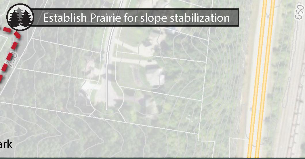
*Establish prairie plantings in stormwater retention area. Mow plantings every fall so this area can still be used for sledding.
*Add path connecting sidewalk along Red Apple Dr to basketball court, playground/shelter, volleyball courts, and ballfield (550 LF)

* Pave gravel parking lot serving the shelter and playground area (18,000 SF)
Add storage space onto existing shelter (12x10 or 12x16)
Add concessions onto existing shelter
MED $18,000 - $36,000
MED $24,000
HIGH $36,000 - $40,000
MED $18,000 - $25,000
MED $120,000 - $180,000
Consider as an alternative for ice rink if not at Abnet Field MED TBD
* = Recommendation carried forward from the city’s 2012 Park & Recreation Plan

TYPE
Playground Equipment (Installed 2020)
Baseball Fields
Soccer Field
Skate Park (Installed 2003)
Bike/Walking Trail Scoreboard (New in 2022)
*Add a small community amphitheater that can be used for concerts or rented out for weddings MED $250,000 - $300,000

Add drinking fountain or bottle filling station HIGH $10,000
Add narrow canopy with solar panels over portion of parking lot to be used by Farmers Market MED $300,000 - $375,000
Add standalone storage space (12x10 or 12x16) MED $18,000 - $25,000
Add sidewalk connection from playground to Park Street, connect to N 4th Street sidewalk (750 LF) MED $30,000
Move skate park to Abnet Field MED N/A
Add open air shelter with seating MED

*Add walking trails with scenic overlooks. Specific route(s) to be determined based on engineering feasibility (approx 1 mile)
MED $45,000 - $90,000
Buckthorn removal needed where rows of apple trees were previously removed. MED $6,500 - $36,000
Work with Winona County to add crosswalk from Apple Blossom Park to North End Park if a trail is developed at North End MED $25,000


*Establish picnic areas and scenic overlooks (4)
At lookouts add benches and informational signage about bluffs/ city history and map/swing bridge
HIGH $2,000 - $10,000 EA
HIGH $2,500 EA
Add informational signage and bench at Maple Forest MED $5,000
Create off-street parking on east side of park-possibly at booster station (4-6 stalls). When lot 25.1867,000 is built on, street parking on McIntosh may need to be prohibited.
Create on-street parking at Old Hickory (4-5 stalls)
Add trail markers (~30) along segments and maps with “you are here” indications (~10) at points where trails connect
Add trail sign that runs perpendicular to road at lower junction of Red Apple Trail and Red Apple Rocks Trail
Add signage and kiosks at both entrance points to better identify park. Park signs should run perpendicular to the road.
Add private property signage along east end of park to indicate where park property lines end
Trail Improvements
LOW $6,000 - $12,000
LOW $2,500
HIGH $50 EA marker/ $500 EA sign
HIGH $500 EA
HIGH $5,000 EA
HIGH $500 EA
Flatten/level and widen trail on east side of park MED $10,000 - $25,000
Develop trail maintenance plan and include volunteers in implementation
Invasives
Selective cutting of invasives (oriental bittersweet, eastern red cedar, and buckthorn)
Establish prairie plantings at west entrance of park
HIGH Maintenance
MED $46,000 - $58,000
MED $20,000 - $35,000
Establish prairie plantings off of McIntosh E Stormwater access road MED $30,000 - $45,000


Note:


McIntosh Trail


Improve trail to maintain minimum 32” width. Consider steps or handrails where slope exceeds 4:1 horizontal to vertical ratio.


Eagle’s Bluff Loop Trail


Red Apple Trail

Red Apple Rocks Trail
Improve trail to maintain minimum 32” width. Consider adding switch backs, steps or handrails where slope exceeds 4:1 horizontal to vertical ratio.


There are currently four trails within Eagles Bluff Park; McIntosh (0.8 miles), Eagles Bluff Loop (0.5 miles), Red Apple (0.6 miles), and Red Apple Rocks Trails (0.8 miles). The Boy Scout Trail (0.4 miles) serves as a direct connection between McIntosh and Eagles Bluff Loop Trails. There is also a connector trail that is located between Eagles Bluff Park and nearby Veterans Park.
The master plan recommends trail improvements on McIntosh and Red Apple Rocks Trails to maintain minimum trail widths of 32 inches. Switch backs, steps or handrails where slope exceeds 4:1 horizontal vertical ratio should also be considered.
Trails markers should be added to each of the existing trail segments with “you are here” indications at points where trails connect. The city should use trail markers that are friendly to those who have a color vision deficiency through utilizing text and color. Along with trail markers there should be posted number markers along hiking trails that correspond to exact longitude/latitude coordinates to facilitate emergency rescues when needed.
To better identify where entrances to the park are, the city should add signage that runs perpendicular to the road along the east and west entrance points to the park. Each entrance to the park should also include a kiosk with trail maps indicating trail difficulty, distance, and points of interest. If the City develops an ordinance prohibiting individual trail maintenance, a sign should also be posted at each entrance with the ordinance on it. The sign should also include a method for individuals to report trail issues to the city either through a website, mobile phone app, or texting service. See Section 5.3 for examples of platforms other communities use for reporting maintenance issues.
From the east entrance of the park, the McIntosh Trail runs parallel to private residences. These residences have had trail users unknowingly trespass on their property and for this reason, it
is recommended that private property boundary signage be installed here.
There are four scenic overlooks within Eagles Bluff Park offering stunning views of the city. The overlook with the goat prairie on the Eagles Bluff Loop Trail has been cleared and invasives removed. The other unnamed overlook on this trail needs brush cut and invasives removed so the overlook is visible. The final two overlooks are both on the McIntosh Trail. The northernmost overlook needs extensive brush cut as there is currently little to no visibility from this point. The other, Table Rock Overlook, also needs brush cut to improve visibility. Signage should be added to all four overlook locations to provide additional information on
• Purpose of goat prairie
• History of the city’s development
• History of the Native American tribes that were located in this area
• Descriptions of how bluffs were formed
One of the highlights of Eagles Bluff Park is the Maple Forest in the central section of the park. This established woodland has a well maintained understory. Maintenance of this asset should continue through monitoring for invasive species such as garlic mustard, bittersweet, and buckthorn. Also recommended is assessment by an arborist or forester on a recurring basis to monitor the health of the existing trees, habitat, and development of a forest management plan.
The master plan recommends the addition of two picnic areas to Eagles Bluff Park. One located at the west entrance point of the park and the other located in the Maple Forest along the Eagles Bluff Loop Trail. At the west entrance this includes the addition of a small shelter and picnic tables and in the Maple Forest just the addition of picnic tables.
Currently there is no dedicated parking at Eagles Bluff. Visitors who enter the Eagles Bluff on the west side are currently parking at Old Hickory and those entering on the east side are parking along McIntosh Road. The master plan recommends developing two dedicated parking areas to serve the park. On the east side, the master plan includes possible off-street parking (4-6 stalls) at the current pump station parcel. As the park becomes more popular, off-street parking will help keep cars off of the residential street, which was a concern brought up during the planning process. The master plan also proposes adding on street parking stalls (4-6 stalls) to Red Apple Drive for visitors who enter the park on the west side.
Oriental Bittersweet Guidance from the Minnesota Department of Agriculture recommends an integrated management plan, including both herbicide and non-herbicide methods, to control bittersweet. The MIPN control database gives recommendations for different herbicides and application rates. The most successful treatment sites the state department has seen have utilized either basal bark or cut stump applications. Cut stump is the preferred method for herbicide application because it provides a targeted approach, reducing impacts to surrounding vegetation and limiting the amount of herbicide used. The vines are cut at the base and a few feet above so they do not have the ability to re-root. Herbicide is applied at the base and is pulled into the roots causing damage.
Primary management methods including cutting and treating or pulling (plants smaller than 3/8” diameter). Herbicides are commonly applied after cutting to prevent the plants from resprouting from the remaining rootstock. It is best to minimize disturbance of the soil mass surrounding the plants to prevent activation of seed bank within the soil. Seeds can remain viable up to 5 years within the soil. The MN DNR also offers suggestions for Non-chemical Treatment Options. In the case of buckthorn, MN DNR recommend to “Cut the stem of the plant a few inches above the soil. Cutting can be effectively done with hand tools (for a few plants), chain saws or brush cutters. Cover the cut
stump with a tin can or black plastic (such as a “Buckthorn Baggie”) to prevent re-sprouting. After cutting the tree, apply the can or plastic over the cut stump and root flare. Use nails to affix the can or a tie to affix the black plastic. Leave in place for one to two years. Check plants regularly to ensure no new growth is occurring from the cut stumps.” (https://www.dNR.state.mn.us/invasives/ terrestrialplants/woody/buckthorn/control.html)
The Eastern red cedar, which spreads across prairies very quickly, impedes views from the bluff onto surrounding landscape as well as out competes other vegetation - such as the ongoing rejuvenation of the Goat Prairie landscapes within the park. Removal and management of Red Cedar is similar to Buckthorn and includes cutting and/or treating select plants. Minimizing soil disturbance minimizes the risk of encouraging continued growth of invasive species seed banks within the soil.
The addition of native plants/prairie is recommended in two locations at Eagles Bluff. One recommended location is at the entrance on the west side of the park and along a steep segment of the connector trail between Eagles Bluff and Veterans Park. These areas are difficult for city staff to mow, and the inclusion of prairie aligns with the recommendations for Minnesota GreenSteps communities.
Plan recommendations also include continued rejuvenation of the Goat Prairie on the south face of the bluff. Woody species that should be removed from the Goat Prairie include buckthorn, red cedar, and white birch. Encouraging restoration of this habitat is not only a sustainable approach to management of the property it also provides a great educational tool for park visitors.


Install access points along trail for fishing on Pine Creek. Specific locations should be determined by consulting locals who fish in the area.
MED $5,000 - $20,000 EA
Add picnic area near proposed parking MED $45,000
Install small off-street parking lot on west side (8-10 cars) MED $12,000 - $18,000
Install entrance sign (1) and trail signs (3)
HIGH $5,000 entrance / $500 EA trail sign
Groom trails for cross country skiing in winter months and consider a snow shoe trail that parallels cross country trail MED $5,000+ equipment, $2,500 signage, and maintenance
Install signage prohibiting ATV use on trail HIGH $500 EA
Add private property signage where trail runs close to homes to indicate where park property lines end HIGH $500 EA
Trail Improvements
Selective cutting to reveal trail around park
HIGH Maintenance
Improve existing 10’ multi-use path (gravel) MED $125,000
Move walking path around prairie HIGH Maintenance
Develop trail maintenance plan and include volunteers in implementation HIGH Maintenance
Native Plantings
Plant 7 acre prairie with path through or around prairie
Planned for 2022 $20,000 - $36,000
* = Recommendation carried forward from the city’s 2012 Park & Recreation Plan


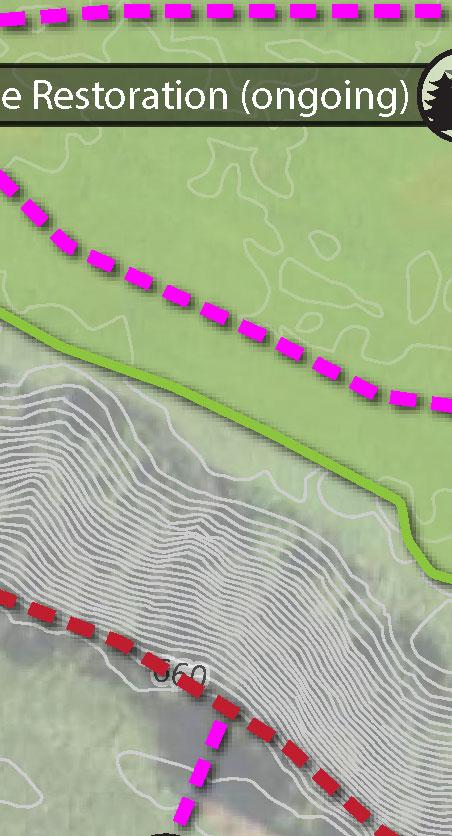


Unnamed Trail (location is approximate)
Improve Existing Trail - 10’ wide gravel travel, maintain 5% slope or less where possible for ADA accessibility.


ADDED Trail (approximate location)


Entrance/Gateway
Property Boundary Signage
Park Signage
Picnic Area Significant Vegetation
Fishing Area clear path to creek from trail, consider one location for improvements for ADA accessibility
Parking P


REV 06.13.2022


There is an existing 0.7 mile trail that extends throughout Horsetrack Meadows. The master plan recommends maintaining the location of this trail, and doing selective cutting along the trail to widen the path to 10 feet and add a gravel walking surface. To ensure the trail is ADA accessible, the city should maintain 5% slope or less where possible. An additional segment of trail is recommended from the proposed parking lot directly south so that visitors could choose to complete a shorter segment of trail if desired.
A mowed trail loop is also recommended around the prairie restoration area. This recommended path is on relatively flat land and therefore could be a fully ADA accessible route within the park if a compliant surface such as gravel, asphalt or concrete is added.
To expand use of the city’s parks during winter months, the city could groom trails for cross country skiing and consider a snow shoe trail that parallels it.
The primary entrance to the park is proposed at the end of Bridle Lane and should be where the main park sign is located, along with a kiosk that displays a map of the trails with trail length and difficulty. If the city develops an ordinance prohibiting individual trail maintenance, a sign should also be posted at each entrance with the ordinance on it. The sign should also include a method for individuals to report trail issues to the city either through a website, mobile phone app, or texting service. See Section 5.3 for examples of platforms other communities use for reporting maintenance issues.
Two secondary entrances are located on Trifecta Avenue. Trail kiosks or maps should also be located here to show the trail and other helpful information.
Signs should be placed at all entrance points that prohibit ATV use on the parks trails.
A small open-air park shelter with picnic tables should be added to the park entrance on Bridle Lane.
Pine Creek runs along the southern edge of the park boundary and sustains a variety of fish including brown trout. The master plan includes three locations where paths should be cleared from the creek to the trail. The city should confirm locations of these access points with locals who fish this creek. One of the three fishing locations should be considered for ADA accessibility. This location could include a small fishing platform or railing to provide support to users.
A small off-street parking lot with 8-10 spots is proposed at the primary park entrance on Bridle Lane.
In Spring 2022, the city seeded a seven acre prairie, Pine Creek Prairie, southeast of the proposed primary park entrance. A majority of the native plantings are a mesic mix (6.8 acres) and the remainder will be a wet mix. Signage describing the specific species present or common wildlife could be added around the proposed trail. Digital media such as QR codes or Geo-tagging could be integrated to appeal to a variety of users and allow for an efficient means to update signage as conditions of the prairie evolve.

(LOW-MED-HIGH)
Make wildlife loop ADA accessible HIGH $30,000 - $45,000
Repair erosion along trail (south side) HIGH $10,000 - $18,000
Develop trail maintenance plan and include volunteers in implementation HIGH Maintenance
Invasives
Garlic mustard removal. Consider partnering with service organizations or volunteers. MED $5,000 - $20,000


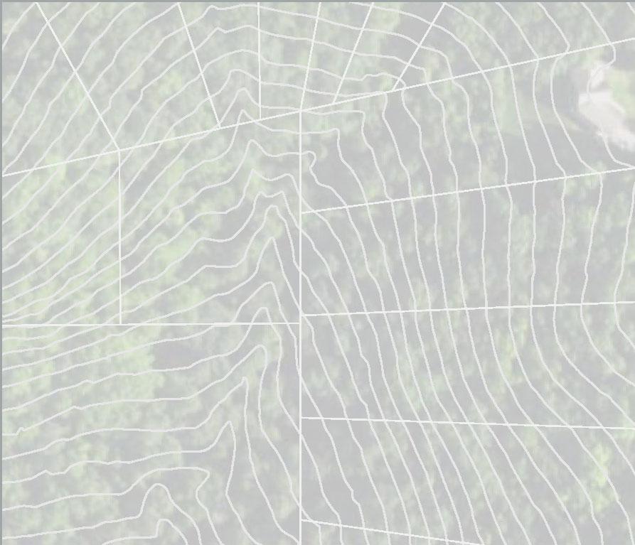


La Crescent CORP Study
Unnamed Trail
Add trail markers every 500 feet or as trail conditions require.
City of La Crescent Houston County, MN
Accessible Trail
Improve trail to allow for ADA compliance to maximum extent practicable. Slopes less than 5%. Firm, stable and slip resistant surface (concrete or asphalt preferred). Develop route from accessible parking stall.

ADDED Trail (approximate location)

REMOVED Trail (approximate location)


10-ft Contours Park Area Existing Protected Blufflands* Parcel Boundary City of La Crescent County Boundary


Data Sources: Houston County (2021) Comp Plan Data (2015) MNDNR (2021)

Creation of an ADA accessible route is recommended around the existing prairie at the current park entrance on N 2nd Street. To make the trail accessible, all slopes should be less than 5% and firm, stable and slip resistant surfacing should be used. Concrete or asphalt are preferred. This trail should be connected by another accessible path that runs from a new ADA stall in the parking lot on N 2nd Street.
There are two segments of existing trail that are located on private property. These segments should be eliminated. Alternative trail locations are recommended in the master plan.
Trail on the south side of the park is experiencing erosion. The plan recommends repairing erosion by diverting water from trails with water bars or other features, bridging wet soils, and considering mulch or gravel in specific locations. Native vegetation can also be added along trail routes to encourage users to stay on the designated trail.
Trail markers should be placed every 500 feet, or closer if needed, along existing and new trails. Maps with you are here indications or other directional signage should be placed where trails connect.
The trail primary trail entrance on N 2nd Street should be improved with a kiosk and map of the trail system with trail difficulty level ratings and distance for Vollenweider/Vetsch/Stoney Point. If the city develops an ordinance prohibiting individual trail maintenance, a sign should also be posted at each entrance with the ordinance on it. The sign should also include a method for individuals to report trail issues to the city either through a website, mobile phone app, or texting service. See Section 5.2 for examples of platforms other communities use for reporting maintenance issues. A map of the park trails should be added to the entrance on N 1st Street.
There is an existing overlook in Vetsch with a small open-air gazebo. Views are currently overgrown and obstructed. The plan recommends selective cutting to revive the overlook here and the possible addition of a council ring overlook near the existing gazebo. The council ring could be an area with plaques that narrate the history of the Dakota Indians other tribes who were located in the region before the city was founded .
There is an opportunity for the city to expand the solar array with an additional 86 kWh ground mounted solar PV system that is located adjacent to the water treatment plant. This supports the city’s resolution to meet 100% of its municipal electric needs from carbon-free energy sources by 2030.
Currently there is parking at the end of N 2nd Street at the entrance to Vetsch. On-street parking stalls should be striped, including at least one accessible parking space close to the entrance.
There are a number of methods to control garlic mustard including manually pulling and herbicides treatments. If pulling, the entire root mass of each plant needs to be removed, plants should be bagged during collection to prevent dispersal of seeds. The MN DNR also recommends plants from the bags can be kept on site for burning or piled and covered with a tarp for decay. If plants cannot be kept on-site, follow DNR guidelines for disposal:
https://www.mda.state.mn.us/plants/ pestmanagement/weedcontrol/disposalnoxweed
Primary management methods including cutting and treating or pulling (plants smaller than 3/8” diameter). Herbicides are commonly applied after cutting to prevent the plants from resprouting
from the remaining rootstock. It is best to minimize disturbance of the soil mass surrounding the plants to prevent activation of seed bank within the soil. Seeds can remain viable up to 5 years within the soil. The MN DNR also offers suggestions for Non-chemical Treatment Options. In the case of buckthorn, MN DNR recommend to “Cut the stem of the plant a few inches above the soil. Cutting can be effectively done with hand tools (for a few plants), chain saws or brush cutters. Cover the cut stump with a tin can or black plastic (such as a “Buckthorn Baggie”) to prevent re-sprouting. After cutting the tree, apply the can or plastic over the cut stump and root flare. Use nails to affix the can or a tie to affix the black plastic. Leave in place for one to two years. Check plants regularly to ensure no new growth is occurring from the cut stumps.” (https://www.dNR.state.mn.us/invasives/ terrestrialplants/woody/buckthorn/control.html)
A forest condition assessment should be completed by a forester every 5-10 years to maintain the long-term quality of habitat and identify/reduce invasives.
Pollinator Garden
South of N 2nd Street, across from the water treatment plant is a vacant mowed property that currently serves as a stormwater detention area. Due to the proximity of homes to this part of the park, a pollinator garden is recommended in this location. See pages 88-89 for plant recommendations. The pollinator garden should include informational signage that describes the importance of pollinator habitat as well as Bird City signage.
There is currently no trail in Vollenweider. It is recommended that a trail be developed that passes by the rock outcroppings on the property (from the 2016 Blufflands Plan) with two entrance points, one on Crescent Hills Drive and another on August Hills Drive. Because the entrance on August Hills Drive is a narrow path between two residences on a cul-de-sac it should be explored further whether this is a viable entrance point. If a viable option, this would be a secondary access point and the main entrance should be on Crescent Hills Drive.
This trail should be extended through Vollenweider to connect with the trails in Vetsch. The added trail segment will be 0.5 miles long.
Trail markers should be placed every 500 feet, or closer if needed, along existing and new trails. Maps with you are here indications should be placed where trails connect.
Two entrances should be developed at Vollenweider, one off of Crescent Hills Drive and another off of
August Hills Drive. Improvements should include park signage that runs perpendicular to the street and map kiosks that show trails, including difficulty and length for Vollenweider/Vetsch/Stoney Point as they all connect.
If the city develops an ordinance prohibiting individual trail maintenance, a sign should also be posted at each entrance with the ordinance on it. The sign should also include a method for individuals to report trail issues to the city either through a website, mobile phone app, or texting service. See Section 5.2 for examples of platforms other communities use for reporting maintenance issues.
Buckthorn
See management description on page 82.
A forest condition assessment should be completed by a forester every 5-10 years to maintain the long-term quality of habitat and identify/reduce invasives.


Reach out to IMBA or another group with mountain bike trail planning expertise, to explore the feasibility and possibly design a mountain biking course
If mountain biking trails are developed, consider using for snowshoe and/or fat tire biking during winter months
TBD TBD
MED $2,500 signage, and maintenance
Remove section of trail that is located on private property HIGH Maintenance
Add erosion control measures on east approach to Stoney Point (east approach is easier climb than west approach)
HIGH $15,000 - $24,000
Develop trail maintenance plan and include volunteers in implementation HIGH Maintenance
Invasives
Buckthorn removal MED $15,000 - $24,000
Establish prairie plantings in open grass areas
MED $5,000+ per acre
Add restroom, shelter, and drinking water/bottle fill station on NE portion of the property, east of Stoney Point Rd MED $250,000 - $400,000
Add dog park
HIGH $40,000 - $56,000


Unnamed Trail
Add trail markers every 500 feet or as trail conditions require.


Accessible Trail
ADDED Trail (approximate location)


REMOVED Trail (approximate location)


The trail on the west side of the property is experiencing erosion, for which the plan recommends repairing erosion by diverting water from trails with water bars or other features, bridging wet soils, and considering mulch or gravel in specific locations. Native vegetation can also be added along trail routes to encourage users to stay on the designated trail.
The soft sandstone that makes up the overlooks is weathering and subject to significant erosion. One suggested option to reduce erosion is to develop an alternative trail alignment to bypass the overlook. Additional signage and periodic observation could help the city maintain the quality of the features.
The proposed trailhead/shelter on the master plan could be a simple structure with covered picnic area, restrooms, drinking water and waste receptacles.
At the end of Stoney Point Road there is a driveway that leads to a private residence, for which the property owner has an easement for access. Although the city staff and assignees may use the driveway, the master plan recommends a new trail be created just to the west of the driveway and only cross the driveway at a single point to where the trail crosses over to the east side of the property and down to South 7th Street.
There are two segments of existing trail on the west side of Stoney Point that cross onto private property. This previous page shows those as trails that should be removed. Before these trails are removed or revised, a survey should be conducted to determine where the boundary between public and private property is so the trails can follow contour lines close to the edge of the park, where the slope is less steep.
Trail markers should be placed every 500 feet, or closer if needed, along existing and new trails. Maps with you are here indications or other directional signage should be placed where trails connect.
If the city develops an ordinance prohibiting individual trail maintenance, a sign should also be posted at each entrance with the ordinance on it. The sign should also include a method for individuals to report trail issues to the city either through a website, mobile phone app, or texting service. See Section 5.2 for examples of platforms other communities use for reporting maintenance issues.
There are a number of methods to control invasives including manually pulling and herbicides treatments. If pulling, the entire root mass of each plant needs to be removed, plants should be bagged during collection to prevent dispersal of seeds. The MN DNR also recommends plants from the bags can be kept on site for burning or piled and covered with a tarp for decay. If plants cannot be kept on-site follow DNR guidelines for disposal: https://www.mda.state.mn.us/plants/ pestmanagement/weedcontrol/disposalnoxweed Buckthorn
Primary management methods including cutting and treating or pulling (plants smaller than 3/8” diameter). Herbicides are commonly applied after cutting to prevent the plants from resprouting from the remaining rootstock. It is best to minimize disturbance of the soil mass surrounding the plants to prevent activation of seed bank within the soil. Seeds can remain viable up to 5 years within the soil. The MN DNR also offers suggestions for Non-chemical Treatment Options. In the case of buckthorn, MN DNR recommend to “Cut the stem of the plant a few inches above the soil. Cutting can be effectively done with hand tools (for a few plants), chain saws or brush cutters. Cover the cut stump with a tin can or black plastic (such as a
“Buckthorn Baggie”) to prevent re-sprouting. After cutting the tree, apply the can or plastic over the cut stump and root flare. Use nails to affix the can or a tie to affix the black plastic. Leave in place for one to two years. Check plants regularly to ensure no new growth is occurring from the cut stumps.” (https://www.dNR.state.mn.us/invasives/ terrestrialplants/woody/buckthorn/control.html)
The master plan also includes continued rejuvenation of a Goat Prairie near the overlooks. Encouraging restoration of this habitat is not only a sustainable approach to management of the property it also provides a great educational tool for park visitors. Goat prairies would benefit from management that reduces tree cover. Tree thinning through cutting and/or prescribed fire will help conserve these unique places. There are a variety of woody species that should be removed from the goat prairie including buckthorn, red cedar, honeysuckle, white birch, crown vetch, sweet clover, and birds foot trefoil.
A forest condition assessment should be completed by a forester every 5-10 years to maintain the long-term quality of habitat and identify/reduce invasives.
There is an opportunity for the city to add a new 54 kWh ground mounted solar PV system on the east side of Stoney Point Road. This supports the city’s resolution to meet 100% of its municipal electric needs from carbon-free energy sources by 2030.
One of the top wants identified by the public during the planning process was a dog park. The master plan includes exploring the feasibility of creating a wooded dog park at the south end of Stoney Point, adjacent to the proposed off-street parking lot. If a dog park is developed in this location, it should be fully fenced in and retain the existing trees and topography.
From the community survey, the #6 most desired amenity to be added into city parks (#8 most desired amenity for residents) was the addition of off-road walking and biking trails. Off-road biking trails specifically also were discussed during the public walking tours and Farmer’s Market pop-up booth held during the planning process. This is also something that the Park & Recreation Commission and Council heard. Along with those who desire bike trails, there is also significant concern from those who did not want bike trails added to this area.
Today there are some people who use trails at Stoney Point for mountain biking. Because there is some biking on the property right now, the priority recommendation should be to add signage where these trails cross hiking trails—improve safety of all trail users. These locations are shown on the master plan on the previous page. These signs would notify all parties trails are crossing and stop signs could be added if deemed necessary.
A next step would be to explore the feasibility of whether or not mountain biking trails would work in the area highlighted on the master plan. The city should partner with the International Mountain Bicycling Association or a similar organization who specialized in sustainable bike trail planning to determine whether the soils, topography, and site overall make sense for these types of trails.
The master plan is not recommending mountain biking trails be added to Stoney Point, but rather that the city further explore whether or not mountain biking trails make sense in this location.
The city should develop new parks in areas that are underserved by existing facilities and areas where future residential expansion is anticipated to occur. There should be a focus on the acquisition of park and open space which will advance the goals and policies of this plan and the La Crescent Comprehensive Plan.
The New Parks & Trails Recommendations Map in Appendix C (Figure 5.1) identifies the location for potential new facilities based in part on La Crescent’s future land use plan (see Figure 2.3) areas potentially underserved by parks (Figure 5.2), and public engagement processes that identified general community priority and need.
A. Site A is a city-owned property that houses a brush drop off site and open storage for a private tress manufacturer. The truss manufacturer has use of the property on a lease basis. In the future, this area has the potential to be converted to a park. A park in this location could include camp sites and serve as a trail head for the Root River, Wagon Wheel Trail, and Mississippi River Trail. The city could consider development of snowshoe and fat tire or cross country ski trails for winter use.
B. Site B is a potential neighborhood park as the city expands west. The park should be between three and ten acres and include a multi-sport court, restroom/shelter/storage, lighted softball fields, playground equipment, and parking.
C. Site C is a potential special use park as the city expands west. The park should be at least two acres in size and could include a dog park and trails that eventually connects to the walking trail at Horsetrack Meadows.
The city should develop a local system of trails that link to regional trails (Mississippi River Trail, Root River Trail, and the Wagon Wheel Trail) and trail systems in adjacent communities. The proposed trails map show recommended bike/ped
improvements including recommendations from the Blufflands Plan that was completed in 2016. A map of the proposed routes and trail improvements can be seen in Figure 5.5. Descriptions of the trail recommendations are shown in the table on the following page.
The need for additional trail maintenance was a common theme throughout this planning process. The city currently performs maintenance on all city-owned trails on an as needed basis, however recently the city has seen individuals perform trail maintenance activities on city-owned property without city permission. To address the need for enhanced trail maintenance, the following four tasks should be completed by the city:
1. Develop an ordinance prohibiting individuals acting without city permission to perform maintenance in city-owned parks or protected blufflands. See examples on page 106.
2. Post signage in city parks that include hiking trails which prohibit individuals from performing trail maintenance.
3. Utilize an app, online form, or text message system for residents to submit maintenance issues —for parks, trails, and other city facilities. Some examples of tools other communities use can be found on page 107.
4. Develop a regular maintenance plan for all city-owned trails, possibly in conjunction with a professional organization who the city could hire to do maintenance. Maintenance guidelines from the Minnesota Department of Natural Resources are found are pages 104105.
• Complete ADA audit of all city parks and develop an ADA transition plan.
• Expand wi-fi availability to all city parks.
• Consider location for a pump track.
• Add a small entrance plaza at the northwest corner of the intersection of HWY 61 and 3rd St. South.
• If bike trails are developed at Stoney Point, the city and partners could host a work day or fundraising events for the course. These events can help maintain the trails and also raise awareness of the opportunities available to the community.
a Add sidewalk to west connecting Veterans Park to Park Street (connect to 4th into overall sidewalk system).
Route Description
b Continue Phases 2 and 3 of Wagon Wheel Trail. Phase 2 connects from Shore Acres Road to the West Channel Bridge. Phase 3 will provide a grade separated connection from the north side of Highway 61 to the south side.
c Connect Wagon Wheel Trail on Main Street to new bike/ped bridge crossing HWY 61 at S. 1st St.
d Support off-road trail extension of Mississippi River Trail from Wagon Wheel Trail to the north.
e Support extension of the Mississippi River trail from the Wagon Wheel Trail to the south (Miller's Corner, HWY 16/26 intersection).
f Add off-road trail along frontage road (N. Chestnut St.) that connects from Veterans Park to new bike/ped bridge across HWY 61/14. Extend N. Chestnut St. across N. 4th St. where there is currently a gap in the road.
g Add off-road trail connecting new Horsetrack Meadows development to trails at Stoney Point.
h Implement segments of the blufflands trail from the 2016 Blufflands Trail Plan.

i Bike/pedestrian crosswalk enhancements needed to improve safety at the intersection of Hwys 6 and 25consider rapid flash beacon.
j Add bike lane along Main St.
k Add off-road trail between future phase of the Wagon Wheel Trail and HWY 16.
l Extend sidewalk from N. Elm St. to Old Hickory Park.
m Add sidewalk or off-road trail between Kistler Dr. and S. 3rd St.
n Bike/pedestrian crosswalk enhancements needed to improve safety at the intersection of HWY 25 and Skunk Hollow Rd - consider rapid flash beacon.
o Pedestrian crosswalk enhancements needed to improve safety at the intersection of N. Elm St. and Jonathan Ln. - consider rapid flash beacon.
p Add sidewalk with crosswalk on Trifecta Ave to connect Wieser Park to Horsetrack Meadows


La Crescent CORP Study
City of La Crescent Houston County, MN
A Park Recomm endation a Bike/Ped Im provement Recom mendation Tr ail Recomm endation
a a
Proposed Region al Bluff land Tr ail (2016 Blu fflan d Plan)
Existin g Trails Blu fflan d Con ser vation A rea Park Existin g P rotected Blu fflan ds* City of La Crescen t Coun ty Boun dar y
Data Sources: Houso n Co unty (2021) Comp Plan Data (2015) MNDNR (2021)
This map is an overlay of maps A and B. It represents areas that are potentially underserved. Darker areas are areas that are highly populated but do not have nearby park facilities.
What is the purpose of this map?
1. To determine if areas of La Crescent are underserved by City parks. Areas that are most underserved are shown by the lightest colors on the map. It may be beneficial for the City to take these areas into consideration when planning future parks.


Esri, HERE, Garmin, SafeGraph, GeoTechnologies, Inc, METI/NASA, USGS, EPA, NPS, USDA
2. Some parks may be subject to heavy use based on surrounding population density. These parks may require additional maintenance and repair.
Esri, HERE, Garmin, SafeGraph, GeoTechnologies, Inc, METI/NASA, USGS, EPA, NPS, USDA


Esri, HERE, Garmin,

La Crescent CORP Study


City of La Crescent Houston County, MN
Park County Boundary City of La Crescent Areas Well Served by Parks Areas Underserved by Parks
Data Sources: Houston County (2021) Comp Plan Data (2015) MNDNR (2021)
US Census Bureau (Population Density per square-mile as of 2010 Census) ESRI Basemap
The following maintenance guidelines provide general recommendations for monitoring and maintaining natural surface trails. The objective is to keep the trails sustainable and minimize adverse impacts such as compaction, displacement, and erosion. Note that the guidelines are generic and not a substitute for trail-specific maintenance procedures that respond to local site conditions, soils, types and levels of use, and other factors.
Trail monitoring and inspection should occur throughout the year to detect potential maintenance issues before unsustainable conditions or safety concerns arise. The following table provides an overview of inspections that can be completed during each season.
A routine inspection schedule is primary to staying on top of maintenance issues and taking care of problems at an early stage. The following suggests an overall seasonal approach to inspections.
Inspect for damage due to winter seasonal uses and freeze-thaw cycles. Check for erosion, plugged culverts, user- and maintenance vehicle-caused damage, unauthorized uses, and other visible signs of tread imperfections. Record all occurrences and schedule maintenance on a priority basis. Also clear debris from the trails as soon as possible in the spring.
Conduct ongoing inspections to keep trail in a safe, usable condition. In addition to items listed for spring, also inspect vegetation growth and encroachment. Pay special attention to erosion issues, drainageways, and ditches that may have received heavy spring runoff. Record all problems and schedule maintenance on a priority basis.
Conduct ongoing inspections to keep the trail in a safe, usable condition. Focus on maintenance issues that should be taken care of before winter to avoid more damage during spring thaw. Special attention should be given to tread dips, drainage crossings, culverts, and drainageways that must be operational for spring runoff.
This is good time of year to check low areas and drainages that cannot be easily accessed during the summer. This includes culverts, ditches, and beaver ponds.
Maintenance practices for natural surface trails falls into a number of basic categories.
The most important factor affecting trail maintenance is properly designing and constructing the trail in the first place using rolling grade techniques and the sustainable practices described in this manual. If a trail segment is found to require extensive maintenance each year to keep it sustainable, it should be redesigned. Refer to Guiding Principle #6 – Ensure that Trails Remain Sustainable in Section 3 – Principles of Ecological Sustainability for additional recommendations on dealing with trails that are proving to be unsustainable.


Vegetation along the trail must be managed to maintain an acceptable clearance zone and preserve the integrity of the trail surface. This includes removal of encroaching vegetation by cutting and/or spraying of an approved herbicide by a licensed applicator. Cutting is the preferred method whenever possible, and the only acceptable approach in ecologically sensitive areas.
Where erosion has taken out vegetative cover, the cause should be addressed prior to restoration. Guiding Principle #5 – Provide Ongoing Stewardship of the Trail And Adjoining Natural Systems in Section 3 provides additional information related to managing and restoring vegetation along trails.
Routine maintenance should be performed on natural trails to prevent simple problems from becoming unsustainable conditions. Routine maintenance typically includes:
• Finding and correcting problems while still small
• Predicting and preventing future problems
• Protecting tread from overuse and from uses the trail is not designed to accommodate
• Closing a trail during extremely adverse tread conditions, typically during spring breakup and other times when saturated soil conditions exist
Of the items listed, the last one is the most important in terms of preventive maintenance. Implementing agencies are encouraged to have set policies defining when trails are to be closed due to adverse tread conditions.
Trail monitoring is typically done for four primary reasons: 1) to monitor for trail conditions that would present safety concerns for users; 2) to determine relative amounts of use and use patterns; 3) to determine impacts to the environment; and 4) to monitor for and immediately address any invasive plant incursions that occur along the trail.
This relates to monitoring for debris, fallen limbs, washouts, rutting, and vegetative growth, then scheduling maintenance to address findings. It also relates to monitoring signage and other built structures to ensure that they are in place and functioning properly.
This relates to monitoring the extent to which trails and trailheads are being used to determine if demand and user expectations are adequately being met. Trail and facility use monitoring is often done in concert with trail condition monitoring. With advances in technology, electronic traffic counters are more routinely used to document trail usage and monitor if closed trails are being used illegally.
This relates to paying special attention to erosion, sedimentation, vegetative damage, off-trail/illegal riding damage, noise, and other factors causing impacts to the surrounding environment.
Monitoring should occur on a scheduled as well as random basis during the use season, typically an average of at least once each week, and preferably on a Friday, Saturday, or Sunday when trail activity is likely to be highest. Persons making these visits should use a common assessment form for each type of monitoring to record conditions encountered during each visit. Information gathered while monitoring trails should be used to determine thresholds for trail management actions, including maintenance scheduling, facility development, trail rehabilitation, and trail closures. Along with written assessment forms, photographs and noise monitoring equipment should also be used to record findings – especially in situations where an environmental concern might lead to trail restrictions or closure if not successfully remedied.
As defined under Guiding Principle #5 – Provide Ongoing Stewardship of the Trail and Adjoining Natural Systems in Section 3, preventing the spread of invasive plants is a major concern of resource managers. Those involved in monitoring and maintaining trails should become familiar with contemporary practices for controlling invasive species and establish preventive programs for all trails. This starts with recognizing which activities facilitate the movement of invasive plants into natural settings and what can be done to limit this.
8.40 - Preservation of Conservation Parks
8.40(5)(c) In the city’s conservation parks it shall be unlawful to remove, damage, or disturb any plant, wood, timber, rocks, stone, earth, signs, fences, or other materials which are part of the natural environment, unless written permission has been given by the Parks Superintendent.
8.40(8)(a) & (b) Any person who violates any provision of this section shall be subject to a forfeiture of not less than $35 and not more than $300. The removal, damage to or destruction of each plant or wildlife species shall be separate violation of this ordinance.
Betsie Valley Trailway Ordinance (Friends of the Betsie Valley Trail - Benzie County, Michigan)
Section 3.01 – Molesting Trailway Property. No person shall move, remove, damage, deface, or in any way molest or construct or alter any structure, fixture, tree, plant, shrub, rock, soil, turf, or any other natural or artificial thing or object in the Trailway System without first obtaining written approval of the Trailway Management Council.
Section 9 – Penalty. Violation of any rule contained herein shall constitute a civil infraction, punishable by a fine of not more than $500. Unauthorized use of motor vehicles on Trail may be subject to impoundment of vehicle.
Parks and Trails Ordinance (Otter Trail County, MN)
It shall be unlawful for any person to:
a. Intentionally remove, alter, injure or destroy any tree, other plant, rock, soil or mineral.
b. Dig trenches, holes or other excavations.
c. Introduce any plant, animal or other agent within a park.
d. Harvest/grow/cultivate a controlled substance.
e. Cut or gather wood.
f. Engage in metal detecting.
g. Transport, possess, or burn firewood.
a. The County Sheriff’s Department, local law enforcement agencies and agents of the State Department of Natural Resources, in connection with duties imposed by law, shall enforce the provisions of this chapter.
b. The Board shall have the right to adopt by resolution additional rules and regulations relative to this chapter.
c. Nothing in this chapter shall prevent employees or agents of the county from performing their assigned duties.
d. A person guilty of violating any provision of this chapter shall be guilty of a misdemeanor, pursuant to Minn. Stat. § 398.34.
e. All fines collected under this chapter shall be deposited into the County Park Fund.


1. TextMyGov - TextMyGov uses a mobile phone’s messaging serivce to contact the city to report code complaints. Users can submit complaints 24/7 and include a picture, description and other information. The system also uses artificial intelligence to direct users to information they are looking for. This system does not require a special app to be downloaded or high speed data connection.

2. SeeClickFix - SeeClickFix is a web and mobile app that allows users to submit complaints. The back end of this platform allows communities to assign work tasks internally and track progress for accountability. This solution requires a good data connection or for a person to remember details and locations and report issues at a later time.
3.GOGov - GOGov is a web and mobile app that allows users to submit requests for service, users can track the status of their issues through the app as well. The platform has other capabilities including complete online case management tools for code enforcement and permitting software to streamline applications and approvals. This requires a good data connection or for a person to remember details and locations and report issues at a later time.

• Consider posting signage or a QR code the park users can scan to determine whether or not a park shelter is reserved at any given time.
• Identify a park to install inclusive playground equipment.
• When updating amenities at parks, consider recreation amenities for a variety of age groups.
• Ensure adequate benches are available at parks with playgrounds for caregivers to watch children.
• If the §90.13 of the city’s ordinances is updated to allow dogs in more parks, install dog waste stations in all parks that allow dogs.
• Implement Blufflands Trail loop through city as shown in 2017 Blufflands Plan.
• *Create a more connected trail system. There are currently three key regional and national segments currently under various stages of planning and development (Wagon Wheel Trail, Mississippi River Trail, and the Root River Trail).
• To protect the safety of the public, city staff should have the ability to close trails when weather conditions warrant doing so. City staff will use methods such as the city website, social media, and/or signage to communicate when trail closures occur. The city could consider creating a volunteer group to assist with placing trail closure signs.
• Add wayfinding signage along the city’s trails to better direct people to the city’s downtown and parks.
• Expand ADA accessibility of all trails within the city with a goal of providing at least one fully ADA accessible route through each park.
• Use trail markers along all hiking trails that are more friendly to those who have a color vision deficiency (see example on the right). These markers use both text and color.
• Post numbered markers along hiking trails that correspond to exact longitude/latitude coordinates to facilitate emergency rescues when needed.
• Install trail counters to determine usage, which can assist with funding and maintenance needs.
• Natural resource professionals should be consulted to address the impact of trail design on erosion and introduction of invasive exotics for the parks with hiking trails.
• For hiking trails, follow the guidelines from Minnesota Department of Natural Resources Trail Planning, Design, and Development
Guideline for low volume, natural hiking trails with a natural surface which are 18 inches for the tread width (footpath).
• Consider updating §90.13 of the city’s ordinances to allow dogs in additional parks. Currently dogs are only allowed in Vetsch, Eagles Bluff, and Vollenweider.
• Consider adopting a low impact design standard that all new parks and trails infiltrate or retain all 2 inch, 24-hour stormwater events on site. Works towards ensuring all existing trails and parks comply with this standard (Minnesota GreenSteps Program).
• Consider developing a lighting ordinance to establish park and athletic field/court lighting standards. This will help determine where and what types of lighting are allowed under certain scenarios.
• Create an ArcGIS Storymap for the city’s parks and trail system to increase outreach and information available to users. Storymaps are accessible from mobile phones with internet capability and could be used to facilitate selfguided naturalist and/or historical hikes in Eagles Bluff or Vollenweider/Vetsch/Stoney Point Parks.
• Consider conducting a feasibility study to explore offering an indoor sports complex for soccer, baseball, tennis, etc. This type of facility should be a shared space between the general public and private sports organizations.
• Partner with Outdoor Recreation Alliance (ORA), or use ORA as a model to establish a La Crescent-based group/organization to perform trail maintenance at Eagles Bluff and Vollenweider/Vetsch/Stoney Point. Volunteer support should be sought by the entity doing maintenance when possible.
• Remind organizations that use city sports fields to clean up and remove any movable equipment that was used.
• Partner with the School District’s Community Education program to build programming that targets retirees (e.g. hiking club). Along with desirable programming, the city should prioritize expanding ADA accessibility of parks.
• Continue to support Joint Powers Agreement with adjacent communities and counties to get funding for planning and implementing the Root River Trail extension through La Crescent.
• Consider discussing with the Minnesota DNR the potential to make Sportsmen’s Landing a trailhead for the Root River/Wagon Wheel Trails. This location could include information about the trail system and a map of La Crescent or QR code visitors could scan to open an interactive map of the city that shows additional parks, trails, food, and retail options within the city.
• Partner with the School District to identify a location for a traffic garden/bicycle playground when schools plan reconstructions of their sites. A traffic garden is a place where children can learn about roadways, traffic, and safety in an enclosed and controlled space.
• Partner with Lions Club, Rotary, the La Crescent Community Foundation, and other civic organizations to aid in development of park amenities and maintenance.
This page left intentionally blank.
This chapter summarizes tools and mechanisms that the city can use to fund implementation of the park, trail, and open space recommendations discussed in Chapter 5. This chapter also outlines the process for plan adoption and plan amendments.
Maintenance and operational expenses of the La Crescent Parks & Recreation Department are generally funded through property taxes and user fees. As the park system grows, the need to increase funding to meet the basic maintenance and operational costs also grows. Often there are insufficient funds to undertake major capital improvement projects. There are a wide variety of potential funding sources to assist with up-front capital costs, including acquisition of land and the development of new recreational facilities.
An important source of funding is grant programs offered by state and federal agencies. Table 6.1 provides a summary of common state and federal park and recreation grant programs. The table is not an exhaustive list of grant programs, rather those that are typically used by jurisdictions to supplement acquisition and development of park and recreation areas. Other grant programs may exist and information regarding funding details shown in Table 6.1 should be verified prior to seeking grant funding.
Community groups and civic organizations are sometimes willing to organize fundraising efforts to assist with costs, programming, and upkeep. “Friends of (name of park)” organizations can support specific parks on an ongoing basis. They may also be able to organize volunteer labor to assist with small development projects such as trail creation, maintenance, or playground installations. Local business and corporate support should also be sought. Both non-profit and for-profit organizations can be rewarded for their support with acknowledgment on a plaque or sign at the site.
The city can set up an endowment fund as an additional means of providing continual financial support for park acquisition and development. An endowment fund is a self-sustaining account in which assets are invested. The annual disbursement amount of the fund is a set percent of assets, generally smaller than the accrued interest amount, which allows the value of the fund and assets to grow over time. A park endowment fund can provide a means for residents to provide ongoing donations to the city’s park system with the certainty that the money donated will only be used for the advancement of recreation in the community. Gifts to an endowment fund are tax deductible under federal and state law.
Transportation Improvement Program (TIP) La Crescent should work with the La Crosse Area Planning Committee (LAPC) and MnDOT to include recommendations of this Plan and/ or future committees in annual updates of the Transportation Improvement Program, to facilitate access to federal and state funding support. In particular, the community should request that “high priority” trail projects get included in the Transportation Improvement Program (TIP).
The city’s Municipal Code includes regulations regarding parkland dedication requirements. Within the corporate limits of the city, subdividers are required to dedicate sufficient land to provide park, recreation and general open space to meet the anticipated neighborhood needs of residential and development areas, as such park development is determined necessary or desirable by this plan. Section 13.14 of the city’s subdivision regulations require that developers dedicate land for parks at a rate of ten (10) percent of the area to be subdivided. The ten (10) percent is calculated on the net-buildable area.
If parkland dedication is not possible or preferred due to the land configuration, topography, or proximity to planned or existing parks, a subdivider may satisfy the requirement for provisions of such park, recreation and general open space by payment of a fee in lieu of land. At the discretion of the city, the subdivider could instead make a cash contribution to the city’s park dedication fund, roughly related to the anticipated need created by the new subdivision. The current fee in lieu of
Land and Water Conservation Fund (LWCF) - https://www.dnr.state.mn.us/aboutdnr/lawcon/index.html
The Land and Water Conservation Fund is a federal and state grant program that aims to improve the health of American citizens through planning, acquiring, and developing land and water-based outdoor recreation facilities. The LWCF in Minnesota supports both state and local grant programs, with each getting 50% of federal appropriations. Local projects are funded via the following two programs:
Natural and Scenic Areas Grant Program: Provides matching grants to local units of government and school districts for up to 50% the cost of acquisition of natural and scenic areas. Eligible projects include fee title and/or permanent easement acquisition Funding priorities for this program are detailed in the State Outdoor Recreation Plan (SCORP), including: endangered and threated species protection, outstanding geological of physiographic features, water quality protection, high quality scenic areas and vistas, and more.
Outdoor Recreation Grant Program: Provides matching grants to local units of government and school districts for up to 50% the cost of acquisition, development, and/or redevelopment of local parks and recreation areas Only one park may be included in an application and only one application per park, however, more than one application can be submitted. This program can fund the development/redevelopment of internal park trails, picnic shelters, playgrounds, athletic facilities, boat accesses, fishing piers, swimming beaches, and campgrounds.
$500,000 March 31 (Submit by March 10th to receive feedback on application) MN DNR
$300,000 March 31 (Submit by March 10th to receive feedback on application) MN DNR
Conservation Partners Legacy (CPL) Grant Program - https://www.dnr.state.mn.us/grants/habitat/cpl/index.html
The Conservation Partners Legacy Grant Program funds conservation projects that restore, enhance, or protect forests, wetlands, prairie, and habitat for fish, game, and wildlife in Minnesota. Reimbursable matching grants are provided by the Outdoor Heritage Fund. 10% matching funds from a non-state source is required to encourage community partnerships. $500,000
Minnesota
https://www.lccmr.mn.gov/index.html
The Minnesota Environment and Natural Resources Trust Fund provides for projects that protect, conserve, preserve, and enhance Minnesota’s air, water, land, fish, wildlife, and other natural resources. Projects are recommended by the Legislative-Citizen Commission on Minnesota Resources (LCCMR) to the state legislature for appropriation, and are signed into law by the Governor. The fund is supported by a combination of Minnesota State Lottery proceeds and investment income.
Changes year over year; Applications for fiscal year 2023 open on August 1, 2022 MN DNR
No min. or max.
Changes year over year; Deadline for 2023 projects was May 26, 2022 LCCMR
Federal Recreational Trails Program - https://www.dnr.state.mn.us/grants/recreation/trails_federal.html
The Recreational Trails Program (RTP) provides funds to states to develop, maintain, and rehabilitate recreational trails and related facilities; projects that promote environmental awareness and safety education pertaining to the use of recreational trails are also eligible. Trails can be both motorized and nonmotorized. Funding is provided by the Federal Highway Trust Fund. Equipment grants require a 25% secured match, and a 25% cash or in-kind match for eligible elements of the project proposal is required.
$150,000 for trails; $75,000 for equipment;
Regional Trails Grant Program - https://www.dnr.state.mn.us/grants/recreation/trails_regional.html
The Regional Trail Grant Program was created to assist local governments in the development of regionally significant trails and trail connections outside the sevencounty metropolitan area defined by Minn. Stats. 473.121 Subd. 2. Priority is given to projects that develop trails of significant length and highlight unique landscapes and cultural sites. Funding is provided by "In Lieu Of" lottery proceeds, and is subject to appropriation by the Minnesota Legislature and Governor. Grants are reimbursable up to 75% of eligible project costs, and a nonstate cash match of at least 25% is required.
$300,000
February, 22 MN DNR
March 31 MN DNR
Local Trails Connection Program - https://www.dnr.state.mn.us/grants/recreation/trails_local.html
The Local Trails Connections Program was created to assist local governments develop relatively short trail linkages between desirable locations and places where people live; the program does not fund the development of significant new trails. Funding is provided by "In Lieu Of" lottery proceeds. Grants are reimbursable up to 75% of eligible project costs, and a non-state cash match of at least 25% is required.
No Child Left Inside Program - https://www.dnr.state.mn.us/no-child-grants/index.html
In 2019, the Minnesota Legislature created the No Child Left Inside Grant Program to create outdoor environmental, ecological, and other natural-resource-based education and recreation programs for youth. $900,000 in additional funds was provided by the legislature in 2021, and additional phases are expected to be announced in 2022 and 2023. For updates, visit the DNR's website.
parkland dedication is $5,000 per residential unit, or $15,000 per acre for commercial subdivisions.
In addition to estimates provided by city staff, we surveyed available for-sale properties that are undeveloped and found the average cost per acre to be approximately $100,000. Using this figure we calculated that the city needs to acquire 7 acres of new parkland to maintain its current service through 2030, given the projected addition of 304 new residents. This means the city would need to collect $728,090 total in fee in lieu between 2020 and 2030. Divided evenly between the 141 new dwelling units anticipated through 2030, $5,180 per dwelling unit in fees-in-lieu would need to be collected. The calculations for these figures are reflected in Table 6.2 on the following page.
$250,000 March 31 MN DNR
No min. or max.
Changes year over year; application deadline for 2023 not announced at time of this report's publication. MN DNR
While the City of La Crescent currently provides a high rate of park acreage per 1,000 residents, it is important to recognize this as an aggregate metric for level of service. Additional parkland will still need to be acquired or dedicated as new subdivisions are added to the city to ensure all geographic areas of the city have convenient access to parks.
State agencies and local municipalities can request funding for public infrastructure projects through Minnesota’s bonding, or capital investments, bill. The primary purpose of these General Obligation (G.O.) bonds is to acquire or improve fixed assets such as land and buildings. To qualify, projects
must be publicly owned, serve a public purpose and mature in no more than 20 years.
The Legislature operates on a 2-year cycle, with even years typically being the time where the state’s bonding bill is developed. However, there is no requirement that it be passed in even years only. The bonding bill requires a 3/5th super-majority in the State Senate and House of Representatives to be signed into law by the Governor.
Comparable Communities Table 6.3 compares La Crescent’s land dedication requirement to peer communities in the region. La Crescent’s land dedication requirement is based on the net-buildable area of the parcel being subdivided, whereas the other communities in the region tie their land dedication requirements to the number of dwelling units being created by the new subdivision. Among the highlighted peer communities, the Village of Holmen appears to require the most land per dwelling unit (1,742 square feet), and the City of Winona requires the least (523 square feet per dwelling unit). For the sake of comparison, if a one-acre subdivision was built in La Crescent, 4,356 square feet would need to be dedicated as parkland. Using the recommended density for neighborhood residential (3-12 units per acre) found in the city’s comprehensive plan, this is approximately 363-1,452 square feet per dwelling unit.
When comparing La Crescent’s fee in lieu of land dedication to other communities in the region, its rate is significantly higher than its peers. However, comparison is difficult since the City of La Crosse and the City of Onalaska do not set a standardized rate in their ordinances. When comparing La Crescent to the City of Winona, La Crescent charges
$4,300 more per residential dwelling unit in fees in lieu of parkland dedication.
When comparing the 2022 operational budgets of its peer communities, La Crescent spends roughly $93 per capita, which is higher than all its peer communities except the Village of Holmen ($117 per capita). The community with the lowest per capita spending on parks is the City of Onalaska at $50.04 per capita.
Based on information provided from city staff, La Crescent currently has 1 full-time parks and recreation employee; it can be assumed however that the city also employs part-time and seasonal parks and recreation staff. With the exception of the City of La Crosse, the other municipalities in the region have 10 or fewer parks and recreation staff. It is important to remember that each community maintains different facilities, provides different programming, and experiences population growth to varying degrees.
La Crescent’s conservancies, parks, forest and trails make up approximately 21.5% of its land use and are a critical component of the high quality of life offered in the city, which helps attracts businesses and residents to the community. As the parks and recreation system expands and the population of the city continues to increase, it should be a high priority of the city to continue to provide park and recreation offerings that meet the needs of residents and help to attract people to the city.
In order to continue to provide consistent levels of service under increased park planning, acquisition, and existing park development, it is likely more full-time staff will be required. In addition to expansion, the City must also continue to respond to the current needs of its existing facilities and programs.
$625 per dwelling unit
"A cash contribution in lieu of parkl and dedication in an amount negotiated with subdivider." Sec. 90 4 (D)(2d)
$2,085,000
$922.21 per residential unit $638.47 per commercial acre*
"An amount established by resolution for each possible dwelling unit within the plat allowed by the Zoning Ordinance or private covenants, whichever allows the fewer. " Sec. 113 13 (e)
1 acre for each 40 proposed dwelling units and no less than two acres in total $494,066
At least 3 acres of land, or 523 sq ft for every dwelling unit Fees in Lieu of Land $940,839
$117.67 $66.53 *Park development impact fees; no fee in lieu rate is stated in City Ordinances
per acre for commercial subdivision $50.04
per residential unit $93.64
$15,000 $84.15
Dedication $5,000 Operational Expenses per Capita
This plan will be adopted following the procedures highlighted below:
Park & Recreation Commission
La Crescent’s Park & Recreation Commission (PRC) shall meet to review the plan and pass a motion to recommend adoption or approval of the plan.
La Crescent’s Planning Commission shall meet to review the plan and pass a motion to recommend adoption or approval of the plan.
Prior to adopting or approving this plan, the City of La Crescent may hold a public hearing to discuss the proposed plan or plan amendment. A notice should be published up to 30 days before a public hearing that contains, at minimum, the following:
• The date, time and location of the hearing.
• A summary of the proposed plan or plan amendment.
• The local government staff who may be contacted for additional information.
• Where to inspect and how to obtain a copy of the proposed plan before the hearing.
The notice should also provide a method for submitting written comments, and those comments should be read or summarized at the public hearing. The public hearing may be held by either the PRC, Planning Commission, or City Council. Public Hearings for this plan are considered to be best practice, but are not required by the city’s Code of Ordinances.
This plan and any future amendments will become city policy when the City Council passes, by a majority vote, a resolution to adopt or approve. The City Council may choose to revise the plan after it has been recommended by the PRC and Planning Commission, and after any potential public hearing (optional).
Plan Amendment vs. Plan Update Amendments can be made at any time, but the city should not amend the plan more than once per year. A common recommended approach is to establish a consistent annual schedule for consideration of minor plan amendments.
The Park and Recreation Commission has prioritized certain recommendations for each existing park in La Crescent. These are explored park by park in Chapter 5. Table 6.4 lists these improvements in a singular list to provide easy access to desired improvements by park. High priority items should occur in the next 1-3 years (2024), Medium priority items should occur over the next three to five years (2026) and low priority items may not be completed within the next five years; however, initial planning activities may occur to bring these items closer to completion. Table 6.5 lists only the high priority improvements for all existing parks.
Est. Cost (in 2022 $)
Total High Priority: --
Replace pea gravel with poured in place (PIP) surfacing or engineered wood fiber (EWF) (2,500 SF) Low $50,000 PIP / $15,000 EWF Level parking lot (1,400 SF) Low $5,000 ‐ $12,000
Total High Priority: $800
Extend sidewalk in front of park along N Elm St (920 LF) Low $40,000
Fix John Harris kiosk Med $2,500 ‐ $5,000
Replace pea gravel with poured in place surfacing or engineered wood fiber (2,700 SF) Low $54,000 PIP / $16,200 EWF
Add one or two play components for kids younger than 5 years oldMed $5,000 ‐ $12,000
Place ADA porta potty in park during summer months High $800/year
Total High Priority: $1,000
Add restroom or seasonal portable toilet Med $100,000 ‐ $150,000 (restroom) $800/year (portable toilet)
Update playground Low $60,000 ‐ 80,000
Replace pea gravel with poured in place surfacing or engineered wood fiber (2,300 SF) Med $46,000 PIP / $13,800 EWF
Add pet waste station High $1,000
Total High Priority: $3,385,900
Implementation of Master Plan High $3,385,900
Priority
Est. Cost (in 2022 $)
Total High Priority: $240,000
*Add pickleball courts (6) that can be overlaid with an outdoor skating rink during winter months (80x120) High $240,000
Add open air shelter or shade structures near proposed pickleball courtsMed $60,000 ‐ $200,000
Extend sidewalk at NE corner of park to connect to ballfields and shelter (450 LF) Med $18,000
Remove orange posts on west side of park High maintenance Add batting cage Med $10,000
Add score board Med $10,000
Replace existing open air shelter with a new shelter that contains restrooms, concessions,and storage for sport orgs/city use (12x10 or 12x16) Med $350,000 ‐ $600,000
Partner with the School District to add dugout roofs Med TBD Add lighting to ballfields Low $130,000 ‐ $160,000 Add skate/bike park Med $300,000 ‐ $600,000+
Total High Priority: --
*Add neighborhood switchback connection off of the cul de sac on 6th Street South (150 LF) Med $24,000 ‐ $35,000
Replace pea gravel with poured in place surfacing or engineered wood fiber (12,000 SF) Med $240,000 PIP / $72,000 EWF
Total High Priority: $36,000
*Establish prairie plantings in stormwater retention area. Mow plantings Med $18,000 ‐ $36,000
*Add path connecting sidewalk along Red Apple Dr to basketball court, Med $24,000
* Pave gravel parking lot serving the shelter and playground area (18,000 High $36,000 ‐ $40,000
Add storage space onto existing shelter (12x10 or 12x16) Med $18,000 ‐ $25,000
Add concessions onto existing shelter Med $120,000 ‐ $180,000
Consider as an alternative for ice rink if not at Abnet Field Med TBD Add scoreboard Med $10,000
Add bleachers to ballfields (baseball and soccer) Med $12,000 ‐ $18,000
Add another volleyball court (80’ x 50’) adjacent to current court. Reduce size of current court to 80’ x 60’ so both courts fit comfortably. Med $10,000
Total High Priority: $10,000
*Add a community amphitheater that can be used for concerts or rented out for weddings Med $250,000 ‐ $300,000
Add drinking fountain or bottle filling station High $10,000
Add narrow canopy with solar panels over portion of parking lot to be used by Farmers Market Med $300,000 ‐ $375,000
Add standalone storage space (12x10 or 12x16) Med $18,000 ‐ $25,000
Add sidewalk connection from playground to Park Street, connect to N 4th Street sidewalk (750 LF) Med $30,000
Add open air shelter with seating (1,800 SF with 10 12 tables) Med $90,000 ‐ $175,000
Move skate park to Abnet Field Med N/A
Install Donated Scoreboard High N/A
* = Recommendation carried forward from the city’s 2012 Park and Recreation Plan
North End Park
Priority
Est. Cost (in 2022 $)
Total High Priority: --
*Add walking trails with scenic overlooks. Specific route(s) to be determined based on engineering feasibility (approx 1 mile) Med $45,000 ‐ $90,000 Buckthorn removal needed where rows apple trees were previously removed. Med $6,500 ‐ $36,000
Work with Winona County to add crosswalk from Apple Blossom Park to North End Park if a trail is developed at North End Med $25,000
Total High Priority: $32,000
*Establish picnic areas and scenic overlooks (4) High $2,000 ‐ $10,000 each
At lookouts add benches and informational signage about bluffs/City history and map/swing bridge High $2,500 each
Add informational signage and bench at Maple Forest Med $5,000 Parking
Create off street parking on east side of park possibly at booster station (4 6 stalls). When lot 25.1867,000 is built on, street parking on McIntosh may need to be prohibited. Low $6,000 ‐ $12,000
Create on street parking at Old Hickory (4 5 stalls) Low $2,500 Trail
Add trail markers (~30) along segments and maps with “you are here” indications (~10) at points where trails connect High $50 each marker; $500 each sign Add trail sign that runs perpendicular to road at lower junction of Red Apple Trail and Red Apple Rocks Trail High $500 each Add signage and kiosks at both entrance points to better identify park. Park signs should run perpendicular to the road. High $5,000 each Add private property signage along east end of park to indicate where park property lines end High $500 each Trail
Flatten/level and widen trail on east side of park Med $10,000 ‐ $25,000
Develop trail maintenance plan and include volunteers in implementation High maintenance Invasives
Selective cutting of invasives (oriental bittersweet, eastern red cedar, and buckthorn) Med $46,000 ‐ $58,000
Native Plantings
Establish prairie plantings at west entrance of park Med $20,000 ‐ $35,000
Establish prairie plantings off of McIntosh E Stormwater access roadMed $30,000 ‐ $45,000
* = Recommendation carried forward from the city’s 2012 Park and Recreation Plan
Est. Cost (in 2022 $) Priority Total High Priority: $9,500
Install access points along trail for fishing on Pine Creek. Specific locations should be determined by consulting locals who fish in the area. Med $5,000 ‐ $20,000 each
Add picnic area near proposed parking Med $45,000 Parking
Install small off street parking lot on west side (8 10 cars) Med $12,000 ‐ $18,000
Install entrance sign (1) and trail signs (3) High $5,000 entrance / $500 EA trail sign
Groom trails for cross country skiing in winter months and consider a snow shoe trail that parallels cross country trail Med $5,000+ equipment, $2,500 signage, and maintenance
Install signage prohibiting ATV use on trail High $500 EA Add private property signage where trail runs close to homes to indicate High $500 EA
Selective cutting to reveal trail around park High Maintenance
Improve existing 10’ multi use path (gravel) Med $125,000 Move walking path around prairie High Maintenance
Develop trail maintenance plan and include volunteers in implementation High maintenance Native Plantings
Plant 7 acre prairie with path through or around prairie Planned 2022 $20,000 ‐ $36,000
* = Carried forward from the city’s 2012 Park and Recreation Plan
Est. Cost (in 2022 $) Priority
Total High Priority: $74,000
At Stoney Point lookout include informational signage about significant vegetation. Ensure signage does not obstruct views. High $5,000 Consider adding solar east of Stoney Point Rd taking into account the impact on overlooks Med Grant Eligible Parking
Add access point and parking lot off of 7th St Med $10,000 ‐ $12,000
Clearly mark property entrances, including those along Stoney Point RdHigh $500 each
Add private property signage along east and west ends of park to indicate where park property lines end High $500 each Install signage if mountain bike trails cross hiking trails Med $500 each Add trails markers (~35) along segments and maps with “you are here” indications (~15) at points where trails connect High $50 each marker; $500 each sign Trail
Reach out to IMBA or another group with mountain bike trail planning expertise, to explore the feasibility and possibly design a mountain biking course Low TBD
If mountain biking trails are developed, consider using for snowshoe and/or fat tire biking during winter months Med
Signage ($2,500), and Maintenance
Remove section of trail that is located on private property High maintenance Add erosion control measures on east approach to Stoney Point (east approach is easier climb than west approach) High $15,000 ‐ $24,000
Develop trail maintenance plan and include volunteers in implementation High maintenance Invasives
Buckthorn removal Med $15,000 ‐ $24,000
Establish prairie plantings in open grass areas Med $5,000 + per acre
Add restroom, shelter, and drinking water/bottle fill station on NE portion of the property, east of Stoney Point Rd Med $250,000 ‐ $400,000
Add dog park High $40,000 ‐ $56,000
Est. Cost (in 2022 $) Priority
Total High Priority: $79,000
Consider Council Ring Overlook near existing gazebo Low $35,000 ‐ $60,000 Selective cutting to revive overlook where gazebo is located High $20,000 Improve vacant property with butterfly garden, ADA walking path, and Bird City signage Med $8,000 $12,000 Expand solar array Med Grant Eligible Add benches High $2,500 each Parking
Mark existing on street parking stalls Low $2,500 Trail Signage & Wayfinding
Add trail markers (~35) along segments and maps with “you are here” indications (~20) at points where trails connect High $50 each marker; $500 each sign Improve trail entrance off of 1st St. High $2,000 Trail Improvements
Make wildlife loop ADA accessible High $30,000 ‐ $45,000 Repair erosion along trail (south side) High $10,000 ‐ $18,000
Develop trail maintenance plan and include volunteers in implementation High maintenance Invasives
Garlic mustard removal. Consider partnering with service organizations or volunteers. Med $5,000 ‐ $20,000
Total High Priority: $700
Add trail markers (~4 ea.) along segments and maps with "you are here" indications (~1 ea.)at points where trails connect High $50 each marker; $500 each sign Trail Improvements
Develop trail throughout Park starting at connection in Vetsch. Trail should run by rock outcroppings (see 2016 Blufflands Plan) Med $40,000 ‐ $60,000
Add trail entrance off of Crescent Hills Dr and August Hills Dr Med $5,000 each Develop trail maintenance plan and include volunteers in implementation High maintenance
Blue Lake
Park * = Recommendation carried forward from the city’s 2012 Park and Recreation Plan
Total High Priority: --
John S. Harris Park
Est. Cost (in 2022 $)
Total High Priority: $800
Place ADA porta potty in park during summer months $800/year
Valley South Park
Total High Priority: $1,000
Add pet waste station $1,000 Wieser Memorial Park Total High Priority: $3,385,900
Implementation of Master Plan $3,385,900
Abnet Field
Total High Priority: $240,000
*Add pickleball courts (6) that can be overlaid with an outdoor skating rink during winter months (80x120) $240,000
Remove orange posts on west side of park maintenance Old Hickory Park
Total High Priority: $36,000
* Pave gravel parking lot serving the shelter and playground area $36,000 ‐ $40,000
Veteran's Park Total High Priority: $10,000
Add drinking fountain or bottle filling station $10,000 Install Donated Scoreboard N/A
Eagles Bluff Park
Points of Interest
Total High Priority: $32,000
*Establish picnic areas and scenic overlooks (4) $2,000 ‐ $10,000 each
At lookouts add benches and informational signage about bluffs/City history and map/swing bridge $2,500 each Trail Signage & Wayfinding
Add trail markers (~30) along segments and maps with “you are here” indications (~10) at points where trails connect $50 each marker; $500 each sign
Add trail sign that runs perpendicular to road at lower junction of Red Apple Trail and Red Apple Rocks Trail $500 each Add signage and kiosks at both entrance points to better identify park. Park signs should run perpendicular to the road. $5,000 each
Add private property signage along east end of park to indicate where park property lines end $500 each Trail Improvements
Develop trail maintenance plan and include volunteers in implementation maintenance
Est. Cost (in 2022 $)
Total High Priority: $9,500
Install entrance sign (1) and trail signs (3) $5,000 entrance / $500 EA trail sign
Install signage prohibiting ATV use on trail $500 EA
Add private property signage where trail runs close to homes to indicate $500 EA Trail Improvements
Selective cutting to reveal trail around park Maintenance
Move walking path around prairie Maintenance
Develop trail maintenance plan and include volunteers in implementation maintenance Stoney Point
Total High Priority: $74,000
At Stoney Point lookout include informational signage about significant vegetation. Ensure signage does not obstruct views. $5,000 Trail Signage & Wayfinding
Clearly mark property entrances, including those along Stoney Point Rd $500 each
Add private property signage along east and west ends of park to indicate where park property lines end $500 each Add trails markers (~35) along segments and maps with “you are here” indications (~15) at points where trails connect $50 each marker; $500 each sign Trail Improvements
Remove section of trail that is located on private property maintenance
Add erosion control measures on east approach to Stoney Point (east approach is easier climb than west approach)
$15,000 ‐ $24,000
Develop trail maintenance plan and include volunteers in implementation maintenance
Other Amenties
Add dog park $40,000 ‐ $56,000
Est. Cost (in 2022 $)
Total High Priority: $79,000
Selective cutting to revive overlook where gazebo is located $20,000
Add benches $2,500 each
Trail Signage & Wayfinding
Add trail markers (~35) along segments and maps with “you are here” indications (~20) at points where trails connect $50 each marker; $500 each sign
Improve trail entrance off of 1st St. $2,000 Trail Improvements
Make wildlife loop ADA accessible $30,000 ‐ $45,000 Repair erosion along trail (south side) $10,000 ‐ $18,000
Develop trail maintenance plan and include volunteers in implementation maintenance
Vollenweider Park Total High Priority: $700
Trail Signage
Add trail markers (~4 ea.) along segments and maps with "you are here" indications (~1 ea.)at points where trails connect $50 each marker; $500 each sign Trail Improvements
Develop trail maintenance plan and include volunteers in implementation maintenance

To encourage public involvement in the City of La Crescent Comprehensive Parks and Recreation Plan Update, the City created an online public opinion survey. The survey was available September 30 through November 1, 2021 and hosted on Survey Monkey.
In total, 543 surveys were filled out. Approximately 70% of those who took the survey live in La Crescent and the additional live in neighboring municipalities in Minnesota and Wisconsin. Most respondents who are not La Crescent residents are from either the La Crescent Township, at 11%, or the La Crosse, WI, at 5%. Refer to Q3 on page A-4 for more information.
The survey represents a diverse range of ages, though certain groups were under- and overrepresented. Generally younger members of the community were under-represented and those categorized as middle-age were over-represented. For instance, those 18 and under represented 0.7% of survey respondents but make up 21.2% of La Crescent residents. Those age 35-54 represented 41% of survey respondents but only make up 24% of the population of the city. The figure depicting respondents’ answers to their corresponding age group compared to 2015-2019 American Community Survey Estimates is shown under Q1 page A-3.
Responses in this summary include responses for all survey respondents no matter their place of residence, and include comments. For questions where there was a significant difference between all responses and only city resident responses, those differences are noted.
Questions with asterisks indicate that there are open ended responses that are included at the end of this Appendix. The number in parentheses after the question indicates the number of people who answered the question.
Q1 WHAT IS YOUR AGE? (538)
What is your age?
25.0%
20.0%
15.0%
10.0%
5.0%
0.0%
Under 18 18-24 25-34 35-44 45-54 55-64 65+
Resident Non-Resident Total La Crescent Population
Q2 DO YOU HAVE ANY CHILDREN LIVING AT HOME WHO ARE UNDER THE AGE OF 18? (540)
Do you have any children living in your home that are under the age of 18?
0.00% 10.00% 20.00% 30.00% 40.00% 50.00% 60.00% 70.00% 80.00%
Other locations included: Town of Campbell, WI; Minneapolis; Hokah Township; Onalaska; New Hartford Township; Madison, WI; and Trempealeau, WI
0-5 years 6-20 years More than 20 years I don't live in the City of La Crescent
Bike for transportation from home to work, stores, restaurants, etc.
Walk for transportation from home to work, stores, restaurants, etc.
Walk or run for exercise
3 or more times per week 1-2 times per week 1-2 times per month 3-11 times per year 1-2 times per year 0 times in the past year
Q7 IS THERE A SPECIFIC LOCATION IN THE CITY OF LA CRESCENT THAT NEEDS TO BE IMPROVED FOR BIKERS/PEDESTRIANS TO SAFELY TRAVEL TO THE CITY’S PARKS? (363) *
The most common answers were:
• Hwy 61 crossing
• Hwy 6
• Hwy 25
• Pave Wagon Wheel Trail
• Connections to parks
• S 7th St Crossings
• Downtown Sidewalks
• Sidewalks by schools
Q8 WHERE WOULD YOU PRIORITIZE THE LOCATION OF NEW BIKING/WALKING TRAILS WITHIN THE CITY’S PARKS? (378) *
The most common answers were:
• Vetsch park
• Eagle Bluff
• Veterans Park
• Wieser Park
• Horsetrack Meadows
• Stony Point
Many comments also included concerns about connections between the parks, and from residential areas and other destinations to the parks.
Q9 HOW CLOSE IS THE NEAREST PARK OR TRAIL TO YOUR HOME? (486)
How close is the nearest park or trail to your home?
Within reasonable walking and biking distance
Within reasonable biking distance, but not walking distance
I have to drive
Did anyone in your household participate in City sponsored recreatin programs in the past year?
8.49%
Q10 DID ANYONE IN YOUR HOUSEHOLD PARTICIPATE IN CITY-SPONSORED RECREATION PROGRAMS IN THE PAST YEAR? (483) 43.48% 48.03%
Q11 DOES THE CITY’S CURRENT VARIETY OF RECREATIONAL PROGRAMS MEET THE NEEDS OF YOUR HOUSEHOLD? (479) *
Does the City's current variety of recreational programs meet the needs of your household?
27.77%
Yes No Not sure 55.53% 16.70%
Yes No Not Sure
The most common answers referenced the need for: a dog park (15), pickleball courts (14), better schedules (9), and better/online registration (3).
WHEN VISITING CITY PARKS, WHICH ACTIVITIES OR FACILITIES DO YOU OR MEMBERS OF YOUR HOUSEHOLD MOST COMMONLY PARTICIPATE IN OR USE? CHECK ALL THAT APPLY. (426) *
When visiting City parks, which activities or facilities do you or members of your household most commonly participate in or use? Check all that apply.
0% 10% 20% 30% 40% 50% 60% 70% 80%
Many open-ended answers included facilities and/or activities that respondents would like in La Crescent. However, 4 responses indicated that they use the tennis courts for pickleball instead of tennis.
MARK UP TO 6 PREFERENCES. (440) *
Which of the following amenities would you like to be added to our City Parks? Mark up to 6 preferences.
Dog park Hiking trails Canoe/Kayak facilities Restrooms Pickle ball courts Off-road walking/biking trails Amphitheater/band shell Splash pad Disc golf course Off-road mountain biking trails Playground equipment for all… Fitness Course Shelters X-country skiing trails Ice skating/Hockey rink Sledding hill Snowshoeing Camping areas Fishing facilities On-road bicycle facilities ATV trails Community Center Park landscaping/Trees Other (please specify) Site furnishings (benches,… Golf driving range Boating facilities Stream & shoreline restoration Playground equipment (ages… Sidewalks Park signage/Directional… Snowmobile trails Sand volleyball courts Basketball courts Playground equipment (ages… Playground equipment (ages… Bocce ball courts Skateboarding facilities Curling rink Horseshoe pits Park parking lots Ball diamonds Soccer fields Equestrian Trails Tennis courts Cricket field Football fields
Common answers included: dog park (4), indoor pool (3), and gaga ball pit (2).
What is your favorite park to visit in the City of La Crescent?
0% 5% 10% 15% 20% 25% 30% 35% 40%
The most common open-ended response was Vetsch (12). When moved to its own category and removed from Other, Vetsch comprised 3% of answers, ranking just behind Veteran’s Park.
The most common open-ended responses were:
• Close to home (97)
• Hiking (53
• Trails (52)
• Playground (38)
• Walking (34)
• Biking (19)
• Shelter (18)
• Quiet (16)
• Accessible (16)
• Ball Park (15)
Q16 A MASTER PLAN IS BEING DEVELOPED FOR THE NEW PARK IN HORSE TRACK MEADOWS LOCATED OFF OF COUNTY RD 6 (SEE IMAGE BELOW). WHAT IMPROVEMENTS WOULD YOU LIKE TO SEE HERE? PLEASE SELECT YOUR TOP 5 DESIRED IMPROVEMENTS. (390)*
A master plan is being developed for the new park in Horse Track Meadows located off of County Rd 6 (see image below). What improvements would you like to see here? Please select your top 5 desired improvements.
Out of 55 open-ended answers, the most common response was “dog park” (21).
Q17 ADJACENT TO THE NEW PARK IN HORSE TRACK MEADOWS IS WIESER MEMORIAL PARK, A RECENT ADDITION TO THE CITY’S PARK SYSTEM (SEE IMAGE ABOVE). WHAT IMPROVEMENTS WOULD YOU LIKE TO SEE AT WIESER MEMORIAL? PLEASE SELECT YOUR TOP 5 DESIRED IMPROVEMENTS. (379)* 0% 10% 20% 30% 40% 50% 60%
Adjacent to the new park in Horse Track Meadows is Wieser Memorial Park, a recent addition to the City's Park system (see image above). What improvements would you like to see at Wieser Memorial? Please select your top 5 desired improvements.
(SEE IMAGE BELOW).
WHAT IMPROVEMENTS WOULD YOU LIKE TO SEE HERE? PLEASE SELECT YOUR TOP 5 DESIRED IMPROVEMENTS. (357)*
A master plan is being developed for Eagle's Bluff Park (see image below). What improvements would you like to see here? Please select your top 5 desired improvements.
0% 10% 20% 30% 40% 50% 60% 70%
Common responses included “leave it be”, mountain biking trails, hiking trails, and a dog park.
A master plan is being developed for Vetsch/Vollenweider/Stoney Point Parks (see image below). What improvements would you like to see here? Please select your top 5 desired improvements.
Q19 A MASTER PLAN IS BEING DEVELOPED FOR VETSCH/VOLLENWEIDER/STONEY POINT PARKS (SEE IMAGE BELOW). WHAT IMPROVEMENTS WOULD YOU LIKE TO SEE HERE? PLEASE SELECT YOUR TOP 5 DESIRED IMPROVEMENTS. (364)* 0% 10% 20% 30% 40% 50% 60%
The most common responses were to leave it natural/as-is (15) and add a dog park (11). many were split as to whether this is an appropriate place for mountain biking, or whether it would affect safety on hiking trails.
Q22 HOW OFTEN DO YOU OR MEMBERS OF YOUR HOUSEHOLD COMMONLY DRIVE SOMEWHERE OUTSIDE OF THE CITY OF LA CRESCENT TO USE SPECIFIC RECREATIONAL FACILITIES? (398)*
How often do you or members of your household commonly drive somewhere outside of the City of La Crescent to use specific recreational facilities?
0%
The most common answers involved water sports (kayaking, canoeing, boating, etc.) (57), going to a dog park (26), and bike riding (43).
Q23 ARE THERE ANY REASONS THAT YOU OR MEMBERS OF YOUR HOUSEHOLD DO NOT PARTICIPATE IN RECREATIONAL ACTIVITIES? IF YES, CHECK ALL THAT APPLY. (207)*
Are there any reasons that you or members of your household do not participate in recreational activities? If yes, check all that apply.
Q24 DO YOU THINK THE CITY SHOULD ALLOCATE LESS, MORE, OR MAINTAIN CURRENT LEVELS OF FUNDING FOR THE FOLLOWING? (375)*
Do you think the City should allocate less, more, or maintain current levels of funding for the following?
0.00% 10.00% 20.00% 30.00% 40.00% 50.00% 60.00% 70.00% 80.00%
Allocate Less Funding Maintain Current Level of Funding Allocate More Funding
Q25 IF YOU WOULD LIKE THE CITY TO ALLOCATE ADDITIONAL FUNDING FOR RECREATIONAL PROGRAMMING, WHICH PROGRAMS SHOULD BE ENHANCED? (SELECT ALL THAT APPLY) (331)
If you would like the City to allocate additional funding for recreational programming, which programs should be enhanced? (select all that apply)
Q26 PLEASE USE THE SPACE PROVIDED BELOW TO IDENTIFY A TYPE OF RECREATION PROGRAM OR SERVICE THAT THE CITY SHOULD CONSIDER OFFERING. (114)
Q27 DO YOU BELIEVE THAT GREEN SPACE CONTRIBUTES TO BETTER MENTAL HEALTH AND WELLBEING? (388)*
Out of the 114 responses, the most common answers were: dog park (21), pickleball (25), and adult programming (11). 96.13%
Do you believe that green space contributes to better mental health and wellbeing? Yes No
3.87%
◊ “1. Puzzled as to why LaCrosse or any other town would warrant an opinion on our parks.
◊
◊
2. Sometimes it can be best to leave the green space as natural as possible.
3. People with agendas, aka their own recreational needs, do not belong on a park and recreation board. “
◊ “Bike/ walking/ areas should not be part of the streets. I feel the practice of having walkers/bikers/mobility carts & cars & trucks using same roads is very dangerous.
◊ Like to see golf cart use be legalized “
◊ A few people should not dictate what happens to the green space. Park and rec board members with an agenda is not democracy. The people who use the hiking trails on a daily basis should have more input than a survey that includes not only other towns but another state!
◊ Quit trying to pave paradise... leave green space natural.
◊ Why do we ask anyone who does not pay taxes in LaCrescent? Why do we care what people in LaCrosse want for OUR parks? I also question having members on a park and recreation board with a personal agenda, mainly the promotion of mountain biking in our forests.
◊ While I think mountain biking can be great, I’d like to make sure we have places where hikers and walkers can appreciate our natural areas, without destruction from bikers. I hope we can find a balance and offer a place for both. But definitely protect the very rare and important species found up on Stoney Ridge.
◊ Can we connect parks that are in close proximity with bike trails.
◊ I love la crescent parks but I have yet to find the perfect park just for hanging out/ relaxing as an adult. I would love to see spaces for adults just to relax. Nice outdoor lounge space that is not surrounded by children’s equipment. Having unique benches for laying, stretching, yoga and outdoor exercise would be amazing.
◊ This is a beautiful city so
let’s enhance that. The enhancements don’t need to be huge, but several smaller tweaks might do the job - or stretch them over a period of a couple years.
◊ No multi-use trails in the woods.
◊ “Id love to see more art around town....murals, sculptures.... etc....
◊ Also, it would be freat to have more by the shore....the citys salt garage thing is ugly and its a beautiful area down there...it would be great to have a food truck park there!!!!”
◊ Dog park please!
◊ Not sure
◊ Mentioned previously establish bird viewing areas
◊ I would like the focus to be on connecting existing trails in the city to trails outside city limits. Have a variety is uses on trails as well.
◊ No lights @ Old Hickory for volleyball
◊ Lots of sidewalks are unlevel
◊ Excited about bike/ pedestrian bridge!!
◊ Mountain bikers have contributed to the maintenance of trails around Stony Point. Therefore mountain biking should be included as part of a multi use trail system.
◊ Mt bikers have built and maintained most of trails around Stoney Point and need to be part of the multi use trail systems. Please have the consultants walk all the trails and see how well they were built so they can improve and expand on this
◊ Leave Vetsch park as it is. Please DO NOT make any additional biking/ hiking trails. Our bluffs are irreplaceable.
◊ Thank you for inviting feedback with this survey. I have often considered how I want to give feedback about our overall love and appreciation for the city parks, and the available rec programs. Overall, I find the facilities to be clean, well kept and accessible. We are thrilled with the teens and young adults that work at the aquatic center and with some of the programming for younger children. They are so often kind and encouraging while teaching and promoting safety.
◊ Do not turn over our lovely, peaceful trails to mountain biking.
◊ Why are we asking residents of another state what to do with our parks.Our tax money supports the parks and paid for MSA. And you ask people from LaCrosse their opinion? Ridiculous.
◊ Don’t waste city water on an ice rink in the downtown that at best had a dozen skaters!!!! Turn that space into a rest stop for walkers. Beautify that corner. Benches.
◊ “The only type of trails that should be “”hike only”” vs “”multi use”” are the ones that would be subject to too much wear. With our soil here, all trails need to be built in order to manage water damage, so it’s a bit of a moot point. On the contrary, the only trails that should be “”bike only”” instead of “”multi use”” are fast downhill trails for safety purposes, and we don’t really have those.
◊ I also wouldn’t mind seeing maps, and a rules board at each trailhead. (1. Helmets required 2. Bike bells recommended.) ◊ Many thanks. “ ◊ A dedicated (preferably fenced-in) off-leash dog park would be wonderful. Overall, very impressed with the improvements the City has made with their parks (play equipment, courts, trails) well done!
◊ The more well maintained parks we have the more we can attract business and families to our community. I think it makes our city attractive, and a nicer place to live.
◊ The end of Main St., near the flags is such a unique place. Could we spruce that up and make it a neat green space that looks more welcoming?
◊ Once again, Eagle’s Bluff could be a fantastic mountain bike center with some TLC.
◊ Would love to see better/more mountain biking and hiking trails. And a dog park! A splash pad too ◊ Thanks
◊ No mountain bikes on the walking/hiking trails.
◊ No opinion
◊ We have beautiful parks I hope safe spaces are kept for hiking!
◊ Quit trying to make La Crescent like La Crosse or other neighbors, sooner or later you’re going to lose the reasons that we like to live here and the reasons we stay here.
◊ Bring back outdoor skating rinks! I will volunteer!
◊ More running/walking trails that are paved.
◊ Please add a dog park somewhere
◊ “Keep hiking trails for hikers
◊ Not multi use”
◊ Please recognize that while multi-use trails are a worthwhile aim, there need to be some safeguards to protect hikers, small children, dogs when we have shared use walk/bike trails.
◊ Please build bike/pedestrian bridge over highway ASAP. Please find a good location and better funding for the Bike Shoppe. Keep trying to build up a local hiking group.
◊ Thank you so much for everything you have done and do to improve our community
◊ I think that the city should have a mountain biking course by itself and not include it on hiking trails. I was on a trail today that would be dangerous trying to get off a trail to let a biker go by. They are separate activities and should be treated as such.
◊ Concerned about bike trails in Eagle bluff park and other parks as not safe, appropriate, and contrary to other forms of recreation such as hiking and nature study
◊ I support recreation for others, even though I may not be able to participate. There should be more focus on activities for adults, things in addition to hiking and biking.
◊ Keep ORA out please.
◊ I think the city does a poor job communicating with residents in general. I also think the city needs to work on maintenance for current infrastructure in addition to expansion.
◊ I lived in LaC for 20 years, saw great improvements to hiking trails. My kid and grandkids live there now. There are plenty of biking trails in La Crosse, many which impede safe hiking. PLease Keep
dedicated hiking trails in La Crescent for the safety of walkers/hikers
◊ city has many parks but not sure that residents, and outsiders, know enough about them nor what’s offered at each.
◊ So many dog owners in La Crescent… it seems like a dog park has been wanted for over a decade.. and lots of new families ask if we have a dog park when they move here
◊ I’d feel we’d walk up to town more as a family if we felt safe walking and had a sidewalk along the highway by the Kistler mobile home park. It feels like a waste to drive to a park that’s only a 10 min walk but it’s dangerous to get there. And our neighborhood doesn’t have a play area or walking trails for our kids and family to enjoy either.
◊ I feel Pine Creek golf course is under utilized, particularly in the winter months. The area is prime for Cross country skiing and sledding.
◊ Explore new park areas along Pine Creek and the bluffs both for walking (to ultimately connect to the other trails) and with habitat restoration on Pine Creek a trout fishery could be developed with bank access that both adults and kids could easily access.
◊ “Preserve viewsheds no ‘rogue cutting’; add restrooms and trash/recycling bins to hiking/biking trails; City does a good job maintaining what currently exists.
◊ Listen to adjacent landowners and ensure ‘Private Property’ signage is clear and heeded.”
◊ Would love to see more hiking trails on our side of the river.
◊ I’m looking forward to the construction of the ped/bike bridge over Hwy 14/61.
◊ La Crescent’s green space and community activities are impressive. It is even more impressive that La Crescent takes an active approach to improvement.
◊ Better allocation of current funding is sufficient. Look at the park usage. There are very very few, if any, instances of the parks being full or even at half capacity. Why would want to seek more park space? We have to find ways to keep people active during the winter times. Staying active in the summer is easy.
◊ Would love to have a connection to Houston from LaCrescent on the Root
River Trail. We bike that often and would love to start from home instead of driving to Houston
◊ I’d love more local bike trails.
◊ great parks and trails
◊ please get rid of the pea gravel at Kistler - ouch! It hard to stop and play on a nice day if you forgot to wear tennis shoes - crocs or sandals do not work well
◊ We have a great opportunity to develop mountain bike and hiking trails similar to what lacrosse has done. Local business would benefit from increased traffic these trails could bring.
◊ We should enhance our City webpage w/ park details, trail etiquette, downloadable trail maps, educational content with info and photos on birds, plants, driftless bluff info, etc. Share info regularly on the City Facebook page. Park & Trail Passport book to encourage kids & adults to explore our area parks and trails. Activities to promote Bird City USA, Tree City USA, Pollinator City, etc. City Staff does a great job maintaining our parks.
◊ I could really use a safe place for my dogs to run and play and I don’t have to worry about them getting hit by a car or having to drive to La Crosse to use their dog parks.
◊ “Do not spend so much on a overpass for bike/ pedestrians over highway.
◊ Look at conection from north 4th over the road.”
◊ I feel strongly that hikers should not have to share trails with bikers. It’s disingenuous to call bikes “human-powered” and think that places them on par with pedestrians. It’s a wheeled vehicle, regardless of how it’s powered, and a bike is bigger, heavier, and faster than a pedestrian. Shared-use trails ruin the hiker’s experience and puts them at risk of bodily injury
◊ An indoor pool would be a great addition and allow year round competition and lessons.
◊ All parks need restrooms and playground equipment for all abilities
◊ Doing a nice job for the community
◊ All-in-all, La Crescent is a great place to live. Thank you for an opportunity to provide feedback, keep up the great work!
◊ Is it possible in incorporate a bike trail around the Horse Track hill area for the bikers
that want to be in the hills?
◊ Please develop a safe place for dogs to socialize and run.
◊ We need a dog park!
◊ DOG PARK!
◊ Free bikes, free wellness classes
◊ Would like to see the root river trail system extend to La Crescent
◊ Bike safety programs for youth. We constantly see kids riding on the wrong side of street, not obeying stop signs, racing down hills with no regard for intersecting streets.
◊ There is room on the northwest corner of Abnet Field for Pickleball courts. The trees are lovely but no one sits there or goes in by the trees. I know some would not want to cut down trees but more could be planted. There is a lot of action at the ball fields and the pickleball courts would fit in perfectly and add to the recreational activity at this park. Otherwise Wieser Park would be another place for pickleball courts. 4 courts would be utilized frequently by a population the size of LaCrescent.
◊ Stay within the current city limits and provide space that is accessible and easily maintained for safety and environmental control. Do not allocate $ for additional land aquisiton or trail access outside the city limits ◊ I’m very happy with all the new hiking trails that have been developed over the last few years.
◊ Improve sidewalk safety lots of tripping hazards, more cross walks to parks that light up.
◊ We need a dog park. Towns smaller then la crescent have a dog park and their community members love it. Would be nice to not have to transport our pets to la crosse.
◊ LaCrescent needs a dog park!!!! ◊ Woodworking, crafting, upholstery ◊ Dog park would be a great addition to the community! ◊ Dog parks ◊ More hiking and biking trails to enjoy our beautiful area! ◊ Dog park is necessary ◊ Many times end up not feeling safe trying to access hwy 14/61 while biking. Very limited bike routes. An access point to the new horse track meadows would be nice for walking and running and biking
◊ Please develop a dog park that
is safe. La crosse dog park has become a homeless park and onalaska is a long drive
◊ It is important to ensure that any new bike or pedestrian trails put in are done professionally to ensure they are safe some of the locations proposed have steep bluff sides or ravines.
◊ The Aquatic Center needs to have a facelift. Bathrooms need to be painted and repaired.
◊ Bathrooms in Aquatic Center need updating, ball diamond at Old Hickory needs maintaining, should build storage shed at Old Hickory for soccer program, build sled storage corral for people to borrow at Old Hickory, affordable kayak rentals, concessions stand at Old Hickory
◊ Need crossing to get to wagon wheel trail and fishing areas safely
◊ It would be awesome to connect La Crescent with the Root River bike trail!!
◊ “La crescent could really develop its hiking and off road bicycle paths. We have the potential to be equivalent to hixon forest if the city would allow. This would attract more tourism to the city and be a great way to use the land that is already designated for outdoor use.
◊
◊ As a long time resident of this town, it is unfortunate that there is a small but rather loud opposition to park development, invasive species management and overall betterment of the city’s natural resources. I would urge the city to consider the residents it wishes to attract and those with young families rather than continue squash innovative ideas and thoughts as it has done at the bequest of the self named “old timers” in the recent past.
“
◊ Building more trails will build more tourism and further grow all of your special events.
◊ I’d like to see our softball/ baseball diamonds updated with scoreboards and fencing so teams want to play here
◊ Please find a way to do swimming lesson registration differently, the current model excludes so many people.
◊ The sidewalks are very uneven throughout town
◊ Thinking I’ve listed enough. Nothing will change.
◊ I would like to see mountain bikes removed from Vetsch
park.
◊ The Pine Creek Golf facility could be better utilized in winter for cross country and snow shoeing - possibly open the clubhouse as a warming facility and sell hot chocolate etc
◊ Would really like to connect to Root River Bike Trail
◊ The bike lanes and offset vehicle lanes do nothing for safety. We’ve never had a problem with vehicle/bicycle interaction. Quit trying to solve a problem that doesn’t exist.
◊ “There could be better signage on trails notifying you about the route & difficulty along the trail.
◊ It would be nice to have a fishing dock that is accessible to people of all abilities.
◊ Improvements to boat landing that could be funded by boat landing passes.
◊ Collaboration between city & Comm Ed to have a permanent site for classes / work towards community center “
◊ Improve opportunities along the Wagon Wheel Trail for additional activities. Maybe a drinking fountain, picnic area, shelter, restrooms, new or better parking signage at both ends. A map of the route at both ends - especially at the north approach of the new bridge.
◊ We do need to make sure other bike riders stop at stop signs and ride safe!!
◊ More resources towards pickle ball, volleyball, baseball & softball fields are needed ahead of bike trails.
◊ “See previous comments.
◊
◊ I have always been proud of how clean and well kept our city is. “
◊ Open city up to UTV trails and riders. City could charge $10 for a permit and it would help local businesses ◊ Need more mountain biking trails
◊ The bike lanes in La Crescent are much more apparent than they are in La Crosse, keep up the good work in that regard
◊ We need a dog park somewhere. We need pickleball courts. I would love to see them added to Vets Park, replacing the 20 year old skate ramps. We have a great opportunity to enhance the trailhead space as the Wagon Wheel bridge comes right into the downtown space. We have
a well developed Downtown Development plan. Let’s pull this all together.
◊ shared use trails can be a great value to people from a mental health perspective. Adding to what we have would be a tremedous asset to the community ◊ Our taxes continue to rise, so let’s be reasonable in our future choices. We’re only 3 miles from la crosse ◊ Securing more green space for communal use
Q4 WHERE DO YOU LIVE? ◊ Town of Campbell, WI ◊ Minneapolis ◊ Hokah Township ◊ Onalaska ◊ rural winona ◊ New Hartford township. La Crescent school district ◊ Hokah Township ◊ Minnesota ◊ City of onalaska ◊ Onalaska, WI ◊ Onalaska ◊ Madison (born and raised in La Crescent) ◊ Dresbach ◊ Town of Campbell ◊ Onalaska ◊ Trempealeau
Q7 IS THERE A SPECIFIC LOCATION IN THE CITY OF LA CRESCENT THAT NEEDS TO BE IMPROVED FOR BIKERS/ PEDESTRIANS TO SAFELY TRAVEL TO THE CITY’S PARKS?
◊ 7th street south ( county 6) at least until Weiser Park. Lots of bikers & runners/ walkers on a road with 49 mph speed limit. Walk/bike trails needed ◊ Bike lanes should be available on all main streets in La Crescent; i.e., Elm, 7th, Oak, Walnut, 7th, 14th. ◊ No ◊ Not that I am aware of. ◊ I wish that older kids would use the crosswalk to cross S 7th to get to Kistler and those neighborhoods. Young kids use the crosswalk but older tweens and teens just cross near Redwood ◊ No ◊ Intersection of Hwy 6 and 25. Driving west it is hard to see walkers/bikers heading east. ◊ Wagon Wheel Trail ◊ Only place is to the Wagon Trail which is already in the works.
◊ We live on county 6 and have 4 small children. We would love to see a sidewalk one day so we can feel better about walking/biking more safely with small kids who are learning how to be safe around cars. The speed limit is just to fast for us to feel safe with them on the shoulder. ◊ Stoney ◊ Focus on the city ◊ Along the highway north to the visitor’s centers trail on I-90. ◊ there’s a low spot on the sidewalk in the SW part of old hickory park near stop sign and those power boxes. In winter ice forms there. Need to dig a little drain so the water can’t pool and turn to ice. Fell hard there once. ◊ Slower speeds on hwy 25 and hwy 6 in town. So many walkers and bikers and cars fly by. ◊ To and from hokah. Same school district but no bike trail connection. ◊ Can’t think of any place that’s a problem. ◊ Need a side walk going up County 6. This is an unsafe area for pedestrians ◊ Not sure ◊ side streets ◊ SKUNK HOLLOW ◊ Vetsch Park needs to be mowed like it used to be—it isn’t just a dog park—there should be picnic tables and benches. ◊ It would be nice to have the gravel portion of the wagon wheel trail paved. ◊ The corner of County 25 and Skunk Hallow. It is a high traffic area with no pedestrian signs. ◊ By the event center ◊ So 7th ◊ along HWY6 from Crescent valley to bottom of hill ◊ Park street ◊ Along highway 61 ◊ Elm has some really uneven sidewalks ◊ Downtown la crescent ◊ Well, the bike bridge will help ◊ None that I can think of. ◊ I do not cross HWY 61 on my bike, but if a walk/bike bridge is planned that we be good. I am comfortable biking/walking on Co. Rd.6, but not on Co. Rd.25 when the speed limit goes to 55 mph. ◊ n/a ◊ I always worry about the trailer park by Subway, and how children in that region must be isolated without a safe route to a park or
trail. For my own family, coming from Old Hickory park area and crossing Elm street always requires extra caution.
◊ The crossing on the south side of the pool.
◊ No ◊ No
◊ Downtown sidewalks/ boulevards are horrible! Businesses don’t keep them safe. Huge cracks. Trees on boulevards aren’t maintained. Dead branches hanging loose.
◊ Crossing the highway 14/61 to get to trails
◊ We skate and would live if the wagon wheel trail was paved from shore acres to main.
◊ -
◊ Not sure-- it would be helpful if this contained a list of all the locations considered “city” parks so I can refresh my memory.
◊ Pretty good access for bikes on main roads right now.
◊ Unsure
◊ Take way stupid bike pedestrian bump outs at south 6th and elm. Also, south 4th and elm they are dangerous.
◊ County road 6 between county rd 25 and pine creek road. Traffic is not safe for bikers/walkers
◊ S 7th street needs a bike lane for kids going to the park/ pool.
◊ better signage to find Eagle Bluff Park from the Highway 14-61
◊ Access to Veterans Park via paved or gravel path from Park St for walkers
◊ No
◊ Quit with the bike lanes.
◊ Bike lanes to old hickory park.
◊ Welshire area has no sidewalks for walking.
◊ Sidewalks need some TLC throughout the city.
◊ Along Highway 16 would be great!
◊ Highway 61 to wagon wheel for bikes.
◊ The current walking and biking bridge over 14/61 planned for the next year
◊ Why didn’t the bike/ pedestrian bridge get built over the highway this year as planned? That is key.
◊ No
◊ A wide bike/pedestrian lane from outer city neighborhoods like Shore Acres, Apple Blossom, and the Race Track would be great.
◊ Connect end of wagon wheel to sidewalk going into La Crosse.
◊ Don’t know of any
◊ Get across the highway and down to the other side
◊ S 3rd St, Oak and STH 16 intersections. STH 16 crossing to access Wagon Wheel bike and walking path area.
◊ Biking and hiking trails in the bluffs of LaCrescent. Volunteer groups to help in maintaining trail system not city employees
◊ Path to Veteran’s
◊ Not that I’m aware of.
◊ Crossing the highway to get to the east side trails
◊ County 6 needs to slow down and get bike lanes
◊ Addressing the intersection of Cty 25 and Cty 6/S. 7th Street would be very helpful in kids and families being able to more safely navigate their way into town.
◊ We’d love to have a sidewalk along the highway between the pump 4 less gas station by Kistler trailer park to S 14th and Oak Street intersection for our kids to travel safely along the highway. The cars do not always merge as they should and many kids live in this neighborhood. I don’t feel safe having my kids walk along there or even when I walk my dog. I also have an Autistic son who lives here in the park who is easily distracted and will wander. One split second is all it takes. Please put in a sidewalk!!
◊ Sidewalks going up Elm/29 to at least Old Hickory Rd would be great. And a crosswalk at Jonathan Ln across Elm/29 would make it safer for those living on the west side of Elm in the north part of the city to get to Old Hickory Park.
◊ Access to the Wagon Wheel trail
◊ County 6 from Elm to Crescent Valley
◊ Many sidewalks and roads are unfit for walking/running/ biking. Much heaving, cracks, holes, uneven surfaces... very dangerous. Highways and pike have space, but far too scary unless there’s a barrier installed to divide pedestrian/bike from vehicles.
◊ County hwy 6 to the horsetrack development
◊ not that I’m aware of
◊ South 7th St
◊ Downtown to Veterans Park
◊ not aware of any
◊ There are often bikers and pedestrians on the Crescent
Hills Drive steep hill and this is dangerous to everyone involved - there isn’t much extra room for them with cars, and it is unsafe. Having a safe trail to walk/bike up/ down the hill (or prohibit walking and biking) is needed.
◊ I would have to say at the street lights on 14/61. Possibly also at the crosswalk across the highway near Bauer’s.
◊ South 3rd street from elm to highway
◊ idk
◊ Sidewalks to Veterans Park from both sides
◊ Elm st gets tight for biking, we try to take side streets as often as possible.
◊ Need a bike trail to the golf course!
◊ school routes - downtown perhaps flashing light at McIntosh Rd E near Harris Park
◊ Path for bikers and walkers from north to south so they dont need to stop at all the intersections, away from traffic.
◊ Crossing from la Crescent to la crosse safely And with lighting for night riding
◊ Better travel path for students from schools to pool. Most routes are high-traffic and not super safe for little kiddos.
◊ A bike lane up Apple Blossom Drive
◊ I hike frequently in Vetsch Park and would like to see them designated for pedestrian use only, or stipulate days for each activity.
◊ I specifically prefer to walk on sidewalks and some areas of town don’t have them.
◊ N/a
◊ No
◊ Across highway to wagon wheel
◊ A dog park would be a great addition ◊ Along county road 6. Would be good to get a sidewalk and slow down the speed limit to 30. ◊ Not that I see. ◊ Stop lights ◊ No ◊ Trail to shore acres, wagon trail and to LAX ◊ Sidewalk by the elementary ◊ Unsure ◊ Crossing the highway for the wagon wheel trail ◊ N/A ◊ An overpass from WagonWheel Trail to La Crescent ◊ Would like to see bike trail
extended from Houston to La Crescent!!!!
◊ Sidewalks in autumn hills subdivision.
◊ No sidewalks to Wieser Park. ◊ No protected walk/ride to Wieser Park. ◊ Not that I am aware of. ◊ ease of access to LaCrosse and WI state trails also not comfortable along the hwy south to brownsville. ◊ No ◊ We (me, my husband, and two children) biked to the farmers market and park quite a bit this summer. The location where we didn’t feel safe was turning by Kwik Trip onto Chestnut St. ◊ Access to the Wagon Wheel trail ◊ No ◊ Kids walking from the HS and elementary to the pool in the summer. ◊ Sidewalk by off ramp near post office ◊ North Fourth Street corridor ◊ No ◊ N/A ◊ I would focus on improving Spruce St between 7th and 11th. There are lots of pavement problems on that stretch, and the street could benefit from “sharrows” to help give bikers some extra legitimacy to ride in the street and remind drivers that bikes belong in the street. ◊ It is difficult to access the marsh trail. ◊ There are areas by the Prospect Hill Cemetery where the weeds grow so tall that you can’t walk on the sidewalk without getting burrs all over you. ◊ No ◊ August Hills/North 4th street. No sidewalks and dangerous visibility. ◊ Dog parks ◊ Not that I’m aware of. ◊ From South 7th street to Wieser Park ◊ Crescent Hills Drive ◊ Near the high school/abnet field ◊ County 6 is scary to walk on as cars are so fast ◊ Everywhere ◊ Not that I know of ◊ N/A ◊ No ◊ Lighting on all streets ◊ There are many uneven sidewalks throughout the city. Which has been a hazard for those who are not very graceful.
◊ “Yes, on Jonathan Ln right after you cross Elm St and go down the hill towards the
community garden. There is not a sidewalk on this hill and it is a very busy road. I feel like the residents who live on the other side of Elm St would really benefit from improvements on this part of Jonathan Ln and increase safety for pedestrians.
◊
◊ Also a bike or pedestrian path that crosses hwy 14 that would take you to the trail by the compost site.”
◊ Crossing Highway to get to Wagon Wheel trail
◊ Cross walk with lights to cross elm street so kids can get to old hickory Park and methodist church youth center
◊ -Veteran’s Park is difficult to safely access both from Park St/N 4th st and the highway frontage road for bikers and pedestrians.
◊ Lancer BLVD!!!
◊ Everything near the Kwik Trip on HWY 14. Near Pine Creek, and Apple Blossom hill as well.
◊ Crossing hwy 14/61
◊ Downtown
◊ No, but better road maintenance, aka filling in pot holes and patching would be very appreciated.
◊ Crossing the highway
◊ YES….a safe walkway from Kistler Court to S 14th St so kids don’t have to walk/bike along the highway
◊ Quit with the asinine bike lanes that no one in their right mind will use. Bikes and cars are supposed to share the road, not have individual lanes. Give the residents their parking back.
◊ North 4th Street, Between Elm and Walnut. You’ll be run over and if not that, than you’ll be deaf from the noise pollution. No way to safely access Veterans from the South on foot. Stop sign of no value. Cops too busy.
◊ South end - sidewalks
◊ All of them.
◊ Connection from city to wagon wheel trail
◊ On the street, Jonathan Lane between Elm St and Honey Gold Court and on to Old Hickory Park. The white stripes seem to double as creating a parking lane and a bike lane. However, the street is too narrow for two lanes of parking (especially with wide pickups and/or trailers) to allow two cars to pass safely let alone with a bike in the mix. Note the lanes are not labelled as to there purpose. This situation
is especially true when traffic is heavy due to an event in the park.
◊ Cty hwy 25 & 6 from the Crescent valley neighborhood and Cornforth to connect to sidewalks.
◊ Yes, another crosswalk across South 7th from Redwood.
◊ “S. 7th Street and out toward Wieser Park
◊ Skunk Hollow Road “
◊ Slow down Elm street.
◊ Downtown in general. Hard to see cyclist when cars are parked along Main and Walnut.
◊ Spruce Drive should have sidewalks…. With the foot traffic to Abnet, applefest, ms and ha from anyone s7th or north that’s the cut across street.
◊ Make bikes follow rules of road
◊ No
◊ Corner of Spruce and 11th is ridiculous on the morning before school. Go watch the confusion between pedestrians and autos.
◊ No
◊ Houston Co 6 to Wieser Park
◊ Crescent Hills Dr. /old hickory
◊ All roads
◊ La Crescent has so much potential for great mountain biking at eagle and vetsch park.
◊ County 6 for as long as possible
◊ Crossing highway between Bauers and the Hill trailer park
◊ No
◊ Walking and biking to Veterans Park is hazardous. The intersection at 4th and N. Chestnut is hectic. There’s no sidewalk or walkway from the south, yet people cross there all the time. Cars and trucks move fast and they don’t pay attention to bikes and pedestrians. Kwik Trip’s lot is busy. There’s no shoulder or designated walkway up or down N. Chestnut. If there was a designated path or walkway via Park St., maybe walkers and bikers would use that access point..
◊ The city park across the street from the Methodist Church they redid that park and very poor job done there’s nothing there at all for the kids to play on.
◊ Not in the hiking areas
◊ None I know of
◊ The Pike, 7th street to Pine Creek, Elm Street to North Ridge.
◊ In city developed parks, NOT IN THE FORESTS.
◊ Not in the forests
◊ Why do we need new trails?
◊ not sure
◊ “Old Hickory Park
◊ Wieser Park
◊ Kistler Park”
◊ “I would love to see a trail go from phase 3 bridge all the way to downtown la crosse. I would take my bike to work everyday if I didn’t have to ride on the pike.
◊ I also know an off-road trail for atvs and dirt bikes would be enjoyed by many. With all the bluffs in our area, there is no where to legally explore on a dirt bike “
◊ Bridge across the highway.
◊ Stoney point
◊ There are so many good trials already in vetch and eagles bluff. They need better signage
◊ “More work on apple blossom nature area.
◊ In the marsh area too”
◊ Maybe Wieser Park?
◊ The south side.
◊ Maybe a safe walking/bike trail down South Seventh towards the country.
◊ along the river
◊ We have beautiful hiking trails but not every one can manage the steep slopes of our bluffs. Have flatter trails for older people or the younger ones pushing strollers.
◊ NORTH END TOWN ◊ Vetsch
◊ Veteran’s Park ◊ More on the south side of town ◊ don’t know ◊ Near old hickory ◊ Ridge area ◊ We love the Vetch and Eagle Bluff trails as they are without bikes ◊ The bluffs. ◊ The bluffs ◊ I do a lot of hiking in Vetsch park, so I am not comfortable with biking there in that park. Seems like there is more room for less conflict between walkers and bikers in Eagles Bluff Park if the bikers want off-road trails.
◊ It would be amazing to link Eagle Bluff trails to Vetch Park trails by adding trails along and above CR 1 ◊ it would be great to have some hiking trails that aren’t so hilly more like the wagon wheel trail. the ones on the
bluffs are great for many people, but hard to climb on eagle’s bluff or stoney point ◊ Parks don’t have enough space for a decent walking trail. ◊ Vetch park ◊ Would like more paved trails around town, extending the new paved trail on shore acres further ◊ Vetch, Stoney, above/behind August Hills to Crescent Hills Road ◊ ◊ I think having some out by Horsetrack Meadows, and more on the back side of Stony Point. I would love to see some just south of the city as well, on the marsh side or by blue lake. ◊ Vetsch Park and north of Eagle’s Bluff Park. ◊ School routes ◊ Sidewalk to get to the new Playground at Veterans and the Farmers Market, and Swingbridge. Coming from Park street ◊ I would work on existing trails. It’s way easier than building brand new trails. Eagle’s Bluff Park would be a good place to start. I could see that having fantastic downhill mountain bike trails. ◊ Unsure ◊ Biking/walking trail from the Aquatic Center to Pine Creek golf course ◊ S 7th street ◊ Hiking only at Vetsch/ Vollenweidder/Stopney Point and Eagle Bluff Parks ◊ Off of the main streets. Outskirts of town ◊ Off city streets ◊ Great opportunity to add dedicated mountain bike trails at vetsch park. ◊ South end of town near high school ◊ Along Highway 16! ◊ I would love a dog park at Wieser park ◊ I saw the plan at the Farmer’s Market - love the idea of a trail going all around/ through the city. Please keep bikes out of Vetch and off Eagles Bluff trails I won’t walk dogs there anymore if mountain bikes take over. ◊ Vetch and Eagle ◊ We need bike trails that do not involve riding on the street or highway. ◊ I want a skate park, for skateboarding and roller skating. ◊ Crescent Hills ◊ I worry about adding mountain biking to the trails now on the bluffs. Erosion from bikes can ruin the
hiking trails. Biking trails need to be separated from hiking trails.
◊ Would NOT prioritize. And completely against trails as multi use. No mountain biking on hiking trails.
◊ some what important
◊ Only on existing biking trails and existing walking trails
◊ Do we have biking trails?
◊ not sure
◊ No bike trails in the woods. No “multi use” trails. If you change the trails, the hikers will leave. Leave it alone and to the people that daily use the parks.
◊ Side roads clearly marked as bike routes
◊ No new walking trails needed. Please do not put bike trails anywhere near hiking trails.
◊ Wagon wheel trail and other accessible, non-hilly areas for biking.
◊ Bluffs around area
◊ Along the water but before the pike
◊ I don’t care.
◊ Across the highway to access the trail to LaX
◊ See above.
◊ It would be nice if bike trails were expanded further into Houston County. It will be nice when the bike trail is finished from La Crosse to La Crescent
◊ Winona is very fortunate to have the path around the lake/lagoon. There needs to be a location in/near La Crescent to create such as path. It would be used by many.
◊ High
◊ no opinion
◊ Downtown/Veterans Park connector to new bike/ped bridge
◊ Would like to see expansion of parks/biking/walking trails at the western edge of town near the race track development. Assuming this is the path to expansion for the city, walking/biking trails would be an asset to draw people there, and would make the area feel less isolated from the rest of the city.
◊ Would love to see more trails near the water on flat ground (similar to the Wagon Wheel Trail).
◊ near the new development at Horse Track or at least in that area.
◊ Very few suggestions. Would like to see the walking trail from crescent hills to ambrosia more permanently established quickly
◊ idk
Q8 WHERE WOULD YOU PRIORITIZE THE LOCATION OF NEW BIKING/WALKING TRAILS WITHIN THE CITY’S PARKS?
◊ New trail skirting Blue Lake from South of town to the city.
◊ Wider trails throughout woods at Vetsch park ◊ Stoney Point area
◊ I heard there was going to be a pedestrian bridge put in this year to safely access the Wagon Wheel trail. I love that trail and it’s perfect to take my kids on... but not easy to access from downtown La Crescent. ◊ Vetsch park ◊ Sidewalk from Park Street to the new playground & farmer’s market at Vet’s Park ◊ Not needed in city parks ◊ With elevation so trails are challenging ◊ Waking path to connect to la crosse.
◊ Eagle Bluff ◊ Expansion of trails in Vetsch Park to the other side of the ridge, if possible. ◊ Stay in the city. Leave those in private areas alone ◊ I don’t have an opinion/idea for this.
◊ Would love something closer to the la crescent township! ◊ N/a ◊ Don’t know ◊ Vetsch ◊ A dog park would be a great addition ◊ Not sure ◊ Bike trails by the water/ river. ◊ ?
◊ I believe that the parks should be for hikers only. Nature should be preserved. ◊ Kistler park ◊ Top of the list ◊ To provide access for tourists. ◊ N/A ◊ Connect root river trail into La Crescent ◊ In a wooded area.
◊ Eagles Bluff, Vetsch/ Vollenweider/Stoney Point, and Wieser Park.
◊ No biking wanted on Eagle Bluff Park and/or Vetsch/ Vollenweider/Stoney Point.
◊ No biking wanted in Vetsch park or Eagle bluff trails.
◊ I think biking and walking trails should be kept separate. A hiking trail should be just for hiking and a biking trail should be just for biking.
◊ south and East as the ability provides.
◊ Mountain bike and hiking trails
◊ The bike trail between LaCrescent and shore acre through the marsh is terrible. There should be another if this can’t be maintained. It stinks for stagnant water and duck poop. It’s awful to ride
a bike through. This is why I do not bike.
◊ By north loop
◊ Veterans park
◊ Unclear
◊ Allow biking in vetch park areas
◊ new trails not necessary, but maintainence of trails is important
◊ Consider more trails on eagle bluff/boy scout trails. If possible, it would be cool to see these connect to the overlook trails on the top of Apple blossom drive
◊ Eagles Bluff for biking, Vets Park for walking
◊ Just maintain the ones we have and add signage to help those navigate and find new trails.
◊ N/A
◊ Dog parks
◊ Across the highway to the Wagonwheel trail also
◊ Vetch park and Stoney trails have been built and maintained by Mtn bikers and would be great to see that expanded and remain open to bicycles along with hikers.
◊ Connect Vetsch Park to trails north.
◊ Near the high school/abnet field
◊ North side of town there are probably more places to put them. Otherwise Vetsch park
◊ Elm up to old hickory park. There is no really good/safe route.
◊ From high school to elementary school and beyond past crucifixion. Right along the frontage road. This would allow students safer path from school and also a good distance for those who walked or ran
◊ Eagles bluff
◊ No opinion. A good nature walk would be cool. ◊ Continue the sidewalks on Elm St after McIntosh Rd as a more direct way to get to Old Hickory Park for pedestrians. Also maybe a walking path in the field to get to veterans park.
◊ Bluffs near Old Hickory Park, Apple Blossom Overlook ◊ Elm and the main street crossing, elm and the 4 way stop. Elm to old hickory area. ◊ “-Veteran’s Park ◊ -Wieser Park”
◊ To vetsch park ◊ Vetsch or the Boy Scout trail could really use some development ◊ In the bluffs! ◊ Vetch Park, eagle bluff ◊ Prefer no biking trails in
current parks. If new parks are developed just for biking that would be great. Improve access to Wagonwherl so highway isn’t an issue ◊ I wouldn’t, what we have is sufficient. ◊ Eagles Bluff, Stoney Point ◊ Doesn’t matter as our tax base is too low. Old Hickory is where the money will be spent. Bigger tax roles. Next up, the “Race Track.” Big money there so that’s where the trails will be. We are down river from all else. ◊ Everywhere ◊ I rode my mountain bike once in Vetsch Park. I think Vetsch Park could be a mountain bike destination for children living in La Crescent. ◊ Consider changes that might be necessary in 2022 when the bridge over HWY 61 is built. Consider both approaches. ◊ No biking in natural areas ◊ County 6 needs a walk/bike lane. ◊ “S. 7th ◊ Skunk Hollow ◊ CTH 25 toward South Ridge” ◊ Wieser park/new addition/ townhall road area. More scenic. ◊ Bluff area ◊ Were good, fix the street pot holes first ◊ We need better baseball and softball facilities ahead of bike trails. How about a pickle ball court instead of using those on the tennis courts? How about a basketball court at Kistler Park? Or a volleyball court on the south end of town? ◊ Not sure ◊ Next to the bluffs and water ◊ No opion ◊ From s. 2nd st hill to eagle park ◊ Vetsch/Vollenweilder, Eagles Bluff, ◊ The City’s Bluffland Plan outlines walking and biking trails from the north end of town to the south. It’s a professional plan that a lot of time, thought and money went into. Use it to guide your process. ◊ Bio multi use for biking
Q11 DOES THE CITY’S
OF RECREATIONAL PROGRAMS MEET THE NEEDS OF YOUR HOUSEHOLD? ◊ Comm. Ed hiking group is great!
◊ SAIL is not run by city, but is very community friendly and
effective for exercisee
◊ Would love off-roading trails
◊ 1. The tennis courts need to be lined so that pickleball can be played - that or a separate pickleball court. 2. one of the tennis courts should have a back board so individuals could practice their game.
◊ Adult swim is impossible at the pool because they use the lanes for swim lessons at the same time. Why would you advertise Adult swim and not actually have it?
◊ More options would be great. Such as youth basketball and football more times during the year.
◊ I would love to be able to have programs that coordinated with each other better. There were a few programs that had time conflicts, so we were not able to do everything we wanted to do.
◊ Pickleball.
◊ I would like to see more offerings for families
◊ Need more programs for retired adults
◊ Pickle ball courts
◊ Pickleball Courts and Event in Community Ed for adults with Development Disabilities
◊ I’m a while middle-aged male. Parks near me seem designed for children & families
◊ What recreational programnone advertised
◊ Dog park would be nice
◊ pool needs to be open later and earlier; there are lights.
◊ LaCrescent has created a drinking culture and stripped the city of family activities. They have a beer tent and call it apple fest. Not much for kids and families in this town.
◊ Have not participated since pandemic began.
◊ We have to use tennis courts to play pickleball. We often have to go to La Crosse to play pickleball because there are only 3 tennis courts to use in La Crescent. It would be nice to have pickleball courts or to at least put pickleball lines on the existing tennis courts. More lighted tennis courts would be nice, too. Right now only one of the three tennis court has lighting.
◊ MORE TREES NEAR PARK BENCHES WOULD BE HELPFUL
◊ I have been driving to Oak Park in Onalaska to play pickleball. It would be nice to have a court or two here in town We have discussed adding pickleball lines to
the new tennis courts The pickleball is slightly lower but the tennis nets would work until a site exclusive to pickleball could be found. I think if the city backed this idea people my age would get on board and help raise money It would make us feel more included. Sometimes it seems like we’re forgotten in the race to build schools, playgrounds and swiming pools which are all good Thanks ◊ Dog park!!!! ◊ Kids are under 2-yr ◊ New to town Covid risk has kept me from participating in the offerings.
◊ Need more social/recreational opportunities for older adults. Why don’t we have an active senior center? Many towns smaller than ours do. ◊ Can we skateboard and roller skates in a new specific park area pretty please ◊ Need more biking trails ◊ Few single adult offerings ◊ By the age of 10, the city programs are too “young”. ◊ I have personally purposed an adult volleyball league to the city. Last year I ran the league with one other person. This is an area I am willing to help the city if they would be open to it. There is a ton of interest.
◊ Need outdoor ice skating rinks ◊ It would be great to have an expanded baseball program that does not travel, at least until the kid is maybe 10?
◊ A Recreation Center or YMCA available for kids in the Houston county area would be so amazing. During the colder months there is not much for kids to do. Why should we give our money across the river if it could be closer to home?
◊ LaCrescent needs a dog park ◊ I might try pickleball league if one is started ◊ I’d like to see younger age activists- below preschool age
◊ Need a Dog Park ◊ However, the sign up process is ridiculous. We never stand a chance to get a spot in swimming. It’s 2021, should change with the times and move to online sign up instead of standing in line for hours praying you get a spotcan’t do this with working parenrs, single parents etc. or set a limit on how many swim sessions etc Always the same kids get spots
◊ Pickleball courts desired
◊ We need a dog park
◊ Evening swimming lessons for working parents
◊ Schedule with day time summer rec practices does not work well for kids with working parents. Only works well for teachers kids
◊ Definitely need a dog park.
◊ Would like more options in the morning for those retired
◊ Not City Sponsored but I and 6 others lead an exercise program called SAIL(Staying acctive and independent for life sponsored by Catholic Charities. Presently we are meet Tues. Thurs. a.m. at Old Hickory park. This venue was chosen due to COVID but the 6 of us who volunteer to lead love the park as a place to meet and exercise. However, we will soon need to move to our former location which is the Community Building. We hope that the City will be accomodating as we move indoors and work to share the space with Senior Dining.
◊ Would like to bike from Houston to La Crescent
◊ Would like to see pickle ball courts added… either additional permanent lines on tennis courts or dedicated courts.
◊ Need pickle ball courts.
◊ I am not sure what the question is referring to. What is the city sponsoring for citizens over 65?
◊ Pickleball Courts I drive to Onalaska 3-4 times a week for pickleball and then eat and shop there too
◊ Dog park
◊ The trail between LaCrescent and shore acres is awful. It stinks from stagnant water and duck poop. This is why I do not bike here. ◊ No ◊ Would love a dog park ◊ Seems that many/most exercise and programs take place at the crack of dawn. ◊ When I was going to high school there, the summer programs were more for adults, elderly, and young children. It felt like there was nothing for middle school and high school students to do ◊ no dog park ◊ More evenings option for kids in the summer. More swimming lessons, tennis lessons, baseball and softball. ◊ Would love a dog park ◊ Need dog park ◊ Having a dog park would be outstanding in our area. Lots are small in town and not everyone can have/
afford a fence. Great way for responsible dog owners and community members to meet. ◊ More biking trails, please. ◊ Please add a dog park to La Crescent! ◊ Thanks ◊ Dog parks ◊ DOG PARK!! AT Vetsch or Wieser park. ◊ But would like more fall and spring offerings for sports ◊ Mt. Biking program ◊ Morning exercise classes, Pickleball courts!! ◊ Soccer for kids would be great I know the other league exists but the cost is too high for us. Most importantly, please update to an online registration system especially for swimming lessons. The in person sign up with one day’s notice is damn near impossible for working families. ◊ Need pickleball courts! We are way behind in the times. We have to travel too far to play ◊ no mountain bike trails (shared use trails) ◊ More ◊ More variety. ◊ Need pickle ball courts / could use a community center to hold classes ◊ day / times ◊ Park and Rec ball is not competitive for my kids. ◊ Need to open up Lacrescent to UTV”s
No need to have so many “programs “
Age
Q12 WHEN VISITING CITY PARKS, WHICH ACTIVITIES OR FACILITIES DO YOU OR MEMBERS OF YOUR HOUSEHOLD MOST COMMONLY PARTICIPATE IN OR USE? CHECK ALL THAT APPLY. ◊ Allowing dogs on leach of course
Skating
Dog parks
We only use the tennis courts to play pickleball...we do not play tennis.
Dog park
None
Outdoor hockey rink
Enjoy beautiful views
Pickle ball and skateboarding and roller skating too
play pickleball
Time
Toilets
Hockey Rink
Dog parks in LaCrosse
Kite flying
Dog parks
Safe space for dogs
◊ Play pickle ball on the tennis court. ◊ Golf ◊ Dog park would be nice ◊ Boat landing ◊ If there was a dog park we would utilize almost daily ◊ We use those checked often with grandchildren ◊ Dog park ◊ I ◊ Splash pad ◊ Bathrooms by Abnet need major work and cleaning ◊ UTV trails ◊ Waiting for Pickleball courts
Q13
WOULD YOU LIKE TO BE ADDED TO OUR CITY PARKS? MARK UP TO 6 PREFERENCES. ◊ Bike trail connecting to the hokah and houston ◊ None ◊ Open bathrooms more hours. And put more portapotties around.
◊ Ga ga ball pit, great game
◊ Biking
◊ Leave green areas alone.
◊ year round swimming pool
◊ Absolutely NOT ATV trails
◊ None. There is plenty to do and don’t need to spend more taxpayer money on it.
◊ I added disc golf -the one in Onalaska is used quite a bit. Wishing away!
◊ None
◊ garbage’s placed along main roads to discard dog poo bags
◊ Bike trail to connect with Root River trail
◊ We need more benches around town, both in and out of parks. There aren’t enough walking routes that allow someone with a disability to sit down and take rests.
◊ Roller skating/ skate boarding
◊ pond for sailing radiocontrolled model sail boats
◊ I keep on current facilities
◊ Leave the green space alone.
◊ Yard games facility
◊ Bike rental
◊ Gaga ball courts popular with kids, easy to build
◊ We need lights on the sand volleyball courts to run the league at reasonable times in the summer once the sun starts to set we had a hard time getting through our 7pm game. It is also far safety concerns as well.
◊ Dog waste stations throughout the city
◊ Year round indoor pool.
◊ Indoor pool
◊ Drinking fountains all year
◊ A dog park would be extremely beneficial. If you drive around town, you’ll
notice the town is very active and a majority of the people walking around have dogs.
◊ Dog park ◊ Dog park ◊ Legalize the use of golf carts as transportation in the city limits. Every town some is has done so: Houston, Caledonia, Spring Grove, etc. ◊ Could the police please enforce speed, noise and traffic signs ◊ A pump track for kids at Harris Park ◊ More garbages at Vetsch Park for dog waste
Q14 WHAT IS YOUR FAVORITE PARK TO VISIT IN THE CITY OF LA CRESCENT?
◊ I do not go to parks, I live on shore acres rd and there are none nearby ◊ Legion Park ◊ Vetch ◊ La Crescent has a wonderful variety of parks and offerings at each - too hard to pick just one. ◊ Vetsch ◊ Vetch--how did this not make the list????? ◊ Vetch ◊ Vetsch Park ◊ Not sure ◊ Aquatic center ◊ aquatic center for now. ◊ Vetch ◊ Vetsch ◊ Trail by the dump ◊ Vetsch Park ◊ Vetsch ◊ Vetsch ◊ Vetsch park ◊ Vetsch Park
Q15 WHY IS THIS PARK YOUR FAVORITE PARK TO VISIT IN THE CITY OF LA CRESCENT? ◊ Tranquility ◊ Great facilities ◊ Playground for kids, soccer field, soft ball field, shelter area. Clean. ◊ It’s walking distance from our home and it has a few things my two year old can do. ◊ Nature experience...quiet ◊ Hiking trails ◊ Peace and quiet ◊ No people, solitude, natural environment, flowers, trees, views
◊ It is the most natural, and it’s so good to get out in the woods, away from houses and people.
◊ The trails and woods and ridge... Feels isolated, easy to access, lots of choices.
◊ Location and scenery ◊ Enjoy the beauty of being in the bluffs and trees.
playground equipment
◊ Roomy and we’ll cared for
◊ Close to home and very nice trails
◊ Easy access - good facilities.
◊ Aquatic Center, proximity to my residence
◊ Close to home and I enjoy watching the ball games. It’s otherwise not much of a park.
◊ We love that there is playground equipment for every age of our kids and that there is a place for parents to sit. We’ve used the shelter in the past as well. And having bathrooms on site is so helpful.
◊ Love the trails
◊ So many options
◊ Variety and size and location
◊ Quiet, peaceful, nature
◊ Multi use, accessable.
◊ We live close within walking distance when Grandkids visit
◊ It is super close, we can bike, walk, playground or run in the open space there.
◊ big fields
◊ Its the closest but we go to crescent valley, old hickory, the park at the pool and the one by the old vfw often as well.
◊ Beautiful walking trails.
◊ Great hiking and views- it’s a gem!
◊ I like the trails.
◊ Pool, tennis, playground all in one. Great central location ◊ Closest
◊ Hiking in the bluffs
◊ Newer, like kistler as well but it’s outdated.
◊ easy access
◊ Close to my house
◊ So many things to do there and nice facilities.
◊ Tennis courts
◊ LOT OF THINGS FOR KIDS, CLEAN ◊ It is surrounded by Nature— wildflowers and birds. ◊ Proximity, cleanliness ◊ Aquatic center, easy access ◊ Close to my house ◊ I live only 2 blocks away, so it very convenient for dog walking.
◊ This is the nicest park we have and is very dog friendly with poop bags and garbage cans and a nice walk around circle.
◊ The variety of uses, great walking path made better by watching all of the activities going on in the park, gorgeous setting. ◊ Hiking trails. Nature ◊ Lots of room and beautiful spot. ◊ Legion Park, can have a get together with family
and friends but needs to be updated and bigger for people to enjoy! ◊ Centrally located and near pool in the summer. ◊ It’s big, and I feel comfortable enjoying nature & taking photos there ◊ Stoney point ◊ Amenities for all ages… ◊ The ball field ◊ Restrooms , beauty, sidewalks ,parking, picnic shelters, ball fields.Kids play area ◊ Has all the amenities ◊ It is large and a convenient location ◊ Because of the soccer fields and it’s a good place to hang out with friends and practice soccer ◊ Hiking fantastic ◊ Hiking and mountain biking trails through the woods. ◊ Mt biking and hiking ◊ Close to home with great views and trails ◊ Good for hiking, bird watching, wildflowers, snowshoeing and relatively close by. ◊ It’s 1 block from our house and we hike/snowshoe in it ALL the time (weekly). We love it because of the feeling that we’re miles away from town. We enjoy the diversity of the existing trails and the solitude that we experience when we’re up there. We truly feel that at this time any additional trails and/ or usage would greatly destroy this amazing gem that was gifted to the city of La Crescent for the citizens of this city by Mr. Vetsch. It would also potentially harm the fragile environment that is there. Unfortunately some people have already caused irreversible damage by cutting down trees, including an ancient cedar. The addition on the bike trails over the past few years are ok, but any additional trails or usage could potentially cause irreparable damage to the already fragile bluff. That would be horrible! Leave it as it is!!!! Thank you.
◊ Clean, spacious, safe, bathrooms available and easy for us to get to from our home
◊ Excellent playground, shelter, and sports fields.
◊ Green space, natural, no people, quiet, peaceful, wildlife, rare flowers
◊ Place for solitude and reflection.
◊ Original park to the city. Needs more amenities. Especially with the Best
Western bringing visitors into the city. More benches. History markers. Trash bins.
◊ It’s the only one with adult and kids activities.
◊ Something for all age groups, bathrooms and shelter available.
◊ We enjoy hiking here,
◊ Pool & tennis
◊ I love to ride my bike at Vetsch. Please keep it multi-use.
◊ -
◊ It is the one my family is closest to and can participate in the most activities-tennis, swimming, play. As my kids get older, I think we will be doing more hiking so Stony Point would be second.
◊ It is huge and has a lot of open area to play with my dog.
◊ We love to hike on the trails at Eagle’s Bluff Park. It is great exercise, we enjoy the feeling of being “out in the woods” and watching the change in seasons, and the park is within walking distance of our house.
◊ Close to our house and sledding hill
◊ The trails and the nature. A shelter would be awesome along with a bathroom
◊ Convenient, family friendly, shelter, restrooms, soccer fields, has everything...
◊ RESTROOMS &
◊ Has equipment that can be used for little ones up to big kids
◊ water exercise, park and bike racks.
◊ Fantastic trails and great views. Could rival Upper Hixon with it’s trails if a little TLC were given to them to turn them into mountain bike trails.
◊ Aquatic center, playground, trash cans, library house, tennis courts, well lit area
◊ We walked around it quite a bit during the covid shutdown-nice and big to walk around. I’ve talked to people from other towns that have added pickleball and they said it was positive for their towns
◊ Has everything we like except a dog park.. Aquatic center, tennis courts, nice playground equipment, picnic tables.
◊ Can bring my dog
◊ Shelter and great playground
◊ great views! great hiking trails!
◊ because it has a playground and garbage’s and restrooms
◊ It’s the nicest one
◊ Outstanding hiking trails;
good challenges; great vistas; much plant and animal life to observe
◊ Close to home
◊ Closest park to our house.
◊ Most to do for kids
◊ Variety of amenities ◊ Amenities
◊ Lots of walking trails
◊ Large park, nice neighborhood, good location for walking ◊ The outdoor hiking opportunities
◊ Pool and tennis courts.
◊ Close to our house.
◊ Hiking with dog
◊ It offers great hiking trails, great views.
◊ Nearby, lots of trees and shade, fun to see families enjoying playground, aquatic center is a gem. Note: aquatic center needs a few hours a week for adults only that are NOT lap swim. Grownups like to play in the water also.
◊ The pool, we use the tennis courts to play pickle ball , the playground equipment
◊ It’s quiet, lots of variety in different seasons of flowers, berries, birds, wildlife etc.
◊ Good views
◊ Love the hiking
◊ It’s has great hiking trails that you can hike in a lot of different areas. Please keep it only for hiking. I really like Eagle Bluff too but I was only allowed to pick one. Please keep it only for hiking!
◊ Eagle bluff for its hiking trails
◊ close to home, I helped finance and install the playground, nice view of bluffs, nice shelter
◊ Peaceful easy feeling. Silence. Solitude.
◊ Nice quality park with access to bathrooms.
◊ Also like Eagle Bluff trails. Variety of dedicated hiking trails
◊ Easy access, open and spacious
◊ View of the valley, lots of sports areas, shelter w/ restrooms
◊ nice walking trail (on the Red Apple side, other side is too steep/slick
◊ Sense of community and variety of activities.
◊ playing pickleball
◊ It’s quiet. Good birdwatching, nice views, not over developed!
◊ Serenity.
◊ Quiet nature reserve. Not many people. In it’s natural state.
◊ Because of area improvements and development find ourselves often in the area
◊ Hiking and running
◊ Hiking trails that are quiet, narrow and just for hiking.
Beautiful nature changes throughout the year.
◊ Mountain biking
◊ Variety of things to do
◊ Quiet trail
◊ quiet
◊ Natural beauty, peaceful (usually!)
◊ The kids enjoy the having parties there because it accommodates more age groups and doesn’t have the peebles that get stuck in shoes like the Kistler park does ( which can also accommodate multiple age groups but foot landscaping is not preferred).
◊ Close to home
◊ Play area and walking around
◊ Closest to our home and a lot of options
◊ Beautiful views and somewhat challenging hike.
◊ Had the most in one location, parking area
◊ Close to our house and good size and nice bathrooms
◊ It has the most accessible amenities and tends to be clean.
◊ I have great memories in this park from childhood.
◊ Close to home
◊ Close to home ◊ The playground has a separate area for smaller kids and bigger kids. Plus it is in a beautiful residential area.
◊ Just a two minute walk from our house / closest thing we have in town to a dog park at the moment.
◊ LYB
◊ Good area to bike and walk.
◊ Close to my home ◊ Hiking / biking trails ◊ Closest
◊ The variety of playground options
◊ wonderful place to hike with a combination of prairie, woodland and hill prairie on Stoney Point
◊ The variety of equipment for all ages ◊ Run into neighbors ◊ Closest to us ◊ Swimming Pool! ◊ This park has the most potential and way away from any busy road. ◊ great views, paths & access to nature ◊ Setting, landscaping, easy access ◊ Location and amenities. ◊ Because it’s right by our house and it has equipment for smaller and bigger kids. It also has tennis courts and the aquatic center.
◊ Beautiful wildlife love the Wagon Wheel trail and would love to have safer areas to view birds on Blue Lake
and hike near Blue Lake this seems like it could be an excellent tourist destination if trails and parking were added. ◊ Closest to my house. Vetsch is also a favorite. ◊ It’s really close to my house ◊ Restrooms and a lot of playground equipment to choose from. ◊ kids favorite ◊ Close to home ◊ Our grandchild loves the playground equipment. ◊ Aquatic Center ◊ It is the closest to our house and easiest to get to. ◊ Kids love the playground equipment and it is close to the tennis courts. ◊ Closest to house ◊ The beauty ◊ Nicely maintained trails and great views. ◊ So many different activities to offer to a variety of ages. ◊ variety of trails - birds - native flowers quiet ◊ Next to the pool and I love the playground ◊ Access to trails ◊ Spacious ◊ For grandkids ◊ Proximity, Natural Setting, Walking Trails ◊ “Many options in park, not super busy ◊ “ ◊ It’s within walking distance of our home and offers a variety for kids - playground, ball field, shelter, bathrooms and open area to run ◊ Diversity of trails, and it’s quite. Not a lot of foot traffic ◊ Great variety of trails in the woods, very natural environment. Not crowded. ◊ Safe location ◊ Variety of play equipment for kids 4-10 ◊ It has nice playground equipment, picnic area, and of course the aquatic center. ◊ Same name ◊ Has the most kid/toddler friendly and non-pebble rocks. We do like the aquatic one, but the pebble rocks drive us nuts ◊ Great park! ◊ We swim a lot in the summer. Also close to home with a lot of activities for different ages. ◊ Variety for all ages, amazing walking area and picnic area, good parking, easy accessibility ◊ N/a ◊ Close to my home and my grandkids like the playground equipment ◊ Beautiful, clean, soccer fields and park equipment. Also close to our home
◊ Nice walking area
◊ Because it is the newest and nicest
◊ It is better than Old Hickory because all equipment is accessible by young children. Old Hickory has a tall platform with two slides that you cannot access without climbing ropes, so as a pregnant mother I couldn’t even get my toddler up there for him to go down those slides
◊ Nice variety of things for the kids to do, good parking.
◊ Proximity to our house
◊ The pool
◊ Take my dog to run
◊ School field trip
◊ Love the trails and the lookouts.
◊ Family friendly place. Clean and well managed
◊ Hiking
◊ Close to ho.e ◊ Walking distance and it’s awesome ◊ It’s convenient and has the amenities needed.
◊ Playground and open fields ◊ Accessibility and activity options
◊ “Location and size ◊ “ ◊ “Lots if option ◊ “ ◊ We live a block away ◊ There is a lot to do kids can play you can walk or family can go hiking ◊ Nearest to our home ◊ It’s nice here.
◊ Because it has clean bathrooms on site ◊ just like the area
◊ Area for my dog to swim ◊ Soccer nets
◊ Trails trails trails!
◊ The hiking trails ◊ It’s close and well maintained. ◊ Hiking trails
◊ I’ve played soccer there as soon as they opened a park/soccer fields, walking distance but really would love a dog park at old hickory ◊ Closest to my home
◊ Close to daughter/grandkids home
◊ Birdwatching, hiking, wildflowers
◊ It’s not often used by others
◊ Access to pool and playground with our grandson. Only 2 blocks from home
◊ Hiking and scenery.
◊ I enjoy meeting friends here for an outdoor lunch. It has some activity but is also peaceful. A nice tree for shade and a little breeze make it perfect.
◊ nicely kept and variety
◊ Park by the pool. We use this with our grandkids
◊ Dog friendly ◊ Outside of town
◊ Best place to take my grandkids
◊ I enjoy hiking ◊ Great walking , beautiful scenery, quiet!! ◊ Only place to kayak ◊ Natural setting ◊ Close to home ◊ More room for my dog to run ◊ It’s big. And offers a variety of amenities.
◊ Pool, playground equipment. Close to our house. ◊ Availability of hiking, unique wildflowers on Stoney point, easily accessible, nice climb. Usually no competition with bikers ◊ It is closest to my house ◊ Closest to my home ◊ Large open Fields and great equipment. ◊ Green space ◊ Close to home and lots of equipment for kids. Also close to the aquatic center. ◊ It’s big and has variety ◊ Variety ◊ Love hiking ◊ It’s close to our home, it has large, open spaces, and the new playground is nice. ◊ Able to have my dogs enjoy the space and love the seclusion. ◊ View ◊ I take my dogs there.
◊ I like the hiking and biking trails and the view from the top is great. Also, the grassy clearing with the pavilion is really nice.
◊ Fun trail to dog walk on ◊ Soccer fields ◊ Size of the fields, basketball court, in a safe area, and playground!
◊ Beautiful overlook, has parking, trails are well maintained
◊ Old Hickory has nice amenities and hiking trails near by. It is also the closest large park to our home. ◊ Love the beauty and walking the dogs there.
◊ Best place to bring dogs currently ◊ Location ◊ “Sledding opportunities ◊ Within walking distance to the playground with grandkids”
◊ Restrooms, playground, ball fields, walking path. This park has the most variety for larger families of all ages. ◊ Nature, convenient
◊ My dog can run ◊ Hiking
◊ Mtn bike trails
◊ Hiking trails and views
◊ Close to where we live
◊ Variety of activities available, we have 2 parks closer that we pass to get there
◊ It’s the nicest park. I didn’t even know half the other parks existed
◊ Hiking
◊ Nice playground equipment, ample parking, nice shelters and bathrooms, kids can play while parents walk the circle sidewalk.
◊ Variety and amenities
◊ “Many options for kids of all ages
◊ Less rocks :)”
◊ I take my dogs here to run and play. It’s safer than being right in town and usually no children or other people using the park. With no local dog park this is the only place I feel safe to exercise my dogs in town. The area is partially fenced but I wish it was complete enclosed.
◊ Close to our home and has so many options for use! Great shelter with clean restrooms too!
◊ Clean, newer playground equipment, lots of space and variety
◊ I love the trails and that it’s not busy
◊ It is close to my house.
◊ “It is the park with the best playground and facilities on the north side of town.
◊ John Harris park is closer but is really lacking in playground equipment. This park is hardly utilized anymore since the equipment has been upgraded. There is a lot of green space that more playground equipment could be added. It is sad to see that money was spent to upgrade the playground equipment a few years ago but now not many go to this park because there is just swings and a slide. “
◊ Beauty being tucked in between bluffs, nearby, restrooms, soccer, baseball, volleyball, basketball, sledding, shelter & playground! ◊ “close to home ◊ “
◊ The variety of options available
◊ Best playground equipment, shelter with tables, bathrooms, sidewalk encircling the park for walking, with soccer, base/ softball fields, basketball court, and volleyball court. Now it just needs a dog park to make it perfect!
◊ Hiking and excellent views
◊ It’s the closest to my house and has the best signage ◊ Trails and a view ◊ Off- road biking trails, and great views ◊ The City and the LYB have
been making wonderful improvements on that location. Close to interstate and great restaurants and the hotel. That is a diamond in the rough that needs to keep improving! ◊ Quiet, walking trails, kids playing ball, skateboarding ◊ Nicest ◊ Large and usually not too busy ◊ Like to watch games and kids playing ◊ It has restrooms, a drinking fountain and multiple play areas that are well maintained. ◊ Proximity to my home and available activities for grandkids. ◊ I love the secluded hiking trails up and around Stoney Point. I am not thrilled by the increasing number of mountain bikers appearing on the trails, and find it less and less desirable to go and dodge bikes. ◊ Most activities ◊ Hiking near here ◊ Fields and amenities ◊ Close. Within walking distance. Hope the sewer ditch isn’t full and the mosquitos from the “swamp” aren’t too bad. ◊ Love the hiking trails ◊ Most to do ◊ Hills! ◊ Newer facilities Variety of things to do ◊ Great hiking! ◊ Quiet wilderness setting. ◊ Quiet, close to home, and a field to run and play in ◊ Near my house and for meetings in the shelter. ◊ It is closest to our home and the sledding hill provides entertainment even during the winter. ◊ Variety of activities ◊ Large, easy parking, close to pool, variety of things for variety of ages. ◊ Closest ◊ Lot of options for all ages… playground. Vball. Ball diamond. Soccer field. Basketball. Shelters. ◊ Out of town ◊ It’s quite, has playground equipment, and an place to sit/eat under a roof. Plus it has restrooms. ◊ “Central location, WIFI, aquatic center, little library. ◊ ◊ On a side note, don’t wait for something to happen at this park… retrofit the dim yellow light fixtures within the park with brighter LEDs. “ ◊ I love the new improvements LYB has done with the baseball & softball field: new fencing, retaining wall,
maybe new scoreboard, etc.
◊ We like the shelter.
◊ Playground and aquatic center. Tennis courts and picnic facilities
◊ “I didn’t even know the majority of the parks listed as options, existed.
◊ We love old hickory because of the versatility. The kids can play while we walk. It is well maintained and we feel safe. “
◊ Biking
◊ Cleanest and best amenities
◊ Stoney point has the potential to be the shining star of the driftless area, from biking to hiking.
◊ Biking/Hiking Trails
◊ the hiking biking trails are very nice. It is relaxing to hike in Vetsch and expansion would be much appreciated
◊ Nice trails, quiet, scenic, challenging
◊ closest to my home
◊ Great trails for walking/hiking with our dogs
◊ Watch grandchildren sports
◊ Hiking trails, enjoying the outdoors
Q16 A MASTER PLAN IS BEING DEVELOPED FOR THE NEW PARK IN HORSE TRACK MEADOWS LOCATED OFF OF COUNTY RD 6 (SEE IMAGE BELOW). WHAT IMPROVEMENTS WOULD YOU LIKE TO SEE HERE? PLEASE SELECT YOUR TOP 5 DESIRED.
◊ Bike trails
◊ I don’t know this area to say. I’d say access to the creek, as long as that doesn’t open it up for development or misuse.
◊ Need flushing toilets in Wieser Park. Center activities at Wieser Park. Updated playground equipment
◊ Basketball courts
◊ Cross country ski trails
◊ snowshoeing and cross country skiing trails
◊ Dog park
◊ Paths for specifically walking pets.
◊ Multi-use trail (dirt/gravel) from N. Pine Creek Rd to Hwy 25 would be cool.
◊ A dog park to be added somewhere.
◊ No ideas
◊ dog park
◊ Dog park fenced in
◊ Work on biking trails there
◊ Bike trail to connect with Root River Trail
◊ Dog park!!!
◊ Skate park
◊ Dog park with shade and
water source
◊ Dog Park
◊ Why add a new park when Wieser park is right there already
◊ include streambank restoration of Pine Creek to improve walk in fishing ◊ Traffic management so as to not disturb residents of HTM ◊ Volleyball courts with lights. ◊ outdoor ice rink ◊ natural playground ◊ Pine Creek is surrounded by mostly private property. So no trail.
◊ Dog bag stations with trash cans ◊ Grills ◊ Biking trails ◊ Natural/alternative playground similar to La Crosse Trane Park ◊ Dog park ◊ Pickleball courts ◊ Dog park!! ◊ Dog park ◊ Dog park! ◊ Most likely won’t go there ◊ Dog park ◊ Dog park ◊ Dog park ◊ Mixed use path for walking/ running/biking ◊ Dog park ◊ Dog park ◊ Dog oark ◊ Bike paths ◊ Splash pad ◊ Dog park ◊ Dog park ◊ Dog park? ◊ Off-road biking trails ◊ Residents of Cty 6 will require traffic calming measures, something very new to LaCrescent ◊ Pickleball courts ◊ Splash pad ◊ Marked bike lanes to and from the area. ◊ Don’t care ◊ UTV trail
Q17 ADJACENT TO THE NEW PARK IN HORSE TRACK MEADOWS IS WIESER MEMORIAL PARK, A RECENT ADDITION TO THE CITY’S PARK SYSTEM (SEE IMAGE ABOVE). WHAT IMPROVEMENTS WOULD YOU LIKE TO SEE AT WIESER MEMORIAL? PLEASE SELECT YOUR TOP 5 DESIRED IMPROVEMENTS.
◊ Nice park for gettogethers
◊ disc golf?
◊ Nothing
◊ Soccer field ◊ Splash pad
◊ None ◊ some of these sound
interesting ...pickleball mainly tho
◊ No ideas ◊ Pumptrack ◊ With shade and a water source ◊ I haven’t used this park. ◊ updated equipment ◊ Walking/biking paths ◊ Would love a splash pad in town
◊ Remove playground equipment. Children have so many better playground options ◊ None ◊ N/a ◊ Updated playground that served all abilities.
◊ I was not aware there was a park there.
◊ No interest. ◊ Fire pit ◊ Pickleball courts ◊ Splash pad ◊ It would seem obvious to combine 16 and 17 above. ◊ Beautification ◊ Lights to do activities at dusk. ◊ Wieser is spelt wrong in this survey. ◊ Mountain bike trails
Q18 A MASTER PLAN IS BEING DEVELOPED FOR EAGLE’S BLUFF PARK (SEE IMAGE BELOW). WHAT IMPROVEMENTS WOULD YOU LIKE TO SEE HERE? PLEASE SELECT YOUR TOP 5 DESIRED IMPROVEMENTS. ◊ Don’t know ◊ possibly a porta potty, not full restrooms? maybe improved accessibility, but I don’t know what that would entail! ◊ This place is wonderful the way it is!! ◊ Sports court ◊ Mountain biking ◊ My biking trails ◊ Leave it be ◊ None the above. ◊ Keep it multi use (I didn’t see bike trails as an option.) ◊ Mountain biking trails are perfect for this park. A lot of trails exist there already and are perfect for development. ◊ None ◊ My granddaughter has gone hiking on this trail-I’ll ask her what could be added ◊ It’s good now ◊ dog park ◊ no bikes ◊ Needs much better and frequent signage along trails. ◊ Mtn biking trails. ◊ NO improvements ◊ Trails need to be widened, improve steep and narrow areas. Additional signage as
well signage indicating easy, moderate or difficult. ◊ Leave it alone ◊ None...leave it be. ◊ Improve quality of existing trails for walking/running and add quality mountain bike trails ◊ Update mountain biking trails ◊ Snowshoeing ◊ Management so as to not disturb/over-congest residential areas; respect private property signage ◊ Beautiful trails - just very steep! More level ground trails would be appreciated. ◊ outdoor ice rink ◊ Fenced dog area ◊ small kiosk near Old Hickory entrance area + signage to warn of steep Westbank entrance ◊ Transparency with property owners adjacent to trail system ◊ Pickle ball courts ◊ Mountain biking trails ◊ Dog park ◊ Dog oark ◊ Off-road biking trails ◊ signage needed to inform that North 4th street is NOT a route to the apple blossom drive. ◊ hiking you are here signs. ◊ Didn’t even know this existed ◊ Don’t care ◊ UTV trails ◊ Mountain bike trails ◊ MTB trails ◊ Biking trail improvements ◊ There is no parking except on streets ◊ Hi
Q19 A MASTER PLAN IS BEING DEVELOPED FOR VETSCH/ VOLLENWEIDER/ STONEY POINT PARKS (SEE IMAGE BELOW). WHAT IMPROVEMENTS WOULD YOU LIKE TO SEE HERE? PLEASE SELECT YOUR TOP 5 DESIRED IMPROVEMENTS. ◊ Don’t use ◊ Plan to leave it be. ◊ Leave it as it is... ◊ Keep it as it is, a haven for hikers. Why change it? ◊ I would like to see a trail accessing Stoney Point from So 7th/Cty 6. This could be a small trail following the property lines (and city/ township lines) so that existing owners would not be impacted. ◊ Sports court/basketball ◊ No mountain biking ◊ Great how it is now. No real need for any additional improvements
◊ Cut down more vegetation. Can’t see much once your near the gazebo
◊ Mow!!
◊ Mountain biking trails
◊ Mt biking multi use trails
◊ Biking
◊ leave it as it is!!!!
◊ MOUNTAIN BIKE TRAILS!!! :)
◊ Leave it be
◊ No improvements required.
◊ Wider pathways.
◊ Biking Trails
◊ Very important to keep this multi use. A Public bike rack and repair stand would be nice to have, along with a bottle/dog watering station. (See upper Hixon for details.)
◊ When we hiked at Vetsch park, we unknowingly ended up going out of the park and ended up on someone’s private land during hunting season. More signs are needed to let you know that the trail you are on is now leaving public land.
◊ None
◊ lol , didn’t know this park was there
◊ Never been there
◊ dog park
◊ Fenced in dog park
◊ no bikes
◊ Prohibit off road biking/ mountain biking
◊ Pumptrack /skateparks
◊ Let it be, let it be.
◊ Dedicated walking/hiking trails.
◊ There is a enough space to designate a walking/hiking trail and bike trail. Improve trails and increase signage.
◊ It’s fine the way it is. Keep the trails group out of there.
◊ None...leave it alone.
◊ Dog amenities
◊ More mountain biking trails
◊ Dog Park or enclosure where dogs can run off-leash, stricter enforcement of leash rule in the park
◊ Snowshoeing
◊ maintain the hill prairie that has developed on Stoney Point
◊ dog waste stations
◊ Sshared use trails ie hiking/ mountain biking
◊ Doggs
◊ Mountain biking trails
◊ Off road mountain biking trails
◊ Fence in the front area by the main entrance and have it be designated for dogs to run around. Would go a long way.
◊ Replacement of gazebo at the top.
◊ Dog park
◊ Dog park
◊ Expansion of Mt bike trails
◊ This park is great for snowshoes, more trails safe for snowshoes
◊ Dog park
◊ We love the natural/ exploring feel of vetch.
◊ None ◊ None ◊ Off-road biking trails ◊ Please do NOT open this to mountain bikes it will be so unsafe that we will never use it again if that happens. Also why is signage on here as an improvement, adequate signage should be a basic requirement and the lack of signage in this park is a safety issue.
◊ Bike trail ◊ No comments ◊ Keep mountain bikes off the walking trails ◊ you are here signs throughout ◊ Leave it alone ◊ UTV trails ◊ Mountain bike trails ◊ More waste receptacles
◊ All walking parks because I’m older and alone, but I enjoy being out in nature walking. ◊ “Bikers on walking trails. ◊ No parking at stoney point road.
◊ There seems to be some golf cart/ ATV use in town. I do not like this, it is against the current law, it is unsafe and looks bad in our beautiful city”
◊ I feel that some of the trails are starting to get too close to private property. I worry about the home owners property and families ◊ “Not personally, but would love to have as many spaces as possible be available to all abilities ◊ “ ◊ the low point on sidewalk sw part of old hickory I mention earlier
◊ The park at the pool is showing its age. Some sharp edges in areas.
◊ Bathrooms aren’t open enough hours for walkers.
◊ Handicap toilet facilities ◊ Steepness of trails.
◊ Speed of drivers on Jonathan Lane is out of control! ◊ Safety of our kids, any age! ◊ accessibility, trails
◊ Road signs to show where the various parks or trails are located
◊ The trail from eagle bluff park to extension toward Veterans park, right near East Bank Edition, has some blacktop
that is half washed away and then has very deep washouts that are dangerous
◊ Some concern about potential conflicts between hikers/ walkers and mountain bikers.
◊ I have able bodied children though. I would want families with children who have physical disabilities to weigh in on this.
◊ it is hard to walk eagle’s bluff trail
◊ “None of the parks are very accessible, aside from the rotary Park.
◊ Additionally, it would be great for parents of kids under 3 to have a park that is safe for the little ones, without the temptation of equipment that is not safe for them”
◊ Vetsch Park - the number of people who do not have their dogs on leashes seems to be growing.
◊ Stony Point peak is concerning--- the primary trail on the north side is very steep and many people do not know about the ones farther south with switchbacks. It would be excellent if some switchbacks were built into the west side of Stony point for those that come. up the south side -- to actually be able to more safely reach the summit.
◊ Some of the people in LaCrescent might not even know some of these parks exist and they are so wonderful. Would be nice to get the word out.
◊ Difficult to hike on “multi-use trails in Hixon Forest with so much bike action. Grateful for Vetsch and Eagles Bluff hiking trails that let you hike w/o being run down (of course, there are polite bikers but there are also plenty of zoomers. Would like to be able to keep the two gem hiking parks in my town La Crescent for hikers.
◊ It is hard to tell where some trails go.
◊ It would be nice to have cameras in the parking lots. There are sometimes suspicious vehicles.
◊ mountain biking and hiking on the same trails are dangerous for hikers.
◊ “Some of the playground equipment at Kistler Park is rusted.
◊ Parks and trails should be clearly marked to avoid trespassing on adjacent properties and ensure safety of families especially those with young children.”
◊ Several of the parks lack
adequate signage, resulting in people going off trail into steep or potentially dangerous terrain. Significant junctions should be marked accordingly, it seems like hikers are trying to do this now vs the city.
◊ I would really love to see an all abilities playground in Weiser Park.
◊ Yes, there is a guy with chainsaw and enormous fires clearing out Vollenweilder Park. I can see the fires from Eagles Bluff.lookout. Private citizens should not be engaged in this kind of hobby? in a forest that is city property.
◊ Would be nice to have more accessibility in more parks, specifically hard surface trails.
◊ Stoney Point - In event of emergency, no way to contact someone; Also, could use benches on the path.
◊ We ran a summer volleyball league at Old Hickory park this past summer. We have sent in a purposal to install lights onto the court. We have also even purposed paying for them and have fundraised for this already. We are currently at 2,000 dollars, however not making enough traction with the city on this. We are willing to run the league do all the work and use the money from the league to pay for the lights. Once the lights are paid for the money would go for court up keep. This would cost the city nothing and they would just end up profiting from this league. It will also bring in people from the surrounding communities into La Crescent to support La Crescent business. I plan to send a follow up email to the city this week.
◊ The hiking trails in Vetsch and Eagles Bluff are such that if mountain bikes are allowed use in them, hikers would be in peril because of the nature of the trails which are narrow and often have blind corners.
◊ Some of the equipment at Kistler park is becoming very well worn (notably the tube slide has plastic sticking up on the inside that has cracked and can hurt a young child)
◊ Would love accessible trail through flower area at Vetsch that is wheelchair/ stroller accessible. Need good signage to warn of steepness of some trails on Eagles Bluff & Stoney Point.
◊ Bikers have a right to be on the
trails also
◊ I worry about safety on mixed-use trails as the use of mountain bikes increases.
◊ Old Hickory has a platform with two slides that doesn’t have any easy way to access it (must climb rope). This is not well suited to a pregnant mother trying to take a younger child to the park
◊ There is no park for those without children to go with dogs or to have family gatherings without children playing on equipment.
◊ It would be nice to just a pedestrian park with no bikes allowed.
◊ The peeple rock is slippery on sidewalks.
◊ Bikers on hiking trails at Vetsch/Stoney Point are dangerous to walkers/hikers. Trails should be dedicated for hikers or bikers.
◊ ground that is uneven steep or has little access can become a hazard and often rescue concerns.
◊ Eagles bluff park has no access or are people aware it’s there.
◊ It would be nice to have a sidewalk to veterans park from the park street side. We like to ride our bike there and need to get off our bike to go over the curb.
◊ Vetsch. Sometimes bikers on paths create hazard for walkers. Also some erosion on trails.
◊ Some of them are hidden (Eagle bluff hiking trail) and could use better signage to make it more accessible
◊ Eagle’s Bluff park is hard to access due to the steep incline and lack of off road parking
◊ It would be nice if Abnet park had a paved parking lot
◊ “Vetsch park needs signage and if you open it as a mountain bike park or even as mixed use we will not go anymore. In every place we have been that’s been mixed use the bikers go on trails they aren’t supposed to and without someone on hand to enforce the rules (which would be extremely hard with the trails in Vetsch) we will stop going as opposed to risk getting into a confrontation with strangers.
◊
◊ Also in the park by the aquatic center, please do some basic upkeep on the metal platforms that are part of the play structures. The rubber coating has deteriorated on several and is now just exposed, rusty and sharp metal. “
◊ I enjoy hiking with my 5 year old daughter, and have been nervous on more than one occasion about the mountain bikers I meet on the trails at Vetsch park.
◊ Veterans Park. Traffic is unbearable to access. Noise from traffic is in violation of Minnesota State recommendations concerning noise pollution. Water in ditch after rain is safety concern. Veterans Park is the “red haired orphan” of city parks. Thank goodness the Event Center was built so new playground equipment was installed. City is lucky no kid was killed or injured because of the rusty dangerous old stuff.
◊ Kistler safety
◊ Safely walking to Wieser Memorial on County 6 ◊ None except as noted above. ◊ I’ve seen rattlesnakes and coyotes....eek
◊ “There is a ramp for what appears to be wheelchair accessible at old hickory…. But then the chips you have to go over to get on it are not very accessible?
◊ Have more swings for special needs. “
◊ “Yes. Improve lighting in Kistler Park. I see lots of folks cutting through there at night. ◊
◊ Again, let’s get ahead of something bad happening.”
◊ In any parks, hiking trails yes, not specific to La Crescent. We need to be prepared with adequate safety measures & security.
Q21 EXCLUDING WINTER MONTHS, ON AVERAGE HOW OFTEN DO YOU OR MEMBERS OF YOUR HOUSEHOLD VISIT OR USE...?
◊ Lacrescent needs to be connected to root river trail, it would bring so much tourism to this area full connection for bikes across wi and mn
◊ We also walk or bike the trails in winter
◊ Reno Spillway and trails off Dresbach wayside- 1-2x monthly
◊ equestrian trails
Q22 HOW OFTEN DO YOU OR MEMBERS OF YOUR HOUSEHOLD COMMONLY DRIVE SOMEWHERE OUTSIDE OF THE CITY OF LA CRESCENT TO USE SPECIFIC RECREATIONAL
◊ Various reasons
◊ Other parks.. trane park in la crosse.. all abilities park in Winona by the big lake..
◊ parks, trails like Myrick, Hixon, the Riverside area for walking, dog parks, picnics, hikes.
◊ Trails, parks.
◊ La Crosse and Dresbach for biking trails.
◊ Grandads bluff for mountain bike trails. Dog parks. Riverside park for relaxing ◊ Riverside park and Friendship gardens ◊ I enjoy walking the La Crosse River Marsh Trails and biking the Root River and Onalaska to Trempealeau trails. ◊ Winona. Kayak, sports, bike ◊ “Running club of LaCrosse runs trails weekly in LaCrosse, Onalaska, LaCrescent and surrounding areas. ◊ “ ◊ Goose Island, Myrick Park, ◊ Root river trail ◊ riverside, myrick, hixon ◊ Nodine, winona, hixon, pettibone, reno, lanesboro, new albin..... ◊ State parks ◊ hiking, cross country skiing ◊ Northern WI ◊ Water viewing, hiking trails ◊ Cross country skiing ◊ Trane park, other walking/ riding trails. ◊ Onalaska for pickle ball ◊ “MN and WI State parks, National Parks, Lake Winona walking trail, Brownsville Overlook etc. We enjoy nature photography and birdwatching (especially Eagles and Swans) and seasonal foliage viewing. ◊ ◊ La Crescent should build eagle/pelican/swan viewing areas on Blue Lake (behind the maintenance building) and Wagon Wheel trail (this would make it safer than trying to cross the railroad tracks) it would increase tourism—winter/spring and fall migration would be popular!!” ◊ Fishing ◊ Dakota, MN to Kipp State Park for hiking purposes. ◊ State parks for hiking, kayaking, and canoeing. ◊ Winona to bike around the lakes. ◊ Riverside Park, walking, Rotary Lights, Moon Tunes ◊ Biking in Lanesboro. ◊ Beaver Creek Valley State Park for wildlife, flowers, scenery, fresh water, and serenity. ◊ “Winona bike trail on lake
◊ Root river bike trails
Wisc bike trails “
Hixon For hiking and grand dads bluff for amazing views..
Walking trails and ATV trails ◊ State parks, la crosse city parks like pettibone, goose island park, for walking dog and wildlife/scenic viewing ◊ Biking on the Root River Trail; HPT trails in La Crosse; Winona trails; Great River Trail, La Crosse River Trail and Marsh trail in La Crosse ◊ “HPT trails La Crosse, Root River trail, Winona trails,Levits Trails Black River Falls, Eau Claire Mt bike trails, La Crosse River Tail,Great River Trail,SpartaElroy, Marsh trails, La Crosse
“
Weekly ◊ State Parks (Great Bluff, Beaver Creek Valley, Whitewater, and Forestville) for hiking, camping, and snowshoeing. Some trails or Wildlife Refuges along the Mississippi River for hiking and bird watching. Root River bike trail for biking. Kayeking or hiking at Goose island. ◊ hiking/snowshoeing at MN state parks ◊ “State park in Caledonia, Nodine ◊ Whitewater ◊ Hixton in La Crosse” ◊ Mountain bike trails at Hixon, pump track at Hixon and below Howies. ◊ swimming pool ◊ Pettibone park for walking trails. Nicely paved and cleared even in winter ◊ “We go hiking and biking all over. Hixon Forest in LaCrosse, Sidie Hollow in Viroqua, Van Peenen in Decorah. ◊ ◊ Went to Duluth 2 weeks ago to Bike at Spirit Mountain, and Colorado in July. “ ◊ Northern Minnesota or North Shore for lakes and hiking. ◊ “Additional trails-- flat gravel trail running on the Trail from the Onalaska landing!!!!! ◊ Also for splash pads and other playgrounds. ◊ The Trane all abilities park!!!” ◊ Winona or La Crosse to do hiking or go to dog parks. ◊ We go to La Crosse parks to use pickleball courts when the tennis courts are all occupied, and to hike or bike on trails. ◊ La Crosse and Onalaska ◊ BIKE TRAILS ◊ All over the US, hiking, swimming, mountain biking ◊ We like to walk around Lake
Winona, and pickleball in Oak Park , Onalaska. We use tennis courts in Onalaska because grandkids are there. I take grandson to Pine Creek for golf. Sometimes the grandkids and their friends go swimming in the new city pool ( it’s pretty awesome -makes me wish I was a kid).
◊ Dog park, Trane all abilities park, hiking trails with better signage
◊ Dog park in Rochester
◊ hiking la crosse city, minnesota rest stop and pool 7 dam
◊ dog park in Onalaska
◊ walking trails around the driftless region
◊ State parks
◊ Kayak and dog park
◊ Hixon Forest
◊ State Parks - hiking, camping. Bike trail from Onalaska to Trempealeau biking, eat in Trempealeau after biking there, dog walking.
◊ I go to Pettibone and Riverside to walk often because there are many benches, and beautiful trees and water. I biking in Pettibone and I use the Wagon Wheel trail to get there
◊ La Crosse Wi &, Lansing, IA, Hiking
◊ Great River Bluff State Park, Beaver Creek State Park, Perrot State Park, Onalaska and La Crosse hiking trails in the bluffs
◊ horse riding, downhill skiing, woodturning
◊ MN State parks, River walk in La Crosse
◊ Use the bike/hiking/walking/ running trail around the lakes in Winona quite often. Also, use the trail from I90 wayside to Dresbach for biking quite often, and see many people walking it.
◊ hixon forest trails, disc golf course, bike trails
◊ Dog park, we go to Onalaska
◊ La Crosse Hixon trails
◊ Winona- lake to paddle board, canoe, kayak
◊ Carly State Park in Altria MN. There are fun river crossings on the hike that my daughter LOVES.
◊ Biking trails, hiking trails
◊ Dog park
◊ Usually Pettibone Park or La Crosse city trails
◊ Hixton trails for hiking and cross country skiing
◊ Goose Island County Park fishing, and walk the trails, bird watch, Bike Trail from Brice Prairie to Trempealeau for biking, walking , birding, cross country skiing, Bike Trail by Houston -walking and biking
◊ Pettibone park kayak access, boating, walking trails
◊ Travel to other areas to visit county or state parks.
◊ Great River Bluffs state park and Beaver Creek in MN, Eagle Road, Hixon, marsh, etc in LaCrosse and many other places for hiking and/or camping.
◊ “Great River Bluffs State Park (hiking trails) ◊ Necedah wildlife refuge (hiking trails) ◊ Trails around Winona Lake (hiking trails)”
◊ The La Crescent-Hokah Community Education hiking group goes to Hixon Forest often.
◊ Hunting areas (during the fall) ◊ Trane abilities park, Houston Nature Park. ◊ Boating/canoeing fishing ◊ “Root River Bike Trail ◊ Bike trails around Winona lakes” ◊ Bike trails ◊ “We visit the MN State Parks or Hixion parks for hiking almost weekly. ◊ We utilize the pump tracks at Lueth and Hixion 1-2 times a month
◊ We visit parks in La Crosse, like the Trane all abilities 2-4 times a month. “
◊ Lacrosse bike trail ◊ La Crosse bowling ◊ State Parks, walking trails ◊ Winona, Rushford, LaCrosse Hiking trails. Also many area State Parks in Minnesota and Wisconsin ◊ Dog Parks. Hiking trails. ◊ Great River Bluffs State Park ◊ Trane park La Crosse ◊ River walk ◊ Trails in la crosse and onalaska ◊ All abilities park in lax, Winona park on lake, myrick park trails/playground
◊ Hiking: Scientific Nature Areas, State Parks, the La Crosse Marsh ◊ Want to get out of la crescent ◊ Root River Trail & Great River State Trail for biking. ◊ Camping ◊ Lake Winona. Equipment rental for reasonable prices. Kayaks, stand up paddleboards, peddle boat, life jackets, canoes, bikes, in line skates. Summer membership: $22 ◊ We go to the La Crosse Trane park due to its new and nice features for younger children. We have a 3 year old. ◊ “1) La Crosse parks - Hickey and Springbrook Parks have really nice, new playgrounds. Myrick Park and marsh trails. Trane All Abilities park is great, kids LOVE it! ◊ 2) New splash pads and
playgrounds in New Albin and Lansing.
◊ 3) Beaches in Winona and La Crosse.
◊ 4) Natural playground and nature center in Houston.
◊ 5) La Crosse Houska Park dog park.”
◊ LaCrosse Dog Parks
◊ Parks, walking , biking , boating and fishing
◊ Kids Coulee ◊ Dog parks ◊ Hixon
◊ “Oak park, Onalaska ◊ Pickleball”
◊ La Crosse’s all abilities park, Winona’s all abilities park, Myrick park trails + playground, Riverside park ◊ Root river Bike Trail and Root River Kayak launches ◊ Hiking the Hixon Trails. ◊ Dog parks. ◊ Hixon to hike ◊ Trane park-all abilities park ◊ Houska park for dog park ◊ Mountain biking trails in La crosse ◊ Petitbone to go kayaking, several trails in La Crosse to go hiking and biking ◊ Dog park
◊ Hixon hiking trails, grand dad bluff hiking trails, rim of the city, great river bluffs hiking, Perot trails, great river landing. ◊ Hixon, Onalaska, Winona, Whitewater State Park, Devils Lake. ◊ I am 75 years plus so am not able to avail myself to very much strenuous activity. I have used all of the listed parks above except Blue Lake. I and family and friends used them for biking, cross country skiing, Hiking, kayaking, and picnicking. ◊ Root river trail for bike riding ◊ Mainly state parks or La Crosse trail systems. Hiking ◊ Access Root River/trail for kayaking or biking. ◊ Hayward area for cross country skiing and mountain biking. Lawrence Lake near Brownsville for kayaking. La Crosse for hiking. ◊ WI state trails ◊ Pickleball ◊ Hixon Forest. ◊ Dog oark ◊ “Hixon Forest-hiking, cross country skiing ◊ Marsh Trail-walking/running ◊ Lake Winona-biking around the lake “ ◊ Hixon forest ◊ Great River bluffs state park ◊ Pettibone to take my dog ◊ Myrick park trails and playground. Springbrook park, lock and dam 7, trane park omni centerplay ground. Lake wazee for swimming
◊ primarily Beaver Creek Valley or Great River Bluffs state park. ◊ Dog park and hiking ◊ Trane All-Abilities Park ◊ Hiking at national parksPerot state park ◊ We love the Trailhead Park at the Houston Nature Center. It’s absolutely perfect for tent camping, and it’s a great place to hop on the Root River trail. Would love to have the Root River trail connect all the way to La Crescent, but that’s a tall order, I understand. But if La Crescent had a little park with tent camping and clean bathrooms/showers like Houston, I’d use it multiple times per year. ◊ Dog park ◊ “Winona - Lake park. Beautiful walking paths, plenty of parking, restrooms ◊ Onalaska for pickleball” ◊ Concerts in the park, dog park, fishing, boating ◊ Anywhere that is great for walking dogs or any of the city of la crosse or Onalaska dog parks ◊ We go to area dog parks ◊ Perrot ◊ La crosse hiking ◊ Splash pads, other city parks, other trails ◊ We got to trane all abilities park and springbrook park/ splash pad often. ◊ Camping and fishing ◊ “La crosse or onalaska dog parks. ◊ Hiking trails in la crosse. ◊ Hokah for hiking/ walking with my dogs to have them off leash. “ ◊ The trane all abilities park ◊ Houston bike trail ◊ Trance All abilities park and splash pads ◊ Myrick park for the playground and hiking trails. Trane all abilities park. ◊ All Abilities Park, sledding hills, hiking/biking trails near weather station in La Crosse ◊ Hixon Forest Trails for mountain biking ◊ Lake Winona - exercise around the lake and canoe, paddle board, etc ◊ Winona rollerblading along lakes-smoothed blacktop trails ◊ XC skiing at Great River Bluff, safe family road biking on the root river trail ◊ Hixon forest for mt.biking and the new gateway trails. Also Hpt at the top of hixon. ◊ Onalaska pool allows toddlers to wear floaties ◊ We love the nature park in Houston as well as their new inclusive playground. We
also have begun to be active outdoors all year long unless it’s -20 so we still use the park and trails in winter.
◊ Fishing, kayaking
◊ Travel to neighboring state parks for hiking.
◊ Relief from the noise and traffic.
◊ Root River Bike Trail
◊ “LaCrosse-parks ans trails
◊ Root River Trails
◊ Winona Lake Trail
◊ Rochester parks
◊ Minneapolis area parks and trails”
◊ Hiking, Pickleball, golf
◊ “Park shelters in La Crosse
◊ Walking trails in La Crosse
◊ Walking at Goose Island Park
◊ Root River bike trails”
◊ “Boat launch for jet skis
◊ Hiking state parks “
◊ Splash pad, Ninja Warrior Park
◊ Bike path Lanesboro
◊ Pettibone
◊ Multiple locations on the Mississippi fishing, water sports. Great lakes - fishing Multiple locations for 4 wheeling
◊ “All abilities park - la crosse
◊ Pettibone, Lawrence lake fishing. No good location in town for that. “
◊ Camping
◊ “Walking/hiking
◊ Trans all abilities park
◊ Myrick Park”
◊ La Crosse, WI- Human Power Trails
◊ La Crosse, Hixon trails, HPT, pump track, Lueth Skate Park
◊ Pettibone Riverside relax by River
◊ State parks for more hiking options
Q23 EXCLUDING WINTER MONTHS, ON AVERAGE HOW OFTEN DO YOU OR MEMBERS OF YOUR HOUSEHOLD VISIT OR USE...?
◊ Age
◊ Our recreational activities are biking, hiking and walking
◊ I think the La Crescent hiking group is an excellent program. Also I think we need adult tennis lessons and leagues, and perhaps other sports.
◊ Sometimes just too busy
◊ Older and alone.
◊ More benches, sidewalks
◊ we are aging out of activities
◊ First Aid/ AED kit
◊ No
◊ We play pickleball on the tennis courts when they are available to use. Could use some lights on all of the tennis courts...right now only one of the three have lighting.
So, only one of the three can be used after dark.
◊ As senior citizens we enjoy a lot of the city’s beauty thru our grandchildren As for us ourselves it is more to keep doing what we can do like walking , swimming , skating ,golf , tennis , pickleball(just learned how this year).
One of our goals is to find a exercise facility for the winter months-maybe the YMCA in La Crosse. ◊ Not many off leash dog friendly area ◊ Work ◊ I didn’t know where the trails are, where they go, how long or even that some of the parks existed ◊ Lack of signage and markers along trails ◊ Older age ◊ Would appreciate more level ground walking trails (many parks have very steep climbs) ◊ We like the trails ◊ Na ◊ Communication ◊ We are not aware of all the parks in the area. Possibly publish something in Community Education time on the City of La Crescent website ◊ age. ◊ Generally unaware of programs ◊ Lack of knowledge/ communication regarding parks available ◊ Need dog park ◊ Lack of dog parks ◊ Swim lesson sign up is impossible for working families who have to plan care more then a day in advance. ◊ We usually are unaware of sign up deadlines or availability of activities. Perhaps a larger marketing campaign for local residents. ◊ Not dog friendly
Q26 PLEASE USE THE SPACE PROIDED BELOW TO IDENTIFY A TYPE OF RECREATION PROGRAM OR SERVICE THAT THE CITY SHOULD CONSIDER OFFERING.
◊ Be very selective ◊ Dog park
◊ Pickleball ◊ Pickleball ◊ Pickle ball courts
◊ I would love a dog park. I think it would help build community.
◊ Pickle ball, Outdoor exercise classes in the summer ◊ “Youth sports - teach kids the basics, but correctly. The tennis instructors were poor this year and last.
◊ You don’t need to duplicate the activities that Community Ed. offers.
◊ Adult sports are needed.”
◊ Options for youth
◊ More youth basketball and football
◊ Pickle Ball, outdoor ThiaChi,
◊ Outdoor exercise classes
◊ Family programs would be great. I would love to see some adult intramural activities/sports
◊ Pickleball
◊ Not sure
◊ Please install pickle all courts somewhere within the city limits
◊ It would be great to have kayak / canoe / paddle board rental on blue lake. Not sure if there is a way to do this in a fiscally responsible way. ◊ More family oriented programs ◊ Quiet time ◊ “A bike campground for touring groups ◊ “ ◊ Swipe or clean the streets weekly , collect the leaves during fall or charge the residents who do not rake their leaves ◊ Don’t know ◊ Dog park there are so many dogs and it would be good ◊ Introducing young people to mountain biking ◊ For the prior two questions, I don’t know how much the city allocates towards this, so can’t adequately offer input as to decrease or increase funding. ◊ I wish they would have a dog park for my dog to meet other dogs and people. ◊ Pickleball courts with lights that would be available for anyone to use, not just leagues, per say. ◊ Mountain Biking club ◊ Pickleball court (make one and see if it catches on-four people can play at once and then 2 switch in while 2 rest or 4 new switch in) It’s more fun with more people ◊ No opinion ◊ DOG PARKS ◊ Card Playing
Adult creative arts classes
Camping
Outdoor hockey and skating rink for all ages! ◊ Outdoor hockey rink. Curling. More activities during the winter. ◊ Dog park
Pickleball ◊ We need a senior center that is open on a regular basis with planned activities and social spaces. ◊ Skate park for skateboarding and roller skating
◊ Connect La Crescent to Root River Bike Trails. ◊ instruction/indoor facilities for hobbies such as woodworking, woodturning, chess, card games, other activities of interest to adults as well as children ◊ Music in the Park during summer months. ◊ pickleball courts, cross country running trails ◊ Building more biking hiking trail systems ◊ Pickleball leagues, kayak club, walking clubs ◊ Adult snowshoeing events and yard games ◊ Dog training, Hiking (not on a weekday) ◊ Dog park ◊ Dog park, snowshoe rentals ◊ Cross country skiing ◊ Walking (not hiking) club; indoor swimming ◊ Adult sand volleyball league. Already mentioned in survey. ◊ continuing the youth baseball program into older ages, so 8/9 etc year olds don’t need to be traveling. ◊ Camping would be awesome if we could find the space. It is unfortunate that all of our historical buildings have been demolished. Our downtown needs a lot of help: bringing in businesses (a cafe with *good* coffee and breakfast items would be nice) maybe some luxury apartments built over the buildings downtown, etc. ◊ Pickleball ◊ Dog park with separated areas for large vs small dogs ◊ Tennis ◊ Youth in Nature hiking, birdwatching, outdoor activities (Scouts type activities in a short summer programs for kids not in Scouts). Adult: pickleball, nature photography (feature on Facebook and City website) ◊ Hiking club ◊ Dog park ◊ Pickle ball, skateboard areas, indoor pool ◊ “My primary activity in parks is hiking (and snowshoeing). However I recognize the importance of these amenities, and their value to everyone, so I am happy to see other activities promoted. ◊ I do feel like kids get so much time on competitive sports that parks and green spaces are better left for other forms of enrichment, especially learning to appreciate nature.”
◊ Disc Golf and Dog park ◊ Year round pool ◊ Programs for toddlers
◊ N/a
◊ -
◊ Pickleball
◊ Dog park
◊ Increased options for swimming lessons (more time slots for working parents)
◊ Pickle ball courts
◊ None
◊ Pickle ball , badminton
◊ Dog park!!! La Crescent is the only city I’ve lived in without one!!
◊ Disk golf
◊ Adult sports would be awesome and could help connect more people in our community. Lions club did kickball for adults which was a huge hit.
◊ Dog parks
◊ all of it
◊ Dog park, ATV trails
◊ Pickleball. #1 racquet sport now in the US. Appropriate for all ages. Minimal equipment needed.
◊ Pickle ball
◊ Pickleball courts.
◊ use local non profit groups not tax payor dollars to enhance any desired programs
◊ Dog park
◊ Senior exercise programs
◊ After school and summer options to keep children out of trouble (I had that problem growing up, there wasn’t really anything for my friends and I to do, which led to bad decisions, not illegal decisions, but not smart ones)
◊ Off road mountain biking trails
◊ Dog park
◊ Pick all, adult tennis lessons
◊ N/a
◊ pickelball
◊ Other fitness, gardening
◊ Adult sports and enrichment; concerts in the park
◊ Dog park
◊ Hiking and nice dog park
◊ Mt biking
◊ There are tons of offerings in the summer. It would be great to do more items outside of summer that are art, nature, environmental focused
◊ I want a dog park. Outdoor yoga or other rec classes. Even when things are going on in town I don’t even know it’s happening. Lack of communication
◊ I would love more none competitive non athletic programs. Having a child that is not interested in that type of activity I struggle to find ways to get her involved.
◊ Volleyball league at old hickory... for adults
◊ A baby and mom class
◊ Pickle ball, bocce, sand volleyball league, bike trail connection to Root River trail & Wagonwheel Trail, bike park & restrooms in downtown.
◊ More mountain biking and trail riding. ◊ Mt.biking program ◊ Youth soccer ◊ Perhaps bike rental. But with safety equipment should you get run over by a huge, jacked up pickup with no exhaust silencers. We have ordinances about this which are not enforced. ◊ “Tennis league ◊ Pickle ball league ◊ “ ◊ Tennis courts are constantly being used for pickleball. People wanting to play tennis have to wait to play. ◊ Fix the roads , I still have the same pot hole in front of my house for 7 years now ◊ “All abilities parks ◊ Proper marketing so the residents know everything that is provided and in a timely manner. If you want to engage more of the community then, educate us. We live in the township of La Crescent. We receive information about Winona not La Crescent. If we do get a catalog, it’s only for classes and much of the time, it is too late to apply. Perhaps expand who is included or in the “know”. We would use more local facilities if we knew what was being offered. “ ◊ Pickleball ◊ UTV trails ◊ Mountain biking
This page left intentionally blank.
On October 9, 2021 the city hosted a public walking tour of Eagles Bluff and Vetsch/Stoney Point to get feedback on improvements residents would like to see as well as any areas of concern.
In total there were approximately 15 people that showed up to hike one of both of the tour sites. MSA collected ideas and concerns from participants as points on a GPS unit. A map of the points documents are on these next four pages.


On October 9, 2021 the had a booth at the farmer’s market to get feedback on improvements to parks, trails, and recreation programming within the community. In total, approximately 15 people stopped by to share feedback with the city
and MSA. The city also had an interactive map available online for people to provide feedback electronically if they were unable to attend the farmers market booth. Feedback from the booth and the online map is provided on the next two pages.

ID #5 Sidewalk to West from Veterans Park to Park Street (connect to 4th into overall sidewalk system)
ID #1 More bike trails, maintain bike trails >ORA?
Biking events like in Viroqua – could have after party event @ Vetsch with food, beer, lemonade. Could be a work day or fundraising event. Raise awareness of park entrance
ID #2 Park sign on Red Apple Side of Eagle’s Bluff
ID #3 Add water fountain
ID #4 Root River Trail very important (x3) connection could come in on Mississippi River Trail –would take people through city. Consider trailhead somewhere (check 2012 park plan)
ID #6 Make entrance more prominent
ID #7 No biking here
ID #8 Consider parking lot for Eagles Bluff @ booster station – alternative to get cars off residential street
ID #9 Need pickleball (maybe 3 4) possibly Wieser Park No to restriping @ Aquatic Center Restroom facility new with shelter
ID #10 Fat tire biking and snowshoeing
ID #11 Private property – people already snowshoeing and fat tire biking
ID #12 This needs to be a clearly established trail
ID #13 Level out this area for an ice skating rink. It can be a volleyball court in the summer and an ice skating rink in the winter.
ID #14 This frontage road desperately needs to be improved. First, connect these roads to create consistency. Then, focus on improving walkability, ie pedestrian lights, benches, trees, sidewalks, etc.
ID #15 This is unsightly and needs ADA access ramps. This area has been ignored for far too long.
ID #16 Widen entrance to Kwik Trip from S. Oak St. We need a road connecting S 4th St. to S 3rd St. Buy out Cindy Gerke (don’t care how much), demolish the “pink nightmare” and connect the city. Too many dead ends in this City. Add exit ramp to Kwik Trip to alleviate the double left turning occurring at the lights and waiting from S 3rd St. to turn left into Kwik Trip.
ID #17 Connect the city to growing areas. Promote exercise and walkability in town by installing an asphalt path that is easier to navigate than the many trails along the hillside.
ID #18 Consider a canopy over part of the Vet’s Park Parking lot that would be similar to the canopy at Cameron Park in La Crosse which is used by the Farmers Market group in La Crosse. The canopies could contain solar panels on the roof.
ID #19 Add sidewalk on Park St to provide better access for families with strollers and wagons to get to the new playground area in Vets Park and better access for families to the Farmers Market area.
This page left intentionally blank.
On April 20, 2022 the city hosted a public open house to get feedback on draft master plans for Eagles Bluff, Vetsch/Vollenweider/Stoney Point,
bottle filling stations, and parking. Connections between parks, additional hiking trails, and improved trail maintenance and trailheads were other common refrains. A handful of residents also suggested making La Crescent hiking maps available online via a website and/or mobile application. A few residents called out specific concerns with a proposed switchback trail in Stoney Point Park being too steep and potentially leading to erosion. These commentors suggested an easement along private land adjacent to the park as a potential solution. Finally, residents were supportive of a dog park, additional pickle ball courts, opportunities for fishing, and winter sports activities such as ice skating, snowshoeing, and cross country skiing to be expanded within the La Crescent parks system.
Horsetrack Meadows, and Wieser Park. In total there were approximately 50 people in attendance. Feedback from the event is provided on the following pages.
• No mountain biking trails; multi use trails are not safe; survey results didn’t demonstrate demand for mountain biking; concern with unregulated trail maintenance
• Add existing hiking trails to website/app
• concerns with proposed switchback trail being too steep & causing erosion
• Improve/add hiking trails, signage, maintenance, and connectivity
• Interest in snowshoeing, cross country skiing, ice skating/hockey rink, fishing, and/or pickleball
• Interest in dog park
• Improve facilities (bathrooms, drinking fountains, cameras, parking)
• Learned of a new park
• Pro multi use trail (biking and hiking trail)
• Weiser Park Option B: 1 vote of support
• Weiser Park Option A: 3 votes of support
Everything! Love this Park! Need Better Maps online & on All Trails.com Maybe a bottle filling station? People online refer to this area as "Double Blcack Diamond". Took my
32 | 33Eagles Bluff 32 | Need to keep this area up 33 | Would be nice to have a ? To the vista road @ the to[p!
Eagles Bluff, Vetsch, Vollenweider, Stoney Point
Signage & Trail Marker are great. Stoney Pt does not need mtn biking LaCrosse. Please stop someone working on trails without permission they Not sure why mtn biking is on plan ‐ Never see any out there and they
Eagles Bluff, Vetsch, Vollenweider, Stoney Point, Wieser Park ‐ Option B (Best) Stoney point, Eagles Bluff, Vetsch and Vallenweider need good hiking Wieser Park needs bathrooms
39General Multi use trails are not safe. Leave the trails as they are. Keep this park
23General
No mountain biking. No ORA in our parks. And no ORA park and rec board member with an AGENDA. Shame on you all for not leaving the park as the citizens have so loudly proclaimed they General The survey says: NO MOUNTAIN BIKING! LISTEN
Harris park needs a porta pottie! Love all the upgrades! Hiking is what we want 13 | Where is this access to Vollenweider General Kistlee Park tennis courts ‐ I would like to recommend that the tennis tennis courts originally supported by the tennis association but there 47General Need to improve view for Gazebo over look for summer viewers General
13General
On the survey, which was conducted in the fall of 2021, The graphs for interest is not in biking Trails ‐ why the push for hiking Trails? The survey comments show about a Two To One against Biking Trails. Out of the survey respondents, I would wonder if most of those wanting General
81General
7Horsetrack Meadows
Abnet ‐ Love it all. Would recommend extending hockey rink parking lot Cameras? Given recent vandalism, do we need cameras? Seriously love Abnet recommendation. One thing though >Veteran's not skating. Please try to find another location for skate park then Abnet. Add drinking fountains? Water bottle filling stations! NorthEnd Park ‐ no idea it exists. As with all: Better maps, maps on AllTrails.com mileage & create more options for varying loops. In general...more & better hiking trails. Gives more opportunities for running
*send Betsy details on cost est. for erosion control on SP >is there anything *easement for trail on private property on Stoney Point 81 | dog park?
Love the ability to fish here in LaCrescent. This would be outstanding. Parking would need more than 1 location to park so homeowners are As with all parks = Better maps online, maps on AllTrails.com (iapp), Better Proposed Park & Trail Rec I like the idea of a trail around Blue Lake
42Stoney Point No mountain bike trails or multi use *your catch phrase multi is a ruse.
19Stoney Point Please do not have mountain bike trails or multi use trails at Stoney Point. concern. And who will enforce this? LaCrescent is a veautiful hiking area.
Trails.com Trailheads, Trail Markers !!! Wider Trails, Trail maps onsite my 8 & 10 yr olds & half the hike my 8 yr old was crying & scared. trails. ‐ Quite peaceful is what we like. Leave the trails alone & do not widen them. They will erode like the Gating trails in they are damaging the trails they are allowed to be out there This is a hiky Mecca. trails park for hiking. No mountain biking. they want it. Listen to the citizens of your town. courts be taped for pickleball Preferably all three but could start with one to see how much it is used. City of Waukon had was no problems when they changed to dual purpose and taped for pickle ball. Than you John Kleig for Vetsch/Vollenweider/Stoney Point and Eagles Bluff and HorseTrack meadows do not show interest in biking Trails. If wanting Bike Trails are residents outside of LaCrescent. Greg Watson 507.895.2855 | 507.500.0166 lot to Grandview Ct. ‐ make lot bigger to accommodate pickleball players/outdoor skaters. not thrilled about moving skater Park to Abnet. Trying to co mingle skateboarders with Pickleball Players & with outdoor ice
AllTrails.com $ app, Better Trailheads, Better Trail markers, Better Maintenance of trails, Connective Trails to "extend" running & walking too. Would love love love showshoeing & cross country skiing. anything NRB could do Would want fishing "platforms"/decks similar to Pettibone. not upset & elderly can fish more locations than just the one nearest parking lot. Better Trailheads/maps, better trail markers ruse. Leave the park alone. Point. Multiuse trails are unsafe. I've heard the bike rider will stop for the hiker for safety ‐ so that acknowledges a safety area. Please do not allow mountain bike or multi use trails
Comment #Master Plan Comment 62Stoney Point If mountain bike trails surrounds entire park, they hopefully won't cut 27 | 72Stoney Point
27 | The mtn biking trail would promote erosion in the ecologicaly sensitive a few years of use 72 | This rapid switch back trail is a massive undertaking in one of the should see if the property owner would provide easement. 72 | 73Stoney Point
72 | This proposed switch back is proposed in a very steep area which 73 | A Large concern about mountain biking being established officially for hikers ‐ don't promote biking in the area| Keep as is. A Local treasure! 16 | 17Stoney Point 16 | wonderful idea to promote this prairie restoration 17 | Very opposed to promoting this area for mountain biking. It is such 36Stoney Point Sign is marked "No trespassing" "Private drive" 75 | 12Stoney Point
75 | Promoting mountain biking is not sustainable for trails (too narrow Vetsch/Stoney/Vollen don'ts see this area as 3 parks ‐ we use all, so confining 12 | This switch back is place in steepest slope. Either follow contour lines 58Stoney Point Switchback too steep ‐ maybe see about an easement to keep the yellow 94 | 74Stoney Point
94 | Like the option B. Don't think a splash pad necessary very interested in the hiking trails. Yes! To Pickleball! 74 | Looking forward to being able to access from 7th St. 82Stoney Point Never knew this existed! What an opportunity! Open it up, connect it Better hiking (which allows walking/running), snowshoeing, etc. 49 | 71Vetsch
1 Outside of Vetch Park (Down river side) is City Property ‐ A slice next be fenced Wedge of land next to Vetch as drainage issues ‐ good for dogs 49 | Planet Pumpkins ? Solar P? keeps weeds down & good in fall 71 | Dog park fenced in ‐ near street has drainage issues not good to build Vetsch Park Would like using the Mt. Biking trails above the Prairie for both biking 22Vetsch, Stoney Point SW corner of Vetsch ‐ continue using trails for both hiking and mountain 37Vetsch, Stoney Point Trails below stoney point should be multi use. Mountain bikers & hikers 24Vetsch, Stoney Point Stoney Point would lik to continue the Multi use trails for both hiking 45Vetsch, Stoney Point Vetch would like to continue using the connecting Trails to Stoney Point 46Vetsch, Vollenweider I am glad to see that the trails will be walking/hiking trails and not multiuse. that was taken. 35Vetsch, Vollenweider So happy to see only hiking trails in these parks and no mountain bike 34Vetsch, Vollenweider Keep Vetsch & Vollenweider for hiking | walking only Signage & trail markers great leave trails alone 38Vetsch, Vollenweider Mountain bike trails were not a priority on survey. Also, some very sketchy 48Vetsch, Vollenweider 48 |Never even knew of Vollenweider! Yes ‐ create trils! Yes connect
81Vetsch, Vollenweider, Stoney Point
63Vetsch, Vollenweider, Stoney Point
76Vetsch, Vollenweider, Stoney Point
As an avid hiker of Stoney Point, Vetsch and Vollenweider as well as my area. It seems certain peaople have an agenda. The hiking community
Love the hiking trails. Grooming & additions welcomed. Wonderful area I was surprised at the mention of mountain bike trails during the presentation. allocated to the more desirable wants in the survey?
Please do not remove hiking trails from Vetsch. Promotion of mountain are you changing our beautiful parks. No basis.
77Vetsch, Vollenweider, Stoney Point Why mountain biking? No interest in survey, no groups have organized
through ANY hiking trails. NO multiuse trails. sensitive area. Much of this trail area is going to suffer from erosion. The mtn biking trails in LaCross are really baren after only steepest parts of the bluff. Plus there is another trail there just off public property that a lot of people use already. We which would be a concern as too much vegetation would need to be cleared to construct it officially in this area ‐ narrow trails, popular w/dog walkers, popular w/ families and people of different abilities ‐ keep accessible treasure! such a beautiful natural area as is. Keep this preserved for hiking. narrow fragile soils) in Stoney/Vetsch. Let current users bike & hike ‐ just don't promote additional mtn biking. Also users of confining biking or hiking to a particular area would be odd lines or get an easement for the part of yellow trail. Cost of building this (in $ and in deteriouratio of slope) is too high yellow trail ‐ or make old one less steep to prevent erosion. to Vetsch, trailheads in more locations, signage, maps! Please! next to Vetch Park across from Stoney Point. I was told Vetch Park could not be fenced off as it was given to the people ‐ no to dogs not houses! build on & hiking mountain biking. Trails should be multi use hikers should both be able to make use of these trails. and Biking below Stoney Point Point above the Prairie for both Mt biking and hiking multiuse. Mountain bikes and hikers are not safe on the same trails and mountain bike trails were not a priority in the survey trails. Thank you. sketchy trail maintenance is goint on. to Vetsch my property line meets up with Vollenweider, I don’t understand why we are now looking at mountain biking in a specific community has been ignored. There are very few mountain biker ins the parks to justify the feasibility study. area for hiking families with dogs & children. Hoping to preserve these as hiking only trails. presentation. Where??? Mountain biking was not notes as a desirable option in survey results. Wouldn't that money be better mountain biking not necessary. 95% of users are HIKERS. No reason to change these parks. The survey indicated zero interest. Why organized to request this, no evidence for this to be considered. Why dilute the hiking experience? No justification for this. Keep it
Vetsch, Vollenweider, Stoney Point
Please stop leaf blowing, weed whacking, root cutting the trails. You create crews? Why? There are never any bikers out there. Leave the park alone
27 | 48Vetsch, Vollenweider, Stoney Point 27 | Please do not take away hiking trails. Leave it as is. I do a lot of hiking 48 | Multi use trails are not safe!
Vetsch, Vollenweider, Stoney Point added Trails shown on map ‐ hopefully hiking Trails only
43Vollenweider Concerned with the very limited parking and the possibility or erosion I prefer option A for Wieser Park
I prefer Option A over Option B. My kids are getting older now. Would have loved this a few years ago. This & the Horsetrack Meadows plan (fishing & trails) would be a great Wieser Park ‐ Option A Like option A for Wieser Re: Dog Park. Love the idea. I only have experience with one dog park. dogs needed to be registered with immunization records on site. This 31 | Vetsch is a mess. Can understand the map, and I hike a lot. Trails Never knew of Stoney Point either! Yes ‐ connect
Wieser Park ‐ Option A
create a mud mess in the spring. You have no permission to do this. I assume this is done by mountain biking maintenance alone please. hiking in this area and have never run into a mountain biker. However, I see many hikers. in the entrance. This area is a drainage area and is always wet. It won't hold up to foot traffic. ago. Families w/younger kids will love this. Adults & older kids will enjoy the Courts. Add water bottle filling stations. great way to spend a weekend without having to leave town. park. It was gated at entry to parking area, and you needed a pass to open gate to parking. In order to obtain this pass, your ensures safety & health of all the pets. criss cross, super messy. Can't tell if on/off trail. No markers exist. Better signage, markers, maintenance!
Note:

Improve trail to maintain minimum 32” width. Consider steps or handrails where slope exceeds 4:1 horizontal to vertical ratio.
Eagle’s Bluff Loop Trail
Red Apple Trail
Red Apple Rocks Trail
Improve trail to maintain minimum 32” width. Consider adding switch backs, steps or handrails where slope exceeds 4:1 horizontal to vertical ratio.


Unnamed Trail (location is approximate)
Improve Existing Trail - 10’ wide gravel travel, maintain 5% slope or less where possible for ADA accessibility.


ADDED Trail (approximate location)


Entrance/Gateway
Park Signage
Picnic Area Significant Vegetation
Fishing Area clear path to creek from trail, consider one location for improvements for ADA accessibility
Parking P
REV 04.18.2022


Unnamed Trail
ADDED Trail (approximate location) REMOVED Trail (approximate location)


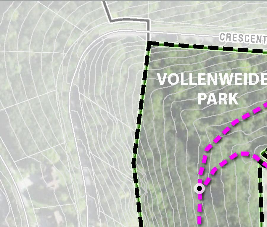


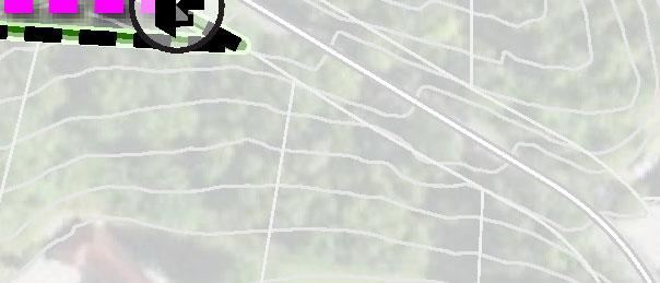


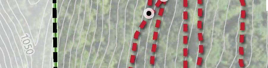


Unnamed Trail
Add trail markers every 500 feet or as trail conditions require.
Accessible Trail
ADDED Trail (approximate location)


REMOVED Trail (approximate location)


Visual Representation of the Recommendations for Vetsch and Stoney Point Parks from the Natural Resource Advisory Group 4/26/2022
The slope is much steeper on the new trail proposed than the original trail. Preferred alternative
1. Obtain an easement from the private landowner for this section.
2. Add a switchback if necessary to the original trail or realign and lengthen the original steep part of the trail to where the contours are more gradual to reduce erosion.
If an easement isn’t possible consider realigning the existing trail to follow the contour curve along the property border until it joins the new proposed purple zig zag route.

Explore a possible reroute of trail to the west of Stoney Point to connect to the existing ridge trail so that the overlook on Stony Point could be reached without the climb up the sandstone face. This could provide a more easily accessible route to the lookout while reducing traffic where sandstone erosion currently exists

Vetsch Park Most of the forest is in good shape with few invasive exotics (except where marked). Therefore keep the trails narrow and limited in number to limit sunlight and discourage the exotics. Maintain the main trails but let foot traffic determine which of the smaller cross trails and shortcuts will ultimately grow shut.
Explore the possibility of eliminating one or the other of these two segments of trails. They are redundant.
Eliminate this trail it is overgrown and no longer used.
Is this red trail the private access road as marked on the sign? Is the entire length a graveled driveway and is it open to the public?

1. Keep this part of the yellow trail to make a loop.
2. Eliminate this part Put in a new trail on the outside of the inholding if possible to make a loop.


P
r n
Park Ser vice
Areas
I ì Pa rk
La Cre scent Pa rk Ser vice Area (0 5 Mile)
Reside ntially Zoned Pa rce ls Pa rk Existing P rotecte d Bluffla nd s* Bluffla nd Conse r va tion Area
City of La Cre scent County B ound ar y
Comp Plan Da a (2015) MNDNR (2021)
Esri, HERE, Garmin, SafeGraph, GeoTechnologies, Inc, METI/NASA, USGS, EPA, NPS, USDA
This map is an overlay of maps A and B. It represents areas that are potentially underserved. Darker areas are areas that are highly populated but do not have nearby park facilities.
What is the purpose of this map?
1. To determine if areas of La Crescent are underserved by City parks. Areas that are most underserved are shown by the lightest colors on the map. It may be beneficial for the City to take these areas into consideration when planning future parks.
2. Some parks may be subject to heavy use based on surrounding population density. These parks may require additional maintenance and repair.
La Crescent CORP Study
City of La Crescent Houston County, MN
Park County Boundary City of La Crescent Areas Well Served by Parks
Areas Underserved by Parks
Data Sources: Houston County (2021)
Comp Plan Data (2015)
MNDNR (2021)
US Census Bureau (Population Density per square-mile as of 2010 Census) ESRI Basemap
Esri, HERE, Garmin, SafeGraph, GeoTechnologies, Inc, METI/NASA, USGS, EPA, NPS, USDA
Esri, HERE, Garmin, SafeGraph, GeoTechnologies, Inc, METI/NASA, USGS, EPA, NPS, US Census Bureau, USDA
La Crescent | Park & Recreation Plan Appendix B | Maps
P
r n t
Park and Trail
Recommendation
a a