This report was prepared by the City of Hillsboro with assistance from MSA Professional Services.
Adopted on [DATE TBD]
[page reserved for adoption resolution]
1. Introduction
1.1 Plan Purpose
Parks, recreation, and trails are key components of a community’s quality of life. Not only do they provide a safe and healthy place to recreate, but they also serve to beautify communities, protect natural resources, and influence the patterns of development.
The City of Hillsboro realizes the importance and benefits its parks, open space, and trail systems have on the City’s character and quality of life and is committed to providing for the recreational needs of its current and future residents. This plan intends to guide the continual improvement of the City parks, recreation, and trail systems and to maintain eligibility for key State and Federal park and recreation grants.
The plan is also intended as a support document to the City of Hillsboro’s Comprehensive Plan and will ensure Hillsboro is aligned with local and State initiatives to promote outdoor recreation. This plan, along with the City’s other long-range plans and development-related ordinances, will be used to implement and promote its parks and recreation program.
Specifically, the plan provides:
• Information regarding demographic trends;
• An inventory of existing park and recreational facilities;
• An analysis of parkland and recreational needs and demands;
• General policy direction regarding park, recreation, open space, bicycle, and pedestrian facility planning and maintenance;
• Recommendations for improving existing parks, bicycle, and pedestrian facilities;
• Identifies the location for potential new parks and trails; and
• Implementation strategies.
This plan identifies conceptual locations for new parks and recommendations for existing parks, trails, and recreational facilities. In nearly every case, more detailed planning, engineering, study, budgeting, and discussions will be necessary before decisions are made to actually acquire land or construct recreational facilities.
1.2 Planning Process
Park and recreation planning is an essential component of long-range community planning in Hillsboro In 2023, the City contracted with MSA Professional Services, Inc. to assist with updating its existing plan (which expires in 2024), as well as develop a master plan for improving Albert Field Memorial Park a key recreational resource for the community. The major project milestones are listed below:
• Project Kick-Off Meeting – January 2023
o Meeting with City staff to discuss issues and opportunities for the park system.
• Online Survey – February 2023
o A survey was open to the public from 1/25 to 2/24 to collect input on priority park improvements.
• Park Site Visits – April 2023
o MSA and City staff visited each City-owned park to identify potential improvements
• Presentation to the Committee of the Whole – May 2023
o MSA presented draft CORP and design concepts for the Albert Field Memorial Park Master Plan
• Committee of the Whole Recommendation – June 2023
o [tentative] Final CORP and Master Plan
• City Council Adoption – June 2023
o [tentative]
This plan was developed following the Guidelines for the Development of Local Comprehensive Outdoor Recreation Plans of the 2019-2023 Wisconsin State Comprehensive Outdoor Recreation Plan (SCORP) created by the Wisconsin Department of Natural Resources (WDNR). The plan content and format have been tailored to fit the needs of Hillsboro
1.3 The Role of Parks, Recreation, and Trails
The benefits of parks go far beyond simply being spaces where people can recreate. Parks contribute to individual’s physical and mental health and provide public safety, environmental, economic, and social equity benefits to communities. Recently, parks have come to the forefront of public health discussions due to COVID-19. The pandemic put parks in the spotlight as people sought out natural areas as refuges from the virus. It is important to remember the benefits parks provide to the communities they serve, which include:
Belonging
Public parks are a unique amenity because they can be accessible to anyone in the community, regardless of age, gender, ability, socioeconomic status, race or ethnicity. Though disparities do exist in the distribution and quality of parks and recreation amenities, many parks and recreation departments across the U.S. are rethinking how to engage and provide benefits to residents who do not currently have access to parks. If parks can be more inclusive, they have the potential to function as a nucleus of neighborhood activity, where residents can gather for social events, recreational activities, and meetings to discuss local issues increasing social interaction and creating an overall sense of community.
Community Health
According to the National Recreation and Parks Association (NRPA), individuals who use green spaces have fewer health issues, improved blood pressure and cholesterol levels, and reduced levels of stress which can lead to lower incidences of depression. According to a report by the NRPA titled The Economic Impact of Parks, “Diabetic individuals taking 30-minute walks in a green space experienced lower blood glucose level than spending the same amount of time doing physical activity in other settings. Thirty minutes of walking in nature resulted in larger drops in blood glucose than three hours of cycling indoors.”
Hillsboro Comprehensive Outdoor Recreation Plan
Ecological Health
Parks, forests, and trails have the potential to improve the health of residents and contribute to the greater ecological health of cities. Parks are often tied together with environmentally sensitive areas such as wetlands, floodplains, surface waters, or significant woodlands which can include trails. These areas provide food and shelter for local wildlife and natural stormwater retention. Individual parks can provide important “rooms” of natural resource activity; however, they become even more functional when they can be linked together by environmental corridors, or “hallways.” Wildlife, plants, and water all depend on the ability to move freely within the environment from room to room.
Economic Prosperity
Leisure time is an important component of everyone’s lifestyle and increasingly people are choosing locations to live based on quality-of-life factors, including recreational amenities. The ability to retain or attract new residents has direct economic benefits for communities. For this reason, having a great park, recreation, and trail system contributes directly to economic development. According to a study completed by the NRPA and George Mason University, 72% of 70 communities studied use parks and recreation images in their economic development materials. The study notes that parks and recreation contribute to economic development through business
attraction and retention, as well as talent attraction. Additionally, if a park system is designed with connections to regional destinations, it can attract outside visitors. This tourism can bring significant benefit to local businesses.
Connections
Connecting parks and recreational facilities to each other and the general population via trails is important to encourage safe, alternative modes of transportation. These paths can provide an important alternate means of traveling for those who prefer to bike for health or environmental reasons and for those who lack other means of transportation due to age, income or disability. Shared-use paths also provide important connections to public transit. According to the National Household Travel Survey conducted by the Federal
Highway Administration, 85% of transit trips begin and end with walking and nearly one in six walking trips is made for the purpose of accessing public transit.
Impact of COVID-19
With the COVID-19 pandemic, communities are seeing increased demand for trails and parks, and t is likely these shifts will impact parks into the future. Funding for park and recreation may also shift in light of the pandemic there will likely be a more diverse set of funding sources and partnerships for park and recreation projects (such as the American Rescue Plan) Following the social upheaval of 2020, parks and recreation departments are likely to put greater emphasis on health equity and social justice in parks and programming.
2. About Hillsboro
2.1 Local & Regional Context
The City of Hillsboro is located in southwestern Wisconsin (Vernon County) and is a gateway to the popular Driftless Region. Hillsboro is located roughly 24 miles north of the City of Richland Center, 50 miles west of the City of Wisconsin Dells, and about an hour and half drive from the state’s capitol in Madison. Hillsboro is also about an hour drive south of the U.S. Army base Fort McCoy. State Rd 80, which intersects with State Rd 82, are the City’s primary regional roadways. County Rd F also enters the City from the north.
2.2 Physical & Cultural Features
The western branch of the Baraboo River runs through the City and feeds into the largest body of surface water in the community, Field Veterans Memorial Lake; a dam is located at the eastern intersection of the west branch of the Baraboo River and the lake South Branch Creek also emerges from Field Veterans Memorial Lake. The topography in the City is moderately hilly, with its core downtown being comparatively flat. The City is surrounded by agricultural lands and patches of woodlands.
Hillsboro was settled in the mid-1800’s by primarily German and Czech immigrants, and the City is known today as the Czech Capitol of Wisconsin. After the Civil War, Hillsboro became a haven for African American settlers who built the fine, round barns unique to this particular area of Wisconsin. The City has also long been a regional hub for healthcare, with the current Gunderson St. Joseph’s Health Services tracing its origins back to original Hillsboro Hospital established in 1911. Today, Hillsboro is known for its annual charity tractor pull event one of the largest in the country and for the Hillsboro Brewing Company. The Brewery is housed in a recently renovated turn-of-the-20th century building near the trailhead for the multi-use Hillsboro State Trail, which connects to Village of Union Center and the 400 State Trail.
2.3 Land Use and Economy
According to Hillsboro’s Comprehensive Plan, 55% of the City’s total acreage is developed, with 33% of that area dedicated to single-family residential use. The second-highest category of developed land is devoted to transportation (roads and highways) at 29%. Parks encompass 39.7 acres of land in Hillsboro roughly 5% of its total acreage. Another 12% of the City is comprised of surface water (Veterans Field Memorial Lake).
Important employers in Hillsboro include: Slama Enterprises (agricultural equipment and services), Dana Foods (dairy and non-dairy products), Ornua Ingredients North America (dairy products), Land O’Lakes Butter (dairy products), and Gundersen St. Joseph’s Hospital (healthcare)
2.4 Demographics
This section describes some historic demographic trends in Hillsboro as it pertains to population, age composition, and housing. This includes data from the U.S. Census Bureau 2020 Decennial Census and American Community Survey (ACS), whose data are reported as rolling averages over a 5-year period. Because ACS data are only estimates and contain a margin of error, they may not always represent conditions as accurately as decennial census data. The population projections are provided by the Wisconsin Department of Administration (DOA) circa 2013; these projections have been adjusted to reflect the results of the 2020 census count.
Population
Per the 2020 census, Hillsboro’s population is 1,397 people. From 1980 to 2020, the population of Hillsboro increased by 10.6%, lower than the rate of increase in Vernon County (19.8%) and the State overall (25.2%).
According to the DOA’s 2013 population projections (adjusted to reflect the results of the 2020 census), the City is expected to add an additional 137 residents between 2020 and 2040. While the DOA forecast appears minimal, given Hillsboro’s smaller population size this growth represents a 9.8% increase over a 20year period, or 0.47% annual growth. This projection is lower than the projected growth for Vernon County (13.6%) but higher than the State (8.1%). New park lands and facilities may be necessary to continue meeting the demands of new residents and neighborhoods.
Age Composition
Population History & Projections
Age composition is an important consideration in park and recreational planning as individuals interests and physical abilities vary due to age Table 1.2 summarizes the age composition of Hillsboro’s population based on 2021 ACS 5-year estimates Approximately 22% of the population is considered youth (<20 years old) which is lower than the rate in 2010 (36%). Approximately 27% of Hillsboro’s population is considered at retirement age (>65 years old), which is higher than the rate in 2010 (13%). This rise in the 65+ age cohort is predictable and seen across the state and country as more members of the Baby Boomer Generation entire retirement. The median age of the City increased from 30.9 in 2010 to 45.4 in 2021, which is above the state median of 39.1.
Housing
Based on 2021 ACS 5-year estimates, there are approximately 570 households in the City, 23% of which include at least one child under 18 years old. The total number of households was down by 5 since 2010; the number of households with at least one child under 18 years old declined 5% since 2010. The average household size in Hillsboro in 2021 was 2.32 individuals, a decrease from 2.56 in 2010, but an increase since 2000 (2.18)
This indicates fewer, and smaller households. This decrease follows national trends (and other communities across the state) showing decreases in average household size attributed largely to smaller families, increases in life expectancy, and increases in single parent households. In total there were approximately 625 occupied housing units in the City based on 2021 ACS estimates; of the occupied units, 404 (71%) are owner-
Table 1.1: Hillsboro Population Summary; Source: Decennial Census & DOA Population Projections (2013)
Table 1.2: Hillsboro Age Composition; Source: 2021 ACS 5-Year Estimates
The following local plans were reviewed, and recommendations incorporated into this planning effort:
Hillsboro Comprehensive Outdoor Recreation Plan 2019-2024
Hillsboro’s previous CORP was developed in 2019 through a grant provided by the University of WisconsinMadison Landscape Architecture Department’s senior capstone project. The plan outlines a number of opportunities to expand recreational offerings in the City, including:
• Developing a youth sports complex
• Accommodating overflow camping from nearby attractions such as the Kickapoo Valley Reserve and Wildcat Mountain State Park.
• Expanding water-based recreation on Field Veterans Memorial Lake and the West Branch of the Baraboo River.
• Linking the current terminus of the Hillsboro State Trail to a bicycle network within the community.
• Expanding a Riverwalk along the lake near Gundersen St. Joseph’s Hospital.
• Rehabilitating the downtown basketball and tennis courts.
• Utilizing the airport runway for recreation.
• Developing a dog park.
Since this plan’s adoption, a Riverwalk was developed along Field Veterans Memorial Lake and a fishing pier and canoe/kayak launch was installed. An additional canoe/kayak launch will be completed in 2023 along the West Branch of the Baraboo River, near the trailhead for the Hillsboro State Trail (see Appendix B – Maps for the location of these amenities).
Hillsboro Comprehensive Plan & 2016 Amendment
The City’s Comprehensive Plan was adopted in 2003 and amended in 2016 to update its Economic Development and Housing chapters. Like the previous CORP, the city-wide Comprehensive Plan plan lays out a number of issues and opportunities relating to recreation in the community:
• Promoting the Hillsboro State Trail connection to Union Center as a major recreational attraction in the region.
• Establishing trails and pathways to connect existing and future parks and improve access for residents
• Establishing a public beach for residents and tourists alike.
• Constructing a barn replica to be used as a visitor center and museum.
• Improving boat launches and fishing piers to enhance water-based recreational activates in the area.
3. Park & Recreation Goals
The following goals are adapted from the National Park, Recreation, and Open Space Standards, a publication of the National Recreation and Park Association, for application by the City. They represent general best practices for municipalities and parks and recreation departments across the U.S.
1. Hillsboro’s parks should provide opportunities for all persons regardless of race, creed, age, sex, or economic status.
2. Advance land acquisition based upon a park and open space system should begin immediately in order to prevent the loss of high-quality sites to other development interests.
3. Facilities should be centrally located within the area that they are intended to serve, must have safe, have adequate access, and be distributed so that all persons in the community can be served.
4. Land acquired for use as parks or recreation areas should be suitable for the specific intended use, and when possible, for multiple uses.
5. Land adjacent to recreation and open space areas should be used in ways that will not interfere with the purposes for which the recreation or open space land was intended, and in addition, recreation and open space areas should be compatible with surrounding land uses.
6. The design of individual park and recreation sites should be as flexible as possible to reflect the changing patterns of recreational needs in a given service area.
7. Special efforts should be made to provide for easy access to and the use of all facilities by the elderly, ill and disabled, very young, and otherwise less-mobile groups in the community.
8. Recreation and open space land should be protected in perpetuity against encroachment by other uses that will inhibit the recreation or open space nature of the land.
9. Park and recreation areas should be used to separate incompatible land uses and guide future urban development.
10. Neighborhood and community level recreation areas should adjoin schools whenever possible. This can enhance the school environment and prevent duplication of facilities.
11. Citizen involvement in the recreation and open space decision-making process should be encouraged and expanded.
12. Facility development must be reviewed with safety in mind, adhering to accepted standards prior to installation.
4. Existing Parks & Recreation Inventory
The following chapter contains information about City-owned facilities, trails, and recreation programs. Privatelyowned parks are not included in this analysis because they are typically only open to private neighborhoods and the City does not have jurisdiction over these parks.
4.1 City-Owned Facilities
Hillsboro currently owns eight parks and recreational facilities under the following classifications:
Neighborhood Parks
Neighborhood parks are typically sites with a smaller collection of recreational activities and typically are intended to serve residents that live nearest to the park. Facilities may include athletic fields, sports courts, playgrounds, and picnic areas. Neighborhood parks may or may not have permanent restroom facilities. Desirable size is between 3 and 10 acres. The following parks in Hillsboro are categorized as neighborhood parks:
• Hammer and Klopfiesch Park: a 4.2-acre park located near the eastern edge of Field Veterans Memorial Lake. This park features open green space, a fire pit, and open-air shelter. The Field Veterans Memorial Dam is also adjacent to this park.
• Municipal Basketball/Tennis Courts: a 0.4-acre facility located directly adjacent to the Hillsboro Public Library off of Pine Ave and Mill St. This facility includes two tennis courts and a basketball court.
Community Parks
Community parks are sites of diverse recreational activities and typically include a mix of facilities such as athletic complexes, large swimming pools, and baseball diamonds. Community parks tend to draw residents from around the community, not just those who live close by. These parks typically have permanent restroom facilities, and a desirable size is between 10 and 25 acres but will vary depending on the facilities offered. The following parks in Hillsboro are categorized as community parks:
• Field Veterans Memorial Park: a 13.4-acre park located along the north shore of Field Veterans Memorial Lake. This park features
a variety of facilities, including a playground, boat launch, canoe/kayak launch, fishing pier, Veterans Memorial, open-air shelter with picnic tables, restrooms, grills, drinking water, gazebo, little free library, and parking lot.
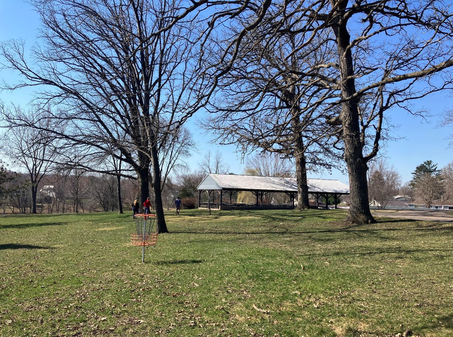
• Albert Field Memorial Park: a 2.1-acre park located in the northern area of the City on a wooded hill, with the Hillsboro Historical Society located directly next door. Its facilities include a playground, open green space, disc golf course, bike/walking trail, two open-air shelters with picnic tables, restrooms, grills, and drinking water. A driving loop is provided around the park.
• Cheyenne Settlers Heritage Park: a 6.3acre park is located near Field Veterans Memorial Park off of Elm St; a recently installed walking path connects the two parks. This park features open green space, a historical marker, and small parking lot.
Special Purpose Parks
Special purpose parks are typically sites for unique, specialized, or single purpose recreational activities, such as golf courses, nature centers, skate parks, and ball diamonds. The following parks in Hillsboro are categorized as special purpose parks:
• Hillsboro Municipal Pool: a 2.3-acre facility located between Hillsboro Elementary and High Schools in the northwest area of the City. The pool features diving boards, benches, concession stand, and small splash pad installed in 2019. Outside the pool is and
open turf field owned by the City.
• Hillsboro Air Strip: a 11.1-acre decommissioned air strip next to the Hillsboro Sewage Plant and Land O’Lakes manufacturing plant. The air strip was once a part of the Kickapoo Airport, which is no longer operational. While not a traditional park facility, it is considered a part of the Hillsboro park system given that it is city-owned property and its current and potential use as a community space; it is currently used for local car drag racing events. The strip also has a direct connection to the trailhead for the Hillsboro State Trail
4.2 School Facilities
Schools can also meet community’s recreational needs as they provide many of the same facilities found in neighborhood parks, such as playground equipment and athletic fields. The School District of Hillsboro includes Hillsboro Elementary School and Hillsboro Middle/High School. Theses schools are located next to each other in the northwest area of the community. Their recreational facilities include:
• playgrounds
• swing sets
• basketball hoops
• running track and football filed
• baseball/softball diamond
• open green space
4.3 Local & Regional Trails
The primary multi-use trail in the City is the Hillsboro State Trail, whose trailhead is located near the Hillsboro Air Strip. This trail is approximately 2.3 miles long and connects directly to the Village of Union Center and the 400 State Trail. The 400 State Trail is a 22-mile trail that follows the route of the former Chicago-Northwestern passenger train, which traveled 400 miles between Chicago and Minneapolis-St. Paul. The trailhead for the 400 State Trail is located at the Reedsburg Depot and ends in the City of Elroy. There, the 400 State Trail connects to the Elroy-Sparta State Trail considered the first ‘rails-to-trail’ project in the world, according to the WDNR. More information about these trails can be found at WDNR's website.
There are additional walking paths within Hillsboro: one connecting N Star Cir to Albert Field Memorial Park, and another connecting Cheyenne Settlers Heritage Park to Field Veterans Memorial Park and St. Joseph’sGunderson Hospital. The later walking path was installed in 2021 and abuts the western branch of the Baraboo River and Field Veterans Memorial Lake. The location of these walking paths, the Hillsboro State Trail, and the City-owned parks detailed above can be seen on the Existing Parks and Trails Map in Appendix B.
5. Analysis of Needs and Demands
This chapter presents an analysis of how well the City’s existing park and recreation facilities satisfy current needs. The adequacy of the City’s existing park and recreation systems are evaluated using the following methods:
• Quantitative Analysis - a comparison of existing parkland acreage and population projections versus park and recreational agencies across the US, including a review of the amount of parkland available to City residents.
• Geographic Analysis - an analysis of the geographic distribution of parks within the City
• Qualitative Analysis – a summary of the results and feedback gathered from the online survey.
• Regional & State Insights - a summary of the demand trends in recreational amenities at the regional and state level.
5.1 Quantitative Analysis
An analysis of existing recreational land area is provided to determine if the recreational needs of residents are being met. This analysis is limited to an evaluation of City-owned park land and does not include school facilities.
Park Acreage Level of Service
The City is targeting a standard of 10.5 acres of total parkland per 1,000 residents, a metric and standard best practice promoted by the National Recreation and Park Association (NRPA). The City of Hillsboro currently provides 0.0284 acres of parkland per resident, or 28.4 acres of parkland per 1,000 city residents. This is based on the total park acreage for the community, which is 39.7 acres. However, this total includes a mix of passive and active recreation lands and the Hillsboro Air Strip, which is not used regularly by community members for recreational activities. Therefore, to highlight the level of service the City is providing for active recreation, Table 5.1 only includes the acreage for parks with active recreation facilities (15.8 acres from Field Veterans Memorial Park, Albert Field Memorial Park, and the Municipal Basketball/Tennis Courts). In terms of active recreation parkland, Hillsboro is providing 11.3 acres per 1,000 residents.
Using the population projections included in Chapter 2, Table 5.1 details the projected supply and demand for parkland based on the City’s population. Assuming the population projections are correct, and the City does not add additional active recreation parkland, by 2040 there will be a deficit of 0.3 acres by 2040 based on the NRPA standard to provide at least 10.5 acres per 1,000 residents
The NRPA collects information from Park and Recreation Departments across the US, including the number of residents per park, budgets, staffing, and park amenities. This data is organized by jurisdiction size so that communities of similar size across the US can see metrics typical of its peers. Figure 5.1 shows the rate of Hillsboro’s active recreation park land per 1,000 residents in comparison to jurisdictions of similar size across the U.S. The City is above the lower quartile, but below the median and upper quartile nationally for jurisdictions with less than 20,000 people.
Active Park Acreage Surplus/Deficit (in acres)
Table 5.1: Active Park Acreage Supply and Demand Analysis; Source: U.S. Census Bureau & WI DOA Population Projections.
This analysis suggests that based on active acreage of parkland, the City may need to acquire additional land by the year 2040 to maintain a standard of 10.5 acres of per 1,000 residents. The geographic, qualitative, regional, and state analysis in the following sections provide additional guidance on this need.
5.2 Geographic Analysis
Acres of Parkland per 1,000 Residents: Active Recreation Land Only (jurisdiction pop. <20,000)
The location of parks in relation to Hillsboro’s residents is an important indicator of how well existing facilities are dispersed throughout the community. The National Recreation and Park Association, in partnerships with the Trust for Public Land and the Urban Land Institute, is part of a national effort dedicated to improving access to safe, quality parks and green spaces. The effort is focused on a goal of everyone in the U.S. having access to a park within a 10-minute walk (approximately ½ mile) of home by 2050. Based on this effort, the green area in the Park Service Areas Map in Appendix B indicates areas of the City that fall within the 10-minute walk park service area. The majority of the developed areas of the City fall within the 10-minute walk service area, with gas present in the northern and eastern portion of the community. however, these areas are not as developed as the rest of the City or contain agricultural or wooded land, meaning people are less likely to live in these areas. Overall, this map indicates that the City’s parks are relatively well distributed throughout the community.
What this map does not speak to are the on-the-ground conditions of the City’s sidewalks and roadways, which impacts resident’s experience walking to nearby parks. The following section contains additional insights regarding perceptions of bicycling and pedestrian safety in the community.
5.3 Qualitative Analysis
An online survey was available early in the planning process for the public to provide their feedback on parks and recreation needs. 219 people began the survey, with the number of responses per subsequent question varying from question to question. The full results of the survey are available in Appendix A. The following section highlights some of the main takeaways from the survey.
Profile of Respondents
The majority of respondents were between the ages of 25 and 54 (68%), and 46% of all respondents had children under the ae of 18 living in their household. 50% of respondents lived in the City of Hillsboro, with another 17% living elsewhere in Vernon County. Nearly half of respondents have lived in the City of Hillsboro for 6-20+ years.
Park Activities & Amenities
The most popular activities and facilities survey respondents reported themselves or a member of their household using in Hillsboro parks were walking (81%), picnic facilities (58%), playground equipment (58%), swimming (38%), and biking (35%).
City of Hillsboro Lower Quartile Median Upper Quartile
NRPA Agency Performance Review 2022
Figure 5.1: Acres of Parkland per 1,000 Residents; Source: NRPA 2022 Agency Performance Review
When asked which amenities they would like to see added, improved, or expanded in the City, the top six responses were (survey takers could chose up to 6 selections):
• Coe/kayak facilities 35%)
• Beach/Lake Access (32%)
• Dog Park (30%)
• Off-road walking/biking trails (23%)
• Playground Equipment (22%)
• Indoor athletic complex (21%)
Safety & Accessibility
80% of survey respondents did not have concerns about safety or accessibility in Hillsboro’s parks. For those that did express concerns, common reasons included:
• Broken playground equipment in Albert Field Memorial Park
• Lack of fencing around the Dam
• High traffic speeds along State Rd 80 next to Field Veterans Memorial Park
• People who let their dogs go off leash in City parks
• Lack of available parking
Funding
Survey takers were asked if they would support the City allocating additional funds to a number of items relating to parks. 66% of respondents supported allocating more funds for park maintenance; 64% of respondents also supported allocating more funds for installing new park facilities or equipment. 30% of respondents did not support additional funds being spent on parkland acquisition, with another 45% saying they were unsure. Similarly, 21% of respondents did not support allocating additional funds for more staff to mange parks and 43% were unsure. Spending additional money on sidewalk and pedestrian enhancements received the most support from survey takers: 73% saying yes, and 12% saying no.
5.4 Regional & State Insights
Baraboo River Corridor Plan: Phase II
Phase II of the Baraboo River Corridor Plan builds off the success and recommendations of Phase I, recommendations details pathways to improve water quality and recreational opportunities along the Baraboo River worth nearly $1.7 million. Phase II expands the planning area from the west corporate limit of the Village of North Freedom through the corporate boundary of the City of Elroy and the City of Hillsboro (nine government entities overall).
Each municipality within the Baraboo River Corridor chose a site within (or just outside of) their community with a strong potential to enhance recreation opportunities within the Baraboo River Corridor. In Hillsboro, this location is E Madison St near the entrance to the Hillsboro State Trailhead and the canoe/kayak launch set to be installed in 2023. The conceptual design for the site includes the conversion of the existing wellhouse into a welcome kiosk, a small parking lot, restrooms, and an open shelter. Further recommendations related specifically to Hillsboro include:
• Installing additional access points and campsites along the river.
• Adding trail connections between the launch sites and other recreation amenities, downtown restaurants, and Gundersen St. Joseph’s Hospital Riverwalk.
Vernon County Land & Water Resource Management Plan
Last updated in 2019, this plan is a locally led effort to identify and resolve natural resource issues and conflicts within Vernon County. This plan includes a Targeted Watershed Assessment (TWA) for Field Veterans Memorial Lake (referred to as Hillsboro Lake), the West Branch of the Baraboo River, and South Branch Creek. The TWA’s management priorities include working with landowners and Vernon County staff to install best management practices (BMPs) to help protect the water quality coming from spring heads that feed into Hillsboro’s waterways; preventing woody overgrowth along streambanks to enable streams to flow in a more narrow and meandering pattern which supports improved fish habitat; and stabilizing stream banks with vegetated buffers such as grasses and forbs to prevent erosion, provide a natural cover for fish, and reduce sediment and nutrient runoff into streams.
State Comprehensive Outdoor Recreation Plan (SCORP) 2019-2023
The Wisconsin SCORP features a Recreation Opportunities Analysis (ROA). The ROA examines existing outdoor-recreation opportunities compared to future opportunities in eight regions throughout Wisconsin. The City of Hillsboro and Vernon County are located in eastern-most edge of the Mississippi River Corridor region.
Input from members of the public in the Mississippi River Corridor identified the following recreational needs in their region:
• Hiking/walking/running trails
• Bicycle trails – both paved and natural surface
• Camping – rustic/quiet campgrounds
• Public shore access to lakes and streams
The top outdoor recreation activities residents living in this region participate in include:
• Bicycling – paved trails
• Bicycling – mountain biking, single track
• Bicycling – winter/fat tire
• Camping – tent • Canoeing/kayaking
• Cross-country skiing/snowshoeing
• Fishing – from a boat, canoe or kayak
• Fishing – from shore
• Harvesting berries, mushrooms, etc
• Hiking, walking and running on trails
• Swimming
• Wildlife/bird watching
6. Recommendations
The quantitative and geographic analysis discussed in the previous chapter reveals the need for improvements to existing facilities, as well as the potential acquisition and development of new sites for future recreational use. It should be noted that some of the recommendations may require considerable cooperation with other entities, including the citizens of Hillsboro, local civic and business associations, and State agencies. In nearly every case, more detailed planning, engineering, study, budgeting, and/or discussion will be necessary before decisions are made to actually acquire land or construct recreational facilities.
The recommendations of this plan are divided into three major sections: (1) existing park facilities (2) new or expanded park facilities and trails; (3) other recommendations.
The timeline for completion of recommendations is noted for existing park facilities is noted in Table X and should be used to guide budgeting decisions. High priority items should occur in the next 1-3 years (2023-2025), Medium priority items should occur over the next three to five years (2026-2028) and low priority items are likely to be competed beyond 2028 (5+ years); however, initial planning can begin earlier to bring these items closer to fruition. Due to budgetary constraints, it is unlikely that all of the recommendations within this chapter will be implemented in the next five years. Maintenance and improvement projects will be prioritized on an annual basis by City staff and as part of the City’s annual budget and Capital Improvement Plan (CIP).
Many of the recommendations regarding locating new park or trail facilities will be coordinated with the sale or donation of land by other parties; therefore, the timing is much more variable. Acquisition projects will be implemented through donation, dedication, purchase, or a combination thereof.
6.1 Existing Park Facilities
The following recommended improvements were gathered through discussions with City staff, park site visits, and the online survey. Please see Chapter 7 for priority levels and cost estimates for each recommendation, and Appendix C for more detailed information regarding the proposed improvements for Albert Field Memorial Park.
Neighborhood Parks
Municipal Basketball/Tennis Courts
• Add more electrical outlets to facility.
• Given the deteriorating condition of the courts, consider a full reconstruction at the current location or relocating the facility to another site.
o A full reconstruction of the existing site could include a single multi-use basketball and tennis/pickleball court and extension the parking lot. Hammer and Klopfiesch Park
• Create a walking path connection to Field Veterans Memorial Park; incorporate into long-term vision for Field Veterans Memorial Lake walking loop.
• Add restrooms.
• Add a canoe/kayak launch.
• Hold more community events at location.
• Add safety barrier around dam.
Community Parks
Albert Field Memorial Park
• See Appendix C for the park’s Master Plan
Cheyenne Settlers Heritage Park
• Reconstruct historic hexagonal barn in partnership with the Cheyenne Settlers Heritage Society.
• Consider park's open space as a future dog park location.
Field Veterans Memorial Park
• Long-term, extend the existing walking path into a loop around the entirety of Field Veterans Memorial Lake, including a pedestrian bridge.
• Add lighting to the park shelters and playground.
• Replace playground wood chip material with a lower maintenance material.
• Hold more summer community events on site
• Ensure any new playground equipment added to the park is ADA accessible and appropriate for children up to age 12.
• Add a fire pit.
• Replace/fix vending machine.
• Create more ADA accessible water features and/or ways to engage with the water.
• Add traffic calming features, lower speed limit, or other safety measures along the portion of State Road 80 that is directly adjacent to park.
• Add water-based equipment rental for canoes, kayaks, paddle boards, etc.
Special Purpose Parks
Hillsboro Air Strip
• Hold more community events at location, such as a car show or farmer’s market.
Hillsboro Municipal Pool
• In the area where there were previously sand volleyball courts, consider constructing a new ADA accessible playground, single outdoor basketball/four square court, and a skatepark
• Upgrade kiddie pool so it is fully operational again.
6.2 New Park & Trail Facilities
The City should develop new parks in areas that are underserved by existing facilities and areas where future residential expansion is expected to occur. There should be a focus on the acquisition of park and open space which will advance the goals and policies of this plan or the Hillsboro Comprehensive Plan.
The Proposed Parks & Trails Map in Appendix B identifies the location for four potential new parks in Hillsboro, determined through conversations with City Staff. These locations are as follows:
Site A – Potential Dog Park
This site is not currently owned by the City but may come up for sale or be donated to the City in the future. The City is considering this location for a future, fenced in dog park to enable dogs to safely be off leash. Dogs are currently allowed on-lease in all City parks. The need for an off-leash dog park was mentioned in the survey comments by many residents and was a high-ranking community priority.
Site B – Potential Neighborhood Park
This parcel of land is currently owned by the City and is located near the intersection of Spring St and Harrison St. Given that this parcel is embedded within an existing residential area, a small neighborhood park is likely the
most appropriate use for the land. Potential facilities could include a small playground, picnic tables, and benches. Further discussions with community members and neighbors adjacent to the park will be needed to determine the site’s feasibility as a park and its desired facilities.
Site C - Potential Parkland
This parcel is not currently owned by the City but could potentially be purchased by the City to create a larger new park site, in combination with the parcel identified above as Site B.
Site D – Potential Community Plaza
This empty parcel is located on State Rd 80, next to the Hillsboro Chiropractic and Rehab Center. Behind a white fence is a small area covered in turf; the area has a relatively steep incline/hill. This City is considering converting this site into a community plaza or welcome center to hold events. The site could also be used as a small sledding hill for kids during the winter.
Site E – Potential RV Parking & Historic Train Car
This site is located in a light industrial area of the City and features a section of decommissioned rail. The City is considering placing an historic train car on the piece of rail for use as a tourist attraction and/or other community space. The empty space adjacent to the rail is a potential location for RV parking, with a number of attractions located within walking distance including the new Baraboo River kayak/canoe launch, trailhead for the Hillsboro State Trail, Hillsboro Brewing Company, and Hammer and Klopfiesch Park.
The Proposed Parks & Trails Map in Appendix B also identifies potential expansions to Hillsboro’s existing trails, primarily:
• A multi-use walking and biking loop around Field Veterans Memorial Lake, connecting to the existing riverwalk near St. Joseph’s Gunderson Hospital and Field Veterans Memorial Park, and Hammer and Klopfiesch Park. A pedestrian bridge over the lake will likely be required to complete this loop, which will incur substantial capital investment and further engineering.
6.3 Other Recommendations
Additional recommendations that apply generally across the City’s park system include:
• Converting the old wellhouse located next to the new kayak/canoe launch and Hillsboro Air Strip into a usable community amenity, such as restrooms and/or a welcome/tourist kiosk.
• Establishing youth and adult sports leagues, such as softball, pickleball, and basketball.
• Establishing summer outdoor recreation classes, such as yoga, birdwatching, hiking, and bicycle safety.
7. Implementation
This chapter summarizes tools and mechanisms that the City can use to fund implementation of the park and open space recommendations discussed in the previous chapter as well as plan adoption and amendment procedures.
7.1 Potential Funding Sources
Maintenance and operational expenses for the City’s parks are generally funded through property taxes, user fees, or the general fund. As the park system grows the need to increase funding to meet the basic maintenance and operational costs also grows. Often there are insufficient funds to undertake major capital improvement projects. There are a wide variety of potential funding sources to assist with up-front capital costs, including acquisition of land and the development of new recreational facilities.
GRANT PROGRAMS
An important source of funding is grant programs offered by state and federal agencies, especially the Wisconsin Department of Natural Resources. Table 7.1 in Appendix D provides a summary of common state and federal park and recreation grant programs. The table is not an exhaustive list of grant programs, rather those that are typically used by municipalities. Other grant programs may exist and information regarding funding details shown in Table 7.1 should be verified with grant providers prior to seeking grant funding.
COMMUNITY FUNDRAISING & VOLUNTEER GROUPS
Community groups and civic organizations are sometimes willing to organize fundraising efforts to assist with these costs, and they may also be able to marshal volunteer labor to assist with small development projects such as trail creation or playground installations. Local business and corporate support should also be sought. Both nonprofit and for-profit organizations can be rewarded for their support with acknowledgement on a plaque or sign at the site.
501(C)3 FOUNDATION
The City can set up an endowment fund as an additional means of providing continual financial support for park acquisition and development. An endowment fund works like a permanent savings account. The amount individuals give, which is the principal, is never spent. Only the interest income is spent, thereby providing a continual source of monies. A park endowment fund can provide a means for residents to either bequeath money or provide ongoing donations to the City’s park system, with the certainty that the money donated will only be used for the advancement of recreation in the community. Gifts to an endowment fund are typically tax deductible under federal and state law.
TAX INCREMENT FINANCING (TIF)
As part of a broader plan to redevelop an area, the City can use tax increment financing to assist with parkland or trail acquisition and development. There are some limitations to what revenues from a TIF district can be used to pay for, generally the costs of constructing public buildings cannot be funded with TIF. Tax increment could be used for land acquisition, trail and site development. Under state statute 66.1105 a municipality can use tax increment to complete public improvements within a 0.5-mile radius of the TID, so long as the use of the funds supports and benefits the TID
7.2 Parkland Dedication, Fees in Lieu, and Impact Fees
The City’s Municipal Code includes regulations regarding parkland dedication requirements. Within the corporate limits of the City subdividers are required to dedicate sufficient land to provide park, recreation, and general open space to meet the anticipated neighborhood needs of residential and development areas, as such park development is determined necessary or desirable by this plan.
Parkland Dedication Requirement
Per Section 14.1.81(a), the City currently requires parkland dedication for new subdivisions; however, the requirements only apply to single-family residential subdivisions or 10 or more units or multi-family single lot subdivisions. The required amount of land to be set aside for parks, recreational areas, or open space are as follows:
Fees in Lieu
If parkland dedication is not possible, a subdivider may satisfy the requirement for setting aside land for parks, recreation areas, or general open space by payment of a fee in lieu of land. These fees are collected and used for purchase of new park land The City does not currently have a set fee in lieu. Per Section 14.1.81(e) of the City’s Code of Ordinances, “the Common Council shall determine the amount to be deposited, based upon the recommendation of the City Administrator. This recommendation will reflect the fair market value of the amount of land that would have been dedicated.”
Impact Fees
Hillsboro does not currently charge a park impact fee. Impact fees are a one-time fee that is assessed and paid as a special charge to develop new parks facilities and amenities (i.e. sport courts, playgrounds, etc.); park impact fees cannot be used to pay for the purchase of acquisition of new parkland. Communities choose to charge park impact fees because the cost to develop new parks is relatively high – roughly $700,000 for a typical neighborhood park. State statutes allow park impact fees to be collected based on maintaining, not increasing park service levels. The City should consider charging a park impact fee to offset the cost of new park development.
7.3 Plan Adoption & Amendments
Best practice procedures for plan adoption are highlighted below:
Committee of the Whole Recommendation
The Committee should meet to review the plan and pass a motion to recommend approval of the plan or plan amendment by the City Council
Public Hearing
Prior to adopting this plan, or plan amendment, Hillsboro can hold at least one public hearing to discuss the proposed plan or plan amendment; a public hearing is not required by the DNR to adopt this plan. if a public
hearing is held, at least 30 days prior to the hearing a Class 1 notice must be published that contains, at minimum, the following:
• The date, time, and location of the hearing,
• A summary of the proposed plan or plan amendment,
• The local government staff who may be contacted for additional information,
• Where to inspect and how to obtain a copy of the proposed plan or amendment before the hearing.
The notice should also provide a method for submitting written comments, and those comments should be read or summarized at the public hearing.
Plan Adoption
The plan and any future amendments become official City policy when City Council passes, by a majority vote of all elected members, an adoption ordinance or resolution. The Council may choose to revise the plan after it has been recommended by the Committee of the Whole, and after a public hearing (optional)
Plan Amendment vs. Plan Update
Amendments can be made at any time, but the City should not amend the plan more than once per year. A common recommended approach is to establish a consistent annual schedule for consideration of minor plan amendments as needed. This plan should be updated every five years in order to maintain eligibility for Wisconsin Department of Natural Resources Stewardship Funding. Unlike an amendment, a plan update should revisit the entirety of the plan content and include more robust opportunities for public participation.
7.4 Capitol Improvement Planning
The recommendations for each existing park, as seen in Chapter 6, are organized in the following table to help with capital improvement planning over the next five years. A cost estimate range and priority level (ideal time frame to be completed) has been assigned to each recommendation.
The priority levels are as follows:
• High-Priority: 1-2 years (2023-2025)
• Medium-Priority: 3-5 years (2026-2028)
• Low-Priority: 6+ years (beyond 2029)
The cost estimate ranges are as follows:
• $= <$5,000
• $$= $5,000 - $10,000
• $$$= $10,000 - $50,000
• $$$$= >$50,0000
• Maint..= General Maintenance (assumed to be <$2,000)
Neighborhood Parks
Municipal Basketball/Tennis Courts
Add more electrical outlets to facility.
Consider reconstructing the courts at current location or relocating facility to another site. A full reconstruction of the existing site could include a single multi-use basketball and tennis/pickleball court and extension the parking lot.
Hammer and Klopfiesch Park
Create a walking path connection to Field Veterans Memorial Park; incorporate into long-term vision for Field Veterans Memorial Lake walking loop.
Add restrooms.
Add a canoe/kayak launch.
Hold more community events at location.
Add safety barrier around dam.
Community Parks
Albert Field Memorial Park
See Appendix C: Albert Field Memorial Park Master Plan for detailed project cost estimates
Cheyenne Settlers Heritage Park
Reconstruct historic hexagonal barn in partnership with the Cheyenne Settlers Heritage Society.
Consider park's open space as a future dog park location.
Field Veterans Memorial Lake
Long-term, extend the existing walking path into a loop around the entire Field Veterans Memorial Lake, including a pedestrian bridge.
Add lighting to the park shelters and playground.
Replace playground wood chip material with a lower maintenance material
Hold more summer community events.
Ensure any new playground equipment added to the park is ADA accessible and appropriate for children up to age 12.
Add a fire pit.
Replace/fix vending machine.
Create more ADA accessible water features and/or ways to engage with the water.
Add traffic calming features, lower speed limit, or other safety measures along the portion of State Road 80 that is directly adjacent to park.
Add water-based equipment rental for canoes, kayaks, paddle boards, etc.
Special Purpose Parks
Hillsboro Air Strip
Hold more community events at location, such as a car show or farmers market.
Hillsboro Municipal Pool
In the area where there were previously sand volleyball courts, consider constructing a new ADA accessible playground, single outdoor basketball/four square court, and a skatepark.
Upgrade kiddie pool so it is fully operational again.
General Recreation Recommendations
Establish kids and adult sports leagues, such as softball, pickleball, and basketball.
Medium TBD
Medium TBD
Establish summer outdoor recreation classes, such as yoga, birdwatching, hiking, and bicycle safety. Medium TBD
Add an off-lease, fenced dog park suitable for both large and small dogs to the City's park system. High TBD