ACKNOWLEDGEMENTS
WITH SPECIAL THANKS TO:
The individuals who provided feedback to help generate the final recommendations of this document.
PARKS & RECREATION BOARD:
Becky Neumann
Ryan Fennel
Amy Schauer
Natalie Steuer
Steve Winger
Jared Fluhr
Amanda Kennedy
PROJECT TEAM:
Chris Janson, AICP
Jim Holz, AICP
Shannon Gapp, AICP
Emily Huston
PREPARED FOR:
City of Asbury, IA
City Hall
5290 Grand Meadow Dr. Asbury, IA 52002
CITY OF ASBURY:
Beth Bonz
Sara Burke
ASBURY CITY COUNCIL:
Jim Adams, Mayor
Bob Reisch
Craig Miller
Mark Schemmel
Russ Domeyer
Curt Kiessling
ASBURY PLANNING & ZONING:
Ron Brass
Bob Bleile
Rick Merkle
Dave Kubik
Sue Davison
Jayme Ironside
Pat Johnson
PREPARED BY:
R:00465318
INTRODUCTION
Plan Purpose
Parks, recreation and trails are important elements in the quality of life for all communities. Not only do these elements provide a safe and healthy place to recreate, they also serve to beautify, protect the natural environment and influence the patterns of development in and around the community.
The City of Asbury realizes the importance and benefits its parks, open space and trail systems have on the City’s character and quality of life and is committed to providing for the recreational needs of current and future residents. This plan intends to guide the continual improvement of the City’s park, recreation and trail systems and maintain its eligibility for State and Federal park and recreation grants. This plan envisions a connected system of parks, open spaces and trails throughout Asbury, related to the City’s natural resources, geography and neighborhoods.
The plan is also intended to be a support document and component of Asbury’s Comprehensive Plan, as well as align Asbury with local and State initiatives to promote outdoor recreation. This plan along with the City’s other long-range plans and development-related ordinances, will be used to implement and promote its parks and recreation program.
Specifically the plan provides:
• Information regarding demographic trends
• An inventory of existing park and recreational facilities,
• An analysis of parkland and recreational needs and demands,
• General policy direction regarding park, recreation, open space, bicycle, and pedestrian facility planning and maintenance,
• Recommendations for new and improving existing park, bicycle and pedestrian facilities, and
• Implementation strategies.
This plan identifies conceptual locations and recommendations for different types of parks, trails, natural areas, and recreational facilities. In nearly every case, more detailed planning, engineering, study, budgeting, and discussions will be necessary before decisions are made to actually acquire land or construct recreational facilities.
Why Plan?
When people talk about the places they love in a community, parks are typically at the top of the list. Parks, trails, and recreational programs are essential to the physical, economic, environmental, and social health of cities and their residents. To ensure that Asbury’s parks and trails system continues to meet community needs and offer these benefits, the City requested the assistance of MSA Professional Services Inc. to complete this Master Plan. The purpose of the Master Plan is to guide the City of Asbury in maintaining and enhancing its parks, trails, and recreational opportunities as the community grows; it also provides insight into the existing conditions and specific recommendations for each of the City’s parks and recreational spaces.
The information in this Plan represents the results of interactive and engaging outreach with Asbury community members, stakeholders, and City staff. Prior to inventory and data collection, the Project Team met with City staff to establish objectives and expectations for the project; community members were then given the opportunity to share their thoughts on the existing conditions and future aspirations of Asbury’s parks and trails.
One overarching goal of the Master Plan and drafting process was to communicate the importance of parks and recreation to people’s quality of life. When our parks, open space, and trails are accessible and well-maintained, we are more likely to engage with our community and reap the numerous benefits that access to nature provides. When our parks thrive, we thrive.
The Role of parks, Recreation & Trails
The benefits of parks go far beyond simply being spaces where people can recreate. Parks contribute to the physical and mental health of individuals and provide public safety, environmental, economic and social equity benefits to our communities. Recently, parks have come to the forefront of public health discussions. It is important to remember the benefits parks provide to the communities they serve.
Public parks are a unique amenity because they have the potential to be accessible to anyone in the community, regardless of age, gender, ability, socioeconomic status, race or ethnicity. Though we often find that disparities exist in the distribution and quality of parks and recreation amenities, many Parks and Recreation Departments across the U.S. are now rethinking how to engage and provide benefits to residents who do not currently have access to parks. If parks can be more inclusive, they have the potential to function as a nucleus of neighborhood activity, where residents can gather for social events, recreational activities, and meetings about local issues, increasing social interaction and creating an overall sense of community.
Community Health
According to the National Recreation and Parks Association (NRPA), when individuals use green spaces, they have fewer health issues, improved blood pressure and cholesterol levels, and reduced stress— which leads to a lower incidence of depression and a greater ability to face problems. According to a report by the NRPA titled “The Economic Impact of Parks,” “Diabetic individuals taking 30-minute walks in a green space experienced lower blood glucose levels than spending the same amount of time doing physical activity in other settings. Thirty minutes of walking in nature resulted in larger drops in blood glucose than three hours of cycling indoors.”
Ecological Health
While parks, forests and trails provide opportunities to improve the health of residents, they also contribute to the greater ecological health of the City. Parks are often tied together with environmentally sensitive areas such as wetlands, floodplains, surface waters, or significant woodlands which can include trails. These areas provide food and shelter for local wildlife and natural stormwater retention. Individual parks can provide important “rooms” of natural resource activity; however, they become even more functional when they can be linked together by environmental corridors, or “hallways.” Wildlife, plants, and water all depend on the ability to move freely within the environment from room to room.
Economic Prosperity
Leisure time is an important component of everyone’s lifestyle and increasingly people are choosing locations to live based on quality-of-life factors such as recreational amenities. The ability to retain or attract new residents has direct economic benefits to the City. For this reason, having a great park, recreation, and trail systems contributes directly to economic development. According to a study completed by the National Recreation and Parks Association and George Mason University, 72% of the 70 communities studied use parks and recreation images in their economic development materials. The study notes that parks and recreation contribute to economic development through business attraction, business retention and expansion and talent attraction. In addition, if a park system is designed with connections to regional destinations, it can serve to bring in additional visitors. This additional tourism can be a significant benefit to local businesses. The City’s plan will align with regional and State plans to promote outdoor recreation in the greater area.
Connections
Connecting parks and recreational facilities to each other and the general population via trails is important to encourage safe, alternative modes of transportation. These paths can provide an important alternate means of traveling for those who prefer to bike for health or environmental reasons and for those who lack other means of transportation due to age, income or disability. Shared-use paths also provide important connections to public transit. According to the National Household Travel Survey conducted by the Federal Highway Administration, 85% of transit trips begin and end with walking and nearly one in six walking trips is made for the purpose of accessing public transit.
Increased Park Usage
We are seeing increased usage of trails and parks that are forcing us to redesign common areas and improving pedestrian and bicycle flow to maintain social distancing. It is likely these shifts will impact parks into the future. Along with the design of park and recreation spaces, we are anticipating the way in which parks are funded is going to shift—there will likely be a more diverse set of funding sources and partnerships for park and recreation projects. A final anticipated impact is the fact that Parks and Recreation Departments are going to be prioritizing health equity and social justice in parks and programming.
Plan Process:
EXISTING CONDITIONS
IDENTIFY NEEDS
GOALS DEVELOPMENT
RECOMMENDATIONS
REVIEW FINAL PLAN
Park Planning
Recreation, bicycle, and pedestrian planning are essential components of long-range community planning in Asbury. For this project, the City contracted with MSA Professional Services, Inc. to assist with an update to its plans.
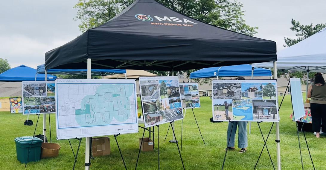
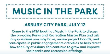
Early in the planning process Asbury facilitated an online community survey to gather citizen feedback on desired public park, trail, and recreational facilities. The process also included a public involvement through a pop-up event. This was held to obtain input from the public on desired park and recreation improvements. The pop-up event at Asbury’s Music in the Park was highly successful and allowed the community to get involved in a setting outside of typical meeting locations such as City Hall. This allowed for open, transparent communication and a sense of ownership in the process. The plan content and format have been tailored to fit the needs of Asbury.
PROCESS 02
PROCESS Community Profile
Regional Context
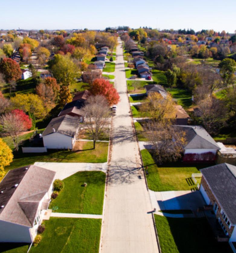
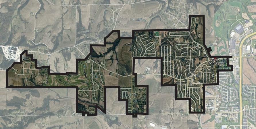
Asbury is located in Eastern Iowa. It resides adjacent to the City of Dubuque’s west side and is the second largest city in Dubuque County. Asbury’s close proximity to Dubuque is a huge asset to the community and make its location effective for those looking for a small-town feel, without being too far-removed from the amenities of a larger community. The City thrives off of local tourism from Sundown Mountain Ski Resort and Meadows Golf Course, as well as its close proximity to Dubuque and the Mississippi River.
History
Asbury was founded in the 1830s by Methodists and named after Bishop Francis Asbury. The city was incorporated in 1933 to legalize beer sales following the repeal of prohibition. Initially, Asbury had 27 residents, but it experienced significant growth, especially between 1960 and 1970, when it became the fastest-growing city in Iowa. Between 2000 and 2020, Asbury’s population grew by 3,693. Today, Asbury is a thriving community with about 6,000 residents, known for its safety, friendliness, and strong family values.
The Importance of Recreation
Parks are often the most important and highly prized components of any community. They are sources of civic pride and are essential to the physical, economic, environmental, and social health of communities and their residents. Good planning is essential to a community’s recreation system as it provides a means to meet the needs and wants of the community. As a plan is developed it is important to keep in mind the variety of benefits that parks and recreation add to the community.
Health
When residents and visitors have access to parks, trails, and recreation facilities, they exercise more and are generally healthier and happier. Additionally, increased exposure to natural areas that parks and open space provide has been linked to improved physical and mental health. Parks and trails encourage healthy, happy, active lifestyles and improve overall quality of life throughout a community.
Cultural & Social
Parks have important social benefits. In a time when social media defines the interactions of many people, parks and recreational centers are places to meet, catch up with family members and friends, and feel like part of the larger community. As a focal point of neighborhoods, parks help develop connections between residents by providing a venue for community building gatherings, like school trips, festivals, and celebrations.
Natural Resources
Parks and open space provide environmental benefits. Natural and planned vegetative landscapes found in parks, preserves and open spaces improve air quality and water quality. These areas may also play a role in stormwater management and protecting the quality and vitality of natural areas.
Property Values
Numerous studies have shown that close proximity and access to parks, trails, and open space has a positive impact on residential property values. Commercial property values can also be increased with proximity to recreational amenities, creating potential for these sites to act as catalysts for future growth and development. Access to recreational amenities helps fuel growth and investment in local economies.
Beautification
Parks contribute to aesthetics of a community. Parkways, treelined streets, gardens, views of water bodies, public art, trails, and landscaped areas around town are all things that contribute to creating beautiful places to live, work, and play. Visitors often remember a place by its access to beautiful natural areas, contributing to a positive community image. Improved linkages should also connect community parks to other community nodes. Attractive, safe and well marked linkages make essential contributions to a community’s livability and viability.
Parks and Open Space Standards
The definitions used in this plan are modified definitions used by the National Recreation and Park Association (NRPA). They are used to classify the existing recreation system and to guide plans for the future. They begin with the smallest and most intensely used and the proceed to largest and least used. Neighborhood and community parks are normally provided by municipalities. Larger recreation areas are normally provided by larger units of government or private enterprise.
NRPA Classifications
Typically on a small lot (1/4 acre), located within a residential neighborhood. Usually have one facility and benches.
- Desirable size - 2 acres or less
- Acres/1,000 population: .25 to .5
- Service Area: 1/8 to 1/4 mile radius
Serves the needs of children 5-15 years old. It provides open fields, courts, shelter facilities, and play area. It should be within walking distance.
- Desirable size - 2-4 acres
- Acres/1,000 population: 0.5 - 1.5 acres
- Service Area: 1/4 to 1/3 mile radius
This provides open space for all ages and enhances the overall environment. A natural location is ideal for this type, and it usually has tables, benches, paths, lights, and is walkable.
- Desirable size - 3-7 acres
- Acres/1,000 population: 5.0 -8.0 acres
- Service Area: 1 to 2 mile radius
Serves the active needs of several neighborhoods. Includes more than a park such as a pool, community center, and fields for sporting events.
- Desirable size - 5 or more acres (15-40)
- Acres/1,000 population: 5.0 -8.0 acres
- Service Area: 1 to 2 mile radius
NRPA Classifications Continued
Intended to serve many neighborhoods. Tends to have woods, water features, trails, and picnic areas. Should be determined by the size of the population.
- Desirable size - 3-7 acres
- Acres/1,000 population: 5.0 -8.0 acres
- Service Area: 1 to 2 mile radius
Created to take advantage of a natural or unusual feature, or to preserve areas and provide recreation. Golf course, marinas and boat ramps could be considered this.
- Desirable size - varies on function
- Acres/1,000 population: varies on function
- Service Area: varies on function
Usually located outside of the urban area and include large tracts of land that have limited development. Usually provided by state, federal or county governments.
- Desirable size - varies on function
- Acres/1,000 population: varies on function
- Service Area: varies on function
Almost the same characteristics as the reservation or preserve; however it may be used to shape urban development. It could connect parks within an urban area.
- Desirable size - varies on function
- Acres/1,000 population: varies on function
- Service Area: varies on function
Special purpose parks designed to serve motorists. They are important to a tourist industry. Size and location depends on natural features.
- Desirable size - varies on function
- Acres/1,000 population: varies on function
- Service Area: varies on function
Asbury Parks
An on-site evaluation of existing parks and amenities provided the basis for formulating future improvement recommendations. As part of this process each of the parks were visited, photo-documented, and inventoried to determine what amenities exist and how each park and open space area is used. The following pages highlight the park locations, and an inventory that was conducted on each of the parks.
City of Asbury Parks and Recreation Areas
Althaus Wetland/Nature Preserve
INITIAL RECOMMENDATIONS:
• Incorporate offerings for all ages and abilities
• Continuation of DNR fish stocking
• Add & enhance lookouts
• Develop a bench plan & replacement program
• Add more and uniform lighting
• Add signage - type to be determined
• Develop an unique look and theme
PARK INFORMATION:
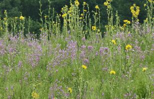
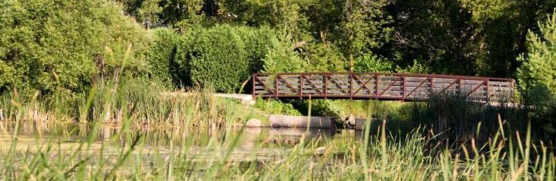
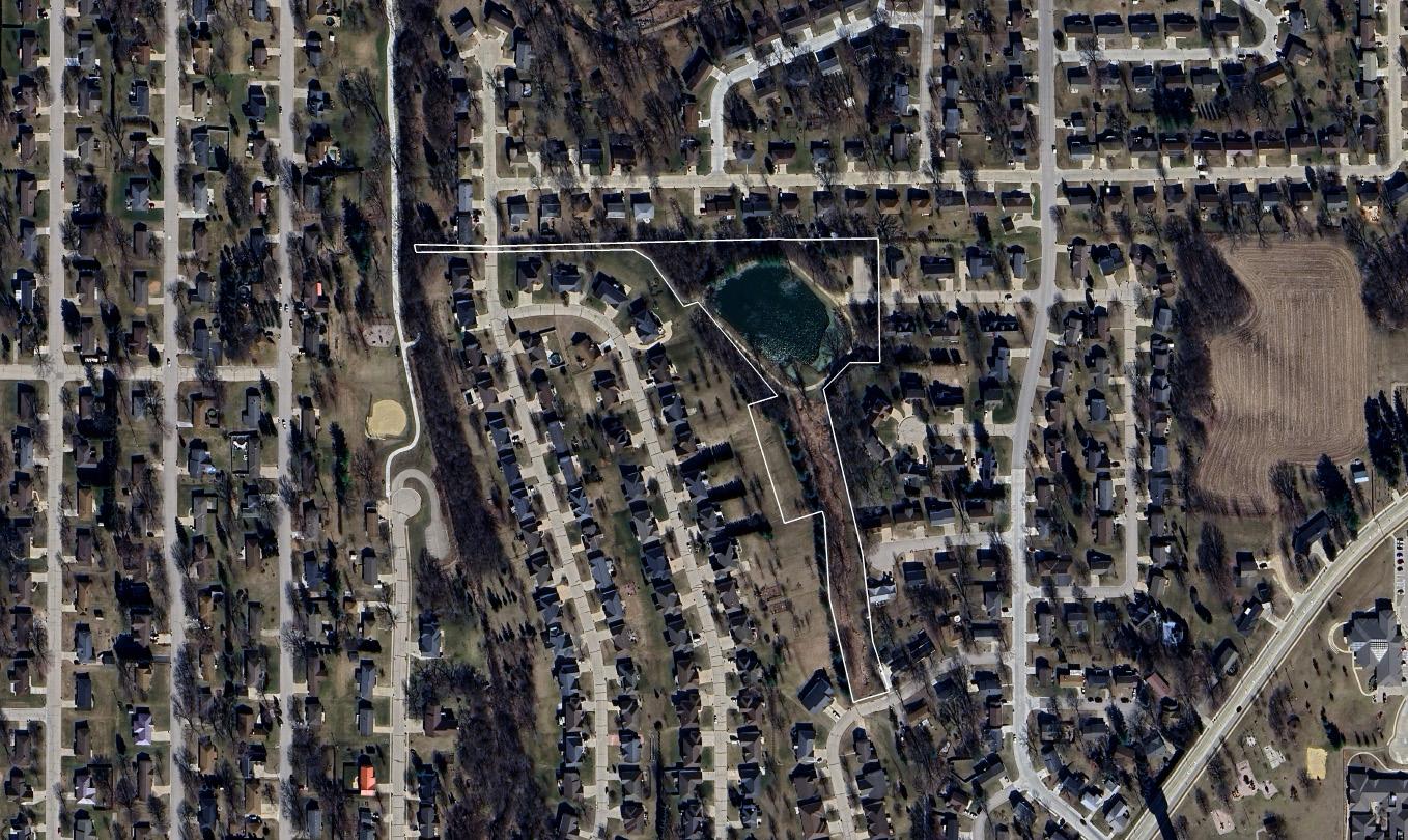
Althaus Wetland and Nature Preserve is located at the end of Wintergreen Drive. The wetland area is home to a large number of native grasses, cattails, butterfly garden and other native birds. The city-wide trail system also connects from Althaus Wetland to Maple Hills Park.
RECOMMENDATIONS
Arrowhead Park
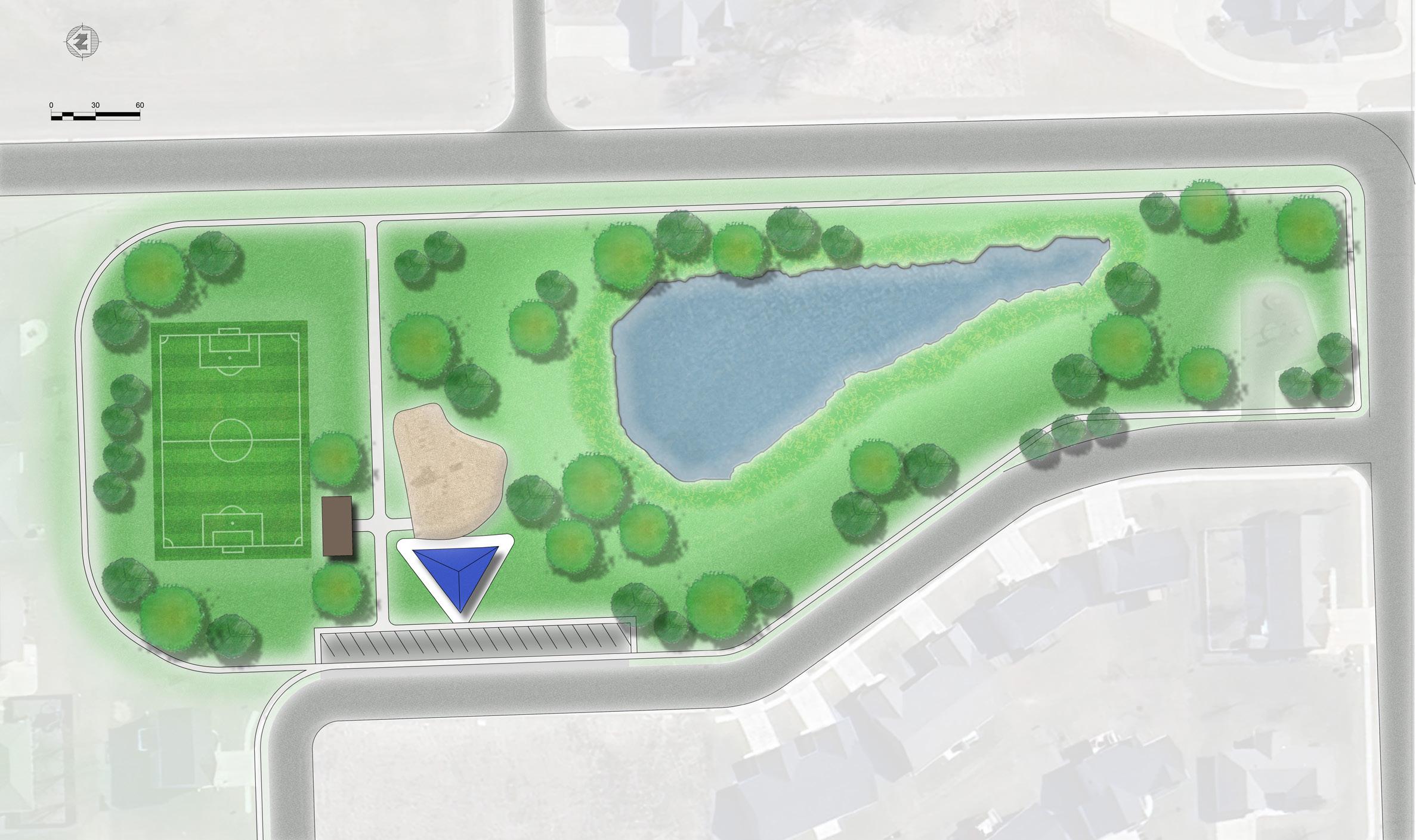
INITIAL RECOMMENDATIONS:
• Add parking and bike racks
• Incorporate a trail loop
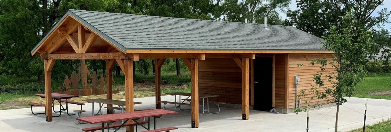
• Add a shelter and/or restrooms
• Add youth soccer
• Add more and uniform lighting
• Add a landscape buffer
• Trail connection to trail system
• Add signage - type to be determined
• Incorporate benches, trash receptacles, and shade trees
PARK INFORMATION:
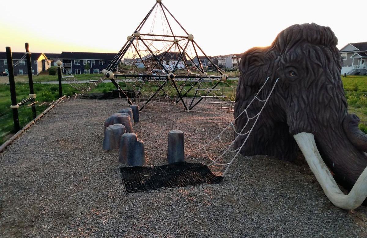
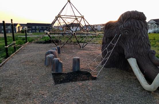
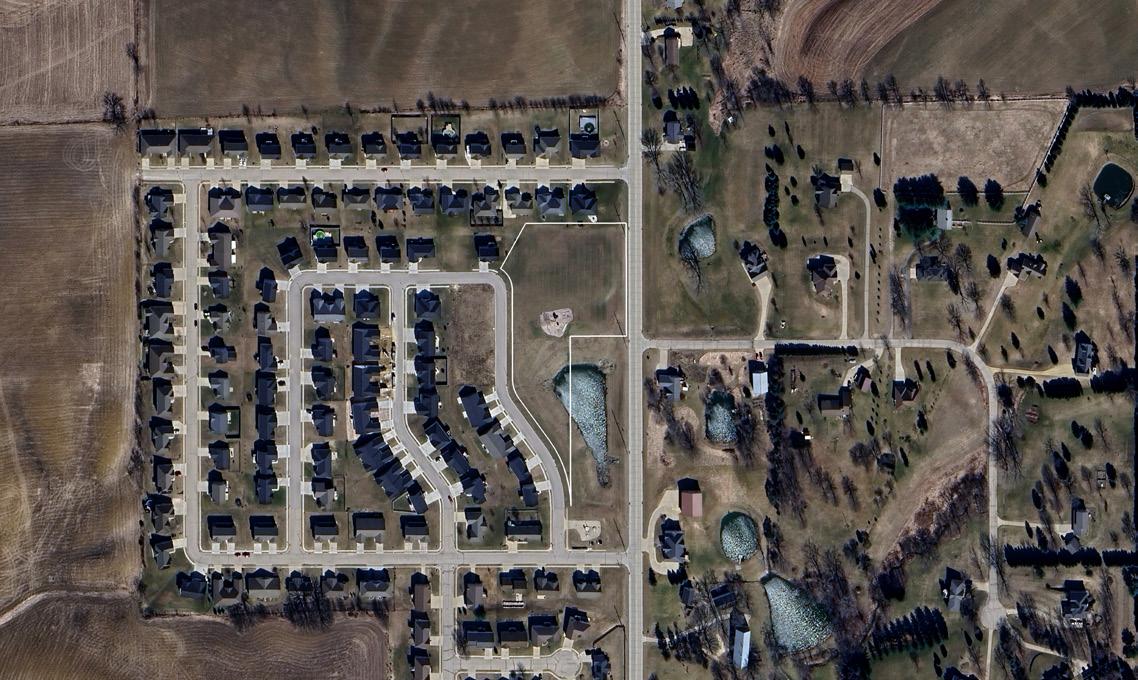
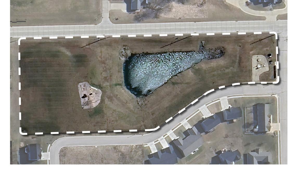
Arrowhead Park is a small neighborhood park that features a unique life-sized woolly mammoth sculpture as its centerpiece, blending nature with a touch of history and imagination. The park is a green space for family and residents to explore the statue and small climbing net structure for middle aged children.
This pocket park seamlessly combines whimsy and education making it a beloved community retreat.
MASTER PLAN
MASTER PLAN
RECOMMENDATIONS
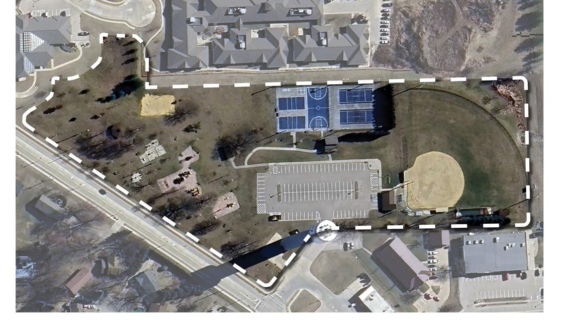
Asbury City Park
INITIAL RECOMMENDATIONS:
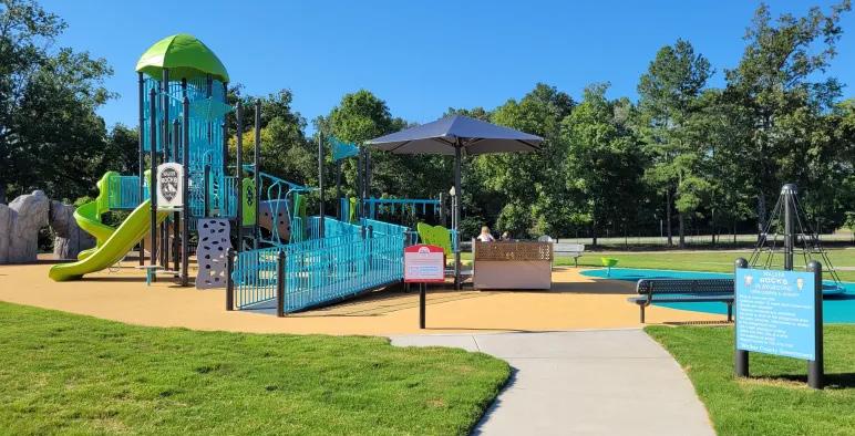
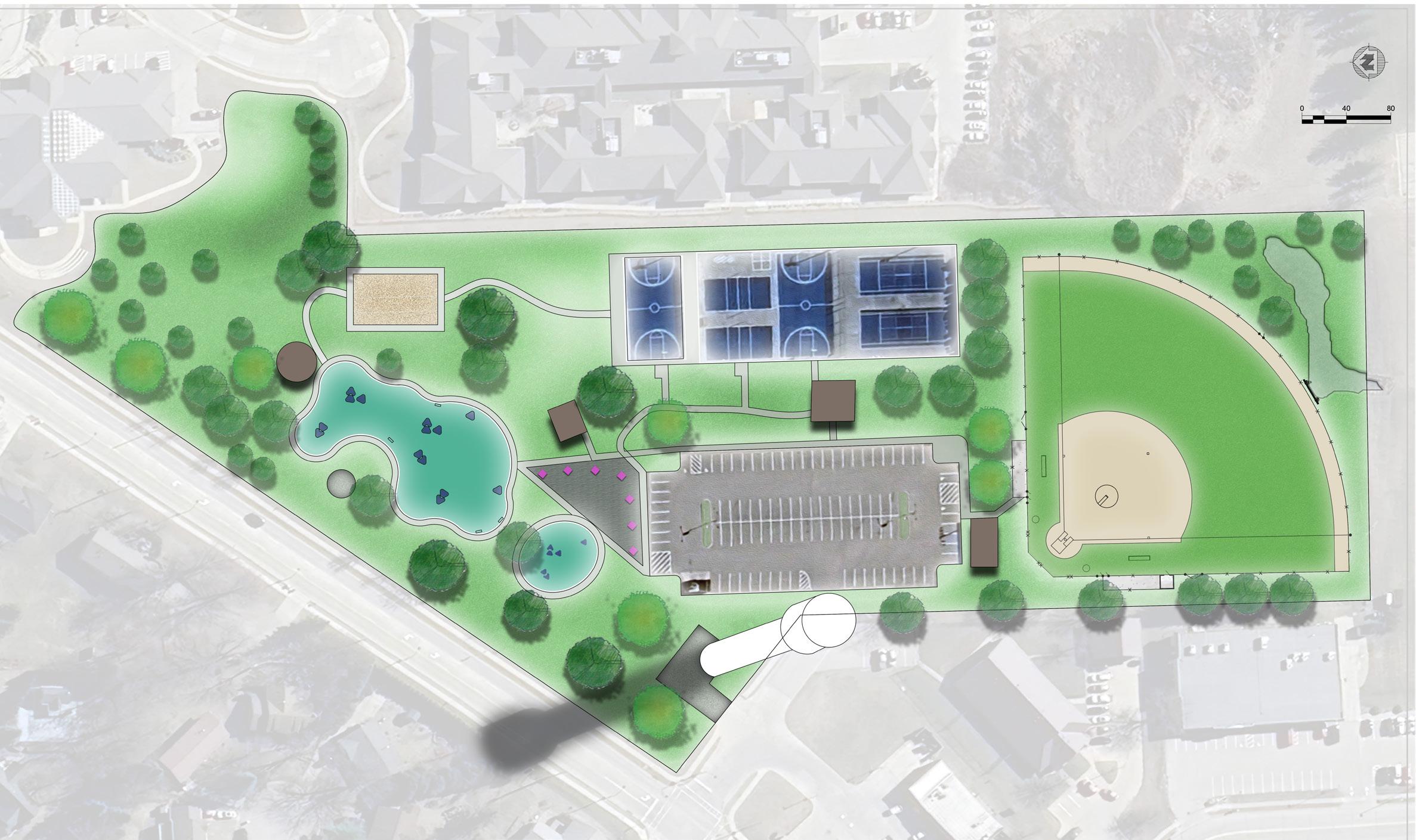
• Incorporate an all-inclusive/ADA Playground
• Utilize poured-in-place rubber surfacing
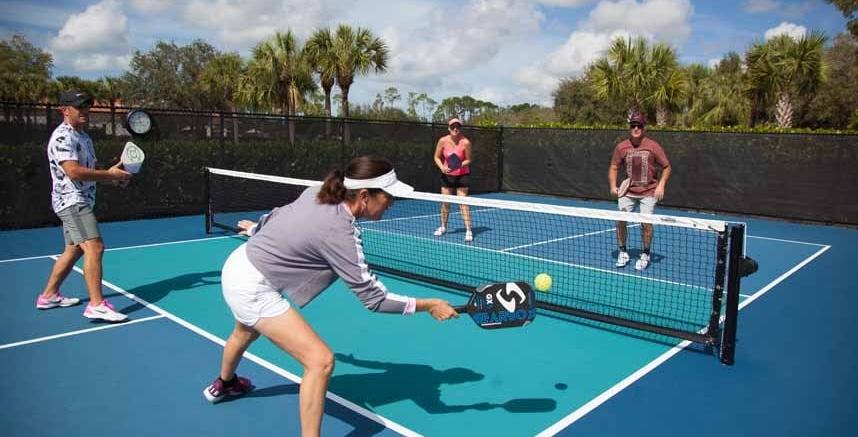
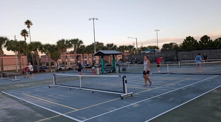
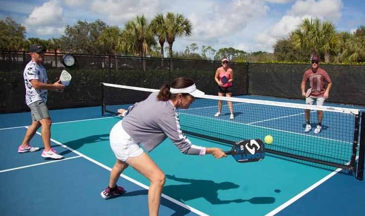
• Re-surface multi-courts with pickleball striping
• Move some exercise equipment to along trails
• Replenish sand volleyball sand
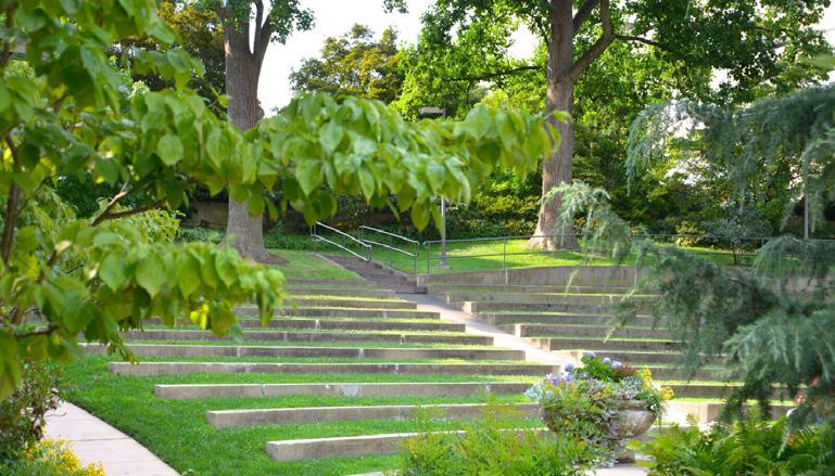
• Add a small amphitheater for events such as Music in the Park
• Develop a bench plan & replacement program
• Integrate more connections and walking paths
• Connect to the trail system
• Highlight and improve sightlines
• Add more sport courts
• Develop a theme
PARK INFORMATION:
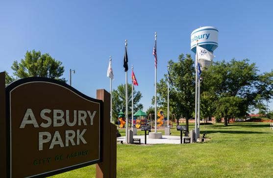
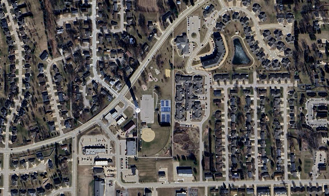
Asbury Park is located on Asbury Road at the intersection of Springreen Drive and Asbury Road. Asbury Park is open to the public from sunrise to sunset, from November 1 of each year to May 1 of the following year. Asbury Park is open to the public from 6 a.m. to 10:30 p.m. from May 1 to October 31 of each year. Asbury Park has a baseball diamond, basketball court, two tennis courts and two hard surface volleyball courts, all of which are lighted. The Park also has swings, slides, tot toys, picnic tables, grills, restrooms, a sand volleyball court and two openair pavilions that are available for rent.
MASTER PLAN
MASTER PLAN
RECOMMENDATIONS
Brook Haven Park
INITIAL RECOMMENDATIONS:
• Add signage - type to be determined (Current shared access may be confusing)
• Add parking
• Add swings and a slide
• Develop the currently unusable portion of the park for trails or disc golf
• Add lighting, benches, trash receptacles, and shade
PARK INFORMATION:
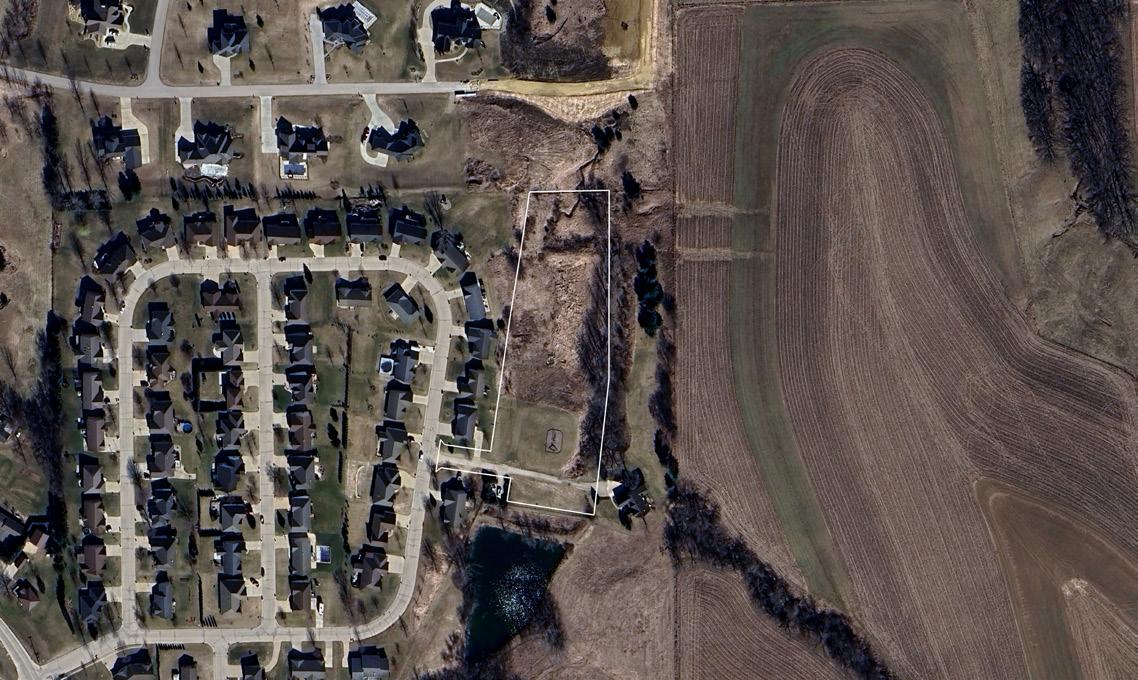
Brook Haven Park is located off Brook Hollow Drive in Brook Haven Subdivision. The small tot lot features swings and slides for small children. It is a small and charming playground perfect for young children and families.
RECOMMENDATIONS
Clay Ridge Park
INITIAL RECOMMENDATIONS:
• Incorporate swings and slides
• Improve runoff and drainage
• Add trees, lighting, benches, trash receptacles
• Add signage - type to be determined
PARK INFORMATION:
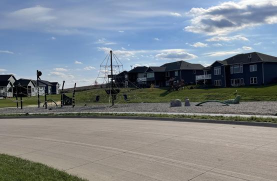
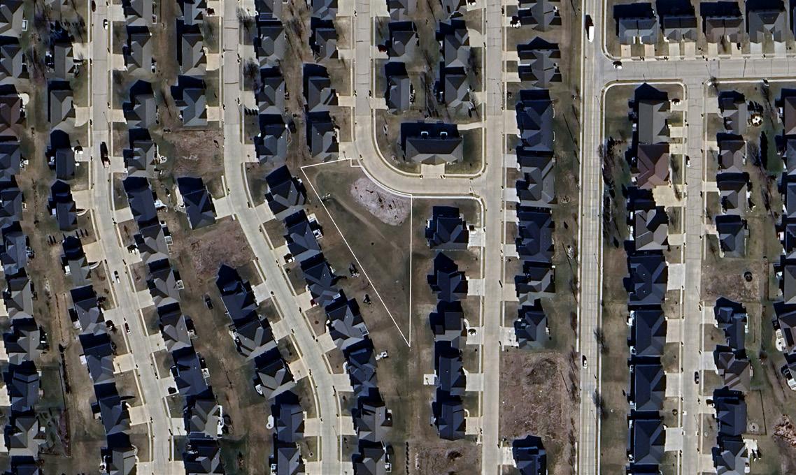
Clay Ridge Park is located off Doe Run Drive. This neighborhood park’s centerpiece is a large rope climbing structure for middle aged children. This small pocket park is perfect families that do not want to travel to the larger Asbury Park.
RECOMMENDATIONS
Cloie Creek Park
INITIAL
RECOMMENDATIONS:
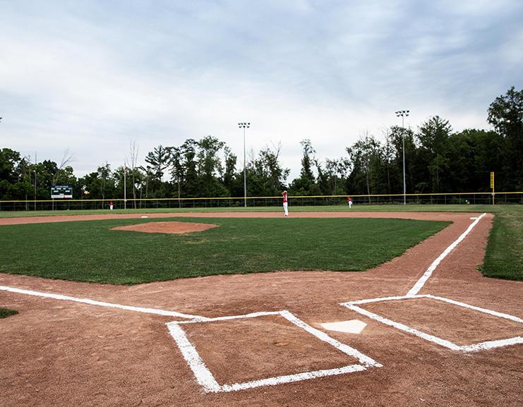
• Expand current offerings with additional courts and/or fields
• Add more sport courts between the existing courts and shelter
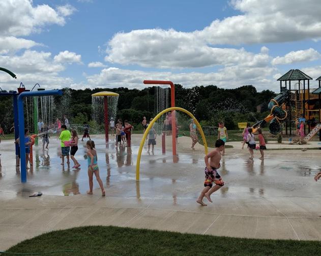
• Expand splash pad offerings
• Add another pavilion
• Add signage - type to be determined
• Mapping/clarification for mountain bike trails
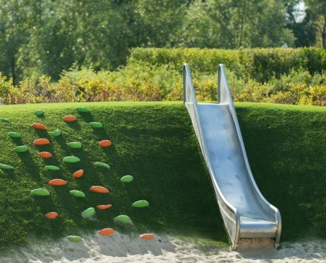
• Create a play mound by the splash pad
• Improved mapping of beginner and advanced mountain bike trails
• Resurface gaga ball
PARK INFORMATION:
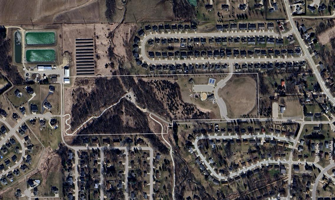
Cloie Creek Park is located off Park Place on Sanibel Lane. Cloie Creek Park amenities include a splash pad, play equipment, mountain bike trail and a spacious pavilion for rent.
The Splash Pad is open from 10 AM - 9 PM daily, Memorial Day to Labor Day each year.
MASTER PLAN
MASTER PLAN
RECOMMENDATIONS
Forest Hills Pond and Trails
INITIAL RECOMMENDATIONS:
• Add enhanced lookouts
• Make the trail around the pond a full loop
• Coordinate west extension of trail to Forest Hills desires - mixed use, soft, or paved
• Maintenance upkeep of trail washout areas
• Have offerings for all ages
• Improve accessibility
PARK INFORMATION:
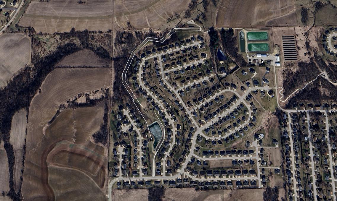
The Forest Hills Trail encircles the Forest Hills Subdivision. The majority of the trail is hard surfaced with a few unpaved portions.
RECOMMENDATIONS
Maple Hills Park
INITIAL RECOMMENDATIONS:
• Remove the tee-ball field
• Promote the park as a trailhead
• Add restrooms
• Replace play equipment with a theme (potentially play off of the stream)
• Incorporate rubber surfacing
• Add lighting along the trail, consider bollards
• Integrate some exercise equipment from Asbury Park along the trail
• Incorporate activities for all ages
• Additional signage, seating, trash receptacles
PARK INFORMATION:
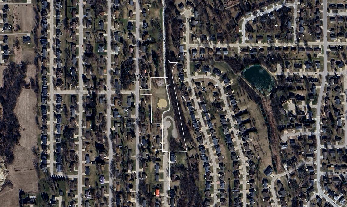
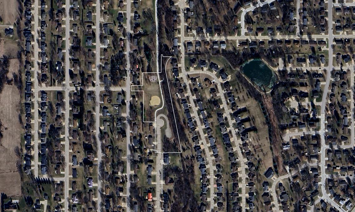
Maple Hills Park is located at the end of Burr Oak Drive and has a softball diamond, updated tot lot and picnic tables.
MASTER PLAN
MASTER PLAN
RECOMMENDATIONS
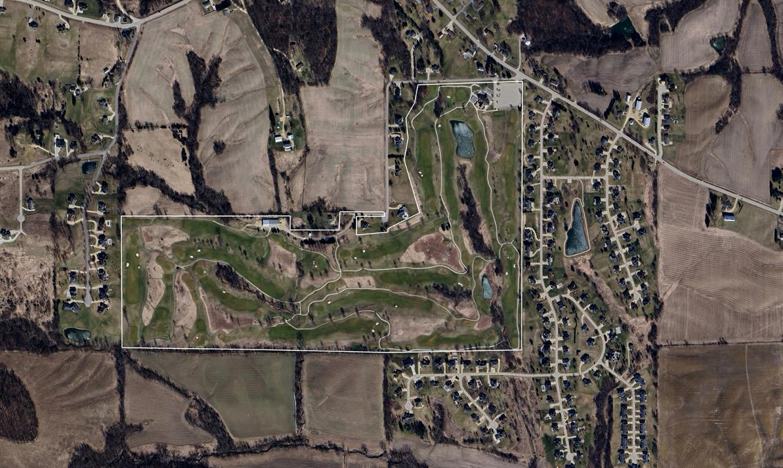
The Meadows Golf Club
INITIAL RECOMMENDATIONS:
• Acquire land elsewhere for a driving range
• Evaluate adding lighting
• Promote the simulator to keep people in Asbury
• Offer winter activities
PARK INFORMATION:
Recreational area with a well-rated golf course, and a clubhouse that hosts events.
RECOMMENDATIONS
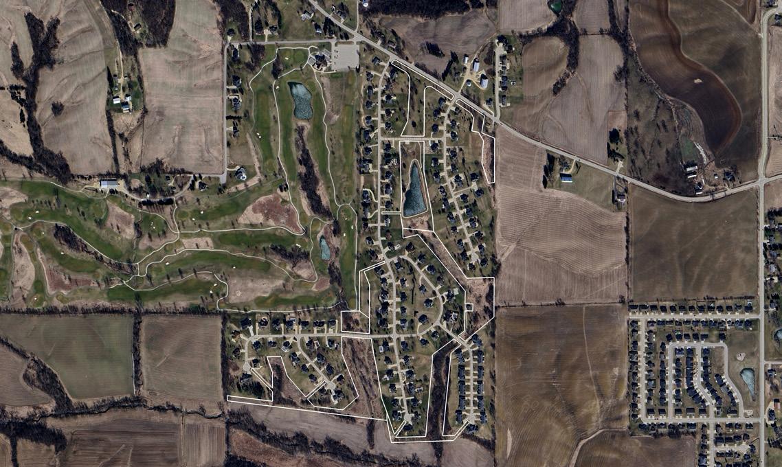
Wedgewood Pond and Trails
INITIAL RECOMMENDATIONS:
• Continuation of DNR fish stocking
• Promote multi-use trails
• Add seating, lighting, trash receptacles
PARK INFORMATION:
Wedgewood Preserve is located in western Asbury. The Preserve is nestled in the Wedgewood neighborhood, but is open for the public to enjoy. Scenic grass trails abound. With an emphasis on the preservation of Iowa’s native species, the Wedgewood Preserve is the perfect place to search for your favorite bird or flower.
RECOMMENDATIONS
Park System “Big Ideas”
The park planning process has generated numerous ideas; however, initial efforts should focus on key priorities. These include improving inclusivity at Asbury City Park, securing additional land to address long-term park needs, identifying sites for new ball fields, partnering with AACRF to expand recreation programming, upgrading sport court amenities to meet evolving demands, and strengthening connectivity through the trail network.
INCLUSIVE PLAY EQUIPMENT
IMPROVED CONNECTIVITY
ACQUIRE LAND FOR PARK DEVELOPMENT
“Big Ideas”
SPORT COURT UPGRADES
ENHANCE RECREATION PROGRAMMING / ACTIVITIES
ADD BALL FIELDS
Park System Priorities
WESTSIDE TRAIL
PURCHASE LAND FOR PARK EXPANSION (ASBURY PARK AND/OR CLOIE CREEK)
CONSTRUCT 1–2 NEW BALLFIELDS
ASBURY PARK ALL-INCLUSIVE PLAYGROUND & ACCESSIBILITY IMPROVEMENTS
RESURFACE HARD COURTS AT ASBURY PARK
ARROWHEAD PARK BUILD-OUT
RECREATION CENTER FEASIBILITY STUDY
MULTI-USE COURT EXPANSION AT CLOIE CREEK
Funding and Other Resources
CAT – COMMUNITY ATTRACTION AND TOURISM PROGRAM (ECIA)
CITY – GENERAL FUND, SPECIAL FUNDS, TIF OR ASSESSMENTS
HC – HIRED CONSULTANT
IACPG – IOWA ARTS COUNCIL PROJECT GRANT
IFMA – IOWA FARMERS MARKET ASSOCIATION
ILRTF – IOWA LIVING ROADWAYS TRUST FUND
KIB – KEEP IOWA BEAUTIFUL COMMUNITY BEAUTIFICATION GRANT PROGRAM
LWCF – LAND AND WATER CONSERVATION FUND
PCRC – PEDESTRIAN CURB RAMP CONSTRUCTION
PIB – PAINT IOWA BEAUTIFUL
REAP – RESOURCE ENHANCEMENT AND PROTECTION CITY PARKS AND OPEN SPACES
TAP – TRANSPORTATION ALTERNATIVE PROGRAM
TFK – TREES FOR KIDS AND TREES FOR TEENS
THF – TONY HAWK FOUNDATION
TIF – TAX INCREMENT FINANCE
TP! – TREES PLEASE! (MIDAMERICAN ENERGY)
TSIP – TRAFFIC SAFETY IMPROVEMENT PROGRAM
VISION
Goals, Objectives, and Policies
OVERVIEW
The City identified a need to reinvigorate its parks and recreation offerings for current and future residents. Public parks are a unique amenity because they have the potential to be accessible to anyone in the community, regardless of age, gender, ability, socioeconomic status, race or ethnicity. Though we often find that disparities exist in the distribution and quality of parks and recreation amenities, many Parks and Recreation Departments across the U.S. are now rethinking how to engage and provide benefits to residents who do not currently have access to parks. If parks can be more inclusive, they have the potential to function as a nucleus of neighborhood activity, where residents can gather for social events, recreational activities, and meetings about local issues, increasing social interaction and creating an overall sense of community.
PLAN OBJECTIVE
Develop a comprehensive, usable, living document which outlines the current assets and improvements of the park system. This plan was created with the objective of analyzing the existing conditions of the parks to better develop an equitable and usable concept for the new park area for visitors and current and future residents. The recommendations of this plan are divided into two major sections:
(1) existing park facilities
(2) new or expanded park facilities
ASBURY PARK AND RECREATION VISION
The City of Asbury will offer activities and programs for citizens of all ages and abilities, while diversifying recreation amenities and improving those that already exist to meet growing needs of the community.
Overall Project Objectives
• Develop a new Parks Plan, utilizing current plans where appropriate to develop a consistent guide for the future;
• Create goals and objectives that are supported by information in existing documents, new plans and studies, data analysis, public input, best practices, and/or successful application in other jurisdictions;
• Identify existing conditions that need to be revised or updated to be consistent with community plans, and propose revisions, as necessary;
• Coordinate and support a public participation process for the Park Planning process that includes a variety of engagement activities.
PARKS AND RECREATION BOARD OBJECTIVES AND INPUT
• Have a plan in place to assist in grant funding opportunities
• Develop a polished and professional planning document to guide future decisions
• Prioritize improvements and inventory existing conditions and amenities
• Create a catalogue of projects for the parks and recreation board, eagle scouts, etc to accomplish
• Highlight and build upon existing parks, pocket parks, recreation areas, and trails
• Determine the lifespan of existing equipment and amenities
• Connect all areas of Asbury
• Preserve and protect green space
• Identify locations for future amenities, courts, fields such as pickleball, softball, etc.
• Create master plans for orderly development of key parks
• Determine updates and vision for future and summer recreation
• Improve accessibility to and within parks
• Make ADA updates and incorporate universal design within parks
• Consider activities and programs for all ages and abilities
SWOT Analysis
STRENGTHS
OPPORTUNITIES
SWOT Analysis
WEAKNESSES
THREATS
SWOT Analysis - Beautification
Summary of comments relating to BEAUTIFICATION
Strengths / Opportunities Weaknesses / Threats
• Days of Caring
• Nice new equipment at Cloie Creek Park
• Good existing landscaping
• Trails are well maintained
• Wedgewood pond has improved
• Outdated equipment at Asbury City Park
• Lack of space for more parks
• Signs could be in better locations directing people to parks and parking areas
• Some parks need more amenities
• Theme or identity for each park
• More seating
• Improved maintenance of ponds
• Clean slate for park planning
• Improved signage
• Lack of connectivity in some locations
• Not ADA accessible
• Lack of funding
SWOT Analysis - Recreation
Summary of comments relating to RECREATION
Strengths / Opportunities Weaknesses / Threats
• Golf Course junior program - fills up quickly
• Youth baseball is popular
• Painting, dance classes, etc.
• Fall winery tour
• Lack of programming
• Lack of someone to plan and organize recreational programs
• No community center
• Opportunity to expand, leverage, and further advertise the golf junior program
• Look into finding someone to organize events and programs
• More fields needed - currently do not have girl’s softball
• More winter programs
• Currently not offering summer programming
• Need space for baseball, softball, soccer, etc.
• Need more activities for all ages
SWOT Analysis - Mobility
Summary of comments relating to MOBILITY
Strengths / Opportunities
• Well maintained trails
• A lot of trails for the size of the community
• Connectivity is generally good
• Vision of the previous plan remains the same
Weaknesses / Threats
• Lack of trees/shade
• Not as inclusive or ADA compliant is it could be
• Some places have stairs onlyneed ramps
• Opportunity for pedestrian crossing with flashing beacon
• Offerings alongside the trailstrash receptacles, dog waste stations, seating, bike fix-it station
• Workout equipment along trails as a circuit
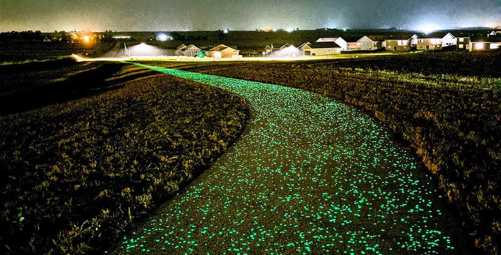
• Solar lighting or glow trail
• Lack of funding
• Some crossings are not as safe as they could be
Community Input Survey
A community survey was created and available to community members. The survey was administered through ESRI’s Survey123, which was formatted to allow users to complete via computer, tablet or smartphone. Participants were invited to respond by visiting a link found on the project website and through other communication and marketing tools the city manages including social media and email. A summary of the results can be found on the following pages.

Community Input Survey Results
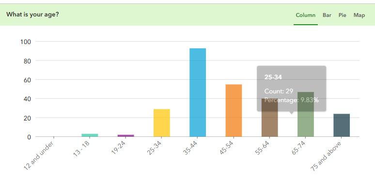
What is your age?
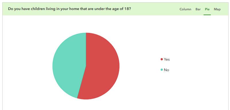
Do you have children living in your home that are under the age of 18?
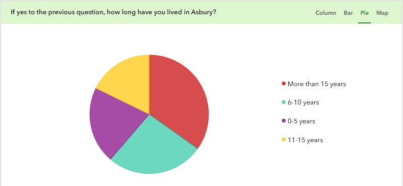
How long have you lived in Asbury?
Community Input Survey Results
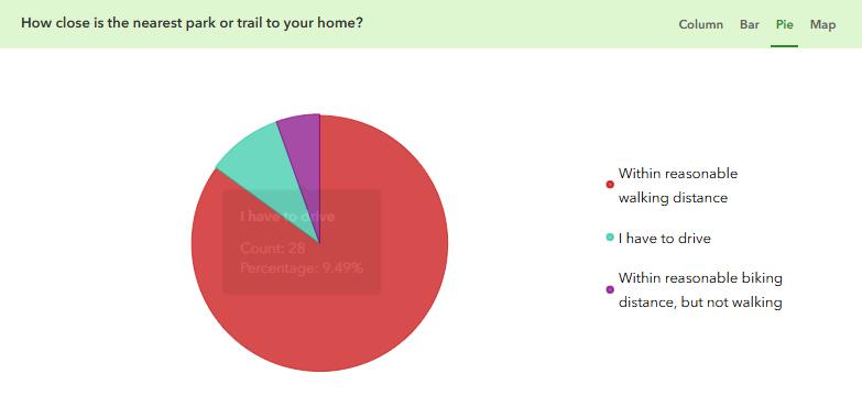
How close is the nearest park or trail to your home?
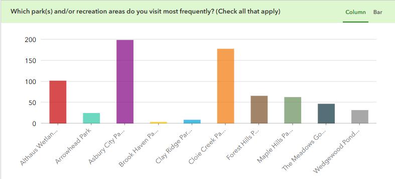
What is your favorite park and recreation area to visit in the City?
Community Input Survey Results
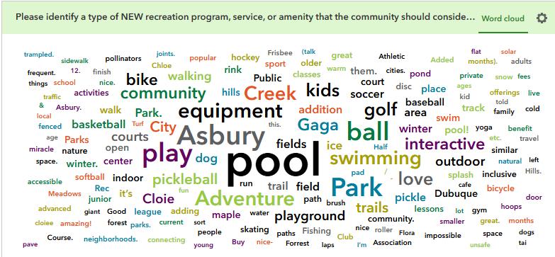
Please identify a type of NEW recreation program or service that the community should consider offering.
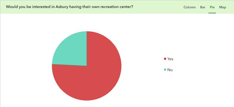
Would you be interested in Asbury having their own recreation center?
Survey Summary
Age Distribution
The largest group of respondents were aged 35-44, making up 31.44%, followed by 45-54 and 65-74 age groups.
Households with Children
Over half of the respondents have children under 18, predominantly aged 6-12 years, with significant representation of younger and older children.
Community Residency
Most respondents (96.66%) live in Asbury, with 34.45% having lived there for more than 15 years, indicating strong community ties.
Park Accessibility
Over 84% of residents live within walking distance to a park or trail, showing strong accessibility.
Popular Parks Visited
Asbury City Park and Cloie Creek Park are the most visited parks, attracting over 60% of respondents.
Preferred Amenities
Trails, splash pads, and playground equipment are highly favored for outdoor and familyfriendly activities.
Walking and Running Popularity
Walking and running are the most common exercises, with over half exercising three or more times weekly.
Lower Biking Participation
Biking for exercise is less common, with nearly 40% not biking in the past year.
Limited Swimming Activity
Over half of respondents did not swim for exercise in the past year, indicating limited participation.
Exercise Accessibility Insights
Promoting accessibility for biking and swimming could increase broader exercise participation.
Survey Summary (Continued)
Popular Recreation Activities
Walking is the most favored activity with 74.92% participation, followed by playground and splash pad use.
Program Satisfaction Levels
45.15% of residents feel current recreation programs meet their needs, while others are unsure or dissatisfied.
Desired New Facilities
Residents desire new facilities such as a swimming pool, indoor recreation center, expanded trails, and additional pickleball courts.
Enhancing Engagement
Improving program variety and facilities can boost community engagement and satisfaction across age groups.
Suggestions & Priorities
Recreation Center Demand
A majority of residents (72.24%) want a dedicated recreation center to enhance local amenities and activities.
Preference for Nearby Parks
Over half (51.84%) prefer walking to neighborhood parks rather than driving to larger parks, emphasizing local accessibility.
Park Improvement Suggestions
Suggestions include connecting trails, upgrading playgrounds, adding shade, and improving accessibility features for all ages.
Amenities and Natural Spaces
Residents value maintaining natural spaces while expanding amenities that support health, safety, and community connection
Project Website
A project website was developed and included the project survey, master planning process, project components, project materials and more. The website also provided a venue to stay informed throughout the planning process, and provided an easy way for citizens to view project materials. This aspect of the communication and participation strategy was important for transparency, as well as sharing information with community members.

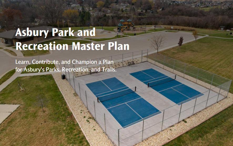

Desktop/Tablet Platform Mobile Platform
Crowdsource Map
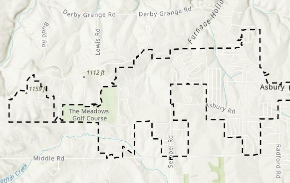
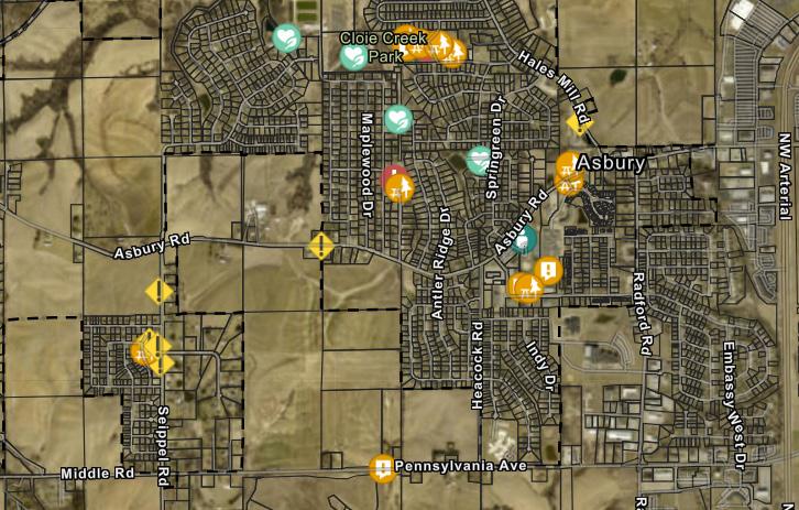
The crowdsource map was a tool created for community members to indicate park locations and features within or around the City of Asbury that they like, would like to see more of, believe would be a good area for new parks, would like to change, or see as a threat/danger to the community.
Crowdsource Map Feedback
Summary of Comments:
- Purchase for Community Recreation Facility with indoor Courts, Pickelball, workout rooms, etc.
- Consider walking paths for better “access” to parks and amenities
- Consider purchasing land for another baseball/softball field
- Consider inclusive playground
- Would love to see an indoor recreation center with food court, volleyball, basketball, pickleball courts. Additionally we could benefit from having our own pool like Thunder Hills
- There is not enough lighting between Asbury Rd & Springreen
- Drinking Fountain Water Bottle Fillers
- Ball Fields too small, not enough parking, lacking water fountains or restrooms
- Should consider working with Dubuque to get a path along Asbury Road from Antler Ridge (or Trail) to Clover Lane (Meadows)
- Work with Dubuque/County to connect trail systems
- Add a trail connecting Forest Hills to Park & extend to Middle Rd
- Add a few parking spots, water fountain, & small pavilion at Arrowhead
- There should be sidewalks on Seippel
- Leave some open green spaces for soccer
- Great play equipment and walking trails
- Improve Signage & Access to Bike Course

- Add some artificial “turf” areas around splash pad to help with drainage, eliminate muddy mess, and provide areas for folks to sit/lay down along splash pad
- A dog park would be great. Only dog park is Dubuque and that one is not great
- Please build ball fields. This is a community with many baseball / softball players
- Please provide more seating areas to those that come to enjoy the splash pad
- 2 ball fields as the other facilities are not adequate
- Use extra green space at Cloie Creek Park
Pop-Up Event
Pop-Up Event Feedback
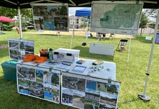
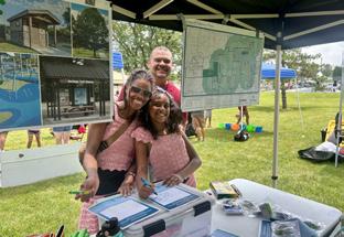
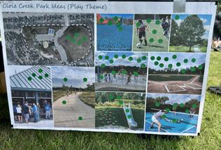
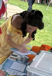
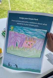
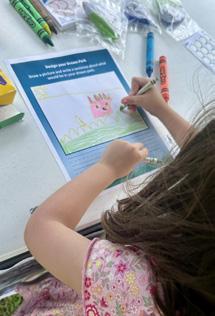
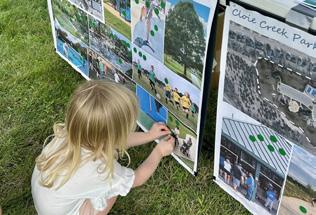
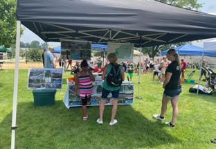
A pop-up event was held at Asbury’s Music in the Park festival on July 12th. Residents and visitors had the opportunity to become engaged in the process by providing feedback and engaging in interactive activities. Participants could add a “green dot” to the images they preferred, or a red dot on those they disliked. There was a great deal of positive feedback and ideas shared throughout the event. In general, participants were in favor of more inclusive play equipment, water-related activities, baseball, and soccer.
Potentially Under-served Areas


Community Park Desires
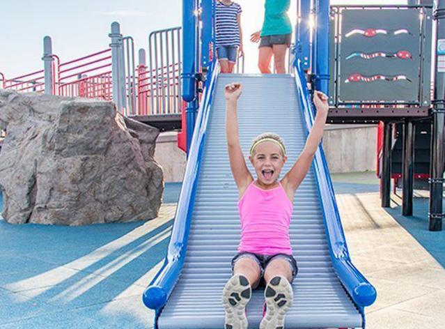
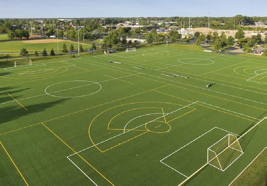
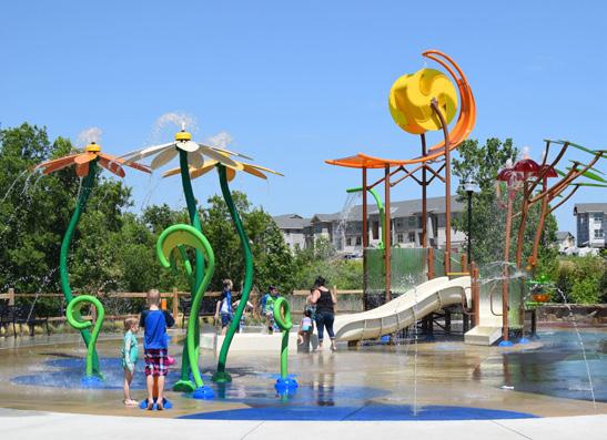
Multiple public engagement efforts were used to determine the following desired future amenities. The public had opportunities to respond both in person and online through the community survey and share what they would like to see be brought into Asbury Parks and Recreation. INCLUSIVE PLAYGROUND
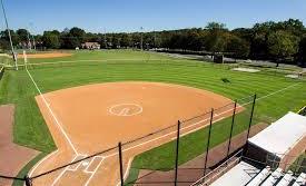
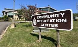
RECREATION CENTER
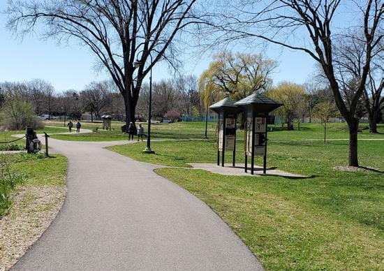
MULTI-USE TRAILS
Parks & Recreation Goals
The purpose of this plan is to guide development of subsequent parks, recreation, open spaces, and bicycle and pedestrian facilities in the City. Goals are presented here as desired outcomes. Strategies include both actions and policy rules—they are the methods proposed to achieve the stated goals.
Have safe access to quality park and recreation facilities and programming regardless of income, age, race, ability, or geographic location.
Parks and open spaces will be designed to be as aesthetically pleasing as possible. 1 2 3 4 5 6 7 8
Provide additional park land and amenities to meet current and future recreation needs.
Develop, improve, and operate the City’s parks and recreation programs in a cost effective manner.
Coordinate park development efforts with other City departments, other units of government, the School District, and sporting organizations.
Provide residents with safe and reliable recreation equipment throughout the City park system.
Provide a seamless network of trails that provide safe and comfortable access.
Provide adequate management and staffing levels to oversee the maintenance of park and open space lands and facilities.
RECOMMENDATIONS
RECOMMENDATIONS
Proposed recommendations are a key component of the Park and Open Space Master Plan. Based on all of the research, analysis, visioning, evaluation and community input that was completed, recommendations have been formulated that provide direction for implementation.

Enhance Park Accessibility

To ensure that all community members have easy access to local parks and recreational areas.
Encourage a culture of creativity and innovation within the parks.
Improve the physical and mental well-being of community members.
Protect and beautify the natural spaces within the community.
Instill a sense of pride and belonging among community members.
Enhance Park Accessibility
To ensure that all community members have easy access to local parks and recreational areas.
Ensuring that parks are accessible to all members of the community is crucial for promoting inclusivity, physical activity, and social interaction. Here are several strategies to improve park accessibility:
1. Physical Accessibility
Pathways and Trails: Design wide, smooth, and well-maintained pathways that accommodate wheelchairs, strollers, and individuals with mobility impairments. Incorporate ramps and avoid steep inclines to ensure ease of movement.
Accessible Play Areas: Install play equipment that is accessible to children of all abilities. This includes sensory play elements, wheelchair-accessible swings, and ground-level play structures.
Restrooms and Facilities: Ensure that restrooms and other facilities are accessible, with features such as grab bars, lowered sinks, and wide doorways. Provide family restrooms to accommodate caregivers and individuals with special needs.
2. Sensory Accessibility
Quiet Zones: Create quiet areas within the park for individuals who may be sensitive to noise. These zones can include shaded seating areas and gardens.
Sensory-Friendly Play Equipment: Incorporate play equipment that caters to various sensory needs, such as tactile surfaces, musical elements, and visually stimulating features.
Clear Signage: Use clear, easy-to-read signage with visual aids to help individuals with cognitive or visual impairments navigate the park.
3. Social and Cultural Accessibility
Inclusive Programming: Offer programs and activities that cater to diverse groups, including seniors, individuals with disabilities, and non-English speakers. This can include adaptive sports, cultural festivals, and language-specific events.
Community Engagement: Involve community members in the planning and development of park facilities to ensure that their needs and preferences are met. Conduct surveys and hold public meetings to gather input.
Educational Opportunities: Provide educational programs that promote understanding and appreciation of different cultures and abilities. This can include workshops, interpretive signs, and guided tours.
Foster Park Innovation
Encourage a culture of creativity and innovation within the parks.
Innovative approaches to park design and management can significantly enhance the user experience, promote sustainability, and foster community engagement. Here are several strategies to drive park innovation:
1. Community-Centric Design
Inclusive Spaces: Design parks to be inclusive and accessible to all, with features such as sensory gardens, wheelchair-accessible trails, and play equipment for children of all abilities. Inclusive design fosters a sense of belonging and ensures that everyone can enjoy the park.
Flexible Use Areas: Create multi-use spaces that can adapt to various activities and events. For example, open fields can be used for sports, festivals, and community gatherings, maximizing the utility of the park.
2. Smart Technology Integration
Interactive Features: Incorporate smart technology such as interactive kiosks, mobile apps, and augmented reality experiences. These tools can provide visitors with information about park amenities, historical facts, and educational content, making their visit more engaging and informative.
Wi-Fi and Connectivity: Ensure parks are equipped with Wi-Fi to support the use of digital tools and assistive devices. Connectivity can also facilitate virtual tours and remote access to park features for those unable to visit in person.
3. Sustainable Practices
Green Infrastructure: Implement sustainable design elements such as rain gardens, permeable pavements, and solar-powered lighting. These features not only reduce environmental impact but also educate visitors about eco-friendly practices.
Energy Efficiency: Utilize energy-efficient technologies in park facilities, including LED lighting, solar panels, and energy-efficient HVAC systems. This reduces operational costs and promotes environmental stewardship.
4. Innovative Programming
Pop-Up Events: Host pop-up events such as outdoor yoga classes, farmers’ markets, and art installations. These temporary activities can attract diverse groups and keep the park dynamic and exciting.
Educational Workshops: Offer workshops on topics like gardening, wildlife conservation, and sustainable living. These programs can engage the community and promote lifelong learning.
Promote Health and Wellness
Improve the physical and mental well-being of community members.
Parks play a crucial role in enhancing the health and wellness of communities by providing spaces for physical activity, relaxation, and social interaction. Here are several strategies to maximize these benefits:
1. Promoting Physical Activity
Exercise Facilities: Install outdoor fitness equipment, such as pull-up bars, balance beams, and stationary bikes, to encourage exercise. Designate areas for group fitness classes like yoga, tai chi, and aerobics.
Walking and Biking Trails: Develop well-maintained trails for walking, jogging, and biking. Ensure these paths are accessible and connect to other community amenities to promote regular use.
Sports Fields and Courts: Provide spaces for sports such as soccer, basketball, tennis, and volleyball. Organize community leagues and tournaments to foster participation and camaraderie.
2. Enhancing Mental Well-being
Green Spaces: Create serene environments with lush greenery, gardens, and water features. These areas can serve as peaceful retreats for relaxation and stress relief.
Quiet Zones: Designate quiet areas within the park for meditation and reflection. These zones can include shaded seating, sensory gardens, and calming landscapes.
Art and Cultural Installations: Incorporate art installations, sculptures, and cultural exhibits to stimulate creativity and provide aesthetic enjoyment.
3. Encouraging Social Interaction
Community Events: Host regular events such as farmers’ markets, outdoor concerts, and festivals. These activities can bring people together and strengthen community bonds.
Picnic Areas: Provide sheltered picnic spots with tables and benches to encourage family outings and social gatherings.
4. Supporting Environmental Health
Sustainable Practices: Implement eco-friendly practices such as rain gardens, native plantings, and solarpowered amenities. Educate visitors about environmental stewardship through workshops and interpretive signs.
Wildlife Habitats: Preserve and create habitats to support local wildlife, promoting biodiversity and ecological balance.
5. Accessibility and Inclusivity
Accessible Design: Ensure all areas of the park are accessible to people of all abilities, with ramps, wide pathways, and accessible restrooms. Provide assistive technology and clear signage to aid navigation.
Inclusive Programming: Offer programs and activities that cater to diverse groups, including seniors, individuals with disabilities, and non-English speakers.
Preserve and Enhance Natural Spaces
Protect and beautify the natural spaces within the community.
Preserving green spaces and parks is essential for maintaining the environmental health, aesthetic beauty, and overall well-being of communities. Here are several strategies to ensure these valuable areas are protected and enhanced:
1. Environmental Benefits
Biodiversity: Green spaces provide habitats for various plant and animal species, promoting biodiversity and ecological balance. Preserving these areas helps protect native flora and fauna, ensuring a healthy ecosystem. Air Quality: Parks and green spaces act as natural air filters, absorbing pollutants and producing oxygen. This contributes to improved air quality, which is vital for the health of residents.
Climate Regulation: Trees and vegetation in parks help regulate the local climate by providing shade, reducing heat islands, and absorbing carbon dioxide. This mitigates the effects of climate change and creates a more comfortable environment.
2. Social and Health Benefits
Physical Activity: Parks offer spaces for exercise and recreation, encouraging physical activity and promoting a healthy lifestyle. Walking trails, sports fields, and playgrounds provide opportunities for all age groups to stay active.
Mental Well-being: Green spaces provide a tranquil environment for relaxation and stress relief. Spending time in nature has been shown to improve mental health, reduce anxiety, and enhance overall well-being. Community Interaction: Parks serve as gathering places for social interaction and community events. They foster a sense of belonging and strengthen community bonds through shared experiences and activities.
3. Aesthetic and Cultural Value
Natural Beauty: Preserving green spaces enhances the aesthetic appeal of urban areas, creating visually pleasing landscapes that residents and visitors can enjoy. Well-maintained parks contribute to the overall attractiveness of a community.
Cultural Heritage: Many parks have historical and cultural significance, serving as landmarks and preserving the heritage of a community. Protecting these areas ensures that future generations can appreciate and learn from the past.
4. Sustainable Development
Urban Planning: Integrating green spaces into urban planning ensures that development is balanced with environmental preservation. This includes creating new parks, expanding existing ones, and protecting natural areas from encroachment.
Community Involvement: Engaging residents in the preservation and maintenance of parks fosters a sense of ownership and responsibility. Volunteer programs, educational workshops, and community events can promote active participation in conservation efforts.
Enhance Community Pride
Instill a sense of pride and belonging among community members.
Parks are more than just recreational spaces; they are vital components of a community's identity and pride. Here are several strategies to promote community pride through parks:
1. Celebrating Local Heritage
Historical Landmarks: Incorporate historical landmarks and monuments within parks to celebrate the community's heritage. Informative plaques and guided tours can educate visitors about the area's history and instill a sense of pride in local achievements.
Cultural Events: Host cultural festivals, art exhibitions, and performances that reflect the community's diverse heritage. These events can bring residents together to celebrate their shared identity and traditions.
2. Enhancing Aesthetic Appeal
Beautification Projects: Engage the community in beautification projects such as planting trees, flowers, and maintaining gardens. These efforts can transform parks into visually stunning spaces that residents take pride in.
Public Art: Install public art created by local artists, including murals, sculptures, and installations. Art can serve as a powerful expression of community values and creativity, enhancing the park's appeal.
3. Fostering Community Engagement
Volunteer Programs: Encourage residents to participate in volunteer programs for park maintenance and improvement. Involvement in these activities fosters a sense of ownership and pride in the community's shared spaces.
Community Workshops: Offer workshops and classes on topics such as gardening, conservation, and outdoor skills. These programs can empower residents with knowledge and skills, promoting a sense of pride in their contributions to the park.
4. Promoting Inclusivity
Inclusive Design: Ensure parks are designed to be accessible and welcoming to all members of the community, including individuals with disabilities, seniors, and families. Inclusive spaces foster a sense of belonging and pride in a community that values diversity.
Family-Friendly Amenities: Provide amenities such as playgrounds, picnic areas, and sports facilities that cater to families. These features encourage residents to spend time together in the park, strengthening community bonds.
5. Highlighting Environmental Stewardship
Sustainable Practices: Implement eco-friendly practices such as recycling programs, rain gardens, and solarpowered lighting. Educating residents about these initiatives can promote pride in the community's commitment to sustainability.
Wildlife Conservation: Preserve natural habitats and promote wildlife conservation efforts within parks. Residents can take pride in their role in protecting the environment and supporting local biodiversity.
https://ambientglowtechnology.com/blogs/projects/nathans-miles-glow-trail
https://www.urbandale.org/Facilities/Facility/Details/Barrett-Boesen-Park-Shelter-96
https://www.homedepot.com/p/Shumard-Oak-Deciduous-Shade-Tree-OAKSHU05G/315948271#overlay
https://volleyballbeachozark.com/beach-volleyball/do-you-need-shoes-for-sand-volleyball/

https://www.tri-cityherald.com/news/local/article279836654.html
https://volleyballbeachozark.com/beach-volleyball/do-you-need-shoes-for-sand-volleyball/ https://www.ussportscamps.com/tips/pickleball/what-is-pickleball
Arrowhead Park | Master Plan (Glow Theme)
Pawnee Lane
Asbury City Park Ideas (Inclusive Theme)
https://walkercountyga.gov/2024/07/23/new-inclusive-playground-opens-in-walkercounty/
https://walkercountyga.gov/2024/07/23/new-inclusive-playground-opens-in-walkercounty/
https://www.american.edu/finance/facilities/landscape-features.cfm
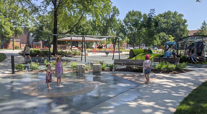
https://www.opkansas.org/recreation-fun/parks-trails/parks/splash-pads/


https://www.homedepot.com/p/Shumard-Oak-Deciduous-Shade-Tree-OAKSHU05G/315948271#overlay
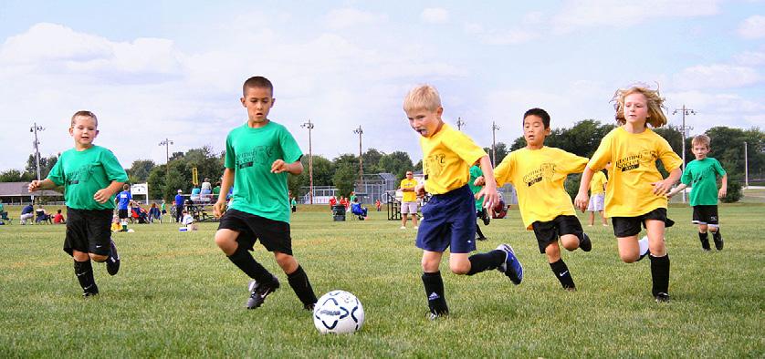
https://cincinnatisoccertalk.com/2016/03/15/fc-cincinnati-gives-back-youth-soccer/
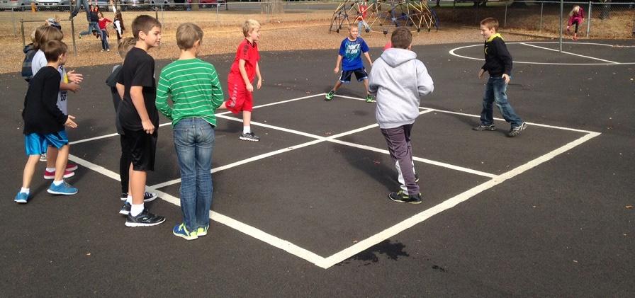
https://greatcampgames.ca/ball-games/four-square/
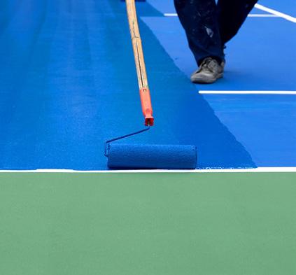
https://www.prosportsurfaces.co.uk/tennis-courts/tennis-court-recolouring/
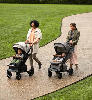
https://www.satarahome.com/blogs/satara-blog/wagons-strollers-and-carseats-oh-my-5-baby-brands-to-know
Asbury City Park | Master Plan (Inclusive Theme)
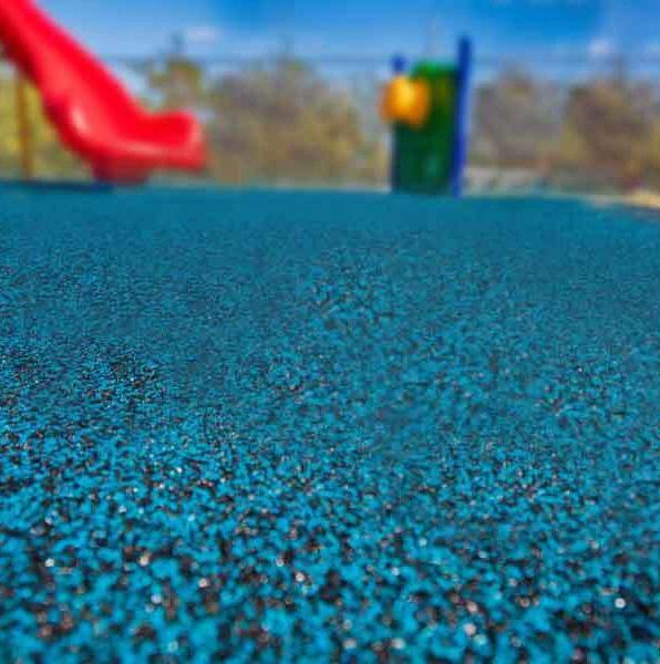
Explore possibility of purchasing
Cloie Creek Park Ideas (Play Theme)
https://willygoat.com/products/pour-in-place-playground-surfacing-fully-installed
https://newcanaanite.com/youth-soccer-roundup-u9-and-u13-girls-red-teams-notchweekend-wins-27734
https://www.homedepot.com/p/Shumard-Oak-Deciduous-Shade-Tree-OAKSHU05G/315948271#overlay
https://www.pinterest.com/pin/778982066766311679/ https://www.bikedenton.org/news/update-trail-funding-mingo-road-and-loop-288-sidewalks
https://ideal-turf.com/commercial/playgrounds-schools-daycares/ https://www.google.com/maps/contrib/108209910767699989851/photos/@42.5202851,-90.763124,3a,75y,90t/ data=!3m7!1e2!3m5!1sAF1QipPlT8fITgZTMYNj7UMWizYJdmgZOTzlQowm2If-!2e10!6shttps:%2F%2Flh3.googleusercontent.com%2Fp%2FAF1QipPlT8fITgZTMYNj7UMWizYJdmgZOTzlQowm2If-%3Dw365-h273-k-no!7i2016!8i1512!4m3!8m2!3m1!1e1!5m1!1e3?entry=ttu&g_ep=EgoyMDI1MDYyMy4yIKXMDSoASAFQAw%3D%3D
https://www.dickssportinggoods.com/protips/sports-and-activities/baseball/field-maintenance-tips-how-to-drag-a-baseball-and-softballinfield
https://volleyballbeachozark.com/beach-volleyball/do-you-need-shoes-for-sand-volleyball/ https://www.ussportscamps.com/tips/pickleball/what-is-pickleball
Cloie Creek Park | Master Plan (Play Theme)
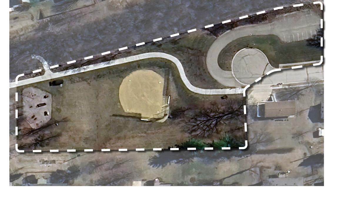
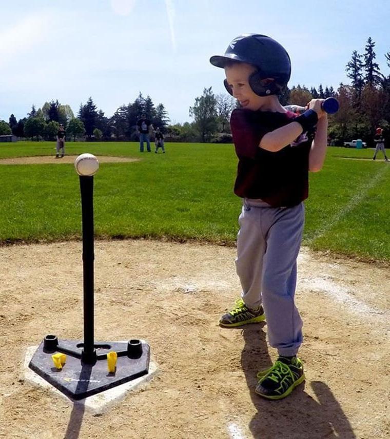
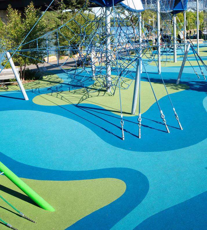
Maple Hills Park Ideas (River Theme)
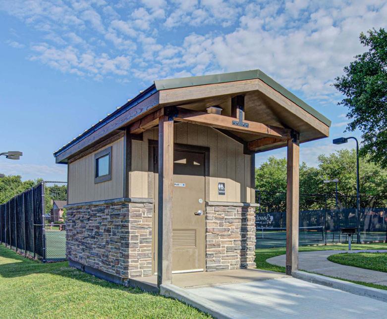
https://greenflushrestrooms.com/blog/what-you-need-to-know-before-you-plan-for-your-park-restroom/
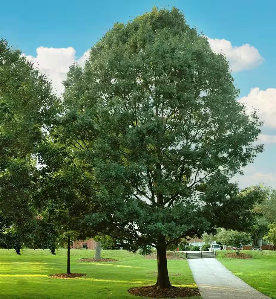
https://www.homedepot.com/p/Shumard-Oak-Deciduous-Shade-Tree-OAKSHU05G/315948271#overlay
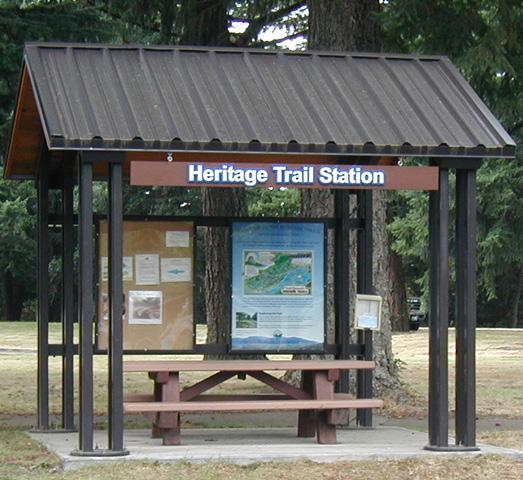
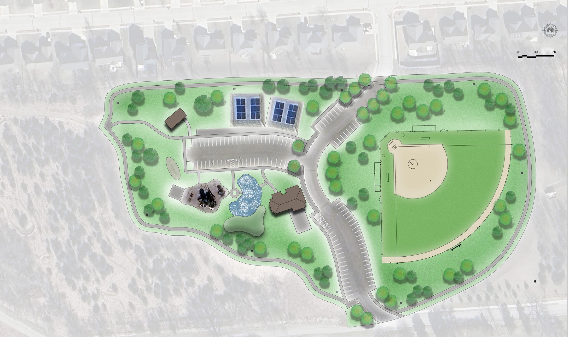
Maple Hills Park | Master Plan (Open Space Theme)
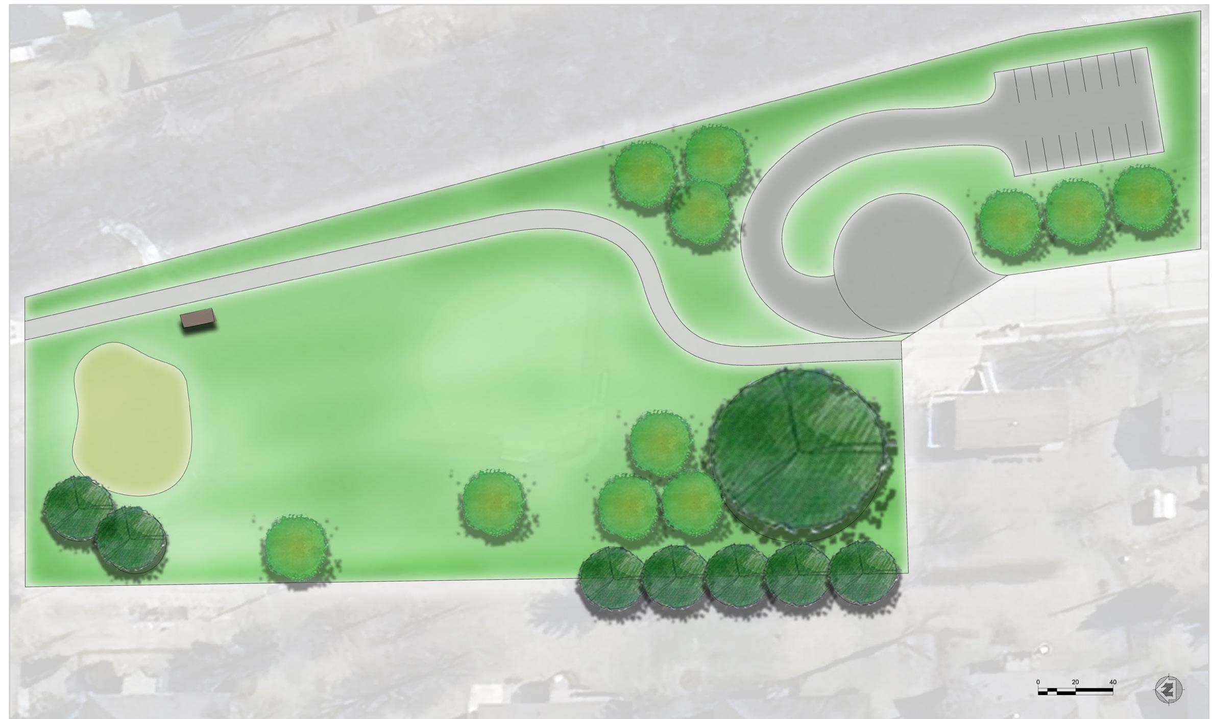
Resurface Play Area & Playground
Improvements
Re-Locate Exercise Equipment from Asbury Park placed at various locations along Trail Consider Sidewalk
Remove Tee-Ball Field (After 2026 Season)
Entrance (Add Signage) (Preserve Open/ Green Space)
Existing Shade Tree
City of Asbury Park Recommendations
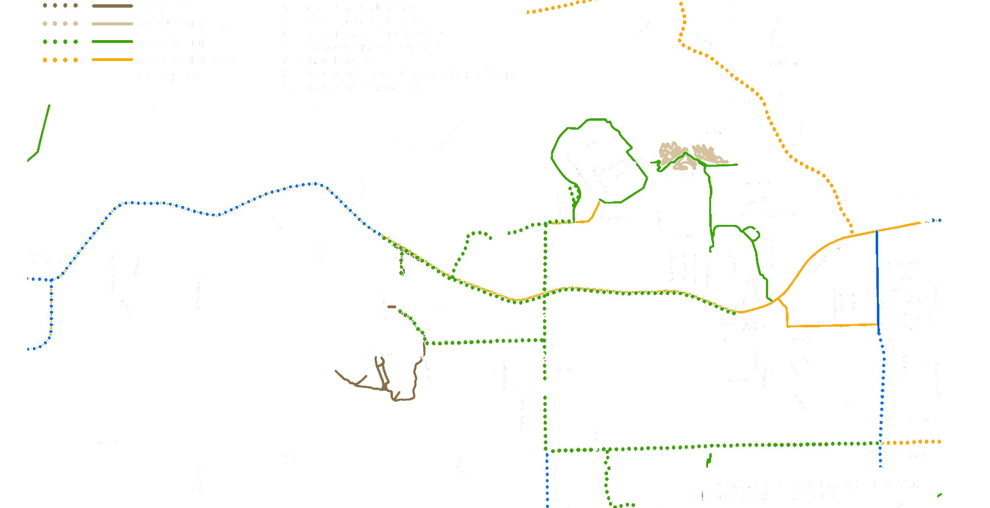
Asbury Trails Recommendations
05 IMPLEMENTATION DRAFT
IMPLEMENTATION
One of the most important aspects of the Master Plan is the discussion on implementation. This section explores potential funding opportunities, discusses the value of establishing priorities, and suggests recommended monitoring methods. This plan also makes an appeal to public partners and citizen groups to provide oversight and to be actively involved in implementation. Residents, local government, the school district, law enforcement, healthcare, local businesses, developers, and other agencies will need to work together for Asbury’s vision for its parks, trails, and open space system to be successful.
As previously described, the community has indicated that fixing what Asbury already has before investing in new attractions, is a primary goal. To achieve that goal, the City should begin by approaching improvement recommendations for priority parks. As these recommendations were determined at a master plan level, each project will require additional study, planning and design. Some of these projects will be within the capabilities of City staff, both on the design and implementation stages. However, more complex projects will likely require involvement from outside consultants.
The City is encouraged to start planning recommendations into the capital improvement budget. Selecting lower cost projects for immediate implementation will illustrate the City’s willingness to put this master plan into action. It will demonstrate commitment to its objectives for implementing this plan and will set a positive course for fulfilling the goals defined by the community.
Action Plan
The Action Plan is designed as a guide to help Asbury community leaders prioritize opportunities and address issues within the City of Asbury and the surrounding area as it relates to parks and recreation. The desired vision for Asbury cannot be created over night. However, by incrementally implementing the recommendations within this plan, Asbury can achieve the desired outcomes set forth in this plan.
Potential Funding Sources
There are five broad funding sources available to help offset costs to complete the projects listed in this Plan, as described below.
General Municipal Funding – It is assumed that some general municipal funds/borrowing will be required to assist with the completion of projects or as a matching source for state or federal grants (e.g. wayfinding, signage, or park land acquisition).
Special Assessments – Particular projects that benefit individual properties (e.g. sidewalk/trail installations) could be funded through special assessments whereby the City recoups initial design and construction costs through increased real estate taxes on those properties for a set period of time.
Private Donations – Some of the projects could be partially or fully funded through private donations or public fundraising.
State and Federal Grants – There are many different state or federal grants that may be able to offset the costs of some of the identified projects. Only those programs most likely to award funding to Asbury are listed.
Tax Increment Financing (TIF) – Tax increment financing (TIF) is a program where the additional taxes generated from development in a TIF district would go towards specified public improvements in a community. This program helps waylay the impacts of new development on a community while improving the attractiveness of the City.
Plan Matrix
Maintenance and Operations
MAINTENANCE SYSTEMS
Maintenance systems steer the process for implementing maintenance procedures associated with maintaining grounds and buildings. These systems require an understanding of city standards, records, workorders, budget, and the maintenance staff.
TYPES OF MAINTENANCE
Scheduled Maintenance - Maintenance procedures that are planned in advance as part of the maintenance schedule.
Routine Maintenance - daily or weekly activities that improve or preserve the piece of equipment, a park asset, or a trail component.
Preventative Maintenance - provided to prevent equipment or a park/trail amenity from breaking down and causing safety concerns and issues.
Cyclical Maintenance - Involves a series of scheduled tasks to completing the full cycle of the activity. For example, maintaining green space within a park. The process contains numerous steps (soil preparation, seeding, fertilizing, watering, mowing and aerating) that are repeated on a scheduled cycle.
Unscheduled Maintenance - Procedures that are not regularly scheduled.
Unforeseen Maintenance - This is a responsive procedure that is preformed due to a failure of an area or piece of equipment.
Maintenance Projects - This activity usually involves a larger scale maintenance activity and the area requiring the maintenance is typically closed to the public while the maintenance is being performed. Users are notified in advance and the project requires planning.
Evaluate existing maintenance practices at least every 2 years to determine if they need to be adjusted to meet the changing needs of the community and maintenance budgeting. Determine if there are ways to reduce maintenance costs, such as engaging public/private partnerships, enlisting and training volunteers, or focusing resources based on community needs and use patterns.
Prioritize maintenance needs for parks, open spaces and trails in the existing system. First, determine a base maintenance standard for the existing system. Following establishment of minimal maintenance needs, prioritize the additional system needs and desires and develop an appropriate action plan given available resources and effort.
City of Asbury 2023 Parks and Trails Plan
use this space to emphasize a key point. To place this text box anywhere on the page, just drag it.]
City of Asbury
2023 Parks and Trails Plan
City of Asbury 2023 Parks and Trails Plan
Acknowledgements
The City of Asbury would like to acknowledge and thank all the people that contributed to the development of this plan
Asbury Mayor and City Council
Jim Adams, Mayor
Russ Domeyer, Council Member
Curt Kiessling, Council Member
Karen Klinkhammer, Council Member
Craig Miller, Council Member
Bob Reisch, Council Member
City of Asbury Staff
Beth Bonz, City Administrator
Sara Burke, City Clerk
City of Asbury Park and Recreation Board
Ryan Fennel
Luke Hartmann
Amanda Kennedy
Becky Neumann
Karah Spahn
Cindy Wiese
Steve Winger
Plan Prepared by
Central Intergovernmental Association (ECIA)
Iowa
ECIA Staff
Dan Fox, Senior Planner
Cover page Photo: “Wedgewood Pond” by ECIA
City of Asbury 2023 Parks and Trails Plan
Introduction
Purpose
The purpose of the Asbury Park and Trail Plan is to develop a plan that will guide the City of Asbury as it maintains and develops its park and trail systems.
Community Overview
The City of Asbury is a growing community located in Dubuque County, Iowa. Asbury is part of the tri-state region located along the Mississippi River near Iowa’s boundary with Illinois and Wisconsin. Asbury is part of the Dubuque metropolitan area and shares a boundary with the City of Dubuque on its east and south sides. Asbury is primarily a residential community, with many residents working in neighboring cities within the metro area. The community’s surrounding landscape is characterized by hills, bluffs, limestone outcroppings, and many streams and rivers. Asbury’s 2020 census population was 5,943, up from 4,107 in 2010.
City of Asbury Park and Recreation Board
The Park and Recreation Board was created to make recommendations to the Asbury City Council concerning plans for and oversight of City parks and recreation activities. The Park and Recreation Board served as the steering committee for the development of the Asbury Parks and T rails Plan The Board consists of seven members appointed by the Asbury City Council The Park and Recreation Board members at the time the plan was developed were:
• Ryan Fennel
• Luke Hartmann
• Amanda Kennedy
• Becky Neumann
Plan Objectives
• Karah Spahn
• Cindy Wiese
• Steve Winger
The process of establishing the objectives of the Asbury Parks and Trails Plan began with a review of the City’s existing plans. The review included the City’s two primary planning Documents: The City of Asbury
Comprehensive Plan and the City of Asbury Strategic Plan Through these documents the City has established its vision for the future and identified goals and objective that will help the community realize that vision. Both the comprehensive and strategic plans are general in nature, focusing on all issues that are most relevant to the future development of the community. The objectives established in the Asbury Parks and Trails Plan will provide a more specific focus on parks and trails while helping move the City closer to achieving the broader goals outlined in its existing plans.
The following section provides a summary of the park and trail-related objectives contained in both existing plans.
City of Asbury Comprehensive Plan
The City of Asbury Comprehensive Plan, adopted in 2013, outlines a vision and set of goals and objectives that are intended to guide the long-term development of the community. The goals for the plan are to foster cooperation among communities, encourage economic development, protect and preserve community resources, improve resiliency to disasters, and encourage a strong community identity. Park and trail-related goals and objectives from the comprehensive plan include:
Goal 1: Provide appropriate levels of recreation facilities for residents.
1.1 Continue to promote and maintain existing parks and public open spaces.
1.2 Develop a Park Comprehensive Plan that includes planning, development and maintenance of outdoor recreation areas, open/green space, pedestrian and biking trail system connecting area parks, community facilities, schools and businesses and link to the Heritage Trail.
1.3 Develop an amphitheater area for movies, concerts, and other social events.
1.4 Expand winter recreational activities to park and golf course area to include but not limited to: cross country skiing, ice skating and sledding.
1.5 Develop pet friendly parks and trails.
Goal 2. Enhance golf course facility.
2.1 Explore driving range.
2.2 Develop Meadows Business and Marketing Plan
2.3 Explore uses for the building for best utilization of facility
City of Asbury 2023 Parks and Trails Plan
(Page intentionally left blank)
City of Asbury 2023 Parks and Trails Plan
City of Asbury Strategic Plan
The City of Asbury holds a strategic planning and goal setting session each fall to set goals and priorities for the next fiscal year and beyond. The most recent session was held November 30, 2021 and was attended by the Mayor, City Council Members, the City Administrator, and city department heads. The 2022 Strategic Plan includes the City’s mission statement, a review of the City’s major accomplishments from 2020-2021, and a list of priorities for the future.
City of Asbury 2022 Mission Statement:
The City of Asbury provides exceptional services in a fiscally responsible and professional manner to create a high quality of life for the community to live, play and work.
PARKS AND TRAILS ACCOMPLISHMENTS
The 2022 Strategic Plan lists the following park and recreation-related accomplishments from 2020 and 2021.
• Installation of playground equipment in Arrowhead Subdivision.
• Recreation services agreement with the City of Dubuque.
• Design Cloie Creek Trail (Maple Hills Park to Forest Hills)
PARKS AND TRAILS PRIORITIES
As part of the strategic planning work session, the Mayor and City Council identified and ranked a list of issues facing the community. Issues were categorized as Top Priority, High Priority, or Other Priority . The plan also includes a list of Continuing Priorities. These are initiatives and program s that the City has already started and agreed to continue into 2022. Park and trail-related priorities are listed below.
TOP PRIORITY
Long Range Planning for Annexation and Future Development – Identify areas for future parks and trails.
HIGH PRIORITY
Pedestrian Walkways: Connect City via sidewalks and trails.
a. Sidewalks Springreen
b. Sidewalks Seippel Road
c. Long-term sidewalk policy
CONTINUING PRIORITIES
• Cloie Creek Trail Project.
• Meadows Golf Building and Course Improvements.
• Long-term park operating and maintenance plan and budget.
• Apply for grants to fund park projects.
Parks
and Trail Plan Objectives
The City Park and Recreation Board held a series of work sessions to develop a list of objectives for the park and trail plan. The Board developed an initial list of objectives early in the plan development process and continued to review and revise the list based on the information collected through the planning process and input from the community.
The objectives guided the development of this plan and will continue to guide the community’s future park and trail activities. The final Parks and Trail Plan Objectives are listed below.
Park and Trail Objectives
1. Connect the community’s parks and neighborhoods with a network of trails, sidewalks, and on-street bicycle routes.
2. Provide recreational opportunities for all ages and abilities.
3. Conserve the community’s open spaces and natural resources.
4. Acquire land for future parks to meet the community’s needs.
5. Maintain high standards for the city’s existing recreation facilities and ensure that new facilities are built to last.
City of Asbury 2023 Parks and Trails Plan
Existing Conditions
This section provides an overview of the City of Asbury’s Existing Parks and Trails.
Parks ASBURY PARK
Asbury Park is located on Asbury Road at the intersection of Springreen Drive and Asbury Road. At over nine acres it is the community’s largest park. Asbury Park has a baseball diamond, basketball court, two tennis courts, and two hard surface volleyball courts, all of which are lighted. The Park also has swings, slides, tot toys, picnic tables, grills, restrooms, a sand volleyball court, and two open-air pavilions that are available for rent Asbury Park is home to the community’s annual Music in the Park Festival.
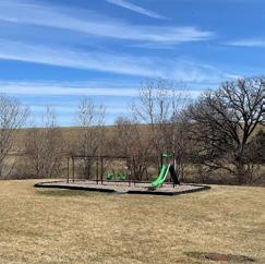
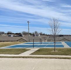

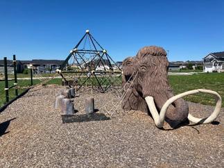
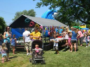
“Music in the Park” by Asbury Music in the Park Facebook Page
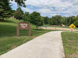
“Maple Hills Park” By ECIA
“Asbury Park Courts” by City of Asbury
Brook Haven Playground by ECIA “Arrowhead Park” by ECIA
City of Asbury 2023 Parks and Trails Plan
CLOIE CREEK PARK
Cloie Creek Park is located off Park Place on Sanibel Lane. Park amenities include a splash pad, play equipment, mountain bike and a spacious pavilion for rent. The splash pad is open from 10:00 a.m. to 9:00 p.m. daily, Memorial Day to Labor Day
Maple Hills Park is located at the end of Burr Oak Drive and has a softball diamond, updated playground, and
ALTHAUS WETLAND AND NATURE PRESERVE
Althaus Wetland and Nature Preserve is located at the The wetland area is home to a large number of native grasses, cattails, butterfly garden, and other native birds. The city-wide trail system also connects Althaus Wetland to Cloie Creek and Maple Hills
Wedgewood Preserve is located in western Asbury. The Preserve is nestled in the Wedgewood neighborhood, is open for the public to enjoy. Scenic grass trails abound. With an emphasis on the preservation of Iowa’s native species, the Wedgewood Preserve is the perfect place to search for your favorite bird or flower.
acre neighborhood park located off Doe Run Drive. The park has a large rope climbing
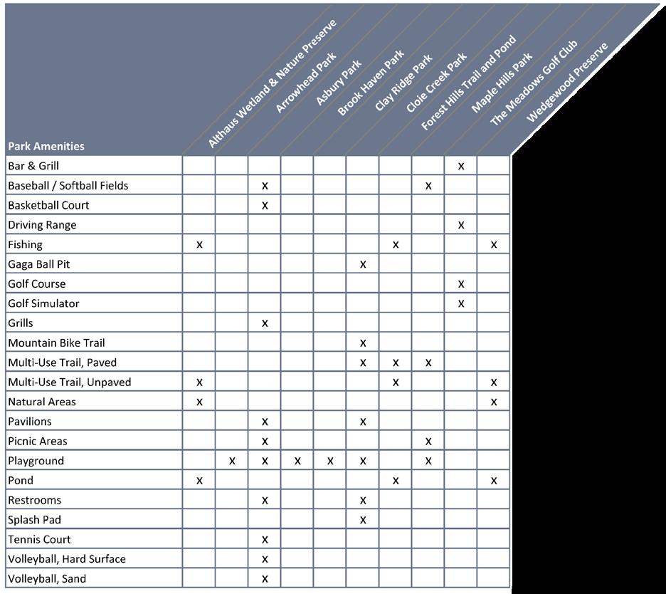
Table 1 Asbury Park Amenities
City of Asbury 2023 Parks and Trails Plan
BROOK HAVEN PARK
Brook Haven Park is located off Brook Hollow Drive in Brook Haven Subdivision. The small playground is a neighborhood park for small children.
PARK AMENITIES
The City of Asbury’s existing parks offer a wide range of recreational amenities. Table 1 provides a summary of Asbury’s existing Park Amenities.
Existing Trails
The following section describes the City of Asbury’s existing Bicycle and Pedestrian facilities.
ALTHAUS POND TRAIL
The Althaus Pond Trail connects Asbury Road, Althaus Pond Wetland and Nature Preserve, and Maple Hills Park. The trail completely encircles the pond and includes a pedestrian bridge.
CLOIE CREEK TRAIL
The trail was constructed in the spring and summer of 2022. The trail connects Maple Hills Park, Cloie Creek Park, and the Forest Hills Trail. The trail also connects a number of residential neighborhoods to nearby parks.
FOREST HILLS TRAIL
The Forest Hills Trail encircles the Forest Hills Subdivision. The majority of the trail is hard surfaced with a few unpaved portions.
WEDGEWOOD TRAILS
The Wedgewood Preserve, located within the Wedgewood Subdivision, provides several walking trails. The grass trails are open to the public and allow users to view the area’s green space areas which provide excellent opportunities for bird watching.
City of Asbury 2023 Parks and Trails Plan
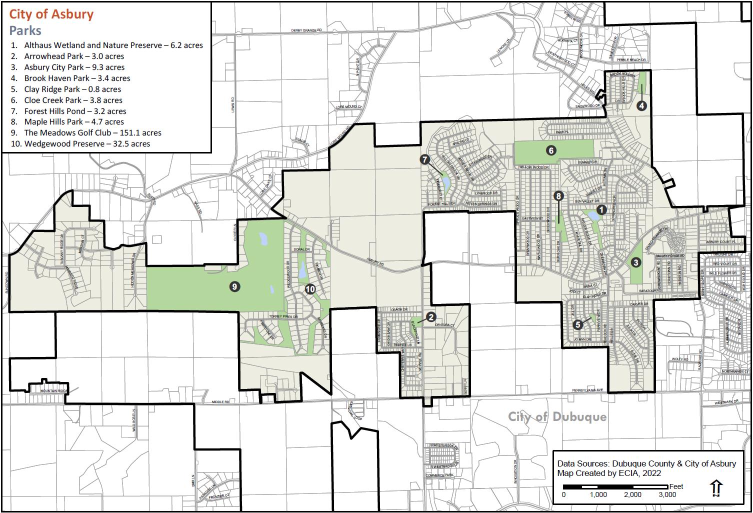
Figure 1. Existing Asbury Parks
PARK AND TRAIL MAPS
Figure 1 maps the City of Asbury’s existing parks and Figure 2 maps the community’s existing trails.
City of Asbury 2023 Parks and Trails Plan
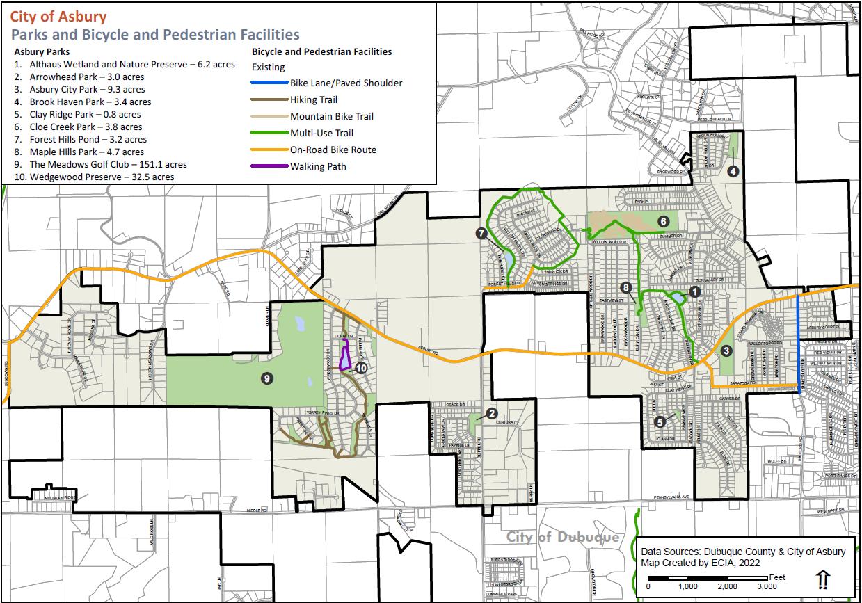
Figure 2. Existing Asbury Trails
City of Asbury 2023 Parks and Trails Plan
Park and Trail Issues and Needs
Through the plan development process, the Asbury Parks and Recreation Board compiled a list of the community’s trail and park needs. This section of the plan lists the needs along with some discussion of potential methods for addressing them
City of Asbury Trail Issues and Needs
The planning process identified the following needs for the community’s trail system.
COMMUNITY CONNECTIVITY
In general, there is a need for bicycle and pedestrian connections between Asbury’s neighborhoods and its parks, businesses, and other key locations. The city has some great parks and trails, but in many cases the only way to travel between them is by car. On-road biking is an option for some, but this may not be safe for less experienced riders, especially children. Many residents would prefer to walk or bike to their favorite park rather than packing up the family for a short car ride.
The concept of connecting Asbury’s east and west sides was a consistent theme in the connectivity discussion. Over time Asbury has generally been built up starting in the east and moving west along Asbury Road. The majority of the community’s existing parks and trails are located on the older east side, but as new west side neighborhoods have been added through annexation and new construction, the community has seen a growing need for more parks and trails on the west side and an increasing desire for connectivity between the newer west side neighborhoods and the existing recreation facilities on the east side.
Examples of connectivity needs identified through the planning process include:
• Wedgewood to Seippel Road trail connection
• Arrowhead Park walking path
• Improved pedestrian crossing at the intersection of Asbury Road and Seippel Road
ASBURY ROAD
Asbury Road is the primary east-west roadway in the City of Asbury and will be the primary route for developing a bicycle and pedestrian connection across the community. Asbury Road is the city’s most heavily traveled roadway carrying an average of 5,000 vehicles per day on the west side of the city and more than 16,000 vehicles per day on the east side.
The City reconstructed the eastern portion of Asbury Road within the last few years adding sidewalks along much of the project corridor. These sidewalks are well used by the community. The western portion of Asbury Road remains a rural highway profile with narrow shoulders and ditches on either side of the roadway. The photos below illustrate the difference between the two sections of the roadway.
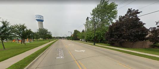
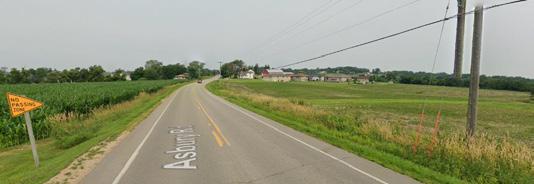
Asbury Road Near Asbury Park. Looking west. Google Street View Photo, Ju ly 2019.
Asbury Road between Seippel Road and Wedgewood Subdivision. Looking west toward Wedgewood. Google Street View, July 2019.
City of Asbury 2023 Parks and Trails Plan
Existing conditions will make developing a permanent sidewalk or trail along the western portion of Asbury Road a long-term project. But, if development continues on the City’s west side, reconstruction of Asbury Road may become necessary at some point in the future, and bicycle and pedestrian facilities should be considered as part of those reconstruction plans.
HARD SURFACING EXISTING TRAILS
The Asbury community identified hard-surfacing some of its existing gravel and grass surface trails as an opportunity to enhance the city’s bicycle and pedestrian network The existing trails around Forest Hills and Althaus ponds are currently gravel surfaced The Althaus trail provides a complete loop around the pond, while the Forest Hills Trail only goes about two thirds of the way around The existing crushed limestone trail surfaces do not provide adequate access for people in wheelchairs or for children in strollers. The ponds are stocked with fish, so the improved trails would also provide better access for fishing. Improvement options include paving the existing gravel trails and extending the Forest Hills trail to make a full loop around the pond.
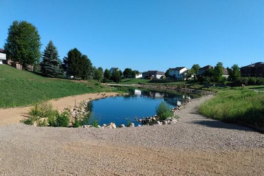
The 32-acre Wedgewood Preserve is home to a two and a half mile trail system that includes a paved walking path around the pond and a collection of grass surface trails winding throughout the park area. Some community members have pointed out that hard-surfacing the trails would improve their accessibility and could increase their usage. Other members of the community have stated their preference for the natural trail surface and have pointed out that the grass trails are frequently used by snowshoers and cross country skiers during the winter months.
During planning discussions, it was noted that selective paving of trails might be the best option for Wedgewood Preserve. A hard-surfacing project in the preserve could focus on the paving the most used trial sections, and leave the remaining sections of trail natural.
SEIPPEL ROAD SIDEWALKS OR TRAIL
The City Council identified sidewalks along Seippel Road as a High Priority in its strategic plan. A multi-use trail has also been discussed for this location in the City’s previous future bike and pedestrian facility map. Seippel Road would provide a key north-south bike and pedestrian route and would serve as a connection to the City of Dubuque’s trail network. The Seippel Road route would also connect residential subdivisions to the new Arrowhead Park.
DUBUQUE AND HERITAGE TRAIL CONNECTIONS
Many Asbury trail users enjoy traveling outside the city to use trails in nearby communities. Trails in the city of Dubuque and the Heritage Trail in Dubuque County are popular with Asbury residents. Again, connectivity is an issue. For most people, accessing these trails requires driving by car. The City should continue to look for opportunities to work with nearby communities to plan for future regional trail connections.
WINTER TRAIL RECREATION
For some Asbury residents, trail use does not stop when the temperatures drop. These residents would like to see the City work to expand wintertime usage of its trails. Possible strategies to achieve this objective include expanded snow and ice removal on the trail system and staging events promoting winter activities on the community’s trails such as cross country skiing, snowshoeing, and fat tire bike riding.
“Existing crushed stone walkway around Forest Hills Pond.” By Amanda Kennedy
City of Asbury 2023 Parks and Trails Plan
City of Asbury Park Issues and Needs
The planning process identified the following needs for the community’s parks system.
ADDITIONAL WEST SIDE PARK AREA
Continued growth on Asbury’s west side has led some to call for additional park space in this area. Arrowhead Park is currently the City’s most westerly park. The City requires new subdivisions to set aside land for greenspace or parks, but many of the western subdivisions were originally developed in the county before annexing into the City of Asbury. Questions going forward – Is there need for a park farther west? And if a need exists, is there a potential location?
ADDITIONAL PARK AMENITIES
Through the planning process community members identified several amenities they would like to see in Asbury’s parks. A summary of the items discussed during the planning process is provided below.
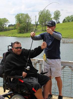
BOCCI BALL
The Parks Board has received requests from the community for a bocci ball court but has not been able to find a good location in any of the existing parks.
DISC GOLF
Disc golf was a priority identified in the September 2021 survey. The City does not currently have a location identified for a disc golf course.
FISHING ACCESS
The City currently has fishing ponds in Althaus Park, Forest Hills, and Wedgewood Preserve. The three ponds are stocked and are well used by local anglers, but accessing the ponds can be an issue, especially for people with mobility limitations. Accessibility could be improved by adding paved trails or walking paths, removing excess vegetation around the edge of the ponds, and adding accessible fishing docks.
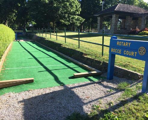
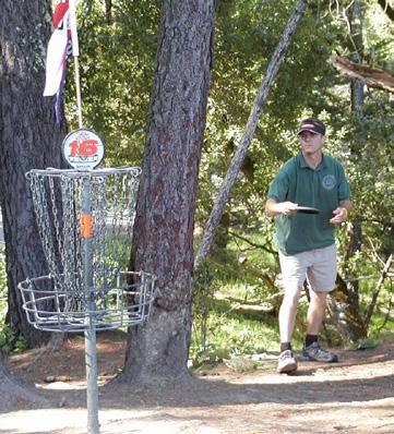
Left, “Accessible fishing dock” by Dubuque County Conservation Center, “Winterset, Iowa Bocce Court” by The Winterset Citizen. Right, “Dis c golfer and basket” by Steve Ganz.
City of Asbury 2023 Parks and Trails Plan
NATURAL AREAS
Park amenity discussions in Asbury tended to focus on enhancing the park system’s active recreation infrastructure, but Asbury residents also noted that the community’s parks should also provide natural spaces that encourage relaxation and enjoyment of the outdoors Native prairie and forest landscapes provide a pleasant outdoor setting while also improving air and water quality, preserving native species, and providing animal habitat.
PICKLEBALL COURTS
Asbury currently has two pickleball courts in Cloie Creek Park. With the growing popularity of the sport, the existing courts are in high demand and the Parks Board has received many requests for additional courts
SOCCER FIELDS
The city does not currently have a dedicated soccer field. The open space at Cloie Park can be used for soccer, but it does not have goals. The Park and Recreation Board has considered the open area in Cloie Park as a multipurpose area that could be used for soccer and other activities. Soccer goals could be added at this location.
SWIMMING POOL
Asbury does not currently have a public swimming pool and some residents would like the City to add one. The Park and Recreation Board and the City Council have considered the swimming pool issue at various times over the years and have ultimately decided against pursuing the idea. Challenges with building a swimming pool include: lack of a suitable site within the community, high upfront costs, and high operation and maintenance costs. Staffing a pool is another significant challenge. In recent years, public swimming pools in the area have been closed or operated for limited hours due to lifeguard and staffing shortages. Given these challenges, the city has elected devote resources to development of other park facilities such as the Cloie Creek Park splash pad.
TRAIL EXERCISE STATIONS.
The existing exercise stations in Asbury Park are all located in one place Some would prefer to have exercise stations along a trail so you can walk or run between stations.
INFORMATION
Over the course of the planning process, several people mentioned that they were learning things about the city’s parks and trails that they didn’t know before. In some cases, they did not know about a city park because it is located in a part of town they don’t usually visit. In other cases, they knew of a park or a trail, but were unsure if it was part of a city park and open to the public. These stories point to a need for information. Initiatives to inform the community about the Asbury’s parks and trails could include: expand the information available on the City of Asbury’s website; add wayfinding and informational signage; and hold events in some of the community’s lesser known parks.
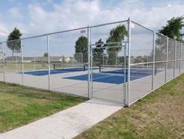
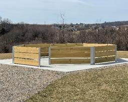
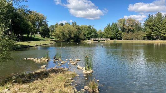
“Pickleball Court” (left) and "Gaga Ball Pit” (right) by City of Asbury
“Althaus Pond” by ECIA
City of Asbury 2023 Parks and Trails Plan
Future Bicycle and Pedestrian Network Concept
Through this Parks and Trails Plan, The City of Asbury is continuing the work of creating more opportunities for walking and biking within the community. Over the past several years, Asbury has continued to add to its network of on and off-street walking, hiking, and biking routes. While progress has been made, there is still work to be done to reach the goal of developing an integrated bicycle and pedestrian network in Asbury.
This section maps out a general concept for the community’s future bicycle and pedestrian network ,focusing on two priority areas:
• Improve bicycle and pedestrian safety
• Expand community’s bicycle and pedestrian network
Improve Bicycle and Pedestrian Safety
BICYCLE SAFETY
On-street biking allows bicyclists to access destinations that they would not be able get to using the off-street trail system alone. However, safety is an important consideration with on-street bicycling. Bicyclists are more exposed and vulnerable to injury than people in cars, and bicyclists are more likely to interact with cars when riding on streets. To improve bicycle safety, the City needs to consider the needs of bicyclists in the transportation planning process and integrate design improvements into existing streets.
PEDESTRIAN SAFETY
Pedestrians, like bicyclists, are also more vulnerable to injury if they are involved in a vehicle crash. Motor vehicle speed is a major risk factor for pedestrians. To improve safety for pedestrians, communities can plan and design streets in ways that will slow motor vehicle traffic, alert drives to the possible presence of pedestrians, or provide separate spaces for pedestrians to walk safety. Figure 3 illustrates how the risk of pedestrian death increases with increasing vehicle speeds.
Expand the Community’s Trail Network
Off-street trails provide walking and biking-based mobility and recreation. Off-street trails are also a good option when traffic volume and vehicle speed make on-street facilities too dangerous. The City of Asbury has worked to expand the its trail network over the past several years. The newly constructed Cloie Creek Trail is the most recent example of a successful trail project in the community. The City has plans to continue to expand the network and to improve existing trails
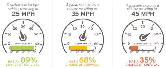
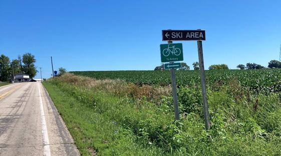
Figure 3. Vehicle Speed and a Pedestrian’s Risk of Death “Small Town and Rural Multi Modal Networks,” p. 5-3
“On road bike route sign south of Asbury” by ECIA
City of Asbury 2023 Parks and Trails Plan
Bicycle and Pedestrian Facilities
Asbury has a number of design options at its disposal for improving pedestrian and on-street bicycle safety. The Federal Highway Administration has produced or recommended several design guidance documents that can help communities select the appropriate bicycle design elements. Guidance documents include the AASHTO Guide to Bikeway Facilities, the Manual on Uniform Traffic Devices (MUTCD), the Federal Highway Administration’s Small Town and Rural Multimodal Network Guide, and the National Association of Transportation Officials (NACTO) Urban Bikeway Design Guide, and Urban Street Design Guide
The following section provides a brief description of some possible improvements and some guidance on how they should be designed, but designers should consult the latest version of the Iowa DOT Design Manual or the Iowa Statewide Urban Design and Specifications (SUDAS), as well as national standards and guidelines listed above. The next section, Facility Selection, discusses the selection design of facilities based on the context into which the facility is being installed.
ON-ROAD BICYCLE FACILITIES
PAVED SHOULDER
Roadway shoulders can be enhanced to serve as space for pedestrians and bicyclists. Paved shoulders are appropriate on roads with moderate to high traffic volumes and speeds. The minimum functional width for a paved shoulder used by bicyclists is 4 feet (especially if placed between rumble strips and the edge of pavement). On lower-traffic roads, a narrower 3-foot wide shoulder can be provided immediately adjacent to the travel lane if rumble strips are omitted or placed at the outside edge of the shoulder. The width of a paved shoulder is dependent on traffic volumes and speeds. See Figure 4
BIKE LANE
Bike lanes provide a dedicated space for bicyclists on the edge of a moderate to high speed and traffic volume roadway. Bike lanes are similar to paved shoulders. The difference is that bike lanes are intended for more urban applications and have additional pavement markings and signage. Bike lanes are typically 5 feet wide and have a minim um width of 4 feet not including the gutter See Figure 5
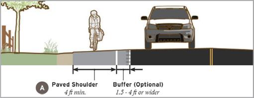
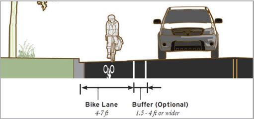
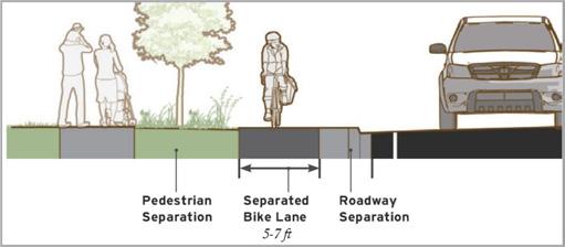
Figure 4. Paved Shoulder. Source: “Small Town and Rural Multi Modal Networks,” p. 3-5
Figure 5. Standard Bike Lane. Source: “Small Town and Rural Multi Modal Networks,” p. 3-13.
Figure 6 Separated Bike Lane Source: “Small Town and Rural Multi Modal Networks,” p. 4-27.
City of Asbury 2023 Parks and Trails Plan
SEPARATED BIKE LANE
Sometimes referred to as protected bike lanes, buffered bike lanes, or cycle tracks, separated bike lanes offer additional separation from vehicle traffic. Typically, the bike lane is separated by a buffer area, rumble strips, or a vertical element such a curb, parked cars, decorative planting, or flex post. See Figure 6
MULTI-USE TRAILS AND SIDEPATHS
A multi-use trail (MUT) is a two-way facility physically separated from motor vehicle traffic and used by pedestrians, bicyclists, and other non-motorized users. This type of facility provides recreational opportunities in addition to transportation. The cost of MUTs typically greatly exceeds the cost of sidewalks and on-road bikeways since they often require right-of- way acquisition and drainage changes. MUTs can be located in an independent right-of-way or run parallel to a roadway. MUTs that run parallel to streets and roads are referred to as sidepaths. Sidepaths may not be appropriate where there are many commercial driveway crossings and/or intersections per mile.
The minimum width for a MUT is 10 feet and 8 feet is acceptable for short distances under physical constraint (or the current standard as specified in the Iowa DOT Design Manual or SUDAS). Additional width can be provided to accommodate high volumes and separated parallel paths can be provided to reduce conflicts between bicyclists and pedestrians. MUTs must be designed with bicyclists in mind (e.g., designing curves based on an 18 mile per hour design speed).
SHARED ROADS
Where traffic volumes and speeds are low, many bicyclists can comfortably share lanes with motor vehicles. In rural areas, pavement markings may not be needed, although wayfinding signage is beneficial. On urban streets with moderate traffic volumes, shared lanes usually include shared lane markings (or “sharrows”) to indicate preferred bicyclist lane positioning, act as wayfinding aids, and alert drivers to a greater expected presence of bicyclists. In rural areas, shared roads should have traffic volumes below 1,500 ADT. In urban areas, shared lanes should be provided on streets with posted speed limits of 35 miles per hour or less and ADT less than 3,000. Higher speeds and traffic volumes may discourage bicyclists.
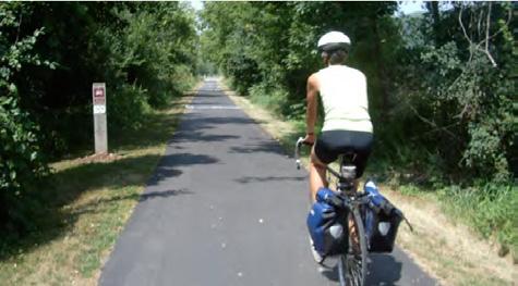
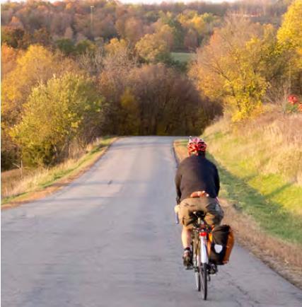
“Multi-Use Trail” by Iowa DOT
“Shared Road” by Iowa DOT
City of Asbury 2023 Parks and Trails Plan
SIDEWALKS AND PEDESTRIAN CROSSING IMPROVEMENTS
For pedestrians, sidewalks and street crossings are important design elements. Sidewalks improve pedestrian safety by providing a separate space for people on foot The standard width for a sidewalk is 5 feet with 4 feet permitted to avoid obstructions (or the current standard as specified in the Iowa DOT Design Manual or SUDAS). Sidewalks should be wider at schools, transit stops, downtowns, main streets, and anywhere else higher volumes of foot traffic occurs.
While pedestrians may be separated from motor vehicle traffic while on the sidewalk, they will eventually need to cross a street. The majority of pedestrian and motor vehicle interactions occur at street crossings and thus present a potentially dangerous situation. Basic pedestrian crossing improvements such as signage and marked crosswalks can help improve safety at street crossings by providing a designated place to cross, alerting drivers to the presence of pedestrians, and reminding them to slow down. Additional improvements like curb extensions and median islands provide additional pedestrian protection by shortening the crossing distance. Figure 7 illustrates some crossing improvement examples.
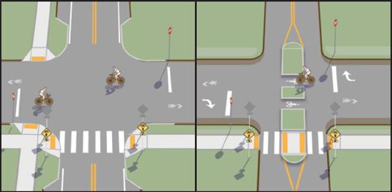
INTERIM IMPROVEMENTS
Full reconstruction of a street can take several years from planning to final construction, but a community may need to add safety improvements more quickly. Interim improvements use low cost, temporary materials to enable faster project delivery. The interim approach also allows the community to test the effectiveness of the improvement before committing to the full cost of reconstruction. Figure 8 shows an example of curb “bump-outs” made using painted curbs and plastic flex posts in Minneapolis, MN. The city installed the intersection bump-outs as a safety measure following the death of a pedestrian. The City was able to install the interim improvements quickly at a cost of around $6,000 for the whole intersection. Permanent curb bump outs could cost up to $20,000 per corner and take months or years to plan, design, and install.1
Figure 7 Crosswalks, Curb Extensions, and Median Islands Source: “Small Town and Rural Multi Modal Networks,” p. 2-14
1 See Nelson, Emma.
Figure 8. Minneapolis Painted Curbs Source: Joel Koyama, Star Tribune.
City of Asbury 2023 Parks and Trails Plan
FACILITY SELECTION
Designing a bicycle and pedestrian network that is well-used by the community is often a matter of choosing the correct facility for a given location. The facility selection process often needs to strike a balance between factors that attract users, like safety and comfort with other factors, like cost and right of way availability.
To help communities with the facility selection process, the Iowa Bicycle and Pedestrian Long-Range Plan established a Bicycle and Pedestrian Facility Section Guide. The guide provides tools that communities can use to help determine the appropriate types of bicycle and pedestrian accommodations based on the context of a location.
The Facility Selection Guide bases its recommendations on two primary contextual factors for bicycle and pedestrian safety and comfort: motor vehicle traffic volume and motor vehicle speed. Proximity to motor vehicle traffic is a significant source of stress, discomfort, and safety risks for bicyclists and pedestrians. In locations where motor vehicle speeds exceeded 25 miles per hour, the risk for bicyclist and pedestrian injuries and fatalities increases as traffic speed and volume increases. Streets with more vehicle traffic and higher vehicle speed will require more protection for bicyclists and pedestrians, while low speed, low volume streets may require little or no additional intervention.
The Bicycle Selection Matrix is the primary tool provided by the Facility Selection Guide. The Guide provides two matrices, one for rural areas and one for urban and suburban areas. Both matrices provide guidance on selecting an appropriate facility type based on posted speed limit, traffic volume, and context. The Facility Selection Matrix, shown in Figure 9, includes preferred and acceptable values for each facility type. Designers should utilize forecast traffic volumes if available. Additionally, designers should default to selecting the preferred facility over the acceptable facility when possible.
According to the Facility Selection Guide, the matrix was designed based on the concept that “speed and traffic volume are interrelated and must be considered together when selecting and appropriate facility for bicyclists. Typically, as speeds increase, the traffic volume threshold for providing separation decreases.”
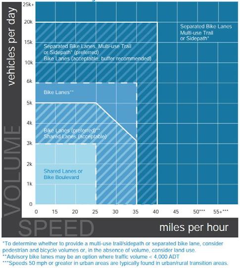
The full Facility Selection Guide is available for download from the Iowa DOT’s website.
Figure 9. Urban and Suburban Facility Selection Matrix
Source: “Iowa Bicycle and Pedestrian Long Range Plan,” p. 95.
City of Asbury 2023 Parks and Trails Plan
Projects
The City of Asbury has identified a list of key projects that will help the community achieve the objectives established in this plan. This section of the plan provides a project description, a project location map, and prioritizes the project list.
Parks Projects
ARROWHEAD PARK DEVELOPMENT
The City plans to construct additional park facilities in Arrowhead Park north of the existing playground. This undeveloped area of the park covers approximately 1.3 acres. The City’s initial plans for this area included sand volleyball, basketball or tennis courts, and a pavilion, but the type and configuration of facilities has not been finalized and could change before the project is implemented. Plans for Arrowhead Park also include a parking lot, a shade structure, and walking paths through the park and around its
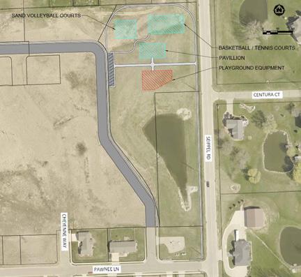
perimeter. Figure 10 illustrates a possible development concept for Arrowhead Park.
OXUS GROTTO PROPERTY
ACQUISITION
Oxus Grotto is a community origination that owns a 1.9 acre property just east of Cloie Creek Park. The City of Asbury has not taken any official action on acquiring the property, but City Council has discussed the acquisition and the project has been identified in the City’s CIP. The property currently includes an open grass covered area, parking lot, and a 2,300 square foot building that could be used for activities and other programming.
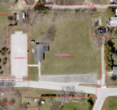
ADDITIONAL PROPERTY ACQUISITION
Moving forward, the City of Asbury will continue to acquire property for parks to provide the space needed to meet the recreation needs of a growing community.
The subdivision process will be the city’s primary means of acquiring land for smaller neighborhood-scale parks. The City’s subdivision development regulations require the owner of a new subdivision to set aside land for park development. Arrowhead, Clay Ridge, and Brook Haven parks are examples of park areas that were acquired through the subdivision process.
In addition to smaller neighborhood parks, the City of Asbury also plans to acquire larger areas for park development. The City’s comprehensive plan
Figure 11. Oxus Grotto Property Source. Dubuque County
Figure 10. Arrowhead Park Development Concept. Source MSA and the City of Asbury
City of Asbury 2023 Parks and Trails Plan
identifies the area around the intersection of Asbury Road and Seippel Road as a possible location for a future park.
INFORMATION
Provide additional information to the community on the City’s system of parks and trails. Information activities include:
• Provide maps of the city’s parks and trails.
• Expand the park and trial information on the City’s website.
• Hold events in lesser-known city parks to build community awareness.
PARK AMENITY PROJECTS
The Asbury community has identified several amenities that it would like to see in the city’s parks. These amenity projects are listed below. Specific locations for these amenities have not yet been determined.
• Bocci Court
• Disc Golf
• Accessible Fishing Docks
• Pickleball Courts
• Trail Exercise Stations
• Natural Areas
Trail Projects
ALTHAUS TRAIL PAVING
Pave the existing unpaved trail around Althaus Pond in Althaus Park.
FOREST HILLS POND TRAIL
Pave existing Forest Hills Pond Trial and extend trail to completely encircle the pond.
ASBURY ROAD BICYCLE AND PEDESTRIAN IMPROVEMENTS
Install bicycle and pedestrian Improvements along the western portion of Asbury Road. This long-term project will be implemented when the roadway is reconstructed at some point in the future. The project could include development of a multi-use trial along the roadway or a combination of sidewalks and bicycle lanes.
SEIPPEL ROAD TRAIL
Install a paved multi-use trail along Seippel Road. The trail will allow for eventual connection to the City of Dubuque’s trial system. Pedestrian safety could be improved by adding crossing improvements at the Asbury Road/ Seippel Road intersection.
WEDGEWOOD TO FOREST HILLS TRAIL
Construct a paved multi-use trail connecting the Wedgewood and Forest Hills subdivisions. This trial will be a long term project. The project will be implemented as the land between the two subdivisions is developed.
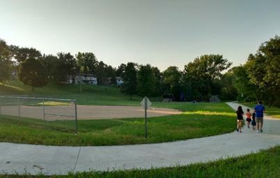
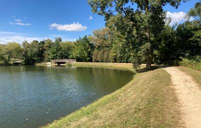
“Maple Hills Park Trail” by Amanda Kennedy (Top) and “Althaus Pond Trial” (Bottom) by ECIA.
City of Asbury 2023 Parks and Trails Plan
WEDGEWOOD TO ARROWHEAD PARK/SEIPPEL ROAD TRAIL
Construct a paved multi-use trail connecting the Wedgewood subdivision to Arrowhead Park and Seippel Road. The half-mile trial route will follow an existing city easement to connect the two destinations. Within the Wedgewood subdivision, the trial will continue north, connecting to the existing paved walking path that encircles the pond, and then continue north to Asbury Road. The full length of the trial will be approximately nine tenths of a mile.
City of Asbury 2023 Parks and Trails Plan
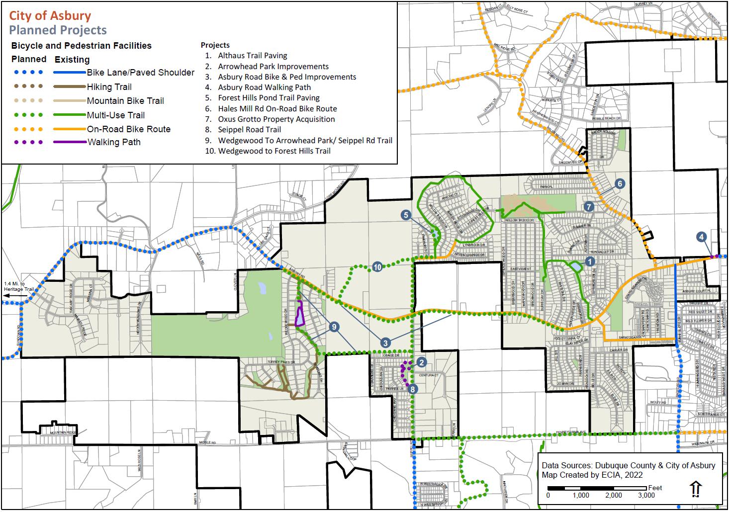
Project Map The City of Asbury’s park and trail projects are mapped in Figure 12
Figure 12 Asbury Park and Trail Projects
City of Asbury 2023 Parks and Trails Plan
Project Priorities
Through the planning process, the City of Asbury evaluated the existing conditions of the City’s park and trail facilities, collected input from members of the community, and identified gaps and needs. The city used the information collected to develop a list of improvement projects designed to fill the gaps and elevate the quality of the community’s parks and trails overall.
After compiling the project list, the community’s final task was project prioritization. Asbury organized its projects into two groups: Top Priority Projects and Opportunity Projects.
TOP PRIORITY PROJECTS
The projects in the top priority group are the most important projects for the future development of the park and trail systems and are projects that should be implemented first. Projects in the top priority category should also be ready to implement in the near future. Top priority projects should be considered short to medium term objectives that should be targeted for implementation over the next ten years. Table 2 lists the City of Asbury’s top priority projects.
OPPORTUNITY PROJECTS
The projects in the opportunity group are projects that will help move the community closer its long-term goals, but are not considered immediate needs The City does not expect to be able to implement quickly. Opportunity projects are to be considered long-term objectives, that would be implemented between ten and twenty years down the road.
However, with opportunity projects the implementation timeline can be moved up if an opportunity presents itself. For example, a road reconstruction project could provide an opportunity to add a new bike lane or trail Table 3 Lists the City of Asbury’s opportunity projects.
Table 2. Top Priority Projects
Project
Wedgewood Trail to Arrowhead Subdivision
Forest Hills Pond Trail Paving
Althaus Trail Paving
Arrowhead Park Improvements
Information
Table 3. Opportunity Projects
Project
Oxus Grotto
Description
Trial connecting Wedgewood and Arrowhead Subdivisions
Pave existing gravel trail and extend trail to make a full loop around the pond
Pave existing gravel trail around Althaus Pond
Improvements in Arrowhead Park
Provide additional information on the city’s parks and trails
Description
Acquire Oxus Grotto Property
Asbury Road Bike and Ped Improvements Bike and ped improvements on western portion of Asbury Road.
Asbury Road Walking Path
Hales Mill Road on Road Bike Route
Property Acquisition
Wedgewood Subdivision to Forest Hills Trail
Seippel Road Trail
Walking path connection between existing sidewalk and City of Dubuque
Signed on-road bike route connecting the city to Heritage Trail.
Continue to acquire property for future park development
Construct a multi-use trail between Wedgewood and Forest Hills.
Develop a multi-use trail along Seippel Road.