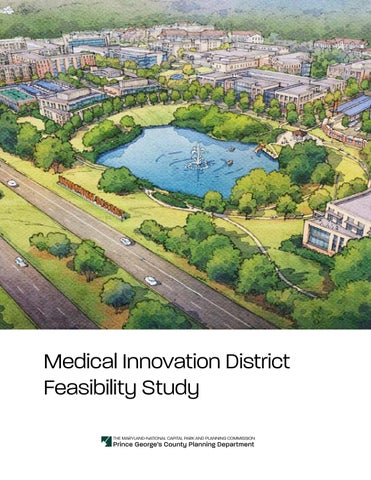
Medical Innovation District Feasibility Study THE MARYLAND-NATIONAL CAPITAL PARK AND PLANNING COMMISSION
Prince George’s County Planning Department
Abstract Date
October 2026
Title
Medical Innovation District Feasibility Study
Author
The Maryland-National Capital Park and Planning Commission
Subject
This report examines opportunities to create a mixed-use Medical Innovation District centered on MedStar Southern Maryland Hospital Center in Clinton, Maryland.
Source of copies
Series number Number of pages
The Maryland-National Capital Park and Planning Commission 1616 McCormick Drive Largo, MD 20774 516262306 69
The MedStar Southern Maryland Hospital Center (SMHC) area at MD 5 (Branch Avenue) and Surratts Road in Clinton presents a strategic opportunity to strengthen Prince George’s County’s economy and improve access to employment, education, retail, and healthcare services. This study explores the potential to establish a Medical Innovation District that leverages the hospital as an anchor institution to support economic development, innovation, and community investment. The report examines the characteristics of successful medical innovation districts and outlines strategies to foster collaboration among healthcare providers, research institutions, businesses, entrepreneurs, and workforce development partners. Recommendations focus on creating a mixed-use, transit-accessible environment that supports high-quality jobs, business growth, research and innovation, community amenities, and long-term economic resilience while enhancing quality of life for residents. Map Sources Maps in this report include abbreviated source citations. Full data citations for individual map layers and datasets are provided in Appendix A, Map Citations.
Page ii • Medical Innovation District Feasibility Study
Prince George’s County Planning Department
October 2026 The Maryland-National Capital Park and Planning Commission Prince George’s County Planning Department 1616 McCormick Drive Largo, MD 20774 www.pgplanning.org
The Maryland-National Capital Park and Planning Commission Artie L. Harris, Jr., Chair Kevin A. Anderson, Vice Chair
Officers William Spencer, Acting Executive Director Gavin Cohen, Secretary-Treasurer Debra S. Borden, Esq., General Counsel The Maryland-National Capital Park and Planning Commission (M-NCPPC) is a bi-county agency, created by the General Assembly of Maryland in 1927. The Commission’s geographic authority extends to the great majority of Montgomery and Prince George’s Counties: the Maryland-Washington Regional District (M-NCPPC planning jurisdiction) comprises 1,001 square miles, while the Metropolitan District (parks) comprises 919 square miles, in the two counties. The Commission has three major functions: • The preparation, adoption, and, from time to time, amendment or extension of the General Plan for the physical development of the Maryland-Washington Regional District.
• The acquisition, development, operation, and maintenance of a public park system.
• In Prince George’s County only, the operation of the entire county public recreation program.
The Commission operates in each county through a Planning Board appointed by and responsible to the County government. All local plans, recommendations on zoning amendments, administration of subdivision regulations, and general administration of parks are responsibilities of the Planning Boards.
The Prince George’s County Planning Department: • Our mission is to help preserve, protect and manage the County’s resources by providing the highest quality planning services and growth management guidance and by facilitating effective intergovernmental and citizen involvement through education and technical assistance.
• Our vision is to be a model planning
department of responsive and respected staff who provide superior planning and technical services and work cooperatively with decision makers, citizens, and other agencies to continuously improve development quality and the environment and act as a catalyst for positive change.
PRINCE GEORGE’S COUNTY PLANNING BOARD
Kevin A. Anderson, Chair
Brittany Jenkins
Gloria Gary Lawlah
Lori Matthews
MONTGOMERY COUNTY PLANNING BOARD
Artie Harris, Chair
Page iv • Medical Innovation District Feasibility Study
Billy Okoye, Vice Chair
Shawn Bartley, Vice Chair
Mitra Pedoeem
Josh Linden
James Hedrick
Prince George’s County Planning Department
Prince George’s County Aisha N. Braveboy, County Executive
County Council The County Council has three main responsibilities in the planning process: setting policy, plan approval, and plan implementation. Applicable policies are incorporated into area plans, functional plans, and the general plan. The Council, after holding a hearing on the plan adopted by the Planning Board, may approve the plan as adopted, approve the plan with amendments based on the public record, or disapprove the plan and return it to the Planning Board for revision. Implementation is primarily through adoption of the annual Capital Improvement Program, the annual Budget, the water and sewer plan, and adoption of zoning map amendments.
COUNCIL MEMBERS Krystal Oriadha, Chair, 7th District
Eric C. Olson, Vice Chair, 3rd District
Wala Blegay, At-large
Jolene Ivey, At-large
Thomas E. Dernoga, 1st District
Wanika B. Fisher, 2nd District
Timothy Adams, 4th District
Shayla AdamsStafford, 5th District
Danielle Hunter, 6th District
Edward P. Burroughs III, 8th District
Sydney J. Harrison, 9th District
Donna J. Brown, Clerk of the Council
Prince George’s County Planning Department
Medical Innovation District Feasibility Study • Page v
Table of Contents Executive Summary . . . . . . . . . . . . . . . . . . . . . . . . . . . . . . . . . . . . . . . . . . . . . . . . . . . . . . . . . . . . . . . . . . . . 9 Planning Context and Engagement . . . . . . . . . . . . . . . . . . . . . . . . . . . . . . . . . . . . . . . . . . . . . . . . . . . . . . . . . . . . . . . . . . . . . . . . . 10 Key Findings . . . . . . . . . . . . . . . . . . . . . . . . . . . . . . . . . . . . . . . . . . . . . . . . . . . . . . . . . . . . . . . . . . . . . . . . . . . . . . . . . . . . . . . . . . . . . . . . 10 Recommendations . . . . . . . . . . . . . . . . . . . . . . . . . . . . . . . . . . . . . . . . . . . . . . . . . . . . . . . . . . . . . . . . . . . . . . . . . . . . . . . . . . . . . . . . . . . 11
Medical Innovation District Vision . . . . . . . . . . . . . . . . . . . . . . . . . . . . . . . . . . . . . . . . . . . . . . . . . . . . . . 13 What is an Innovation District? . . . . . . . . . . . . . . . . . . . . . . . . . . . . . . . . . . . . . . . . . . . . . . . . . . . . . . . . . . . . . . . . . . . . . . . . . . . . . 14
Planning Background and Process . . . . . . . . . . . . . . . . . . . . . . . . . . . . . . . . . . . . . . . . . . . . . . . . . . . . 15 Public Participation . . . . . . . . . . . . . . . . . . . . . . . . . . . . . . . . . . . . . . . . . . . . . . . . . . . . . . . . . . . . . . . . . . . . . . . . . . . . . . . . . . . . . . . . . 16 Stakeholder Interviews . . . . . . . . . . . . . . . . . . . . . . . . . . . . . . . . . . . . . . . . . . . . . . . . . . . . . . . . . . . . . . . . . . . . . . . . . . . . . . . . . . . . . 18 Open House . . . . . . . . . . . . . . . . . . . . . . . . . . . . . . . . . . . . . . . . . . . . . . . . . . . . . . . . . . . . . . . . . . . . . . . . . . . . . . . . . . . . . . . . . . . . . . . . . 19
Analysis . . . . . . . . . . . . . . . . . . . . . . . . . . . . . . . . . . . . . . . . . . . . . . . . . . . . . . . . . . . . . . . . . . . . . . . . . . . . . . . . 21 Market Study . . . . . . . . . . . . . . . . . . . . . . . . . . . . . . . . . . . . . . . . . . . . . . . . . . . . . . . . . . . . . . . . . . . . . . . . . . . . . . . . . . . . . . . . . . . . . . . 21 Site Analysis . . . . . . . . . . . . . . . . . . . . . . . . . . . . . . . . . . . . . . . . . . . . . . . . . . . . . . . . . . . . . . . . . . . . . . . . . . . . . . . . . . . . . . . . . . . . . . . 28 Land Use and Zoning Analysis . . . . . . . . . . . . . . . . . . . . . . . . . . . . . . . . . . . . . . . . . . . . . . . . . . . . . . . . . . . . . . . . . . . . . . . . . . . . . 32
Recommendations . . . . . . . . . . . . . . . . . . . . . . . . . . . . . . . . . . . . . . . . . . . . . . . . . . . . . . . . . . . . . . . . . . . . 39 Goals . . . . . . . . . . . . . . . . . . . . . . . . . . . . . . . . . . . . . . . . . . . . . . . . . . . . . . . . . . . . . . . . . . . . . . . . . . . . . . . . . . . . . . . . . . . . . . . . . . . . . . . 39 Basis of Recommendations . . . . . . . . . . . . . . . . . . . . . . . . . . . . . . . . . . . . . . . . . . . . . . . . . . . . . . . . . . . . . . . . . . . . . . . . . . . . . . . . 39 District Framework . . . . . . . . . . . . . . . . . . . . . . . . . . . . . . . . . . . . . . . . . . . . . . . . . . . . . . . . . . . . . . . . . . . . . . . . . . . . . . . . . . . . . . . . . 40 Land Use and Zoning . . . . . . . . . . . . . . . . . . . . . . . . . . . . . . . . . . . . . . . . . . . . . . . . . . . . . . . . . . . . . . . . . . . . . . . . . . . . . . . . . . . . . . 42 Conceptual Program . . . . . . . . . . . . . . . . . . . . . . . . . . . . . . . . . . . . . . . . . . . . . . . . . . . . . . . . . . . . . . . . . . . . . . . . . . . . . . . . . . . . . . . 46 Open Space . . . . . . . . . . . . . . . . . . . . . . . . . . . . . . . . . . . . . . . . . . . . . . . . . . . . . . . . . . . . . . . . . . . . . . . . . . . . . . . . . . . . . . . . . . . . . . . 48 Multimodal Transportation . . . . . . . . . . . . . . . . . . . . . . . . . . . . . . . . . . . . . . . . . . . . . . . . . . . . . . . . . . . . . . . . . . . . . . . . . . . . . . . . . 50 Site Design . . . . . . . . . . . . . . . . . . . . . . . . . . . . . . . . . . . . . . . . . . . . . . . . . . . . . . . . . . . . . . . . . . . . . . . . . . . . . . . . . . . . . . . . . . . . . . . . . 52 Next Steps . . . . . . . . . . . . . . . . . . . . . . . . . . . . . . . . . . . . . . . . . . . . . . . . . . . . . . . . . . . . . . . . . . . . . . . . . . . . . . . . . . . . . . . . . . . . . . . . . 64 Appendix A . . . . . . . . . . . . . . . . . . . . . . . . . . . . . . . . . . . . . . . . . . . . . . . . . . . . . . . . . . . . . . . . . . . . . . . . . . . . . . . . . . . . . . . . . . . . . . . . . 65
Acknowledgments . . . . . . . . . . . . . . . . . . . . . . . . . . . . . . . . . . . . . . . . . . . . . . . . . . . . . . . . . . . . . . . . . . . . 68
Page vi • Medical Innovation District Feasibility Study
Prince George’s County Planning Department
MedStar Southern Maryland Hospital Center anchors the proposed Medical Innovation District at MD 5 (Branch Avenue) and Surratts Road in Clinton. PHOTO: M-NCPPC Prince George’s County Planning Department
Medical Innovation District Feasibility Study • Page vii
Page 8 • Medical Innovation District Feasibility Study
Prince George’s County Planning Department
Executive Summary Today, many residents face long commutes to reach high-quality jobs, must travel long distances to reach higher education institutions, and must leave the community for high quality retail and healthy food options. The MedStar Southern Maryland Hospital Center (SMHC) at MD 5 (Branch Avenue) and Surratts Road in Clinton presents a unique opportunity and can be leveraged to create a Medical Innovation District to address these issues. These types of districts can be economic engines that support high-quality jobs, strong retail amenities, a diverse mix of uses, community open space and amenities, and transit.
It also pairs expanded healthcare services and medical innovation with housing, education and workforce training, research and entrepreneurship, retail and healthy food options, and high-quality public spaces organized to support walkability, bicycling, and active transportation while preserving compatibility with surrounding neighborhoods.
This study positions the district as a medical innovation district—an ecosystem where anchor institutions, companies, start-ups, and support organizations cluster in a compact, transit-accessible setting. In this model, success comes from pairing medical facilities with research entities, a specialized talent pipeline, an incubator/accelerator, financing networks, flexible space (including wet labs), and a physical environment that makes collaboration visible and convenient.
Prince George’s County Planning Department
Medical Innovation District Feasibility Study • Page 9
Planning Context and Engagement The study area for the Medical Innovation District Feasibility Study is located at the intersection of MD 5 (Branch Avenue) and Surratts Road in Clinton, Maryland, comprising approximately 170 acres. The site is home to the MedStar SMHC, which has plans to expand with a new Intensive Care tower and Medical Transportation Center. The 2013 Approved Central Branch Avenue Corridor Revitalization Sector Plan identifies this area as a focus site anchored by the hospital expansion and a future Southern Maryland Rapid Transit (SMRT) station. This feasibility study was commissioned to expand that vision by creating a Medical Innovation District. This study:
• Seeks to expand the economic opportunity
through the creation of an economic engine with high-quality jobs;
Key Findings
• With MedStar SMHC as a major asset, viability
will require other key anchors as well as increased residential population.
• Access, visibility, and internal connectivity are
development constraints that must be addressed.
• Site form and environmental conditions require
adjustments to the district development strategy.
• Currently planned transportation projects
such as the Southern Maryland Rapid Transit (SMRT) line and a grade-separated interchanged/ realignment at Branch Avenue and Surratts Road will maximize the development potential of the district.
• Land use and zoning will need to be changed to implement the vision of a mixed-use, walkable, transit-oriented district.
• Provides community-desired amenities; • Accommodates needed housing to support desired retail and innovation jobs;
• Incorporates community feedback from a public
work session and open house, as well as interviews with key stakeholders (Council District 9, Employ Prince George’s, Prince George’s Community College, and the Prince George’s County Economic Development Corporation);
• Emphasizes transportation and intersection improvements as prerequisites; and
• Calls attention to needing to address affordability, over development risks, and continued community engagement.
Page 10 • Medical Innovation District Feasibility Study
Prince George’s County Planning Department
Recommendations
• The development pattern should be
focused around a mixed-use, walkable community paradigm.
• Update Future Land Use and Zoning to enable mixed-use, transit-oriented growth.
• Create signature open spaces and healthsupportive mobility.
• Improve multimodal access and internal connectivity.
• Improve Vehicular Access by adding an entrance
from MD 5 (Branch Avenue) at the south end of the site, connecting to an extended Hospital Drive.
Overall, the feasibility study concludes that the Medical Innovation District is achievable as a phased effort with recommended changes to the land use map, changes to the zoning designations of properties within the district, increases to the permitted density, implementation of the planned transportation improvements, the creation of strong partnerships, the implementation of a governance model (to recruit major research/education anchors, build lab-ready facilities, and develop business support systems), and the addition of higher density housing to both sustain a medical innovation district as well as the desired retail amenities.
• Plan for a comprehensive, innovation-supporting program that is regionally competitive and also neighborhood-serving.
• Create a dedicated district entity with the
responsibility of establishing partnerships for development and implementation.
Su
rrat
ts R d MD 5 (Branch
The Medical Innovation District Feasibility Study outlines a long-term vision for a vibrant, mixeduse, innovation-focused, and transit-oriented district anchored by MedStar Southern Maryland Hospital Center (SMHC) at MD 5 (Branch Avenue) and Surratts Road in Clinton. The concept pairs expanded healthcare services and medical innovation with housing, education and workforce training, research and entrepreneurship, retail and healthy food options, and high-quality public spaces— organized to support walkability, bicycling, and active transportation while preserving compatibility with surrounding neighborhoods.
Avenue)
The Medical Innovation District framework should guide future development into a mixed-use, walkable community. Prince George’s County Planning Department
Medical Innovation District Feasibility Study • Page 11
Page 12 • Medical Innovation District Feasibility Study
Prince George’s County Planning Department
Medical Innovation District Vision The Medical Innovation District is envisioned as a vibrant, mixed-use, innovation-focused, and transitoriented destination in southern Prince George’s County. In addition to medical innovation, the plan aims to deliver employment opportunities, quality amenities, healthy food options, and diverse housing within a walkable and pedestrian-friendly environment. One of the most fundamental ways to support health is increased physical activity. Alongside the focus on innovation in medical science and health care, the Medical Innovation District is envisioned to support walkability (including those with assistive mobility aids), bicycling, and active transportation. Specifically, the vision proposes:
• Improved access to healthcare; • Improved community health; • Access to high-quality, local jobs; • Education and job training opportunities; • Increased healthy food options; • Supportive transit service and reduced
Successful implementation of the Medical Innovation District reduces the need for residents to travel outside the region for services and amenities or to relocate in search of opportunities. It also positions the district as a destination and catalyst for economic development in the region. Along with enticing investment and locating anchor institutions, the success of the district also relies on increasing the local population to support retail and services. This necessitates increasing housing within walking and bicycling distance of the Medical Innovation District and the planned SMRT station. Smart and sustainable development built around jobs, amenities, and transit creates a district that fosters innovation, supports community health, expands economic opportunity, provides desired amenities, and preserves the character of the surrounding community.
commute time;
• Support for high-quality services and amenities; • Additional housing to support medical workers and researchers;
• Housing opportunities for residents of all stages of life; and
• Opportunities that can help keep people in their communities.
Prince George’s County Planning Department
Medical Innovation District Feasibility Study • Page 13
What is an Innovation District? In The Rise of Innovation Districts: A New Geography of Innovation in America, Bruce Katz and Julie Wagner of the Brookings Institution identified the growing phenomenon of innovation districts and defined the districts as “geographic areas where leadingedge anchor institutions and companies cluster and connect with start-ups, business incubators, and accelerators” as well as “physically compact, transitaccessible, and technically-wired communities”. Locating private company facilities proximate to research labs, universities, and other companies allows for easy collaboration and sharing of ideas as well as access to specialized equipment and support services. These innovation districts are most often urban with walkable environments that combine offices, housing, and retail. Public spaces provide opportunities for socializing and cross-collaboration. Key factors that define and support life sciences innovation districts include:
• Research institutions that generate cutting-
edge innovations and house scientists, engineers, physicians and other key professionals;
Innovation districts typically develop over a period of decades through a formal, intentional process led by a research university or city or more informally as real estate developers make facilities available and individual companies make their location decisions. Since the 2014 release of the Brookings research, at least 150 districts have emerged worldwide attempting to replicate the success. In a 10-year follow-on evaluation of these efforts, Bruce Katz and Julie Wagner confirmed the importance of innovation districts and observed that: “The imperative to innovate across multiple dimensions cannot be met in siloed labs or isolated research parks or by lone researchers or independent companies. Rather, it can only be addressed at scale in places where companies, researchers, universities, investors, skills providers and other supportive entities come together and leverage the physical proximity of talented workers, basic and applied R&D and next generation infrastructure.”
• Specialized workforce involving not just PhD
scientists but also graduate students, technicians, and specialized support personnel;
• Clusters of similar life science companies
of different sizes and levels of maturity, ranging from start-ups to second-stage companies commercializing key innovations to mature companies that serve as mentors and collaborators;
• Support networks, including attorneys
specialized in regulatory approvals, Intellectual Property, and licensing; investors in early-stage companies; business incubators and accelerators; and specialized laboratory and other facilities;
• Physical environments that help to attract and
retain key knowledge workers with live/work/play opportunities including key amenities such as restaurants; and
• Accessibility via walking, transit and driving.
Figure 1. Elements of an Innovation Ecosystem
Innovation Ecosystem Economic Assets Firms, Institutions, and Organizations
Physical Assets Buildings, Open Spaces, Streets, and Infrastructure
Networking Assets Relationships, Opportunities, and Activities
Components of a successful innovation ecosystem
Page 14 • Medical Innovation District Feasibility Study
Prince George’s County Planning Department
Planning Background and Process The 2013 Approved Central Branch Avenue Corridor Revitalization Sector Plan identified the subject site as a focus area due to the then-planned hospital expansion and proximity to a future bus rapid transit or light rail stop—currently planned as a Southern Maryland Rapid Transit (SMRT) station. An economic feasibility study undertaken as part of the 2013 plan found the high number of veterans in the area and the transition of Joint Base Andrews’ Malcolm Grow Medical Center to an outpatient clinic presented opportunities for growth. MedStar Southern Maryland Hospital Center could serve as the anchor for a new medical district or health services center. The plan also found that demand exists for senior living facilities that could be integrated with medical services. It further envisioned a range of services including a compact, mixed-use medical district; office space, employment facilities, open space, retail, a larger hotel, and housing. In November, 2024, the Prince George’s County Planning Department, in conjunction with District 9 Council Member Sydney J. Harrison, held a work session introducing the concept of medical innovation districts and discussing the potential for one in this location. Following the public work session the Planning Department initiated a process to develop a study to analyze the feasibility for a medical innovation district around the existing MedStar Southern Maryland Hospital Center and on adjacent parcels, approximately 138 acres in Subregion 5, Planning Area 81A, Councilmanic District 9.
Specifically, the feasibility study does the following:
• Study the site in more detail; • Perform an updated market study; • Identify the necessary conditions and
participation required for a successful medical innovation district;
• Make specific recommendations for Land Use and Zoning;
• Make recommendations for site design and development;
• Identify opportunities for key partnerships; and • Identify potential next steps for countywide
updates that will support the implementation of the Medical Innovation District.
This report represents the culmination of the feasibility study and will be used to communicate the overall vision, process, and recommendations to the general public, stakeholders, decision-makers, and potential Innovation District partners. The Medical Innovation District Feasibility Study boundary overlaps both the 2013 Approved Subregion 5 Master Plan and the 2013 Approved Central Branch Avenue Corridor Revitalization Sector Plan. This study will also be used to inform changes and updates that occur as part of the upcoming minor plan amendment and sectional map amendment process.
This feasibility study expands upon the 2013 sector plan to envision a mixed-use medical innovation district where education, research, healthcare, healthy living, and industry converge. By fostering interdisciplinary collaboration, encouraging entrepreneurship, and supporting the development of recent technologies, this district will aim to advance medicine and improve healthcare outcomes. Prince George’s County Planning Department
Medical Innovation District Feasibility Study • Page 15
Public Participation MEDICAL INNOVATION DISTRICT PUBLIC WORK SESSION The Prince George’s County Planning Department, along with the consultant team and District 9 Council Member Sydney J. Harrison, hosted the Medical Innovation District Public Work Session on November 20, 2024, at the Southern Area Aquatics and Recreation Complex (SAARC) in Brandywine, MD. The public work session comprised two parts; the first focused on Prince George’s County Council District 9 and planning Subregions 5 and 6, and the second focused on the concept of developing a medical innovation district within the area surrounding the MedStar Southern Maryland Medical Center (SMHC). This report summarizes the Medical Innovation District portion of the work session. The event included a brief presentation on how hospitals can act as anchor institutions, drive economic growth, and serve as catalysts for development. The presentation also introduced the concept of innovation districts and showcased examples of possible amenities, placemaking opportunities, and types of infill housing using precedent images. Following the presentation, attendees participated in a facilitated exercise to identify the site’s Strengths and Weaknesses and identify potential Opportunities and Threats (SWOT) associated with the project.
SWOT SUMMARY Strengths: The site was identified as having two main strengths: 1) its location and 2) land development potential. The location is seen as particularly strong because of proximity to the existing MedStar SMHC and easy access to the surrounding area. Despite some traffic-related concerns, its location next to MD
5 (Branch Avenue) and a future Southern Maryland Rapid Transit (SMRT) station contributed to the strength of the location. Half of the respondents highlighted the convenient location near MedStar SMHC as a major advantage. Just slightly fewer people emphasized the availability of land suitable for future development. Particular strengths cited were available vacant land, the potential for expansion, and surrounding natural resources that can support growth. Weaknesses: The primary weaknesses identified include existing traffic and infrastructure issues and existing limited hospital and medical services. Most comments focused on traffic congestion, inadequate pedestrian and bicycle infrastructure, and limited access points. Concerns were also raised about the need for hospital renovations, limited medical services, long waiting times, and a shortage of skilled medical staff. Opportunities: Enthusiastic responses pointed to opportunities for more amenities and placemaking, such as new dining options, green spaces, and diverse uses onsite. Healthcare service improvements and working with local food systems were also seen as potential opportunities. Economic development and job creation, along with transportation improvements and expanded housing options, were highlighted as significant possibilities. Threats: The main threats revolve around traffic and infrastructure pressures from new development, potentially leading to overdevelopment, and negatively affecting quality of life. Concerns about gentrification, unaffordable housing, and other issues such as crime and development financing were also noted as potential threats.
Community members attend a November 2024 public work session to learn about innovation district concepts in Council District 9. PHOTO: M-NCPPC Page 16 • Medical Innovation District Feasibility Study
Prince George’s County Planning Department
KEY TAKEAWAYS Based on the responses provided by attendees, several conclusions can be drawn:
• Strategic Location and Potential for Growth: The site is strategically located near a major hospital, which is perceived as a significant advantage for development. The availability of land presents opportunities for expansion and growth, making it an asset for future projects.
• Need for Infrastructure Improvement: There
are significant challenges related to traffic congestion and inadequate infrastructure, including for pedestrians and cyclists. Addressing these issues could enhance accessibility and efficiency, making the site more attractive for development and solving existing traffic issues.
• Healthcare and Economic Development
Opportunities: There is a strong potential for enhancing healthcare facilities and services, which could include renovations, expanding
medical staff, and expanding medical services. Additionally, there are opportunities for economic growth through job creation, new amenities, and placemaking initiatives, which could improve the overall appeal of the site.
• Risk of Overdevelopment and Gentrification: The potential for overdevelopment poses a threat, as it could negatively impact the quality of life by increasing traffic and infrastructure strain. Furthermore, gentrification could lead to unaffordable housing and disrupt community dynamics, which must be carefully managed.
• Balanced Approach Needed: To maximize
benefits while mitigating risks, a balanced approach that addresses infrastructure needs, promotes sustainable development, and considers community concerns is essential for leveraging the strengths and opportunities of the site effectively.
Attendees of the public work session examine the site’s strengths and weaknesses and identify potential opportunities and threats associated with the proposed Medical Innovation District. PHOTO: M-NCPPC Prince George’s County Planning Department
Medical Innovation District Feasibility Study • Page 17
Stakeholder Interviews The consultant team interviewed four key stakeholder groups: the Office of Council Member Sydney J. Harrison (including staff); Employ Prince George’s; Prince George’s Community College; and the Prince George’s County Economic Development Corporation. These interviews were used to inform development options and potential success opportunities for the Medical Innovation District. Additionally, they served to understand the needs and capabilities of potential partners and gain a deeper insight into local strengths and challenges. Shared across all interviews, the Medical Innovation District was seen as a transformative opportunity for District 9 and southern Prince George’s County. Stakeholders saw the Medical Innovation District providing value in many areas, including:
• A new hub for healthcare, research, and innovation;
• A catalyst for economic development, job creation, and expanded opportunity;
• A way to provide amenities currently missing in
the area, such as high-quality retail, restaurants, and services; and
• A way to provide desired lifestyle, housing,
and opportunities that can encourage younger generations to stay rooted in their community.
• Education and Healthcare Partnerships. Build on existing relationships to expand healthcare education and strengthen medical innovation identity.
• Research and Innovation Infrastructure. Fill
the urgent need for wet lab space to attract and retain researchers and medical entrepreneurs. Without investment in facilities, businesses will continue to seek other locations.
• Transit and Access. Reliable transportation
is necessary for workers, for housing, and to help alleviate concerns relating to traffic and development on site. Transit access is required to be competitive in the region.
• Collaboration and Shared Responsibility.
All stakeholders noted that success will require partnerships between government, educational institutions, workforce agencies, private investors, and community members. No single entity can deliver the vision alone: collaboration and partnership are needed for success.
• Aligning Policy with Vision. Ensure land use,
zoning, and transportation policies align with the goals of the Medical Innovation District and support its implementation.
In analyzing and synthesizing key takeaways and lessons from these interviews, a set of common themes and goals emerged:
• Economic Growth and Identity. Create a
focused and recognizable destination for the region. The Medical Innovation District can be both an economic driver and vibrant center for neighborhood life.
• Workforce Development and Training. Connect training to jobs, both existing and in the future. Ensure partnerships with private investment, education, and job placement to create new industries, educate students, and place workers when the Medical Innovation District develops.
Page 18 • Medical Innovation District Feasibility Study
Prince George’s County Planning Department
Open House The Prince George’s County Planning Department, along with the consultant team and District 9 Council Member Sydney J. Harrison, hosted a public open house to share updates on the Medical Innovation District Feasibility Study and gather community input on the vision, concept plans, and overall direction of the project. The open house was hosted at the Southern Area Aquatics and Recreation Complex (SAARC) in Brandywine, Maryland, on Wednesday, November 5, 2025. Following the presentation, attendees were invited to review large-format prints and offer their comments, suggestions, and provide guidance for future work. County planning staff and the consultant team engaged with residents one-on-one and in small groups to answer questions, discuss the concept plans in greater detail, and take written notes of the comments and suggestions.
KEY THEMES FROM RESIDENT FEEDBACK Community members generally expressed support for the overall vision of creating a vibrant, mixeduse Medical Innovation District. Attendees were enthusiastic about retail, entertainment, and medical innovation opportunities, but they emphasized that traffic and infrastructure improvements are essential prerequisites for success. Key themes have been grouped and summarized into four main categories:
• Community Vision and Identity. There was a
strong desire to see Clinton become a destination, not just a “pass-through”. Residents were supportive of adding retail and amenities and wish to see family-friendly entertainment options, recreation, and gathering space for community and cultural activities in addition to the Medical Innovation uses.
• Education and Workforce. Some residents
expressed interest in incorporating primary education facilities in addition to colleges and research universities. Supporting jobs and workforce development should also include workforce housing, allowing Medical Innovation District workers to live near their jobs.
• Medical Innovation District. There was
general support for the Innovation District, with a suggestion to make sure there was space for medical manufacturing in addition to research and lab space. Incorporating a community makerspace to support innovation and entrepreneurship was also mentioned.
• Infrastructure and Transportation. There
was strong consensus from attendees that any development of the Medical Innovation District needed to be coordinated with, and preceded by, improvements to the intersection of Branch Ave and Surratts Road and construction of the Southern Maryland Rapid Transit (SMRT) line.
In addition to the key themes above, many residents express the need for continued public engagement as the project develops and is integrated into other plan updates.
Residents share feedback and speak with project staff at the Open House. PHOTOS: M-NCPPC Prince George’s County Planning Department
Medical Innovation District Feasibility Study • Page 19
Page 20 • Medical Innovation District Feasibility Study
Prince George’s County Planning Department
Analysis Market Study Southern Prince George’s County is an emerging population center for the County with significant residential development occurring in the Brandywine area just south of the Study Area. The Metropolitan Washington Council of Governments’ Round 10.0 Cooperative Forecasts show a 30.6 percent growth in the Branch Avenue corridor population from 2025 to 2045 with an increase of roughly 40,000 residents. Employment centers have been slower to develop, with the new development focusing primarily on serving area residents. The Branch Avenue corridor is a major commuting route with most area residents traveling out of the area for employment. Expanding economic activity in the local area could help to create local job opportunities and reduce the need to leave the county for employment. MedStar Southern Maryland Hospital Center (SMHC) is a key activity center for the region, serving patients from Prince George’s, Charles, Calvert and St. Mary’s counties. In the 2013 Approved Central Branch Avenue Corridor Revitalization Sector Plan, the MarylandNational Capital Park and Planning Commission (MNCPPC) recommended intensification of the MedStar site to accommodate hospital expansion as well as housing including senior housing, office space, open space, retail, and a hotel. This analysis reviews the elements required for a successful medical innovation district and lays out a path for achieving that vision in the Study Area surrounding MedStar SMHC, beginning with an overview of innovation districts and a review of existing innovation districts in Maryland and Washington, DC.
Prince George’s County Planning Department
STUDY AREA CONTEXT The proposed site for the Medical Innovation District on Surratts Road includes MedStar’s Southern Maryland Hospital Center (SMHC). Sitting at the top of a hill, the Study Area as now delineated includes approximately 138 acres, of which 67 acres are owned by MedStar, including 41 vacant acres not planned for MedStar development. MedStar and its SMHC are pursuing a strategy of distributed care whereby the acute care hospitals become increasingly focused on providing tertiary care, the highest level of medical treatment for complex cases. The hospital is in a continuous cycle of facility, equipment and care upgrades to expand the range of advanced care services. Since acquisition by MedStar in 2012, SMHC has seen $160 million in investment to modernize and upgrade its facilities and capabilities. More basic services are being moved out of the hospital itself and distributed throughout the region in outpatient surgical centers and medical office buildings, making services more accessible to patients. The emphasis of these outpatient centers is on preventive care to minimize the need for tertiary care. Patients enter the system through their personal physicians, nursing homes and/or the Emergency Department with transport by personal car, ambulance or helicopter. SMHC patients that need specialized advanced care are transported by helicopter to other MedStar centers.
Medical Innovation District Feasibility Study • Page 21
MedStar SMHC’s operations focus on providing the best possible care for its patients and members of the community. While research is embedded in SMHC’s role as a teaching hospital for Georgetown University, the on-site research is primarily clinical research rather than the more basic research that typically takes place within a research university. The MedStar Georgetown Cancer Institute at SMHC has particular expertise with the latest technology for cancer treatments. From facilities in Washington, DC and Baltimore, MedStar’s Institute for Innovation works systemwide to “explore and build innovation capabilities, services, and solutions” and serve as “the system’s testbed laboratory for exploring and refining new solutions.”
Proposed nearby developments being reviewed by the Prince George’s Planning Board include:
MedStar’s future SMHC development plans include:
The Study Area is almost exclusively auto-oriented with few people living within walking distance of the hospital and minimal transit service. One Prince George’s County Bus line (Route P85) links the hospital center with the Branch Avenue Metro station every 25 minutes from 6:00 am to 8:00 pm from Monday through Saturday.
• A transport support center; • A surgical tower; • Emergency Department expansion; and • A medical office building (in the long term). MedStar currently plans to focus its future development within the developed portion of the site between Surratts Road on the north and the Lakeside offices on the south. The southern end of the site also includes an independently-owned 9.5-acre rental townhouse development with almost 100 units originally intended to accommodate hospital staff. Also located within the Study Area is the Autumn Lake Healthcare at Bradford Oaks, a 79,000 squarefoot skilled nursing center sitting on 9.13 acres on the north side of Surratts Road, and a convenience store at the intersection of Branch Avenue and Surratts Road. The Study Area is bounded on the north by a wellestablished neighborhood of single-family detached houses. Development along Surratts Road east of the Study Area is a blend of single-family detached houses on independent lots and organized subdivisions of single-family detached housing. West of Branch Avenue, Surratts Road includes a range of single-family subdivisions dating primarily from the 1990s and early 2000s.
Page 22 • Medical Innovation District Feasibility Study
• Junica Brandywine Village – 150 two-family
condos on 6.28 acres at 13512 Brandywine Road;
• Michael’s Retreat – 155 townhouses on 30.43 acres at Brandywine Road and Accokeek Road; and
• Enclave at Brandywine, Phase 2 – 36 lots on 5.44 acres at 15841 General Lafayette Boulevard in Brandywine.
Within one mile of MedStar SMHC, population density averages 2,200 people per square mile. Retail development is limited to a convenience store at the Branch Avenue/Surratts Road intersection.
Three major factors will influence the viability of commercial development on the site. First is the limited nearby population base within a 10-minute drive of the site (the typical drive consumers are willing to make for convenience retailing), estimated by Esri at 3,049 residents in 1,129 households. Expanding that population base will be important to supporting the Medical Innovation District vision. Three large land holders control the land to the south – PEPCO, M-NCPPC and the Maryland Veterans Commission. Second are the existing business clusters along Branch Avenue. Three nodes stand out as particularly competitive for new commercial development: 1) the Woodyard Road interchange to the north in Clinton, 2) Brandywine Crossing to the south in Prince George’s County, and 3) the greater Waldorf area just south of the county border in Charles County. Third are access and visibility constraints that make it difficult to access the heavy pass-by traffic along Branch Avenue. Surratts Road provides the Study Area with its single access point to Branch Avenue. Views into the Study Area from Branch Avenue are limited to that intersection. Currently, the only access to the 41 acres of available vacant land is limited to Surratts Road and Hospital Drive. A second access point from Branch Avenue could become necessary.
Prince George’s County Planning Department
MEDICAL INNOVATION DISTRICT PROSPECTS The key elements for a successful medical innovation district include:
• Major research institution with cutting-edge research, faculty and graduate students;
• Critical mass of research and skilled workers; • Entrepreneurial support network; • Investment in facilities and equipment; and • Physical environment that encourages collaboration.
Fortunately, MedStar SMHC’s operations offer an entrance point for the start of a medical innovation district. Regional hospitals possess the potential to serve as catalysts for innovation hubs in suburban and rural communities, leveraging their existing infrastructure, skilled workforce, and community connections to attract healthcare technology companies, research initiatives, and complementary businesses that drive economic development and knowledge-based growth.
Research Institutions Major research institutions very often lead the development of innovation districts by:
• Building public and legislative support, • Supporting the development entity financially, • Anchoring the first building(s) with university centers and laboratories,
• Leasing space in subsequent buildings to facilitate development financing,
• Encouraging technology transfer of innovations developed in university labs,
• Providing programming and networking support, and
• Capitalizing equity investment funds. Prince George’s County has a wealth of scientific and technical research that is supporting institutional and entrepreneurial development. In fact, this was one of the key assets that enabled the creation of the University of Maryland’s Discovery District in College Park, coupled with the State of Maryland’s investment in the district. The Study Area will need a major research institution to play this role.
Prince George’s County Planning Department
The key life sciences research institution in Prince George’s County – the U.S. Department of Agriculture’s (USDA) Beltsville Agricultural Research Center (BARC) – has a specialized focus on plants and animals rather than human beings and is located north of the Capital Beltway. While BARC is located outside the immediate Study Area, potential opportunities may be developed to build on existing community agricultural assets by establishing satellite facilities for BARC or partnerships that extend BARC’s research capabilities into the local market. A recent USDA reorganization announcement calls for closing BARC, though the closure may take several years. Because of the window for the closing of BARC, there is an urgency to leverage BARC’s industry and institutional knowledge while it still resides in Prince George’s County.
Critical Mass of Research and Skilled Workers A review of life sciences companies in Prince George’s County shows that the county has an existing base of private bioscience companies that advance and commercialize innovations. Of the 85 entities listed in Maryland’s Life Sciences Directory for Prince George’s County, 22 are focused on biotechnology, pharmaceuticals, medical technology and digital health, representing 1.4 to 8.3 percent of the companies in Maryland. The largest number of Prince George’s County companies are in digital health with facilities in College Park, taking advantage of the University of Maryland, College Park. Without the base of private companies or a major educational institution in close proximity, the specialized workforce that supports innovation districts is limited. Currently, training programs for life science careers are focused in Montgomery County and Baltimore. No training for biotechnology or biopharma manufacturing is provided in Prince George’s institutions. This gap offers an opportunity and suggests a potential for a life sciences education and workforce training center, such as the one in Hughesville in southern Charles County where the College of Southern Maryland has centralized its health sciences programs in a 50,000 square-foot Center for Health Sciences.
Medical Innovation District Feasibility Study • Page 23
Entrepreneurial Support Network As can be seen in the preceding descriptions of some of the most competitive innovation clusters, including Montgomery County’s Greater Seneca Science Corridor, Baltimore’s BioPark and the University of Maryland’s Discovery District, an extensive network of support services is needed to support the development and growth of tech entrepreneurs. These include:
• Technology transfer operations to help move innovations out of research labs and into commercialization;
• Incubators for start-up companies; • Accelerators for second-stage companies ready to start prototyping and scale-up processes;
• Networking among similar companies and larger firms;
• Access to equity and venture financing; • Intellectual property attorneys; • Experts to help guide companies through the regulatory processes;
• Training programs to provide new technicians; and
• Continuing education to help experienced staff
Community colleges can foster thriving entrepreneurial ecosystems through comprehensive programming that includes targeted business courses, strategic partnerships with Small Business Development Centers and technology organizations, dynamic pop-up events and networking opportunities, plus ongoing mentorship and resource support for emerging entrepreneurs. Prince George’s Community College (PGCC) provides associate degrees in Health Sciences, plus certificate programs in areas like Health Information/Medical Records Technology and Business Administration. Additional offerings include continuing education for career advancement, university transfer programs, and the Academy of Health Sciences. Officials from PGCC stated in an interview that the school places students at MedStar Southern Maryland Hospital Center (SMHC) for on-site training in their medical programs. An expansion of MedStar SMHC, or the inclusion of other specialized healthcare entities, could greatly strengthen their educational offerings. In addition, the Medical Innovation District would provide jobs in a variety of non-medical fields, therefore creating more opportunities for workforce development and capacity building with other industry partners.
stay current with new science and techniques.
Currently, southern Prince George’s County has few of these services other than some statewide systems. Development of a robust and effective entrepreneurial ecosystem typically requires active participation by a range of public and private entities. In an interview with officials from the Economic Development Corporation (EDC), healthcare was identified as a focus area, and healthcare-related projects in a Medical Innovation District would be eligible for support from the EDC. The EDC generally does not support residential projects, except when there is an integrated ground-floor commercial or retail use. Expanding this entrepreneurial ecosystem could begin with a focused effort by the Economic Development Corporation to support entrepreneurs in southern Prince George’s County with a small technical assistance office or possibly an incubator with office and lab facilities as well as support services for startup businesses..
Page 24 • Medical Innovation District Feasibility Study
Prince George’s County Planning Department
Investment in Facilities and Equipment
Physical Environment for Collaboration
Not least among the required support services is the creation and equipping of laboratory space. Such space is extraordinarily expensive, requiring exacting design and construction standards, with costs in excess of $1,000 per square foot (roughly double the cost of a conventional Class A office building). An innovation district may get its start with facilities developed by a university and government partnership, but longterm growth demands private investment. Only a few companies in the country invest in speculative buildings with finished lab spaces. As an example, Connect Labs by Wexford in the Baltimore BioPark fills a critical gap, providing fully equipped labs that are ready for immediate move-in and supported by staff that handles many of the regulatory issues, such as hazardous waste disposal and inspections. With pre-leasing needed to make the buildings financeable, university lease commitments are often critical.
At their best, innovation districts bring together researchers, skilled technology workers and entrepreneurs to exchange ideas and collaborate in the development of new discoveries and products to improve health outcomes. Together with deliberate programming and network building, walkable environments with public gathering places and opportunities for unplanned encounters can be invaluable in achieving those types of breakthroughs. The Study Area design and development could help to create such places through trails, plazas and natural areas. The Study Area plan also should include a significant increase in local housing to create a larger population base and pedestrian activity. This increased population density will be essential to achieving the setting for a vibrant innovation center.
Without available lab space, innovation districts have found it difficult to meet the needs of life sciences companies, particularly second-stage companies ready to move beyond the start-up stage. The costs, time and risks involved in building new space are typically unsupportable for young tech companies. Public investment in an incubator or accelerator facility with laboratory space may be necessary in the initial phases of developing the Medical Innovation District in Clinton. Outside public investment, philanthropic support may bridge the gap in the Study Area for lab space. Building lab space in rural or suburban areas, like the Study Area, with philanthropic support requires connecting with suburban /rural-focused and national funders, and establishing a sustainable and collaborative structure. Many members of funding collaboratives invest through multi-year, general operating support grants, allowing for greater flexibility and responsiveness. Examples of these philanthropic interventions include: Janelia Research District, funded by Howard Hughes Medical Institute as a 689-acre district in Ashburn, VA with small labs focused on interdisciplinary projects to advance scientific research; the CZ Biohub, established in 2016 in San Francisco with a $600 million grant from Mark Zuckerberg and Priscilla Chan to foster scientific collaboration; and Parker Institute for Cancer Immunotherapy (PICI) initiated with $250 million gift from Sean Parker to accelerate the development of cancer immunotherapies connecting 40 laboratories.
Prince George’s County Planning Department
Medical Innovation District Feasibility Study • Page 25
Moving Forward for Medical Innovation District Development Building upon the MedStar SMHC base to achieve the vision of a medical innovation district will require major sustained investments, including:
• Creation of a Medical Innovation District entity
as a designated partnership among key entities for the purposes of 1) securing key public and private-sector political and financial support, preferably multi-year funding, and also 2) guiding development sites in a coordinated manner;
• The creation and maintenance of strong
partnerships with institutions of higher education, including Prince George’s Community College;
• Identification of an anchor university with strong identity in the Washington, DC/Baltimore region to serve as an institutional partner;
• Relocation or creation of a major research center
or institution to join MedStar SMHC in anchoring the development, possibly one that could take advantage of the surrounding agricultural base;
• Strong partnerships with the Economic Development Corporation and Employ Prince George’s;
• Strong support from the Prince George’s County Council, the Prince George’s County Executive, and the State of Maryland to secure funding to complete the design and construction of the Southern Maryland Rapid Transit (SMRT) line;
• Strong support that the SMRT line be constructed as light rail transit (LRT);
• Transit improvements to improve access to the site, currently being planned by the Maryland Transit Administration as part of the SMRT project and also found in the Prince George’s County Planning Department’s 2009 Approved Countywide Master Plan of Transportation;
• Rezoning and planning to create a walkable
environment with a mix of uses that will attract skilled knowledge workers to the site;
• A “Bio-Innovation Fund,” which would serve as
a public-private venture fund and a source of layered capital (with public, philanthropic, and institutional investors), with initial seed funding courtesy of the County;
• Early-stage gap financing;
Page 26 • Medical Innovation District Feasibility Study
• Significant site improvements, including
specialized laboratory facilities and flexible wet/dry labs, to support the desired mixeduse environment;
• Development of “graduation space” - space
designed for startups outgrowing their subsidized business incubators;
• Creation of an entrepreneurial ecosystem, with
strong coordination and support from the Office of the County Executive as well as the Economic Development Corporation, to provide specialized business assistance, access to funding, access to markets, and a robust network of collaborators;
• Expanding the base of private businesses pursuing innovation research and product development in the County;
• A focused workforce training effort to build a skilled labor force;
• A larger population base to support the desired amenities; and
• Expansion of the potential development area to
provide for more-developable sites with better proportions and support additional development.
Additional strategies to be considered as part of a successful development of the Medical Innovation District include:
• Dedicated, tailored life sciences/ biohealth incentives;
• Creation of a clinical pipeline hub with proper
regulatory navigation that supports expediting development/permitting reviews;
• Clinical matchmaking with other regional hospitals;
• A health equity and community integration strategy that includes community health innovation programs, local hiring industry pipelines, and partnerships with community clinics;
• Development of long-term performance metrics
that have clear Key Performance Indicators for jobs, startup businesses, annual public reporting, and ability to reinvest revenue locally;
• A global positioning and recruitment strategy that includes a targeted recruitment of global biotech firms entering domestic markets, soft landing programs, and international partnerships, which
Prince George’s County Planning Department
would include identification of the global markets strong in the areas of life sciences and biohealth;
• A housing strategy for retention of talent, which
could include targeted housing such as workforce housing (micro-housing should be considered) for lab technicians and nurses, executive housing for senior researchers, and live-work units for entrepreneurs. A real estate capital strategy for lab space;
• A Placemaking and Identity strategy that
integrates arts and culture into the fabric of the Medical Innovation District and utilizes signature public spaces and programming that ensures the preservation of the history of the community;
• A Federal and Defense Health Alignment Strategy
that leverages the Medical Innovation District’s proximity to Joint Base Andrews and United States Department of Defense health research programs, with a focus on military medicine, trauma care innovation, and medical logistics and readiness technologies;
• The creation of a Data Infrastructure & Digital Health Ecosystem that includes health data interoperability partnerships, attraction strategies for artificial intelligence/machine learning health companies, and secure datasharing environments;
• Increased speed to market development
processes, a supportive zoning process, preapproved building typologies, and a dedicated innovation ombudsman to cut through bureaucracy; and
• Building design should include resilience and
future-proofing infrastructure for a pandemicready lab design, flexible manufacturing conversion capability, and energy resilience (microgrids and backup systems).
With attraction of a major research institution occupying 200,000 to 300,000 square feet of space, the associated Medical Innovation District could support up to an additional 300,000 to 500,000 square feet of related office and research space at full development. Restaurant and retail facilities of 5,000 to 8,000 square feet could contribute to the Medical Innovation District vitality with outdoor seating. Ideally, a vibrant mixed-use development of that size would include 500 to 800 apartments and townhouses to generate patrons for the restaurants and retail spaces and to accommodate graduate students, researchers and
Prince George’s County Planning Department
other residents within walking distance of the Medical Innovation District’s main gathering place. Achieving the community vision of a retail cluster based on healthy foods and sit-down dining would require a household base of roughly 26,000 households within a 10-minute drive time – an addition of more than 6,500 new households.
MARKET STUDY KEY TAKEAWAYS MedStar SMHC has made significant investment in the site and has plans to further build up their existing facility. This will greatly contribute to the future success of the Medical Innovation District. In addition to these investments, a successful project will require:
• Research institutions that generate innovation with scientists, engineers, physicians, and professionals;
• A specialized workforce, including researchers,
students, technicians, service, and support staff;
• Clusters of life-science companies that
collaborate, compete, mentor, and market innovation breakthroughs;
• Support networks, including attorneys, investors, business incubators and accelerators, and specialized laboratories and other facilities;
• A physical environment that attracts workers, provides space for interaction, and offers desired amenities;
• Larger population base to support desired amenities; and
• Convenient and connected access with walking, biking, transit, and automobiles.
Providing desired community amenities and services is dependent on:
• Attracting a major research institution to the site to serve as a second anchor;
• Additional office, research, and educational space; and
• Increasing the amount of housing and population
density in the local and surrounding area – more than 6,500 new households within a 10-minute drive. The current residential development pipeline does not provide the needed households.
Addressing these needs will strengthen the market potential for a Medical Innovation District.
Medical Innovation District Feasibility Study • Page 27
Site Analysis CONTEXT The study area is located at the intersection of MD 5 (Branch Avenue) and Surratts Road in Clinton, MD, comprising approximately 170 acres. The site is home to the MedStar SMHC, which has plans to expand with a new Intensive Care tower and Medical Transportation Center. Immediately south of the hospital is a rental townhome community and two medical office buildings, associated with MedStar.
The study area also includes a small commercial building, a skilled care nursing home, and a few singlefamily homes. The site is relatively narrow; stretching approximately one-and-a-half miles from top to bottom and just 200’ wide at its narrowest point.
Map 1. Site Location
MD
d ard R
e)
u ven hA
c ran
5 (B
dy Woo
ile
ile
Rd
2M
rra tts
1/
Su
1M
ue Branch Aven
SITE
Surr atts Rd
MD 5 ue)
h Aven
(Branc Source: Prince George’s County Planning Department, GIS Open Data Portal, 2026. Page 28 • Medical Innovation District Feasibility Study
0’
1,500’
3,000’
6,000’
Prince George’s County Planning Department
ENVIRONMENTAL There is significant topographic change at the corner of Branch Avenue and Surratts Road, offering both a challenge and potential opportunity for the site. While this difference in elevation makes the site feel physically removed from Branch Avenue, it also presents an opportunity for a building with increased visibility, serving as a prominent visual marker and symbol for the Medical Innovation District. The far northern and southern tips of the study area overlap the floodplain, but most of the site remains outside the floodplain boundary. A steep slopes analysis (those between 15 and 25 percent, and those greater than 25 percent) reveals which areas of the site may be unsuitable (or impractical) for development. However,
most of the steep slopes are located outside the study area boundary. As redevelopment moves forward, broader environmental conditions should also be considered, including watershed and hydrologic conditions, natural drainage patterns, stream valley features, woodland conservation and environmental buffer requirements, and other environmental considerations. Taken together, these factors may shape how development is organized on the site and where mitigation or conservation measures may be appropriate. Later-phase environmental studies will be needed to identify constraints affecting individual development sites, inform project design, and support development review.
Map 2. Environmental Analysis Diagram
R Fox
Su
rrat
un
ts R d
Dr
Dangerfield Rd
Hospital Dr oo
M
Su
rra tt
s
r pla
Rd
Po
e Dr Ridg
h Avenue)
MD 5 (Branc
re
n sL
Dr
Hill
lly
Ho
Ln
Legend Streams / Water Floodplain Slopes between 15%–25% Slopes greater than 25% Source: Prince George’s County Planning Department, GIS Open Data Portal, 2026. Prince George’s County Planning Department
0’
750’
1,500’
3,000’
Medical Innovation District Feasibility Study • Page 29
EXISTING STREETS AND TRANSPORTATION The site has one point of access which limits connectivity and could pose a challenge for development potential. Public transportation is available via Prince George’s County’s “TheBus” Route P85, connecting to the WMATA Branch Avenue Metro station. There are two bus stops on site: one in front of the hospital building and another near the medical office buildings just south of the existing stormwater pond. MD 5 (Branch Avenue) is classified as a “Primary – Limited Access” highway north of Surratts Road and as “Primary – Separated” to the south, providing access
to regional highway networks including MD 301 and I-495 (located approximately 3.5 miles and 5.5 miles away from the site, respectively). A short segment of Surratts Road to the west of Branch Avenue is classified as a “Secondary Street,” and the remaining roads surrounding the project site are local streets. Street connectivity is limited, with the surrounding road network reflecting a curvilinear suburban pattern of large blocks. Local streets tend to be narrow, rural in character, and lack sidewalk infrastructure and safe pedestrian street crossings. Bicycle infrastructure around the study area is limited.
Map 3. Existing Streets and Transportation Diagram r
nD
u xR Fo
Su
rrat
ts R d
Dangerfield Rd
Hospital Dr
h Avenue)
MD 5 (Branc
es or
o
M
S Ln ur
ra tt
s
Rd
r pla
Po
Hill
Dr
lly
Ho
Ln
Legend Primary Street Secondary Street Local Street TheBus Route P85 Bus Stop
Sources: Prince George’s County Planning Department, GIS Open Data Portal, 2026; Maryland Department of Information Technology, Maryland iMAP, 2026. Page 30 • Medical Innovation District Feasibility Study
0’
750’
1,500’
3,000’
Prince George’s County Planning Department
PLANNED TRANSPORTATION IMPROVEMENTS Two major planned transportation improvements will affect development of the Medical Innovation District. The first is a new grade-separated, diamond interchange at Branch Avenue and Surratts Road, which will re-align Surratts Road to the north, align Fox Run Drive with an extended Hospital Drive, and create safer, more direct access into the site. It will also improve the site’s connections to the surrounding roadway system, including regional highway networks. Map 4. Planned Transportation Improvements
x Fo
Su
n Ru
The second is the future Southern Maryland Rapid Transit (SMRT) line, developed by the Maryland Transit Administration. More than a transportation improvement, the SMRT line has the potential to significantly improve transit access to the district and support its long-term vision as a more connected, multimodal place. The multiple current proposed alternatives for the SMRT line fall into two general categories as they relate to the Medical Innovation District site: 1) the transitway remains in and/or next to the existing Branch Avenue right-of-way; or, 2) the transitway is brought up into the MedStar SMHC site and rejoins Branch Avenue to the south of the site.
SITE ANALYSIS KEY TAKEAWAYS
Dr
• The site’s narrow dimensions and natural features limit developable land. Adjustment to the proposed Medical Innovation District boundary may be necessary for needed development.
rrat
ts R d
Dangerfield Rd
• There is only one way in and out of the site, creating potentially unsafe and inefficient traffic patterns.
• Planned intersection updates, street realignment, Hospital Dr
h Avenue)
MD 5 (Branc
and transit investments will significantly improve site accessibility, but additional street network connections may be necessary.
o
M
S n ur ra tt
L es or
s
Rd
Legend Realigned Surratts Rd. Interchange MD 5 (Branch Avenue.) SMRT Hospital Option 4A Preferred Transit Stop
Source: Prince George’s County Planning Department, GIS Open Data Portal, 2026. Prince George’s County Planning Department
0’
750’
1,500’
3,000’
Medical Innovation District Feasibility Study • Page 31
Land Use and Zoning Analysis LAND USE
Existing Land Use
The 2014 Plan Prince George’s 2035 Approved General Plan (Plan 2035) sets policies and priorities for future development in the County, including locations to focus growth, preservation, and future land use. At a smaller scale, subregion plans, master plans, sector plans, and corridor plans add detailed planning and goals for specific locations. The Medical Innovation District Feasibility Study area is within both the 2013 Approved Subregion 5 Master Plan and the 2013 Approved Central Branch Avenue Corridor Revitalization Sector Plan. Future Land Use is determined first as a policy and rezoning follows (mapping the most appropriate classification to implement the land use policy).
A mix of land uses and development patterns exist within the study area. North of Surratts Road the land is mainly vacant, with a small commercial node at the intersection of Surratts Road and Fox Run Drive. Adjacent to the intersection is a single-family detached home and skilled-nursing facility. South of Surratts Road, the site is anchored by MedStar Southern Maryland Hospital Center, surrounded by surface parking lots. The site of a former hotel now serves as a surface parking lot and temporary helipad. Just south of the hospital on the east side of Hospital Drive is a rental townhome community. Two medical office buildings are found on the west side. Further to the south is a strip of vacant land owned by MedStar. Outside the project area, the surrounding land uses are predominantly single-family residential.
Map 5. Existing Land Use un
xR Fo
Su
Dr
rrat
ts R d
Dangerfield Rd
h Avenue)
MD 5 (Branc
Hospital Dr
Land Use Commercial
o
M
S n ur ra tt
L es or
Institutional s
Rd
Transportation and Utilities Institutional Church Residential Attached Residential Townhouse Residential Single Family Parks and Open Space Vacant Not Classified
Source: Prince George’s County Planning Department, GIS Open Data Portal, 2026. Page 32 • Medical Innovation District Feasibility Study
0’
750’
1,500’
3,000’
Prince George’s County Planning Department
Future Land Use
Areas with Mixed Use may vary with respect to their dominant land use; i.e., commercial uses dominate land uses in a Commercial Mixed Use classification while residential uses dominate in a Residential Mixed Use classification, and institutional uses dominate the Institutional Mixed Use classification. The Mixed Use category is higher density without a required dominant use. Much of the existing MedStar Southern Maryland Hospital Center is on property designated as Institutional Mixed Use. In the same sector plan (Table 8. Land Use Categories, p. 64), Residential Low for this location is defined as residential areas at 3.5 dwelling units per acre and is primarily for single-family detached dwellings.
The Future Land Use map is a combination of both the 2013 Approved Subregion 5 Master Plan and the 2013 Approved Central Branch Avenue Corridor Revitalization Sector Plan future land use recommendations. The currently and/or previously developed property south of Surratts Road is designated as Institutional Mixed Use with the remaining lands designated Residential Low. In the 2013 Approved Central Branch Avenue Corridor Revitalization Sector Plan (Table 8. Land Use Categories, p. 64), Mixed Use Includes multiple uses, for example, residential, commercial, and institutional, on one property or within one zoning classification. Map 6. Adopted Future Land Use
r
nD
u xR Fo
Su
rrat
ts R d
Dangerfield Rd
Hospital Dr
h Avenue)
MD 5 (Branc
o
M
S n ur ra tt
L es or
s
r pla
Rd
Po
Hill
Dr
lly
Ho
Ln
Land Use Mixed Use Institutional Residential Medium-High Residential Low Parks and Open Space Source: Prince George’s County Planning Department, GIS Open Data Portal, 2026. Prince George’s County Planning Department
0’
750’
1,500’
3,000’
Medical Innovation District Feasibility Study • Page 33
ZONING Zoning is an integral part of community development; it is the underlying framework that allows a vision to come to life. Zoning sets rules for what is allowed to be built and the dimensional standards that control how it is built. Zones define intent, allowable uses, density, and other minimum and maximum dimensional criteria, such as building height, placement within a parcel, and distance between buildings.
• Residential, Single-Family-65 (RSF-65). The
RSF-65 zone provides for single-family detached communities reflective of traditional subdivisions patterns. The minimum lot size within the zone is 6,500 sq. ft. and a maximum of 6.7 dwelling units per net acre is allowed.
• Residential, Rural (RR). The RR zone provides
The summary below is only for zones which are mapped in the study area and in immediate proximity, as defined by the Prince George’s County Zoning Ordinance. They are:
for low-density, single-family detached dwellings on lots approximately one half-acre in size that incorporate a rural character. The minimum lot size is 20,000 sq. ft. and a maximum of 2.17 dwellings units per net acre is allowed.
• Commercial, General and Office (CGO). The
• Residential Estate (RE). The RE zone provides
CGO zone provides for a broad and diverse range of retail, business, civic, and mixed-use development at major intersections and other highly visible and accessible locations. It supports connectivity and provides a balance between automobile access and pedestrian-, bicycle-, and transit-friendliness. It incorporates high-density residential development, including townhouses, multifamily dwellings, artists’ studios, and livework dwellings to complement nonresidential development. There are no minimum lot sizes, except for multifamily buildings, and a range of residential densities are allowed: from 20 dwelling units per net acre for Townhomes up to 48 dwelling units per net acre for multifamily buildings.
Page 34 • Medical Innovation District Feasibility Study
for low-density, single-family detached dwellings in a rural estate setting. The zone is designed to respect natural land features and conserve open space. The minimum lot size is 40,000 sq. ft. and a maximum of 1.08 dwelling units per net acre is allowed.
• Agricultural-Residential (AR). The AR zone
provides for agriculture as a primary use while supporting large-log single-family detached housing. It allows for limited nonresidential uses including animal care, recreation and entertainment, visitor accommodation, and resource extraction (under limited conditions). The minimum lot size is 2 acres with a maximum density of .5 dwellings per net acre.
Prince George’s County Planning Department
Existing Zoning
Commercial, General, and Office (CGO), along with two parcels north of Surratts Road. Outside of the study area to the east is more residential land, zoned Residential, Rural (RR) and Residential Estate (RE). Lands owned by PEPCO, to the east of the study area, and a few adjoining parcels are zoned AgriculturalResidential (AR).
Most of the study area (approximately 90%) is zoned Residential, Rural (RR), including the majority of the MedStar-owned property. The existing MedStar SMHC, medical offices, and townhomes have been developed under prior special exceptions to be permitted on site. A small corner of the hospital site is zoned
Map 7. Existing Zoning
r
nD
u xR Fo
Su
rrat
ts R d
Dangerfield Rd
Hospital Dr
h Avenue)
MD 5 (Branc
S n ur
M
o
L es or
ra tt
s
r pla
Rd
Po
Hill
Dr
Zoning CGO LCD RSF-A RSF-95 RR RE AR ROS Source: Prince George’s County Planning Department, GIS Open Data Portal, 2026. Prince George’s County Planning Department
0’
750’
1,500’
3,000’
Medical Innovation District Feasibility Study • Page 35
LAND USE AND ZONING KEY TAKEAWAYS
• The future land use map developed as part of the 2013 Approved Central Branch Avenue Corridor Revitalization Sector Plan was based on a smaller focus area around MedStar SMHC. The newly expanded vision needs to be coordinated with a new future land use map.
• As concluded in the market study and site analysis, there is a need for more development to fully realize the vision, including a broader mix of uses and more residential density.
• The current zoning designations do not support the vision for a vibrant, walkable, mixed-use medical innovation district. This could hinder the development of a true innovation district that includes housing, amenities, and economic opportunities.
• The existing district area relies on special
exceptions, indicating that the zoning framework is out of step with desired land uses. This creates uncertainty for future investment and development.
• A shift to a mixed-use zoning approach is
necessary to facilitate integrating residential, commercial, and institutional uses, supporting the creation of a walkable, transit-oriented innovation district.
• Zoning is needed that will enable flexible and
higher-density development, critical to attracting amenities, supporting transit, and creating a competitive environment for research, healthcare, and related businesses.
• There is a need for streamlined market
development processes, a supportive zoning process, pre-approved building typologies, and a dedicated innovation ombudsman to cut through bureaucracy.
• There is also a need for building designs
that include resilience and future-proofing infrastructure for a pandemic-ready lab design, flexible manufacturing conversion capability, and energy resilience (microgrids and backup systems).
ILLUSTRATIVE EXAMPLE Higher-density, mixed-use development illustrates the walkable environment envisioned for the Medical Innovation District. PHOTO: M-NCPPC
Page 36 • Medical Innovation District Feasibility Study
Prince George’s County Planning Department
STUDY AREA The MedStar Southern Maryland Hospital Center anchors the proposed Medical Innovation District. Existing access, surrounding land uses, and transportation connections provide the foundation for future redevelopment. PHOTOS: M-NCPPC
Prince George’s County Planning Department
Medical Innovation District Feasibility Study • Page 37
Page 38 • Medical Innovation District Feasibility Study
Prince George’s County Planning Department
Recommendations Goals
Basis of Recommendations
The specific recommendations in the Medical Innovation District Feasibility Study are intended to guide the development of the District and support the following goals:
The recommendations are designed to support the vision, goals, and successful development of the Medical Innovation District. The recommendations are supported by findings from the market study, recognized planning and development practices for Innovation Districts, site analysis, transitsupportive planning practices, land use and zoning analysis, and resident and stakeholder feedback. The recommendations build upon three core principles of ecosystem integration over isolated development:
• Build on existing anchors and develop a plan to create the Medical Innovation District;
• Support regional innovation and creation of new economic drivers;
• Support economic development for the immediate area and southern Prince George’s County.
1.
• Support the creation of high-quality local jobs; • Provide housing for new and existing medical
Speed, certainty, and competitiveness of development;
2.
Capital access and commercialization capacity; and
3.
Prince George’s County’s strategic advantages in delivering a medical innovation district.
staff, researchers, workers, and students in the Medical Innovation District;
• Create housing opportunities for more residents. • Provide high-quality amenities for the Medical Innovation District and the general public;
• Support healthy living and lifestyles; • Increase access to healthy food options. • Support the local economy by encouraging
These recommendations are intended to advance the vision and objectives of the Medical Innovation District and contribute to its successful development.
development that does not require residents to leave the region for desired businesses, services, and amenities.
Prince George’s County Planning Department
Medical Innovation District Feasibility Study • Page 39
District Framework Building on existing strengths and assets, the Medical Innovation District framework identifies key elements and recommendations necessary to grow a thriving innovation community. The prominent site is large enough to support multiple neighborhoods with unique identities that link together to create a unified place. The framework is arranged as an innovation core with surrounding villages linked together by a network of pedestrian- and bicycle-friendly streets, greenways, and open spaces. Toward the edges of the Medical Innovation District, it is important that buildings and urban design transition to surrounding established residential neighborhoods. The framework is intended to illustrate development and design principles for the successful implementation of the vision.
• A network of open spaces, greens, plazas, and
courtyards should be designed to provide lowstress travel, access to nature, and encourage physical activity.
• The market study, program needs, and site
analysis determined there is a need for viable development parcels. The boundary of the Medical Innovation District should be expanded to permit the creation of viable parcels. In addition, the boundary should be expanded to allow the development of needed residences to support future development in the area.
Along with the illustrative plan, it forms a hypothetical representation of how the vision may develop, but it is not a specific development plan. As the Medical Innovation District takes shape over time, specific users and their unique needs will need to be accommodated. For example, a large corporate partner, medical technology manufacturing company, or educational institution would each have their own specific needs, and the site plan would necessarily need to be configured differently. While the illustrative plan represents one possibility, the framework is intended to provide flexibility and adaptability for a variety of as-yet-unknown partners.
Framework Recommendations:
• The Medical Innovation District should be
designed with a gradation of density and intensity, with the highest density at the core and less density at the edges.
• Buildings should face streets, define blocks, frame open spaces, and contribute to a high-quality, walkable public realm.
• Parking should be hidden from view and internal to blocks.
• A grid of streets should be incorporated to
connect the constituent parts of the Innovation District to each other and to its surroundings.
• Streets should be designed to be people-centered, accommodating walking and bicycling, in addition to vehicular traffic.
ILLUSTRATIVE EXAMPLE High-quality public spaces and pedestrian-oriented design contribute to the vibrant, walkable environment envisioned for the Medical Innovation District. PHOTO: MONA MÄKELÄ, ADOBE STOCK
Page 40 • Medical Innovation District Feasibility Study
Prince George’s County Planning Department
Map 8. Medical Innovation District Illustrative Framework Plan
r
nD
u xR Fo
Su
North Village
ts R d
d Rd
Dangerfiel
1
Hospital Dr
5-m /4 Mile in W alk
“Main Street”
h Avenue)
MD 5 (Branc
Mixed Use Innovation Core
ile alk 2M W 1/ in -m 10
rrat
SMRT Station
o
M
S n ur ra tt
L es or
s
r pla
Rd
Po
Hill
Dr
lly
Ho
Ln
Potential new Access to Branch Avenue
South Village Connection to future Stream Valley Park
Legend MedStar Hospital Mixed Use Innovation Core “Main Street” Retail Housing - High Density Housing - Medium Density Housing - Low Density Green Spaces
1 Mile
5-min Bike
Trail Network Preserve Street Network SMRT Line and Station Source: Prince George’s County Planning Department, GIS Open Data Portal, 2026. Prince George’s County Planning Department
0’
750’
1,500’
3,000’
Medical Innovation District Feasibility Study • Page 41
Land Use and Zoning This study makes specific recommendations for the purpose of aligning the vision of a world-class medical innovation district with future land use policy and the appropriate zoning classifications that will enable and support its development and implementation.
LAND USE This map shows the recommended Future Land Use map for the Medical Innovation District project.
Land Use Recommendations:
be required to ensure proper scale and compatibility with neighboring uses. This new Future Land Use designation for parcels within the Medical Innovation District boundary would be reflected in updates to the Future Land Use maps of the 2013 Approved Subregion 5 Master Plan and the 2013 Approved Central Branch Avenue Corridor Revitalization Sector Plan.
Designate Mixed Use for all parcels within the project boundary. While a mixed-use designation is necessary for the study area, detailed site planning and urban design will Map 9. Recommended Future Land Use Map
un
xR Fo
Su
Dr
rrat
ts R d
Dangerfield Rd
Hospital Dr
h Avenue)
MD 5 (Branc
n
M
o
L es or
Su
rra tt
s
r
ill D
rH
pla Rd Po
lly
Ho
Ln
Land Use Mixed Use Institutional Residential High Residential MediumHigh Residential Low Parks and Open Space Source: Prince George’s County Planning Department, GIS Open Data Portal, 2026. Page 42 • Medical Innovation District Feasibility Study
0’
750’
1,500’
3,000’
Prince George’s County Planning Department
ZONING Zoning for the Medical Innovation District should not hinder the inclusion of potential anchors, partners, or other opportunities necessary for the success of the Medical Innovation District, nor should it unnecessarily complicate the development of the district by requiring additional rezoning actions as it develops. It should offer the greatest flexibility for future success. The Commercial, General, and Office (CGO) zone allows the greatest variety of uses, intended for an urban, mixed-use format at major intersections and other highly visible and accessible locations. It supports connectivity and provides a balance between automobile access and pedestrian-, bicycle-, and transit-friendliness. In addition to commercial, research, and educational users, the success of the Medical Innovation District, the success of the SMRT line, and the provision of high-quality amenities and services are all dependent on a necessary population density and housing. The CGO zone allows a variety of types of medium- to high-density residential development necessary for the successful creation of the Medical Innovation District.
Prince George’s County Planning Department
This zoning will allow the mix of uses necessary to attract:
• Additional investment; • Research institutions, innovation incubators & accelerators;
• High-quality office; • High-density housing; • College or university; • Hotel; • Medical offices; • Research and development; and • High-quality retail and dining.
Medical Innovation District Feasibility Study • Page 43
Zoning Recommendations:
• Parcels within the district boundary should be
• Context-appropriate transitions between the
changed to “Commercial, General and Office” (CGO), if those parcels are not currently in the CGO Zone.
properties recommended for future zoning to the CGO zone and the surrounding existing lowerintensity development should be emphasized and implemented in development plans.
• Parcels within the Medical Innovation District
• A County-initiated rezoning as part of a subregion
boundary should be included for rezoning in the Sectional Map Amendments (SMA) of the 2013 Approved Subregion 5 Master Plan and the 2013 Approved Central Branch Avenue Corridor Revitalization Sector Plan.
Master Plan or General Plan update process should be implemented. A master developer for the Medical Innovation District could also choose to initiate rezoning to Planned Development Zones to implement the vision, but a Countyinitiated rezoning would reduce complexity and help facilitate implementation.
Map 10. Recommended Zoning Map
r
nD
u xR Fo
Su
rrat
ts R d
Dangerfield Rd
Hospital Dr
h Avenue)
MD 5 (Branc
n
M
o
L es or
Su
r ill D rH a l p s Rd Po Zoning
rra tt
CGO CS RMF-48 LCD RSF-A RSF-95 RR RE AR ROS
Source: Prince George’s County Planning Department, GIS Open Data Portal, 2026. Page 44 • Medical Innovation District Feasibility Study
0’
750’
1,500’
3,000’
Prince George’s County Planning Department
POTENTIAL ALTERNATIVE ZONING CONSIDERATIONS Part of what maximizes the potential for a medical innovation district is the urban form and its design. Supportive zoning and design regulations that encourage, and in some cases require, mixed-use walkable development are beneficial to ensure the full realization of the Medical Innovation District vision. When it comes to zoning recommendations, the site is currently limited to the County’s residential and non-residential base zones, however, Transit Oriented or Activity Center zones may be more appropriate for a Medical Innovation District. However, Transit Oriented/Activity Center zoning is available for use only where designated on the Growth Policy Map in the Prince George’s County General Plan. The Transit-Oriented/Activity Center zones are specifically intended for important centers of neighborhoods and communities, and places with an urban intensity. They support transit and serve as economic engines for Prince George’s County. Importantly, they have been created to implement walkable and bikeable places and require mixeduse development. These zones have additional regulations that require a higher level of design quality, better connectivity, reduced parking requirements, and sidewalk and street standards that ensure an urban character. While the base zones would not necessarily prohibit development of a compact, walkable, and integrated district, neither do they require mixed-use, compact, pedestrian focused development patterns. This further stresses the importance of having an ombudsman or master developer to ensure that the vision for the Medical Innovation District will constantly be at the forefront and that all entities involved in the effort understand the vision to be realized.
Prince George’s County Planning Department
Alternative Zoning Recommendation: Even though this recommendation is outside the scope of the current study, given the economic importance of the Medical Innovation District, the regional importance of the Southern Maryland Rapid Transit project, and the high-quality vision for development, this study recommends the following for further consideration:
• As part of the planning process for any subsequent
update to the County’s General Plan, designation of the Medical Innovation District and its vicinity as a General Plan Center should be explored and considered. A Center is designated by the General Plan as a focal point of concentrated mixed-use and pedestrian-oriented (re)development to capitalize on public investments in infrastructure and transportation facilities, in particular, mass transit. Designation of the Medical Innovation District as a Center in the subsequent General Plan would invite a reclassification of the District from the Commercial, General and Office (CGO) zone to an appropriate Center-based zone in the County Zoning Ordinance that would allow for the accommodation of increased residential density as well as an increase in the floor area ratio for commercial development, beyond the CGO zone.
These actions would align the project vision with the County’s overall planning, economic development, and transportation goals as well as unlock zoning categories that are better suited to creating a vibrant, mixed-use, people-focused, and sustainable district.
Medical Innovation District Feasibility Study • Page 45
Conceptual Program The conceptual development program for the Medical Innovation District is derived from the existing MedStar SMHC, the market study, other innovation district precedents, and assumptions based on multifamily development and construction economics. The illustrative plan and conceptual program should not be interpreted as a prohibition on other uses.
CONCEPTUAL DEVELOPMENT PROGRAM The total conceptual program represents approximately 5,000,000 square feet of development in the following categories:
MedStar SMHC ±540,000 square feet, including: • Existing Hospital; • Planned ICU tower expansion; • Medical office; and • Medical transportation and training center
Innovation Program ±800,000 square feet, including: • Innovation Center; • Business Incubator/Accelerator; • Educational Institution; and • Mix of Office ȥ “Wet” Lab; ȥ Research; and ȥ General Office
new density and development should focus on sites that are adjacent to jobs and transit. While the site could theoretically accommodate 6,500 new units, the plan assumes that developing residential buildings to their maximum allowable height would not be economically feasible or compatible with surrounding neighborhoods. Again, great care and emphasis should be given to context-appropriate transitions between the properties recommended for future zoning to the CGO zone and the surrounding existing lowerintensity development. Also, the magnitude of this recommended development would require significant upgrades to infrastructure. Particular care should be taken regarding height, massing, and design where the district abuts existing homes. The CGO zone allows multifamily residential up to 110’, but multifamily residential buildings in the innovation core have been drawn at four to six stories. While there is potential for some buildings to be taller, this is in line with construction types, building codes, and structured parking costs in the region. In the North Village, multifamily buildings are shown at three stories, with two to three story townhomes, duplexes, and homes.
Conceptual Program
Retail and Commercial ±150,000 square feet, including: • Grocery/Fresh Food; • Retail, Restaurants, and Services; and • Hotel
Page 46 • Medical Innovation District Feasibility Study
Planned Hospital Expansion
85,000 SF
Medical Office
75,000 SF
Innovation, Lab, Office, and Education
800,000 SF 1,340,000 SF
Restaurant, Retail, and Services
95,000 SF
Hotel
55,000 SF
Commercial Subtotal
Potential Housing Program Increasing the residential density of the site is important for many reasons. The market study findings project that more than 6,500 new households are needed withing a 10-minute drive of the site to support the desired amenity program. Housing is also needed for medical workers, researchers, employees, and students associated with the Medical Innovation District, as well as the general public. Planning for this
380,000 SF
Medical Innovation Subtotal
Housing ±3,500 units, including: • 180 bed Skilled Care Nursing Home (existing); • 220 dwelling units of Senior Housing; • 2,900 dwelling units of Multifamily Housing (mixed type and tenure); • 80 Townhomes; and • 120 Duplex and Single-family homes
Existing Hospital
150,000 SF
Skilled Care Nursing Home
78,000 SF 180 Bed
Senior Housing
200,000 SF 220 DU
Multifamily Housing
2,900,000 SF 2,900 DU
Townhomes
192,000 SF 80 DU
Duplex and Single-family
228,000 SF 120 DU
Residential Subtotal
3,600,000 SF 3,500 DU
Grand Total
5,090,000 SF Prince George’s County Planning Department
Map 11. Conceptual Program Diagram r
nD
u xR Fo
Su
rrat
ts R d
Dangerfield Rd
Hospital Dr
h Avenue)
MD 5 (Branc
es or
Ln
o
M
r
ill D
rH
pla Po
lly
Su
Ho
rra tt
s
Ln
Rd
Legend Hospital and Medical Office Innovation, Lab, Office, and Education Restaurant, Retail, and Services Hotel Skilled Care Nursing Home Senior Housing Multifamily Housing Townhomes Duplex and Single-family Source: Prince George’s County Planning Department, GIS Open Data Portal, 2026. Prince George’s County Planning Department
0’
500’
1,000’
2,000’
Medical Innovation District Feasibility Study • Page 47
Illustrative example: Sycamore & Oak in Washington, DC, demonstrates the type of active public space, outdoor seating, and pedestrian-oriented environment envisioned for the Medical Innovation District. PHOTO: M-NCPPC
Open Space One of the important features of an innovation district is the idea of knowledge spillover and the productive exchange of ideas. Central to this concept is the need for open spaces that function as a district “crossroads,” providing opportunities for planned and serendipitous meetings that can spark innovation. In addition to helping drive innovation, access to open space and walking paths can also improve population health.
Open Space Recommendations Design principles and strategies include:
• Create an “Innovation Square/Commons”—a
signature open space feature, perhaps a central plaza or central green or a combination of the two—to serve as the central identity, a crossroads, information exchange, and social gathering place.
• Provide a variety of open spaces of varying sizes
and purposes, including commercial plazas, social nodes, active recreation, passive, and natural.
• Design buildings with private courtyards and
greenways in addition to the publicly accessible open spaces in the district.
Page 48 • Medical Innovation District Feasibility Study
• Create a network of off-street walking trails
that link Medical Innovation District buildings together and to surrounding neighborhoods.
• Provide access points into the Medical Innovation District, open spaces, and amenities from surrounding community.
• Create connections to Piscataway Creek. • Develop a strong identity and branding strategy
through landscaping, equity-focused community spaces, event and programming infrastructure, quiet zones and restoration spaces, outdoor research and demonstration spaces, and activated streetscapes.
Prince George’s County Planning Department
Map 12. Open Space Network un
xR Fo
Su
Dr
rrat
ts R d
Dangerfield Rd
Hospital Dr
h Avenue)
MD 5 (Branc
es or
Ln
r
ill D
o
M
H lar
p Po
lly
Su
Ho
rra tt
s
Ln
Rd
Legend Plaza / Square Park and Greenway Trail Connection to Stream Valley Park Source: Prince George’s County Planning Department, GIS Open Data Portal, 2026. Prince George’s County Planning Department
0’
500’
1,000’
2,000’
Medical Innovation District Feasibility Study • Page 49
Illustrative example: The University of Maryland Capital Region Medical Center in Largo demonstrates how connected streets, sidewalks, bicycle facilities, and surrounding development can support multimodal access to a regional medical campus. PHOTO: M-NCPPC
Multimodal Transportation Another important feature of an innovation district is an emphasis on multimodal transportation. The study is inclusive of multiple methods of getting to and from the Medical Innovation District, as well as getting across the district. The study recognizes the importance of public transit and also promotes the interconnectivity of streets accessible for all forms of active transportation. Beyond supporting bicycle travel within the District, the County should study how bicycle infrastructure could be extended to surrounding streets and linked to potential trail connections. Bike lanes are most useful when they are part of a connected network.
Multimodal Transportation Recommendations:
• Support construction of the realignment of
Surratts Road and a new grade-separated intersection with MD 5 (Branch Avenue), proposed by the State Highway Administration (SHA).
• Create a new intersection with MD 5 (Branch
Avenue) at the southern end of the district to increase visibility and access, reduce traffic congestion at the intersection of Hospital Drive and Surratts Road, and improve emergency access to MedStar SMHC.
• Create an interconnected grid of streets. • Construct the Southern Maryland Rapid Transit (SMRT) line as light rail transit (LRT).
• Maintain a preferred SMRT alignment behind MedStar SMHC with adjustments. The SMRT
Page 50 • Medical Innovation District Feasibility Study
alignment would rejoin Hospital Drive south of MedStar SMHC.
• Locate the SMRT station further to the south. This places the station at the center of the Innovation Core, expanding access to more people, amenities, jobs, and housing.
• Design streets to support walkability and active
transportation, with bike paths or on-street bike lanes where appropriate.
• Connect the district with accessible sidewalks and off-street paths.
• Study opportunities to expand bike lanes
beyond the district to connect to surrounding destinations and a broader bicycle network. Prince George’s County Planning Department
Map 13. Proposed Streets and Transportation un
xR Fo
Su
Dr
rrat
ts R d
Dangerfield Rd
Hospital Dr
h Avenue)
MD 5 (Branc
es or
Ln
r
ill D
o
M
H lar
p Po
lly
Su
Ho
rra tt
s
Ln
Rd
Legend Existing Street Proposed Street SMRT Alignment Transit Stop
Source: Prince George’s County Planning Department, GIS Open Data Portal, 2026. Prince George’s County Planning Department
0’
500’
1,000’
2,000’
Medical Innovation District Feasibility Study • Page 51
Site Design The illustrative plan demonstrates the underlying framework, design principles, and land use recommendations for key elements of the Medical Innovation District. However, the illustrative drawing does not necessarily represent the final physical configuration or development program; it illustrates
one of many design outcomes and what is necessary to create a successful medical innovation district. The final build-out will depend on the businesses, institutions, investors, and development partners that choose to locate here.
Map 14. Illustrative Plan
r
nD
u xR Fo
Su
North Village
rrat
ts R d
Dangerfield Rd
Hospital Dr
Mixed Use Innovation Core
MD 5 (Branc
Hospital and Medical Office
r pla
Po
o
M
h Avenue)
Legend
n
L es or
Su
rra tt
s
Hill
Dr
lly
Rd
Ho
Ln
Innovation, Lab, Office, and Education Restaurant, Retail, and Services Hotel Skilled Care Nursing Home
South Village
Senior Housing Multifamily Housing Townhomes Duplex and Single-family Source: Prince George’s County Planning Department, GIS Open Data Portal, 2026. Page 52 • Medical Innovation District Feasibility Study
0’
750’
1,500’
3,000’
Prince George’s County Planning Department
INNOVATION CORE The Innovation Core is the heart of the Medical Innovation District, roughly defined as the area surrounding the existing MedStar Southern Maryland Hospital Center (SMHC) and within a 10-minute walk of the proposed SMRT station. It integrates medical innovation uses with retail, amenities, and open spaces to create a vibrant mix of uses.
The Innovation Core is intended to have the greatest intensity and mix of uses and provide the driving energy of the district. A mixed-use “main street” extends from Surratts Road to the SMRT station, with retail and other active ground-floor uses that energize the street and enhance walkability.
Map 15. Illustrative Plan – Innovation Core Surratts
Rd
Dangerfield Rd
“MAIN STREET”
INNOVATION SQUARE
Surratts Rd
Restaurant, Retail, and Services
SMRT
Hospital Dr
Innovation, Lab, Office, and Education
CENTRAL PARK
h Avenue)
Hospital and Medical Office
MD 5 (Branc
Legend
MEDSTAR SMHC
s re oo
Ln
M
Hotel
Ridge
Skilled Care Nursing Home Senior Housing
Dr
Multifamily Housing Townhomes Duplex and Single-family Source: Prince George’s County Planning Department, GIS Open Data Portal, 2026. Prince George’s County Planning Department
0’
250’
500’
1,000’
Medical Innovation District Feasibility Study • Page 53
Conceptual rendering of Innovation Square as a pedestrian-oriented public space surrounded by mixed-use development. SOURCE: TORTI GALLAS + PARTNERS Page 54 • Medical Innovation District Feasibility Study
Prince George’s County Planning Department
Prince George’s County Planning Department
Medical Innovation District Feasibility Study • Page 55
A central gathering space, “Innovation Square,” is imagined along the main street. The square is envisioned as a flexible and programmable space, providing a variety of experiences. Movable furniture provides a comfortable place to sit, eat, work on a laptop, or quickly meet with people you met in the park.
Grassy lawns, shade trees, comfortable seating, outdoor dining, hardscaped plazas, and an interactive water feature create an environment that encourages people to interact with each other. Programming and special events (such as concerts, pop-ups, yoga in the park, etc.) are recommended to keep Innovation Square busy and activated throughout the week, drawing visitors and residents alike.
Map 16. Illustrative Plan – Innovation Square and Main Street Legend Hospital and Medical Office Innovation, Lab, Office, and Education Restaurant, Retail, and Services Hotel Multifamily Housing
Hospital Dr
INNOVATION SQUARE
MEDICAL TRANSPORTATION CENTER
Source: Prince George’s County Planning Department, GIS Open Data Portal, 2026. Page 56 • Medical Innovation District Feasibility Study
MEDSTAR SMHC
0’
60’
120’
240’
Prince George’s County Planning Department
MedStar SMHC is shown with a planned expansion of a new intensive care unit bed tower, additional medical office buildings, and new parking. A new medical transport and training facility is illustrated on the west side of Hospital Drive, adjacent to the existing emergency department entrance. The existing stormwater management pond is transformed into a central green space and focal point for the district, with walking trails, overlooks, and natural vegetation.
The perimeter of the Innovation Core presents an opportunity for medium- to high-density residential uses. Buildings step down in height and have been designed to present smaller faces where adjacent to existing single-family homes, ensuring appropriate neighborhood compatibility. A variety of internal parks and greenways provide connections between buildings and the surrounding innovation villages and promote physical activity and health.
High-quality retail, amenities, and public gathering places are essential to the success of the Medical Innovation District. PHOTOS: TORTI GALLAS + PARTNERS Prince George’s County Planning Department
Medical Innovation District Feasibility Study • Page 57
Conceptual rendering of the proposed Medical Innovation District, illustrating the overall development vision and relationship among buildings, open spaces, transportation, and surrounding areas. SOURCE: TORTI GALLAS + PARTNERS Page 58 • Medical Innovation District Feasibility Study
Prince George’s County Planning Department
Prince George’s County Planning Department
Medical Innovation District Feasibility Study • Page 59
“It is important to develop a wide variety of residential types to provide for the needs of diverse groups of people.”
VILLAGES Outside of the Innovation Core, the remaining areas should be developed as urban villages that are linked to the core through the street and open space network. It is important to develop a wide variety of residential types to provide for the needs of diverse groups of people. This includes: size (tiny homes, microunits, cottage clusters, duplexes, townhouses, and multifamily); stage of life (younger singles, families, and seniors); affordability (workforce and marketrate); and tenure type (rental and ownership). While the urban villages focus on providing residential uses needed to support retail, offices and laboratories, and the hospital in the Core, non-residential uses may be appropriate if they are designed and integrated well.
A variety of housing should be provided to meet the needs of current and future employees, researchers, students, and anyone else who wants to live in the Medical Innovation District. PHOTOS: TORTI GALLAS + PARTNERS Page 60 • Medical Innovation District Feasibility Study
Prince George’s County Planning Department
North Village With the existing skilled nursing facility, the North Village is ideal for expanded senior housing. This approach would allow for a continuum of care, supporting seniors with varying needs and enabling them to remain within the community as their requirements change over time. Integrating additional senior housing would also help foster intergenerational connections and support services tailored to older adults, enhancing the overall livability of the area. A corner store, or other small retail use, is at the intersection of the realigned Surratts Road and Fox Run Drive, serving as the northern termination of the Innovation Core “main street” and providing convenience for residents on the north side of Surratts Road.
The neighborhood to the northeast illustrates a variety of housing types arranged around parks, green spaces, and courtyards that step down in density as they back up to the stream valley and adjacent neighborhoods. The North Village presents a strong opportunity to establish an age-qualified, cluster-style micro-housing community for seniors, organized around shared open spaces that foster connection, accessibility, and independent living. With convenient access to health care, a multimodal transportation network, and a quiet, pastoral setting, this area is well positioned to support a highly livable and sought-after senior community. Attention should be given to the interface between the North Village and Innovation Core, ensuring that street and intersection designs promote safe and accessible pedestrian and bicycle connections across Surratts Road to the Core and the SMRT station.
e) nch Avenu
r
nD
u xR Fo
Enhanced Crossing
Conceptual Program Hospital and Medical Office Innovation, Lab, Office, and Education
MD 5 (Bra
SMRT Tran
sitway
Map 17. Illustrative Plan – North Village
Restaurant, Retail, and Services Hotel
Surratts Rd
Skilled Care Nursing Home
Dangerfield Rd
Senior Housing
Townhomes
tts ra Rd
Hospital Dr
r Su
Multifamily Housing
Duplex and Single-family
Source: Prince George’s County Planning Department, GIS Open Data Portal, 2026. 0’ Prince George’s County Planning Department
250’
500’
1,000’
Medical Innovation District Feasibility Study • Page 61
South Village South Village, the Medical Innovation District’s southern gateway, features a new on/off ramp and roundabout at MD 5 (Branch Avenue). This enhancement is designed to facilitate clear and convenient access to the district from both northern and southern directions, promote more balanced traffic distribution to alleviate congestion, and enhance emergency vehicle access to MedStar SMHC. Because of the property’s shape, South Village has limited potential for new building development. However, it offers significant opportunities for open areas, recreation facilities, walking trails, and access to nature. The plan also shows a possible connection to Piscataway Creek to the south, linking the Medical Innovation District to regional parks and bike networks. Walking trails, open spaces, and sidewalks link the South Village seamlessly to the Innovation Core. The network of walkable streets will encourage active lifestyles and foster a sense of community, both important aspects of healthy lifestyles. While the illustrative plan shows housing at this location, the southern tip’s visibility from Branch Avenue, its distance from the innovation core, and lack of direct adjacency to existing single-family homes may also make it suitable for innovation-supporting nonresidential uses like office space, laboratory space, or educational and/or vocational space.
Potential for development, active recreation, and connections to natural parkland exists in the South Village.
“The network of walkable streets will encourage active lifestyles and foster a sense of community, both important aspects of healthy lifestyles.”
PHOTOS: TORTI GALLAS + PARTNERS
Page 62 • Medical Innovation District Feasibility Study
Prince George’s County Planning Department
Recreation and Open Space
SM
MD
5(
Bra
nc
hA ve n
ue )
RT Tra n
sit
wa y
Proposed Second Access Point and Southern Gateway
Hos pital Dr
MD 5 (Branch Avenue)
Streets, Sidewalks, and Paths connect to Innovation Core
Exte nded
Map 18. Illustrative Plan – South Village
Connection to Future Stream Valley Park
Conceptual Program Multifamily Housing Source: Prince George’s County Planning Department, GIS Open Data Portal, 2026. Prince George’s County Planning Department
0’
250’
500’
1,000’
Medical Innovation District Feasibility Study • Page 63
Next Steps Development of the Medical Innovation District will require an intensive and sustained effort to bring together the different elements that drive an innovation district. The creation and development of the Medical Innovation District demands full-time attention from a dedicated staff working with partners across County and State government, MedStar, and various educational institutions. Potential partnerships should be investigated and pursued with the following entities:
• Office of the Prince George’s County Executive; • Prince George’s County Council; • Prince George’s County Economic Development Corporation;
• Prince George’s Community College; • Employ Prince George’s; • Office of the Maryland Governor; • Maryland State Assembly; • Maryland Economic Development Corporation; • Maryland Technology Development Corporation; and
• Maryland Department of Housing and Community Development.
Mobilizing key public and private-sector, political, and financial support will be critical to the effort to recruit or create a major research institution on site. In later phases, once the educational/research anchor has been secured, the Medical Innovation District entity should work with study area property owners to solicit private developer interest and work with innovation tenants to provide access to an entrepreneurial support system and foster collaborations.
Page 64 • Medical Innovation District Feasibility Study
Implementation This study serves as a guide for decision-makers and planners to determine planning, design, land use, and zoning policies for the Medical Innovation District site. Specifically, the boundary of the Medical Innovation District comprises portions of the 2013 Approved Subregion 5 Master Plan and the 2013 Approved Central Branch Avenue Corridor Revitalization Sector Plan, which will both undergo updates through the minor plan amendment process. A sectional map amendment for each of the two plans will more than likely accompany each minor plan amendment. Recommendations from this study will need to be evaluated and coordinated as part of the update process to these concurrent, overlapping county plans. As noted in the Land Use and Zoning recommendations, the County may also wish to consider an update to the 2014 Approved Plan Prince George’s 2035 General Plan (Plan 2035), designating the Medical Innovation District site as a Center on the Growth Policy Map. This would align the project vision with the County’s overall planning, economic development, and transportation goals as well as unlock zoning categories that are better suited to the creation of a vibrant mixed-use, people-focused, and sustainable district. Finally, the County should amend the Zoning Ordinance and corresponding use tables to allow for multiple units in all zones that permit residential development. The County should also amend the use tables to allow multiple tiny homes, micro-units, and cottage clusters on one parcel.
Prince George’s County Planning Department
Appendix A Map Citations MAP 1. SITE LOCATION Prince George’s County Planning Department, Property, Polygon, June 12, 2026, https://gisdata.pgplanning.org/ opendata/downloadzip.asp?FileName=../data/FGDB/ Property_Py.zip.
Prince George’s County Planning Department, Dec 2023 MD Tiff, June 12, 2026, https://gisdata.pgplanning.org/ opendata/search.asp?s=Maryland%20Western%20 Shore%20Ortho.
MAP 2. ENVIRONMENTAL ANALYSIS DIAGRAM Prince George’s County Planning Department, Property, Polygon, June 12, 2026, https://gisdata.pgplanning.org/ opendata/downloadzip.asp?FileName=../data/FGDB/ Property_Py.zip.
Prince George’s County Planning Department, Floodplain Consult DPIE, Line, June 12, 2026, https://gisdata. pgplanning.org/opendata/search.asp?s=Floodplain_ Consult_DPIE_Ln.
Prince George’s County Planning Department, Dec 2023 MD Tiff, June 12, 2026, https://gisdata.pgplanning.org/ opendata/search.asp?s=Maryland%20Western%20 Shore%20Ortho.
Prince George’s County Planning Department, Slope 2023, Polygon, June 12, 2026, https://gisdata.pgplanning.org/ opendata/search.asp?s=Slope_2023_Py.
Prince George’s County Planning Department, Floodplain DPIE, Polygon, June 12, 2026, https://gisdata.pgplanning. org/opendata/search.asp?s=Floodplain_DPIE_Py.
MAP 3. EXISTING STREETS AND TRANSPORTATION DIAGRAM Prince George’s County Planning Department, Property, Polygon, June 12, 2026, https://gisdata.pgplanning.org/ opendata/downloadzip.asp?FileName=../data/FGDB/ Property_Py.zip.
Maryland Department of Information Technology, Maryland Local Transit - Prince Georges County Transit Routes, June 12, 2026, https://mdgeodata.md.gov/imap/rest/services/ Transportation/MD_LocalTransit/FeatureServer/23.
Prince George’s County Planning Department, Dec 2023 MD Tiff, June 12, 2026, https://gisdata.pgplanning.org/ opendata/search.asp?s=Maryland%20Western%20 Shore%20Ortho.
Maryland Department of Information Technology, Maryland Local Transit - Prince Georges County Transit Stops, June 12, 2026, https://mdgeodata.md.gov/imap/rest/services/ Transportation/MD_LocalTransit/FeatureServer/22.
Prince George’s County Planning Department, Transportation 2023, Polygon, June 12, 2026, https://gisdata.pgplanning. org/opendata/search.asp?s=Transportation_2023_Py.
MAP 4. PLANNED TRANSPORTATION IMPROVEMENTS Prince George’s County Planning Department, Property, Polygon, June 12, 2026, https://gisdata.pgplanning.org/ opendata/downloadzip.asp?FileName=../data/FGDB/ Property_Py.zip.
Prince George’s County Planning Department, Dec 2023 MD Tiff, June 12, 2026, https://gisdata.pgplanning.org/ opendata/search.asp?s=Maryland%20Western%20 Shore%20Ortho. Prince George’s County Planning Department, Transportation 2023, Polygon, June 12, 2026, https://gisdata.pgplanning. org/opendata/search.asp?s=Transportation_2023_Py.
MAP 5. EXISTING LAND USE Prince George’s County Planning Department, Property, Polygon, June 12, 2026, https://gisdata.pgplanning.org/ opendata/downloadzip.asp?FileName=../data/FGDB/ Property_Py.zip.
Prince George’s County Planning Department, Dec 2023 MD Tiff, June 12, 2026, https://gisdata.pgplanning.org/ opendata/search.asp?s=Maryland%20Western%20 Shore%20Ortho.
Prince George’s County Planning Department, Property Info, Polygon, June 12, 2026, https://gisdata.pgplanning.org/ opendata/search.asp?s=Property_Info_Py.
Prince George’s County Planning Department, Transportation 2023, Polygon, June 12, 2026, https://gisdata.pgplanning. org/opendata/search.asp?s=Transportation_2023_Py.
Prince George’s County Planning Department
Medical Innovation District Feasibility Study • Page 65
MAP 6. ADOPTED FUTURE LAND USE Prince George’s County Planning Department, Property, Polygon, June 12, 2026, https://gisdata.pgplanning.org/ opendata/downloadzip.asp?FileName=../data/FGDB/ Property_Py.zip. Prince George’s County Planning Department, Property Info, Polygon, June 12, 2026, https://gisdata.pgplanning.org/ opendata/search.asp?s=Property_Info_Py.
Prince George’s County Planning Department, Dec 2023 MD Tiff, June 12, 2026, https://gisdata.pgplanning.org/ opendata/search.asp?s=Maryland%20Western%20 Shore%20Ortho. Prince George’s County Planning Department, Transportation 2023, Polygon, June 12, 2026, https://gisdata.pgplanning.org/opendata/search. asp?s=Transportation_2023_Py. Prince George’s County Planning Department, Future Land Use, Polygon, June 12, 2026, https://gisdata.pgplanning. org/opendata/search.asp?s=Future_Land_Use_Py.
MAP 7. EXISTING ZONING Prince George’s County Planning Department, Property, Polygon, June 12, 2026, https://gisdata.pgplanning.org/ opendata/downloadzip.asp?FileName=../data/FGDB/ Property_Py.zip.
Prince George’s County Planning Department, Dec 2023 MD Tiff, June 12, 2026, https://gisdata.pgplanning.org/ opendata/search.asp?s=Maryland%20Western%20 Shore%20Ortho.
Prince George’s County Planning Department, Property Info, Polygon, June 12, 2026, https://gisdata.pgplanning.org/ opendata/search.asp?s=Property_Info_Py.
Prince George’s County Planning Department, Transportation 2023, Polygon, June 12, 2026, https://gisdata.pgplanning. org/opendata/search.asp?s=Transportation_2023_Py. Prince George’s County Planning Department, Zoning, Polygon, June 12, 2026, https://gisdata.pgplanning.org/ opendata/search.asp?s=Street_Centerline_Ln.
MAP 8. MEDICAL INNOVATION DISTRICT ILLUSTRATIVE FRAMEWORK PLAN Prince George’s County Planning Department, Property, Polygon, June 12, 2026, https://gisdata.pgplanning.org/ opendata/downloadzip.asp?FileName=../data/FGDB/ Property_Py.zip.
Prince George’s County Planning Department, Dec 2023 MD Tiff, June 12, 2026, https://gisdata.pgplanning.org/ opendata/search.asp?s=Maryland%20Western%20 Shore%20Ortho. Prince George’s County Planning Department, Transportation 2023, Polygon, June 12, 2026, https://gisdata.pgplanning. org/opendata/search.asp?s=Transportation_2023_Py.
MAP 9. RECOMMENDED FUTURE LAND USE MAP Prince George’s County Planning Department, Property, Polygon, June 12, 2026, https://gisdata.pgplanning.org/ opendata/downloadzip.asp?FileName=../data/FGDB/ Property_Py.zip.
Prince George’s County Planning Department, Dec 2023 MD Tiff, June 12, 2026, https://gisdata.pgplanning.org/ opendata/search.asp?s=Maryland%20Western%20 Shore%20Ortho.
Prince George’s County Planning Department, Property Info, Polygon, June 12, 2026, https://gisdata.pgplanning.org/ opendata/search.asp?s=Property_Info_Py.
Prince George’s County Planning Department, Transportation 2023, Polygon, June 12, 2026, https://gisdata.pgplanning. org/opendata/search.asp?s=Transportation_2023_Py.
MAP 10. RECOMMENDED ZONING MAP Prince George’s County Planning Department, Property, Polygon, June 12, 2026, https://gisdata.pgplanning.org/ opendata/downloadzip.asp?FileName=../data/FGDB/ Property_Py.zip.
Prince George’s County Planning Department, Dec 2023 MD Tiff, June 12, 2026, https://gisdata.pgplanning.org/ opendata/search.asp?s=Maryland%20Western%20 Shore%20Ortho.
Prince George’s County Planning Department, Property Info, Polygon, June 12, 2026, https://gisdata.pgplanning.org/ opendata/search.asp?s=Property_Info_Py.
Prince George’s County Planning Department, Transportation 2023, Polygon, June 12, 2026, https://gisdata.pgplanning. org/opendata/search.asp?s=Transportation_2023_Py.
Page 66 • Medical Innovation District Feasibility Study
Prince George’s County Planning Department
MAP 11. CONCEPTUAL PROGRAM DIAGRAM Prince George’s County Planning Department, Property, Polygon, June 12, 2026, https://gisdata.pgplanning.org/ opendata/downloadzip.asp?FileName=../data/FGDB/ Property_Py.zip.
Prince George’s County Planning Department, Dec 2023 MD Tiff, June 12, 2026, https://gisdata.pgplanning.org/ opendata/search.asp?s=Maryland%20Western%20 Shore%20Ortho.
MAP 12. OPEN SPACE NETWORK Prince George’s County Planning Department, Property, Polygon, June 12, 2026, https://gisdata.pgplanning.org/ opendata/downloadzip.asp?FileName=../data/FGDB/ Property_Py.zip.
Prince George’s County Planning Department, Dec 2023 MD Tiff, June 12, 2026, https://gisdata.pgplanning.org/ opendata/search.asp?s=Maryland%20Western%20 Shore%20Ortho.
MAP 13. PROPOSED STREETS AND TRANSPORTATION Prince George’s County Planning Department, Property, Polygon, June 12, 2026, https://gisdata.pgplanning.org/ opendata/downloadzip.asp?FileName=../data/FGDB/ Property_Py.zip.
Prince George’s County Planning Department, Dec 2023 MD Tiff, June 12, 2026, https://gisdata.pgplanning.org/ opendata/search.asp?s=Maryland%20Western%20 Shore%20Ortho. Prince George’s County Planning Department, Transportation 2023, Polygon, June 12, 2026, https://gisdata.pgplanning. org/opendata/search.asp?s=Transportation_2023_Py.
MAP 14. ILLUSTRATIVE PLAN Prince George’s County Planning Department, Property, Polygon, June 12, 2026, https://gisdata.pgplanning.org/ opendata/downloadzip.asp?FileName=../data/FGDB/ Property_Py.zip.
Prince George’s County Planning Department, Dec 2023 MD Tiff, June 12, 2026, https://gisdata.pgplanning.org/ opendata/search.asp?s=Maryland%20Western%20 Shore%20Ortho. Prince George’s County Planning Department, Transportation 2023, Polygon, June 12, 2026, https://gisdata.pgplanning. org/opendata/search.asp?s=Transportation_2023_Py.
MAP 15. ILLUSTRATIVE PLAN - INNOVATION CORE Prince George’s County Planning Department, Property, Polygon, June 12, 2026, https://gisdata.pgplanning.org/ opendata/downloadzip.asp?FileName=../data/FGDB/ Property_Py.zip.
Prince George’s County Planning Department, Dec 2023 MD Tiff, June 12, 2026, https://gisdata.pgplanning.org/ opendata/search.asp?s=Maryland%20Western%20 Shore%20Ortho.
MAP 16. ILLUSTRATIVE PLAN - INNOVATION SQUARE AND MAIN STREET Prince George’s County Planning Department, Property, Polygon, June 12, 2026, https://gisdata.pgplanning.org/ opendata/downloadzip.asp?FileName=../data/FGDB/ Property_Py.zip.
MAP 17. ILLUSTRATIVE PLAN - NORTH VILLAGE Prince George’s County Planning Department, Property, Polygon, June 12, 2026, https://gisdata.pgplanning.org/ opendata/downloadzip.asp?FileName=../data/FGDB/ Property_Py.zip.
Prince George’s County Planning Department, Dec 2023 MD Tiff, June 12, 2026, https://gisdata.pgplanning.org/ opendata/search.asp?s=Maryland%20Western%20 Shore%20Ortho.
MAP 18. ILLUSTRATIVE PLAN - SOUTH VILLAGE Prince George’s County Planning Department, Property, Polygon, June 12, 2026, https://gisdata.pgplanning.org/ opendata/downloadzip.asp?FileName=../data/FGDB/ Property_Py.zip.
Prince George’s County Planning Department
Prince George’s County Planning Department, Dec 2023 MD Tiff, June 12, 2026, https://gisdata.pgplanning.org/ opendata/search.asp?s=Maryland%20Western%20 Shore%20Ortho.
Medical Innovation District Feasibility Study • Page 67
Acknowledgments Senior Management Team James R. Hunt, MPA Gwen McCall-Winston
Acting Planning Director Deputy Director of Administration
Katina Shoulars
Acting Deputy Director of Operations
Andrea R. Gilles, AICP
Division Chief, Community Planning
Sarah R. Benton, AICP
Assistant Division Chief, Community Planning
Production Team Kierre McCune
Planning Supervisor and Project Facilitator, Community Planning
Michael D. Calomese, AICP
Planner III and Project Manager, Community Planning
Korey R. Arsenault
Planner III and Deputy Project Manager, Community Planning
Daniel Sams
Planner IV and Project Developer, Community Planning
Consultant Team TORTI GALLAS + PARTNERS Erik J. Aulestia, AICP Timothy W. Zork, AICP, LEED-AP
Principal, Planning & Urban Design Senior Associate
PARTNERS FOR ECONOMIC SOLUTIONS Anita Morrison
Founding Principal
Abigail B. Ferretti
Founding Principal
Publications Team Dan Hartmann
Department Program Manager
Thi-Lai Simpson
Publications Design Specialist
Corianne Setzer
Publications Specialist
M’balu Abdullah
Senior IT Support & Web Manager
Special Thanks Elena Perry, AICP, LEED Green Associate
Planner III, Community Planning
Hannah Menard
Planner II, Community Planning
Page 68 • Medical Innovation District Feasibility Study
Prince George’s County Planning Department
THE MARYLAND-NATIONAL CAPITAL PARK AND PLANNING COMMISSION
Prince George’s County Planning Department