
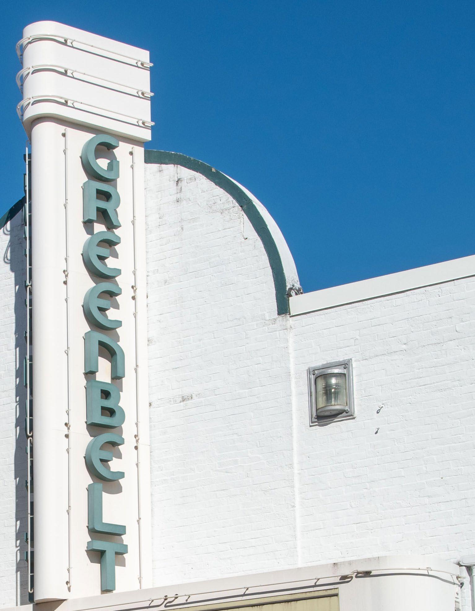
Greenbelt Strategic Wayfinding Plan
Abstract
Date June 2026
Title Greenbelt Strategic Wayfinding Plan
Author The Maryland-National Capital Park and Planning Commission
Subject Wayfinding Strategies for the City of Greenbelt
Source of copies The Maryland-National Capital Park and Planning Commission 1616 McCormick Drive
Largo, MD 20774
Series number 239262306
Number of pages 62
This document is a strategic wayfinding plan for the City of Greenbelt, Maryland, a municipality located in Prince George’s County, Maryland, incorporated in 1937 (Planning Area 67, Councilmanic District 4). In December 2021, the City of Greenbelt applied to the Prince George’s County Planning Department’s Planning Assistance to Municipalities and Communities (PAMC) program to fund a strategic wayfinding plan. PAMC funding was approved by the Prince George’s County Planning Board on May 5, 2022, and the project kicked off in January 2023. With the plan, the city seeks to orient, direct, and inform visitors and residents to both wellknown and less well-known attractions within historic Greenbelt and the city as a whole, with coordinated signage. This plan is consistent with the adopted strategies in the 2014 Plan 2035 Approved General Plan and the 2013 Approved Greenbelt Metro Area and MD 193 Corridor Sector Plan.
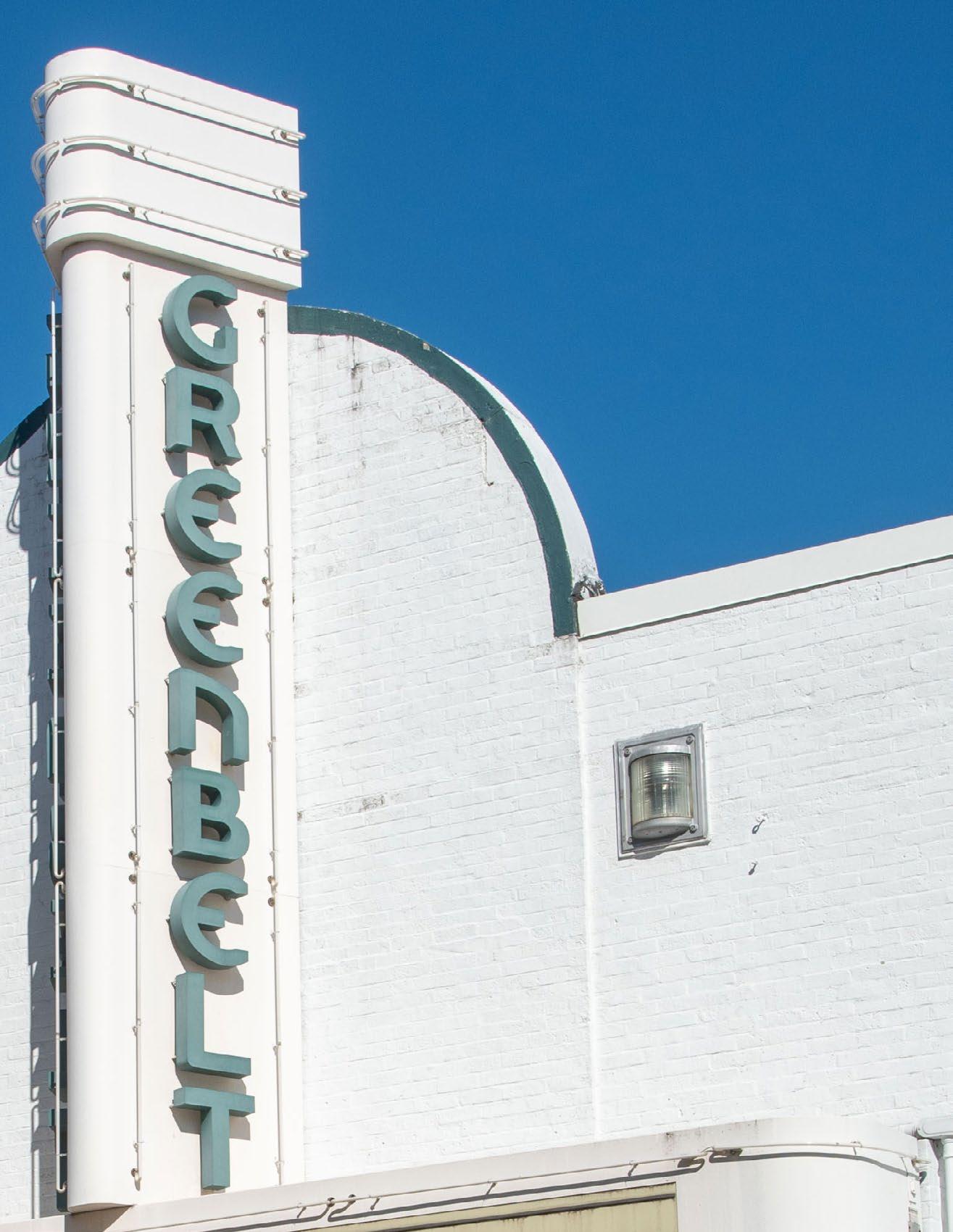
The Maryland-National Capital Park and Planning Commission
Artie L. Harris, Chair Vacant, Vice Chair
Officers
William Spencer, Acting Executive Director
Gavin Cohen, Secretary-Treasurer
Debra S. Borden, Esq., General Counsel
The Maryland-National Capital Park and Planning Commission (M-NCPPC) is a bicounty agency, created by the General Assembly of Maryland in 1927. The Commission’s geographic authority extends to the great majority of Montgomery and Prince George’s Counties: the Maryland-Washington Regional District (M-NCPPC planning jurisdiction) comprises 1,001 square miles, while the Metropolitan District (parks) comprises 919 square miles, in the two counties.
The Commission has three major functions:
• The preparation, adoption, and, from time to time, amendment or extension of the General Plan for the physical development of the Maryland-Washington Regional District.
• The acquisition, development, operation, and maintenance of a public park system.
• In Prince George’s County only, the operation of the entire county public recreation program.
The Commission operates in each county through a Planning Board appointed by and responsible to the County government. All local plans, recommendations on zoning amendments, administration of subdivision regulations, and general administration of parks are responsibilities of the Planning Boards.
The Prince George’s County Planning Department:
• Our mission is to help preserve, protect and manage the County’s resources by providing the highest quality planning services and growth management guidance and by facilitating effective intergovernmental and citizen involvement through education and technical assistance.
• Our vision is to be a model planning department of responsive and respected staff who provide superior planning and technical services and work cooperatively with decision makers, citizens, and other agencies to continuously improve development quality and the environment and act as a catalyst for positive change.









PRINCE GEORGE’S COUNTY PLANNING BOARD
Vacant Chair
Billy Okoye, Vice Chair Manuel R. Geraldo, Esq., Brittany Jenkins Lori Matthews
MONTGOMERY COUNTY PLANNING BOARD
Artie Harris, Chair Josh Linden, Vice Chair Mitra Pedoeem Shawn Bartley James Hedrick
Prince George’s County

Aisha N. Braveboy, County Executive
County Council
The County Council has three main responsibilities in the planning process: setting policy, plan approval, and plan implementation. Applicable policies are incorporated into area plans, functional plans, and the general plan. The Council, after holding a hearing on the plan adopted by the Planning Board, may approve the plan as adopted, approve the plan with amendments based on the public record, or disapprove the plan and return it to the Planning Board for revision. Implementation is primarily through adoption of the annual Capital Improvement Program, the annual Budget, the water and sewer plan, and adoption of zoning map amendments.
COUNCIL MEMBERS




Donna







J. Brown, Clerk of the Council
Krystal Oriadha, Chair, 7th District
Eric C. Olson, Vice Chair, 3rd District
Wala Blegay, At-large
Jolene Ivey, At-large
Thomas E. Dernoga, 1st District
Wanika B. Fisher, 2nd District
Timothy Adams, 4th District
Shayla AdamsStafford, 5th District
Danielle Hunter, 6th District
Edward P. Burroughs III, 8th District
Sydney J. Harrison, 9th District
List of Figures and Tables
Figure 1. Examples of Diverse Signage in Greenbelt
Figure 2. Greenbelt Signage Final Concept Design
Figure 3. Gateway Welcome Signage
Figure 4. Existing Art Deco Sign on Southway
Figure 5. Directional Signage
Figure 6. Example TAC Signage
Figure 7. Informational Signage
Figure 8. Existing ATHA Directory Sign
Figure 9. Identification Signage
Map 1: Wayfinding Plan Study Area
Map 2: Key Sites in Wayfinding Focus Area
Map 3: Signage Improvement Areas
Map 4: Gateway Sign Locations
Map 5: Vehicular Existing and Proposed Directional Sign Locations
Map 6: Pedestrian-Oriented Directional Sign Locations
Map 7: Informational Sign Locations (Kiosk and Directory)
Map 8: Identification Sign Locations (Site names)
Map 9: Identification Sign Locations (Banners)
Table 1: Gateway Sign Recommendations
Table 2: Recommendations for Existing Directional Vehicular Sign Modification (TAC)
Table 3: Recommendations for Directional Vehicular Sign Recommendations
Table 4: Directional Sign Location Recommendations (Trail Marker)
Table 5: Directional Sign Location Recommendations (Pedestrian)
Table 6: Informational Sign Location Recommendations (Directory)
Table 7: Informational Sign Location Recommendations (Kiosk)
Table 8: Identification Sign Location Recommendations (Site name)
Table 9: Identification Sign Location Recommendations (Banner)
Table 10: Cost Estimation by Sign Type
Introduction
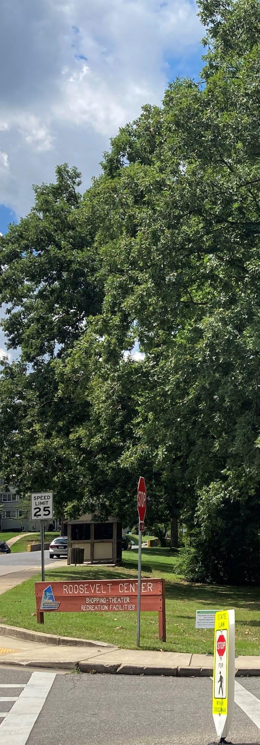
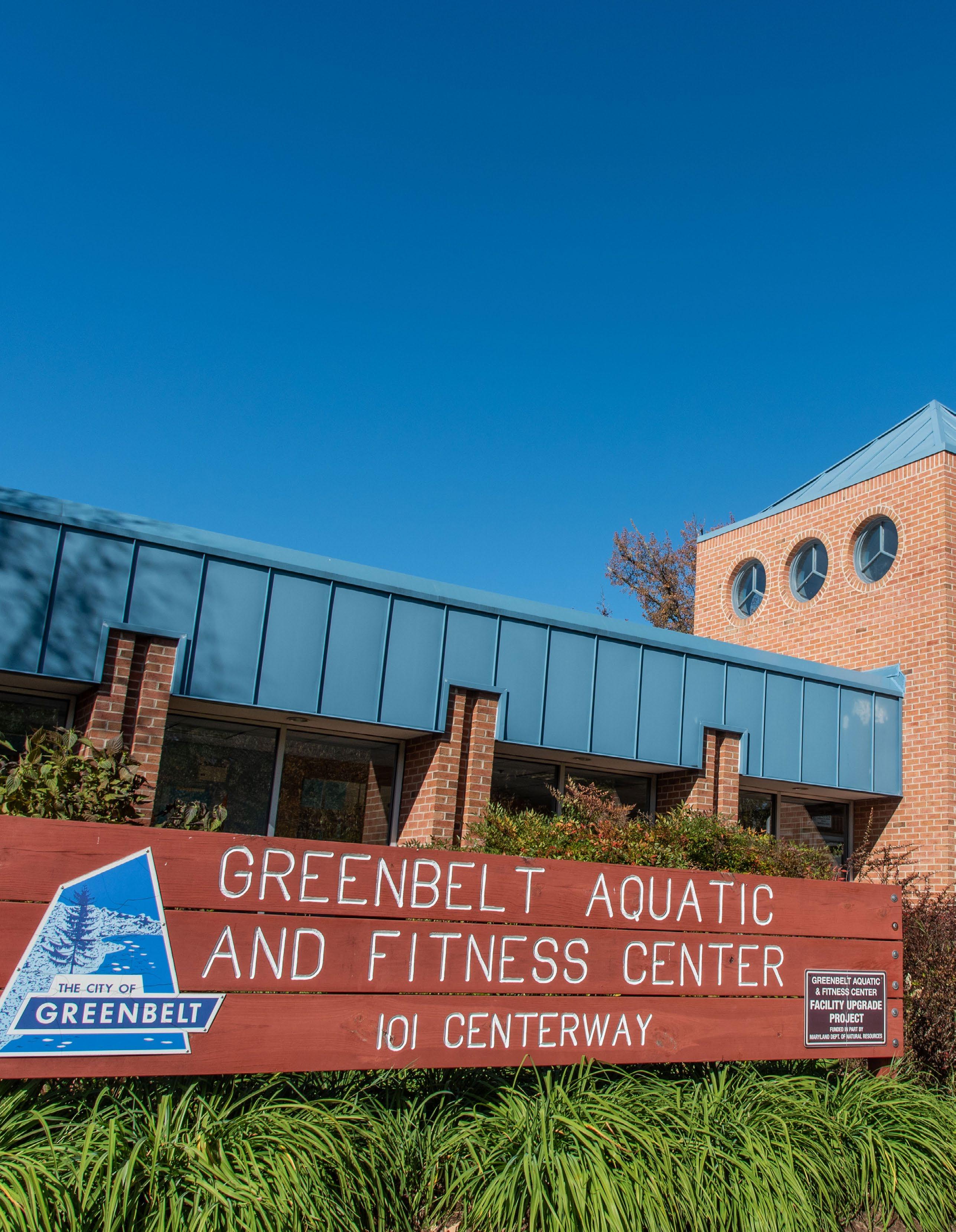
Incorporated in 1937 and a National Historic Landmark District, the City of Greenbelt is rich with natural amenities, Art Deco architecture, and multimodal access. Despite strong assets, inconsistent wayfinding lead to navigation challenges, making it difficult for visitors to locate main attractions. A lack of uniform signage blurs the city’s identity and sense of place. The primary goals of this plan were to:
Provide a detailed analysis of existing signage conditions;
Facilitate collaboration with city staff, advisory boards, and the community to ensure the plan meets the needs and goals of stakeholders;
• Develop a comprehensive wayfinding system that addresses existing gaps and helps improve the experience of city navigation by pedestrians, bicyclists, and drivers;
Create a cohesive identity through a standardized signage system; and
Propose a wayfinding plan with signage design concepts and location recommendations. Subsequent sections of this report provide details of the existing conditions analysis, stakeholder engagement and responses, and design concepts for new wayfinding signage. Funding and implementation strategies are explored as a baseline for future cost analysis.
CREDIT: M-NCPPC

Planning Background
In December 2021, the City of Greenbelt applied to the Prince George’s County Planning Department’s Planning Assistance to Municipalities and Communities (PAMC) program to fund a strategic wayfinding plan. PAMC funding was approved by the Prince George’s County Planning Board on May 5, 2022, and the project kicked off in January 2023. This wayfinding plan is consistent with the observations, recommendations, and strategies in the 2014 Plan 2035 Approved General Plan and the 2013 Approved Greenbelt Metro Area and MD 193 Corridor Sector Plan. Plan 2035 observes, “Without distinctive physical characteristics—such as… distinctive signage… —our communities are visually blending into each other,” (page 198).
The 2013 Approved Greenbelt Metro Area and MD 193 Corridor Sector Plan’s Transportation Key Recommendations include, “Implement a comprehensive wayfinding system for orientation and to help direct people and traffic to major destinations and attractions,” (page 3). The plan observes, “the isolation of the Greenbelt Metro Station and the lack of connectivity and wayfinding signage detract from the ability of pedestrians and bicyclists to travel to the station,” (page 49). Transportation Strategy 1.5 directs, “Provide a comprehensive wayfinding system of street signage, directional signs, interpretive signs, and markers,” (page 124). Economic Development, Marketing, and Branding Objective MB5 states, “Develop and implement a comprehensive wayfinding system of street signage, directional signs, interpretive signs, and markers,” (page 185).
Study Area Overview
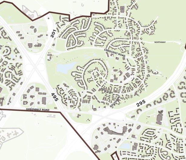
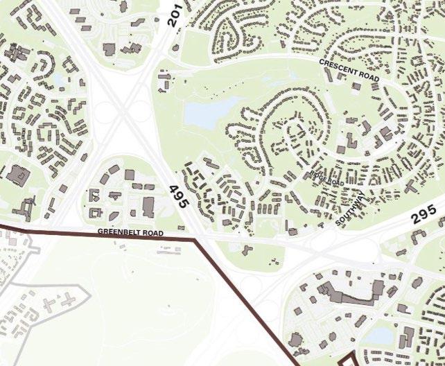
The study area comprised the portions of the municipality north of Greenbelt Road and the Capital Beltway, and did not include Greenbelt Park, owned by the U.S. Government, for which signage could not be prescribed. However, it was necessary to recommend some signs outside this boundary to provide directions to sites inside the boundary.
Wayfinding Plan Study Area
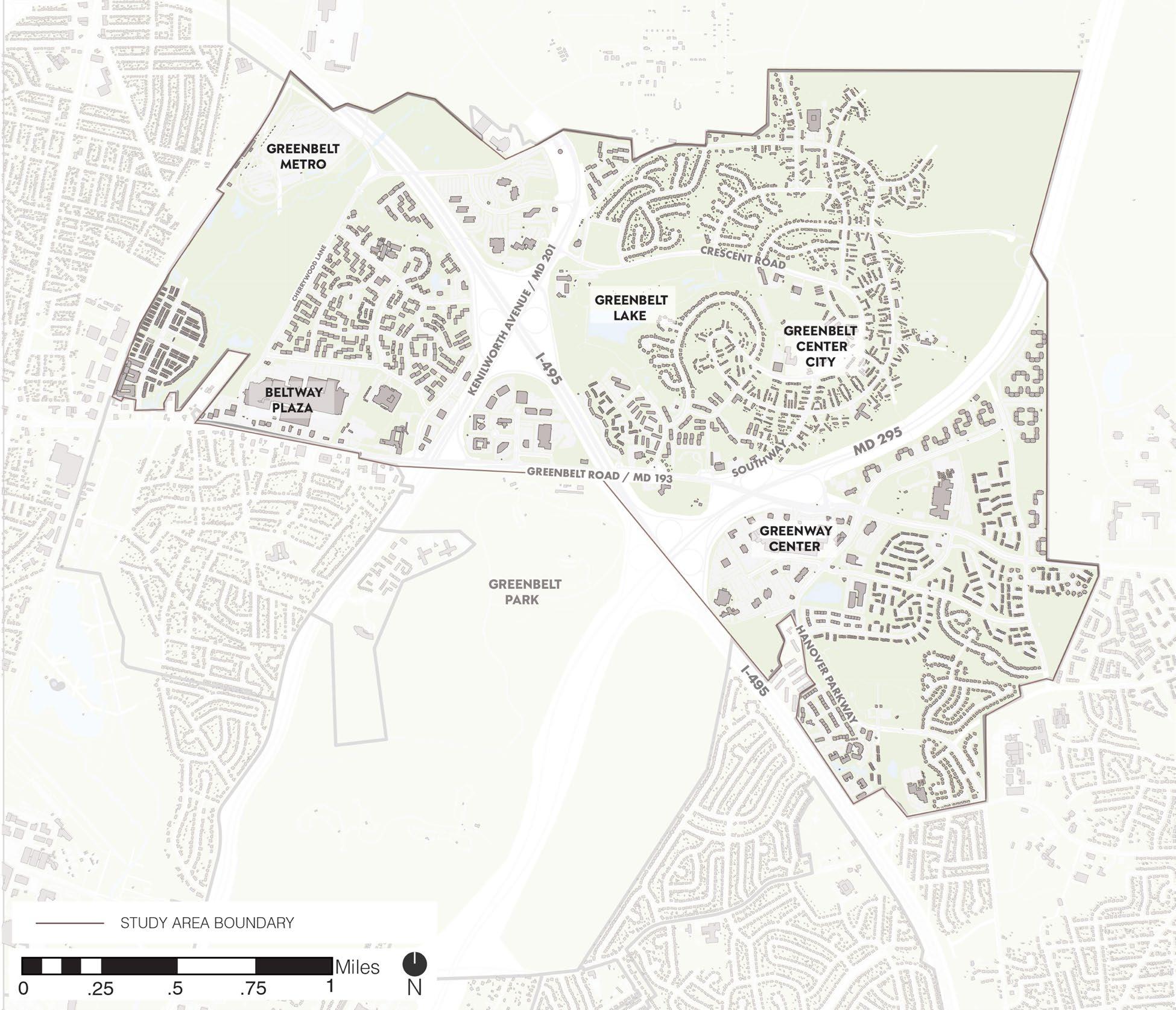
SOURCE: BASE AERIAL BY ESRI, MAXAR, EARTHSTAR GEOGRAPHICS, AND THE GIS USER COMMUNITY. INFORMATIONAL LAYERS BY PRINCE GEORGE’S COUNTY ( HTTPS://GISDATA.PGPLANNING.ORG/OPENDATA/ ). MAP CREATED BY NEIGHBORHOOD DESIGN CENTER.
As defined by Kevin A. Lynch in The Image of the City, “way-finding” is “a consistent use and organization of definite sensory cues from the external environment.”
1960: Cambridge, Massachusetts, The M.I.T. Press.
Wayfinding Principles
A successful wayfinding system facilitates getting from one place to another, provides clear information to the wayfinder about where they are, directions to where they want to go, and cues along the journey to help them stay on track. Signage, kiosks, and markers (pavement and trail) are common wayfinding elements that communicate directional information in urban environments. Landmarks and public art are also important elements that reinforce wayfinding through cognitive mapping, which is the ability of someone to rely on their memory and visual cues in their environment to create an internal map that helps them navigate intuitively.
Wayfinding systems are also one of the best tools to communicate and reinforce the brand of cities and neighborhoods. Displaying the local heritage and culture of the community on signage, public art, and landmarks strengthens the sense of place.
Greenbelt is one of several communities such as Hyattsville, Largo, and the Northern Gateway in the County that have initiated or implemented wayfinding projects to improve navigability and distinguish their identity. This wayfinding strategy will provide a visual connection to the many destinations within and around the city and guide people along trails, paths, and rights-of-way to important sites that drive tourism and community connections.
Existing Conditions
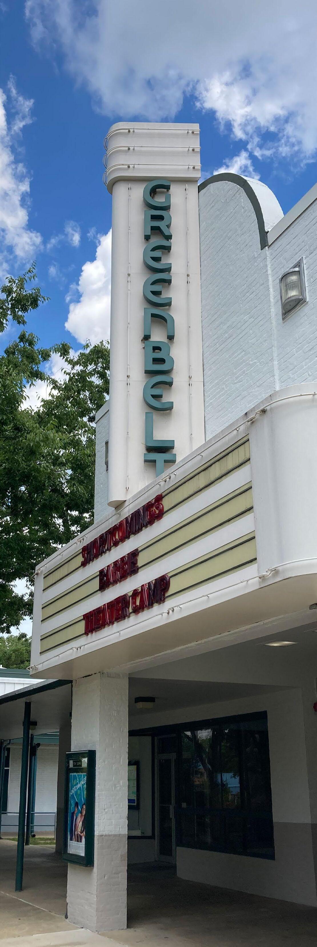
Greenbelt offers a range of amenities for residents and visitors. The Greenbelt National Historic Landmark District is one of the nation’s first planned communities1 and the site of many of the city’s popular destinations and amenities, including Roosevelt Center, Greenbelt Community Center, Greenbelt Branch Library, the historic Greenbelt Cinema, and numerous recreational facilities. Trails and green spaces are plentiful, and Greenbelt Park (outside the study area) offers an oasis for hiking, camping, and public gatherings. The city is served by the Greenbelt Metro Station and intersects MD 201 (Kenilworth Avenue), MD 193 (Greenbelt Road), I-295 (Baltimore-Washington Parkway) and I-495 (Capital Beltway), providing rail and automobile access to Washington, D.C. and Baltimore. Signage conditions and system gaps:
• Lack of a cohesive signage system
• Inconsistent signage content and standards
• Missing key wayfinding elements (maps, directions)
1 Greenbelt (PG:67-4) National Register of Historic Places nomination form, Maryland Inventory of Historic Properties. https:// apps.mht.maryland.gov/medusa/PDF/PrinceGeorges/PG;67-4.pdf
Key Sites
Map 2 identifies points of interest and destinations within the wayfinding focus area identified by the City. These sites are categorized by use and listed in the table below. Most key sites are along Greenbelt Road and in Roosevelt Center.
Key Sites in Wayfinding Focus Area
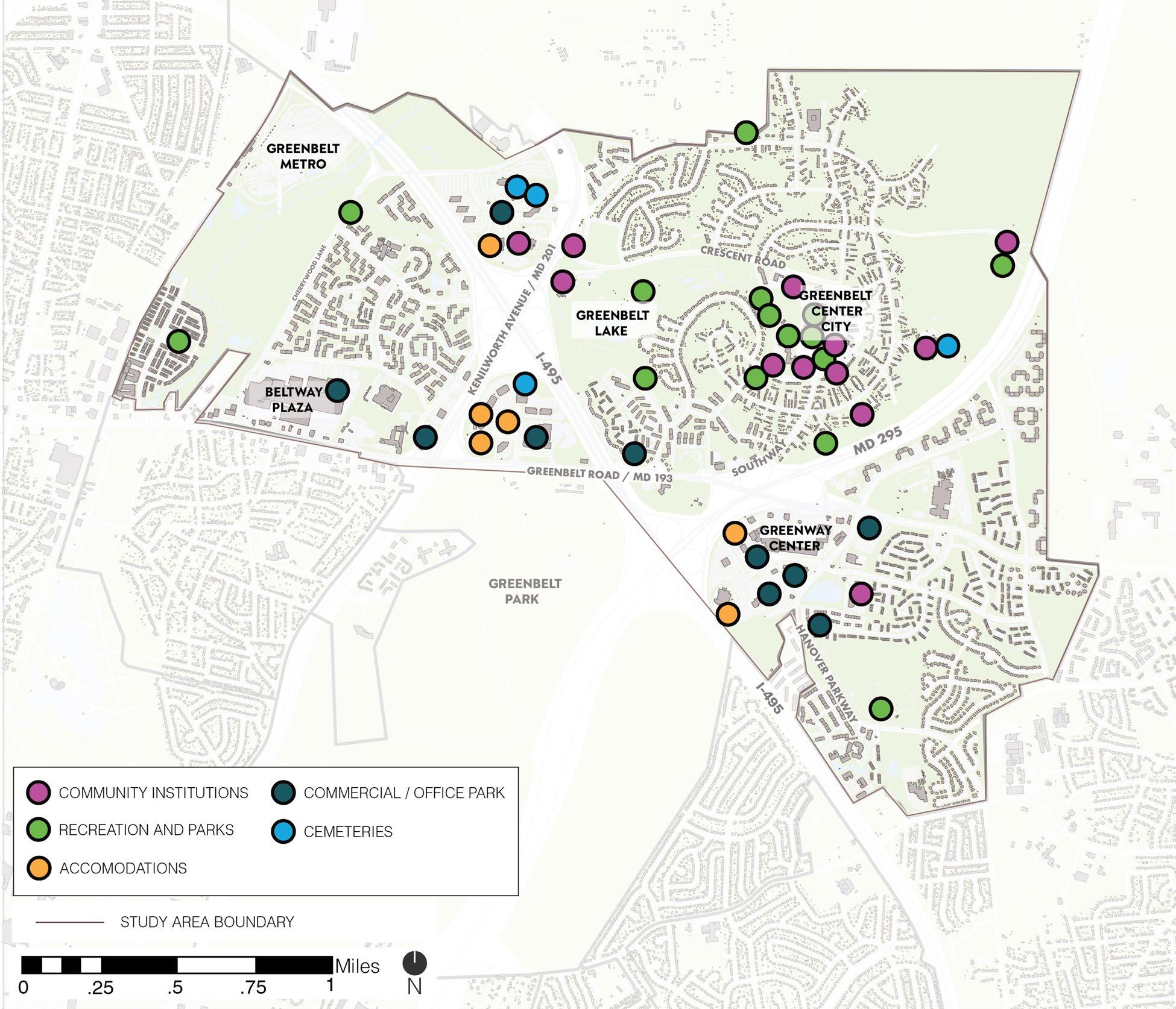
SOURCE: BASE AERIAL BY ESRI, MAXAR, EARTHSTAR GEOGRAPHICS, AND THE GIS USER COMMUNITY. INFORMATIONAL LAYERS BY PRINCE GEORGE’S COUNTY ( HTTPS://GISDATA.PGPLANNING.ORG/OPENDATA/ ). MAP CREATED BY NEIGHBORHOOD DESIGN CENTER.
MAP 2

COMMUNITY INSTITUTIONS
Greenbelt Post Office
Greenbelt Municipal Building
Greenbelt Branch Library, PGCMLS
Roosevelt Center
Greenbelt Volunteer Fire Department and Rescue Squad
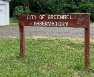
City of Greenbelt Observatory
Greenbelt Homes, Inc.
Greenbelt Cinema
Green Ridge House
Greenbelt Police Department
United States District Court, Greenbelt Division
Greenbelt Arts Center
Greenbelt Public Works Department
State Highway Administration (SHA)


District 3 Office
CEMETERIES
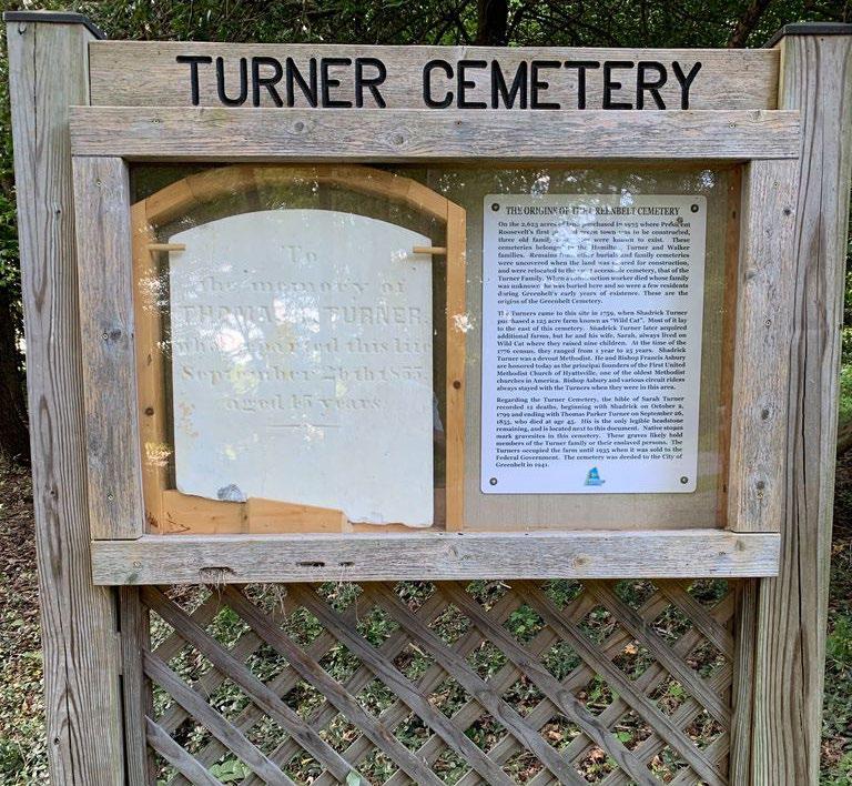
Turner Cemetery
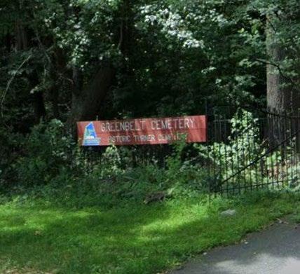
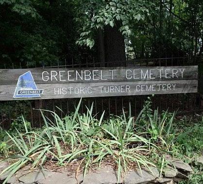
Greenbelt Cemetery
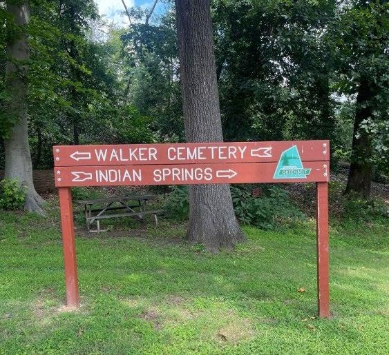
Walker Cemetery
Hamilton Cemetery
COMMERCIAL / OFFICE PARKS
Greenway Center
Beltway Plaza Mall
Triangle Centre / Golden Triangle
Capital Office Park
Maryland Trade Center
Hanover Office Park
Belle Point
Commerce Center
Greenbelt Professional Center
Greenway East Professional Center
RECREATION & PARKS
Greenbelt Aquatic & Fitness Center
Greenbelt Community Center
Greenbelt Youth Center
Springhill Lake Recreation Center
Greenbelt Museum
PRIMARY CITY OWNED PARKS
Buddy Attick Lake Park
Schrom Hills Park
ATHLETIC FIELDS / SITES
Braden Field Complex
McDonald Field
Northway Field
Braden Tennis/Pickleball Courts
Lakecrest Tennis/Pickleball Courts
Greenbelt Skatepark
Braden Sand Volleyball Court
OTHER PARK SPACES
73 Court Ridge Road
Greenbelt Dog Park
Central Park at Greenbelt Station
Greenbrook Lake
TRAILS
Greenbelt Metro Trail [future]
Indian Creek Trail
East Coast Greenway
American Discovery Trail
ACCOMMODATIONS
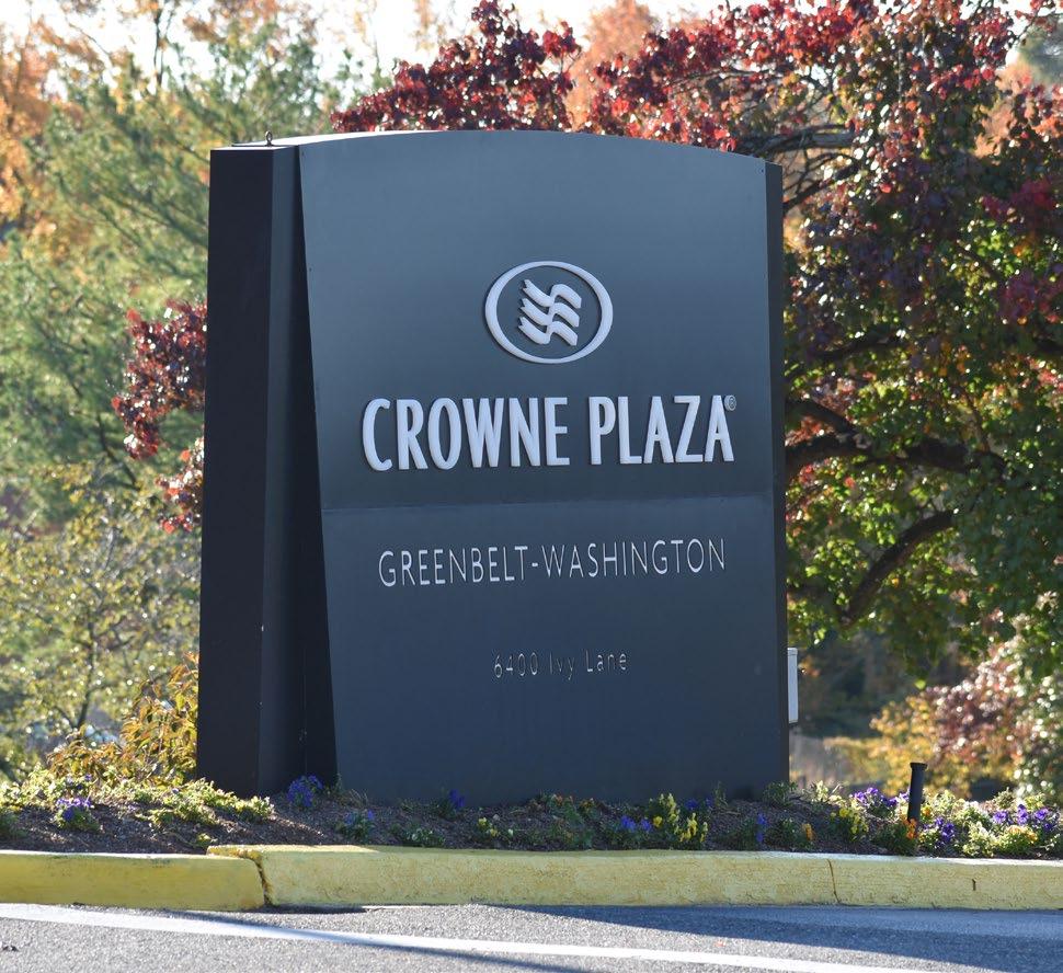
Crowne Plaza
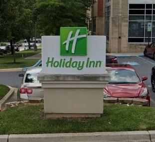
Holiday Inn
Hilton Garden Inn
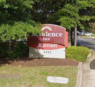
Residence Inn by Marriott
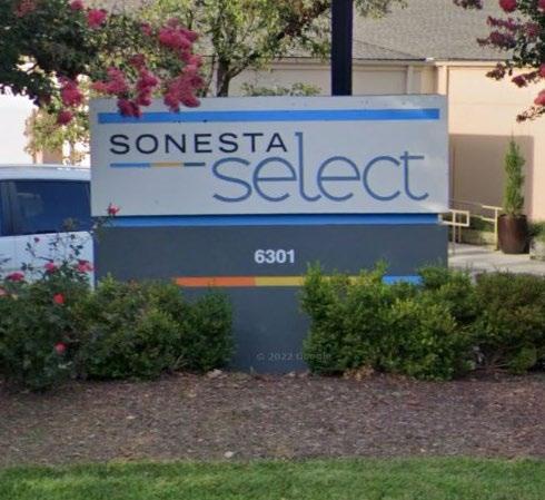
Sonesta Select
Woodspring Suites



Analysis of Signage Conditions and System Gaps
Hotels and business parks typically have their own branding standards, therefore, this strategy focuses on key destinations and cultural landmarks. The goal is to propose a wayfinding system that remains unique, user-friendly, and serves the broader community and visitors.
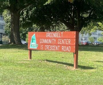
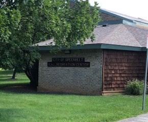
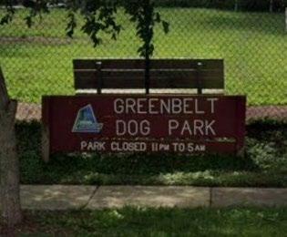
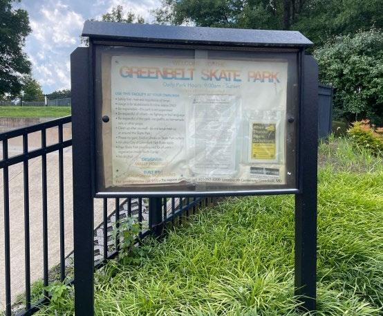
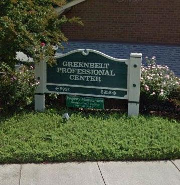
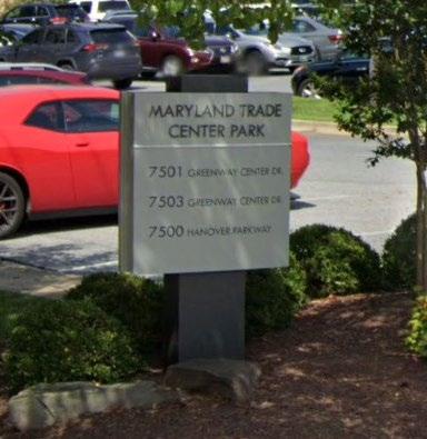
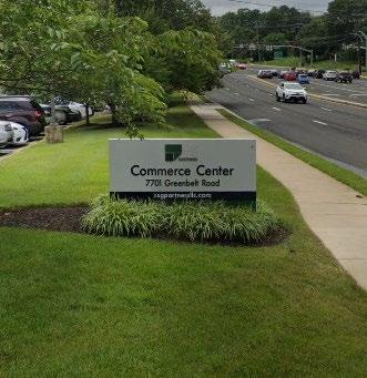
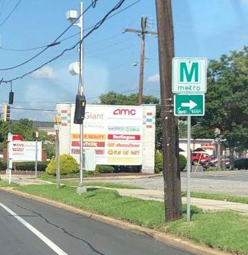
While there is some consistency in the style of signage within park facilities, overall, the signage types lack
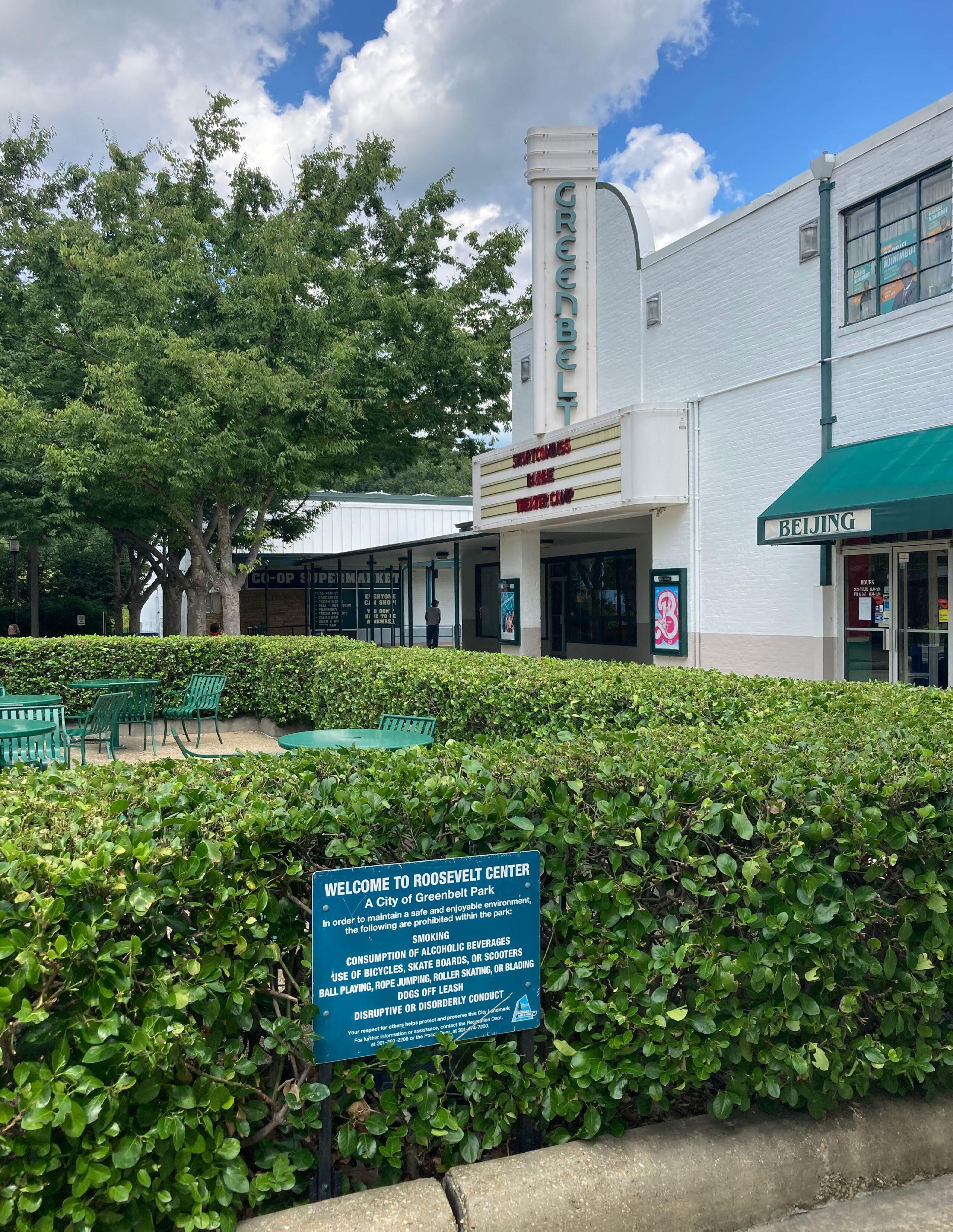
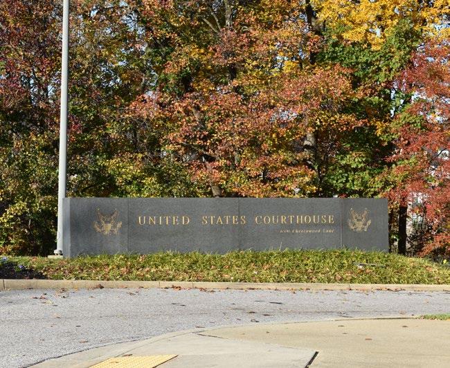
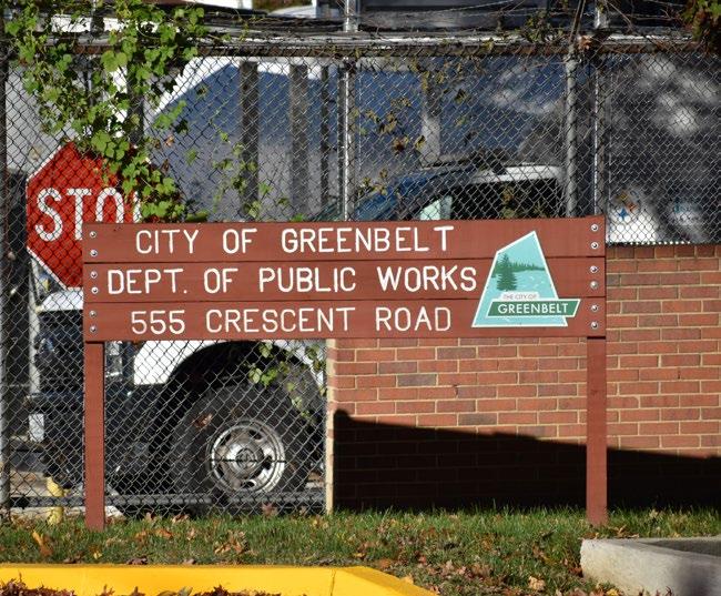
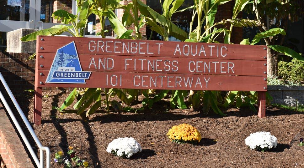
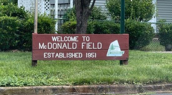
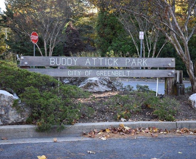
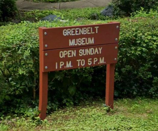
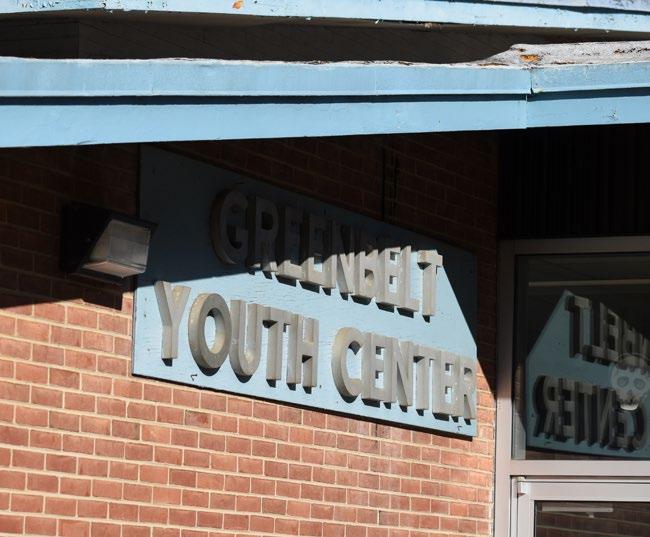
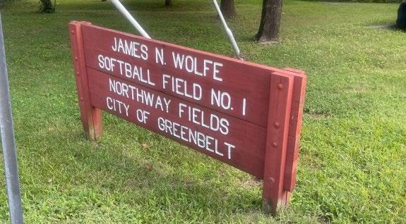
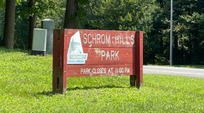
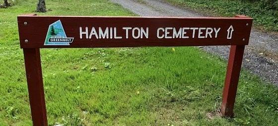
cohesion. Materials are varied, although wood panel/ post signs are the most common. Signage content varies widely, with no consistent listing of addresses, arrows, and business names. Key sites lack wayfinding elements such as maps or arrows.
Appendix A provides detailed information about existing signage, including type, condition, and content.
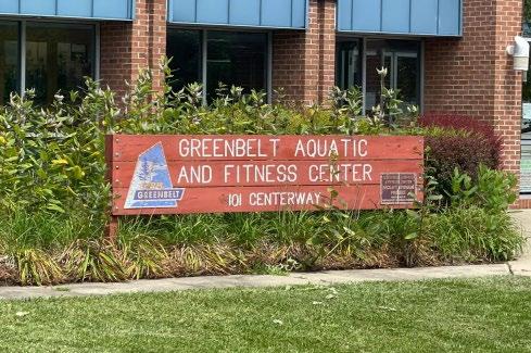
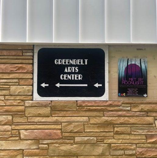
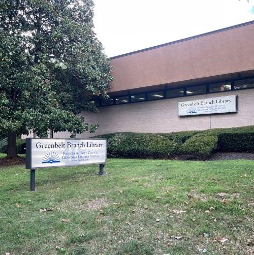
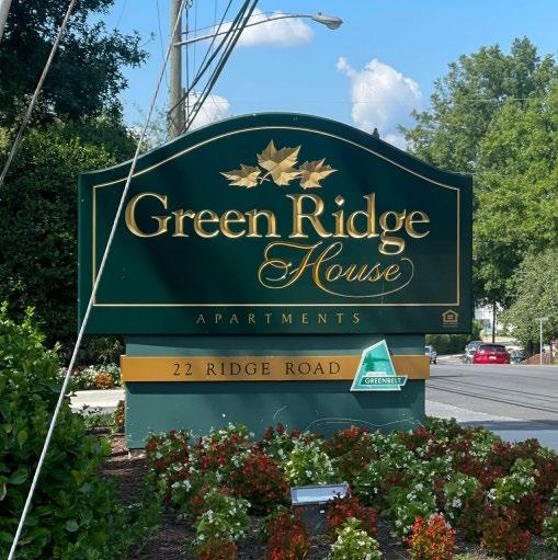
Figure 1. Examples of Diverse Signage in Greenbelt
CREDIT: NEIGHBORHOOD DESIGN CENTER.
Community and Stakeholder Engagement
An online survey and interactive map were created for community members to provide comments about topics relating to signage and wayfinding.
Signage Improvement Areas

Survey responses indicated there is a significant demand for improved signage to enhance visibility and accessibility for both drivers and pedestrians.
The goal of the survey and mapping exercise was to gather resident opinions on existing signages and for the community to identify key destinations and wayfinding gaps. The interactive mapping tool was provided as a link at the end of the community survey. The survey was hosted by the City of Greenbelt and was publicized via city newsletter and social media posts. The survey was open for responses mid-January to February 2024. The community survey received 179 responses while the interactive map received 108 responses.
For the survey responses the largest share of respondents (34.5 percent) were in the 61-74 age group and the 45-60 age group (27.1 percent). Those in the 30-44 age group responded with at a rate of 18.1 percent. The majority of the respondents were residents of the Center City (55.4 percent), the area between Kenilworth Avenue and the Baltimore-Washington Parkway. Residents of Greenbelt East (east of the Baltimore-Washington Parkway) represented another significant portion at 29.9 percent. Residents of Greenbelt West contributed 7.4 percent and 7.3 percent of the respondents resided outside of Greenbelt.
Survey responses indicated there is a significant demand for improved signage to enhance visibility and accessibility for both drivers and pedestrians. Suggestions include better placement of signs along roads and pedestrian areas, particularly for community institutions, parks, and recreation facilities. Concerns about inadequate signage are especially prominent for Roosevelt Center and Greenbelt Center City. Residents and visitors expressed a need for directional signs to key landmarks. There is a desire for parks and facilities to be more visible from major roads like Greenbelt Road, along with requests for consolidated and more prominent signage for businesses on main roads such as Crescent Road and Southway. Appendix B presents a summary of the key community feedback received through the survey. Using the interactive mapping the residents were asked to map locations in Greenbelt where signage was good, bad or needed improvement. Most “bad” or “need improvement” points are in Greenbelt Center City (see Map 3).
Presentations were made to city staff to share draft research findings, the outline and draft of the Strategic Wayfinding Plan, and draft sign design concepts. These materials were also shared in draft form with relevant city advisory boards and the Greenbelt City Council to gather comments and ensure alignment with community goals and priorities.
BETTER PLACEMENT OF SIGNS ALONG ROADS AND PEDESTRIAN AREAS
CONCERNS
ABOUT INADEQUATE SIGNAGE
DESIRE FOR PARKS AND FACILITIES TO BE MORE VISIBLE FROM MAJOR ROADS
Stakeholder work sessions were held with the following agencies to discuss implementation and coordination, identify available funding, and ensure compliance with county, state, and federal regulations.
Maryland State Highway Administration (SHA)
Peter Campanides, P.E., Former Assistant District Engineer – Traffic, Prince George’s County District 3 Office
• Stephen M. Hollie Jr, Project Manager (Consultant), Office of Traffic and Safety
Prince George’s County Department of Public Works & Transportation (DPW&T)
Erv Beckert, Chief of Highway and Bridge Design Division
• Hadi Quaiyum, Chief of Traffic Engineering and Safety Division
M-NCPPC Prince George’s County Department of Parks & Recreation (DPR)
• Robert Patten, Planner IV, Trail Development Program Manager, Park Planning and Environmental Stewardship Section
Anacostia Trails Heritage Area, Inc. (ATHA)
Valerie Woodall, Associate Director
Date Event
April 24, 2024
September 4, 2024
November 5, 2024
Presentation to city staff on Existing Conditions
Presentation to the Advisory Boards on Sign Design Concepts and Strategic Wayfinding Plan Outline
Stakeholder Work Session I— city staff, DPR, DPW&T & ATHA reviewed Sign Design Concepts and Strategic Wayfinding Plan Outline and discussed coordination and implementation
November 11, 2024
December 16, 2024
April 16, 2025
September 17, 2025
Stakeholder Work Session II— city staff, MDOT SHA reviewed Sign Design Concepts and Strategic Wayfinding Plan Outline and discussed coordination and implementation
Presentation to the Greenbelt City Council on Sign Design Concepts and Outline of Strategic Wayfinding Plan
Presentation to the Advisory Boards on the Draft Strategic Wayfinding Plan
Presentation to the City Council on the Draft Wayfinding Plan
Wayfinding Strategy
Greenbelt’s wayfinding system is guided by a set of design goals and concepts intended to enhance navigation, strengthen community identity, and ensure consistency across the city.
Design Goals and Concepts
SIGNAGE TYPE: Updated signage must be accessible, incorporate informational maps when appropriate, provide context for users and comply with the Maryland Manual of Uniform Traffic Control Devices (MdMUTCD) where appropriate.
SIGNAGE LOCATION: Provide necessary signs to enhance the connectedness of the city’s amenities and key sites.
COMMUNITY CHARACTER: New signage should reflect and represent the unique character of the community, fostering a sense of identity and pride.
Collectively, these design goals and concepts informed the development of the wayfinding sign types provided in the following sections.








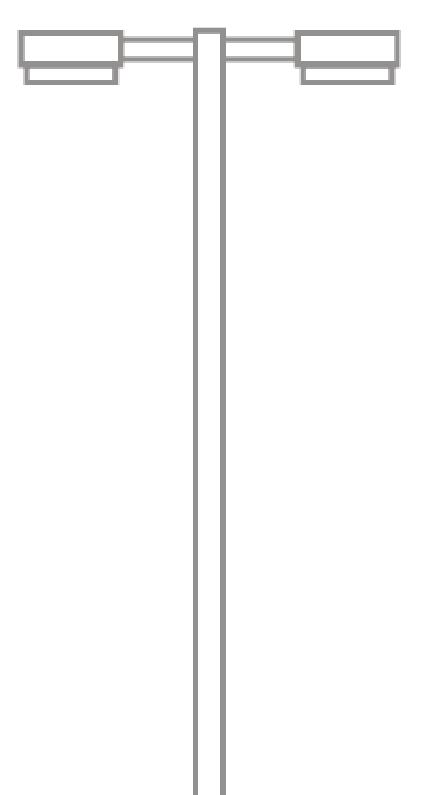



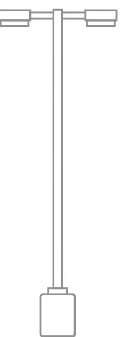







Greenbelt Signage Final Concept Design
The Greenbelt Wayfinding System consists of various sign types that support user movement and decision-making. The design concept incorporates the Art Deco style, which is prominent throughout Greenbelt and was highlighted by advisory boards during the engagement process. The family of signs adapts as needed, to the City’s primary and secondary colors. The schematic in Figure 2 presents the final concept sign designs for Greenbelt’s wayfinding system.







*Part of existing Greenbelt city branding colors www.greenbeltmd.gov






Figure 2. Greenbelt Signage Final Concept Design Pantone
Pantone
Pantone
Greenbelt Logo

Greenbelt Welcome Signage
Gateway signs are prominent welcome signs positioned at key entry points to a city, town, or neighborhood. As part of a community wayfinding plan, these signs establish a sense of place, marking the transition into a defined area. They often incorporate distinctive branding elements such as logos, colors, and architectural features that reflect the community’s identity. Gateway signs enhance navigation by signaling arrival and suggesting how a visitor might perceive the community: Welcoming? Exclusive? Historic? Modern? Traditional? Quiet? Fun?
The gateway monument sign is a key element of Greenbelt’s wayfinding plan, marking major entrances into the city with a bold presence. The design elements reflect Greenbelt’s historic Art Deco and Streamline Moderne architectural heritage, incorporating clean lines, rounded corners, and smooth surfaces. The Greenbelt logo is featured. The lettering is recommended to be backlit, ensuring it remains highly visible and inviting.
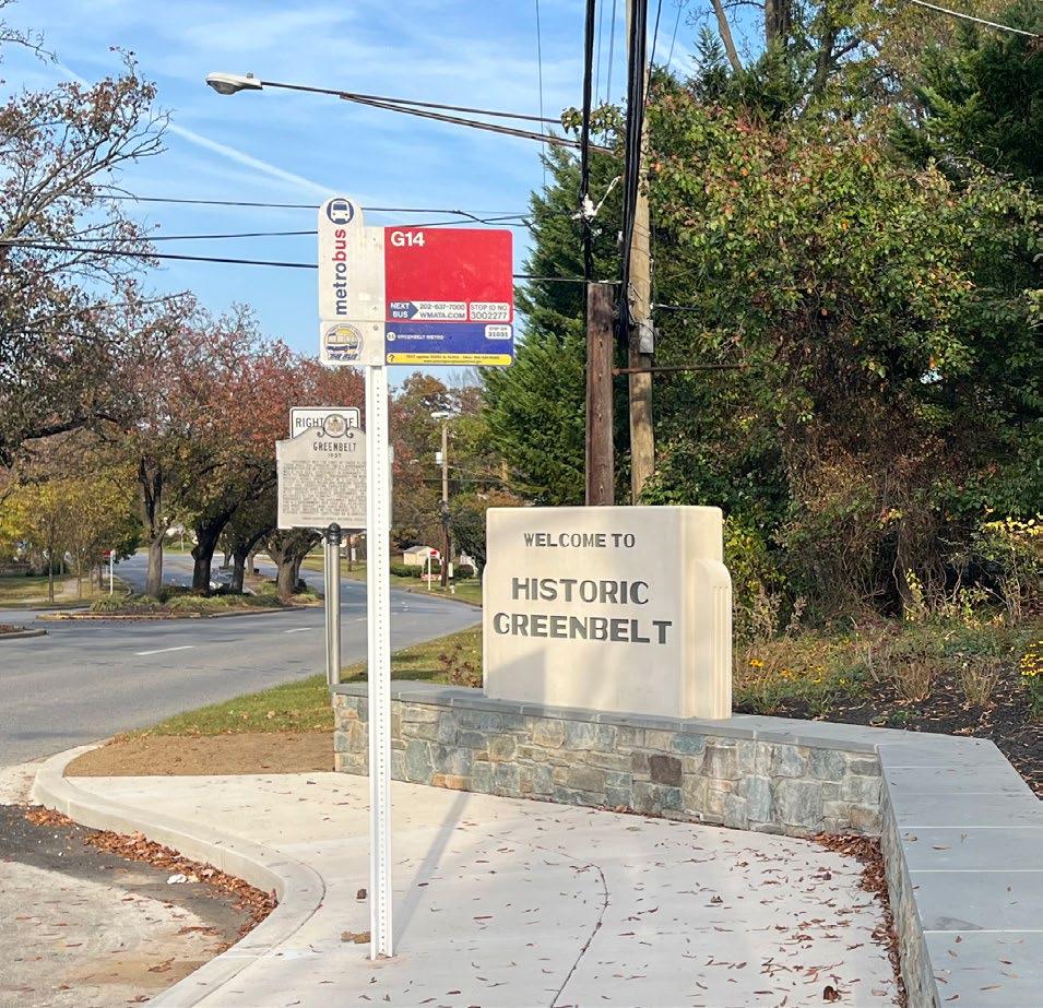
A recently installed monument sign “Welcome to Historic Greenbelt” on Southway at the juncture of the Baltimore-Washington Parkway off-ramp and a service road continues the Streamline Moderne style of prominent buildings throughout the historic district, juxtaposed with the rustic stonework suggesting nature. The proposed gateway signs are intended to complement this monument sign.
MATERIALS
Precast Concrete or GFRC (Glass Fiber Reinforced Concrete): Mimics natural stone but is lighter and more durable.
• Lettering and graphics: Laser-Cut or Routed Aluminum Lettering – Mounted onto the aluminum panel for a dimensional effect. Illumination: Integrated LED backlighting for nighttime visibility.
• UV-Resistant and Anti-Graffiti Coatings: Protects from weathering and vandalism.




Figure 3. Gateway Welcome Signage
Figure 4. Existing Art Deco Sign on Southway SOURCE: NEIGHBORHOOD DESIGN
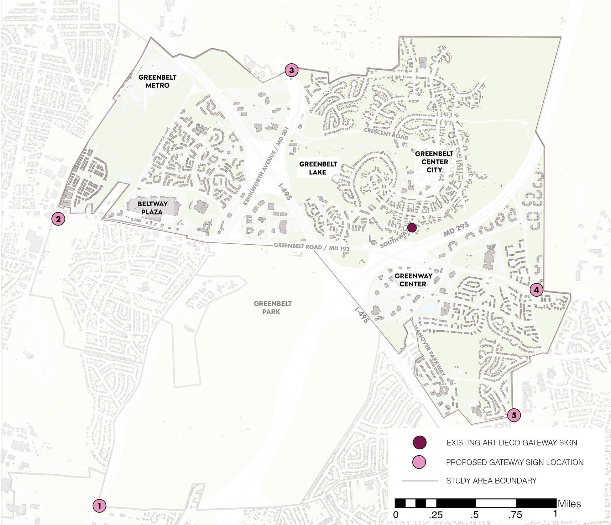
Gateway Sign Locations

Directional Signage
Directional signage identifies key destinations within reasonable travel distances or travel times from the sign location. They help to orient travelers with directional elements—typically an arrow, travel distance, and travel time—to the destination to enhance users’ confidence when making travel decisions. Vehicular decision signs, pedestrian/bike decision signs, and trail markers are directional signs proposed throughout this wayfinding plan to facilitate multimodal access to key sites.
TOURIST AREA CORRIDOR SIGNAGE
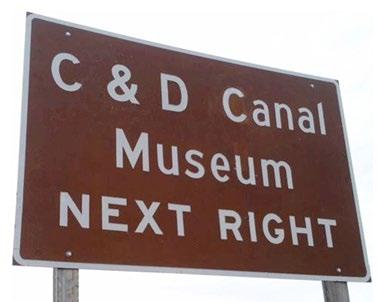
Tourist Area Corridor (TAC) signs are supplemental directional guides on selected public roads that provide clear navigation to state recreational and cultural facilities.2 These signs are brown and white or blue and white, commonly present along highways and state roads and alert travelers of upcoming attractions. Table 2 lists the existing TAC signs within the study area, which can supplement the local wayfinding system. However, since these signs must adhere to strict design standards for statewide uniformity, they will not be consistent with the style or aesthetic of the proposed wayfinding signage family.
5. Directional Signage

MATERIALS
• Sign Panel: Aluminum (0.080” or 0.125” thick) – MdMUTCD-preferred, lightweight, corrosionresistant, and long-lasting.
Reflective Sheeting: Diamond Grade
Reflective Sheeting – Recommended for hightraffic or major roadways like Kenilworth Ave (MD 201) and Greenbelt Road (MD 193).
Post and Mounting System: Powder-Coated Aluminum or Galvanized Steel Posts Ensures rust resistance and longevity.
Graphics and Lettering: Digitally Printed UV-Resistant Inks – Prevents fading, ensuring long-term clarity.


2 Maryland Department of Transportation, State Highway Administration, Tourist Area and Corridor Signage Program (TAC), https://roads.maryland.gov/mdotsha/pages/Index.aspx?PageId=4
Figure
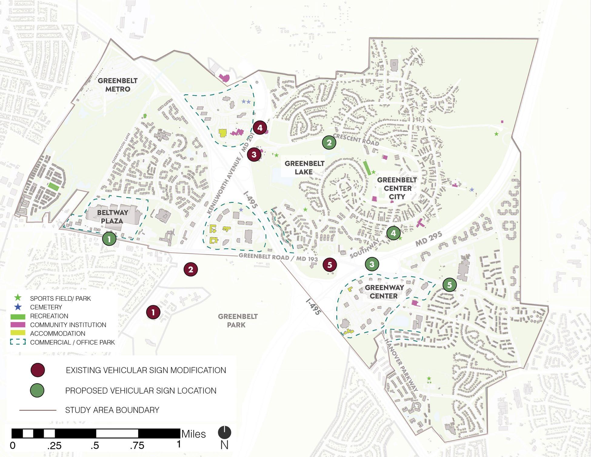
In coordination with the State Highway Administration (SHA), there is flexibility to modify or repurpose existing TAC signs in coordination with a local wayfinding plan. This can include adding icons or community logos. A combination of TAC signage and community wayfinding signage is proposed to enhance navigation and visitor experience throughout the study area. Recommended locations include areas along MD 201 (Kenilworth Avenue) and MD 193 (Greenbelt Road). Blue and white local information signs along Crescent Road and Southway should be replaced with updated signage.
SOURCE: MDOT SHA, HTTPS://ROADS.MARYLAND.GOV/MDOTSHA/PAGES/INDEX.ASPX?PAGEID=4
Vehicular Existing and Proposed Directional Sign Locations
SOURCE: BASE AERIAL BY ESRI, MAXAR, EARTHSTAR GEOGRAPHICS, AND THE GIS USER COMMUNITY. INFORMATIONAL LAYERS BY PRINCE GEORGE’S COUNTY ( HTTPS://GISDATA.PGPLANNING.ORG/OPENDATA/ ). MAP CREATED BY NEIGHBORHOOD DESIGN CENTER.
Figure 6. Example TAC Signage
MAP 5
Pedestrian Signs and Trail Markers
This strategy recommends new pedestrian signage on local roads along walking and biking paths. When trails are in proximity, the signs can incorporate iconography to indicate the local trail paths, supplemented by the trail name. A pedestrian sign with pedestrian or bicycle icons can replace a standard green and white trail wayfinding sign used by the M-NCPPC Department of Parks and Recreation (DPR), if located in the same proximity.
However, the proposed signs will not replace signage on trails owned and managed by M-NCPPC-DPR. The department is currently updating its trail wayfinding signage guidelines; further coordination between the city and DPR should occur to eliminate gaps in the system with adequate signage and ensure that signage placement does not overlap.
Anacostia Trails Heritage Area (ATHA) pedestrian signs also exist in the study area, particularly in Greenbelt Center City. Currently, ATHA is conducting an inventory study to assess these signs, including the potential for consolidation or replacement based on the city’s needs and recommendations presented in this study. The PAMC-funded 2023 Anacostia Trails Heritage Area Wayfinding and Signage Study proposes recreational and cultural resource interest area signs for Roosevelt Center and Buddy Attick Park.
Strategically placed trail markers along the pedestrian and bike routes will reassure users that they are on a designated trail when navigating Greenbelt. The city should evaluate the placement of the markers in partnership with M-NCPPC-DPR to ensure consistency and ease of recognition for users as they move through the local trail network.
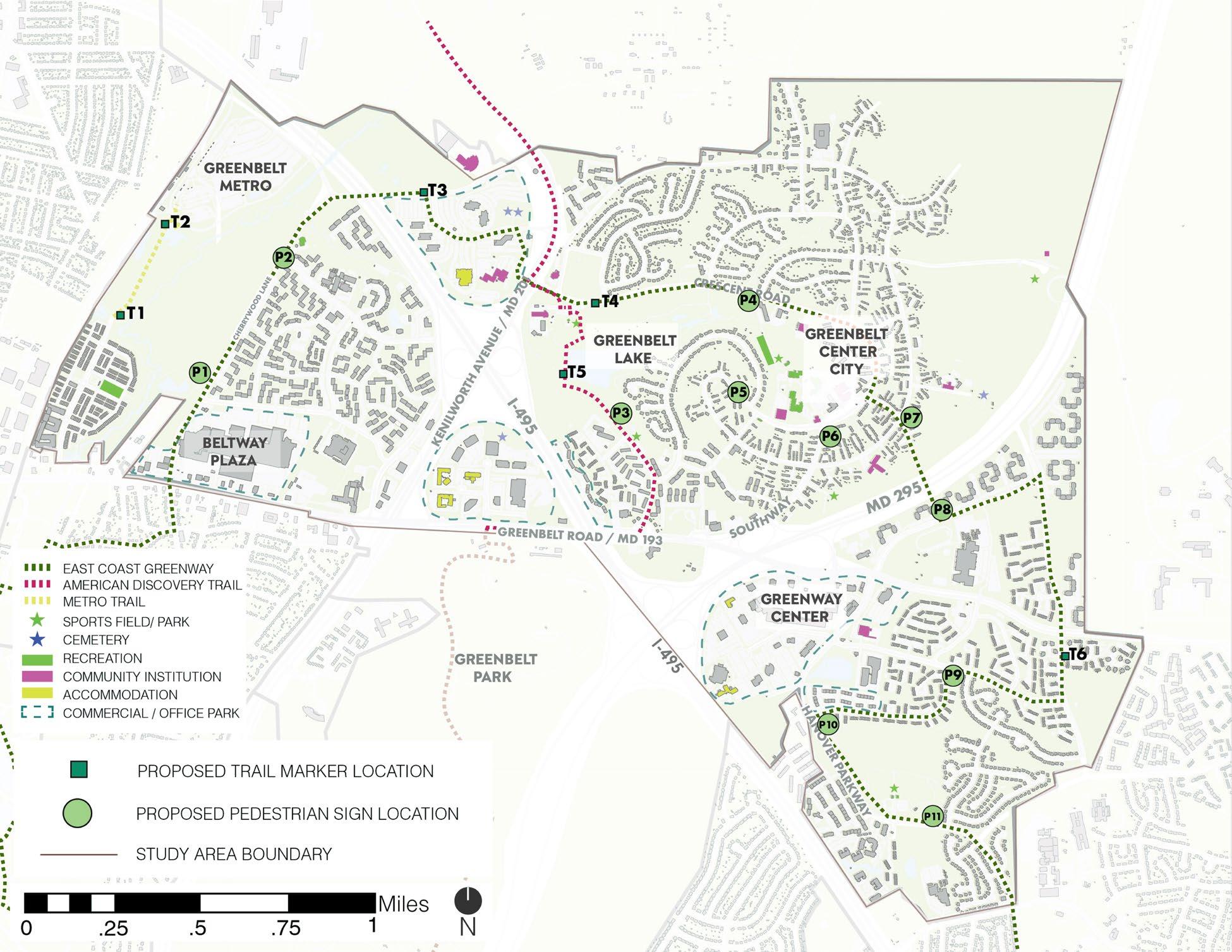
4. Directional Sign Location Recommendations (Trail Marker)
Table 5. Directional Sign Location Recommendations (Pedestrian)
ID # Recommended Key Sites Location
P1
P2
P3
P4
P5
P6
P7
P8
P9
Beltway Plaza Mall, Greenbelt Metro, Springhill Lake Recreation Center, Greenbelt Station Central Park Southbound Cherrywood Lane
Greenbelt Metro, Springhill Lake Recreation Center, Capital Office Park, Greenbelt Cemetery Northbound Cherrywood Lane
Buddy Attick Lake Park, Lakecrest Tennis/Pickleball Courts Lakecrest Drive (38°59'59.4"N 76°53'15.5"W)
Buddy Attick Lake Park, Braden Courts, Greenbelt Skatepark, Greenbelt Youth Center, Greenbelt Aquatic & Fitness Center Field House Road
Greenbelt Museum, Greenbelt Branch Library, Greenbelt Community Center, Greenbelt Cinema Crescent Road and Lakeside Road
Greenbelt Museum, Greenbelt Branch Library, Greenbelt Community Center, Greenbelt Cinema, Greenbelt Arts Center, Greenbelt Skate Park Southway and Crescent Road
Greenbelt Cinema, Greenbelt Arts Center, Greenbelt Observatory, Hamilton Cemetery Gardenway and Ridge Road
Greenbelt Cinema, Greenbelt Arts Center, Greenbelt Observatory, Roosevelt Center Hanover Parkway (Entrance to Spellman Overpass)
Greenway Center, Greenbelt Post Office, Schrom Hills Park & Recreation Center Ora Glen Drive & Greenbrook Drive
P10 Greenway Center, Schrom Hills Park & Recreation Center Southbound Hanover Parkway
P11
Greenway Center, Schrom Hills Park & Recreation Center, Greenbelt Post Office Northbound Hanover Parkway
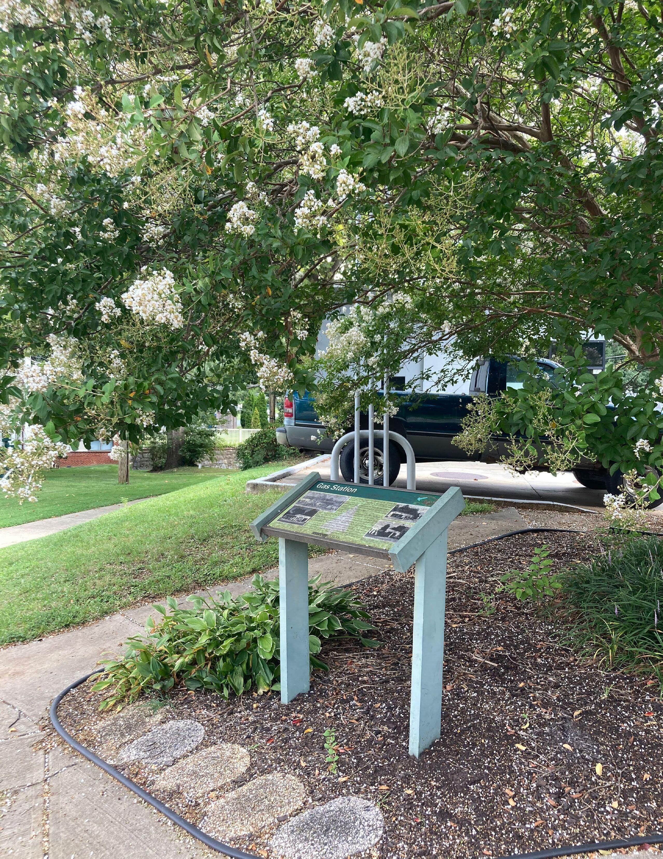
CREDIT: NEIGHBORHOOD DESIGN CENTER.
Informational Signage
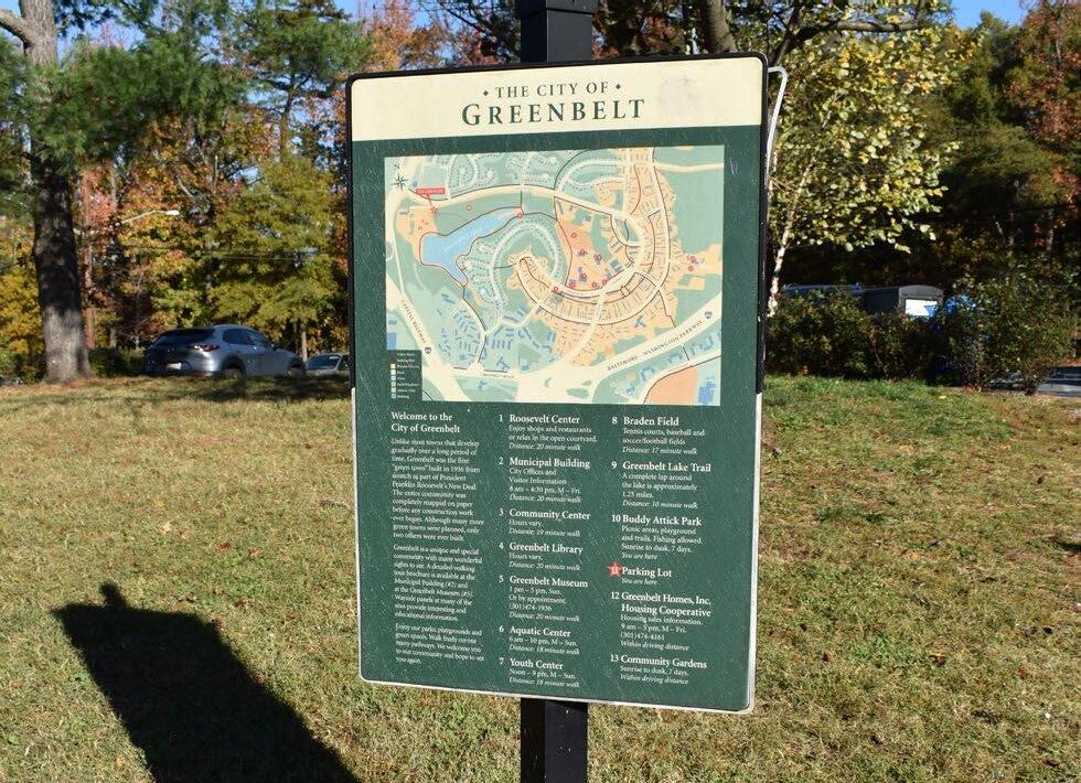
Informational signage provides visitors and residents with essential details about a place, service, or point of interest. These signs often include maps, historical markers, informational plaques, directories, historical or cultural context, and regulations (such as parking rules or hours of operation). They are found in public spaces such as parks, transit stations, downtown districts, and historic sites. Informational signage enhances the user experience by offering clear, accessible, and visually engaging content that helps people navigate and engage with their surroundings.
Directories help users navigate and learn more about their surroundings with greater detail about history and other information. Table 6 lists proposed locations for informational directories.
Kiosks should include maps and be placed at key locations, such as Roosevelt Center, Buddy Attick Park, along major pedestrian and bike trails, and where additional historical context can be shared. These kiosks help inform visitors that they have arrived at an important location, enhancing their understanding of the city’s history and cultural heritage. Kiosks and directories can incorporate digital screens, allowing for real-time updates, as well as QR codes that provide additional information through mobile devices.
MATERIALS
Aluminum: Most common, corrosion-resistant, lightweight, and long-lasting.
• Concrete or Stone Base (Polished or Honed Finish)—Provides a solid foundation Etched Metal Panels (Bronze or Brushed Aluminum)—For engraved maps, directories, or historical information. This material offers longevity and a refined look.
• E-Paper Displays or LED Screens—if digital displays are preferred.





Figure 7. Informational Signage
CONSOLIDATION
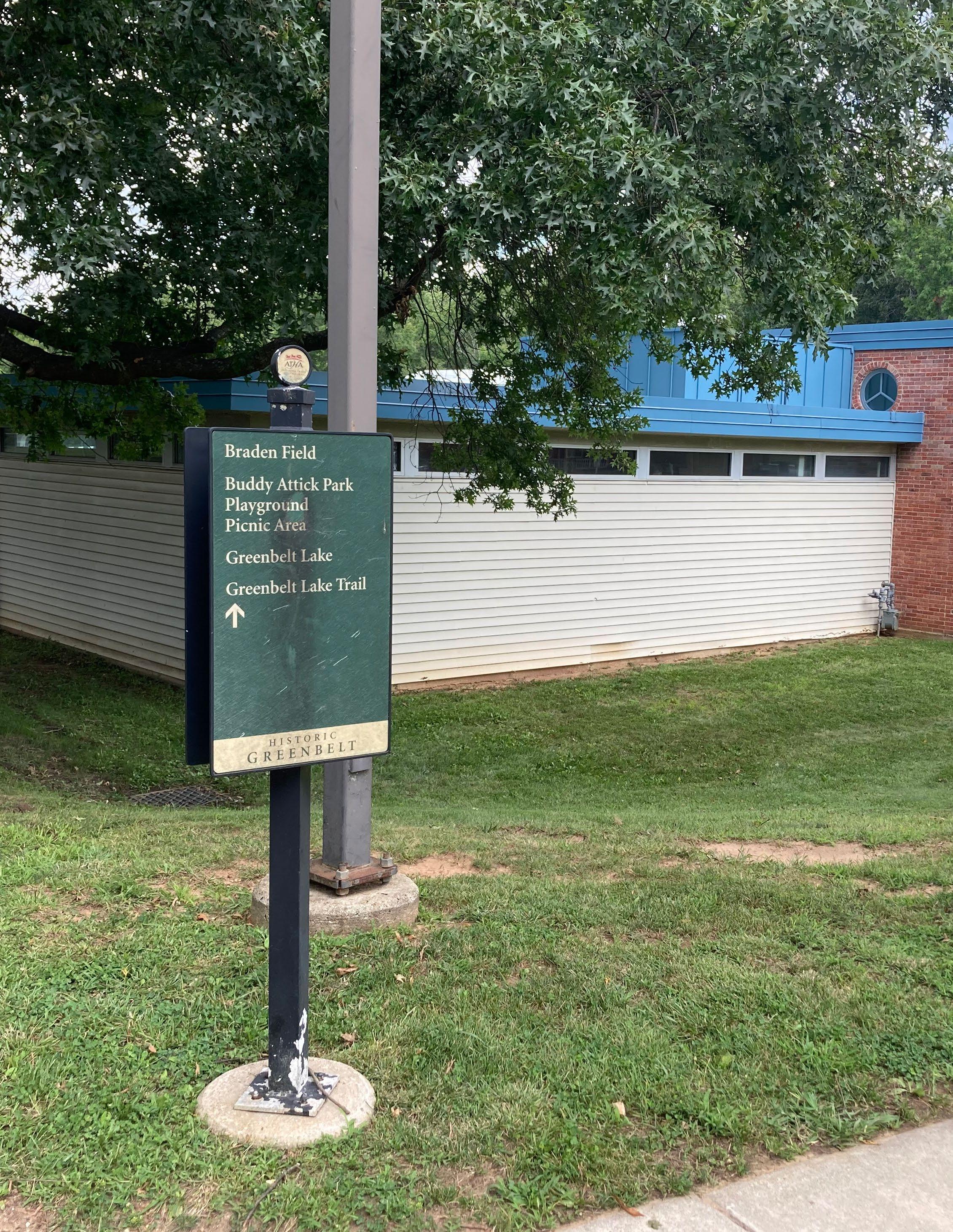
Currently there are a number of informational signage types in Greenbelt, including signage through Anacostia Trails Heritage Area (ATHA). In this strategy, ATHA signage would be supplementary to the proposed signage and would focus on connecting visitors to the Roosevelt Center. Where suitable, ATHA signage should be consolidated to reduce sign clutter.
ATHA is conducting a sign inventory project that should be taken into consideration when planning final installation of any informational signage in Greenbelt.
Informational Sign Locations (Kiosk and Directory)
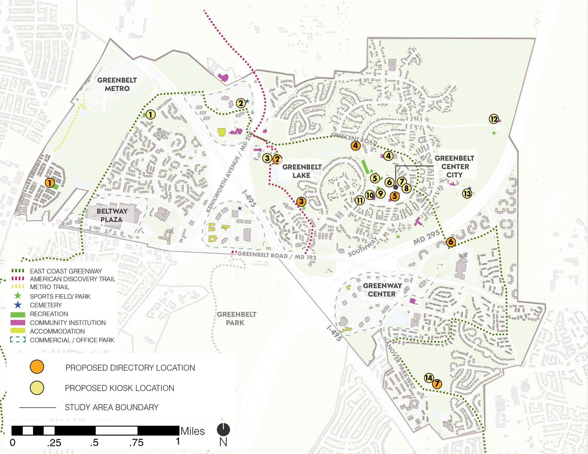
Figure 8. Existing ATHA Directory Sign
SOURCE: NEIGHBORHOOD DESIGN CENTER.
MAP 7
CREDIT: NEIGHBORHOOD DESIGN CENTER.
Identification Signage
Identification signage marks and highlights key destinations, buildings, or districts within a community. These signs help visitors and residents easily locate important sites such as parks, civic buildings, historic landmarks, and cultural institutions. Unlike directional signage, which guides movement, identification signage confirms arrival at a specific place. These signs often incorporate consistent branding, colors, and materials to reinforce the community’s identity while ensuring clear and readable information.
Figure 9. Identification Signage
MATERIALS
Sign Panel: Aluminum (most common):
Corrosion-resistant, lightweight, and durable.
This strategy recommends identification signs at the key sites listed in Table 8. The proposed identification signs are consistent with the design language, making them easily recognizable and enhancing wayfinding clarity. New signage would replace the existing wood post building signage.
In proximity to private developments that will implement custom wayfinding, like office parks and commercial centers, the city can reinforce its wayfinding system through banners along public rights of way.
Structural Supports: Steel or Aluminum Posts: Strong and weather resistant.
• Decorative Enhancement: Corten steel, stainless steel, or powder-coated aluminum for durability
Protective Coating: Anti-Graffiti Coatings to prevent vandalism.
• UV-Resistant Finishes: Extend lifespan in outdoor conditions.
Banners: Heavy-Duty Vinyl, which is waterproof, UV-resistant, strong against wind and tearing and can be printed with high-quality graphics


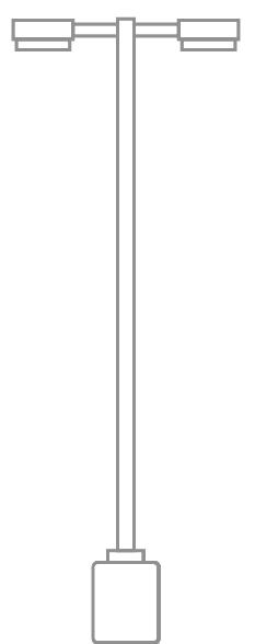
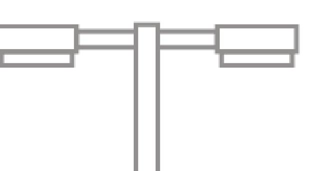






Site Identification Banner
Identification Sign Locations (Site names)
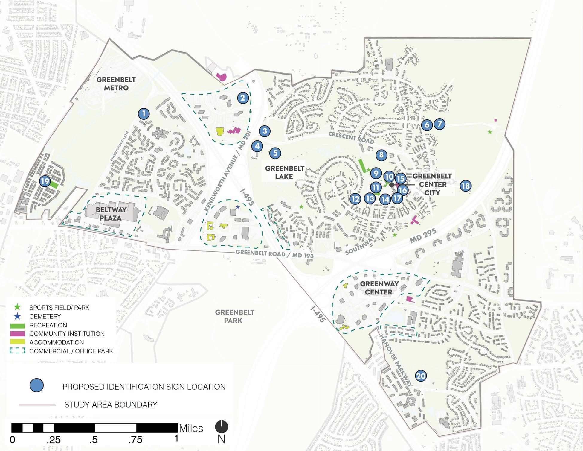
SOURCE: BASE AERIAL BY ESRI, MAXAR, EARTHSTAR GEOGRAPHICS, AND THE GIS USER COMMUNITY. INFORMATIONAL LAYERS BY PRINCE GEORGE’S COUNTY ( HTTPS://GISDATA.PGPLANNING.ORG/OPENDATA/ ). MAP CREATED BY NEIGHBORHOOD DESIGN CENTER.
Identification Sign Locations (Banner)
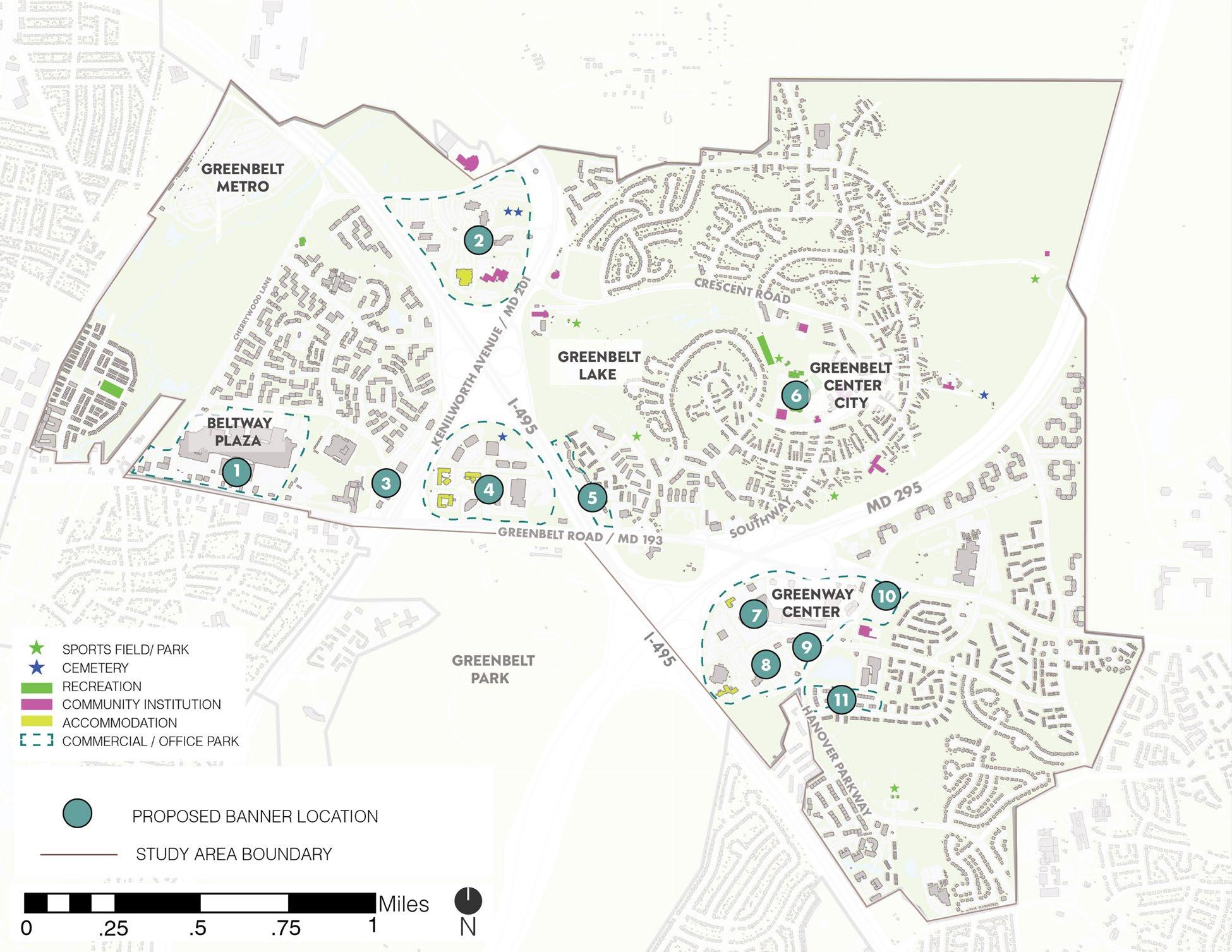
SOURCE: BASE AERIAL BY ESRI, MAXAR, EARTHSTAR GEOGRAPHICS, AND THE GIS USER COMMUNITY. INFORMATIONAL LAYERS BY PRINCE GEORGE’S COUNTY ( HTTPS://GISDATA.PGPLANNING.ORG/OPENDATA/ ). MAP CREATED BY NEIGHBORHOOD DESIGN CENTER.
Implementation Strategy
As the community wayfinding plan moves forward, the concept designs developed in this phase will serve as the foundation for the next stage of the project. To ensure successful implementation, the concepts outlined in this strategy must be developed with precise specifications, materials, and structural details that meet all applicable regulations. Further review of site requirements (i.e., ADA clearances, utility conflicts, sight-distance constraints, historic district reviews, sidewalk conditions, etc.) will be necessary once the exact locations of wayfinding elements are evaluated and selected.
The wayfinding systems should be implemented in the following sequence:
1. Gateway signage
2. Vehicular directional signage
3. Pedestrian directional signage. With navigation pathways in place, building identification signage is added to clearly mark key sites. These signs reinforce place identity, improve visibility of key destinations, and support consistent branding across the district.
4. Trail markers
5. Banners
6. Informational kiosks and directories
With core wayfinding components in place, banners are added to reinforce branding and beautify commercial districts, helping to attract pedestrians and increase foot traffic to support local businesses.
Each type of sign can be developed independently based on funding availability and city priorities. If funds become available for specific elements—such as gateway signs, directional signage, kiosks, or banners—these can be installed as standalone projects while still conforming to the overall wayfinding plan.
Since these are conceptual signage designs, it is recommended to consult a graphic designer during implementation for detailed refinement of each sign. Throughout the process, community engagement should be ongoing, ensuring residents and business owners understand and support the wayfinding system. A public launch event should introduce the new signage, and a long-term maintenance plan put in place to keep elements updated and functional.
Costs: Key Factors and Funding Strategies
The cost of implementing a community wayfinding system varies depending on multiple factors, including materials, installation, site preparation, signage complexity, and regulatory requirements.
Key Factors Affecting Costs
1. MATERIALS: Different materials offer varying durability, aesthetic appeal, and installation complexity, all of which influence the price.
• Metal: Steel, aluminum, and other metals offer a modern and durable solution. While metal signs can be cost-effective, custom finishes, such as powder coating or engraving, will increase costs.
• Wood or Composite: Wood and composite materials are often less expensive but may not have the same long-term durability as metals or stone.
• Digital Displays: Digital or LED signs are typically the most expensive option due to their complexity and ongoing maintenance requirements.
2. SIGN SIZE AND COMPLEXITY: The size and design complexity of the sign affects the overall cost. Larger signs require more materials and labor, and custom-designed signs with logos, patterns, or artistic elements will increase the price.
3. INSTALLATION: Installation costs can vary based on the complexity of the setup, the location of the sign, and the materials involved. Some signs require specialized equipment or foundation work, which can raise installation costs.
• Simple Installation: Freestanding signs or smaller signs with basic posts and supports tend to have lower installation costs.
• Complex Installation: Gateway signs, signs requiring electrical wiring for lighting, or those placed in difficult-to-access areas will require more labor and specialized equipment.
4. SITE PREPARATION AND LANDSCAPING: Depending on the sign’s location, site work may be required, such as grading, paving, or landscaping. These costs are often overlooked but can significantly affect the overall budget.
5. LIGHTING AND ELECTRICAL NEEDS: Signs with integrated lighting—whether LED, solarpowered, or traditional electrical setups—add additional costs for wiring, installation, and energy sources.
• Non-illuminated Signs: These are less expensive to install and maintain.
• Illuminated Signs: Require additional wiring, electrical connections, and specialized maintenance.
6. CUSTOMIZATION AND BRANDING:
Incorporating unique branding elements, such as logos, specific typography, or custom color schemes, will increase the cost of design and materials.
• Standardized Signs: Use generic designs and often lower cost materials.
• Custom Signs: Signs that reflect the community’s branding, culture, or identity can significantly raise costs due to the need for design consultation, customized materials, and details.
7. REGULATORY COMPLIANCE AND PERMITTING
• Certain types of signage may require permits, zoning approvals, or adherence to local regulations (such as accessibility standards, including ADA compliance). These can add additional costs for consultation, design changes, or application fees.
• Permitting Fees: Depending on local laws, the cost of obtaining the necessary permits can vary.
• Compliance: Ensuring compliance with accessibility standards or other local codes might require additional features, such as braille or tactile elements.
8. MAINTENANCE AND LONGEVITY: The lifespan and maintenance of the signage should also be considered. Durable materials such as high-quality metals or stone may have higher upfront costs but lower maintenance expenses over time. Materials such as wood may require frequent repainting or repairs.
OTHER COST CONSIDERATIONS
• Design and Consulting Fees: Engaging a design consultant or wayfinding specialist may add costs depending on the project’s complexity and the level of customization required.
• Project Management and Labor Costs: Larger projects may require dedicated project management, engineering services, or specialized labor, contributing to additional costs.
Potential Funding Sources
For Greenbelt’s community wayfinding plan, funding can come from a variety of sources, including federal, state, and local grants, as well as partnerships and sponsorships. Potential sources of funding are listed below.
FEDERAL AND STATE GRANTS:
1. Maryland Department of Transportation (MDOT) - Transportation Alternatives Program (TAP). Provides funding for pedestrian and bicycle infrastructure, including wayfinding signage.
2. Maryland Heritage Areas Authority (MHAA) Grants. Supports projects that promote historical and cultural tourism, which could help fund signage related to historic sites in Greenbelt.
3. Maryland Department of Housing and Community Development (DHCD) - Community Legacy Program. Offers grants for projects that strengthen community identity, including signage and streetscape enhancements.
4. Federal Highway Administration (FHWA)Recreational Trails Program (RTP). Funds signage for trails, bicycle routes, and pedestrian pathways.
5. National Endowment for the Arts (NEA) – Our Town grants. Support creative placemaking projects that integrate arts, culture, and design in efforts to advance local economic, physical, and other community-desired outcomes.
LOCAL AND REGIONAL FUNDING
1. Prince George’s County Redevelopment Authority. Community Impact Grants offer funding for neighborhood beautification projects, including signage, banners, and wayfinding systems.
NONPROFIT GRANTS AND PHILANTHROPIC FOUNDATIONS
Organizations such as the National Trust for Historic Preservation or Local Tourism Boards may support wayfinding projects that promote heritage and tourism.
The table below provides estimated cost ranges for signage included in the Wayfinding Plan. These estimates are based on typical industry pricing for design. Costs may vary depending on final specifications, materials, vendor selection, and site conditions and does not include soft costs (design development, engineering and technical documentation, survey and site analysis, permitting and regulatory compliance, and project management and administration). These figures are intended to support preliminary budgeting and phasing discussions and require further evaluation with detailed engineering and fabrication specifications to determine precise costs. All costs are provided as estimates only and may be subject to inflation, market changes, and local construction conditions.
Identification
Identification
Informational
Informational Kiosk 1,000-3,500
* SUBJECT TO VARIATION BASED ON KEY COST FACTORS OUTLINED EARLIER IN THE
Table 10. Cost Estimation by Sign Type
CREDIT: NEIGHBORHOOD DESIGN CENTER.
Appendix A: Inventory of Existing Signage
Institutions
Greenbelt Arts Center
Greenbelt Cinema
Roosevelt Center
Greenbelt Municipal Building
Greenbelt Branch Library, PGCMLS
Green Ridge House
Greenbelt Homes, Inc.
Greenbelt Post Office
City of Greenbelt Observatory
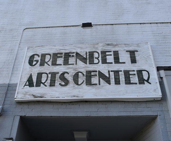
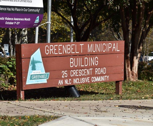
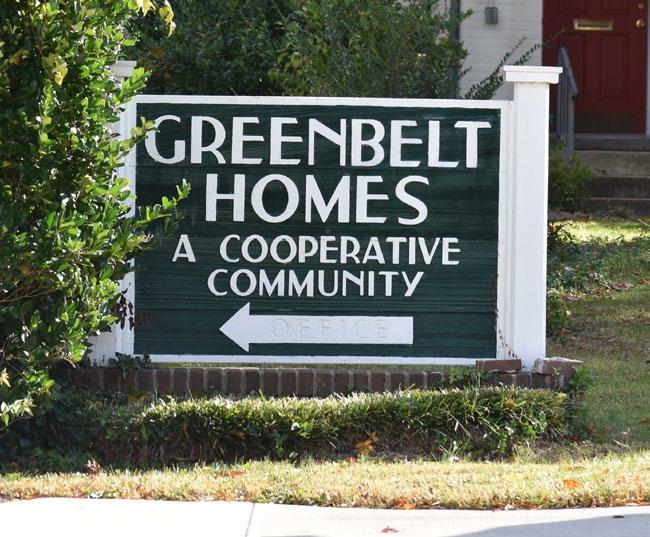
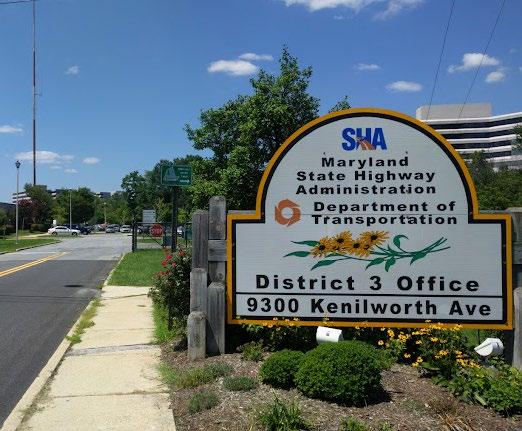
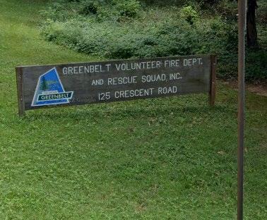
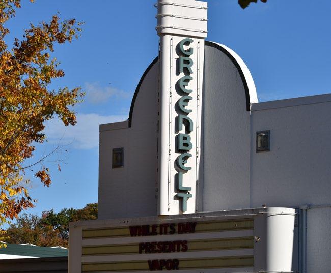
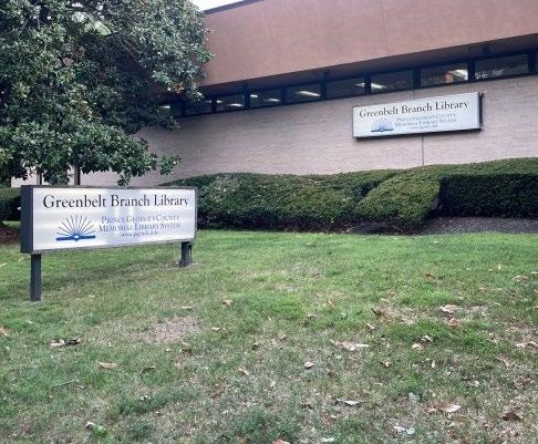
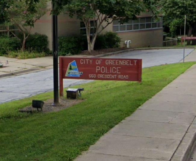
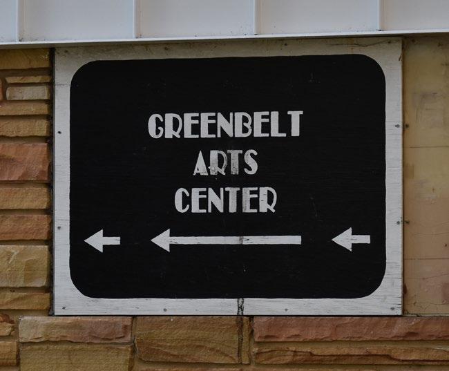
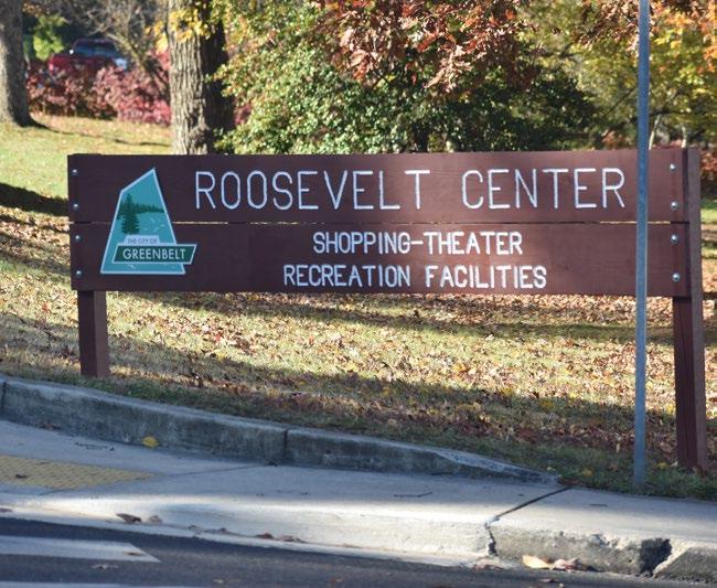
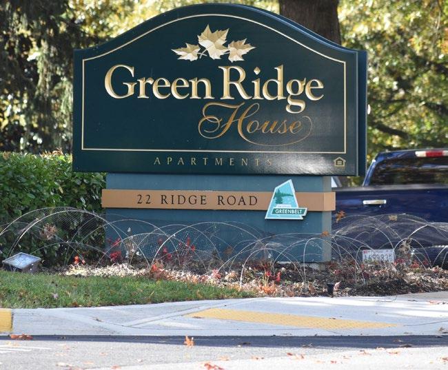
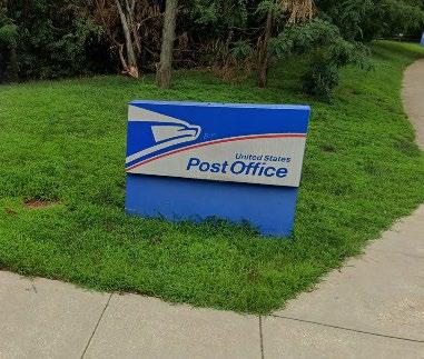
Recreation and Park Facilities
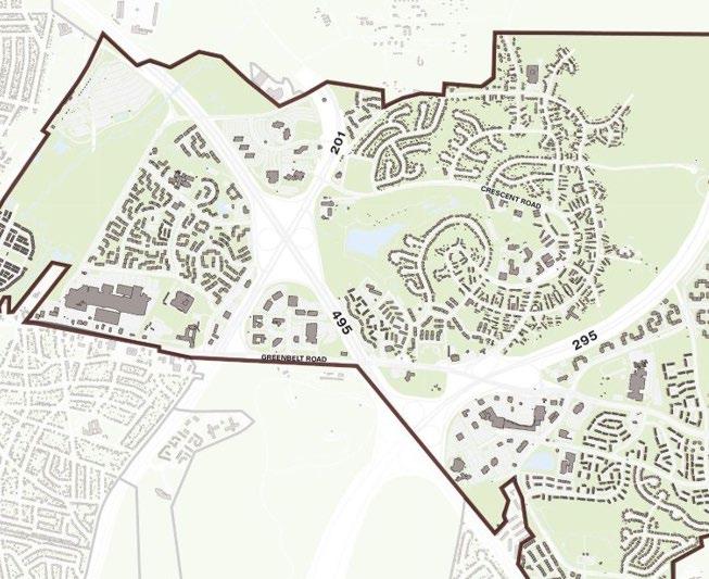
GREENBELT KEY SITES
* No existing signage for location 5 and 13
Central Park at Greenbelt Station
Springhill Lake Recreation Center
Buddy Attick Lake Park
Lakecrest Tennis/Pickleball Courts
Braden Sand Volleyball Court Braden Tennis/Pickleball Courts 6. Greenbelt Dog Park
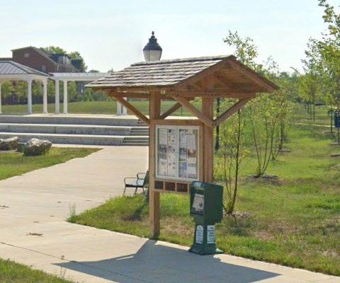
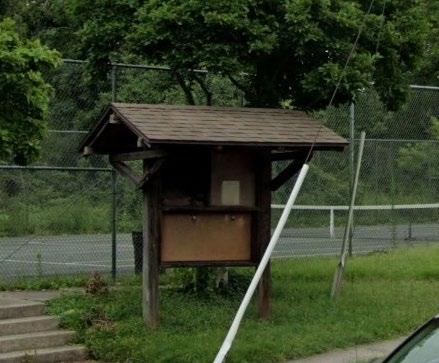
7. Greenbelt Museum 8. Greenbelt Community Center
Greenbelt Skatepark 10. Greenbelt Youth Center
Greenbelt Aquatic & Fitness Center
Northway Fields
73 Court Ridge Road Park
McDonald Fields
Schrom Hills Park & Recreation Center
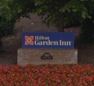
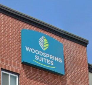
Accommodations Sites
GREENBELT KEY SITES
1. Crowne Plaza 2. Sonesta Select 3. Residence Inn by Marriott 4. Hilton Garden Inn
Holiday Inn
Woodspring Suite
Business and Office Parks
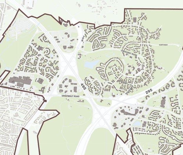
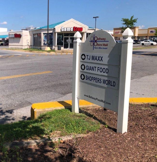
GREENBELT KEY SITES
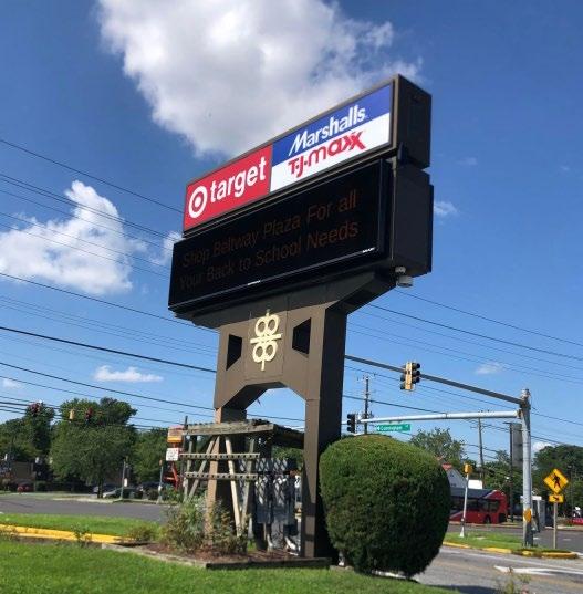
Beltway Plaza Mall
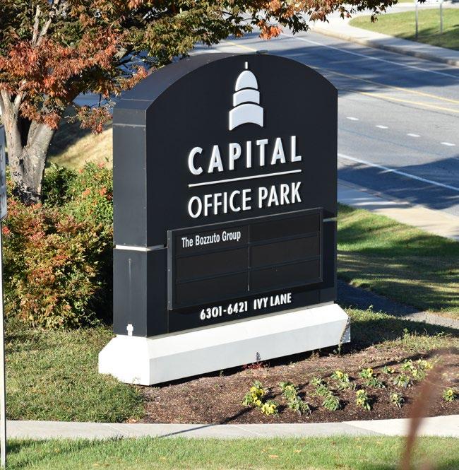
Capital Office Park
Greenbelt Professional Center
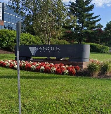
Triangle Centre/Golden Triangle
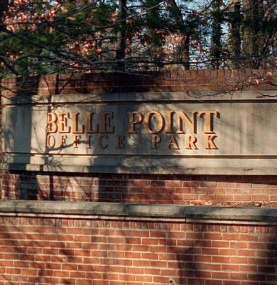
Belle Point
Maryland Trade Center
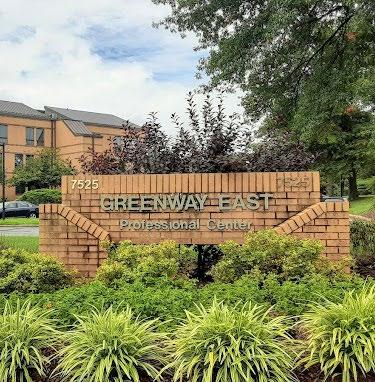
Greenway East Professional Center
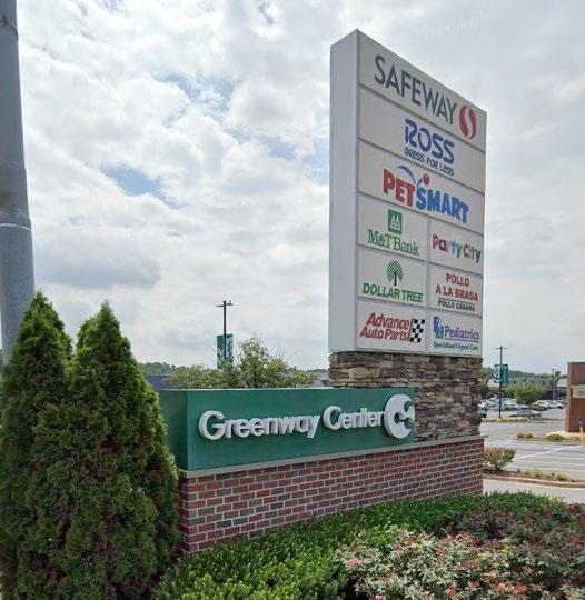
Greenway Center
Commerce Center
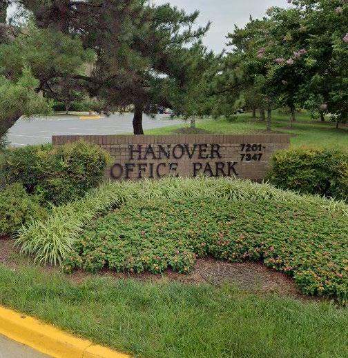
Hanover Office Park

Historic Cemeteries
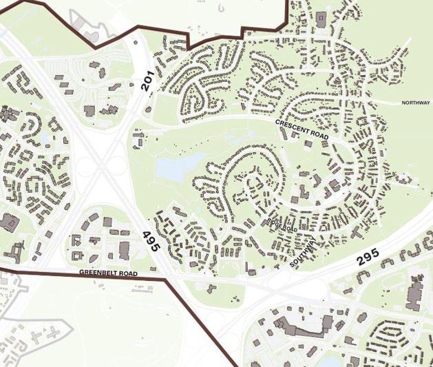
GREENBELT KEY SITES 1. Turner Cemetery
Greenbelt Cemetery
Walker Cemetery
Hamilton Cemetery
Appendix B: Key Community Feedback
Topic Feedback
Wayfinding and signage challenges in Greenbelt
Directions and navigation
Signage
Transportation and accessibility
Residents report frequent navigation problems in Greenbelt center city caused by small, hard-to-read signage, confusing directions along Ridge Road, and missing pedestrian pathways and trail markers, making it difficult to reach destinations like Roosevelt Center and Belle Point without GPS. They want comprehensive maps and clearer directional signs with improved safety and accessibility to support pedestrians and cyclists.
Residents are seeking updated, and readable street signs. They noted ineffective or missing signs at major intersections and entry points and poor legibility especially at night of the existing signs. There is desire for more visible and informative signs, especially for visitors.
Residents expressed frustration with an overemphasis on bicycles, including concerns about cyclists ignoring traffic laws. They also noted insufficient pedestrian pathways and transit connections to key destinations like Roosevelt Center. They also raise safety and navigability concerns around bike lanes and major roads and request better lighting and accessibility features such as curb cuts.
Effective existing wayfinding and signage features in Greenbelt
Signage aesthetics
Information and maps
Community character and identity
Residents favored signage that reflects Greenbelt’s natural environment, history, and local identity. They appreciated the new Historic Greenbelt sign and noted that it is in character with the city.
Existing directional and informational signs along with maps, are valued by residents for highlighting landmarks and giving an overview of Greenbelt. They also noted that historical context on signs adds interest and helpful background.
Signage contributes to Greenbelt’s character and community identity. Preference for gateway signs at key entrances that inform visitors and signal arrival into the community. Residents also favored wooden signs that provide historical context.
Appendix C: Stakeholders
Stakeholders will play a significant role in the implementation of Greenbelt’s community wayfinding plan, each contributing expertise and oversight to ensure a well-coordinated and effective system.
• Community Members
• Greenbelt Advisory Planning Board (APB)
• Greenbelt Arts Advisory Board (AAB)
• Greenbelt City Council
• Maryland State Highway Administration (SHA)
• Prince George’s County Department of Public Works & Transportation (DPW&T)
• Prince George’s County Department of Parks & Recreation (DPR)
• Anacostia Trails Heritage Area, Inc. (ATHA)
The State Highway Administration (SHA) reviews and approves wayfinding signage along state roads, ensuring compliance with the Manual of Uniform Traffic Control Devices (MdMUTCD) guidelines and maintaining safety standards for vehicular signage. Prince George’s County Department of Public Works & Transportation (DPW&T) oversees signage installations along County-managed roads and provides input on infrastructure impacts and maintenance considerations.
M-NCPPC’s Prince George’s County Department of Parks and Recreation (DPR) manages trail signage, including the placement of wayfinding markers along trails and greenways, ensuring they align with existing trail systems and accessibility requirements. The Anacostia Trails Heritage Area (ATHA) may support the project through funding opportunities and expertise in heritage tourism, helping to highlight Greenbelt’s historic and cultural sites within the broader regional trail network.
Greenbelt’s Advisory Planning Board and Arts Advisory Board played a key role in guiding the design aesthetic of the signage, helping to ensure that designs reflect Greenbelt’s artistic identity and cultural heritage. These boards may also contribute recommendations for incorporating artistic elements into signage, such as decorative panels or locally inspired motifs.
The Greenbelt City Council will provide final approval and oversight, ensuring that the wayfinding plan aligns with Greenbelt’s broader planning and development goals. The Council will also be responsible for approving funding allocations, securing grants, and prioritizing implementation phases based on budget and community needs. The wayfinding plan will also serve as a guidance document for the Council when they receive signage requests from businesses and community members in the future.
Appendix D: Maryland Manual on Uniform Traffic Control Devices (MdMUTCD) Guidelines for Community Wayfinding
The Maryland Manual on Uniform Traffic Control Devices (MdMUTCD) provides standardized guidelines for traffic control devices in the United States, including those for community wayfinding. These guidelines are essential for ensuring that signage is consistent, clear, and effective in guiding people to their destinations safely and efficiently. When it comes to community wayfinding, MdMUTCD specifies that signs should be designed for visibility, legibility, and comprehension, with attention to factors like size, color contrast, and placement.
The MdMUTCD emphasizes that wayfinding signs should be placed at appropriate locations to maximize visibility without causing confusion. It also recommends that the wording on signs be concise and use familiar language, avoiding overly technical or complex terms. Additionally, symbols and icons should be standardized to reduce ambiguity.
The use of arrows, destination names, and distances can help guide pedestrians and drivers effectively through urban environments, especially in areas where multiple pathways or routes intersect.
Community wayfinding systems should be integrated into the existing traffic control system, ensuring they do not overwhelm the visual environment or conflict with other traffic signals and signs. MdMUTCD also advises considering the needs of all users, including people with disabilities, ensuring that signs are accessible and readable by everyone, which may include the use of tactile or braille elements on some signage.
Any final wayfinding design concepts must adhere to MdMUTCD Community Wayfinding guidelines to ensure compliance with state and national standards for visibility, legibility, and placement.
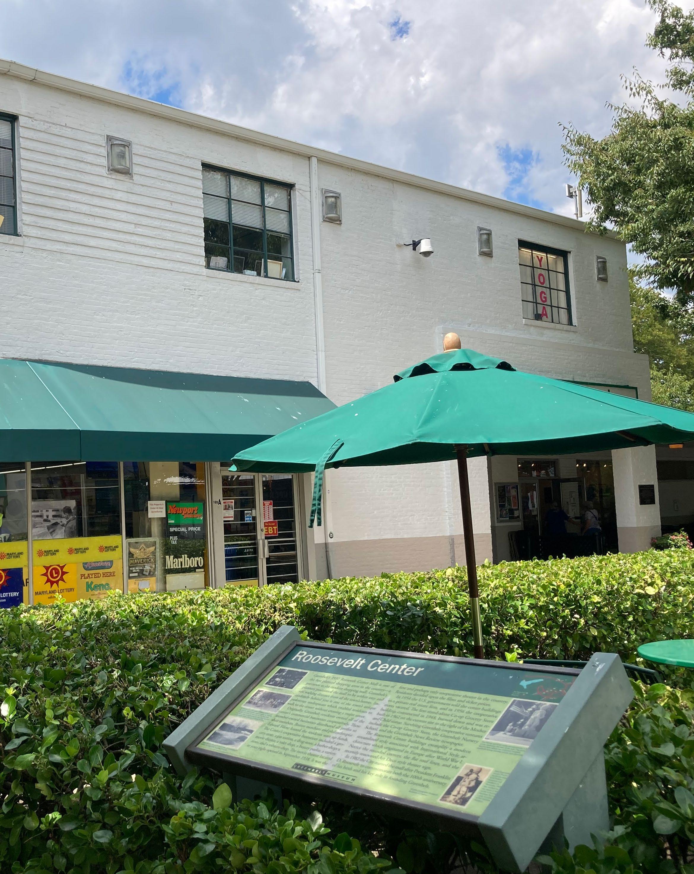
CREDIT: NEIGHBORHOOD DESIGN CENTER.
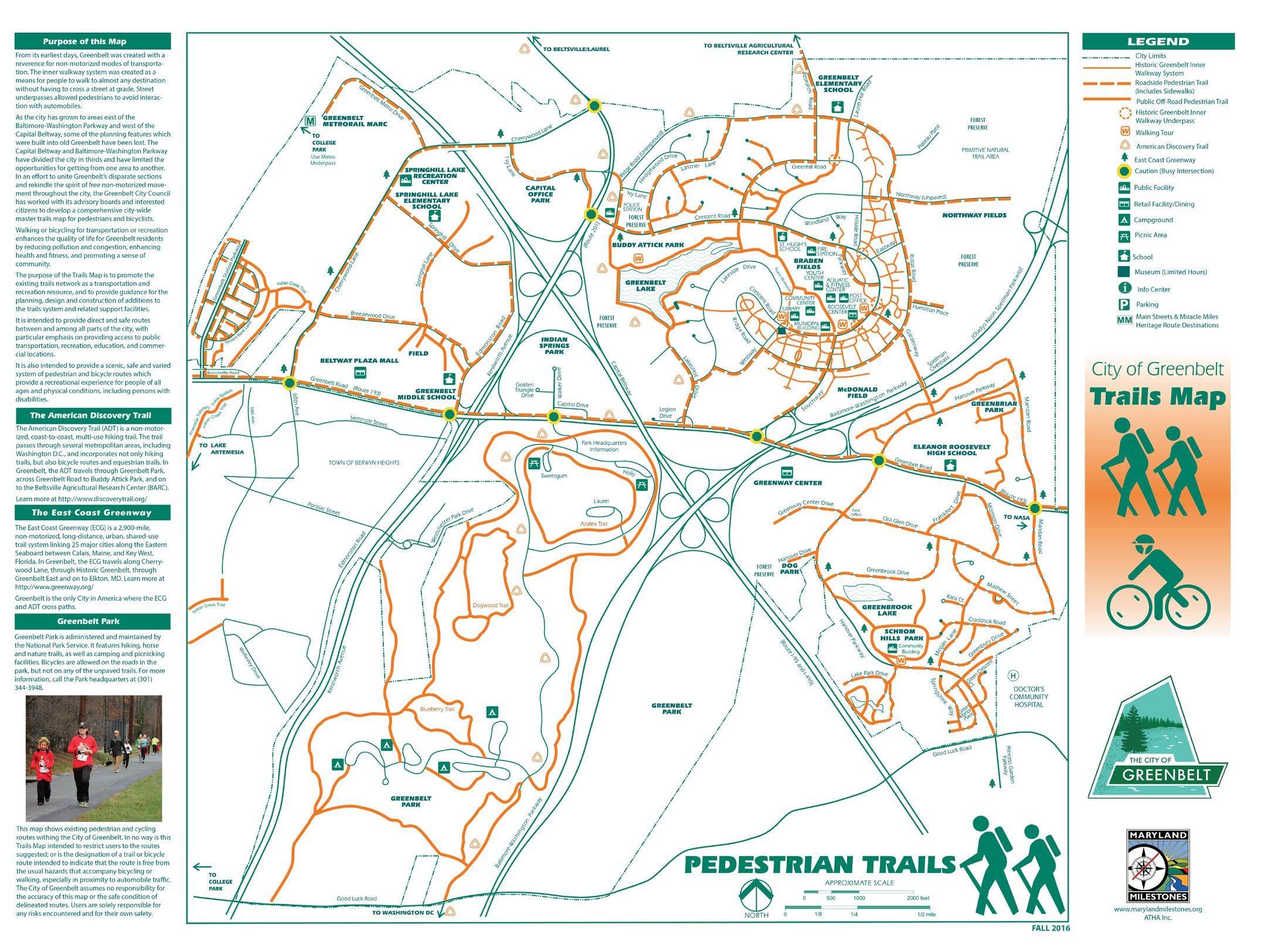
Appendix E: Wayfinding Bicycle/ Pedestrian Trail Map for Greenbelt
For illustrative purposes only.
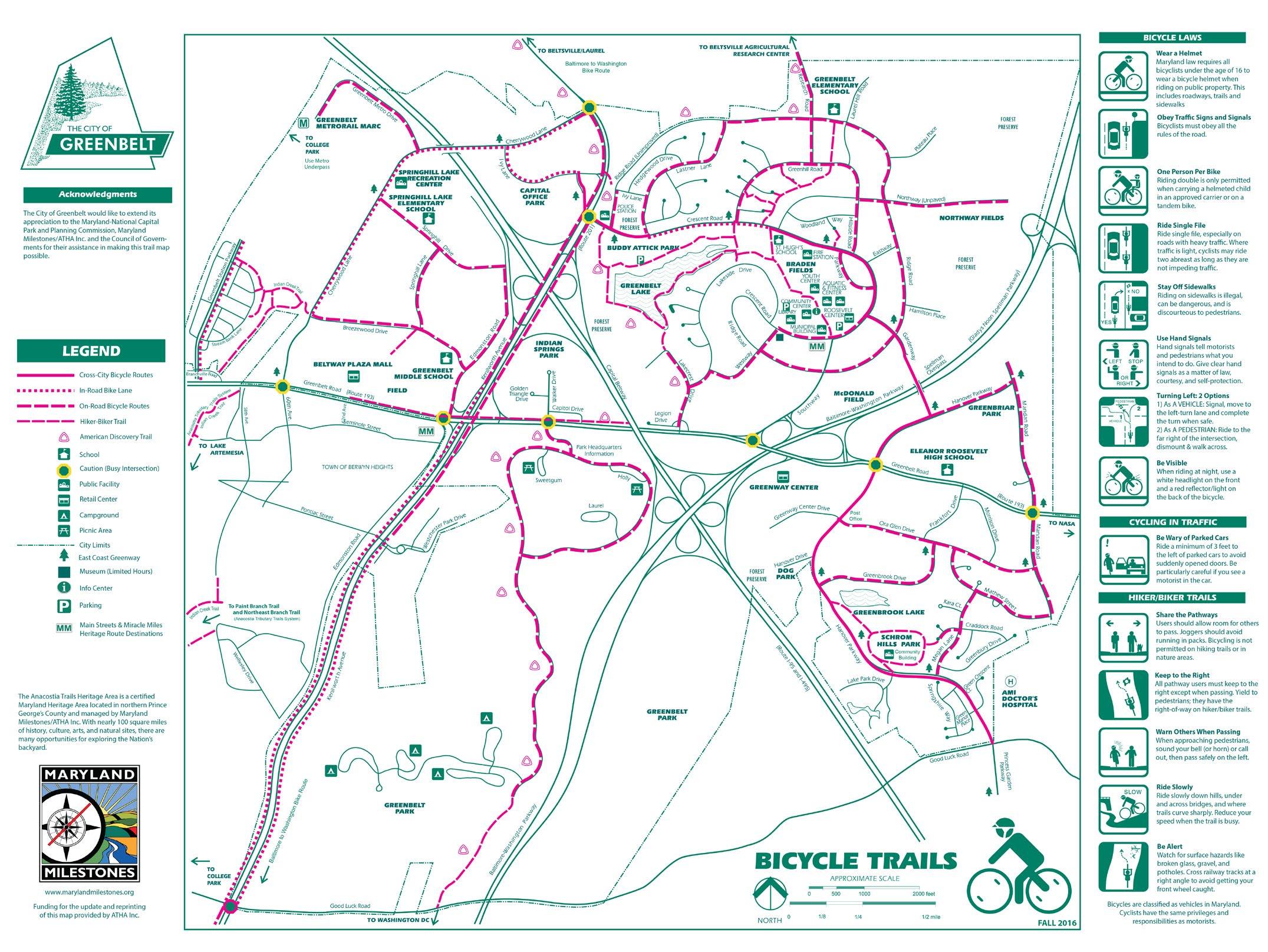
SOURCE: CITY OF GREENBELT AND ANACOSTIA TRAILS HERITAGE AREA, INC.
SOURCE:
CITY OF GREENBELT AND ANACOSTIA TRAILS HERITAGE AREA, INC.
Acknowledgements
This project was funded and managed by the Planning Assistance to Municipalities and Communities (PAMC) program, Prince George’s County Planning Department.
M-NCPPC Prince George’s County Planning Department
James R. Hunt, MPA Acting Planning Director
Katina Shoulars Acting Deputy Director for Operations
Gwen McCall-Winston Deputy Planning Director of Administration
Community Planning Division
Andrea Gilles, AICP Chief
NEIGHBORHOOD REVITALIZATION SECTION PROJECT CORE TEAM
Josephine Selvakumar Supervisor B.Arch., MCRP
Frederick Stachura, J. D.,** Supervisor
Daniel Sams Planner IV, PAMC Program Manager
Anusree Nair Planner II, Project Manager
PROJECT RESOURCE TEAM
Zachary Banham Senior GIS Specialist, Placemaking Section
Thomas Suchecki,* Graduate Intern, Neighborhood Revitalization Section
PROJECT DEVELOPMENT, NEIGHBORHOOD REVITALIZATION SECTION
Wendy Irminger,** Planner III
Zachary W. Luckin,* Planner I
Technical Support
PLANNING DIRECTOR’S OFFICE
Tamika Henderson Administrative Specialist II
PUBLICATIONS
Daniel Hartmann Department Program Manager
Jessie Harkcom Publication Design Specialist
M-NCPPC Prince George’s County Department of Parks and Recreation
PARK PLANNING AND ENVIRONMENTAL STEWARDSHIP SECTION
Robert Patten Planner IV, Trail Development Program Manager
Mussie Tewolde Principal GIS Specialist
NEIGHBORHOOD DESIGN CENTER, INC.
Christina Hartsfield Programs Director of Architecture & Community Planning
Lubna Chaudhry,* Project Manager
Kelly Fleming,* Programs Director of Environmental Resilience and Landscape Design
Allie O’Neill,* Programs Director of Architecture & Community Planning
City of Greenbelt
Terry Hruby, AICP,* Director of Planning and Community Development
Jaime S. Fearer, AICP Acting Director of Planning
Holly Simmons,* Community Planner
MAYOR & CITY COUNCIL
• Mayor Emmett Jordan
• Mayor Pro Tem Kristen L.K. Weaver
• Silke Pope
• Jenni Pompi
• Danielle McKinney
• Amy Kensel
• Frankie Santos Fritz
• Rodney Roberts (Former Council Member)
• Josué Salmerón, City Manager
ADVISORY PLANNING BOARD (APB)
• Benjamin Friedman, Chair
• Isabelle Gournay, Vice Chair
• Judith "J" Davis
• James Drake
• Matthew Inzeo
• Keith Chernikoff (Past Member)
• Maria Silvia Miller (Past Member)
• Syed Shamim (Past Member)
ARTS ADVISORY BOARD (AAB)
• Tom LeaMond, Chair
• Tatiana Ausema
• Oliver Gaycken
• Vijay Parameshwaran
• Kristin Stenson
• Barbara Stevens
Special Thanks to:
Peter Campanides, P.E.,* Assistant District Engineer – Traffic, Prince George’s County District 3 Office, MDOT SHA
Stephen M Hollie Jr. Project Manager (Consultant), Office of Traffic and Safety, MDOT SHA
Erv Beckert Chief of Highway and Bridge Design Division, DPW&T
Hadi Quaiyum Chief of Traffic Engineering and Safety Division, DPW&T
Valerie Woodall Associate Director, Anacostia Trails Heritage Area
*Former Employee
**Retired
THE MARYLAND-NATIONAL CAPITAL PARK AND PLANNING COMMISSION Prince George’s County Planning Department