3 minute read
The roads less taken


A selection of scenic drives in and around the valley
BY NATALIE JOHNSON
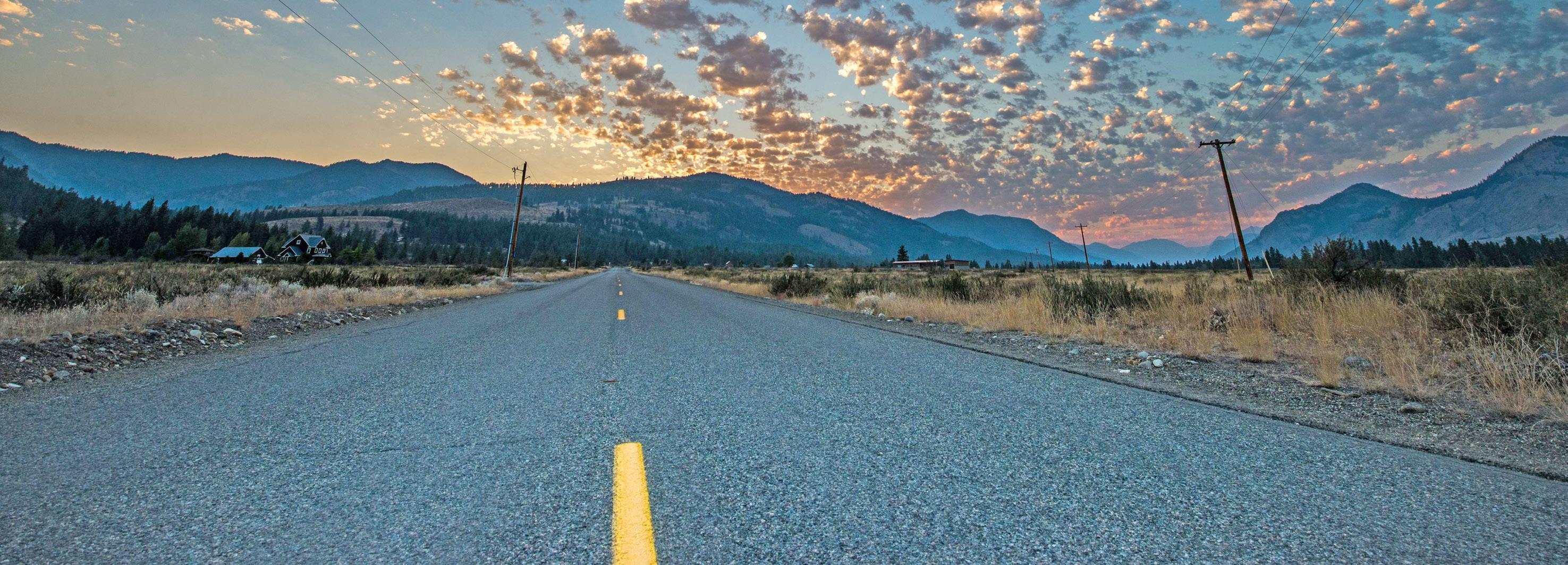
Nearly every drive is a scenic drive when you’re in the Methow Valley. Whether you’re looking at snow-covered mountains from a distance, cruising alongside the Methow, Twisp or Chewuch rivers or gazing at rolling wheat fields and herds of cattle, the Methow has a little of everything.
You could drive Highway 20 over Loup Loup Pass for a winding, forested trip in and out of the valley, or take the back way between Twisp and Winthrop on the TwispWinthrop Eastside Road. Twisp River Road is a paved path along the Twisp River ending in a Washington State Parks Recreation Area, while a drive up to Bear Creek and Pipestone Canyon hits gravel and dirt roads.
The Cascade Loop Scenic Byway, which includes the Methow Valley and follows Highway 20 west across Washington Pass, was recently named a National Scenic Byway, recognizing its miles of beauty as it loops around the North Cascades.
We’ve collected a handful of short, scenic drives for locals and visitors alike to enjoy this summer in the Methow Valley.
■ CASCADE LOOP SCENIC BYWAY
The Cascade Loop Scenic Byway is a 440-mile loop stretching as far west as Oak Harbor, but a portion of it starts at Pateros at the confluence of the Methow and Columbia Rivers and heads north through the Methow Valley, first on Highway 153, then at Highway 20 at Twisp.
Highway 20 passes through Twisp, Winthrop and Mazama before turning west over the North Cascades.
The drive has incredible views from the road, but plenty of places to stop and enjoy the scenery up close. North Cascades National Park has no entry fee, and the area includes many hiking and camping opportunities in the warmer months.
■ CHEWUCH LOOP
The Chewuch loop snakes past shrub-steppe, farmland and country houses and provides a path to Pearrygin Lake State Park and the National Forest.
To start on the west side from Winthrop, head out of town on Highway 20 and turn right onto West Chewuch Road.
At the stop sign about 7 miles out, you can turn right, cross the Chewuch River bridge and head back toward Winthrop on East Chewuch Road to finish the loop.
Alternately, continue straight ahead on Forest Service Road 51. In about 5 miles you will encounter a short walking trail to scenic Falls Creek Falls.
You can ramble for many miles more on the primitive road, all the way to the Thirtymile Fire Memorial, which commemorates the four firefighters who died in 2001 while combating the fire. It is a quiet and contemplative place to stop before returning the way you came.
■ SIDE TRIP
If you choose the East Chewuch Road route back to Winthrop, a left turn at Bear Creek Road takes you to Pearrygin Lake State Park. After the pavement ends, you can continue south on Bear Creek Road along a ridgeline overlooking Pearrygin Lake, then all the way to the Bear Creek Golf Course.
At Lester Road just before the golf course, turn left for the road to Campbell Lake and Pipestone Canyon, where there is a parking area at the end of the road. There’s a bit of a view of Pipestone Canyon from there, but take a trail for 1.5 miles for a better look.
■ TWISP RIVER ROAD
Second Avenue in Twisp Becomes Twisp River Road, which becomes a Forest Service road before ending at the Roads End Campground – about a 25-mile drive – and becoming the Twisp Pass Trail.
The first public access to the river is at Elbow Coulee, about 9 miles from town (Elbow Coulee is an interesting side trip that connects to Patterson Lake Road). Keep driving and you’ll reach the War Creek Campground, further still will take you to the Mystery Campground and the Slate Creek Trailhead. Keep going on the forest road toward Gilbert Mountain to find more trailheads and campgrounds, before the road finally dead ends at the fittingly named Roads End Campground. The Twisp Pass Trail continues on, but the car has to stay behind.
■ HARTS PASS
Starting at the Mazama Store, go west toward Lost River. Turn right on Harts Pass Road after 8.8 miles – about 2 miles past where the pavement ends. In 12 more miles you’ll be at Harts Pass. Bear right to get to Slate Peak in another 2 miles.
Check road conditions before heading out and be aware of seasonal conditions such as lingering snow or slides. The road to Harts Pass is a steep, narrow, primitive route with intimidating drop-offs along the way (Dead Horse Point is called that for a reason). Go slow, watch for oncoming traffic, and enjoy the ride.

