6 minute read
TAKING SMALL STEPS

Take seven easy walks
Just when resolutions are being made to get out and do some more walking, the idea starts to feel a lot less appealing. It’s not just the nippy weather and ludicrously early sunsets; slopes have turned slippery, woodland tracks have degenerated into boggy quagmires, and, if you’re not careful, a gentle stroll can become a gruelling slog.So, to help break the new year in gently, here are some suggestions for seven short, undemanding walks, says Andrew Swift
Advertisement
Although some of the following short walks may be muddy in places, all are over level – or nearly level – terrain, and several of them (marked with a *) are suitable, at least in part, for pushchairs and wheelchairs.
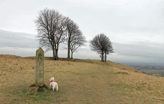
1Bannerdown
On the edge of the Cotswold plateau, three miles north-east of Bath, Bannerdown has little in the way of views, because of the trees that encircle it. It does have a rich history, however. The Roman Fosse Way ran across it and some believe it was the site of the Battle of Mount Badon, at which Romano-British forces – possibly led by King Arthur –repelled an Anglo-Saxon advance in the late 5th or early 6th century. Although largely flat, patches can be muddy, while the more adventurous can explore old quarries and wild woodland on the west side of the escarpment. To get there, drive east through Batheaston, turn left up Bannerdown Road at the mini roundabout at the far end, and after 1.5 miles – as the road levels out – pull into a parking area on the left, where a choice of two gates leads onto the down (ST794689).
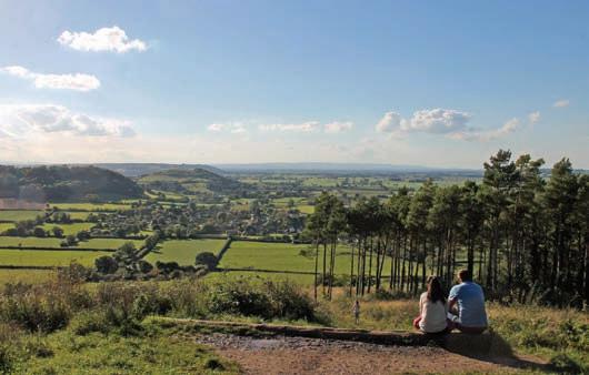
2 Combe Hill Wood*
Combe Hill Wood, 30 miles south west of Bath, commands one of the finest views in Somerset, extending over the Somerset Levels to the Quantock Hills, 15 miles away. A circular all-ability path from the car park leads to the viewpoint, while further north, where the going gets rougher, a track leads past a prehistoric earthwork called the New Ditch to the 33m-high Hood Monument, designed by Bath architect Henry Goodridge.
To find Combe Hill Wood, head to Wells, carry on along the A39 and, after passing Glastonbury, bear left at a roundabout along the B3151. Two miles further on, bear left along a road signposted to Keinton Mandeville. After a mile and a half, pull into a large car park on the right (ST503329; www.combehillwood.co.uk).
3 Roundway Down
On 13 July 1643, eight days after the Battle of Lansdown, Royalist forces routed the Roundheads at the Battle of Roundway Down, in one of the greatest cavalry victories of the English Civil War. In its aftermath, the Roundheads were pursued westward, through the ramparts of an Iron Age hillfort, towards the edge of the escarpment, down which many tumbled to their deaths. The hillfort is still known as Oliver’s Castle, and walking the path around its ramparts, with the land shelving away below you and red kites soaring above, you can still sense the horrors of that distant day. The views westward, though –with Lansdown visible 17 miles away – are magnificent.
To get to Roundway Down, follow the A361 through Devizes, and, 0.75 miles past the town centre, turn left along Folly Lane, following a sign for Roundway. After another 0.75 miles turn right by a phone box along a lane with a no-through-road sign. When the lane forks, fork left and carry on for 0.75 miles, with the lane becoming ever rougher, before pulling into a parking area with a gate leading to the path around the ramparts (SU005648).
4 Uley Bury
Another hillfort with rough but reasonably level tracks can be found high above the Severn Plain at Uley Bury. This is the Cotswold landscape at its most dramatic. Unassailable green cliffs guard one of Gloucestershire’s most impregnable fortresses, with views across the Severn to the Forest of Dean and the Welsh mountains.
To get there, head north from Bath along the A46 for just over 20 miles, before turning left along the A4135. After 2.5 miles, take the third right, signposted to Uley. Carry on at a crossroads, head down to Uley, turn right at a T junction along the B4066, drive through the village and, after climbing steeply for half a mile, pull into a parking area on the left (ST786993). Go through a gate on the left and after 60m turn left through another gate to follow the path around the ramparts.
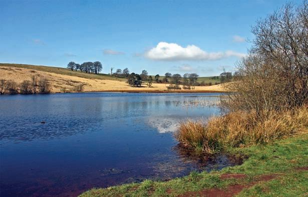
5 Stockhill Woods and Priddy Mineries*
Stockhill Woods, the largest on Mendip, were planted in the 1940s on the site of lead workings. Although much of the terrain bears marks of this legacy in the form of deep clefts and ‘gruffy ground’, a 600m allability trail and an 1100 metre easy-going trail provide easy access, while rougher paths traverse the farther reaches. Across the road from the car park, there is also the option of following the course of a tramway which carried the ore off for smelting. Today it leads past deep pools and across wild heathland to where the ruins of the old leadworks lie surrounded by glittering black slag. To find Stockhill Woods, head west from Bath along the A39. After 19 miles, turn right at Green Ore traffic lights. After another 2.5 miles, turn left at a crossroads, carry on for 0.75 miles and pull into a car park on the left (ST 549513).
6 Severn Beach*
The paved promenade running north along the shoreline from Severn Beach is a superb place for a bracing winter walk. It leads under the
View from Combe Hill Wood Roundway Down
Priddy Mineries Uphill and Brean Down
Second Severn Crossing to New Passage, where ferries once set out for the perilous trip across the estuary. Beyond New Passage, where the path is rougher, you come to Pilning Wetlands, an important site for migrant and over-wintering birds.
There should be ample parking at the north end of Beach Road (ST539852; BS35 4PF), but a better option is to take the Severn Beach Line from Temple Meads – a fascinating 37-minute journey with trains every hour. It once featured in Thomas Cook’s list of Great European Rail Journeys, which gives an idea of what a little-known gem it is.

7 Uphill
Another very different coastal experience can be found at Uphill, with rutted tracks and boardwalks rather than paved promenades. The Romans established a port here, but today the tidal creek is home to a bucolic marina set amid sea marshes and overlooked by a ruined church on the edge of a cliff. One path leads through two nature reserves, where birds overwinter on the salt marshes, while another winds alongside the creek to emerge on sands which stretch all the way north to Weston-super-Mare.
Parking is at the village car park on Uphill Way (ST316585; BS23 4XP). Walk west along the road from here for 150m and take a left turn at Uphill Sluice to the nature reserves. Alternatively, carry on along the road for another 40m and turn left to follow the footpath alongside the creek.

Many more walks can be found in Andrew Swift’s Country Walks from Bath published by by Akeman Press; akemanpress.com


