
11 minute read
Chinese News at


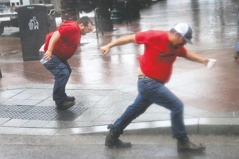
Susan Hiland/Daily Republic Fairfield Police Chief Deanna Cantrell enjoys an evening out at the Prime Rib in the Park at McNaughton Park in downtown Fairfield, Saturday.
Prime
From Page One
a property.
“We will find a home for the kids,” Marshall said.
It has been a challenge to keep doing programs that are interesting to the teens with Covid-19 and not being able to meet in person, but they have solved some of that with online tutorials and programs.
Marshall said he did notice a decrease in teens participating in online activities and understands the reluctance of parents for their teens to go out into large group activities.
“Covid has made everything a challenge,” Marshall said.
PAL officials recently decided to have a Parking Lot Skate Night, which Marshall said was quite popular.
Blane Christian, 13, and Lanissa Celaya, 13, both of Fairfield, joined PAL just because of the Skate Night.
“It was a lot of fun,” Christian said.
Celaya said she really liked PAL and couldn’t wait to get involved with more activities.
They both were helping with the dinner by being part of the cleanup crew. It was something they didn’t mind doing.
Police Chief Deanna Cantrell thought Fairfield PAL was an important program for the city.
“It helps us reach out to low-income kids and give them an opportunity to do things that they don’t normally get exposed to,” Cantrell said.
The police chief said she hoped the positive interaction would also be a benefit for the teens since the Police Department puts on the program and they would come to see working for the police or the city as a good thing.
“PAL is important for so many reasons,” she said.
The Fairfield Host Lions Club is the original service club in Solano County and since 1924 has been providing a multitude of services through a number of fundraisers.
Skies
From Page One
Saturday. That advisory was upgraded to an air pollution warning Friday for both Friday and Saturday, then extended Saturday to include Sunday.
That warning was downgraded Sunday to an air quality advisory for Monday.
An air quality advisory is a step below an air pollution warning – called a Spare the Air alert – that triggers bans on most indoor burning (fireplaces, wood-burning and pellet stoves) and outdoor burning (fire pits and similar options), as well as recommendations for people most vulnerable to breathing polluted air to seek shelter indoors.
The Bay Area Air Quality Management includes all or parts of the nine Bay Area counties, including western Solano County around Fairfield and Suisun City west to the Vallejo-Benicia area. The Yolo-Solano Air Quality Management District includes the area around Vacaville and Dixon, east into Winters and Yolo County.
Moderate air pollution levels are also expected Monday across the YoloSolano district.
Air quality Sunday was moderate for much of the day in western Solano County and entered the good range for a time in Vallejo and Benicia. Air pollution levels Sunday were moderate and at times unhealthy for sensitive groups in eastern Solano County and neighborning Winters.
Districts that monitor air quality classify pollution levels on a sliding scale that ranges from good, to moderate, to unhealthy for sensitive groups, to unhealthy, to very unhealthy, to hazardous.
The Caldor Fire that’s burning in the Sierra Nevada in El Dorado County continues to send smoke into the air, with some of it drifting west across the Sacramento region and pushing into the Yolo-Solano area. Smoke from other Northern California and western wildfires is also contributing to ghe haze
Air quality in communities near the Caldor Fire has at times jumped into the hazardous range.
Smoke can irritate the eyes and airways, causing coughing, a scratchy throat and irritated sinuses. Elevated smallparticle pollution in the air at ground level – such as soot and smoke – can trigger wheezing in people who have asthma, emphysema or chronic obstructive pulmonary disease, known more commonly as COPD.
Air pollution district officials report that elderly people, children and those with respiratory illnesses “are particularly susceptible to elevated air pollution levels and should take extra precautions to avoid exposure.”
For real-time air quality readings for the Bay Area, go to http:// baaqmd.gov/highs. For air quality information in the Yolo-Solano district, to include information about the Sacramento region and up into the Sierra Nevada, go to http://www. sparetheair.com/.
California Lottery | Sunday
Fantasy 5 Numbers picked
Match all five for top prize. Match at least three for other prizes. 1, 5, 10, 28, 31
Daily 4 Numbers picked 1, 5, 7, 2 Daily Derby 1st place 2, Lucky Star 2nd place 8, Gorgeous George 3rd place 9, Winning Spirit Race time 1:44.32
Tribune ConTenT AgenCy
SOUTH LAKE TAHOE — The Caldor Fire burning near South Lake Tahoe continued its slow creep east on Sunday, with crews engaged in a “pretty good firefight” as they braced for the arrival of strong winds, according to California Department of Forestry and Fire Protection operations chief Cody Bogan.
Crews were primarily focused on two areas, including the Delta division on the fire’s northwest perimeter, which spurred new evacuation orders around Pleasant Valley Road over the weekend.
But the majority of growth and activity was on the fire’s northeastern edge, near the town of Strawberry and in the direction of the South Lake Tahoe basin, officials said. By Sunday morning, the fire had seared through 156,515 acres and was 19% contained.
Firefighters on Saturday made a substantial stand to protect Strawberry, including the historic Strawberry Lodge. Flames at one point were within feet of the town’s general store, but crews were able to keep them at bay through strategic backfiring and hose line operations.
But the biggest threat to the Tahoe Basin could be yet to come, as the National Weather Service has issued red flag warnings indicating gusty wind conditions in the fire area from 11 a.m. Monday to 11 p.m. Tuesday.
“We are expecting a big change in the weather pattern,” incident meteorologist Jim Dudley said during a briefing Saturday evening. “What will happen is that the winds that have been affecting the fire on the ground level . . . are going to be aided by southwesterly winds aloft. “
Officials said the winds will meet with hot, dry conditions to create elevated fire weather concerns. Gusts on Monday could be as strong as 35 mph.
Crews on Sunday will be working hard and fast to get ahead of the shift.
“We have one more day of fairly light winds across the fire, and then things change later Sunday night, Monday, and they will continue into Tuesday,” Dudley said.
Adding to the challenges is the area’s topography, which includes deep drainages and canyons that can act as funnels for the wind and flames, officials said.
“We have a saying: Where water flows, fire goes,” said fire behavior analyst Steven Volmer.
Volmer said the fire is currently spotting at distances as far as threefourths of a mile, and the probability of those spots creating new fires is 90%. In the days to come, that probability will increase to 95%.
Winds have long been the “X” factor in the state’s extreme fire behavior, officials said, so the forecast for the week could spell trouble for crews and for residents waiting for answers.
“We’ve had spotting occurring with these weaker winds,” said Cal Fire public information officer Henry Herrera. “So once they reach those [higher] speeds, there is potential for increased spotting, and for the spotting distance to increase as well.”
Residents in many areas near the fire are watching with concern and wondering whether and when it is time to take action.
In the Christmas Valley – the first part of the Tahoe basin to be placed under a voluntary evacuation notice – resident Carol Bin, 61, moved her horses to nearby Gardnerville, Nev., last week. She said she was hunkering down with air purifiers to protect against the fire’s thick yellow-gray smoke while she waited to see what the blaze would do next.
A former Big Bear resident, Bin said she has faced evacuations before. She wasn’t eager to do it again.
“The hardest part is to pack,” she said. “Do I pack for a week? Or do I pack like I’m never coming back?”
Winds
From Page One
this year. Floods killed 20 people this month in Tennessee. And drought- and heat-wave-fueled wildfires are raging in California, Minnesota, Greece and Turkey.
Ida hits Louisiana at a particularly vulnerable moment. The state’s hospitals are already overwhelmed with more than 2,600 coronavirus patients. Just 41% of the population is fully vaccinated.
“I feel sick to my stomach watching,” Eric Blake, a forecaster at the National Hurricane Center said on Twitter. “This is a very sobering morning.”
Ida, which came ashore about 60 miles south of New Orleans, is expected to drive up ocean levels as much as 16 feet and dump 2 feet of rain. Winds will be strong enough to rip roofs from houses, and snap trees and power poles. Blackouts could last weeks. About 80,000 homes and businesses were without power at 11:20 a.m. local time, according to Poweroutage.us, which tracks utility outages.
In addition to Ida, the hurricane center is tracking Tropical Storm Julian in the central Atlantic, as well as three other potential storms there. Meanwhile, Hurricane Nora is raking Mexico’s Pacific coast.
New Orleans asked residents to evacuate or take shelter. The levee gates are closed in many areas and hospital wards were cleared out. Most oil production in the Gulf of Mexico is shut down. Thousands of people have fled the region.
Ralph Tovar, a visitor
Scott Olson/Getty Images/TNS Utility workers play in the wind from Hurricane Ida as they wait for the storm to pass to begin repairs in New Orleans, Louisiana, Sunday.
from Chicago who was stranded in New Orleans because his flight was canceled, tore apart a plastic umbrella bag to fashion a rain-proof hood as he stood inside the oldest cathedral in the U.S., St. Louis Cathedral, as the first gales began to lash the city.
“It’s in God’s hands now,” Tovar said in an interview. “Hopefully, we can get out Tuesday. Stay safe everyone and try to stay inside.”
The storm could damage close to 1 million homes along the coast, according to CoreLogic. It’s forecast to run directly over chemical plants, refineries and the Louisiana Offshore Oil Port. All told, damages and losses could exceed $40 billion, said Chuck Watson, a disaster modeler at Enki Research.
“It could be catastrophic,” said Jim Rouiller, lead meteorologist at the Energy Weather Group.
In the hours before landfall, sidewalks and normally bustling squares in the heart of the city’s tourist district were deserted. Trash cans tipped over in the wind and rolled in the street.
Even if the levee system holds and keeps the surge at bay, New Orleans could face a major flood risk from the rain alone, said Ryan Truchelut, president of Weather Tiger LCC. FEMA has deployed about 2,500 people to Louisiana and states including Alabama, Florida, Georgia, Mississippi and Texas.
President Joe Biden declared a state of emergency for Louisiana. New Orleans is below sea level and depends on levees and pumps to keep the ocean and river out. The Mississippi River in downtown New Orleans has already risen about 2 feet from Saturday and is forecast to rise 4 feet higher later Sunday, the National Weather Service said.
As of Sunday, 537 flights had been canceled in New Orleans, Dallas and Houston through Monday, according to FlightAware, an airline tracking service. Louis Armstrong New Orleans International Airport was thronged with local residents lining up for outbound flights or trying to rent vehicles to flee the city. Queues at rental car kiosks were hours long.
Oil explorers bracing for the storm have already halted the equivalent of more than 1.2 million barrels of daily crude production. Royal Dutch Shell Plc, BP Plc and others are shutting offshore platforms and evacuating crews.
The Gulf is home to 16% of U.S. crude production, 2% of its natural gas output, and 48% of the nation’s refining capacity. Ida could also flood cotton, corn, soybean and sugarcane crops, said Don Keeney, a meteorologist with commercial forecaster Maxar.
Troops
From Page One
underscoring the threat to U.S. troops still on the ground and the political risk surrounding the U.S. withdrawal from Afghanistan that’s due to be completed on Tuesday. Before the remains were returned on Sunday, the U.S. lunched a drone strike, destroying a vehicle that posed an “imminent ISIS-K threat” to the Kabul airport, Central Command spokesperson Bill Urban said in a statement. Explosions after the strike indicated it had “a substantial amount of explosive material” aboard, he said.
A Navy hospitalman, an Army staff sergeant, and 11 Marines were killed in the suicide bombing, which wounded an additional 18 U.S. service members and killed dozens of Afghans seeking to flee. The bombing at the airport’s Abbey Gate, where the U.S. was processing potential evacuees, was carried out by ISIS-K, an Afghan offshoot of the terror organization.
Before the transfer took place, Biden and first lady Jill Biden met with families of the service members who died.
Biden warned ISIS on Thursday that the U.S. would “hunt you down and make you pay.” The Pentagon said Saturday that the U.S. killed two ISIS-K members and wounded a third in a retaliatory air strike.
As vice president, Biden took part in a 2016 dignified transfer ritual for a soldier killed in action in Afghanistan. Barack Obama attended two such events as president and Donald Trump took part in four when he was president.
Biden said Thursday he had “some sense” of the loss for families of the slain service members, noting that his son, Beau Biden, had served in the Army in Iraq before dying of brain cancer. ”You get this feeling like you’re being sucked into a black hole in the middle of your chest; there’s no way out,” Biden said. “My heart aches for you.”
Biden has been criticized by lawmakers and foreign leaders over the execution of the U.S. withdrawal. He has acknowledged his administration did not anticipate the quick collapse of the Afghan government.