ORE and EMPIRE
Conquistadors to Guggenheims on the Camino Real
by martin stupich
Foreword by dagoberto gilb
Essays by martin stupich, michael romero taylor, betsy fahlman, and toby jurovics
photographs
ORE and EMPIRE
by martin stupich
Foreword by dagoberto gilb
Essays by martin stupich, michael romero taylor, betsy fahlman, and toby jurovics
photographs by martin stupich
Foreword by dagoberto gilb
Essays by martin stupich, michael romero taylor, betsy fahlman, and toby jurovics
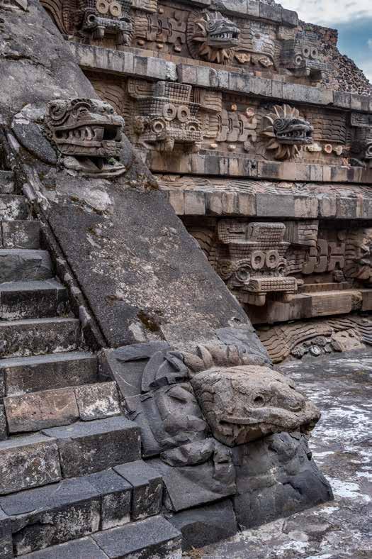
Aztec temple, Near Mexico City
Quetzalcoatl, Temple of the Feathered Serpent (partly intact, partly restored), in one complex of several Teotihuacán pyramids in the Valley of Mexico. This predates by centuries the temples and pyramids, 30 miles to the southwest, demolished by the conquistadors in the 16th century to obliterate, with mixed success, native religion. The Spaniards replaced human sacrifice with genocide; pyramids with cathedrals.
“In 2016 scientists agreed that sometime around 1950 we shifted from the Holocene Epoch to the Anthropocene as humans have indelibly marked and changed the earth. Scientists, artists, and writers had recognized the aptness of the term since Nobelist Paul Cruzen first uttered it in 1999. For creative-arts people this word and its heavy load of meaning became an important statement-making genre. Martin Stupich has been photographing in the Anthropocene for thirty years, the powerful ASARCO Smelter Project the latest in his records of our signature on this planet.”
annie proulx , Pulitzer Prize–winning author
“Perceiving beauty fully sometimes requires also looking at the seemingly unappealing, for there is often an understory, as well as an intricate relationship between that which we want to see and that from which we want to avert our gaze. Pulling back these layers and teaching us how to look more closely at the world around us, in these images the storyteller-photographer Martin Stupich encourages us to see beauty in these structures, even in their demise, for they were made and labored within by human hands. Curious about the complex story of magnificence, he encourages us to recognize the delicacy and strength of our humanity.”
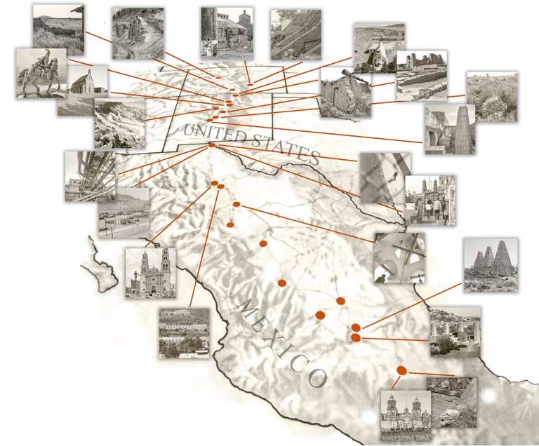
Important sites by locale, state and country
1. Teotihuacan, Mexico, MX
2. Mexico City, DF, MX
3. Querétaro, Querétaro, MX
4. Mineral de Pozos, Guanajuato, MX
5. San Luis Potosí, San Luis Potosí, MX
6. Aguascalientes, Aguascalientes, MX
7. Zacatecas, Zacatecas, MX
8. Durango, Durango, MX
9. Hidalgo del Parral, Chihuahua, MX
10. San Francisco de Conchos, Chihuahua, MX
11. Santa Eulalia, Chihuahua, MX
12. Ciudad Chihuahua, Chihuahua, MX
13. Ciudad Juárez, Chihuahua, MX
14. Rio Grande between Chihuahua and Texas
15. Smeltertown, El Paso, Texas, USA
I6. El Paso, Texas, USA
17. Kelly, New Mexico, USA
18. Socorro, New Mexico, USA
19. Abó, New Mexico, USA
20. La Bajada, New Mexico, USA
21. Ohkay Owingeh, New Mexico, USA
22. Alcalde, New Mexico, USA
23. Costilla, New Mexico, USA
24. Costilla, New Mexico, USA
25. San Luis Valley, New Mexico and Colorado, USA
26. Pueblo, Colorado, USA
27. Pueblo, Colorado, USA
28. Leadville, Colorado, USA
dagoberto gilb
For almost two decades I worked construction, most of those jobs at high-rise sites. Dirty, sweaty, muscle work. Hardhat and boots required. Hours as early and long as ants, duration on feast or famine terms. Fences surrounded the area to warn innocent, curious pedestrians to not stroll into the work zone dangers. Besides the splintered, chapped, calloused hands, a dozen tie wire cuts and scabby wounds on arms, animal-scented men (in my time, only a rare woman), there were many other gigantic mechanical beasts that tore open the earth, pounded and scooped and discarded it. It was another vision being created, a land and time we who worked there came to know well, way past the onset, first close encounter. Look down, look up. Big holes and long tall ladders. Torches sparking, discs grinding, machines torquing. Stacks of scaffolds here, what will become floors there; manlifts attached, steel beams weighing hundreds of pounds swinging high and wide sky bound. At floor 15, stand at the edge and feel the vertigo shift in dimension like new age artwork. At 23, more at 32, stars light up below.
For me, with union gigs in the capital city of the Southwest, Los Angeles, it was giving in to the call of the wild. It was volunteering to board a ship to cross the barely known seas to find the unknown. It was working in icy Alaska on a desolate pipeline, riding a horse on a few months’ long cattle drive. It was heading to mountains of Mexico to search for gold. A construction gig was dropping into in the Wild West—semi-civilized, raw as just cut meat. Beyond the jobsite cage—usually like two football fields square—a modern, opulent civilization thrived for miles in all cardinal directions and its comfortable citizens could watch us, like prehistoric birds of prey through peepholes and photo-friendly landings.
One day, close to quitting time, it’d be way up high, a wind blowing through, swaying the skeleton building, the sun hitting and coloring the horizon, the sky closer than the ground, a dude from another crew would walk over: hey, didn’t we both work that pyramid job together too? We laughed in the air as fresh as it is at this height—maybe as clean as it was in those ancient work days. My Wild West job, years into it by then, became a window to view our almost hidden away human activity—to rip open the skin and gut the living earth in order to celebrate, adorn, worship, make our world outside luxuriant. We want shiny awe, need magnificent awe. We want silver, gold, copper. From domestic towers, to temples and pyramids and domes, amulets and pendants, monuments of and for gods and lovers and rulers, this commerce of luxury comes from the depths of the treasure chest earth.
As most who will have the enormous pleasure of encountering this book, I strain to find description for the abandoned remains of an industrial slaughter ground for
minerals. Not a geologist or scientist, I see myself still and only as one of those workers connecting to those of past and long past. Now, as wordless with wonder as I’d get up high in the steel bones of a high-rise—stopped, not using my body—it’s almost as one being chosen to be allowed to view and learn the insights inside this book. An El Pasoan for so many years, I’d been an average pedestrian, too simple to realize what the ASARCO smokestack was beyond its ugly spew, doing what it did to those who lived nearby. Never occurred to me what it was in the large, the human history. It had only been the giant marker that told me I was a few more curves of the Rio Grande and highway from home to my family.
Look through these photographs, be struck by what is shockingly beautiful to the mind. It’s as if we are seeing through a deep space and time microscope. We aren’t only the time we experience at that moment, but far more ancient. Yes, in the graveyard of ASARCO, this hidden life of our human species is glimpsed. Almost a man-made geologic form itself. But no, it’s more: the startling talent of Martin Stupich’s art, of course. With it, he shows us the whole of this human effort of want and need, across time and cultures, that leaves this detritus as something that bears a unique human marking, often in sight. Always a mysterious world, fenced off, but a world of creation, of high risk and cost—for beauty, luxury, betterment for all, and only dangerous work for the unseen poor.
martin stupich
If joined together, History and Geography crown our reading with delight and profit; if parted, they threaten both with a certain shipwreck.
—dr peter heylyn , Cosmographia (1649)
A good book, to engage me fully, has within its first five pages a map showing the geography described between the covers, or a graphical timeline dissecting the sweep of the story that I am about to enter. Often the best of these illustrations is as compelling as the author’s narrative or the pictures filling the book I’m holding. It is a simple preference, like my favoring aerial photographs over portraits or historical biographies over memoirs.
“The long view,” whether through the Hubble telescope or a rearview mirror, is a useful voice for storytelling. Ore and Empire is an example of this artist learning on the fly a swath of the world—by trusting that it offers more than what’s scattered about in plain view. The El Paso ASARCO (American Smelting and Refining Company) smelter, in all its visual cacophony, would alone have been an engaging photographic subject. But from its place on the Rio Grande, in the thin, brilliant Chihuahuan desert air, ASARCO feels not just like a “place,” but like a small piece of a vast whole—one part of ten million acres of raw geography delineated by the continent’s mountain spine and the green ribbon of one of its great rivers, history’s Rio Bravo, the modern Rio Grande.
When it was completed in 1966, the world’s tallest industrial smokestack punctuated the skyline of El Paso–Ciudad Juárez from ASARCO’s smelter site on the Rio Grande. Though the eighty-three-story-tall double-shelled concrete chimney held that world record for less than two years, it remained a regional icon for forty-seven. In 2013 it fell in a seventy second burst of timed detonations, ending decades of local pride as well as derision. Environmentalists cheered as they watched the tower crash to the ground, while in the same breath they warned of its poison ash and the dust cloud now slowly drifting east toward downtown El Paso. Others alerted citizens to the hazards lurking in the pulverized concrete and twisted rebar jumble that was the stack—and which now had fallen precisely as planned into its nine-hundred-foot-long grave, awaiting burial. Also watching the stack drop were some whose families for generations had depended on smelter wages. A few shared their thoughts
The story of smelting begins more than thirty-five hundred years ago–almost simultaneously–in Sumer (modern southern Iraq), in China, in Egypt, and in Mesoamerica. The fundamental elements of smelting remain unchanged, evolving only in sophistication and in scale. Simply: crushed metalbearing rock (ore) heated sufficiently will give up its treasure, i.e. copper, iron, silver, gold. The earliest smelters were mere fire pits, eventually enhanced with crude bellows. Their modern descendants might be massive oxygen-charged gasfired rolling cylinders a quarter mile long, or rows of towering coke-fueled blast furnaces. From any epoch and at any scale, they command attention on the landscape.
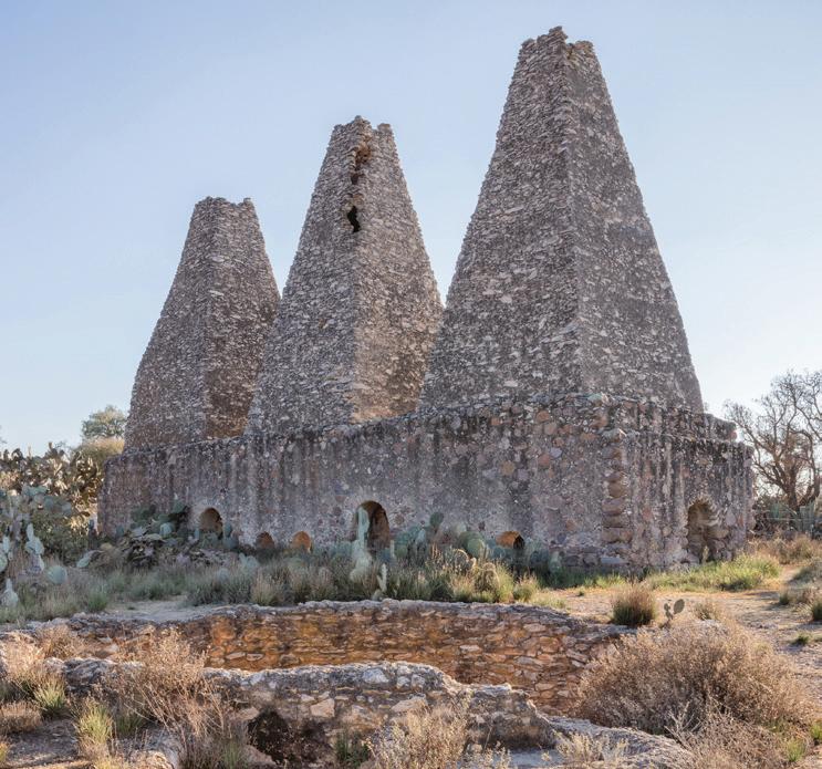
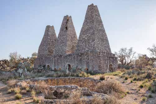
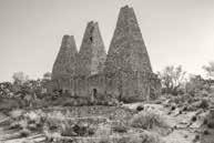
This photograph from Santa Brígida makes that point, the smelter’s three spires dominating an isolated desert valley straddling el Camino Real de Tierra Adentro in central Mexico. In 1595 Indians, working for Jesuits licensed under Spanish King Felipe II, completed this elegant silver smelter. Its hornos (ovens) and stacks are made of native stone and mud; their interiors finished with plaster stucco–the handiwork so splendid that this three-story marvel seems mere decades old, not four centuries.
(I was there with them). Some spoke in nostalgic, whispered fragments that were almost inaudible through tears. “Finally,” one said to me, “it’s over.”
By then I had been photographing on the ASARCO demolition site for more than three years, a process I naïvely thought would end when the infamous stack fell. But life doesn’t unfold neatly in chapters. As I closed in on making my last pictures in El Paso, my research led me to a time before ASARCO’s beginning, back a century and a half to Meyer Guggenheim’s early years as a genius entrepreneur patriarch; to his sons building a worldwide conglomerate, starting with the incidental investment in 1880 in a small Leadville, Colorado mine.
From there the story leapfrogs north to Pueblo and across the Rio Grande to central Mexico, where in 1902 M. Guggenheim Sons bought the flourishing lead and silver mine at Santa Eulalia in southern Chihuahua State. Here they tapped the same lodes that, in 1652, had been worked by the Spanish crown’s army of proxies and local enslaved Indians. Santa Eulalia’s mountain of silver had funded construction of the magnificent regional capital of Ciudad Chihuahua, whose grand cathedral dates from 1725. In the twentieth century the same mine fed Guggenheim coffers, helping to underwrite a century of brash exuberance.
Artifacts, and the departed, don’t easily give up their stories. As an artist, the best I can do is to photograph remnants of their ephemeral landscape: El Paso’s smelter (and next door its workers’ cemetery), California Gulch in the Colorado Rockies, Santo Domingo in the desert canyon above Ciudad Chihuahua. This history and its vista reach across 1,500 miles. But nowhere to be seen, not even as mirages over the horizon, are Peggy Guggenheim’s Venetian palace, or el Museo Guggenheim Bilbao, or Frank Lloyd Wright’s Solomon R. Guggenheim Museum in Manhattan.
Almost involuntarily, I see myself magically lifting and transporting it, Frank Lloyd Wright’s 5th Avenue spiral gem, two thousand miles south to carefully perch it on a tailings dump in Santa Eulalia. Then I invite the town’s mineros in to wander—to marvel at what they and their ancestors have built.
The twentieth-century Guggenheim trail doesn’t go cold in Chihuahua. Further south in Mexico, ASARCO miners and smelter workers, exploiting the Conquistadors’ historic claims, ceaselessly transformed hard rock into treasure. I finally saw it: a modern map of Guggenheim’s industrial empire, its imprint on the world, fits perfectly atop the seventeenth-century map of Spanish conquest. In places, Conquistadors and Guggenheims had mined the same lodes (exactly!), traveled the same roads (exactly!), and depended for labor on families whose ancestors worked these same veins centuries earlier. Today, between Leadville, Colorado, and central Mexico, abandoned pits and shafts, Baroque cathedrals, hacienda ruins, and anonymous graves dot the mountains and deserts for 1,500 miles. Each of these thousand remnants holds a story we will never hear. I meet that silence by making this collection of photographs. As such, my work is a sort of forensic poetry. Pure curiosity sparked this project more than a decade ago. Now my regard for simple beauty sustains it—and me—in this exhausted yet inexhaustible sublime landscape.
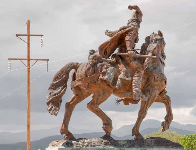
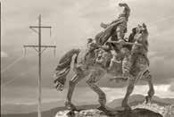
This bronze equestrian monument on the historic pueblo of Ohkay Owingeh commemorated “the last conquistador,” Don Juan de Oñate and his 1598 founding of the first capital of Nuevo México–which he named San Juan (for himself and his patron saint). After a long career of conquest, murder, and lesser cruelties he was prosecuted by Spain for atrocities–most famously against the Acoma. Banished from Nuevo México and exiled from Mexico City to Spain, he died there in 1626. Installed in 1994, this statue stood at the Northern Rio Grande National Heritage Center on the Camino Real twelve-hundred miles north of Mexico City. Three weeks after George Floyd’s death in 2020, amidst national demands for racial justice, the sculpture was forklifted off its pedestal by county commissioners and removed “temporarily.”
The Principals
martin stupich
This story hangs on the framework of centuries of history; but its robust twin arms are the 19th century reach of the Guggenheim mining and smelting empire, and before that the 16th and 17th century exploits of Spanish and Mexican Conquistadors.
conquistadors (1519–1600)
In the Americas, Spain’s Conquistadors were at first explorers–mainly Francisco Pizarro, Hernán Cortéz, Francisco Vásquez de Coronado, and Mexicoborn Don Juan Oñate. Their disciplined well-armed legions thrust from Cuba to Peru, propelled by rumors that in América untapped lodes of silver and gold, and ancient royal treasure troves were theirs for the taking. From 1519 forward, greed and entitlement turned them inevitably into predatory warrior-conquerors, licensed by Spain’s crown to pillage, enslave, baptize, and govern the civilizations whose land they overran. Conquest was swift; it took Cortéz less than two years to overwhelm and subdue Montezuma II and conquer the Aztec capital, now the site of Mexico City.
By 1600 Conquistadors had overpowered centuries-old cultures, from the Taíno in the Caribbean, to the Inca in Peru’s Andes (where still, at Potosí, most of the world’s silver is mined). Farther north in modern New Mexico, mythical cities of gold and heathen souls needing salvation bedazzled Spain’s royal and papal armies, drawing the conquerors deep into the American interior. Five centuries on, from the southwestern U.S. to the far tip of Chile, their language and religion endure.
guggenheims (1880–mid-20th century)
During the Gilded Age, though most of the era’s robber barons traded in railroads, oil, steel and coal, the family name dominating the narrative of the period is Guggenheim–not a single entrepreneur, but a dynasty spanning five generations, a century and two continents.
In his seventy-seven years, Meyer Guggenheim transformed himself from young Swiss immigrant lace wholesaler in Philadelphia to modern international mining mogul. At the turn of the 19th century in the U.S., males seldom lived past fifty. By that age, Guggenheim had fathered ten children, built and grew fortunes, forged a family dynasty, and ensured its stamina by
KEY TO THE CAMINO LANDSCAPE (refer to map on page 8) from south to north, as the Guggenheims found it, and as they left it:
training five of his seven sons in finance, and in the business of running a mining and smelting consortium–one of the world’s first multinational corporate success stories.
The Guggenheims built their fortune on risk and skill. With no mining background, in 1880 Meyer Guggenheim paid $5,000 for a minority interest, sight unseen, in two small underperforming Leadville, Colorado lead and silver mines. Within a year, based on prospects for success, the family formed M. Guggenheim’s Sons.
The Colorado works prospered; soon the company was acquiring more mines and building smelters–and railroads to connect them–from Mexico to Alaska. By virtue of their eventual control of ASARCO (American Smelting and Refining Company)—Guggenheim purchased and developed mineral claims in Latin America—Peru, Chile, Bolivia, with some of their most active investments in central and northern Mexico, closer to U.S. markets. Mexico’s mines, their proximity to El Paso, Texas, and the Guggenheims’ mastery of Mexico’s Revolutionary Period politics, ultimately ensured the success of the El Paso ASARCO plant—the centerpiece of this photographic project.
the setting
This visual chronicle reaches from 1595 to 2022. This story of ASARCO, copper, and industrial-scale mining and smelting starts not at the beginning, but near the timeline’s middle—in the nineteenth century. Its epicenter straddles the Mexico-Texas line where the Rio Grande and el Camino Real de Tierra Adentro intersect, then merge. The saga unfolds on a multilayered map and over a tangle of timelines spanning half a millennium, embracing a mosaic of nations—Native and ancient, and recently drawn—that reaches from El
Paso south to Mexico City, and north to Colorado. Parts of the story overlap and mingle like a watercolor’s translucent washes, populating one expansive diorama.
The earliest layer, the first landscape, is of sixteenth-century Spanish North America, where Europeans’ “contact” with Indigenous peoples and treasure led to conquest (exploitation, assimilation, religious conversion, or extermination). During this long moment—the Age of Discovery—treasure extracted from central Mexico’s (and Peru’s) fabled silver lodes sailed off to Spain, funding history’s first truly global empire. In North America, el Camino Real defines this vestigial sweep of historic land, from Mexico to beyond Santa Fe, its hard-trod earth the stage for this centuries-long story. Few physical traces of the Spanish onslaught remain. Crude surface excavations and hand-dug silver and copper mines have long since eroded, collapsed, or been subsumed ages ago by larger digs. Among the few early mining artifacts still standing, the most splendid is the thirty-five-foot-tall stone and stucco smelter oven and its three pyramidal-peaked chimneys at Santa Brígida near Mineral de Pozos in Guanajuato State, Mexico. Built in 1595 by Indians enslaved by Jesuits working under Spanish license, the Santa Brígida smelter was more than four centuries old in 2013 when ASARCO’s 828-foot El Paso smelter stack, a modern marvel, was toppled after standing for less than five decades.
Four hundred years before I began photographing Paso del Norte’s historic smelting landscape, conquistadors traversing it on horseback waded north across the wide, silty Rio Bravo (our Rio Grande) where it cuts a gash through the Rocky Mountains. The lure was silver, gold, and pagan souls—all promising generous returns for the trouble. By the mid-nineteenth century, El Camino Real, joining Mexico City to Santa Fe through today’s El Paso, was well-worn.
from
The photographer has not visited these five sites:
5. SAN LUIS POTOSÍ. In 1592 gold and silver drew Spaniards to Potosí, named for the conquistadors’ fabled Bolivian silver mine. San Luis Potosí was the perfect place for Americans, by 1890, to build crusher mills and smelters.
6. AGUASCALIENTES. By 1575, Spaniards had established a presidio on the site. In 1893, Guggenheims built a smelter here to process ores from Tepezela and Asientos mining districts.
7. ZACATECAS. Don Juan de Oñate was born here in 1550. By 1605 Zacatecas mines were the source of twenty percent of the world’s silver.
8. DURANGO. In 1564 Spain built a regional capital here, on the Silver Road linking Mexico City to northern mining districts.
9. HIDALGO del PARRAL. Once prosperous, in 1640 Spain’s King Felipe IV berated Parral’s declining fortunes by proclaiming neighboring Santa Barbara “Capital of the World of Silver”.
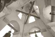
SAN FRANCISCO DE CONCHOS. In 1604 Spanish missionaries settled here. As a security measure along the Camino, in 1685 a presidio was built near the mission church to protect commerce along the route–especially its freight wagons laden with silver, rolling between northern smelters and the treasury in Mexico City. (photo: 2016)
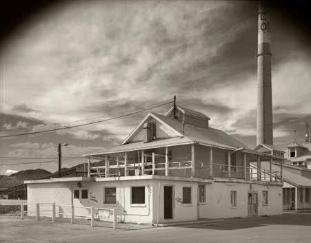
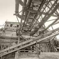
In the 1880s, the first smelting to occur on this site was done in a small mud brick building whose tiny scale soon made it obsolete. Larger facilities were built, but the original adobe structure survived (with modifications shown here), serving as the on-site ASARCO office, and later as the field headquarters during ASARCO’s multi-year demolition and environmental remediation.
Its rutted, parched landscape was infamous, first blazed by Indigenous hunters and traders, then by Spanish soldiers, Catholic missionaries, and migrants. And, after them, mining engineers, railroad surveyors, and captains of industry hoping to claim the treasure the conquistadores had missed.
Two centuries into the Conquest, by 1750, a continuous flotilla joined Veracruz on Mexico’s Gulf Coast with Spain’s port at Sevilla, its galleons groaning with bullion smelted from Mexican ores. But not all the freshly forged treasure left New Spain. Conquistadors retained enough to fund grand
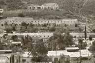
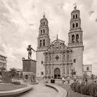
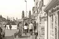
This “paso” through the mountains was the gateway to the fabled treasures of northern New Spain. Spain established a settlement here; by 1659 a mission church was rising in the heart of the new colony.
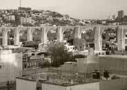
royal and papal ambitions in América. Political and church clout clustered where mines flourished along the southern Camino Real, on a section known as Camino de la Plata. This Silver Road linked the country’s rich mining and smelting districts to its power center at Mexico City. Along the entire route the church (and Spanish royals) staked claim to their conquered provinces, branding them with flamboyant civic and liturgical architecture—the stamp of Empire—thereby bolstering their dominion over peoples and lands. Today those colossal European-influenced Baroque “silver cathedrals” and sprawling public plazas remain the Crown’s and the Vatican’s unambiguous mark on the cultural topography of the New World. Mexico City, Puebla, Querétaro, Zacatecas, San Luis Potosí, Aguascalientes, Parral, Chihuahua, and Ciudad Juárez each have at their center a version of this bold exclamation point–distinguished by soaring bell towers and a prominent dome festooned inside with gold- and silver-gilt saints and martyrs, and topped outside with a crucified Christ. A map of this corridor through modern Mexico is a concise geographic guide tracing the course of riches flowing through, and pouring out of, the New World.
Spain’s influence in the Americas contracted greatly through the 19th century–under pressure from both sides of the Atlantic. By the late 1800s American east-coast speculators had reshaped the continent’s mountain spine from Alaska to southern Mexico, much of it along the historic Camino route (its northern half, no longer a part of Mexico). Wilderness morphed into industrial landscape, linking scores of mines and smelters by a network of new railroads to deep water ports and world markets.1 Controlling most of it, either by influence or outright ownership, were a half dozen Gilded Age icons: Clark, Hearst, Heinze, Huntington, Rockefeller,2 and Meyer Guggenheim, founder
of M. Guggenheim Sons and its American Smelting and Refining Company (ASARCO). That rowdy era was as much clad in copper as gilt in gold. Copper—its mining, smelting, and refining—was at the heart of enormous new fortunes, Guggenheim’s primary among them. The family name, after more than a century, remains a synonym for high drama, philanthropy, arts patronage, and implausible wealth.
From south to north on the Royal Road, fewer than two lifetimes stand between us and those who survived (or did not) service to the princes of industry, church, or crown. Along the way, the most poignant ruins are stilllegible artifacts. For the length of El Camino, the ordered civility of grand haciendas (which were actually planned company towns) anchored crowded one-story adobe or wood shanty workers’ ghettos. Thousands of feet beneath them were shafts and timber-braced tunnels; and within a short haul the fiery din of crushers and smelters. Today these crumbling remains speak, though faintly, with an eloquence unique to archeological ruins. Scattered from Pozos to El Paso, from Magdalena to Pueblo, their rusting hulks, melting stone foundations, and toxic-slag mountains are the headstones honoring a score of generations of trabajadores and their families.
the land atop a treasure vein Environment is another way of saying context. The ASARCO smelter, America’s largest,3 rose where it did and succeeded so completely for so long because the natural setting and political landscape favored it, and because ASARCO took prudent advantage of both. To put it simply (and Michael Romero Taylor’s essay elaborates on this idea), the Rio Grande cutting
in the
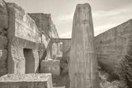
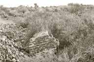
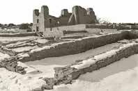
by Spain’s army of conquistadors, Tompiro and Tanoan, Quarai served as the ecclesiastical headquarters for the Catholic pope’s Inquisition in Nuevo Mexico. Abandonment and ruin followed the Pueblo Revolt of 1680. (photo: 2013)
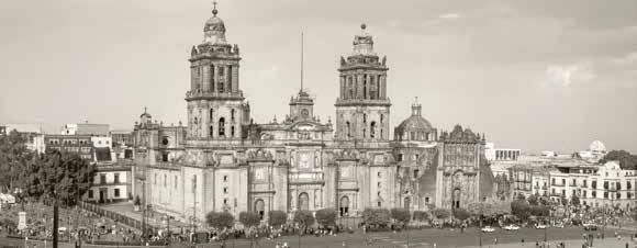
Under construction for two and a half centuries starting in 1573, Mexico City’s Metropolitan Cathedral is built atop the rubble of Aztec sacred sites. To obliterate pagan influence, conquering Spaniards demolished massive pyramids and temples dating from fifteen centuries earlier. Conveniently, the recycled stone– already quarried and dressed–was ready for use in building what is still the largest Catholic cathedral in the Americas. (photo: 2020)
through a mountain range to form el Paso del Norte was for three centuries crucial in steering North America’s destiny.4
Every cultural artifact on any landscape owes a debt to nature. And every natural element in that same landscape bears culture’s heavy imprint. Other authors,5 artists, and activists articulate that topic more fully than I. My goal in this photographic project is to understand the big complex picture by responding to beauty in its many facets wherever I encounter it.
Within three miles of the El Paso smelter site, the stunning range of topographic variety is, in a subtle way, incomparable. A bi-national urban grid, with its population of three million, fans out from a point where in 1598 don Juan de Oñate crossed el Rio Grande del Norte into Nuevo México. Half a millennium later the perimeter of this sun-bleached metropolis abruptly halts, the frayed edges of Juárez-El Paso opening onto searing desert for hundreds of miles in all directions. And like islands rising from a sea of gypsum,
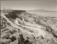
1598 arrival spurred plotting of a permanent trail which by the 1920s was known as Route 66. (photo: 2009)
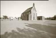
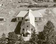
French chapel occupies a spot at the center of an ancient Indian pueblo claimed by a Mexican general working for a Hapsburg king enthroned in the Spanish capital. Don Juan de Oñate, a Mexican, christened it the Seat of Government of New Spain. Within two years Oñate, guilty of atrocities against his Indigenous “subjects,” was banished, exiled to Mexico. The capital was moved to the site of today’s Santa Fe. (photo: 2017)
ALCALDE. Don Juan de Oñate y Salazar crossed the Rio Grande into Nuevo Mexico in 1598. Within months his marauders had enslaved and murdered scores of natives along the way, mostly in present-day northern New Mexico, between Acoma and Ohkay Owingeh. This monument was unceremoniously removed in 2020.
mesquite, and chamisa, mountains beyond number punctuate the glare to the horizon. This is the landscape at the crossroads of the continent where, after campaigns of conquest, slavery, and salvation, cultures converge and now thrive. El Paso del Norte, a narrow slit cut by an ankle-deep stream through an isolated desert mountain range, is also the pivot point for one of North America’s historic chapters—a complex, ongoing narrative centuries in the making.
In the long view, industrial landscape is ephemeral. At least that is nature’s perspective—one that, at a leisurely pace, sees tectonic plates collide and black holes gobble up galaxies. But our timetable is different, and our priorities more urgent. We live, build, learn, exploit, populate, and cultivate, measuring our progress by tracking how much or how fast or how big or how many. Industry is a noun conjuring loud, gritty machines in hulking buildings blighting vile neighborhoods in polluted cities. But industry, as an attribute, connotes an exemplary human trait. To be industrious, to practice industry, is to be unlazy, hardworking, and resourceful. In our time, a culture’s success is measured in industrial output. Applying our personal industriousness to industry is the same as good citizenship.
As an artist (and a former farmhand and steelworker) I not only understand labor, I honor it. The work we do shapes our autobiographies. It helps to define our lives. This is true of individuals and of peoples.
I use the common term cultural landscape to understand the physical world outside my window, stretching as far as I can see. Making these pictures conjures for me a sprawling map with El Paso at its center, a map reaching deep into Mexico and extending north to embrace much of what we know today as the American West. It is a topography strewn with clues to the story—the history—of the lives of heroic but often unnamed souls.
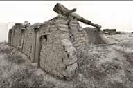
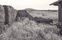
of the most expansive in the American west–from Garcia, Colorado southwest to Ute Mountain,
New
Sometimes the most complex subjects are the most subtle, like the debris field of artifacts scattered in history’s wake: adobe villages melting into hillsides; smelter foundations and aqueducts and cemeteries, cathedrals and railroads. Their placenames are descriptive (Smeltertown; Leadville) and honorific (Santa Eulalia; El Camino Real). They have this in common: everything I see was built by hand by someone, by some community, some person multiplied by the thousands over the centuries—persons whose names are lost. The names we do remember are of people who paid or owned or commanded the laborers and the miners. Oñate, Juárez, Villa, Guggenheim. But the unnamed trabajadores binding a dozen generations are invisible to us.
My task here is to look for, then to make tangible, the remnants left by these anonymous thousands over half a millennium. It is to their industry that I feel most indebted.
Artifacts vanish, turned to powder due to either time or human mischief. These photographs, made in this most remarkable landscape, are my stab at learning the stories they might reveal—learning the stories and then passing them on.
notes
1. Monica Perales, Smeltertown (Chapel Hill: University of North Carolina Press, 2010), 5, 32, 36 (map).
2. Michael P. Malone, The Battle for Butte (Seattle: University of Washington Press, 1981), 133–38.
3. C. L. Sonnichsen, The Pass of the North, Volume II (El Paso: Texas Western Press, 1980), 72.
4. The name “El Paso del Norte” is cited by various scholars as a reference to the most convenient river crossing (of El Camino Real de Tierra Adentro) in the north of Mexico and also as a reference to the canyon cut by the river, forming an east-west passage through the formidable north-south mountain chain.
5. Betsy Fahlman, “The Muse of Enterprise: The Industrial Landscapes of El Paso” (this volume) and Toby Jurovics, “The Old Topographics” (this volume).
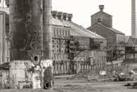
In the 1880s, the GuggenheimASARCO smelter was Pueblo’s largest; but obsolete by 1909, it was demolished. A contemporaneous industrial icon, the Colorado Fuel and Iron Company, still stands a century later, hinting at the nature of Pueblo’s late 19th century Arkansas Valley smelter landscape. (photo: 2018)
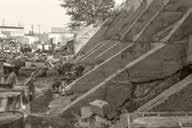
PUEBLO. The Guggenheim ASARCO smelter, its buildings leveled more than a century ago, has for decades been an active Superfund environmental remediation site. Other than a prominent slag mountain, this concrete remnant, on the north side of the ASARCO tract, is one of the last visible artifacts from pueblo’s Guggenheim/ ASARCO period. (photo: 2020)
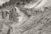
LEADVILLE. In 1880 M. Guggenheim Sons bought an under-performing lead and silver mine. Within a few years its great success encouraged the company, new to the minerals business, to invest in more mines, and in state-of-the-art smelters in Leadville, Pueblo, El Paso, and in central Mexico. In 2023, Leadville and the upper Arkansas River watershed are a half century into an environmental restoration effort. (photo: 2017)
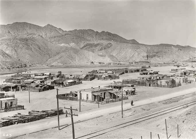
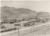
This photograph was made from the ASARCO tailings mesa east of the county road (now Paisano Drive). The view looks west toward the Rio Grande and Mount Cristo Rey. Smeltertown was demolished in the 1970s, part of the nationwide push for urban renewal; the barrio was scraped away, its community scattering before resettling in El Paso neighborhoods and beyond. Photograph ca. 1910, the Otis Aultman Collection, El Paso Public Library.
michael romero taylor
Every time I drive by the site of the old ASARCO plant, I am reminded of the special place that it is. The now flattened landscape has been broken, but if you use your imagination and strip away the asphalt, concrete, and razor wire border fences near the site, you can read the layers of history that blanket the area where ASARCO once stood proud at El Paso del Norte, the Pass of the North; the location of alternating intrigue, turmoil, and tranquility for thousands of years. A pass where the movement of man and nature has always taken place—a kinetic landscape, a crossroads. A place where one had to have patience, since the temperament of the river could paralyze families and entire armies waiting to cross until the floods subsided, especially in the spring when the mountains far to the north would release their snow melt.
The Pass of the North is part of who I am. When we were children, we would travel south to El Paso down the Mesilla Valley to visit relatives; my parents would point to the largest ASARCO stack and remark, “That’s the tallest smokestack in the world.” We seven kids in the back of the Volkswagen bus were always soundly impressed by this pronouncement. Whether or not it was really the tallest is irrelevant. And at the time, so was the pollution it spewed. For young boys like me, ASARCO was the epitome of the erector-set industrialized world. The smokestacks were our datum point for approaching El Paso from the Mesilla Valley, thirty-five miles upriver where we were raised, and at night, hundreds of feet high, their blinking red lights served as our beacon heading back north. I have experienced moving through this pass for the past sixty-eight years, lingering enough to try and comprehend its significance.
Our mother, Mary Daniels Taylor, spent her childhood in the 1920s and early 1930s in company housing right next to ASARCO, where her father, Albert Milton Daniels, was foreman at the Southwestern Portland Cement Plant. It defined the edge of Smeltertown, on the east bank of the Rio Grande, just to the north of the iconic train trestles. My mother’s early life on this part of the border, the scene of much drama then and in prior centuries, had a profound influence on her later work as a respected scholar of border studies. Besides being mother to seven children, she was an avid historian, getting up at four in the morning before the house awoke to research the history of the Mesilla Valley and El Paso. She taught us from a young age the respect
that she had for the Pass of the North, the place where people for millennia had been crossing El Rio Grande del Norte (the Great River of the North). Occasionally she would take us to the Pass near ASARCO, the place where, as a child, she spent time looking for ruins and landmarks like the historic river ford now marked by an abandoned park, its granite slabs inscribed with snapshot histories of the pass, or the site of the old Custom House at Frontera across the river in Juárez, or Zach White School, where she attended elementary classes and later taught.
El Paso / Juárez is home to one of the largest border populations in the world, now now approaching three million. What made it this way? The Pass of the North is a tale of two inseparable cities in two countries, a demographic that embraces a unique borderlands passion, and experience expressed (in part) through an amalgam of Spanish and English language, smoothly woven together during everyday conversations into the “Spanglish” that many of us speak. The entangled place names at the pass exemplify its complexity: the original seventeenth-century settlement of El Paso del Norte was in Ciudad Juárez’s historic plaza center, about three miles across the Rio Grande and to the south of the ASARCO site. The nineteenth-century Anglo-American settlement of Franklin sprang up from the 1823 Juan María Ponce de León ranch on the north side of the river. El Paso del Norte, Mexico, changed its name in 1888 to Ciudad Juárez to honor the charismatic president Benito Juárez, who led the Mexican Republic from there in the 1860s. In 1873 Franklin changed its name to El Paso to reflect its location at the Pass of the North.
What was this landscape like before the Industrial Age, with the building of the railroad and the ASARCO smelter? It was indeed a pass—six miles long, shouldered by mountains and hills on both sides of the river; in the past century it has been chewed up by mining and by cement and brick plants, the massive smelting operations of ASARCO, and paved over by shopping centers, urban sprawl, and interstate highways. The river is now in a straitjacket of dams and levees and border fences. At night the river frontier is illuminated by glaring security lights, monitored 24/7 from land and air by border patrol in helicopters and SUVs. Compared to the wild terrain that existed before the arrival of Euro-Americans, it is a jarring scene.
This pass has long been part of a very significant cultural route. Even the name—the pass of the north—connotes movement, the gateway upriver to what is now northern New Mexico. The Rio Grande that cuts through the pass was a riparian lifeline along which people and wildlife had traveled for millennia prior to the arrival of the Spanish. The river was vital for sustaining
life in natural cycles that alternately brought drought and floods. Its rich soils nurtured a green ribbon teeming with life, incising the otherwise arid desert. Archaeologists believe people were hunting large mammals such as bison and gathering plants here as far back as 10,000 years ago. The river terraces in the area were being used by seasonal hunters and gatherers of plants, and they were dotted with habitations dating to 4,500 years ago.1 In my early years as an archaeologist, I conducted a survey on the west mesa overlooking the pass, recording incredible Archaic period camp sites and a multiroom earthen pueblo site dating to 900–1400 AD. Occasionally I would take time to pause and gaze over the river to imagine the caravans, armies, trading expeditions, shamans, and priests who had maneuvered the pass.
When Juan de Oñate’s colonizing expedition from deep in Mexico crossed the river through the pass bound for northern New Mexico in 1598, the route became part of the Camino Real de Tierra Adentro, the “royal road to the interior lands,” the earliest Euro-American trade route in what is now the United States. Directly tying Spain’s colonial capital at Mexico City to its northern frontier in distant New Mexico, the Camino Real spanned three centuries, two countries, and 1,600 miles. It not only connected the pass to Mexico City but also, through its maritime routes, to Spain and the rest of Europe as well as the Philippines and the Far East, making Spain, through its complex network of roads and shipping routes, one of history’s earliest global economies. In the shadows of what would later become the ASARCO plant, countless travelers moved along this global cultural route.
Oñate and his colonizing expedition were in search of a new home far to the north. They hoped to better their lives, maybe even to find hints of the type of wealth found at Tenochitlán, the site of today’s Mexico City, 1,200 miles to the south at the beginning of the royal road. What a scene, and what a cacophony Oñate’s expedition must have been to the local Manso Indians at the pass four centuries ago: 400 men, 130 of whom brought their families; 83 creaking wagons and carts laden with an incredible variety of provisions, much of which had never been seen before in these far reaches of New Spain; and 7,000 over-excited animals thirsty for water.2 It is said that the caravan went as fast as a pig could trot. When Oñate’s mobile city reached the Rio Grande in the vicinity of today’s San Elizario, Texas, twenty-four miles downriver from the ASARCO site, it stopped to take possession of the lands in the watershed of the Rio Grande for King Phillip I in faraway Spain, adding what is now much of the southwestern United States to the Spanish Kingdom. The river, with its game and fish, was a welcome respite for the
exhausted expedition after crossing the Chihuahua desert from the south. From San Elizario, Oñate sent scouts upriver to find a suitable river crossing. The Mansos led them to a time-worn, rocky ford at the narrows of the Rio Grande, where the present-day Franklin Mountains yielded to the river, forming the cut and joining the riverbed near the site of where ASARCO would later be located. It took days for the entire caravan to cross the river, assisted by the Mansos, who helped guide the laden wagons through the swift current.3 Members of the Oñate expedition, and subsequent colonizers who used this pass heading north, are the ancestors of many present-day Hispanic residents in New Mexico and the El Paso area. I am one of those descendants on my father’s side. But the pass did not just see Spaniards during the colonial period. Enslave Indians who were forced to work in the silver mines of Zacatecas, seven hundred miles south on the camino, also came through the pass, as did thousands of mestizos (Spanish for “persons of mixed race,” in this case Spaniards and Indians).
Thus began the documented historic use of the Pass, starting with 223 years of dominance over the region by the Spanish empire initiated by Oñate’s entrada. We know through various journals, ledgers, and other documents that for more than four hundred years the pass has been witness to many events that tell stories of struggle, joy, heartbreak, fortune, and poverty, the most recent being the incredible story of ASARCO and Smeltertown.
The gorge at the pass did not offer an easy route for much of the seventeenth and eighteenth centuries. Seasonal flooding often made the ford impassable. The foothills east of the river were difficult to traverse by wagon since the adjacent Franklin Mountains precipitously dropped to the river’s edge. Travelers crossed at Oñate’s southern rocky ford and continued along the very rough eastern bank of the river up through the pass. The Camino Real continued north hugging the river, generally along the same route as today’s Paisano Drive.
This stretch of the camino was one of the more difficult ones until road improvements and railroad construction made the route more passable thanks to modern machinery that could blast, haul, and grade the rocky terrain. Some travelers detoured around the rugged mountains by way of the Camino de los Muleros (Road of the Muleteers) to the west along the base of Cerro Cristo Rey, then joined the river again, and the main camino, near today’s Sunland Park at a ford about six miles north.4
By the early 1600s there were Franciscan missionaries working with Indigenous people at settlements near the center of today’s Ciudad Juárez, Mexico.
In 1659, with the establishment of Nuestra Señora de Guadalupe de los Mansos (Our Lady of Guadalupe of the Mansos Mission) at the pass, the area became an important stop on El Camino Real de Tierra Adentro.5
About this same time, Spaniards built a dam on the river below today’s ASARCO site, which diverted water through an acequia (ditch) to El Paso del Norte. In addition to localized traffic, the pass witnessed caravans coming from far south in Mexico every three years on the way north to supply the missions in faraway New Mexico. These were major events that brought not only much-needed supplies, but news and correspondence from within and beyond the Americas.
Among seminal events that the pass experienced was the mass exodus of Spaniards who survived the Pueblo Revolt of 1680 in northern New Mexico. After eight decades of Spanish mistreatment and exploitation in scattered settlements and missions, the Pueblo Indians revolted and killed several hundred settlers. This drove almost two thousand remaining Spaniards and Indian captives and allies out of the region along the camino three hundred miles to the south, eventually reaching the Guadalupe Mission at El Paso del Norte. The population pressure, created by this sudden influx of refugees, forced the Spanish officials to establish new settlements downriver from the mission to provide for more irrigable lands and room to minimize social strife. Today, the settlements of Ysleta del Sur, Socorro del Sur, Senecú, and San Elizario are surrounded by the greater metropolitan area of El Paso and Ciudad Juárez, but they still retain their identities with their founding three centuries ago. By the middle of the eighteenth century, the valley at the Pass of the North was an incredibly busy trading center, sustained by rich farmlands watered by miles of acequias irrigating extensive gardens, fruit orchards, fields of corn and wheat, and vineyards that produced good wines and brandies, both sacramental and secular. Trading caravans traversing the pass created a constant stream of interaction, communication, and exchange of news, traditions, and lifestyles.6 The sights, sounds, and smells of agriculture, ranching, commerce, and transportation created a lasting impression on travelers passing through the area. In the 1760s, it was estimated that five thousand people lived in the scattered villages, ranches, and farms below El Paso del Norte for about twenty miles. The settlement and surrounding farms and hamlets offered some safety and protection in numbers, but it was by no means a peaceful, bucolic environment during the Spanish Colonial period, which witnessed much conflict with the surrounding nomadic Indians and with in-fighting among the Spaniards, Pueblo Indians, and mestizos. The
settlements at the pass were located far from the centers of power in larger cities south such as Zacatecas and Mexico City, and, as a result, El Paso del Norte did not receive the attention that it needed to maintain enough Spanish soldiers and funding.
Until the early nineteenth century, there were no Euro-American settlements on the north side of the river, but in 1823 Juan Ponce de León established a farm in what would later become downtown El Paso. The settlement reportedly included a flour mill at the falls where the Rio Grande emerged from the pass, very close to the ASARCO site.
Another seminal event at the pass was the Mexican American War, a historic pivot point that changed the region forever. In December 1846, 1,200 Mexican soldiers and peasants camped near the ASARCO site in anticipation of marching north to meet the American army head-on.7 A few days later at Bracito, about thirty miles upriver from the pass, the Mexican Army was defeated, and after subsequent battles in Chihuahua and Mexico City, the Mexican government conceded. The result was a new boundary between the two nations, one that transferred almost half of Mexico’s territory to the United States through the 1848 Treaty of Guadalupe Hidalgo. The Rio Grande became the new, natural international border from the Gulf of Mexico to the pass, at a point opposite the ASARCO site. Today, on the west side of the river, a large limestone obelisk marks the first boundary marker set in place in 1856 after binational negotiations determined the latitude where the boundary leaves the Rio Grande and heads west to the Pacific.8 The pass quickly became an important crossing on the new international border.
After the new boundary was determined, the pass saw a torrent of Anglo travelers heading west on the heels of the discovery of gold in California in 1849. Thousands of these gold seekers camped near La Frontera, on the north side of the pass, on their way to the gold fields. Stage lines and mail service from the east, many of which had major stops and offices in El Paso, followed this stream of adventurers heading west.9 The El Paso area was one of the few stops for travelers that was relatively safe and well-watered, where they could rest after traversing hundreds of miles of west Texas desert to resupply provisions before continuing. Several of the main streets in El Paso today retain the nineteenth-century names that reflect these destinations and movement: San Antonio, Santa Fe, San Francisco, Overland, and El Paso (the road to Ciudad Juárez, old El Paso del Norte).
The historic river ford at the south end of the pass, where Oñate’s 1598
expedition had crossed, became the location of Hart’s Mill, where Juan Ponce de León had his original mill a few years earlier. Originally from Kentucky, Simeon Hart married a Hispanic woman from the area and became a very successful merchant, trader, and social figure in El Paso. By 1850 his property was comprised of his extensive residence, the mill, a stage stop, and a restaurant, and it was one of the first permanent compounds in American El Paso.10 Part of Simeon Hart’s complex became the fifth site of Fort Bliss from 1881 to 1893. The sixth and current Fort Bliss is located northeast of the city, which today represents a major economic anchor in the region.11 Part of the old Hart residence still exists and served as a restaurant called La Hacienda up until the early part of this century. It was one of those wonderful Mexican restaurants where ice-cold beer, bolillos, and delicious bargain lunches were enjoyed by thousands over the years.
The railroad arrived in 1881 and changed everything at the pass. The population exploded from a small ranching town to a city. With the railroads came smelting and mining—the powerhouse of El Paso’s economy for over a century. The rails passed directly through old Fort Bliss and what would later become Smeltertown, where generations of ASARCO’s workers would live with their families. The railroad shifted the major transportation routes from the footpaths and wagon roads of the ancient pass to new bridges that crossed the river and linked with Mexican railways to the interior. The arrival of the railroad meant a new global linkage and hub of transportation and trade that was key in connecting North America north/south and east/ west, adding a new dimension to the already diversified border. With the building of the International Brick Company across the river from ASARCO in New Mexico in 1897, and the Southwestern Portland Cement Company adjacent to ASARCO in 1907, concrete and brick building materials helped changed the skyline of El Paso, which by then offered most of the amenities of other large cities in the United States.12 In 1916 cement from Southwestern Portland Cement Company was shipped by rail north to build Elephant Butte Dam, one hundred miles above the pass, which enabled unprecedented irrigation and the expanded cultivation of crops in the Mesilla and El Paso valleys, providing a more reliable water source for the ever-increasing Rio Grande Valley population.
Important sieges and battles of the Mexican Revolution also played out at the Pass of the North.13 Across the river from ASARCO in 1911, Mexican revolutionaries under Pascual Orozco’s command camped and eventually entered the historic core of Ciudad Juárez under cover of the acequia that tiered off
from the river opposite Hart’s Mill. Thousands of curiosity seekers on the US side watched pitched battles take place in Ciudad Juárez from rooftops and railroad cars in the vicinity of Smeltertown.
Through the symbiotic relationship between autos and highways, new transportation routes were built on top of or adjacent to the ancient camino that had brought travelers through the pass for centuries. Paisano Drive (Highway 85) and the Pan American Highway pass right by the front door of Smeltertown, and the 1970s Interstate passes adjacent to and to the eastern border of the site. Every day, thousands of people from diverse backgrounds share this narrow corridor through the Pass of the North with the river, trains, and highways. Speeding along the interstate through the gauntlet of overpasses, train trestles, and interchanges, it is hard for one to imagine the stories concealed by this scoured landscape at the Pass of the North. The area is much different than in the early nineteenth century. Layers of history have been stripped from the surface by the raging river and by intense mining over the past 150 years, leaving us with a confusing vista that is hard to decipher. But the fact is that the Pass of the North is pivotal to the narrative of the United States and Mexico. This place, as jumbled as it seems today, is one of the most historically rich sites in the United States, a place where the first permanent European colonizing expedition crossed over into what is now the United States, a crossroads of ideas and customs for centuries, a place that has witnessed countless stories of daily life. Even though most of the physical remains of Smeltertown have been scraped from the landscape, telling vestiges still serve as touchstones for the people who once lived in the shadows of its smokestacks: the forty-three-foot sandstone statue of Cristo Rey overlooking the valley, the river, the train trestles, bridges, and tracks, grades, the cemetery, Paisano Drive, and remnants of the surrounding pass. The Camino Real de Tierra Adentro, the long-distance route that for centuries carried so many travelers through the pass, is the same route used by generations of workers who sought employment at ASARCO, and it is the same route that today is used by thousands of people heading north and south through El Paso and across the international border. How many millions of people have passed through here? Where were they going? Where were they coming from? How many individual orbits have coincided, collided, crossed paths, exploded, or shared life and emotions? Imagine the stories they could tell! The Camino Real de Tierra Adentro is still alive and well through the Pass of the North. This place represents a true crossroads
for the continent, a place where energies and forces have converged. My family history is tied up like a ball of string around this nexus.
As I am funneled into this narrow corridor when I travel to El Paso, I always glance toward the river where my mother spent her childhood. Feelings are good here in this zone, at this special crossroads that physically and figuratively has been, and continues to be, so much a part of me. I relish its rush, its power, its significance, its cleansing, its swath of history and things that transpired here in the past that have become part of the mystery of the place. It is a strong, spiritual, and always humbling place. I often try and decipher its secrets. Sometimes I think too hard about it, try too hard to analyze what I am feeling. But most of the time I catch myself, and gratefully I just experience it, basking in the enigma of the place.
notes
1. Thomas C. O’Laughlin, The Keystone Dam Site and Other Archaic and Formative Sites in Northwest El Paso, Texas (El Paso: Publications in Anthropology N. 8, El Paso Centennial Museum, the University of Texas at El Paso, 1980).
2. “Oñate Expedition,” Texas State Historical Association, accessed December 20, 2016. https://tshaonline.org/handbook/online/articles/upo02.
3. C. L. Sonnichsen, Pass of the North (El Paso: Texas Western Press, University of Texas at El Paso, 1968), 17.
4. Sonnichsen, Pass of the North, 32.
5. George D. Torok, From the Pass to the Pueblos: El Camino Real de Tierra Adentro National Historic Trail (Santa Fe, NM: Sunstone Press, 2012), 71 6
6. Torok, FFrom the Pass to the Pueblos, 72.
7. Sonnichsen, Pass of the North, 112.
8. Torok, From the Pass to the Pueblos, 113.
9. Torok, From the Pass to the Pueblos, 98.
10. Torok, From the Pass to the Pueblos, 111.
11. Monica Perales, Smeltertown (Columbia: University of South Carolina Press, 2010), 22, 31.
12. Perales, Smeltertown, 229.
13. Sonnichsen, Pass of the North, 397.
The Industrial Landscapes of El Paso betsy fahlman
One writer poetically described the American Smelting and Refining Company’s (ASARCO) 1899 one-hundred-foot tall sheet-iron smokestack “built in a wooden frame supported by a cross-work of timbers,” as providing visitors with “an Eiffel Tower effect.”1 Situated on the Texas / Mexico border, El Paso does not immediately conjure art, but rather a gritty frontier city, whose most dominant industry was once the American Smelting and Refining Company. El Paso lacked the deep historical resonance found in the landscape and Native peoples that drew artists to the creative colonies of Santa Fe and Taos. Nor did the city possess the seaside charms of the picturesque coastal towns in California overlooking the Pacific Ocean, which attracted many artists as well as their students, both seasonally and permanently, offering popular art classes during the summer months.
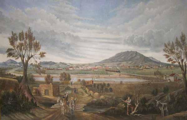
Many remember El Paso for its environmental pollution where the tallest stack in America spewed toxic yellow smoke filled with sulfur dioxide and heavy metals into the air when the smelter was in full production.2 Nevertheless, beginning in the late nineteenth century, a small group of artists was inspired by the unusual beauties of El Paso’s Industrial landscape.3 Not surprisingly, these artists received no commissions from ASARCO. Industrialists who became patrons of art generally did not want to see canvases celebrating the source of their wealth and its environmental depredations (though smoky skies denoted jobs and prosperity), preferring conservatively safe aesthetic choices such as comforting placid French Barbizon landscapes and peasant views, or academic figure paintings of mythological and historical subjects. El Paso was not a place known for wealthy collectors, which explains why the city’s art museum was not established until 1959. Nevertheless, the artists who ventured to El Paso found both pleasant and dramatic scenes to capture their interest. In 1885, French artist Léon Trousset (1838–1917) painted a handsome panoramic view of El Paso as seen from the Mexican border4 (figure 1). The artist employed common landscape conventions typical of the European art historical canon which American artists translated into the conventions of the Hudson River School in the nineteenth century, framing the scene with trees, and placing figures in the foreground to establish scale. This practice also included a single man cutting down a tree, a common trope of the ever westward advancement of civilization impelled by Manifest Destiny. In the
far background, the prosperous and expanding city of El Paso is visible at the base of the Franklin Mountains; between 1880 and 1890, the city’s population increased thirteen-fold. Above the mountains are dramatic clouds that convey the energy of the enterprise unfolding below (which would later include the smoke of pollution), and the artist includes several standard signifiers referencing the progress of a civilization whose industry could thrive in a pastoral context. On the right side a train steams across a wooden bridge over the Rio Grande, a common reference to the “machine in the garden”5 of the fruitful harmony of industry within the context of landscape. On the left we see, in the far distance, the stacks of a smelter ejecting a plume of white smoke. The ASARCO facility dates from 1887, but smelting on that site dates back even earlier. By the time Trousset had completed his large canvas, El Paso had become a busy commercial and railroad hub and trains passed through from all directions: the Southern Pacific to the west, the Santa Fe to the north, and the Texas Pacific and the Galveston-Harrisburg-San Antonio to the east, and the Mexican Central Railroad headed into Ciudad Juárez across the border.
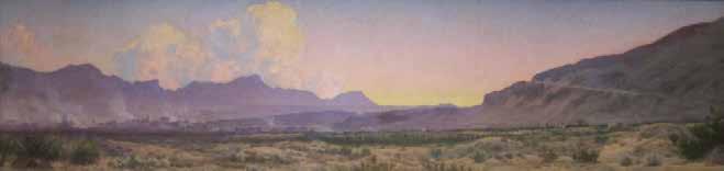
The landscape conventions employed by Trousset continued into the first quarter of the twentieth century, and may be seen in View of El Paso at Sunset, by Audley Dean Nicols (1875–1941) (figure 2). The artist, who was born in Pittsburgh, moved to El Paso in 1919 for health reasons, and remained in the city until his death in 1941. Once settled in the Southwest, he made numerous views of his favorite subjects—desert scenes in Texas, New Mexico, and Arizona. For him, these sere regions were full of color, as Nicols observed of the typical landscapes he painted:
The so-called gray of the desert is a mistake. The desert is everything but gray. There are fresh blues in the skies, pinks and yellows in the sunset, opalescent purple, rose, and lavender in the distant mountains, dull greens
of every shade in the vegetation, and reds and yellows in the rocks and earth—but never gray.6
His atmospheric panoramic landscape is lyrical in color, and it represents an optimistic view of the region at a time of great prosperity. The attractive hazy lavender tones that infuse the painting led to his becoming the center of a group that by the 1940s had become known as the “Purple Mountain Painters.”7
Nicols’ large canvas presents the modern landscape of El Paso during a period of economic and population expansion. The stacks of ASARCO are emphatically present at the left. In the middle of the composition is the city of El Paso itself, whose skyline is punctuated by some of the many handsome commercial buildings that the architectural firm of Trost and Trost designed in the city between 1903 and 1933.8 At the right are several of the early buildings of the College of Mines and Metallurgy of the University of Texas, founded in 1914.9 That school offered its students a highly practical education, in contrast with the training of teachers at normal schools, or the broad liberal arts curriculum found at other colleges and universities. El Paso’s institution of higher education was grounded in the industrial source of the prosperity of the city, and training the next generation to work for the city’s major employer.10
Several notable New Mexico-based artists ventured across the Texas border, and found inspiration in the city’s typical features. Born in the remote mining town of Virginia City, Montana, Freemont Ellis (1897–1985) had an unsettled childhood. His father was an itinerant dentist who eventually saw some success in mining. He later pursued a career in vaudeville and the management of motion picture theatres, before settling in El Paso, where his son Freemont briefly pursued an unsuccessful career as an optometrist. He had more success as an artist, and in January 1919, thirty of his paintings were exhibited at the University Club in El Paso. It was his first one-person show, and his work sold so well that he decided to become a full-time artist.
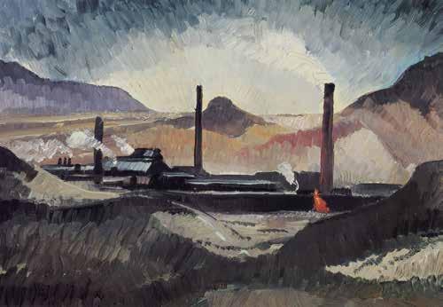
Ellis painted El Paso Smelter at Night in 1919 (figure 3). His canvas represents a very different sort of view of the ASARCO site than the more traditional images portrayed by either Trousset or Nicols. It certainly does not capture “the very spirit, soul, and poetry of the desert”11 that one critic had admired in the work Ellis had shown at the University Club. Instead of a distant, pastoral view, he has taken a vantage point close to the smelter. Apocalyptic in mood and dramatically lit, it captures the spectacular night sky illuminated as it was
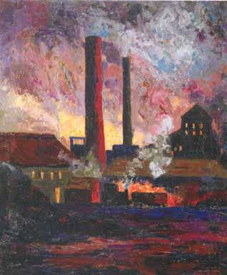
when the facility was in full production. Smoke pours out from the stacks, and the scene is ablaze with fiery colors, the sky full of smoldering grey, purple, red, and orange clouds billowing from the smelter. The thick application of paint conveys a powerful texture suggesting the emotional charge of the scene. The buildings appear as heated to near molten, and the foreground landscape crackles suggesting volcanic eruption. A critic writing in the El Paso Morning News observed in 1919: “He delights in indulging in a riot of melting colors, all blending in exquisite harmony and glowing in subtle lights and shade so characteristic of the far reaches of the arid plain.”12 This description parallels one appearing in the 1940 WPA guide to Texas whose writer was decidedly painterly in characterizing the changeable colors of the ASARCO plant: “A tawny cloud of smoke and jets of snow-white steam hover about the brick and sheet metal buildings by day, while at night the regular dumping of white-hot slag weirdly illumines the scene.”13 The same year Ellis painted El Paso Smelter at Night, he moved to Santa Fe where he would remain for the rest of his career. With four other painters, in 1921 he founded Los Cinco Pintores, whose members worked in modernist styles grounded in representational modes.
One of the founding members of the Taos Society of Artists in 1915, Ernest
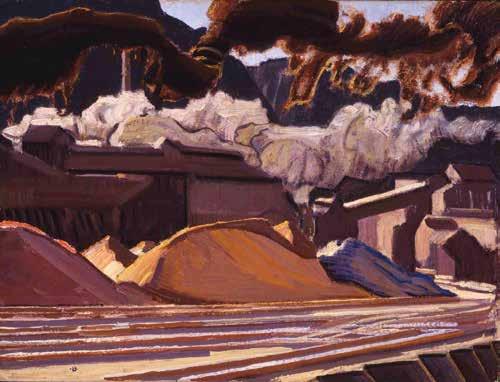
Blumenschein (1874–1960) remains best known as a painter of northern New Mexico scenes. With the exception of a series of railroad paintings he made during the 1950s, late in his career, he rarely produced scenes that could be thought of as industrial. His small painting, El Paso Industry of 1935 presents a painterly and highly expressive view (figure 4). In his several canvases of the freight yards in Albuquerque, he was inspired by the scenes, characterizing them as “a dramatic movement of the masses and lines with certain qualities of light and color,”14 that captured its “character, strength, and virility.”15 These are elements also evident in El Paso Industry. Despite the small scale of his canvas, Blumenschein effectively reveals the raw power of the smelter during the daytime. With expressive energetic brushstrokes, he moves the viewer through the scene from the train tracks in the foreground highlighted with an electric light blue, to the orange-brown rusty-looking slag heaps, to the smelter itself with billowing white and brown smoke, its stack in the background nearly obscured. The dark colors of his palette convey the rough beauty of the scene.
During the thirties New Deal art programs, with their emphasis on representational styles and regional themes, encouraged several El Paso artists to
draw on local industrial subject matter, including the smelter. Some did this through government sponsored art projects under federal cultural initiatives aimed at providing relief for artists, including the Public Works of Art Project (PWAP), the short-lived predecessor to the more famous WPA.16 The PWAP, which lasted only six months, was locally administered, and as a result the works were often exhibited in or installed in unsecured venues such as public schools. The more highly visible and secure post office murals (as major federal commissions) generally remained in situ. Small unframed works on paper, particularly highly portable prints and watercolors, were more likely to disappear once the government programs ended in 1943. In 1934, supported by the PWAP, Beth MacLafferty Blake (1901–1993) produced watercolors and lithographs of industrial scenes. Her works (now lost), Smelter from Scenic Drive and Globe Mills were exhibited in El Paso public schools. When she toured the ASARCO smelter, she complained that she “was constantly choked with fumes and peppered with grit.”17
Also supported by the PWAP were the two murals painted by Emilio García Cahero (1897–1939), Mining and Metallurgy, for Holliday Hall at what was then the College of Mines and Metallurgy. Each was 14 x 120 feet, and in combination covered 3360 square feet of wall space.18 Born in Veracruz, Cahero taught art for many years at the Academia de San Carlos in Mexico
City before establishing his studio in El Paso in the 1930s. He was part of the Mexican muralist movement, and during the 1920s, was one of a group of artists who painted murals in the Colegio de San Ildefonso in Mexico City. Diego Rivera, David Alfaro Siqueiros, and José Clemente Orozco were among those who contributed to this project, which numbered 41 murals.
Despite the prominence of the ASARCO complex within the local landscape, El Paso’s most notable artist (and a native El Pasoan), Tom Lea (1907–2001), only painted a single work of the site, The Smelter, From Mesa Road of 1936 (figure 5). Described as “a desert Southwesterner to the bone,”19 Lea was a significant regionalist artist, but his heart was not with the new West of commerce and vigorous industrial production, but rather with its rich historical narrative and the sere landscapes of West Texas. His mural in the United States Courthouse in El Paso is comprised of a series of panels portraying “the giants who came trying to tame the desert mountain country.”20 His grand narrative featured pioneer settlers, cowboys, cattle, conquistadors, Spanish padres, and others. Lea spent considerable time away from El Paso during the 1920s and early 1930s, including moving to Santa Fe in 1933 (he had become friends with Freemont Ellis), but returned to El Paso for good in 1936, the same year as his painting of the smelter. Lea was an active muralist under the New Deal, but only in the mural he executed for the El Paso Federal Court House in 1938 did
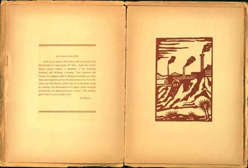
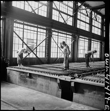
Figure 7. Fritz Henle, Phelps Dodgerefiningcompany,El Paso, TX, December 1942, Farm Security Administration/ Office of War Information
Photograph, Prints and Photographs Collection, Library of Congress (LC-DIG-fsa-8d34657, digital file from original neg ).
he make a reference to local industry. In it he included an old miner with his pickax and mule as one of the mural’s several stock characters.21
One of three high schools in the city, El Paso High School was constructed in 1914, and by 1930 had 1500 students. In 1930, the students of Eula Harlacker’s 2B art class, put together a booklet titled El Paso in Block Print which featured images of notable local structures including the Austin and El Paso high schools, the Cortez Hotel, and some representative locals including a native American from one of the three regional tribes, wearing a feathered headdress. Subjects also included the Juárez Mission just across the Rio Grande, Mexican dancers doing the Fandango, a Mexican woman food vender, Mount Franklin, a Fort Bliss polo player, and the Isleta Mission. A cowboy was characterized as one of the Riders of the Range: “The cowboy is not just a colorful figure of the West, but a necessity of the cattle industry.” Produced by the vocational Print Shop, the publication contains a surprisingly diverse group of images, with thoughtful captions written by the students. For his caption for the El Paso Smelter, (figure 6) Joe Dupree wrote:
Built on the igneous hill rising on the east bank of the Rio Grande as it approaches El Paso, stands the world’s largest custom smelter, a subsidiary
of the American Smelting and Refining Company. Two hundred and twenty-five shippers send in during an average year more than three hundred and ten thousand tons of ore from five states and Old Mexico. From this ore is obtained, ready for refining, fifty thousand tons of copper, thirty thousand of lead, sixty-one thousand ounces of silver. This industry gives work to seven hundred men.
Not all of the artists who portrayed El Paso industrial themes focused on ASARCO. In December 1942, Fritz Henle (1909–1993), employed by the Office of War Information (the successor to the Farm Security Administration), came to El Paso on assignment and made eighty-two photographs of the Phelps Dodge Refining complex.22 Born in Germany, a commission from Time-Life, Inc. led to the publication of some of his photographs in Fortune, and he moved to the United States in 1936. He became an early contributor to Life Magazine, publishing more than fifty picture essays. In 1942, the same year he came to El Paso, he became a United States citizen. In February 1929, east across town from ASARCO, construction of the Phelps Dodge refinery began and its first refined casts of copper were made in March 1930. A major local employer, the complex “was once one of the largest refiners of electrolytic copper in the U.S.”23 There “copper was refined and formed into a continuous-cast rod, which would then be turned into electric wire and cable.”24 Henle’s extensive series documenting this facility reinforces how important large-scale copper production was for the war effort. In one photograph, three workers are posed with balletic precision standing above the huge electrolytic tanks “in which sheets of pure copper are formed” (figure 7). These were later melted and cast into ingots. Conveyors transferred the ingots to the loading yard. The furnaces made the cast house intensely hot and smoke-filled; the furnaces’ copper-laden exhaust was drawn into huge ducts and reprocessed to recover any remaining copper.
One of the earliest of El Paso’s more modern artists was Hari Kidd (1899–1964) who favored brightly colored paintings. He was also something of a local character who was described in 1936 by a writer for the El Paso Herald-Post as a “bohemian.”25 Born in Detroit, he attended El Paso High School, and led a rather peripatetic life, in Canada, England, and Philadelphia. In 1940, he published Artist at Large in El Paso which contains thirty-two offset prints. Appearing first in the El Paso Herald-Post, they included images of a number of local industries. El Paso was the site of several petroleum refineries, including the Standard Oil Refinery which was part of the series
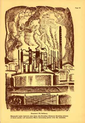
(figure 8). Kidd described the site as: “Mammoth tanks, intricate pipe lines; sky-thrusting chimneys flaunting plumes of black smoke—all announce Man’s increasing power over the elements” Now it is part of Western Refining after two separate facilities on the site merged in 1993. One was begun by Standard Oil in 1928, and the other in 1931 by a precursor of Texaco.
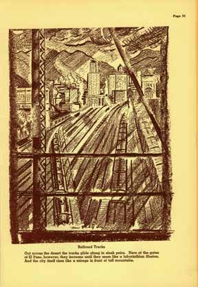
Kidd’s Railroad Tracks depicts the railway network that linked the city to its markets: “Out across the desert the tracks glide along in sleek pairs. Here at the gates of El Paso, however, they increase until they seem like a labyrinthian illusion. And the city itself rises like a mirage in front of tall mountains”
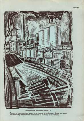
(figure 9). And a third print pictured the Southwestern Portland Cement Co.: “Towers of concrete stand guard over a maze of equipment. Stone and sand are mixed by man to build monuments as enduring as our mountains” (figure 10). Founded in 1907, its headquarters was in a building designed in 1911–1912 by Trost & Trost, celebrated regional architects.
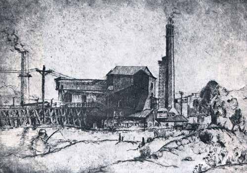
Printmaker Irving Schwartz (1895–1989) came to the Southwest as a young boy, settling in El Paso at the turn of the twentieth century.26 His employment
history was varied, starting with a stint in the artillery during World War I, then as a polo player, a retail merchant, a rancher and cattleman, and finally an appointment with the Bureau of Indian Affairs. He purchased an etching press about 1930, which he installed in his garage. A meticulous craftsman, he was a friend to Freemont Ellis and Tom Lea. His themes were regional; one example, his small etching Ore Mill depicts the AS&R Smelter in 193327 (figure 11).
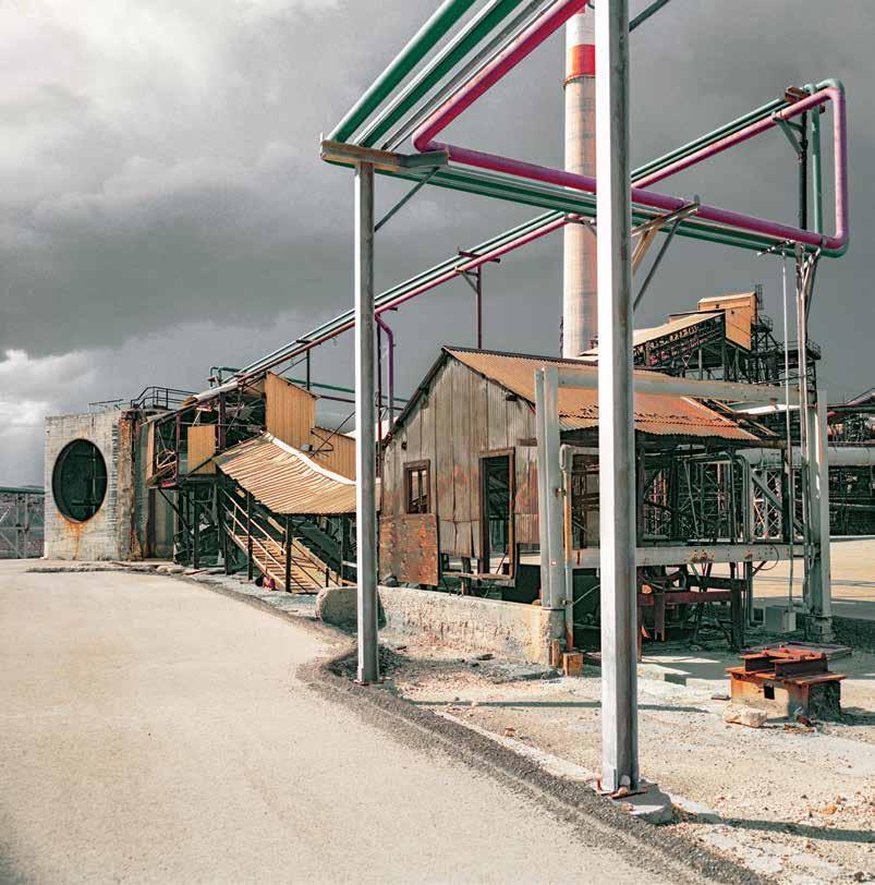
This essay gives historical context to Martin Stupich’s (b. 1949) decade-long photographic documentation of the ASARCO complex in El Paso, beginning in 2010, through the day the big stacks, one 828 and the other 612 feet tall, were taken down with 300 pounds of explosives on April 13, 2013.28 He continued his site work while expanding his project to include the mining and smelting landscape stretching from the central Rocky Mountains south to Mexico City. At once both factual and artful, he captures the deep historical and contemporary resonances of a powerful industrial landscape. His photographs present not only what the site and its many highly practical structures looked like, but also
what it felt like to be there, confronted by a colossal industrial site that would soon disappear after more than 100 years of operation.
His images go beyond mere documentation, revealing a deeper understanding of an industrial landscape which was once the bustling site of nonstop production, a site which overnight, in 1999, transitioned to what is termed “Dead Tech.”29 These were not structures that could be readily reclaimed: they did not lend themselves to adaptive reuse, and not just because of toxic industrial waste. Permitting them to crumble into colossal ruins of the post-machine age was not a risk management option.
Yet it is important not to let these industrial colossi disappear from memory, for when they are lost, a vital part of American history vanishes. Representing both a progressive era’s confidence in the benefits of modern industry (without questioning their environmental and human costs) and arrant capitalism, they are astonishing artifacts of the industrial sublime, true “wonders of work” in the words of printmaker Joseph Pennell, who was inspired by similar scenes during the first two decades of the twentieth century. Stupich’s photographs guarantee that the visual character and meaning of the site will endure. As new landscape replaces it, the old one is preserved in his images.
The narrative of ASARCO is a complicated—and often vexed—chronicle in which a company’s mining and smelting operations, within a broad
geography, becomes a more epic tale than simply documenting the industrial archeology that generated an immense fortune. Stupich’s handsome color photographs may be read as modern history paintings, honoring the labor that built these artifacts—the maze of structures that housed ASARCO’s smelting operations, and the Gordian knot of its historical legacy. His work emphatically pictures the New West, and derives not from the hallowed tropes of Manifest Destiny grounded in the classic beauties of the first discovery by artists commissioned by the great government and railroad surveys, but rather a New Industrial Topographics portraying the human-altered landscape of the contemporary west.30
I am deeply grateful to Martin Stupich, a fellow traveler in industrial archeology, for giving me the opportunity to pursue my quirky interests in the relationship between American art and industry by introducing me to El Paso. I would like to acknowledge the invaluable assistance in my research of the following individuals and institutions: Special Collections, University of Texas at El Paso (Claudia Rivers and Abbie Weiser), El Paso Museum of Art (Patrick Shaw Cable, Christian J. Gerstheimer, and Michelle Villa); and the El Paso Public Library.
notes
1. Isaac F. Marcosson, Metal Magic: The Story of the American Smelting & Refining Company (New York: Farrar, Straus and Company, 1949), 150.
2. See John Burnett, “A Toxic Century: Mining Giant Must Clean up Mess,” NPR, February 4, 2010. https://www.npr.org/templates/story/story.php?storyId=122779177. Phelps Dodge and ASARCO produced 29% of America’s refined copper. See W.H. Timmons, El Paso: A Borderlands History (El Paso: University of Texas at El Paso, 1990).
3. For more on the art history of El Paso, see Carol Ann Price, Early El Paso Artists (El Paso: Texas Western Press, The University of El Paso, 1983); Carol Price Miller and Holly Thurston Cox. Guide to Early El Paso Artists: With Biographical Sketches and Early Art Exhibits and Galleries (El Paso: Printed by Early El Paso Art Project, 1999); and Carol Price Miller, et al, Into the Desert Light: Early El Paso Art 1850-1960 (El Paso: El Paso Museum of Art, 2010). See also Mary A. Sarber, Photographs From thr Border: The Otis A, Aultman Collection (El Paso: El Paso Public Library Association, 1977).
4. Trousset painted scenes of other towns in New Mexico, California, Texas, and northern Mexico. One other industrial scene has been located: a view of the Park City and Billings Smelter (1886, Socorro Public Library). The smelter was located near Socorro.
5. See Leo Marx, The Machine in the Garden: Technology and the Pastoral Ideal in America (New York: Oxford University Press, 1964).
6 Audley Dean Nicols quoted from a 1972 article in the El Paso Times in Sara Sanchez, “An El Paso Treasure That Spent Time in a Janitor’s Closet Now Hangs in Art Museums, El Paso Times, February 5, 2019. https://www.elpasotimes.com/story/news/education/episd/2019/02/05/ el-paso-painting-audley-dean-nicols-goes-from-janitors-closet-to-museums/2678044002/
7. See Carol Price Miller, et al, Into the Desert Light: Early El Paso Art 1850-1960, p. 16.
8. The firm was one of the most notable in the Southwest. Henry Charles Trost (1860-1933) was the firm’s chief designer. Between 1899 and 1903 he established a successful architectural firm in Tucson. In 1903, he moved to El Paso, which he had first visited in 1901, joining his brother Gustavus Adolphus Trost (1876-1950) who was already there, and together they established the architectural firm that bore their names. In 1908 Gustavus’ twin brother Adolphus Gustavus Trost (1876-1957) joined the firm as the chief engineer. For more on the firm, see Lloyd C. and June-Marie F. Engelbrecht, Henry C. Trost: Architect of the Southwest (El Paso: El Paso Public Library Association, 1981).
9. In 1967 it became the University of Texas at El Paso.
10. One other artist is known to have painted the smelter in the twenties. New England painter Aldro T. Hibbard (1886-1972) met Winifred Jackman (1898-1986) in 1923 when she was a student in his summer school in Rockport, Massachusetts. She was from El Paso, and in 1924 he visited her family there (they married in 1925). It is likely on this trip that he painted the AS&R Smelter (later ASARCO). The work has not been located.
11. Barbara Spencer Foster, with Bambi Elizabeth Ellis, Freemont F. Ellis: Last of Los Cinco Pintores of Santa Fe (Santa Fe: Sunstone Press, 2010), 38-39.
12. Patrick Shaw Cable, Editor, Renoir to Remington: Impressionism to the American West (El Paso: El Paso Museum of Art, 2014), 21.
13. A Guide to the Lone Star State (Compiled by Workers of the Writers’ Program of the Works Projects Administration in the State of Texas, American Guide Series, Sponsored by the Texas State Highway Commission). New York: Hastings House, 1940), 565.
14. “Blumenschein Explains What Makes a Painting New,” Santa Fe New Mexican, September 13, 1953, quoted in Elizabeth J. Cunningham, “In Contemporary Rhythm: The Search for Final Perfection,” in Peter H. Hassrick and Elizabeth J. Cunningham, In Contemporary Rhythm: The Art of Ernest L. Blumenschein (Norman: University of Oklahoma Press, in Cooperation with The Albuquerque Museum of Art and History, Denver Art Museum, and Phoenix Art Museum, 2008): 275.
15. “Blumenschein Explains What Makes a Painting New,” p. 275.
16. Established by Franklin Delano Roosevelt in 1935, the Works Progress Administration was renamed the Work Projects Administration in 1939. The WPA was ended in 1943.
17. Carol Price Miller and Holly Thurston Cox. Guide to Early El Paso Artists, np.
18. The frescoes were unfortunately destroyed in the early 1960s. See Fernando Leal, “Los frescoes de Garcia Cahero en el Paso E.U.,” El Nacional: Diario Popular (Mexico City), January 20, 1935. Also in the thirties he completed two murals at the School of Construction Engineers in San Antonio. Returning to Mexico, he died in Mexico City in 1939.
19. John O. West, “Tom Lea: Artist in Two Mediums,” Southwest Writers Series, No. 5 (Austin, TX: SteckVaughn Company, Publishers, 1967), 1.
20. John O. West, “Tom Lea: Artist in Two Mediums,” p. 2. The only other industrial theme he pursued was for a 1946 commission from Life Magazine to do a series of paintings on the cattle industry. For this assignment, his travels ranged from the Chicago stockyards to ranches in Mexico. He series was never published and the eleven paintings he produced were given by the magazine to the Dallas Museum of Art in 1950. See Western Beef Cattle: A Series of Paintings by Tom Lea (Dallas: Dallas Museum of Fine Arts, 1950).
21. For more on thirties era work in Texas, see Patrick Stewart, Lone Star Regionalism: The Dallas Nine and Their Circle, 1928-1925 (Dallas: Texas Monthly Press, 1985); Robert L. Reid, Picturing Texas: The FSAOWI Photographers in the Lone Star State, 1936-1943 (Austin: Texas State Historical Association, 1994); and Philip Parisi, The Texas Post Office Murals: Art for the People (College Station; Texas A&M University Press, 2004). Portrayals of heavy industry in the murals in Texas post offices and courthouses relate mostly to oil (Amarillo, Electra, Graham, Houston, Kilgore).
22. On this same trip he traveled to Morenci, Arizona, to photograph the mining and processing operations at the Phelps Dodge facilities there.
23. El Paso Copper Refinery, Texas, Center for Land Use Interpretation, http://clui.org/ludb/site/el-paso-copper-refinery. The complex is now owned by Freeport-McMoRan which acquired Phelps-Dodge in 2007. In September, 1942, Russell Lee visited the Anaconda Copper Mining Company’s electrolytic copper refinery in Great Falls, MT, and described the process in his caption: “Refining tanks in which the anodes of impure copper are refined by electrolytic means to the pure cathode copper. The anodes are placed in the tank as they are received from the Anaconda smelters; between these anodes are suspended starting sheets which are thin sheets of electrolytic copper; the cathode sheets remain in the tank until sufficient copper from the anode has been deposited on the cathode to give it a weight of approximately 170 pounds.”
24. El Paso Copper Refinery, Texas, Center for Land Use Interpretation, http://clui.org/ludb/site/ el-paso-copper-refinery.
25. Carol Price Miller and Holly Thurston Cox. Guide to Early El Paso Artistsˆ, np.
26. Biographical details are scant for this artist. See The Eye and The Hand of Irving Schwartz, 1895-1989 (El Paso: El Paso Museum of Art, 1995), np.
27. Other prints by Schwartz depicting ASARCO include Shafthead (6 x 4” plate); Depression at the Smelter (5 ½ x 11” plate, 10 5/8 x 15 ½” framed, 1933); Miners Dumping Slag (3 x 3 7/8” plate); Smelter Worker (4 ¼ x 3” plate, 1933); and Brick Factory (3 x 5” plate, 12 ¼ x 11 ¼” framed).
28. See Erica Orden, “El Paso Says Goodbye to Landmark: Asarco Smokestacks Are Demolished as Part of Effort to Clean Up and Redevelop Industrial Site,” Wall Street Journal, April 14 2013.
29. See Manfred Hamm, et al, Dead Tech: A Guide to the Archeology of Tomorrow (San Francisco: Sierra Club Books, 1983).
30. “New Topographics: Photographs of a Man-Altered Landscape,” was the title of an exhibition organized by the George Eastman House in Rochester, New York in 1975.
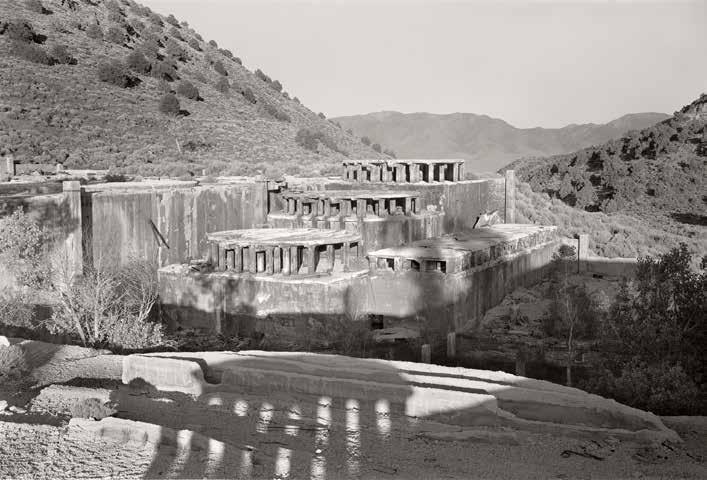
In a messy world, we gravitate toward neatly defined, linear packages, ordering our existence in centuries and decades, wanting events to fit like wooden pegs neatly aligned in a row of square holes. Conveniently, by that measure, 2020 marked Martin Stupich’s fortieth year making photographs in the American West. I noted this fact while counting another interval backwards, one that doesn’t fit quite as evenly but that vibrates in my imagination like a telegraph line stretched tightly between two moments in time—1867 and 1980—yet somehow also affixed to the same geographic point: the Comstock Lode in Virginia City, Nevada. At each end stands a view camera on a tripod, Timothy H. O’Sullivan behind one and Stupich the other. Or perhaps one might imagine two tin cans and a century plus of string, Stupich’s ear pressed tightly at one end as he awaits a faint message from his forerunner. But Mr. O’Sullivan did not seem the type to have spoken at a whisper—rather, I suspect he bellowed. And I imagine that other young photographer, the Nevada landscape upside down and backward on his ground glass, pulling his head out from under his dark cloth and hollering back.
It is remarkable to imagine that the medium of photography can be contained within the life span of three or four not particularly old people. It has been a brief yet potent inflection in how we describe and comprehend the world around us. In the late nineteenth century, when photographers supplanted painters and draftsmen on the geographic and geologic surveys of the American West, it had the virtue of being relatively fast, efficient, and easily reproducible. O’Sullivan also understood that a camera, in the right hands, could capture narrative, metaphor, and geologic time. A lot could be packed into that frame, and there are times looking at his photographs that it seems a miracle his ground glass didn’t shatter. Three words come to mind: tension, structure, and rigor. A century later, they are the same words I would use to describe Stupich’s photographs. To cinch the load down a little more tightly, I’ll borrow a phrase from his own assessment of the cultural landscape of nineteenth-century Nevada: “pragmatism ruled.”1 I cannot offer a more knowing or succinct summary of Stupich’s career than the one he has already written, and I encourage readers to find his essay, “The Historic American Engineering Record and Me: 1980 until Now.”2 In it, he describes a career defined by the pragmatic, governed by a string of federal acronyms: HABS
(Historic American Buildings Survey), HAER (Historic American Engineering Record), and HALS (Historic American Landscapes Survey) as well as the more familiar NPS and DoD. These were assignments that came with rules and expectations—to create visual documents that fit within fixed parameters and clearly rendered the required information. One might assume that this would lead to dozens of photographers making thousands of indistinguishable images, but reading the directions again carefully, one finds no prohibition against working thoughtfully, methodically, or gracefully. Just as it has been wrongly suggested that O’Sullivan’s government commissions were a hobble rather than an opportunity, it is often misunderstood that one must create a document stoically, without care or inflection. To paraphrase the photographer Frederick Sommer, when doing a job, one should do it no less well than they possibly can.
Landscape photography has been similarly misunderstood, the prevailing impression that it is easily done, the horizon placed neatly in the middle of the frame and the shutter released. In its simplest sense, landscape is an art of topography, the literal description of a recognizable place notable for both its dramatic scenery and its absence of people, intended to evoke a reaction of awe or wonder and perhaps a little ire that more hasn’t being done to protect or conserve its presumed “wilderness-ness.” In other words, landscape photography was believed to be a style without a great deal of inherent conflict. The questions it asked were pro forma, answered with a simple pronouncement of “beauty.” This all changed in the 1970s, when photographers were no longer willing to suffer this particular fiction, to endorse the equation “landscape=wilderness.” Much has been written on this moment, as if photographers everywhere suddenly realized that the compass had been set for magnetic rather than true north, and simultaneously adjusted the declination. The exact spot where photography pulled over to check the map has been clearly circled—George Eastman House, Rochester, New York, 1975; the exhibition, “The New Topographics: Photographs of a Man-altered Landscape.” The break, however, was not complete, and photographers continued to find beauty in the quotidian, in subtle rather than heroic horizons, in places that had been damaged or abused but still carried with it them the possibility of hope or redemption. But as hope becomes less and less a part of our dialogue, glancing back at that map on the seat beside us we might notice a narrow road, just past the Sinclair station, veering off in another direction.3
As an undergraduate and graduate student in the 1970s, Stupich was taught by lyrical, poetic artists who used the camera in deeply personal ways:
Emmet Gowin, John McWilliams, and Elaine O’Neal. This was one of photography’s richest moments, a time of serious picture making, high expectations, and earnestness as well as burgeoning attention from museums and universities. It was also a time of fairly set expectations, and after completion of an MFA, it was assumed that one would embark on a teaching career, passing along the same care and attention that one had been given by their mentors. But this is where Stupich left the highway, and instead he spent three years working on a National Endowment for the Arts commission to photograph Atlanta’s MARTA subway system, which he described as “a dynamic engineered landscape”4—a subway has never sounded more interesting. From there, a friend suggested he apply for a job “out west” with the Historic American Buildings Survey / Historic American Engineering Record: “I was first put to work for HAER in 1980, collaborating with National Park Service historians and a group of young hires like myself. Our summer working in Nevada’s Comstock historic mining landscape immersed me for the first time in the world of projects with real performance expectations, guidelines, and—most importantly—unambiguous transmittal criteria.”5 This was not the language of “fine-art photography,” but those first months set his compass for the next forty years: “That summer job in Virginia City, Nevada, was a baptism by fire. My role was to document 260 sites with a medium-format view camera: commercial buildings, a town’s main street, an opera house, residential structures, locomotive and freight sheds, head frames, open pit mines, mine adits, shafts, tailings piles, and a stamp mill.”6 This list could as easily substitute for the table of contents for the volume now in your hands. Mill Ruins with Shadow at American Flat, Nevada, 1980 feels like an anchor being set for everything that would follow. Nestled into a shallow valley, Stupich photographed the supports for long-gone cedar tanks that had held cyanide solution for leaching gold and silver from the ore; photographed with the same respect and admiration as if its columns were from Sardis or Palmyra. Awash in warm afternoon light, a literal shadow of the past slips into the foreground, echoing the silhouettes of an ancient forum. The site feels not like an imposition on the landscape, but rather as if it had always been there, its presence the cause of neither surprise nor alarm.
Stupich developed a practice almost unique among his peers—he worked without antipathy toward the built environment. More importantly, he drew no distinction between what some considered intrusions or affronts into the landscape and the landscape itself. There was no purity test, nor did he judge the landscape based on notions of its grandeur or hospitality. His catalogue
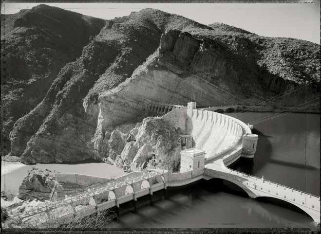
reads as a history of the modern American endeavor, from rails to the space age, in no particular order: steel mills, bridges, played out mines and open pits, ICBM silos, the Panama Canal, Cape Canaveral, and western dams. Roosevelt Dam, before Entombment in Concrete Monolith, Arizona, 1988 sits in perfect balance, no element carrying either favor or bias. Much like O’Sullivan’s photographs of Nevada and Utah, Stupich arrests geology, freezing the angled thrust of the canyon wall, tense with latent energy. The uplift’s strata are mimicked by the terraced face of the dam, gracefully arcing in the opposing direction. The weight of the Salt River can be felt against the dam’s upstream face, and, within the realm of “transmittal criteria,” we are given a sense not just of the dam’s appearance but of how it functions. His photographs of the Roosevelt, Parker, Hoover, Glen Canyon, and Bonneville Dams capture not just their physical form but why they were constructed as they
were, their place within the immediate landscape, and their role as part of a larger system. Seen together, they become a rubric of the hydrology of the West, the ambitions and hubris of the Bureau of Reclamation, our successes and failures, and our inability to recognize the inevitable. If that first summer in Nevada fixed his course, revealing the possibility of a particular kind of life in photography, more time in the field led to a more expansive and holistic understanding of these systems and their intricacies. Between 2003 and 2006, Stupich documented “the transformation of Wyoming’s Red Desert from the largest roadless area in the contiguous United States into a natural gas field.” This comment might be regarded as flippant, but it is simply a statement a fact. Within its 2.5 million acres, the Red Desert Basin encompasses a geologic, natural, and human history that came to a very particular late twentieth-century point: that the value of any place is ultimately measured by how easily one can access its fossil-fuel reserves. Of course, this is most easily accomplished when out of sight. Unless you happened to be driving through Wyoming in the summer of 2001 and noticed all the Halliburton equipment staged along the highway, you might not have had any sense of what was coming. Stupich’s photographs of the Red Desert document what happens when a landscape collides with twentieth-century enterprise, the shadows of emigrant trails crisscrossed by freshly laid gas pipelines. A photograph of rocks migrating down a wash, moved by wind, water, and gravity, is captured with the same equanimity as the open-pit coal mine feeding the Jim Bridger power plant —arguably, the only difference one of speed and scale. Writing of a photograph he made of the Phelps Dodge Pit #4 in Morenci, Arizona, a site that he has returned to on numerous occasions, Stupich wrote, “The Morenci copper pit is a spectacle, visible from the moon (I am told), and is part of your autobiography and mine. We drive cars, use electricity, have plumbing, collect pennies. We all use copper, silver, gold. So we all helped dig that hole, and all the others like it from Peru to Mexico to Zambia. In that respect, my ‘message’ is ‘look at what we had someone do for us.’ It is partly about acknowledging that each of us helps create the world we live in, whether you choose to call our deeds abominable scars or engineering marvels.”7 What happened in the Red Desert, in a few short years, cannot be “undone”—it wasn’t only allowed to happen, but, for better or worse, we gave our consent.
The ASARCO Smelter makes one fact emphatically clear: geology is destiny. Looking at a map, the five-hundred-acre site is a pushpin on the Rio Grande as it cuts through a low gap, a placemark along an international border marking El Paso-Ciudad Juárez, Fort Bliss, transcontinental rail lines, and the rough
midpoint of El Camino Real’s 1,500-mile-long route, traveled by Spanish conquistadors and Guggenheims alike. The surrounding desert appears barren and inhospitable, especially when seen through the windshield of a car traveling eighty miles an hour along I-10 in one-hundred-degree heat. It is a landscape that encourages little empathy, the terraced hillsides and manmade river channel obscuring its profile. But Stupich uses his camera like the blade of a pocket knife, leveraging something shiny out of the dried mud of a riverbed. To be fair, it didn’t take much effort to figure out where to start photographing–the pushpin of the smelter towers were impossible to miss and made explicitly clear why the smelter site was here and what its purpose was. We have become accustomed to industrial scale, from warehouses and overpasses to skyscrapers and factories, but the immensity of the ASARCO facility was physically intimidating—its towers were landmarks for dozens of miles in all directions. And as Stupich approached the site with his camera, his careful documentation unfolded the superhuman scale of the ASARCO complex. Even akimbo and off their mounts, the flywheels and matte ladles and turbines and furnaces suggest a place that must have been terrifying for the people that worked there. It isn’t easy to imagine the clamor, the heat, and the constant threat of physical harm because most of us have never been in such an environment. The photographs convey a place indifferent to human scale, one even less habitable than the desert landscape beyond its gates, every hours-long shift a physical assault.
Images like the south end of the #1 furnace emerge as a postmortem to the photographs made almost a century earlier by Charles Sheeler at the Ford Motor Company’s River Rouge Plant. In 1927, Sheeler received a commission from Ford to document what was at the time the largest integrated automobile factory in the world. His photographs capture the sheen of a monumental new industrial era, an aesthetic he continued to celebrate in his subsequent paintings American Landscape (1930) and Classic Landscape (1931)—his faith in Ford’s colossal edifice could not have been more conspicuous. The seventy-five thousand workers who ran the plant almost entirely absent, his images rise with a heroic grandeur that celebrates the triumph of American industry, innocent or ignorant of its cost. We recognize the same forms at ASARCO, equally void of its human presence but now encrusted with soot and slag and rust—the archaeological ruin of this earlier promise and progress.
Writing this essay during the first months of 2021, it is clear that many of our expectations and understandings about the world are no longer relevant as we enter fully into the twenty-first century. Indeed, the presumptions
from which Stupich worked throughout his career have been slowly chipped away and shattered. When he first planted his tripod in the Nevada dust, he was chronicling sites and artifacts from a past that, although in ruins, had laid the foundation of our present. Nineteenth-century forays into the silver veins of the Comstock Lode, dug by hand and hammer, became the open pit mines that provided the raw materials Apple used to make my iPhone— they are both recognizable parts of the same system, we just became more adept at scale. Whether leaching invisible traces of gold from ore in cyanide vats or excavating with earth movers rolling on thirteen-foot-high tires, the photographs in Ore and Empire have simply stretched Stupich’s vision to a continental scale. The collapse of the ASARCO smelter towers, with their sonic concussion and rising clouds of dust, was a closing parentheses on a short chapter in our history. Learning his craft on what was essentially a nineteenth-century work of technology—a 4 x 5-inch view camera, one that with an hour or so of practice Timothy H. O’Sullivan would have been able to master—Stupich has captured the rise and fall of an industrial culture so vast and pervasive it has laid the groundwork for our undoing, one that is everywhere, and inescapable.
My career as a photography curator was set on its course in the windowless basement of the Solomon R. Guggenheim Museum on New York City’s Upper East Side, and my office for the 2010s was a short walk from the site of a former ASARCO lead refinery that operated for a century on the banks of the Missouri River. I welcome Betsy Fahlman’s clever adjustment—the “New Industrial Topographics”—as it fits Stupich’s photographs precisely. Almost twenty years ago, he wrote the following, and it has remained constant: “A subtext that runs through these decades of work is my uneroded belief that the cultural landscape, and all that occupies it (these elements of geography), render a true likeness, our best chance at a faithful collective selfportrait.”8 Stupich was once called out by a colleague for making images that were too beautiful, that seemed to suggest he liked these places. He does. The Hoover Dam is beautiful, a graceful concrete parabola just downstream of Black Canyon, flooding the site of some of the most elegant photographs made in the nineteenth-century West, and holding back a century of folly and greed and willful ignorance of hard Western fact. All of this doesn’t mean you make an indifferent photograph, nor is recognizing its beauty an acquittal. Rather, it is an act of acknowledging what is before your lens by making the best photograph one possibly can, and thereby honoring the landscape, its history, and our place within it.
notes
1. Martin Stupich, “The Historic American Engineering Record and Me: 1980 until Now,” The Journal of the Society for Industrial Archaeology, 44, nos. 1 & 2 (2018): 180.
2. Stupich, “Historic American Engineering Record,” 179–93.
3. See Toby Jurovics, “Same as it Ever Was: Rereading the New Topographics,” in Reframing the New Topographics, edited by Gregory Foster-Rice and John Rohrbach Chicago: Center for American Places, 2010.
4. Stupich, “Historic American Engineering Record,” 179.
5. Ibid.
6. Ibid.
7. Email to the author, 2011.
9. Stupich, “Introduction,” Cameraman Obscura: Thirty Years Sneaking Around in Broad Daylight (Tokyo, PGI Photo Gallery International exhibition catalog, 2000.
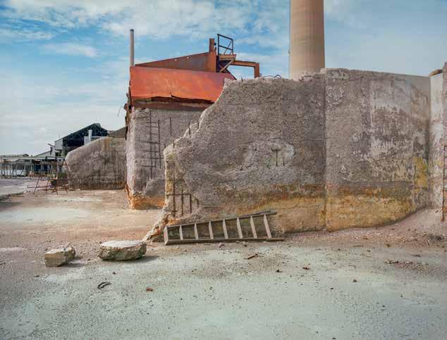
ASARCO, El Paso. Rock ballast is laid on porous mat, lining the reconfigured Parker Brothers Arroyo. Its channel, and the capped slag mound in the upper right, are engineered to passively restore groundwater quality to preindustrial levels of purity by filtering storm runoff before it flows into the Rio Grande, a few hundred yards downslope.
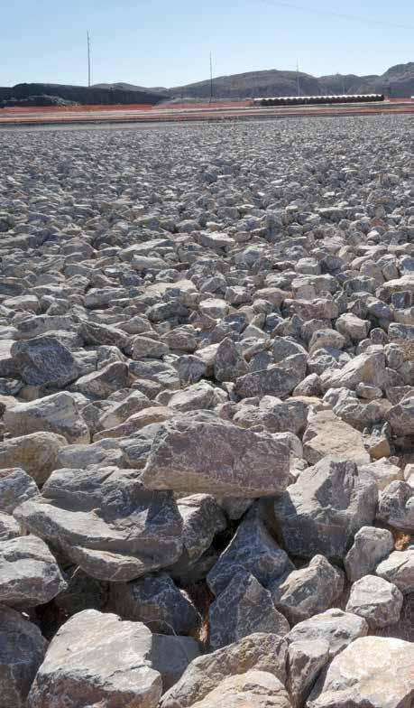
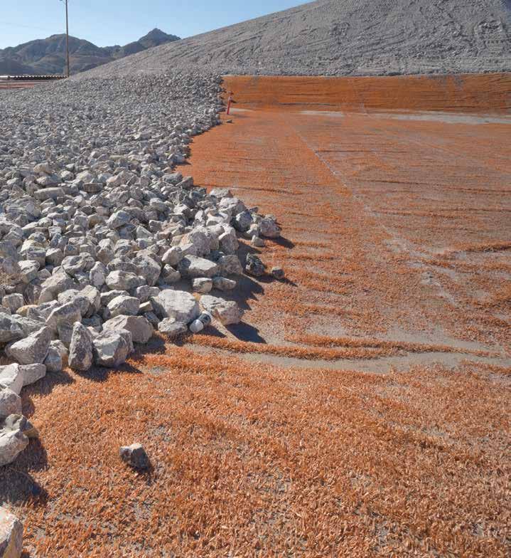
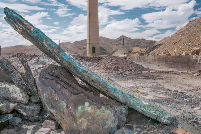
ASARCO, El Paso. Copper-rich slag awaiting reclamation. A normal biproduct of any ore smelting process, slag is loose material that ranges from sand-size grains to massive chunks. At the El Paso ASARCO site, a late phase of building-demolition and environmental remediation involved scraping and grading the landscape, sculpting acres of terrain, then gathering and isolating mounds of slag, some thirty feet high. Sometimes, albeit rarely, the process exposed giant slabs and boulders of copper-rich material. In this image, the turquoise color indicates exceptionally high concentrations of nearly pure copper— its density far exceeding anything found in the raw ores from which it came. As technologies improve, slags with a pure copper content (matte grade) of less than 2 percent can be re-smelted, rendering a reasonable profit.
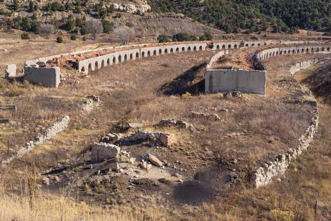
Cokedale, Colorado. Coke ovens (or kilns) are integral to the landscape of nineteenth- and twentieth-century minerals extraction. Cokedale was founded in 1906 as an ASARCO company town. Its ovens relied on local Colorado coal mines to feed more than one hundred kilns nearly continuously for a half century (coal is the raw material from which coke is produced). The coke was shipped by rail to fire ASARCO smelters in Pueblo and 450 miles south, in El Paso. The coal came primarily from mines in nearby Ludlow and Hastings. Ludlow is remembered for labor troubles and for the 1914 massacre in which the mine owners (headed by John D. Rockefeller Jr.) had slaughtered with machine guns twenty-one strikers along with their wives and children. Hastings is notorious for an underground explosion in 1917 that killed 121 miners.
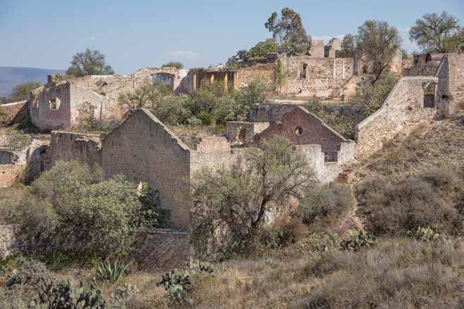
Guanajuato State, Mexico. Hacienda Triángulo, established in the mid-19th century along the camino by French business interests, El Triángulo’s sub-surface mines operated until 1923, when an active bore accidentally penetrated the aquifer, immediately and catastrophically flooding miles of tunnels—beyond modern pumps’ ability to drain them. The mines closed; most of the population moved away.
Guanajuato State, Mexico. Santa Brígida Respirador, Mineral de Pozos, Mexico. This site, an early major silver mining and smelting center, was economically viable for four centuries, through the 1920s. This 700-foot-long respirador is a (possibly 16th century) remnant, part of the area’s coke production infrastructure.
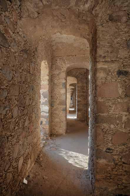
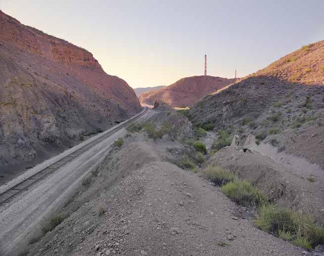
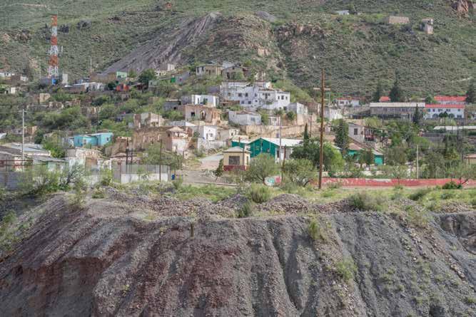
Chihuahua State, Mexico. Company Town. Santo Domingo in the Santa Eulalia (Potosí) mining district in Mexico. The settlement is built into a hillside, upon a tailings dump dating from the nineteenth century. The red wall at right of center is the north edge of a 1940s workers’ baseball diamond.
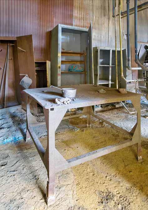
ASARCO El Paso. The clay-work table as it was left at the end of a shift in 1999, the last time anyone stood here—eleven years before this picture was taken.
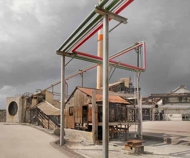
ASARCO El Paso. In this view looking up between the concrete walls of the (once innovative) double tube stack, daylight pours in through the 12-foot-wide duct opening (right). The partially intact jacket of fiber insulation remains pinned to the inner concrete wall. The crescent of daylight is 828 feet above the camera.
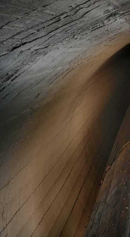
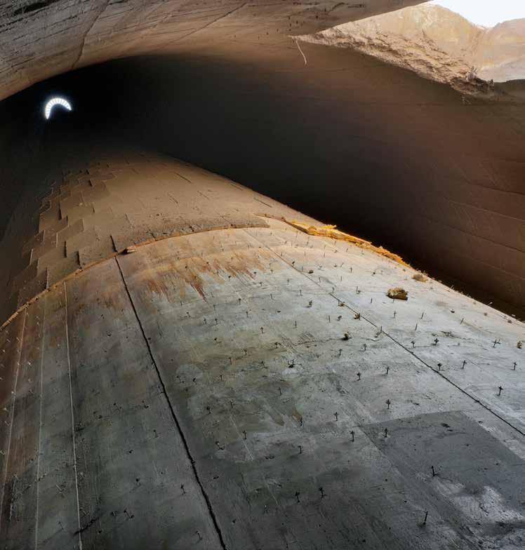
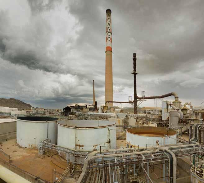
ASARCO El Paso. Ingersoll-Rand steam powered electrical turbine in the on-site power plant. Virtually all electricity used on the ASARCO site was generated here.
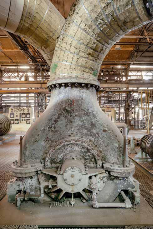
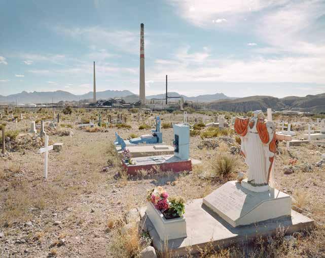
ASARCO El Paso. Smeltertown Cemetery, prior to ASARCO demolition. This cemetery occupies land adjacent to the ASARCO slag dumps at the north end of the smelter site. The first graves here date from the 1880s, and the cemetery remains a social center for the now long-dispersed Smeltertown community.
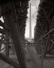
The ASARCO smelter’s two main stacks were visible for miles, dominating the El Paso/ Ciudad Juárez horizon from all directions–during the daytime as emphatic towers reading like exclamation points on a sprawling map; and at night as brilliant beacons rising from the smelter’s din, exhaling their infamous plumes into the desert sky. Here the lead stack (it served the lead vs. the copper smelter) is framed by timber trestles which carried ore in rail cars to the bedding plant, headed eventually to the smelter furnaces.
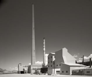
On the hundred-acre smelter site, architecture ranged in scale from one-story corrugated tool sheds to the 828-foot tall copper stack. Even with familiarity and visual clues, it seems implausible that the stack in the distance (on the right in this photo) was a half mile behind and twenty stories taller than its elegant partner.
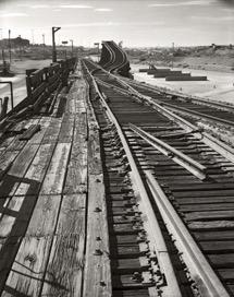
This rail trestle and ramp, more than eighty years after its construction–having never been treated with creosote–was in such fine condition that after its disassembly and removal from the site, was re-milled and sold as ‘architectural’ or ‘restoration grade’ lumber.
The 4 x 5 photos above, based on the Historic American Engineering Record (HAER) model, represent the fifteen pictures I made on the smelter property during the first day I had access thirteen years ago. It was also the last day the OSHA safety officer allowed me to lug the hefty view camera and large tripod around an active demolition site. After that, I was to use only a smaller tripod and more nimble film and digital cameras. I made these large-format pictures anticipating a full scale HAER documentation transmittal. But with neither a sponsor nor a client, reality intervened, leading to an even more expansive and gratifying project.
martin stupich
Unless otherwise noted, all photographs and graphics in this volume are by the author.
Betsy Fahlman is a professor of art history at Arizona State University, where she has taught since 1988. She did her undergraduate work at Mount Holyoke College, and graduate work at the University of Delaware, where she earned her master’s and doctoral degrees. A specialist in American Art, her interests include public art, American modernism, the New Deal, industrial archeology and the art history of Arizona. Her books include Kraushaar Galleries: Celebrating 125 Years (2010), New Deal Art in Arizona (2009), Wonders of Work and Labor: The Steidle Collection of American Industrial Art (2008), James Graham & Sons: A Century and a Half in the Art Business (2007), Chimneys and Towers: Charles Demuth’s Late Paintings of Lancaster (2007) and Guy Pène du Bois: Painter of Modern Life (2004).
https://art.asu.edu/student-andfaculty-work/betsy-fahlman?dept= 160341&id=1
Toby Jurovics has been a curator of photography at the Princeton University Art Museum and the Smithsonian American Art Museum, as well as Chief Curator and Holland Curator of American Western Art at Joslyn Art Museum. An expert on nineteenth and twentieth century photographic surveys of the American West, he has organized over sixty exhibitions by artists including Robert Adams, Lewis Baltz, Barbara Bosworth, Emmet Gowin, and numerous thematic exhibitions of both painting and photography. In 2010,
he organized a major retrospective on Timothy H. O’Sullivan in conjunction with the Smithsonian American Art Museum and the Library of Congress, Framing the West: The Survey Photographs of Timothy H. O’Sullivan; the accompanying catalogue was published by Yale University Press. He has also published essays on Thomas Joshua Cooper, Steve Fitch, John Gossage, William Sutton, and the New Topographics.
Director, Barry Lopez Foundation for Art & Environment: https://barrylopez foundation.org/barry-lopez/
Michael Romero Taylor is a native of the Rio Grande borderlands, and U.S. National Park Service Cultural Resource Specialist for historic trails in the Americas. He served as the New Mexico State Historic Preservation Officer in the early 1990s, and was the Deputy Director of New Mexico State Monuments from 1995 to 2001. Taylor holds a masters certificate from the Architectural Conservation Course in Rome, Italy, and has been active in the International Council on Monuments and Sites (ICOMOS) for the past three decades. He frequently lectures on historic preservation, emphasizing traditional earthen (adobe) architecture, and historic cultural routes in Latin America, Europe, and Asia.
https://www.nps.gov/articles/000/ global-perspectives-on-el-camino-realde-tierra-adentro.htm
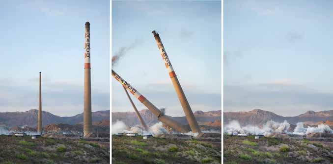
“Every cultural artifact on any landscape owes a debt to nature. And every natural element in that same landscape bears culture’s heavy imprint. . . . My goal in this photographic project is to understand the big complex picture by responding to beauty in its many facets wherever I encounter it.”
martin stupich