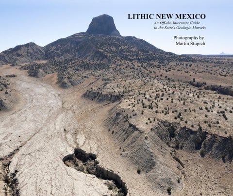
elibrary. forty photographs This (much thinner) between volume 2024 and could 2026, sitdown-shifting happily next to elf, of pandemic more pictures and state thansponsored text, like apandemonium. family photo album Needing a king st jackets absent with an agenda a dense was genealogy the answer; or family seeking Bible. solace in plein turies-old artists’ fallback. In my decades documenting rcheology nteresting New and tormented Mexico place cultural is represented landscapeshere. I hadn’t I forgo thought the tready nature, know except wellasthrough a balm,books, a saccharine calendars, comforting and media. refuge So in no mes. nds, In nomaking White Sands, these photographs, no Carlsbad Caverns, I didn’t turn none myofback Georgia on cliffs world; orrather, pastel Ibanded found myself buttes. Nor looking is this more a geography deliberately at ough I aim to describe fairly this vast state, there are more s from the west than from the east. New Mexico’s western eoward photography, the continental or landscape dividepainting, is topographic if it’s not chaos. about Thevistas east is ad or the flat grandeur llano tipping of clouds gentlyortoward water,the it’sMississippi; about upthrust here or ef shows their inverse itself mostly (and often in shallow close-by canyons, neighbors)–canyons lone mesas and andthe cone. ing in any part of New Mexico’s 77-million-acre share of the osed crust is like auditing a field-geology seminar; it belies ubjective, at creationand took notGod all less landscapes than a week. tug at A each two-hour of us inSandia the same ke heneast they ofdo, Albuquerque being gob-smacked turns a calming is always afternoon a surprise, into and a brainorrent . Veer of offbig thepicture highway questions: onto anyWhat county rent road theanywhere Rio Grande in ostupendous – the horizon forceinsent front theofSandias’ you, once granite your eyes wall shooting adjust, will a ough les off, theordesert perhaps floor, oneand hundred. when? Chances Was it violent are you’ll and sudden get your our ng; only or slow–eons reference,long–and by sighting inaudible, an anomaly, so that a quirk to raptors in theriding hermals, volcanic the plugonly likenoise Cabezon was or of abees range, andthe finches Guadalupe and skittering maybe, e horizon like a surfacing U-boat. Wonders like these, and s, aren’t unique–certainly not to the west or to New Mexico. reams ng to work of photographs in my ownofback open yard pit (all mines, 120,000 steel mills, squareand miles of ds,luck the pictures brings me in Lithic to theseNew pictures, Mexico thiswon’t portfolio. vex or And provoke to with ey were you. prompted by raw unscripted gratitude and barefaced eing New Mexico as the ‘Land of Enchantment’ comes pich hantment is potent, smacks of magic, and we are not the first 26 it. People in the Pleistocene, plodding east over the Bering ue e, eventually got here and found the place hospitable, en enchanting, and they stayed. In centuries and decades r own, the same pull-of-place attracts souls from everywhere. n and adopt New Mexico as home, or just as often, the y are adopted, absorbed by the place itself (as I was).
35º30’1.94”N, 106º50’9.98”W Shiprock, San Juan County, New Mexico (2006) 36º47’08.00”N, 108º41’13.32”W Soda Dam #1, Sandoval County, New Mexico (2025) 35º47’43.67”N, 106º41’28.38”W Cabezon, Sandoval County, New Mexico (2006 35º35’59.15”N, 107º05’43.89”W Soda Dam #2, Sandoval County, New (2025) County, New Mexico (2022) WhiteMexico Mesa, Sandoval 35º47’43.67”N, 35º32’13.09”N, 106º41’28.38”W 106º47’39.04”W
Gilman and #2, Sandoval County, County, Gypsum#1 Mine, White Mesa, Sandoval New Mexico Mexico (2024) (2025) New 35º32'5.10"N, 106º48'24.85"W Rio Guadalupe Canyon, Sandoval County, New Mexico Cabolito Wall(2025) #1, Cibola County, 35º43’54.50”N, 106º45’49728”W New Mexico (2025)
Waldo Canyon, Santa Fe County, Cabolito Rampart, Cibola County, New Mexico New Mexico (2023) (2025) [no GPS] 35º27’17.32”N, 106º8’52.43”W Cabolito Wall #2, Cibola County, Diablo Canyon #1, Santa Fe County, New Mexico (2025) New Mexico (2024) 34º54’32.62”N, 107º51’14.38”W 35º48’20.99”N, 106º8’30.10”W
Rio Grande Gorge #1 to South, Taos County, Diablo Canyon #2, Santa Fe County, New Mexico (2026) New Mexico (2024) 36º21’20.04”N, 105º43’37.94”W 35º48’16.68”N, 106º8’21.67”W Rio Grande Gorge to north, Taos County Galisteo Dam,(2026) Santa Fe County, New Mexico (2021) New Mexico 35º28’5.24”N, 106º12’32.35”W 36º21’24.62”N, 105º43’42.33”W
Crestone Dike #1 SantaRio Fe Grande County,Gorge, East of Carson toward New County, Mexico (2024) Taos New Mexico (2021) 35º17’17.36”N, 105º56’18.55”W 36º21’0.93N, 105º44’11.62”W
Santa Fe County near Los Cerrillos, Red River Canyon tailings, Taos County, New Mexico Mexico (2024) New (2021) 35º26’30.25”N, 36º41’34.49”N, 106º4’43.73”W 105º29’49.48”W
Sandia Bernalillo County,Santa Fe County, Devil's foothills, Throne #1, Waldo Canyon, New New Mexico Mexico (2024) (2022)
35º5’55.28”N, 35º26’36.51”N,106º28’29.85”W 106º8’1.76”W
Devil's Throne #2, Waldo Canyon, Santa Fe County, New Mexico (2022) 35º26’36.51”N, 106º8’1.76”W
54-55 77
Near Sandia Ambrosia west faceLake, #2, Bernalillo McKinleyCounty, County, New Mexico (2025) (2024) 35º17’50.45”N, 107º47’40.37”W 35º20’26.67”N, 106º28’46.54”W
56 78
Elephant City of Rocks Butte,#1, Sierra GrantCounty, County,New Mexico (2013) New Mexico (2022) 33º09’15.56”N, 107º11’13.40”W 32º35’50.19”N, 107º58’18.32”W Elephant Butte, Lake Sierra County, City of New Mexico Rocks(2022) #2, Grant County, New Mexico (2022) 32º35’35.17”N,107º11’0.61”W 33º8’49.91”N, 107º58’24.33”W
79 57
59 80
60-61 80
63 81
64-65 82-83
67 84 69 85
71 86-87
88-89 72-73
91
CityVentana La of Rocks Arch #3,#1, Grant Cibola County, County, New Mexico (2022) New Mexico (2025) 32º35’48.71”N, 107º58’19.14”W 34º52’9.86”N, 107º53’20.53”W La Bajada Mesa #1, Santa Fe County, New La Ventana MexicoArch (2024) #2, Cibola County, 35º34’41.83”N, New Mexico (2002) 106º11’26.07”W 34º52’9.41”N, 107º53’19.78”W La Baja La Mesa #2, Santa Fe County, New La Ventana MexicoArch (2024) #3, Cibola County, 35º33’25.72”N, New Mexico (2025) 106º13’38.79”W 34º52’9.41”N, 107º53’19.78”W Camino Real at La Bajada, Santa Fe County, New La Ventana MexicoArch (2024) #4, Cibola County, 35º33’21.89”N, New Mexico (2025) 106º13’44.29”W 34º52’9.86”N, 107º53’20.53”W Quebradas, Socorro County, New Mexico (2024) 34º7’10.78”N, Lava #1, Cibola106º48’19.18”W County, New Mexico (2025) 35º5’0.91”N, 107º45’59.47”W Near Lake Valley, San Juan County, New Mexico Lava #2, Cibola (2025) County, New Mexico (2025) 36º12’3.44”N,107º45’59.23”W 35º5’0.98”N, 108º10’40.27”W Crestone Volcano #1, Dike Doña #2, Ana SantaCounty, Fe County, New Mexico (2024) 31º49’17.65”N, New Mexico (2023) 107º13’31.42”W 35º17’25.51”N, 105º56’47.63”W Volcano #2 (mined), Doña Ana County, New Crestone Mexico Dike(2024) #3, Santa Fe County, New Mexico (2023) 31º49’18.29”N, 107º13’47.14”W 35º17’26.32”N, 105º56’20.42”W Florida Mountains, Luna County, New Mexico (2021) 32º9’56.00”N, 107º36’57.35”W
TCHI'KUIENAD (Isleta)