A COMPREHENSIVE ANALYSIS OF NORWOOD PLAN1012
PRINCIPLES OF PLANNING DESIGN GRAPHICS II
Sophie Gartland, Margaret Dull, Claire Flanagan, Niamh O’Melia
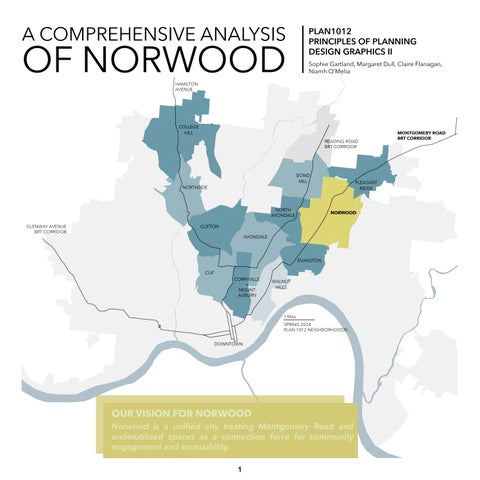
OUR VISION FOR NORWOOD
Norwood is a unified city treating Montgomery Road and underutilized spaces as a connection force for community engagement and accessibility.
1
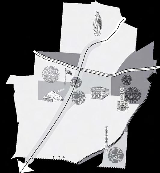
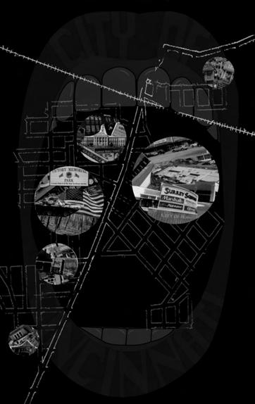
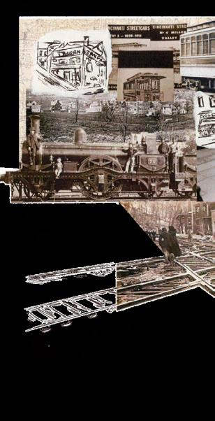
TABLE OF CONTENTS 4-9 10-15 16-19 INTRODUCTION 5 Abstract 6 Linkages and Figure Ground Maps 6 Data Analysis 7 Imageability Maps 8-9 People of Norwood CITY OF NORWOOD 11 Abstract 12 Norwood at First Glance 12 Welcome to Norwood Postcard 13 Comparative Data Analysis ROOTS OF NORWOOD 17 Abstract 18 Welcome to Sharpsburg 19 Montgomery Road 19 Street Car Graphics 2
16-19 20-31 32-45 NORWOOD Sharpsburg Postcard Road Graphic Graphics CURRENT NORWOOD 21 Abstract 22 Welcome to Norwood Postcard 22 Norwood Cracked Wordle 22 Thematic Maps 23 Land Use map 24-25 Residential Norwood 26-27 Southern Norwood 28-29 Understanding Factory 52 30-31 The Juxtaposition of Surrey Square FUTURE OF NORWOOD 33 Abstract 34-35 Analysis of Existing Conditions 36-37 Our Vision for Norwood 38-39 Transportation 40-41 Surrey Square Proposal 42-43 Green In Between 44-45 Revisualizing Norwood Lateral 3
INTRO DUCTION
4
ABSTRACT: REVIEWING NORWOOD
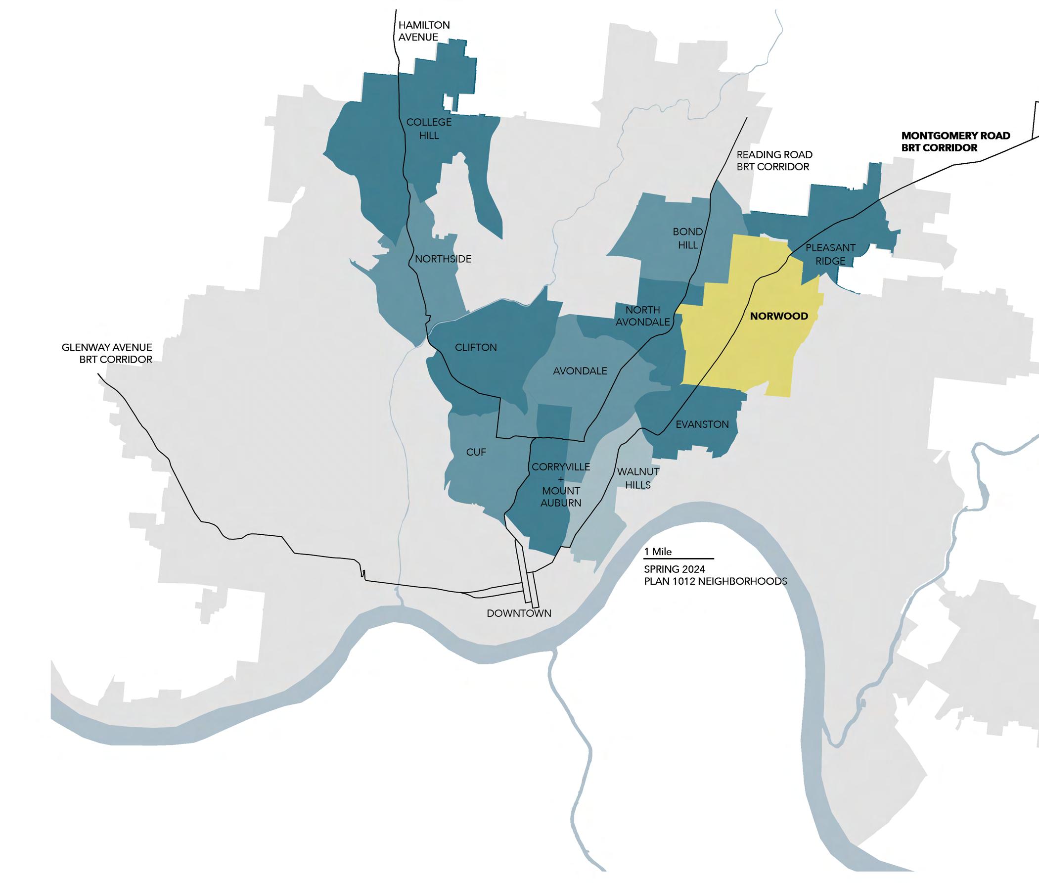
Norwood is an independent city within the city of Cincinnati. With Norwood’s roots stemming from the streetcar route of Montgomery Road, the city thrived and created an industrial, working class, community driven hub. As Cincinnati grew in population and influence, simultaneously occurring during World War II, the over-dependence on cars drastically affected Norwood’s original purpose. A once people oriented city has now become car dominant with two large roadways dividing the city into four sections. As surrounding Cincinnati thrives, Norwood is left struggling due to its limited resources being its own city, leaving markings on Norwood’s potential. With Cincinnati’s new BRT system set to be established in 2028 along Montgomery Road, Norwood’s core, Norwood has the prior streetcar’s main street framework to rejuvenate its old cultural roots and become a city for the people again. With a balance of pedestrian oriented streets, third places, and sustainable environmental pushes, Norwood can prosper beyond Cincinnati’s shadow.
5

FIGUREGROUND
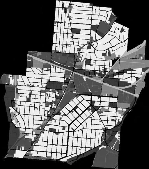
This map shows the configuration of blocks, buildings and open space within Norwood. It is apparent where Norwood Lateral runs through the middle of Norwood, as well as large spaces within the city that are mostly parking lots, especially in commercial areas such as Surrey Square and Rookwood Plaza.
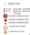
This map shows street network hierarchy, intersection density, and walk sheds. Montgomery Road in particular, stands out as having the highest intersection density attributed to the concentration of commercial uses along its corridor.
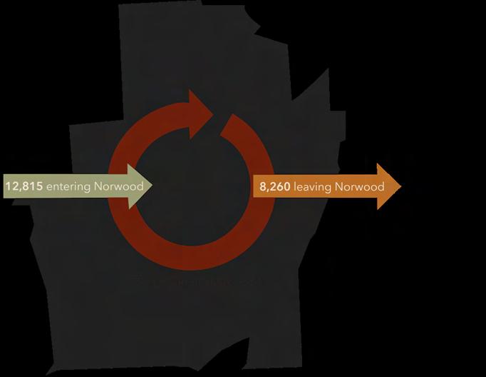
MONTHLY HOUSEHOLD INCOME WORK FLOW
There are almost x2 the amount of people from Norwood commuting to work there than there are local Norwood residents leaving the city to work.
LINKAGES AGE DISTRIBUTION
Norwood’s most common month rent charge is $701-$1,000, which is fairly low to adjacent neighborhoods. Due to Norwood being a smaller city, they typically have lower property taxes and rent.
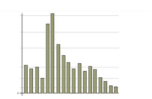
The predominate age among Norwood is 25-29 years old. This graph reflects Norwood’s young age group as many of its residents are students from local universities or are recently graduated.
On the Map 2020 US Census 2020
6 51% - $1,001-$1,500 24% - $701-$1,000 15% - $1,500-$2,000 2500 2000 1500 1000 500 200 <5 30-34 60-64 5-9 35-39 65-69 10-14 40-44 70-74 15-19 45-49 75-79 20-24 50-54 80-84 25-29 55-59 >85 10% - > $1,500 On the Map 2020
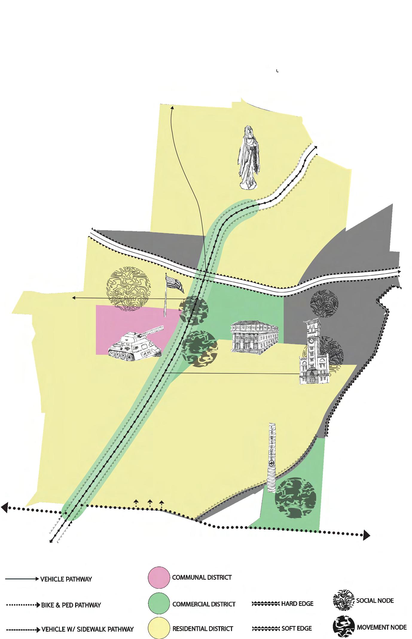
IMAGEABILITY MAPS
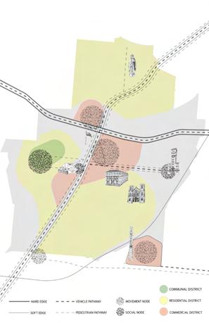
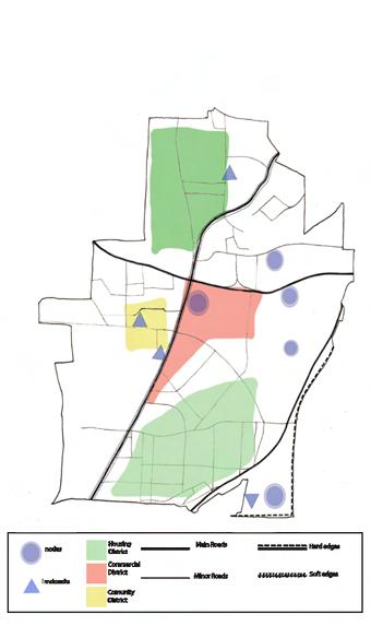
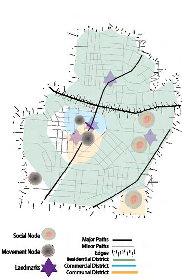
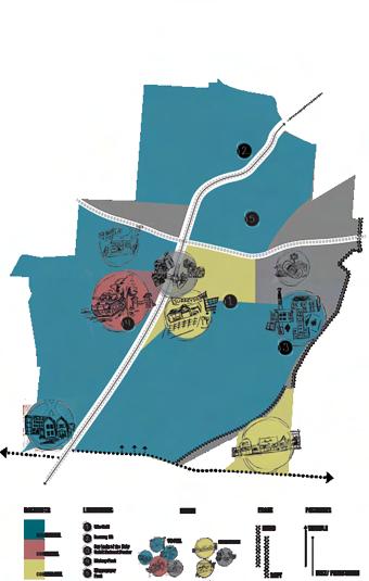
This map is a culmination of our collective opinions and impressions on the city at first glance. Using Kevin Lynch’s characteristics of a city, we thought about how we perceive Norwood.
7
PEOPLE OF NORWOOD
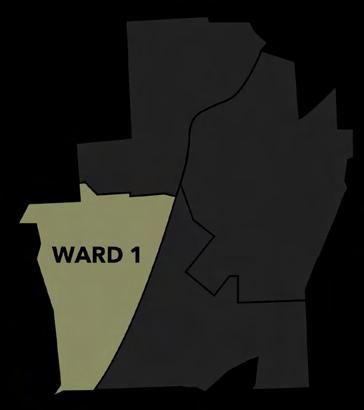
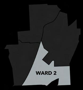
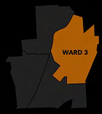
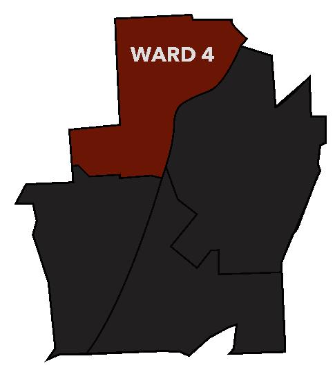
A profile of an individual from each ward in Norwood. This looks at how the different areas of Norwood have different outlooks and experiences.

THOMAS MOORE
“Community is EVERYTHING to me.“

MOLLY O’MALLEY
“Norwood is a great place to start your family and grow old in. You have your own community in addition to Cincinnati’s perks.“
Growing up in a downtown apartment, I missed out on the backyard gatherings and close-knit neighborhoods. After college, I sought affordable living near Cincinnati but away from the downtown chaos, leading me to Norwood. Initially seen as a temporary solution, Norwood quickly won me over. A job offer in downtown Cincinnati solidified my stay, and now, almost four years later, I’m deeply rooted in Norwood’s community.
I’ve forged friendships across the city and feel fully integrated into its fabric. I live only a few blocks away from the main strip along Montgomery Road, and am walking distance from so many amenities. As an avid cyclist, I’m grateful for Wasson Way, which I use multiple times a week.
The strong sense of community here has inspired me to become a better neighbor and actively engage in volunteer work, made easy through Norwood Together. They recently put together an international art show in Victory Park that was vibrant with art, music and food, reinforcing what makes living in Norwood so special. In Norwood, efforts like these are recognized and appreciated, making it a place many are proud to call home.
“I can’t wait to see how Norwood and its community evolve.”
“You are in the center of so many amenities for a fair price and safe atmosphere. I can let my kids play outside and not feel worried.“
I am a middle aged mom of two that resides in Ward 2, the lower right, of Norwood with my husband. In my young adult years, I moved from Cleveland and met my husband where we eventually needed a practical place to live in the Cincinnati region.
I felt Norwood was the perfect mix of a small town feeling but access to the city life I always desired to endure in a simple fifteen minutes to the river.
Both of my children are in college now but I remain in Norwood for the tight knit community and reasonable price. I loved watching my kids grow up in a neighborhood full of pride and passion and hope they will one day come back home to follow me and my husband’s footsteps.
WARD 1 WARD 2 8

SEAN WATSON
“My mommy makes me hold her hand when we cross the busy roads.”
“I wish there were more parks near my house for me to play at.”
I am a 9-year-old boy who lives in the city of Norwood with my mom and dad. I go to school super close to my house so I can walk there. My school’s name is Sharpsburg Primary school.
Me and my mom walk together but the sidewalks are all cracked and there are always lots of holes in the roads. I love riding my bike and I ride all the time but whenever I have to ride around my block it’s really bumpy one time, I hit one of the big cracks and fell and scraped my knee.
After school, I like playing outside my mom says we need to leave our city sometimes to see really pretty parks. My mom and dad get really mad in the mornings because they have to drive so far to get to work. My dad tells me that he has to leave our city to work and so do most people in Norwood.

MEGAN DAILY
“But I feel like, as a whole, it’s a good community to live in.”
“I feel like it’s becoming like a younger neighborhood. I think most people may, just like we do, want to be in like Hyde Park and stuff. But don’t have 700k to spend on a house.”
“But yeah, I think the only downside to living in Norwood is definitely the roads. They’re in need of some love, that’s for sure...... I feel like as someone who used to live in Hyde Park, I think about their Kroger and then I think about the Norwood Kroger. There’s definitely disparity there. ”
“Yeah, I mean I think anytime you have major developments and houses being flipped, I feel like it’s always a double edged sword. The city needs revitalization, but at the same time we’ve got that gentrification of people who have lived here forever and now things are getting super expensive.
So, I do acknowledge that there definitely are, you know, pros and cons to it, but I think it’s nice to have factory 52 here, maybe not for the housing, but for there to be like breweries and new restaurants and space to be outside.
WARD 3 WARD 4 9
CITY OF NORWOOD
10
COST OF INDEPENDENCE
Norwood is an enclave within the city of Cincinnati. This causes great difference in infrastructure, spending, and land utilization within Norwood’s boundaries. Norwood being its own city causes many obstacles that forces them to prioritize their necessities. The history of Norwood has always connected them to Cincinnati, but they still remain the prideful, independent city they are today due to their past, major milestones.
11
NORWOOD AT FIRST GLANCE
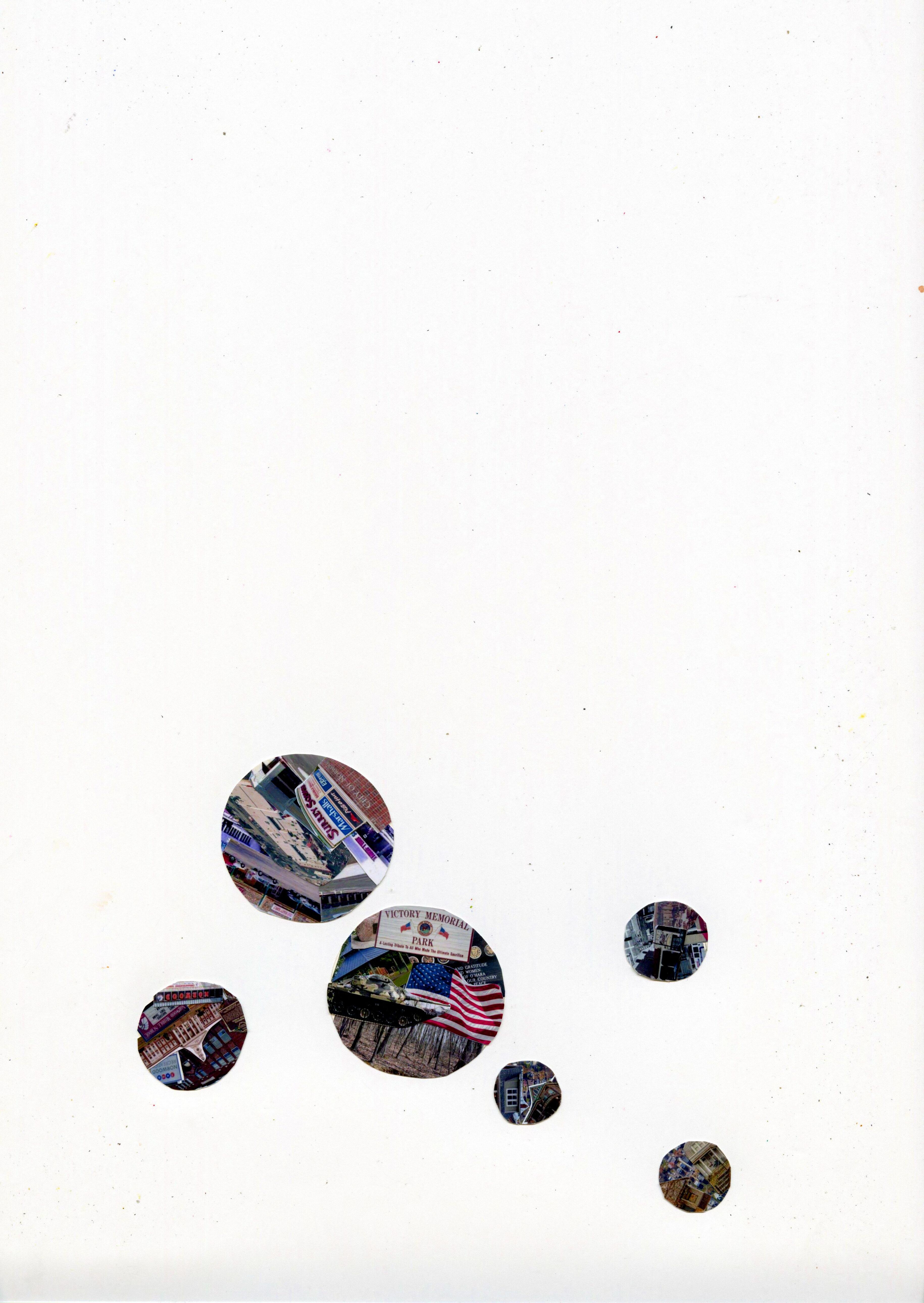
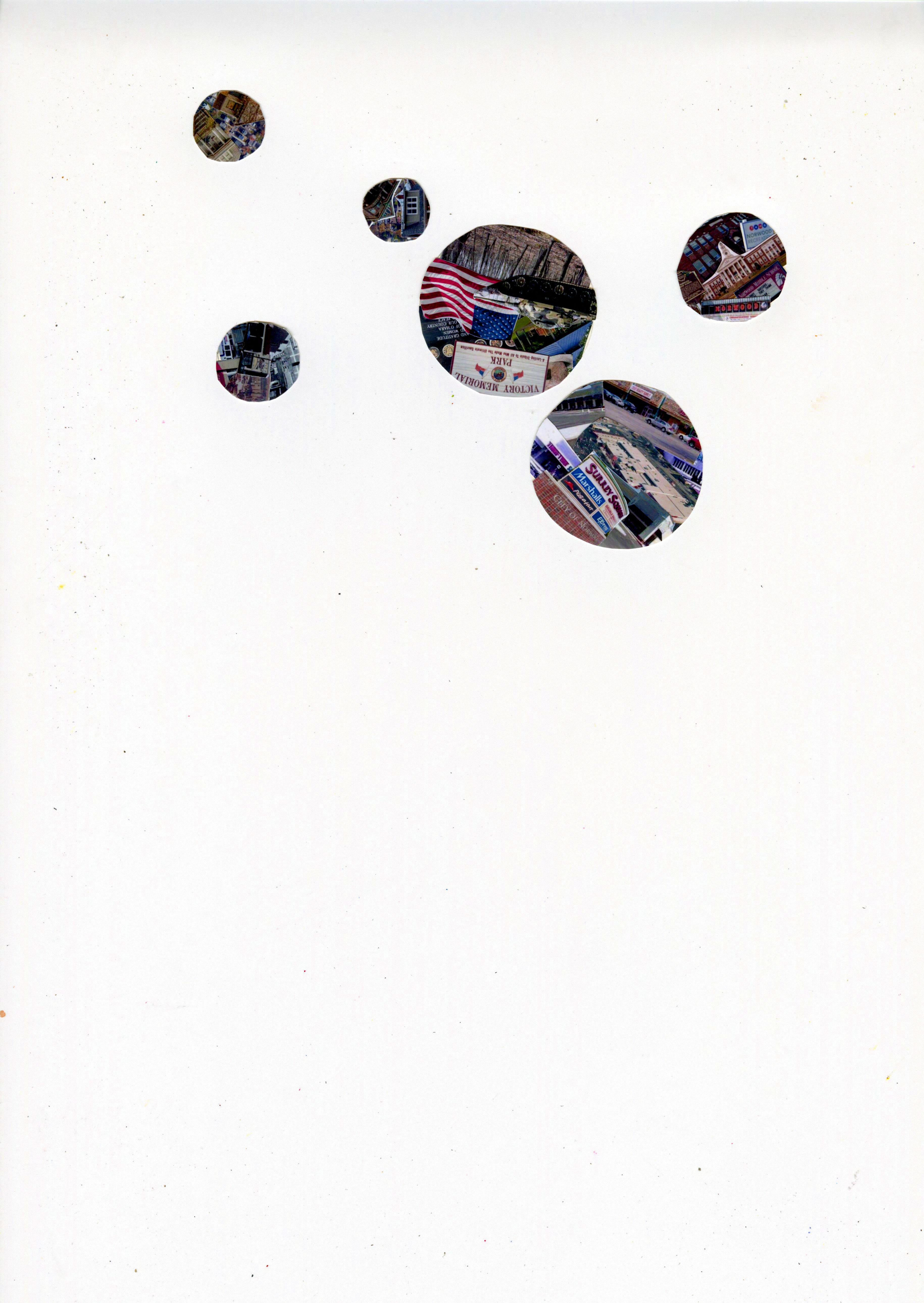
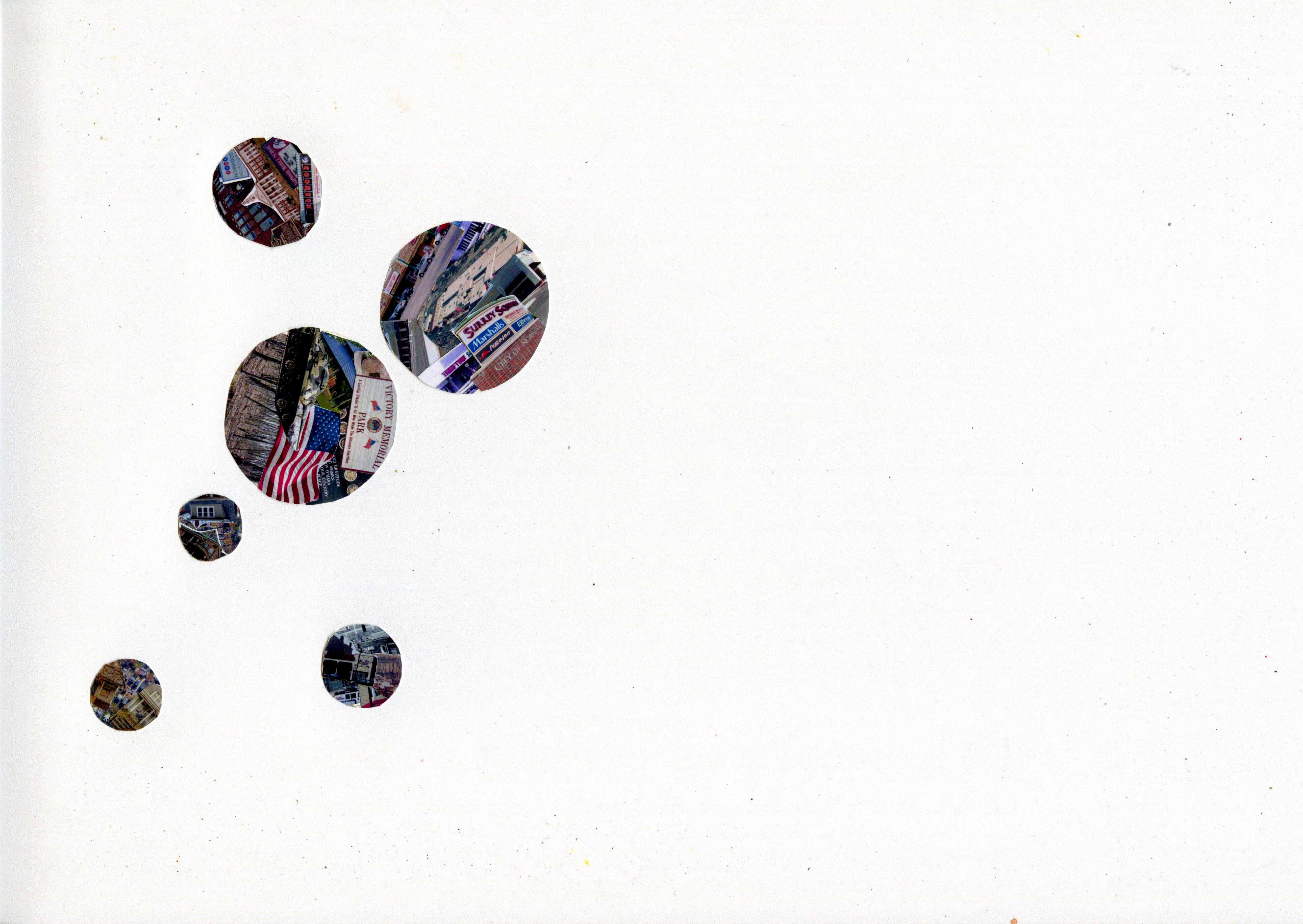
Shown is a creative map of the first impressions of Norwood. Major themes were identified including Norwood literally being “swallowed” by city of Cincinnati. Norwood Lateral and Montgomery Road also play a large role as they split the city in halves due to their overbearing infrastructure. When originally analyzing Norwood, six major place types were prevalent. Along Montgomery Road, we saw various issues but potential within the roots and community.


WELCOME TO NORWOOD POSTCARD
Dear Reader,
We are no longer Sharpsburg we are now known as Norwood. We have created a flag for our new city. The street car has become to new way to travel, hope you come visit soon.
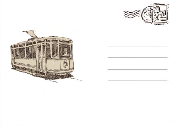

Sincerely, Norwood
12
NORWOOD SPENDING
CINCINNATI SPENDING
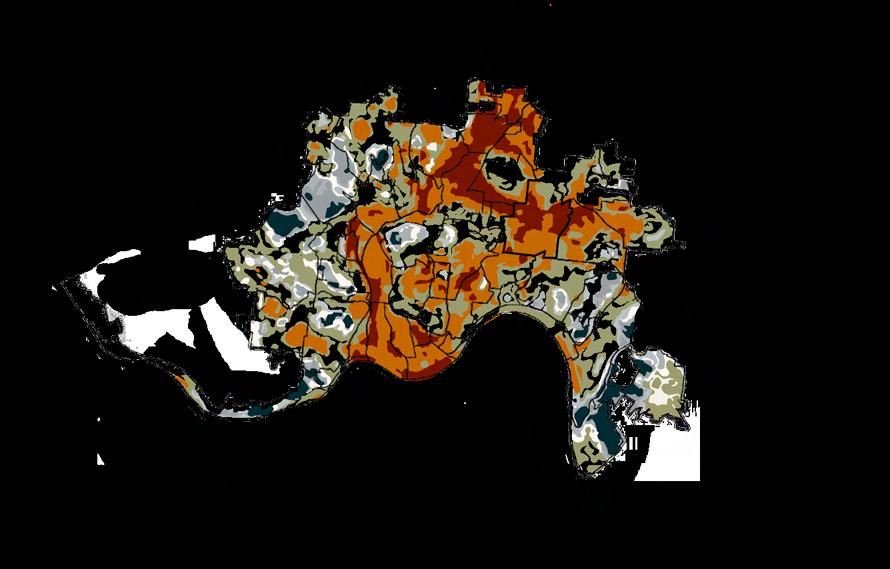
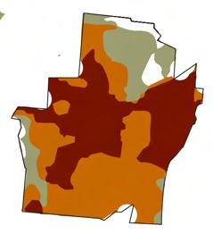
SURFACE TEMPERATURE
Norwood suffers from one of the most intensely heated spots in the Greater Cincinnati region. Due to their very limited green space and heavy infrastructure such as Norwood Lateral Expressway and Montgomery Road intersection, many CO2 emissions from industries and vehicles are released which ultimately increase surface temperature.
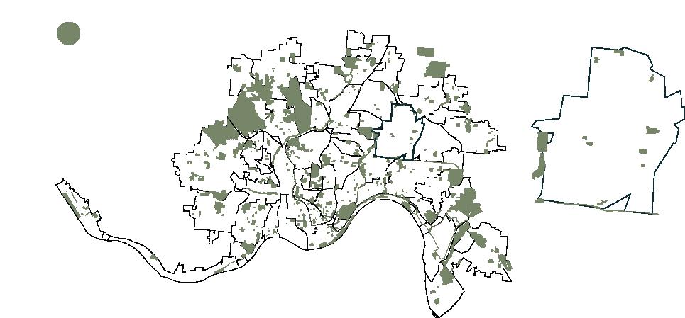
PARKS AND GREEN SPACE
The City of Cincinnati contains more that 5,000 acres of parkland including 5 regional parks, and 70 neighborhood parks motivated by the city’s goals and Cincinnati Parks Master Plan. On the other hand, the City of Norwood has very little access to parks and green spaces.
CINCINNATI
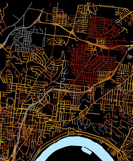
Norwood disproportionately has a lower PCI (pavement cracked index) than surrounding Cincinnati. Cincinnati also has x2 the percentage of pedestrian pathways as Norwood.
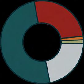
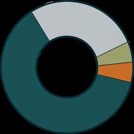
50.5% Public Safety City of Norwood, Ohio Regular Audit City of Cincinnati, 2024 61.9% Public Safety 27% Other Parks and Recreation Parks and Green Space 5.4 Transportation 1.3% Community Development 25% Government/Intergovernment 1.3% Community Development 1.2% Transportation 22% Other
NORWOOD INFRASTRUCTURE QUALITY
13 poor warmer colder high ArcGIS Pro 2023 ArcGIS Pro 2023 ArcGIS Pro 2021 ArcGIS Online
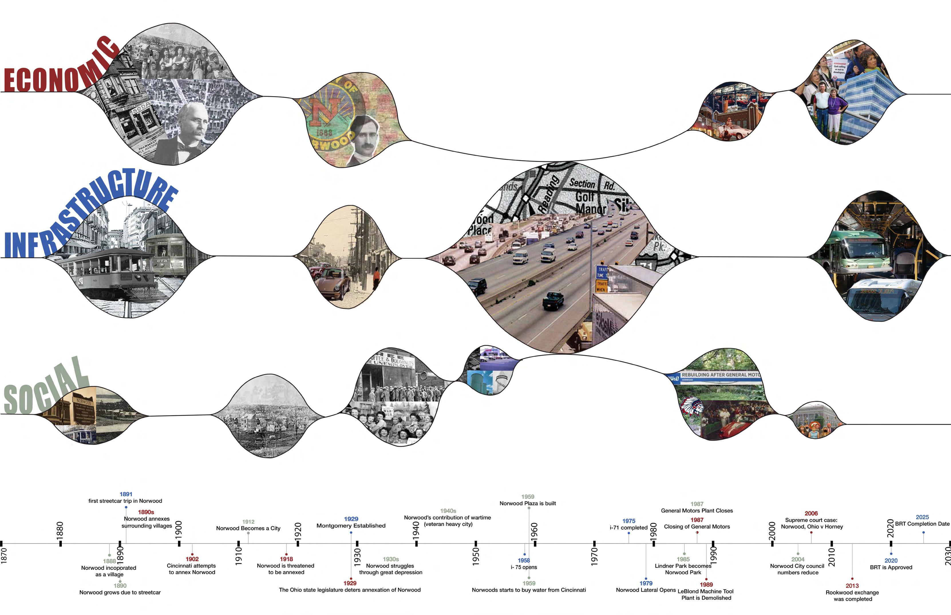
NORWOOD TIMELINE
Throughout Norwood’s history, they learned the economic difficulties of being its own city. Norwood faced several annexation threats from city of Cincinnati. Then looking towards the 1990s, businesses in Norwood were closing which left the citizens of Norwood without jobs. Norwood fought to become its own city and is still learning how to thrive.
Infrastructure severely impacted Norwood’s history. Norwood has thrived due to its infrastructure many times in history. One major flourishing event of Norwood includes being home the streetcar which grew the new city. Then, when Norwood Lateral opens and completely usurps Norwood, splitting the city in halves. Hopefully looking toward the future, Norwood can grow positively again with the aid of BRT.
Abundant social and cultural aspects of Norwood’s history made them the independent city they are today. What makes Norwood unique and able to thrive is the prideful people and communities. The citizens of Norwood came together and made Norwood a community-based city. Although there were struggles throughout their history, Norwood’s community remains strong.
14
15
ROOTS OF NORWOOD
16
STREETCAR SUBURB
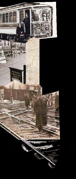
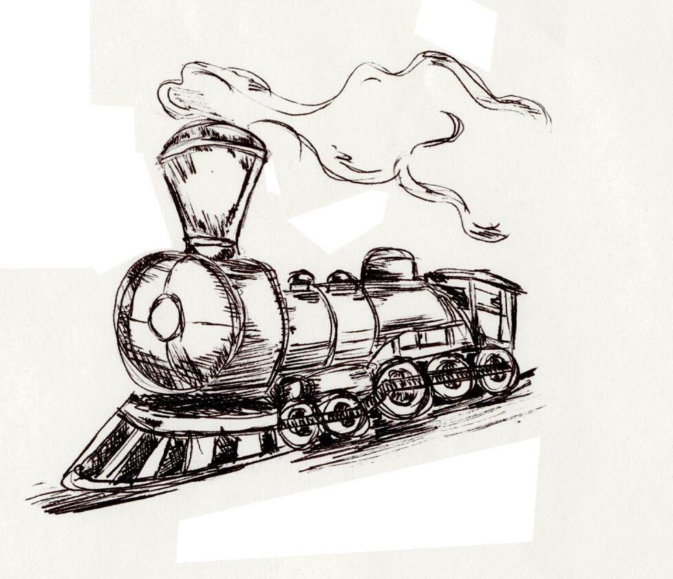
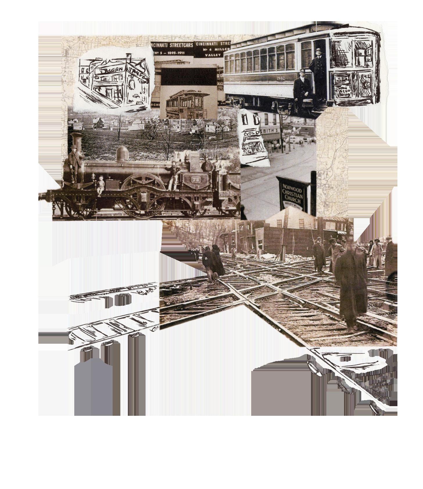
Norwood was created as a suburb to escape the city of Cincinnati. Street car lines extended from Cincinnati’s downtown into northern neighborhoods and cities such as Norwood. The street car route along Montgomery Road drove the cities expansion spreading outward of Montgomery. Montgomery Road became the core of Norwood, depicting a main street feel that thrived. Many industries flourished providing local jobs which encouraged people to stay in Norwood and ultimately become the city it is today.
17
WELCOME TO SHARPSBURG POSTCARD
“Dear Reader,
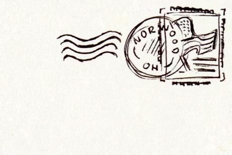
Greetings from Sharpsburg, Ohio, 1809-1866. From farmland to village, Sharpsburg came to be at the crossroads of my own general store and Samuel Bowman’s Tavern. A number of streetcar and rail lines were developed in the late 1800s, attracting businesses and residents to Norwood.
Sincerely,
 John Sharp”
18
MONTGOMERY ROAD
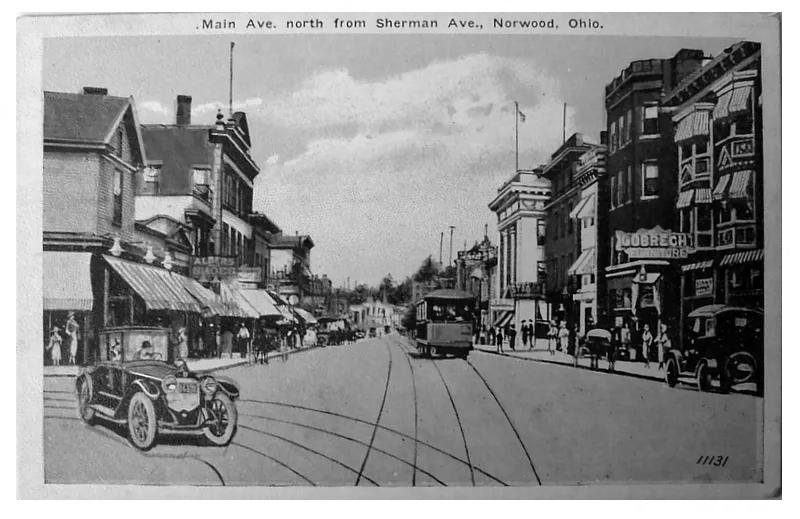
By the 1960s, urban renewal had started to drastically change the look and feel of the street. The changes continue to today, as most of the old buildings have been demolished, and strip malls have replaced the “Main Street” experience.
STREETCAR ATTRACTS BUSINESS
Norwood grows attracting businesses and residents because of the street car. The accessibility the street car provided played a important role in drawing in businesses and residents to Norwood.
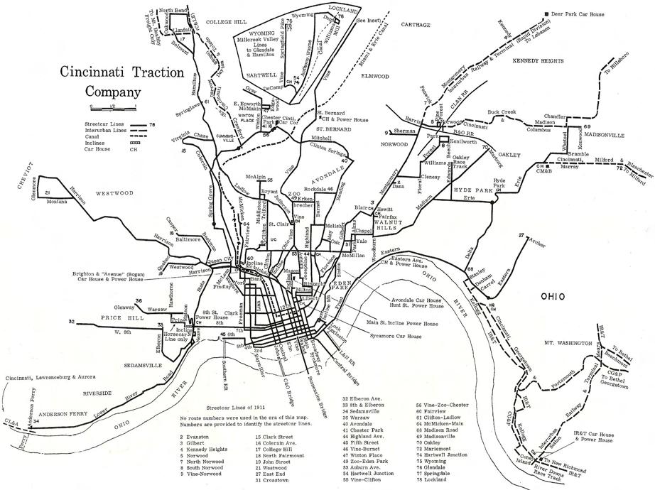
STREET CAR OPENS

In July of 1891, to celebrate US Independence Day, the city of Norwood opened their streetcar system for the first time. This graphic shows one of the routes along Montgomery road.
Dana
Gilbert
Woodburn
M
Streetcar route within Norwood border
19
CURRENT NORWOOD
20
INFLUENTIAL FRAMEWORK
Due to Norwood’s historic street car framework, several themes of Norwood were identified and mapped. The city’s general layout reflects a centralized feel around the core main street, Montgomery Road. This typical flow then pushes outward, creating centralized density including commercial space along its core. A common pattern observed is car dependency stemming from Montgomery Road and Norwood Lateral which both split the city in halves. These factors all contribute to pinpointing several places within Norwood to further analyze its impact within the city.
21
WELCOME TO NORWOOD POSTCARD
Dear Reader,
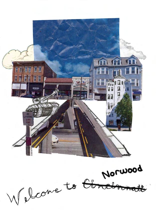
Sincerely, Norwood
We are no longer Sharpsburg we are now known as Norwood. We have created a flag for our new city. The street car has become to new way to travel, hope you come visit soon.
NORWOOD CRACKED WORDLE

Norwood has a great division that is caused by intersescting roadways Norwood Lateral and Montgomery Road. These large infrastructures create a car dependent city breaking Norwood into sections.
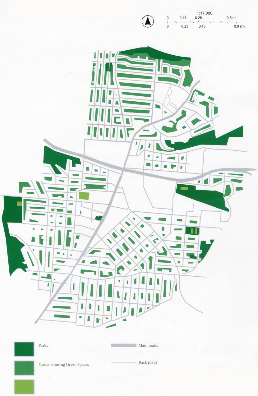

FINDING

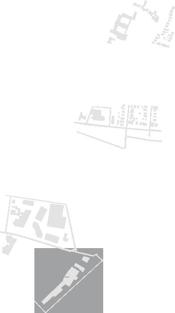
Norwood’s has a few types of green spaces including parks, fields, and residential yards. Norwood has a general lack of accessible green space, especially parks, due to most of it being private lawns.
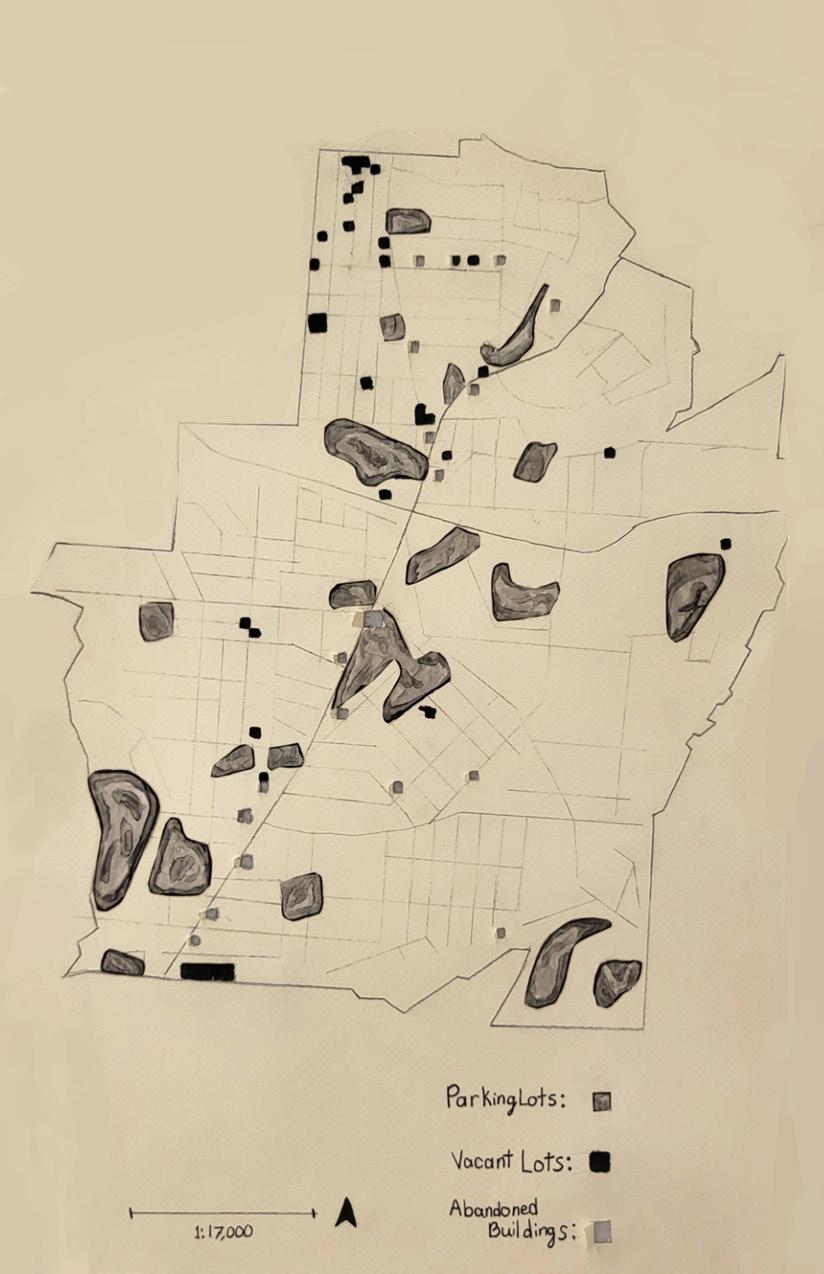

EMPTY SPACES
Norwood has many empty lots and unused spaces. It can be noted the abundance of underutilized space in comparison to parks, yards, and other green spaces.
NORWOOD VIEWS
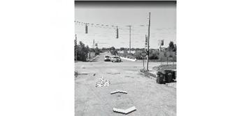

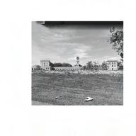
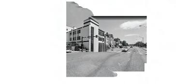
There are a variety of view sheds within Norwood, some that reflect the communities needs and create a welcoming environment and some that need re-evaluated to create more dynamic and enjoyable space.
Vacant Lots Abandoned Buildings
THE GREEN IN NORWOOD Parkinglots
Empty 22 Empty Lot Vacant Building Parking Lot Fields Yards Parks

Residential Commercial Industrial Municipal
LAND USE
Above is a visual representation of different types of land use patterns in Norwood, including residential, commercial, industrial, and municipal. It is clear that majority of Norwood is residential, while the center of Norwood is more commercial.
23
CROSS SECTION ROLSTON AVE
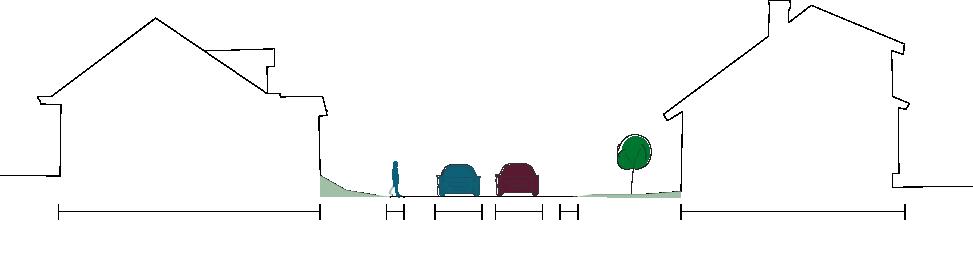
Looking at the residential areas in Norwood to see what is working and what isn’t. How the streets are

CROSS SECTION WORTH AVE
Another view to look at homes is the housing side by side you can see the very little space between each of the housing throughout Norwood. This is so Norwood can stuff as many homes into the city as possible.
STREET ELEVATION
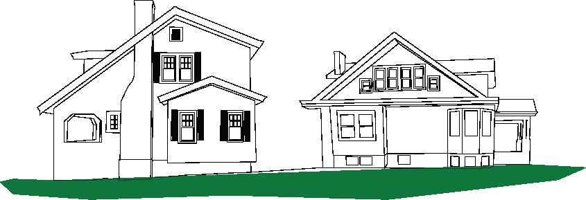
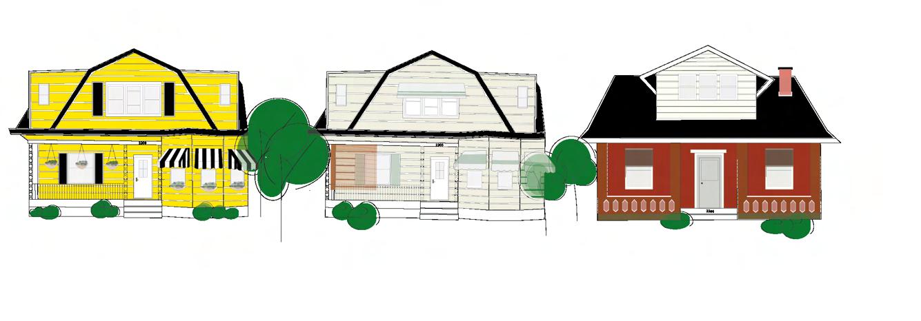
This street elevation is to look at the difference and similarities of 2 homes next to each other in a neighborhood. Mostly the similarities of the 2 classic homes. Which are very close together with an equal lack of yard and green space.
25
SOUTHERN NORWOOD
In southern Norwood, a lot of the spaces feel mismatched, underutilized, and not cohesive. There is a lot of untapped potential in these areas and the following section captures that perfectly.
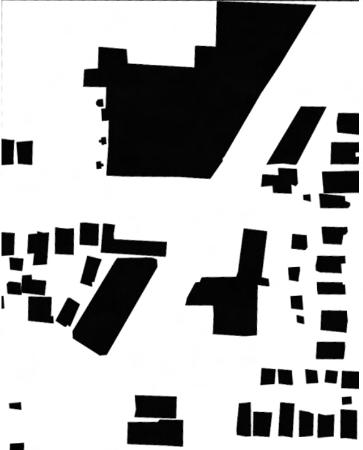
FIGUREGROUND
This map shows the area covered by the models.
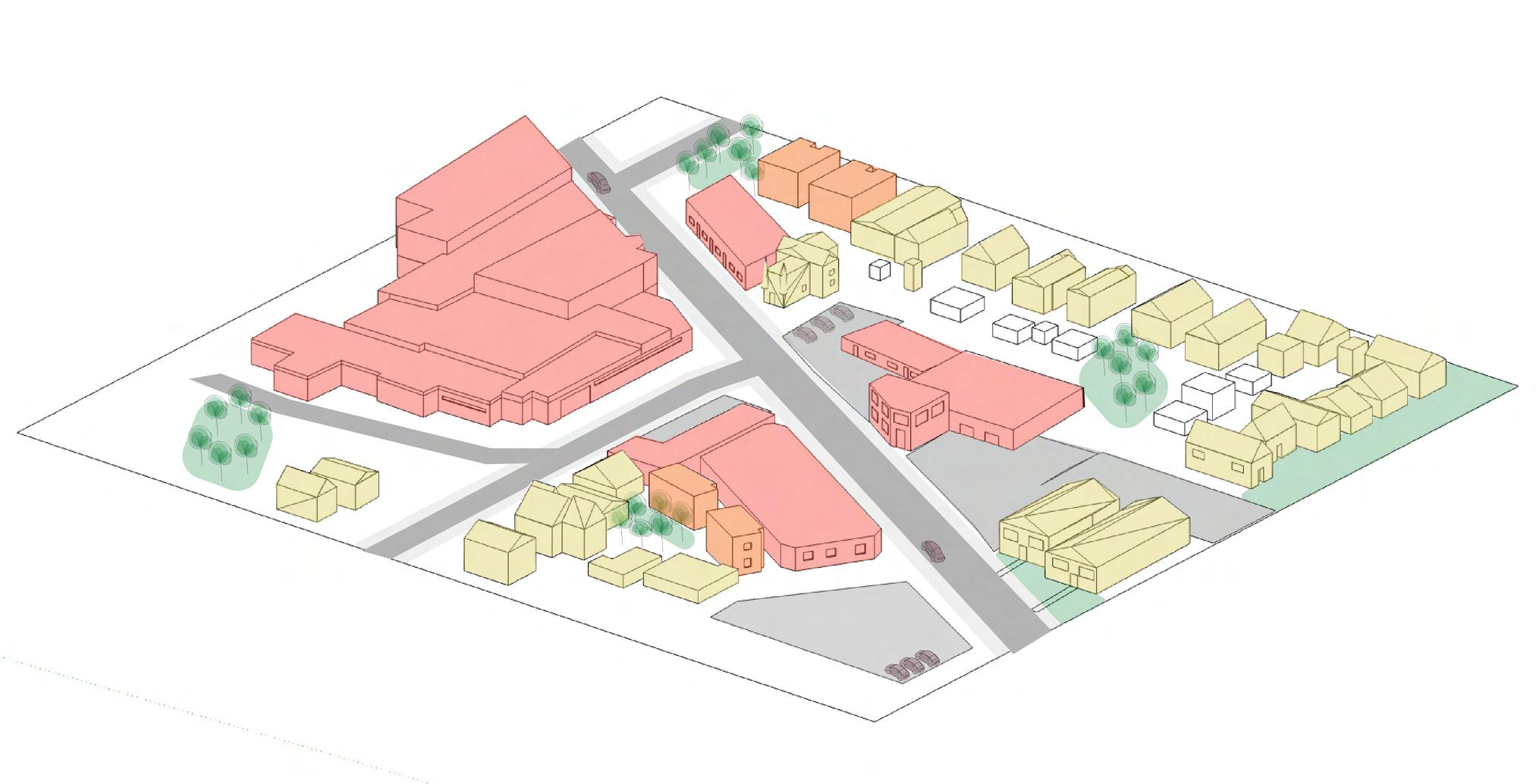
3D MODEL
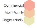
There is a jumbled array of different building types in this area. Single standing homes, apartments, and commercial buildings all lay together. This idea would look more cohesive if so much of the space wasn’t dedicated to parking lots. An overwhelming amount of this space is made up of concrete
26
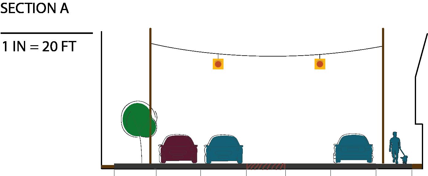
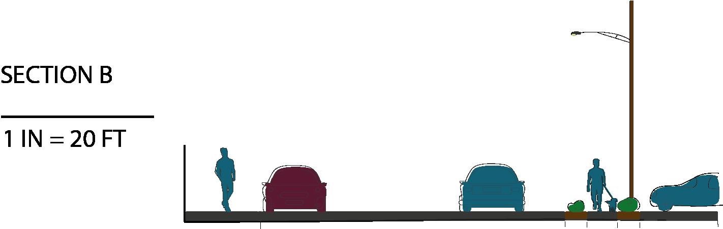
MONTGOMERY RD CROSS SECTION
This section crosses Montgomery and is where most congestion would be
MENTOR AVE CROSS SECTION
This section is along a side road that has a parking lot next to it.
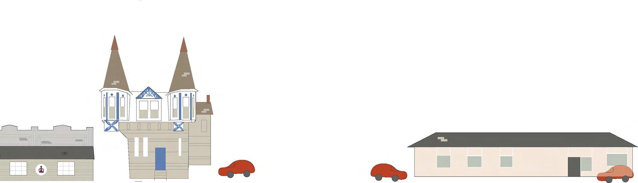
ARCHITECTURAL ELEVATION ALONG MONTGOMERY RD
This elevation is seen along Montgomery and it highlights the lack of consistency in building quality, style, and use. It also highlights the saturation of parking lots in the area.
27
UNDERSTANDING FACTORY 52
Through Urban Analysis techniques, a figure ground map, a three-dimensional model, cross sections and an elevation can help to better understand what makes Factory 52 such a unique community within Norwood.
PARKING GARAGE
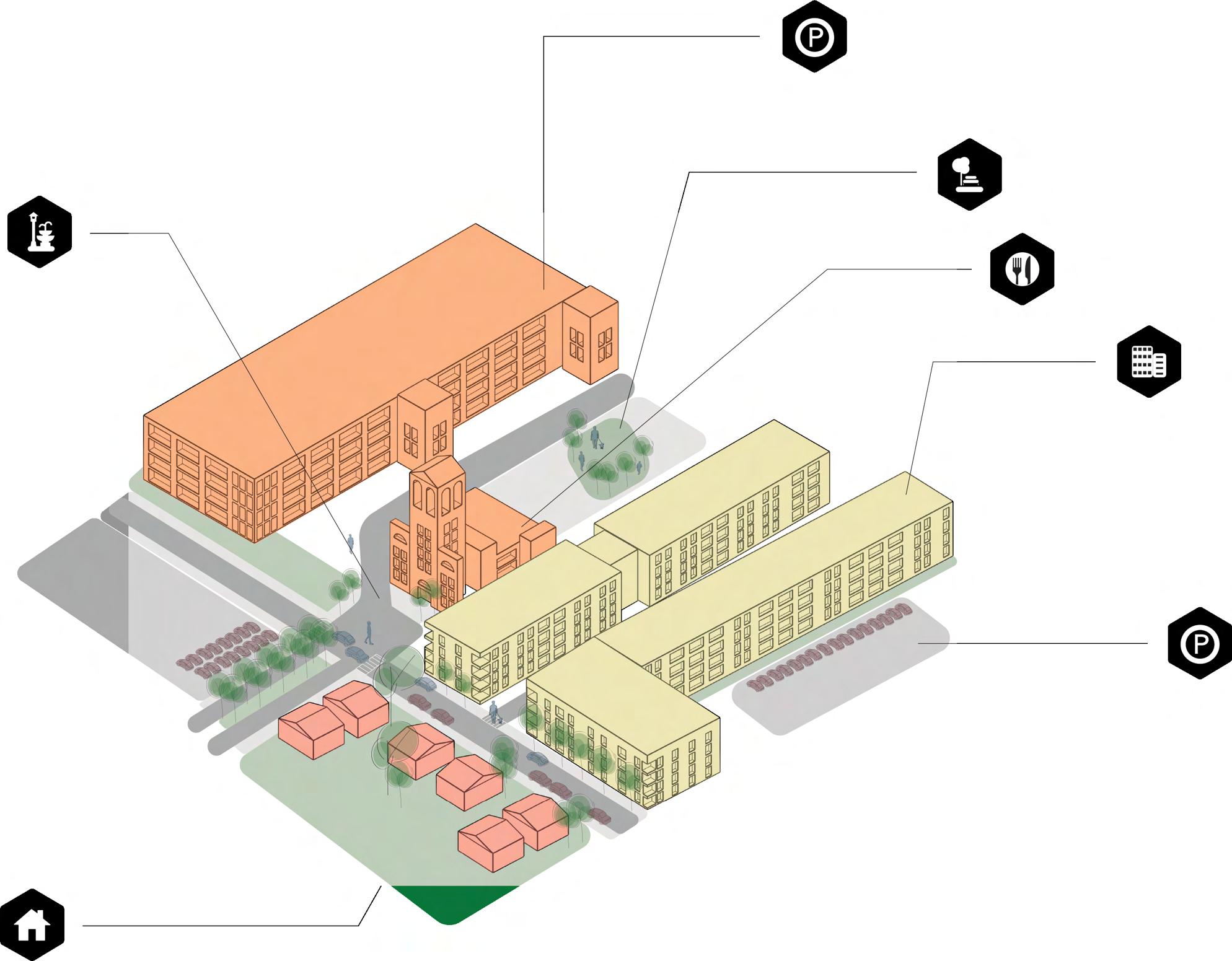
FIGURE GROUND
OLD AND NEW FACADES COEXIST PLAZA
SINGLE FAMILY HOMES
GREENSPACE/ PARK RESTAURANT APARTMENTS
PARKING LOT
OLDER SINGLE FAMILY HOUSING
NEW RESIDENTIAL APARTMENT HOMES
REPURPOSED AND REDESIGNED BUILDINGS
This three-dimensional model highlights old and new buildings as well as key landscape and streetscape features that make Factory 52 a desirable place. Although the facades have contrasting features from different time periods, they create a visually dynamic experience, blending history with modern architectural styles. This uniqueness along with human scale design techniques, green spaces and trees, come together to offer an experience for residents of Norwood and visitors.
Figure ground map of Factory 52 and its adjacent surroundings.
28
VISUALIZING WALKABILITY
The Urban Design Elements of Factory 52 intentionally enhance pedestrian experiences while coexisting with automobiles. Key streetscape features, including pedestrian infrastructure and human scale lighting creates an inviting environment for pedestrians. Thoughtfully integrated landscape elements such as green buffers and trees create a welcoming environment.
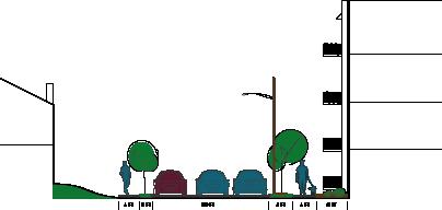
This cross-section shows the street where the most automobile activity occurs, while still ensuring pedestrian safety.
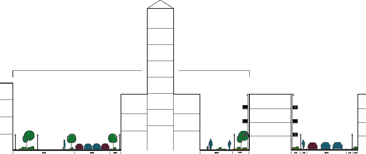
The length of this plaza spans 210 feet and seamlessly incorporates pedestrian and automobile spaces.
VISUALIZING NEW AND OLD
The purpose of this street elevation is to detail the contrasting features of the older single family housing and the new residential apartment homes.
1 IN = 20 FT
29
THE JUXTAPOSITION OF SURREY SQUARE
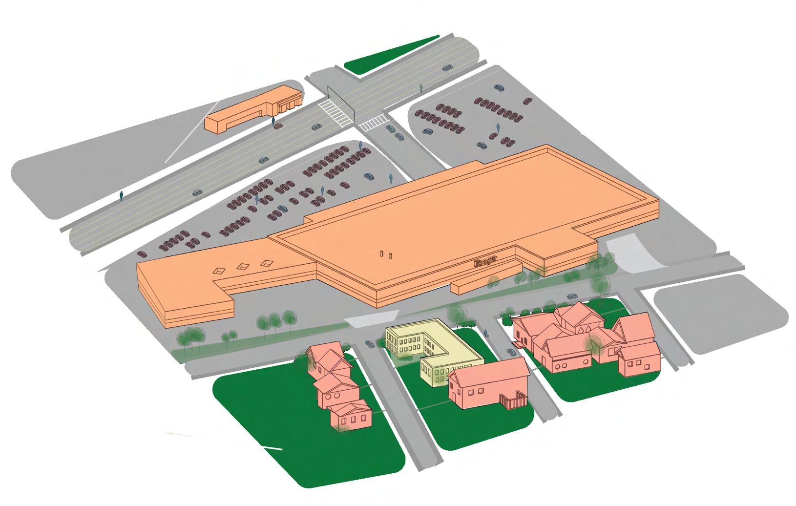
Surrey Square has had a large impact on the atmosphere of surrounding Montgomery Road. The large commercialized strip mall leaves a prominent visual difference in comparison to residential multi and single family.

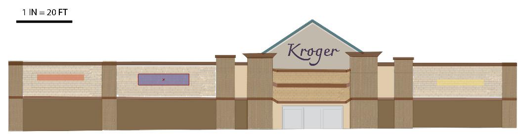
It can be shown the drastic size difference
Norwood’s Kroger in Surrey Square has in comparison to adjacent residential spaces.
FIGURE GROUND PARKING LOT
COMMERCIAL GROCIER
RESIDENTIAL HOMES
APARTMENTS
Older Single Family Housing New Residential Apartment Homes
Commercial Spaces
SURREY SQUARE MODEL
Within the limited spaces, there are several difference types of buildings. This can lead to a drastic change in atmosphere within a small space. The Kroger takes up over half of the infrastructure as well as parking lots. This leads to a car dominate area in a neighborhood that in primarily residential.
P s
30
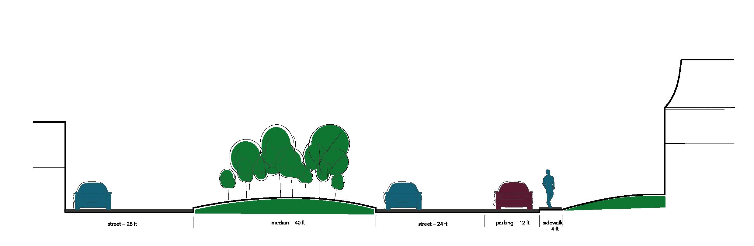
COLLECTOR STREET ALONG RESIDENTIAL HOMES
Norwood has abundant car infrastructure that tends to dominate the utilized land. Typically, there is twice as much concrete, if not more, in a block. Locations such as the Kroger parking lot is an effective example.
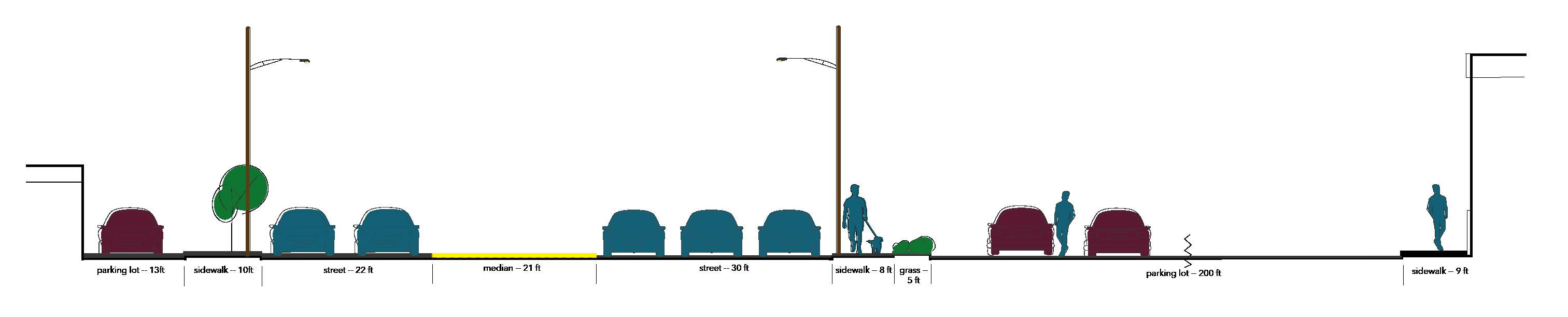
KROGER PARKING LOT ALONG MONTGOMERY ROAD
SURROUNDING BUILDING CHARACTER
Norwood is known as a predominately residential area with ornate and old housing. In contrast, is a fairly large cookie-cutter Kroger that is overwhelming to the eye.
1 IN = 200 FT 1 IN = 20 F T
1 IN = 200 FT
31
FUTURE OF NORWOOD
32
IDENTIFY, THEN ACT
By breaking down what Norwood is today, themes are discovered that ultimately foreshadow Norwood’s future. With identifying these themes and their corresponding issues and patterns, future growth can be intentionally strategized for the city’s public good. These identifiable themes, issues, and patterns all contributed to potential projects that serve the people of Norwood. With small and large wins, Norwood can utilize their pre-existing framework to create a city that prioritizes its people and environment.
33
ANALYSIS OF EXISTING CONDITIONS


TRANSPORTATION COMMUNITY DEVELOPMENT
THEMES
When one looks at Norwood there are three clear themes in terms of its issues & opportunities within the neighborhood:

SWOT ANALYSIS
This SWOT Analysis shows strengths, weaknesses, opportunities and threats within Norwood.
34
ISSUES MAP
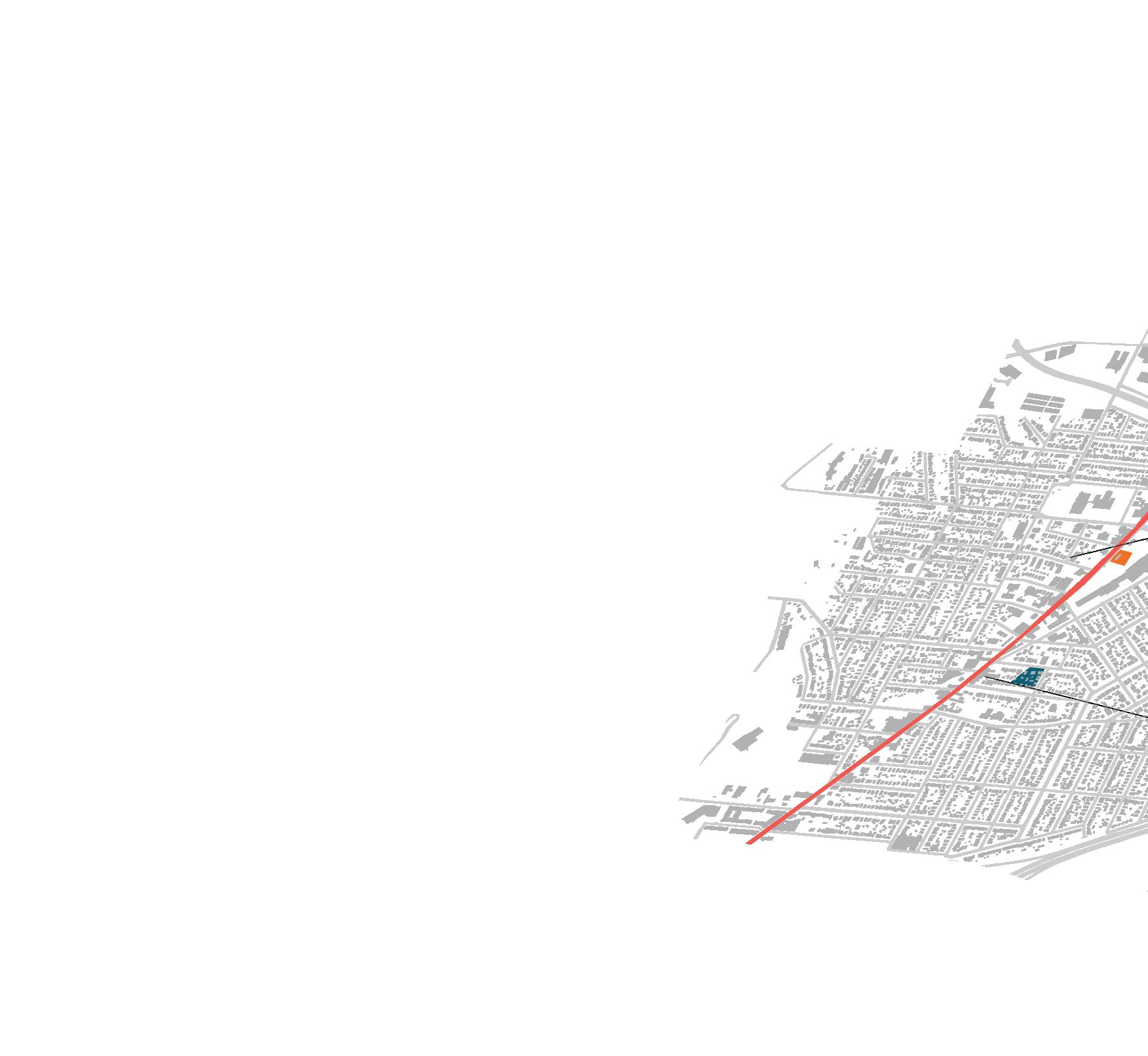
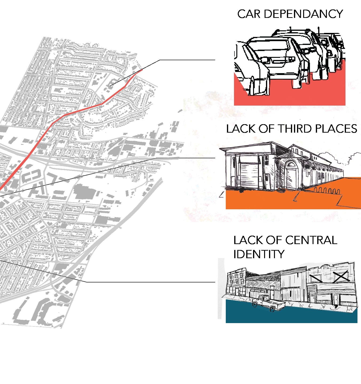
This map highlights an example of an overarching issue of each theme.
With the lack of sidewalks and bike lanes, Norwood residents have no choice to depend almost entirely on cars.
Most of Norwoods developed properties are dedicated to residential and businesses. This results in a lack of community/social spaces for the people living in Norwood.
After General Motors shut down in the 80s, Norwood has struggled to come back. Over time, businesses have been forced to leave due to finances, and buildings have been left to sit for years. This results in a lack of main street, and a lack of positive city character.
35
OUR VISION FOR NORWOOD
Norwood is a unified city treating Montgomery Road and underutilized spaces as a connection force for community engagement and accessibility.
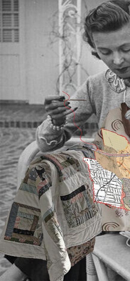
NORWOOD LATERAL AS A CONNECTING FACTOR
Create a connection point between Norwood Lateral and perpendicular avenues to make a more cohesive environment
Utilize the space adjacent to The Lateral to incorporate more pedestrian and bike friendly infrastructure
Take advantage of the slight valley of The Lateral to address the storm water runoff problem and feasible connection between The Lateral and the Rest of Norwood
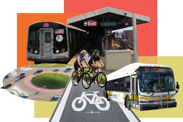
DIVERSIFICATION OF TRANSPORTATION
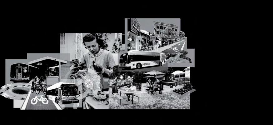
Utilizing the public transportation such as BRT and trains and make them more efficient and pleasant for the citizens to reduce car traffic
The addiction of bike lanes to the streets for a more sustainable transportation method
Roundabouts are utilized all around Europe to help reduce traffic and have a steady flow of the cars on the road.
36
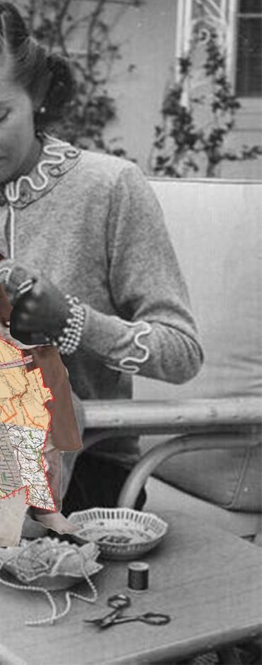
WELCOME TO THE FUTURE POSTCARD
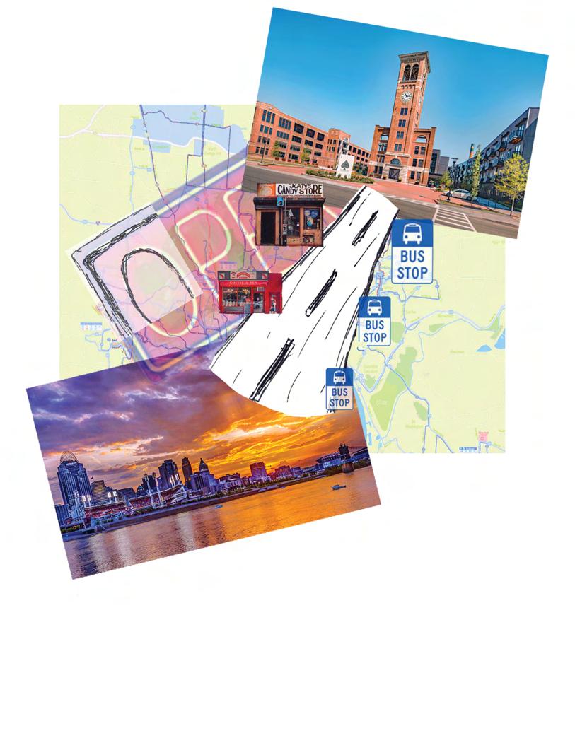
“Dear Reader,
Greetings from the future of Norwood Ohio! We hope that you will enjoy the new and improved connectivity and BRT routes.
Your future is bright, Your friend”
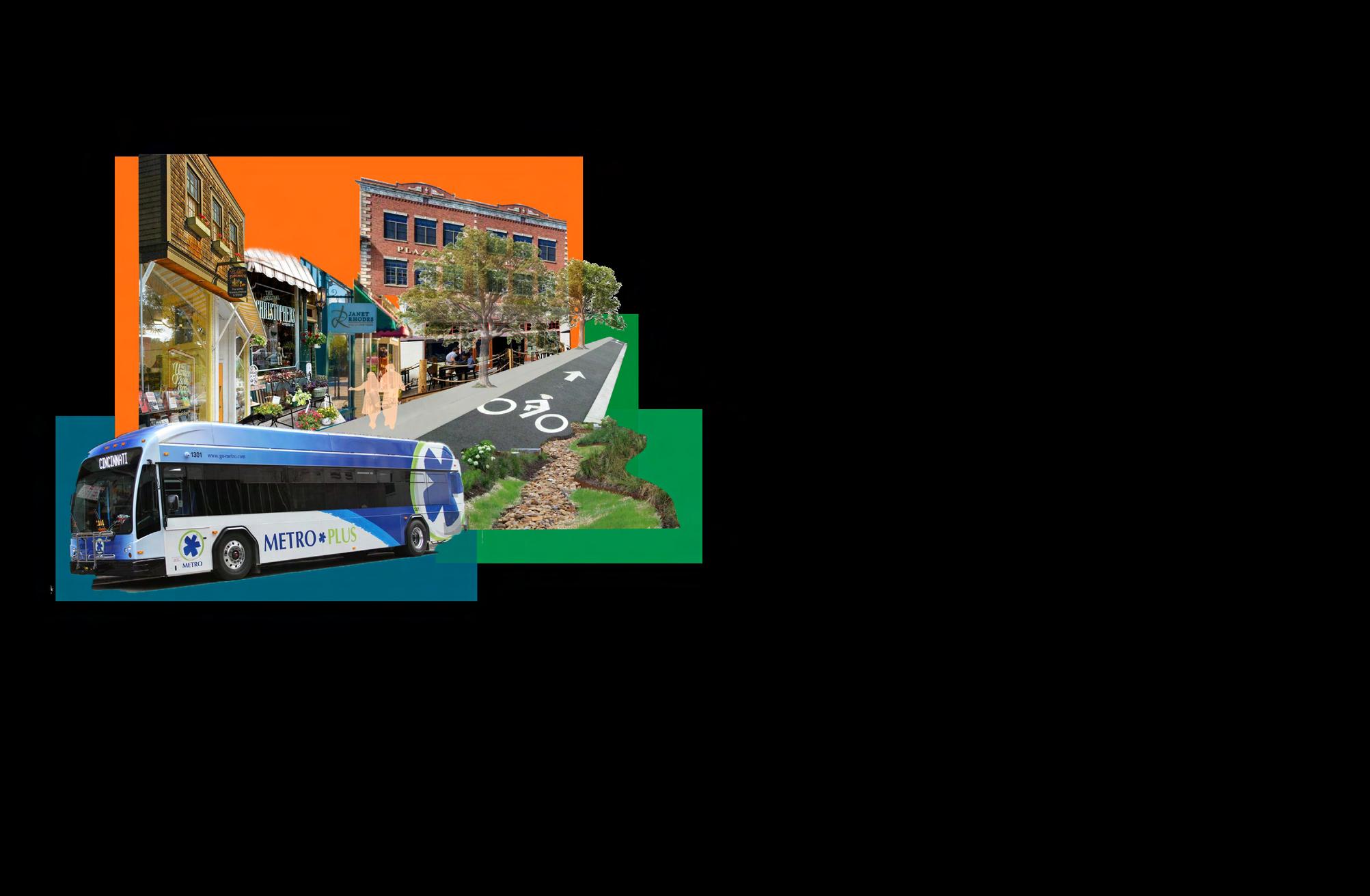
BRING BACK THE MAIN STREET
Create inviting pedestrian friendly spaces to encourage Multi-modal transportation
Combine a priority for pedestrians and a priority for environmentalism
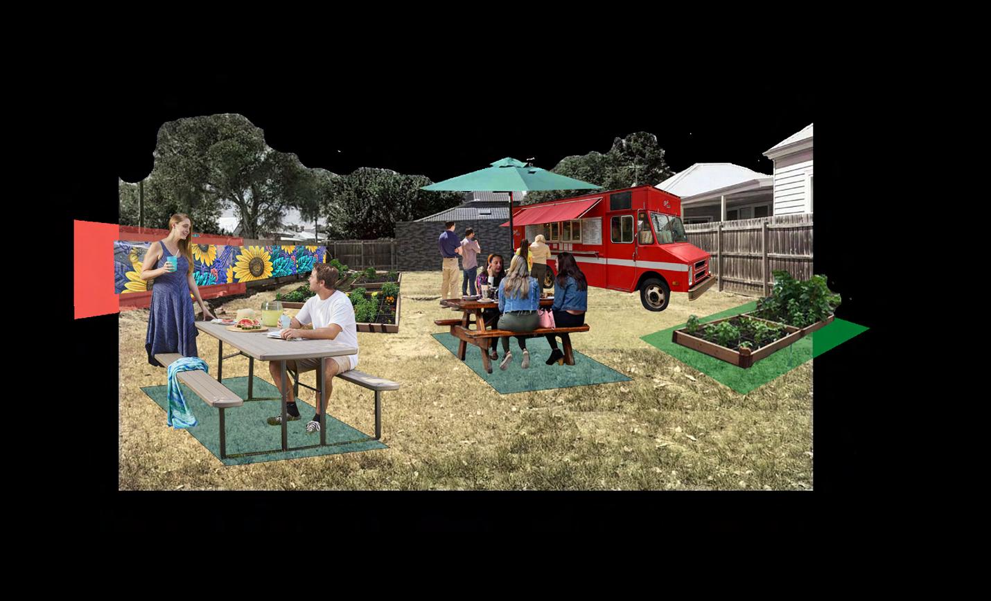
RE-GREENING NORWOOD
Creating a more functional, accessible, and sustainable Victory Memorial Park, that serves as a central asset in Norwood
Implementing green infrastructure that focuses on storm water management in those “in between spaces”
Re-purposing underutilized spaces to create public, multi functional communal spaces
37
TRANSPORTATION
DECREASING CAR DENSITY IN NORWOOD
FIRST AND LAST MILE TRANSIT CORRIDOR
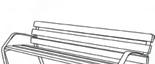
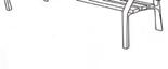
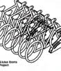
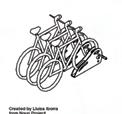
The “First and Final Mile” refers to the mile from one’s home to public transportation, a topic that does not get enough attention. Many bike rack have been installed in addition to electric shared bikes that make going back home more efficient after using public transportation.
Green Space
A transit corridor is a designed path that facilitates the movement of cars buses and people all at the same time on the same street. Transit corridors are for the singular purpose of reducing travel time between destinations.



 Pedestrian Path
Bike Lane Street Storm Street Parking
38







Bus Median
Water Drain 39
Shared Bike (First and Last Mile) Bus Lane
Storm
SURREY SQUARE PROPOSAL
The main BRT stop in Norwood will be right outside of Surrey Square. The existing bus stop there currently is one of the most utilized in Hamilton County. This is a perfect setup for massive development around this area. The pedestrian space is dismal at best and there is plenty of usable space around it due to the many unneeded parking lots.
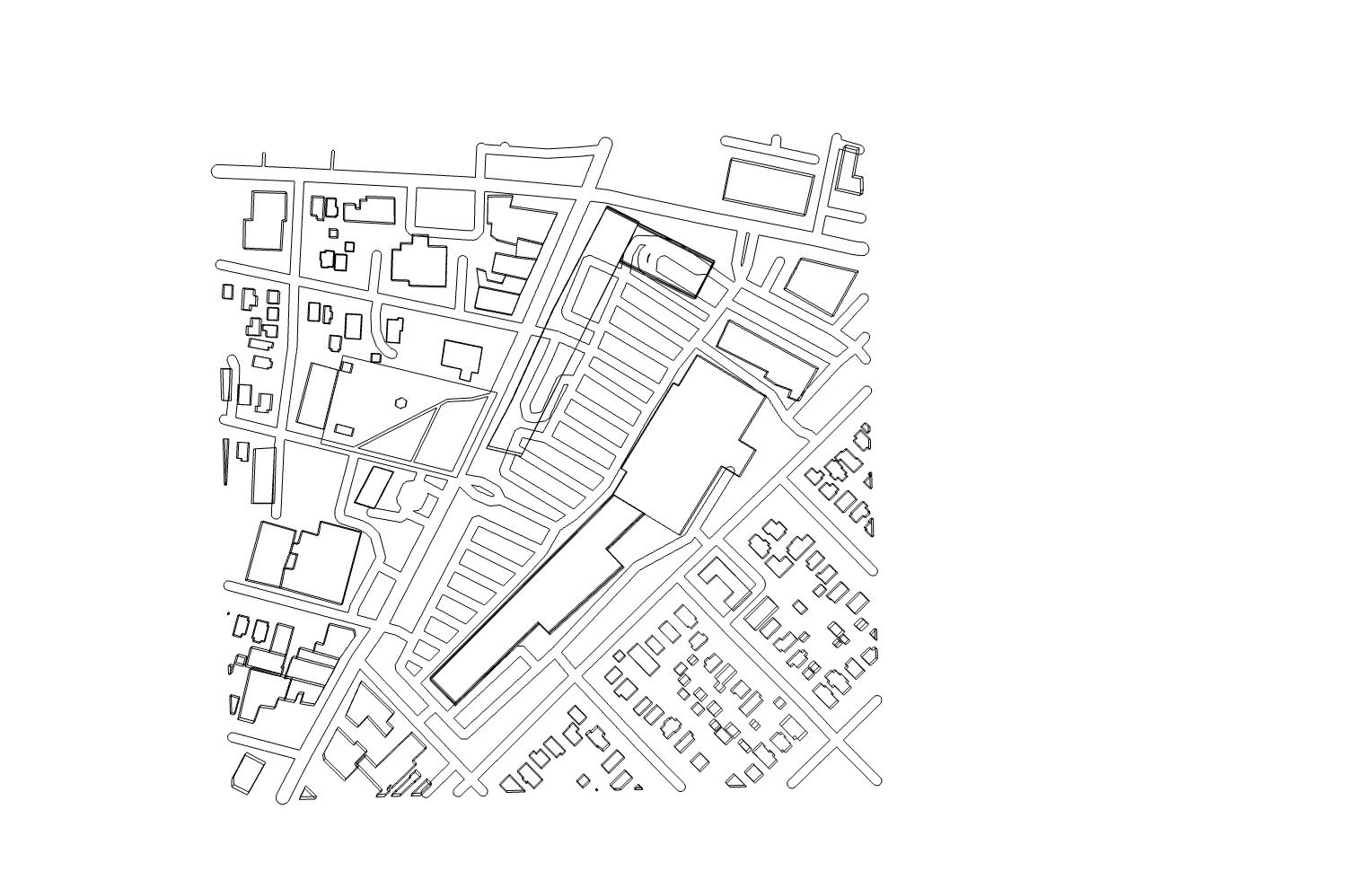
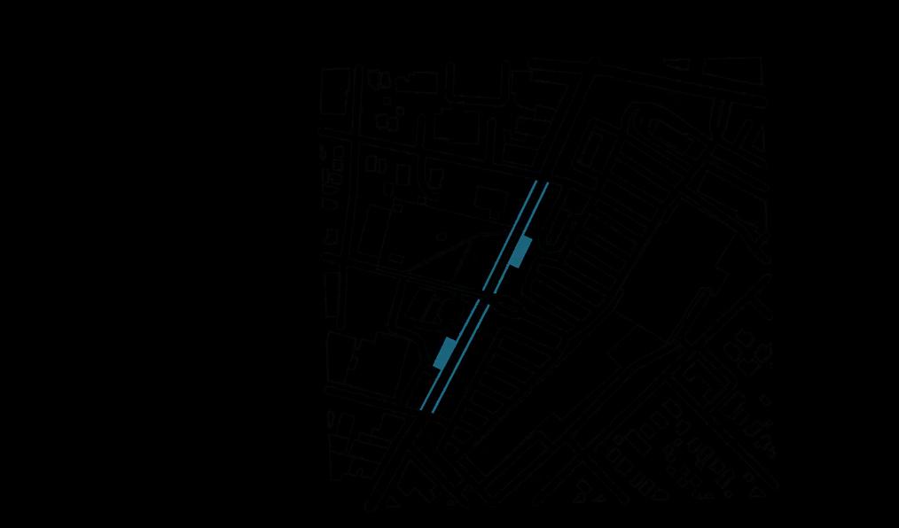
Implementation of BRT stops and increased sidewalk barriers
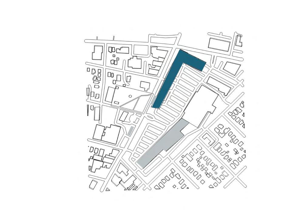

Redeveloping the strip mall into mixed use buildings with affordable housing
Implementing the same design along the northwest corner of the square
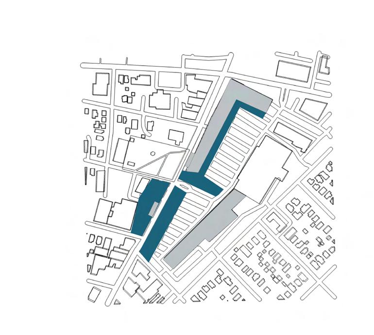
Finally, converting a lot of the current parking space into pedestrian courtyards

40 1 2 3 5 4 Existing Conditions
covered
covered BRT stops
pedestrian only courtyards
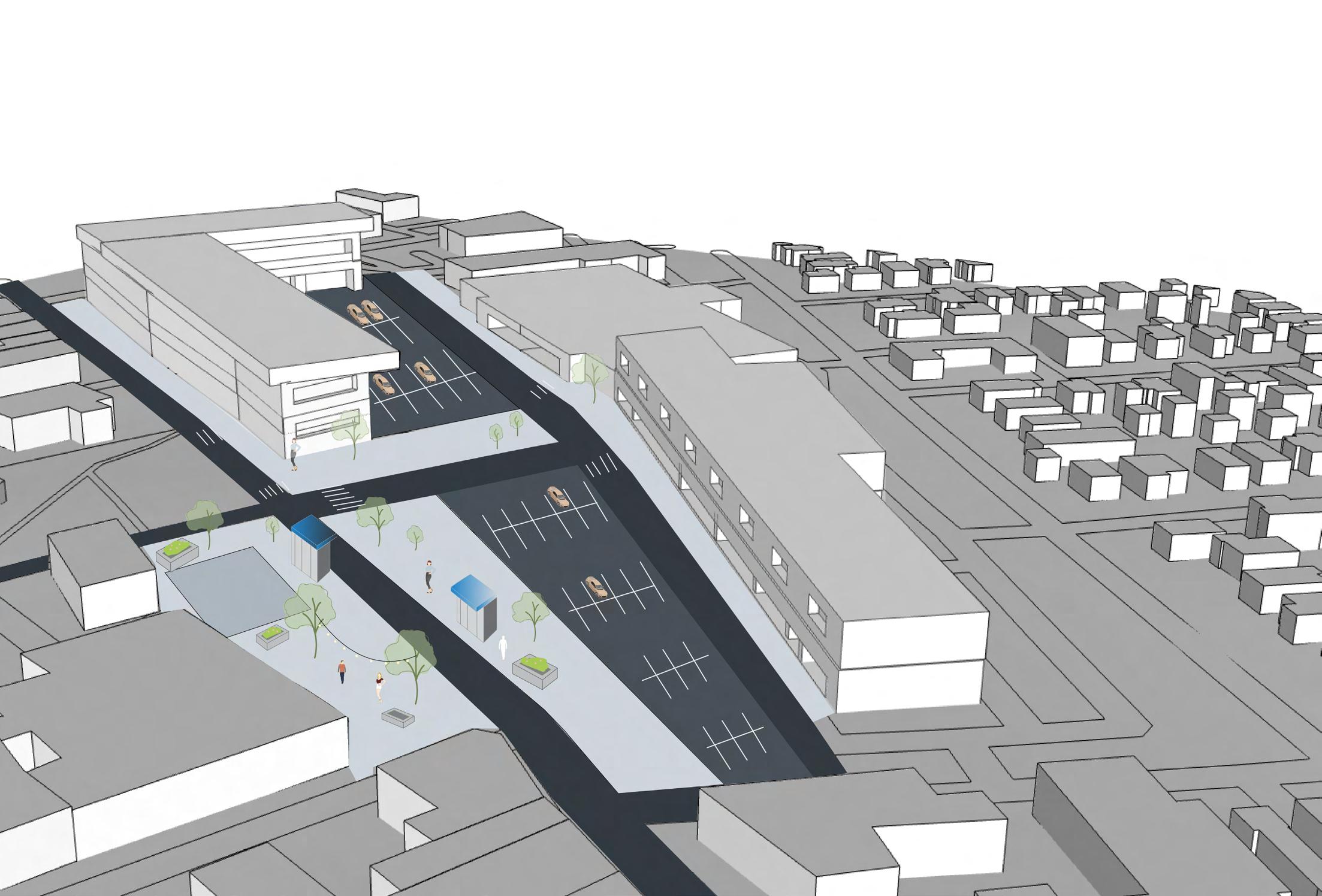
Increased sidewalk size
mixed use strip malls
41
GREEN IN BETWEEN
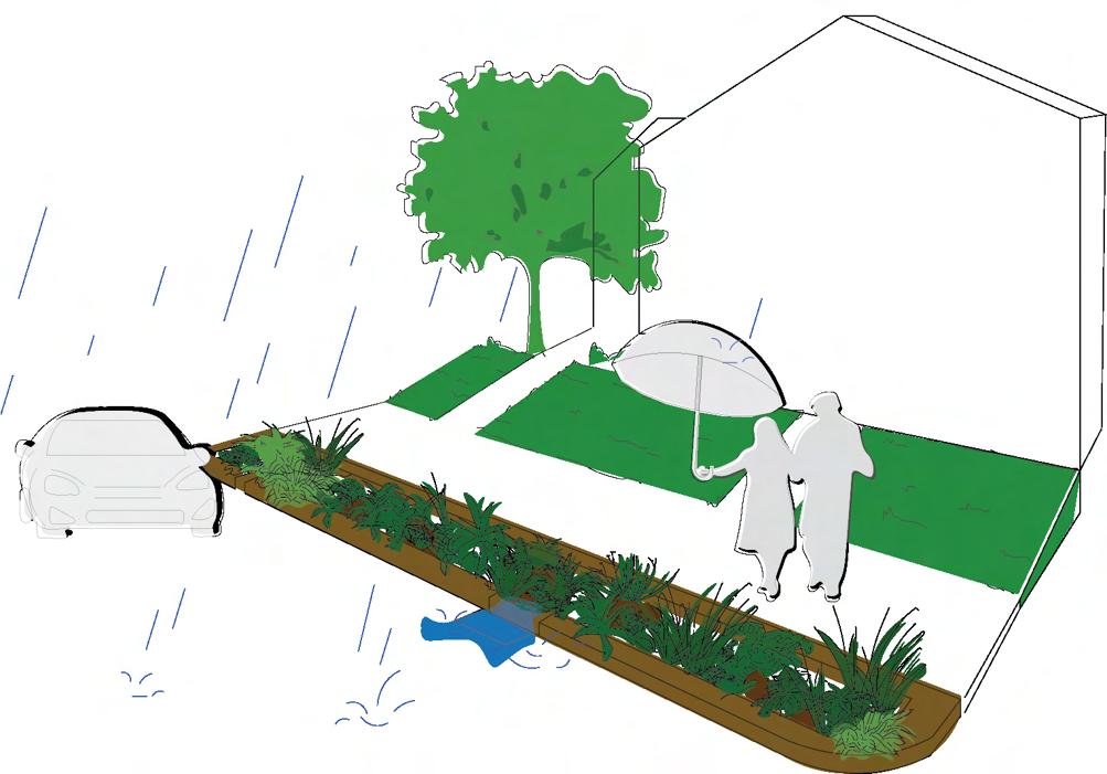
Greening in between spaces such as alleyways and residential streets creates a network of interconnected green spaces that not only enhance the beauty of the community but also provide numerous environmental and social benefits for residents.
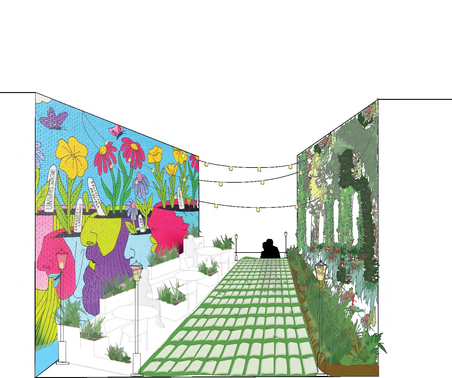
GREENING ALLEYWAYS
Neglected spaces such as alleyways can be transformed into vibrant, welcoming and sustainable spaces.


PEDESTRIAN SCALE

COMMUNITY MURAL MOVABLE TABLES AND CHAIRS

PERMEABLE PAVEMENT

BIOSWALE

VERTICAL WALL GARDEN
GREENING STREETS
Traditionally landscaped buffers should be replaced with bioswales in residential areas to help reduce the risk of flooding and maximize environmental benefits.
42
RE-IMAGINING VICTORY MEMORIAL PARK
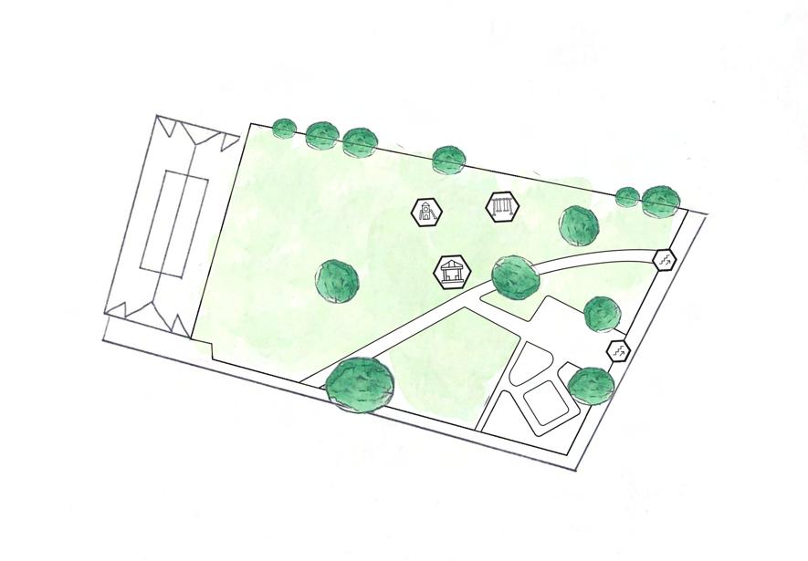
With its central location and the increased development spurred by the implementation of BRT, Victory Memorial Park has the vibrant main street for Norwoods residents.

EXISTING CONDITIONS
This existing conditions map points out features such as a neglected playground, swing set and gazebo that highlight the parks lack of functionality and identity. Additionally, the presence of inaccessible stairs at the front entrance further exhibits its challenges.
COMMUNITY MURAL
Adding a community inspired mural reinforces the parks identity and adds vibrancy to what is currently a vacant building
NATIVE LANDSCAPING
Re-wiled pockets of prairie gardens creates enhances biodiversity
CENTRAL SEATING AND PLAY AREA
A variety of seating and play equipment is used to engage residents
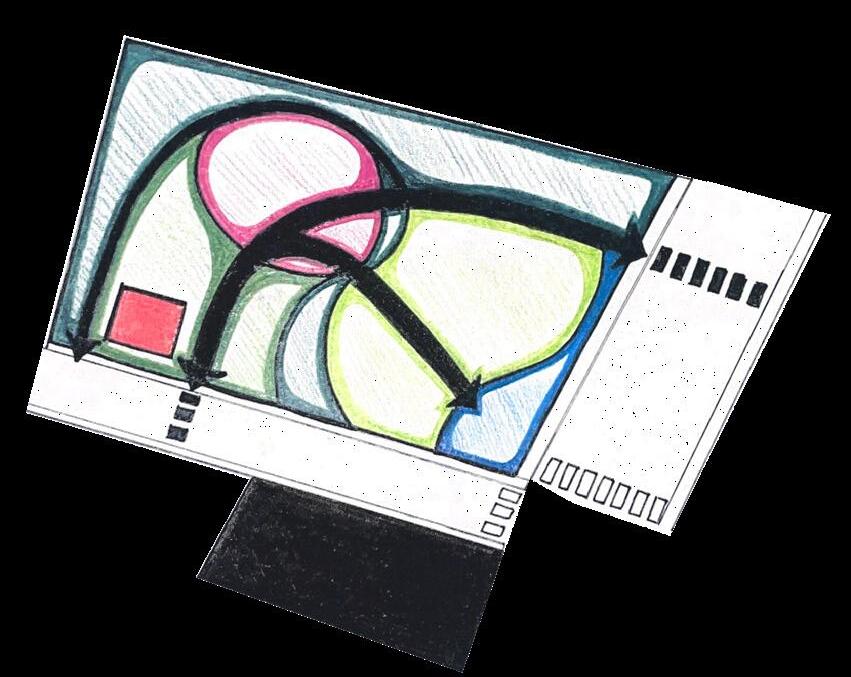
CONCEPT DIAGRAM
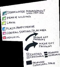
Re-imagined access points, landscaping, and amenities to create a more welcoming and accessible environment. Highlights include redesigned pathways, relocation of the memorial, and dedicated space for a central seating and play area.
BIOSWALE FEATURES
Integrating bioswales aids in storm water management, creating a more sustainable and resilient environment
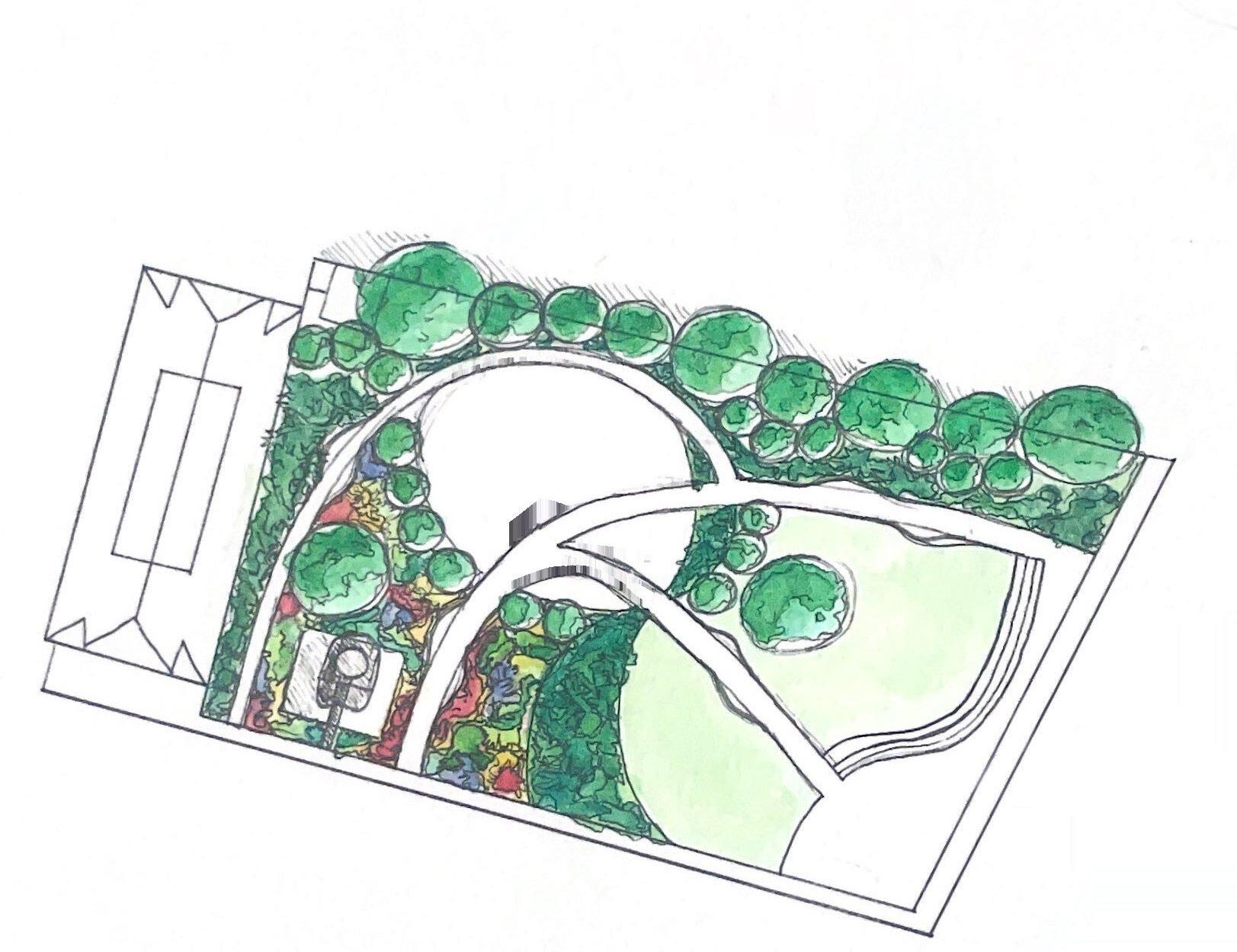
The memorial is relocated to activate this front of the park, which is inactive in its current conditions, reinforcing its identity RELOCATION OF TANK MEMORIAL
Seating is placed with trees and surrounded by vegetation to create s seamless connection to nature SEATING
Increased tree canopy and lush vegetation create a natural buffer along an inactive edge LANDSCAPING BUFFER
The plaza amphitheater hybrid design is versatile and includes an entrance ramp WELCOMING AND ACCESSIBLE PARK FRONT
43
REVISUALIZING NORWOOD LATERAL
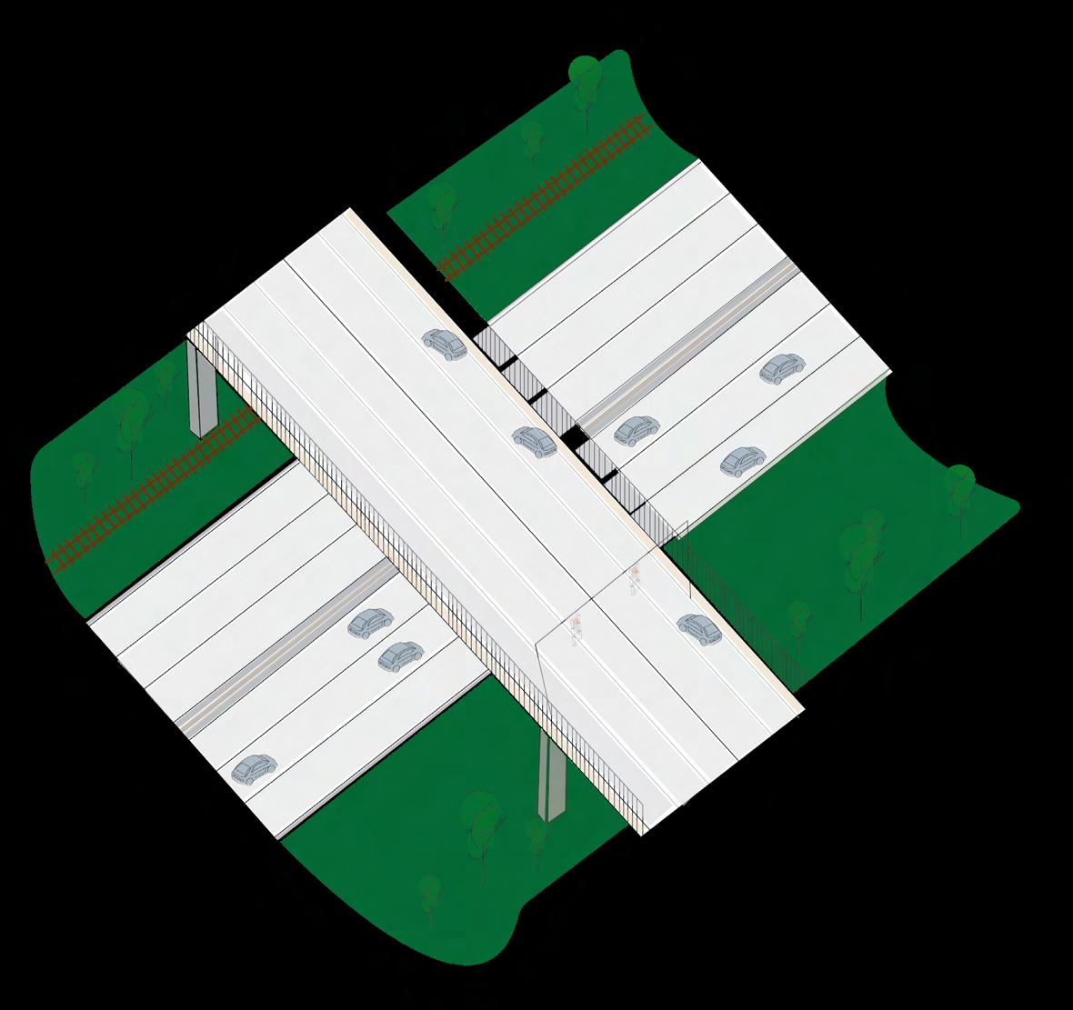
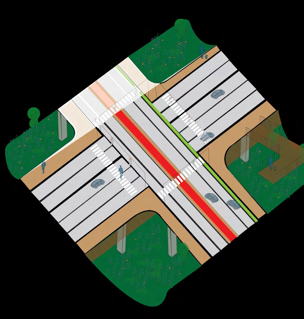
Norwood Lateral has been a ripped seam of the city that prohibits connectivity. With the revitalization of Norwood Lateral, there is an opportunity for Norwood’s community to perceive the Lateral as a joining point rather than a tear.
NORWOOD LATERAL REVISUALIZED
Bike Lane
Both Roadways Raised to Same Level BRT Lane
Wide, Pedestrian Friendly Sidewalks
CURRENT NORWOOD LATERAL
Fenced Off Road with Little Sidewalk
Small, Unsafe Shoulder Large,
Connecting Pathway beneath Norwood Lateral
Abundant Bioswale Vegetation
Safe, Interior Crosswalks
Little Vegetation
Norwood originally has Montgomery Road going over Norwood Lateral, which is in a miniature Due to this elevation difference and a car dominated there is a significant disconnect in major roadways lie at the center of Norwood. Norwood can reignite the connection of roadways by leveling two major roads and including a more pedestrian, and bus oriented system that prioritizes the addition to the new space beneath The Lateral, has the potential to include a pedestrian and pathway connecting to adjacent Crown Project
Dividing Median
Dominated, Isolated Roadway 44
Raised Roadway Car
as a roadway miniature valley. dominated area, roadways that can potentially leveling out the pedestrian, bicycle, the people. In Lateral, Norwood bike friendly Project routes.
FUSING THE COMMUNITY BENEATH THE LATERAL
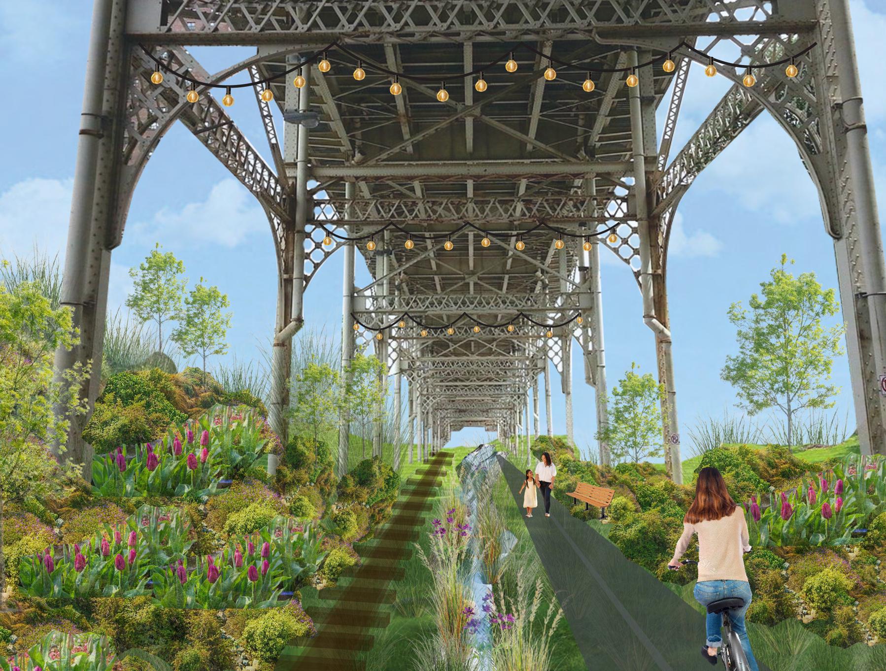
Due to a major rail road track running parallel to Norwood Lateral, Norwood can not simply level the entire valley so that The Lateral and Montgomery Road are even. With the concept of raising The Lateral to Montgomery Road, there is the potential to have two pedestrian friendly connections. First being on The Lateral and Montgomery, and second being beneath The Lateral. This new space opens several opportunities for Norwood’s civilians to posses their very own pedestrian and bike friendly major pathway connected to adjacent Crown Project routes accessible to all. With high visibility, quality lighting, and bioswale management resources, Norwood has the potential to create a space dedicated for the community and the environment.
Diverse Bioswale
Vegetation
Pedestrian & Bike Path
In Use Train Track
Outdoor Seating
Bioswale Management Creek
High Visibility
Bridge
Proper Lighting
Crosswalks
45
Ramp Connecting Roadways to Lower Pathway
SUMMARY
The city of Norwood embodies a unique complexity stemming from it’s status as an enclave within Cincinnati which presents challenges at times. However, with the implementation of the BRT route along Montgomery Road, connectivity for Norwood residents will be significantly enhanced, granting easier access to neighboring resources. Using the BRT route as a driving factor for change within Norwood, we’ve outlined four necessary objectives. These include transforming Norwood Lateral into a unifying link, diversifying transportation options, revitalizing its main street charm, and enhancing green spaces. Envisioning a future where Norwood is a unified city treating Montgomery road and underutilized spaces as a connection force for community engagement and accessibility.
46