Learning from
Ganga Riverfront Public Spaces Network at Patna
Nishant Lall
Learning from
Ganga Riverfront Public Spaces Network at Patna
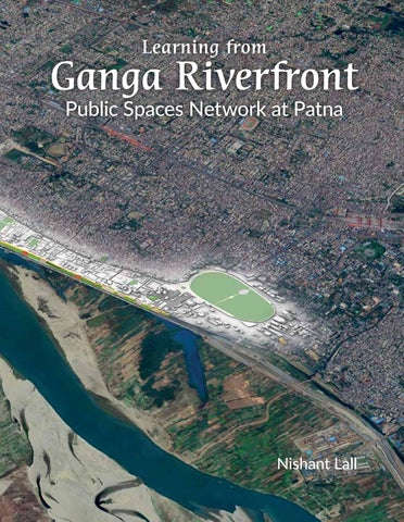
Learning from Ganga Riverfront chronicles a unique revitalization programme at the River Ganga in Patna. For a city with its back to the river, with isolated ghats and a disconnected development proposal, this project proposes a comprehensive development solution addressing vital concerns such as public space and civic amenities, along with environmental awareness and ecological restoration. The project connects existing fragmented open spaces to provide a continuous public space along the river, aiding in religious festivities and recreation. Engaging a long stretch along the river, the proposed development includes 6.5 kilometres of promenades, six community, education and recreational buildings, as well as food kiosks, ecological landscaping and other public amenities. The project received funding of $40 million from the World Bank and was supported by Ministry of Water Resources (Ministry of Jal Shakti). Designed as a multipurpose space, the project also aims to develop ghat prototypes that could create a typology for the river’s edge, integrating heritage buildings and being sensitive to the local context. As a holistic development, the proposal promotes a walkable city, creating larger usable open spaces and attracting people from all age groups.
With 300 images, 125 drawings and 25 maps.
Learning from Ganga Riverfront
Public Spaces Network at Patna
2
Learning from Ganga Riverfront
Public Spaces Network at Patna
Nishant Lall
3
First published in India in 2026 by Mapin Publishing Pvt. Ltd 706 Kaivanna, Panchvati, Ellisbridge Ahmedabad 380006 INDIA T: +91 79 40 228 228 E: mapin@mapinpub.com www.mapinpub.com Text © Nishant Lall Image © NilaA Architecture and Urban Design except those listed below: Akshay Kaul and Associates: PP. 112–113 Bihar Foundation: P. 44 centre-right Bihar Tourism: P. 70 top row: centre; second row: right; third row: left, right Dynamic World: P. 43 Flying Elephant Studio: P. 46 third row: right Fran Pritchett: P. 44 above-left Fumihiko Maki / Opolis Architects: P. 46 second row: right Google Earth: PP. 36, 44 below Google images: PP. 68 first row: left, centre & right; second row: left, centre & right; third row: left, centre; fifth row: left, right; 69 first row: left, centre & right; second row: left, right; third row: left Google Maps: PP. 26, 27, 36, 37 Hunarshala Foundation: P. 70 fourth row: centre Jal-Jeevan-Hariyali Mission: P. 54 Kaja Geratowska/ Bauwelt: P. 70 fifth row: centre Kenzo Tange Architects: P. 70 fourth row: left MIT Visualizing Cultures: P. 46 top row: below-centre, below-right NASA: PP. 25, 30 National Remote Sensing Centre, ISRO: PP. 28, 53, 54, 55, 56, 57 above and below Open Street Maps: P. 33 Oriental Scenery, Thomas Daniell and William Daniell: P. 44 above-right Prashant Panjiar Archives: PP. 6–7, 8, 72–73, 138, 210–211 Ranjit Kumar, NilaA: PP. 24, 134, 139, 189 above, 190, 192 Sita Ram: P. 44 centre-left Studio Matter Goa: P. 70 fifth row: right Subodh Gupta Studio: P. 46 bottom row: centre Wikipedia: P. 46 second row: left; 69 second row: centre Yasuke Asai/ Niranjan Welfare School: P. 70 fourth row: right
All rights reserved under international copyright conventions. No part of this book may be reproduced or transmitted in any form or by any means, electronic or mechanical, including photocopy, recording or any other information storage and retrieval system, without prior permission in writing from the publisher. The moral rights of Nishant Lall as the author of this work are asserted. ISBN: 978-93-85360-97-8 Copyediting: Roshan Kumar Mogali / Mapin Editorial Editorial Assistance: Neha Manke / Mapin Editorial Design: Pratyush Narendra Katikar / Mapin Design Studio Design Advisor: Gopal Limbad / Mapin Design Studio Production Assistance: Rakesh Manger / Mapin Design Studio Production: Mapin Design Studio Printed in India
Captions pp. 6–7 Dairy farmers ferrying across the River Ganga in the early morning in the 1990s, Patna p. 8 Washermen along the River Ganga in the 1990s, Patna
CONTENTS
Author’s Note
6
Introduction: Designs for a Variable Edge
9
Project Timeline
16
City and Nature
23
1 | Tri-River Junction
25
2 | Linear City
42
3 | Gradient and River Hydrology
54
Reimagining the Riverfront
73
4 | Revitalization and Urban Vision
74
5 | Edges, Paths and Connections
96
6 | Typology of Interventions
114
From Plan to Practice
133
7 | Maidan to Ghat
140
8 | Campus to Ganga Kinare
180
9 | Old City to Ganga Setu
212
Afterword: Patna Promenade
254
Project Credits
256
Acknowledgements
258
Amitava Kumar
Author’s Note Why Riverfronts? Riverfronts represent a part of a larger ecological, hydrological and geographical system that has redefined the evolution of cities across the world. What was earlier an ecological-cultural edge for smaller riverine communities has now become an urban-public space construct for dense cities across the subcontinent. As civic agencies gather efforts to address pollution in river systems, riverfront enhancement has been a default approach. However, this edge is a complex hydrological and ecological system that must be understood before an appropriate design response takes shape.
The Learnings Terrain Logic
Riverfronts offer a very specific terrain logic at each precinct, and understanding the terrain with the dynamics of water flow is essential even before preparing the canvas for any design intervention. This would entail understanding the watershed and hydrological impacts of this natural edge on the urban fabric of the city. Understanding Gradients
Design thinking and ideation for this unique edge must begin with an understanding of the gradient of this water–land edge. Some slopes are more suitable for ecology, while others may be more suitable for public spaces. This edge is also not a static edge; it varies with seasons and water flow, hence a more calibrated approach is required to maintain biodiversity and ecological benefits.
6
Designing for Retreat
Inhabit the edge in a way that allows for built infrastructure, public spaces and ecological interventions to respond to the rise and retreat of floodwaters. Structural systems based on piles, stilts and decks adapt more efficiently to overflow and the unimpeded retreat of water. Such systems adapt to hydrological fluctuations of levels in sync with groundwater flow. Designing for Access and Connections
Riverfront zonal plans must be generated to keep and enhance the existing connections to the urban fabric beyond the riverfront edge. This pedestriancentric focus allows the new public space or landscape edge to be accessed by a greater number of people. Hence, the design is much more than “a front” only and begins to weave laterally into the city fabric. A Scalar Design Approach
The design paradigm must allow a collaborative framework of imagination and implementation, in which inputs from a wide range of experts are developed into site-specific programs. Some of these may develop into shade, shelters, pavilions, vending zones, ritual spaces and other civic facilities.
Designs for a Variable Edge
7
8
Introduction
Designs for a Variable Edge
“For the [anonymous medieval] singer, the pada [verse] was not something whose words had unalterably been fixed, to be slavishly followed while singing, but something that was provisional and fluid, a working draft, whose lines and images could be shifted around or substituted by others or deleted entirely.” —Arvind Krishna Mehrotra, Songs of Kabir
Patna Riverfront is a publicly funded urban upgrading initiative aimed at improving pedestrian access to the River Ganga edge. When the project began in 2012 and its approval came in 2014, it became one of the first initiatives for river-edge upgrading that was underpinned by a cross-disciplinary approach to address complex civic issues. A call for a consistent and calibrated approach to planning, ecology and design along these variable edges—canals, nullahs, rivulets, lakes and perennial rivers—resonates in all Indian cities. While new areas under planning need to adhere to codes like the Coastal Regulation Zone (CRZ) and the River Protection Zone (RPZ), existing cities, which are built up to the edge and lack clear infrastructure for water and waste management, require a far more scientific approach, driven by hydrology, nature and resultant urban interventions. These refer not only to technical sciences but also to health issues, including the mitigation of vector-borne diseases due to ineffective water management at local levels in cities. When construction began at Patna Riverfront in 2014 in various stretches of the riverfront, a small booklet was already being used for outreach purposes with academic and civic partners to catalogue site progress, such as the Baharwa Ghat public space remediation works opening in 2015, the Pathri Ghat public space project in 2016 and so on. When the entire project was completed at the end of 2019, we began a set of documentation efforts to record the process. These were initially limited to architectural drawings and the design process; however, we felt it was imperative to discuss the larger hydrological and city-
9
wide learnings that emerged during the process. Public space access became a prime concern in Indian cities during the pandemic, and the recently built riverfront promenade was thronged by people during this period, raising wider, long-term discussions on open space, ecosystem services and well-being in cities and small towns.
Working Narratives “The discipline imprinted in a sequentially unfolding narrative predisposes the reader to think historically, making it difficult to see the text as a map, a geography of simultaneous relations and meanings that are tied together by a spatial rather than a temporal logic.” —Edward W. Soja, Postmodern Geographies: The Reassertion of Space in Critical Social Theory
Most discussions on cities in India are often restricted to metro cities, and with 500 million people residing in small cities and cluster town belts in the Ganges Basin in northern India, the book aims to enhance access to a working methodology so that many different and new approaches can be developed by stakeholders at each scale. While there is no direct path to these interventions, nor a replicable model, the book aims to urge an improvised methodology suited to the complex context of these edge conditions in the city. Riverfront projects are misunderstood as a complete transformation of the edge, mostly because we see examples that have evolved over many decades. For example, the architectural promenade at Varanasi is a set of transformations evolving from erosion protection of slopes over centuries. The context of Patna is very different. It is the land of convergences of three major Himalayan rivers and a floodplain that spans 7–10 kilometres and carries a huge amount of silt that has formed the fertile alluvial plains of Bihar. Also, there is no riverbank road, which is common to all other riverfront projects; most of the urban fabric in the Patna Riverfront zone is pedestrian-oriented. While working on the book, I felt it was important to trace some cues and prods; the book highlights three important approaches and learnings that have been the armature of the work for almost ten years. These learnings come from: ◦ settlement studies, ◦ urban transformation and scale of architectural interventions and ◦ urban design implementation.
10
Introduction
Learnings by Way of Settlement Studies “Interested in the play of ‘forces of nature’ and ‘activities of man’—the need to study all the geographical factors and the biosphere of the region—and the urban landscape [Anton Wagner] started [his] book [Los Angeles: The Development, Life, and Form of the City of Two Million in Southern California] with a detailed study of the city’s geological history and structure—its ‘geological dynamism’ as he called it.” —Anthony Vidler, Los Angeles: The Architecture of Four Ecologies
In Patna, we had limited exposure to the Ganges except at a few points where gaps in the embankment wall would allow us a glimpse of the historic river system. Even while studying architecture in Delhi, though the college was located at the edge of the River Yamuna, there was no visual or pedestrian link. It was only when the Yamuna flooded in 1997 that we first saw water swell up to the Ring Road that runs along the eastern flank of Delhi. It was not until the final year, when we undertook a study of the water catchment system in Mehrauli (an almost 750-year-old settlement outside Delhi), that I was exposed to the hidden stepwell systems in Delhi and later in Ahmedabad (while doing an internship with B.V. Doshi). Subsequently, a study trip to Mumbai brought us, young, eager architects, to the famed Marine Drive and the now conserved Art Deco district, but it was not until later that year, when I visited Kerala, that I began to understand the water–city landscape. Spending a few days in Alleppey, India’s backwater village cluster with a whole network of canals and waterways, gave a glimpse of what North Indian rivers were historically—a mobility corridor. The elaborate canal system in Alleppey, where daily life, vending, going to school and work happen by boat, and where the vernacular urban fabric responds to this canal system as a well-crafted ensemble, offers a glimpse of a cohesive water-based urbanism. Along with the grand architecture destinations, boardwalks and piers were my introduction to Los Angeles. However, apart from visual cues and experiences, it was at UCLA, while doing the LA Now research studio led by Thom Mayne, that students worked on an urban lab exploration of real issues affecting the megacity of Los Angeles, including concerns about flooding in the LA River, overcrowding in the school system and the revitalization of downtown with housing. Strategic thinking in each context would allow tactical ideas to emerge at an academic level, which led to further volumetric explorations as design studio projects. I joined a study tour to Venice with a few university students and saw works of the Italian master Carlo Scarpa at Fondazione Querini Stampalia, where his detailing on architectural components responded to water levels inside the
Designs for a Variable Edge
11
Public Spaces Urbanism at Patna Project Timeline 2013–14
2014
2015
2016
DPR AND TECHNICAL STUDIES IMPLEMENTATION
Launch: National Ganga River Basin Project by the World Bank Group
Project Report: Environmental Impact Assessment Report (EIA)
Project Report: Civic Vision Report–Patna
Awards: Asia Architecture Award 2016 post by the World Bank
Project Report: Safety Assessment And Risk Management For Patna Riverfront Development Project by IIT Delhi
Outreach: TEDxDelhi talk by Nishant Lall
Awards: IA&B Young Designer 2016 Award
Project Report: Cultural Impact Assessment Report by INTACH Delhi
Public Use: Chhath Puja celebrations at Baharwa Ghat, Patna Riverfront
16
Awards: 2A Asia Architecture Award, Vienna / Category: Urban Projects, Rural Projects, Landscape & Public Spaces (including squares and streets)– “Umbrellas by the River”
2018
2019
2021
2022
2024–25
OPENED FOR PUBLIC USE 500 M EXTENSION WORK STARTED
Awards: Merit award in Urban Design by AIA International Design Awards 2022 (The American Institute of Architects)
Outreach: Yoga Day celebration at Patna Riverfront
Awards: Inclusive Design Excellence Award AIA International Design Awards 2022 Awards: Sustainable Futures Award by AIA International Design Awards 2022
Hon’ble Prime Minister Shri Narendra Modi lays the foundation stone at Patna Riverfront.
Outreach: Presentation at CEPT University
Outreach: IUDI talk
Outreach: Presentation at UIA 2020 Rio Outreach: Conservationist Mike Pandey captures the Patna Riverfront for Nat Geo India, highlighting efforts to keep the River Ganga clean.
Outreach: Regenerating Riverfronts: A Framework for Indian Cities–TREADTalks, Centre for Policy Research
22
City and Nature
City and Nature
By River By Sea
23
24
City and Nature
1 | Tri-River Junction Understanding the Terrain Few regions in the world are as densely populated as the Gangetic Plains, with more than 500 million people residing in a few large city regions, as well as a diffuse† network of cities, small towns and cluster settlements stretching over 1,000 kilometres along the River Ganga. When it comes to water and its flows, geography becomes the primary generator of territorial logic, and the Gangetic Plains demonstrate one of the most ancient forms of this logic, which developed into a riverine-based civilization. The needs and necessities of the time led our ancient settlements to form around river systems and water catchment zones. River systems were the earliest economic and transport corridors, bringing with them the bounty of nutrient-rich soil from seasonal floods that supported the agrarian economy. A complex terrain logic has, over centuries, shaped a riverine culture that is based on variations of excess and depletion. This logic is further
BRAHMAPUTRA BASIN Area: 580,000 km²
INDUS BASIN Area: 1,100,000 km²
GANGA BASIN Area: 1,086,000 km²
previous pages f ig. 1.1 River edge at Collectorate Ghat showing its neglected condition and garbage, 2012 facing page fig. 1.2 Aerial view of the Old City showing the pedestrian promenade and highway under construction fig. 1.3 Ganga, Brahmaputra and Indus basins—the three life-giving rivers of the subcontinent † Only 35% of India’s population lives in urban areas, compared to 84% in the United Kingdom, 92% in Japan and 64% in China. In Bihar, the urban population is even lower, at just 15%.
25
ig. 1.4 Satellite view of the f Himalayas, the Brahmaputra river basin and the Ganga river basin meeting the Bay of Bengal
codified in cultural practices, oral traditions, crafts, seasonal rhythms and crop cycles. The health of the river system has a strong bearing on the water security of this densely populated subcontinent, and many scientific assessments have been carried out to bring to the fore this fragile relationship between the dense network of settlements and their watershed. Modern means of visualization through digital mapping tend to generalize local content into a highly pixelated view—revealing some aspects while obscuring others. Since a modern project uses this platform as a starting point, it becomes imperative to support this with sensitive on-ground mapping. Any contemporary project or initiative must start by reaffirming this ancient terrain logic on which the cities in the subcontinent are based. As extreme climate change makes its impact evident, this terrain logic extends to wind movement, heat exchange and the microclimates of cities across North India. The territorial logic highlights the crucial layers of cultural landscape, including physical networks and points of convergence, which then relate to the vastness and slowness of the broader terrain. It also draws attention to the watersheds that feed these rivers and rivulets and to the region’s deep dependency on a highly dynamic monsoon system.
Vastness and Slowness “Geography in my opinion is the primary and primordial architecture.” —Paulo Mendes da Rocha, Paulo Mendes da Rocha: Fifty Years
The unique geography of the Gangetic Plains and the subcontinent has another fundamental yearly cycle—the moisture-rich monsoon winds that arrive each year from June to September. The Gangetic Plains, lying between the snowladen Himalayas and the rocky strata of the Deccan Plateau to the south, heat up in the scorching summers and create favourable conditions for the
26
City and Nature
progression of monsoon winds. The monsoonal deluge of up to 2,000 mm yearly replenishes the rivers with one of the highest water contents in the world. The resultant fluvial systems also recharge local aquifers, surface ponds and lake systems, while enriching regional biodiversity. The Lower Ganga Basin is a unique geo-terrain; as gradients transition from the Middle Ganga Basin to the Lower Ganga, its immense plains become ideal grounds for the convergence of water systems from the Himalayas and the Deccan Plateau. This slow landscape, marked by the deposition of silt and mineral content, creates one of the most fertile riverine plains in the world. It is on these fertile plains that agriculture contributes up to 60% of the local economy. The cultural geography has evolved with this seasonal logic, which over time has created a pattern on the physical landscape. The population density in India is 312 persons per square kilometre, whereas in the Ganga Basin, it is 512. The river
ig. 1.5 The Ganga f watershed formed by many rivulets carrying the headwaters of the Ganga
GANGA
NEW DELHI LUCKNOW
AGRA KANPUR
ALLAHABAD
PATNA
KOSI
BRAHMAPUTRA
VARANASI FARAKKA
KOLKATA
NEW DELHI (215 m MSL)
AGRA (169 m MSL)
GANGA
KANPUR LUCKNOW ALLAHABAD VARANASI PATNA FARAKKA (126 m MSL) (123 m MSL) (98 m MSL) (80.71 m MSL) (53 M MSL) (12 m MSL)
KOLKATA (9 m MSL)
Tri-River Junction
27
4 | Revitalization and Urban Vision
“So is [social urbanism] the phenomenon of architecture and public space being used towards social goals, or is it a type of urban intervention defined by a social process? … The building blocks of social urbanism are what [Alejandro] Echeverri called ‘integral urban projects’ (PUIs). These are not buildings, but projects that incorporate multiple programmes simultaneously, from transport to landscaping, from street lighting to a cultural centre.” —Justin McGuirk, Radical Cities: Across Latin America in Search of a New Architecture
B.N. COLLEGE GHAT COLLECTORATE GHAT
PATNA COLLEGE GHAT
MAHENDRU GHAT
MISHRI GHAT
ANTA GHAT ADALAT GHAT
Precinct 1
KALI GHAT
T.N. BANERJEE GHAT
Precinct 2 ZONE A 6 km
74
Reimagining the Riverfront
RANI GHAT GANDHI GHAT
KRISHNA GHAT
LAW COLLEGE GHAT
BAHARWA GHAT
Precinct 3
Distinct Urban Precincts Geographical and physical constraints led to the development of smaller urban precincts. These are walkable zones where detailed work begins to focus on buildings, heritage structures and open space potentials. During early design sessions and feasibility studies, an incremental urban intervention scheme to address the complex landform, livelihood linkages and upgrading of the riverfront urban fabric seemed most appropriate. The process began with extensive riverside studies and observations. Several boat rides were undertaken along the 8–9-kilometre core river stretch before any ideas could be initiated among stakeholders. Limited access to the riverfront from the land side meant that this was the only option. This also offered a sense of how the riverfront may have been before private boundary walls were constructed, effectively turning the city away from the Ganga. A thin strip of higher ground at city level emerged along the river, often concealed within fragmented stretches on the riverbank. A further ground-up study was conducted at these pinched land pockets, including alleyways that provided last-mile connectivity to the river and supported the daily rituals of the local community.
previous pages fig. 4.1 Patna’s river edge in the 1990s fig. 4.2 Urban precincts along the river edge, Patna
Mixed-Use Area
Govt. Buildings
Patna Medical College and Hospital
Green Zone With Brick Kilns
Patna College, Science College, NIT
Roads
Community - Residential Area
GHAGHA GHAT GULBI GHAT
CHOUDHARY TOLA GHAT
RAUSHAN GHAT
ALAMGANJ GHAT
PATHRI GHAT
LOHARWA GHAT
RAJA GHAT
HANUMAN GHAT
BHADRA GHAT GAI GHAT
NAUJAR GHAT
MAHAVIR GHAT
Precinct 3
Precinct 4
ZONE B
ZONE C
Revitalization and Urban Vision
75
5 | Edges, Paths and Connections
Transforming Singular Access Points into an Urban Network This section chronicles the urban studies carried out for the project after the vision plan was approved, from 2013 to 2014, and the subsequent design development into architectural intervention zones. While the larger urban vision plan resonated with most stakeholders and civic officials, a few were sceptical about the exact delineation in their local areas. This became a crucial stage and the real test of the urban idea, determining whether it was feasible on the ground. ig. 5.1 Improving the f connectivity of the riverfront to the city
facing page fig. 5.2 Existing access routes to the river
96
Reimagining the Riverfront
The riverfront comprises a thin strip of land varying from 30 to 50 metres depending on local conditions, much of which is on a gradient. To enhance local understanding, the vision plan covered an extended study area of urban fabric ranging from 100 to 300 metres from the river and bounded by the main transportation spine, Ashok Rajpath, a city-level vehicular link between the Old City and the new.
97
From Plan to Practice
From Plan to Practice
Typology of Interventions 133
178 From Plan to Practice
Maidan to Ghat 179
8 | Campus to Ganga Kinare “The water was not a problem, but an inspiration for him. Instead of denying entry to it, Scarpa allowed it to flow off more freely, and, by raising the floors in the rooms at risk, guaranteed their continued use. The water now enters through a grating on the canal side of the ground floor and flows through a small channel along the walls in such a way as not to prevent people from freely walking round the rooms. The path becomes a catwalk, and the one-time obstacle became the motif of the design.” —Sergio Los, Carlo Scarpa
previous pages fig. 8.1
Aerial view across the urban precinct zone, 2023
ig. 8.2 Satellite view of f the urban area
AUDIO-VISUAL THEATRE
BAHARWA GHAT
180 From Plan to Practice
123
4
5
6
7
8
INDEX MAP 1 2 3 4
West Gandhi Ghat Existing Gandhi Ghat East Gandhi Ghat Baharwa Ghat
5 6 7 8
Law College Ghat Gulbi Ghat Ghagha Ghat Raushan Ghat
SUMMARY OF AREA-LEVEL INTERVENTIONS
Urban Anchor
Linkages
Audio-visual theatre-cumlibrary at Baharwa Ghat
2,000-metre-long, six-metre-wide pedestrian walkway
Pause Points: New Public Space Interventions River gates at Baharwa Ghat Amphitheatre at Baharwa Ghat
Retrofit and Upgradation of Ghats Krishna Ghat Rani Ghat
Street Links
Urban Municipal Facilities
Law College Ghat
Crematoria at Gulbi Ghat
181
182 From Plan to Practice
ig. 8.3 Master Plan: Krishna f Ghat to Baharwa Ghat (Scale: 1:2500)
Campus to Ganga Kinare 183
Tactical Urban Design: Area-Based Upgradations Planning and Urban Design
Most Indian cities have a planning department that develops planned townships and layouts with various amenities. These typically follow a master planning approach, providing facilities based on projected population figures at the area level. This operates as a tiered system, ranging from the city level to the local level and finally to the colony or neighbourhood scale. However, for many city dwellers living in unplanned or organically settled colonies, access to civic facilities remains limited. Even planned colonies suffer from inadequate upkeep of community centres, sports facilities and shopping areas. Many of these spaces are vehiclecentric, with limited pedestrian connectivity, making them difficult for youth and elderly residents to access on foot.
186 From Plan to Practice
Education-Centric Transition Zone
The second zone of the Urban Vision Plan is a transition zone between institutional colleges and university settings and the edge of the Old City, which has a dense residential and mixed-use urban fabric. Patna has long had strong roots as a regional hub for coaching and education in eastern India. Students (up to 50,000, including formally registered college students and informal coaching students) arrive from across the country, often living in packed dormitories and coaching centres while preparing for competitive entrance examinations for colleges and universities. Many students use the ruined steps of older ghats to approach the river’s edge, where they study, practise mock examinations and revise with peers before exams. This usage pattern was observed and acknowledged by all
ig. 8.5 Aerial view of the f pedestrian promenade connecting all the public spaces
Campus to Ganga Kinare 187
210 From Plan to Practice
Campus to Ganga Kinare 211
9 | Old City to Ganga Setu “‘Can patios make cities?’ is the title of an article urban designer Josep Sert wrote in 1953, the article that includes much of their South American work, but rather than describing individual projects, it highlights the ‘patio’ at different scales as the defining element of their plans.” —Josep Lluís Sert, Sert: Arquitecto en Nueva York
previous pages fig. 9.1 Boatman resting on his boat by the river and the Ganga Setu in the 1990s ig. 9.2 Interventions f from Law College Ghat to Pathri Ghat
LAW COLLEGE GHAT GULBI GHAT GHAGHA GHAT
212 From Plan to Practice
1
2
3
4
5
6
7
INDEX MAP 1 2 3 4
Choudhary Tola Ghat Pathri Ghat Alamganj Ghat Loharwa Ghat
5 Hanuman Ghat 6 Raja Ghat 7 Gai Ghat
SUMMARY OF AREA-LEVEL INTERVENTIONS
Urban Anchor
Linkages
Pause Points: New Public Space Interventions
Retrofit and Upgradation of Ghats
Community centre at Raja Ghat
- 1,200-metre-long, 4.5-metre-
- Canopies at Choudhary
- Raushan Ghat
- 800-metre-long, three-
- Umbrellas at Pathri Ghat
wide pedestrian walkway
metre-wide pedestrian bridge connections
Tola Ghat
- Loharwa Ghat
Street Links
Gai Ghat Street
GHATS PEDESTRIAN PROMENADE CONNECTING ALL THE PUBLIC SPACES
RAUSHAN GHAT
CHOUDHARY TOLA GHAT PATHRI GHAT
213
Acknowledgements
The idea of the book emerged from various workshops and sessions attended during 2017– 2020 on the topic of public spaces, restoration and flood mitigation along river systems. This included site-specific workshops, studies, advisory works and proposals at various locations along the Ganga, the beachfront in Visakhapatnam, the Kutch coastal landscape and the design of a flood modelling centre on the River Kosi. During this time, the last stretches of Patna Riverfront were under construction and hence my role was to bring in implementation learnings and constraints. When I was faced with a candid question—why a book?—I found myself reflecting on the many translated texts I had been reading at the time. These works, often interpreted and reinterpreted by different contemporary authors, suggested that a single idea could exist through multiple voices and readings. The book became an opportunity to explore an urban and architectural project beyond its visual folio as a series of readings and revisitations—an evolving idea whose meaning extends beyond a singular authorship. Such a project becomes a way of creating collective realities, opening up new possibilities and shaping different versions of the everyday. For designers, it is also about creating a set of relationships with one’s own projects and initiatives, which ferment in the slow space and time of the construction process, approval processes where a project is not a singular point of reference but rather a working narrative of overlapping contexts, landscapes, visual fields and creative processes. This book would not be possible without the overarching support of Bipin Shah, publisher at Mapin, and his team—Gopal Limbad, Roshan Kumar Mogali and Neha Manke—for the design and copyediting. Bipin provided a framework for developing the book within Mapin’s ongoing Learning from India Series that addresses emerging urban issues in India. I would like to express my gratitude to the many individuals and institutions whose support, encouragement and insights contributed to this book. To Thom Mayne, my final-year professor at the University of California, Los Angeles, under whose guidance we were part of a book project alongside the academic semester in 2002, and who also generously gave his time to review the book project along with our other works in the summer of 2024 at his Los Angeles studio. To Prof. Rahul Mehrotra at Harvard University for detailed feedback on the book draft and narrative structure, and for the inspiration provided by his many books on Indian urbanism, including Kumbh Mela: Mapping the Ephemeral Megacity. To Prashant Panjiar, who provided me with a window into his book-making process through his exquisite photography works and who also sent images of the Ganga at Patna from his archives.
258
To Rajiv Ranjan Mishra, the then director general of the National Mission for Clean Ganga (NMCG), for his nudge and encouragement to write a book on the learnings of riverfront work. To Puskal Upadhyay, co-author of Ganga: Reimagining, Rejuvenating, Reconnecting, for his generous mentions of the design contributions of the Patna Riverfront. To Peeyush Sekhsaria and Ashok Sukumaran, friends and collaborators who have generously offered feedback at various stages of text edits and the graphic layout of the book, including the outreach video. To Gautam Bhatia for early encouragement to start the book initiative and Kanu Agrawal for giving detailed feedback on one of the first drafts. To Amitava Kumar of Vassar College for a visit note on the Patna promenade along with artists Ranjeeta Kumari and Naresh Kumar. To Ravish Kumar for a casual chat on Dutch colonial architecture that existed on the Patna Riverfront. To my wonderful colleagues and visitors at the School of Planning and Architecture, New Delhi, in the Department of Urban Design, where I have taught for the last 15 years, and at the Institute of Urban Designers India (IUDI)—K.T. Ravindran, Ranjit Mitra, Ujan Ghosh, Sanjay and Tanuja Kanvinde, Abhimanyu Dalal, Manu Mahajan, Arunava Dasgupta, Amit Hajela, Romi Roy, Mriganka Saxena, Vandini Mehta, Sudipto Ghosh, Rwitee Mandal, Rajiv Bhagat, Pilar Maria, Rashmi Sadana, Nidhi Batra, Rajesh Dongre, Nitin Bathla, Rajat Ray and A.G.K. Menon. To Geeta Wahi Dua and Brijender Singh Dua for their invitation to be a part of the editorial advisory board of LA Journal of Landscape Architecture. To Rajesh Advani at ArchitectureLive! for posting an article on the completion of the project in 2020 along with a video. Outreach events at universities and with urban partners helped bring the project to a broader audience: Srinivas Chokkakula at the Centre for Policy Research, A. Srivathsan and Bimal Patel for their invitation to the CEPT Urban Design Roundtable, Shiny Varghese (The Indian Express), Feroze Gujral (TEDxDelhi), Anne Feenstra (arch i: Platform for Exploring Design), Smita Dalvi (Tekton: A Journal of Architecture, Urban Design and Planning) and Keshav Chandra (New Delhi Municipal Council). To Snehanshu Mukherjee for his guidance on setting up a design studio in Delhi and Pankaj Vir Gupta for a copy of his book Yamuna River Project.
259
To Vani Bhushan and Tomáš Hlava for their feedback and ideation on graphic design. To the UCLA School of the Arts and Architecture for their updates on the Riverfront Project at various milestones to the larger academic and alumni community, and for including the work in the exhibition “Drawn.” Other local institutions—Centre for Science and Environment (CSE), Sushant School of Art and Architecture and Jamia Millia Islamia Faculty of Architecture and Ekistics—for their invitation to discuss the project at various stages. To Indian Architect & Builder, 2A Asia Architecture Award, AIA International ( American Institute of Architects) , UIA 2020 Rio and Stanford Natural Capital Alliance for including the project in their events, exhibitions and award cycles. To Dr Subhadra Anand, who introduced a new window into water systems (the River Indus) when she asked us to be involved with the design of Jhulelal Tirathdham–Centre for Sindhi Unity and Identity in Kutch, Gujarat. To our various supporters of our design studio during the book project—Lakhi Family, Hinduja Foundation, Embassy Group, Shaan Bhargava, Geeta Mishra, Aruna Madnani and Niyati Sareen. To my colleagues in the United States, who have provided much-needed encouragement when we relocated to Delhi from Boston—Dennis Pieprz, Riki Nishimura, Kishore Varanasi, Dan Muntean, Winnie Wong, Jae Kwon, Dan Watanabe, Gustavo Rodrigues, Aditya Kumar and Karen Nelson, who offered my first teaching assignment at the Boston Architectural College. To friends in India and the United States for their incredibly supportive and creative feedback— Pitamber Sahni, Kachina Chawla, Vishal Dar, Prabhakar Pundir, Deeksha Nath, Kabir Sheikh, Anuradha Parmar, Anshuman Madan, Shaina Anand, Sibiraj Raveendran, Siddhartha Jajodia, Aradhana Bhuria, Rajeev Raheja, Vikrant Vig and Yuthika Sharma. To the generous hospitality of Prashant Sood and Eleonora Pulci for two summers of writing and editing work at their London apartment in 2022 and 2025. To my family for their constant support and enthusiasm—Prerna, Aanya, Sumeir, my parents and the extended Lall and Sood family. Finally, I dedicate this book to all the people who use riverfront spaces every day and to all vloggers, rappers and street artists whose videos popularize the public space (more than 5 million views).
260
Nishant Lall is an urban designer and architect from University of California Los Angeles (UCLA) with over two decades’ experience in Los Angeles and Boston. Having worked on several award-winning urban projects, he set up NilaA Architecture and Urban Design in New Delhi in 2010. From 2016 to 2024, Lall was an urban design consultant to the Climate Change and Disaster Risk Management at World Bank India. He is a Visiting Professor of Urban Design at School of Planning and Architecture, New Delhi.
ARCHITECTURE
Other titles Of interest Gardens Within a Garden
Learning from Ganga Riverfront
Public Spaces Network at Patna Nishant Lall
drawing architecture series
Select Colonial Buildings Miki Desai drawing architecture series
Wooden Buildings of Kerala Miki Desai
www.mapinpub.com
Printed in India
260 pages, 300 images 125 drawings, 25 maps illustrations 7.16 x 9.25” (182 x 235 mm), sc with gatefold ISBN: 978-93-85360-97-8 ₹1950 | $40 | £30 | World Rights
Sunder Nursey, New Delhi Edited by Geeta Wahi Dua and Archana Saad Akhtar
₹1950 | $40 | £30 ISBN 978-93-85360-97-8
www.mapinpub.com