12 minute read
Stage 2. Bocairent - Aielo de Malferit. The mountains that surround the valley


The mountains that surround the valley
This second stage that will take us from Bocairent to Aielo de Malferit, is the longest of the crossing and also the most uneven. We will travel almost entirely the two most important mountain alignments that surround the Vall d’Albaida: the mountain of la Ombría of Ontinyent, which is actually an extension of the Agullent mountain (Covalta) and the Grossa mountain, which closes the valley from the northwest. It is the most mountainous stage and has solitary stretches, since we will only pass through one town: Fontanars dels Alforins. From Bocairent we will go back up the mountain range of the Ombria to the farmhouse of Ponce to travel the entire mountain range through its high parts on an aerial path that largely coincides with the GR-7. We will descend to Fontanars dels Alforins to cross the Pla and climb again this time to the Grossa Mountain range, mountain alignment that separates us from the region of La Costera and that we will also cross in its entirety. From the ruins of the balarma house we reach the port and continue to finish in Aielo de Malferit descending a spectacular ravine.
Advertisement
36 Stage 2_The mountains that surround the valley
Stage 2: Bocairent-Aielo de Malferit
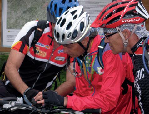
Well equipped with water, tools and supplies, we set off crossing the town of Bocairent through the streets of Maestro Serrano and Martí Calabuig, to José Puig street to leave the town by the Paseo de la Derrota. Almost immediately, after the last houses a detour will indicate the way to go that in prolonged ascent that will take us to the top of the mountains. As we have noticed in the presentation of the stage, this route is the longest and most accumulated unevenness of the entire Vall d’Albaida crossing. It is also the most solitary since we only pass through a single population, Fontanars del Alforins, in which we can recover strength, provide water and even eat there. That is why we must start calmly and climb with good cadence and quiet pedaling. Although this part of the mountains, was also ravaged by the fire of 1994, we will immediately realize the landscape value of it and the possibilities that it has of recovery especially if the man respects his natural growth and prevents new fires. The path we follow, even though it has a certain slope, does not become particularly hard or difficult since it is in good condition. This non-aggressive asphalt allows the roads not to deteriorate due to rains and to stay longer making it easier for owners to access their lands in the mountains. Two farms with their respective houses are visible from the road, the first the house of defeat and the second, the farmhouse of Bonavista, which is usually inhabited and is the one that gives its name to the road.
37
Fontanars dels Alforins.
We go at all times following the ravine of the Border (Frontera) that is on our left and that also gives name to this term. Near it runs the GR-7, the long-haul path that crosses the Valencian Community from south to north and through which we will coincide later a good stretch. A little final push and we reach the Alt de Ponce. This crossing already in the upper part and by which we will continue towards the west, is important not only because we already change orientation, but because we see that here, the vegetation is more varied and abundant. We are in the Pla de Ponce, and a few meters from the junction we will see the house that gives name to the place. It is worth it to come to observe all the architectural ensemble that stands out, as usual in the farmhouses and scattered mountain houses, for its austerity. The main building consists of a ground floor and a top with gabled roof and roofed with tiles. There is also a well with cistern next to the stockyards and another well a little further away. We see next to the house two large holm oaks and a small redoubt of pine trees that were saved from the fire. As soon as we stop in the shade of the trees and observe the environment, we can come to understand the hardness of life in the rural world, and even more so, in the scattered farmhouses.
38 Stage 2_The mountains that surround the valley
The small terraces that are still worked maintain the land and sow cereals for hunting, makes us think how one or several families could live there. Winters, once much colder and wetter, with heavy snowfall, or even warm summers made survival dependent on the vagaries of heaven. The work, not only of cereal mowing, but of the construction of stone margins, maintaining agricultural dependencies, feeding animals and livestock, also very common in this mountain range, was of extreme hardness. Therefore, as the economic and industrial conditions of the nearby populations improved, the farmers and villagers left their rural centres and migrated in search of better living conditions. Today, that we see nature from a more urban or romantic point of view, it is difficult for us to imagine the day-to-day life of these isolated people in the middle of nowhere. The farmhouse of Ponce, well known in Ontinyent, is today a meeting point for hunters, where they have lunch and prepare the day. A traditional activity deeply rooted in the Vall d’Albaida. We continue in a west direction to drive along the upper part of the mountains, on an aerial crossing and of great beauty. Nearby you will find the Alt del Molló, Alt de Coca and also, somewhat lower, the Font del Ballester. This fountain is the highest of the municipality of Ontinyent and supports summers well as it is regulated with a small tap inserted into the rock itself. The GR-7 passes next to it and we can replenish water if we need it. It is also a point of confluence with the Enginyers trail, a horseshoe path built by forest engineers to access the mountains and carry out reforestation work. The place is a delicious place, not only for the formidable views over the farthest mountains such as the
El Portitxol.

Caroig, the Monduver or the Pla dels Alforins, but because of the vegetation that surrounds us composed of ash, walnut or holm oaks: the latter are remains of the primitive Carrascar of Ponce, a forest that covered all this slope of the Umbría.
39
Pla dels Alforins.

Our path continues through the high of the mountains, passing through places such as the Alt del Corral or the collado de Fenassosa until we reach a major crossing before the descent that we will follow on the left in the direction of the Replana. This indicated crossing would take us to the Font and the Gamellons Site. It would also take us to the hermitage of Morera and the road from Ontinyent to Fontanars, but we will discard this detour, to reach by the Replana pathway, to a wide forest track that runs through a firewall, to the highest point of our entire journey (973 m ). We will pass next to a goat stockyard, whose consequences on the vegetation and the environment are sadly visible, with the idea of reaching the road that comes from Beneixama, and that we will continue in strong and relaxing descent towards Fontanars dels Alforins.
40 Stage 2_The mountains that surround the valley
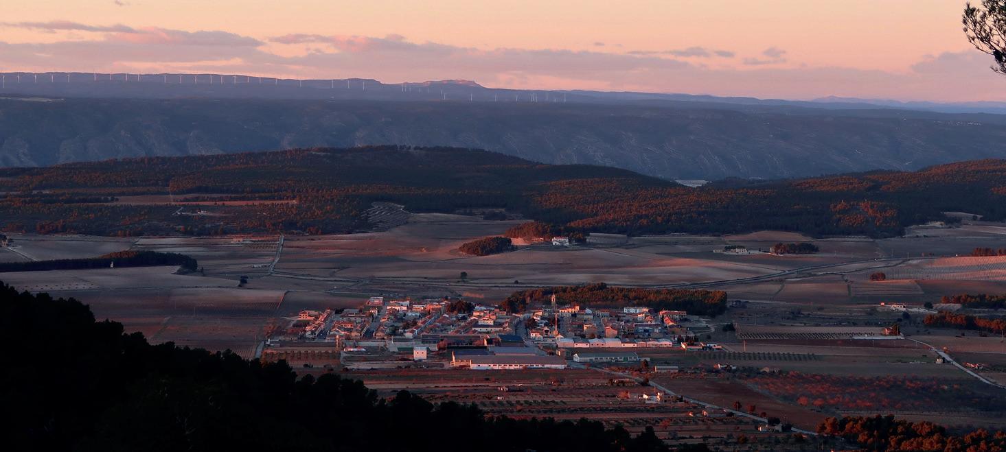
Fontanars is a small village, away from the Vall from a geomorphological point of view, as it is located on the plateau and is part of the plateau, but it is very close historically and culturally to Ontinyent and the Vall d’Albaida. It was the monarch Jaume I himself who transmitted the ownership of the Alforins to the Ontinyent’s Vila. Originally occupied by the Romans, evidence demonstrating the abundant archaeological remains. The Muslims were, however, the ones who gave it the name: Al forí, which means in Arabic, barn. Strategically located, not only as a place of passage, but as a cereal supply area, Fontanars emancipated from Ontinyent in August 1927 to continue as an independent municipality. Eminently agricultural, Fontanars stands out today for the cultivation and production of wines, with a good number of cellars, and also for oil, almond and fruit trees. This sets up a peculiar landscape, chromatic, of extraordinary beauty wrapped in forest and dotted with stately homes. Crossed the town a part of the Pla (in Fontanars we can find some quality restaurant to recover strength) and after a short stretch of road in descent towards Ontinyent, we will go up the Grossa mountain range by a zigzagging track that goes up steep slope. Following this spectacular path, it will take us to the highest hills of this lineup. It is our second and definitive climb, since we will soon reach Pla de la Balarma and the path that continues along the ridge of the mountains will take us to the Balarma House, already very close to the port. It’s five kilometers of ascent to the highest point. The House of the Balarma is today a set of ruins of what was an ancient farmhouse. Nearby is the Ontinyent-Aielo road that we will continue towards this last city. A short stretch of asphalt from the top of the Port, the detour to Aielo and we only have the last part of the stage that is the descent by the barranc del Joncar. Here, as always, we have to take extreme precautions, especially for two reasons: the first because we are already at the end of the day and the light, unless it is summer, is no longer the same. We may even get dark during the descent and so, if we have doubts, we always have the option of the road. And the second reason is that the accumulated tiredness, even if we are fit, makes us no longer have the same reflections. Also of course, because in every descent we have to be cautious. We will reach Aielo de Malferit by the oldest part of the town. We will go through the mosaic of cultivated plots and we can observe, if we still have light, the contrast of traditional dry crops, small orchards, and the white lands of the valley.
Download the route:
https://es.wikiloc.com/wikiloc/view.do?id=21208385
41

Stage 2: The mountains that surround the valley
Data sheet
55,99 km No
988 m 973 m
1.355 m 254 m
Orographic profile
973 m
254 m Roads and tracks: 44,54 km Highway: 11,7 km Physical difficulty: Difficult Technical difficulty: Moderate Starting point: Ontinyent End point: Bocairent
42 Stage 2_The mountains that surround the valley. To make a stop
The wineries of Fontanars dels Alforins
Alforins lands
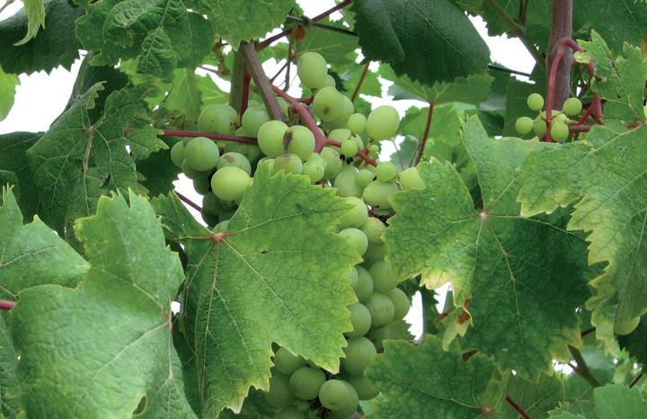
Fontanars dels Alforins has a dozen traditional wineries, some of which date back to the eighteenth century, which can be visited and know the whole winemaking process and its tasting. They are wineries of a marked family character where excellent quality wines are made with varieties such as Monastrell, Garnatxa, Tempranillo or the native Verdil. The environment is known as “Terres dels Alforins” and is marked by history, tradition, soil and temperature.
fontanarsdelsalforins.es
Aj. Fontanars dels Alforins C/ Alfons XIII, 12 46635 Fontanars dels Alforins cultura@fontanarsdelsalforins.es
Casa Julio

The liquor factory
A gastronomic reference
The Restaurant Casa Julio, in Fontanars, is a gastronomic reference not only of the Alforins, but of the whole cobrand of the Vall d’Albaida. Opened in the 1940s as a traveller’s anchor, the food house was evoked with the ideas of each generation until it received a Michelin star in 2009, which he resigned four years later. Based on traditional cuisine, Julio Biosca, the fourth generation of the restaurant, brought everything learned in the Basque Country and began a new vision maintaining the cuisine of a lifetime.
Restaurante Casa Julio
Av. Conde Salvatierra de Álava, 9 46635 Fontanars dels Alforins T 962 22 22 38
Official provider of the Royal Household
Known as Botellería, the Great Liquor and Aniseeds Factory, it began producing its products in 1880. She won numerous international awards and competitions, she was declared official supplier of the Royal Household by the same queen regent Maria Cristina. At the end of the nineteenth century the company passed into the hands of Joaquín Juán Mompó, nicknamed of the Marquis of Malferit who opened a new factory next to the palace whose installations preserved as before, constitute a heritage jewel and a true museum of industrial archaeology.
turismo.aielodemalferit.es
Plaça Palau, 1 46812 Aielo de Malferit T 962 36 30 10 touristinfo_aielo@gva.es
43
Malferit’s castle-palace

Nino Bravo museum Gasaqui
Headquarters of the current Town Hall
The malferit castle-palace was built in the 15th century to serve as a residential palace and military fortress, so it is assumed that the primitive building was endowed with defensive towers. Jaime de Malferit, lord of Aielo and Cairent, founded the new town and built the Gothic palace personally taking care of the decoration. Deeply renovated in the eighteenth and nineteenth centuries, the building is organized around a central courtyard formed by the three wings that make up the whole palace.
The voice
In Aielo de Malferit we cannot fail to visit the museum of Nino Bravo, an endearing and emotional exhibition of which was one of the best voices of all time. It is a collection of personal items, with a lot of audiovisual, photographic, sound and written material with objects donated by family, friends and fans. The museum allows us to know the artistic trajectory of the singer to the climax of his professional life. Born in Aielo in 1944, he died at the age of 28.
In Aielo de Malferit
The Gasaqui Complex is a hotel establishment, traditional and well known in the region with all kinds of services, including a heated swimming pool and gym. It is located between the municipal terms of Aielo de Malferit and l’Ollería in a strategic point and ideal to finish the second stage, just at the beginning of the old road between both towns, known in Aielo as the Camí de la Ermita, as it passes through the hermitage of Sant Joan. The hotel has spacious and comfortable rooms.
turismo.aielodemalferit.es
Passeig de L’Eixample, s/n 46812 Aielo de Malferit T 962 36 07 20 touristinfo_aielo@gva.es
museoninobravo.com
Passeig de L’Eixample, s/n 46812 Aielo de Malferit T 654 39 42 96 museoninobravo@outlook.com
complejogasaqui.com
Autovía del Mediterráneo CV 40 PK 14 46812 Aielo de Malferit T 962 36 06 08 info@complejogasaqui.com