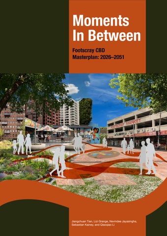
Moments In Between Footscray CBD Masterplan: 2026–2051
Jiangchuan Tian, Lizi Grange, Nevindee Jayasingha, Sebastian Kainey, and Qiaoqiao Li Footscray CBD Masterplan: 2026–2051
1
Colophon
Moments In Between: Footscray CBD Masterplan: 2026–2051 Issue Date: 19 June 2026 Status: Final report
Prepared by: Jiangchuan Tian; Lizi Grange; Nevindee Jayasingha; Sebastian Kainey; Qiaoqiao Li Document compiled by Sebastian Kainey. Field survey shop vacancy analysis by Lizi Grange, Sebastian Kainey and Jiangchuan Tian. Cover image by Sebastian Kainey and Nevindee Jayasingha. Cover design by Nevindee Jayasingha. Linking Moments graphics by Nevindee Jayasingha. In conjunction with: Maribyrnong City Council PO Box 58, Footscray, VIC 3011 www.maribyrnong.vic.gov.au
Footscray Station. Source: Photo by Sebastian Kainey.
Executive summary Footscray today
Key targets (2051)
Footscray CBD is one of Melbourne’s most culturally rich and diverse centres. It’s home to the vibrant multicultural Footscray market, active plazas, street arts and a growing creative economy whose diversity and energy give Footscray its character. Its population is projected to double by 2051, creating immense growth pressure within the centre.
To measure the success of this framework, the masterplan establishes strict actionable baselines to achieve by 2051:
Yet the centre’s potential is currently held back by a fragmented public realm. Underutilised land, inactive street frontages, and inconsistent cycling and pedestrian infrastructure makes movement through the centre difficult. Extensive impermeable surfaces dominate the ground plane, contributing to an urban heat island effect, while the CBD’s canopy cover stands at just 8% and the retail vacancy rate sits at 18%. Cultural and First Nations heritage remains underrepresented in the public realm.
Our vision Rather than reinventing Footscray, this masterplan focuses on addressing these challenges by bringing the centre’s existing moments to the forefront and stitching these isolated fragments together to transform Footscray CBD into a connected, thriving civic place.
Footscray is a lively, activated civic centre where lush, shaded streets, walkable paths, and vibrant public spaces form a network of everyday life designed for the families and creatives who give Footscray its distinct character. Its rich multicultural identity and vibrant local economy is supported by affordable housing and thoughtfully designed spaces that allow all people to thrive.
• Ecology: Achieve a 30% canopy cover across the CBD. • Economy: Reduce retail shop vacancy to a maximum of 6%. • Equity: Mandate a minimum of 6% affordable housing in all new private builds, and 25% affordable housing on Council-owned sites.
Our plan: Five core principles The masterplan interventions are driven by five overlapping and mutually reinforcing principles:
Invigorating the district
Design for street-level life
An everyday journey
Grey to green
Community care and creativity
Together, the five principles overlap and reinforce one another, stitching fragmented moments into a connected and thriving civic space. This establishes a coherent spatial logic that shapes how people move, gather, and experience the public realm
Catalyst projects To physically anchor these principles, the framework outlines three major interventions • Catalyst Project 1: Albert Street Precinct - Delivers a vibrant mixed-use neighborhood by integrating diverse housing, community spaces, and critical green infrastructure. • Catalyst Project 2: Paisley Street Housing - Delivering a ground-lease cooperative housing model focused on retaining families, students, and creatives. • Catalyst Project 3: Raleigh Street Carpark Hub - Consolidating CBD parking into a multi-deck hub to reallocate on-street spaces for active transport and greening.
FROM SERIES OF MOMENTS
4
COHESIVELY DRIVEN CENTRE
Moments In Between
Footscray CBD Masterplan: 2026–2051
5
Acknowledgement of Country We acknowledge the Wurundjeri Woi Wurrung and Bunurong peoples of the Kulin Nation as the Traditional Owners of these lands. We recognise and respect the contributions of all First Nations people who live, work, and play within the City of Maribyrnong.
Brook Andrew, Welcome to Footscray, 2024 at 88 Hopkins Street, Footscray. Source: Photo by Nicole Reed
6
Moments In Between
We pay our respects to their ancestors and Elders, past and present, and honour their continued connection to Country and its rich cultural heritage.
We celebrate their unique cultural and spiritual relationships with the land, sky, water, and sea, and recognise Aboriginal and Torres Strait Islander peoples’ extraordinary history as artists, storytellers, and custodians of the oldest continuous living culture in the world.
Footscray CBD Masterplan: 2026–2051
7
Contents 3 Colophon [SK] Executive summary [NJ] 4 7 Acknowledgement of Country [JT]
Introduction 12 14 16
Purpose of document [NJ] The brief [SK] Metropolitan and regional context [LG]
Place Context 20 22 24 27 28 30 32 34
Footscray Activity Centre context [LG] Footscray CBD context [LG] Strategic policy context [LG] Statutory planning context Indigenous context [JT] Post contact history [JT] Demographics [QL] Cultural analysis [JT]
Making it Happen 78 80 82 84 88
Catalyst Projects Masterplan [SK] Catalyst Project: Albert Street [NJ] Catalyst Project: Paisley Street [JT] Catalyst Project: Raleigh Street [LG] Reflections [LG]
Appendix 92 93 94 96 97
Appendix 1: 3-30-300 [LG] Appendix 2: Dress Rehearsal [LG] Appendix 3: The Woonerf Model [SK] Bibliography [LG] AI use statement [NJ]
Vision for Footscray 42
Strategies overview [NJ]
Strategies and Actions 46 48 50 52 56 64 68 72
Key moments in Footscray [NJ] Key issues and challenges [NJ] Strategy map overview [SK] Invigorating the district [QL] Design for street-level life [SK] An everyday journey Grey to Green [NJ] Community care and creativity [JT]
Key: [initials] indicate the team member responsible for section. [JT] Jiangchuan Tian; [LG] Lizi Grange; [NJ] Nevindee Jayasingha; [SK] Sebastian Kainey; [QL] Qiaoqiao Li
Leeds Street, Footscray. Source: Photo by Sebastian Kainey.
SECTION ONE
Introduction
10
Moments In Between
Footscray CBD Masterplan: 2026–2051
11
Purpose of document A strategic framework for the future of the Footscray CBD
The primary purpose of this masterplan is to establish a long-term vision and build urban strategies to promote a more liveable, resilient, and inclusive Footscray. While the framework recognises the broader metropolitan role of the Footscray Activity Centre, the project focuses on the Footscray CBD core. By targeting our interventions within this specific site, the document aims to address spatial fragmentation within the CBD and establish a strong design standard for the wider area. This masterplan seeks to define a clear vision for the 2051 Footscray CBD by establishing a highly connected civic hub that stitches the moments in between, ensuring that new infrastructure, housing, and public spaces are thoughtfully designed to support the families, students, and creatives who underpin Footscray’s unique multicultural identity. To deliver this vision, the masterplan develops a series of key spatial and policy strategies designed to address the CBD’s current physical and systemic challenges. These strategies focus on reactivating underutilised land, implementing builtform controls to foster street-level vibrancy, prioritizing active mobility, embedding green infrastructure into the public realm and celebrating local culture through community-led creativity. Together, the purpose of this document is to integrate these strategies into an actionable, 25-year roadmap that guides the City of Maribyrnong, developers, and community stakeholders in cultivating a thriving, cohesive centre.
Byron Plaza, Footscray. Source: Photo by Sebastian Kainey.
12
Moments In Between
Footscray CBD Masterplan: 2026–2051
13
The brief What are our targets, who is our client and key stakeholders
6%
18%
retail shop vacancy by 2051
current retail shop vacancy
6% affordable housing in new builds
nil
affordable housing requirement
by 2051 (50% for Council sites)
8%
30%
current canopy cover
canopy cover across the CBD by 2051
Client City of Maribyrnong
Key Stakeholders • Community members and residents: creatives, students and families • Local businesses and traders • Development industry and landowners • Aboriginal and Torres Strait Islander communities • State Government Departments • Creative Victoria • Affordable housing providers
Key Stakeholders within Council • Planning and Environment Directorate • Infrastructure Services Directorate • Community Life Directorate
Guiding our project are the following three targets; through our strategies we will see retail shop vacancy move from 18% to 6%, affordable housing in new builds be at 6%, and see canopy cover increase to 30%. Delivering these ambitious targets requires alignment across a broad stakeholder group, from residents to state government and affordable housing providers. This means planning solutions must work across many competing interests. Abbey Rich and Olana Janfa, This is Footscray, 2023 at 21 Victoria St Footscray. Source: Photo by Sebastian Kainey
14
Moments In Between
Footscray CBD Masterplan: 2026–2051
15
Metropolitan and regional context Strategic locations within Melbourne’s Activity Centres
There are 60 centres designated in the Activity Centres Program in the Greater Melbourne region. The majority of these are in the southeastern suburbs, with only 6 in the west.
MARIBYRNONG
Footscray sits at a critical junction between Melbourne’s outer west and the CBD, served by three metropolitan and three regional train lines. While Footscray falls outside the Activity Centres Program, it has been recognised as a designated precinct.
Maribyrnong Activity Centres Footscray is strategically located in close proximity to the Middle Footscray, West Footscray, and Tottenham activity centres, forming a local planned high density area in the inner west. BRAYBROOK Planned future connection to the airport through Sunshine Train Station
FOOTSCRAY
TOTTENHAM
M Fo idd ot le sc ra y
WEST FOOTSCRAY
W Fo es ot t sc ra
To t
y
te
nh
am
Through its connection to the Sunshine Precinct, Footscray will gain access to major future transport infrastructure. This includes the planned Suburban Rail Loop, and the Melbourne Airport Rail Link, further reinforcing its role as a key regional activity and transport hub.
MAIDSTONE
SEDDON KINGSVILLE
YARRAVILLE
Footscray Activity Centre Activity Centres Program locations Property parcel Waterways Crown land
Activity centre map of Melbourne metro area, with both the current trainlines, and future planned Suburban Rail Loop. Source: https://www.vic.gov.au/train-and-tram-zone-activity-centres
16
Moments In Between
Train stations Railway line Tram line
Map of Maribyrnong local government area showing suburb outlines, the three activity centres from the activity centres program, and the outline of the Footscray Activity Centre. Source: Map compiled by Lizi Grange in QGIS from open source data.
Footscray CBD Masterplan: 2026–2051
17
SECTION TWO
Place Context
18
Moments In Between
Footscray CBD Masterplan: 2026–2051
19
Footscray Activity Centre context Understanding the local area
The Footscray Activity Centre (FAC) is within the suburbs of Footscray and Seddon in the City of Maribyrnong local government area. The area extends from major health and education institutions to the north, through the commercial centre, to the Maribyrnong River to the east. To the north, the new Footscray Hospital and Victoria University’s main campus together establish a growing health and knowledge precinct, generating significant daily movement and supporting long-term population and employment growth across the centre. The Maribyrnong River forms a distinctive eastern edge to the activity centre, with riverside parklands offering open space and recreation for residents and visitors. An extensive cycling and walking network runs along the riverfront, connecting the FAC to the broader metropolitan trail network. Two landmark transport projects, the Westgate Tunnel and the Dixon Veloway, both opened in December 2025, are reshaping how the activity centre connects to Melbourne. The Westgate Tunnel project removes thousands of trucks from inner-west streets, significantly reducing heavy vehicle traffic through Footscray’s local road network and improving amenity across the activity centre. The Dixon Veloway is a 2.5 km elevated cycling expressway running from Shepherd Bridge in Footscray to the city side of Moonee Ponds Creek in Docklands, carrying riders above truck routes, port traffic, and some of the inner west’s busiest intersections.
Flemington Victoria University
Hospital
Project CBD boundary
At the centre of all this sits the Footscray CBD which remains the commercial, civic, and cultural hub of the wider activity centre detailed on the next spread.
Footscray
Library
Nicholson st mall Maddern Square
Joseph’s road precinct
Footscray market Footscray train station
ibyr Mar
City of Maribyrnong offices
non
g Ri
ver
Middle Footscray train station
Footscray Activity Centre boundary
West Melbourne
Seddon Aerial map of centreing on the Footscray CBD, with the surrounding suburbs outlined. Source: Map compiled by Lizi in QGIS from nearmap aerial map, and open source ABS boundary files
20
Moments In Between
Footscray CBD Masterplan: 2026–2051
21
Footscray CBD context Understanding the local area
The Footscray CBD masterplan area is defined by a concentrated centre that serves as the commercial and civic centre of Melbourne’s inner west. Footscray Train Station anchors the precinct, functioning as the primary gateway between the outer western suburbs and the Melbourne CBD. Immediately in front of the station, Footscray Market acts as a cornerstone of daily life, drawing both local shoppers and visitors from across the city to its diverse fresh produce and food. Hospital precinct RO
D
The broader CBD retail network radiates outward along Paisley, Barkly, Nicholson, and Leeds Streets, supporting a mix of independent traders, multicultural restaurants, and specialty retail that gives Footscray its distinct character. Within this area, several key destinations contribute to the precinct’s civic and cultural identity:
O P
RD
ST
NG
LO
EE
NICHOLSON ST
G
PAISLEY ST
• The City of Maribyrnong Offices and the Victoria University southern campus anchor the area as a civic and education precinct, drawing workers and students into the CBD throughout the day.
ALBERT ST
Library
• Footscray Library which is poised to undergo a significant transformation becoming the new home of Creative West, a mixed space of a library, performance venue and open space.
FRENCH ST
BARKLY ST
• Nicholson Street Mall, a car-free pedestrian strip in the centre of the precinct.
HOPKINS ST
LEEDS ST
• Maddern Square offers a flexible mixed-use environment centred on a basketball court, capable of activating for community events such as the Football World Cup watching parties.
Footscray market Maddern Square Nicholson Footscray st mall ST NG I train station V IR
PICKETT ST
BUNB U
RY ST
Together, these elements establish Footscray CBD as a layered, multi-functional centre, one that balances everyday convenience, community gathering, and an emerging creative and civic space.
H ST
City of Maribyrnong offices
Footscray Activity Centre boundary 0
100
200m
L ST EHAL WHIT
ST PER
West Footscray
COW
HYDE
ST
RALEIG
River precinct
Victoria University
Aerial map of centreing on the Footscray CBD. Source: Map compiled by Lizi in QGIS from nearmap aerial map.
22
Moments In Between
Footscray CBD Masterplan: 2026–2051
23
Strategic policy context State-level documents
City of Maribyrnong documents
The 2025 “Plan for Victoria” is an overarching vision for the State of Victoria for 2050. The five pillars of the plan include: 1. Housing for all Victorians
A plan by Victorians, for Victorians
2. Accessible jobs and services 3. Great places, suburbs and towns 4. Sustainable environments 5. Self-determination and caring for Country Mildura
The City of Maribyrnong strategic documents are aligned with the state level documents, but provide more detail specified to the local government area. There is only one major difference between the state level “Plan for Victoria” and the local government documents which involves housing strategy in the Footscray Acticity centre. In the state vision it says that the activity centres should have high density housing, the City of Maribyrnong envisions that the centre of the Footscray CBD remains low to medium density preserving the sunny streets and historic core. While many of the documents are comprehensive, some of them discussed later require an update including; Footscray Structure Plan, Maribyrnong Medium Density Guide and Maribyrnong City Design Manual.
Swan Hill
Wodonga Echuca
Wangaratta
Bendigo
Horsham
Shepparton
Ararat
Ballarat
MELBOURNE Bairnsdale
Hamilton
Geelong Latrobe City
Warrnambool
Sale
Colac
Portland
Wonthaggi
PLAN FOR VICTORIA / 1
Front page of Plan for Victoria Source: Plan for Victoria
The Statewide Treaty document outlines the agreement of Australia’s first treaty between a government and Aboriginal or Torres Strait Islanders. The Treaty establishes Gellung Warl, which is a permanent Aboriginal representative body, to advise government on matters affecting Aboriginal people. It commits both parties to a renewed relationship built on truth, respect, and self-determination. This Treaty is a starting off point for further treaty negotiations at a more local level.
S TAT E W I D E T R E AT Y FIRST PEOPLES' ASSEMBLY OF VICTORIA LTD AND THE STATE OF VICTORIA
Front page of Statewide Treaty Source: Statewide Treaty
24
Moments In Between
[top L] Front page of Footscray Structure Plan. Source: City of Maribyrnong [middle L-R] Front pages of; Urban Forest 2024 Update, Maribyrnong Housing Strategy 2018, Maribyrnong Medium Density Design Guide. Source: City of Maribyrnong [bottom L-R] Front pages of; Walking Strategy 2023-33, Bicycle Strategy 2020-2030, Maribyrnong City Design Manual. Source: City of Maribyrnong
Footscray CBD Masterplan: 2026–2051
25
Statutory planning context The regulatory framework for Footscray CBD
Zones The statutory zones pictured below display the current planning controls in the Footscray CBD. Inside the Footscray Activity Centre, the majority is covered by the Activity centre zone. On the edges, but still within the CBD area there are many areas of residential and mixed-use zoning.
Overlays The overlay map seen below displays the extra planning controls over a site to address specific issues or constraints beyond what zoning allows. In the CBD there are areas of heritage overlays through the centre, an environment audit overlay on the land around the train station, and a special building overlay in the southeast indicating areas of stormwater or overland flooding.
The recently renovated City of Maribyrnong offices in Footscray. Source: The City of Maribyrnong (Maribyrnong City Council Civic Precinct and Community Hub Redevelopment).
26
Moments In Between
[left] Map of the Footscray CBD displaying the statutory planning zones. [right] Map of the Footscray CBD displaying relevant overlay layers. Source: Maps compiled by Lizi Grange in QGIS from open source Victorian state data (www.data.vic.gov.au)
Footscray CBD Masterplan: 2026–2051
27
Indigenous context Indigenous history of Footscray
For 40,000+ years before present First Nations people have cared for this Country thousands of years.
1803 Charles Grimes surveyed the river, marking early colonial contact.
1839–1840 A river punt established access, shaping early settlement growth.
1841 Lynch’s Bridge on the Maribyrnong River. The riverbank remained a key site of Aboriginal activity.
1930s William Cooper led Aboriginal rights activism from Footscray.
Today Ongoing efforts recognise and protect Indigenous heritage.
[left] Footscray, Victoria Australia Vintage Map #19 (1896). Source: vintagemaps.com.au. [middle] Footscray, north-west view from Hopkins Street, 1917. Source: photo by John Young. [right] Footscray - Brook Andrew Mural. Source: image by Nicole Reed. Footscray CBD. Source: Photo by Sebastian Kainey
28
Moments In Between
Footscray CBD Masterplan: 2026–2051
29
Post contact history Tracing Footscray’s history through industry, community, and culture
Pre-1839
1933-1941
The Maribyrnong River (now the eastern boundary of Footscray) has been an important source of water for the Kulin Nation indigenous people for tens of thousands of years, providing them with fish, eels, and fresh water.
In 1933, William Cooper, a 72-year-old Yorta Yorta activist, moved to Footscray after becoming ineligible for the old-age pension while living on an Aboriginal reserve. He lived at several addresses in Melbourne’s western suburbs, including 120 Ballarat Road, 27 Federal Street, and 73 Southampton Street. From Footscray, Cooper organised political campaigns and helped build a nationwide movement for Indigenous rights through the Australian Aborigines’ League.
Image by William Barak. Source: Figures in possum skin cloaks. 1898
1839-1859
Aboriginal rights activists William Cooper and John Patten during the 1938 Day of Mourning. Source: Man Magazine March 1938.
In 1839, James Palmer established a ferry service near present-day Bunbury Street, connecting the main thoroughfares of Williamstown and Geelong. In 1849, the West Bank town was officially surveyed, and early hotels began to appear. In 1859, Footscray became a municipality, marking the beginning of its urban organization.
1936 Designed by British architect Joseph Plottel, the new town hall was completed in 1936, replacing the old building from 1875. In the American Romanesque Revival style, it is the only municipal building of this style in Victoria.
Maribyrnong River at Footscray, c. 1875. Source: State Library of New South Wales Image 63642.
1859 On January 17, 1859, the Williamstown railway line opened, and Footscray station officially began operation, becoming an intermediate station between Melbourne and Williamstown Port. That same year, the line branched off here towards Bendigo, making Footscray a key hub in the Victorian railway network. The existing station building, constructed in 1900, is now listed on the Victorian Heritage Register.
Footscray town hall hall napier street footscray front view 1996. Source: Victorian Heritage Database.
Footscray Railway Station, Footscray, Victoria, circa 1900. Source: Museums Victoria.
1975-2010s
1860s-1891 From the 1860s onwards, Footscray became the industrial engine of the colony, with tanneries, slaughterhouses, and chemical plants being built along the Maribyrnong River. On January 20, 1891, Footscray was officially upgraded to a city, boasting the second-highest tax revenue in Victoria after Melbourne, and was once known as “the Birmingham of Australia.” 30
Aerial View of Footscray, Victoria, 20 Jan 1959. Source: Museums Victoria.
Moments In Between
Footscray Market. Source: Graham Denholm, Time Out Melbourne, 3 September 2019.
Following the end of the Vietnam War in 1975, a large influx of Vietnamese refugees settled in Footscray, creating a vibrant Vietnamese commercial district in what is now the heart of the CBD, around Hopkins Street and Nicholson Street. Ethiopian, Somali, and other African communities subsequently joined in. The Footscray Community Arts Centre, established in 1974, became a hub for creative activities.
Footscray CBD Masterplan: 2026–2051
31
Demographics An overview of who lives in Footscray and how it is evolving
Demographic data for the Footscray research area indicate rapid population growth, cultural diversity, increasing urbanization, high public transportation usage, a large proportion of high-density housing, and growing pressure on public spaces and land availability.
Footscray is steadily growing, with its population projected to reach 26,076 by 2026 and 41,943 by 2051, placing increasing pressure on housing, public spaces, and infrastructure. The area's proximity to Melbourne's city center helps reduce car dependency while promoting greater use of public transport and walking.
Footscray's housing is becoming increasingly urbanized, with high-density housing accounting for 44.5% of all dwellings, detached homes making up 27.2%, and mediumdensity housing comprising 27.3%. At the same time, environmental carrying capacity is limited, with forest cover below the Maribyrnong district average (13% compared to 17%), and per capita open space is also lower—only 41 square meters per person, compared to 79 square meters in the Maribyrnong district.
Travel behavior further reflects Footscray's innercity character. Compared to more suburban areas, the study region shows a greater preference for public transport and lower reliance on driving. Remote working is also relatively common. These trends indicate the need to develop walkable communities, enhance highquality public spaces, and carefully plan population growth so that housing and infrastructure can develop in tandem.
Footscray is also known for its cultural diversity. A significant portion of the local population speaks languages other than English at home, and communities from Vietnam, India, China, the Philippines, Malaysia, and Bangladesh contribute to the area's multicultural character. This diversity is a valuable social resource that should be supported through inclusive services, community facilities, and accessible public spaces. Brook Andrew, Welcome to Footscray, 2024 at 88 Hopkins Street, Footscray. Source: Photo by Nicole Reed
32
Moments In Between
Footscray CBD Masterplan: 2026–2051
33
Cultural analysis Community voices from Footscray
Image: SalamFest Footscray. Source: Photo by Phil Gao.
Community Voices. Source: https://www.yourcityyourvoice.com.au/cw. 34 Moments In Between
Footscray CBD Masterplan: 2026–2051
35
Cultural analysis Footscray: A microstory of cultural crossroads
First Nations culture and Country
A living multicultural landscape
Footscray sits on Country connected to the Wurundjeri Woi Wurrung and Bunurong peoples of the Kulin Nation. Their connection to the Maribyrnong River region spans over 40,000 years and continues today through culture, knowledge, stories, and care for Country. This living connection forms an important foundation of Footscray’s cultural identity.
Today, this layered history is visible in Footscray’s urban fabric — its food economy, religious institutions, and street life — reflecting a community where First Nations culture and country, immigrant history, and contemporary urban culture continuously intersect.
A history of immigration Following European contact, Footscray became a significant immigrant settlement. Post-WWII waves brought European arrivals, followed by communities from Southeast Asia, the Middle East, and Africa, each contributing to the suburb’s evolving character.
Footscray Market. Source: Photo by Sebastian Kainey
A microstory of cultural. Source: photo by Jiangchuan Tian.
36
Moments In Between
Footscray CBD Masterplan: 2026–2051
37
SECTION THREE
Vision for Footscray
38
Moments In Between
Footscray CBD Masterplan: 2026–2051
39
Footscray is a lively, activated civic centre where lush, shaded streets, walkable paths, and vibrant public spaces form a network of everyday life designed for the families and creatives who give Footscray its distinct character. Its rich multicultural identity and vibrant local economy is supported by affordable housing and thoughtfully designed spaces that allow all people to thrive.
40
Moments In Between
Footscray CBD Masterplan: 2026–2051
41
Strategies overview Five interlocking principles that the framework is built around
Each of the five core principles overlaps and reinforces the others, linking isolated moments to transform Footscray from a fragmented centre into a connected, thriving civic place
42
Invigorating the district
Design for street-level life
An everyday journey
Grey to green
Community care and creativity
Reactivate underutilised sites through cooperative housing, affordable retail and mixeduse development to support local jobs, creativity and inclusive growth.
Foster human-centred design and fine-grain CBD character through built form controls. Initiate design excellence programs to promote competition and make Footscray a destination for all to enjoy.
Prioritise people first mobility, supported by seamlessly integrated public transport that connects people easily to where they need to go.
Prioritise tree canopy, native planting and water sensitive urban design to build a cooler, greener, and more biodiverse public realm. Landscape is treated as infrastructure, not an afterthought.
Promote an inclusive and thriving centre where culture and creativity is shared, celebrated and made easily accessible. Our community programs and activities bring people together.
Moments In Between
Footscray CBD Masterplan: 2026–2051
43
SECTION FOUR
Strategies and Actions
44
Moments In Between
Footscray CBD Masterplan: 2026–2051
45
Key moments in Footscray Celebrating Footscray’s cultural and civic points
Footscray CBD has a collection of strong, memorable moments that give the centre its character. The market thrives with its vibrant multicultural energy. Maddern square acts as a small gathering space and Byron Plaza offers a familiar everyday openness. The emerging canopy along Nicholson Street signals the green potential and provides pockets of shade, while the active cycling infrastructure on French Street demonstrates alternative sustainable ways of movement. The First Nations presence of the Wominjeka Tarnuk-Yooroom welcome bowl grounds the centre. These demonstrate that Footscray CBD already has the skeleton of a thriving civic heart, each of these moments reflect the character, diversity and the community that makes Footscray what it is and represents an asset worth protecting and building upon.
46
Moments In Between
Footscray Market Photography by Sebastian Kainey
Byron Plaza Photography by Sebastian Kainey
Maddern Square Photography by Nevindee Jayasingha
French street bicycle lane Photography by Nevindee Jayasingha
Nicholson Street Canopy cover Photography by Nevindee Jayasingha
Wominjeka Tarnuk-Yooroom ‘welcome bowl’ By Vicki Couzens, Maree Clark and Jeph Neale Photography by Jiangchuan Tian
Footscray CBD Masterplan: 2026–2051
47
Key issues and challenges Addressing spatial fragmentation
Vacant land, Rayan Street, Footscray. Source: Photography by Sebastian Kainey
Albert street, Footscray. Source: Photography by Sebastian Kainey
Impermeable surfaces intensifying urban heat Source: Photography by Sebastian Kainey
48
Footscray market rooftop carpark Source: Photography by Sebastian Kainey
Inactive Albert street, Footscray. Source: Photography by Sebastian Kainey
Hyde Street car parking Source: Photography by Nevindee Jayasingha
Moments In Between
Footscray’s CBD is held back by a series of interconnected challenges that limit its potential as a thriving civic centre. Extensive hard impermeable surfaces such as at-grade car parks and underactive rooftop car parks generating urban heat. Sparse and disjointed tree canopy offering minimal shade and climate resilience along key streets. Limited quality green and open spaces within walking distance make it difficult for the community to access. Movement through the centre is fragmented, cycling infrastructure is inconsistent and narrow pedestrian paths affecting the walkability. Underutilised land and inactive frontages leave parts of the centre feeling disconnected, unsafe, and inactivated. First Nations visibility and recognition within the public realm remains minimal. Addressing these challenges are the foundation for this masterplan. Rather than reinventing Footscray, this masterplan focuses on addressing these challenges by bringing the centre’s existing moments to the forefront and stitching these moments together, strengthening their connections and improving the links between streets, spaces, and experiences to create a more connected and thriving civic heart.
Footscray CBD Masterplan: 2026–2051
49
Strategy map overview Framework for an active, connected and vibrant Footscray CBD
The Strategy map overview brings together the key actions proposed across all five principles of this masterplan. It identifies priority locations for housing, open space, active transport, and community infrastructure. The map provides an overview of a spatially coordinated vision for how Footscray CBD can grow and evolve as a vibrant, inclusive, and well-connected activity centre.
1
Retail trust purchases vacant shops and lease them out at below market rates to support local businesses.
2
Ground lease cooperative housing project for families, students, and creatives, on existing car park sites.
3
Government partnership to re-activate underused sites for employment, housing, and creative production.
4
Recommend reductions to preferred heights and integrate floor area ratio (FAR) controls as well as solar access protections.
5
6
50
Moments In Between
Consolidate City of Maribyrnong’s current design guideline documents and develop a comprehensive ‘Urban Design Guide’ Initiate design excellence competition program for key large sites or significant development proposals.
7
Implement parking strategy to cap the current number of available parking within the CBD, and build a multi deck parking hub based on a council site to enable re-allocation of in street parking for other uses.
8
Expand active transport infrastructure including widening footpaths, increase in bike lanes, and greener streets to encourage walking or wheeling. Mandate requirements for development to include throughblock links in key locations.
9
Create an integrated public transport hub at the train station to facilitate ease of connecting between transport types— train, bus, and tram.
10
Activate vacant and underutilised private land as temporary green open spaces and community gardens through peppercorn leases, planning incentives, grants, and community partnerships.
11
Delivering a Town Park on councilowned land with significant existing canopy as a multi-use community space.
12
Mandate deep soil planting, vertical greening, and public open space contributions on all new developments.
13
Incentivising developers to include community space.
14
Establish a cultural community space on the civic spine.
15
Protect and preserve the local cultural heritage. Through increased visibility, and revitalising heritage spaces e.g. the old theatre.
Footscray CBD Masterplan: 2026–2051
51
Invigorating the district Land use activation strategy map
Action Retail Trust Activation Corridor Retail trust purchases vacant shops and leases them out at below market rates to support local businesses
Paisley Street Cooperative Housing Pilot Ground-lease cooperative housing project for families, students and creatives on existing car park sites.
Street Reactivation Precinct Government partnership to reactivate underused sites for employment, housing and creative production.
52
Moments In Between
Footscray CBD Masterplan: 2026–2051
53
Strategy Implementation RETAIL TRUST ACTIVATION LOCATION PLAN
HOW THE RETAIL TRUST WORKS
Retail Trust Activation Corridor Establish a retail trust in streets with high concentrations of vacant shops to manage or acquire empty storefronts, then lease them at low prices to local small businesses, creative professionals, or community organisations.
Vacant Shop
Trust-managed Affordable Tenancy
Vacant shop
Local retail trust acquires or manages properties
Local traders/ creatives/social enterprises
closed and under-utilised shops create gaps and weaken the street.
The trust purchases or leases properties and manages them in the community interest.
Priority is given to local operators who reflect the community and meet daily needs.
Active street life and reduced vacancy
Priority is given to local operators who reflect the community and meet daily needs.
PHASING
Active Local Business
PHASE 1 (1-2 years) PLAN & PAR TNER • Secure partnerships • Identify priority sites • Establish retail trust • Community engagement
Street Cooperative Housing Pilot Deliver cooperative and affordable housing on existing car park sites using a ground-lease model.
Street Reactivation Precinct •
Redevelop council car park sites
•
Use ground-lease to community housing provides/ cooperatives.
•
54
PHASE 2 (2-5 years) PILOT & ACTIVATE • Pilot cooperative housing • Acquire / manage first shops • Activate vacant sites • Quick-win streetcape upgrades
Provide diverse housing for families,students and creative workers.
Moments In Between
Reactivate underused sites for employment, housing and creative production.
•
Convert vacant/ underused buildings into studios, workshops and small offices.
•
Provide mixed-use development with active ground floors and housing above.
PHASE 3 (5+ years) EXPAND & CONSOLIDATE • Scale up housing projects • Expand retail trust corridor • Deliver more mixed-use sites • Long-term management
LONG-TERM VISION An inclusive, creative and resilient Footscray for everyone
Footscray CBD Masterplan: 2026–2051
55
Design for street-level life Current building heights in Footscray CBD study area
This map illustrates current building heights within the Footscray CBD study area. This is made up of various zones, such as; Activity Centre Zone (ACZ1), Housing Choice and Transport Zone (HCTZ2), and general residential Zone (GRZ1). Understanding the existing built form conditions is essential to informing proposed height recommendations on the subsequent pages for the Footscray CBD. As illustrated, the current building height distribution across the study area is highly fragmented, ranging from 7 metres (2 storeys) in residential areas up to 76 metres (25 storeys) near the train station precinct, with significant variation occurring across relatively short distances. By establishing a clear baseline of what currently exists, this analysis identifies the opportunity to introduce a more logical and place-responsive height framework that reflects the unique characteristics of the study area, supports housing diversity and density in appropriate locations, and provides greater certainty for future development outcomes across the Footscray CBD.
Map of current building heights for Footscray study area. Source: Map compiled in QGIS from open source Victorian state data (www.data.vic.gov.au) by Sebastian Kainey.
56
Moments In Between
Footscray CBD Masterplan: 2026–2051
57
Design for street-level life
Preferred maximum building heights, have been identified to promote a range of building types to support diversity in the appearance and scale of buildings. The preferred heights in this map are based on lot sizes and with a goal maintaining finegrain character in the study area. In general the preferred height has been lowered to 19m (8 storeys) to encourage development and the viability of built form.
Proposed preferred building height map and actions
Actions Recommend reductions to preferred heights and integrate floor area ratio (FAR) controls as well as solar access protections
Hawke + King apartments, West Melbourne Source: Six Degrees Architects, Photo by Greg Elms.
Consolidate City of Maribyrnong’s current design guideline documents and develop a comprehensive ‘Urban Design Guide’
Queen Victoria Market, Munro Site, Therry St entrance. Source: Six Degrees Architects, Photo by Dan Preston.
Initiate design excellence competition program for key large sites or significant development proposals
Barangaroo Harbour Park, NSW Source: AKIN
Map of preferred building heights for Footscray study area. Source: Map compiled in QGIS from open source Victorian state data (www.data.vic.gov.au) by Sebastian Kainey.
58
Moments In Between
Footscray CBD Masterplan: 2026–2051
59
Design for street-level life
Solar access controls protect the amenity of Footscray’s streets and public spaces by limiting how new development can cast shade on the public realm. As Footscray CBD grows and building heights increase, ensuring that key streets, footpaths, and open spaces retain adequate sunlight throughout the day is important for pedestrian comfort, outdoor activity, and the long-term liveability of the centre.
Solar controls and Floor Area Ratios (FARs)
Floor Area Ratios (FARs) regulate the total buildable floor area relative to site area. By capping floorspace yield, FARs shift the focus toward better design outcomes, encouraging buildings that are contextually responsive, sustainable, and less reliant on artificial lighting, heating, and cooling. 4
In the Footscray CBD study area, FAR controls apply only to sites above 1,000m², acknowledging Footscray’s fine-grain urban fabric and the limited viability of applying mandatory FAR to smaller lots. Zone 1 and 2 are also excluded due to low floor area in these lower preferred building height zones. To illustrate the indicative housing yield these controls could deliver, a simple dwelling calculation has been applied across a selection of test sites, dividing the allowable residential floor area by 70m², a standard 2-bedroom apartment size. This provides an approximate number of dwellings each site could accommodate.
2
1
3
6
Floor Area Ratio Controls by Zone
5
Zone
Preferred Height
Site Coverage
FAR
Z1
10m (3 storeys)
—
—
Z2
13m (4 storeys)
—
—
Z3
19m (6 storeys)
70%
4.2:1
Z4
25m (8 storeys)
60%
4.8:1
Z5
43m (14 storeys)
50%
7:1
Floor Area Ratio Test Sites
Map of solar controls and floor area ratio test sites. Source: Map compiled in QGIS from open source Victorian state data (www.data.vic.gov.au) by Sebastian Kainey.
60
Moments In Between
Site
Lot Size
Zone
Total Floor Area
Ground Floor Activation
Residential Floor Area
Approx. 2br Apt.
1
87 Paisley St
1,533m2
Z4
7,358m2
920m2
6,438m2
92
2
9 Leeds St
2
1,016m
Z3
4,456m
2
743m
2
2
3,713m
53
3
35 Pickett St
1,019m2
Z4
4,892m2
612m2
4,281m2
61
4
70 Ryan St
2
1,952m
Z3
8,198m
5
214 Nicholson St
2
2,579m
6
72-82 Whitehall St
5,017m2
1,366m
2
Z5
18,053m
2
1,290m
2
16,764m
2
239
Z3
21,071m2
3,512m2
17,559m2
251
2
Footscray CBD Masterplan: 2026–2051
6,832m
98
2
61
Design for street-level life A quick win to consolidate design documents in Maribyrnong
A quick win for Design for Street-level Life is in relation to Action two: Consolidate City of Maribyrnong’s current design guideline documents and develop a comprehensive ‘Urban Design Guide’
Queen Victoria Market, Munro Site, Therry St entrance Source: Six Degrees Architects, Photo by Dan Preston.
This new guide will extend coverage across built form typologies such as; medium density residential, mixed-use commercial, large sites, heritage and public realm interfaces. The guide will be more locally specific than state-level guides and increases clarity for developers and land owners and creates a consistent standard of design expectations. This recommended action should be priortised to ensure the standard is set ahead of incoming growth and density in the Footscray CBD area. There are two precedents that inform the recommendation of this action: Precedent 1:
Precedent 2:
City of Sydney DCP 2012. Consolidated a fragmented suite of legacy DCPs into one document across the entire LGA.
Central Melbourne Design Guide. This demonstrates how a single, illustrated, guide can set clear design expectations across urban structure, building mass, public interface and design detail.
[top] 9 Wilson Avenue Brunswick. Source: Neometro and MA+Co. Photo by Tom Ross. [left] 122 Roseneath Street, Clifton Hill. Source: Assemble. Photo by Tom Ross [right] Short Lane, Surry Hills, NSW. Source: Woods Bagot. Photo: Trevor Mein
62
Moments In Between
Footscray CBD Masterplan: 2026–2051
63
An everyday journey Strategies for the 2051 vision of transport, connectivity, and parking
O DR
An Everyday Journey: Transport, connectivity, and parking 1
O P ST
NG
Actions
RD
LO
EE
P
G
1
P BARKLY ST
HOPKINS ST LEEDS ST
2
P
NICHOLSON ST
P
ALBERT ST
FRENCH ST
PAISLEY ST
PICKETT ST
NG
VI IR
ST
P
Photo of Park ‘N’ Play in Copenhagen Source: Area Architetti
BUNB U
RY ST
P1
2
P
T
IGH S
RALE
Implement parking strategy to cap the current number of available parking in the CBD, and build a multi deck parking hub based on a council site to enable Photo of Park ‘N’ Play in Copenhagen Source: Area Architetti re-allocation of on street parking for other uses.
Footscray train station
3
2
L ST WHIT
EHAL
ER ST
R ST
COWP
HYDE
ST
NAPIE
Photo of FrenchSeparated St bicycle lane infrastructure bicycle lane on French Street. Source: Photo by Lizi Source: Photo by Lizi Grange
3
P
Footscray activity centre boundary
Train stations
Current bicycle path
Project area outline
Railway line
Proposed bicycle path
Property parcel 5min walk radius from key parking
Tram line Proposed bus routes
Proposed key walking route
Car parking locations
Expand active transport infrastructure including widening footpaths, increase in bike lanes, and greener streets to encourage walking or wheeling. Mandate requirements Expand active transport for developments to include throughblock infrastructure including links in key locations, for example within the widening footpaths, increase proposed Albert Street catalyst project. in bike lanes, and greener streets to encourage walking or wheeling. Mandate requirements for development to include throughblock links in key locations.
P BUCKLEY ST
We propose to implement a parking strategy to cap the current number of available parking in the CBD, and then build a multi deck parking hub based on a council site to enable the re-allocation of on street parking for other uses. This is further discussed in Catalyst Project 3.
3
Create an integrated public transport hub at train station to facilitate ease of connecting between transport types- train, bus, tram
Photo of Clayton bus interchange Source: Anston Architectural Products
Bus Interchange
Create an integrated public transport hub at train station to facilitate ease of connecting between transport types- train, bus, tram. The council will advocate for the State Government to build this as Footscray is a key connection with 15 bus routes. With the introduction of this, buses can then be re-routed away from Paisley Street enabling more room for active transport along a key connection route between the Footscray Train Station and Arts West.
Map compiled in QGIS using open source data from data.vic.gov.au by Lizi Grange
Map of the Footscray CBD displaying the different transport options. Source: Map compiled by Lizi in QGIS from open source Victorian state data (www.data.vic.gov.au)
64
Moments In Between
Thematic diagram of Parramatta transport interchange. Source: NSW Department of Transport
Footscray CBD Masterplan: 2026–2051
65
An everyday journey: A quick win A staged update of active transport infrastructure along Paisley Street
A quick win for transport infrastructure in Footscray could be accomplished using a “dress rehearsal” process similar to the New York pedestrianisation of Broadway Street (see appendix 1).
Paisley Street Paisley Street is a major retail thoroughfare in the heart of Footscray’s CBD. It runs between Footscray Train Station and the tram stop, extending down to the Footscray Library and the new home of Arts West.
P
O
O DR
Currently, Paisley Street features narrow footpaths and an excess of on-street car parking. This proposal seeks to address these limitations by widening the footpaths to accommodate a greater variety of uses, such as outdoor restaurant seating, while also introducing a dedicated bike lane. The redesign will also provide space for incorporating greenery along the street.
ST
NG
RD
LO
EE
P
G
P BARKLY ST
P
LEEDS ST
2
NICHOLSON ST
PICKETT ST
P
ALBERT ST
FRENCH ST
PAISLEY ST
VI IR
NG
ST
3
P
Footscray train station
BUN
P1 Collage of Paisley Street with introduced bicycle lane and widened footpath on the north side of the street. Source: Collage by Lizi Grange
66
Moments In Between
P
T
IGH S
RALE
Zoomed in strategy map of the Footscray CBD highlighting the location of Paisley Street. Source: Map compiled by Lizi Grange in QGIS from open source data.
FootscrayPCBD Masterplan: 2026–2051
67
Grey to Green Ecology, landscape and public realm Actions Establish a connected green corridor and civic spine linking Footscray’s fragmented green and public moments from the CBD to the Maribyrnong River and Footscray Park. Through phased implementation and early pilot projects, introduce parklets and tree pits to convert onstreet parking, combining with sidewalk widening to establish safe, fluid pedestrian movements.
1
P
O
O DR ST
NG
RD
2
O
L EE
G
BARKLY ST
The Tooley Street Portable “parklet”, WMB studio, London, 2015 Source: Photography by Ed Butler and Mickey Lee
HOPKINS ST
1
PICKETT ST
LEEDS ST
FRENCH ST
PAISLEY ST
NICHOLSON ST
4 ALBERT ST
5
NG
ST
VI IR
BUNB U
RY ST
T
IGH S
RALE
Deliver a multi-use Town Park on council-owned land while embedding water-sensitive urban design across public land. This framework protects existing mature canopies and transforms grey transport corridors, car parks, and footpaths into permeable, biodiverse catchments like bioswales and rain gardens to actively mitigate urban heat and localized flooding.
2
Philadelphia Navy Yards, James Corner Field Operations, 2015 Source: Halkin Mason Photography
Mandate deep soil planting, vertical greening, and public open space contributions on all new developments while incentivising retrofits via grants. Amending the planning scheme to enforce strict minimum canopy replacement metrics ensures private high-density growth actively expands the precinct’s ecological fabric rather than stripping it away.
3 BUCKLEY ST
NAPIE
WHIT EHALL
COWP
ST
ER ST
HYDE
ST
R ST
Villa M, by Triptyque with Philippe Starck and Coloco, Paris, 2021 Source: Photography by Michael Denancé
4
Legend Study Area
Green & Permeable spaces
Open Spaces Civic & Recreational Spaces
Proposed Water Sensitive Urban Design
Council Car Parks
Proposed Greening Elements
Footscray Activity Centre
Canopy Cover
Property Parcel
Public Parks
Road Casement
Small Local Parks
Proposed Actions
Temporary Parks
Green Spine
5min Walk to Parks
Proposed Park
Special Building Overlay Railway Rail Station
Proposed Civic & Recreational Spaces Proposed 5min Walk to Parks
Proposed Temporary Open Spaces
0
100
200
300 m
Map of the Footscray CBD displaying the different Ecology, landscape and public realm conditions. Source: Map compiled in QGIS from open source Victorian state data (www.data.vic.gov.au) Canopy and vacant sites drawn manually from nearmap
68
Moments In Between
Activate vacant and underutilised private land as temporary green open spaces and community gardens through peppercorn leases, planning incentives, grants, and community partnerships. Establishing a meanwhile use programme modelled on Melbourne’s 3000acres initiative offers landowners liability protection and maintenance support in exchange for temporary community use.
3000acres Project, Melbourne Source: By Darren Coughlan
Footscray CBD Masterplan: 2026–2051
69
Grey to Green: Quick Win Establish a connected green corridor and civic spine linking Footscray’s existing green and public moments Establishing a green and civic spine through Footscray CBD is a long-term commitment, not a single project. Using a similar process from New York City’s Broadway “Dress Rehearsal” strategy (see appendix 2), green and civic connections can be introduced incrementally, starting with low-cost, temporary interventions that invite community feedback, and build momentum for larger change over time. This action also works toward the 3-30-300 rule (see appendix 1), directly targeting the 3-tree and 30% canopy cover benchmarks through the progressive introduction of street trees across the CBD. The drawing shows three different ways this action can be implemented across Footscray’s Streets. These can be considered as chronological stages or as a set of options, each suited to different streets, constraints and situations. The first approach converts alternating on-street parking bays into parklets with plantings and seating. It is the most immediate intervention and acts as the pilot move on Albert Street Catalyst Project. In major streets, arterial roads such as Hopkins and Barkly Street, where further change may not possible, this may remain as a long-term intervention that contributes to the corridor.
Zoomed in map of the Footscray CBD highlighting the Green and Civic spine in Green. Source: Map compiled by Nevindee Jayasingha in QGIS from open source data.
Where conditions allow, the second approach removes alternating bays to create large tree pits and nature strips. This introduces canopy trees and native understorey planting, beginning to restore the ecological connection along the street edge. The third approach shows how incrementally removing parking bays over time allows the introduction of rich native planting and large mature canopy, reducing urban heat and supporting biodiversity while creating new seating and gathering spaces that activate the street and improve passive surveillance and safety Some streets may only ever reach the first approach while others may progress further as funding and opportunity allow. Together they show how we can incrementally introduce green and civic connection back into Footscray’s CBD. 70
Moments In Between
Illustration by Nevindee Jayasingha Pilot Interventions. Converting alternating on-street parking bays into modular parklets and tree pits as the first visible intervention of the green corridor and civic spine strategy
Canopy and Biodiversity Expansion. The strategic reallocation of parking spaces creates space for continuous nature strips, supporting native understorey planting and long-term canopy growth.
Street-Level Activation. A complete transition of parking zones into large green infrastructure addressing urban heat while providing safe, activated community gathering spaces that encourage passive surveillance.
Footscray CBD Masterplan: 2026–2051
71
Community care and creativity Strategies for culture and place
Incentivising developers to include community space.
Community space. Source: photo by The Brookings Institution.
Establish a cultural community space on the civic spine.
Civic spine. Source: photo by Papago Plaza mixed-use community proceeds with Scottsdale development - Daily Independent.
Protect and preserve the local cultural heritage. Through increased visibility, and revitalising heritage spaces e.g. old theatre. Maribyrnong City Council
Pho
Footscray Library
Street Art
Community Center
Wominjeka tarnuk-yooroom
Theater Art Gallery Church
Map of strategies. Source: photo by Jiangchuan Tian.
72
Cultural Visibility. Source: photo by Vibrant Chicano Art Gallery.
Moments In Between
Footscray CBD Masterplan: 2026–2051
73
Community care and creativity A Quick Win: creative places pilot program to activate vacant shops
Establish a cultural event coordinator for Footscray.
A cultural event. Source: photo by The Sidings.
Reinstate creative places pilot program to activate vacant shops.
Creative pilot program. Source: photo by Dan Glasgow.
Maribyrnong City Council
Pho
Footscray Library
Street Art
Community Center
Wominjeka tarnuk-yooroom
Theater
Visible Culture
Art Gallery
Sound Culture
Church
Map of quick win. Source: photo by Jiangchuan Tian.
74
Moments In Between
Footscray CBD Masterplan: 2026–2051
75
SECTION FIVE
Making it Happen
76
Moments In Between
Footscray CBD Masterplan: 2026–2051
77
Catalyst Projects Masterplan
The catalyst project masterplan provides the contextual overview of the three catalyst sites. The projects are centred around key council owned sites and significant private land in the heart of Footscray. Building on the already successful moments of Footscray such as the Footscray Market, Maddern Square, and the proposed Creative West project, these sites will be linked through a civic spine and will create pedestrian connections between the current and future moments of Footscray. 78
Moments In Between
Footscray CBD Masterplan: 2026–2051 Catalyst project masterplan. Source: Plan by Sebstian Kainey.
79
Catalyst Project: Albert Street From fragments to a fluid civic spine: Applying all five core principles to redefine the Albert Street Precinct The Albert Street Precinct connects three private lots adjacent to Albert Street together to deliver housing, community spaces, and green infrastructure. Bounded by the Creative West precinct to the west, Paisley Street to the south, and the Nicholson Street Mall to the east, Albert Street functions as a green and activated central spine similar to the Woonerf living street model (see appendix 3). Although the block currently contains a disconnected mix of at-grade car parks, vacant land, and businesses, its critical location makes it a strategically significant site within the CBD core. This framework establishes the planning requirements and design expectations that must be met when the site develops over the coming years. Council’s direct role focuses on acquiring the vacant block between the Nicholson Street Mall and the proposed housing to create a publicly accessible pedestrian through-link. Future development across the precinct must deliver cooperative and affordable housing for creative workers, students, and families. Building heights will be carefully controlled to protect solar access for ground-level public open spaces. All new ground floor development must be activated by creative workshops, studios, retail, or community programming that naturally extends the Creative West economy into the residential fabric.
Collage and illustrations by Nevindee Jayasingha
Green parklets along Albert Street introduce nature into the CBD, fostering civic connection and passive surveillance.
Albert Street catalyst project plan. Source: Plan by Sebstian Kainey.
80
Moments In Between
Widened footpaths and dual bike lanes on Paisley Street prioritize active transport while native tree pits extending the green corridor.
Active ground-floor cafes, studios and seating seamlessly connecting residents with the public realm.
Ground-level community gardens and open green spaces featuring deep soil planting, canopy trees, and native understorey vegetation extend the green spine, providing a shared outdoor space for residents and the broader community. A retail trust will manage vacant Albert Street shopfronts, leasing them to local businesses, creatives, and community organizations to ensure ground-floor activation remains diverse, affordable, and communityoriented. Movement is transformed by widening footpaths along Paisley Street, introducing bike lanes, and extending the green corridor through tree pits and parklets to bring nature back into the street, creating space for passive surveillance, civic connection, and rest. These changes will be introduced incrementally through a “dress rehearsal” approach (see appendix 2), allowing community feedback to shape the permanent design. All 5 principles will be embedded in this project as planning conditions, ensuring it contributes to the greening, movement, and activation of the Albert Street public realm. Footscray CBD Masterplan: 2026–2051
81
Catalyst Project: Paisley Street A mixed housing catalyst that replaces car parking with affordable housing, townhouses, open space and pedestrian connections. Housing The Paisley Street catalyst project reimagines the existing car park as a more socially valuable urban site. Instead of using the land mainly for vehicles, the proposal introduces new housing, green space and pedestrian links within the Footscray CBD. The central part of the site is proposed as affordable housing, providing more accessible living options close to public transport, shops and community facilities. The lower part of the site is designed as townhouses, creating a smaller-scale residential edge that responds to the surrounding neighbourhood. The project aims to support a more people-focused and inclusive Footscray. By replacing hard surface parking with homes, trees and shared outdoor spaces, the site can contribute to both housing affordability and everyday public life. It also creates opportunities for residents to meet, rest and move through the block more comfortably.
Collage by Qiao Qiao Li.
The Paisley Street catalyst project plan. Source: photo by Sebastian Kainey and Jiangchuan Tian.
82
Moments In Between
Footscray CBD Masterplan: 2026–2051
83
Catalyst Project: Raleigh Street Introducing a multi-story mobility hub and town park
Open Space A thoughtfully designed public space incorporating: • Water Sensitive Urban Design (WSUD) elements, such as a swale or bioretention pools, and a rain garden • A basketball court and skate park
The Raleigh Street car park is an at-grade, council-owned space situated approximately 270m from Middle Footscray Train Station and 600m from Footscray Train Station. It lies roughly 180m from the Paisley Street housing project and 250m from the Arts West site. The site is zoned under the Activity Centre Zone and carries a Special Building Overlay due to the risk of overland flooding. It was formerly the location of Billy Button Creek, a seasonal creek that has since been piped underground, though it continues to cause flooding during heavy rainfall events. We propose to transform this at-grade car park into a vibrant mixed-use space, with its design determined through an open competition. The development would incorporate two key components:
Multi-Storey Car Parking Hub A sustainably designed parking structure featuring: • Ground floor retail activation and bicycle parking • Five levels of car parking providing approximately 480 spaces
• Deep soil planting zones to support mature tree growth • Wurundjeri Woi-wurrung and Bunurong knowledge and cultural expression embedded throughout the design and execution By consolidating car parking within this hub, in conjunction with a broader strategy to cap parking supply across Footscray, a significant number of on-street parking spaces could be reallocated for other purposes. This supports the activation of on-street parklets as outlined in the Grey to Green strategy, and improvements to active transport infrastructure as detailed in the An Everyday Journey strategy. Given the site’s proximity to the Paisley Street housing project, this car parking hub could also be leveraged to remove on-site parking requirements for that development, with residents instead allocated spaces within the hub. This approach has the potential to meaningfully reduce construction costs. As noted earlier in this report, the Footscray community has expressed a clear desire for increased access to open space, and this proposal directly responds to that need.
• A rooftop playground
Diagram of the Raleigh Street Catalyst Project. Source: Diagram created by Sebastian Kainey and Lizi Grange
84
Moments In Between
Collage of the Raleigh Street Catalyst Project showing multi story parking hub, and open space activities. Source: Collage by Lizi Grange
Footscray CBD Masterplan: 2026–2051
85
Actions
Responsible parties Stakeholders
Invigorating the District Partner with state government to develop in the albert street precinct - employment, housing, creative spaces.
Maribyrnong City Council
City development Creative community Local businesses
Deliver a cooperative housing project for families, students and creatives on a ground lease on Paisley Street car park
Maribyrnong City Council
City development Community groups
Set up a retail trust that purchases vacant shops and rents them out at below market rates Increase the area of affordable housing and set up retail, green spaces or community facilities as a transition between residential and commercial areas. This will reduce functional conflicts and make the spatial connection more natural.
City Council City development City futures Developers
Maribyrnong City Council
Maribyrnong City Council- Planning and environment directorate
City development Inclusive communities
Design for Street- level Life Consider reductions to preferred heights and integrate floor area ratio (FAR) controls with Maribyrnong City solar access protections Council
City council Developers
Consolidate City of Maribyrnong's current design guideline documents and develop a comprehensive 'Urban Design Guide'
Maribyrnong City Council
City Council Developers Private land owners
Maribyrnong City Council
City Council Community Members Built Environment Industry
Initiate design excellence competition program for key large sites or significant development proposals
Timeframe Short Medium Long (0-5 years) (5-10 years) (10-20 years)
Actions
Responsible parties Stakeholders
Grey to Green Activate vacant and underutilised private land as temporary green open spaces through peppercorn leases, planning incentives, grants, and community partnerships
Maribyrnong City Council Community groups
Private landowners Community groups State government (land tax exemption)
Maribyrnong City Council- Planning team
Victoria Planning Authority DEECA Sustainable Victoria Private landowners Developers
Maribyrnong City Council
Residents VPA Parks Victoria Community groups
Maribyrnong City Council- Planning team, City development and Parks team
Vicroads DEECA Yarra Trams PTV AusNet Greening the West Landowners and traders Private landowners Developers
Establish a cultural event coordinator for Footscray
Maribyrnong City Council
People, culture and capability Community life directorate Business association
Reinstate creative places pilot program to activate vacant shops
Maribyrnong City Council (Facilitator) Private Landowners (Partners)
Shop owners Artists and creatives Nearby retailers
Incentivising developers to include community space
Maribyrnong City Council (Policy) State Government (Approval)
Real estate developers and investors DTP City Futures
Establish a cultural community space on the civic spine.
Maribyrnong City Council (Lead) State Government (Funding Partner)
Residents Local artists and cultural organisations Traditional owners Governance and Commercial services
Protect and preserve the local cultural heritage. Through increased visibility, and revitalising heritage spaces eg old theatre
Maribyrnong City Council Heritage Victoria (State Level)
Heritage Victoria Local Historical societies Tourists and historians
Ongoing
Mandate deep soil planting, vertical greening, and public open space contributions on all new developments Delivering a Town Park on council-owned land with significant existing canopy as a multi-use community space for families, residents, and creatives
Establish a connected green corridor and civic spine linking Footscray's existing green and public moments
Implement parking strategy for capping current numbers
City council Residents
Build multi story mixed use car park to enable re-allocation of on street parking
Maribyrnong City CouncilInfrastructure services
City council Residents DTP
Implementing expanded active transport infrastructure (eg expanded sidewalks and bike lanes), including buying a block to enable throughblock link between Nicholson st mall and Creative West.
Maribyrnong City CouncilInfrastructure services
City council Residents DTP
Mandate requirements for new developments to include throughblock link, and green travel plans, with reduced parking requirements
Maribyrnong City Council- Planning and environment directorate
City council DTP Developers
State governmentDTP
City council Residents DTP PTV
Create an integrated public transport hub at train station to facilitate ease of connecting between transport types- train, bus, tram
86
Moments In Between
Long Medium (5-10 years) (10-20 years) Ongoing
Community care and creativity
An Everyday Journey Maribyrnong City Council- Planning and environment directorate
Timeframe Short (0-5 years)
Regulate
Invest Footscray CBD Masterplan: 2026–2051
Advocate 87
Reflections How this masterplan could be applied to other activity centres within Melbourne The combination of overarching attributes used to build this masterplan listed below could be applied to many activity centres across Melbourne including: • denser housing and employment • great design • ease of movement • equitable green open space But what makes Footscray “Footscray” is really the people. Our focus on housing and industry is for creatives, students, and families which reflects who is here now. Alongside and amongst them are the communities whose presence defines Footscray’s character: Vietnamese and East African, and many other cultures who have made this place their own across generations, bringing with them languages, food, economies, and a close-knit community. And while under-represented in the community, all land, sky, and waterways belongs to the Wurundjeri and Bunurong peoples, for whom this Country has been a meeting place for over 60,000 years.
[right] Collage of future vision for Footscray CBD. Source: Collage by Nevindee
88
Moments In Between
Footscray CBD Masterplan: 2026–2051
89
Appendix
90
Moments In Between
Footscray CBD Masterplan: 2026–2051
91
Appendix 1: 3-30-300
Appendix 2: Dress Rehearsal
Increasing trees and open space for everyone in the built environment using the 3-30-300 rule
Pedestrianising Broadway Street, New York City
The 3-30-300 guideline is an urban planning guideline by Cecil Konijnendijk to increase the quantity, and ensure an equitable distribution of green spaces into the built environment. The rule stipulates that everyone should be able to see 30 trees from every home, that every neighbourhood needs 30% canopy cover, and that people live no more than 300m from the nearest park or open space (Konijnendijk, 2023).
New York City has been progressively updating Broadway Street in Manhattan beginning in 2009 in order to make it more pedestrian and bicycle friendly.
This helps with promoting health, mental wellbeing, and climate resilience for both the human and non-human ecosystems. This could be implemented in Footscray CBD to ensure equitable distribution of trees and green spaces as Footscray’s population grows over the next 26 years.
The first stage of the Union Square upgrade was completed in 2012 by reducing the traffic lanes and widening the footpaths to allow for easier access by pedestrians. As the lanes were reduced, this also reduced traffic speeds through the area. The approach used a “Dress Rehearsal” strategy where temporary structures were introduced, then slowly replaced as funding came in. This left room for community feedback regarding what was or was not working. After the 2012 update was completed, the Union Square north change resulted in 49% fewer commercial vacancies (compared with 5% more borough wide) from increased foot traffic in the area (Department of Transport, 2012). Another stage called “Broadway Vision” with a phase completed in 2024 is intended to further reduce traffic and increase bicycle lanes as seen in the image above. These changes have been met with overwhelming positive reviews from residents and retail owners.
2007
Google maps image of E17th Street from 2007 with roads predominantly used by cars. Source: 6sqft.
2014
Google maps image of E17th Street from 2014 with footpaths extended now used as a mixed space including seating, pedestrians, and still 2 lanes of traffic. Source: 6sqft.
2024
Diagram representing the 3-30-300 rule. Source: Sabatini, 2024
92
Moments In Between
Cyclists and pedestrians travel along the newly redesigned plaza block on Broadway, from East 17th Street to East 18th Street. Source: NYC DOT
Footscray CBD Masterplan: 2026–2051
93
Appendix 3: The Woonerf Model Reimagining Footscray’s Streets as Shared Social Spaces
Woonerf, a Dutch concept meaning living street, reimagines the street as a shared social space where pedestrians, cyclists, and vehicles coexist on equal terms. Through the use of traffic calming measures such as landscaping, street furniture, bollards, and intentionally narrow lanes, the Woonerf model slows vehicle movement and reclaims street space for community life. In the context of Footscray CBD, this model has strong potential application across the study area’s finer-grain laneways and secondary streets, where low traffic volumes and proximity to retail and hospitality uses create ideal conditions for activation. Applying Woonerf principles to these streets that connect the market precinct or run between Paisley and Barkly Streets could significantly enhance pedestrian amenity, support outdoor dining and informal gathering.
[top] Illustration of Woonerf design principles. Source: https://citygreen.com/woonerf-street-concept-for-shared-city-spaces/ [bottom]John Hirsch Place, Winnipeg, Canada. Example of ‘living street’ model, which involves curb-less strees and significant landscaping to enhance the pedestrian environment. Source: https://citygreen.com/woonerf-street-concept-for-shared-city-spaces/
94
Moments In Between
Footscray CBD Masterplan: 2026–2051
95
Bibliography Anston Architectural Products. “Transport Interchange, Monash University Clayton.” Anston Architectural Products. Accessed May 26, 2026. https://anston.com.au/projects/transport-interchange-monash-university-clayton/.
Green.” Dezeen. May 15, 2017. https://www.dezeen.com/2017/05/15/james-corner-field-operationscircular-landscape-philadelphia-navy-yards-central-green-architizer-awards/.
Astbury, Jon. 2022. “Plant-Covered Villa M by Triptyque and Philippe Starck ‘Brings Nature back to the City.’” Dezeen. June 12, 2022. https://www.dezeen.com/2022/06/12/villa-m-triptyque-philippe-starck-coloco-paris-hotel/.
Landezine. 2024. “MoLAA Demonstration Garden by Studio One Eleven.” Landezine. January 26, 2024. https:// landezine.com/molaa-demonstration-garden-by-studio-one-eleven/.
Australian Bureau of Statistics. 2021. Digital Boundary Files. https://www.abs.gov.au/statistics/standards/australianstatistical-geography-standard-asgs-edition-3/jul2021-jun2026/access-and-downloads/digital-boundaryfiles
Maribyrnong City Council. Maribyrnong River Heritage Trail Brochure and Map. Accessed May 26, 2026. https:// www.maribyrnong.vic.gov.au/files/assets/public/v/2/planning-services-documents/city-strategy/heritage/ updated-maribyrnong-river-heritage-trail-brochure-and-map.pdf
Area Architetti. “Park N Play.” Area Architetti. Accessed May 26, 2026. https://www.area-arch.it/en/park-n-play/.
Nearmap. Accessed March-May 2026. https://www.nearmap.com/au
Cities People Love. 2020. “Re-thinking Design Strategies for Street-Level Frontages.” https://citiespeoplelove.co/article/ re-thinking-design-strategies-for-street-level-frontages.
New York City, Department of Transport. 2024. Broadway Vision: Nyc Dot Completes Latest Phase of Broadway Redesign with New Plaza, Two-Way Bike Connections above Union Square. Broadway Vision: NYC DOT Completes Latest Phase of Broadway Redesign With New Plaza, Two-way Bike Connections Above Union Square
City of Maribyrnong. 2014. Footscray Structure Plan 2014. bdeb8ed439e461135c08b53a3aba229b_Footscray_ Structure_Plan-2014.pdf ———. 2018. Maribyrnong Housing Strategy Summary Report 5-June-2018 Draft-Endorsed 26-June-2018. https:// www.maribyrnong.vic.gov.au/files/assets/public/planning-services-documents/city-strategy/currentprojects/housing-strategy/maribyrnong-housing-strategy-summary-report-5-june-2018-draft-endorsed-26june-2018.pdf ———. 2023. Maribyrnong Medium Density Design Guide. https://www.maribyrnong.vic.gov.au/files/assets/public/v/1/ planning-services-documents/city-design/strategies/maribyrnong-medium-density-design-guide-2023.pdf ———. 2020. Maribyrnong Bicycle Strategy 2020-2030. https://www.maribyrnong.vic.gov.au/files/assets/public/ planning-services-documents/city-design/strategies/maribyrnong-bicycle-strategy-web-2020-2030.pdf ———. 2023. Walking Strategy 2023-2033. https://www.maribyrnong.vic.gov.au/files/assets/public/v/1/planningservices-documents/city-design/active-transport/walking-strategy-2023-2033.pdf ———. 2024. Urban Forest Update 2024. https://www.maribyrnong.vic.gov.au/files/assets/public/v/1/infrastructureservices/environment/urban-forest-update-2024.pdf ———. 2015. Diversity Map – Footscray Sites of Interest. January 12, 2015. https://www.maribyrnong.vic.gov.au/files/ assets/public/planning-services-documents/city-strategy/heritage/diversity_map_-_footscray_sites_of_ interest_%E2%80%93_a3_printable_pdf_file_%E2%80%93_final_12_january_2015.pdf ———. 2017. City Design Manual. https://www.maribyrnong.vic.gov.au/files/assets/public/planning-servicesdocuments/city-design/strategies/17-201562-city-design-september-2017-maribyrnong-city-designmanual-web-v2.pdf Croeser, T., Garrard, G.E., Visintin, C. et al. Finding space for nature in cities: the considerable potential of redundant car parking. npj Urban Sustain 2, 27 (2022). https://doi.org/10.1038/s42949-022-00073-x Coughlan, Darren. 2015. “3000acres – Growing on Vacant Melbourne.” Greening the West. May 3, 2015. ttps:// greeningthewest.org.au/2015/05/3000acres-growing-on-vacant-melbourne/. Department of Transport and Planning. 2025. Plan for Victoria. Final-Plan-for-Victoria-For-Web.pdf Department of Transport and Planning. 2025. “Train and Tram Zone Activity Centres.” https://www.vic.gov.au/train-andtram-zone-activity-centres. FIRST PEOPLES’ ASSEMBLY OF VICTORIA LTD AND THE STATE OF VICTORIA. 2025. Statewide Treaty Document Fa Signed. https://www.treatyvictoria.vic.gov.au/sites/default/files/2025-11/Victorias-Statewide-TreatySIGNED.pdf Freepik. 2026. Analog City Landscape with Buildings. https://www.freepik.com/free-photo/analog-city-landscape-withbuildings_31261464.htm. Gehl, Jan.1971. Life Between Buildings: Using Public Space. Copenhagen: Danish Architectural Press. Halkin Mason Photography. “Philadelphia Navy Yards / James Corner Field Operations.” Photograph. 2015. Aerial view of central green. ArchDaily. Published September 25, 2015. Accessed May 26, 2026. https://www.archdaily. com/774111/philadelphia-navy-yards-james-corner-field-operations. Holland, John . 2021. “The Tree Canopy – How Urban Forests Can Help Redress the Balance.” GroupGSA. June 22, 2021. https://groupgsa.com/exploration/tree-canopy/. Howarth, Dan. 2017. “James Corner Field Operations Adds Circular Landscaping to Philadelphia Navy Yards Central 96
Moments In Between
———. 2012. Measuring the Street. https://a860-gpp.nyc.gov/concern/parent/k0698835k/file_sets/hx11xg09n PACE Advanced Water Engineering. “Central Park Parking Lot Bioswale System.” n.d. Accessed April 9, 2026 https:// pacewater.com/project/central-park-parking-lot-bioswale-system/. Pham, Diane. 2017. “Before & After: 10 Nyc Blocks and Enclaves Transformed by Pedestrian-Friendly Design.” https:// www.6sqft.com/before-after-10-nyc-blocks-and-enclaves-transformed-by-pedestrian-friendly-design/. Tucker, Emma. 2015. “Parklet by WMB Studio Adds Greenery to London’s Streets.” Dezeen. November 28, 2015. https://www.dezeen.com/2015/11/28/portable-parklet-wmb-studio-greenery-bench-london-park/. Victorian State Government. Discover and access Victorian Government open data. Accessed March-May 2026. https:// www.data.vic.gov.au/ Winder, Adair . 2026. “Feedback Sought on New Cultural Hub in Melbourne’s Footscray.” ArchitectureAu. January 29, 2026. https://architectureau.com/articles/feedback-sought-on-new-cultural-hub-in-melbournes-footscray/.
AI use statement Claude (https://claude.ai) and ChatGPT (https://chatgpt.com/) was used to generate ideas and iterative drafts throughout the preparation of this assessment. Specifically, to develop and refine the vision statement across multiple iterations, working on word choices, structure, and tone. The output was then collaboratively edited by the group to establish the final vision statement for this report. This was initially part of an assignment that led to the report. Claude and ChatGPT was also used to refine the principle description to improve the flow, grammar and clarity. Similar to issues and opportunities text to check grammar, clarity and flow. Artificial intelligence was also used for technical help fix QGIS or adobe issues. AI was generally used to help revise sentences, wording and check spelling to ensure it meets proper grammar standards. All outputs were reviewed, edited and refined individually or in collaboratively as a group with changes made to wording and content to reflect our voice, analysis and judgment. Site analysis, photographs, QGIS mapping and other visuals were conducted independently or as a group. Footscray CBD Masterplan: 2026–2051
97
98
Moments In Between