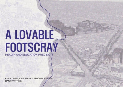
A LOVABLE FOOTSCRAY HEALTH AND EDUCATION PRECINCT
EMILY DUFFY, KIER FEENEY, AFROUZA SABIELA, HANA PARTRIGE 1
ACKNOWLEDGMENT OF COUNTRY We acknowledge the Traditional Owners of the land on which this work is based, the Wurundjeri Woi Wurrung and Bunurong Peoples of the Kulin Nation. We recognise their continued connection and care for Country. The City of Maribyrnong sits between these two clans, with the intersection of the Maribyrnong and Yarra Rivers acting as an important meeting place. Across these rivers, many sacred sites have been identified which highlights the deep cultural, spiritual and historical significance of this land. As the oldest living continuous culture on earth, we pay our respects to their Elders past and present and extend this respect to all Aboriginal and Torres Strait Islander peoples. Always was, always will be.
Source: Authors
2
COLOPHON Published within Planning project 1: Compact City, Master of Urban Planning in Design (UPD), Monash University. Authors: Afrouza (Ocha) Sabiela, Emily Duffy, Hana Partridge, Kier Feeney Semester 2, 17 June 2026 Curating a more livable Footscray: UPD4001 This project unit explores the complexities and implications of the intensification of cities across multiple scales and how to actively engage in their transformation. Through real world, place-based projects, this foundational studio helps you to develop research foundations, analytical and spatial methods in strategic planning and design.
3
EXECUTIVE SUMMARY Footscray has so many elements to love. Filled with a diverse community, multicultural food scene, strong public transport connections and an up-and-coming health and education precinct − Footscray has a bright future. However, some key challenges are preventing it from its full potential. Over this semester, urban planning analysis has been conducted to ensure that in its growth to 2050, it is loved by the current community and those who are welcomed along the way. This report presents the investigation and analysis of Footscray’s northern Health and Education Precinct. Place issues, initial opportunities and case study precedence analysis was previously conducted and presented in April. This research has been used as a foundation and informed further place, people and history analysis, including relevant strategic and statutory policy. This knowledge has been dissected to create a precinct specific vision and guiding strategies. This framework aims to assist in curating a more livable and lovable Footscray by 2050. Alongside contextual research, further understanding of the needs of Footscray’s people and its environments (built, natural and social) has been developed. Through iterative analysis and problem solving, solutions and proposals were evolved to ensure they were personalised to Footscray’s Health and Education Precinct.
ATRRIBUTES:
ISSUES:
Vacant, unused land lots
Variation in building heights
Footscray Hospital
Lack of wayfinding devices
Vehicle oriented roads
To identify opportunities for future planning, issues were identified in the focus area through on-site research and consultation with the City of Maribyrnong. Current issues include; insufficient canopy cover and vegetation along Nicholson and Droop Street; poor walking infrastructure and wayfinding devices between the precinct and city ‘core’; car-centric streets disincentivising safe and enjoyable active transport; Underutilised council sites
Lack of canopy cover/greenery
Victoria University
4
EXECUTIVE SUMMARY extreme variation in building heights and typologies between Footscary Hospital and the surrounding single-story residence; and under-utilised councilowned carparks and abandoned lots such as the Little Saigon lot. Four strategies that consider public realm, ecology, transportation, built form and land-use have been created: Leafy and Lively Love Our Streets Growing Thoughtfully Inspiring Activation These strategies have been broken down in 3-4 actions for implementation over short, medium and long terms. Key actions include a public realm masterplan to assist in identifying key locations for targeted increased vegetation and canopy cover. Secondly, improving street quality to increase active transport appeal and safety. Thirdly, extending the Activity Centre Zone to facilitate housing densification in targeted locations (near Footscray Hospital). Fourthly, introducing Inclusionary Zoning throughout the entire precinct to ensure social housing development. Lastly, using community-based interim projects at the Councilowned Droop Street carpark to help with alternative land-use transition for the site.
“In 2050, green and active corridors seamlessly marry the Health and Education Precinct with the heart of Footscray. Every corner and street is alive and tied to our multicultural history. The precinct is walkable, safe and inspiring filled with diverse housing, community centres and parks − loved by workers, students and all who call it home.”
GUIDING STRATEGIES
KEY ACTIONS
Leafy & Lively
1. Masterplan Public Realm
Love our Streets
2. Improve Street Quality
Growing Thoughtfully
3. Extending the Activity Centre Zone 4. Inclusionary Zoning
Inspiring Activation
5. Interim Projects
5
EXECUTIVE SUMMARY
L E E
G
ACTIVITY CENTRE CORE
N ST
G N O
D A RO
NICHOLSO
FOOTSCRAY HOSPITAL
ST
Connecting these three projects is the Nicholson Street Corridor which is proposed as an overarching Catalyst Link Project. The Nicholson Street Upgrade will be gradually implemented and is crucial in maximising the benefit of the individual catalyst projects, but in also creating a cohesive and integrated physical and social community in Footscray. Within this, a final recommendation is made for the name change of Nicholson Street to Footscray Way alongside its longterm transition into a lively, mixed-use street by 2050.
VICTORIA UNIVERSITY
P OO DR
Alongside this, three catalyst projects have been identified to assist the Strategies in motioning Actions to develop Footscray’s lovability. A Footscray Connection Bridge is proposed over the Ballarat and Geelong Road intersection to substantially increase active transport safety and ease of connection from the Hospital and University to Footscray’s core. Adjacent to the Hospital, a Droop Street Housing Masterplan will use a Development Plan Overlay (DPO) to propose building locations, building heights, greenspace allocation and pedestrian throughway connections. This is to ensure the expected development in this region occurs thoughtfully for the urban environment and critical worker population. Similarly, a DPO Masterplan has been proposed for the abandoned, but privately owned, Little Saigon Lot. It is desired for this to become an Aged Care facility to serve the aging multicultural community of Footscray. This demographic has shaped Footscray over the past 50 years, and it’s important they have a place to remain as they downsize and the area grows.
6
EXECUTIVE SUMMARY To ensure the success of the strategies they must be measurable, and grounded in an understanding of implementation timing and feasibility. Three targets have been identified as benchmarks for the successful urban development of the Footscray’s Health and Education precinct. Additionally, the implementation timing of the actions and their mechanism (advocate, regulate or invest) has been outlined. Besides the City of Maribyrnong Council, the Department of Transport and Planning, Western Health and Victoria University will need to be involved in implementation to various degrees and timing.
The proposed vision and its framework (strategies, actions and catalyst projects) will assist the City of Maribyrnong in shaping Footscray and its Health and Education Precinct into a place loved by workers, students and all who call it home.
Targets
1. 2. 3.
40% Increase of Canopy Cover 25% Increase in Pedestrians
4000 Additional Housing
7
IMPLEMENTATION
STRATEGIES & ACTIONS
VISION FRAMEWORK
CONTEXT
INTRODUCTION
1. 2. 3. 4. 5.
8
CONTENTS INTRODUCTION
10
IMPLEMENTATION
67
Purpose Brief
11 12
CONTEXT
13
Implementation Table Stakeholder Relations Timeline of Actions Key Actions
68 70 71 72
Regional Context Focus within Footscray Relevant Policy Zones and Overlays Existing Building Heights Key Attributes Indigenous Context Place History Demographics People of Footscray DNA of the Precinct
14 16 17 19 21 22 24 25 27 28 29
REFLECTIONS REFERENCES
73 74
VISION FRAMEWORK
30
Vision
31
STRATEGIES & ACTIONS
34
Key Issues & Opportunities Nicholson Street Issues Framework Overview Leafy & Lively Love our Streets Growing Thoughtfully Inspiring Activation Catalyst Masterplan Catalyst Project 1 Catalyst Project 2 Catalyst Project 3 Catalystical Link Project Check In
35 36 37 38 41 44 48 51 52 56 59 62 66
Strategy Overview Targets
32 33
Curating a more Livable Footscray | Health and Education Precinct Monash University | Group Five
UPD4001: Compact City April 2026
9
1. INTRODUCTION
10
PURPOSE This report presents a vision for Footscray in 2050, with analysis that aligns with four key strategies to make Footscray a more lovable place. This document is focused on the Health and Education Precinct within Footscray, north of the suburb’s activity centre. The precinct contains the Footscray Park Victoria University campus and the newly constructed $1.5 billion Footscray hospital, which will treat over 20,000 patients a year and employ over 4500 individuals (Western Health, 2026). Both the University and Hospital are major generators of activity within the region and introduce new opportunities for development, which highlights the need for stronger integration between the focus precinct and the activity centre. Currently the two precincts are connected through residential streets with no wayfinding devices, poor walking infrastructure and lack of built form diversity. The City of Maribyrnong will be a municipality that will undergo a drastic transformation with a required 48,000 new dwellings issued before the year 2050 to house up to 61,000 new residents. A framework has been developed to assist in making decisions for the spatial development of the focus area. The report outlines the key attributes and context of the focus precinct, key issues and opportunities that have been identified, proposed strategies and their ‘actions’ and lastly
catalyst projects. Grounded in both historical and current place context, this document showcases potential areas of improvement to assist in the focus precinct’s future growth. The project is heavily informed by a strong analysis of the culture, character and history of Footscray to formulate the best future opportunities without detracting from the essence that already exists. In particular, analysis was centred around the idea of what makes a place people love to work, study and live in. A key focus was on creating pedestrianoriented, green corridors that physically and socially connect the precinct with the Footscray core and community. Other focus areas include diversifying land use in residential zones, increasing housing and activating under-utilised areas. The proposed strategies aim to ensure a harmonious relationship between the quickly developing Footscray Hospital and Victoria University with the core of Footscray. This has enabled the proposed vision, targets and actions to not only be relevant, but personal to Footscray’s Health and Education Precinct.
Curating a more Livable Footscray | Health and Education Precinct Monash University | Group Five
UPD4001: Compact City April 2026
11
BRIEF The following document has been created for the Maribyrnong City Council to help guide and inform the updated Footscray Structure Plan (FSP). Key stakeholders include the Victorian Department of Transport and Planning (DTP), Footscray Hospital, Victoria University, Wurundjeri Woi-wurrung Aboriginal Cultural Heritage Corporation, private developers and the local Footscray community. In consultation with the council, key issues highlighted were: • • • • • •
Congested roads with poor active modal infrastructure. Climate change, lack of canopy cover and increasing Urban Heat Island Effect. Central retail precinct with lack of open space. Making the area feel welcoming and safe (both perceived and actual). The new Footscray Hospital as its own potential “hub”. Low levels of private investment and development.
Alongside these issues, the Victorian Government has directed housing targets for the municipality. By 2051, the Maribyrnong area needs to accommodate a total population of 155,000 by providing the targeted 48,000 additional dwellings (Department of Transport and Planning Victoria, 2025).
Image Caption: Focus area in Footscray Source: Authors
Curating a more Livable Footscray | Health and Education Precinct Monash University | Group Five
Image Caption: Stakeholder diagram Source: Authors
UPD4001: Compact City April 2026
12
2. CONTEXT
13
REGIONAL CONTEXT
hospital context
The Footscray Activity Centre is located in the local government area of Maribyrnong, West of the Melbourne CBD. The centre acts as a gateway for the West, connecting Melbourne to the western suburbs as well as several regional hubs such as Ballarat, Bendigo and Geelong.
Curating a more Livable Footscray | Health and Education Precinct Monash University | Group Five
Maribyrnong Local Government Area CITY OF GREATER MELBOURNE
UPD4001: Compact City April 2026
14
MAJOR HOSPITAL ANALYSIS
Footscray Hospital is one of the few major public hospitals in Melbourne’s West. It acts as a significant health infrastructure asset for the city. Western suburbs and communities face challenges in accessing highlevel acute care services. Footscray Hospital is envisioned to address this gap by serving as the primary hospital for Footscray and its surrounding areas, offering a high level of accessibility. The hospital anchors the Footscray Health and Education Precinct as an emerging leader in health and higher education in Victoria.
Image: Public health hospital map Melbourne Source: Authors
Curating a more Livable Footscray | Health and Education Precinct Monash University | Group Five
UPD4001: Compact City April 2026
15
FOCUS PRECINCT WITHIN FOOTSCRAY
Footscray is an inner-city suburb in Melbourne, Victoria, Australia, 5 km (3.1 mi) west of Melbourne’s Central Business District, located within the City of Maribyrnong local government area and its council seat. Situated within the City of Maribyrnong, it is bounded generally by the Maribyrnong River to the east and bordered by suburbs including Seddon, Yarraville, West Footscray, and Maribyrnong (Australian Bureau of Statistics, 2021). The Maribyrnong River is the primary geographic feature, flowing along the eastern edge, which historically facilitated industrial development and now features extensive parklands. The area sits at roughly 25 meters in elevation and is part of the Victorian Volcanic Plain, known for its basaltic soil, with parts of the area formerly known as swampland. Footscray is a dense, diverse, and industrial-residential suburb with a core commercial area, experiencing rapid urban renewal and high-density development, especially along the riverfront and the Health and Education P recinct (Melbourne Water, 2022).
Image: Health and Education precinct Source: Authors
Curating a more Livable Footscray | Health and Education Precinct Monash University | Group Five
UPD4001: Compact City April 2026
16
RELEVANT POLICY: KEY STRATEGIC POLICY Victoria’s Active Transport Plan Victoria’s Active Transport Plan aims to increase daily walking and riding trips (towards a target of 25 per cent active transport by 2030). Rather than simply delivering infrastructure projects, the plan focuses on overcoming barriers surrounding safety, convenience, and comfort of active transport. This framework informs our principles to think holistically about mobility, recognising that active transport is enabled by addressing factors beyond infrastructure. By
Housing Strategy prioritizing active travel unlocks a multitude of benefits for the future of the Health and Education precinct. These include improved environment (i.e. improving air quality and mitigating the urban heat island effect), health benefits, boosted local economic activity, and enhanced social cohesion through spontaneous community interactions. For Footscray, the Active Transport Plan will improve accessibility to key services and amenities, supporting the Activity Centre program that envisages residents to closer proximity to key transport hubs.
Curating a more Livable Footscray | Health and Education Precinct Monash University | Group Five
The Maribyrnong Housing Strategy Discussion paper seeks to gain feedback from stakeholders to refine the direction of the draft Housing Strategy that will shape Maribyrnong housing to the year 2051.
Demographic trends show within Maribyrnong an significant influx of young professionals, students and key workers that needs to be considered in the housing that is built within Footscray.
Footscray is predicted to absorb a significant proportion of this density. The strategy thinks not only of the supply of housing, but also of delivering the right housing in the right places for the right people.
UPD4001: Compact City April 2026
17
OTHER POLICIES 1. Victoria’s Active Transport Plan
2. Victorian Aboriginal and Local Government Strategy 2021-2026
3. The Maribyrnong Wallking Strategy
4. Maribyrnong Open Space Strategy
Plan for Victoria, is a long term, state wide strategy that guides growth through to 2050. It focuses on five key pillars: 1. Self determination and caring for Country 2. Housing for all Victorians 3. Great places, suburbs and towns 4. Accessible jobs and services 5. Sustainable environments
The Victorian Aboriginal and Local Government Strategy 2021-2026 serves to embed Aboriginal self-determination across local governance systems and the Victorian Government. The strategy relies on a cyclical, three stage implementation model - Understand, Embrace and Embed that aim for more collaborative and place based solution and decision making.
The Maribyrnong Walking Strategy provides a comprehensive framework to transform the municipality with the vision of “creating a walkable city that is accessible and safe for all”.
The Open Space Strategy provides strategic direction for the future planning and management of opened spaces and recreational networks across Maribyrnong.
The plan replaces Plan Melbourne 2017 2050, to better address urgent issues such as climate change, housing affordability and transport priorities at a larger scale and integrated approach. Within this plan,
Within this strategy, City of Maribyrnong must implement early and upfront deliberative engagement with Traditional Owners to co-design local urban planning and precinct development across Footscray.
Footscray is identified for its highest percentage of ‘walked only’ trips to work, 7.6%, providing opportunities to increase walking through enhancement of walking network.
Footscray is a focal point of the strategy with significant population growth that creates demand for close proximity open spaces. Footscray, anticipated to undergo densification, is susceptible to urban health build up, and needs high quality green spaces and large canopy trees that cool the built environment.
Footscray sits as a key Metropolitan Activity Centre that provides a key connection with additional activity centres selected in the West.
Curating a more Livable Footscray | Health and Education Precinct Monash University | Group Five
Particularly, the strategy outlines potential to capture this behaviour through establishing and improving key links between Victoria University, Footscray Station and the new Footscray Hospital are acknowledged as essential.
UPD4001: Compact City April 2026
18
ZONES & OVERLAYS: ZONE MAP Centred around an 800-metre catchment of Footscray Station, the Activity Centre Zone (ACZ) encourages mixed use, higher density and transit oriented development in the coming decades. This ACZ contrasts with the rigid, low-scale surrounding of the General and Neighbourhood Residential Zones. This zoning friction is particularly evident adjacent to the new Footscray Hospital precinct, where residential zoning limits the capacity for the precinct to accommodate denser housing for future population.
Curating a more Livable Footscray | Health and Education Precinct Monash University | Group Five
UPD4001: Compact City April 2026
19
OVERLAY MAP Ma
The FAC is subject to Development Contribution Plan Overlay (DCPO), which ensures that private development contributes to public realm improvements. Footscray is also subject to targeted Heritage Overlays (HO) that aim to preserve the historic building fabric along Barkly Street and the residential corridors along Nicholson Street. Within the ACZ, an extensive Parking Overlay (PO) is used to reduce parking allocation, to reduce congestion and encourage active transport modes.
ST
BAL
R T IE
NA
L AR
r ib
y rn
on
gR
iv e
r
AT R D
N
Legend
Footscray Hospital
NG
RD
N IC H O LS O
GE
O EL
N ST
Footscray Activity Centre Boundary
Victoria University Footscray Station
DR
Overlay
OO
Development Contributions Plan Overlay
PS T
Design and Development Overlay
Environmental Audit Overlay
D
LD
ST
LE ED S ST
Environmental Significance Overlay
A ON
Heritage Overlay Incorporated Plan Overlay
BA R K LY ST
Land Subject to Indundation Overlay
BY R O N ST
M O O R E ST
Development Plan Overlay
Neighbourhood Character Overaly
H O PK IN S
Public Aquisition Overlay
ST
Parking Overlay Special Building Overlay Specific Controls Overlay Significant Landscape Overaly
0
100
200 m
SCALE: 1:6500 @ A4
Curating a more Livable Footscray | Health and Education Precinct Monash University | Group Five
UPD4001: Compact City April 2026
20
EXISTING BUILDING HEIGHTS The existing building heights in the study area are prodominantly 1-2 storeys. This contrasts with the new 12 storey Footscray Hospital.
BAL
LAR
AT R D
NG
RD
O EL
MOORE ST
NICHOLS
ON ST
GE
Legend
P
OO
DR
Footscray Acticity Centre Boundary
ST
Footscray Hospital
DONALD ST
Victoria University Footscray Station BYRON ST
Existing Building Heights 1 Storey (<3.5m) 2 Storeys (3.5 - 7m) BARKLY ST
3-5 Storeys (7 - 17m) 5-7 Storeys (17 - 24.5 m)
HOPKINS
ST
8-10 Storeys (24.5 - 35m)
0
100
200 m
SCALE 1:5000 @ A4
Curating a more Livable Footscray | Health and Education Precinct Monash University | Group Five
UPD4001: Compact City April 2026
21
FOOTSCRAY HOSPITAL The new Footscray Hospital is a key aspect of the Health and Education precinct, situated on the corner of Geelong and Ballarat Road. The project is one of the largest health infrastructure projects completed by the Victorian government costing over $1.5 billion dollars. The new hospital precinct was produced in response to the increasing demand for accessible healthcare in the Western suburbs of Melbourne, which are experiencing unprecedented population growth (Victorian Health Building Authority, 2026). The new hospital will assist in these demands and offer state of the art facilities for individuals and families. The establishment of this hospital will reduce the wait times and alleviate pressure for hospitals in the surrounding area, drawing more people into Footscray precinct. According to the Victorian Health Building Authority the Footscray Hospital will: • • • •
The Footscray Hospital is a huge centre of this project due to the influx of workers, patients and people the hospital will bring into the area. This hospital will activate the Health and Education precinct, marking the importance of the integration of the activity centre with these facilities.
Source: Victorian Health Building Authority Exterior view of the new Footscray Hospital
increase of 200 hospital beds Support 15,000 additional patients and treat 20,000 individuals in the emergency ward annually. Create 250 new jobs 4500 Western Health staff are transferred to the new hospital. Source: Victorian Health Building Authority
(Source: Authors)
Hospital Entrance
Footscray Hospital entrance
Curating a more Livable Footscray | Health and Education Precinct Monash University | Group Five
UPD4001: Compact City April 2026
22
VICTORIA UNIVERSITY Victoria University Footscray Park campus is the largest campus of the university and the birthplace of VU. Across Footscray there are two distinct campuses with Nicholson Street campus near the train station and the Footscray Park campus located across from the new Footscray Hospital. The campuses are connected through Nicholson Street, acting as a connective spine between the campuses and their facilities. Chancellor The Hon. Steve Bracks AC stating that student enrolments have gone from 41,584 in 2022 to 49,106 in 2024 amounting to 10% change (Victoria University, 2026). The Victoria University 2024 annual report (Victoria University, 2024) outlines a total of 49,106 students comprised of 37,025 Higher Education students and 12,081 Vocational students.
Source: Authors Caption: Footscray Park Campus
This demonstrates the importance of integrating the Health and Education precinct with the activity core of Footscray to further sustain and connect all the students who study in the area. This highlights the need for pedestrian oriented infrastructure, connecting the two campuses as well as providing safe transit experiences for students. FOOTSCRAY PARK CAMPUS
Source: Architectus
NICHOLSON STREET CAMPUS
Redevelopment of Level 1, Building M, of the Footscray Park Campus
Curating a more Livable Footscray | Health and Education Precinct Monash University | Group Five
UPD4001: Compact City April 2026
23
INDIGENOUS CONTEXT
60,000 Years Indigenous Country
The focus precinct within Footscray sits on the traditional home of the Wurundjeri Woi Wurrung and Bunurong people of the Kulin Nation over the span of 40,000 years. The local government area of ‘Maribyrnong’ was named after the Indigenous word ‘Mirring-gnay-birnong’ which translates to ‘I can hear a ringtail possum’ (City of Maribyrnong, 2026). The City of Maribyrnong sits between two clans of the Kulin Nation, with the intersection of the Maribyrnong and Yarra River enacting as an important meeting site. This area is characterised by the two groups along the river, a symbol of the exchange of culture, language and goods. Across these rivers many sacred sites have been discovered, showcasing the significance of this area under an Indigenous lens.
WURUNDJERI
MARIBYRNONG RIVER
Caption: Maribyrnong River Image Source: ABC.net.au
YARRA RIVER
‘MIRRING-GNAY-BIR-NONG’
“I CAN HEAR A RINGTAIL POSSUM” Curating a more Livable Footscray | Health and Education Precinct Monash University | Group Five
BUNURONG Indigenous Country Map Source: Authors
UPD4001: Compact City April 2026
24
PLACE HISTORY
After the colonial settlement, land use shifted to grazing and early agriculture. The river was used for transport and resource extraction, turning Footscray into an industrial hub with lots of tanneries, mills, and abattoirs (Footscray Inter-war and Post-war Heritage Precinct Study, 2021). Post-war migration
60,000 Years Indigenous Country
reshaped Footscray into a multicultural residential and industrial mix (The Patron of Footscray, 2018). The wharves area of Footscray, since the earliest days of settlement, had played a significant role in the industrial development of Melbourne and Australia (Melbourne’s Living Museum of the West, 2024).
Curating a more Livable Footscray | Health and Education Precinct Monash University | Group Five
However this era was disappearing and is almost invisible now as Footscray is rapidly transforming into an inner city food and fashion hub (Melbourne’s Living Museum of the West, 2024). From the late 1990s, factories started to close, leaving many vacant lands (Stephens, 2026). Starting from the 2000s,
regeneration and reconnecting are the main priorities of Footscray’s Urban Renewal. Today, many sacred sites of cultural and spiritual significance remain.
UPD4001: Compact City April 2026
25
HEALTH & EDUCATION PRECINCT HISTORY 60,000 Years Indigenous Country Community founding In the early 1900s, community and business leaders in Melbourne's industrial west resolved to build an acute care hospital for their community. It took 34 years of fundraising and refusals before the hospital finally opened in 1953.
Patient care By 1956 the hospital had reached its full planned capacity of 213 beds only two years after opening, with urgent medical cases being turned away. By 1969 the Medical Superintendent was already calling for it to become a 500-bed institution.
Image Source: Facebook Archives Construction of the Footscray and District Hospital on Eleanor St (1947)
Teaching & research By 1977, Footscray Hospital reached agreement with Melbourne University to teach and train medical students. Then in 1980, the hospital had become an affiliated teaching hospital with Monash University and a clinical school of the faculty of medicine. Name changes The hospital cycled through Footscray & District Hospital (1953) > Western General Hospital (1972) > Maribyrnong Medical Centre (1986) > Western Hospital (1989) > Footscray Hospital (2014), before the new building opened in 2026.
Infrastructure More than 8,600 different people worked on the new Footscray Hospital project, with over 90 per cent local content. The new hospital opened on 18 February 2026, replacing the Gordon Street site after 73 years.
Image Source: The Sydney Morning Herald Footscray Old Hospital Site (1953)
Image Source: Victorian Health Building Authority Construction of the new Footscray Hospital (2023)
Source: Whpeoplehospital.com.au/timeline
Curating a more Livable Footscray | Health and Education Precinct Monash University | Group Five
UPD4001: Compact City April 2026
26
DEMOGRAPHICS 31.5% Detached
Population: 20,882 people (2026)
15.3% Semi detached
41,900 people (2050)
Total dwellings:
52.3% Apartments
Where are Footscray residents from? 22.5% Footscray is a melting pot of cultures with a diverse range of backgrounds particuliarly from Vietnam, Ireland, China and India. This represents vibrant community that must preserved and honoured throughout development and future proposals.
10.1%
12,174 dwellings (2026) 41,900 dwellings (2050)
Housing typoloogy is diverse across Footscray with majority of resident’s living within apartment complexes, highlighting that development is feasible and embraced within the suburb.
Education: FOOTSCRAY
43.2%
49.1% of people were born overseas
63.5% of people have at least one parent born overseas.
Footscray is home to 20,882 people in 2025. By 2050, it is expected to double, with people living in 21,529 dwellings (about twice as many as it has now.)
VICTORIA
18.5%
9.3% 10%
Occupation Top occupations are Professionals, Clerical & Administrative workers, Managers and Service Workers. This would include those working within our precinct at the Footscray Hospital & Victoria University. This represents a huge demographic of people who would enter the precinct - a demographic that need to fall in love with the place you work.
29.2%
Footscray contains a highly educated population with 43.2% of residents attaining a Bachelor’s degree and above, compared to 29% across Victoria. Curating a more Livable Footscray | Health and Education Precinct Monash University | Group Five
UPD4001: Compact City April 2026
27
PEOPLE OF FOOTSCRAY Amanda Nguyen (34)
Lilly Holland (19)
Ba Pham (72)
STOCK PHOTOS
“How can Footscray be more lovable for its people?”
Source: IS stock
Source: IS stock
Source: IS stock
Registered Nurse at Footscray Hospital
First year student of a Bachelor of Early Childhood Education & Leadership at Victoria University
Longterm Community Member
Amanda uses Nicholson Street to access the activity centre on lunch breaks. Amanda loves the abundance of food options and diverse cuisines that can be enjoyed on a work break. However, the busy intersection disrupts this journey and experience of during long shifts.
Catches the train from home to Footscray Station, walks to Footscray Park campus up to three times a week. Lilly loves travelling to Footscray for university and enjoys sitting in Footscray Park for study breaks with friends.
Ba Pham has lived in Footscray for 40 years, moved to Footscray from Vietnam in the 1970’s. He lives in a heritage home off of Nicholson Street and loves to walk to the Footscray Market through the corridor every day.
Curating a more Livable Footscray | Health and Education Precinct Monash University | Group Five
UPD4001: Compact City April 2026
28
DNA OF THE PRECINCT
The Health and Education precinct is characterised with a distinct contrast between the new monolithic structure of the Footscray hospital and the streets of standalone heritage homes that surround. At its core, the DNA of the Health and Education precinct is one built on connectivity and collaboration, as a site for healthcare workers, students, residents and visitors alike. The newly constructed $1.5 billion dollar Footscray Hospital changes the demographic over those who visit this precinct. The area is filled with multicultural businesses, restaurants and cafes, showcasing the diverse population that live within this area. The area is an emerging precinct, for students and healthcare workers while remaining dotted with Footscray’s storied past.
Image : DNA collage Source: Authors
Curating a more Livable Footscray | Health and Education Precinct Monash University | Group Five
UPD4001: Compact City April 2026
29
VISION FRAMEWORK
3.
30
VISION In 2050, green and active corridors seamlessly marry the Health and Education Precinct with the heart of Footscray. Every corner and street is alive and tied to our multicultural history. The precinct is walkable, safe and inspiring filled with diverse housing, community centres and parks loved by workers, students and all who call it home.
Curating a more Livable Footscray | Health and Education Precinct Monash University | Group Five
UPD4001: Compact City April 2026
31
STRATEGIES OVERVIEW
LEAFY & LIVELY
LOVE OUR STREETS
GROWING THOUGTFULLY
INSPIRING ACTIVATION
Creating a resilient environment with abundant leafy streets and public green spaces that supports the liveability for all beings in Footscray.
Transforming our streets to create lovable daily commutes by promoting active transport and enhanced connectivity between the Health and Education Precinct and Footscray’s heart.
Coordinating the development of the precinct to carefully offer higher-density that offer diverse housing that are built for and with the community in mind.
Revitalising underused spaces by introducing mixed-use developments to deliver urban places owned and cared for by the community.
Curating a more Livable Footscray | Health and Education Precinct Monash University | Group Five
UPD4001: Compact City April 2026
32
TARGETS
1. 2.
TOTAL POPULATION Current Footscray Population (2021):
19,957
3.
40%: Canopy covers increase In consultation with the City of Maribyrnong, a canopy cover target of 40% by 2051 is proposed, supported by the Urban Forest Strategy 2024.
25% Increase in Pedestrian Active Transport
Image Source: YourSay Yarra Canopy cover in our streets provide a natural way to cool our city
According to the Walking Strategy 2023-2033, in 2022 Footscray had 7.6% of walk-only trips to work. A target of 25% walk-only trips to work is proposed to align with the overall active transport goals in the Victorian Active Transport Plan.
Image Source: Sunshine Coast Council How to help shape two active transport corridors
4000: Housing The study area currently encapsulates approximately 18% of Footscray’s total population. By 2051 it is predicted that this will increase to 25% due to the exceptional growth of the Health and Education sectors. To accommodate this, a target of 4,000 additional dwellings has been proposed within the precinct (See Appendix A).
Expected Footscray Population (2051):
41,943 Curating a more Livable Footscray | Health and Education Precinct Monash University | Group Five
Image Source: Authors Footscray Residential building
UPD4001: Compact City April 2026
33
4. STRATEGIES & ACTIONS 34
KEY ISSUES & OPPORTUNITIES KEY ISSUES AND OPPORTUNITIES 1.
6.
Issue: Vehicle Oriented Streets Main roads do not contain walking infrastructure. Opportunity: Pedestrian-oriented infrastructure and bike paths.
Issue: Variation in Building Heights Footscray Hospital sits amongst residential streets. Opportunity: Higher-density and diverse housing. 2.
5.
3.
Issue: Lack of Canopy Cover/ Greenery Major streets such as Droop and Nicholson St are uninviting and uninspiring. Opportunity: Increasing canopy cover, vegetation and permeable surfacing in public realm.
Issue: Council-owned Sites Underutilised council-owned sites along Droop St. Opportunity: Social housing development and interim activation.
Curating a more Livable Footscray | Health and Education Precinct Monash University | Group Five
4.
Issue: Vacant Land Lots Dead zones and vacant land around the focus precinct. Opportunity: Mixed-use facility developments.
Issue: Lack of Wayfinding Devices Limited signage along key transit corridors. Opportunity: Signage, street activation and wayfinding devices.
UPD4001: Compact City April 2026
35
NICHOLSON STREET ISSUES 1.
8. 5. 9. 4. 6. Disconnected cycling networks
Rundown streetscape infrastructure Source: Authors
6.
2.
Poor crossing infrastructure
3.
9.
7. Cracked pavements and uneven surfaces
8.
3.
5. 2. Disparity in building heights
Lack of atmosphere and activity
4.
1.
7. Geelong Road and Ballarat Road inter-
Inconsistent vegetation beds
Curating a more Livable Footscray | Health and Education Precinct Monash University | Group Five
UPD4001: Compact City April 2026
36
FRAMEWORK OVERVIEW
1. LEAFY & LIVELY 2. LOVE OUR STREETS 3. GROWING THOUGHTFULLY 4. INSPIRING ACTIVATION
0
100
Scale: 1:4500@A4
200 m
Curating a more Livable Footscray | Health and Education Precinct Monash University | Group Five
Footscray Station UPD4001: Compact City April 2026
37
LEAFY & LIVELY 1.1.LEAFY & LIVELY STRATEGY: STRATEGY: Creating a resilient environment Creating a resilient environment withwith abundant leafy streets andand public green abundant leafy streets public green spaces that supports thethe liveability for all spaces that supports liveability for all beings in Footscray. beings in Footscray.
4
2
ACTIONS: 1
2
3
4
1
Masterplan Public Realm Create a Public Realm Masterplan to implement increased canopy along the key pedestrian corridors.
3
Greenspace Investment Allocating land within master plans to allow the Council to purchase for green space using Development Contributions.
Greenspace Allocation Provisioning greenspace requirements in large developments using the DPO.
Engagement Places Create a network of public interactive art places that fosters community connection and identity.
Curating a more Livable Footscray | Health and Education Precinct Monash University | Group Five
Green Corridors
Activity Centre Boundary
UPD4001: Compact City April 2026
38
LEAFY & LIVELY: ACTIONS
Image: Moray Street (Melbourne Pollinator Corridor) Source: RewildingMag
Image: St Leonards South, NSW Source: NSW Government
1. Masterplan Public Realm
2. Greenspace Investment
A Masterplan of the Public Realm would allow the council to advocate for an increased canopy outcome through specified tree and vegetation placement and species. Nicholson and Droop Street are prioritised as they are the key pedestrian corridors between the precinct and the core.
Using the Development Plan Overlay, the council can regulate the allocation of land toward council-owned, public green space. The council can acquire the land using Development Contributions to initiate Masterplan development next to the hospital.
Curating a more Livable Footscray | Health and Education Precinct Monash University | Group Five
UPD4001: Compact City April 2026
39
LEAFY & LIVELY: ACTIONS
Image: Royal Park, Melbourne Source: Participate Melbourne
Image : Playable Streets, Melbourne Source: Playable Streets
3. Greenspace Allocation
4. Engagement Places
Within medium-large developments (including the Little Saigon Lot) the Development Plan Overlay can be used to regulate greenspace requirements. This can ensure private development contributes to both private and publicaccessible greenspace.
Along key Nicholson and Droop Street corridors the council can introduce spaces of interactive community engagement. This would be through partnerships with local artists, community groups, Victorian University and the Hospital.
Curating a more Livable Footscray | Health and Education Precinct Monash University | Group Five
UPD4001: Compact City April 2026
40
2. LOVE OUR STREETS STRATEGY:
Transform our streets to create lovable daily commutes by promoting active transport and enhanced connectivity between the Health and Education Precinct and Footscray heart.
1
ACTIONS: 1
PEDESTRIAN OVERPASS Increasing access between VU, Footscray Hospital and the activity centre through pedestrian infrastructure, allowing for safer, faster and more seamless transit across Geelong Road.
2
STREET QUALITY IMPROVEMENTS Improving pedestrian experiences through widened footpaths, street infrastructure and landscaping to promote modes of active transport through key connection corridors.
3
4
4 2
3 BICYCLE PATH NETWORKS Developing a network of bicycle paths that enhance connection between the two precincts, buidling on the existing paths that exist.
WAYFINDING DEVICES Implementing signage and wayfinding devices along key corridors to guide and navigate pedestrians moving through the activity centre towards the Health & Education precinct.
Curating a more Livable Footscray | Health and Education Precinct Monash University | Group Five
UPD4001: Compact City April 2026
41
LOVE OUR STREETS: ACTIONS
Image: Warringah Freeway Pedestrian Bridge Source: Aurecon
Image: High Line gardens Source: High Line
1. Falcon Street Bridge, NSW
2. High Line, New York City, USA
The Falcon Street Pedestrian and Cyclist Facilities Project was created to separate pedestrian and cyclists from the vehicle movement on Falcon Street, North Sydney. This allows increased access for the local community across the Warringah Freeway and can be applied to the busy intersection over Ballarat Road and Geelong Road.
The High Line in New York is a 1.45-milelong elevated linear park located on along an abandoned freight rail line in Manhattan’s West Side. The park is around 30 feet above street level, containing lush gardens, public art and skyline views. This example demonstrates the opportunity for public infrastructure to be an enjoyable journey for pedestrians to promote active transport.
Figure 3: SEOULLO 7017 Garden Source: MVRDV Curating a more Livable Footscray | Health and Education Precinct Monash University | Group Five
Figure #: blah blah Source: UPD4001: Compact City April 2026
42
LOVE OUR STREETS: ACTIONS
Image: Seoullo 7017 Garden Source: MVRDR
Image: St Kilda Arts Precint Source: Port Phillip City Council
3. Seoullo 7017 Garden
4. Implementing Signage & Way finding/ Port Phillip Council
A Rotterdam- based architectural firm transformed the area from a busy highway overpass to a 1km long plant filled linear park. In total the park includes 24,000 plants which have created a lush and inviting atmosphere.
The City of Port Phillip Council were nominated for the 2023 Victorian Premier’s Design Awards for their creative wayfinding. Signage, infographics and directions to guide pedestrians could be implemented along key connection corridors. The signage would produce a wayfinding identity across the precinct, allow individuals to navigate between the main sites/facilities of the area.
The overpass is inviting, beautiful and architecturally renowned marking the possibility for similiar pedestrian infrastructure in Footscray to follow suit.
Curating a more Livable Footscray | Health and Education Precinct Monash University | Group Five
UPD4001: Compact City April 2026
43
THOUGHTFULLY 3. GROWING GROWING THOUGHTFULLY
Ma ri
by rn
on g
R iv
er
STRATEGY: Coordinating the development of the Coordinating the development of the precinct to carefully offer higher-density precinct to carefully offer higher density and diverse housing, built for and with the and diverseinhousing, built for and with the community mind.
BAL L ST
AR A TR
T IE
R
D
N NA
community in mind.
D
Development Plan Overlay (DPO) Site Mandate a master plan of the site that considers central green open space and coordinated development. Incentivise amalgamation of property in exchange for increased height.
BAR KLY S
A ON
LD
MOOR E S T
ON ST ST
LE EDS ST
Extending the Activity Centre Zone Extending the ACZ immediately adjacent to the Footscray Hospital to support the growth of the Health and Education Precinct.
ST
3
P
2
OO
1
RD
DR
ACTIONS:
NG
NICHOLS
GE
O EL
BYR ON S T
T HOPKINS
Inclusionary Zoning (IZ) across Footscray Activity Centre Applying IZ across the Activity Centre that mandates 6% of floor space for new developments to be sold at 50% discount to a registered housing association.
ST
Footscray Station
Legend:
Curating a more Livable Footscray | Health and Education Precinct 100 200 m Monash University | Group 0 Five
Scale: 1:7500@ A4
Proposed Activity Center Boundary Existing Activity Centre Zone Masterplan Site
Railway Tramline Footscray Hospital Victoria University
UPD4001: Compact City April 2026
44
GROWING THOUGHTFULLY: ACTIONS
Image: Toronto Discovery District Source: Toronto Discovery District
Image: St Leonards South DCP Source: Urban Talk
1. Extending Activity Centre Boundary
more housing required to house key health care workers, higher education professionals, and students.
2. Introducing DPO
Extending the boundary of the Footscray Activity Centre Zone to encompass the area adjacent to the new Footscray Hospital to support the growth of the Health and Education precinct to have:
Toronto’s Discovery District is a highly successful mixed use innovation precinct that integrates a major hospital with the University of Toronto. With highly flexible zoning, the district has successfully clustered research labs, allied health businesses and diverse workforce housing.
Introducing a Development Plan Overlay (DPO) to the site next to the hospital to deliver housing through coordinate density and enforcement of lot amalgamation.
1) Clustering of allied health businesses near the hospital 2) Supporting the development of
Curating a more Livable Footscray | Health and Education Precinct Monash University | Group Five
This approach adapts the mechanisms used in St Leonards South (NSW). The council masterplanned an existing low density residential area to support
more higher density housing. Through a Development Control Plan (DCP), allowed for comprehensive planning of the site to include pedestrian thoroughfares, local parks, community and recreational spaces. While a unique statutory tool for this specific context, a DPO would be essential to manage development alongside new hospitals and future tram super stops.
UPD4001: Compact City April 2026
45
GROWING THOUGHTFULLY: ACTIONS
Image: Green Square Affordable Housing Scheme Source: Sydney Morning Herald
3. Introducing Inclusionary Zoning Introducing Inclusionary Zoning (IZ) mandates across the entire ACZ to supply affordable rental housing and foster a diverse social mix. This action combines the statutory mechanisms of the Arden Structure Plan 2022 to ensure that the community housing providers retain ownership and management of the property.
This widespread application of inclusionary zoning has worked in Sydney such as the Green Square Affordable Housing Scheme that has captured the value during major urban renewal to house key works from being priced out and live closely to their work. Maribyrnong City Council can enact this widespread mandate to protect Footscray diverse social mise for gentrification and displacement.
Curating a more Livable Footscray | Health and Education Precinct Monash University | Group Five
UPD4001: Compact City April 2026
46
GROWING THOUGHTFULLY: PROPOSED BUILDING HEIGHTS With the expected devlopment around the Hospital, an increase in building heights is proposed to encourage targeted densification. Alongside this, 1-2 storeys is proposed along Nicholson Street to retain the neighbourhood character.
Ma rib y Riv rnon er g
BAL
ST
LAR
In line with the Council direction, the Footscray core will remain relatively low density, with development focused around the perimeter and hospital.
AT R
N NA
D
ER
Legend
TI
Footscray Study Area Boundary Up to 2 Storey NG
Up to 4 Storey
RD
LO
E GE
N ST
Up to 8 Storey
NICHOLSO
Up to 10 Storey Up to 12 Storey Greenspace P
OO
DR ST LD
ST
BARKLY
MOORE ST
LEEDS ST
NA
DO
BYRON ST
ST
HOPKINS
Scale: 1:6500@A4
0
100
ST
Footscray Station
200 m
Map: Proposed building heights Source: Authors
Curating a more Livable Footscray | Health and Education Precinct Monash University | Group Five
UPD4001: Compact City April 2026
47
4. INSPIRING INSPIRINGACTIVATION ACTIVATION STRATEGY: STRATEGY:
Revitalising underused spaces by Revitalising underused spaces by introducing mixed-use developments to introducing mixed-use developments to deliver urban places owned and cared for deliver urban places owned and cared for by the the community. community. by
ACTIONS: 1
Aged Care Development (Medical) Implement a Development Plan Overlay (DPO) to guide the activation of the underused Saigon Lot into a vibrant aged care facility and integrated public green space for the local multicultural ageing community.
2
Student Centre Development (Education) Activate the underused house lots with the allocation to student centre facility through a coordinated Victoria University buy-back scheme and Council partnership.
3
Social Housing Development (Community) Activate the underutilised council-owned Droop Street Car Park site with the allocation to social housing, supporting the vulnerable communities.
4
Interim Activation (Community) Establish an interim community project at the underutilised council-owned Droop Street Car Park site, utilising short-term cultural pop-ups as a strategic tool to deliver early activation.
Curating a more Livable Footscray | Health and Education Precinct Monash University | Group Five
UPD4001: Compact City April 2026
48
INSPIRING ACTIVATION: ACTIONS
Image: The Hogeweyk Dementia Village Source: Photo by Anita Edridge
Image: Marrickville Library and Pavilion NSW Source: Archify
1. Aged Care Development
2. Student Centre Development
Through partnerships with the Footscray Hospital and Victoria University, the Council can implement the Development Plan Overlay to deliver an aged care facility by regulating the change of land use of the underutilised Saigon Lot. This action will be adapting the integrated public green space of The Hogeweyk Dementia Village.
Enacting as a strategic neighborhood upgrade, Victoria University and the local council are teaming up to buy quiet, underused residential lots and transform them into lively spaces for students to study, gather, and access university services. This development will be modelled after Marrickville Library and Pavilion in New South Wales. The ground floor is lined with transparent
Curating a more Livable Footscray | Health and Education Precinct Monash University | Group Five
façades, allowing activities inside the building to be visible from the street. This creates a strong sense of openness and invitation.
UPD4001: Compact City April 2026
49
INSPIRING ACTIVATION ACTIONS
Image: Bangs Street Prahran Social Housing Source: Jackson Clements Burrows Architects (JCB)
3. Social Housing Development
Image: Footscray Night Market Source: FoodieTrails
social housing within an existing low‑rise residential neighbourhood.
The activation of the underutilised council‑owned Droop Street Car Park by reallocating the site for social housing will increase the supply of affordable homes in the precinct, pushing well beyond the Activity Centre Zone’s 6% mandated baseline. A strong precedent for this approach is the Bangs Street Social Housing project in Prahran, which successfully delivered medium‑density
Curating a more Livable Footscray | Health and Education Precinct Monash University | Group Five
4. Interim Activation While the long‑term social housing project is being planned and coordinated, an interim activation is proposed through a temporary interactive art exhibition and pop‑up multicultural market. This short‑term initiative introduces the community to a new use of the site, easing the transition away from its current car‑park function. The activation will significantly increase footfall in the surrounding area.
UPD4001: Compact City April 2026
50
Footscray Park
CATALYST MASTERPLAN
Victoria University
Within the proposed strategies, three projects have been identified as catalysts to developing Footscray’s lovability. R AT R D
Footscray Hospital
BALLA
1. Pedestrian Overpass 2. Droop Street Housing Masterplan 3. Saigon Lot Masterplan
1
G
R
D
D
Nicholson Street Upgrade will be gradually implemented to not only be crucial in maximising the benefit of the individual catalyst projects, but in also creating a cohesive and integrated physical and social community in Footscray.
EE
N
NICHOLSON ST
G
LO
(Prodominantly single-storey)
2
Residential Housing
The three projects are located within a triangle, with the Nicholson Street corridor as the key connection corridor. Subsequently, the upgrade of this segment of Nicholson Street has been designated an overarching Catalyst Link Project.
R O O P ST
D
ST
3
(Retail and food hub)
Civic Centre
Legend:
O
AL
LEEDS ST
D
N
BARKLY ST
Key Connection Corridor Catalyst Projects Green space Footscray Hospital Victoria University
PAISLEY ST
0
Curating a more Livable Footscray | Health and Education Precinct Monash University | Group Five
UPD4001: Compact City April 2026
50
100 m
Footscray Station
Pedestrian Movements
51
CATALYST PROJECT 1: FOOTSCRAY CONNECTION BRIDGE EXISTING CONDITIONS The intersection of Ballarat Road and Geelong Road in Footscray is a high volume, traffic congested and complicated junction. The intersection acts as a gateway into Melbourne West, making it unsuitable for active transport and pedestrian use. However, the addition of the newly built Footscray Hospital & increasing enrolments at Victoria University only builds on the opportunity for a safer, more pedestrian oriented intersection.
access of the activity centre’s core amenities, retailers and public transport networks. Current issues: •
•
The six lane intersection at Geelong Road and Ballarat Road acts as both a physical and psychological barrier between the Health and Education precinct and Footscray’s activity core. Due to the lack of pedestrian infrastructure, upon personal experience and observation, the road is difficult to transit over for pedestrians partaking in active transport modes. The Health and Education Precinct’s surplus population of workers, patients and students requires infrastructure to assist in the
Physical seperation between Footscray Hospital, Victoria University, Footscray Park & the Activity centre core. Prolonged waiting time periods for students, workers & those wanting to access key attributes of the Health & Education precinct.
Image: Crossing to Footscray Hospital Source: Author
Image: Aerial View of Droop St Housing Source: Google Maps
Image: Pedestrian waiting at intersection Source: Author
Curating a more Livable Footscray | Health and Education Precinct Monash University | Group Five
UPD4001: Compact City April 2026
52
PROPOSED CATALYST The proposed overpass involves connections between Nicholson Street across Ballarat and Geelong Road. The infrastructure will allow more pedestrians to partake in active transport modes to access various key attributes of the Health and Education Precinct. The overpass would consist of four ramp access points linking Footscray Hospital, Victoria University, Footscray Park and the Nicholson Street corridor down to the activity centre core.
stair elevator
The overpass would consist of points for wheelchair users through elevators at key points of the intersection to increase accessibility and ease. The overpass would contain both walking paths and cycling paths to promote all forms of mobility and active transport across this intersection, potentially connecting to networks that pre-exist in Footscray Park.
Image: Proposed intersection overpass Source: Authors
Image: Precinct connection diagram Source: Author
Curating a more Livable Footscray | Health and Education Precinct Monash University | Group Five
UPD4001: Compact City April 2026
53
DESIRED OUTCOME The pedestrian bypass allows more pedestrians to cross to and from the Health and Education Precinct and the activity core with ease. The bypass is filled with seating options and vegetation inspired by New York City’s High Line, to attract new visitors and create meaningful experiences for those crossing through the precincts. The bridge acts as a symbolic connective route allowing the Health and Education Precinct to be integrated with and down into the core of Footscray. Workers and students are able to cross without having to worry about safety due to ongoing traffic, extended wait times and possibility of being stuck at a median island. The outcome is daring and would be a stark financial commitment, resulting in the necessary collaboration of the Department of Transport and Planning with Footscray Hospital, Western Health and Victoria University. These organisations could work collaboratively to formulate a proposed infrastructure design that benefits all who use these facilities while improving the overall connectivity of Footscray.
Image: Footscray Connection Bridge collage Source: Author
Curating a more Livable Footscray | Health and Education Precinct Monash University | Group Five
UPD4001: Compact City April 2026
54
SECONDARY OPTIONS The proposed catalyst is daring and would not only be a huge durational commitment but a financial one too. The Maribyrnong City Council’s Advocacy Plan (Maribyrnong City Council 2019) has formulated some urban design strategies that can be used for this specific intersection through key infrastructure interventions. Although the catalyst proposal of an overpass is the ideal long term solution to weaving the precinct’s amenities together, included are three options that are more short term and less costly, to pedestrianise the intersection.
1. Remove Turning Slip Lanes
2. Implement Wombat Crossings
3. Traffic signalling
Image: Slip Lane at Geelong Road to Ballarat Road Source: QGIS Nearmap
Image: Wombat Crossing Source: Safe System Solutions
Image : Pedestrian priority crossing Source: ABC NEWS
Left turning slip lanes enable cars to maintain high speeds when passing from Geelong Road and Ballarat Road. These slip lanes encourage vehicles to remain at speed making the intersection unsafe for pedestrians. By closing these slip lanes completely and modifying them into 90-degree angle left turns, the sharpness slows down vehicles. The removal of the slip lanes also reduces the crossing distance for pedestrians and distinguishes who has right of way.
Due to the fast speeds of vehicles, wombat crossings could be implemented as an alternative option to prevent conflict with pedestrians. A wombat crossing is a raised pedestrian crossing elevated to the same level as a footpath to create a continuous walkway for pedestrians. Vehicles are required to give way to pedestrians as well as are slowed down by this raised platform. The wombat crossing will slow vehicles from 60km an hour to 30-40km an hour giving pedestrians priority and assurance of safe crossing.
Upon observations, pedestrians are subject to long wait times crossing the six-lane highway. Pedestrians must wait at almost three separate median strips to cross from Nicholson Street to Victoria University, resulting in many losing patience and crossing illegally. To fix this issue, pedestrian head starts can be implemented giving those walking across the intersection before vehicles get a green light. This gives pedestrians the opportunity to be midway through the intersection before cars begin to move. Pedestrians could also be prioritised through traffic signal modifications with more frequent rotations in a cycle to reduce wait times.
Curating a more Livable Footscray | Health and Education Precinct Monash University | Group Five
UPD4001: Compact City April 2026
55
CATALYST PROJECT 2: DROOP STREET MASTERPLAN EXISTING CONDITIONS The master planned site is located along Droop Street, situated adjacent to the new Footscray Hospital. The area is subject to the General Residential Zone (GRZ) that allows housing up to three storeys and mandates that new developments are to respect existing neighbourhood character. However, currently, the area comprises 1-2 storey residential dwellings that feels disjoined against the 12-storey hospital that dominates the precinct. The site presents a unique opportunity for development, with the new Footscray Hospital completed early 2026 and well as the proposed super tram stops along Droop St. The hospital has introduced a significant workforce, however the current surrounding area limits the capacity for workers to live close to where they work, with limited housing. Image: Existing Image of the Site from Geelong Rd Source: Author
Image: Aerial View of Droop St Housing Source: Google Maps
Curating a more Livable Footscray | Health and Education Precinct Monash University | Group Five
Image: Existing Image of Site from Droop St Source Author
UPD4001: Compact City April 2026
56
MAPPING
FEDERAL ST Legend: Proposed amalgamation Proposed buildings Existing buildings Shared pedestrian pathway 12
Key pedestrian connection Open space Vegetation Carpark entrances Tramline
TIERNAN ST
The masterplan sets building height regulations that considers solar orientations, anticipated building use and surrounding urban form. The development positioned closest to Geelong Road, has building heights proposed to 12 storeys due to noise consideration. This will allow residential uses on higher floors, with commercial uses encouraged on lower floors. The development, positioned closest to Geelong Road, allows building heights up to 12 storeys allowing the ground level floors to be used for commercial spaces as it can withstand the noise of the arterial road traffic. This specific lot would also be an ideal location for a hotel to service guest of patients at the Footscray Hospital. The remaining two blocks set 6-8 storey building heights, ideal for key worker housing. Ample space between developments and setbacks has been provided.
GEELONG RD
The Droop Street Housing Masterplan uses a Development Plan Overlay (DPO) to mandate coordinated development for the area containing 17 property parcels. Rather than allowing development to occur on individual parcels, the DPO schedule mandates a lot to be amalgamated. As illustrated in the masterplan, the individual lands are assembled into four large blocks in which three are dedicated to higher density housing, and one central block to be dedicated to a public greenspace.
6
6 2
2
8 6
2
Tramstops
DROOP ST
0
25
50 m
Scale 1:1000 @ A4
Image: Droop Street Masterplan DPO Source Author
Curating a more Livable Footscray | Health and Education Precinct Monash University | Group Five
UPD4001: Compact City April 2026
57
DESIRED OUTCOME Dedicated greenspace offers greenery for residents and the general public - as well as designed as a throughway from Droop Street tram stops to the Footscray Hospital entrance. The Council will act as the initiator of this master planned site by acquiring the green space lots. Successful delivery will require partnerships with DTP, Western Health, private developers partners, and existing landowners.
Artist depiction of potential outcome with applied masterplan Source: Authors
Curating a more Livable Footscray | Health and Education Precinct Monash University | Group Five
UPD4001: Compact City April 2026
58
CATALYST PROJECT 3: SAIGON LOT MASTERPLAN EXISTING CONDITIONS The Saigon Lot was once a lively local market, but after a fire in 2016 the site was destroyed and has remained vacant ever since. Positioned on Nicholson Street and only 300 metres from Footscray Station, it now sits as an inactive site on a key corridor, contributing to a lack of street vitality and missing the opportunity to support the surrounding Health and Education Precinct. The absence of a clear purpose has left the site disconnected from the daily life of Footscray, highlighting the need for a strategic catalyst project.
Image: The original Little Saigon Market before it was destroyed by a major fire (2016) Source: Google Earth
Image: Aerial View of Saigon Lot Source: Google Maps
Curating a more Livable Footscray | Health and Education Precinct Monash University | Group Five
Image: Existing Condition of the Saigon Lot (2026) Source: Authorw
UPD4001: Compact City April 2026
59
MAPPING The catalyst project uses the Development Plan Overlay (DPO) to establish a clear framework for the future redevelopment of the Saigon Lot. Through the DPO, the proposed building outlines, height controls, green‑space allocation, and pedestrian through‑connections have been set out.The proposed building heights have been carefully planned in response to physical site conditions, ensuring adequate sunlight access and minimising shadow impacts on the adjacent street. Although the planning system cannot mandate a specific land use, the site has been strategically designed to facilitate an aged‑care facility that would support Footscray’s ageing Vietnamese community. To strengthen the public realm, the project proposes extending the green space into the street reserve, repurposing what is currently an on‑street car park into a public open space. This expansion would be delivered by the Council through a streetscape redesign and allocation. The green space development is envisioned as a Council‑led partnership involving the Footscray Hospital and Victoria University.
Image: The Saigon Lot Masterplan DPO Source: Author
Image caption: The Saigon Lot Masterplan Source: Author
Curating a more Livable Footscray | Health and Education Precinct Monash University | Group Five
UPD4001: Compact City April 2026
60
DESIRED OUTCOME This catalyst imagines the Saigon Lot as a deeply lovable place, a space that feels welcoming and emotionally connected to the people of Footscray. The design centres on creating an inclusive setting for the ageing Vietnamese community, honouring their long‑standing contribution to Footscray’s cultural identity. By giving older residents a place where they can gather and rest, the project ensures they remain forever connected to the neighbourhood they helped shape. This approach strengthens the Health and Education Precinct by embedding a strong sense of lovability into the public realm. The outcome is a place that people enjoy being in and return to.
Image: The Saigon Lot Aged Care Collage Source: Author
Curating a more Livable Footscray | Health and Education Precinct Monash University | Group Five
UPD4001: Compact City April 2026
61
CATALYSTICAL LINK PROJECT NICHOLSON STREET UPGRADE Stage 1: Existing Condition
Curating a more Livable Footscray | Health and Education Precinct Monash University | Group Five
Stage 2: Actions and Catalysts
Stage 3: The Footscray Way
UPD4001: Compact City April 2026
62
Stage 1: Existing Condition Stage 2: Actions and Catalysts This section of Nicholson Street sits between the Footscray Hospital, Victoria University, Footscray Park and Barkley Street . Currently, the street consists mainly of historical singlestory, detached residential houses, with a small southern section of food and retail uses between Barkley and Donald Street. Since Saigon Lot was burned down in 2016, the area has been subject to vacant lots and shops, significantly reducing foot traffic in what was previously a lively commercial zone. The street infrastructure is predominantly car-centric, with a short one-way segment between Byron Street and Barkly Street for vehicle access into the intersection. Alongside local traffic, the road experiences traffic coming off Ballarat Road travelling south into Footscray’s Core and vice-versa.
A gradual transformation of Nicholson Street is proposed with the implementation of the suggested strategies, actions and the three catalyst projects. In the short term, this will manifest as streetscape upgrades and redesigns (See pg. 64). Traffic will be reduced to one-way only between Ballarat Road and Donald Street to prioritise safe and enjoyable active transport. Access to Nicholson Street will also be removed for local roads Stirling Street, Lynch Street and Newell Street. A short segment between Donald Street and Ryan Street will be fully pedestrianised to prevent through traffic with a low-speed ‘shared zone’ created until Barkley Street. To ensure the development of mixed-use along the street, it is recommended for the council to encourage three ‘initiative sites’ within the current residential area. The specific location along the street is insignificant, however, it is ideal for these sites to provide either community, health or education uses (outlined in red). Nicholson Street would be an ideal location for the recommended Student Centre, to help the University’s physical
Curating a more Livable Footscray | Health and Education Precinct Monash University | Group Five
Stage 3: The Footscray Way
integration into Footscray’s core. Similarly, the council must work with the Footscray Hospital and Western Health to encourage the location of a new health facility on Nicholson Street. To show leadership and confidence in the long-term transformation of Nicholson Street the council must also invest into a property for the location of a new community space on the street.
A gradual transformation of Nicholson Street is proposed with the implementation of the suggested strategies, actions and the three catalyst projects. In the short term, this will manifest as streetscape upgrades, into a medium term street redesign (Figure [cross section 2]). To ensure the development of mixed-use along the street, it is recommended for the council to pursue and encourage 3 initiative sites within the current residential area. The specific location is insignificant, however it is ideal for these sites to provide either community, health or education uses (outlined in red). Nicholson Street would be an ideal location for the recommended student centre, to begin a physical integration with Footscray’s core. Similarly, the council must work with the Footscray Hospital to encourage the location of a new health facility on Nicholson Street. Lastly, the council may invest themselves into a property for the location of a new community facility on the street to show leadership and confidence in the long-term transformation of Nicholson Street.
UPD4001: Compact City April 2026
63
NICHOLSON STREET UPGRADE: CROSS SECTION
Nicholson Street is a wide residential road with a high proportion of street space allocated to motor-vehicles. There is no allocated nature strip and, consequently, current footpaths have poor infrastructure due to tree roots creating fissures in the concrete. A street redesign would see a greater allocation to active transport, with priority on pedestrians walking between the Hospital, University and Footscray’s core via a widened 5m footpath. Reduction to one-way motor-vehicle access will allow cyclists to have priority on the road and remain separate to pedestrians. New nature strips will increase vegetation and feature native plants and trees, bike parking, street furniture and education boards to ensure a memorable, lovable journey that facilitates engagement. It is desired to have Wurundjeri culture and learnings along the street (ie. Infographics, art installations, plant species signage) to help represent the historical and continued connection to Country of First Nations in Footscray. It is acknowledged that these are big changes regarding vehicle access. Almost all residential houses here do not have front driveways and are rearaccessible, increasing feasibility of this change and hopefully reducing the interaction between pedestrians and motor-vehicles. Additionally, on-street parking will still be available, with priority for accessibility permits and the provision of increased drop-off locations near health facilities.
Curating a more Livable Footscray | Health and Education Precinct Monash University | Group Five
UPD4001: Compact City April 2026
64
NICHOLSON STREET UPGRADE: VISION COLLAGE
By 2051, Nicholson Street will be well known and loved by locals, students and workers as Footscray Way. The proposal involves a vibrant and inviting corridor right through the spine of Footscray. Footscray Way functions not only as a connection route from the Health and Education precinct down to the core, but also a street for all who live and work to love.
“Which way should we go?”
“Let’s go the Footscray Way” Image: Footscray Way revitalisation collage Source: Author
Curating a more Livable Footscray | Health and Education Precinct Monash University | Group Five
UPD4001: Compact City April 2026
65
CHECK IN: A MORE LOVABLE FOOTSCRAY? Let’s check in with Amanda, Lilly and Ba and see how these proposed changes improved their everyday lives STOCK PHOTOS
Amanda Nguyen (34) Amanda loves running into her coworkers on her break along Footscray Way. She often stops for chats on the benches under the lemon-scented eucalypts - It’s her favourite part of her day. Today, she ran into Mia who moved into the new apartment next to the hospital and she invited her over a drink.
Lilly Holland (19) Lilly enjoys a Ca’phe Muoi while waiting for her group mates at a local cafe. They all head to class across the Footscray Connection Bridge together and have planned to catch-up for a picnic lunch before their placement at the Aged Care. She is nervous for her first shift − but is happy it’s somewhere she feels comfortable.
Ba Pham (72) Some of Ba’s friends have moved into the new Aged Care and he loves to join them for Tai Chi in the park every morning. He watches all the students, families, nurses and vendors buzzing around in the street and feels at home in his beloved Foostcray.
Curating a more Livable Footscray | Health and Education Precinct Monash University | Group Five
UPD4001: Compact City April 2026
66
IMPLEMENTATION
5.
67
IMPLEMENTATION TABLE Action
Leafy and Lively
1.1 Create a Public Realm Masterplan to implement increased canopy along the key pedestrian corridors.
1.2 Allocating land within master plans to allow the Council to purchase for green space using Development Contributions.
1.3 Provisioning greenspace requirements in large developments using the DPO.
Key Partners
Parks and Gardens/ Planning and Environment
Community/ Aborist
Planning and Environment
DTP/ Developers
Planning and Environment
DTP
Advocate/ Invest
City of Maribyrnong Council
VU/ Western Health/ Local Artists
Advocate/ Invest
Vic State/ Vic Roads/ DTP
DTP/ Vic State/ Engineering and Transport Consultants
City of Maribyrnong Council/ City of Amenity
DTP
City of Amenity
Community
Medium
Advocate
Regulate/ Invest
Regulate
1.4 Create a network of public interactive art places that fosters community connection and identity. 2.1 Increasing access between VU, Footscray Hospital and the activity centre through pedestrian infrastructure, allowing for safer, faster and more seamless transit across Geelong Rd.
Love Our Streets
Responsible
Short
2.2 Improving pedestrian experiences through widened footpaths, street infrastructure and landscaping to promote modes of active transport through key connection corridors.
Advocate
2.3 Developing a network of bicycle paths that enhance connection between the two precincts, building on the existing paths that exist.
Invest/ Regulate
2.4 Implementing signage and wayfinding devices along key corridors to guide and navigate pedestrians moving through the activity centre towards the Health & Education precinct. Curating a more Livable Footscray | Health and Education Precinct Monash University | Group Five
Long
City of Amenity
Invest
UPD4001: Compact City April 2026
68
Curating a more Livable Footscray | Health and Education Precinct Monash University | Group Five
UPD4001: Compact City April 2026
69
STAKEHOLDER RELATIONS
unity mm Co
Department of Transport and Planning
Comm unit y
State Government
Local Artist Comm unit y
y unit mm Co
Aborist
Engineering and Transport Consultants
Vic Roads
Developers
A Loveable Footscray
unity mm Co
Western Health
Comm unit y
Registered Housing Association
Creative Communities
ty uni mm Co
Com mu nity
Victoria University
City Development
Park and Gardens City Amenity Inclusive Communities Planning and Environment
Curating a more Livable Footscray | Health and Education Precinct Monash University | Group Five
UPD4001: Compact City April 2026
70
TIMELINE OF ACTIONS Short Term
Medium Term
Long Term
Focuses on establishing masterplans, zoning extensions, and DPOs to guide development, alongside quick-win signage and interim cultural pop-ups.
Focuses on active transport delivery, implementing affordable housing mandates, and partnering to activate underutilised lots for students and social housing.
Focuses on delivering long-term social and infrastructure networks that foters connection and better accessibility.
1.1 Create a Public Realm Masterplan to increase canopy along the key pedestrian corridors.
2.2 Improving pedestrian experiences in key corridors through widened footpaths, street infrastructure and landscaping.
1.4 Create a network of public interactive art places that fosters community connection and identity.
1.2 Allocate land in master plans for Council to purchase for green space via Development Contributions.
2.3 Develop a bicycle path network that enhance connections between the two precinct on existing paths.
2.1 Increase access between VU, Footscray Hospital, and the Activity Centre through pedestrian infrastructure for safer transit across Geelong Rd.
1.3 Mandate greenspace requirements in large developments using the DPO.
3.3 Applying Inclusionary Zoning (IZ) across the ACZ, mandating 6% of floor space to be sold at 50% discount to registered housing association.
2.4 Implementing signage and wayfinding to guide pedestrians towards the Health & Education precinct. 3.1 Extending the ACZ immediately adjacent to the Footscray Hospital. 3.2 Apply a DPO adjacent to Footscray Hospital to guide housing development.
4.2 Activate the underused house lots for a student centre through coordinated Victoria University buy-back scheme and Council partnership. 4.3 Activate the underutilised council-owned Droop Street Car Park site by allocating it to social housing.
4.1 Implement a DPO to activate the underused Saigon Lot into an multicultural aged care facility. 4.4 Establish an interim cultural pop up project to activate council-owned Droop Street Car Park site.
Curating a more Livable Footscray | Health and Education Precinct Monash University | Group Five
UPD4001: Compact City April 2026
71
KEY ACTIONS
1. 2. 3. 4. 5.
Masterplan Public Realm
Next Steps
This masterplan will assist in identifying key locations for targeted increased vegetation and canopy cover. It would enable a clear plan for the public realm in Nicholson Street throughout its gradual upgrade.
•
Engaging with landscape designers to map new vegetation
•
Working with the amenities team to find sites of improvement
•
Engaging with the DTP to extend the ACZ zoning
•
Apply for application of the IZ for the ACZ
•
Connecting and collaborating with key partners (VU, Footscray Hospital and community groups)
Improve Street Quality Infrastructure maintenance and improvements are a key first step in increasing active transport appeal and safety. This could be through fixing pavements, uneven surfaces or implementing wayfinding devices to guide pedestrians through key corridors.
Extending the Activity Centre Zone Extending the ACZ will allow housing densification in targeted locations, near Footscray Hospital.
Inclusionary Zoning Introducing Inclusionary Zoning throughout the entire precinct will ensure social housing is included in ACZ development.
Interim Projects
In summary, five key actions are identified within the proposed strategies. These will be instrumental in ensuring the strategies are implemented as soon as possible, with next steps outlined respective to each key action. Finally, this will ensure long-term success in creating A Loveable Footscray by 2050.
Interim projects at the Council-owned Droop Street car park will ease the transformation of the land use by familiarising the community with new functions on the site.
Curating a more Livable Footscray | Health and Education Precinct Monash University | Group Five
UPD4001: Compact City April 2026
72
REFLECTIONS Throughout this semester, through iterative processes, site visits and extensive analysis we have formed a sound understanding of the place and community of Footscray. We acknowledge that this is an exceptional circumstance due to the fast paced nature of how the precinct is developing with the introduction of the newly constructed Foostcray Hospital. However, we believe that our strategies that are proposed to be implemented within this precinct would actually reinforce the role of Footscray Health and Education precinct as a leader within Victoria. We want to expand from the precinct being just liveable, but also a place loved by its workers, students, visitors and residents - new and old. We believe philosophy is reflected in our proposed strategies, actions and catalyst projects, that have been meticulously refined to be place specific and based on international and Australian precedence analysis. Footscray will be a vibrant and lovable health and education hub that remains one big, cohesive and proud community.
73
REFERENCES ABC. The unofficial history of the Maribyrnong River. Accessed April 17, 2026. https://www.abc.net.au/listen/ programs/melbourne-drive/unofficial-history-of-mariby rnong-river/12313458. Archifynow. “Marrickville Library.” Accessed June 11, 2026. https://www.archify.com/au/archifynow/marrickvillelibrary. Architectus Australia. A Fair Share of Open Space. Ac cessed 14 April 2026. https://architectus.com.au/latest/afair-share-of-open-space/. Aurecon. “The Falcon Street Pedestrian and Cyclist Facilities Project”. Accessed May 18, 2026. https://www. aurecongroup.com/projects/transport/falcon-streetpedestrian-and-cyclist-bridge Australian Bureau of Statistics (ABS). “Footscray Census All persons QuickStats”. Australian Bureau of Statistics (ABS). Accessed April 12, 2026. https://www.abs.gov.au/ census/find-census-data/quickstats/2021/SAL20935 Australian Bureau of Statistics (ABS). “Region summa ry: Footscray”. Australian Bureau of Statistics (ABS). Accessed April 12, 2026. https://dbr.abs.gov.au/region. html?lyr=sa2&rgn=213031348 Australian Bureau of Statistics. “Footscray (Suburbs and Localities)”. 2021 Census QuickStats, 2021. Accessed April 13, 2026. https://www.abs.gov.au/census/findcensus-data/quickstats/2021/SAL20935 Better Future. “Better Future Melbourne Design Awards 2023: Port Phillip Creative Wayfinding.” Accessed May 14, 2026. https://betterfutureawards.com/MEL23/project. asp?ID=26525. City of Melbourne. “Visitor experience: Royal Park Master Plan.” City of Melbourne: Participate Melbourne, 2023. Accessed May 23, 2026. https://participate.melbourne.vic. gov.au/royal-park-master-plan-review/royal-park-masterplan-refresh-visitor-experience. City of Yarra Yoursay Yarra. “Branching out: Managing Yarra’s urban forest.” Accessed June 10, 2026. https:// yoursayyarra.com.au/urban-forest. Cushing, H. “This Pollinator Corridor Is Transforming Melbourne’s Streets.” Rewilding Magazine, 2024. https:// www.rewildingmag.com/the-pollinator-corridor-thatstransforming-melbournes-streets. Department of Transport and Planning. Designing Better Medium Density Housing in Victoria. State Government of Victoria, 2025. https://www.planning.vic.gov.au/__data/as sets/pdf_file/0019/740062/Designing-Better-Medium-Den sity-Housing-in-Victoria-accessible.pdf
Department of Transport and Planning. Victoria’s Active Transport Plan 2026. State Government of Victoria, 2026. https://edge.sitecorecloud.io/stategovernc45d-cftw-pro duction-c9ca/media/Project/TransportWebsite/Forms/ Victorian-Active-Transport-Plan.pdf
Maribyrnong City Council. Maribyrnong Medium Density Design Guide. Footscray, VIC: Maribyrnong City Council, 2023. https://www.maribyrnong.vic.gov.au/files/assets/ public/council-plans-reports-and-publications/mariby rnong-medium-density-design-guide_2023.pdf
Engage Victoria. Plan for Victoria: Statewide housing targets. Department of Transport and Planning, Accessed 8 April, 2026. https://engage.vic.gov.au/project/develop ing-a-new-plan-for-Victoria/page/housing-targets-2051
Maribyrnong City Council. Urban Forest Strategy Decem ber 2018. Map. Maribyrnong City Council Urban Forest Strategy, 2019. https://www.maribyrnong.vic.gov.au/files/ assets/public/planning-services-documents/city-design/ strategies/urban-forest-strategy-december-2018.pdf
Foodietrails. “Footscray Night Market”. Accessed June 4, 2026. https://www.foodietrails.com.au/events/footscraynight-market ID (Informed Decisions). “Footscray: About the forecast areas”. ID (Informed Decisions). Accessed April 12, 2026. https://forecast.id.com.au/maribyrnong/about-forecast-ar eas?WebID=300 Jackson Clements Burrows Architects (JCB). “Bangs Street Prahran”. Accessed June 4, 2026. https://jcba.com. au/projects/bangs-street-prahran. Jas Stephens. “The Footscray History: From Industrial Heart to Melbourne’s Cultural Crown Jewel”. Jas Stephens Real Estate. Accessed April 2, 2026. https://www.jasste phens.com.au/the-footscray-history-from-industrial-heartto-melbournes-cultural-crown-jewel/ Maribyrnong City Council. “Aboriginal Maribyrnong.” Maribyrnong City Council. Accessed April 2, 2026. https:// www.maribyrnong.vic.gov.au/Community/Discover-Mariby rnong/Our-history-and-heritage/Aboriginal-Maribyrnong Maribyrnong City Council. “Discussing Plans for the City of Maribyrnong’s Housing Futures Options”. Maribyrnong City Council. June 18, 2025. https://www.maribyrnong.vic. gov.au/News/Future-housing-options Maribyrnong City Council. “The History of Footscray and Surrounds.” Maribyrnong City Council. Accessed April 2, 2026. https://www.maribyrnong.vic.gov.au/Community/ Discover-Maribyrnong/Our-history-and-heritage/The-histo ry-of-Footscray-and-surrounds Maribyrnong City Council. ” The City of Maribyrnong Open Space Strategy”. VIC: Maribyrnong City Council, 2014. Accessed May 8, 2026. https://www.maribyrnong.vic. gov.au/Building-and-Planning/Planning-Services/Currentand-future-planning/Strategies-Plans-and-Policies/OpenSpace-Strategy. Maribyrnong City Council. Maribyrnong Housing Strategy Discussion Paper. Footscray, VIC: Maribyrnong City Council, 2025. https://hdp-au-prod-app-marib-yourcityfiles.s3.ap-southeast-2.amazonaws.com/6117/4977/3980/ Housing_Strategy_2025_-_Discussion_Paper_120625.PDF
Curating a more Livable Footscray | Health and Education Precinct Monash University | Group Five
Accessed May 8, 2026. https://www.localgovernment. vic.gov.au/__data/assets/pdf_file/0029/183935/VictorianAboriginal-and-Local-Government-Strategy.pdf. Toronto’s Discovery District. “Toronto Discovery District Map”. Accessed May 16, 2026. https:// torontodiscoverydistrict.ca/district-map/ UrbanTalk. “Audrey, St Leonards”. Accessed May 15, 2026. https://www.urbantalk.com.au/projects/canberraave/
Maribyrnong City Council. Walking Strategy 2023-2033. Footscray, VIC: Maribyrnong City Council, 2023. https:// www.maribyrnong.vic.gov.au/files/assets/public/v/1/plan ning-services-documents/city-design/active-transport/ walking-strategy-2023-2033.pdf
Visentin, Lisa. “More affordable housing for Green Square as council sells land”. The Sydney Morning Herald, February 5, 2018. https://www.smh.com.au/national/nsw/ more-affordable-housing-for-green-square-as-councilsells-land-20180202-h0skgq.html
Matters Journal. “Australia’s First Dementia Village.” Accessed May 18, 2026. https://mattersjournal.com/ stories/dementiavillage.
Western Health. “Footscray Hospital and Western Health’s development timeline”. Accessed June 6, 2026. https:// www.whpeopleshospital.com.au/timeline.
Melbourne Water. “Maribyrnong River: Melbourne Water”. 2022 Melbourne Water. Accessed April 13, 2026. https:// www.melbournewater.com.au/water-and-environment/ water-management/rivers-and-creeks/maribyrnong-river
Western Health. 2026. “Footscray Hospital.” Accessed April 15, 2026. https://westernhealth.org.au/location/ footscray-hospitalhttps.
Melbourne’s Living Museum of the West Inc. “Industrial Heartland.” Melbourne’s Living Museum of the West Inc. Accessed April 2, 2026. https://livingmuseum.org.au/ footscray-industrial-heartland/ MVRDV Architects. “Seoullo 7017 Skygarden”. Accessed May 16, 2026. https://www.mvrdv.com/projects/208/ seoullo-7017-skygarden. OCULUS Landscape Architect. “St Leonards South Landscape Master Plan Report.” New South Wales Government Independent Planning Commission, 2017. Accessed May 23, 2026. https://www. ipcn.nsw.gov.au/sites/default/files/pac/projects/2018/11/ planning-proposal-for-the-st-leonards-south-residentialprecinct/st-leonards-south-residential-planning-proposaldocuments/attachment-o-draft-landscape-master-plan-22-september-2017.pdf.
AI STATEMENT We acknowledge the use of Microsoft Copilot (https://copilot.microsoft.com/) to refine the academic language and accuracy of our own work. The prompt used was “Improve the accuracy of language, including grammatical structures, punctuation and vocabulary”. The output was then modified further to better represent our tone and style of writing. All AI-generated content was critically evaluated and modified to ensure that ideas remained our own.
Playable Streets. “Playable Streets.” Accessed May 23, 2025. https://www.playablestreets.com. Sunshine Coast Council. “How to help shape two active transport corridors”. Accessed June 12, 2026. https:// oursc.com.au/community/how-to-help-shape-two-activetransport-corridors-1. The Crafty Pint. “The Patron of Footscray”. Accessed April 1, 2026. https://craftypint.com/news/1927/the-patron-offootscray. The High Line. “High Line, New York City, USA.” Accessed May 18, 2026. https://www.thehighline.org/gardens. The State of Victoria . “Victorian Aboriginal and Local Government Strategy 2021 – 2026”. The State of Victoria. UPD4001: Compact City April 2026
74
APPENDICES Appendix A Overall Footscray Current Footscray Population (2021): 19,957 Expected Footscray Population (2051): 41,943 Precinct Using spatial analysis, the precinct is approximately 17.72% Footscray Thus, Current Precinct Population (2021): ~3,536 (17.72% of total Footscray population) Expected Precinct Population (2051): 7,432 (if it follows the same proportion to 2011) Which is an increase of 3,896 residents Increased Precinct But assuming the proportion of the population in the precinct increases from 17.2% to 25% by 2051 due to densification with the Hospital: Expected Precinct Population (2051): ~10,488 Which is an increase in 6,949 residents (approx. 7000)
Curating a more Livable Footscray | Health and Education Precinct Monash University | Group Five
UPD4001: Compact City April 2026
75
CONTRIBUTIONS All teammates contributed equally and communicated openly throughout the assessment.
Curating a more Livable Footscray | Health and Education Precinct Monash University | Group Five
UPD4001: Compact City April 2026
76
A LOVABLE FOOTSCRAY EMILY DUFFY, KIER FEENEY, AFROUZA SABIELA, HANA PARTRIGE