RTP 3.0 Vision Plan
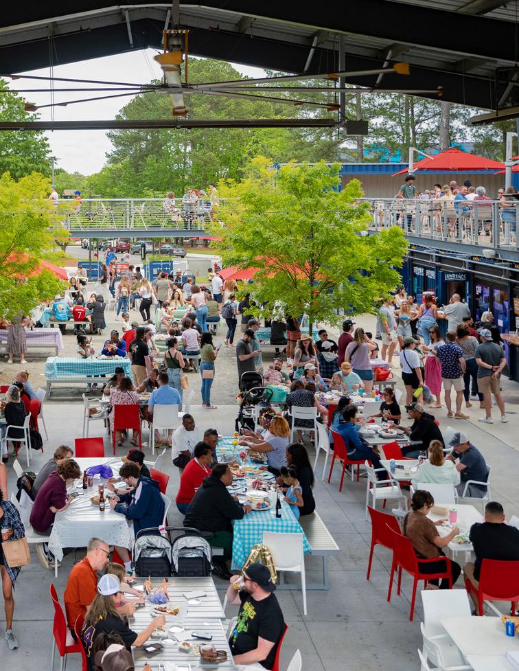
RTP 3.0 is the vision for the next half-century of research, innovation, workforce, community and economic development in RTP.
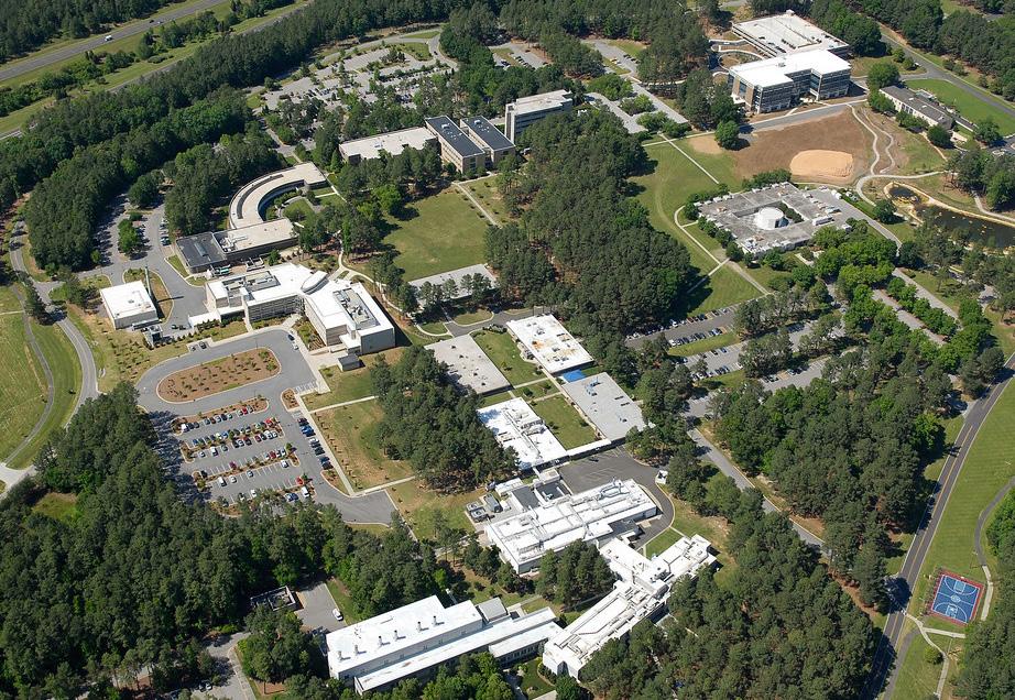
Research Triangle Park (RTP) the largest research and science park in North America. Since 1959, RTP has supported the dramatic growth of research and development across the eponymous Triangle region. Today, RTP is home to more than 385 companies and 55,000 employees across its 7,000 acres.
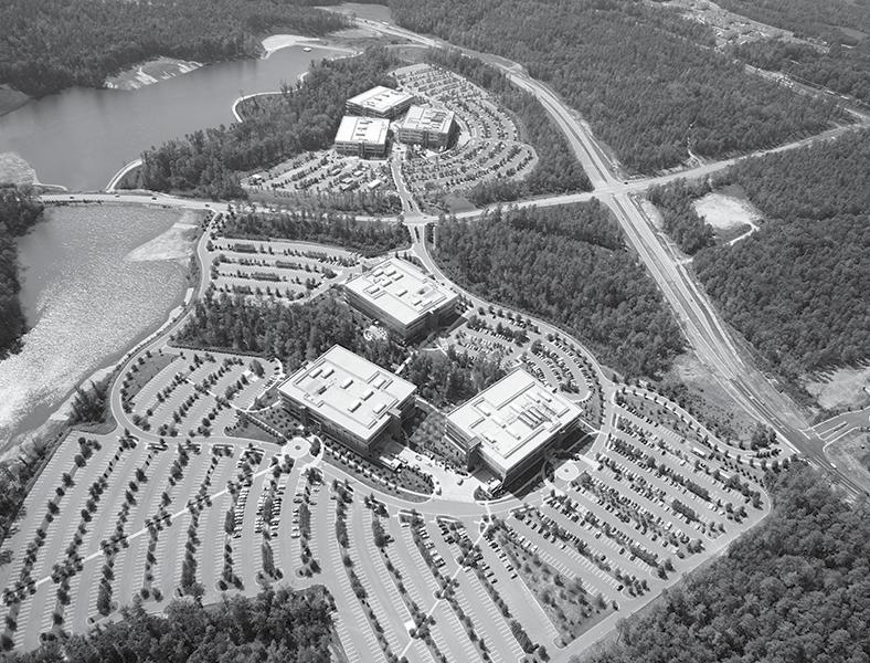
A singular development pattern, reinforced by zoning constraints, has dominated RTP across its 65-year history: auto-oriented suburban office campuses with lowscale buildings and surface parking. While RTP is nearly out of available parcels, there is tremendous capacity within existing sites to evolve to support changing research and development needs, as well as regional growth, in more walkable and sustainable ways.
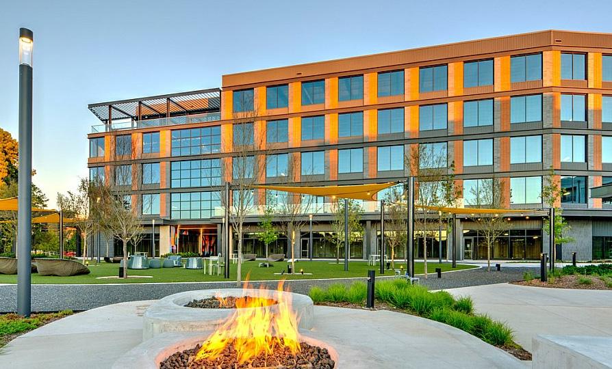
The Horseshoe represents the Park’s first move toward commercial mixed-use within the Hub RTP development.
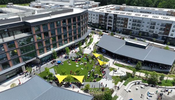
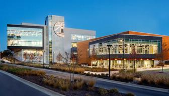
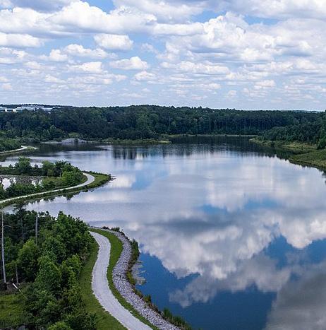
THIS NEXT EVOLUTION, RTP 3.0, CAPTURES AND SHAPES A TREMENDOUS OPPORTUNITY FOR THE PARK, RESPONDING TO THE CHALLENGES OF TODAY AND OPPORTUNITIES OF TOMORROW:
• Scale & Geography: At 7,000 acres—half the size of Manhattan—RTP remains one of the largest research parks in the world. Significant underutilized land presents opportunities to introduce new nodes of activity without compromising RTP’s research-driven core.
• Regional Growth: The Raleigh-Durham region has experienced tremendous population growth over the last three decades. That growth is projected to continue with the addition of one million people by 2040, equating to roughly 400,000 dwelling units over the next 15 years. RTP has a unique opportunity to play in addressing housing needs, mobility and workforce support.
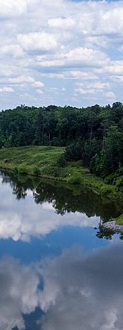
• Sustainability & Equity: The vision emphasizes environmental stewardship, walkability and mixed-use places that welcome diverse communities and create inclusive opportunities.
• Flexibility: The RTP 3.0 Vision Plan conceptually identifies where change may likely happen—strategic locations for new uses, enhanced corporate campuses, and vibrant neighborhoods—while leaving room for market dynamics and innovation to shape the outcomes.
Established in 1959, RTP was created as a collaborative effort between government, business, and the three largest universities in the region to strengthen North Carolina’s economy and stem the outmigration of talent. Strategically located between three Tier I research universities, Duke University, the University of North Carolina at Chapel Hill, and North Carolina State University, the Park was envisioned as a hub for research, innovation and technology. Over the decades, RTP has grown into one of the largest research parks in the world, home to hundreds of companies ranging from global corporations to early-stage startups. Its development has played a pivotal role in transforming the region into a nationally recognized center for science, technology and innovation.
Since its founding, RTP has continually adapted to new challenges and opportunities, expanding from its original vision (RTP 1.0) into a hub of global research (RTP 2.0). Today, as we look ahead, RTP 3.0 charts the next chapter—one that strengthens research and development while embracing sustainable, inclusive, and strategic mixed-use growth.
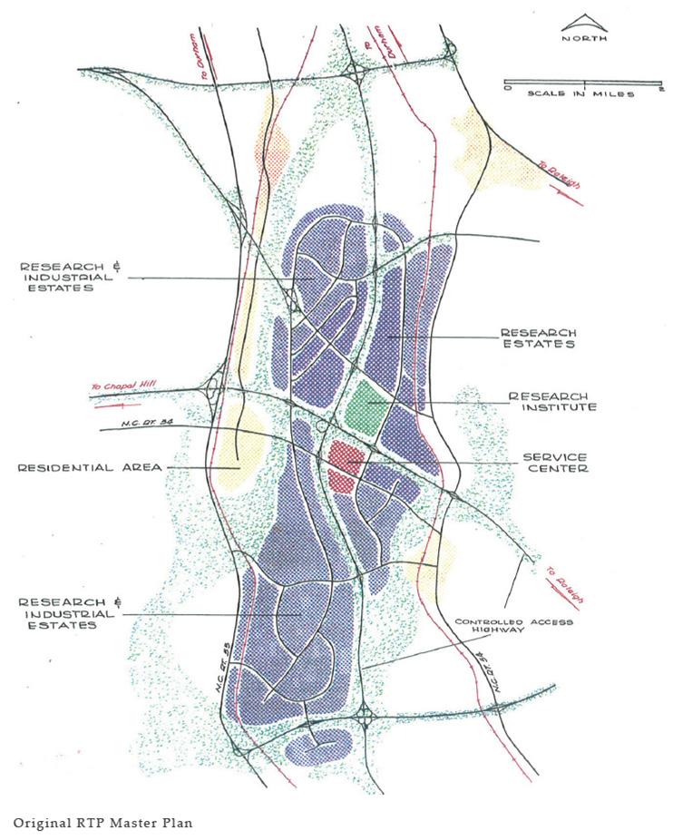
The original RTP vision, created in the late 1950s and early 1960s, established five core objectives:
• Serve as an economic catalyst for the region and state.
• Support research collaboration among the founding universities
• Leverage & retain talent from founding universities while attracting global talent.
• Serve as a symbol for a dynamic and innovative spirit
• Create a place for ground-breaking research and technological discovery.
These principles remain central to RTP’s identity. Over the decades, the Park grew rapidly, attracting leading corporations such as IBM and hundreds of others, resulting in today’s community of over 385 companies.
The 2012 master plan (RTP 2.0) introduced mixed-use development for the first time, providing support for catalytic projects such as Hub RTP and its properties: Frontier RTP, Boxyard RTP, Horseshoe at Hub RTP, MAA Nixie and more. These additions diversified the Park’s offerings, introduced new amenities, and reinforced RTP’s role as a place where innovation and community thrive together.

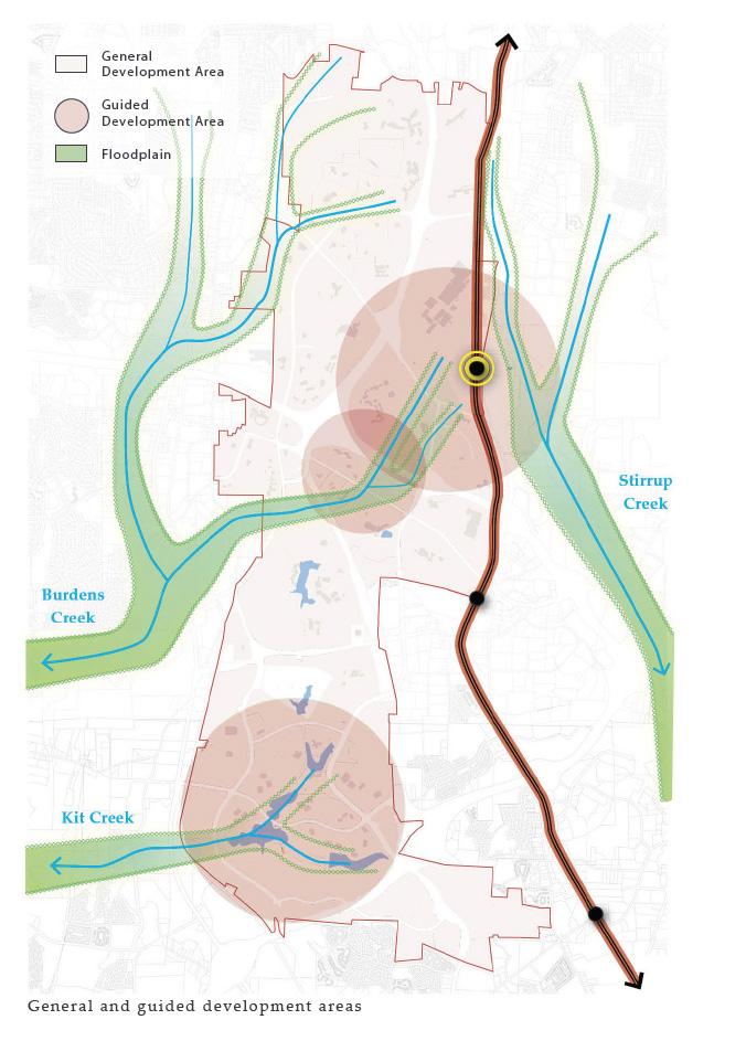
RTP 3.0 maintains the five core objectives of RTP 1.0, but it adds one more: Create opportunities to transform key locations in the Park into vibrant, mixed-use centers.
RTP 3.0 gives definition and structure for new uses and development opportunities that support the changing needs of the Park over the next 50 years. While there is ample opportunity for existing corporate campuses to continue to operate and grow in the traditional development patterns of the past 65 years, RTP 3.0 acknowledges the need to introduce opportunities for more walkable, mixed-use innovation environments where research and development today thrives. Introducing diverse land uses, including residential, commercial and recreational spaces, helps to create balanced, vibrant communities and to reinforce RTP’s position as a leading innovation hub.
Re-establish RTP as a global epicenter of 21st Century innovation and sustainability, strengthening its role as an economic driver in the region.
Support and grow biotechnology, agtech, and life sciences, accommodating specific needs for research and development facilities, including security and privacy.
Introduce placemaking strategies, including open spaces, and public uses to activate and enhance RTP.
Introduce housing and mixed-use development to form live-work-play environments.
Improve accessibility and mobility through both built and natural connections, prioritizing sustainable modes of transport.
CREATE INCLUSIVITY & RESILIENCY
Structure development to promote social, environmental, and economic sustainability.
The RTP 3.0 Vision Plan is a conceptual framework for future growth. It is not a mandate, but a tool—designed to clarify opportunities, illustrate possibilities and provide a shared foundation for how RTP might evolve based on what we know today. This vision is grounded in RTP’s mission and goals, informed by extensive input from stakeholders, and flexible enough to adapt to market conditions and future adaptations.
The vision plan balances privacy, flexibility, and future changes while providing a diagram that owners and tenants can use to better understand broader development desires. The plan is a shared, living document that captures what we know today about interests in future development. The vision plan can also help aid applications for state and federal funds for things like transit and infrastructure.
Ultimately, the RTP 3.0 Vision Plan seeks to balance flexibility and clarity—outlining where growth may occur and what form it might take, while ensuring RTP remains the nation’s premier research park.
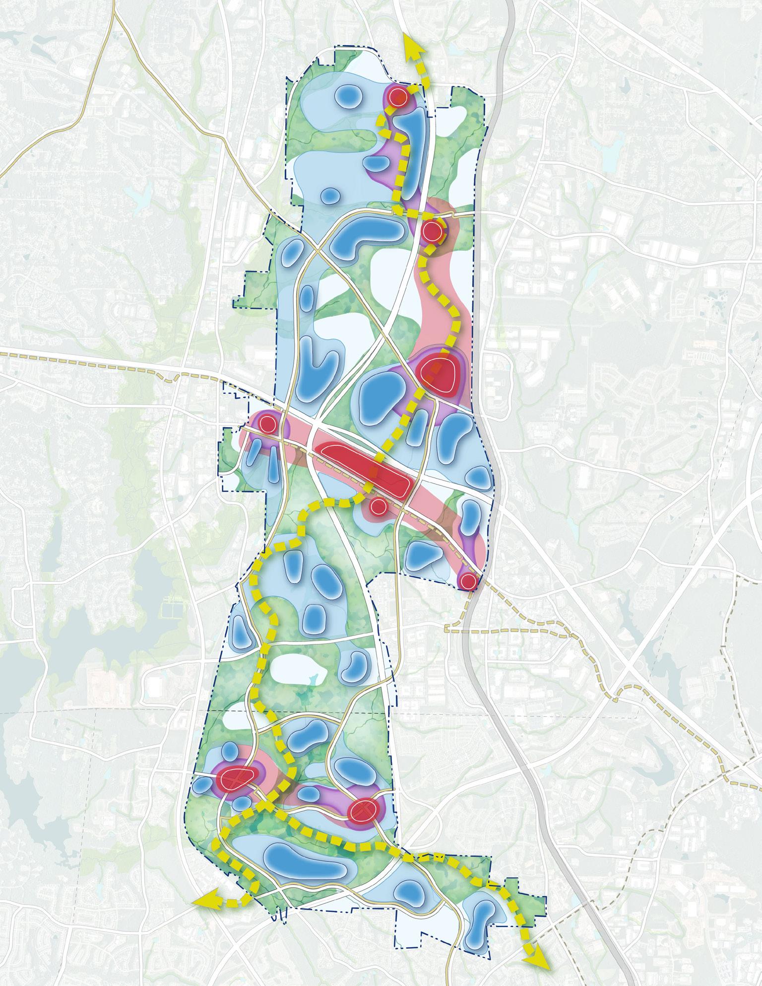
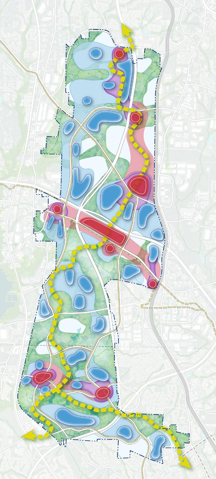
The vision plan is expressed through a layered framework, starting with the existing ecological fabric and circulation networks and then layering on the vast base of existing and potential enhanced corporate campuses, followed by potential locations for future mixed-use nodes or residential neighborhood developments. A potential RTP Greenway is layered on top to connect the existing network of RTP multi-use paths and existing and future development in a branded, 10-mile route stretching from north to south across the Park.
• Ecological Fabric: Watersheds, conservation areas, and forested land form the foundation of RTP’s identity. Future growth will respect and reinforce these natural systems.
• Existing and Enhanced Corporate Campuses: The core fabric of RTP remains its research and technology campuses. Enhanced corporate campuses provide opportunities for reinvestment and growth in dated campuses.
• Potential Mixed-Use Nodes/Residential Neighborhood Development: Possible locations for mixed-use and residential development are identified with denser concentrations at key intersections and corridors to reinforcing the idea of 15-minute neighborhoods and walkable urbanism.
• Blending of All Three Place Types:
The Vision Plan highlights locations where higher density development might occur that connects mixed-use, residential neighborhood, and enhanced corporate campus style developments.
• RTP Greenway and Multi-Use Trails:
RTP is interlaced with existing and proposed bike and pedestrian infrastructure connecting to the American Tobacco Trail and, once built, the Triangle Bikeway. A proposed north-south RTP Greenway spine will link existing multi-use trails, corporate campuses, mixeduse nodes, residential neighborhoods, and ecological corridors. It is a tremendous opportunity to spur economic development and serve as an amenity for the Park.
• Potential Passenger Rail
The plan acknowledges existing and potential future bus, bus rapid transit (BRT), and rail routes, ensuring RTP is prepared for future transit-oriented growth.
RTP 3.0 establishes three new land use types for continued development and growth in RTP.
To guide growth, RTP 3.0 introduces three new land use types in addition to the existing corporate campus model. These land use types are:
Creates walkable, transit-supportive centers with a blend of research, residential, amenities and public space.
Provides new housing opportunities to support RTP’s workforce and regional growth.
Expands capacity for research and tech campuses while allowing more flexibility in building scale, density and parking.
THESE NEW LAND USE TYPES ARE DESIGNED TO:
• Reinforce RTP’s role as a global leader in research and innovation.
• Encourage walkability and connectivity.
• Reduce reliance on surface parking by supporting structured parking solutions.
• Introduce diverse housing typologies.
• Encourage a mix of uses to support the needs of the RTP community.
• Strengthen ecological networks and open spaces.
• Improve health and quality of life for employees, visitors and surrounding community.
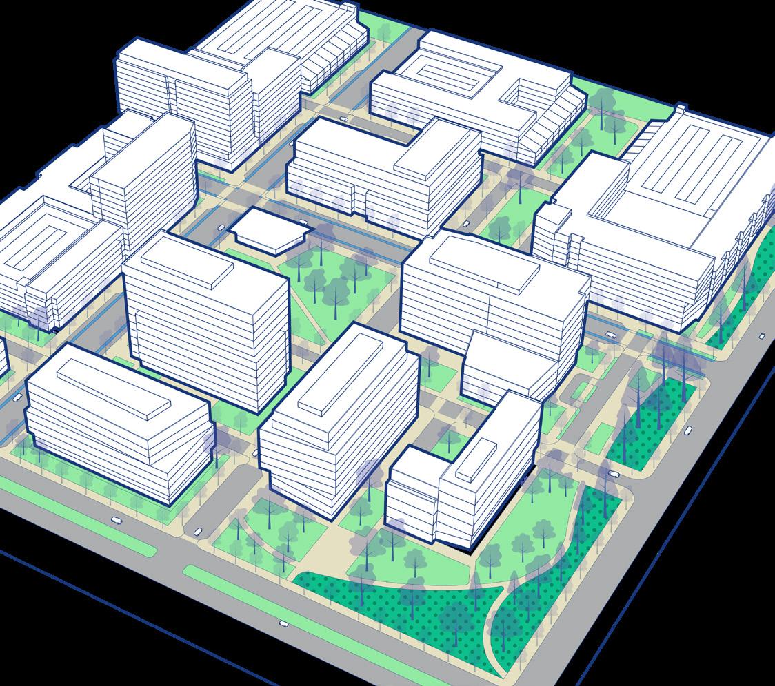
Mixed-Use Node
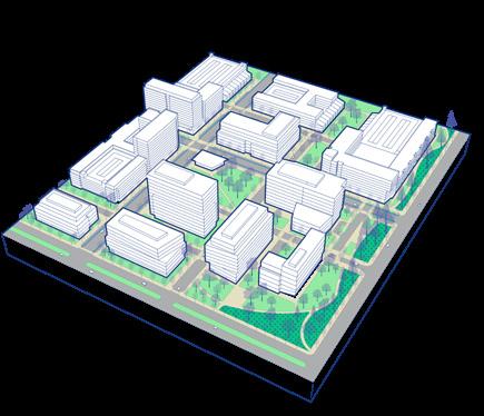
MUNs are walkable, 15-minute neighborhoods with a focus on research and development uses supported by residential, retail and other uses. In a MUN, employees and residents can easily access daily needs within a short walk or bike ride. This land use type requires safe and connected infrastructure that supports walking, biking, rolling and public transit use. Green spaces and recreational amenities will be integrated throughout the community, providing residents with accessible opportunities for leisure, wellness and environmental benefits.
KEY PLANNING PRINCIPLES:
Compact and Mixed-Use Development:
Concentrate housing, employment, retail, and community services within walkable distances to reduce reliance on cars.
Mobility and Connectivity:
Prioritize safe, convenient, and accessible walking, biking, rolling, and transit networks. Ensure multimodal connections link to regional transit and surrounding neighborhoods.
Diverse Housing Options:
Provide a range of higher-density housing types, sizes, and price points to serve people of all ages, abilities and income levels.
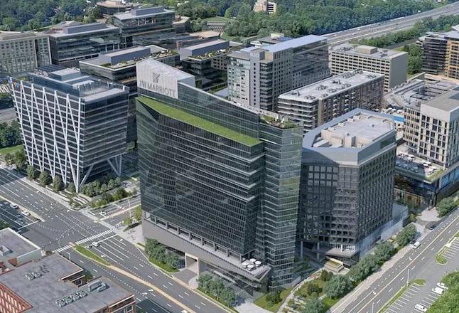
The area surrounding Reston Station in Reston, VA, has developed into a MUN typology with a variety of land uses at higher densities to activate this area.
Public Realm and Green Space:
Integrate parks, plazas and recreational areas throughout the neighborhood. Ensure green spaces are multifunctional, supporting both social interaction and ecological benefits.
Human-Scale Design:
Design streets and buildings to encourage active ground floors, pedestrian comfort and a vibrant public realm.
Sustainability and Resilience:
Incorporate green infrastructure, energy efficiency and climate-responsive design. Support local food systems and reduce carbon emissions through compact growth.
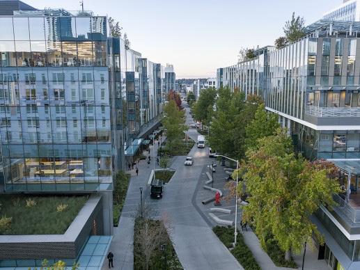
Lake Union in Seattle, WA, features a variety of supportive land uses in an urban form integrated to support innovation companies located in the district.
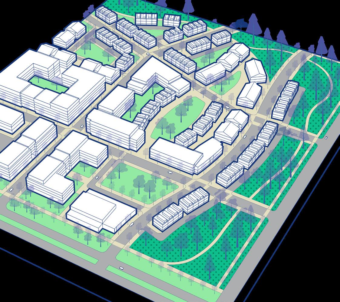
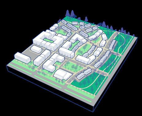
RND emphasizes the creation of complete neighborhoods that balance residential living with a mix of supportive uses and community amenities. A diversity of housing types at varying price points and densities ensures inclusivity, with options ranging from low- and mid-rise apartment buildings and townhouses to higherdensity residences and ground-floor nonresidential uses. While the primary land use is residential, complementary commercial, civic, and institutional functions are integrated to support daily needs. Development is designed to promote safe walking and biking, with access to transit, bus routes, sidewalks and bikeways along major corridors. Publicly accessible amenities—including parks, trails, community gardens and recreational facilities—are connected throughout the neighborhood.
KEY PLANNING PRINCIPLES:
Walkability:
Streets and blocks are designed for pedestrians first, with sidewalks, street trees and safe crossings. Daily needs are located within a short walk of homes.
Mixed-Use and Compact Form:
A blend of housing, shops, offices, civic uses, and recreation within close proximity.
Connected Street Network:
A grid or modified grid street system disperses traffic and provides multiple routes. Streets are narrow, treelined, and designed for slower speeds.
Diverse Housing Choices:
A variety of housing types, sizes, and price ranges to serve a mix of incomes and ages. Integration of apartments and townhomes within the same neighborhood.
Prominent Civic Spaces:
Parks, plazas, greens, and civic buildings (such as schools or libraries) are centrally located and accessible. Public spaces serve as community gathering places and focal points of neighborhood identity.
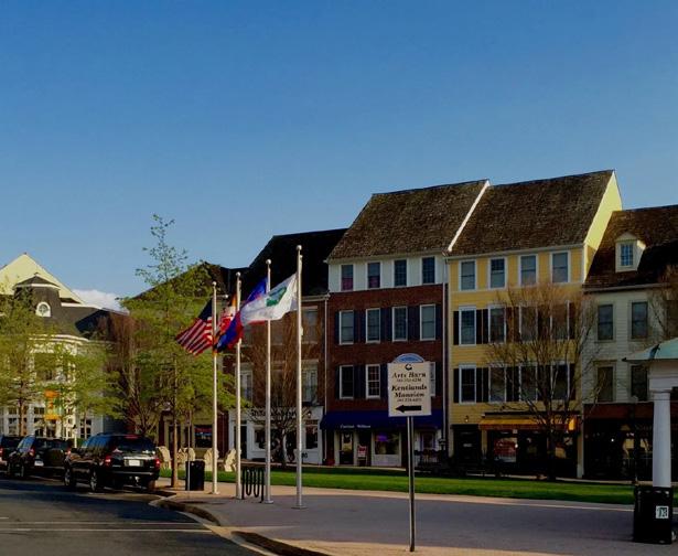
Kentlands, Maryland is a good example of RND, blending compact, walkable urban design and community-oriented amenities, while integrating diverse housing options.
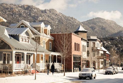
South Main, Buena Vista, CO has a diversity of housing types and densities expressed through varied, human-scale architecture with a small commercial main street.
Corporate Campus
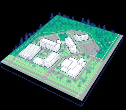
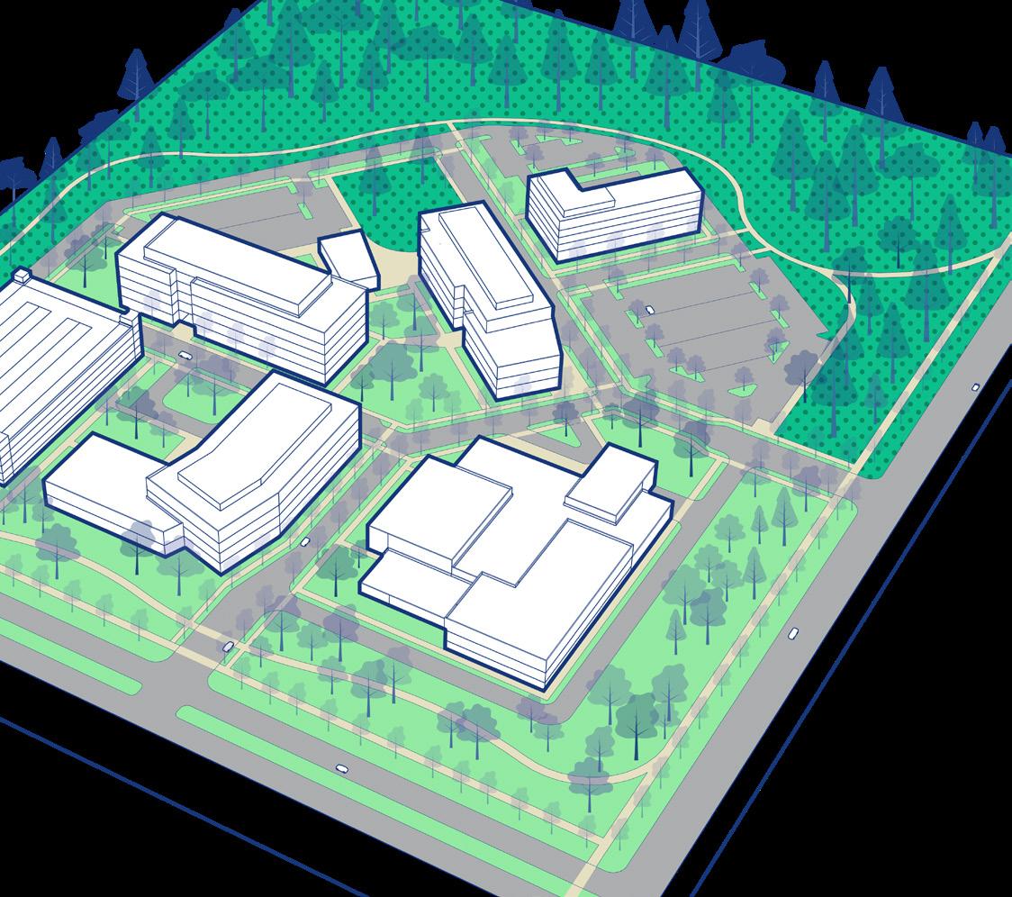
ECCs are re-imagined workplace environments that transform traditional, auto-dominated suburban office parks into more vibrant, walkable and amenity-rich destinations. Unlike conventional campuses—often car-oriented with isolated buildings and large surface parking—enhanced corporate campuses prioritize connectivity, mixed-use development, and employee well-being. They integrate offices with supporting amenities such as dining, fitness and wellness centers, day-care, and public or semi-public green spaces, while promoting pedestrian, bicycle, and transit access. The design typically emphasizes context-sensitive infill, creation of cohesive blocks, and the thoughtful integration of natural features, balancing private organizational needs with opportunities for community engagement.
KEY PLANNING PRINCIPLES:
Walkable, Pedestrian-Focused Core:
Prioritize pedestrian zones and connected pathways to promote health, wellness and social interaction.
Strategic Infill and Mixed-Use Development:
Focus growth within the existing campus footprint, integrating complementary uses such as dining, wellness and shared facilities.
Integration with Natural Features and Open Space:
Organize buildings and amenities to maximize access to green spaces, sunlight and outdoor recreational areas.
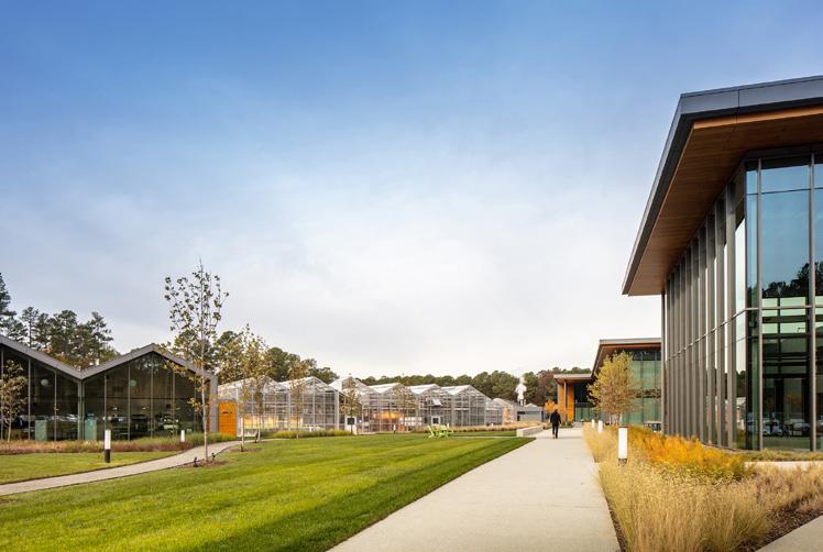
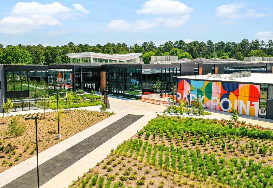
Alexandria Center for AgTech in the RTP shows a move towards ECC-style development with a pedestrian focused core, trail connections, and restaurants.
Efficient Parking and Land Use:
Locate parking garages at the campus periphery to free central areas for development, open space and pedestrian activity.
Context-Sensitive and Connected Design:
Ensure new development respects existing buildings, surrounding context, and provides strong connections to transit and trails.
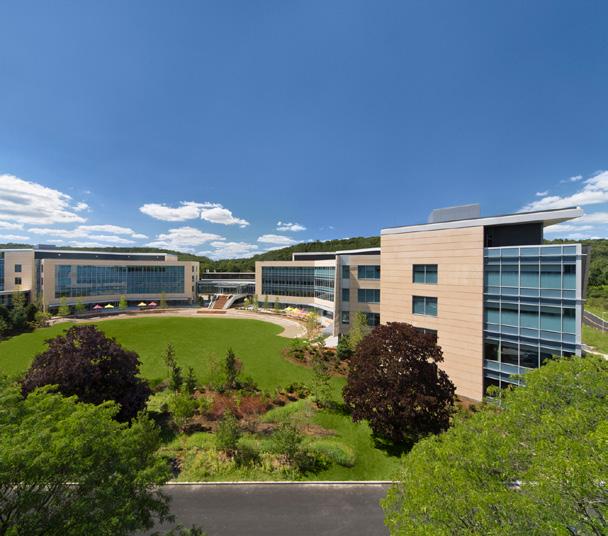
Regeneron BioMed Realty Campus in Greenburgh, NY maximizes natural light and connections to open space through it’s compact, walkable footprint.
RTP 3.0 proposes a 10-mile northsouth greenway to better connect RTP and spur economic development.
Along with nodes of mixed-use development, multimodal corridors anchored by transit-oriented development, infrastructure network enhancements, and new land use types, RTP 3.0 proposes the RTP Greenway to connect the Park.
There is an extensive network of multi-purpose trails throughout the Park today. The majority of these trails exist within public right-of-ways along the primary roadway network. A number of properties have secondary trails within their campus. Some of these trails are public but most are currently private. Despite this existing network, there are gaps and properties that have limited safe access to these trails.
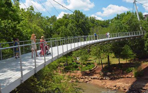
The RTP Greenway is envisioned as a north-south corridor that will provide an alternative multimodal circulation route to connect the Park. The corridor consists of two components: the greenway and trails.
The RTP Greenway is a linear, natural area that may include trails, amenities, undeveloped open space, stream buffers, environmental preserves, and/or wildlife corridors and connect separate tracts of open spaces. For RTP 3.0, the RTP Greenway is a tool for preservation, character defining, and organization.
The RTP Greenway Trail, is a public access facility (multi-use path) within a greenway or public utility easement that connects development nodes. For RTP 3.0, the RTP Greenway Trail is utilized as a multimodal connector, activator, and amenity.
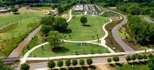
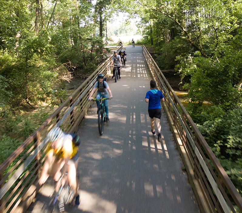
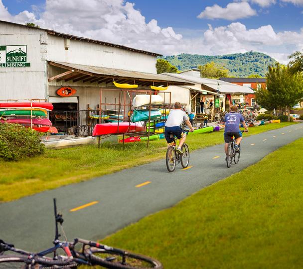
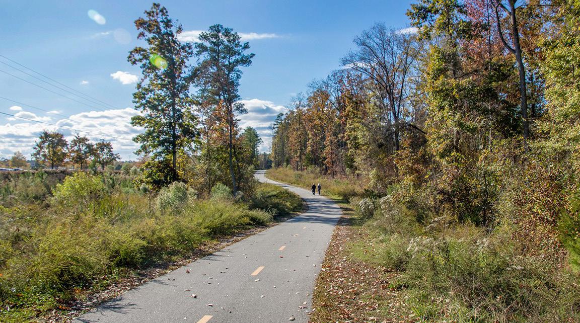
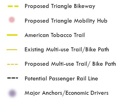
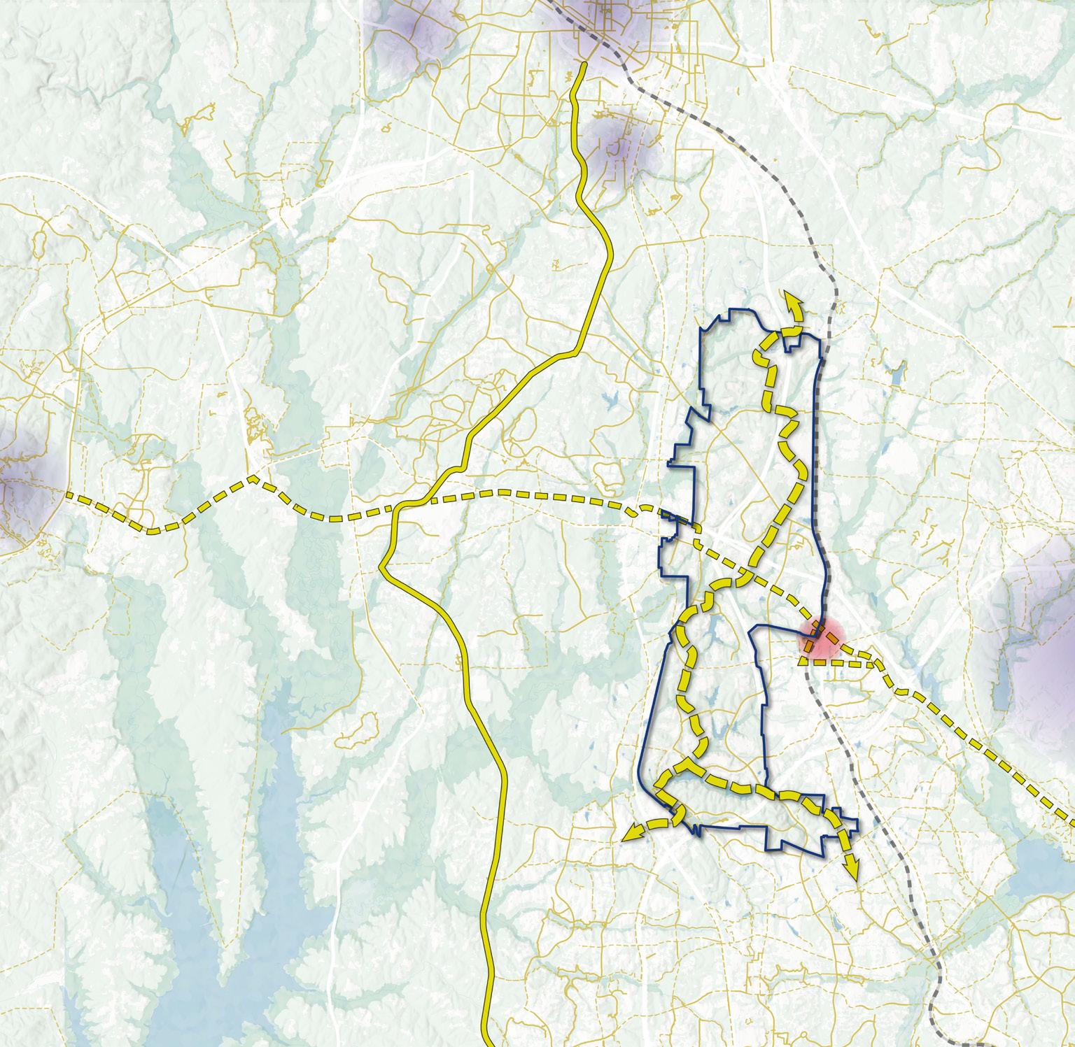
Improving connections throughout RTP is an important benefit to the proposed RTP Greenway. Equally as important are opportunities to connect to regional anchors and other multi-use paths and bike routes outside the Park. The proposed Triangle Bikeway alignment passes through the heart of RTP along NC-54 and will better connect RTP to UNC-Chapel Hill, RDU Airport, and the American Tobacco Trail. Additional linkages to the American Tobacco Trail to the north connect to Downtown Durham, Duke University, and North Carolina Central University.
Conceptual diagram of the RTP Greenway connecting different land use types and amenities
THE RTP GREENWAY’S PRIMARY GOALS ARE TO:
• Connect existing and future assets and amenities
• Spur economic development
• Build on and enhance the existing RTP trail network while providing opportunities for micromobility and increased pedestrian and bike connectivity
• Align, preserve, and enhance the natural systems within and adjacent to the Park
1 Multimodal Spine
2 Future Expansion Opportunity
3 Multimodal Feeder
4 Neighborhood Connector
5 Regional Connection to RTP Greenway
6 Nature Trail
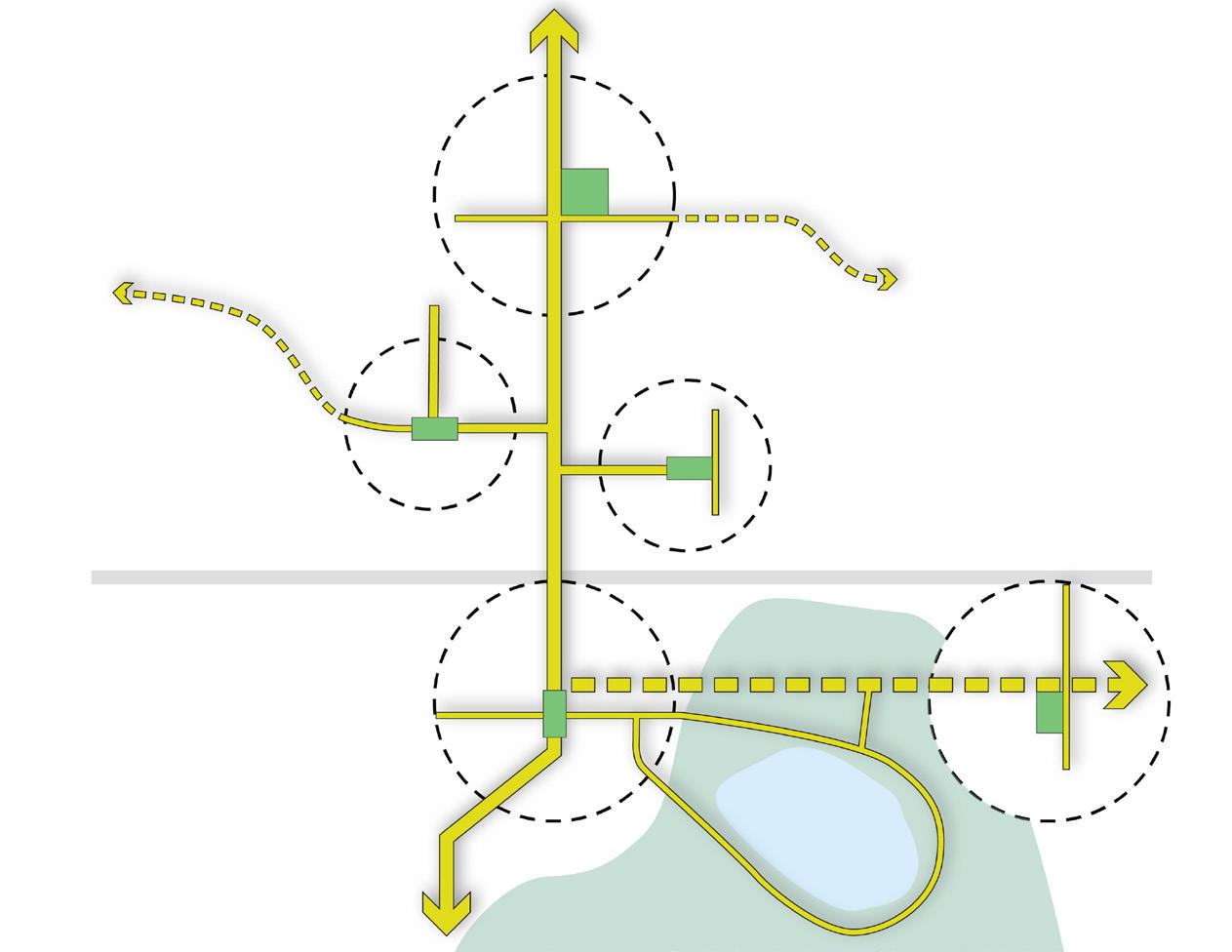
Conceptual diagram of the RTP Greenway connecting different land use types and amenities
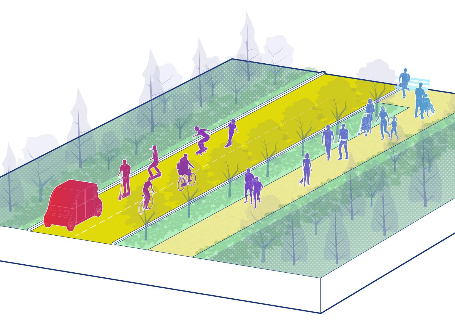
HIGH-SPEED USERS up to 20 MPH
• Neighborhood Electric Vehicles
• Motorized micromobility including scooters and bikes
• Experienced cyclists
MID-SPEED USERS up to 10 MPH
• Casual cyclists
• Runners
• Skateboarders
LOW-SPEED USERS up to 3 MPH
• Walkers
• People with families
• People with disabilities
The RTP Greenway will require navigating a variety of constraints in order to become a continuous, 10-mile-long public amenity for the RTP community and surrounding neighborhoods. These challenges include land ownership and secure campuses, topography and natural features, highways and major barriers, and incorporation of major public uses. The RTP Greenway will navigate these various challenges with a strategic kit of parts to address a wide range of contexts.
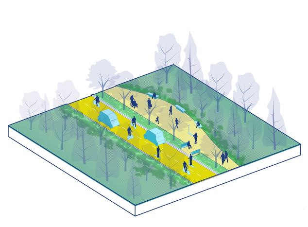
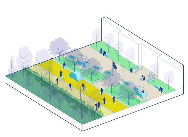
Property ownership and campus types (open versus secure campuses) are major hurdles to a continuous greenway within RTP. The cross section of the RTP Greenway will need to respond to various conditions throughout the Park requiring different strategies to maintain a consistent user experience while responding to each campus’ individual needs. Below are three section examples of different conditions along the envisioned RTP Greenway.
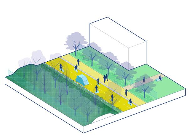
Within RTP, there are a number of natural features and topographical conditions that will require creative strategies for a continuous RTP Greenway. Many potential campuses have significant topography and will require bridges and/or ramping systems to provide safe and manageable pedestrian and bicycle movements. These elements should work with the context and enhance the character of the overall user experience.
Additionally, the RTP Greenway can adopt natural elements within the design of the trail itself, using materials and native species to blend the trail with its environment.
RTP is bisected by two major highways (I-885 and I-40). These roadways are significant barriers, creating gaps and limiting opportunities to connect the RTP Greenway. One solution is to explore the use of pedestrian bridges or park “lids,” which create open space amenities over highways allowing for a more continuous RTP Greenway experience and minimizing highway disruption.
While balancing the needs of existing campuses within the Park and the need for additional public amenities to support the growing RTP community, incorporating larger parks and recreational facilities will be important to the success of the RTP Greenway. These spaces will be limited based on types of campuses and site sizes. These amenity spaces should strive to be public (accessible by Park employees and residents, as well as the surrounding communities).
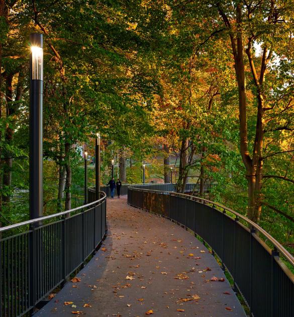
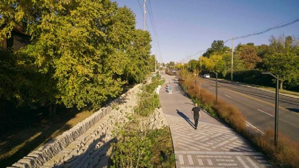
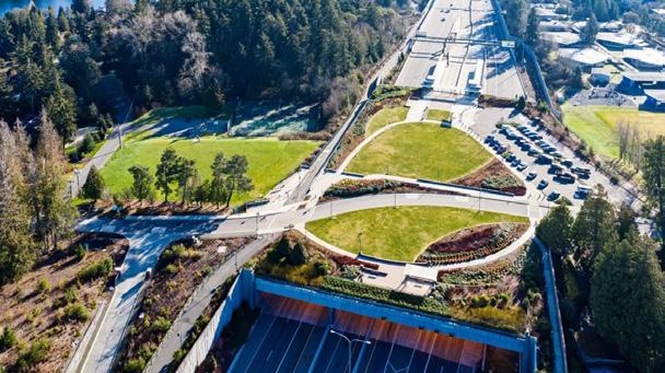
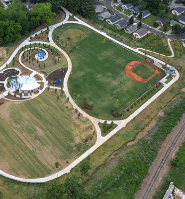
RTP 3.0 acknowledges that each location and campus in the park has unique needs.
The RTP 3.0 Vision is organized around a series of focus areas, each shaped by its unique site conditions and adjacent context. These focus areas represent where there is existing development or where there may be new development in the future. The focus areas are conceptually represented, allowing future development to respond to changing opportunities and challenges while maintaining a cohesive, connected framework. The proposed RTP Greenway serves as a key organizing feature to connect these identified focus areas. Within each focus area, tailored strategies will guide the integration of land uses, the alignment of greenways and open spaces, and the development of multimodal connections.
Land use strategies will define the appropriate mix of residential, commercial, civic, and institutional uses in ways that support property owner needs, RTP community needs, and regional market demand. The RTP Greenway and open space strategies will ensure that parks, plazas and natural areas are woven throughout the different focus areas, enhancing ecological value, promoting health and recreation, and linking to broader regional green networks. Connectivity strategies will prioritize safe and efficient movement for all modes of travel—walking, biking, rolling, transit, and vehicles—while ensuring seamless connections between focus areas and adjacent neighborhoods.
Together, the focus areas create a framework that balances flexibility with clear direction, ensuring that development is responsive, resilient and wellintegrated into its surrounding context.
and enhanced
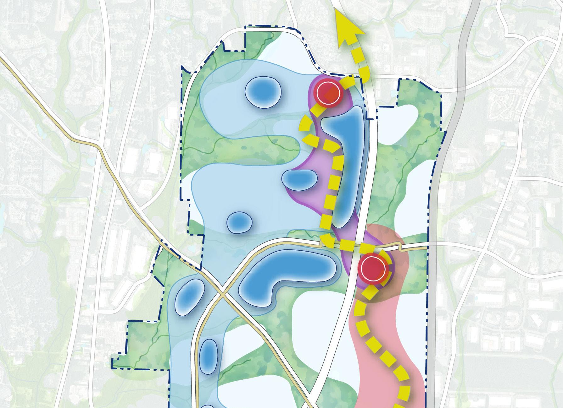
The North RTP focus area is located between T.W. Alexander Drive and Ellis Road, with two access points from I-885. Moore Drive serves as the primary north–south spine. The area includes a mix of natural landscapes and corporate campus development.
The RTP 3.0 Vision Plan identifies North RTP as a potential ECC-prominent area. A mix of uses—including service retail, restaurants, hotels, and other campus-supporting amenities—may be clustered near the intersection of Ellis Road and Moore Drive. This intersection is a key gateway into RTP and offers high visibility for these uses. In addition to supporting the RTP community, this area could also provide synergistic amenities for surrounding residential neighborhoods and commercial development north of Ellis Road.
The potential RTP Greenway alignment could parallel Moore Drive, integrating with existing trails and amenities while linking the mixed-use node at Ellis Road to properties south of T.W. Alexander Drive. In this focus area, the RTP Greenway would function primarily as a multimodal movement system, connecting employees to amenityand service-rich nodes. Supportive open space amenities would likely be smaller in scale due to existing development and natural area constraints.
Conservation & heavily forested areas
Existing and enhanced corporate campuses
Potential mixed-use nodes/ residential neighborhood development
Blending of all three place types
RTP Greenway & multi-use trails
Potential passenger rail
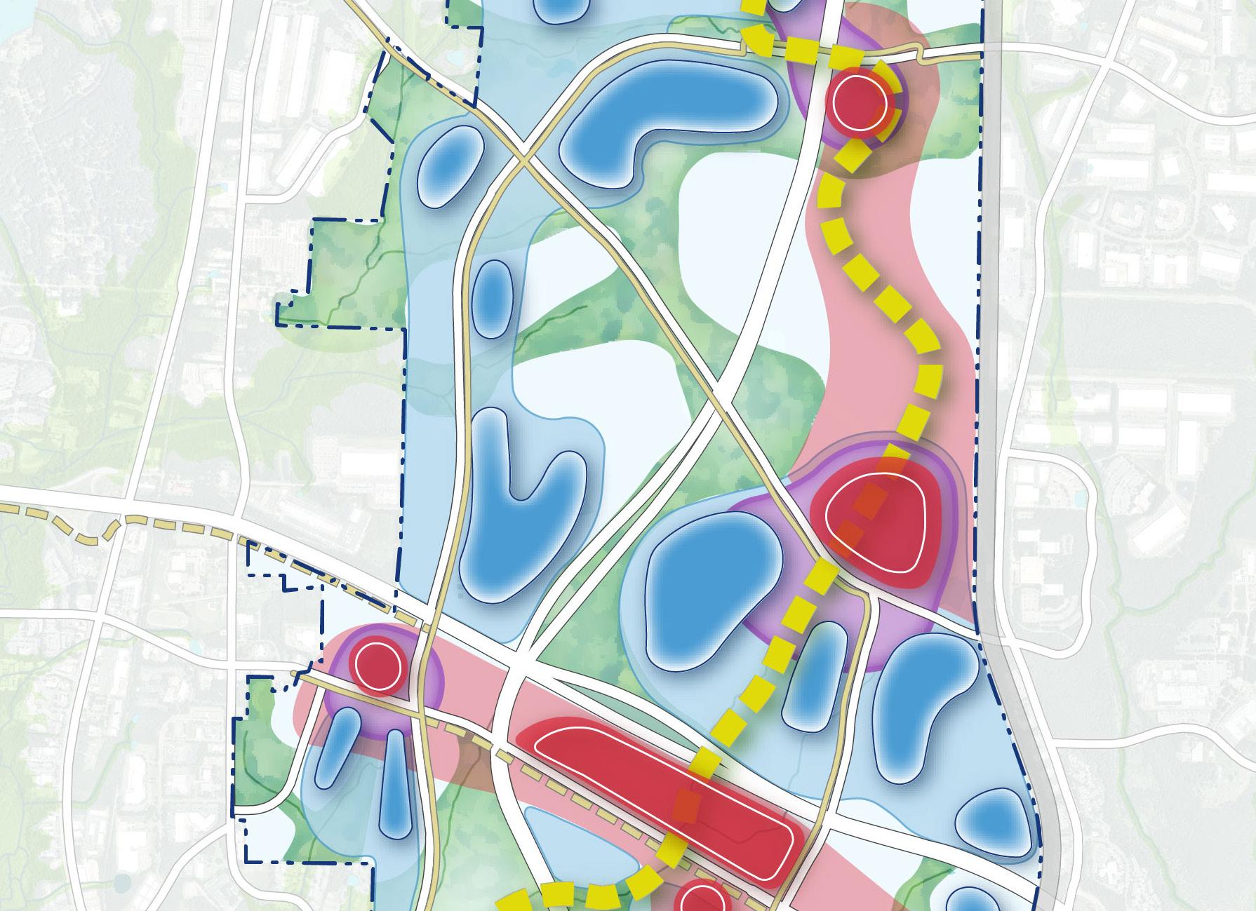
The Cornwallis Road focus area consists of properties fronting Cornwallis Road and is bounded by T.W. Alexander Drive and I-40. This area also has two access points from I-885. It is predominantly developed with large corporate campuses interspersed with smaller natural areas.
The RTP 3.0 Vision Plan envisions this focus area as a potential location for all land use types, supported by the size of existing campuses and access to key transportation corridors. Given the area’s length, the plan suggests two potential MUN opportunities at key intersections. ECC opportunities are concentrated toward the south end of Cornwallis Road, building on existing uses and recent campus investments.
The RTP Greenway will be a critical open space element in future development, serving as the primary multimodal, non-vehicular connection between the North RTP focus area and the NC-54 Corridor. Larger outdoor amenities may be feasible here due to property sizes and regional access.
Conservation & heavily forested areas
Existing and enhanced corporate campuses
Potential mixed-use nodes/ residential neighborhood development
Blending of all three place types
RTP Greenway & multi-use trails
Potential passenger rail
TWAlexanderDr.
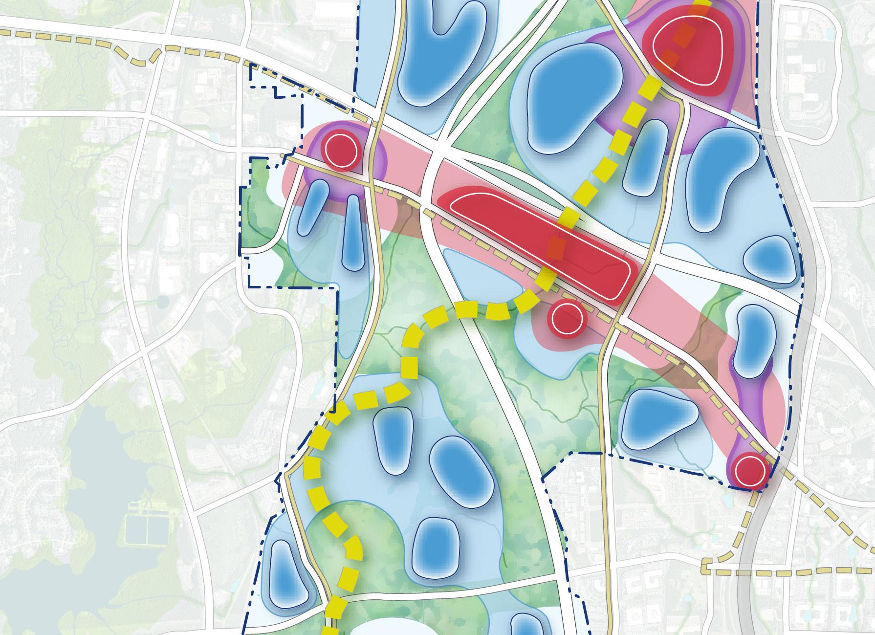
The NC-54 Corridor focus area includes properties adjacent to NC-54, with key access points from I-40. This corridor functions as a major east–west gateway into RTP. Recent development at Hub RTP have introduced a mix of uses, including residential and retail, reinforcing this corridor as the central heart of RTP. The landscape is mature, with natural areas weaving between development along the corridor.
The RTP 3.0 Vision Plan positions the NC-54 Corridor as a dense, urban, mixed-use area providing services, amenities and entertainment for all of RTP. To accommodate higher-density development, the area is envisioned as a multimodal corridor featuring bus rapid transit (BRT), regional bike facilities, and a multi-use trail system. With the addition of a planned transit center and potential passenger rail, development is encouraged to maximize transit-oriented opportunities.
The RTP Greenway should connect through Hub RTP, which is organized around a revitalized stream corridor serving as the development’s central amenity. At this intersection, the RTP Greenway would maximize opportunities for nearby corporate campuses to connect with the Hub’s amenity-rich environment. Additional open space amenities are expected to be smaller in scale due to existing development and natural resource constraints.
Conservation & heavily forested areas
Existing and enhanced corporate campuses
Potential mixed-use nodes/ residential neighborhood development
Blending of all three place types
RTP Greenway & multi-use trails
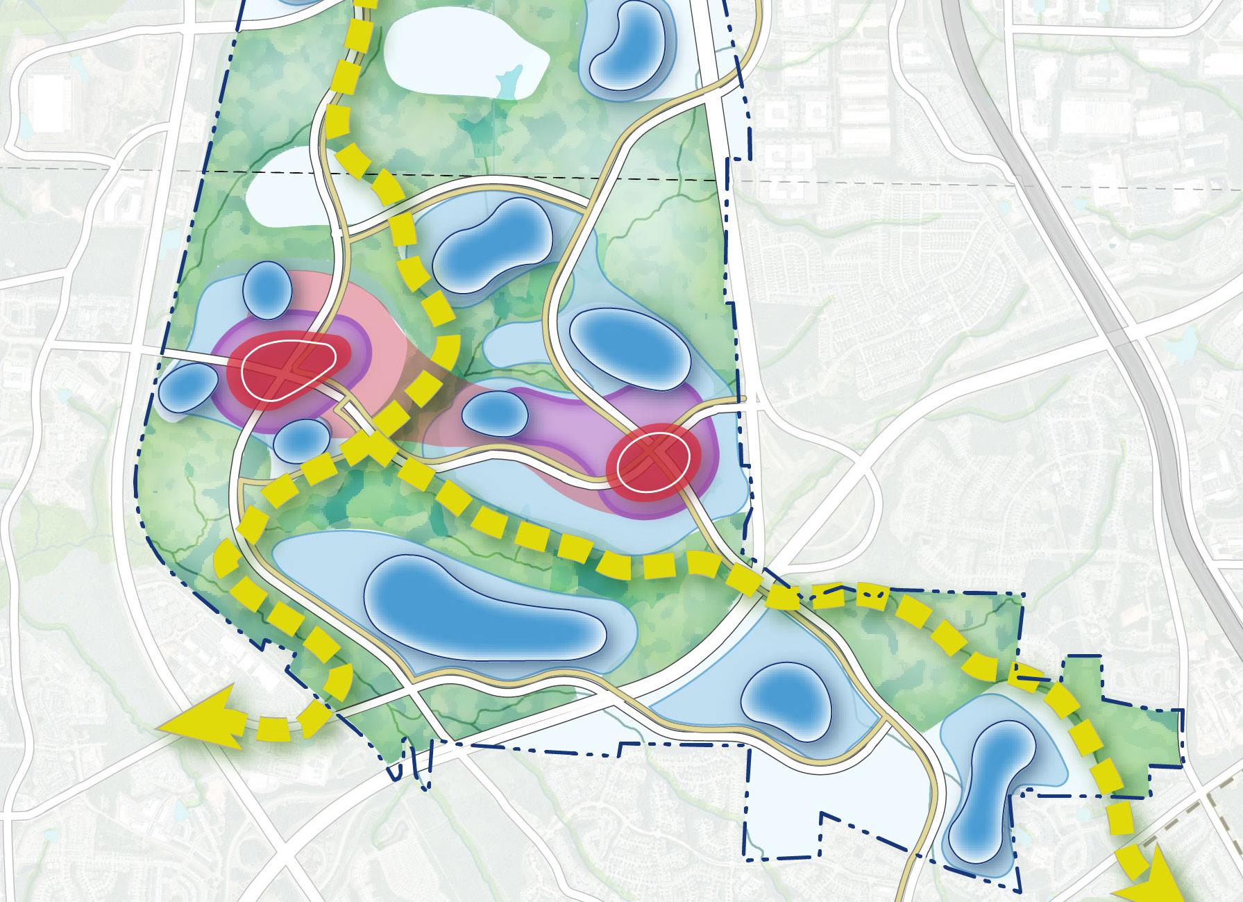
The South RTP focus area is located between Development Drive and Little Drive, with one access point from I-885. Kit Creek Road serves as the primary east–west spine. The area is characterized by natural landscapes, corporate campuses and a series of lakes. Existing outdoor amenities include campus recreation areas and trails. The surrounding context is primarily newer residential neighborhoods and retail centers.
The RTP 3.0 Vision Plan envisions South RTP as another ECC-prominent area. A mix of uses—including service retail, restaurants, hotels, and some housing—may be clustered at the intersections of Louis Stephens Drive with Kit Creek Road, as well as Kit Creek Road with Davis Drive. These intersections are key gateways into RTP and provide high visibility for these uses. In addition to serving RTP, this area has the potential to offer synergistic amenities for adjacent residential neighborhoods.
The RTP Greenway could align with existing lakes and trails, linking the potential mixed-use nodes along Kit Creek Road. In this focus area, the RTP Greenway would primarily function as a multimodal movement system, connecting employees to amenity- and service-rich destinations. Additional open space amenities would likely be smaller in size given the existing development and natural area context.
Conservation & heavily forested areas
Existing and enhanced corporate campuses
Potential mixed-use nodes/ residential neighborhood development
Blending of all three place types
RTP Greenway & multi-use trails
Potential passenger rail
LouisStephensDr.
RTP has always been a place where ideas transform into impact. RTP 3.0 reaffirms that mission, strengthening research and innovation while creating places that are sustainable, connected, and inclusive.
As RTP begins to implement RTP 3.0 guided by this vision plan, flexibility will continue to be essential to realizing RTP 3.0’s success. Adjustments to this longterm vision for the Park will be necessary over time to adapt to changing market conditions, land ownership patterns and industry and workforce needs.
By thoughtfully supporting growth in ways that are adaptive and resilient, RTP will continue to attract global talent, support regional prosperity, and remain a model for research parks worldwide.
700 Park Offices Drive, Suite 007 Durham, NC 27713 www.rtp.org