Mabelle Zhang
Portfolio
City Planning
Urban Design
Community Engagement
Master in City Planning | MIT DUSP 2025
Selected Works
planning with data designing with place engaging with people
mabellez@mit.edu

Portfolio
City Planning
Urban Design
Community Engagement
Master in City Planning | MIT DUSP 2025
Selected Works
planning with data designing with place engaging with people
mabellez@mit.edu
224 - 387 - 8429
I use planning, design, and community dialogure to create resilient, vibrant public spaces and neighborhoods. For me, these disciplines are deeply intertwined, each essential to crafting visionary yet implementable master plans reflecting a community’s unique needs.
I’m a urban policy analyst by training and worked in real estate development, community organizing, and placemaking before graduate school. Now, I’m getting my Masters of City Planning at MIT with an Urban Design Certificate and a development focus.
I’ve worked on public space and planing challenges at various scales, from small lots to major parks to neighborhood-level plans. I’m excited to bring my approach to any challenge coming my way.
Activate University Pl. Plaza Summer 2024 | Place Activation
Planning + Design
Co-Design Open Space Spring 2024 | Community Engagement
Design + Engagement
Public Life Study in Union Square Summer 2024
Professional Planning
Revitalizing Ashmont Main Streets Fall 2024 | Neighborhood Planning
Academic: Client-Based Planning + Design
NoSo Development Proposal Spring 2024 | Urban District Blue Green
Academic Planning + Design
Academic: Client-Based Design + Engagement
Type: Professional | Individual | Union Square Partnership
Role: Urban Design Intern
Date: Summer 2024
Location: Union Square Park, NYC
Skills: Scenario Planning, Visual Storytelling,
Software: Rhino, Adobe Illustrator
About University Place on 14th Street, across from Union Square Park, is underutilized, serving mainly as bike parking, litter space, and vendor storage. This project proposes design solutions to revitalize the area, aiming to build a shared vision with city officials, residents, and donors to transform it into an engaging public space.
These renderings were shared with potential donors, which secured $50K in funding for future activations
• Identified bike parking relocation to remove parking from University Place; Pitched to DOT and approved
• Identified key design drivers
• Proposed activation options and developed visualizations
• Pitched to donors and city officials
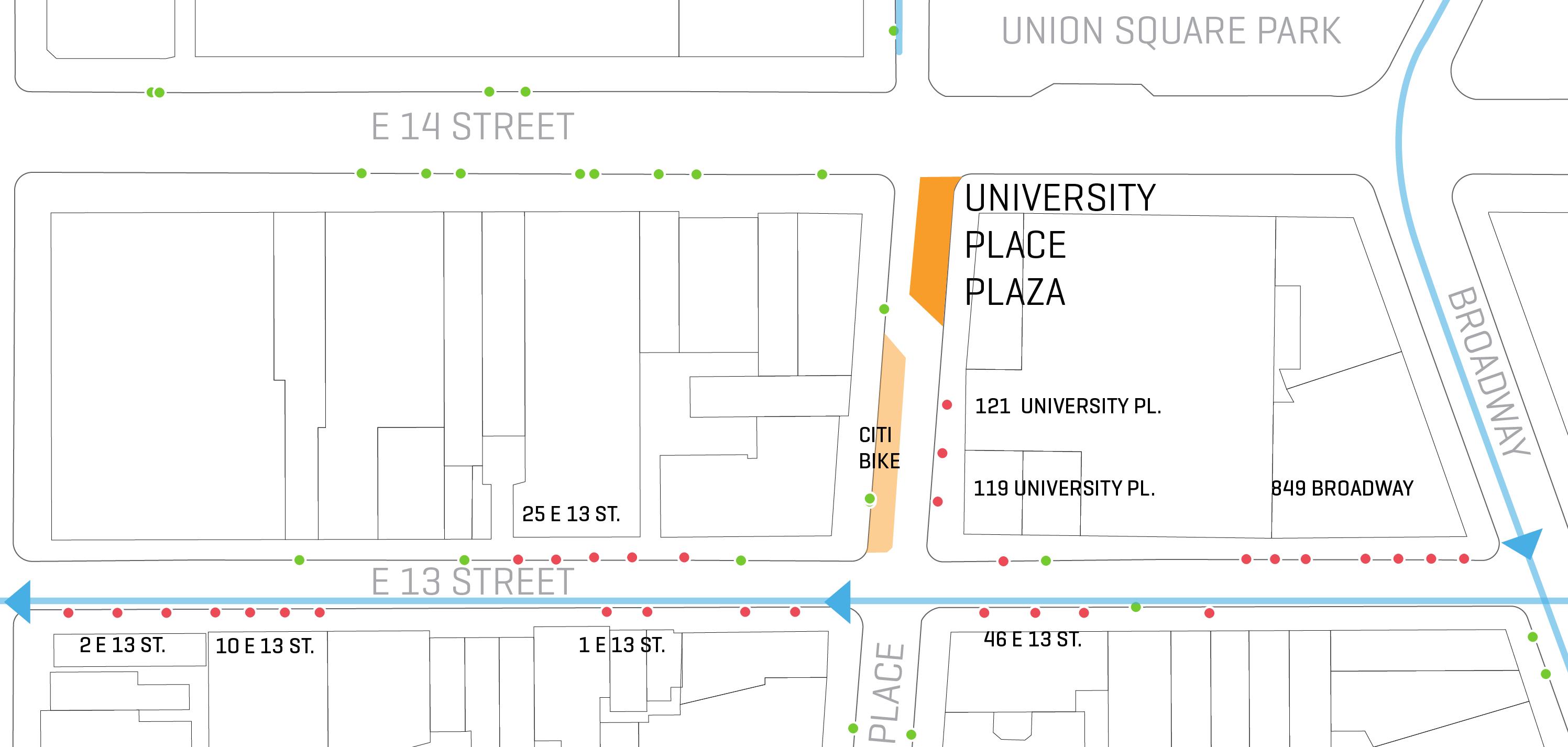
Existing
To open up the plaza, we proposed removing the bike corrals and suggested new rack locations on 13th Street, a backof-house street. These locations meet DOT Street Design Guidelines, and DOT agreed to the relocation.
Open Space Network
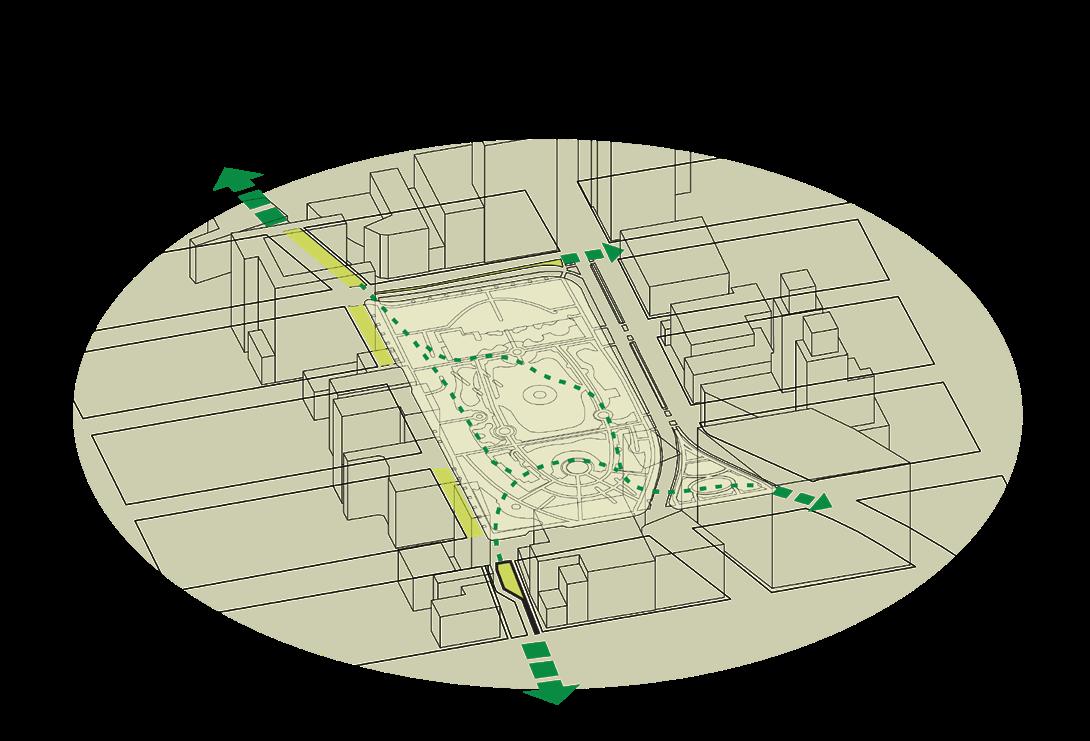
University Place is part of a network of plazas extending the Park’s open space. This provides more space for relaxation and recreation and more connection within and beyond the park.
Public Art + Landmarks Network
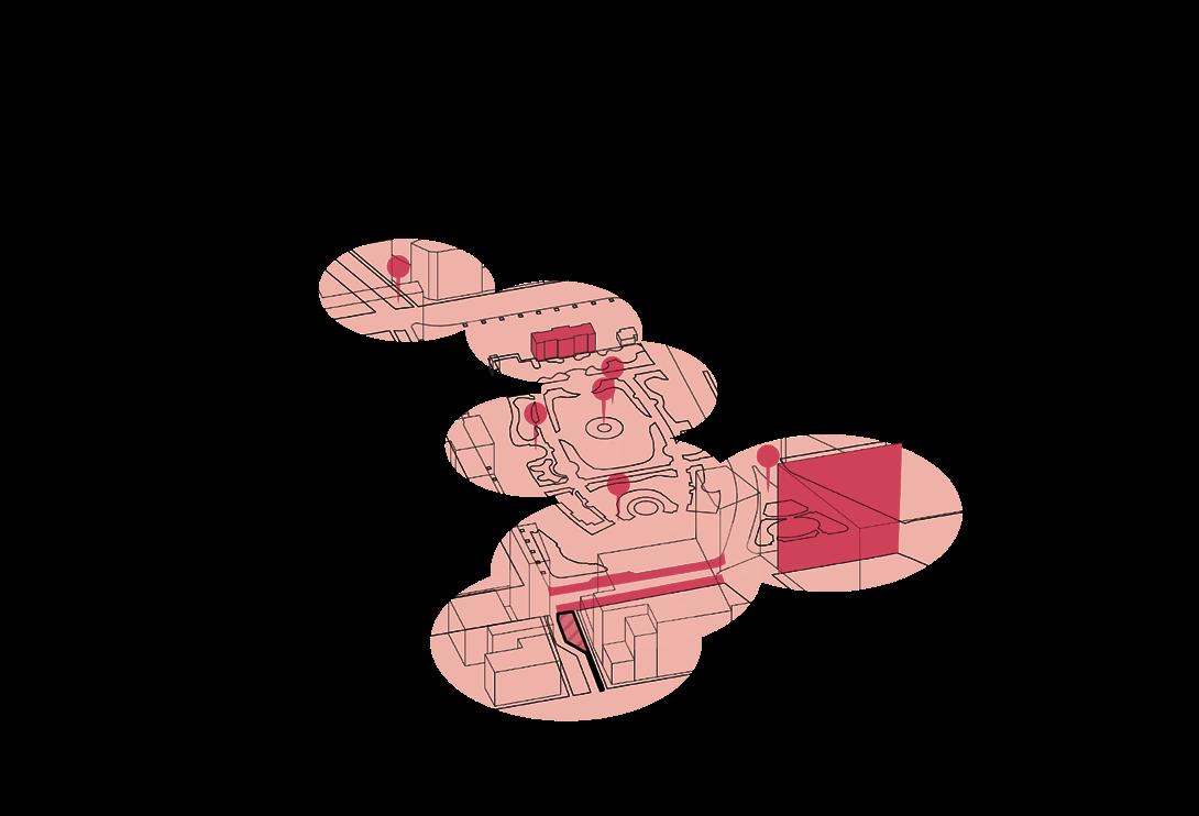
Union Square has a high concentration of public art and historic landmarks, creating a strong urban identity, beautifying the area, and drawing vistors and residents alike.
Gateway to Union Square
Mixed-Use Adjacencies
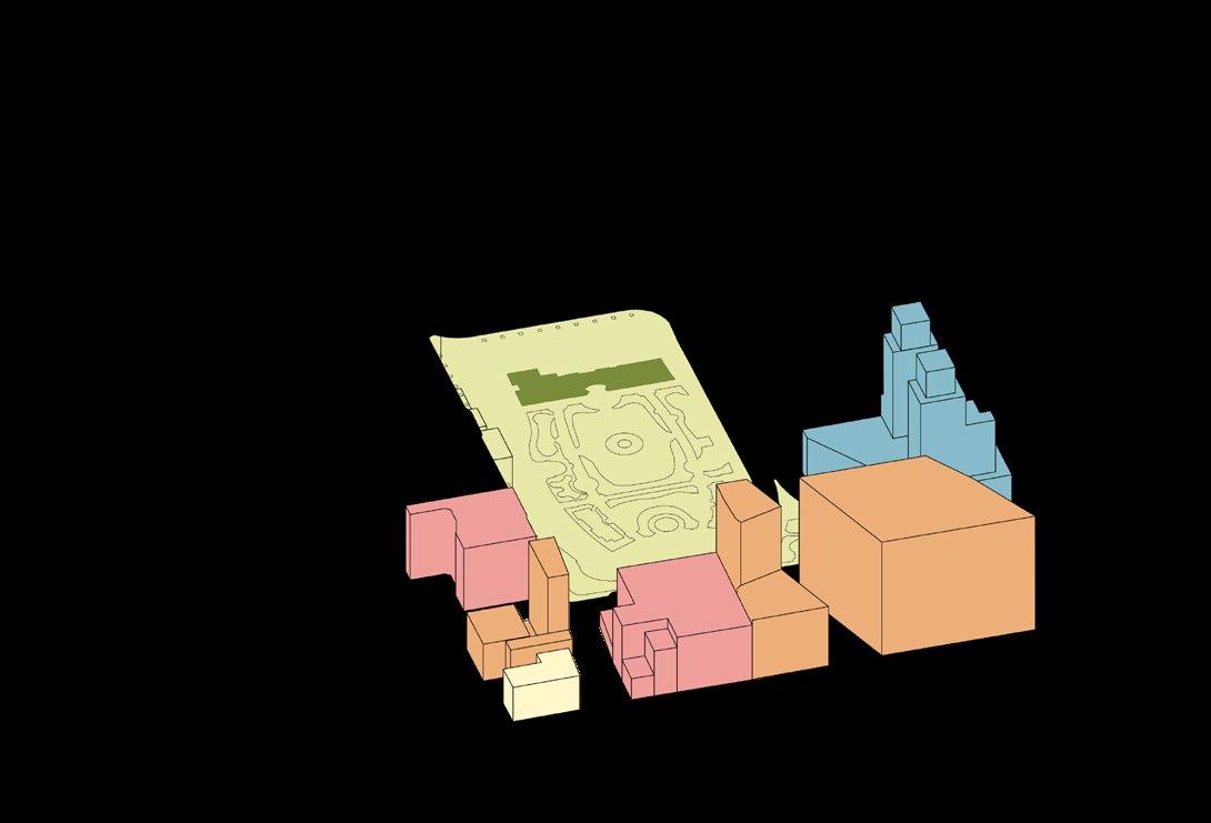
University Place is at a unique intersection of land uses, including commerical, residential, mixed-use, hospitals, open space, and children’s spaces. This creates a dynamic space with diverse user groups.
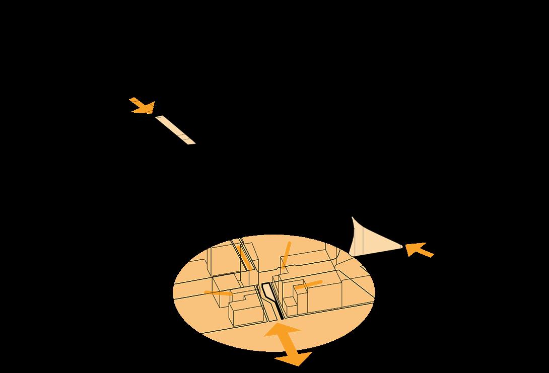
University Place is a crucial gateway to Union Square from the southwest, establishing a connection from Washington Square Park to Madison Square Park. These gateways welcome visitors to a pedestrian-friendly space.
Public Art + Landmarks Network
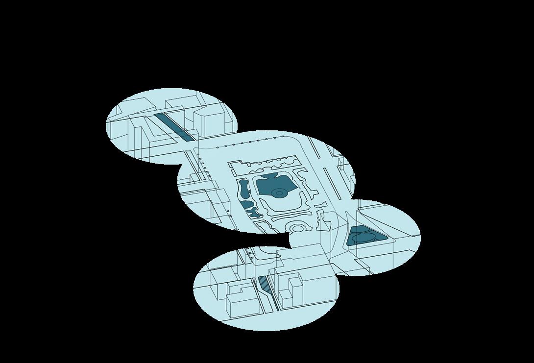
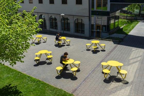
University Place could be integreated into a larger public seating network, which creates pockets of rest, comfort, and can increase dwell time in the district.
Cost Estimate: $6,500
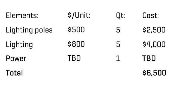
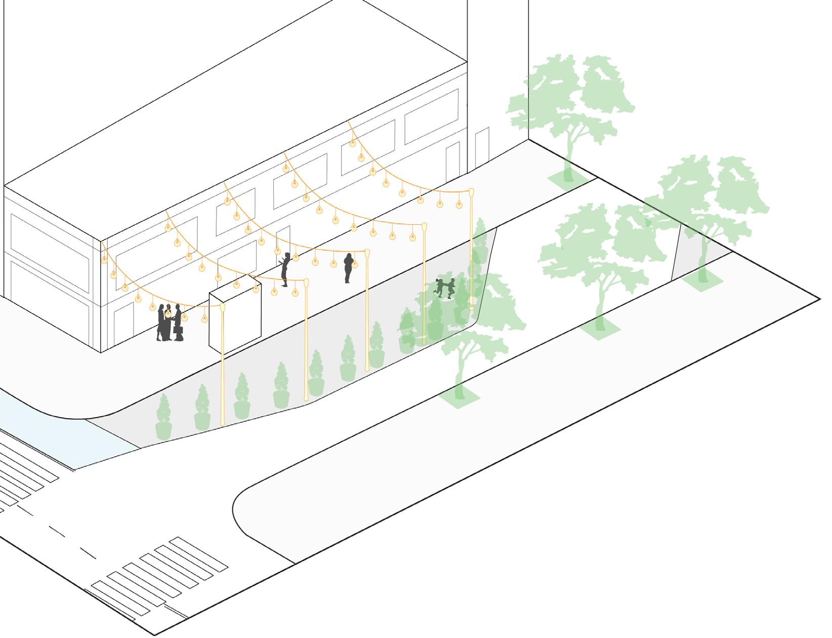
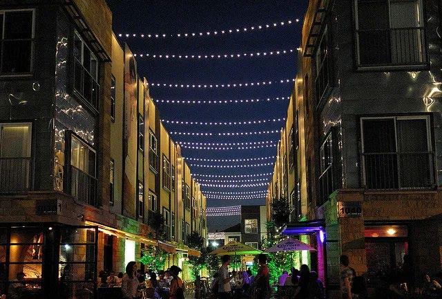
This option activates the space with overhead lights, enlivening the space and providing a sense of safety and security. This option is the most cost-effective and realistic .
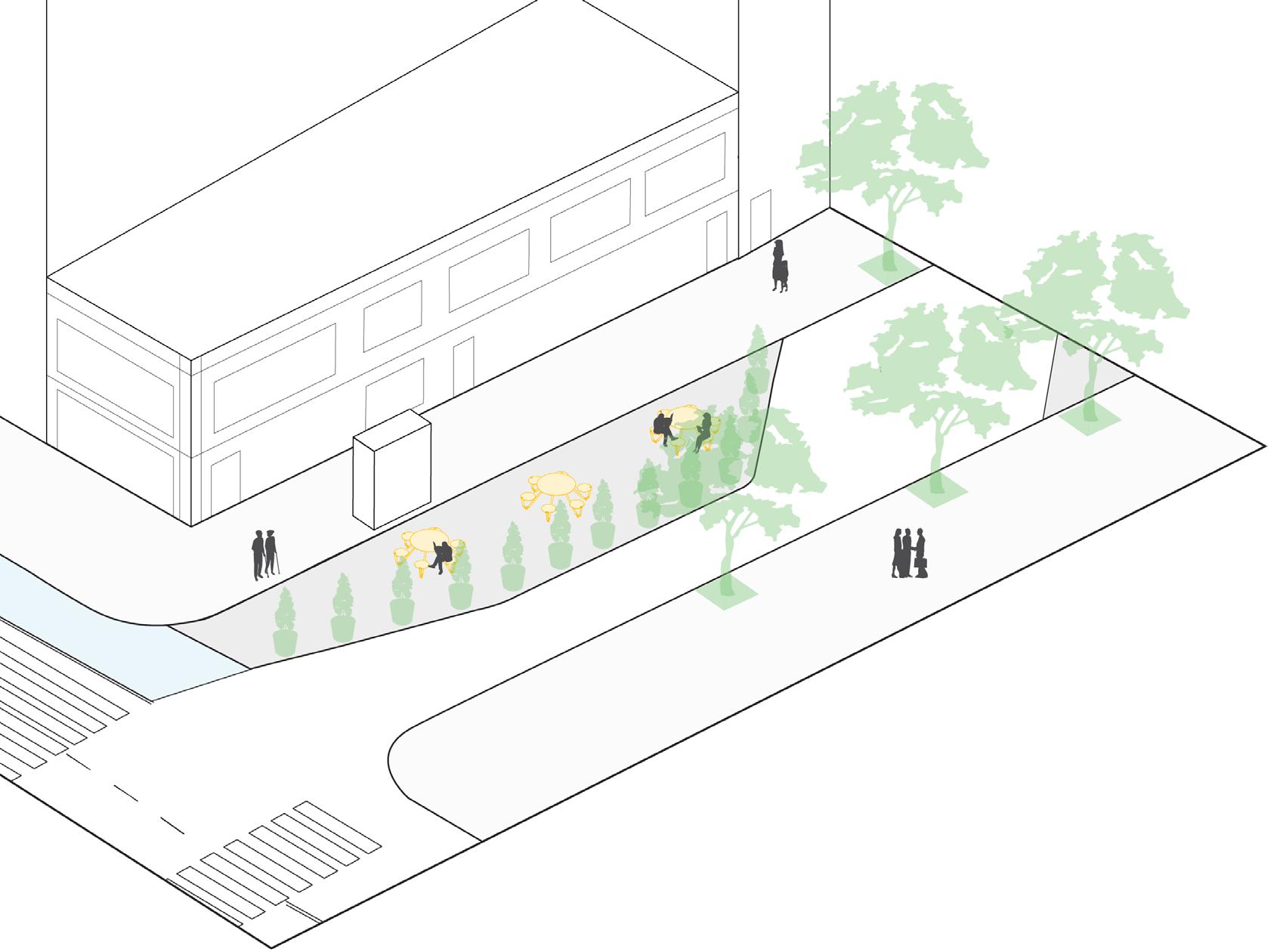
Cost Estimate: $20,000
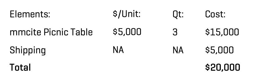
This option provides communal seating, inviting visitors in to rest and relax. This connects with the larger seating network in Union Square Park. .
Cost Estimate: $36,200
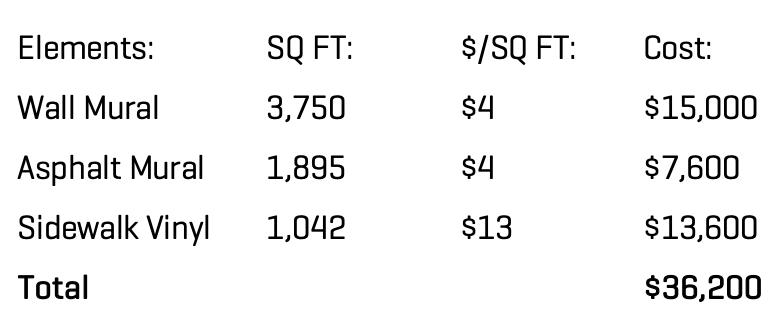
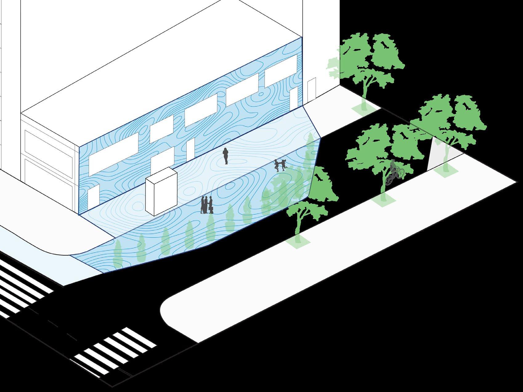
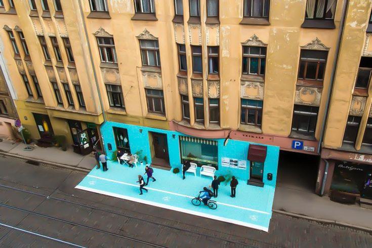
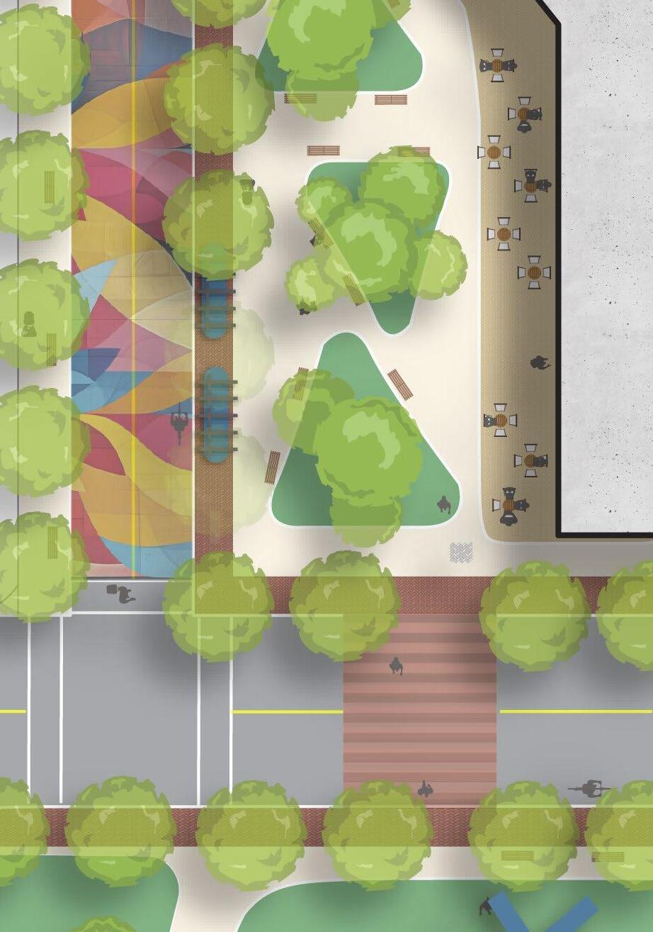
This option activates the space with a continuous wall to asphalt mural with vinyl art on the sidewalk connecting wall and road. This creates an identity for this space through art and is an opportunity for local artists to create art in a notable location.
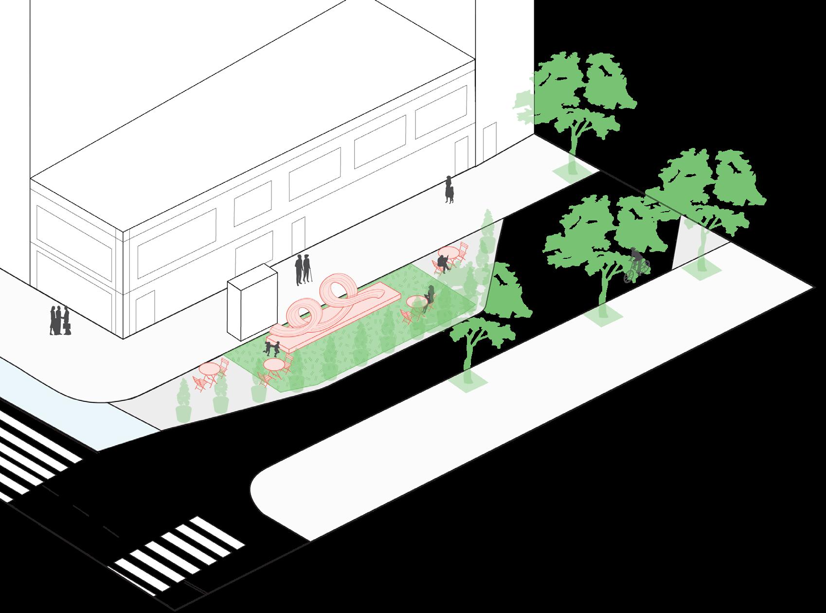
Cost Estimate: $50,000
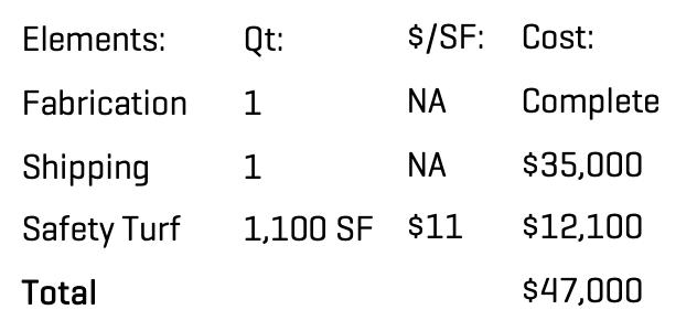
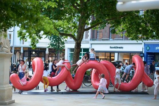
This option activates the space through an art installation, with the hope this site becomes a place for rotating art installations. This option includes a safety surface and additional tables and chairs for visitors to sit and enjoy the installation.
How to re-imagine an under-used public space through a community process?
Type: Professional | Individual | Boston Housing Authority
Role: Public Realm Fellow
Date: Spring 2024
Location: Boston, MA
Skills: Multi-Lingual Engagement (English and Chinese), Workshop Facilitation, Survey Design, Open Space Planning and Design
About
As part of a competitive graduate fellowship, I led a multilingual community visioning at St. Botolph Apartments, a public housing site in Boston’s Back Bay, to reimagine underutilized open spaces.
I created a playbook for public realm visioning, designed to demonstrate community-led design is possible and repeatable at other sites. Working closely with residents and the Resident Task Force, I facilitated visioning sessions in multiple languages (English, Chinese) for an inclusive and collaborative process with elderly and disabled residents.
My Contribution:
• Designed a semester-long, multi-part community engagement process
• Created engagement materials including surveys and visioning boards
• Facilitated engagement sessions in both English and Chinese
• Framed the project and crafted its narrative to build buy-in from BHA for continued use of community engagement as a key tool
• Contributed to the creation of a booklet on best practices
Open/Public Space as:
An important place for socializing, relaxing, and building community
Co-Design as:
A way to create spaces that meet resident needs and create a sense of ownership to a place
Revitalized Open Space as:
A relatively inexpensive and quick way to make a space more livable
Show we can create re-imagine, co-design, and execute public spaces projects with community
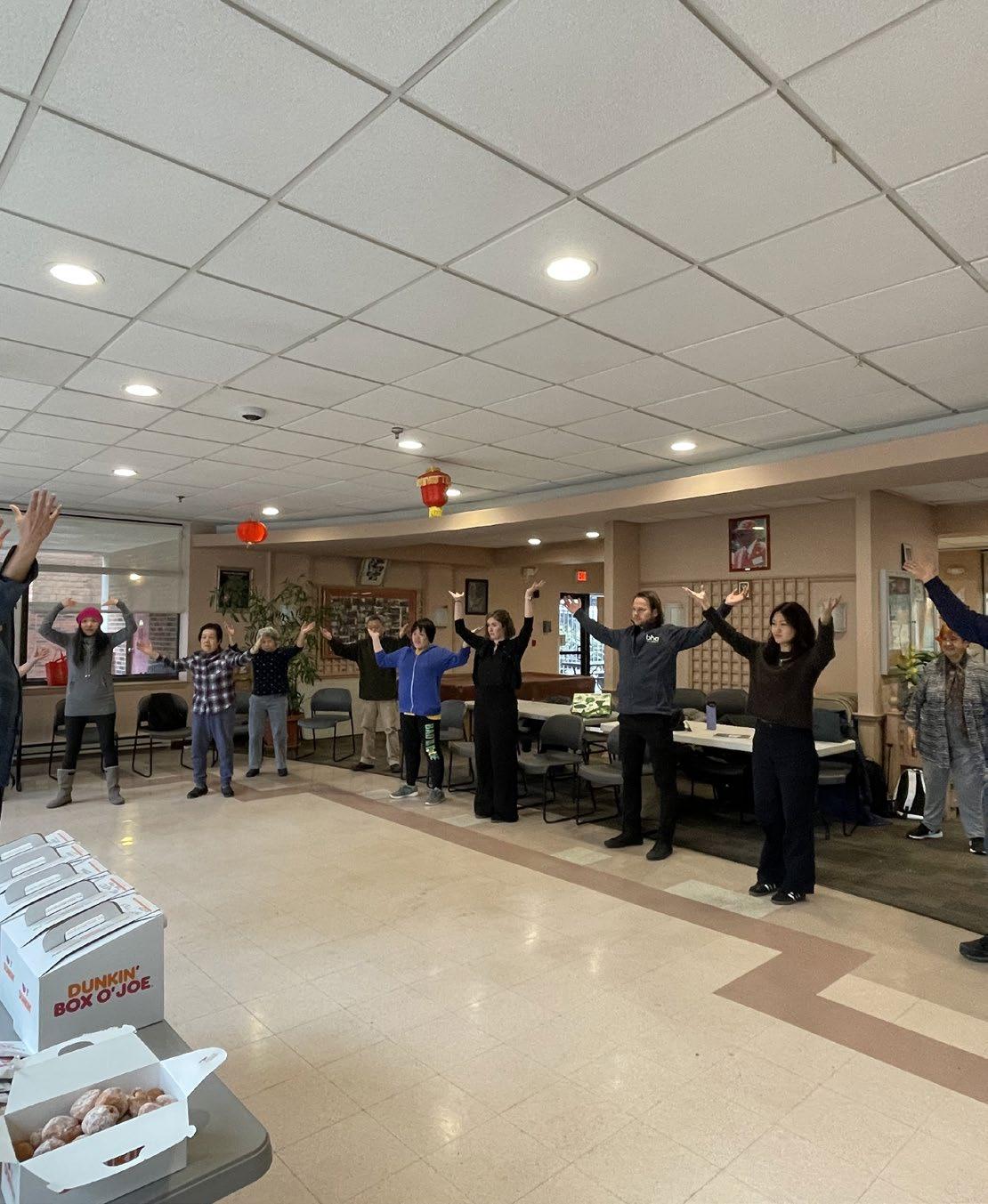

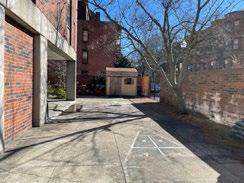
We created a casual environment, we aimed to understand residents’ current uses + preferences. We had a resident-led tai-chi class followed by a one-page survey. We engaged 17 residents.
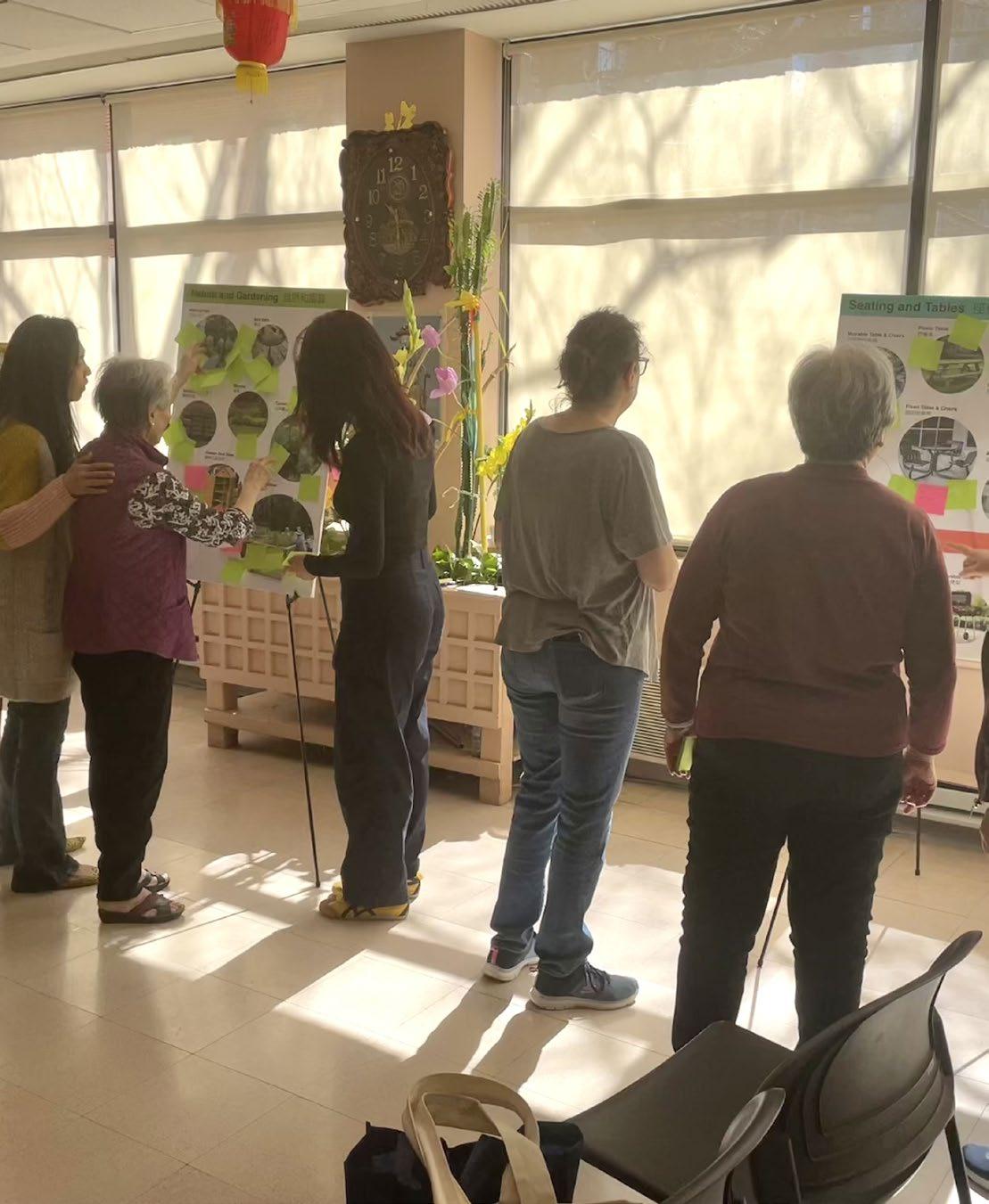
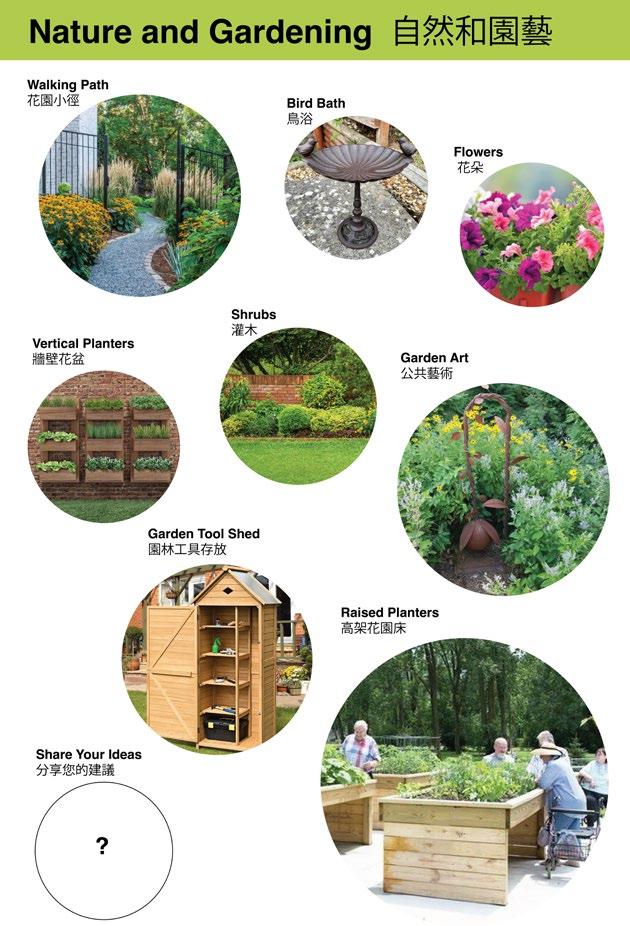
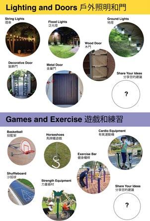
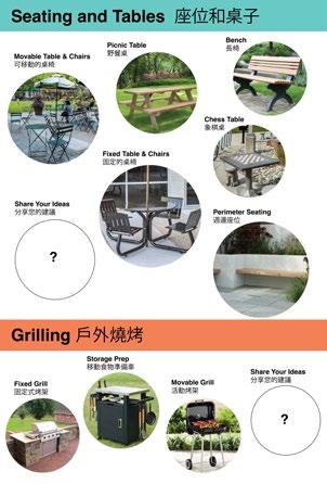
We refined preferences with an interactive visioning exercise. Residents rated which proposed items they liked and which were priorities. We engaged 28 residents.
Increased Greenery
Benches & Increased Seating
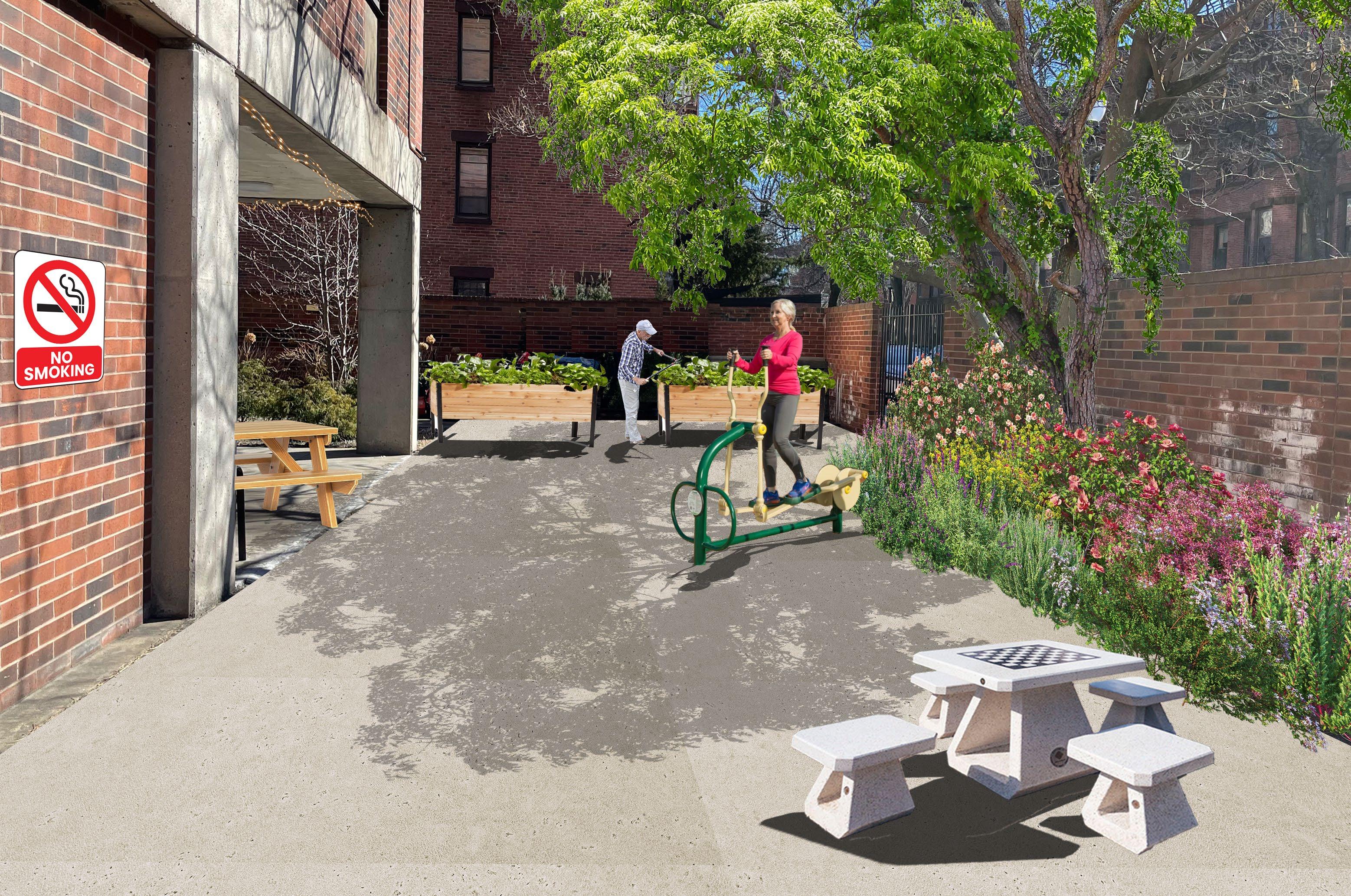
Based on resident feedback, we created a vision:
• Safety, Security, and Aesthetics with Atmostpheric Lighting and Steel Door
• Connections to Nature with Gardening Space and A Green Wall
• Varied Seating with Picnic Table and Chess/Mahjong Tables
• Support for Games, Exercise, and Grilling Infrastructure
• Deter Smoking and and Promote Cleanliness:
This vision was then incorporated into ongoing building renovations. A landscape architect was hired to complete the 360K patio renovation, to be finished in Summer 2026.
”Fitness Equiptment Chess + Mahjong Table
希望有更多的綠地,休閒座椅, 使其成為一個清潔美麗的休閒 場所
I expect more landscaping, grass, and chairs to sit on. I hope for the patio to become a real beautiful clean rest area.
Resident Survey Response
Research: Research and outreach to understand problem
Scope: Determine engagement project scope and needs (see Engagement Matrix)
Plan: Plan community engagement stages and events
• What information do want to know need per engagement stage?
• How will you collect and share information?
Initial Coordination: Coordinate initial engagement events and requirements with site staff and partners. Get events on people’s calendars ASAP!
Logistics for Engagement Event:
• Secure location for engagement event
• Create materials for engagement event depending on event style
• Request even interpretors and material translations at least 2 weeks in advance, as early as possible
Outreach Process:
• Begin outreach for residents and/or target audience
Together with two BHA graduate fellows, we created a playbook on community visioning for open spaces. This includes best practices, lessons learned, and in-depth case studies from our work. The playbook serves as a reference to guide future visioning efforts.
This
• Determine necessary languages at site
• Create flyer and request translations at least 2 weeks in advance of event
• Send out emails, mailings, and flyer site at least 1 week in advance of the event; Collaborate with site staff and task force for outreach
• Promote event at existing community events
Final Preparations: Confirm final event details with project partners. Finalize food and drink orders
Host engagement event!
Analzye, Reflect, and Report Back:
• Collect and analyze feedback from engagement
• Report to stakeholders on what you found
This
and
Type: Professional | Individual | Union Square Partnership
Role: Urban Design Intern
Date: Summer 2024
Location: Union Square in New York City
Skills: Data Visualization, Data Collection + Analysis, Infographics
Software: R, Excel
About
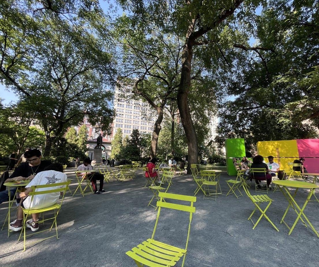
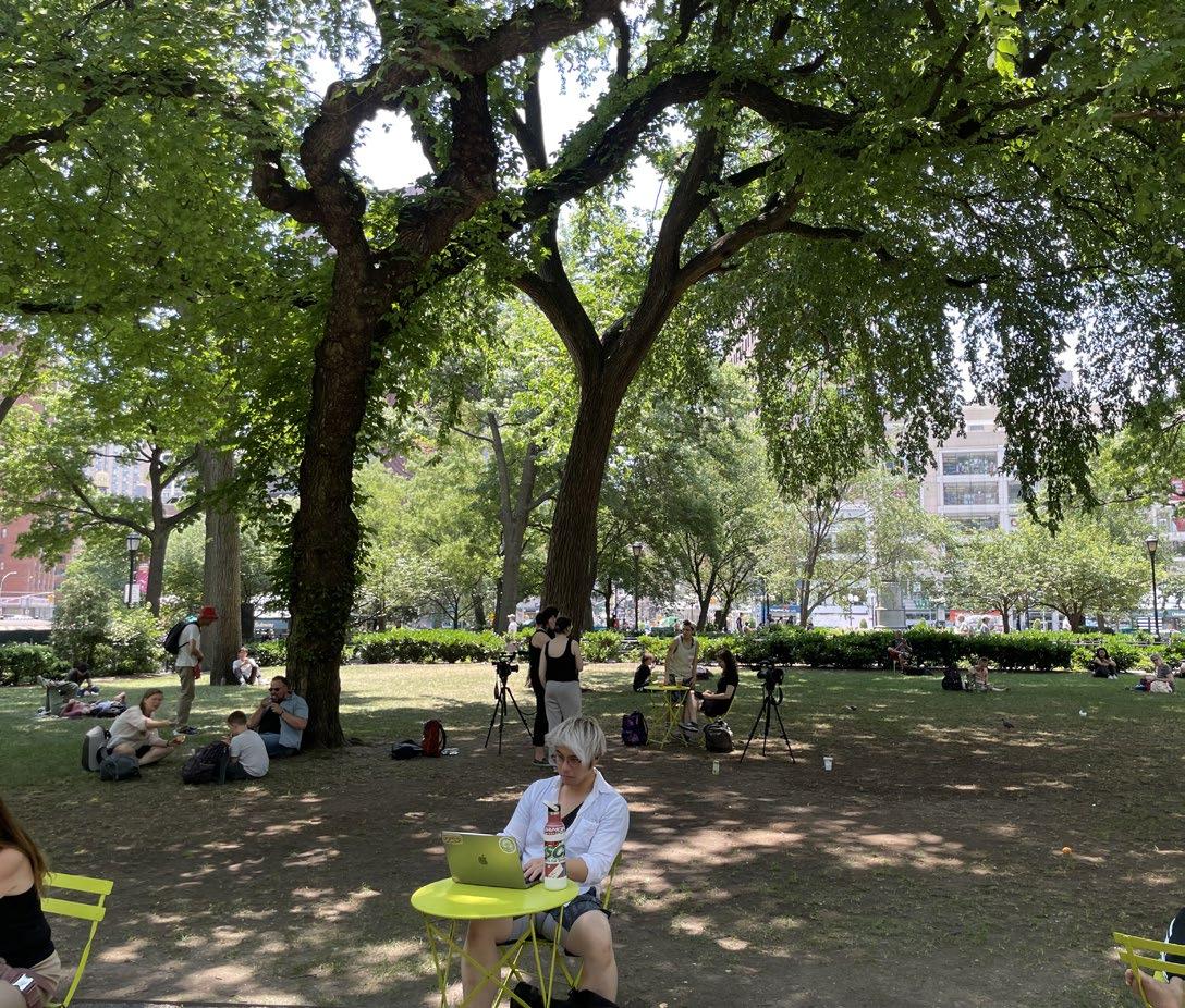
Union Square Park recently completed a visioning plan, but 30% designs are yet to be developed. Previously, an NYU capstone class created a toolkit for public life studies, which had not been tested. My goal was to pilot this toolkit in a manageable area of the park, with the intent to scale its implementation across the entire space.
By rigorously analyzing park user data, this study provides insights that will directly inform future design and programming, ensuring the park better meets the needs of its community.
• Defined project scoped, established methodology
• Proto-typed data collection tools, focusing on userfriendly design
• Coordinated a team of four data collectors
• Compiled, cleaned, analyzed, and visualized data in compelling forms
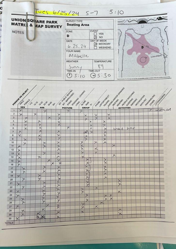
Matrix + Map Tool
To capture demographics + activities data
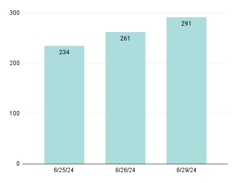
• Tuesday, June 25, 2025: typical weekday, no Greenmarket
• Wednesday, June 26, 2025: typical weekday, with Greenmarket
• Saturday, June 29, 2025: typical weekend, with Greenmarket
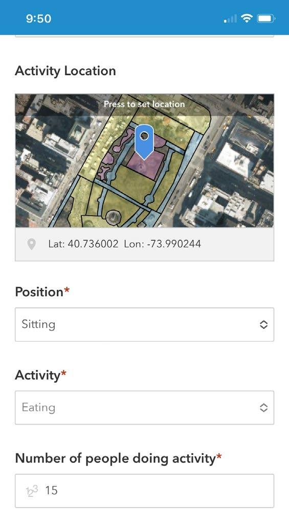
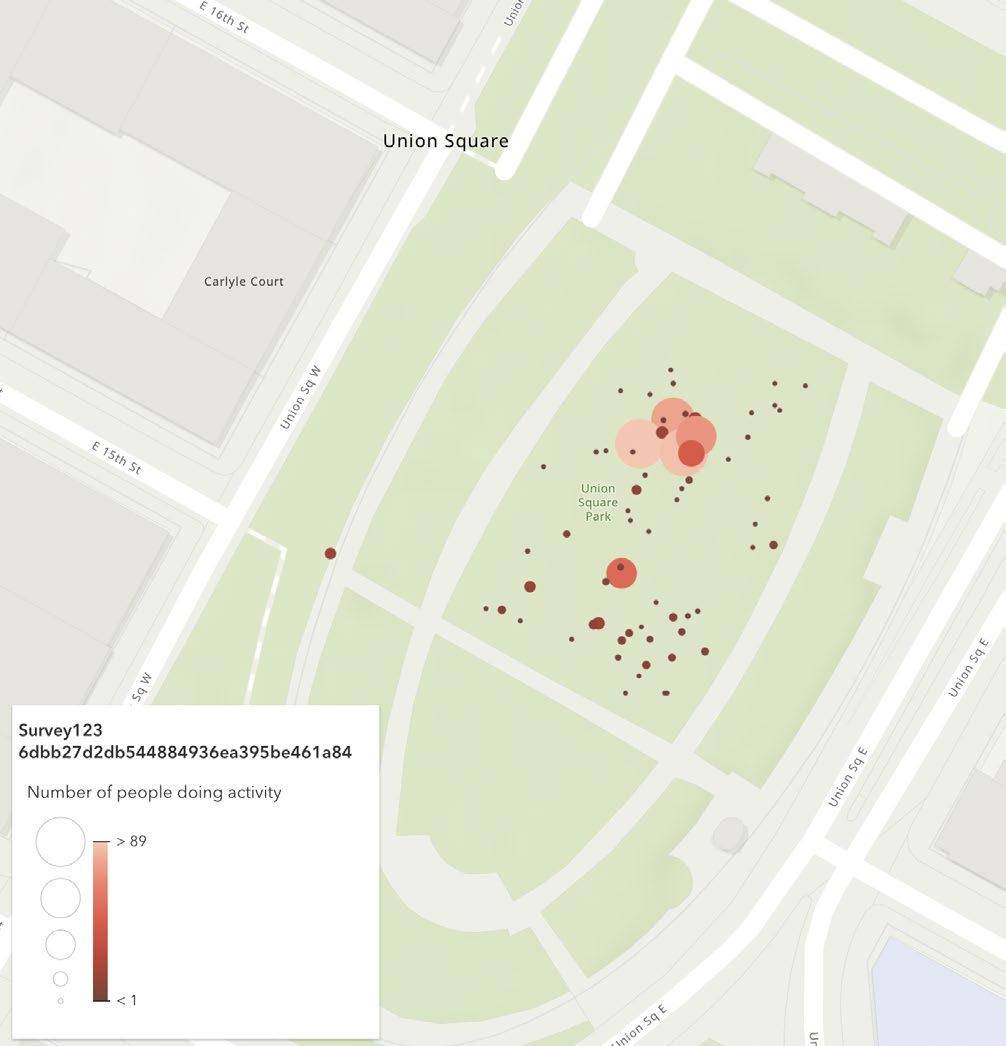
ESRI Survey Tool
Capture location data at a large-scale
6 Observations Each Day
Each day is divided into three 2-hour time sections, with a 20-minute observation each hour
• 8AM-10AM, morning peak activity
• 12PM-2PM, mid-day peak activity
• 5PM-6PM, evening peak activity
Over three days, usage peaked on the weekends but remained high on weekdays, indicating the Central Lawn is a well-used and important open space.
People use the Central Lawn, a lot!
Usages trends are consistent over the day and week, from weekday to weekend and sunny to cloudy weather
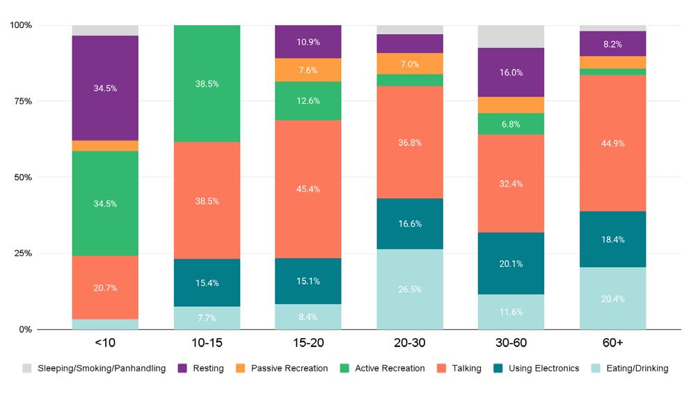
Compared to the Union Square neighborhood, adults (20-30) are over-represented, likey because Union Square is a work hub. Older adults (+60) are significantly under-represented, raising questions.
- a
The Central Lawn trends female, where females make up more than 50% of users. This suggests that women generally feel safe as users.
The Central Lawn is a passive recreation hub where 90%+ people are engaged in passive recreation
It’s a place for talking, eating, and resting But when it’s active, kids drive it
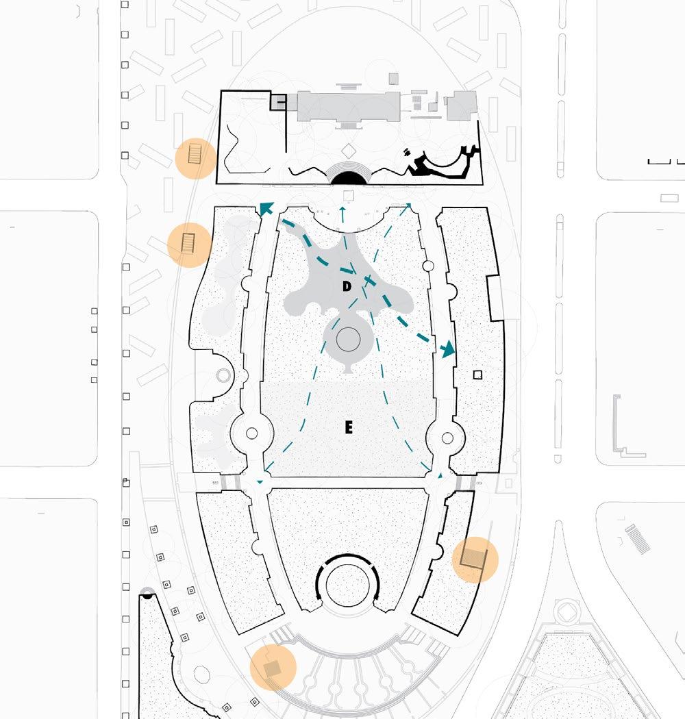
Central Lawn is a shortcut for transit stations
Creating paths to meet these desire lines could help users
People enjoy natural seating and shade such as the flagpole steps and the deep lawn with large trees
Type: Academic | Team | Revitalizing Main Streets Practicum
Date/Location: Fall 2024 | Ashmont in Dorchester, MA
Client: Greater Ashmont Main Streets
Instructors: David Gamble, Jeff Levine
Skills: Transit Planning, Neighborhood Planning, Data Analysis
Software: R, GIS, Adobe Illustrator, Adobe Photoshop
A team of six MIT DUSP graduate students collaborated with Greater Ashmont Main Streets to research, analyze, and propose actionable recommendations to better connect, gather, and celebrate. Our recommendations focused on two areas: the Ashmont Corridor and Peabody Square.
Working in a team of two, I created design and policy recommendations for Peabody Square to enhance safety, mobility, and community gathering.
See the full report here.
• Conducted spatial analysis of heat, transit, and traffic patterns in and around Peabody Square.
• Designed a site plan, sections, and visualizations to effectively communicate our recommendations.
• Developed actionable design and policy recommendations to address safety, mobility, and community gathering needs.
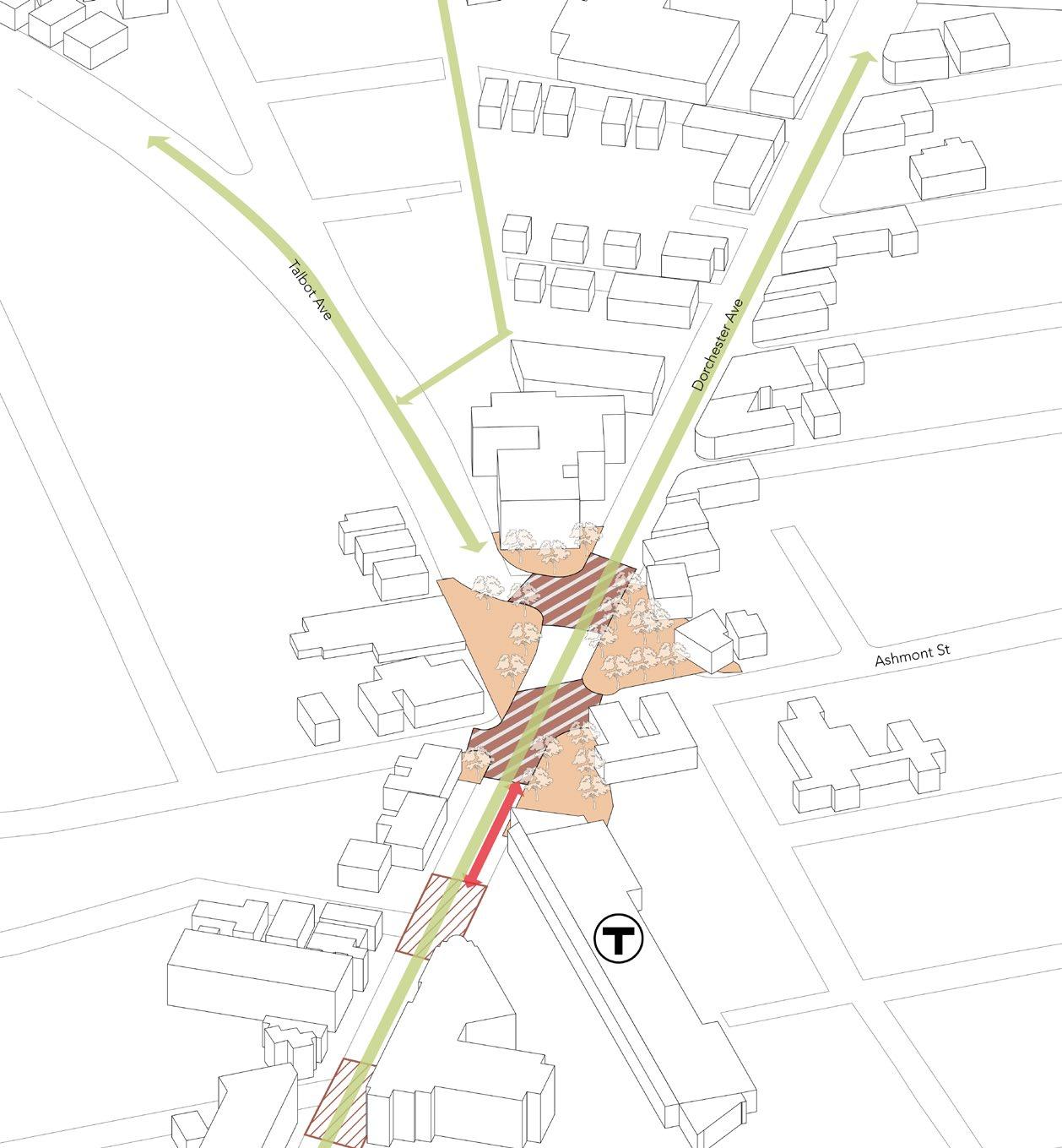
Improve safety and traffic flow with
• Bus priority at Ashmont station
• Two-way bike lane along Dot Ave
• Bike cap connection to Dorchester Greenway
Expand public space with
• Converting adjacent parking into plaza and green space
• Improve existing plazas with greenery, shade, seating, and programming
Calm traffic with
• Raised intersections at Ashmont x Dot and Talbot x Dot
• All-way crosswalks to enable safe, carfree movement for all
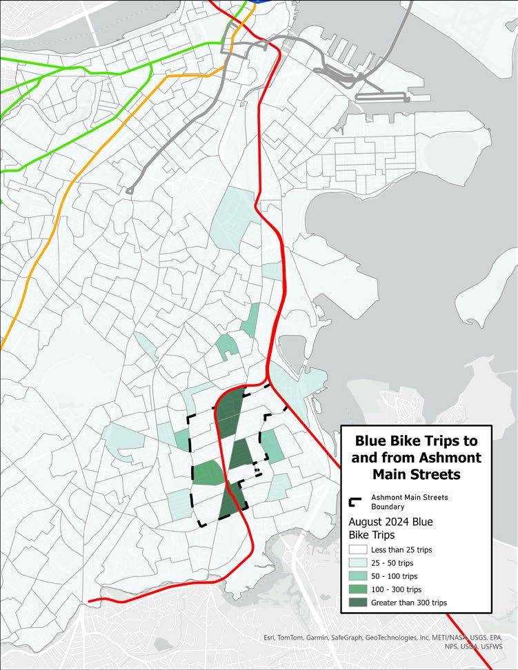
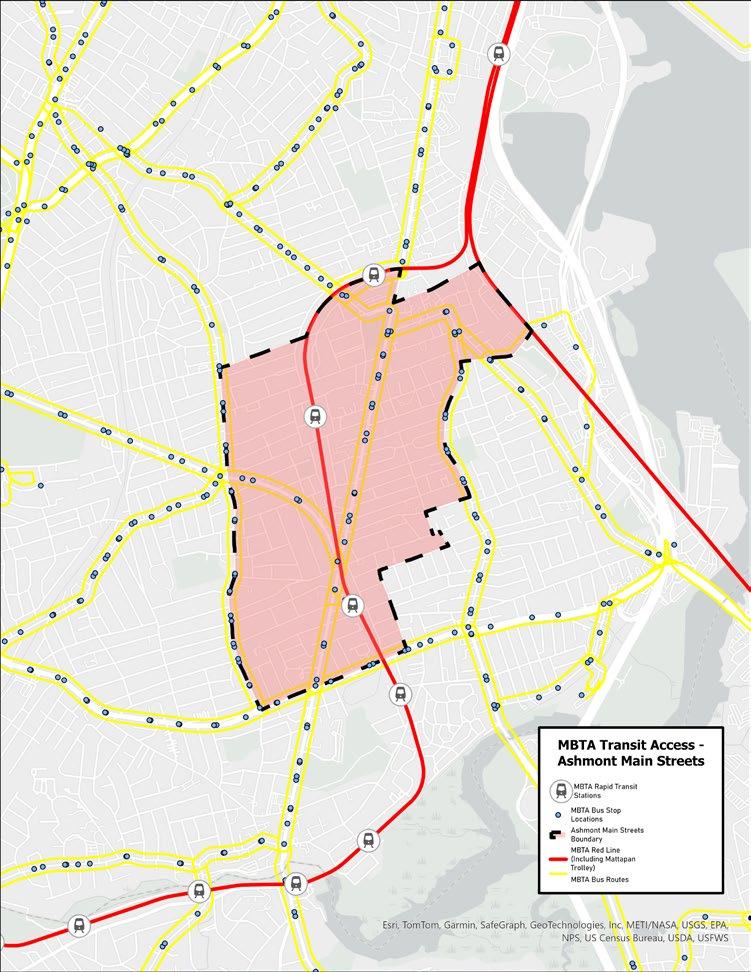
Peabody Square is a vital transit gateway located next to Ashmont Station (the Red Line terminus and major bus station) and Dorchester Avenue (a key Boston North-South artery.)
Ashmont Station supports the city’s busiest bus routes, including the 22 and 23. These two lines carry ~ 10,000 passengers daily. Despite high bus usage and frequency, Peabody Square lacks bus priority infrastructure, leading to congestion and delays.
Ashmont is also a multi-modal connection point with high BlueBike usage. This underscores the area’s potential for more integrated and efficient mobility solutions.
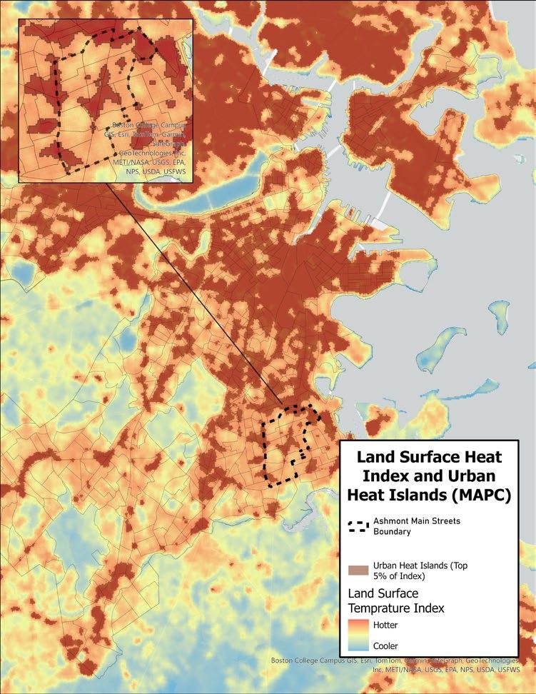
Peabody Square experiences significantly higher land surface temperatures compared to the surrounding neighborhood. Notably, the highest temperature ever recorded in Boston at 102.6°F was measured near Ashmont Station in 2019.
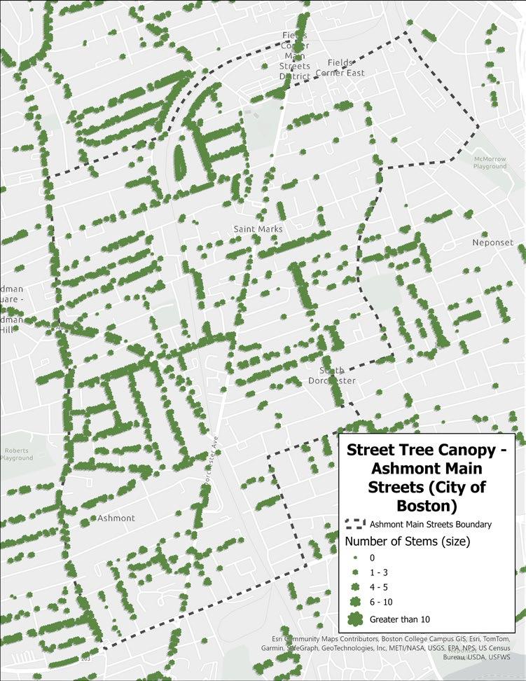
This heat disparity is exacerbated by a limited tree canopy, which contrasts neighboring zones and contributes to the elevated temperatures.
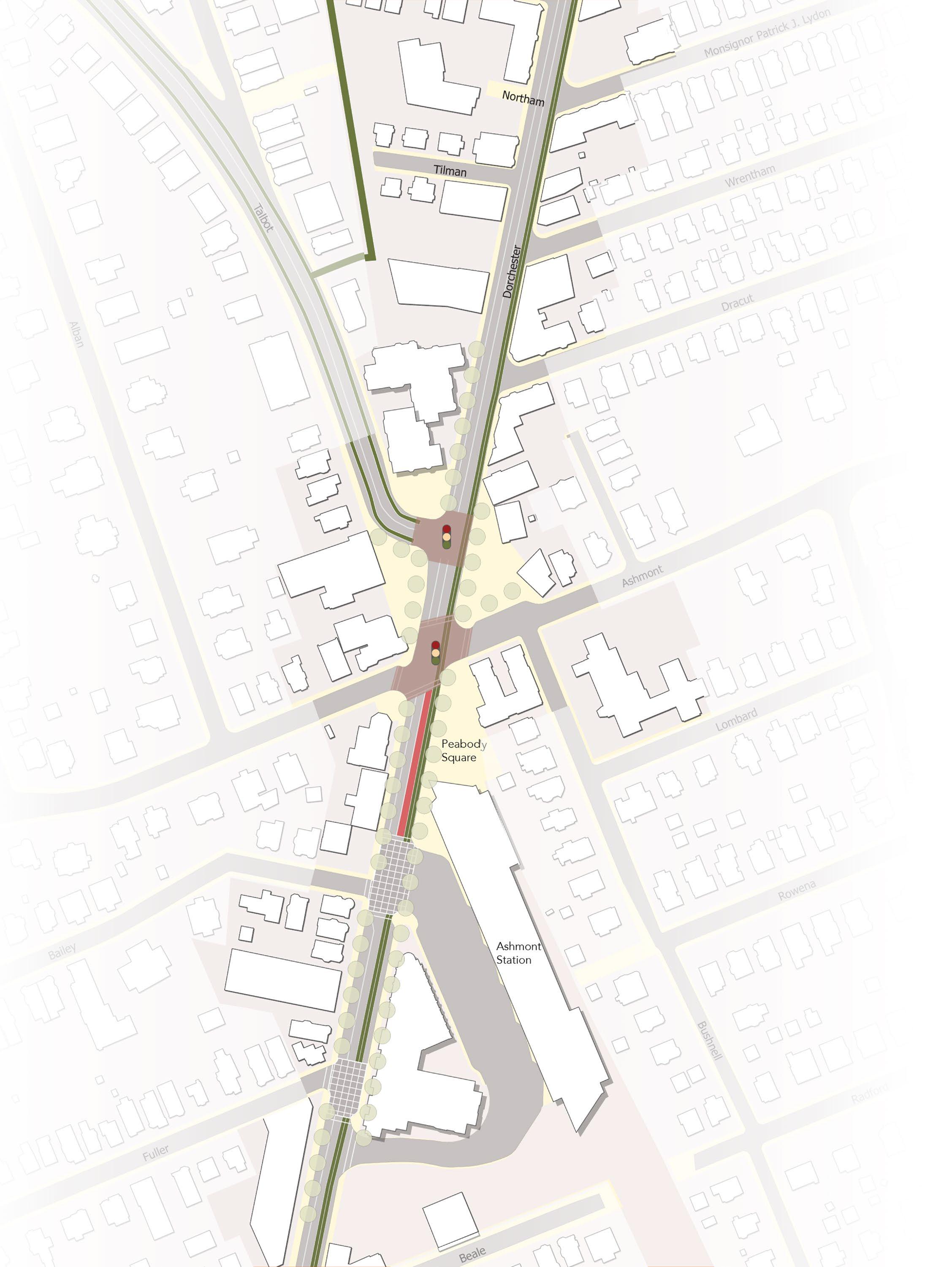
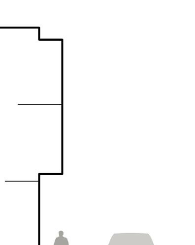
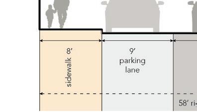
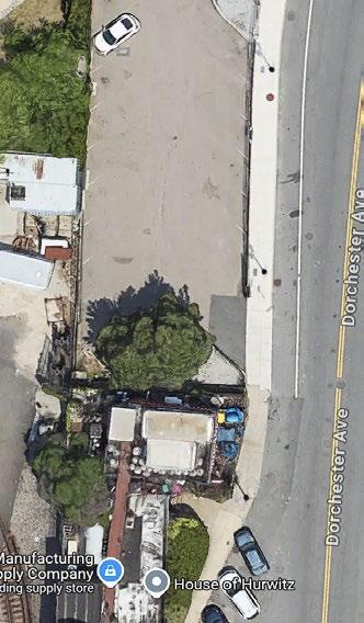
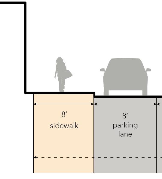
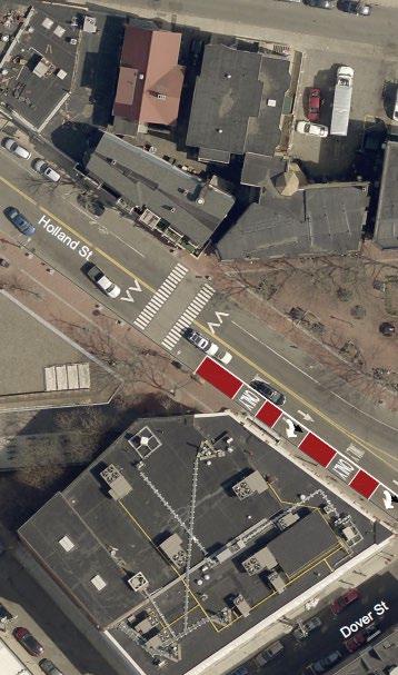

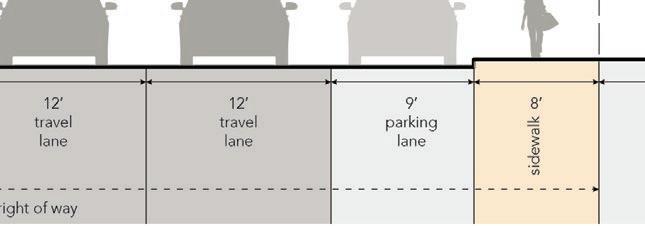
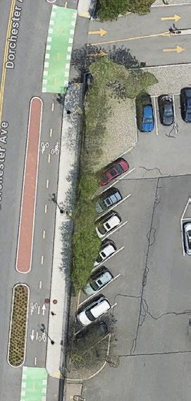
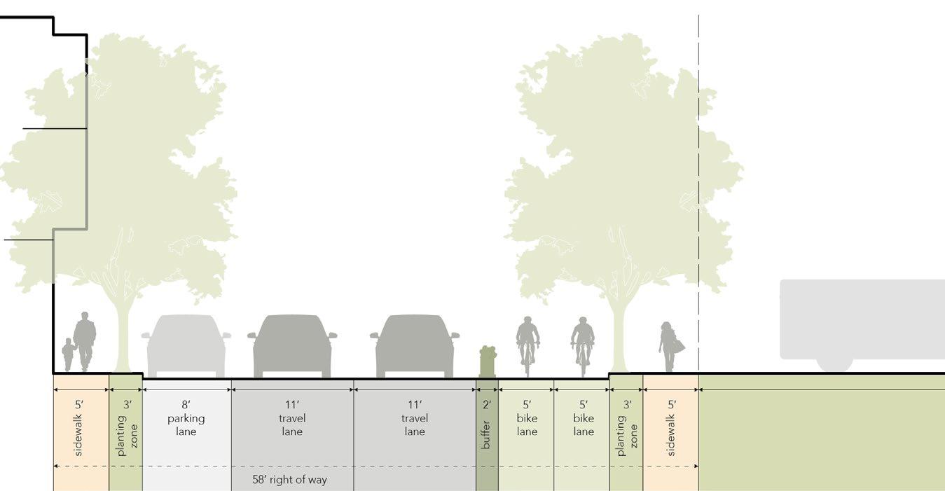
Along Dot Ave, we propose a two-way bike lane through Peabody Square, connecting Ashmont to Fields Corner. The northern end of Dot Ave has infrastructure for bikers, with concrete protection from South Boston to the Seaport. Similar infrastructure can be applied here to promote multi-modal travel and biker safety.
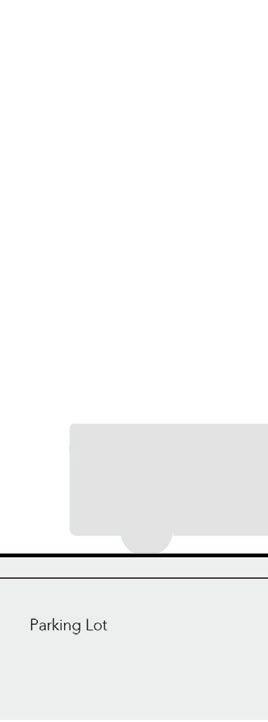
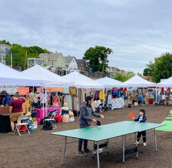
Additionally, we propose expanding tree canopy along Dot Ave and through Peabody Square. This will help combat heat island effect and improve pedestrian experience. Parking lots near Peabody can be activated through pop-ups, similar to Gilman Square.
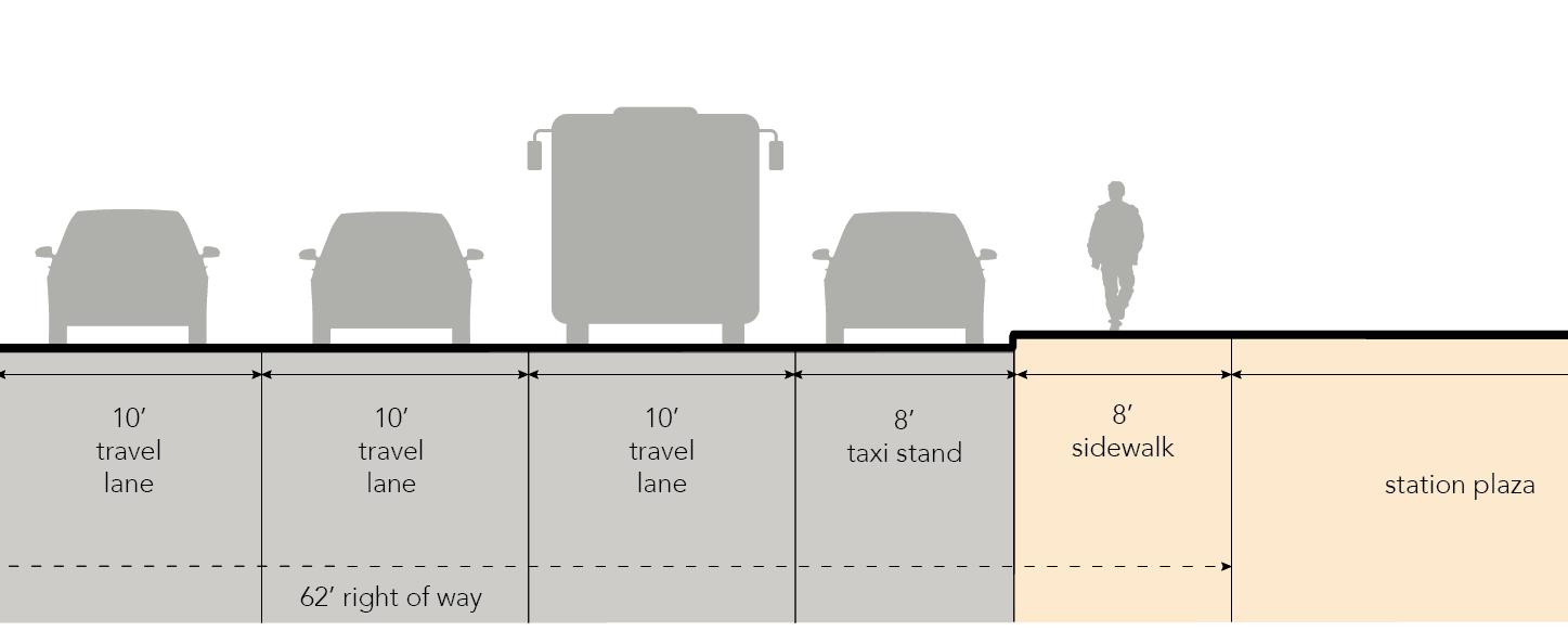
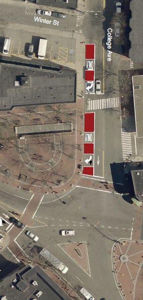
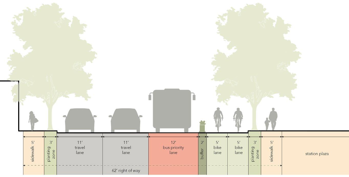
A short 250 foot bus priority lane would improve bus circulation in and out of Ashmont Station. This would reduce congestion and conflict between cars, buses, and pedestrians. Similar short transit lanes exist throughout the Greater Boston Area, including in Davis Square, and could be implemented here.
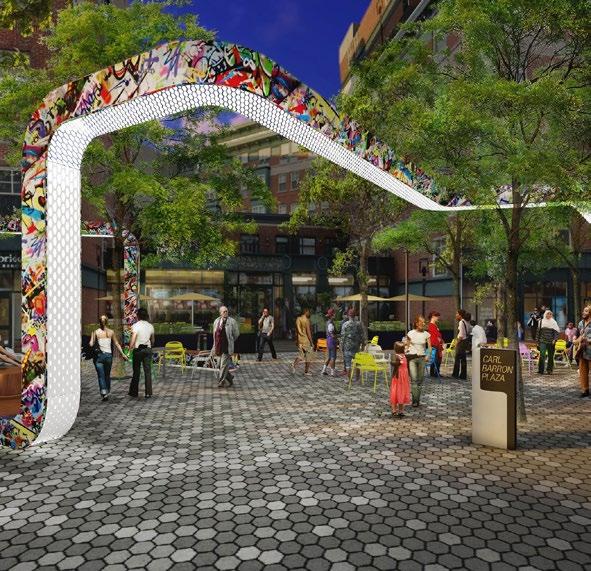
Additionally, expanded tree canopy and plaza activation with art can further make the station plaza a more enjoyable place for visitors and transiters to gather and relax.
Type: Academic | Team | Real Estate Development Studio
Date: Spring 2024
Instructors: Kairos Shen
Location: Fort Point Channel in Boston, MA
Skills: Proposal Development, Master Planning, Space Planning, Mixed-Use District Design
Software: Adobe Illustrator, Rhino, Excel
About
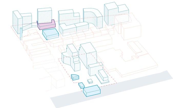
NoSo (North of Southie) is a mixed-used arts and cultural development proposal in Boston’s historic Fort Point neighborhood. It aims to transform this historic artists enclave to become a 21st century arts hub.
In this studio, students developed a financially viable development proposal in compliance with zoning, regulations, and economic development goals. Our team uniquely selected two non-adjacent parcels to enhance exister urban fabric centered on Midway Artists Centers.
As part of a four-person team, I completed these tasks:
• Created all visuals, including the 2D site plan, 3D model, diagrams, and public realm design.
• Assisted with financial modeling and phasing design
I also gave these conceptual contributions:
• Emphasized connectivity within site and urban context
• Ensured regulation compliance and public benefit provision
• Focused on creating a destination through placemaking, public space activation
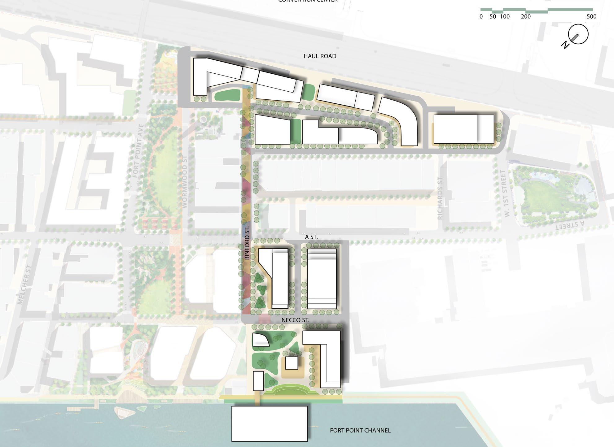
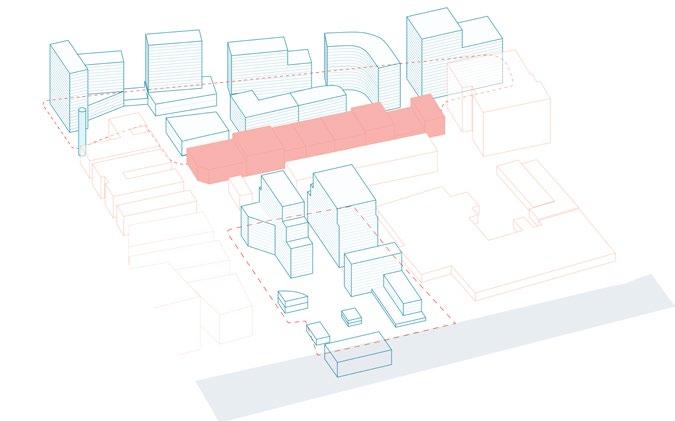
Empower Fort Point arts community at neighborhood’s heart
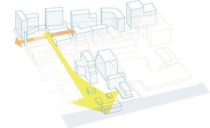
Connect and Activate Binford Street as key neighborhood corridor
Build cultural services + amenities to build a destination
Connect with Seaport’s Harborway Corridor
Existing Buildings
Proposed Buildings
Proposed Art Nodes
Proposed Green Space
Plazas
Proposed Connections
Midway Artists Lofts anchoring development
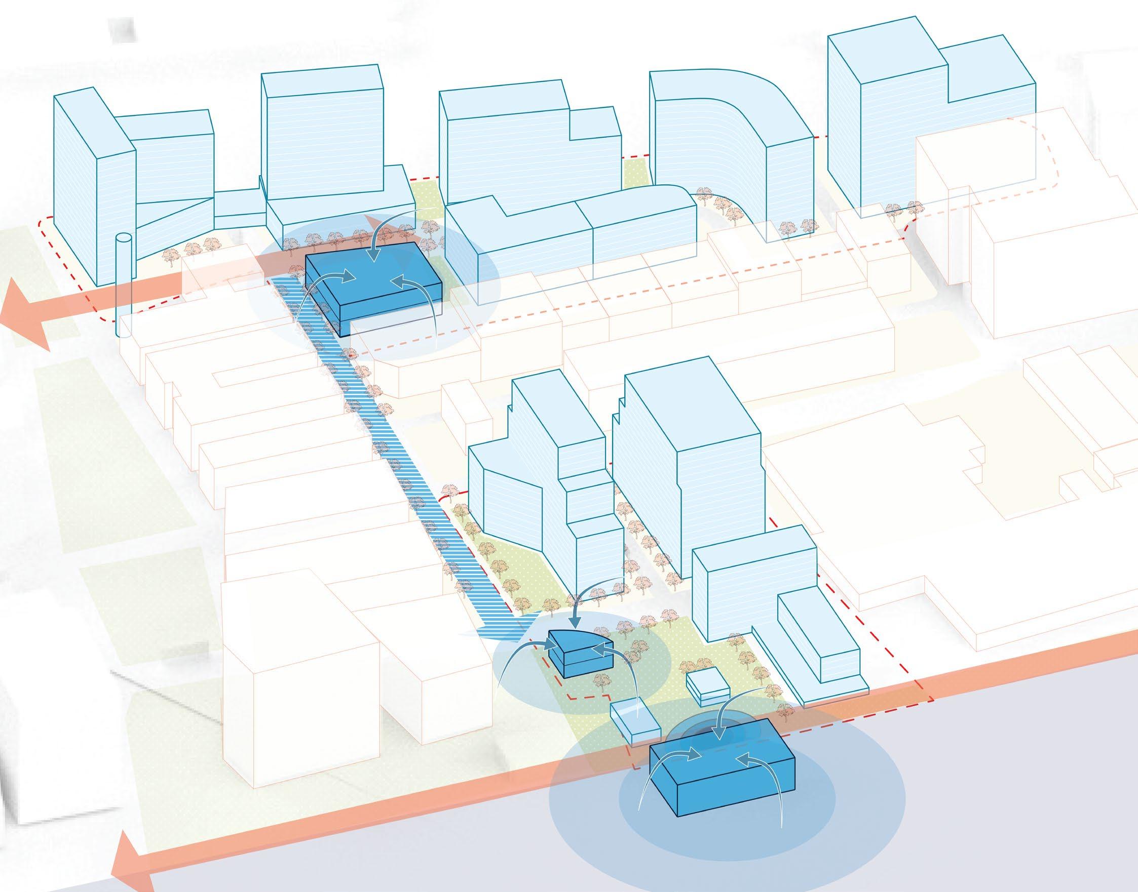
Extends the Seaport Harborwalk
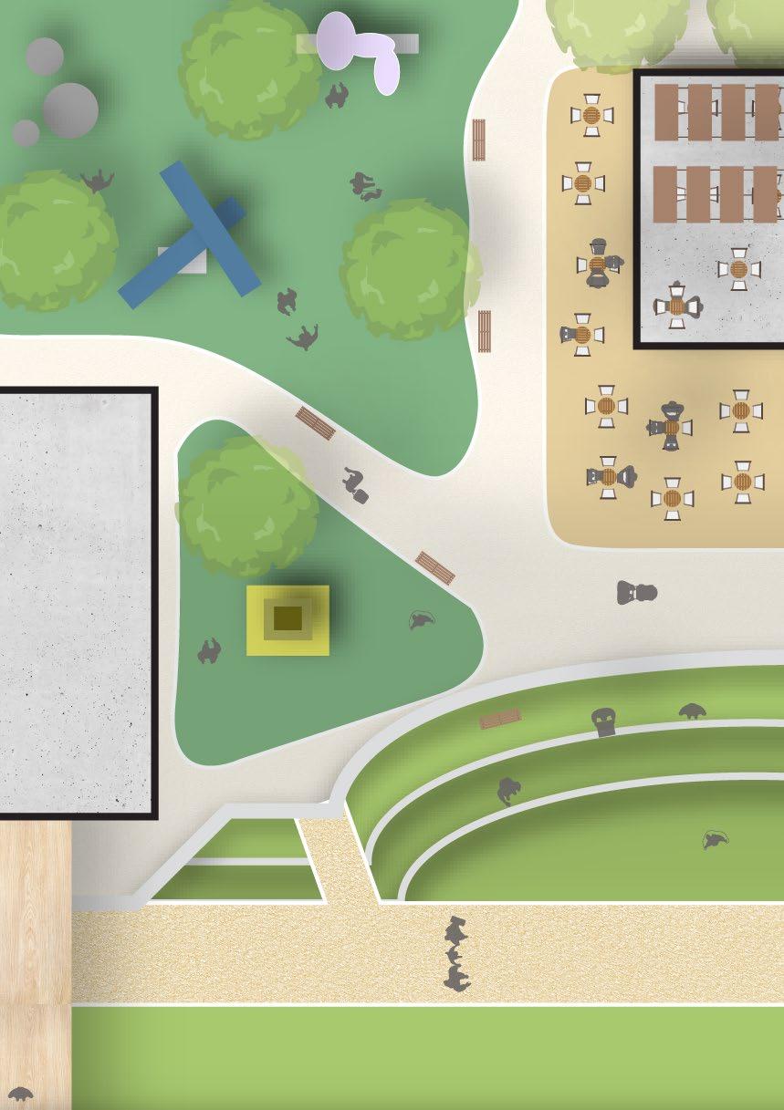
Amphitheater Berm
Provide seating, open space, and flood protections
Community Arts Gallery & Garden
Partner with the Barr Foundation
Waterfront Initiative for open space progamming
Floating Concert Venue
Partner with Boston Center for the Arts and AEG Presents
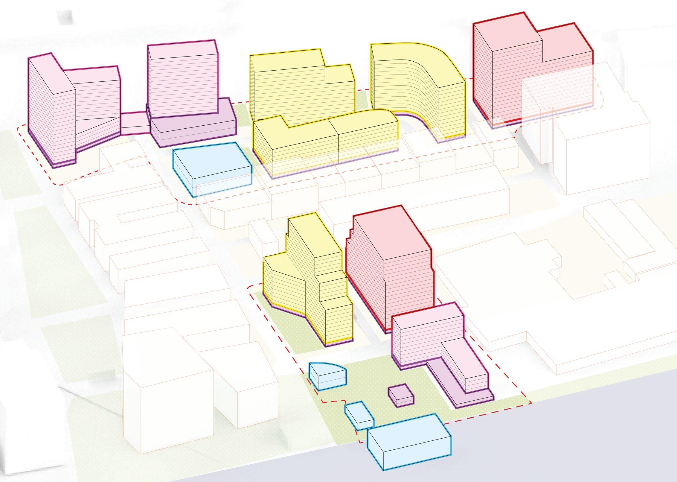
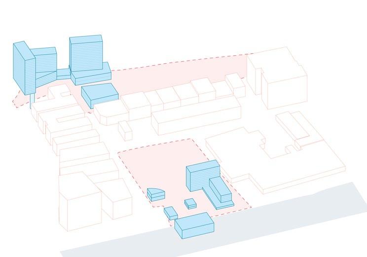
Phase 1: Cultural Activation
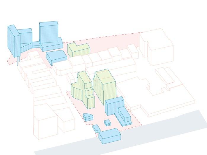
Phase 2: Neighborhood Infill
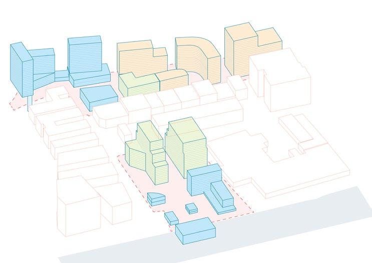
Phase 3: District Expansion
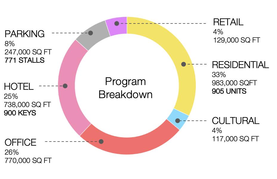
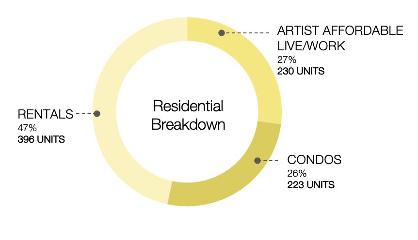
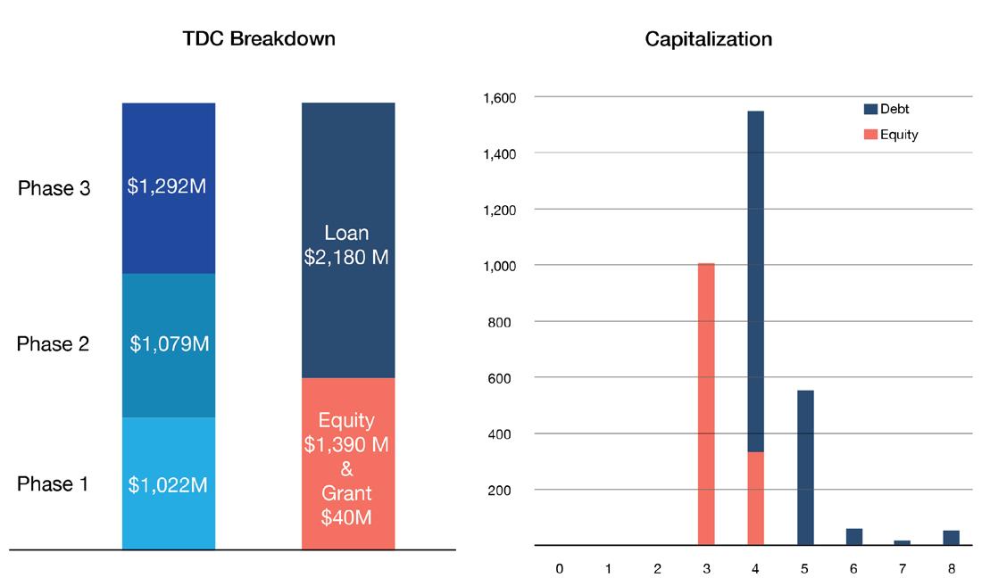
12 acres of urban development over 8 years to generate:
$3.3 Billion Total Development Cost
$55 Million Ground Rent
13.6% Levered IRR
1.76x Equity Multiple
Type: Academic | Individual | Rockaways Housing Superstorm, GSD
Date and Place: Fall 2024 | Rockaways, NYC
Instructors: Ed Wall
Client: RISE Rockaway
Skills: Open Space Design, Community Engagement, Workshop Facilitation, Resiliency Planning
Software: ArcGIS, R, Adobe Illustrator, Photoshop
About
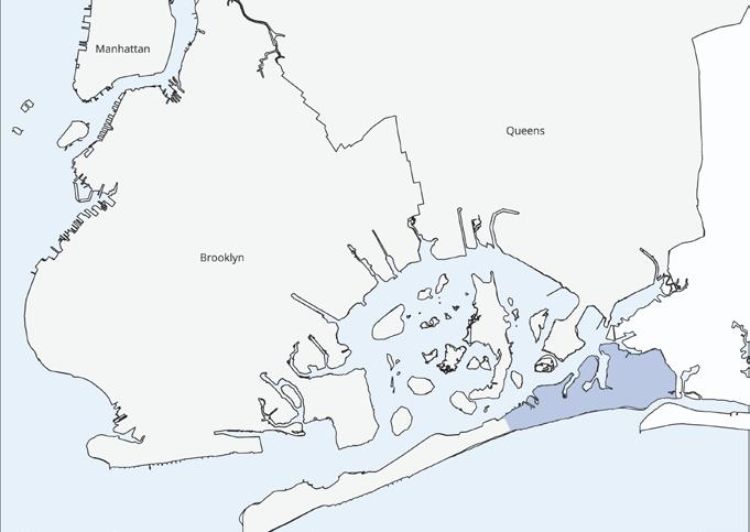
This seminar was a client-based project for RISE Rockaway, to create an open space strategy for the Jamaica Bay side of the Rockaways peninsula—a traditionally neglected area. While the Army Corps of Engineers prepares to construct a floodwall, RISE sought alternative strategies.
My project envisions transforming this area into a recreationoriented, resilient waterfront. Using engagement and analysis, this plan integrates green solutions and celebrates nature- and water-based activities
My Contribution:
• Conducted a community engagement session in collaboration with RISE and team of four students
• Performed initial site analysis, including historical mapping and demographic analysis.
• Individually developed a comprehensive project proposal with a 3D view, 2D diagrams, and eye-level vignettes.
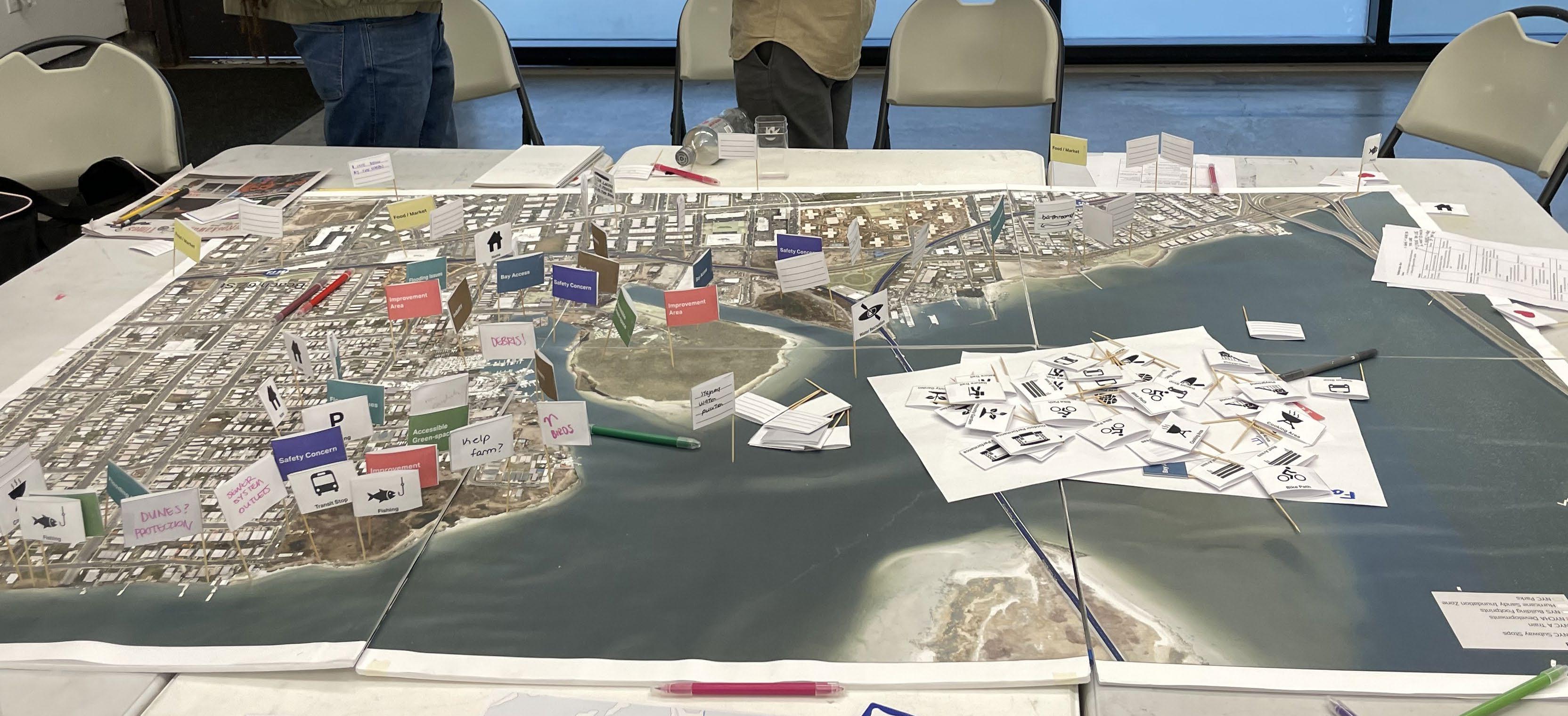
For the engagement, I worked with a team of four to design an interactive activity where residents used small flags to identify key areas in Averne. They shared what they loved about the neighborhood, highlighted challenges, and pinpointed locations needing improvement.
This exercise revealed critical insights, including frequent inland flooding on 64th, 70th, and 72nd streets, a need for more recreation and fishing spots, limited spaces for young people, interest in a ferry stop, and a strong desire to enhance the area’s natural environment.
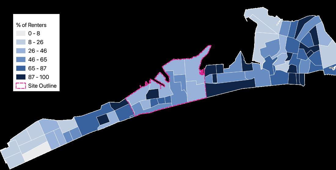
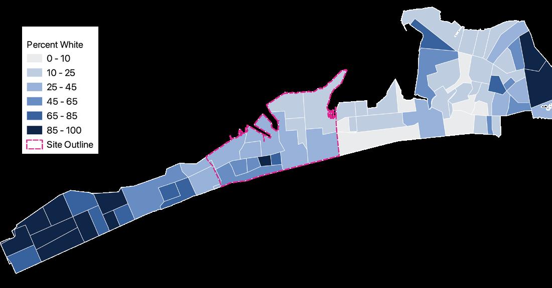
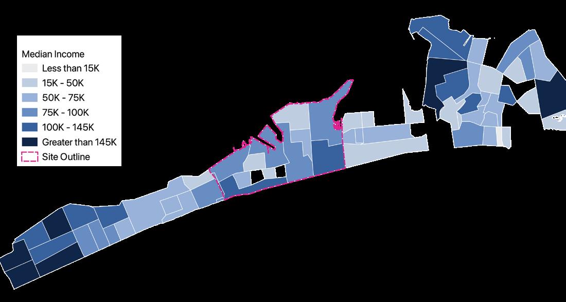
I analyzed census data using R, extracting relevant information for the site. The analysis revealed that our site, outlined in yellow, ranks mid-range in terms of Black population percentage, homeownership, income, and housing stock.
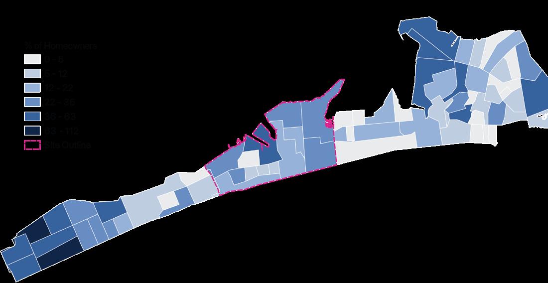
For my site, the Averne Neighborhood
• Population: 101,000 People
• Housing Units: 91,500 Units
• Units Impacted by 2100 4-Feet Sea Level Rise: 22,000
% of Renters
Median Income
Housing Year Built % White
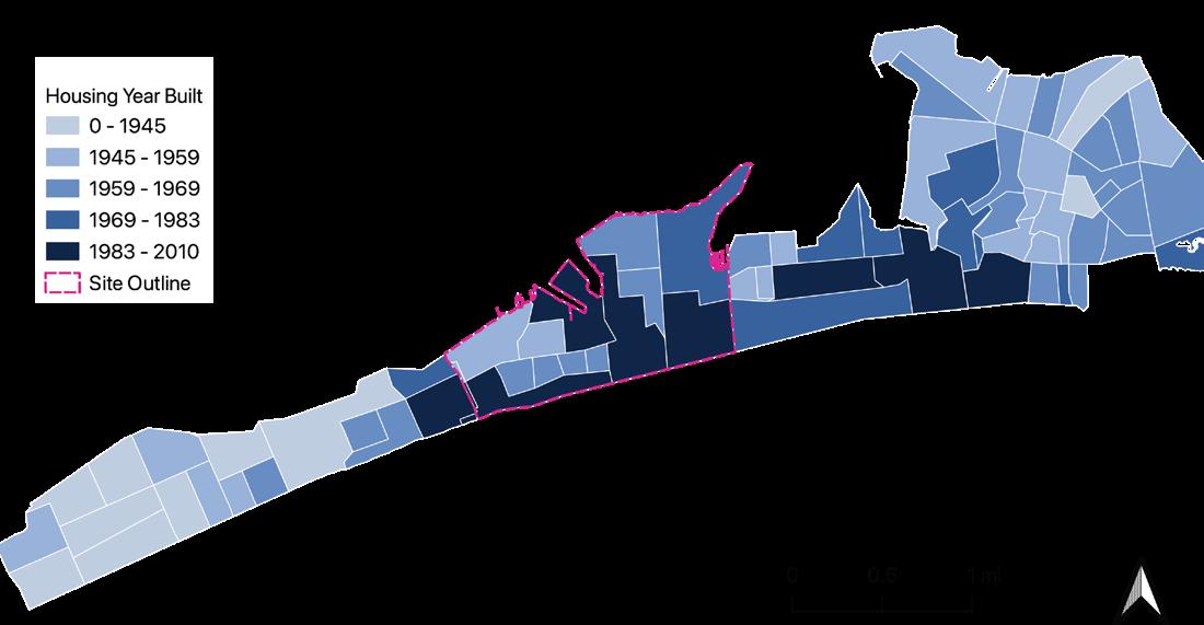
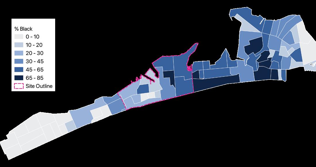
Housing Units per Acre Site Locator
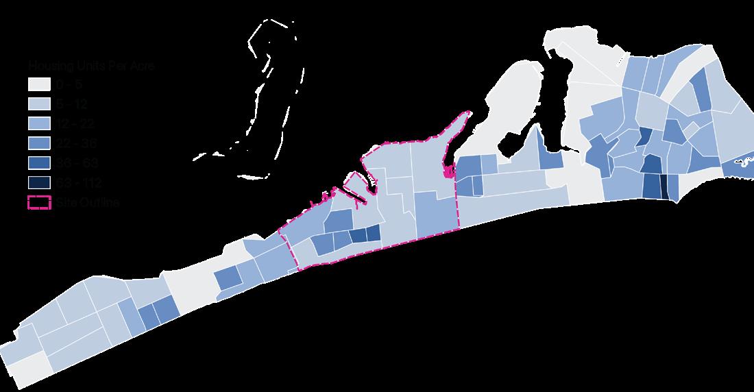
Data: ACS 2018-2022 5 Year Estimates
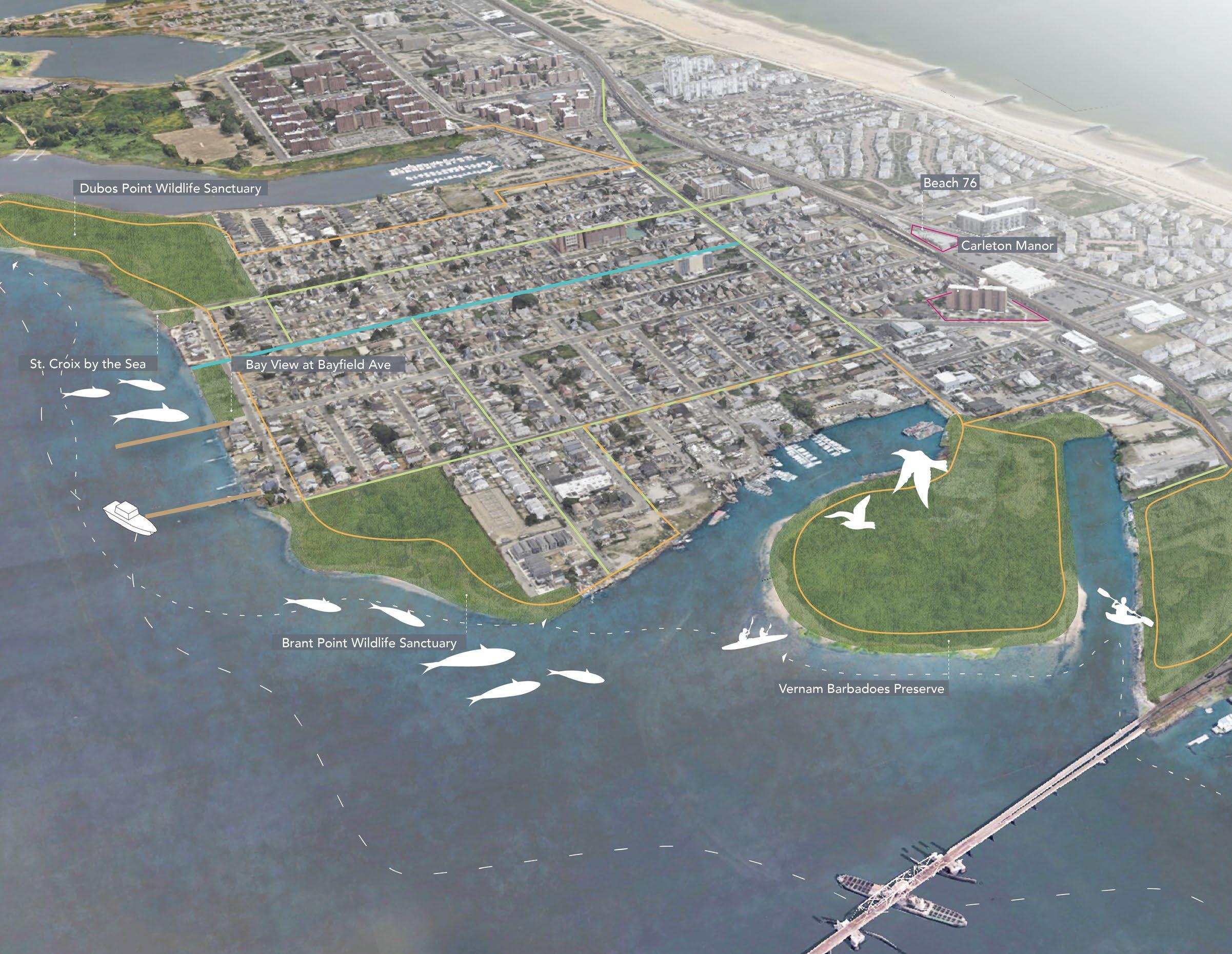
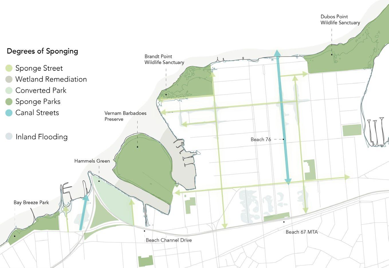
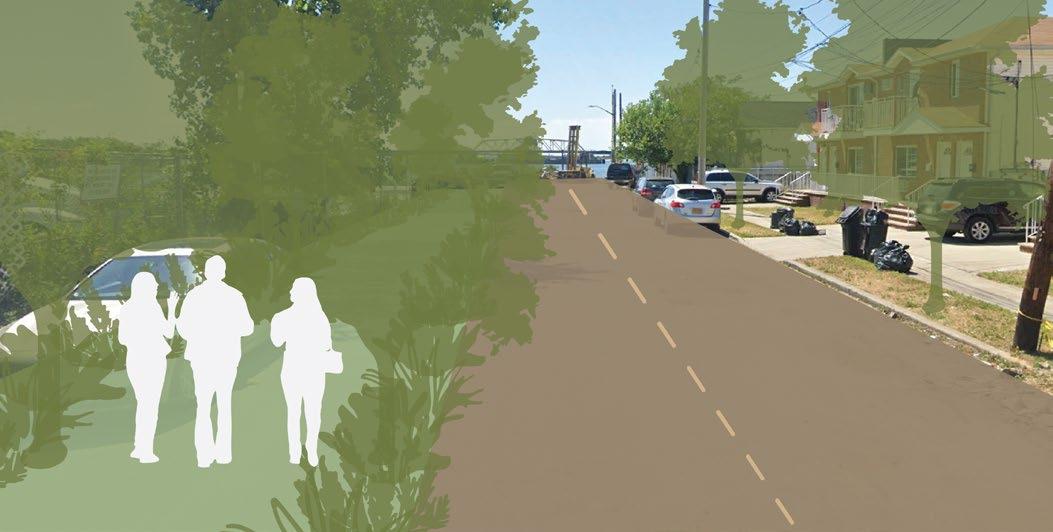
This is achieved by expanding green space into underutilized lots, creating a network of “sponge streets”, that retain and filter water, creating canals in especially waterrisk areas, targeted wetland remediation to cleanse stormwater runoff before it runs into the bay.
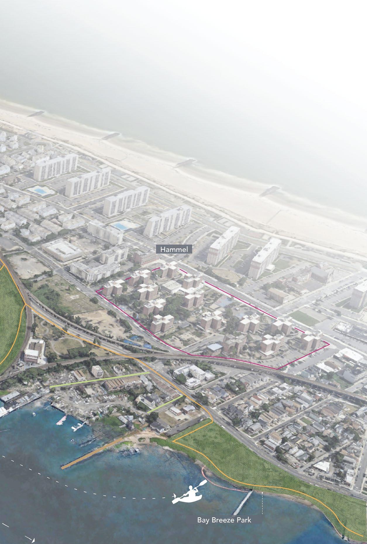
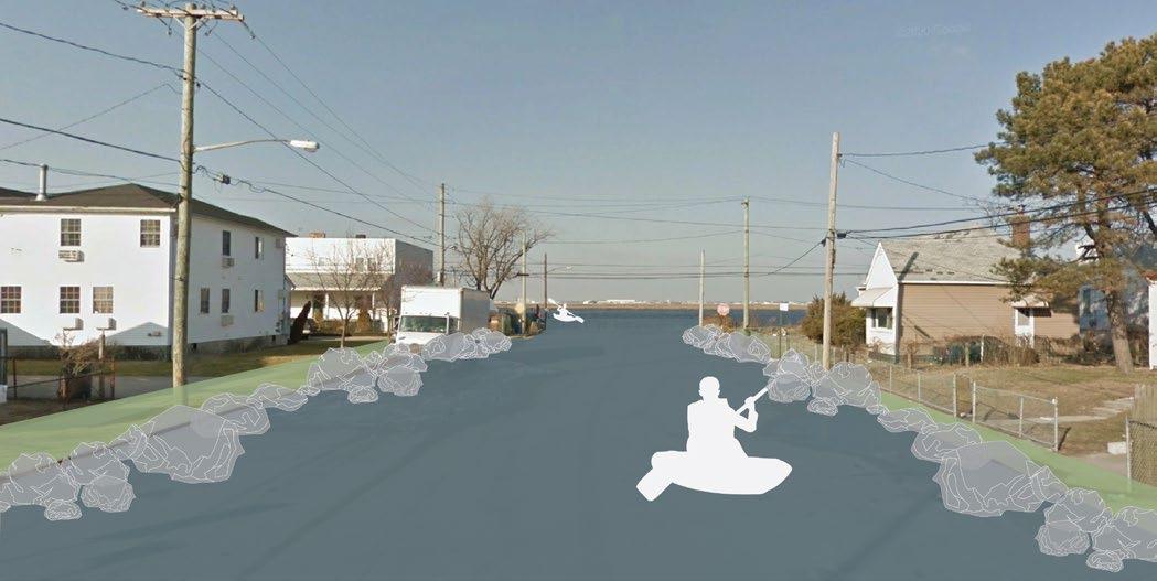
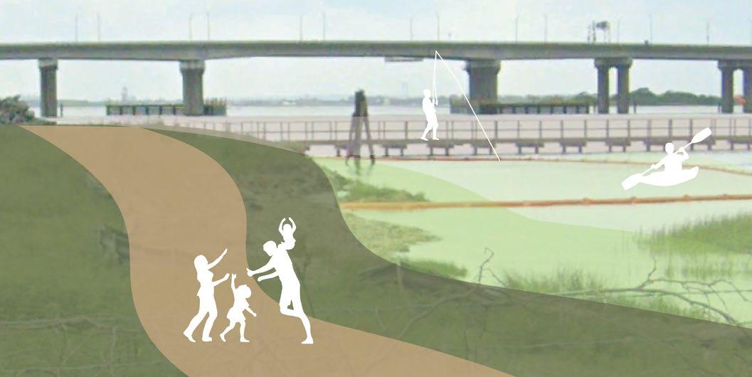
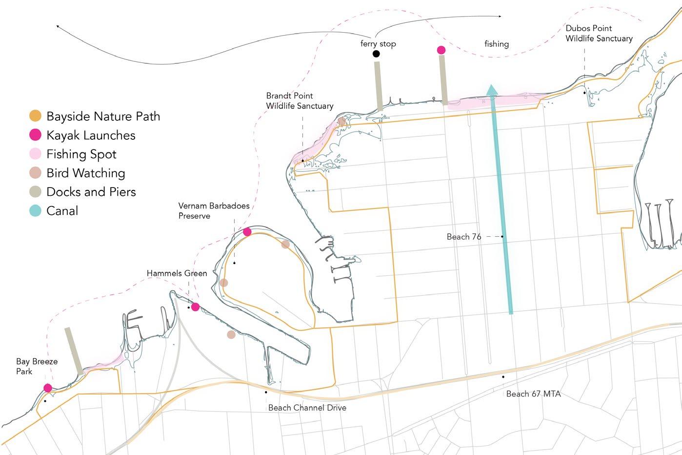
This project aims to make this area into a immersive nature recreation experience. The Bayside Nature Trail provides continuous access to the bay with recreation stops along the way. These include kayak launches, bird watching, fishing spots, a network of pieces and docks, and a ferry stop.