CONNECTED CONNECTED
PRESENCE PRESENCE
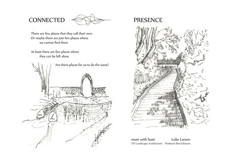
There are few There places arethat fewthey places callthat theirthey owncall their own Or maybe there Or maybe are justthere few places are justwhere few places where we cannot find we them cannot find them At least thereAtare least fewthere places arewhere few places where they can be left theyalone can be left alone Are there places Are there for usplaces to do the for us same? to do the same?
most with least most with leastLuke LarsenLuke Larsen
UO Landscape Architecture Professor Bart Johnson
CONNECTED
PRESENCE 4 1
2
3
N Scaled 1”:200’ Residential multifamily housing abuts this North Eugene open space park. The following analysis seeks to acknowledge the successes of prior conservation efforts while proposing appropriate propriate site interventions intervention that do the MOST with the LEAST.
D E L T A P O N D S: A BARRIER
A Place that gathers water, gravel, people, sh, and time
NO BRIDGE
BOUNDARY BOUND DARY CONDITIONS CONDIT TIONS
EXISTING CHALLENGES
DESIGN G GOALS OALS
An evaluation of existing conditions leading to a community
A PATH DISCONTINUOUS ISCONTINUOUS LOOP
CIRCUIT CONNECTED D CI IRC
PERPETUAL MOTION
CALM PRESENCE
A PLATFORM
ACTION PLAN
AGRICULTURAL FLOODPLAIN
1936
MINING EXPLORATION
1952
AGGREGATE MINING
INFORMAL RECREATION
1968
HYDROLOGICAL FRAGMENTATION
COMMERCIAL RETAIL
RESIDENTIAL HOUSING
1977
HARDENED SOUTHERN EDGE
1987
COMMERCIAL EXPANSION
PATRON PROFILE Number of users per social group type
INDIVIDUAL
LOCAL USER (Lives within 5 miles)
FAMILY
COMMUNITY USER (Lives in Eugene)
COUPLE
VISITING USER (Any other user)
The small sample demographic data was collected through twelve hours of
WHERE THEY
COME FROM
direct observation over a four session period. Most of the people who come by themselves come from the surrounding neighborhood. Most of the people who come as families come from the greater Eugene area. Couples tend to average out the results.
Prairie Meadow
Boggy Forest
Peninsular Prairie
Bluff Forest
Riparian Prairie
Riparian Forest
ECOTONE BOUNDARIES MULTIFAMILY DEVELOPMENT
RECREATION INFRASTRUCTURE
1994
GOOD PASTURE ISLAND
CONVERGENCE
A river meandering through the ood plain once ran through this place. The river shifted and left gravel beds behind. Mining interests extracted aggregate. High water tables reclaimed the pits turning them into pools. The ponds existed unmanaged and allowed invasive species to claim the disturbed territory. Informal recreation brought people and vehicles. Studies began. People documented the place while proposing conservation strategies. Residential development expanded. People pushed against the ponds. Recreational infrastructure was installed. The surrounding neighborhood has been drawn to the place. They are an ecological community in dialogue. People are in the pond.
2005
ABUTTING DEVELOPMENT
1850
RIVERS MEANDER
LOCATION LINGERING
THE RESIDENTIAL EDGE
Number of users who stayed in a place for a period
HUMAN USE CORRIDORS People
HABITAT PATCHES
Time (minutes)
Time (minutes)
Time (minutes)
Time (minutes)
PARKING LOT
PLATFORM
OVERLOOK
TRAIL END
People pass through but occasionally will take in the view. Most who did stayed in their cars
A popular place. People like it here. They never stay long. Most people leave after two minutes.
Rarely used. But demonstrated the strongest pull of captivation.
An abrupt and reective destination.
TERRITORIAL CLAIM
FORM CONNECTIONS BY: 1. BREAKING
2.
BARRIERS
3.
TAKING TIME
EXISTING CONDITION
SPLITTING
LEVELS
EXISTING CONDITION EXISTING CONDITION
EXISTING CONDITION 1 CLEAR PATH
EXISTING CONDITION
ALTERNATE
MAINTENANCE AND INTENTION TO SLOW PEOPLE DOWN
DROPPED JOISTS STRUCTURAL DIAGRAM VIEW AND ENGAGEMENT
ANOTHER VIEW
2 DIRECT PATH ALTERNATE
4. BUILD A BRIDGE TO:
NARROW IMPACTS
PRESERVE A CORRIDOR L u ke L ar s e n
B a rt J ohnson
M o s t w i t h L e as t
L a n d s ca p e A r ch i t e ct u r e Spring 2014
Un i v e r s i t y o f O r e go n
T h e
A field of TENSION variations in BOUNDARY conditions
P r e s e n c e
We made this place We can remember it Though we cannot see all of the hands now clearly Complexities evolve As forces dissolve The things that live among us Boundaries and territories Ways to divide When really just seeking a whole
o f
Crossing and blending Deposit then scour Weaving a delicate mess together
N a t u r e
We are people We have been forever And we will be for as long as our memory holds
Finding Places
contained human use
There are few places that they call their own Or maybe there are just few places where we cannot find them At least there are few places where they can be left alone Are there places for us to do the same?
habitat corridor
We fit in completely As long as we fancy That we do it delicately and with charm But let us remember The cause and the starting That deemed this place special with right The pond and the critters The episodic sunshine The birds and their pride for their young A living framework For all to witness As it changes with the markings of time So as the people come down here Let them do it with caution Else they push what is left away
EXISTING BIKE PATH EXISTING WALKING PATH PROPOSED BIKE PATH CONNECTIONS
A
PROPOSED BRIDGE CONNECTION
P l a c e
WOODED PATCH (+ 40’ width) EXPOSED WATER RESIDENTIAL CONNECTIVITY Existing riparian corridors are a means of organizing bicycle and walking pedestrian routes. In existing developments bike routes are deployed by slipping through hard boundaries making them transmissive.
Means of community ACCESS
t o B e
Let them come down here and Be a part in it But keep them in a corridor contained Let it loop with delightment Let them see through the forest Lets create a place for their visions to roam A circuit A meeting Lending connection around it A PLACE for the PRESENCE of NATURE to BE
Breeze in the Afternoon white whisps twirl around me born of the breeze’s discretion settling on the water and bound to its surface swirl back then forth there is no discernible order They collect As more continue to pass through
LATENT OPPORTUNITIES
CLAIMING TIME A
AASHTO : Design Standard pedestrian bridge - 85 lbs/ft 2 5’ occupiable width Design Load = 425 lbs/ ft
A
Spanning Member
r
A -36 Tube Steel 8” x 4” x 1/2”
N NTS
BEING PRESENT
Stillness within a changing scene
Mmax = 34.75 Kip ft fbx = 27 ksi < Fbx = 28 ksi 97% UTILIZATION
Delta Ponds City Park DESIGN PROGRAM
DESIGN INTENTION
To encourage people to SPEND TIME in the Park while CONTAINING them within a
Vmax = 6.65 Kips
defined corridor so as to separate uses and protect patches of existing wildlife habitat.
CONNECTING CORNER
the controlled blending of habitat and human use Secondary Spanning Member
Walking Path Network - 65 person daily capacity existing
Entry Public Space
proposed
- Overlook and seating for 6 people
A - 36 Tube Steel 4” x 2” x 3/16” Mmax = 3 Kip ft
- Occasional gathering for 15 people
fbx = 20 KSI < Fbx - 28 KSI
Bridge Capacity
71% UTILIZATION
- 450 lbs/ ft2 live load
The corner of the RESIDENTIAL EDGE is reclaimed as an open and section AA
transmissive boundary between a patch of riparian forest and multifamily housing
Vmax = .16 Kips
The public space facilitates community access to the city park path circuit while also encouraging small social gatherings. A bride contains people while completing a walking loop. The corner park connects the neighborhood community.
Vertical Bearing
End Reaction = 12 kips Alluvial Soil Capacity = 3 kips/ft 2 Required Bearing Area = 4 ft 2
Lateral Bearing End Reaction = 64 kips Alluvial Soil Capacity = 3 kips/ft 2
CONNECTING CORRIDOR
Required Bearing Area = 21 ft 2